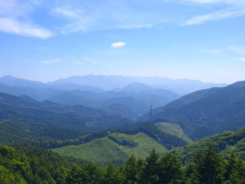
I had climbed these mountains in December 2013 from the Kawaguchiko side. I wanted to hike them again but from the Fuefuki side; I also wanted to try out our JapanwildsKuro-dake Map for Avenza. Finally, I was interested in riding the free shuttle bus between the Ashigawa Agricultural Products Market “Ogossoya” and the Suzuran-gunseichi Parking Lot; it started running last year to reduce traffic due to the nearby Fujiyama Twin Terrace. However, the bus I had used on my previous trip to the area from Isawa Onsen had been discontinued, so I ended up renting a car from Kofu city instead and skipping the shuttle entirely.
Hiking inside the Fuji-Hakone-Izu National Park
富士箱根伊豆国立公園
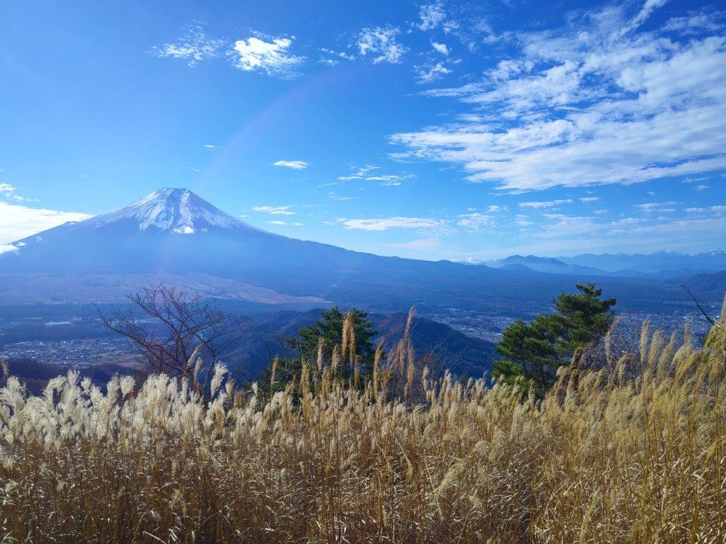
From the parking lot, I could take the most direct route up Mt Kuro, and after checking out the view from the nearby observation point, follow the ridge westwards past Mt Hafu and then down to Shindo Pass, also the location of the Fujiyama Twin Terrace. From there, I would again take the most direct route back to the parking. If time allowed, I could drop by Kamiku no Yu onsen on the way back. The weather was supposed to be sunny but near freezing at higher elevations. I hoped to get some good views of Mt Fuji and also catch the last of the Autumn colours.
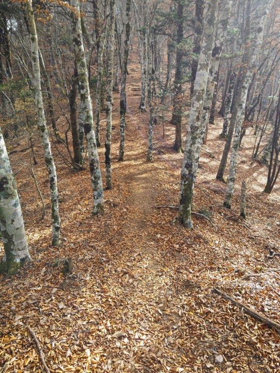
Fallen Leaves (left) and Beeches (right) at the Start of the Hike
Trail near the Top (left) Autumn Colours at the End of the Hike (right)
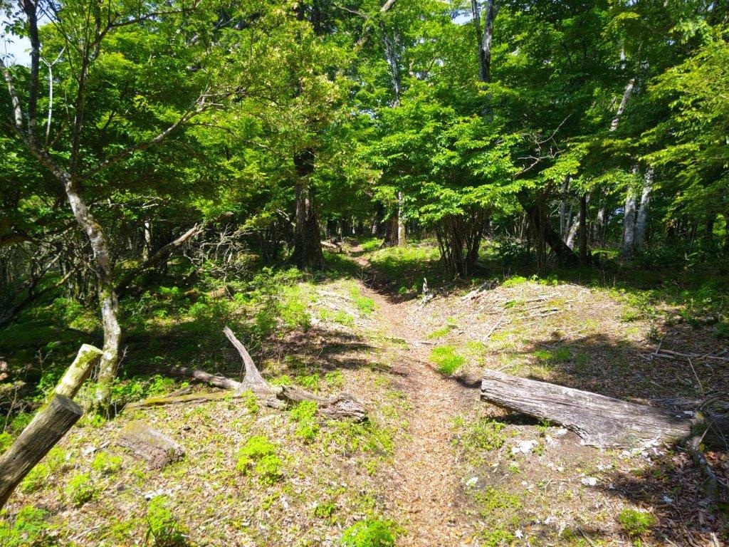
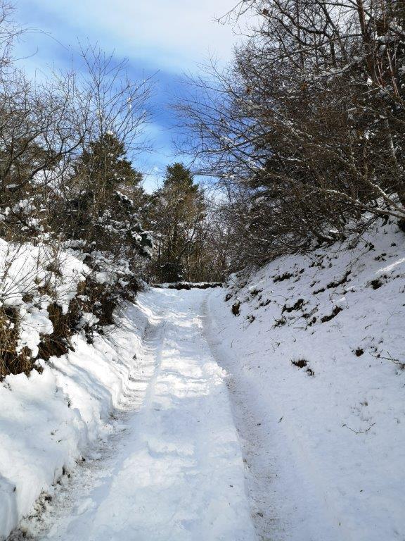
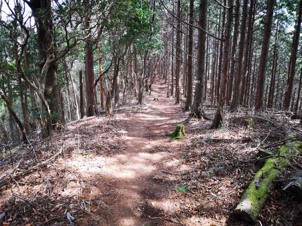
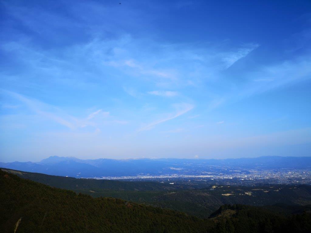
It was a blue sky day as I drove southwards from Kofu station towards the Misaka Mountains (御坂山地). After following a narrow road along the Ashi river valley, I arrived at the Lily of the Valley Flower Colony Parking Lot (すずらん群生地駐車場) just after 11h30. I had to use a smaller parking for hikers since the main one, a little further down the road, was reserved for people using the Twin Terrace Bus. A little after noon, I set off along a faint path starting from the parking lot. After passing a second parking for hikers and crossing a small bridge over a dry riverbed, I arrived at an electric fence beyond which was the start of a well-defined walking path.
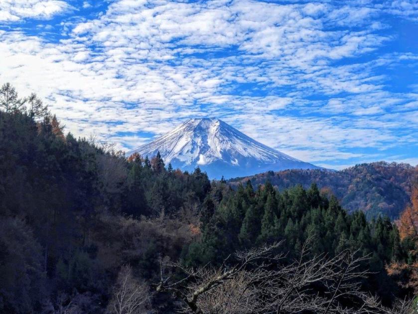
Last Rays of Sun near the Summit of Mt Kuro
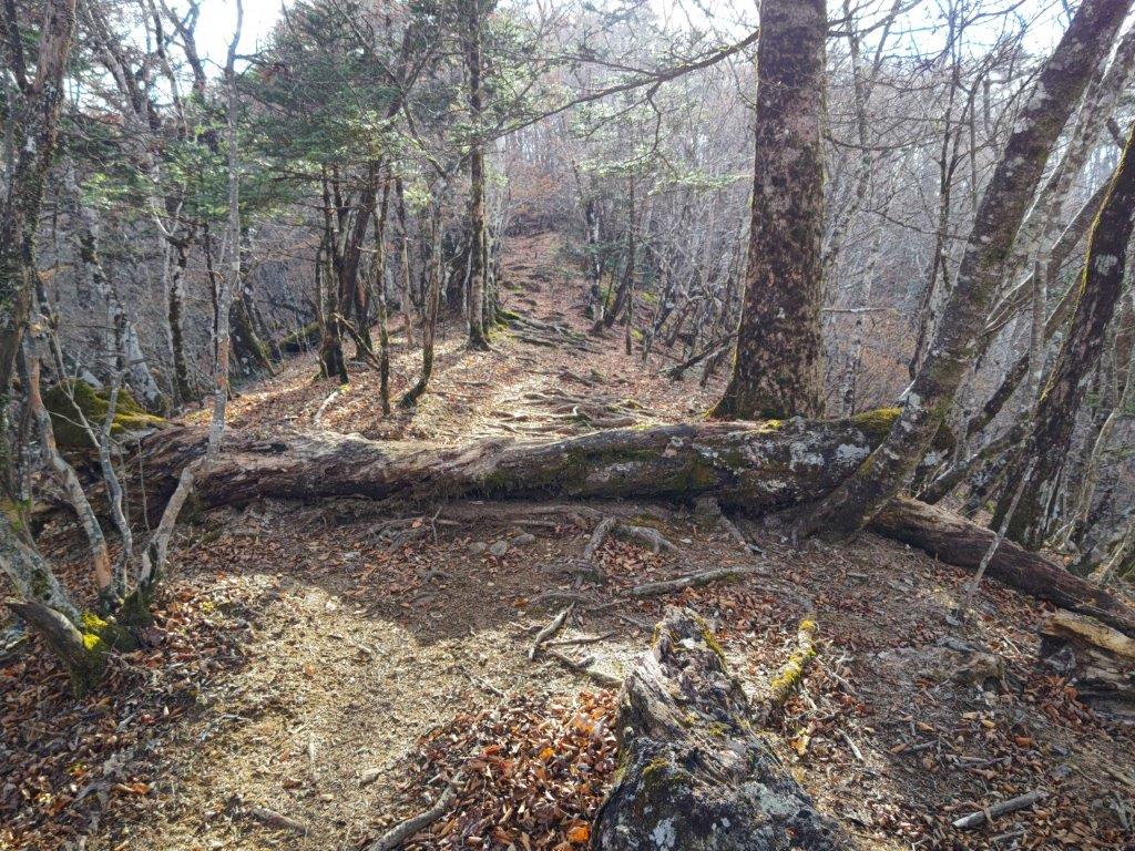
Trail near Mt Hafu
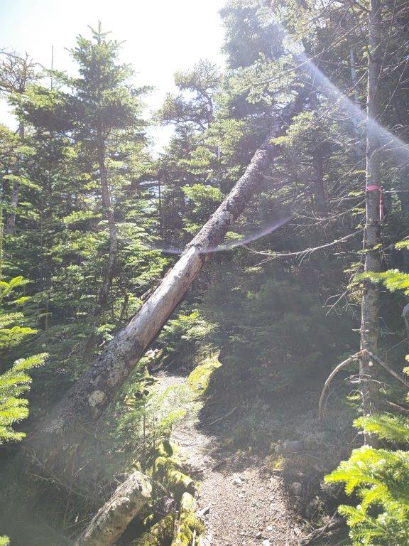
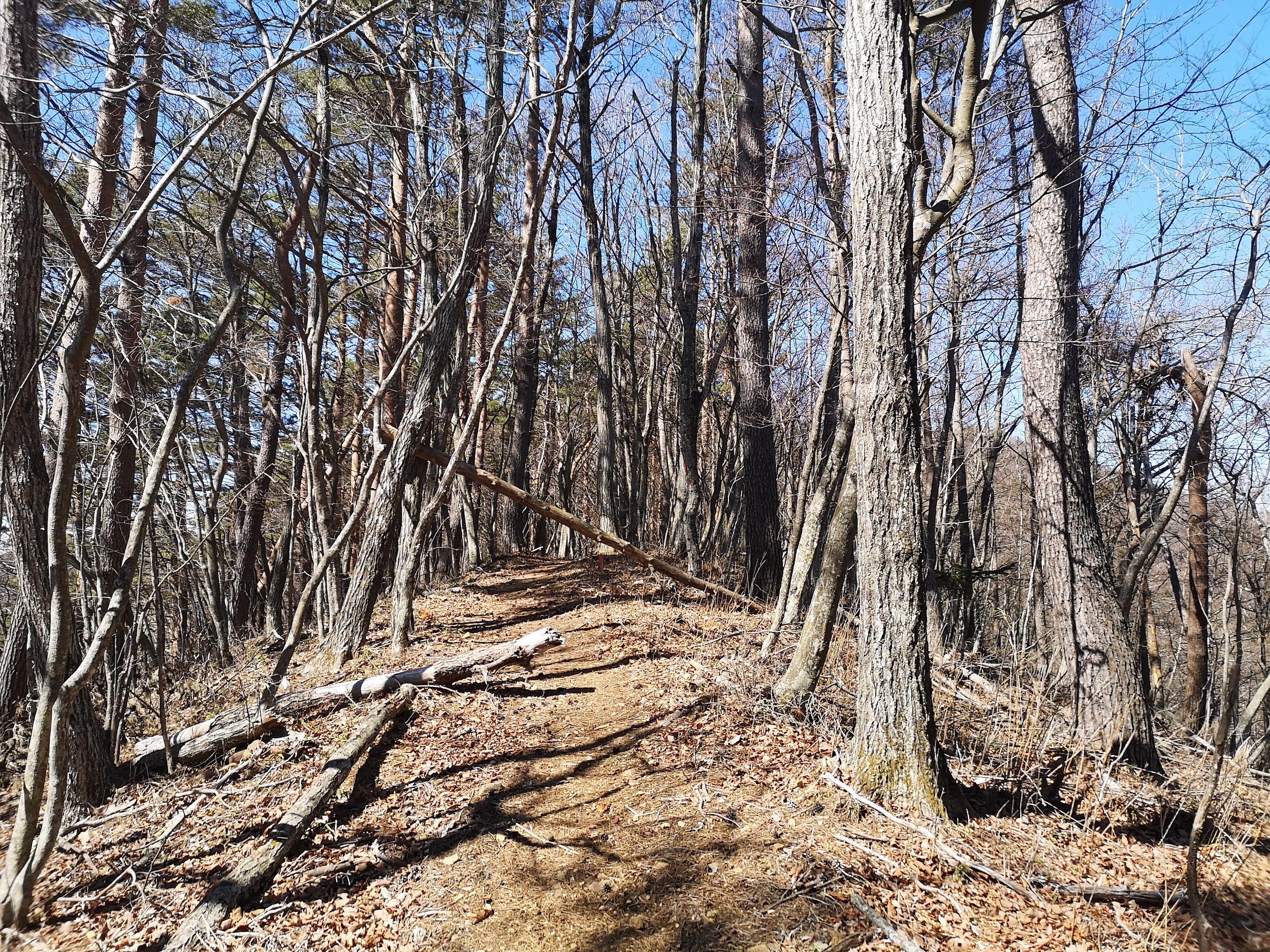
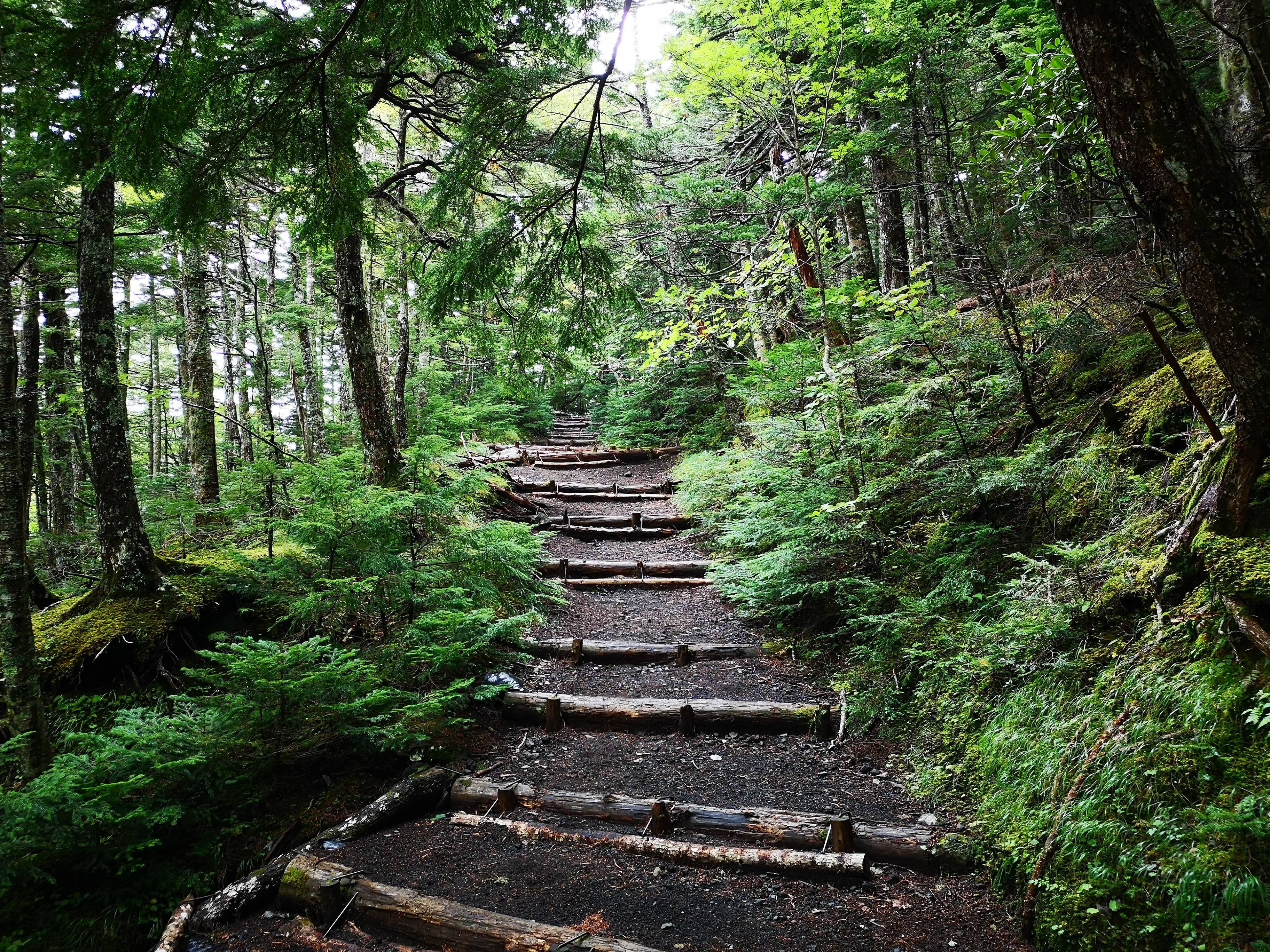
I found myself walking among tall beeches, their tops already bare of leaves, drawing attention to their white trunks. After recrossing the dry riverbed, I reached a paved road where I turned right and soon passed the gated entrance for the road for Fujiyama Twin Terrace, closed to private cars. A little further, I arrived at a sign for today’s mountain, pointing to a faint trail heading up the left side of the dry riverbed. Here, I was glad I could see my position on the Japanwilds digital map since the trail was at times hard to follow. At 1pm, I turned right onto a ridge, the path merging with a signposted trail leading to the summit.
Sun Rays Filtering through the clouds
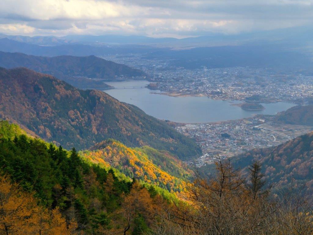
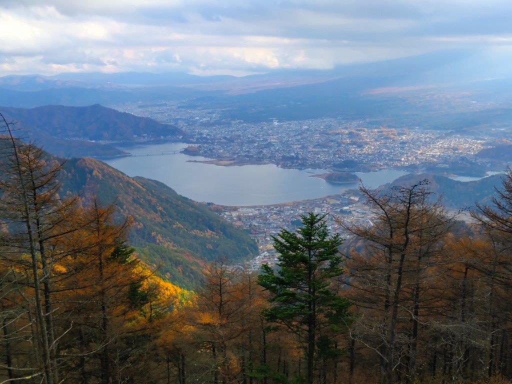
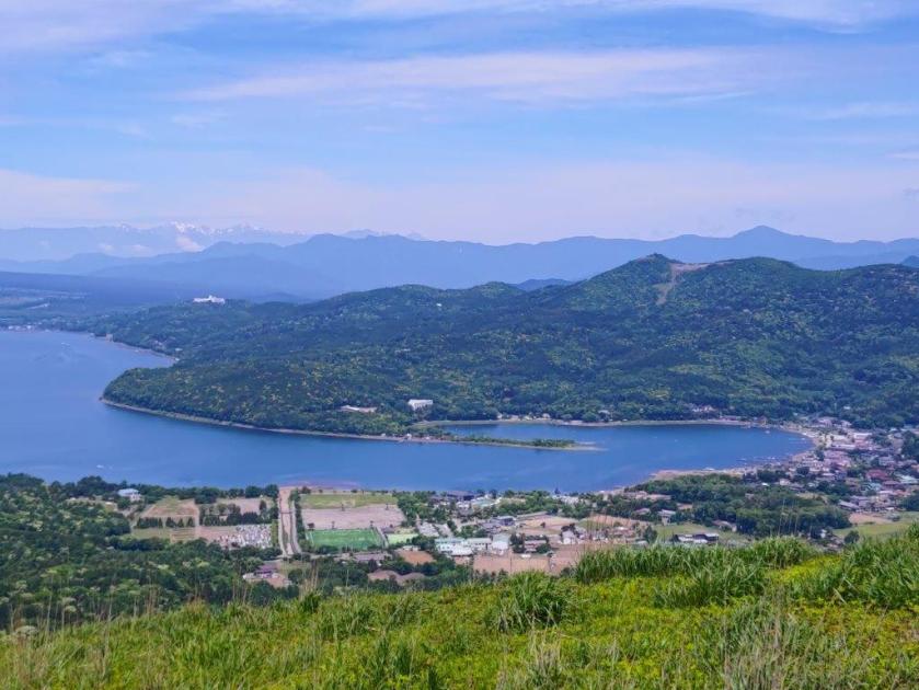
View of Kawaguchiko Lake from below Mt Hafu
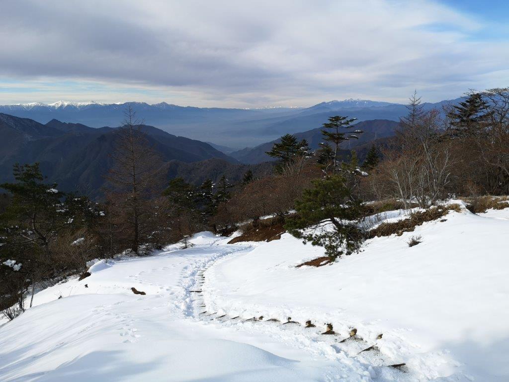
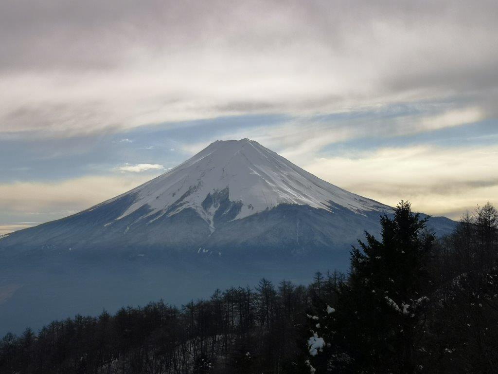
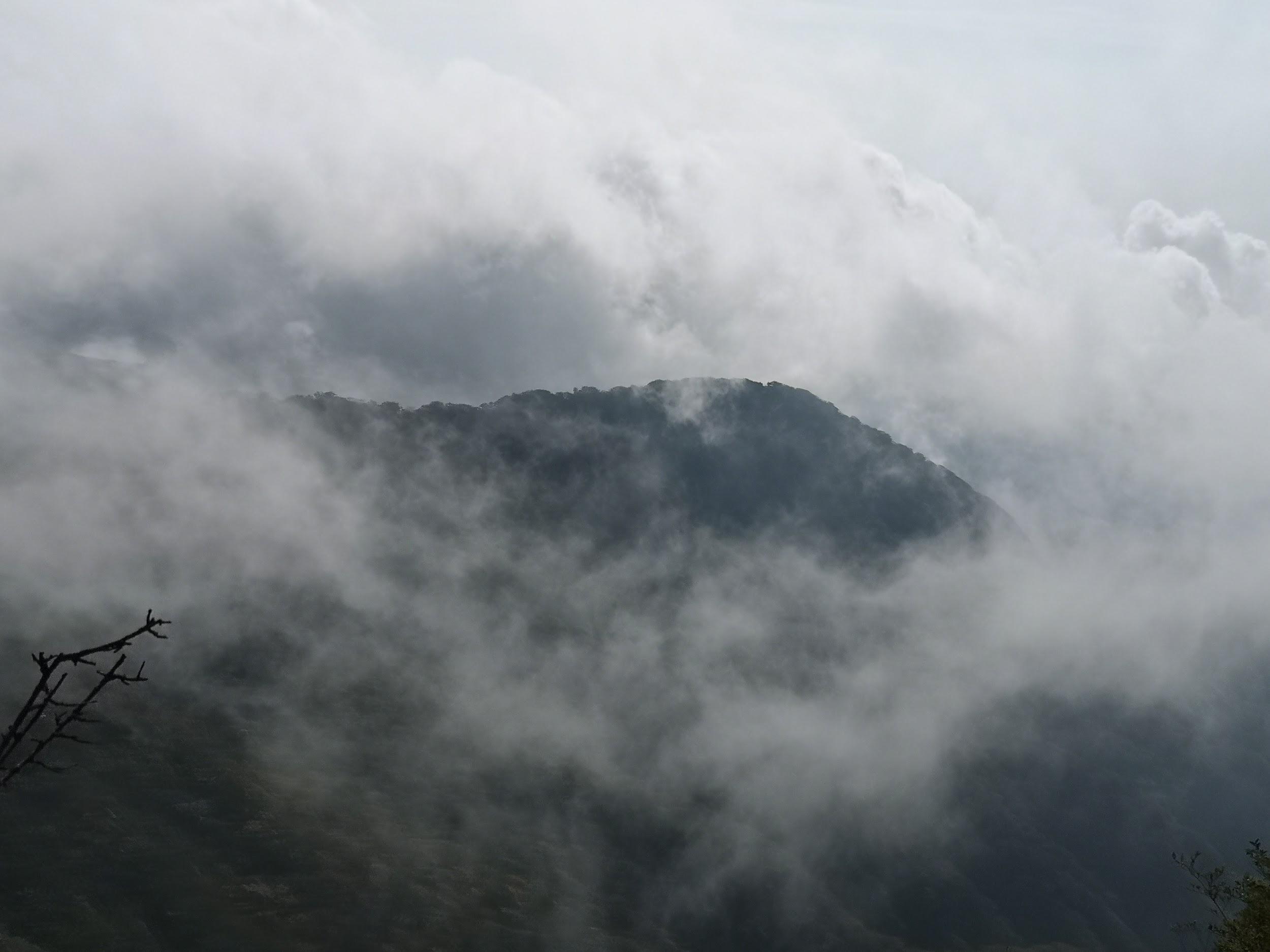
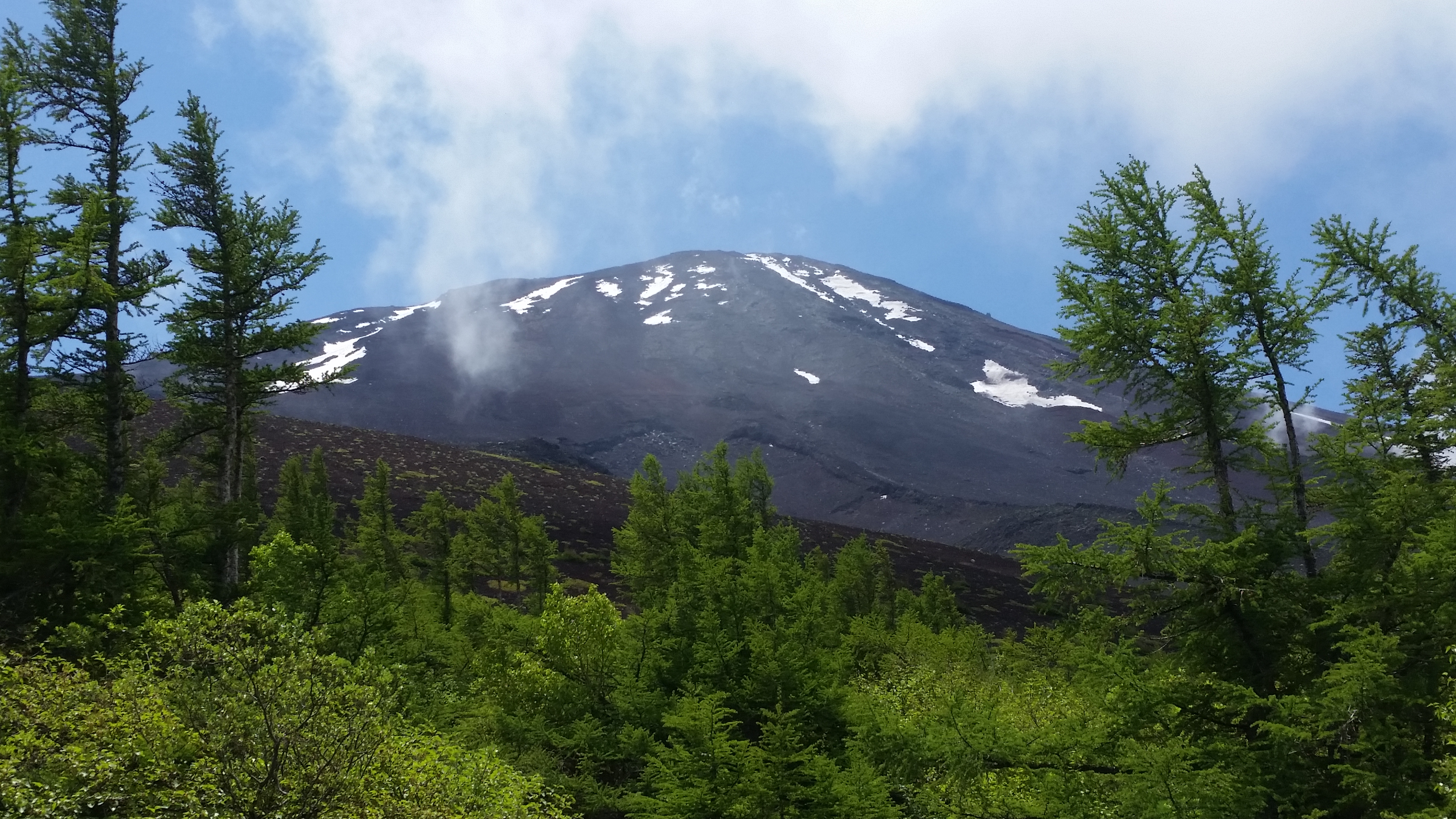
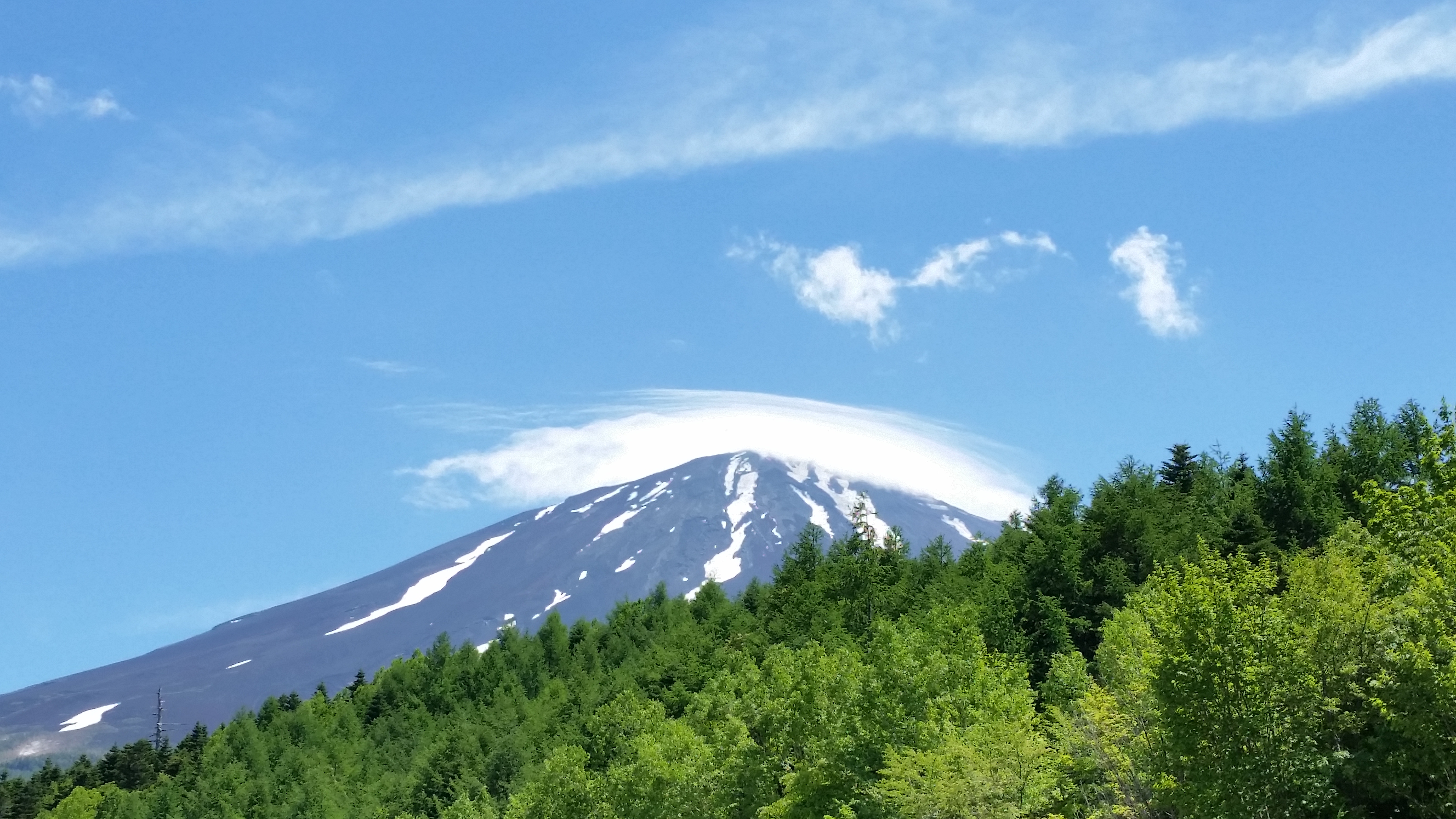
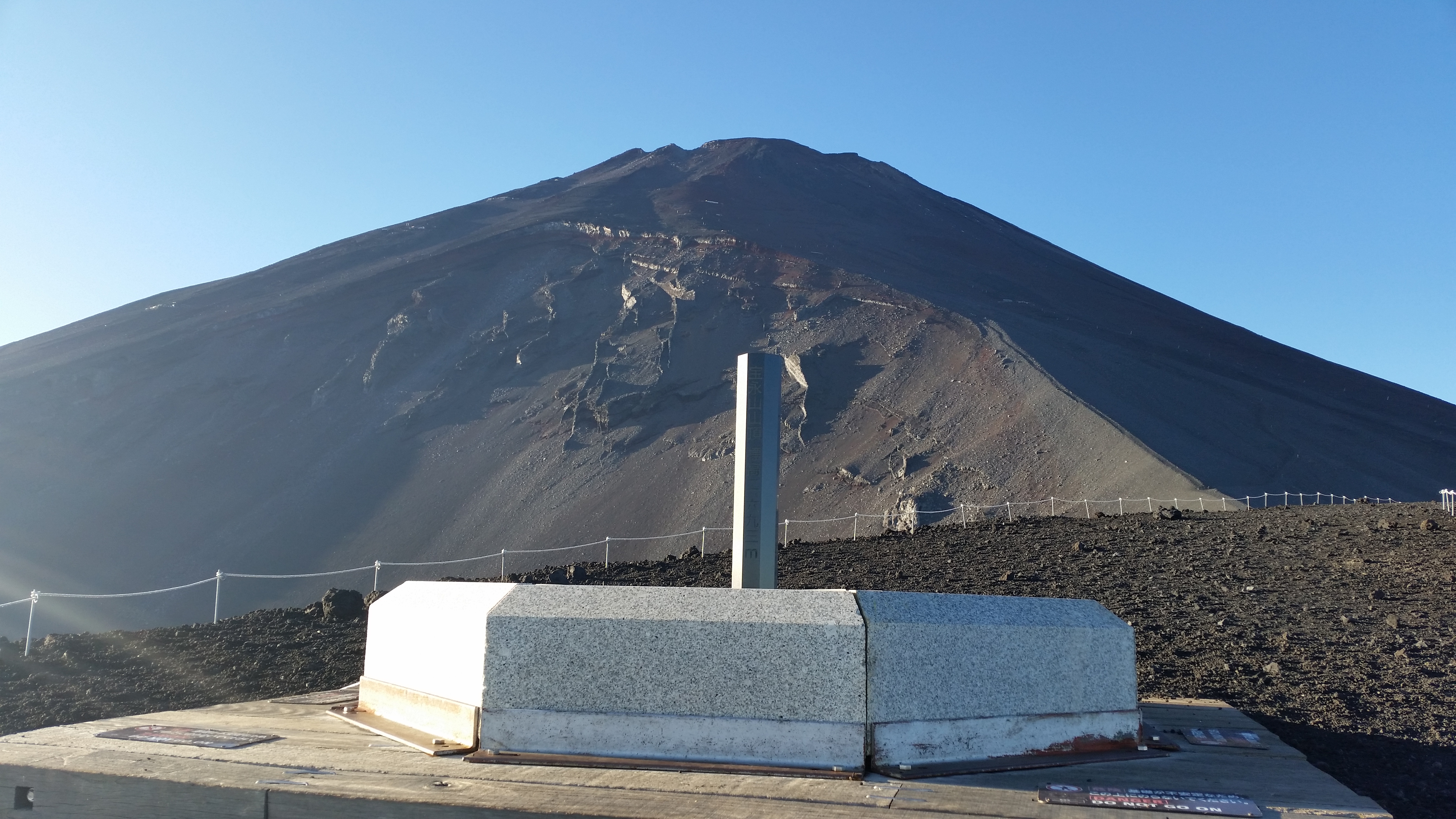
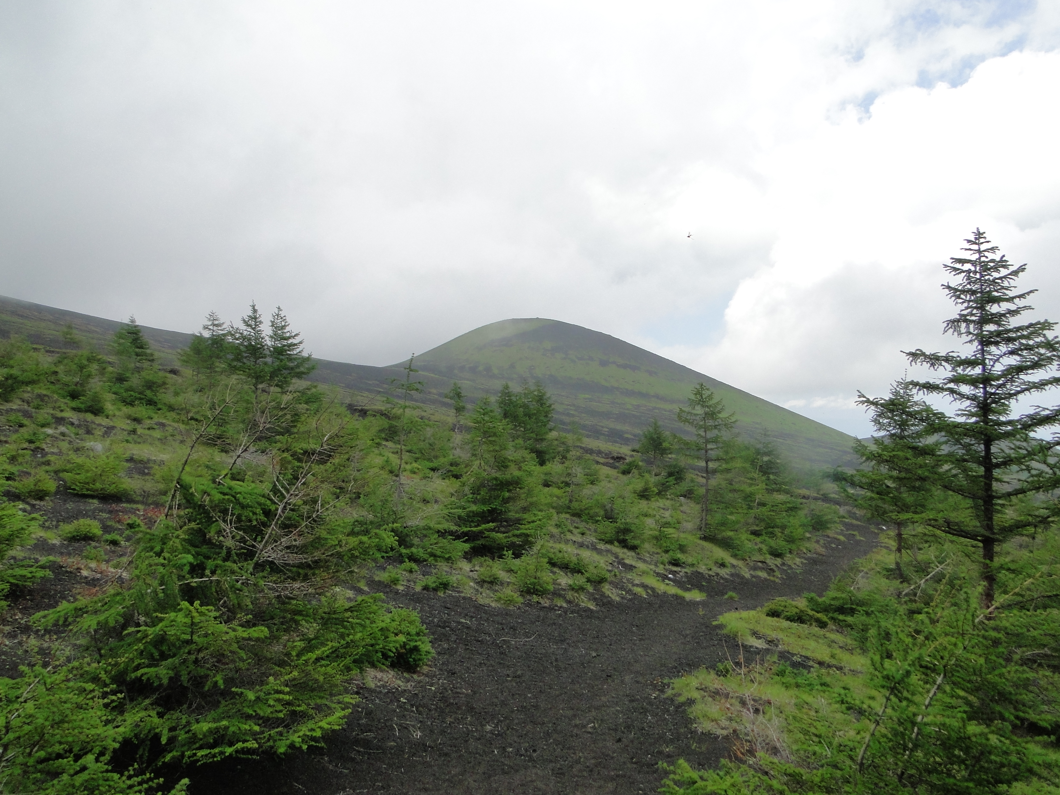
I made good time up the steep trail allowing me to stay warm in the frigid temperatures. I was above 1000 meters and Autumn was already well over, the white beeches providing most of the scenery; a sign indicating told me I was inside a 100 famous forest of Yamanashi. The trail gradually became less steep, giving me a chance to catch my breath without having to take a break. After a couple of turns, I suddenly came upon the summit of Mt Kuro (黒岳 くろだけ kuro-dake meaning “Mt Dark”), the highest peak of the Misaka mountains and a 300 famous mountain of Japan. It was completely in the trees so I dropped my pack and headed for the observation point a few meters to the right, hoping to get a glimpse of Mt Fuji.
First Terrace of Fujiyama Twin Terrace
Autumn Leaves Catching the Sun from the First Terrace
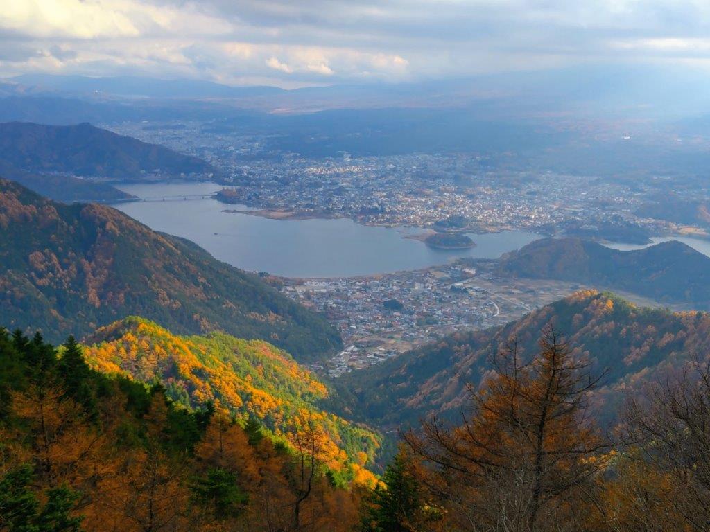
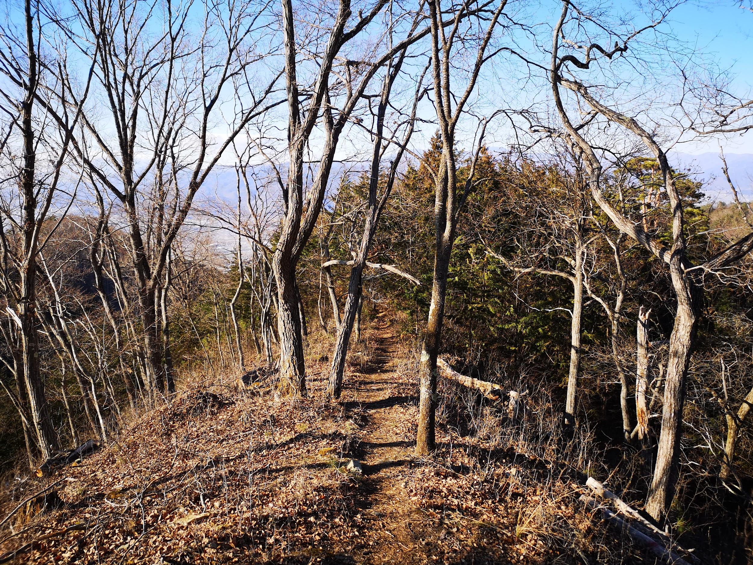
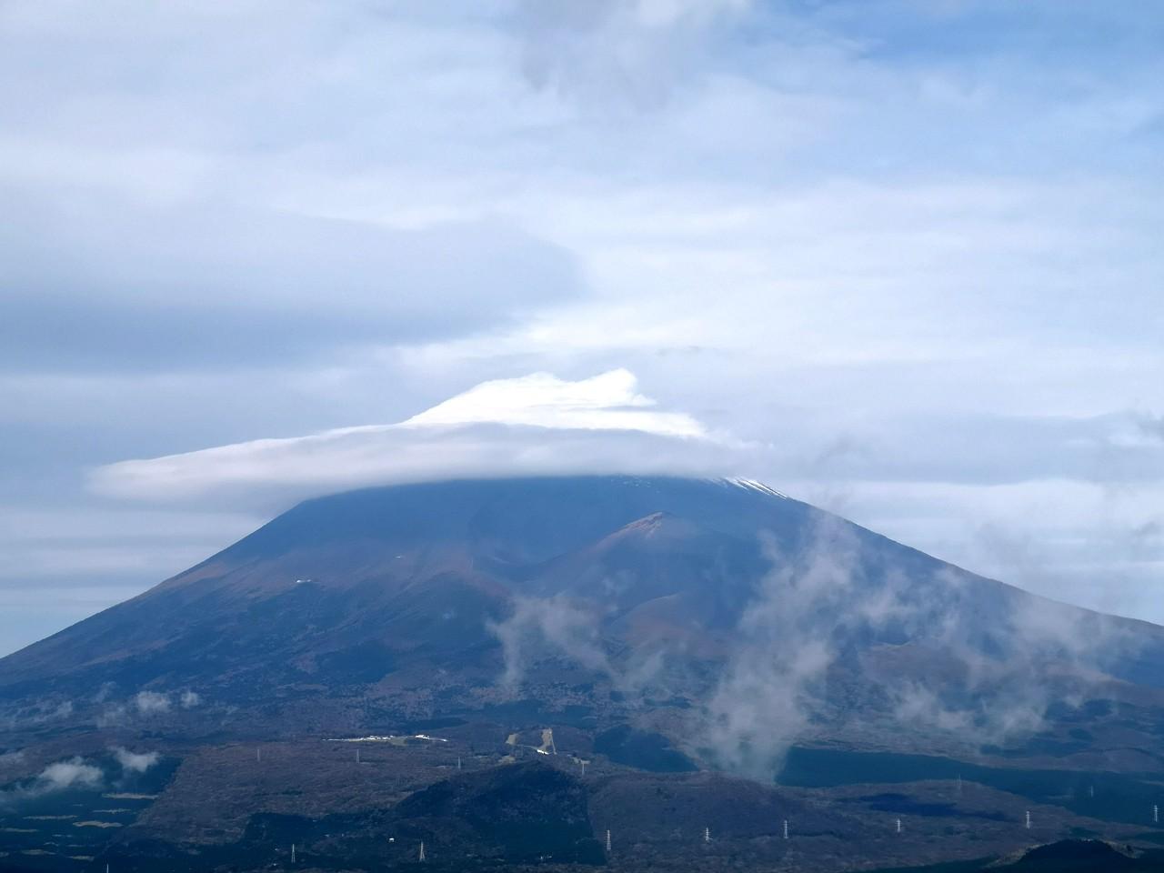
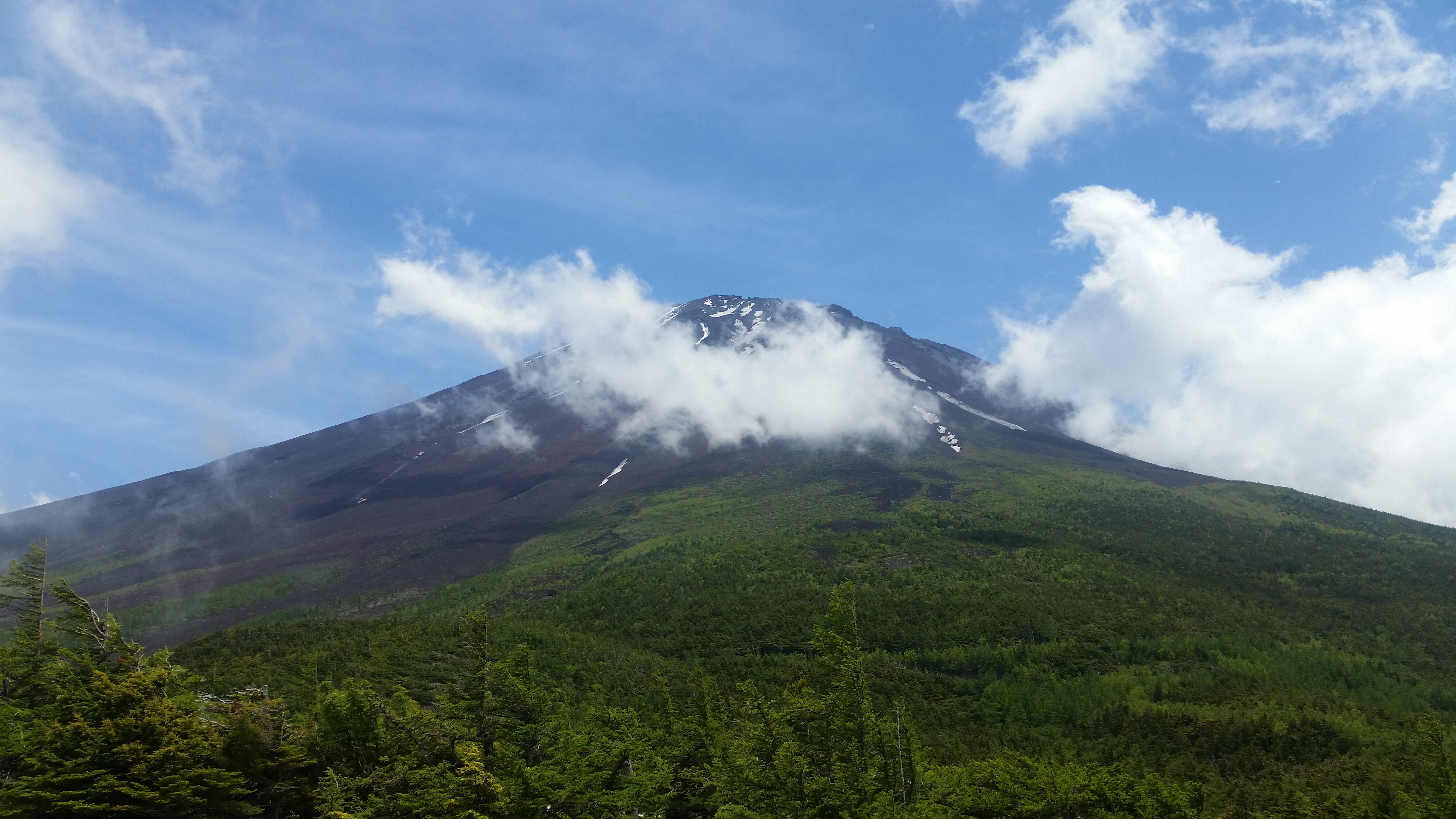
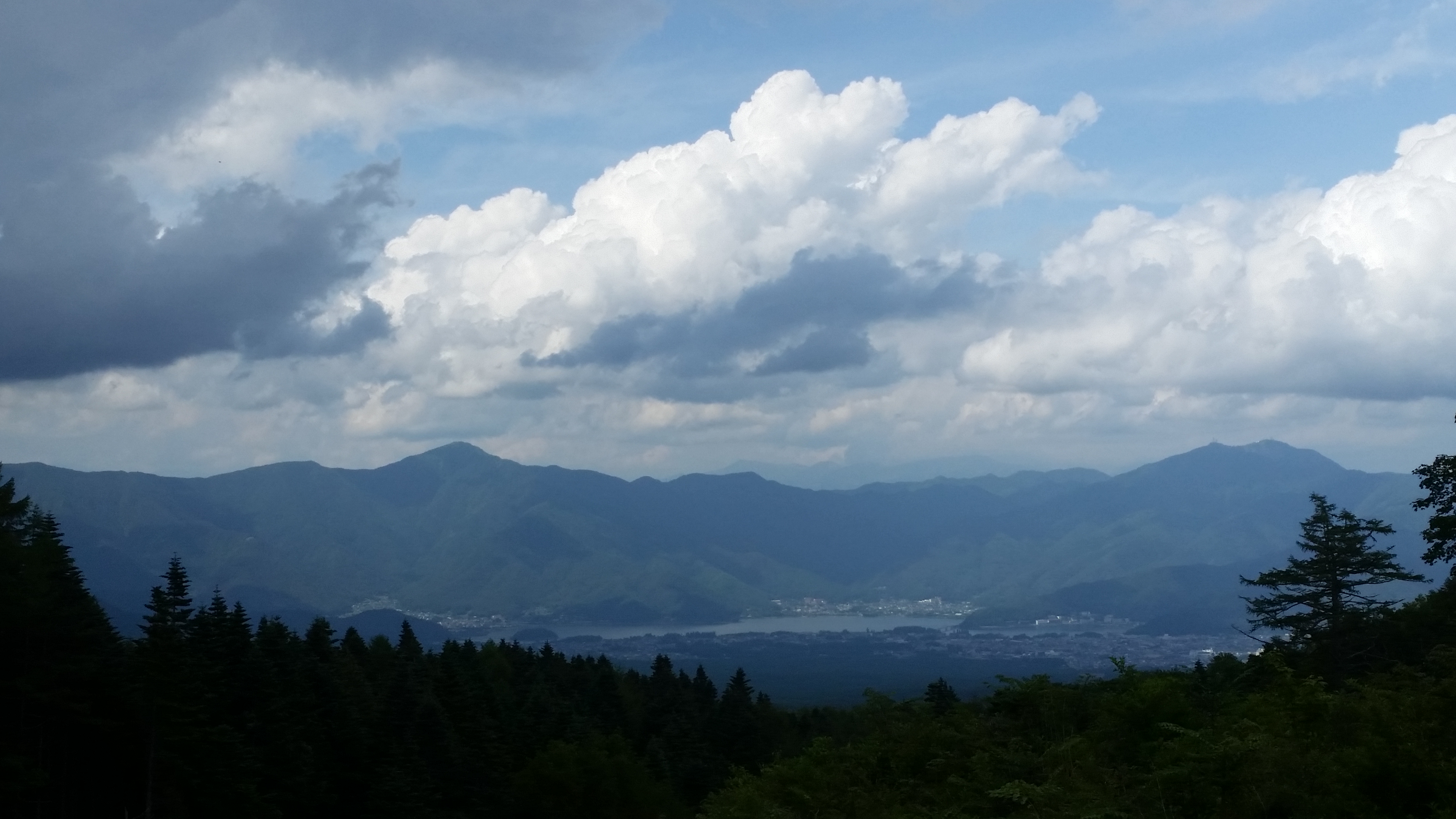
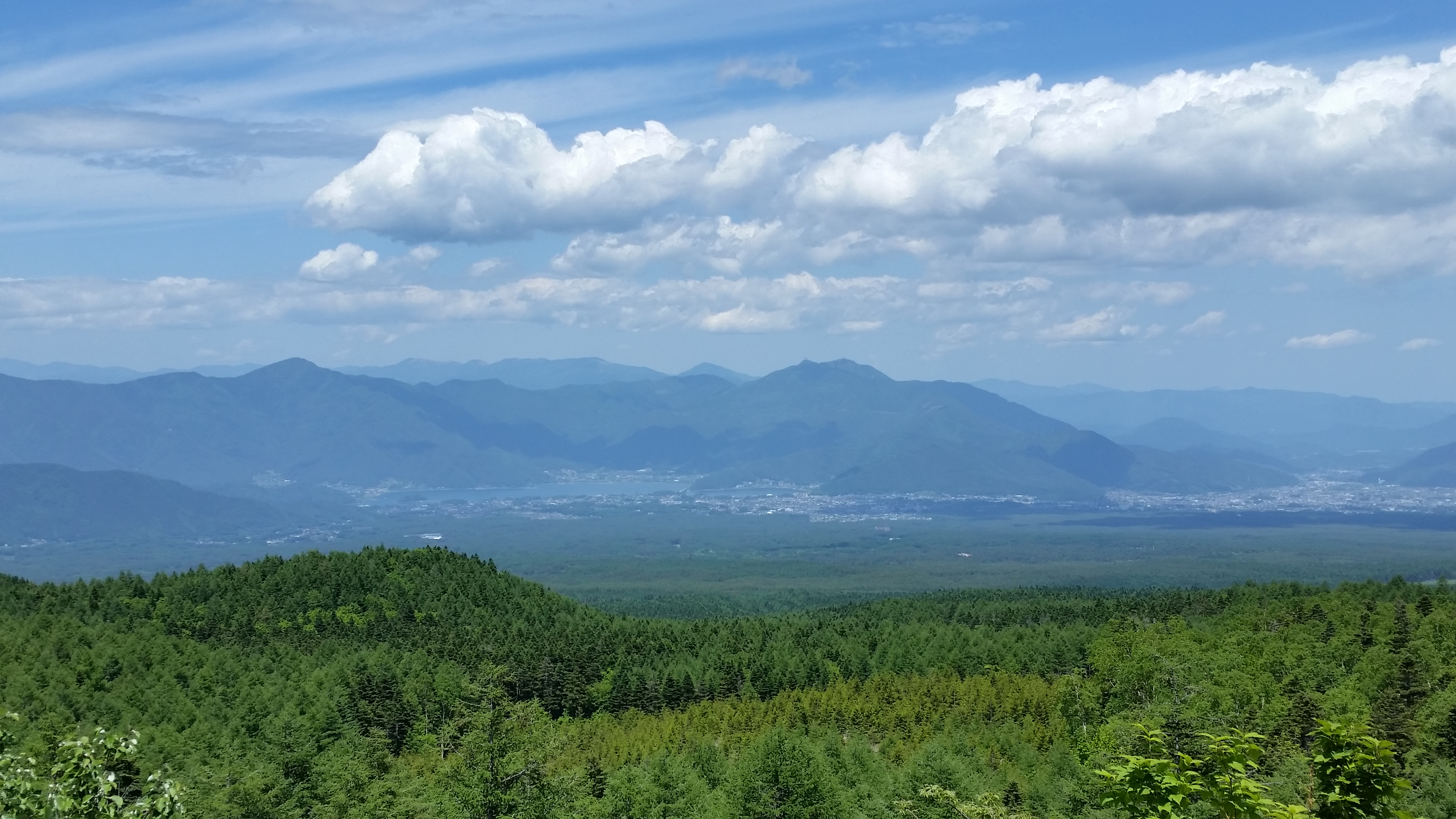
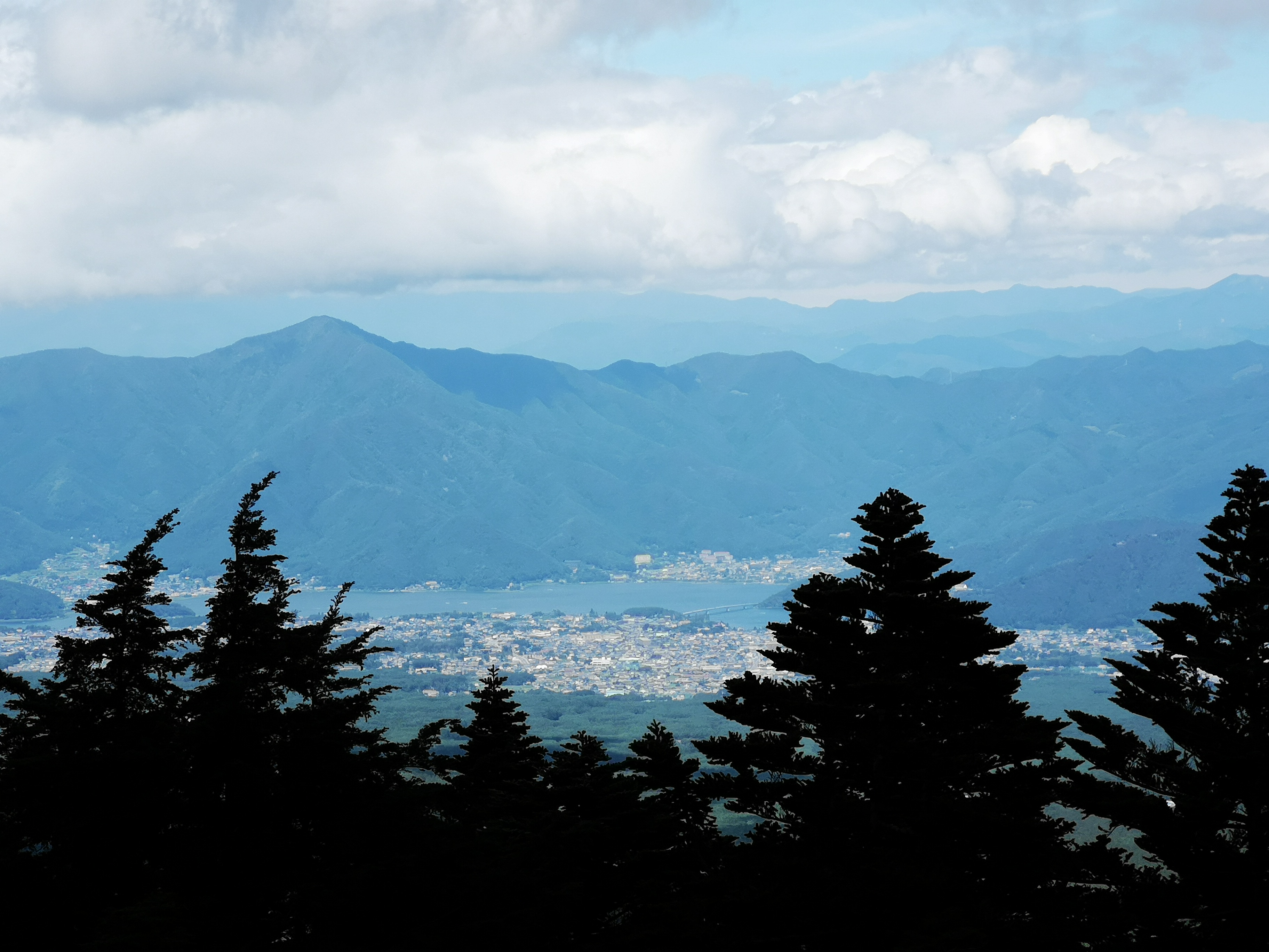
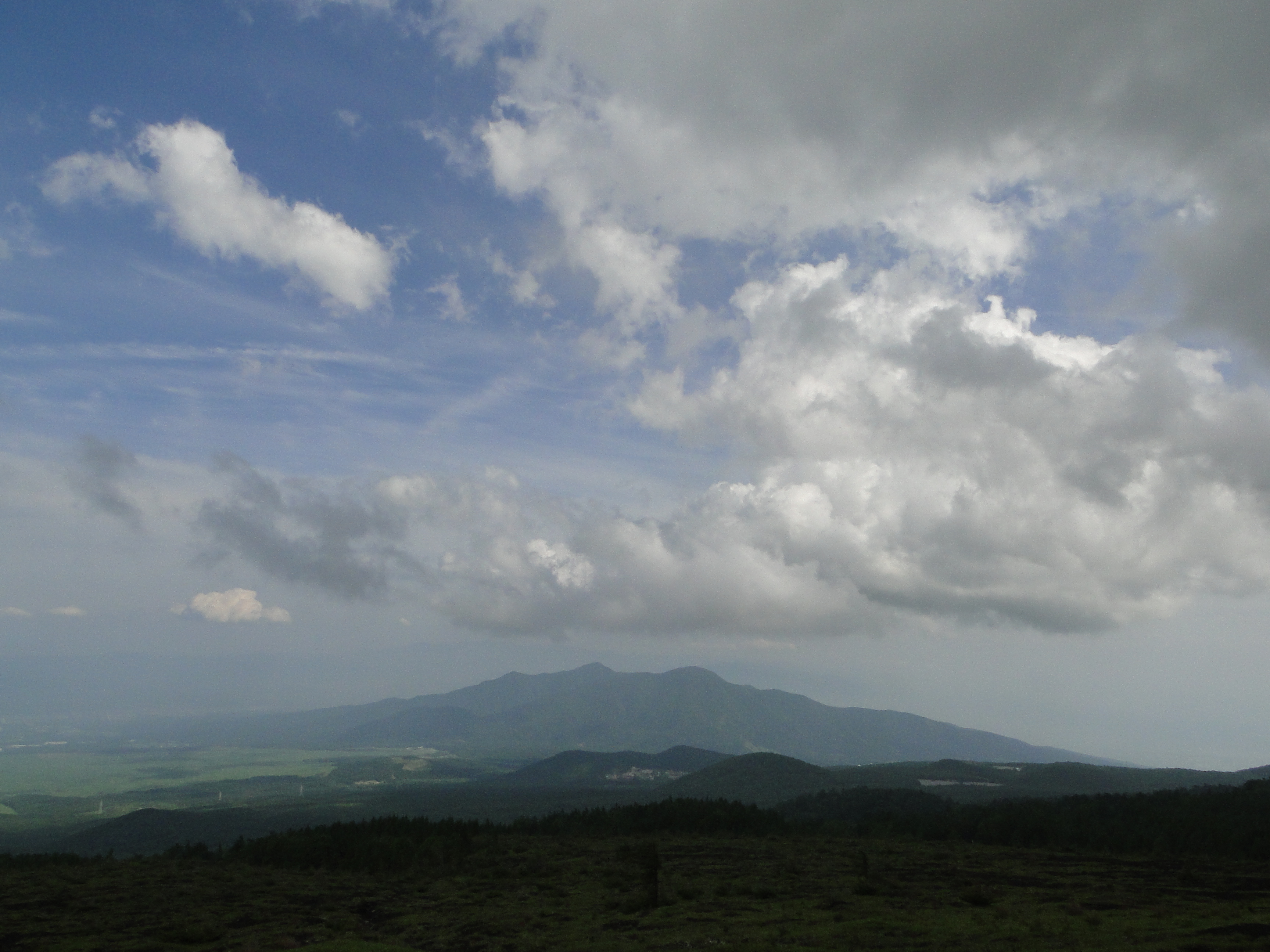
I was surprised to see that thick clouds had rolled in during my ascent, completely hiding Mt Fuji from view. According to the other hikers, I had missed Japan’s iconic volcano by only a few minutes. Looking down, I still had a view of Kawaguchiko lake extending east to west along the base of the mountains. On the right side, I could see Mt Ou and Mt Setto, two other main peaks of the Misaka mountains. I decided to skip my planned lunch break and immediately head to the next summit, in hope that the clouds would have cleared by then. I retraced by steps and headed down a steep path on the west side; beyond Suzuran Pass (すずらん峠), the path became level and easy to walk.
In the Distance, Mt Shakushi and Mt Mishotai
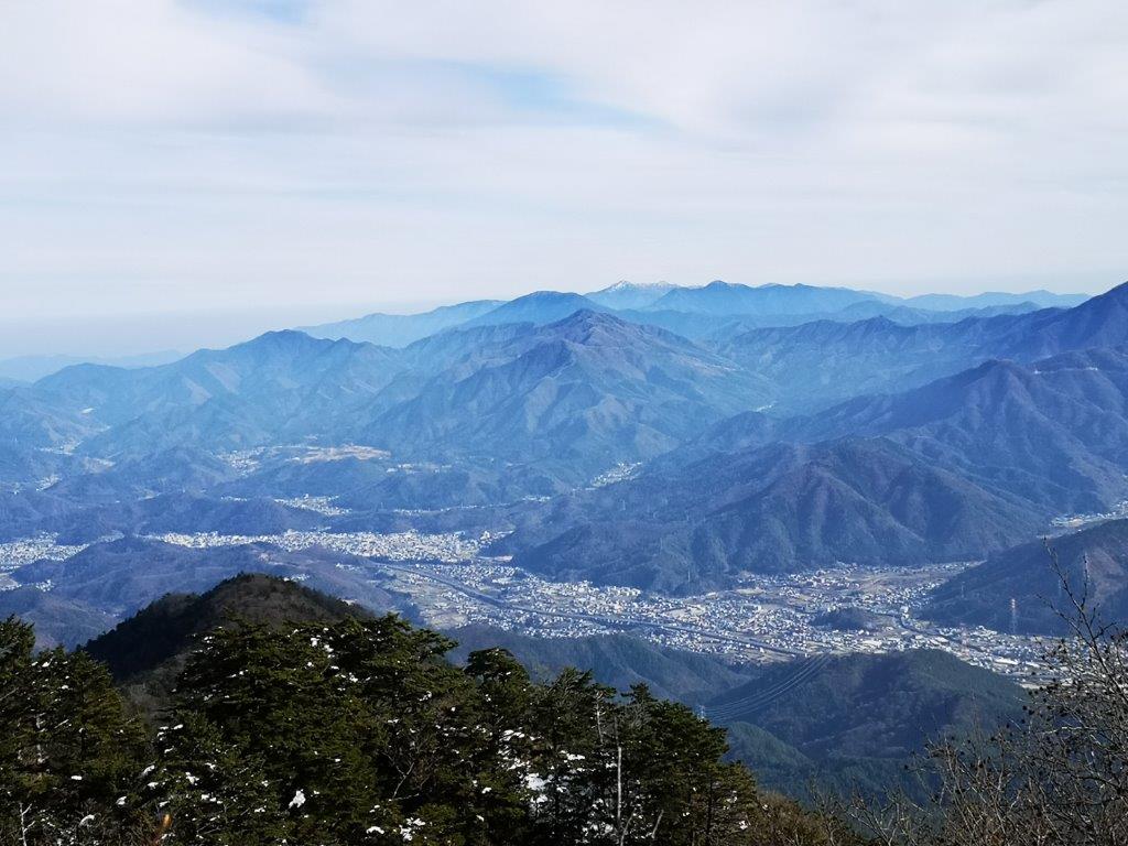
View of Kawaguchi City and its Lake from the 2nd Terrace
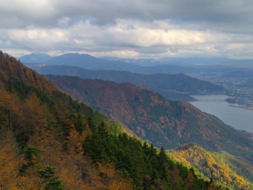
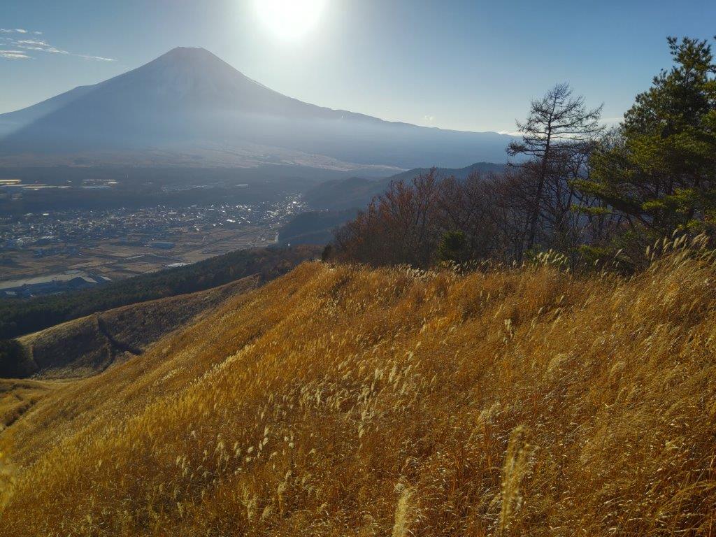
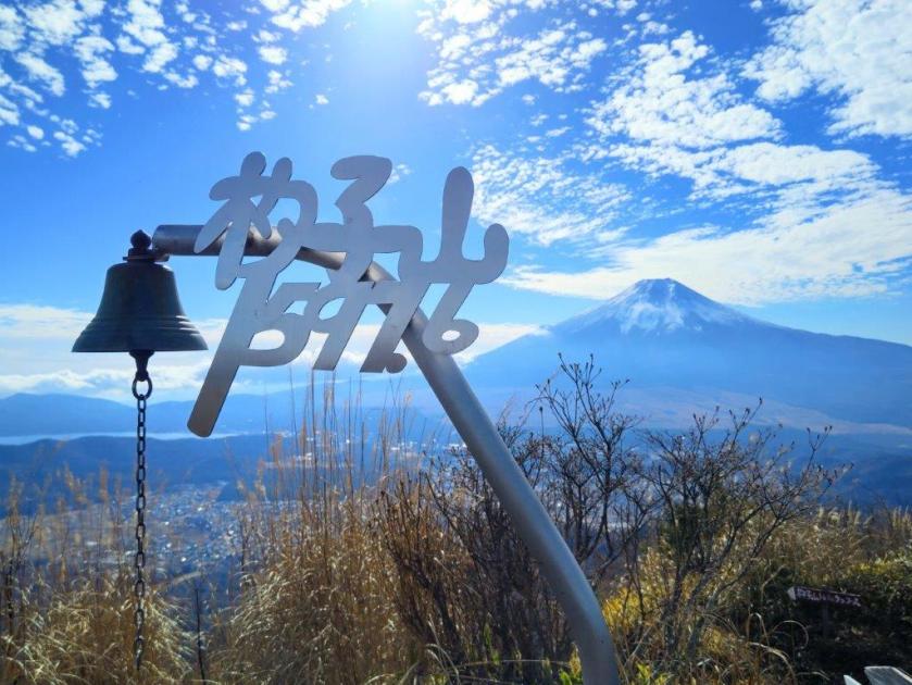
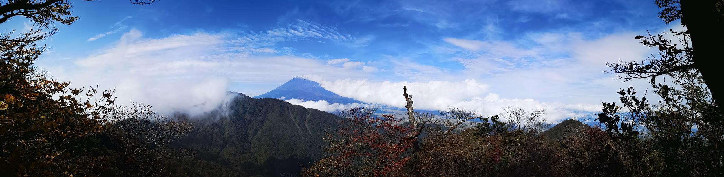
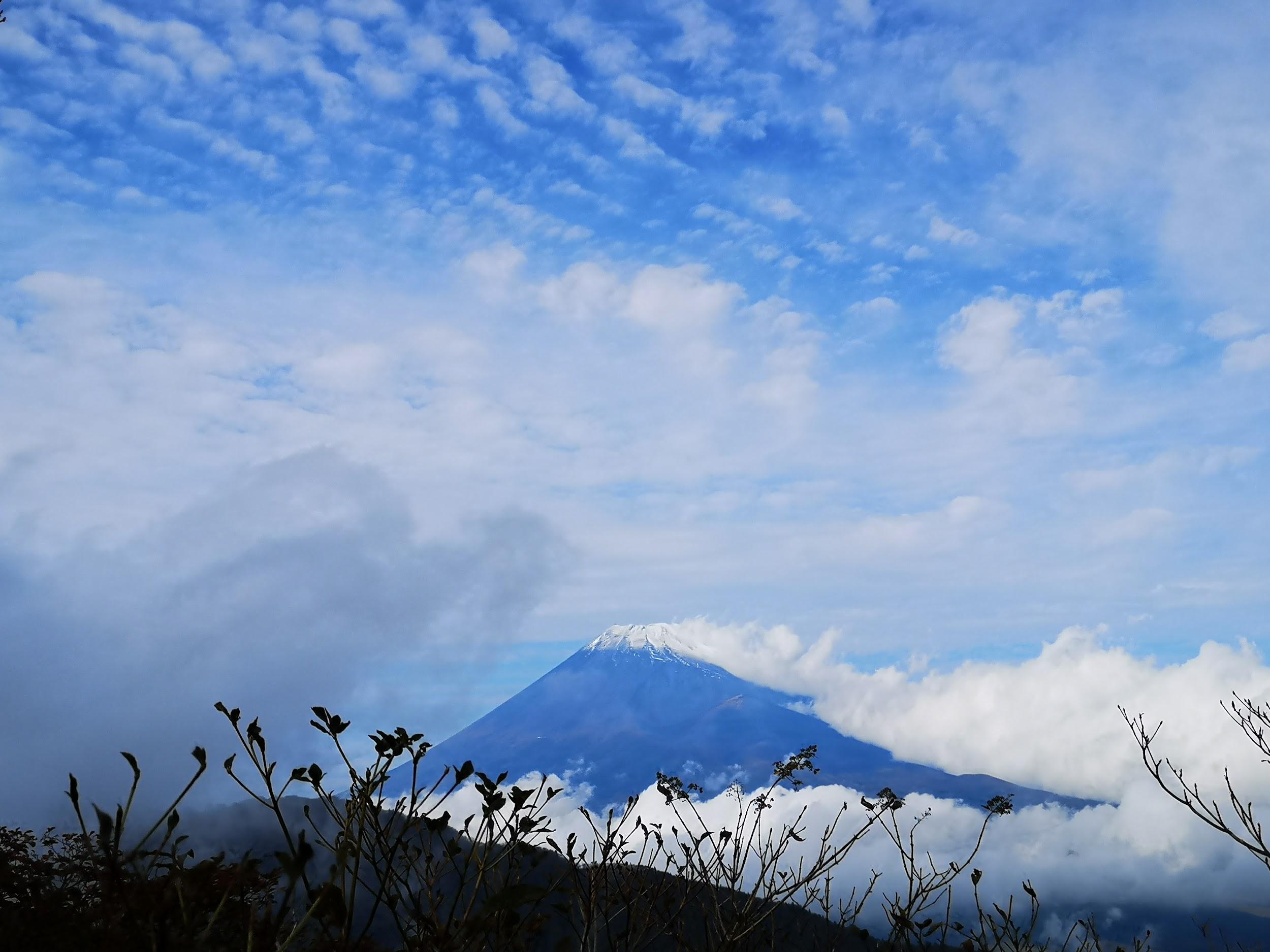
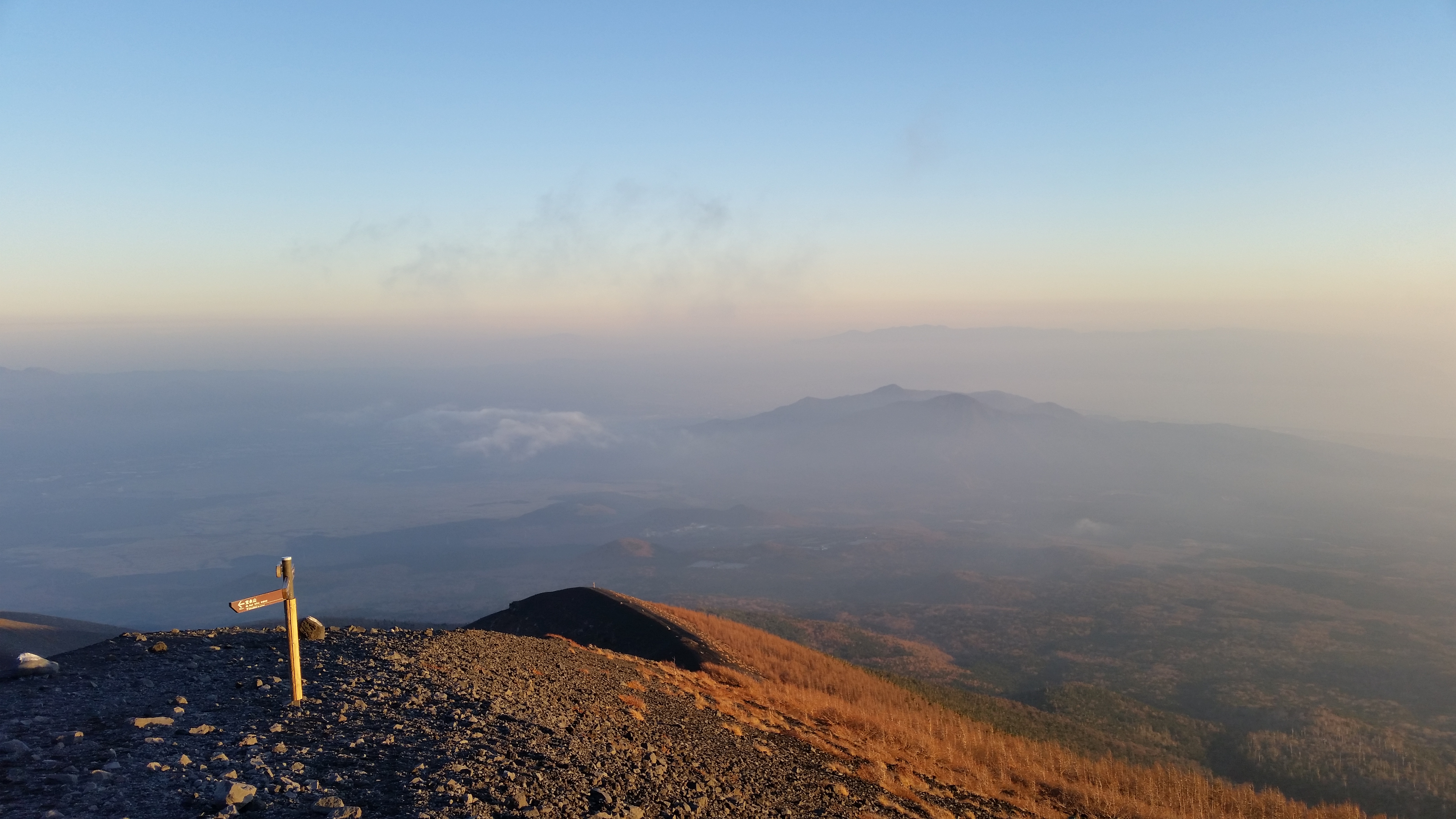
This was the most peaceful and pleasant part of the hike, surrounded by pines masking all sounds and views. I soon passed the summit of Mt Hafu (破風山 はふうざん hafu-zan), only noticeable by its summit marker doubling as a signpost. A short way down the west side was another viewpoint of the Fuji Five Lake area. It was past 2pm so I settled down for a late lunch. Although the clouds were still in, sun rays filtering through the gaps created a magical scenery. At 2h30 I set off again, and soon after passing another viewpoint on the left side, I came upon the first terrace of Fujiyama Twin Terrace at Shindo Pass (新道峠). Opened in July 2021, it was accessible via a short bus ride from the Suzuran Gunseichi parking (a fee is charged each way), and thus was filled with about a dozen sightseers.
Second Terrace of Fujiyama Twin Terrace
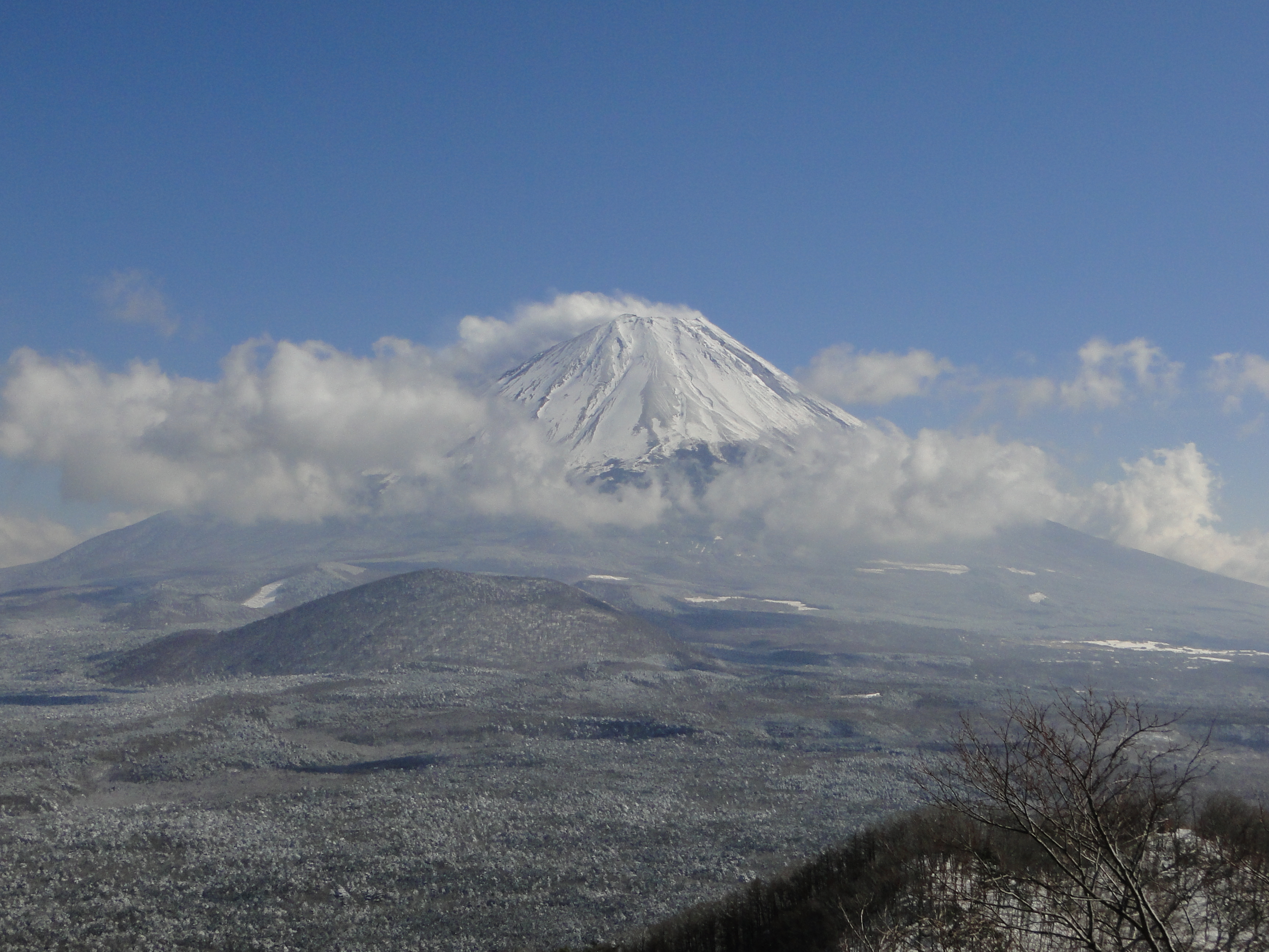
Mt Fuji on a Clear Day (Dec 2013 Photo)
I was stunned by the view of the golden larches covering the foothills, enhanced by the late afternoon sun rays, although Fuji was still stubbornly in the clouds. I made my way to the first terrace, just a few meters away; it was deserted of people, tall pines slightly in the way of the perfect view. It was nearly 3pm, a couple of hours before dark, so I gave up on seeing Japan’s highest mountain and headed down via a paved road, moving to the side once to let the bus pass. Fifteen minutes later, I turned left onto the trail from Suzuran Pass; after descending through dark cedars, I reached a small road the second parking for hikers.
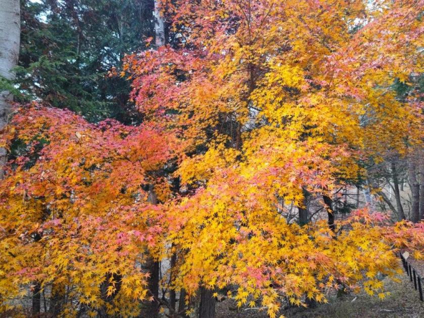
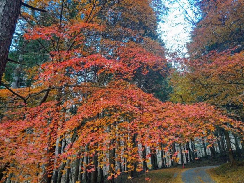
Autumn Leaves near the End of the Hike
A multicolour Japanese Maple Tree
During this part,I finally got a close up view of some beautiful Autumn leaves. A little after 3h30, I arrived back at my car, the last one left in parking area. I drove a short distance to Kamiku-mo-yu, which I reached just before sunset, and after a refreshing hot bath, got back behind the wheel for the return trip to Kofu. Although I experienced a “shy Fuji” today, I was glad I could do a hike in the Fuji area, somewhat of a challenge nowadays due to the high number of overseas visitors. I’d like to return one day and try another hike, but this time starting from Fujiyama Twinterrace.
I found out about this mountain in one of my guidebooks. I had hiked Mt Ishiwari and Mt Mikuni, north and south of it respectively, but never the section in-between. Looking at my map, I saw that I could traverse from Myojin Pass in Shizuoka to Yamanaka lake in Yamanashi. For the first part, I’d follow my 2019 hike but I’d skip Mt Mikuni, entirely in the trees, by following a road to Mikuni Pass. From there, I would head north, passing 3 peaks, before heading down into the Fuji Five Lake Area; Once I reached the end of the trail, I’d follow another road and end the hike at Ishiwarinoyu hot spring.
Hiking in the Fuji-Hakone-Izu National Park
富士箱根伊豆国立公園
Start of the Hike (left) Road for Mikuni Pass (right)
Trail for Mt Teppogi (left) Trail for Mt Takazasu (right)
To get to the start of the hike, I’d ride the first “Mt Fuji” limited express from Shinjuku to Suruga-Oyama, and there catch a Fujikyu seasonal bus for Myojin Pass. For the return, Google Maps suggested going through Kawaguchiko, but I knew from past experience that the Fuji excursion limited express trains would be fully booked far in advance. Instead, I decided to use a taxi to get to Asahigaoka where I could catch a bus for Gotemba station and ride the last “Mt Fuji” limited express back to Shinjuku. The weather was supposed to clear in the morning, turning cloudy in the afternoon, in tune with my early start and early finish plan. I was looking forward to a hike far from Tokyo and hoped I’d get a view of Mt Fuji before it vanished in the clouds.
Find Japan Hiking Maps on Japanwilds and subscribe to our newsletter
View of Hakone from near Myojin Pass
Trail between Myojin Pass and Mt Mikuni
The sun was already high in the sky at 7am as the limited express made its way through Tokyo. After getting off at Suruga-Oyama station at 8am, I hurried to the bus stop but still found myself standing for the 3o-minute ride to the pass, as many people had arrived just before me on the local train. Surprisingly, I had the trail mostly to myself after starting out from Myojin Pass (明神峠 900m) at 9am, since most people first headed to nearby Mt Yubune (I had done the same 6 years ago).
Road leading to Mikuni Pass
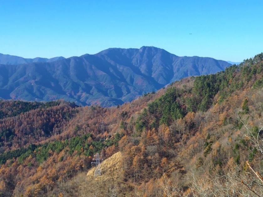
View of the Tanzawa Mountains
I soon had a view on Mt Ashitaka and the Hakone mountains through the trees on the left side. It was already quite warm but fortunately most of this section was in the tree shade. At 9h30, I reached a paved road beyond which the trail for Mt Mikuni rose steeply through the forest. A signpost with a small metal figure of Kintaro perched on top told me I was at the halfway point between the Myojin and Mikuni passes. I turned right onto the paved road, now entering Kanagawa prefecture.
Looking ahead at Mt Teppogi
Looking back at Mt Mikuni
Almost immediately, I got a view of the Tanzawa mountains on the right side, my first time to see them from this angle. Further along, the view was lost behind trees; I picked up the pace to get this boring section quickly behind me, unexpectedly busy with cars and motorcycles. Half an hour later, I reached a huge parking lot at Mikuni Pass (三国峠 1164m), completely filled with cars; apparently this is a popular spot for hiking and escaping the early summer heat. Here, I left the road and turned right onto a trail, now entering Yamanashi prefecture as well as the Fuji-Hakone-Izu National Park.
First View of Mt Fuji above Mikuni Pass
The Climbing Season Starts Soon
After a few minutes, I had my first Fuji view of the day, as I left the forest for a grassy area that continued all the way up the mountainside. Mt Fuji was mostly bare of snow with only a few white streaks around the summit crater, the climbing season less than a month away. I headed up the dirt path as it went straight up, getting steeper and steeper, passing several people on their way down. The grassy surroundings, due to past volcanic eruptions, offered plenty of wonderful views of the Fuji Five Lake Area. Less than half an hour after leaving Mikuni Pass, I reached the summit of Mt Teppogi (鉄砲木ノ頭 てっぽうぎのあたま teppougi-n0-atama also known as Mt Myojin 明神山), marked by a stone shrine; instead of “Mt” the Japanese name uses “head”, an apt description of the wide and slight rounded summit area.
Heading straight up Mt Teppogi
View of Mt Fuji and Yamanaka Lake
The panoramic view was stunning, one of the best I had seen in a while; I was glad I had woken up early today to travel so far. The high-altitude clouds that had appeared one hour ago were getting blown away by high-altitude winds, creating fantastic patterns in the sky above Fuji. On the south side was Mt Mikuni, covered in green forest; looking west, I could see Mt Fuji and Yamanaka Lake with the white peaks of the South Alps visible in the distance; to the north was Mt Ishiwari, with behind it, Mt Mitsutoge and Mt Mishotai, left and right respectively. It was too early for a lunch break, only 11am, so after enjoying the view, I set off again.
View from the Summit of Mt Teppogi
A Popular Spot to See Mt Fuji
The path headed straight down, through thick forest covering the east side. I moved quickly with no views to distract me, and half an hour later, passed Kiridoshi Pass (切通峠 1050m), after which the path started to climb gently. The trees thinned, allowing some green grass and blue sky to gradually reappear. I was now walking along the Tokai Nature Trail (東海自然歩道), which I had last followed just 6 months ago. As the noon chime started to play through the valley, I arrived at Mt Takazasu (高指山 たかざすやま takazasu-yama). The view on the west side, beyond dried stalks of pampas grass (“susuki“), was similar to the previous one, although with more clouds. Since it was noon, I sat on the shaded side of a wooden platform for an early lunch break.
After setting off again, I found myself walking through more thick forest, along a mostly level path; although I was deprived of views in all directions, I was glad to be in shade at the hottest time of the day. Very soon, I reached the third and final summit of the day, Fujimisaki-daira (富士岬平 1170m); this time, the “Mt” was replaced by “plateau”, indicating its relatively small prominence along the ridgeline. By now, puffs of cloud were covering the highest part of Mt Fuji, giving it kind of retro hairstyle. After a short break, I headed down a path on west side, leaving behind the Tokai Nature Trail.
Mid-morning Blue Skies
Grass Reappearing below Mt Takazasu
The path was steep and eroded making this descent the toughest part of today’s hike. Fortunately, I soon reached a road leading through an area of mostly deserted villas. I always enjoy walking past holiday homes, trying to imagine what it must be like to spend a summer weekend there. I eventually reached a main road where I turned left. After a 15-minute walk, I reached the entrance to the hot spring and was disappointed to find out that it was closed. Apparently they were doing some temporary renovations, which wasn’t the case when I first planned the hike a few weeks ago. I was confident I could find some alternative and marched on under the hot sun to the Yamanakako Hirano tourist office.
View from Mt Takazasu
The Clouds have Reappeared
I was delighted when the lady from the tourist office told me there was a a hot spring hotel just down the street that accepted day trippers. Although it didn’t have an outdoor bath, I was happy to be able to wash off the sweat and change into some fresh clothes. At 2pm, I had the bath to myself, with a view of the ridge I had just hiked on the west side. One hour later, a taxi dropped me off at the Asahigaoka bus terminal. Although, the bus for Gotemba showed up late, typical for the Fuji Five Lake area, I still arrived at the station with plenty of time to spare, and a little before 5h30, I boarded the limited express for the comfortable ride back to Shinjuku.
Trail between Mt Takazasu and Fujimisaki-daira
Mt Fuji in the Clouds
In total this hike took about 5 hours, with little ascending and descending, although including travel time, it was nearly a 14-hour outing. This was mainly because I took a longer way back to avoid the masses of tourists heading back from Kawaguchiko, and also because of my preference for limited express trains and post-hike hot spring baths. Catching the seasonal bus to Myojin Pass was also a great way to get to the area, although it requires a very early departure (in my case, 6am); in this case I was rewarded with great views that I may not have gotten with a later departure. Hopefully, I can redo this hike, or a variant, in a different season when the Ishiwariyu hot spring is open.
I had climbed this mountain once before but I wanted to redo it via a different route. This would be my first trip to the Fuji Five Lake Region since 2022. I decided to go up via the Asumi ridge; it was mostly in the trees but had a couple of viewpoints on the Fuji side. Looking at my map, I realised that going down via the Japanese Pampas grass (“susuki“) field, as I had done previously, was the best option, as it offered plenty of views of Mt Fuji.
I would take the Chuo Limited Express to Fujisan station, although the section past Otsuki would be standing room only. From the station, I would ride a taxi to Fudoyu Inn, next to the trail entrance. For the return from Oshino village, I could take a bus or a taxi back to the station, depending on the timing. The weather was supposed to be sunny with average temperatures for the season. I was looking forward to getting some closeup views of Mt Fuji and walking through the “susuki” field.
Hiking in the Doshi Mountains 道志山地
Hiking in the Fuji Five Lake Region 富士五湖
Heading Up the Z Trail (left) and the Asumi Ridge (right)
Looking Down (left) and Up (right) the Steps to Ozasu Pass
The grey skies hanging over Tokyo turned into blue skies as the limited express entered Yamanashi. At Otsuki station, I gave up my comfortable seat and squeezed into the front car, the train packed with tourists. Fortunately, few people got off at Fujisan station, and after a short taxi ride, I arrived at Fudoyu Inn. After getting ready, I set off at 11am, up a trail through a deforested area.
The top of Mt Fuji is only 20 kilometers away
Hiking through the Japanese Pampas Grass Fields
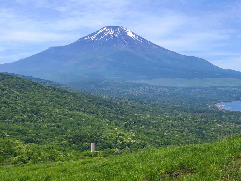
Turning around, I had a superb view of Mt Fuji, my first since April. The sky was streaked with cirrus clouds but Mt Fuji was clearly visible, its distinctive snowcap shining in the morning light. After a couple of switchbacks, I arrived at the entrance of the Z trail (Zコース), a gentle slope through the forest. At 1130, I reached the Ridge Trail (尾根コース), on Asumi-One (明見尾根). Through the bare trees on the north side, I had a glimpse of next valley. After a few minutes of level walking, I reached a viewpoint.
Mt Fuji viewpoint just above Fudoyu Inn
Deforested Area at the Start of the Hike
This was the best view of Mt Fuji of the day: it was framed by green cedars on both sides, with golden “susuki” below and white clouds above. I was resolved to enjoy the Fuji views early in the day; later on, the sun would move behind, leaving just a dark outline. The path suddenly became quite steep, some parts lined with rope for safety. I climbed as quickly as I could, passing many hikers on their way down. Just before 1230, I reached the second viewpoint of the climb.
Autumn Colours on the Lower Hills
Best Fuji View of the Day
I took a few minutes to enjoy the view of Mt Fuji, beyond the “susuki” swaying in the wind. To the west, I could see Kawaguchiko City, and far behind, Mt Warusawa and Mt Akaishi, two prominent peaks in the South Alps. One last effort brought me to the top of Mt Shakushi (杓子山 しゃくしやま shakushi-yama), a Yamanashi 100-famous mountain. To the left of Mt Fuji was Yamanaka lake and to the right was the entire range of the South Alps, from the Shirane-Sanzan to Mt Hijiri; on the north side were the Oku-Chichibu mountains; on the right side, the Kanto plain was still hidden by the clouds. It was just past 1pm so I sat at at a bench for a lunch with a view.
Mt Fuji and the South Alps from the Asumi Ridge
Looking back at Mt Fuji
I was amazed to see a paraglider fly at high altitude, back and forth past the summit of Mt Fuji, at one point passing above my lunch spot. The jump-off point being much lower down on the mountain, it must have caught the perfect updraft. A little after 1h30, I set off again, heading down the steep south side. I soon re-entered the trees, and less than half an hour later, reached Ozasu Pass and the paragliding launch spot. I continued straight ahead, following an up and down trail; near an electric pylon, I passed a viewpoint of Mt Mitsutoge.
The Oku-Chichibu Mountains from the Top of Mt Shakushi
Kawaguchiko City and the South Alps from the Top of Mt Shakushi
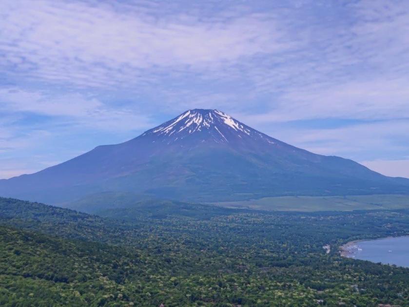
I was surprised by how demanding this section was, with short rocky sections lined with rope for safety, even though I had done it once before some years ago. One hour after leaving the top of Mt Shakushi, I arrived at the summit of Mt Takazasu (高座山 たかざすさん takazasu-san). Mt Fuji was visible once again, its north face now mostly in the shade. After a short break, I continued my descent, and very soon I was walking above a huge field of Japanese pampas grass (“susuki“) covering most of the mountain side.
View of Mt Mitsutoge between Ozasu Pass and Mt Takazasu
View of Mt Fuji from the Top of Mt Takazasu
I enjoyed unobstructed views of Mt Fuji for the next half an hour but since it was past 3pm, the low sun made it difficult to get good photos. On the other hand, the “susuki” were at their best, shining golden in the mid-afternoon light. At 3h30, I reached a forest road leading to a paved road at Toriichi Pass. There, I turned left, and after walking downhill for a short while, arrived at Oshino Village. Since it was still early, I decided to walk to nearby Oshino Hakkai. Once there, I was lucky to be able to flag down a passing taxi, allowing me to quickly get back to Fujisan station. After riding the Fujikyuko line to Otsuki, I boarding the limited express for the one-hour ride back to Shinjuku.
Susuki field below the Mt Takazasu
Heading towards Toriichi Pass
The entire hike took about 5 hours, roughly the same time as my previous hike along a slightly longer route. I was glad that for the extra expense of taking a taxi to the trailhead, I got several good viewpoints of Mt Fuji along the way. Although I saw a number of people while going up the Asumi ridge, I saw no one during the entire descent, a shame considering the amazing Japanese pampas grass field on the way. Late autumn is definitely the best time to visit this mountain, although I’d love to attempt this hike earlier in the day to get clearer views of Mt Fuji.
It had been 4 years since my last hike on Mt Fuji, so I thought it was time to visit again. As on my previous trips, instead of climbing to the summit, I wanted to combine several of the trails that crisscross the Shizuoka side of the mountain. This would allow me to do some moderate hiking, further helping me get back into shape, and immerse myself in nature again, since I would be inside the Fuji-Hakone-Izu National Park. I would get up extra early to catch the first Odakyu limited express of the day, the only one in the morning going all the way to Gotemba station. From there, I would take a Fujikyu bus to the Gotemba New 5th station, the lowest of the four trails up Mt Fuji. This time, I decided to do a loop hike, so I would travel back the same way. The weather was supposed to be sunny and even a little warm, perfect for a high-altitude ramble on the side of Japan’s most famous volcano. I was looking forward to getting some great views and enjoying the beautiful forest covering the lower half of Japan’s highest mountain.
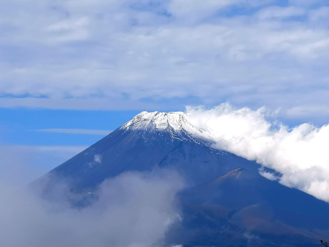
Summit of Mt Fuji from the 5th station, clear of clouds and snow
Pleasant hiking at high altitude
Some clouds remained as I rode the early morninglimited express to Gotemba, where I boarded a Fujikyu bus for the one-hour ride to the Gotemba New 5th station (1439m 御殿場口新五合目), getting there a little after 9am. By now, the clouds had vanished, and it was already felt quite warm under the sun. From the parking lot observation tower I enjoyed a wide view to the west of Gotemba city and the Tanzawa and Hakone mountains; turning around, I could also see cloud free summit of Mt Fuji, looking somewhat ordinary without its snowcap. At 9h30, I set off up the, now officially closed for the season, trail for the summit.
The Tanzawa mountains in Kanagawa
Yamanaka lake in Yamanashi
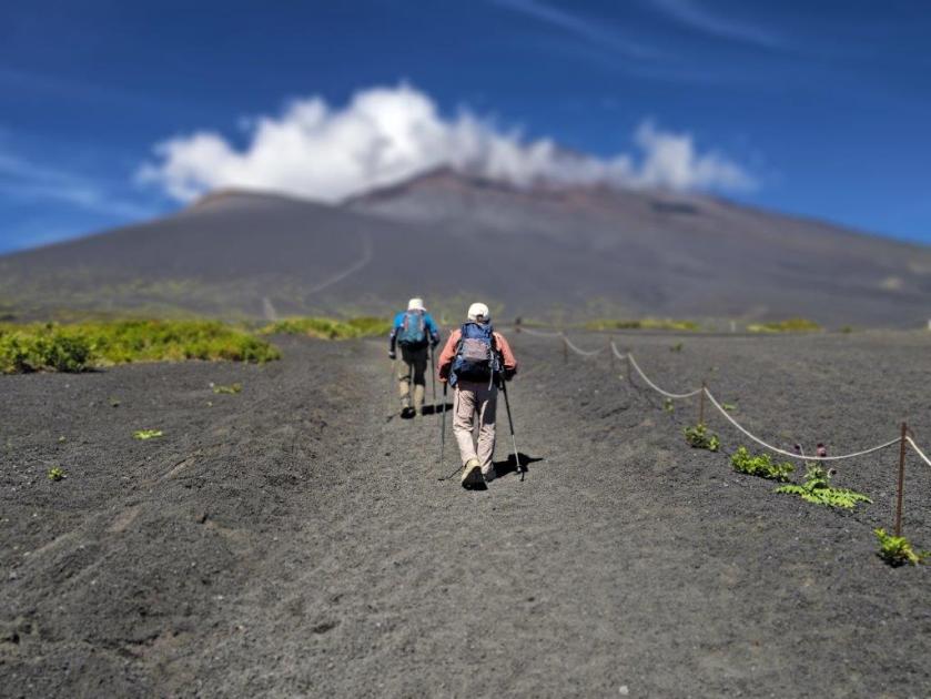
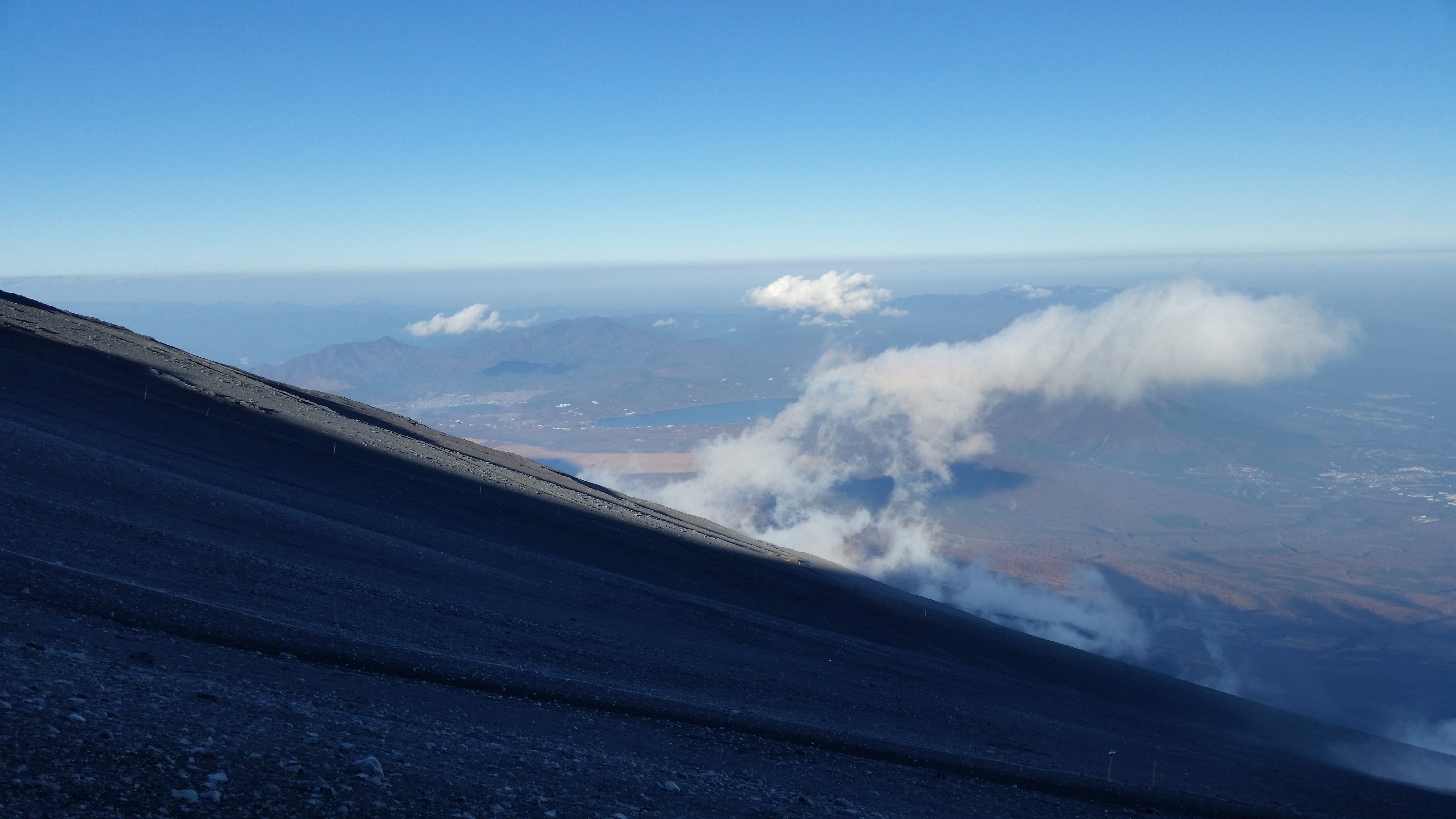
It seemed like a perfect day to climb to the top, which felt tantalizing close, even though it was 17oo meters higher. I quickly reached a junction at Oishi-Chaya (大石茶屋), where I took the left branch, heading towards a gap between two pimple-like mounds protruding from the volcano side. I slowly treaded up the sandy path, often stopping and turning to take in the soaring views; north, I could now see the light blue waters of Yamanaka lake, emerging from behind a light-green ridge. At 10h30, I reached the wide, flat top of Mt Futago (双子山 ふたごやま futago-yama, also called Futatsuzuka-Shitazuka 二ツ塚下塚).
The summit looks tantalizingly close
The twin mounds of Shitazuka (left) and Kamitsuka (right)
I was stunned by the majestic view, looking down at the surrounding area, which had been obscured by the clouds on my previous visit. South, I could now see Mt Ashitaka, and directly behind, the Izu peninsula and Tsuruga bay; the slightly higher Kamitsuka (上塚), and Mt Fuji, now with a cloudy headpiece, rose behind me. After a short break, I headed back to the main trail along a valley between the two mounds, and followed the “H route” of the Mt Fuji Natural Recreation Forest Trail (自然休養林歩道 “shizen kyuyorin hodo“), as it climbed gently through scattered pines, with impressive views of the rocky formations around Mt Hoei, as well as of Mt Ashitaka.
View of some of the rocky formations around Mt Hoei
View of the Ashitaka volcano mountain range
It felt amazing to walk this mostly level, panoramic trail at an altitude of nearly 2000 meters. A little before noon, I arrived at the entrance of Goten Garden (御殿庭入口). From this point, the feel of the hike became completely different, as I made me way through a dense mixed forest, on a narrow and faint path. However, this section was equally enjoyable, as the midday sun amplified the various shades of green, from the dark green of the pine needles to the light green blades of the grassy forest floor. I soon arrived at a junction at the base of Goten garden (1977m 御殿庭下). I found a fallen tree in a sunny clearing, and sat down for an early lunch.
The low mountains of Izu disappearing into the haze
It was easy to forget I was hiking on Mt Fuji
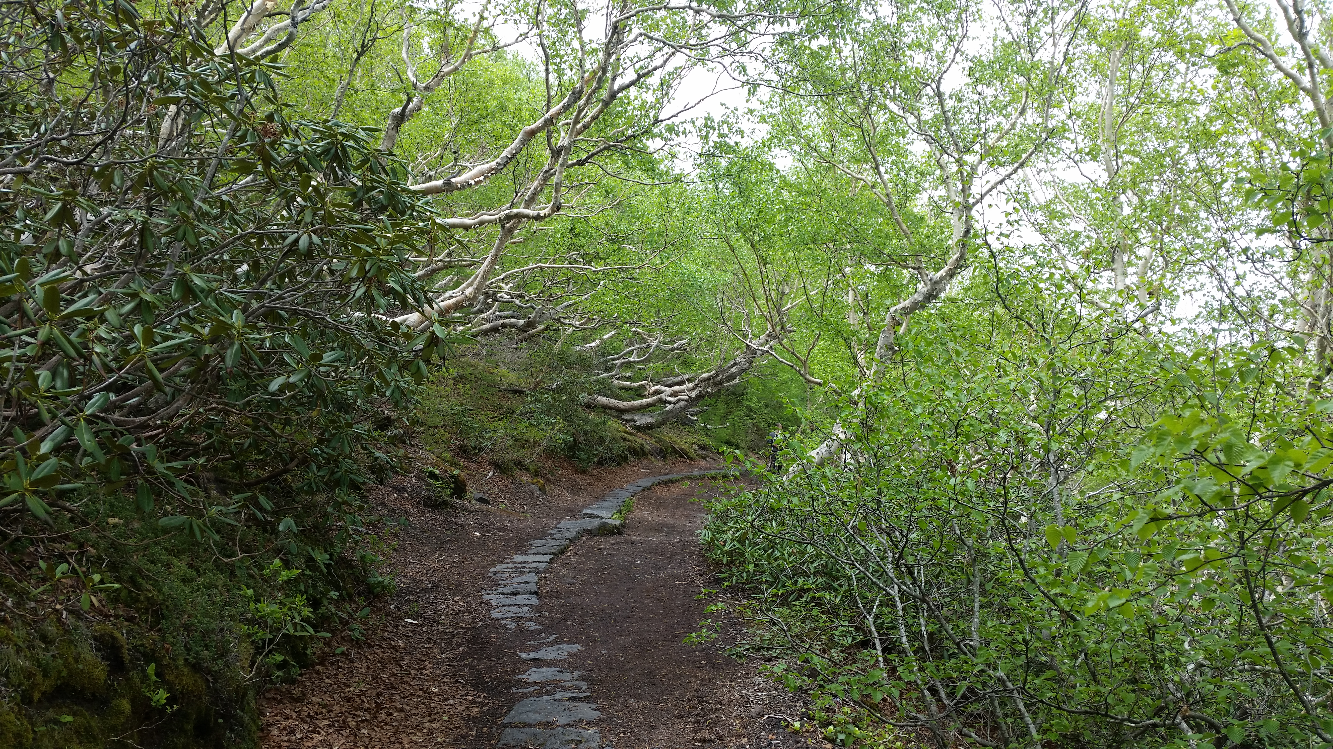
It was hard to believe I was more than halfway up Japan’s highest mountain, as I was completely surrounded by trees; it was also eerily quiet, except for the background hum of insects. At 12h30, I headed down the steep Suyamaguchi hiking trail (須山口登山道), also the “D route” of the Nature Recreation Forest Trail. As the altitude dropped, I got to enjoy the change in the surrounding nature, from a thick, impenetrable pine forest, to a roomy, shady birch forest. After nearly an hour of descending, I reached another junction at about 1600m, where I turned left, along the “E route”, heading back to my starting point.
Looking back at the trail hiked so far from the entrance of Goten Niwa
A mix of dense pine (left) and spacious birch (right) forests
I was once again walking along a pleasant and mostly level trail, although this time, the views were hidden by the towering birches. I slowed my pace and admired the beautiful nature of the Fuji part of the Fuji-Hakone-Izu National Park, better known for the volcano view, rather than the ancient forests covering its lower slopes. At 2pm, I reached Maku Rock (幕岩 “makuiwa“), a lava formation created by the Mt Hoei eruption 300 years ago. From there, it took less than an hour along the ” I route” to get back to the Gotemba New 5th station, completing the loop hike in five hours and a half.
Sunny, grassy path lower down the mountain
A relaxing trail near the end the hike
I was glad I had chosen to revisit the area on a clear day: although the the top of Mt Fuji was shrouded in clouds for most of the day, I enjoyed great views in other directions; I also got a decent workout thanks to the moderate climb from the 5th station to Goten Garden. After a short wait, I caught the bus for Gotemba station; even though the bus was full, I had seen few people on the route I had chosen. Back in Gotemba, I made a quick visit to Ninjinyu public bath (人参湯) to wash off the sweat, before boarding the limited express train for the 90-minute comfortable ride to Shinjuku.
See the views from halfway up Japan’s highest volcano
I had been thinking about visiting the Fuji Five Lakes area again. Having heard on the news that it had snowed there, I decided to make it my next destination, as it would be a great opportunity to do some snow walking close to Tokyo. Also, I could use the Fuji Excursion limited express from Shinjuku, which hadn’t existed on my last visit 5 years ago. From the station, I could catch a bus to the trail entrance. Reaching an elevation of 1230m, it’s one of the highest bus lines near Tokyo that is open all year round. After climbing to the summit, I would go down the opposite side to Mitsutoge station on the Fujikyu line. I was a little unsure about the weather forecast: it was supposed to be sunny, despite the presence of high-altitude clouds. However, I was mainly concerned about the amount of snow and ice on the trail. I packed my light crampons and planned alternatives, feeling excited about seeing the first snow scenes of the season.
I travelled to Kawaguchiko under gloomy, grey skies, and felt certain I would be hiking inside freezing cold clouds. However, once I was on the bus, the clouds parted, the sun started shining and Mt Fuji appeared. At 10h30 I started hiking from “Mitsutoge Tozan Guchi” (三つ峠登山口), first on a road next to a mountain stream, then on a forest road, winding gently up the mountain side.
Finally, snow!
Just a little further on to the highest point
I saw the first traces of the recent snowfall thirty minutes later, and one hour after setting off, I could feel the satisfying crunch of snow underfoot. It was melting quickly but enough was left to create the hoped for winter landscape. Patches of blue were spreading above as the weather continued to improve. I passed a handful of hikers, and even a couple of jeeps (see video), probably fetching supplies for the lodges before the busy weekend.
Looking south towards the Tenshi mountains
The Mikasa mountains with the Japanese Alps behind
At noon, I had a glorious view of snowy Fuji outside the Mitsutoge Lodge. I had an early lunch and then continued to the highest point, Mt Kaiun (開運山 meaning “better fortune”), above an impressive rocky face. This part truly felt like a snow hike, but thanks to steps placed on the steep slope, I didn’t need to take my crampons out. At 12h30 I was on top of Mitsutoge (三ッ峠 みつとうげ), a 200-famous mountain of Japan. Despite the name, “three passes”, it has three summits rather than mountain passes.
Time to head down down – on the right is Yatsutagake
The southern ridge of Mitsutoge
I had arguably one of the best views of the entire area, the visibility being excellent despite high clouds veiling the sun. Ancient volcanoes surrounded the younger Fuji-san: Mt Hakone, Mt Amagi, Mt Ashitaka and Yatsugatake. The snowy peaks of the Japanese Alps stretched across the western horizon. I could see all the main mountain ranges: Doshi, Tanzawa, Tenshi, Misaka, and Chichibu. Only the north side was blocked by trees and a radio tower; to the northeast, Tokyo was covered in a grey smog.
The Doshi mountains with Tanzawa in the background
Mt Kura with Mt Shakushi directly behind
By 1pm the sun had completely vanished; thankfully it was a windless day and it wasn’t as cold as I had expected. I retraced my steps to the lodge and, since it was still early, I made a roundtrip to Mt Kinashi (木無山 1732m), another of the three summits. Although the name means “without trees”, they were inconveniently blocking the view; only Mt Fuji was visible directly south. By now, it was nearly 2pm and time to head down.
Reaching the base of the cliffs
High-altitude clouds masking the sun
It soon became clear I wouldn’t need my crampons at all today. I descended safely, thanks to a series of steps and a walkway, and reached the base of the cliffs. It’s a popular rock climbing spot and a couple of people were practicing their skills. All traces of snow were now gone, but it was thrilling to walk under the cliff face. At first, the path was mostly level, as it went round to the east side, but eventually it started to zigzag into the valley .
Mt Fuji in the afternoon shade
Last sun rays of the day
I could still see Mt Fuji through gaps in the trees, its eastern side now in the shade. The sun made a final appearance, shining briefly through the leafless trees, before disappearing for good behind a ridge at 3pm. Shortly after, I reached a paved road at the trail entrance. I dropped by Mitsutoge Green Center to take a hot bath before continuing to the nearby Mitsutoge station. At 5pm, I boarded a local trail for Otsuki, where I transferred to the Chuo limited express for the one-hour ride to Tokyo.
It was my third trip to this multi-peak mountain just south of Mt Fuji, and my first trip of the year to Shizuoka. This time, I planned to climb a secondary peak after which this ancient volcano is named. To get to the start of the trail, I would use the same bus I had taken at the end of my hike on Mt Ihai. From the summit, I would walk all the way down to the base of the mountain on Suruga Bay, and then walk along paved roads to a bus stop. To do this as a day trip, I needed to take the shinkansen there and back; it seemed worth it, since the weather was supposed to be quite good the next day. I was hoping to see plenty of “Sakura” and also get a glimpse of Mt Fuji.
A view of “floating Fuji” on the way down
It took less than an hour to travel the 100 kilometers between Tokyo and Mishima stations. I rode the bus all the way to Momozawa Onsen (桃沢温泉), the last stop. It had been sunny when I left in the morning, but now the sky was overcast. I started hiking at 10am inside a river park following the Momozawa river up the mountain valley. The path crossed the rushing river over several suspended bridges and went through a barbeque area with several cherry blossom trees in full bloom.
A nice place for a BBQ
All too soon I reached the end of the park and the lovely river walk. I then followed a narrow paved road for a short while to the start of the hiking trail and the Ashitaka Water Shrine, which I decided to check out quickly. It was interesting to see a shrine right next to a river. The sun had come out of the clouds and there was a slight breeze. The combination of sun, wind and water, as well as the new green of the surrounding vegetation was enchanting. At 11h30, I finally started hiking up a steep mountain trail.
Waterfall at the end of the park
It was a brand new path not shown on my map. I soon reached the ridgetop, completely in the trees, where I turned right along a flatter section. At 12h30, I emerged onto a level forest road, which I followed for a hundred meters. I then left it to follow a smaller path up the side of the mountain. This area was cleared of trees; looking back, I had a view of Hakone to the east. I reentered the forest and was now walking next to a dry riverbed. I saw some “Mitsumata” flowers in full bloom, the petals facing down, making them hard to photograph.
Walking the ridgetop among the trees
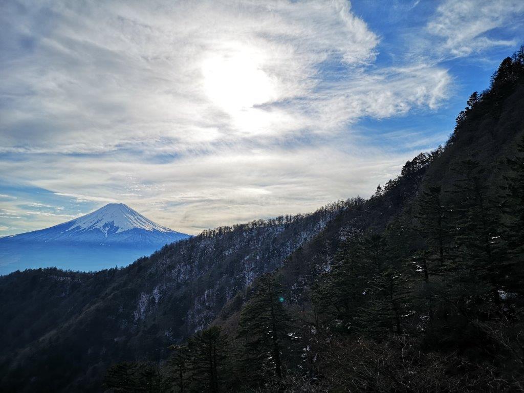
It took me an hour of climbing through a dark forest to reach a windy pass with a view west of Suruga Bay. I took a short break before heading up the round summit on the left. Ten minutes later I was standing at the top of Mt Ashitaka (愛鷹山 あしたかやま ashitakayama). Turning around, I could see the snowy summit of Mt Fuji, playing hide and seek in the clouds. I could also see the two highest peaks of this volcanic complex, Mt Echizen and Mt Ihai. I explored the tree-covered summit and found a small shrine.
View of Mt Fuji from the top of Mt Ashitaka
After lunch and a short rest, I started to head down on the other side. It was nearly 3pm and I had to make good time if I wanted to catch my bus. The path was mostly in the trees, but I got another view of Mt Fuji, now free of clouds, and later on, a view of the entire Hakone area. On this side, the trail had suffered from erosion and at times was hard to walk on. I saw another interesting flower, the Japanese Andromeda, growing from a tree. The air was filled with birdsong and it felt like spring had finally arrived.
The Hakone mountains behind Susono city
Suddenly, I spotted a pheasant next to the path. I had seen these birds before but they usually fly away. This one, however, was in ho hurry to get away. I soon found out why: behind some bushes was a brown chick, almost as big as the mother (see video). I left them in peace and continued on my way. It was 4pm and I was out of the forest, walking along the tea fields for which Shizuoka is famous. Soon I reached the Ashitaka 600 Golf Club from where I had a hazy view of the Numazu Alps with the Izu peninsula in the background.
Mother pheasant trying to lead me away from her chick
I walked down a steep road, stray white golf balls littering each side, and passed under some superb cherry blossom trees in full bloom. The sky was cloudy again but the temperature was still comfortable. Using Google Maps, I walked thirty minutes to the bus stop inside the Fujitsu Numazu Plant. As I stood all alone inside the empty parking lot, I really wondered whether a bus would come to pick me up on a Saturday afternoon. However, it arrived right on schedule and dropped me off at Numazu station, for a short train ride to Mishima and my shinkansen ride back to Tokyo.
This hike followed the ridgeline in the opposite direction of Mt Shaka. I had been wanting to return there for a while, but couldn’t figure out how to get back to the train station at the end of the trail. After poring over maps and bus timetables, I discovered that the bus taking me to the starting point, also passed relatively close to the end point. Unfortunately, the trail was just off my Mt Fuji hiking map, and it wasn’t included in my “Mountains of Yamanashi” guide book either. So using the Yamareco website, and information from the Inayama Zelkova Forest website, I created my own hike. It involved a round-trip on one section, thus forming a Y shape.
The Fujikyu bus from Isawa Onsen to Ogossoya (the Ashigawa farmer’s market) was discontinued in 2024. Access is now via car, or by bus from Kawaguchiko Station. However, since 2024, a free shuttle bus runs on weekends between Ogossoya and Suzuran.
Bird’s eye view of Kofu City
Hard to believe that this is just 100 km from Tokyo
After taking the comfortable Chuo line limited express to Isawa Onsen, I boarded a nearly empty bus for the one-hour trip to Torisaka Pass 鳥坂峠. This was my third time taking this bus, and each time it has been empty; a shame since it goes into a valley surrounded by several good hiking trails with views of Mt Fuji. I arrived at the pass just before 11am, and although several cars were parked there, I saw no one during my hike. The other hikers probably went the other way, towards Mt Shaka. I first followed a road (closed to cars) for a few minutes, till I reached a small trail on the right, marked by a stone monument. After about five minutes of climbing, I reached the ridgeline where I took the trail heading left.
Easy-to-spot start of the trail
Nice hiking trail at 1000 meters elevation
The next section was a pleasant ramble that climbed gradually through bare trees. At an elevation of 1000m, spring had yet to arrive. It was a blue sky day, but a cold wind was blowing from the valley below. I soon arrived at Kasugasawa-no-to 春日沢の頭 (1235m), a flat open space surrounded by trees. After a short up and down, I reached Mt Kasuga 春日山. Here again there was no view. Since it was only noon, I decided to wait a little longer for lunch. After another short descent, I reached a narrow road, closed to cars in the winter. I continued up a surprisingly steep trail on the opposite site, to the top of Mt Meisho 名所山. The trail continued beyond to another road, from where it was possible to walk to the last stop of my morning. However, I preferred to retrace my steps, back down the steep slope, thanks to which I could get some views of the Oku-chichibu mountains above the trees.
Steep slope on Mt Meisho
The Oku-Chichibu Mountains with Mt Kinpu in the center
Once I was back on the road I had crossed earlier, I walked along it, heading North for 5 minutes to an amazing viewpoint with a bench of the Kofu valley. It was 1h30 so I decided to take a break for lunch. To my left, I could see the South Alps, the highest peaks hidden in the clouds; in front the wide expanse of the Kofu valley, with the buildings of Kofu city in the middle, and Yatsugatake under a big cloud behind; to my right, I could see the Oku-Chichibu mountains, completely free of clouds, with the small triangular peak of Mt Kinpu in the middle.
Looking Northwest towards Nagano
Looking Northeast towards Yamanashi
It was still terribly windy, so I had to cut my lunch short. I made my way back to Kasugasawa-no-to, where I took a path to the left, and followed a wide downhill slope. I reached Mt Ina 稲山 just before 3pm. There was another view, similar to the one I had during lunch. Here I had the choice between a North trail and a South trail, both of the same length. They each followed a ridge above a valley and ended at the same place. I couldn’t find the North one, so the choice was easy. From now, the ridge became steeper and more narrow, with many tall pine trees along the path. You truly felt you were hiking in the mountains, a feeling you don’t always get when hiking closer to Tokyo.
Some of the best hiking was through the Zelkova forest
Approaching the end of the hike
At 4pm I emerged onto a small road and a small parking area. On the way to the bus stop, I made a short detour by the nearby Yatsushiro-Furusato Park. There were some “Kofun” (ancient mound tombs), and good views of the surrounding mountains. At 5h30 I caught the empty bus back, and reached Isawa onsen station before 6pm. After a quick hot spring bath at Yamanami Hotel, I got the limited express train back to Tokyo.
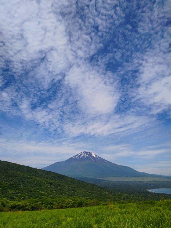
This is one of my favourite areas to hike in the late autumn and early winter since the views of Mt Fuji are so beautiful. Also, since April 2019, there is a direct limited express between Shinjuku and Kawaguchiko that I really wanted to try. It’s the same deal as the Chuo line limited express – all seats are reserved only. However, for the Fuji train, there were no seats to be had on the day itself, and I had to stand most of the way. Although it’s convenient, I probably won’t be using this train again.
View of Mt Fuji from Yamadaya Hotel
I got off at Fuji station, boarded the bus for Motosu lake, and got off at Yamadaya Hotel next to Shoji lake. The view of Mt Fuji rising from behind the lake was stunning. Originally I wanted to hike all the way to Mt Ou and end at lake Saiko, but considering the fresh layer of snow that covered the higher reaches of the mountain, I decided to shorten the hike, and make a loop back to my starting point. The fact that the Yamadaya hotel also allowed day-trippers to use their hot spring bath was also a factor in that decision.
Already hiking in the snow in November
I started up the hiking path quite late in the day – at 11h15. I had hiked up this path once before in February 2013 in the snow, and there was snow again this time. I met many people coming down – apparently this is a popular hike. I reached Panoramadai パノラマ大 one hour later, and had an early lunch. Six years ago I continued down to lake Motosu on the other side. This time, I retraced my steps to follow the ridgeline Northwards. There were less people, and the path went up and down more steeply. Fortunately, the snow layer was thin, but I had to be careful not to slip on the descending parts. I was glad I had chosen the shorter hike and that I didn’t have to rush!
View of Shoji lake and Mt Ou in February 2013
View of Mt Fuji and Aokigahara forest in February 2013
There was a great view of Mt Fuji and Shoji lake, a few meters to the right of the path, just before Shoji pass – I nearly missed it even though it was marked on my map. After that, the path climbed steadily. I reached an area with a small shrine that seemed like the top but wasn’t. It took another five minutes along a level path to reach the true summit of Mt Sanpobun 三方分山. It was surrounded by trees, but there was a nice view of Mt Fuji on the South side.
The best view of the hike was near Shoji Pass
View from the top of Mt Sanpobun
It was past 2pm and time to head down. On the way, I had some good views of the ridge leading up to Mt Ou – hopefully I can hike it another time. The whole mountainous area spreading North-East, and bound by the Fujikyuko and Chuo lines, is known as the Misaka mountain range. One hour later, I emerged from the forest near the base of the lake. There was an interesting shrine with a couple of very large cedar trees. According to the sign, they were 1200 years old, 10 meters in circumference, and 40m high! A short walk brought me back to my starting point where I was able to take a nice bath with a good view of Mt Fuji in the late afternoon light.
This wasn’t my first visit to Mt Ashitaka – I had already climbed the highest peak, Mt Gozen (1504m), in December 2013. I had taken the most direct route up, then headed Northeast to Mt Kuro (1086m), before ending up on the Eastern side of the mountain. The close-up views of snow-capped Fuji were absolutely stunning. However, Mt Ashitaka, a 200-famous mountain, is quite a huge mountain with more peaks to climb and ridges to hike, and I had been meaning to return for a while. As usual, logistics held me up, but his year I discovered that there was limited express train that runs several times a day between Shinjuku and Gotemba – it’s also a very easy way to get to the Mt Fuji area – so I decided it was time to visit Shizuoka again.
Mt Fuji visible from behind the ridge leading up to Mt Ihai
After arriving at Gotemba station, I hopped onto a mostly empty bus for the short ride to the base of Mt Ashitaka. Despite the good forecast, the weather was pretty horrible, and the top of the mountain was hidden in the clouds. After getting off the bus, I couldn’t find any signs, but thanks to Google Maps, I eventually stumbled on a sign indicating the start of the trail. It pointed to a staircase going down, but no sooner had I stepped on it, out of the corner of my eye, I spotted a spiderweb spread right across it…with a massive “jorogumo” (a kind of orb-weaver spider) in the center. Although they aren’t poisonous, I didn’t really want one on myself. There was no way around or under it, and rather than destroy the web, I choose to climb over the railing and lower myself onto the staircase lower down.
Today I got to see Mt Fuji wearing a baseball cap
At the bottom of the short staircase, I crossed a small stream and headed up into the forest on the other side. At 9h30, I was finally hiking. Almost immediately, I walked into another spiderweb – luckily it seemed to be spiderless. However, from that point onwards, I decided to arm myself with a small stick, and wave it in front of me as I marched on. The path followed a gently sloping ridge through cedar forest, with few signs to confirm that I was on the correct path. There was no one else, apart from a couple of deer that escaped into the forest. There was a section with many fallen trees, possibly caused by the recent typhoons. Most of this hike on the Eastern side of Mt Ashitaka is inside the Southern part of the Fuji section of the Fuji-Hakone-Izu National Park, although there weren’t any signs indicating this.
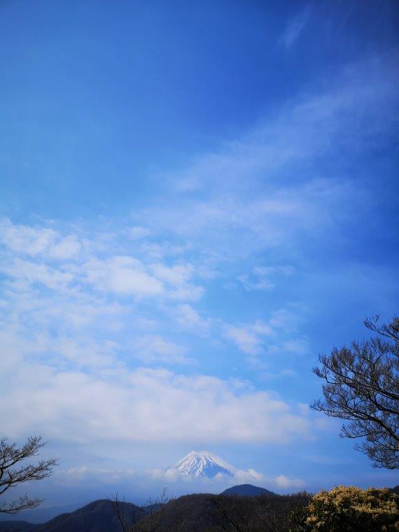
Cloudy day yet Mt Fuji was clear
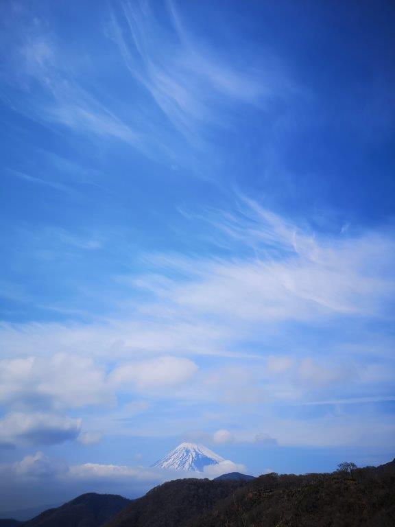
Just before 11am, I got my first views of Mt Fuji on the West side. The weather had cleared up a bit but the top of Mt Fuji was still in the clouds – under a kind of baseball cap. The further I climbed, the more the ridge narrowed, and the more views I got. Soon, Mt Fuji was totally clear and I started to lose a lot of time taking photos. I also had some views of Hakone to the East The ridge went on and on, and after what seemed like a long time, I reached Mt Mae, connecting with a trail coming from the valley – there was no view, and the summit marker was half-broken. Beyond that, the path descended a bit and I was able to make out my target peak – it looked close, but it took me another hour to reach. Occasionally I could hear the roar of lions from the nearby Fuji Safari Park below.
Cloudy ridge on the Northern side of Mt Ashitaka
I arrived at the top of Mt Ihai 位牌 (meaning “mortuary tablet” although there were none at the top) at quarter to one, and very behind schedule. There were 2 other people at the top, about to head down. They kindly offered me some tasty “age-senbei” or fried rice crackers, which I enjoyed on the train ride back. From the top, looking Westwards, I could see Mt Fuji and Mt Gozen – according to the sign, the connecting ridge is quite dangerous. The weather was much better now – blue skies with swirls of mist floating by. Southwards, I could make out an impressive valley, but not much else since there were still a lot of clouds in that direction. Originally, I had been planning to hike towards Mt Ashitaka, the peak that gives the whole mountain its name, but I realised that there was no way I could catch the last bus back – at 3h35 – if I took this longer way. If I missed my bus, I faced another two hours of walking to Mishima station on paved roads. So this time, I took the shorter route down.
Swan cloud passing by
Even with this shorter route, I would barely make it to the bus stop on time. Very soon I reached an amazing viewpoint. Behind me, the top of Mt Fuji was visible from behind the ridge I had just climbed up, with a beautiful blue sky in the background. In front, the Hakone mountain range rose up from the valley in between. I had never seen Hakone from this angle – I was so fascinated that I stepped into some brambles, and I had to spend a few minutes putting bandaids on all the scratches (the weather was warm enough for shorts).
Hakone Panorama
I finally managed to pull myself away from the view and continue down the mountain. I really enjoyed this part of the hike, following a narrow forested ridge, and it was a shame I had to rush it. It took me ninety minutes to reach the viewpoint at Ikenodaira 池ノ平 (846m), where I could get a view of Numazu city, Suruga Bay and the Izu peninsula, although the visibility wasn’t the best at this time of the day. I snapped a few pictures and continued down. Very soon I reached a parking and a road, from where it was another thirty minutes to the bus stop, which I reached with ten minutes to spare. This time the bus was pretty full, but I was able to sit all the way to Mishima station, where I caught the shinkansen back to Tokyo.
Now that the Mt Fuji climbing season is officially over, you may think that there is no point in going to Fuji-san anymore, and that it’s time to put away that Mt Fuji hiking map. Actually, there are number of good hiking courses that can be done “down” the mountain from the various 5th stations – as opposed to going up. The buses are still running so why not take advantage of them? hiking is hiking, it doesn’t matter if it’s up or down, as long as the scenery and views are beautiful. Also, it’s perfect if you need to get in shape for some more intensive hiking in the near future – the muscles will ache regardless of the inclination of the hike.
Before you go hiking I’d strongly recommend you get the Mt Fuji hiking map!
The tippy top of Fuji briefly visible through the clouds
So here is a quick description of several hikes that I’ve done up to now on the flanks of Japan’s highest volcano. There are several more that can be done, so consider this is a work in progress, but as you can see, there are a lot of good “lower altitude” hiking options. All of them, save a couple, were done from the top of the Subaru line, simply because the Fujinomiya side is a little bit far and expensive for a daytrip.
If you decide to go during the official hiking season (July to mid-September), you may be asked to pay 1000 yen. However this is only for people hiking up to the top – if you say that you are heading down instead, they won’t insist on the fee. Just make sure you know your route and/or final destination (as mentioned in this article) as they may ask you about it – I’m not sure what happens if you fail that question!
Ochudo 御中道 to Oniwa 御庭 – Middle path to the garden
The ochudo offers some easy walking – light footwear should be fine!
So let’s start with a short and easy one. To find the start of the Ochudo trail, look for the staircase going up to the right of the bus stop (when facing the mountain). This easy-to-walk path will take you clockwise around the side of Mt Fuji with only minor ups and downs, through some impressive volcanic landscape. On the way, and if the clouds are feeling generous, you might get some clear views of the summit, so keep checking to your left at every clearing. Most of the way, you are at the tree line limit, but occasionally you’ll also get some sweeping downward views to the right as well.
The first part of the trail is mostly through a wooded section
After about an hour or so, you’ll reach the end of the trail. It used to go further around the side of the volcano, but the part is now closed due to rockfall danger. It takes 20 minutes to walk to Oniwa 御庭 where you can catch a bus back to Fujisan station. Or, if the bus times don’t line up, you could head back along the Ochudo to your starting point, where you can get a bite to eat and browse the souvenir shops while waiting for the next bus back (they sell a great relief map of the Mt Fuji area). Another option would be to visit Okuniwa 奥庭 (inner garden) and / or hike down to the 3rd station – read the next section for more.
A good view of Mt Fuji with some snow remaining in June
Okuniwa 奥庭 to Fujiyama Onsen ふじやま温泉 via the Funatsu rindo 船津林道
You can connect this hike to the previous one if you want to make a long day out of it (like I did). Otherwise, you can just get off at the Oniwa bus stop 御庭 (the last one before the end) and walk down the short path to the Okuniwasou 奥庭荘. Out of season, it’s a good place to enjoy some local dishes, and check out their souvenirs. When I was there I got to sample some wood berries for free.
Despite a wisp of clouds, the summit was briefly visible
After checking out the hut, I’d recommend doing the short 20-minute loop that starts and end behind the hut, marked with a torii (red shinto gate). There is an excellent view point of Mt Fuji – if the clouds are being kind on the day you are there, After this short warm-up, head straight down the mountain through incredibly beautiful forest to the third station or sangome 三合目 – if you go out of season, you will most likely see few people – hard to believe on a mountain such as Fuji!
Thick forest above the third station
Eventually – just over an hour – you’ll pop out of the forest into a wide rocky clearing. Here there are two options – you can go straight and continue to the third station (see next section) or you can do a hard right and descend along the Funatsu Rindo (described here). The Funatsu rindo is an easy to walk, easy to follow path that will take you the forested parts on the lower flanks of Mt Fuji. When I walked it, I saw absolutely no one. Perfect for some deep pondering. After an hour you’ll need to cross the Subaru line (near the 2nd station) and then there is at least another 90 minutes of solitary forest walking till you emerge onto a paved road. At one point there are some good views of Kawaguchiko town and lake.
A view of Kawaguchi lake from the Funatsu forest path
From there, it is a bit of a slog (another 90 minutes) along a fairly straight paved road till you get to Fujiyama Onsen. You’ll need to turn right at one point – just use Google maps to point the way out for you – it’s smack next to the Fujikyu Highland theme park (you could also just follow the screams from the roller coaster). If hot springs aren’t your thing then continue straight – you’ll eventually get to Kawaguchiko station.
Subaru Line gogome (5th station) スバルライン五合目 to Shojiko Lake 精進湖 through Aokigahara jukai forest 青木ヶ原樹海
Another amazing hike is the one that through that goes through the heart of Aokigahara forest. If you live in Japan, you’ve probably heard of it before. It is also known as suicide forest, since it’s famous for people going there to end their lives. However there is almost no chance of encountering anything upsetting along a well-established hiking path. On the other hand you’ll get a great opportunity to cross an interesting forest that is growing on top of an ancient lava field.
Spectacular view of the Kawaguchi area from near the third station
This hike starts along a path below the Subaru Line 5th station. Unfortunately it’s a bit worn out and hard to walk at times. After about an hour you’ll emerge into the same rocky clearing as in the section above. Continue straight in the direction of lake Shoji. After another fifteen minutes you’ll go under the Subaru line via a small tunnel – this is the third station. If you have time, I’d suggest making your way up to the road and walking down it a few minutes – there is an excellent view point next to the road, where you can even see Mt Fuji.
Mt Fuji with its cloud umbrella or kumogasa 雲傘, from the Subaru line near the 3rd station
Beyond that is a three to four slog through Aokigahara forest. I say slog because it’s a relatively straight path through forest that pretty much looks the same all along the way. However don’t let that discourage you – it feels awesome to be walking through such a vast forest. As before, you’ll probably encounter few people. The last portion is through regular forest. Finally you’ll pop out onto the road that goes circles Mt Fuji – there is a bus stop, right on Shoji lake to your right called Akaji 赤地, that will take you back to Kawaguchiko station.
The last part of the hike is through a nice forested area
Subaru Line gogome (5th station) スバルライン五合目 to Sengen jinga Shrine 浅間神社 via the Yoshida route trail 吉田ルート
This is the classic route up and down Mt Fuji, when starting below the 5th station. There are a number of descriptions of this path on other sites, and it was also recommended to me by staff working at the 5th station. Consequently, you will pass many people, mainly going up. It is also the second shortest of all the hikes described here, after the Ochudo). This is the one route where you will certainly be approached for the 1000 yen donation – just tell them you are headed for “umagaeshi” 馬返し (there is a small parking lot there) or Sengenjinja shrine 浅間神社, where there is a bus stop.
Big climbing sign with rocky backdrop
Head East (away from the end of the Subaru line), between the souvenir shops – the start of this hike is the same as the one that goes up the mountain. During the daytime you’ll get to see exhausted, bedraggled climbers returning from a night spent on the mountain. Luckily, you won’t be going up but down. At first the path is pretty flat but after a short while you’ll get to a split – take the branch heading down (not the climbing route). Shortly, you’ll get to another split – take the descending one again, which passes below a hut. Look to your left for the start of the Yoshida route, a small trail that disappears into the forest. This part should take less than half an hour.
The Yoshida trail has one of the better maintained paths
The Yoshida route is probably the best maintained trail of the lot. On the way, you’ll pass a number of historical landmarks with signs in Japanese and English. This path was used in ancient times to climb Mt Fuji, before there were proper roads to various 5th stations. A lot of the landmarks are in ruin (or becoming ruins) but the old photos from the Meji area are worthwhile checking out.
View of Kawaguchi lake
There are also several viewpoints towards the Kawaguchiko area. As with the other paths, the surrounding forest, especially at a higher altitude is awe-inspiring. The various stations are well indicated as well as the ever decreasing altitude. After a short hour, you should reach a tori (shinto gate) made of stone. This is ichigome 一合目. There is a small hut just below, which functions as a resting spot or 休憩所 (kyukeijo). I was actively encouraged to take a break there while passing in front. I was offered free tea, miso soup and pickles, since it was the last official hiking day on Mt Fuji. I was surprised to get such a warm and friendly welcome – I guess they don’t that many people climbing up the lower parts of Mt Fuji, compared to the higher ones.
Approaching Umagaeshi
A few minutes below the resting spot, there is a car park – this is the aforementioned Umegaeshi. Here you need to be careful – don’t take the road but instead go to the back of the car park, You’ll find a small path that heads into the forest. It mostly runs parallel to the road but it is way nicer than road-walking. The final bit before reaching Nakanochaya 中の茶屋 (the teahouse in the middle) is especially pretty. It will take you an hour to reach the teahouse. It was another very friendly resting spot – they invited to sit inside and have some tea, again totally free.
Lovely forest walking at the end of the Yoshida trail
As I was leaving they pointed out there was a shuttle bus that was about to leave for Fujisan station. The next bit was a guaranteed one hour of asphalt-road walking, and I was starting to have a strange pain in my ankle, so I decided to take advantage of this unexpected transportation opportunity – I hadn’t expected anything till Sengen shrine. Since I did want to stop by the Fujiyama onsen before getting on the train, the driver kindly offered to drop me off at the closest corner. One drawback of doing this is that I completely missed Sengen shrine so I will need to come back one day.
Fujinomiya gogome (5th station) 富士宮五合目 to Mt Hoei 宝永山 and back
This is a good one to do if you have a JR Rail pass because it requires you to take a shinkansen to Shinfuji 新富士 station on the Tokaido line. You will be able to ascend to nearly 2700m – pretty impressive for a day trip from Tokyo. This is possibly the highest you can get on any mountain in Japan, without having to spend the night in a hut. In addition, most of the hike is above the tree line, so if the clouds are busy elsewhere, fantastic views are guaranteed.
On the flanks of Japan highest mountain
The 5th station “gogome” of Fujinomiya-guchi 富士宮口 五合目 2380m is a lot less busy than the Subaru Line 5th station. In fact, when I was there in early November, there was only a handful of other cars. To get to the start of the trail for Mt Hoei 宝永山 2693m about 20 minutes away, you’ll need to go to the 6th station or “rokugome” 六合目, above the car park. Outside the official climbing season, you’ll need to clamber over the gate barring access to the Mt Fuji climbing trail. It’s pretty easy, there is a gap on the side – don’t let the “no climbing” sign deter you.
Mt Hoei’s crater
At the 6th station, turn right and just follow the signs for Mt Hoei. The first part is mostly flat and above the treeline. In less than 20 minutes. you will be inside a semicircular bowl – Hoei’s crater (Mt Hoei was formed during the last eruption of Mt Fuji at the start of the 18th century). From here it’s an hour zigzag till the rim. Then turn right – the last ten minutes are straight and flat. If the weather is clear you’ll get some great views. Turn around and you should also be able to see the summit of Mt Fuji looking tantalizingly near (it isn’t).
Looking back towards the summit of Mt Fuji from the top of Mt Hoei
Afterwards, the easiest option is the go back the way you came – no zigzagging needed here, just go straight down. It should take a little over an hour. If you want to do something longer, and that isn’t a loop, go down the other side of Hoei’s crater (turn right at the sign) and after a few minutes you’ll reach the big sand run “osunabashiri” 大砂走 that goes all way down to Gotemba guchi gogome (fifth station) 御殿場口五合目 where you can catch a bus down to Gotemba station. Map time for this part says 75 minutes but you should be able to do it much faster if you run down through the sand – give it a try!
The Hoei’s crater path intersection
Another option is to head down the mountain at the first intersection you reach after passing the crater. This will take you down the mountain through beautiful forest. It should take a couple of hours to reach the road, where a bus stop is never too far away. This is a more adventurous route – there are many other paths criss-crossing the side of the mountain – so I definitely recommend having a map of the mountain if you choose this option. And of course check all the bus timetables in advance. You can also reach the Gotemba fifth station but I think the sand run is by far the better route.
Nishisuzuka 西臼塚 to Gotemba gogome (5th station) 御殿場五合目
This is perhaps the only route that involves some uphill. It is also the lowest of all the hikes, starting at around 1200m and finishing at 1450m – most of the course is in the forest. Finally it is the most difficult to follow, so I definitely recommend having a good map. Here you’ll need to get off the bus much sooner – at the Nishisuzuka 西臼塚 parking lot, about 45 minutes from Shin-Fuji 新富士 station.
Take the path leading into the forest on your left. The path is in a pretty bad state – the center part has kind of collapsed so the first five or ten minute is hard-going but it will soon get better. In less than 20 minutes you’ll reach an intersection – go right. The original path loops around back to the road. Soon after, turn right, and you’ll find yourself climbing straight up the side of the mountain…for almost an hour to 90 minutes depending on how fit you are. You’ll cross a forest road one third of the way up.
Forest trail on the lower reaches of Mt Fuji
Finally you’ll emerge into a parking area on the road that goes all the way up to the fifth station. You have reached 1600m. If you want to cut out the climbing bit (and shorten the hike considerably), you can get off at the next next bus stop (Takabachi 高鉢) – you’ll need to walk back along the road for twenty minutes to read the parking. Take a break, and the continue along the road on the opposite side of the road.
This is arguably the most best part of the hike. It’s mostly flat, there are relatively few people, and the surrounding forest is beautiful. This is the Takabachi Course 高鉢コース. Keep straight at the next intersection, and after that always take the higher path. After about a couple of hours, you should a point that is around the height of the second station, and which is called “goten niwa shita” 御殿庭下. This is the high point of the hike, nearly 2000m – the surrounding vegetation, mostly pine, screams alpine, a far cry from the forested parts at the start of the hike.
Hiking on side of Mt Fuji – what a pleasure!
If you have energy to spare you could continue straight up to Mt Hoei and the Fujinomiya fifth station (see above hike). Otherwise, turn left here, go straight for a bit and then head down at the next intersection. In under an hour you’ll get to another intersection – looking at the map you’ll see that this side of the mountain literally has a web of trails. Both paths will take you to the Gotemba 5th station – the one I did and describe here is the higher one.
Mt Futago comes into view
This path will take you between two small protuberances on Fuji’s side – Futatsuzuka 二ッ塚 (1929m) to the left, and Mt Futago (twin mountain) 双子山 1804m to the right – if the weather is still clear you could quickly run up and check out the view from the top of Mt Futago. It should take about an hour to reach the Gotemba 5th station and a bus stop, at the bottom of the sand run. This final section of the hike, in contrast with the initial part, offers lots of good views since it crosses an ancient lava flow and so is mostly rocky with few trees. You’ll get some excellent views of Mt Ashitaka 愛鷹山 1504m, a two-hundred famous mountain, just South of Mt Fuji.


![Mt Shakushi (1597m) & Mt Takazasu (1304m), Fujiyoshida City, Yamanashi Prefecture, Sunday, November 26, 2023 [MAP AVAILABLE]](https://hikingtokyo.com/wp-content/uploads/2023/12/dsc_1408.jpg?w=1024)


![Mt Futago (1804m), Gotemba City, Shizuoka Prefecture, Sunday, September 11, 2022 [Hiking on Mt Fuji]](https://hikingtokyo.com/wp-content/uploads/2022/09/img_20220911_110420.jpg?w=1024)


![Mitsutoge (1785m), Fuji-Kawaguchi & Nishi-Katsura Towns, Yamanashi Prefecture, Friday, December 10, 2021 [Snow hike / Map Available]](https://hikingtokyo.com/wp-content/uploads/2022/01/img_20211210_120210-1.jpg?w=1024)


You must be logged in to post a comment.