Mt Daigenta (1598m) & Mt Nanatsugoya (1675m), Yuzawa Town, Niigata Prefecture, Saturday, October 3rd, 2020

I had this mountain in my sights for the past two years. Located in the North-Eastern corner of the Joshin-Etsu Kogen National Park, there were three challenges that had to be overcome to climb this peak. First, since it’s over 150 km north of Tokyo, the climbing season is shorter (from June to October); next, shinkansen access is required for a daytrip: finally, the hiking time was nearly 8 hours, so I needed to be in good physical condition. I was feeling good at the start of October, and so, despite the cloudy forecast, I decided to buy a Tokyo Wide Pass, and attempt the “Matterhorn of Joshu”, as it’s known in the area. I hoped that the steep pyramid-shaped top wouldn’t give me too much trouble, and also that I would get to see some nice autumn colours.

Hiking in the Joshin-Etsu Kogen National Park 上信越高原

The Matterhorn of Joshu

The shinkansen enabled me to reach Echigo-Yuzawa station before 8am and catch the first bus to the start of the trail. Even though it was a Saturday, the bus was empty, most people having gone by car. It took me another half hour of road walking to reach the real start of the hiking trail at 9am. Soon after, I arrived at a bridgeless river crossing. I had to step from stone to stone for about ten meters, using a rope to keep my balance. In case of heavy rain, my guidebook recommended taking off one’s shoes and crossing barefoot. Fortunately, the water level was low today. Recently, I’ve seen several damaged bridges, so perhaps it’s a smart thing to dispense with one altogether.

Some blue patches in the morning

The Daigenta River

Following the river upstream, I soon reached a junction, where I continued straight; if all went well, I would return via the path on the right at the end of the hike. The path was mostly level except for a section equipped with a ladder. It took me ten minutes to reach a second bridgeless river crossing. This one was was shorter – I just needed to step over a gap between two big boulders. The river was beautiful here, so I decided to take a short break. I was glad I did, because the next section was thirty minutes of non-stop steep climbing. It was lined with ropes, which I used to pull myself up, and save some leg power. I don’t think I’ve ever encountered such a long section of uphill before!
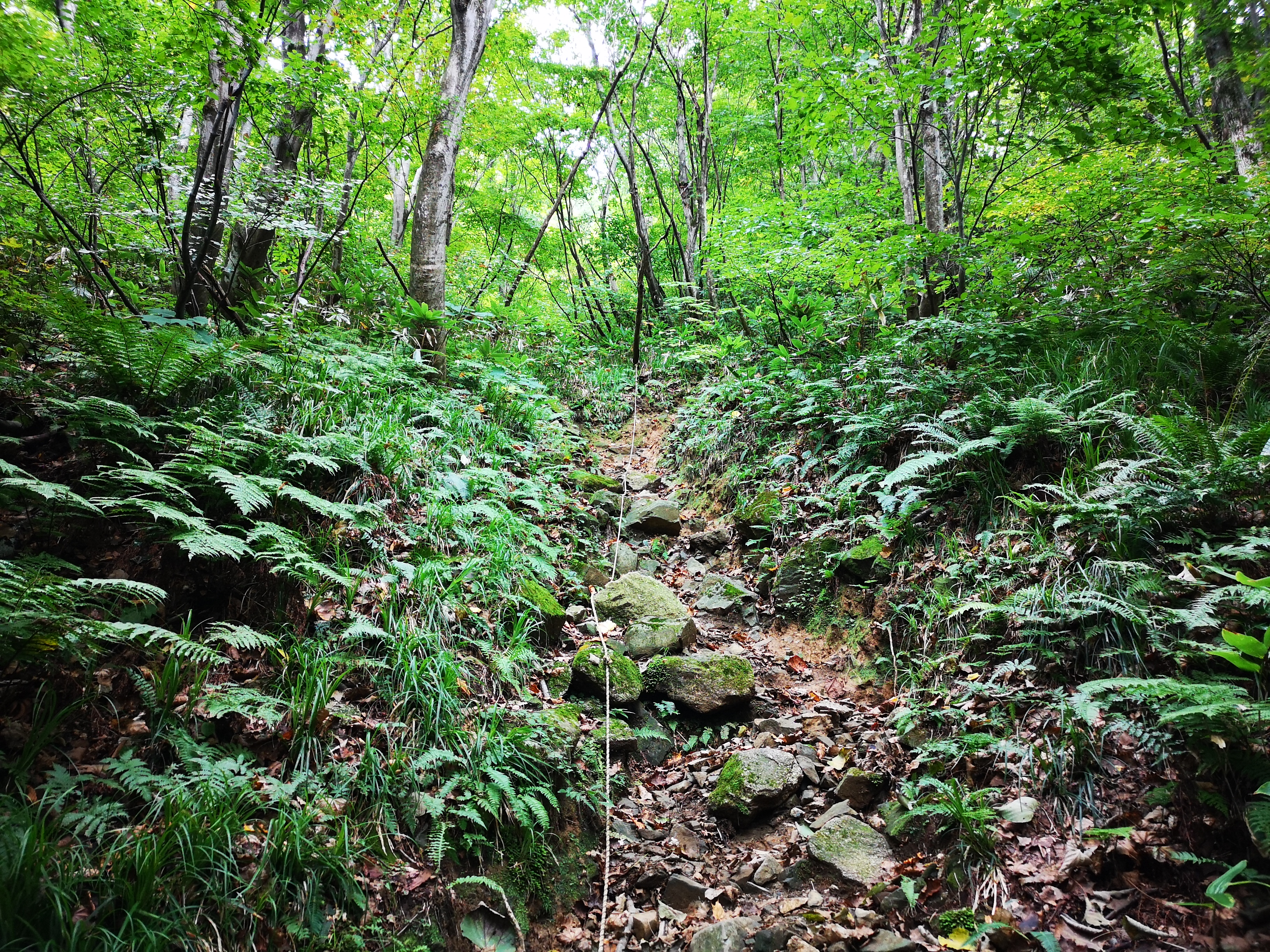
Straight up!

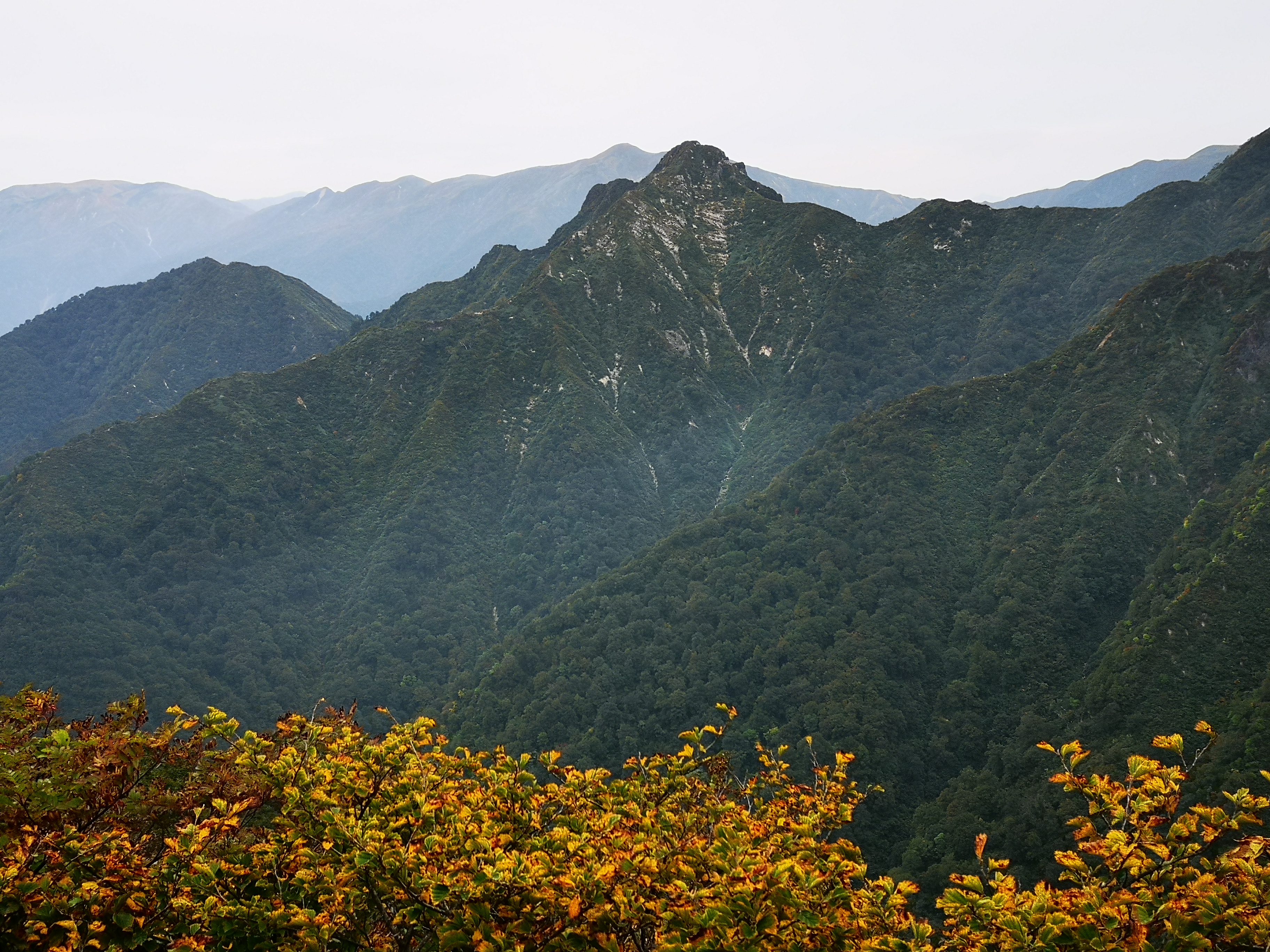
First views and autumn colours

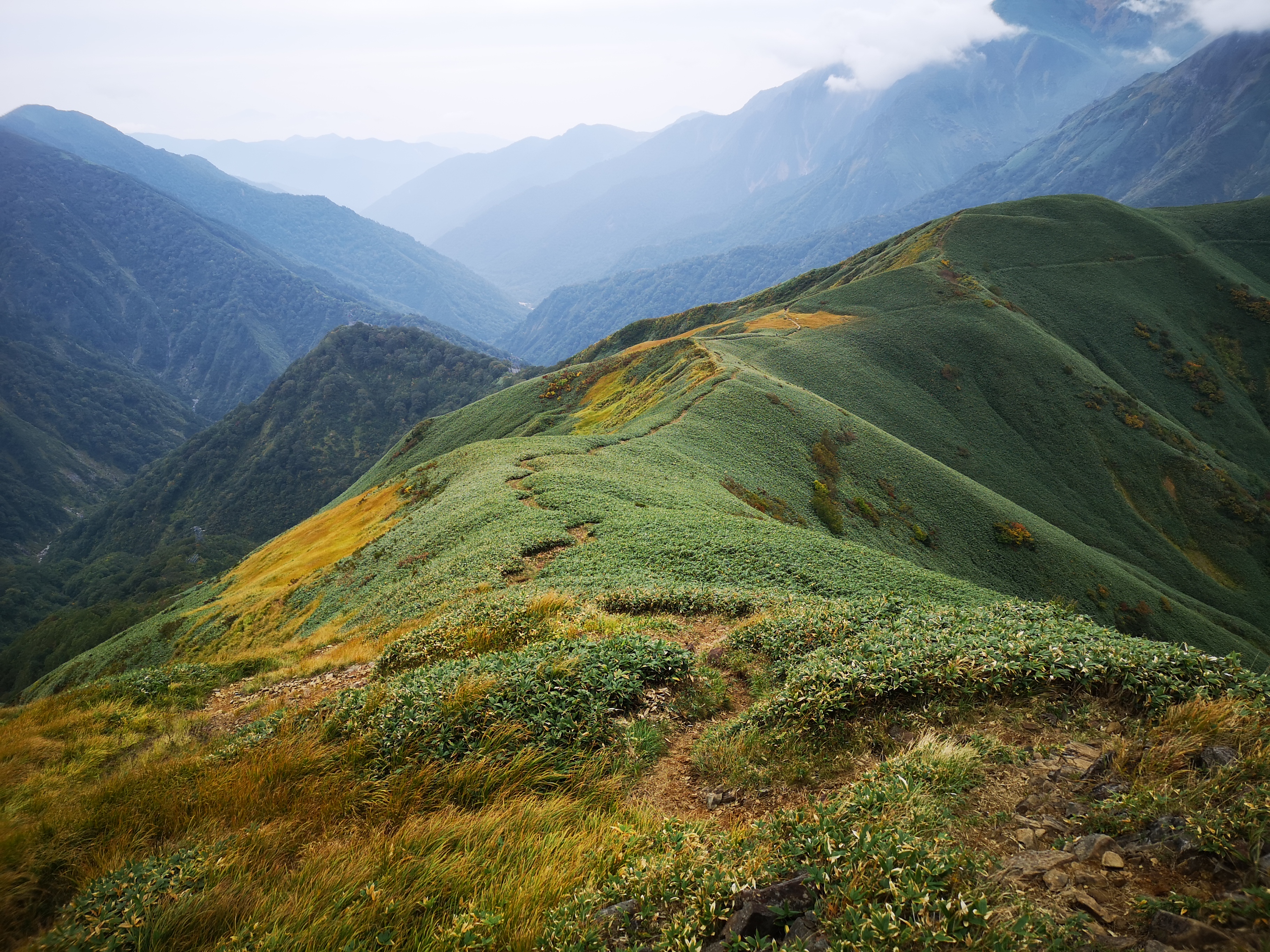
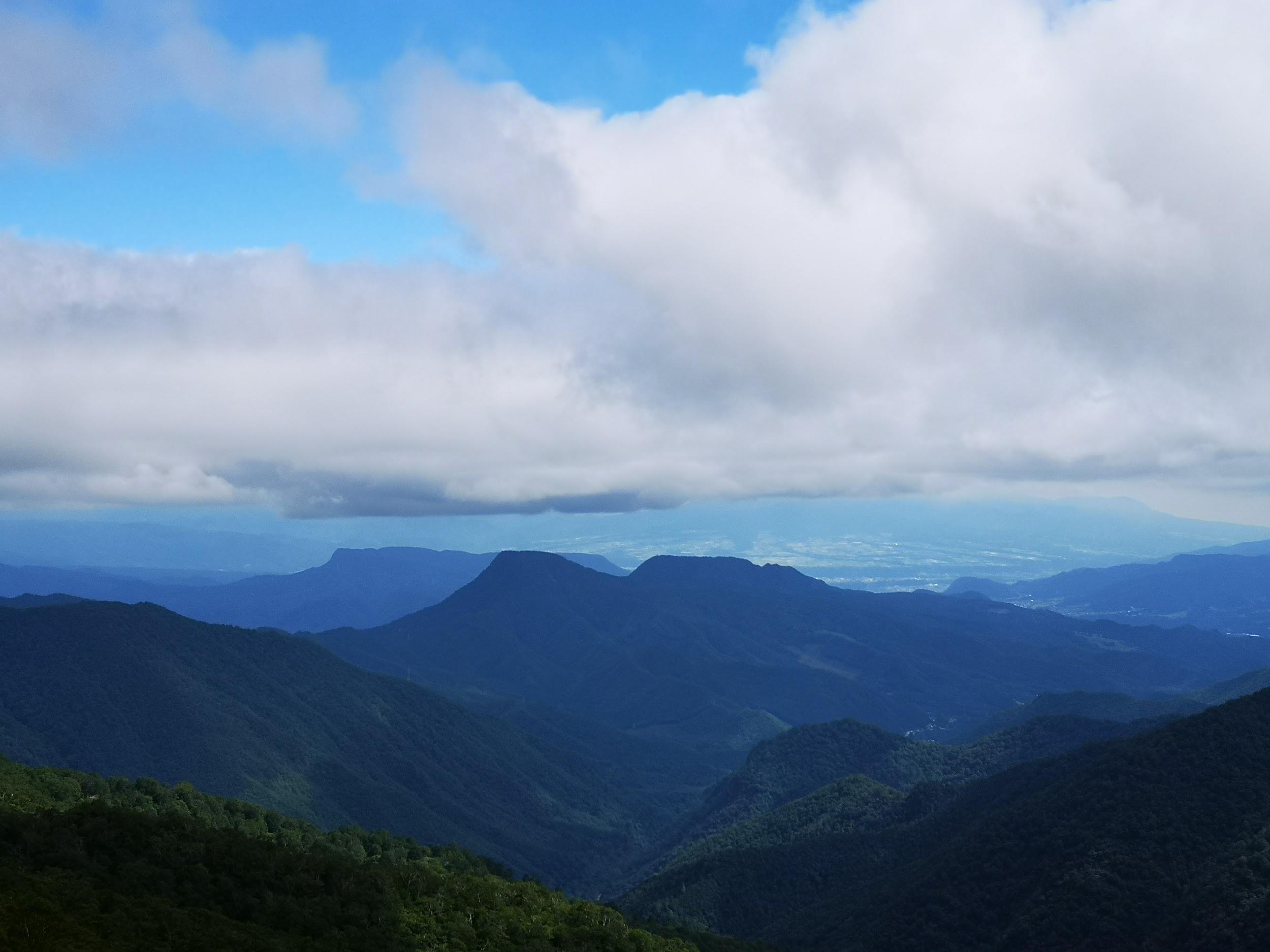
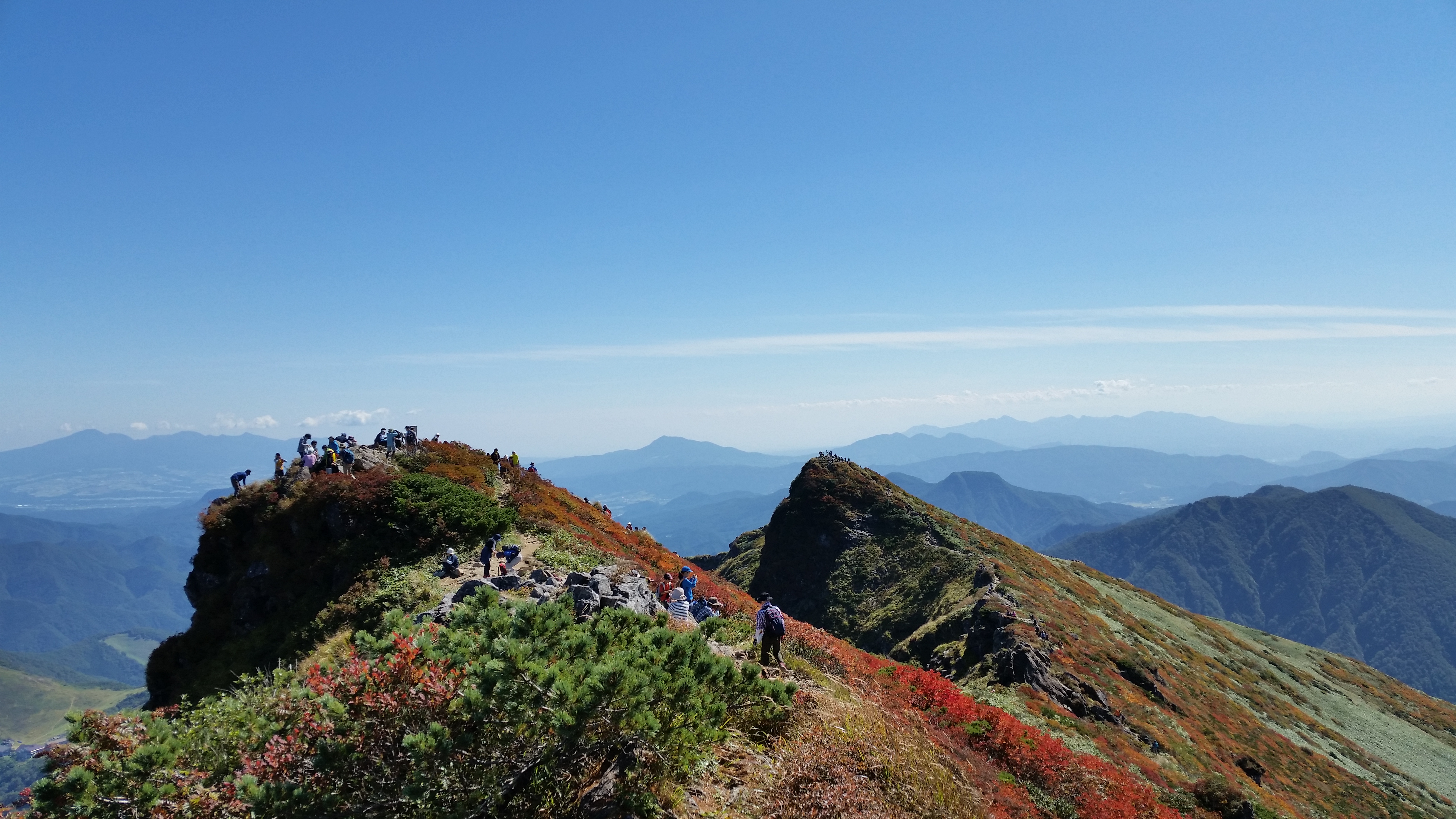
At ten thirty, I reached a short flat section, and had my first glimpse of the summit area through the trees – it looked deceptively close. After some more steep climbing, I was walking along the top ridge. Here, the trail climbed gradually and was mostly above the trees; I had good views of the dark green mountains surrounding the river valley; turning around, I could see the flat light green rice fields of Niigata prefecture. The path was getting rockier and steeper, and the view more and more dramatic; I was nearing the base of the triangular summit. I passed a mother and daughter team coming down; they had planned to go down the other side, but after one look at the path, had wisely decided to turn back.

Up the left ridge and then down the center

Great views looking back

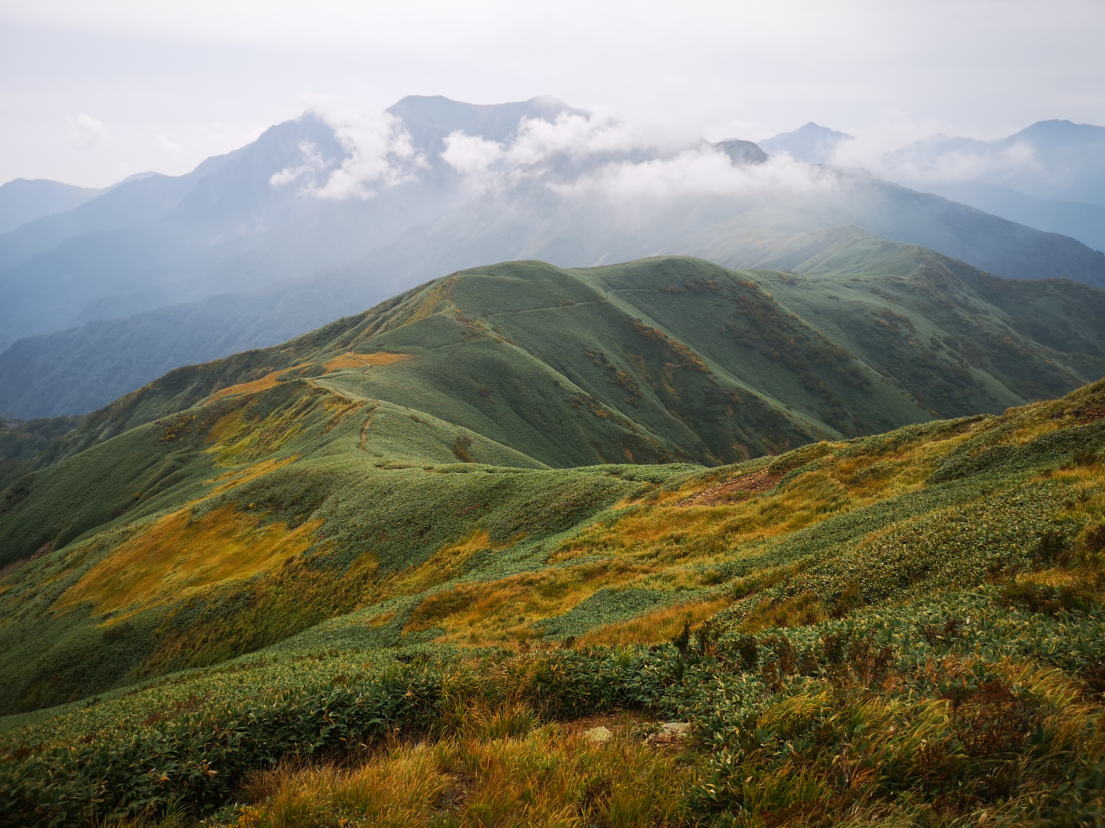
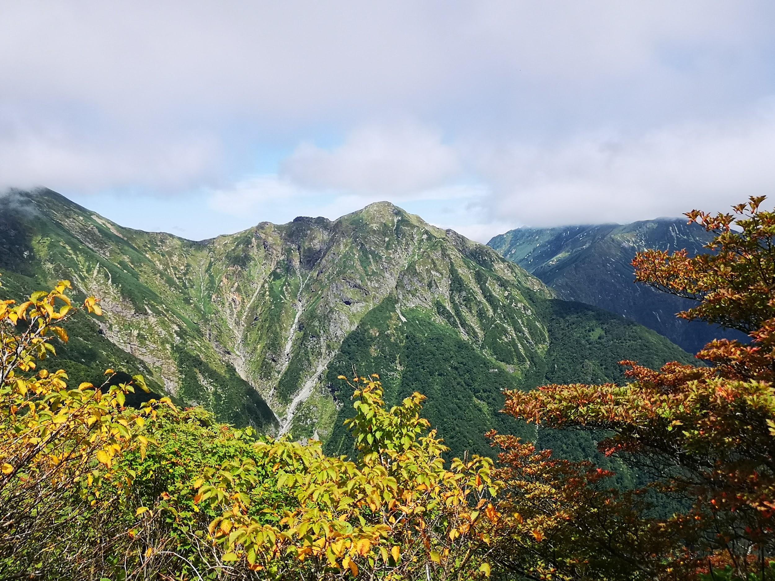
At 11h30, I was standing on the flat, narrow top of Mt Daigenta (大源太山 だいげんたさん daigentasan). I kept my break short since I was worried about getting off the summit. My guidebook said that although it was steep, there was no risk, as long as one moved carefully. I tend to move quite quickly, but here I took my time, using the two sets of chains whenever possible, and managed to get through this part safely. By noon, I was at the lowest part of the saddle, and started to climb up towards the next peak. Here, the autumn colours were at their best. I started to have glimpses of the Tanigawa range ahead, playing hide and seek in the clouds. The bamboo grass was really tall around this point, and made walking difficult. Occasionally, I stopped to look back at Mt Daigenta. From this side, it really did look like the top of the Matterhorn.

Looking South towards Gunma prefecture

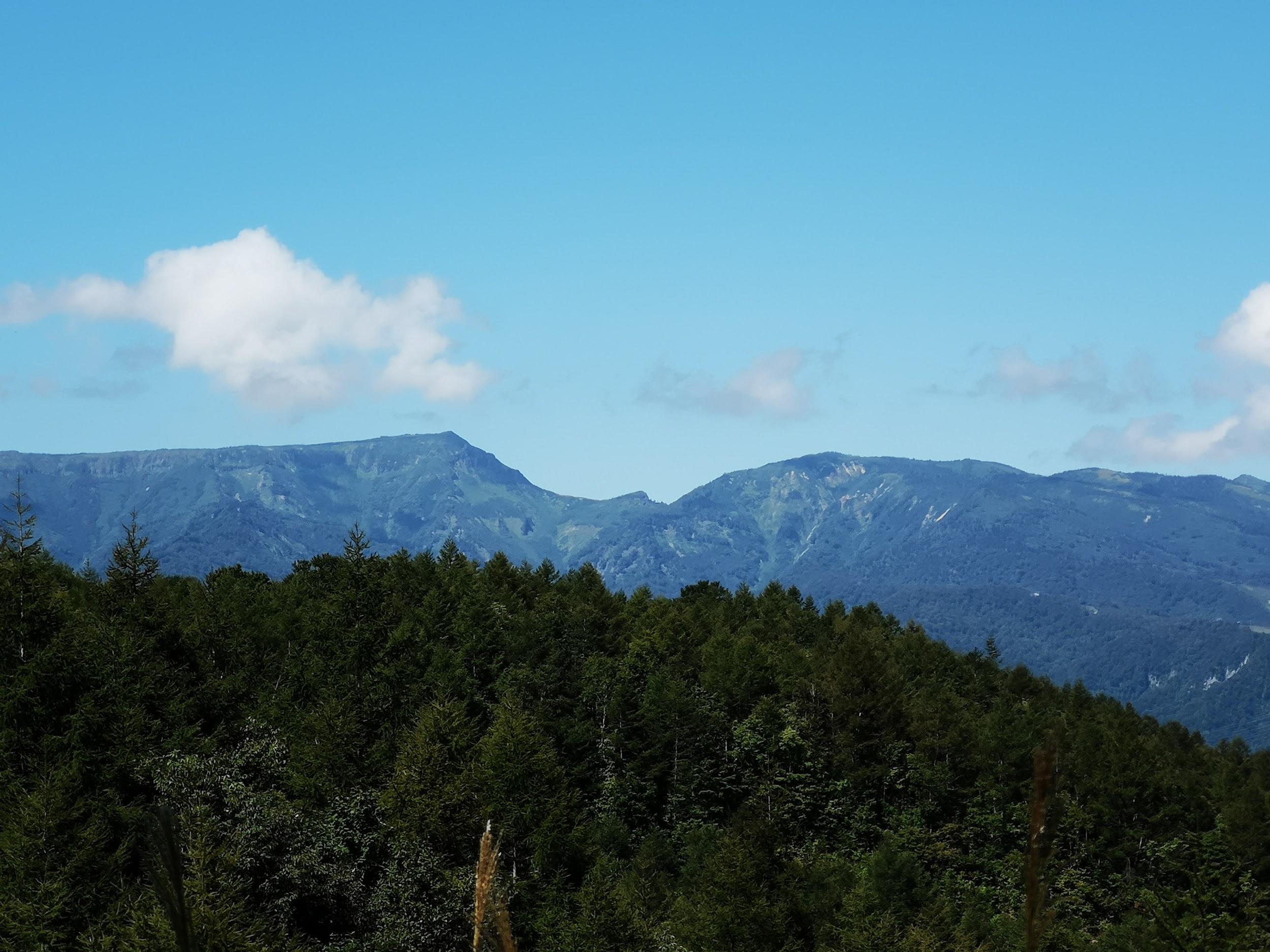
Mt Asahi, a mountain I have yet to climb

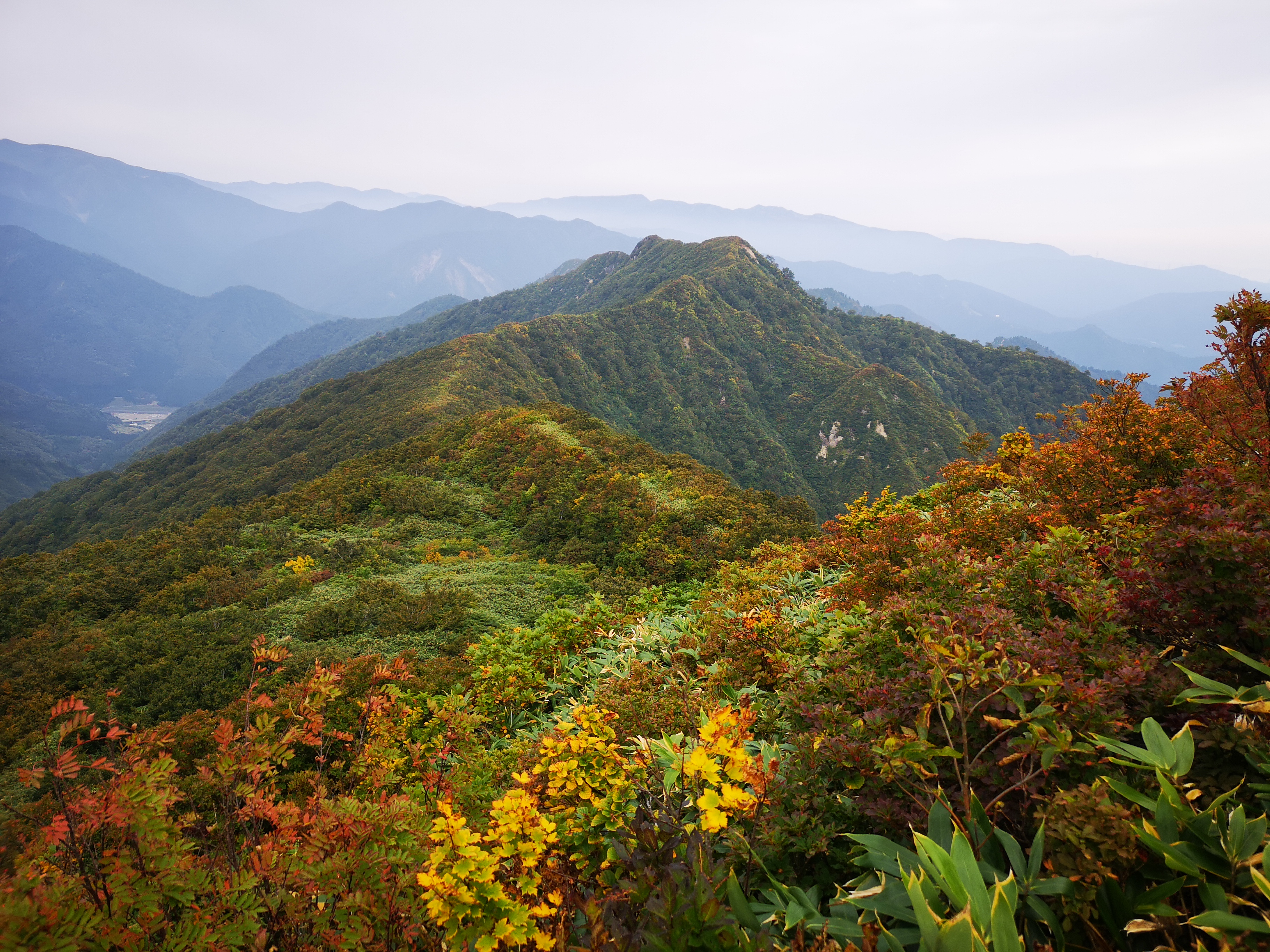
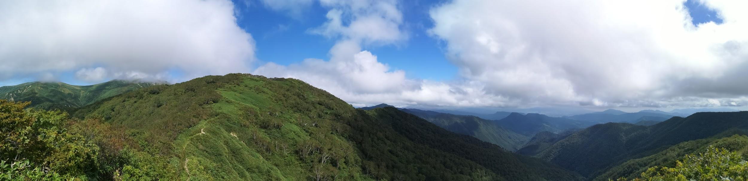
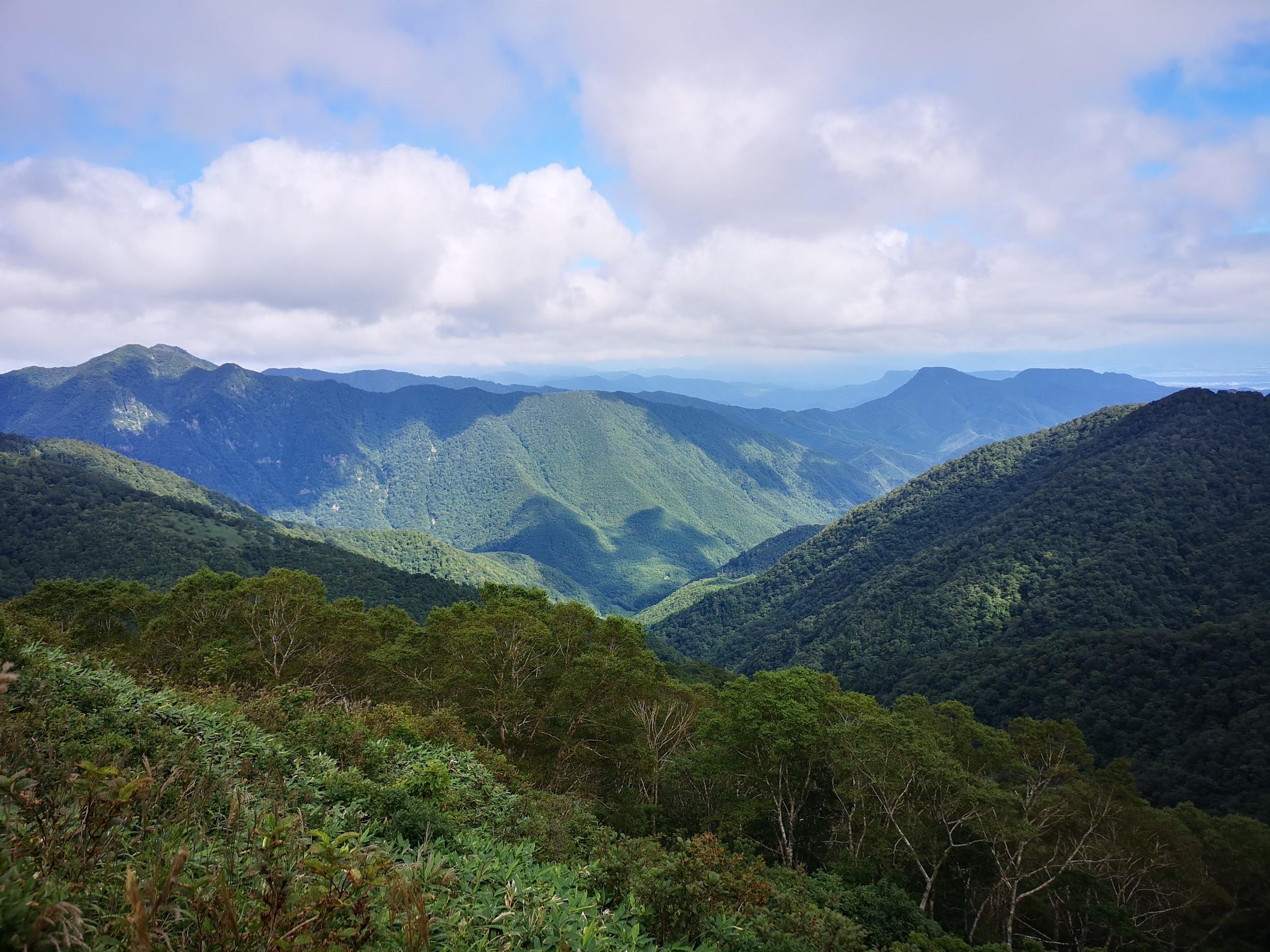
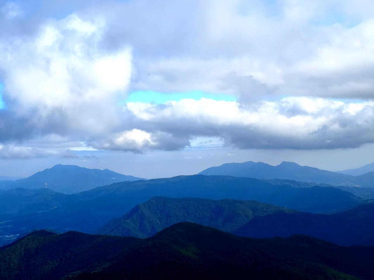
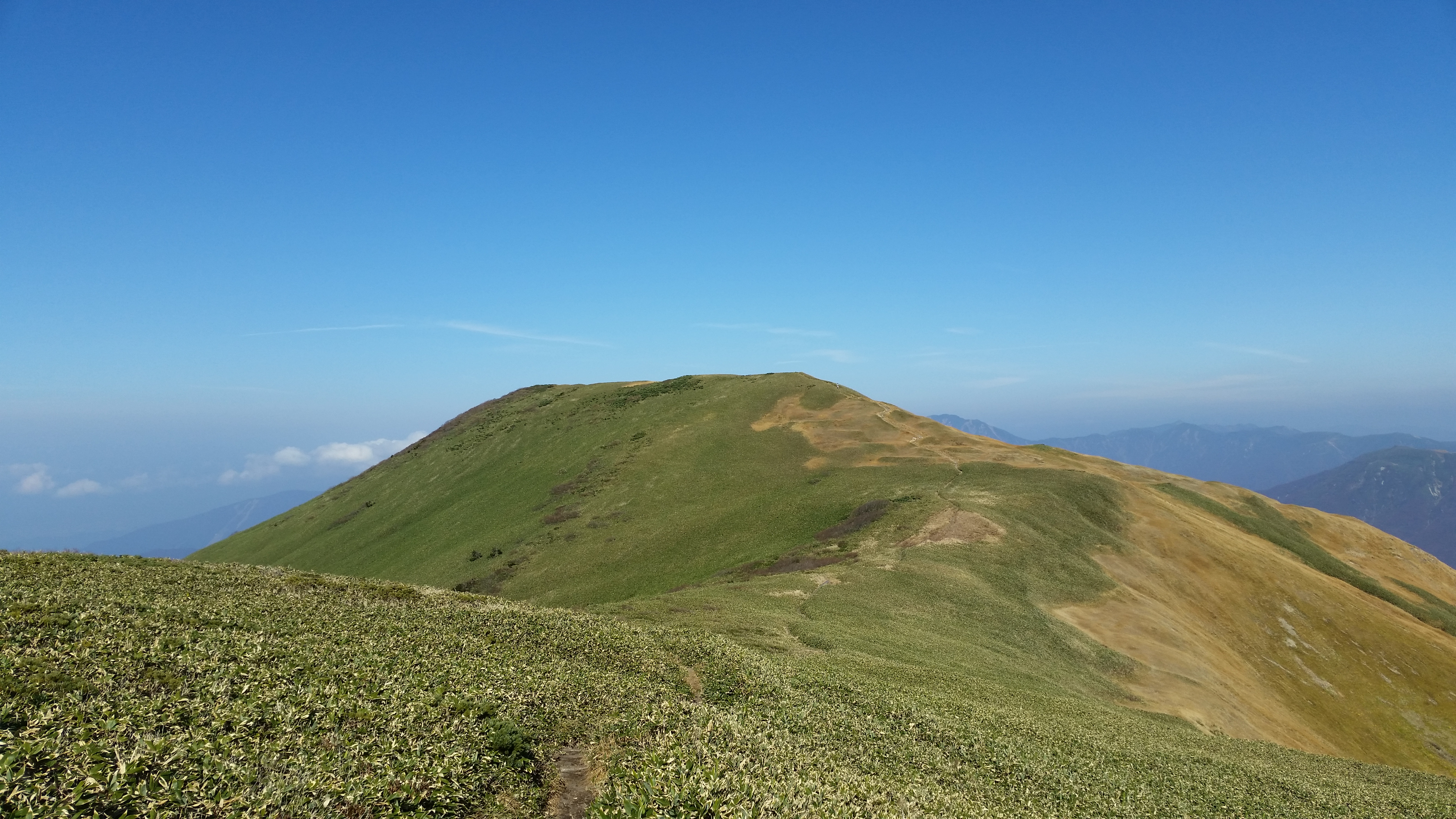
It took me nearly an hour to reach the top of Mt Nanatsugoya (七ツ小屋山 ななつごややま nanatsugoyayama). To the South was Mt Daigenta and Yuzawa Town. Looking East, I could see the long ridge connecting Mt Makihata with Mt Asahi. Directly in front, was Mt Tanigawa, resembling a dark fortress. Far away to the West, I could see the flat top of Mt Naeba emerging from the clouds. The wind had started to blow and it was getting cold. There was no one else around and it was pretty lonely. I was only half-way through the hike, and I had to pick up the pace, otherwise I would miss the bus back. I half-walked, half-jogged along the mostly flat trail, and covered a two-hour section in less than an hour. I took a short break to enjoy the last panoramic views before heading down. Some parts of the descent had been eroded, and had to be be navigated slowly. The path made a lot of switchbacks, and it seemed to take forever to reach the river at the bottom of the valley.

Wonderful hiking under the clouds and above the trees

Walking in the shadow of Mt Tanigawa

I finally arrived at the junction I had passed at the start of the hike and in no time I was back at the first river crossing. Here I met up with the mother and daughter combo I had seen earlier. The daughter was just about to start crossing. Knowing that I couldn’t wait around if I wanted to catch the bus, I excused myself and went ahead. Since she was already holding the rope, I used my walking stick to steady myself, and crossed without hesitation. Minutes later I was back on the road, and I arrived at the bus stop just after 3h30, about seven hours after setting out, and a few minutes before the return bus. Back at Echigo-Yuzawa station, I had time to tale a hot bath and do some Japanese sake tasting, before hopping back on to the shinkansen for the one hour trip back to Tokyo.

Walking the top of Joshu

The second half of the hike was mostly flat

Watch a video of the Mt Daigenta hike including the two river crossings

Mt Daigenta (1764m) & Mt Mikuni (1636m), Yuzawa & Minakami Towns, Niigata & Gunma Prefectures, Saturday, September 14, 2019

Hiking in the Mikuni Mountains 三国山脈

This update should belong to the Tokyo Wide Pass update for Silver week 2019, but since the second hike of that holiday fell through due to a combination of bad weather and a poorly-marked trail, I only managed one hike (a repeat of this year’s Golden Week). I was excited about this hike since it connects two prefectures, and two consecutive stations on the Joetsu Shinkansen. The staff at the ticket window were good enough to confirm that I wanted a return on the same day from a different shinkansen station! It’s also entirely within the Joshin’etsukogen National Park.

Gunma view from the top of the ridge connecting Mt Daigenta and Mt Mikuni

After arriving at Echigo-Yuzawa station in Niigata prefecture, I hopped on the bus headed for Naeba Prince Hotel, getting off at Asakai, a few minutes past the stop for Mt Sennokura. My plan was to hike up the ridge leading South from Mt Tairapyo, so that I could pick up my hike from 2017, about half an hour past the Tairapyo Mountain Hut. My map indicated that the hike went up through the ski resort but that the start of the trail was hard to find. I found something that seemed like a trail and headed up it, but after climbing for nearly thirty minutes, it turned out to be a deadend.

A hint of autumn, looking Westwards to Niigata

I was now faced with two options. Either head back down, and follow the road to the start of the trail of Mt Mikuni (where I had expected to end up) and go and back down from there. Or, cut across the hillside in the hope of coming across the actual trail. I chose the second one, following a very faint overgrown track through thick bushes at the edge of the forest covering the mountainside, thinking all the time that if this doesn’t work out, I’ll have to walk back the same way. Finally I gave up on the bushwacking, and started to climb directly up through the forest. It was pretty steep, but there was less vegetation to slow me down.

The ridgeline I was hiking up

After about ten minutes of climbing straight up the side of the mountain, using the thin trees as handholds, I spotted some rope to the right. I moved towards it, and discovered the path. My joy at finding the path, was tempered by the fact that it headed straight up the mountainside at roughly the same gradient I had been doing just before – the rope was there to help pull yourself up. The path continued for what seemed like forever. I finally reached a minor summit with a view of the remaining way to the top ridge. I had just started out, and I was already exhausted!

The instantly recognizable shape of Mt Naeba, as seen halfway up the ridge

After a short descent, the path continued to climb relentlessly. At precisely noon, I emerged at the high point, more than two hours after setting out, and completely knackered. This was after all my first big ascent since the start of the summer. I admired the great 360 degree view – Niigata to the West and Gunma to the East – then dropped my pack, and headed towards Mt Daigenta 大源太山 about 15 minutes away.

In the foreground Mt Azumaya (climbed May 2017) and in the background Mt Mitsumine (climbed May 2019).

From the top there were good views of Mt Sennokura playing hide and seek in the clouds. Further to the right, Mt Tanigawa was stubbornly sitting inside a big cloud. After a quick bite, I headed back to pick up my pack and started southwards along the ridgeline towards Mt Mikuni visible in the distance. Since I lost time finding the start of the trail, it was now impossible to catch the earlier bus which would have given me some time to use the hot spring at Sarugakyo Onsen. I had been there once before after descending from Mt Azumaya two years earlier and was looking forward to visiting again. Now I had to race to catch the last bus back.

Around 2000m, Autumn has arrived…

After some ups and downs, with spectacular views, especially towards Gunma prefecture, I reached the flat top of Mt Mikuni 三国山 just after 2pm. The name translates as “three country mountain”. In modern times, it sits on the border of two prefectures, but during the Edo period, it probably sat at the junction of three areas. From the top, I was able to see for the first time Mt Inatsutsumi, although Mt Shirasuna beyond was lost in the clouds. I could also see the end of the hike, straight down the side of the mountain to Mikuni Pass, and then further down the valley to Hoshi onsen 法師温泉, a secret hot spring.

Mt Ono (left) and Mt Haruna (right)

The path down to Mikuni pass consisted mostly of wooden steps – perfect for running down since I still wasn’t 100% sure I would be able to catch my bus. In no time, I reached the pass, where I turned left into the forest. Soon I reached a road, beyond which was the path to Hoshi Onsen, the last part of which followed a river. I reached the end of the hike with ten minutes to spare. Since there was no time for a bath, I used the Tokyo Wide Pass to go from Jomo Kogen back to Echigo-Yuzawa (just ten minutes), where there is a hot spring in the station.

Hoshi Onsen, a place I would like to stay at someday

NEXT UP: Mt Konara in Yamanashi Prefecture

Tokyo Wide Pass – Where to go? Part IV : Jomo-Kogen, Echigo-Yuzawa & beyond

Here I will explore the stations on the Niigata/Joetsu line that are accessible with the pass.

JOMO-KOGEN 上毛高原

First up, a place I had never heard of till I first started using the pass: Jomo-Kogen.

A shinkansen only stop at the lowly altitude of 450 meters and 70 minutes from Tokyo station, it sits within striking distance of a number of mountains on the northern edge of the Kanto plain that are accessible thanks to the bus terminal just outside the station.

A word of caution: there is little in the way of restaurants and shops, the Newdays inside the station closes early and there usually isn’t a food cart on this line, so make sure you don’t come back hungry, and forget about that after-hike beer.

20150922_130617
Top of Mt Tanigawa

  • Mt Tanigawa 谷川岳 1977m (hundred famous mountain)

You can catch a bus to the ropeway (change at Minakami) and even do an onsen in Minakami if you come back early enough. Even if you don’t go all the way to the summit, the views from Mt Tenjin 天神山 just above the top of the ropeway are fantastic in clear weather.  

  • Mt Hotaka 武尊山 2158m (hundred famous mountain)

This is a tough one to do in a day trip without public transport. Unless you are a very fast walker, try to hitchhike while walking the road up to the campsite and make sure to bring a headlight for the descent – thankfully the last bus is relatively late. The famous Takaragawa onsen 宝川温泉 lies further down the valley.  

  • Mt Oku-Shirane 奥白根山 2578m (hundred famous mountain)

In theory it’s possible to reach the Nikko-Shiranesan ropeway with one bus change and that in turn will whisk you up to 2000m (still 3h from the summit though). I have climbed Mt Shirane but I haven’t done it yet with the pass from that side. The return could be done via the Nikko side.  

  • Mt Azumaya 吾妻耶山 1341m, Mt Mistumine 三峰山 1123m

I haven’t attempted these 2 yet as access is troublesome. Perhaps the easiest and fastest option is to take a taxi from Jomo-Kogen (15min) and return via Minakami or Kamikoku stations on the Joetsu line, or by bus from Sarugakyo Onsen (see below).

  • Mt Mikuni 三国山 1636m and Mt Inazutsumi 稲包山 1598m

More mountains I haven’t climbed yet. There is a bus heading east for Sarugakyo Onsen 猿ヶ京温泉 where you can change buses for Houshi Onsen 法師温泉. Combining both peaks in a one-day hike seems doable but tough and requires favourable bus times. Another option would be to start or end on the Niigata side and going through Echigo-Yuzawa (see below). 


ECHIGO-YUZAWA (and beyond)

A new addition since 2015 which I have yet to try out with the pass, Echigo-Yuzawa is well and truly beyond the mountains of northern Kanto, and sits in a pleasant valley firmly inside Niigata prefecture. Weather is notoriously bad here so check the forecast thoroughly and come prepared.

  • Mt Naeba 苗場山 2145m (hundred famous mountain)

Another tough day-trip since there is no bus to the trailhead. The bus for the Prince Hotel will get you to the access road and then try to hitchhike and make sure to have a headlight for the return. I went there in June and there was a lot of snow left (crampons weren’t required though).

There is also the option of using the Dragon Gondola from the Prince Hotel but it only runs for a short time in the autumn.  

  • Mt Sennokura 仙ノ倉山 2026m (two hundred famous mountain / not done)

The start of this hike also requires taking the bus for the Prince Hotel.

  • Mt Mikuni 三国山 1636m and Mt Inazutsumi 稲包山 1598m (not done yet)

This hike starts from the Prince hotel and can be done as a loop but can also finish or start from the Gunma side (see Jomon-Kogen above).

  • Mt Daigenta 大源太山 1598m (not done yet)

A bus going the opposite direction will take you to Daigenta Canyon where you can attempt to climb this non-famous matterhorn lookalike.

  • Mt Makihata 巻機山 1967m (hundred famous mountain)

A local train to Muikamachi (25min) will get you close enough to attempt this beautiful mountain. Totally doable in one day if you are motivated enough but bring a headlight for the return.

From Muikamachi one can also take a bus for the start of the trails for Mt Hakkai 八海山 1778m (200 hundred famous mountain) and Mt Kinjou 金城山 1369m but this is uncharted territory even for myself.


20151019_132058
Walking the top ridge of Mt Makihata