
Hiking in the Mikuni Mountains 三国山脈
This update should belong to the Tokyo Wide Pass update for Silver week 2019, but since the second hike of that holiday fell through due to a combination of bad weather and a poorly-marked trail, I only managed one hike (a repeat of this year’s Golden Week). I was excited about this hike since it connects two prefectures, and two consecutive stations on the Joetsu Shinkansen. The staff at the ticket window were good enough to confirm that I wanted a return on the same day from a different shinkansen station! It’s also entirely within the Joshin’etsukogen National Park.
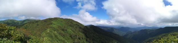
Gunma view from the top of the ridge connecting Mt Daigenta and Mt Mikuni
After arriving at Echigo-Yuzawa station in Niigata prefecture, I hopped on the bus headed for Naeba Prince Hotel, getting off at Asakai, a few minutes past the stop for Mt Sennokura. My plan was to hike up the ridge leading South from Mt Tairapyo, so that I could pick up my hike from 2017, about half an hour past the Tairapyo Mountain Hut. My map indicated that the hike went up through the ski resort but that the start of the trail was hard to find. I found something that seemed like a trail and headed up it, but after climbing for nearly thirty minutes, it turned out to be a deadend.
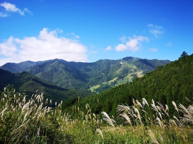
A hint of autumn, looking Westwards to Niigata
I was now faced with two options. Either head back down, and follow the road to the start of the trail of Mt Mikuni (where I had expected to end up) and go and back down from there. Or, cut across the hillside in the hope of coming across the actual trail. I chose the second one, following a very faint overgrown track through thick bushes at the edge of the forest covering the mountainside, thinking all the time that if this doesn’t work out, I’ll have to walk back the same way. Finally I gave up on the bushwacking, and started to climb directly up through the forest. It was pretty steep, but there was less vegetation to slow me down.

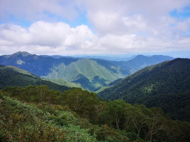
The ridgeline I was hiking up
After about ten minutes of climbing straight up the side of the mountain, using the thin trees as handholds, I spotted some rope to the right. I moved towards it, and discovered the path. My joy at finding the path, was tempered by the fact that it headed straight up the mountainside at roughly the same gradient I had been doing just before – the rope was there to help pull yourself up. The path continued for what seemed like forever. I finally reached a minor summit with a view of the remaining way to the top ridge. I had just started out, and I was already exhausted!
The instantly recognizable shape of Mt Naeba, as seen halfway up the ridge
After a short descent, the path continued to climb relentlessly. At precisely noon, I emerged at the high point, more than two hours after setting out, and completely knackered. This was after all my first big ascent since the start of the summer. I admired the great 360 degree view – Niigata to the West and Gunma to the East – then dropped my pack, and headed towards Mt Daigenta 大源太山 about 15 minutes away.

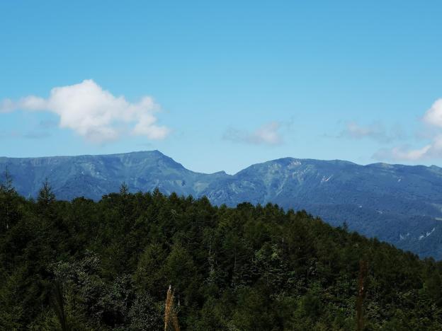
In the foreground Mt Azumaya (climbed May 2017) and in the background Mt Mitsumine (climbed May 2019).
From the top there were good views of Mt Sennokura playing hide and seek in the clouds. Further to the right, Mt Tanigawa was stubbornly sitting inside a big cloud. After a quick bite, I headed back to pick up my pack and started southwards along the ridgeline towards Mt Mikuni visible in the distance. Since I lost time finding the start of the trail, it was now impossible to catch the earlier bus which would have given me some time to use the hot spring at Sarugakyo Onsen. I had been there once before after descending from Mt Azumaya two years earlier and was looking forward to visiting again. Now I had to race to catch the last bus back.

Around 2000m, Autumn has arrived…
After some ups and downs, with spectacular views, especially towards Gunma prefecture, I reached the flat top of Mt Mikuni 三国山 just after 2pm. The name translates as “three country mountain”. In modern times, it sits on the border of two prefectures, but during the Edo period, it probably sat at the junction of three areas. From the top, I was able to see for the first time Mt Inatsutsumi, although Mt Shirasuna beyond was lost in the clouds. I could also see the end of the hike, straight down the side of the mountain to Mikuni Pass, and then further down the valley to Hoshi onsen 法師温泉, a secret hot spring.

Mt Ono (left) and Mt Haruna (right)
The path down to Mikuni pass consisted mostly of wooden steps – perfect for running down since I still wasn’t 100% sure I would be able to catch my bus. In no time, I reached the pass, where I turned left into the forest. Soon I reached a road, beyond which was the path to Hoshi Onsen, the last part of which followed a river. I reached the end of the hike with ten minutes to spare. Since there was no time for a bath, I used the Tokyo Wide Pass to go from Jomo Kogen back to Echigo-Yuzawa (just ten minutes), where there is a hot spring in the station.
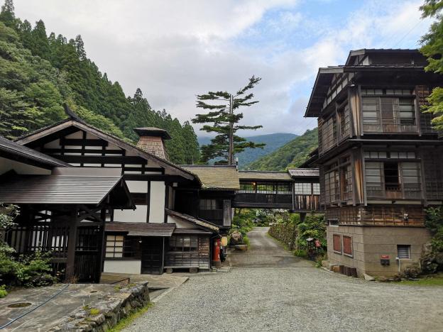
Hoshi Onsen, a place I would like to stay at someday
