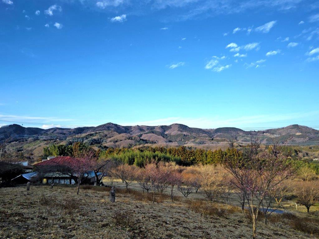
Mt Mido (878m), Shimonita Town, Gunma Prefecture, Monday, January 9, 2023

After my Annaka to Annaka hike, I needed to find another mountain I could climb in the winter using the Tokyo Wide Pass. I decided to visit the Nishi-Joshu area, since my last hike there was nearly 3 years ago. I found a suitable peak in my mountains of Gunma guidebook, low enough to be still free of snow, and short enough so I could catch the mid-afternoon bus back. To give myself some extra time, I would get to Shimonita station an hour before the morning bus and take a taxi to the trailhead. Although the hike went up and down the same path, I could check out a couple of viewpoints on the way, as well as this peak’s claim to fame: two tall rock pillars perched on the mountain side. I was looking forward to revisiting Nishi-Joshu after a long interval and getting some new views of the area.

Hiking with the Tokyo Wide Pass

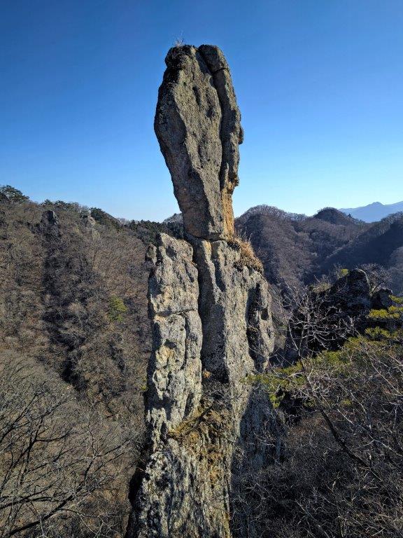
“Old Man Old Woman Rock” the highlight of the hike

Download a map of the Mt Mido hike

This map was developed for Japanwilds with the Hokkaido Cartographer

Find more Japan hiking maps on Avenza

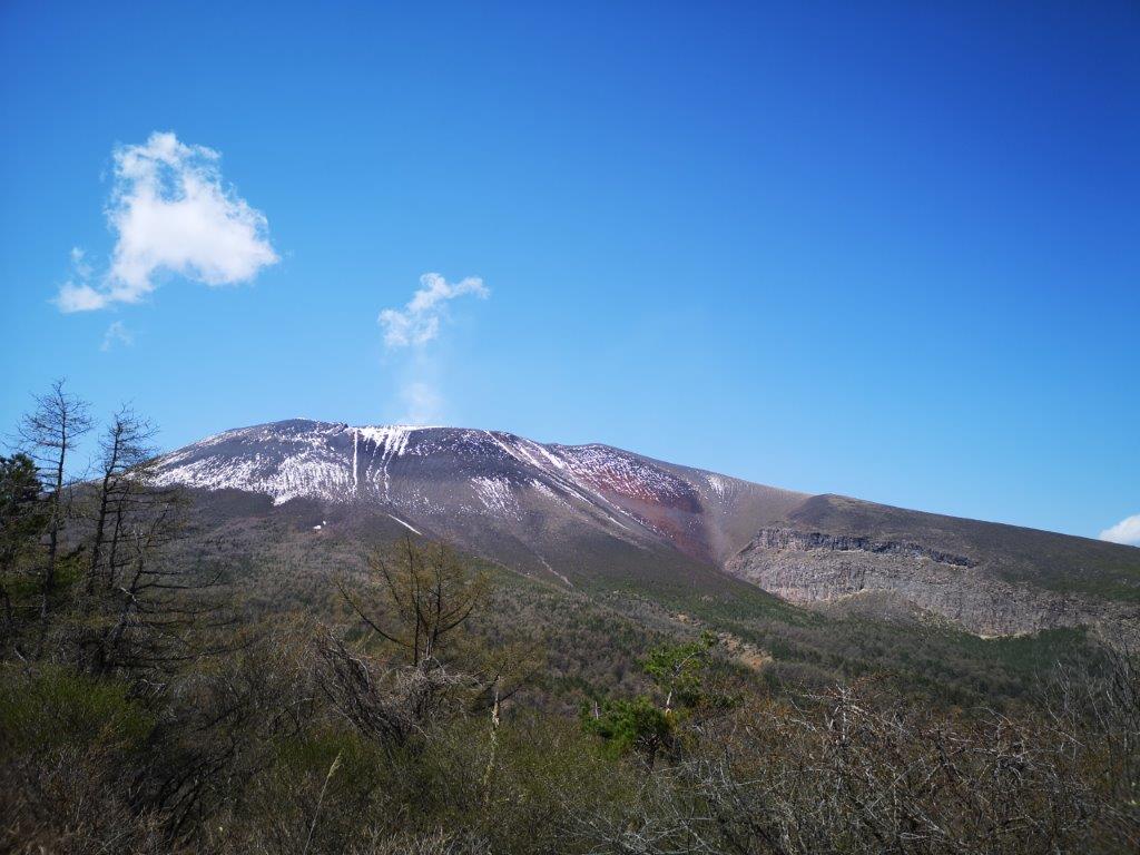
View of flat-topped Mt Arafune from Jijiiwa-Babaiwa

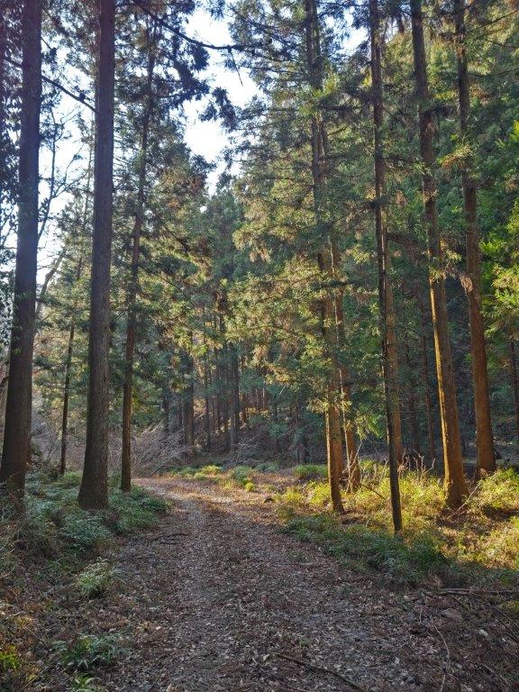
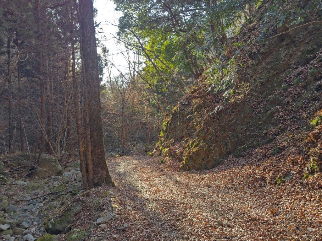
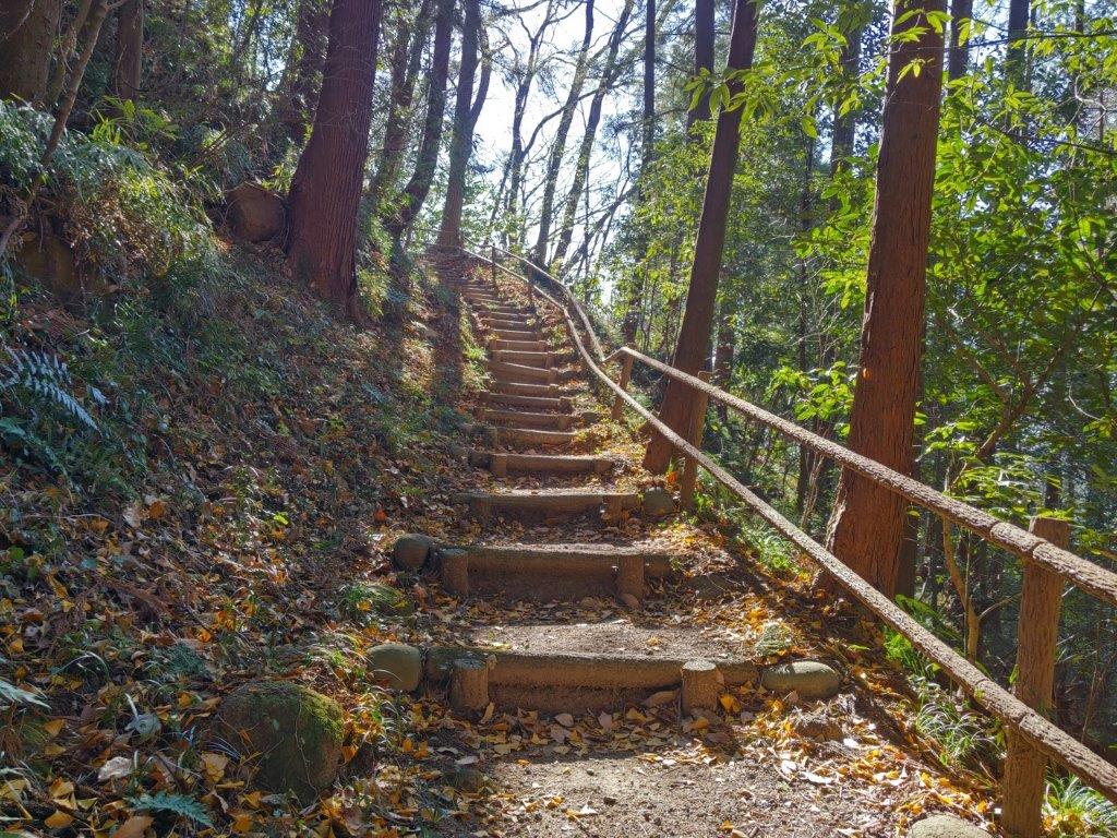
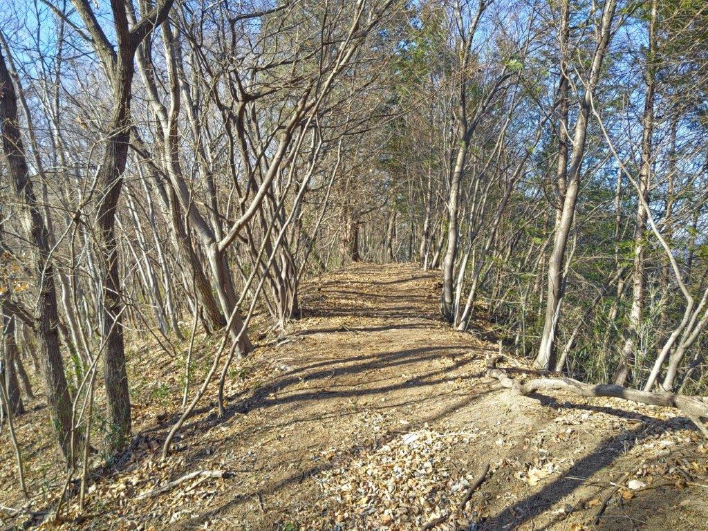
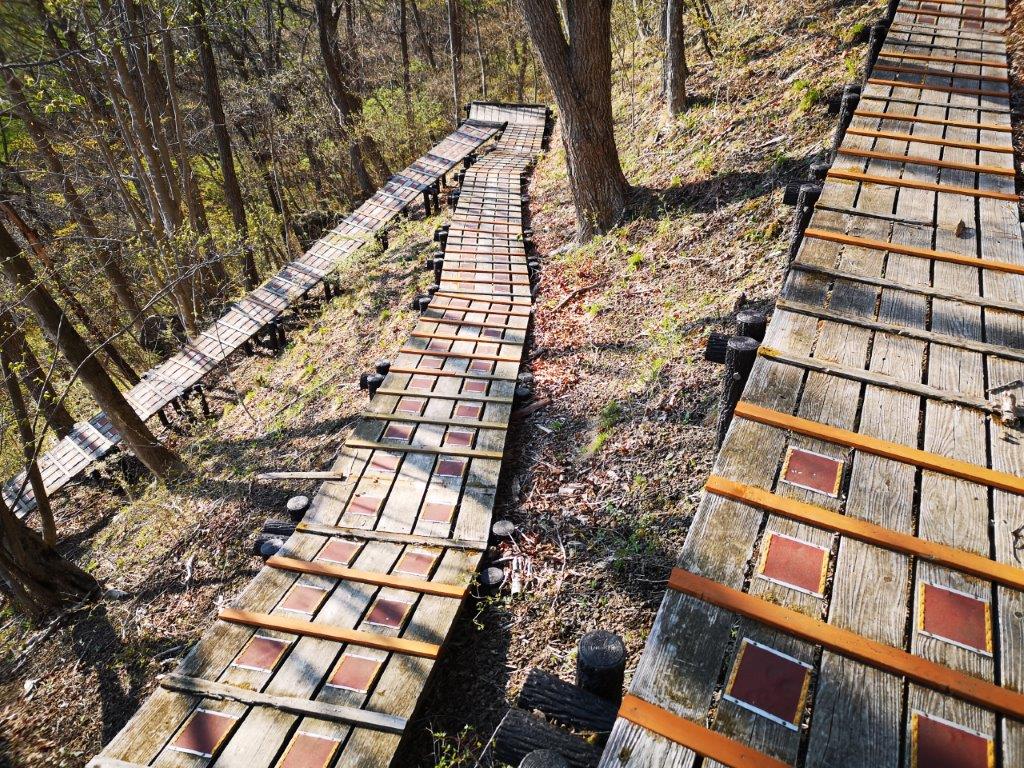
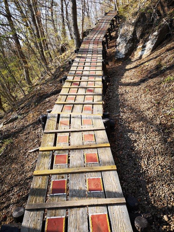
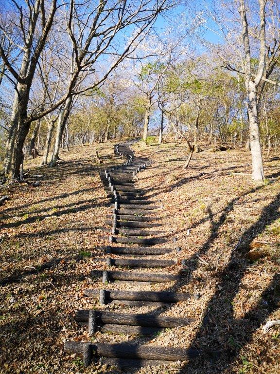
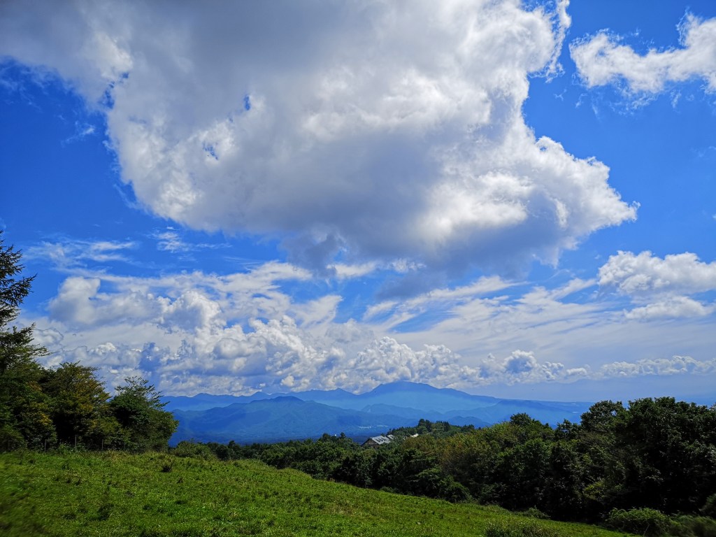
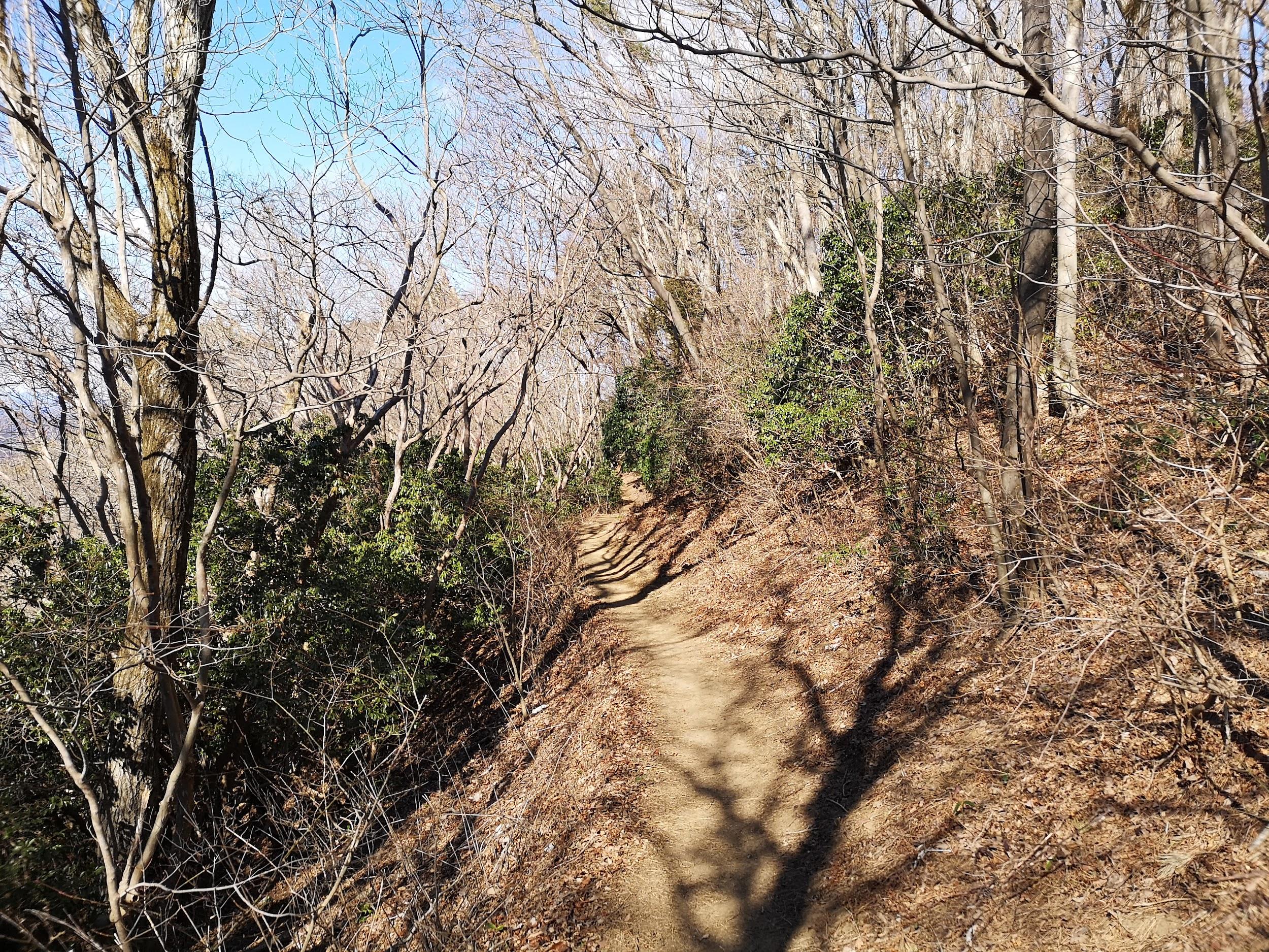
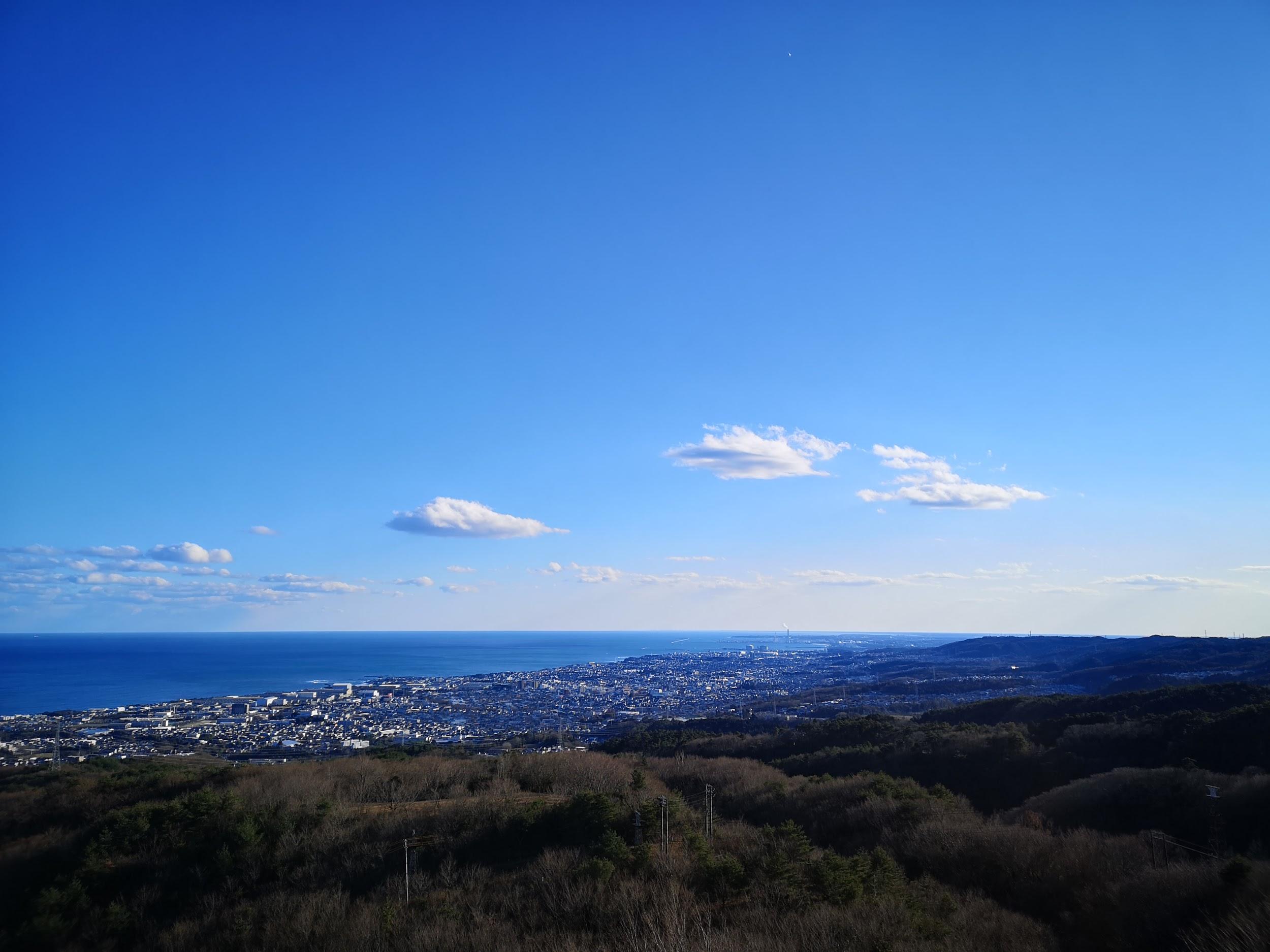
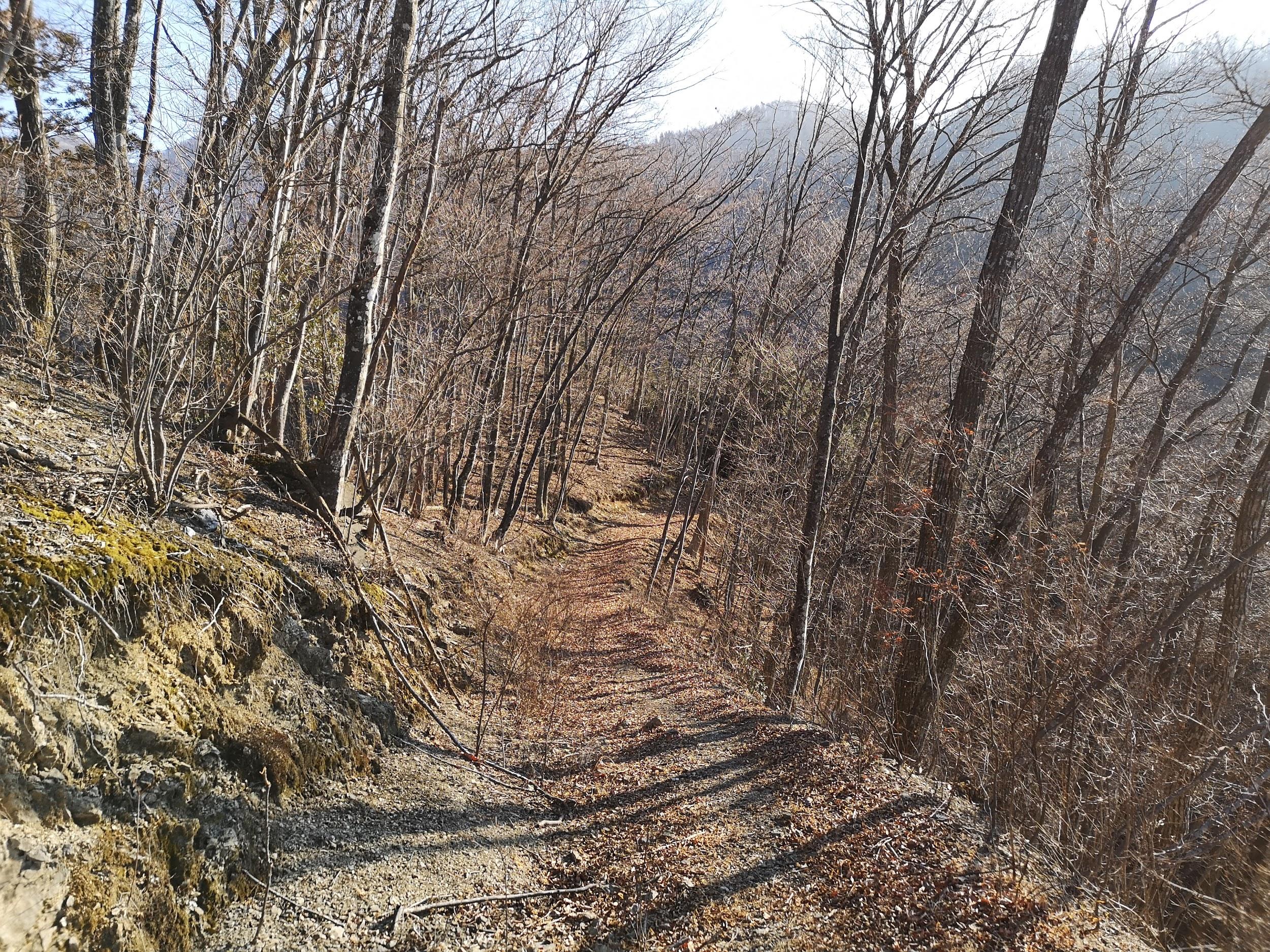
I rode the shinkansen to Takasaki on a sunny, cloudless day and then transferred to the Joshin line for Shimonita, arriving there a little after 10am. It took about ten minutes by taxi to reach the trail entrance, and after getting ready, I set off along a forest road through the cedars. I soon passed the end of the forest road, and by 11am, was walking up a rocky valley; I was finally starting to warm up, thanks to the sun, shining through the bare trees.

Walking among the cedars (left) Mi-n0-Taki waterfall (right)

View of Mt Myogi from the summit

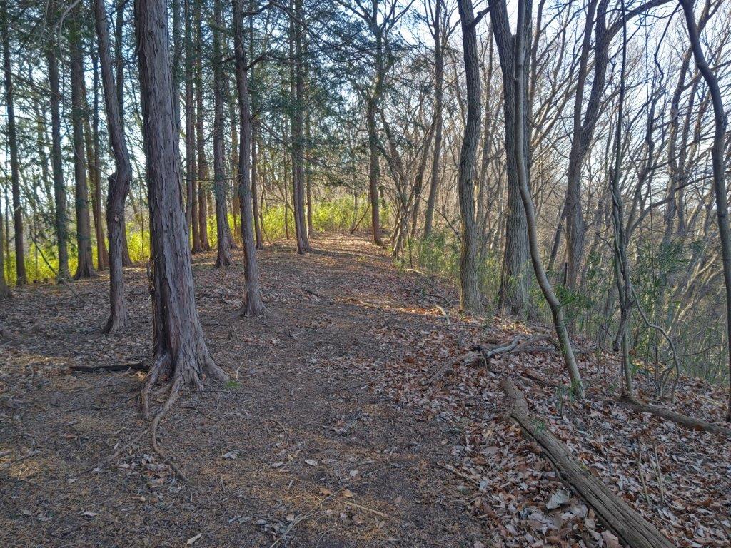
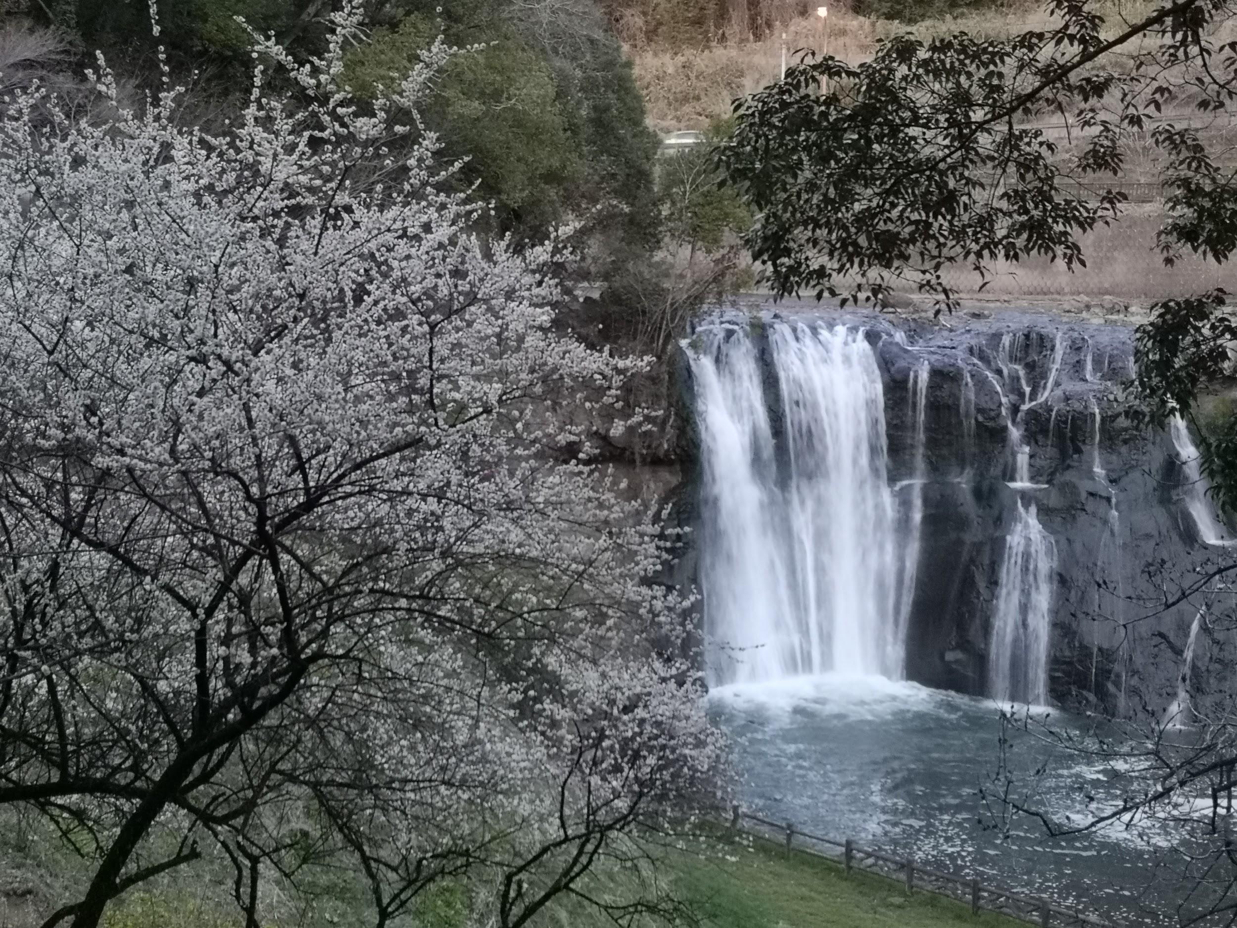
I was extra careful to check for hidden holes, the path being covered in a layer of dead leaves. At 11h30, I reached Mi-no-Taki waterfall, barely a trickle at this time of year. It was also the trickiest part of the hike, requiring a quick scramble up a rocky face, fitted with a rope for safety. Next, a short, steep climb brought me to an intersection at the top of the valley. Here, I dropped my pack and headed left for the short roundtrip to the first viewpoint.

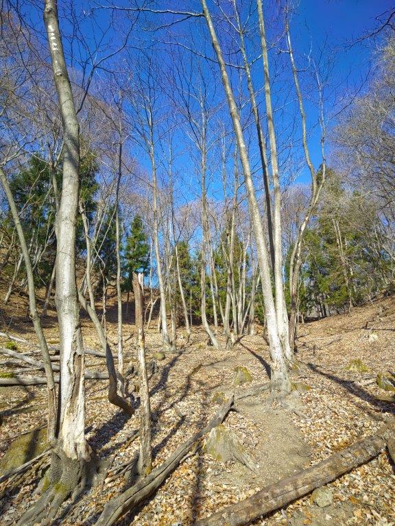
Steep section at the top of the valley (left) Old Woman Rock (right)

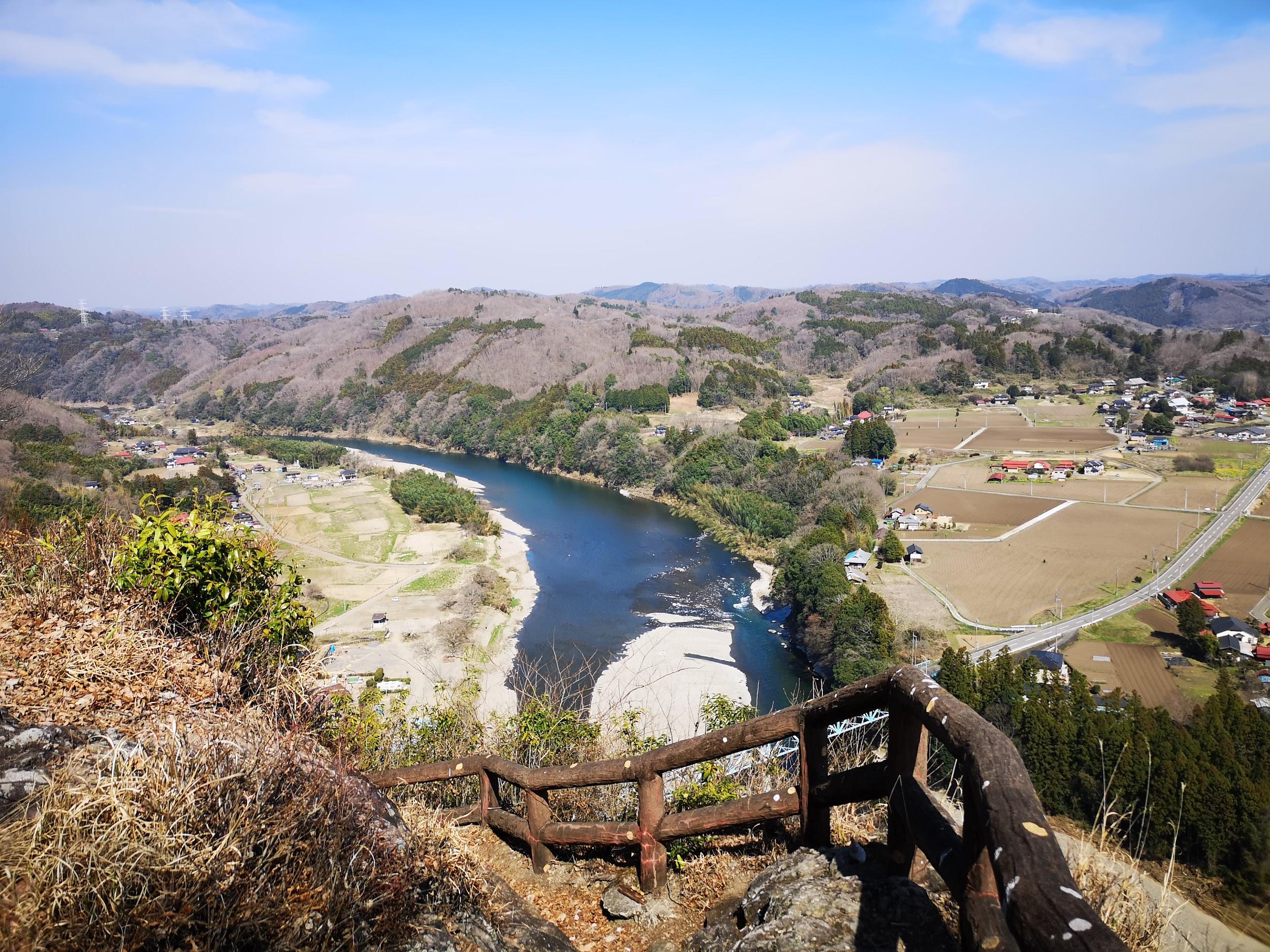
Looking down at Jijiiwa-Babaiwa from the second viewpoint

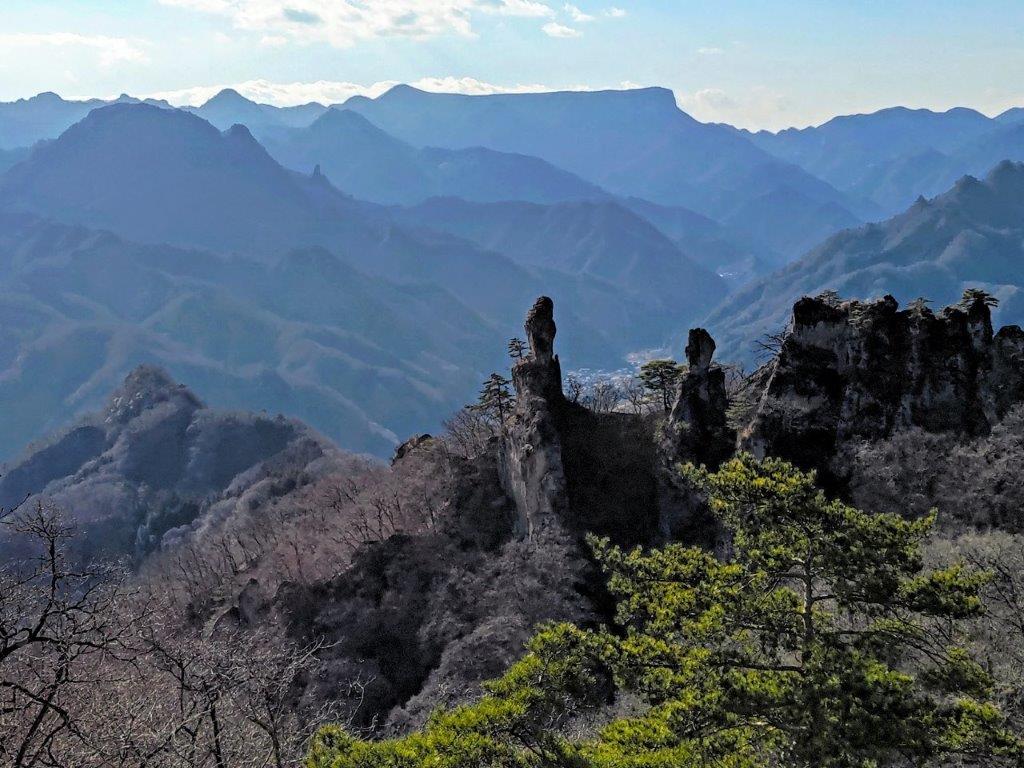
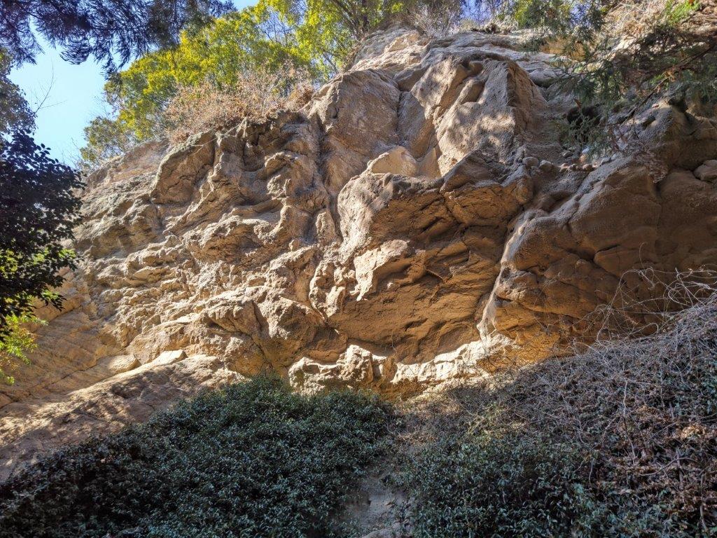
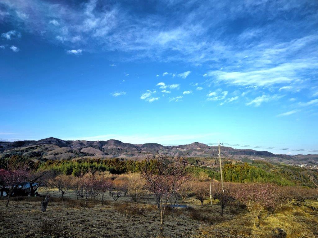
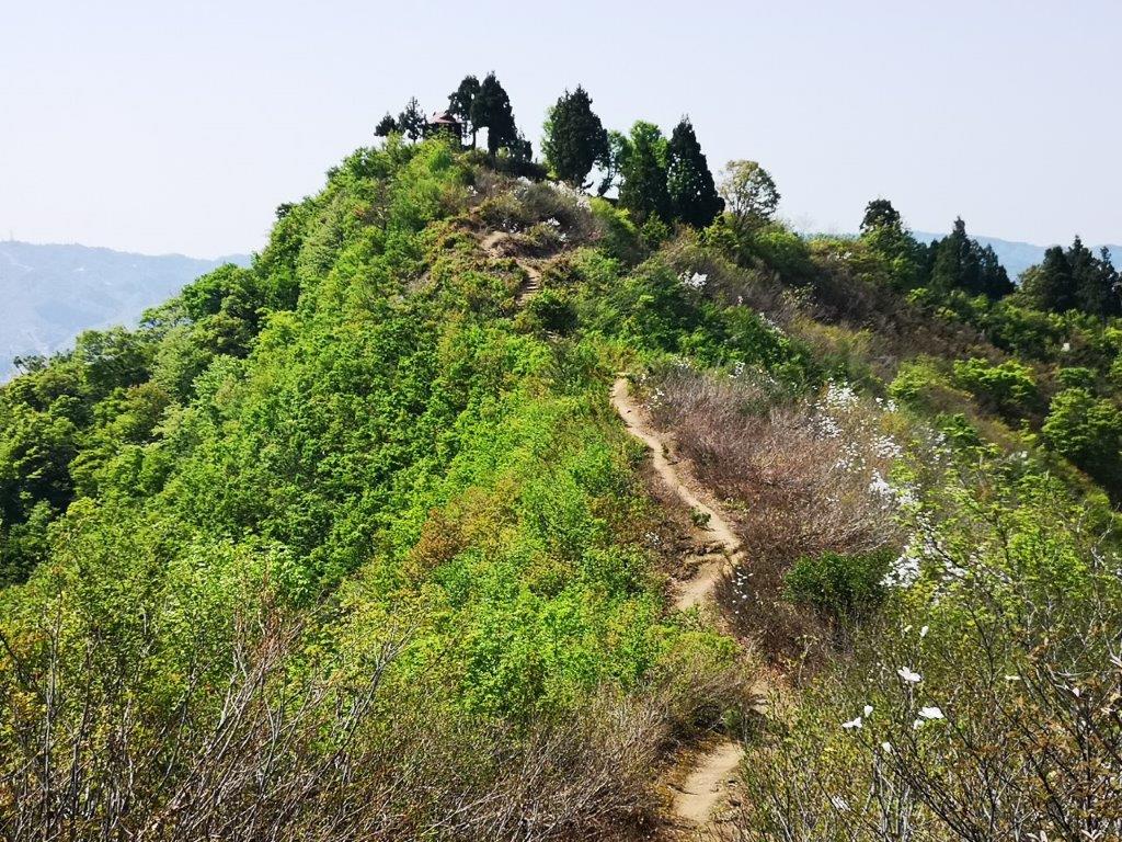
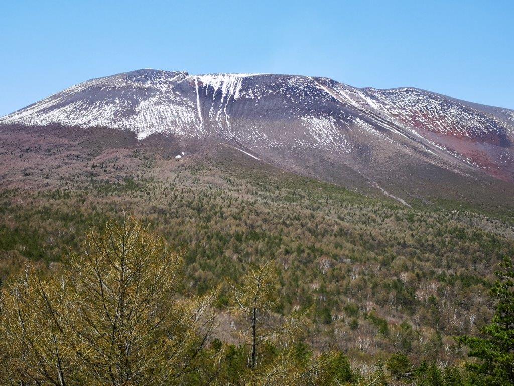
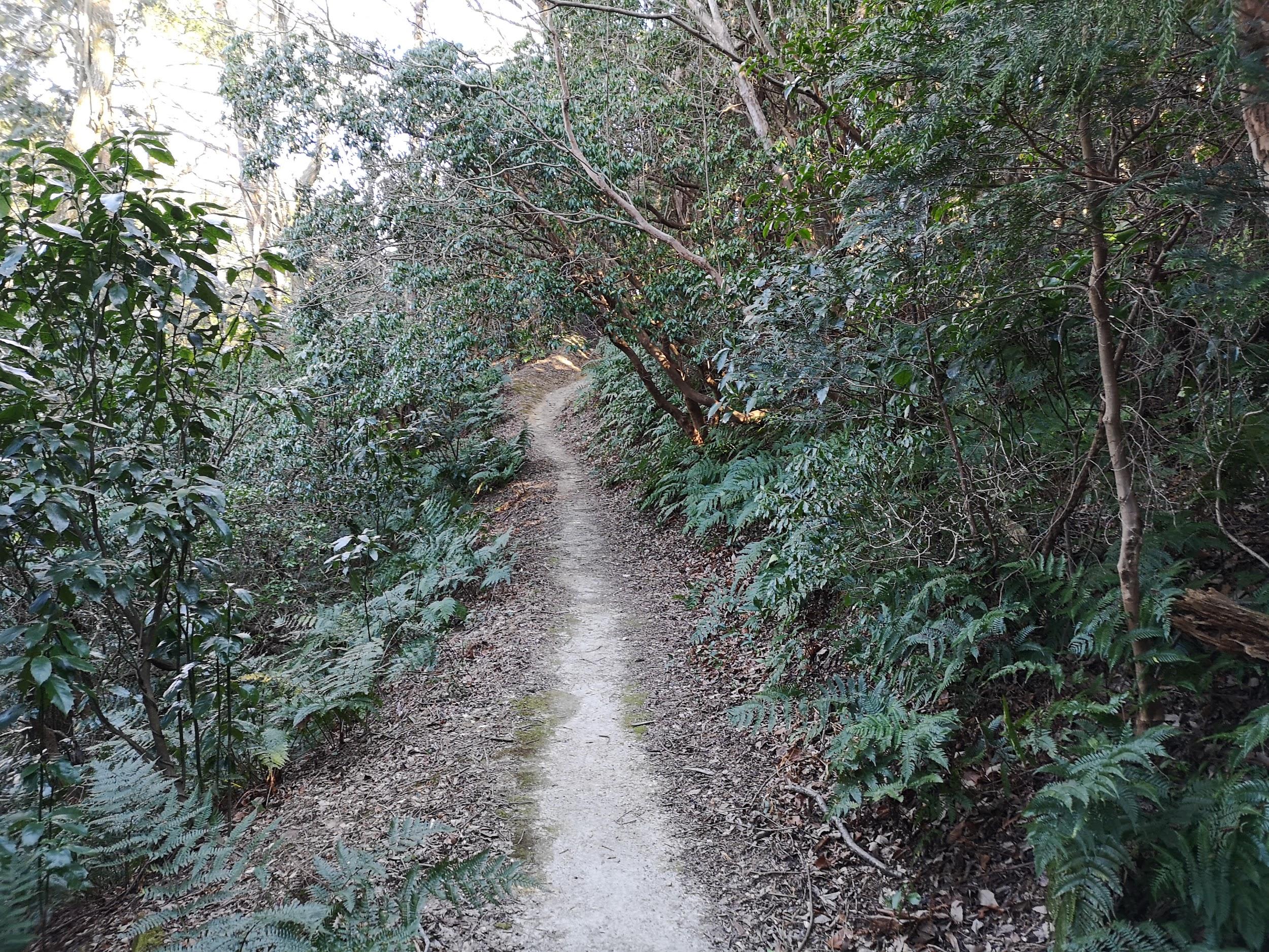
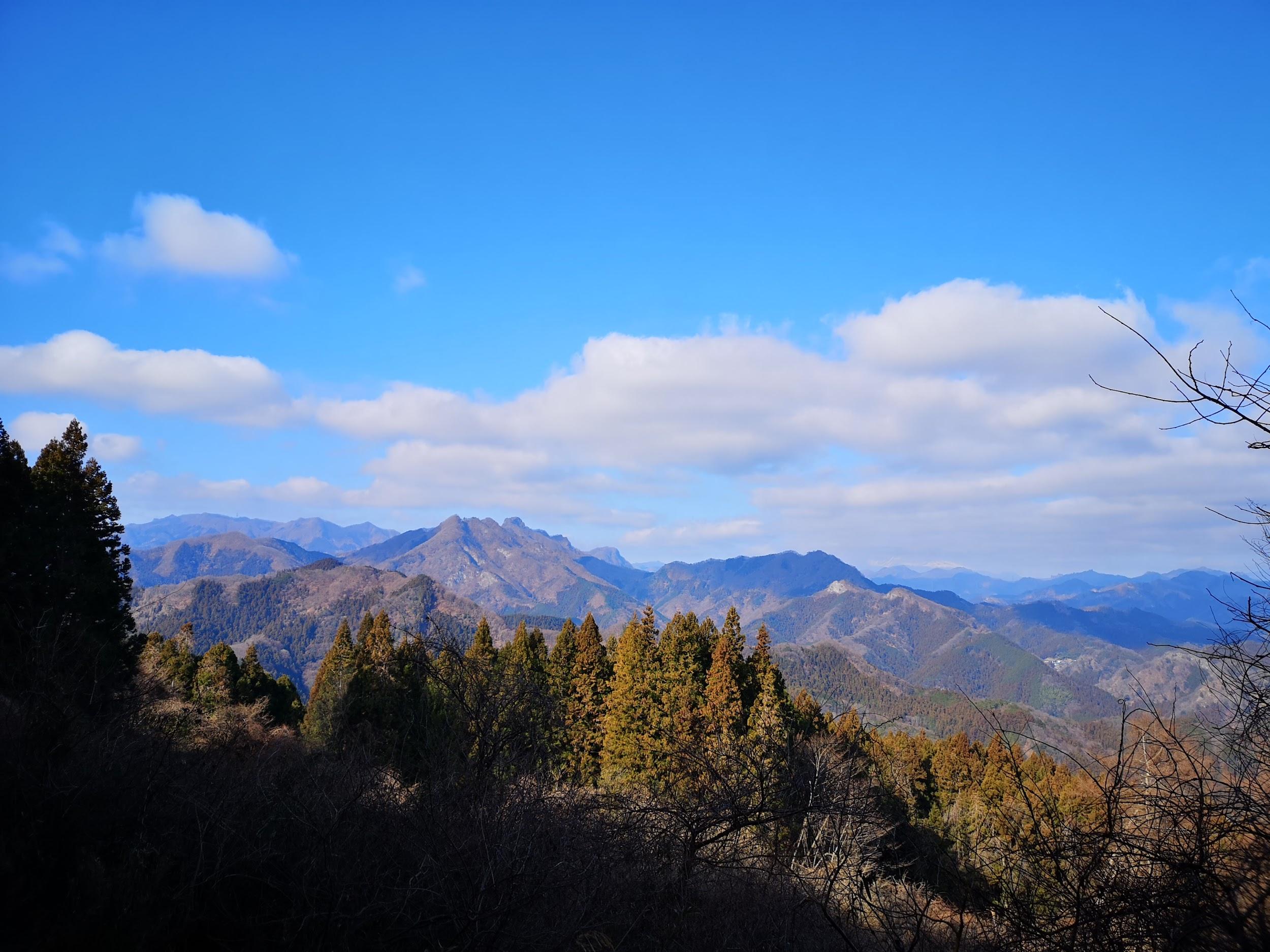
I followed a narrow ridge passing by the base of a rocky outcrop, and after a few minutes, reached a level, rocky ledge, opposite “Jjji-iwa Baba-iwa” (じじ岩ばば岩) meaning “Old man rock old woman rock”), two impressive stone pillars perched at the end of the ridge. Turning around, I had a bird’s-eye view of a deep valley, with flat-topped Mt Arafune in the background. Since it was nearly noon, I found a spot to sit and had an early lunch. After enjoying the view, I made my way back to the intersection and continued along the right branch.

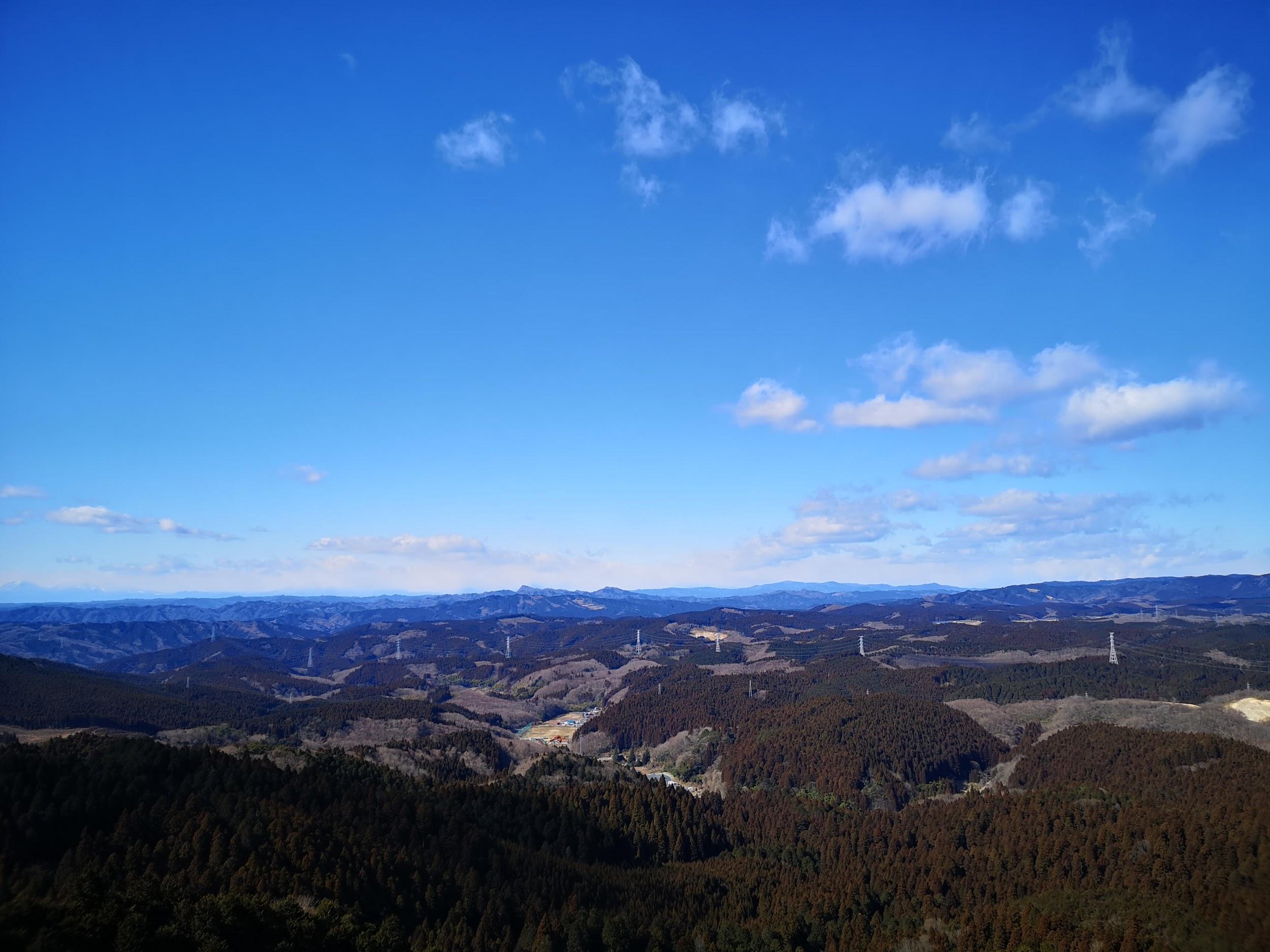
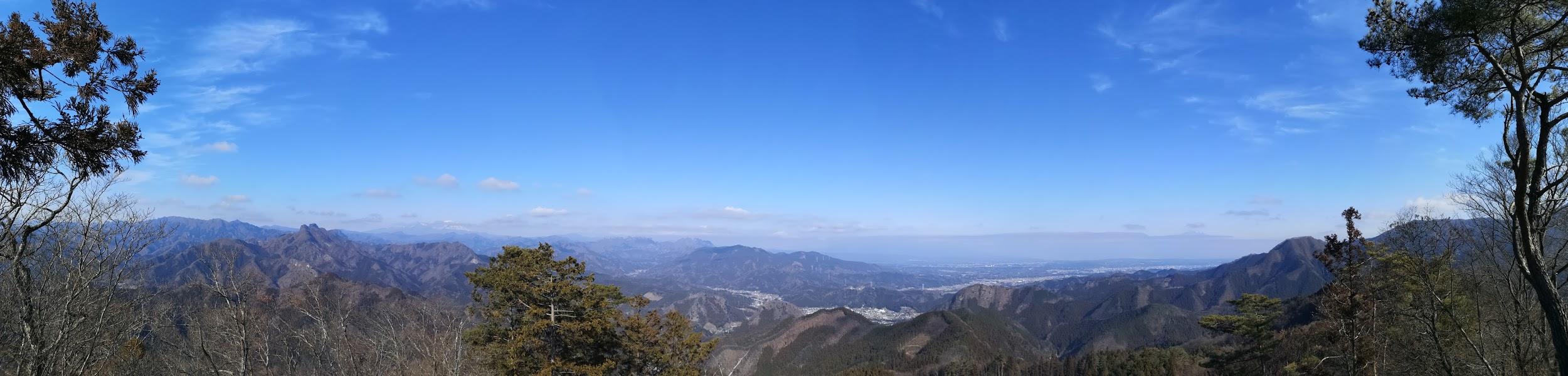
Looking south towards the Mikabo Super forest road

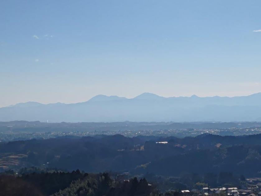
View southeast of Mt Ogeta

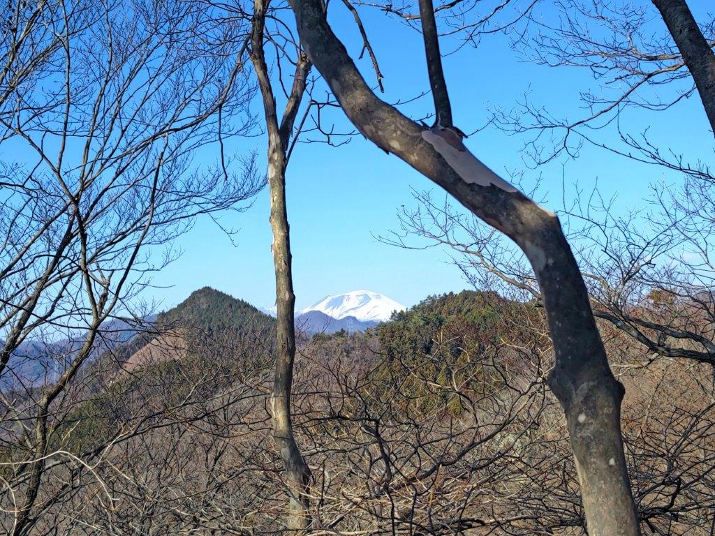
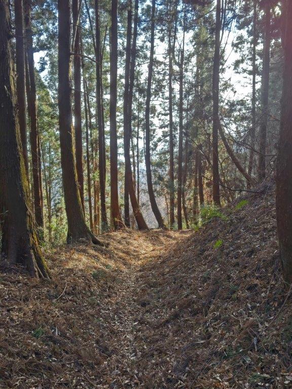
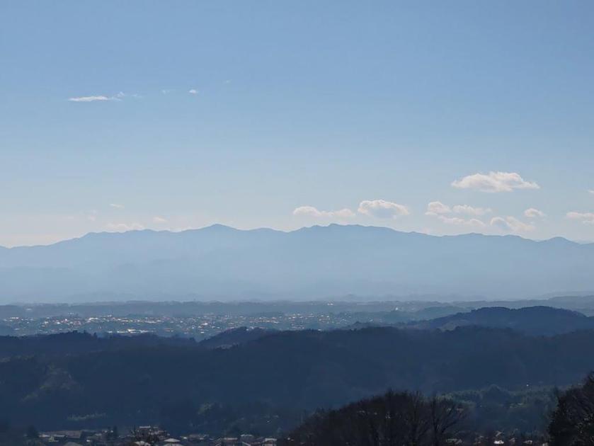
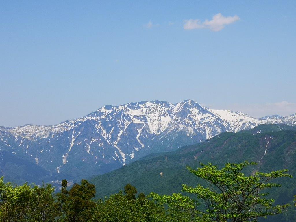
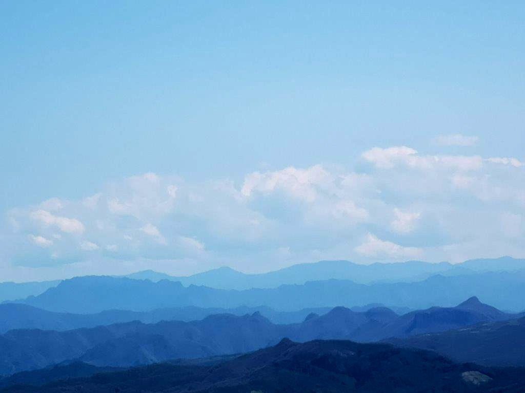
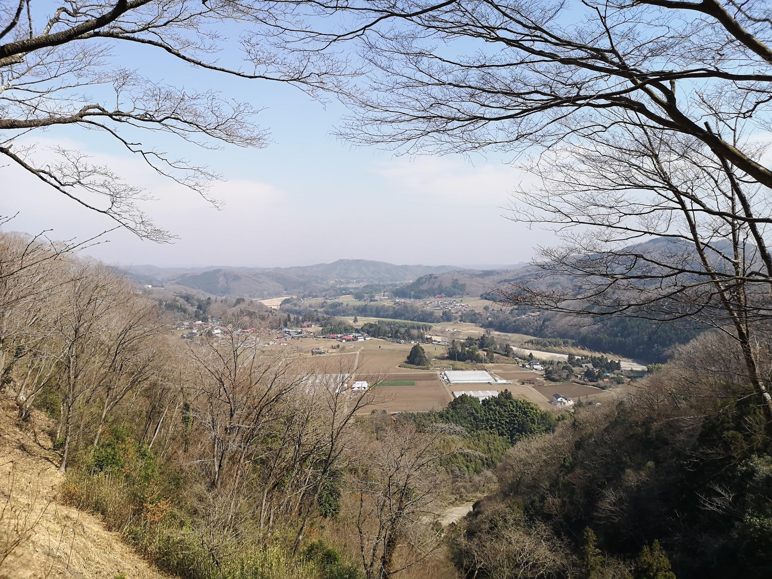
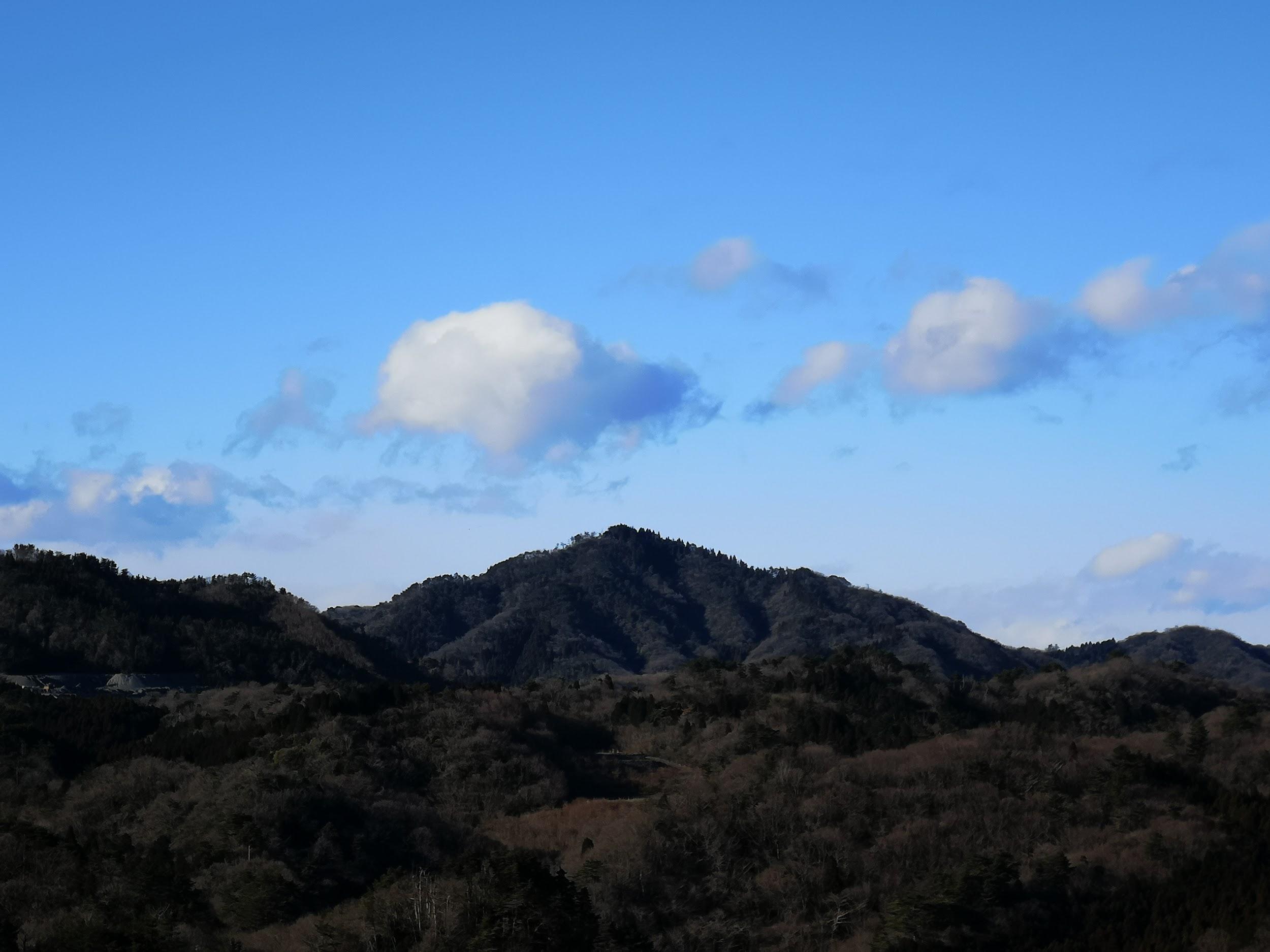
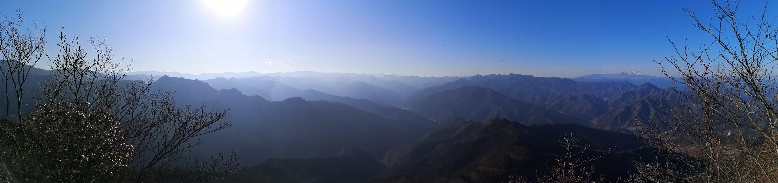
I was surprised by how dry everything was, dust flying up from the trail at every gust of wind. After some more climbing along the narrow, twisting ridgeline, I reached the summit of Mt Mido (御堂山 みどうやま mido-yama), a Gunma 100-famous mountain, a little before 1am. It was mostly in the trees, but I could make out the jagged summit of Mt Myogi, as well as the snowy top of Mt Asama, both on the north side. After a short break, I retraced my steps to a turn-off for the nearby “Jitoba-ura-tenbosho”, the rear viewpoint of the stone pillars.

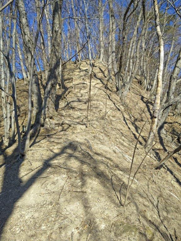
Climbing the narrow ridgeline (left) Walking back along the forest road (right)

Late afternoon light filtering down into the deep valley

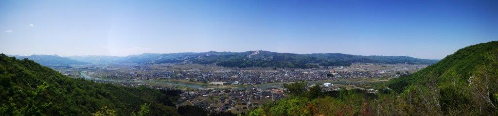
Standing next to a rocky outcrop, I had a fantastic view of “Jijiiwa-babaiwa”. I continued a little further to the end of the path, where I had a view of Mt Ogeta and the Kanto plain on the west side, and Mt Akaguna and the Mikabo Super forest road on the south side. I found a place to sit and finished the second half of my lunch. It was now past 2 pm so I quickly made my way back down the same way, carefully navigating the descent down Mi-no-taki waterfall, reaching the bus stop just in the time for the 3h30 bus. Back at Shimonita, I boarded the Joshin line for the one-hour trip back to Takasaki, where I transferred to the Shinkansen for Tokyo.

See a video of the Mt Mido hike
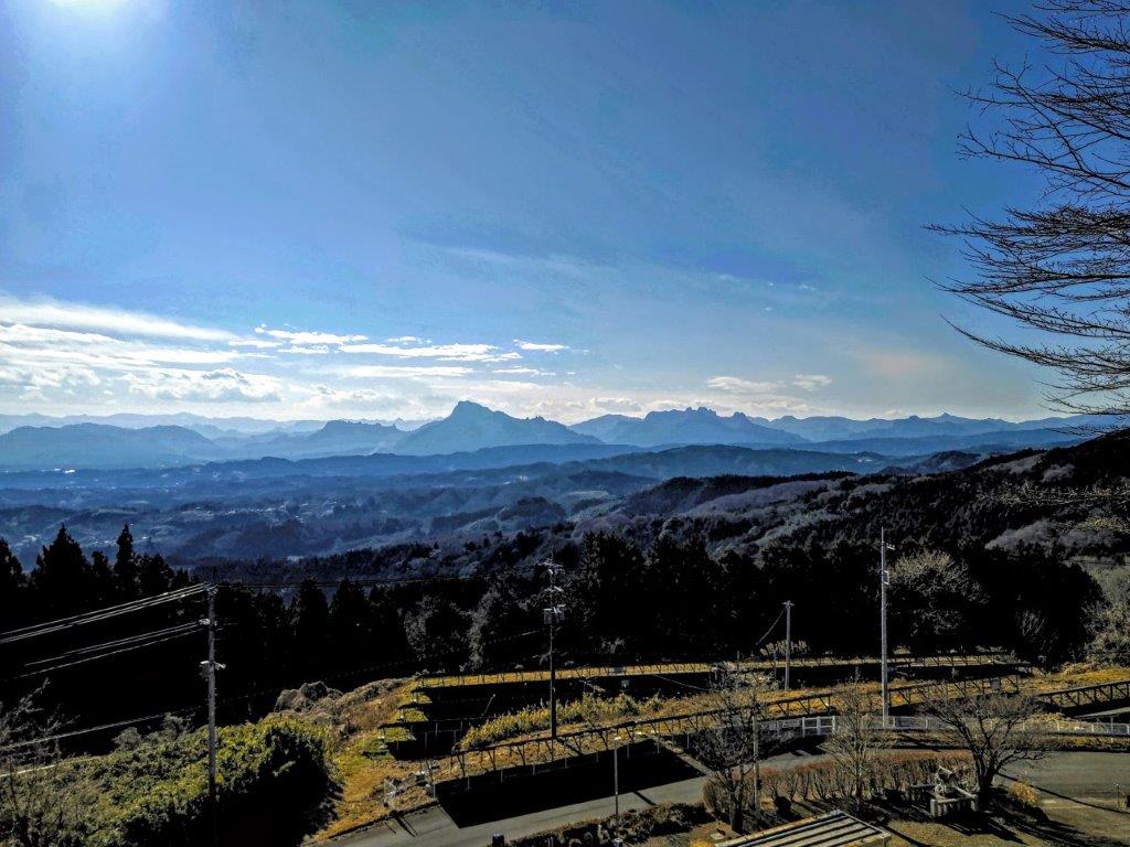
Mt Sekison (571m), Annaka City, Gunma Prefecture, Saturday, January 7, 2023

I wanted to use the Tokyo Wide Pass for the long first weekend of 2023. I searched my maps for some low-altitude mountains near a shinkansen station and finally found a series of minor summits, part of the Annaka Alps, north of Annaka-Haruna station, one stop from Takasaki on the Hokuriku line. I had often passed through this station on the way to and from Karuizawa, so I was glad for a chance to finally get off there. The hike through these hills was relatively short, but could be extended by following the Kanto Fureai no Michi, as it headed south from Mt Haruna. Upon reaching a road, I could catch a bus back to Annaka station on the Shin-Etsu line, therefore completing an “Annaka to Annaka hike” of my own creation.

Hiking with the Tokyo Wide Pass

Hiking the Kanto Fureai no Michi 関東ふれあいの道

Hiking the Annaka Alps 安中アルプス

View of the hike from Kanbai Park

I reached the Annaka-Haruna at 11am on a sunny winter day and was stunned by the clear view of Mt Myogi from outside the station. Half an hour later, I was walking up a road on the north side, and soon spotted a signpost for a trail on the right. I followed a narrow path as it went through a bamboo forest, then merged with a forest road, before reaching a parking lot at the end of a paved road. On the other side, the trail continued up a series of log steps through beautiful forest.

View of Mt Myogi from Annaka-Haruna Station

Start of the trail leading to the “47 statues”

I suddenly found myself walking under a cliff, and felt nervous about rockfall, something I hadn’t expected on today’s hike. I had arrived at a historical site called “The statues of the 47 loyal retainers of Ako-Gishu” (赤穂義士四十七士石像), in memory of the 47 Ronin. After quickly confirming that there were indeed 47 statues along the base of the cliff, I set off again, up a steep trail winding around the back of the rocky outcrop.

A log staircase going up through sunny forest

The trail passes near the base of a rocky outcrop

As I neared the top, I stepped into a hole hidden by dead leaves and banged my knee on a rock; fortunately, it was more fright than harm. A few minutes later, I reached the summit of Mt Goten (御殿山 400m); it was completely in the trees so I soon moved on. I followed a mostly level trail through a dark cedar forest till it ended at a dirt road. Using my map, I quickly picked up the trail again, as it led to the top of a hill.

The hike alternated between sunny and shady sections

Hiking through the winter woods

I was now walking on a sunny level path, with glimpses of Mt Haruna on the north side, through leafless trees. At 1pm, I arrived at the summit of Mt Sekison (石尊山 せきそんさん sekison-san), a gunma 100-famous mountain, and rested on a bench with a narrow view to the south. After lunch, I followed a path down the other side, and after crossing a road, walked up the next hill. I soon passed the summit of Mt Toya (605m 戸谷山 とややま), in the trees, and headed down the other side, arriving at the Kanto Fureai no Michi at 2pm, where I turned left.

Most of the trail was easy to walk

The entire hill range is known as the Annaka Alps

I followed a pleasant trail, downhill through sunny forest, with occasional views of the Joshu mountains, reaching a road and a bus stop at around 3pm. I decided to check out the Akima Plum Grove (秋間梅林), a short distance away. From the highest point of Kanbai Park (観梅公園), I was rewarded view of the hills I had just hiked, as well as some early pink plum blossoms. I followed a different path through the park back to the road. There, I got on a bus for Annaka station, just 3 stops from Takasaki station, from where I could catch the shinkansen for the 40-minute ride to Tokyo.

See the views along the Mt Sekison hike

See more pictures of the Mt Sekison hike

Mt Sakado (634m), Minami-Uonuma City, Niigata Prefecture, Thursday, May 5, 2022

For my third trip using the Tokyo Wide Pass, I decided to head north to Niigata: reachable via shinkansen and covered by the pass; the beautiful May weather was supposed to last for one more day in the Yuzawa area. Looking at my hiking map, I found a suitable mountain that promised some good views, also the site of an ancient castle, and close to a train station. The hike was under three hours, which was fine, since it would be my third one in as many days. From Echigo-Yuzawa station, I would ride a local line for a few stops, and then walk to the start of the trail; since it was a loop hike, I could travel the same way back. The forecast announced blue skies again, but also summer-like temperatures. I was a little concerned as this hike was 1000 meters lower than the two previous ones, but I was excited about visiting Niigata again after nearly two years and seeing the Echigo mountains in spring.

The Echigo mountains in spring

Mt Kinjo, climbed two years ago

It was another beautiful May day as I rode the nearly empty shinkansen to Echigo-Yuzwa, where I transferred to the JR line for the short ride to Muikamachi. Standing outside the station, I had a view of today’s mountain, looking more impressive than it had on paper. I walked through the town and over the Uono river, reaching the trailhead at Torisaka Shrine (鳥坂神社) just before 11am. I was surprised to see some snow in the shade, even though I was only 200 meters above sea level. I didn’t make me feel any cooler as I started up the Yakushi Ridge Route (薬師尾根コース) on what was so far the hottest day of the year.

First view to the south of the Joshin-Etsu mountains

Climbing the log steps under the midday sun

I made my way up a grassy slope, lined with a handful of Buddhist statuettes. I soon reached the first viewpoint of the day: looking south, I could make out Mt Tanigawa and Mt Naeba in the midday haze, still white with snow. Contrary to my expectations, from this point forward the path was out of the tree cover, and it felt very hot under the midday sun. On the other hand, thanks to the clear weather, I enjoyed amazing views back of the flat Yuzawa valley, as the path followed a narrow ridge, that eventually merged with the summit ridgeline. Looking south again, I could now see Mt Kinjo, patches of snow still covering its top half.

Looking back at Muikamachi Town

One of the flat sections of the Yaukushi Ridge Route

The steeper sections of the trail were fitted with log steps, making it easy to climb; higher up, there was even a metal staircase. Just before 1pm, I arrived at the small wooden shrine marking the summit of Mt Sakado 坂戸山(さかどやま sakado-yama). Although the summit of yesterday’s mountain seemed artificial, today’s summit was man-made, all that was left of the highest point of Sakado castle. On the north and east sides, I had a spectacular view of the 3 great mountains of Echigo covered in snow: Mt Hakkai, Mt Echigo-Koma and Mt Naka. I found a spot in the shade and sat down for lunch. Once done, I made a short round-trip to a couple more grassy mounds along the eastern ridge, also part of the castle ruins.

The steeper bits were fitted with log steps (left) and metal ones (right)

Looking down at Minami-Uonuma City

I was rewarded with amazing views in all directions; it almost felt like I was hiking in Switzerland. I also saw many Mangolia flowers (tamushiba) along the path. At 2pm, I started to head down the Shirosaka Route (城坂コース). Very quickly the path dived into the forest, the cool shade a welcome relief; however, I was soon out of the trees again at the top of a steep valley. I followed a switchback path while enjoying the bird’s eye views of the flat valley below, framed on both sides by bright green ridges. It was the hottest time of the day and amazingly many people were still going up. Half an hour later, I reached a famous cherry blossom spot near the flatter base of the mountain.

A side view of Mt Hakkai

Making the roundtrip along the east-west ridge

I was shocked to see many trees broken in half: apparently an avalanche had swept down the steep mountain side during the winter. However, I was amazed to see some flowers still in full bloom on one of the damaged trees (see video), a sign of hope among the destruction; this also meant that I had seen cherry blossoms on all 3 hikes. I followed the now level path, and after passing under some cedar trees, I was back at my starting point by 3pm. It took about an hour for the return to Echigo-Yuzawa station, where I enjoyed a hot spring bath and some local sake, before boarding the shinkansen for the eighty minute ride to Tokyo.

A switchback path down the Shirosaka Route

See the views of Mt Sakado in the spring

A slideshow of some more photos of the Mt Sakado hike

Mt Meshimori (1643m), Minamimaki Village, Nagano Prefecture, Wednesday, May 4, 2022

For my second trip using the Tokyo Wide Pass, I chose another relatively easy mountain opposite Yatsugatake and about fifty kilometers south of the previous hike. I would travel to Kobuchizawa using the Chuo limited express, change to the Koumi line for Nobeyama, and finally hop on a bus for Shishi Rock, just opposite the trail entrance. After reaching the summit, I would descend via a different trail to Kiyosato, one station before Nobeyama. The sunny May weather was supposed to hold one more day, with slightly warmer temperatures. I was looking forward to visiting Kiyosato again, and seeing Yatsugatake from a new angle and in a different season.

Yatsugatake still topped in white in the middle of spring

The conical top of Mt Meshimori

I arrived at Kobuchizawa shortly before 10am on a perfect, blue-sky day, and boarded the highest train line in Japan for the 45 minutes ride to the highest train station in Japan, Nobeyama (1345m). It was my first time there and the wide open fields surrounding it gave the impression of being on a high plateau. I had planned to get some extra food from a 7\11 near the station, the highest convenience store in Japan, but the free loop bus was leaving in a few minutes, and I decided to get on rather than wait for the next one.

View of Yatsugatake from Shishi Rock

The South Alps also visible from Shishi Rock

I has some a great side view of Yatsugatake during the ten-minute ride to Hirasawa pass (平沢峠); although the surrounding countryside was bright green, the higher reaches of this ancient volcano were still of a brilliant white. Before starting my hike, I checked out the rocky formation of Shishi-iwa (しし岩 meaning lion rock); standing on the highest rock, I could see the Minami Alps to the south. After a short climb, I passed the flat summit of Mt Hirasawa (平沢山 1653m), from where it was a mostly an easy, level walk to a trail junction. I went left and after a short climb, arrived at the exposed and windy peak of Mt Hiramori (平盛山 1643m).

Near the Mt Hiramori (left) and Mt Meshimori (right) junction

The rounded summit of Mt Hiramori

Looking south, I could see the conical shape of today’s mountain, miniature people walking up and down the steps on the western side: it seemed almost man-made and reminded me of the “Lion’s Mound” in Belgium. To the east, I could see the highest peaks of Oku-Chichibu, Mt Kinpu, and Mt Miuzugaki with its blue-grey cliffs. After a short break, I set off again, and a few minutes later, arrived at the top of Mt Meshimori (飯盛山 めしもりやま meshimori-yama), just after 1pm. Its name could be translated as “a pile of food” which only made me hungrier, since I hadn’t packed a lunch today.

View of Yatsugatake from near the top of Mt Meshimori

View of the highest peaks of Oku-Chichibu

After enjoying the panoramic view, which included a faintly visible Mt Fuji, I headed down the western side; surrounded by pine trees and facing a view of the Alps on the left and Yatsugatake on the right, I almost felt like I was hiking in the Swiss Alps. At 1h30, I arrived at an intersection with a forest road near an open shelter. Here, I was delighted to see some cherry blossoms near full bloom, since I had thought I had already seen the last ones of the season. I continued down the path through green forest and soon arrived at a road outside a village. Beyond, the road descended into a river valley and then up the other side.

Walking towards Kiyosato

Walking through the new green of spring

It was only 2pm when I arrived at Kiyosato so, I hopped on another loop bus (this one had a flat fee) for Sun Meadows, where I got on a chairlift for Kiyosato Terrace (1906m), a viewpoint halfway up Mt Yatsugatake. Like the day before, I got to observe the mountain where I had been just two hours earlier. A ton of people were lining up for the return trip, so I opted to walk down to Utsukushi Mori (美し森 meaning beautiful forest). It was a peaceful walk, on a path little used this time of the year. I passed the lonely Hagoromo Pond (羽衣池 1610m) before arriving at a viewpoint on Mt Utsukushimori (美し森山 1542m) at 4pm.

View of the highest peaks of Yatsugatake from Utsukushi Mori

Last view before heading down to Utsukushi Mori bus stop

It enjoyed one last view of the South Alps, as well as a closeup view of Mt Aka and Mt Gongen, before heading down to the bus stop just a few minutes away, where I caught the same loop bus back to Kiyosato station. I had half an hour before the train back so I had a local beer and some food at a table outside a nearby Family mart. Around 5pm, I boarded the Koumi line and transferred to the Chuo limited express in Kobuchizawa for the comfortable two-hour ride back to Shinjuku.

See the views of Mt Meshimori

Mt Sekison (1667m) & Mt Hanare (1256m), Karuizawa Town, Nagano Prefecture, Tuesday, May 3, 2022

I finally had a chance to use the Tokyo Wide Pass,first time in four years, and in the end I did three hikes in a row. For the first one, I chose a small volcanic protrusion on the south side of Mt Asama (similar to Mt Hoei), which had been on my to-climb list for a while; being a relatively short trip up and down the same trail, it was reserved for a shinkansen jaunt. If I had time and energy after that, I would climb a small peak within Karuizawa Town, apparently the first one climbed by the Japanese Emperor, an enthusiastic hiker. After getting off the high-speed train, a short train ride on a local line, followed by an equally short taxi ride, would bring me to the start of the trail. I could travel to the second mountain by local bus, and at the end, walk half an hour back to the shinkansen station. The weather was supposed to be clear but cool for the season. I was looking forward to visiting Karuizawa after nearly two years and getting some close-up views of Mt Asama.

Hiking in the Joshin-Etsu-Kogen National Park

上信越高原国立公園 

Mt Asama still wearing its winter coat

Karuizawa with Mt Myogi and Nishi-Joshu in the background

I had never seen Tokyo station so crowded: on the platform itself, it was nearly impossible to figure out where the end of the line was, and I was very lucky to snag one of the last unreserved seats. After a comfortable ride, I got off at Karuizawa station just before 10am, and transferred to the much less crowded Shinano railway for the two-stop ride to Shinano-Oiwake. I was pleasantly surprised to see cherry trees still in full bloom, one month after Tokyo. I got on the last taxi waiting outside the station and was at the trail entrance by 10h30. After getting ready and having a late breakfast, I set off at 11am.

Walking under the pine trees at the start of the trail

The surreal Nigori River

The first part of the hike was along an easy to walk trail, slowly rising through a pine forest within the southern reach of the Joshin-Etsu-Kogen National Park (上信越高原国立公園). The altitude was around 1000 meters and spring was in full swing. Just before noon, I reached Nigori River (濁川 meaning “murky river”). I was stunned by its surreal yellow colour, probably due to the volcanic nature of the area. I was lucky to catch this sight on a sunny day, the water surface glittering like gold. After a few more minutes, I reached Chi-no-taki (血の滝), meaning “blood waterfall”, although it was still a muddy yellow.

Following a yellow river through the winter woods

Mt Asama, one of the hundred famous mountains of Japan

I was walking through a forest bare of leaves, since at 1400 meters, winter was back. The path continued to follow the Nigori river, passing “chi-no-ike” (血の池 “blood pond”), before turning away to the left, up a small valley. I soon reached the ridgetop, where I had my first view of Mt Asama, its rocky summit still sprinkled with snow. I walked up a short, steep slope in the opposite direction, and just after 1pm, was standing on the top of Mt Sekison (石尊山 せきそんさん sekison-san), its characters meaning stone and respect.

Yatsugatake, its highest peaks still covered in snow

Mt Asama is also an active volcano

The view was alot better than expected: on the east side, I could see the ridge connecting Mt Hanamagari with Usui Pass; behind Karuizawa was the craggy top of Mt Myogi; south were the mountain ranges of western Gunma; to the west, I could make out the shape of Yatsugatake, its highest peaks still shining white; the opposite side offered a stunning closeup view of Mt Asama. I was the only person on the mountain, so I settled on the grass for a quiet lunch. After half an hour, I started to descend the same way.

Still some snow due to a recent spring storm

It’s still winter above 1500 meters

I saw some puffs of smoke rise from the crater, reminding me that I was on the side of an active volcano. I retraced my steps back to the trail entrance; now and then the wind was blowing quite hard and made the tall pines trees sway above me. I moved quickly, as I wanted to allow enough time for the second climb of the day. I arrived back at my starting point at 3pm, and soon after reached the bus stop of the Chikuma city bus. Karuizawa being a popular resort town, I got stuck in some traffic and only reached the South Entrance of Harareyama Park (離山公園 after 4pm.

A well-maintained walkway along the steeper parts

Nearing the top

It was a relaxing climb through the forest, greener at 1000 meters; the steeper part near the top was along a well-maintained wooden walkway. Frequent signs breaking up the hike into 100 meter segments, were encouraging on the flat bits, less so on the ascending ones. At the end of a long staircase past some cherry trees still in full bloom, I reached the top of Mt Hanare (離山 はなれやま hanare-yama), the name meaning separation. To the west, I had a wider view of Mt Asama, as well as Mt Sekison, where I had been standing three hours earlier; it was against the sun, and would surely look even more impressive in the early morning.

Mt Asama from the top of Mt Hanare

Cherry blossoms, pink in the late afternoon sun

I was enjoying the late afternoon view when the five o’clock chime sounded through the valley. Normally, a call for children to come home for dinner, it also meant I had to hurry down if I wanted to catch my planned Shinkansen, about one hour later. I set off towards the East Entrance, and after some descending, I reached a wide gravel road taking me down to the base of the mountain. The last part was a pleasant walk past summer cottages set within the forest, for which Karuizawa is famous. At 6pm, I was back at the station, where I boarded the high speed train for the one hour ride back to Tokyo.

See the yellow waters of Nigori River and the volcanic fumes of Mt Asama

Mt Tennyo (1528m), Hokuto City, Yamanashi Prefecture

Hiking on Yatsugatake 八ヶ岳

I found out about the Yatsugatake “ondanhodo (八ヶ岳横断歩道 meaning “crossing path”) hiking down Mt Gongen. Looking at my hiking map it seemed like a mostly level path following the contour of the mountain. However, I wasn’t sure how well-maintained the hiking path would be, seeing that it didn’t lead to one of the popular summits in the area. Also, I was curious whether there would be any good views along the way. I decided to start from Kiyosato 清里 station, and finish at Kai-Koizumi 甲斐小泉 station, not to be confused with Kai-Oizumi 甲斐大泉, one station away. According to my map, the hike would take over 8 hours, but hopefully it could be done in less.

Hiking through the cow pastures

I left Tokyo under grey skies, but I wasn’t worried, since sunny weather was forecasted for Yamanashi; indeed, as soon as I reached Kofu city, the clouds parted and the sun appeared. I was more concerned about the train back being full as well, and I made sure to book my return seat as soon as I got off at Kobuchizawa. I was using the Tokyo Wide Pass which had gone through an upgrade since the last time I had used it. The fancy card format was out, replaced by a ticket similar to a shinkansen ticket, that could be put through the automatic ticket gates. I could also use it to reserve my seat in a ticket machine (I had one of the station staff show me how).

Hiking on the slopes of Yatsugatake

The Kawamata river valley

The Koumi line was also full so I had to stand for the short but exciting ride; the train went up the side of the valley, reaching Kiyosato – altitude 1274 meters – where I got off at 10am; the next stop on the line is Nobeyama 野辺山, the highest train station in Japan at 1345 meters. The air was definitely cooler here, and the village reminded me of Switzerland. To get to the start of the “ondanhodo” trail, I had to walk alongside a busy road for 45 minutes. Then, it was another half an hour of gentle climbing through forest before a short descent led me to Kawamata River. I took a short break here and had a late breakfast, enjoying the warm sun and the sound of the water.

The Oku-Chichibu mountains, in the clouds

Dragonfly taking a break on the top of a signpost

Setting off again, I soon reached wide pastures with a sweeping view of the Oku-Chichibu Mountains, and cows – it’s not often I get to see cows while hiking in Japan. It took me another hour to reach the top of Mt Tennyo (天女山 tennyosan meaning heavenly woman). The view, on the other hand, wasn’t so heavenly and didn’t detain me long. Since there is a bus route and a number of facilities in the area, there were many hikers. However, from then on I had the trail mostly to myself. After a few minutes of climbing I reached a sign for a viewpoint off the main trail. I decided to check it out, but ended up disappointed since trees blocked the view. Probably at one time in the past, it must have been quite spectacular. I retraced my steps, having lost five valuable minutes. The path continued to climb steadily with no end in sight. Since I wasn’t aiming to summit a peak, any meters gained would eventually have to be walked down. It was around this point, that the surrounding forest, a mix of coniferous and deciduous trees, started to get really beautiful.

The Kofu valley with on the left Mt Mizugaki

The “ondanhodo” trail, a pleasant walk through the forest

Eventually I reached the highest point of today’s hike, 1791 meters according to my map, and after a short level bit, I started descending again. This pattern continued for the rest of the hike, although on a smaller scale, as the trail made its way along the natural folds of the mountain. It was tougher than I had imagined but the trail was well-maintained and enjoyable; there were frequent numbered signposts; It made me appreciate the size and complexity of the massive ancient volcano I was walking on. I saw no other hikers and it was very peaceful. There were few viewpoints; I passed another sign of an observatory up a path heading straight up, but decided to skip it since I was still behind (I found out later that there was indeed a view). 

The Minami Alps

Looking back at Yatsugatake

At 2h30, I reached a break in the trees with a nice view Eastwards of Kofu valley. I sat down on the side of the trail and had a late lunch. Mt Fuji was in the clouds with only a part of the summit – still free of snow – visible. Soon after lunch, I reached a detour sign; the trail had collapsed lower down. However, I was grateful for it, as it allowed to avoid one of the many “dips” in the path. At 4pm I reached Samisen Waterfall 三味線滝 (1550m). Here, I turned left, leaving the Yatsugatake “ondanhodo” path, and headed down. The trail soon turned into a narrow paved road with nice views of the South Alps in front, and (part of) Yatsugatake behind. After a good hour of road walking, I reached Kai-Koizumi station a little after 5pm, just in time for the local train back to Kobuchizawa, one stop away. After admiring the dusk view from the the top of Kobuchizawa station, I hopped on the limited express for the two-hour ride back to Tokyo.

Listen to the sounds of Yatsugatake

This section of the path across Yatsugatake turned out to be a beautiful and peaceful hike, even though all the ups and down made it tougher and longer than I had imagined. The second half of the hike had few views, but that’s to be expected when walking the side of the mountain. The trail continues all the way round Yatsugatake – I think this may have been one of the better bits, and the only one that can be done from station to station; I’ll find out by hiking more of it in the future! 


Mt Kamakura (216m), Motegi Town, Tochigi Prefecture

This was another hike following the Kanto Fureai no Michi. This time I combined two short segments, so that I could start and end at a train station. The trail went through the countryside and low hills of Eastern Tochigi, near the border with Ibaraki, and about 20 kilometers North of Kasama city. I was hoping that I would be able to walk on forest paths, and that I would be able to enjoy a hike that didn’t take me up a mountain.

null

A secret spot in Tochigi Prefecture

IMG_20200321_170457

Naka River near Shimono-o Bridge

Although I had planned to hike from train station to station, in the end I took a bus from Utsunomiya (Google Maps insisted it was quicker). I arrived at Motegi station, the last stop on the Moka railway, at 10am. I had never been to this corner of the Kanto area before; even though it was just 100km from the center of Tokyo, it felt like I had traveled to the other side of Japan. It was a beautiful blue sky day, and the temperature was on the warm side. I got ready and started walking around 10h30. I followed the distinctive Fureai no Michi signs to a river, which in turn led me to Shiroyama Park, located on top of a low hill.


null

View of Motegi town from Shiroyama Park

There was a small watchtower on one side, probably a reconstruction. From the top, I had a good view of Motegi town to the South, cut in two by the Sasaka river. In the distance I could make out the ridgeline of Mt Takamine. On the other side of the park were the foundations of Shiroyama Castle, as well as some weeping cherry blossom trees or “shidarezakura” in full bloom. The trail continued down the other side of the hill and onto a small road. At 11h30, I arrived at Arakashi Shrine. The path from the entrance “torii” and the shrine itself was lined with some impressive giant cedars.


null

Shidarezakura in full bloom

The next hour was mostly along small back roads. Walking on a road with little traffic is fine. However the longer you do this, the more you feel tired in your legs. There were some wide views, but like with forest roads, fewer surprises. The road took me all the way to the top of Mt Kamakura 鎌倉山, and despite its low elevation, there were good views on both sides of narrow forested valleys. There was a small shelter, so I sat down for lunch.


null

View North from the the top of Mt Kamakura

Afterwards, I followed a small trail for a few minutes along the top ridge, past a tiny shrine, and arrived at a dramatic viewpoint. It showed a wide bend of the Naka river, famous for being the clearest river in the Kanto area. While I was taking pictures, I noticed a couple of birds of prey, flying in circles and using the air currents to gain altitude once they had drifted too low (see video at the end).

This slideshow requires JavaScript.

Mt Kamakura Viewpoint

I couldn’t stay too long since today’s hike was about 25 kilometers. Also, there was a soba restaurant, on the other side of the river, that I wanted to drop by, even though I had just had lunch. I quickly followed a small path down the side of the small mountain. While crossing the bridge, I noticed a group of people kayaking down the river, something I might like to try one day.


null

Naka River as seen from the bridge

After a delicious meal of cold soba and tempura or “tenmorisoba” at Sobanosato Magino, I continued on my way at about 2h30. The next two hours were again mostly along small roads. They were interrupted by two short sections of lovely forest walking. Occasionally I had some good views of the surrounding hills. There were a couple of observation towers, but the views must have been better decades ago, when the trees weren’t so high.

null

One of the nicer sections of the hike

It was getting late, so I decided to skip the last part of the hike to Kaiishi Shrine, and head directly to the train station. I recrossed the Naka river, and followed the road till I reached the Ryumon falls 龍門の滝 just after sunset. After admiring the falls, I made my way to the nearby and appropriately named Taki station (meaning waterfall station) to wait for the local train for Utsunomiya, where I would hop on the shinkansen for Tokyo. In the end there was a little too much road walking for my taste, but I was happy that I was able to summit at least one mountain!


null

Ryumon falls and Sakura


null

Sunset on the Naka River

Birds in flight above Tochigi Prefecture

Jogasaki Coast & Mt Omuro (580m), Ito City, Shizuoka Prefecture, Tuesday, February 11, 2020

This hike was unusual because I wasn’t hiking up and down mountains, but along a beautiful coastline. The suspended bridge on the Northern end is a popular sightseeing spot, however few people wander down the hiking trail that extends Southwards along the coast. It took me five hours at a leisurely pace to reach a second suspended bridge near the end of the trail. Although there are no mountains, there were many small ups and downs along the way, and lots of great views of the ragged coastline.


Halfway point of the jagged Jogasaki Coast

I took the Odoriko Limited Express from Tokyo station to Izu-Kogen (2 hours), and then hopped onto a local train to travel back one station to Jogasaki-Kaigan station. This small charming station was entirely made of wood and had a spacious comfortable waiting room. There was a small foot bath next to the platform, and a view of Sagami Bay and Oshima Island from the entrance. The famous early blooming cherry trees were still completely closed, but would be opening very soon.

IMG_20200211_095911

Oshima Island from Jogasaki-Kaigan station

Kadowaki Suspension Bridge with Oshima island in the background

I walked 20 minutes to the Boranaya restaurant, which is right next to the start of the Northern end of the trail. Across the bay, I had good views of Futo Hot spring, the next stop after Jogasaki-Kaigan. In the far distance, I could make out the faint outline of the Boso peninsula. It took me less than 30 minutes to reach the wobbly Kadowaki Suspended Bridge 門脇つり橋 (48 meters long and 23 meters high). A little further was the Kadowaki Lighthouse 門脇埼灯台 (25 meters high). I climbed the narrow spiral staircase to the observation floor (17 meters high), but since it was indoors, I couldn’t get any good photos through the glass.

Spectacular rocks near the Kadowaki Suspension Bridge

Grey cliffs and blue sea

It was already past 11am, so I quickly started hiking South along the coastal trail, leaving the sightseers behind. It was a warm sunny winter day; to my left was the dark blue sea sending its foamy waves roaring and crashing onto the ragged coastline; to the left were the mountains of central Izu, under the shadow of thick grey clouds. There were few other hikers, and most of the time I had the trail to myself.

The sparkling sea in the morning

Dark clouds got the upperhand in the afternoon

According to my map, the trail should take about 4 hours. However, every rocky promontory had a small path, branching off the main trail, going to its very tip. Since it would have taken too much time to explore them all, I had to decide which ones would yield the best views, and which ones to skip. I had just started down one such small path, when I was rewarded with a glimpse of a squirrel scampering through the trees. Walking another one, I spotted a couple of adventurous rock climbers on a secluded cliff. There were other climbers in several spots along the way, and I was reminded that the Jogasaki Coast 城ヶ崎海岸 was a popular place for this activity. A lot of these paths went close to the edge of cliffs, so I had to be careful, since unlike the rock climbers, I had nothing to protect myself from a fall!

This squirrel posed for a few seconds so I could take its picture

Climber nearing the top of the cliff

The trail was very well maintained. Fallen trees, no doubt from last year’s powerful typhoons, had been sawn through and removed from the path. There were frequent excellent Japanese / English signposts along the way, as well as information signboards on the various local sights, like the jagged Igaigaine いがいが根 rock formation. The main thing I learned was that the rugged coastline was created from lava flow when nearby Mt Omuro erupted long ago. When exploring the rocky terrain off the trail, I had to be careful not to trip and fall on the sharp lava rock!

Most of the time, the trail was easy to walk

Fallen trees have been removed from the trail

Around noon I passed by Renchaku-ji temple, and was lucky to finally see some early blooming cherry trees. At 2h30, I reached the Tajima no Taki observation platform, from where I could see quite a unique sight: a waterfall over the sea. A little further away, I could see a rock bridge with waves washing through it from both sides, and meeting at the center with a thunderous crash (see video below).

Pink cherry blossoms with a background of blue sky

The rock bridge surrounded by frothy waves

Along the trail there were many beautiful pine trees, possibly Japanese red pine. They were especially prominent along the second half, soaring high in the sky above. According to Wikipedia, they can grow up to 35 meters in height!

Many pine trees along the trail

Walking among the tall pine trees

A few minutes later I reached the Hashidate Suspension bridge 橋立吊橋 (60 meters long and 18 meters high). The trail ends just a little further at a small fishing village. I retraced my steps to the river above the waterfall, and followed it to a parking area and Izu-Kogen station, less than thirty minutes away.

The Hashidate Suspension Bridge

Mt Mihara on Oshima island, an active volcano that last erupted in 1986

One constant throughout the hike was the view of Oshima Island directly opposite and only 20 km away. Some of the other Tokyo islands (Toshima and Ni-jima) were faintly visible further to the South. I could even make out the outline of Kozu-jima about 75 km away. As the day progressed, and the sun moved further west, the details of Mihara volcano on Oshima island became more clearly visible, and I was reminded of my trip there in 2018.

Mt Omuro (580m) Crater Walk

Before heading back to Tokyo, I decided to make a quick visit to Mt Omuro 大室山 (580m), a short bus ride from the station, and the reason the Jogasaki coast exists in the first place. It has a perfect conical shape and is visible from nearly everywhere on the Izu Plateau. Unfortunately, it isn’t possible to hike to the top. I rode the chairlift up and walked around the top crater in twenty minutes. There was a spectacular 360 degree panorama of the entire area. I could see Mt Fuji (60 km away), the Hakone mountains, the Tanzawa mountains, the Miura peninsula, Sagami and Tokyo B\bays, the whole Izu-Kogen, the Tokyo Islands and Mt Amagi.

I made another visit to Mt Omuro in Dec 2022

Mt Fuji, Hakone, Tanzawa

After taking the chairlift back down just before closing, and catching the last bus back, I stopped by Izukogen no Yu Onsen. After a relaxing hot spring bath, I hopped onto the Odoriko limited express headed for Tokyo.


Mt Fuji, clear of clouds in the late afternoon

Watch the crashing waves along the Jogasaki Coast

See the views from the Mt Omuro crater (Dec 2022)

Below: slideshow of photos from the Mt Omuro crater walk (Dec 2022)

Mt Kamimine (598m), Mt Oiwa (530m), Mt Takasuzu (632m), and Mt Sukegawa (328m), Hitachi City, Ibaraki Prefecture, Sunday, February 9, 2020

Hiking in the Hitachi Alps 日立アルプス

This was my first time hiking in the Hitachi Alps 日立アルプス, but traversing the entire range in one day seemed too long, so I decided to go up the West side, do a round trip to a peak on the North end, then head to another peak on the South end, and finally walk down the East side. This was a combination of two hikes from my Mountains of Ibaraki hiking book.

View of the Pacific Ocean near the end of the hike

Using the Tokyo Wide Pass, it took me less than 2 hours to reach Hitachi City from Ueno station. I was impressed by the view of the blue sparkling sea through the wide station windows, but I had to hurry since I only had a few minutes to catch the bus for Oiwa Shrine 御岩神社. It took about half an hour on a nearly empty bus to reach the shrine, known in the area as a power spot. I was fascinated by the many tall cedar trees within the shrine grounds, especially the group of three towering up to 50 meters near the entrance gate.  Apparently it’s one of the one hundred forests of giant trees in Japan. I definitely felt like I was inside some enchanted world!

IMG_20200209_094619

Walking among the tall cedar trees inside Oiwa shrine

I found the entrance to the hiking trail behind the main shrine building. For once, I wasn’t hiking alone, since most visitors to the shrine continue up to the mountain directly above. The straightest route to the summit was closed due to typhoon damage (predating 2019), but the detour path is clearly indicated. I reached the top ridge before 10h30, and turned left along a mostly level path. There were a couple of ups and downs, but each can be avoided by taking an alternate path on the right (something I confirmed on the return). I reached the top of Mt Kamimine 神峰山 just after 11pm. The view of the coast stretching Southwards and the Pacific Ocean was stunning.

View of the sea from the top of Mt Kamimine

I enjoyed a late breakfast sitting on the ground under a tree, since the bench was taken by another hiker. It’s possible to continue beyond Mt Kamimine, and back down to Ogitsu station (one stop from Hitachi station), but today I retraced my steps to where I had reached the top of the ridge one hour earlier. I continued up a short rocky path to Mt Oiwa 御岩山. It wasn’t the highest point of the ridge, and it didn’t feel like a mountain top, but there was a wide view to the West of the forested hills of Ibaraki, including Mt Nantai and Mt Yamizo, as well as the snowy mountains of Tochigi in the distance, so who am I to complain?

Panoramic view from Mt Oiwa

Unsurprisingly, there were quite a few people, and there was even an interesting sign forbidding people to eat rice balls (see below), so after checking out the views, I moved on quickly since it was nearly 1pm. There were multiple paths, but they all joined up eventually. The next part was easy to walk, and quite peaceful as there were few hikers.

Pleasant winter hiking after Mt Oiwa

I soon reached the top of Mt Takasuzu 高鈴山, the highest point of the hike. There was a sixty meter high white tower for measuring rainfall on the Eastern side (no view), and a wooden observation platform on the West side, with similar views as before, plus Mt Kamimine to the North.

Observation platform at the top of Mt Takasuzu

I had my lunch, and set off again at 1h30. The path continued Southwards, but I backtracked a few minutes till a road signposted for the ruins of Sukegawa castle 助川城跡 which I had crossed a little earlier. After a few turns, it joined up with a hiking path on the right. This section was very enjoyable. I saw no one while I made my way down the mountain, and it felt like a secret path. I sometimes wondered if I was on the right trail, and was relieved everytime I spotted a signpost!

Hiking down from Mt Takasuzu along a narrow path

I reached Omusubi pond おむすび池 before 3pm. It was part of a wide park, nearly completely deserted in the middle of winter. Fifteen minutes later I reached the top of Mt Sukegawa 助川山 with a superb 360 degree view.

Arbour and lookout point at the top of Mt Sukegawa

I could see the entire range of the Hitachi Alps, Iwaki to the North, Chosi to the South, and the Pacific Ocean. It was hard to believe that San Francisco lay 8000 km straight ahead with nothing in between but the ocean.

In clear weather, one can see all the way to Choshi

It was windy and cold, and already past 3h30, so I took off again for the last part of the hike. At the edge of the park the signposting was a little confusing, but thanks to Google Maps, I managed to find my way to the ruins of Sukegawa castle, and the edge of Hitachi city. There I caught a bus back to the station, and the comfortable limited express train back to Ueno and Tokyo.

Looking back at Mt Kamimine

IMG_20200209_122452

NEXT UP: Jogasaki in Coast Shizuoka

Mt Kongogaya (788m) & Mt Ozawa (1089m), Nanmoku Village, Gunma Prefecture, Saturday, January 11, 2020

I hadn’t been to Shimonita for a whole year so it was time to visit again. Since it was a 3-day weekend, I bought the Tokyo Wide Pass, and used the shinkansen to get an early start. My target mountain wasn’t enough for a whole day hike, so I decided to climb another small peak on the way. I had to walk thirty minutes to the start of the trail since I wasn’t there early enough to get the bus connection – it’s also possible to go by taxi.

Ridge trail leading to the summit

I started climbing around 10am along a forest road that went back and forth up the mountain. Along the way, I had some nice views of Mt Myogi to the North. I soon reached the summit ridgeline, turned right, and followed the narrowest of trails to the highest point of Mt Kongogaya 金剛萱. The summit was crowded with buddhist statues, but since I was the only person there, I had enough space for myself.

The summit was pretty crowded

I had an excellent view of the mountains of Western Gunma or the “Nishijoshu” 西上州. In the background, Mt Asama was flirting with the clouds. To the South, against the sun, loomed the Oku-chichibu mountains, and deep dramatic valleys. I had reached the summit after 11am, later than I had planned, so after a late breakfast, I hurried down the other side.

Southwards are the Oku-chichibu mountains

This slideshow requires JavaScript.

Panoramic view from the top of Kongogaya

The path was steep and at times hard to follow – my map sensibly recommended to only use it for descending. I finally reached a level forest road, which, after a lot of switchbacking, got me back to the road at the base of the mountain, but too late to catch the bus to my next destination.

I walked one hour to reach a smaller road, along a beautiful river valley, with towering cliffs on the opposite side. It took me another 45 minutes to reach the actual start of the trail, another forest road. Here there was some damage caused by last year’s powerful typhoons, and for a short section, the trail was difficult to walk.

Some of the trail was damaged due to last year’s typhoons

The forest road started to climb, and soon I reached a pass. To the right, was the start of a proper hiking path that headed South along a ridge. There were good views of the valley I had just walked up. To the right, I could also make out the summit of Mt Inafukumi, climbed just one year ago. The path went up and down along several minor peaks, and as I slowly gained elevation, I started to feel the freezing cold of January. After one last uphill scramble, I finally emerged onto the summit of Mt Ozawa 小沢岳 just after 2pm.

On the right, Mt Inafukumi, one of the highest mountains in the area

The view South near the summit marker was a little obstructed by the top of the trees, but once I moved, with extreme caution, close to the edge of a cliff on the West side, I could clearly see the many ridges and valleys of Western Gunma. Nestled deep below was the small village of Nanmoku. Mt Asamaya was now totally clear of clouds. I could also see the summit of Yatsugatake to the West. I could even see the North Alps through a gap of the mountains. Although it felt chilly while climbing through the shady forest, it was nice and warm in the sun. There was almost no wind and It was very silent. I sat down, laid back, and enjoyed the peace and quiet for a short while.

Mt Asama, a magnificent volcano straddling Gunma and Nagano prefectures

This slideshow requires JavaScript.

Some of the views from the top of Mt Ozawa

It was nearly 3pm, and it was time to head down. I had given up on catching the last bus back, and I would have to walk one hour back to the station along the road. I started to jog back down the same way, since there was no other path on the mountain. However, there was a forest road running parallel to the ridge trail, so I decided to follow that for some variety. The road had partially collapsed at one point, and some parts were covered with brambles, so I couldn’t go as fast as I wanted.

Nice view of Mt Asama from the alternate return via the neglected forest road

Most parts of the forest road were quite walkable

The return was uneventful, and I was back on the main road by 4pm. This was one of those rare hikes where I met no other hikers. I didn’t even encounter any animals. Thirty minutes later I passed in front of a factory that looked like something out of Ghibli animation. Shortly after, I got picked up by a passing car. The driver kindly offered to drive me to the train station, even though it was a small detour for him – not the first time I have encountered the kindness of the people of Gunma Prefecture. The driver was employed at the factory, so we had an interesting chat about that. Thanks to him, I was back on a train bound for Takasaki by 5pm.

Dramatic view of Mt Asama the top of Mt Ozawa

NEXT UP: Mt Sekison in Tochigi Prefecture