
I’ve already written a series of articles on the very useful Tokyo Wide Pass. Here are some of the latest hikes I’ve done using it, in reverse chronological order. A small side note before I start: an increase in the number of overseas tourists, combined with an increased awareness of the existence of the pass (because of this blog?) has led to longer lines at some sales points, notably Tokyo and Ueno stations. Allow enough time when purchasing it, or choose less central sales points.
- May 5th 2018: Mt Shakagatake 釈迦ヶ岳 1795m. The highest peak of Mt Takaharayama 高原山, a 300 famous mountain in Tochigi Prefecture, one hour by car from Nasushiobara station 那須塩原 (Tohoku shinkansen). Views of the Kanto plain, Mt Nasu, the Ide range and the Nikko mountains. I met a fellow Belgian (living in Tochigi) on the way up and we ended up completing the hike together!
- May 4th 2018: Mt Takeyama 嵩山 789m. Located in Gunma prefecture on the Agatsuma line 吾妻 (from Takasaki), a ten-minute taxi drive from Nakanojo station 中之条 (return can be done on foot in less than an hour). Great views of Mt Haruna, Mt Onoko, Mt Myogi and the Joshinetsu mountains (mountains on the border of Gunma and Niigata prefectures). This was a short hike (2h1/2) so I combined it with the one below (one train stop away).
- May 4th 2018: Mt Iwabitsuyama 岩櫃山 803m. Also located in Gunma prefecture on the Agatsuma line 吾妻. The trailhead is about 30 minutes on foot from either Gohara 郷原 or Gunma-haramachi 群馬原町 stations. WARNING: this hike has lots of chains and dangerous passages. Do not attempt this hike if you are a beginner or if you are afraid of heights. Also great views of Mt Haruna, Mt Onoko, Mt Myogi and the Joshinetsu mountains (mountains on the border of Gunma and Niigata prefectures). Mt Hotaka and Mt Akagi are also visible.
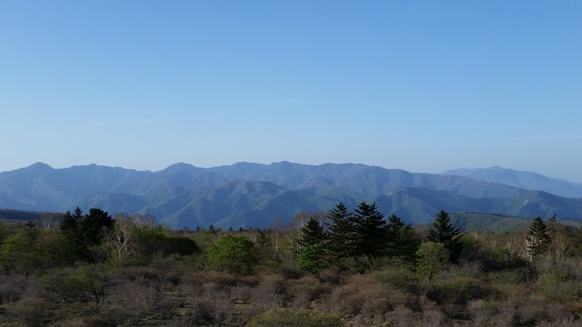
- May 1st 2018: Mt Ogura 御座山 2112m. A 200 famous mountain, located in Nagano prefecture, it is about a 30 minute bus ride (one bus transfer necessary) from Komi 小海 station on the Komi line. By the way, this is a pretty extraordinary train line – the highest station is 1345m high (Nobeyama 野辺山 station)! The Komi line is accesssed from Sakudaira 佐久平 station on the Hokuriku Shinkansen. This is also probably one of the furthest distances you can travel in one day using the pass – 200 km one way! this is because you have to go all the way around the mountainous area that is between the Kanto plain and Yatsugatake. Komi station is only 125km from Tokyo as the crow flies. Return to Komi station is also by bus but from the other (Northern) side of the mountain. Good views of Yatsugatake, Mt Kinpu and Mt Ryokami.
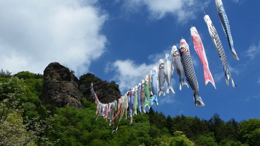
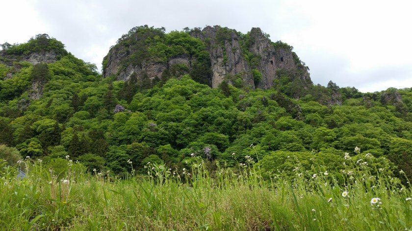
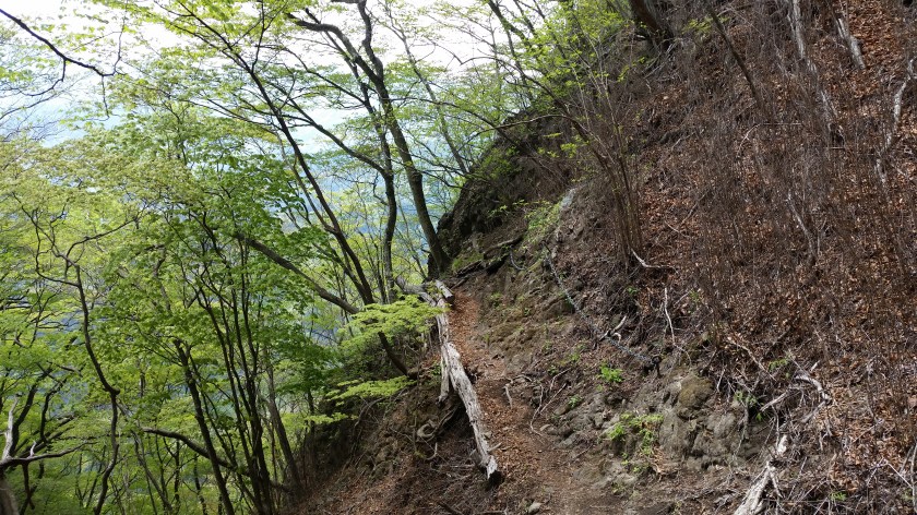
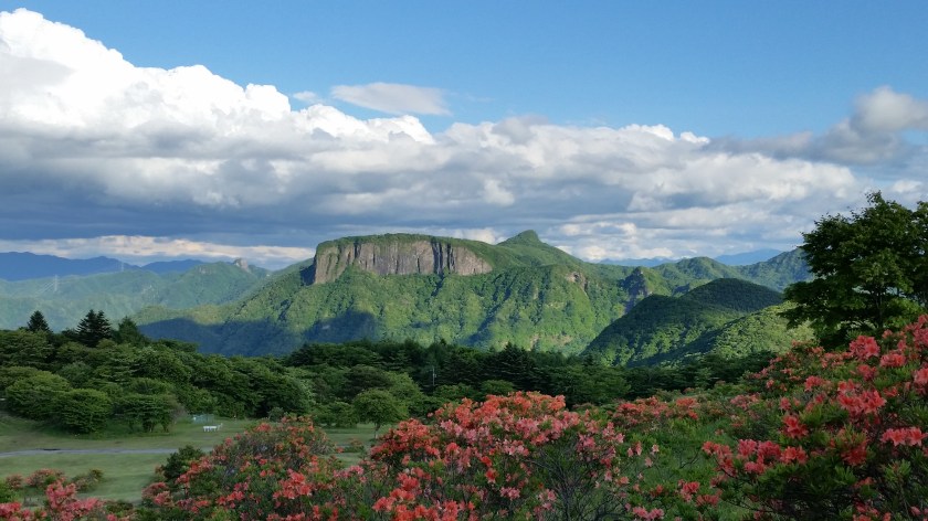
View from the top of Mt Ogura - April 30th: Tatsuiwa 立岩 1265. A Kanto 100 famous mountain in Gunma prefecture, accessed via train (Joshin railway 上信電鉄 from Takasaki), bus from Shimonita 下仁田 station and taxi from Nanmoku 南牧. The trailhead starts at the impressive Sengataki 線ヶ滝 waterfall. WARNING: This hike has a steep section along a gully with loose rocks – be careful not to send any rocks tumbling down below you. Also there is a short section with chains along a rockwall. You need to maintain 3 points of contact at all times when progressing along it. Great views to the south of the Nishijotsu area. Return via the neighbouring mountain (Mt Arafune) to avoid a long walk along on a road from the Tatsuiwa trailhead.
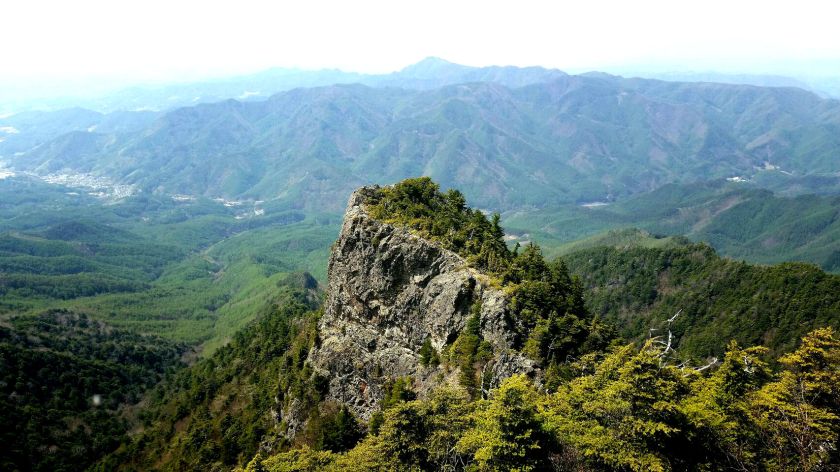
- April 30th 2018: Mt Arafune 荒船山 1423m. A 200 famous mountain in Gunma prefecture, next to Tatsuiwa and shaped as a ship. It was my second time climbing it and it was simply a good way to end my hike at an onsen and bus stop (Arafunenoyu 荒船の湯). No views from the the top but before heading down to the onsen, there is a good viewpoint of Mt Myogi from tomoiwa 艫岩. This is on top of a cliff so be careful – the creator of Crayon Shin-Chan fell to his death here while taking a photo.
- April 29th 2018: Mt Yamizo 八溝 1022m. A Kanto 100 famous mountain and the highest peak of Ibaraki prefecture, also on the border of Fukushima prefecture. One hour by car from Nasushiobara 那須塩原 station, you can literally drive to the top where there is a small castle-shaped observation tower (good views of Mt Nasu, Mt Takahara and the Nikko mountains). However for hiking purposes, I stopped at a small parking area about an hour on foot from the top, and did a round trip to Mt Takasasayama 高笹山 (922m) along the southeastern ridge.

Here are the previous articles I’ve written concerning the Tokyo Wide Pass:
The Tokyo Wide Pass – Why use it?
Tokyo Wide Pass – Where to go? Part I: Takasaki
Tokyo Wide Pass – Where to go? Part II : Karuizawa
Tokyo Wide Pass – Where to go? Part III : Saku-Daira
Tokyo Wide Pass – Where to go? Part IV : Jomo-Kogen, Echigo-Yuzawa & beyond
Tokyo Wide pass – Where to go? Part V: Nikko and Nasu
