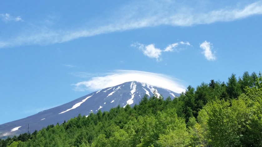
Now that the Mt Fuji climbing season is officially over, you may think that there is no point in going to Fuji-san anymore, and that it’s time to put away that Mt Fuji hiking map. Actually, there are number of good hiking courses that can be done “down” the mountain from the various 5th stations – as opposed to going up. The buses are still running so why not take advantage of them? hiking is hiking, it doesn’t matter if it’s up or down, as long as the scenery and views are beautiful. Also, it’s perfect if you need to get in shape for some more intensive hiking in the near future – the muscles will ache regardless of the inclination of the hike.
Before you go hiking I’d strongly recommend you get the Mt Fuji hiking map!

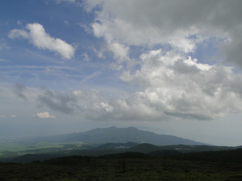
So here is a quick description of several hikes that I’ve done up to now on the flanks of Japan’s highest volcano. There are several more that can be done, so consider this is a work in progress, but as you can see, there are a lot of good “lower altitude” hiking options. All of them, save a couple, were done from the top of the Subaru line, simply because the Fujinomiya side is a little bit far and expensive for a daytrip.
If you decide to go during the official hiking season (July to mid-September), you may be asked to pay 1000 yen. However this is only for people hiking up to the top – if you say that you are heading down instead, they won’t insist on the fee. Just make sure you know your route and/or final destination (as mentioned in this article) as they may ask you about it – I’m not sure what happens if you fail that question!
My Most Recent Mt Fuji Hike from September 2022
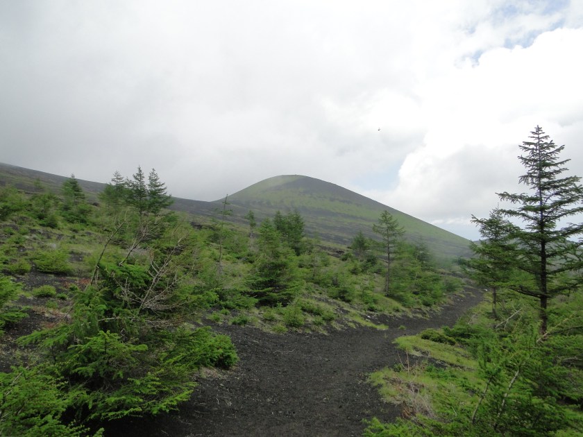
Ochudo 御中道 to Oniwa 御庭 – Middle path to the garden
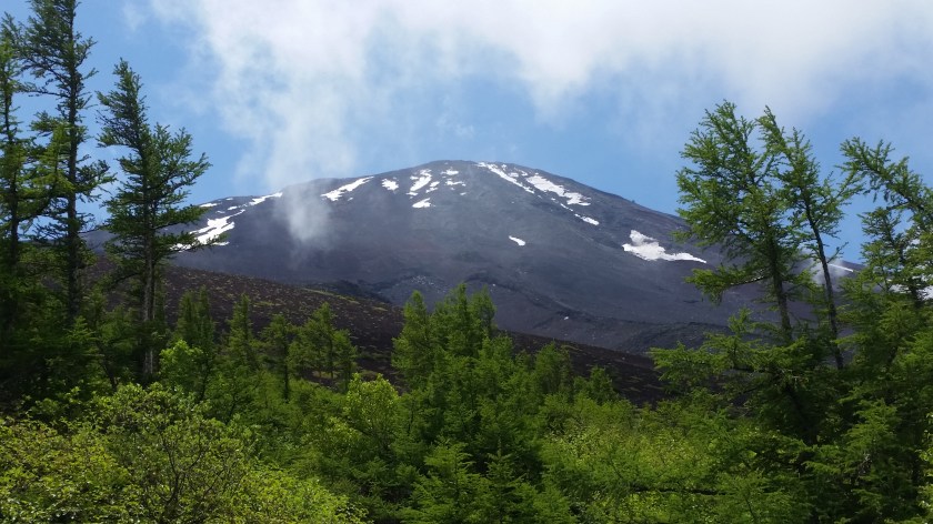
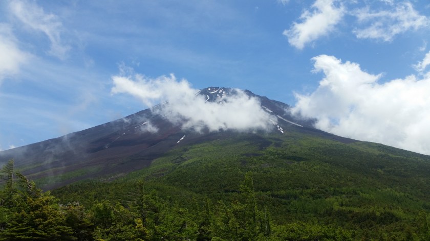
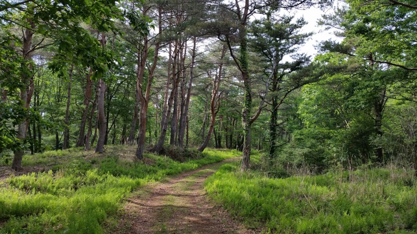
So let’s start with a short and easy one. To find the start of the Ochudo trail, look for the staircase going up to the right of the bus stop (when facing the mountain). This easy-to-walk path will take you clockwise around the side of Mt Fuji with only minor ups and downs, through some impressive volcanic landscape. On the way, and if the clouds are feeling generous, you might get some clear views of the summit, so keep checking to your left at every clearing. Most of the way, you are at the tree line limit, but occasionally you’ll also get some sweeping downward views to the right as well.
After about an hour or so, you’ll reach the end of the trail. It used to go further around the side of the volcano, but the part is now closed due to rockfall danger. It takes 20 minutes to walk to Oniwa 御庭 where you can catch a bus back to Fujisan station. Or, if the bus times don’t line up, you could head back along the Ochudo to your starting point, where you can get a bite to eat and browse the souvenir shops while waiting for the next bus back (they sell a great relief map of the Mt Fuji area). Another option would be to visit Okuniwa 奥庭 (inner garden) and / or hike down to the 3rd station – read the next section for more.
Okuniwa 奥庭 to Fujiyama Onsen ふじやま温泉 via the Funatsu rindo 船津林道
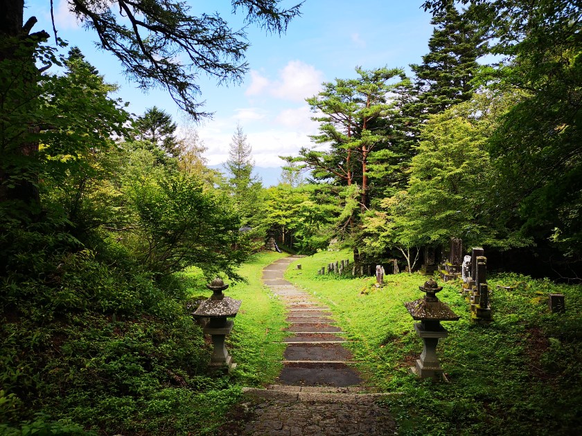
You can connect this hike to the previous one if you want to make a long day out of it (like I did). Otherwise, you can just get off at the Oniwa bus stop 御庭 (the last one before the end) and walk down the short path to the Okuniwasou 奥庭荘. Out of season, it’s a good place to enjoy some local dishes, and check out their souvenirs. When I was there I got to sample some wood berries for free.
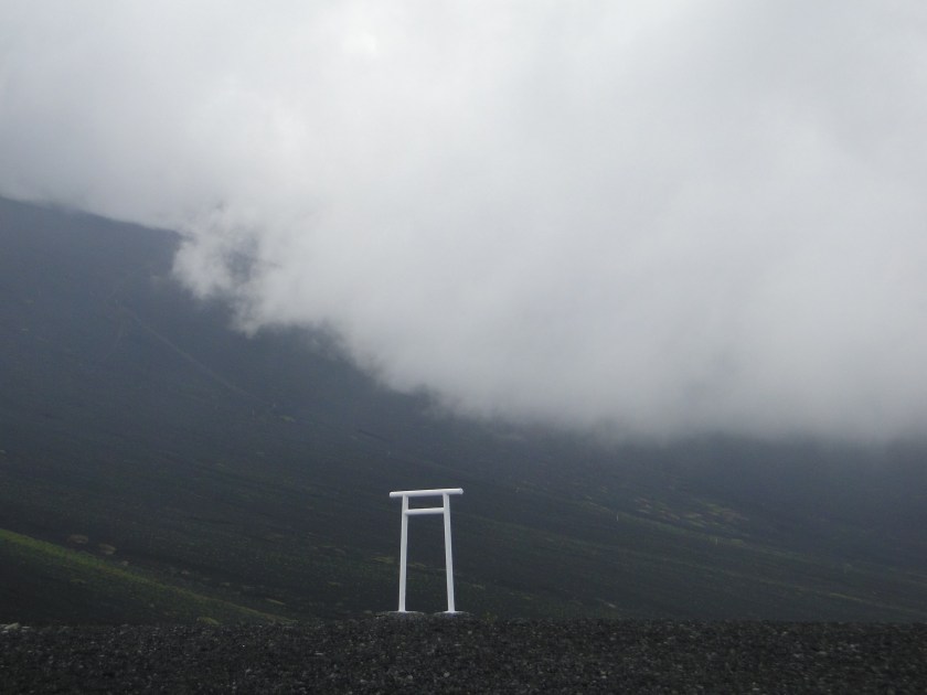
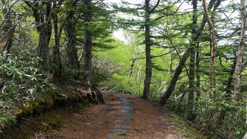
After checking out the hut, I’d recommend doing the short 20-minute loop that starts and end behind the hut, marked with a torii (red shinto gate). There is an excellent view point of Mt Fuji – if the clouds are being kind on the day you are there, After this short warm-up, head straight down the mountain through incredibly beautiful forest to the third station or sangome 三合目 – if you go out of season, you will most likely see few people – hard to believe on a mountain such as Fuji!
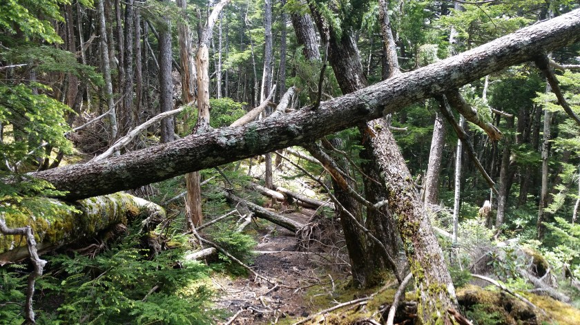
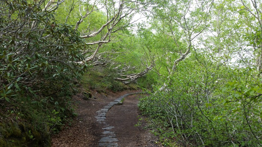
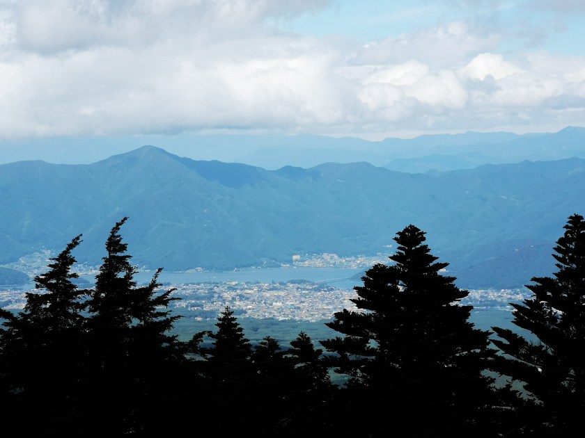
Eventually – just over an hour – you’ll pop out of the forest into a wide rocky clearing. Here there are two options – you can go straight and continue to the third station (see next section) or you can do a hard right and descend along the Funatsu Rindo (described here). The Funatsu rindo is an easy to walk, easy to follow path that will take you the forested parts on the lower flanks of Mt Fuji. When I walked it, I saw absolutely no one. Perfect for some deep pondering. After an hour you’ll need to cross the Subaru line (near the 2nd station) and then there is at least another 90 minutes of solitary forest walking till you emerge onto a paved road. At one point there are some good views of Kawaguchiko town and lake.

From there, it is a bit of a slog (another 90 minutes) along a fairly straight paved road till you get to Fujiyama Onsen. You’ll need to turn right at one point – just use Google maps to point the way out for you – it’s smack next to the Fujikyu Highland theme park (you could also just follow the screams from the roller coaster). If hot springs aren’t your thing then continue straight – you’ll eventually get to Kawaguchiko station.
Subaru Line gogome (5th station) スバルライン五合目 to Shojiko Lake 精進湖 through Aokigahara jukai forest 青木ヶ原樹海
Another amazing hike is the one that through that goes through the heart of Aokigahara forest. If you live in Japan, you’ve probably heard of it before. It is also known as suicide forest, since it’s famous for people going there to end their lives. However there is almost no chance of encountering anything upsetting along a well-established hiking path. On the other hand you’ll get a great opportunity to cross an interesting forest that is growing on top of an ancient lava field.
This hike starts along a path below the Subaru Line 5th station. Unfortunately it’s a bit worn out and hard to walk at times. After about an hour you’ll emerge into the same rocky clearing as in the section above. Continue straight in the direction of lake Shoji. After another fifteen minutes you’ll go under the Subaru line via a small tunnel – this is the third station. If you have time, I’d suggest making your way up to the road and walking down it a few minutes – there is an excellent view point next to the road, where you can even see Mt Fuji.
Beyond that is a three to four slog through Aokigahara forest. I say slog because it’s a relatively straight path through forest that pretty much looks the same all along the way. However don’t let that discourage you – it feels awesome to be walking through such a vast forest. As before, you’ll probably encounter few people. The last portion is through regular forest. Finally you’ll pop out onto the road that goes circles Mt Fuji – there is a bus stop, right on Shoji lake to your right called Akaji 赤地, that will take you back to Kawaguchiko station.
Subaru Line gogome (5th station) スバルライン五合目 to Sengen jinga Shrine 浅間神社 via the Yoshida route trail 吉田ルート
This is the classic route up and down Mt Fuji, when starting below the 5th station. There are a number of descriptions of this path on other sites, and it was also recommended to me by staff working at the 5th station. Consequently, you will pass many people, mainly going up. It is also the second shortest of all the hikes described here, after the Ochudo). This is the one route where you will certainly be approached for the 1000 yen donation – just tell them you are headed for “umagaeshi” 馬返し (there is a small parking lot there) or Sengenjinja shrine 浅間神社, where there is a bus stop.
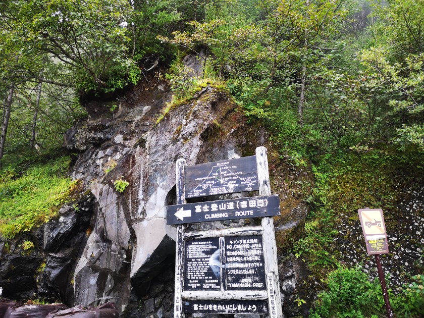
Head East (away from the end of the Subaru line), between the souvenir shops – the start of this hike is the same as the one that goes up the mountain. During the daytime you’ll get to see exhausted, bedraggled climbers returning from a night spent on the mountain. Luckily, you won’t be going up but down. At first the path is pretty flat but after a short while you’ll get to a split – take the branch heading down (not the climbing route). Shortly, you’ll get to another split – take the descending one again, which passes below a hut. Look to your left for the start of the Yoshida route, a small trail that disappears into the forest. This part should take less than half an hour.
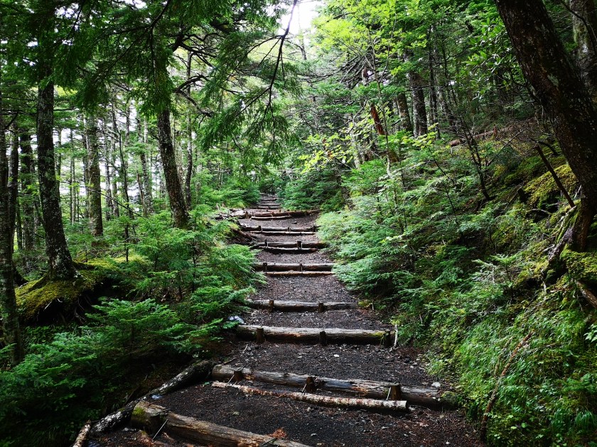
The Yoshida route is probably the best maintained trail of the lot. On the way, you’ll pass a number of historical landmarks with signs in Japanese and English. This path was used in ancient times to climb Mt Fuji, before there were proper roads to various 5th stations. A lot of the landmarks are in ruin (or becoming ruins) but the old photos from the Meji area are worthwhile checking out.
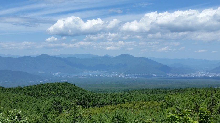
There are also several viewpoints towards the Kawaguchiko area. As with the other paths, the surrounding forest, especially at a higher altitude is awe-inspiring. The various stations are well indicated as well as the ever decreasing altitude. After a short hour, you should reach a tori (shinto gate) made of stone. This is ichigome 一合目. There is a small hut just below, which functions as a resting spot or 休憩所 (kyukeijo). I was actively encouraged to take a break there while passing in front. I was offered free tea, miso soup and pickles, since it was the last official hiking day on Mt Fuji. I was surprised to get such a warm and friendly welcome – I guess they don’t that many people climbing up the lower parts of Mt Fuji, compared to the higher ones.
A few minutes below the resting spot, there is a car park – this is the aforementioned Umegaeshi. Here you need to be careful – don’t take the road but instead go to the back of the car park, You’ll find a small path that heads into the forest. It mostly runs parallel to the road but it is way nicer than road-walking. The final bit before reaching Nakanochaya 中の茶屋 (the teahouse in the middle) is especially pretty. It will take you an hour to reach the teahouse. It was another very friendly resting spot – they invited to sit inside and have some tea, again totally free.
As I was leaving they pointed out there was a shuttle bus that was about to leave for Fujisan station. The next bit was a guaranteed one hour of asphalt-road walking, and I was starting to have a strange pain in my ankle, so I decided to take advantage of this unexpected transportation opportunity – I hadn’t expected anything till Sengen shrine. Since I did want to stop by the Fujiyama onsen before getting on the train, the driver kindly offered to drop me off at the closest corner. One drawback of doing this is that I completely missed Sengen shrine so I will need to come back one day.
Fujinomiya gogome (5th station) 富士宮五合目 to Mt Hoei 宝永山 and back
This is a good one to do if you have a JR Rail pass because it requires you to take a shinkansen to Shinfuji 新富士 station on the Tokaido line. You will be able to ascend to nearly 2700m – pretty impressive for a day trip from Tokyo. This is possibly the highest you can get on any mountain in Japan, without having to spend the night in a hut. In addition, most of the hike is above the tree line, so if the clouds are busy elsewhere, fantastic views are guaranteed.

The 5th station “gogome” of Fujinomiya-guchi 富士宮口 五合目 2380m is a lot less busy than the Subaru Line 5th station. In fact, when I was there in early November, there was only a handful of other cars. To get to the start of the trail for Mt Hoei 宝永山 2693m about 20 minutes away, you’ll need to go to the 6th station or “rokugome” 六合目, above the car park. Outside the official climbing season, you’ll need to clamber over the gate barring access to the Mt Fuji climbing trail. It’s pretty easy, there is a gap on the side – don’t let the “no climbing” sign deter you.
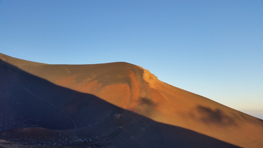
At the 6th station, turn right and just follow the signs for Mt Hoei. The first part is mostly flat and above the treeline. In less than 20 minutes. you will be inside a semicircular bowl – Hoei’s crater (Mt Hoei was formed during the last eruption of Mt Fuji at the start of the 18th century). From here it’s an hour zigzag till the rim. Then turn right – the last ten minutes are straight and flat. If the weather is clear you’ll get some great views. Turn around and you should also be able to see the summit of Mt Fuji looking tantalizingly near (it isn’t).

Afterwards, the easiest option is the go back the way you came – no zigzagging needed here, just go straight down. It should take a little over an hour. If you want to do something longer, and that isn’t a loop, go down the other side of Hoei’s crater (turn right at the sign) and after a few minutes you’ll reach the big sand run “osunabashiri” 大砂走 that goes all way down to Gotemba guchi gogome (fifth station) 御殿場口五合目 where you can catch a bus down to Gotemba station. Map time for this part says 75 minutes but you should be able to do it much faster if you run down through the sand – give it a try!

Another option is to head down the mountain at the first intersection you reach after passing the crater. This will take you down the mountain through beautiful forest. It should take a couple of hours to reach the road, where a bus stop is never too far away. This is a more adventurous route – there are many other paths criss-crossing the side of the mountain – so I definitely recommend having a map of the mountain if you choose this option. And of course check all the bus timetables in advance. You can also reach the Gotemba fifth station but I think the sand run is by far the better route.
Nishisuzuka 西臼塚 to Gotemba gogome (5th station) 御殿場五合目
This is perhaps the only route that involves some uphill. It is also the lowest of all the hikes, starting at around 1200m and finishing at 1450m – most of the course is in the forest. Finally it is the most difficult to follow, so I definitely recommend having a good map. Here you’ll need to get off the bus much sooner – at the Nishisuzuka 西臼塚 parking lot, about 45 minutes from Shin-Fuji 新富士 station.
Take the path leading into the forest on your left. The path is in a pretty bad state – the center part has kind of collapsed so the first five or ten minute is hard-going but it will soon get better. In less than 20 minutes you’ll reach an intersection – go right. The original path loops around back to the road. Soon after, turn right, and you’ll find yourself climbing straight up the side of the mountain…for almost an hour to 90 minutes depending on how fit you are. You’ll cross a forest road one third of the way up.

Finally you’ll emerge into a parking area on the road that goes all the way up to the fifth station. You have reached 1600m. If you want to cut out the climbing bit (and shorten the hike considerably), you can get off at the next next bus stop (Takabachi 高鉢) – you’ll need to walk back along the road for twenty minutes to read the parking. Take a break, and the continue along the road on the opposite side of the road.
This is arguably the most best part of the hike. It’s mostly flat, there are relatively few people, and the surrounding forest is beautiful. This is the Takabachi Course 高鉢コース. Keep straight at the next intersection, and after that always take the higher path. After about a couple of hours, you should a point that is around the height of the second station, and which is called “goten niwa shita” 御殿庭下. This is the high point of the hike, nearly 2000m – the surrounding vegetation, mostly pine, screams alpine, a far cry from the forested parts at the start of the hike.

If you have energy to spare you could continue straight up to Mt Hoei and the Fujinomiya fifth station (see above hike). Otherwise, turn left here, go straight for a bit and then head down at the next intersection. In under an hour you’ll get to another intersection – looking at the map you’ll see that this side of the mountain literally has a web of trails. Both paths will take you to the Gotemba 5th station – the one I did and describe here is the higher one.
This path will take you between two small protuberances on Fuji’s side – Futatsuzuka 二ッ塚 (1929m) to the left, and Mt Futago (twin mountain) 双子山 1804m to the right – if the weather is still clear you could quickly run up and check out the view from the top of Mt Futago. It should take about an hour to reach the Gotemba 5th station and a bus stop, at the bottom of the sand run. This final section of the hike, in contrast with the initial part, offers lots of good views since it crosses an ancient lava flow and so is mostly rocky with few trees. You’ll get some excellent views of Mt Ashitaka 愛鷹山 1504m, a two-hundred famous mountain, just South of Mt Fuji.