

Hiking in the Fuji-Hakone-Izu National Park
富士箱根伊豆国立公園
It had been 4 years since my last hike on Mt Fuji, so I thought it was time to visit again. As on my previous trips, instead of climbing to the summit, I wanted to combine several of the trails that crisscross the Shizuoka side of the mountain. This would allow me to do some moderate hiking, further helping me get back into shape, and immerse myself in nature again, since I would be inside the Fuji-Hakone-Izu National Park. I would get up extra early to catch the first Odakyu limited express of the day, the only one in the morning going all the way to Gotemba station. From there, I would take a Fujikyu bus to the Gotemba New 5th station, the lowest of the four trails up Mt Fuji. This time, I decided to do a loop hike, so I would travel back the same way. The weather was supposed to be sunny and even a little warm, perfect for a high-altitude ramble on the side of Japan’s most famous volcano. I was looking forward to getting some great views and enjoying the beautiful forest covering the lower half of Japan’s highest mountain.

Summit of Mt Fuji from the 5th station, clear of clouds and snow

Pleasant hiking at high altitude
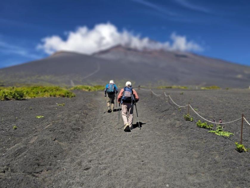
Some clouds remained as I rode the early morning limited express to Gotemba, where I boarded a Fujikyu bus for the one-hour ride to the Gotemba New 5th station (1439m 御殿場口新五合目), getting there a little after 9am. By now, the clouds had vanished, and it was already felt quite warm under the sun. From the parking lot observation tower I enjoyed a wide view to the west of Gotemba city and the Tanzawa and Hakone mountains; turning around, I could also see cloud free summit of Mt Fuji, looking somewhat ordinary without its snowcap. At 9h30, I set off up the, now officially closed for the season, trail for the summit.

The Tanzawa mountains in Kanagawa

Yamanaka lake in Yamanashi
It seemed like a perfect day to climb to the top, which felt tantalizing close, even though it was 17oo meters higher. I quickly reached a junction at Oishi-Chaya (大石茶屋), where I took the left branch, heading towards a gap between two pimple-like mounds protruding from the volcano side. I slowly treaded up the sandy path, often stopping and turning to take in the soaring views; north, I could now see the light blue waters of Yamanaka lake, emerging from behind a light-green ridge. At 10h30, I reached the wide, flat top of Mt Futago (双子山 ふたごやま futago-yama, also called Futatsuzuka-Shitazuka 二ツ塚下塚).

The summit looks tantalizingly close
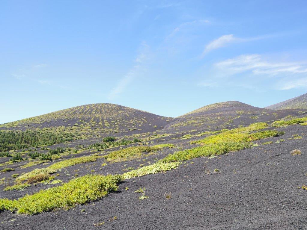
The twin mounds of Shitazuka (left) and Kamitsuka (right)
I was stunned by the majestic view, looking down at the surrounding area, which had been obscured by the clouds on my previous visit. South, I could now see Mt Ashitaka, and directly behind, the Izu peninsula and Tsuruga bay; the slightly higher Kamitsuka (上塚), and Mt Fuji, now with a cloudy headpiece, rose behind me. After a short break, I headed back to the main trail along a valley between the two mounds, and followed the “H route” of the Mt Fuji Natural Recreation Forest Trail (自然休養林歩道 “shizen kyuyorin hodo“), as it climbed gently through scattered pines, with impressive views of the rocky formations around Mt Hoei, as well as of Mt Ashitaka.

View of some of the rocky formations around Mt Hoei

View of the Ashitaka volcano mountain range
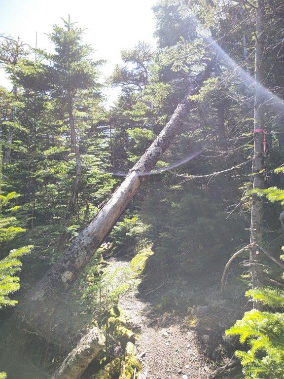
It felt amazing to walk this mostly level, panoramic trail at an altitude of nearly 2000 meters. A little before noon, I arrived at the entrance of Goten Garden (御殿庭入口). From this point, the feel of the hike became completely different, as I made me way through a dense mixed forest, on a narrow and faint path. However, this section was equally enjoyable, as the midday sun amplified the various shades of green, from the dark green of the pine needles to the light green blades of the grassy forest floor. I soon arrived at a junction at the base of Goten garden (1977m 御殿庭下). I found a fallen tree in a sunny clearing, and sat down for an early lunch.

The low mountains of Izu disappearing into the haze

It was easy to forget I was hiking on Mt Fuji
It was hard to believe I was more than halfway up Japan’s highest mountain, as I was completely surrounded by trees; it was also eerily quiet, except for the background hum of insects. At 12h30, I headed down the steep Suyamaguchi hiking trail (須山口登山道), also the “D route” of the Nature Recreation Forest Trail. As the altitude dropped, I got to enjoy the change in the surrounding nature, from a thick, impenetrable pine forest, to a roomy, shady birch forest. After nearly an hour of descending, I reached another junction at about 1600m, where I turned left, along the “E route”, heading back to my starting point.

Looking back at the trail hiked so far from the entrance of Goten Niwa

A mix of dense pine (left) and spacious birch (right) forests
I was once again walking along a pleasant and mostly level trail, although this time, the views were hidden by the towering birches. I slowed my pace and admired the beautiful nature of the Fuji part of the Fuji-Hakone-Izu National Park, better known for the volcano view, rather than the ancient forests covering its lower slopes. At 2pm, I reached Maku Rock (幕岩 “makuiwa“), a lava formation created by the Mt Hoei eruption 300 years ago. From there, it took less than an hour along the ” I route” to get back to the Gotemba New 5th station, completing the loop hike in five hours and a half.

Sunny, grassy path lower down the mountain

A relaxing trail near the end the hike
I was glad I had chosen to revisit the area on a clear day: although the the top of Mt Fuji was shrouded in clouds for most of the day, I enjoyed great views in other directions; I also got a decent workout thanks to the moderate climb from the 5th station to Goten Garden. After a short wait, I caught the bus for Gotemba station; even though the bus was full, I had seen few people on the route I had chosen. Back in Gotemba, I made a quick visit to Ninjinyu public bath (人参湯) to wash off the sweat, before boarding the limited express train for the 90-minute comfortable ride to Shinjuku.
See the views from halfway up Japan’s highest volcano


Nice.
I was really tempted to do Fuji this past weekend. It’s nice to see some nice pics.
Thanks! depending on the weather, it’s possible to hike on (not up) Mt Fuji till the end of October. After this cold, rainy weekend, there will be probably be some snow at the top now.
I came across a guy on Yamareco that climbs it almost every day! I was really, really tempted to go Saturday. Maybe next weekend. I know they started to get snow on 9/30 but from the pictures I’ve seen (and from what I can see just looking out the window), there really isn’t anything accumulated yet.
It is really cool seeing Fuji from different perspectives, isn’t it? That side where Hoei is is way cool.
For clarity, that guy I mentioned has been going to the top. There are several other people I’ve seen on YAMAP climbing it in the first week of October. So I was thinking, why not? You just can’t use a toilet….
I went up to the 6th station in January and was surprised to encounter 2 or 3 people who’d just spent the night on top on their way down. They were kitted out like they were climbing in Nepal or something like that.
Indeed, people climb to the top all year round; proper precautions, are needed though. If you have any doubts, I would suggest going with the highly recommended Kanto Adventures:
https://www.kantoadventures.com/mt-fuji-snow-climbs.html