
Hiking in the Joshin-Estu Kogen National Park
上信越高原国立公園
After a two-month break, I was looking for an easy hike to get back in shape. I also wanted to visit a national park for a total immersion in nature. Shiga-Kogen, last visited two years ago, seemed like the ideal choice, since it had mostly level hiking trails passing next to small lakes, as well as a minor summit. I could get there by taking the shinkansen to Nagano city, then ride the “snow monkey” limited express to Yudanaka, and finally board a bus for the last leg of the trip. For the return, I would catch the same bus but from a slightly lower elevation. The weather was supposed to be sunny with some clouds; hopefully the sun would have the upper hand. I knew that Yudanaka is famous for its snow monkeys bathing in hot water in winter; in summer, however, they tend to roam further away, so I thought I might catch a glimpse of them along the way.

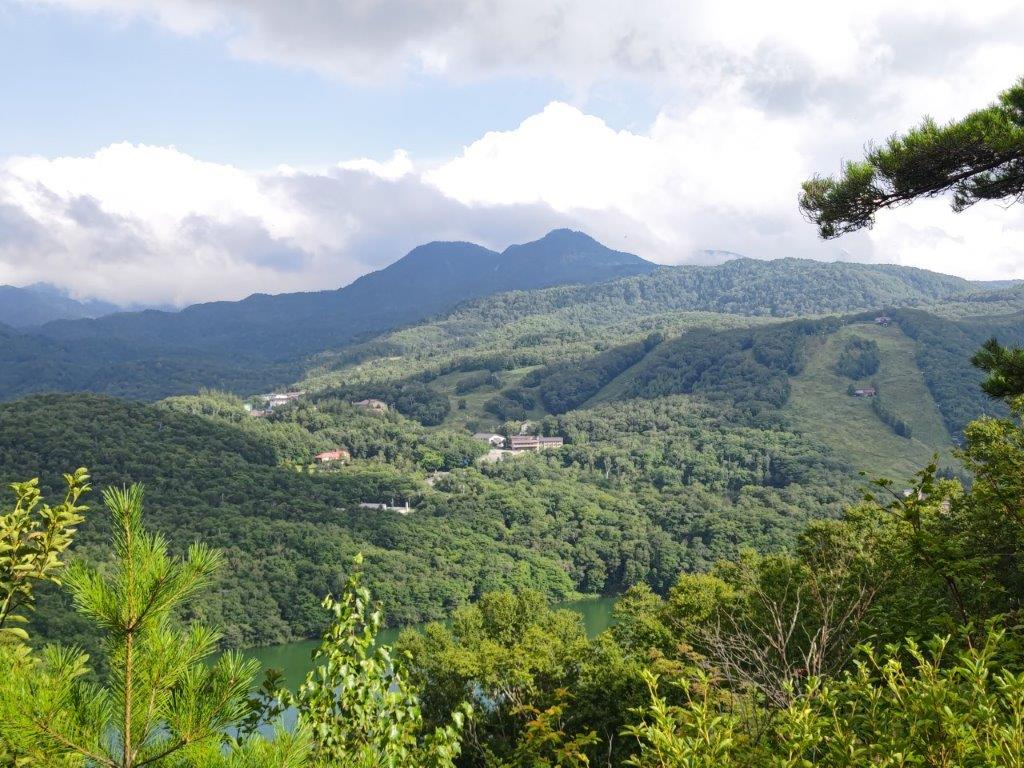
View of Biwaike and the peaks of Shiga-Kogen from Mt Asahi
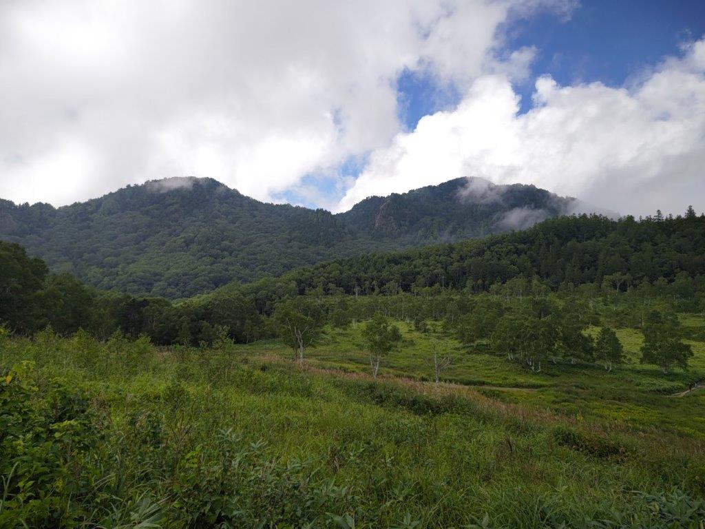
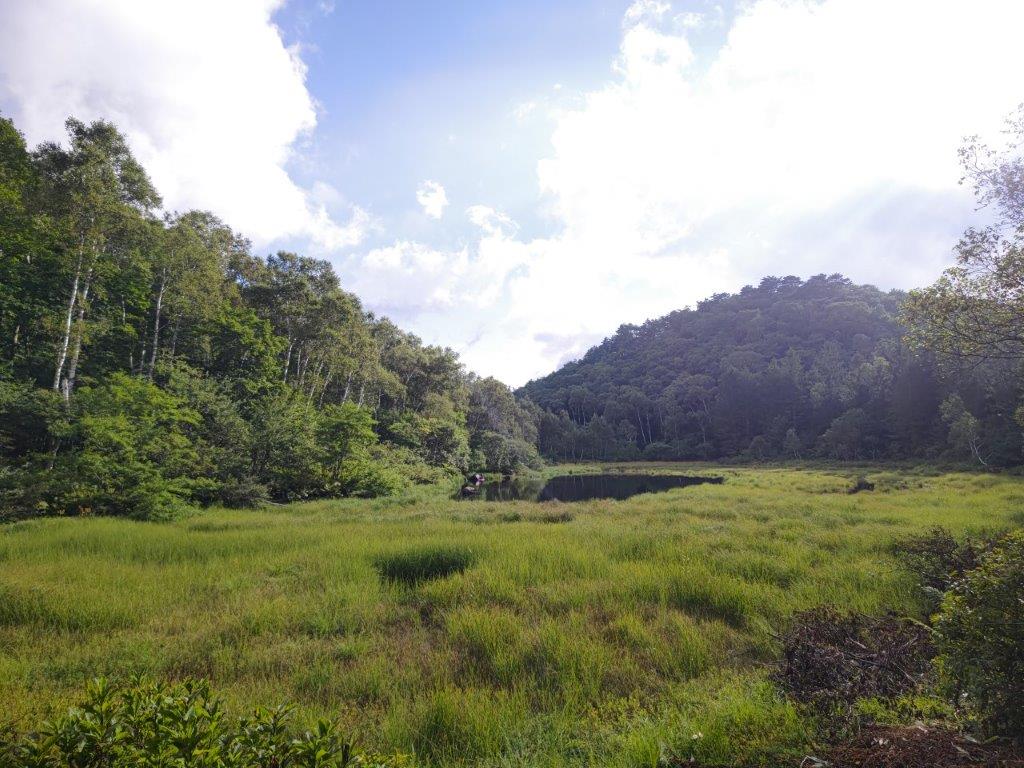
Clouds slowing vanishing above Tanohara Marshland
I rode the Hokuriku shinkansen under blue skies, enjoying the views of the mountains surrounding the Kanto Plain. After getting off at Nagano station, I boarded the limited express for the one hour ride to Yudanaka, where I switched to a surprisingly empty bus for Shibutoge (渋峠); a little before 11h30, I finally got off at Kidoike Pond (木戸池 1620m, meaning “Wooden Door Pond”). After getting ready, I set off on a wooden walkway next to the lake side, but very soon made a sharp right up a short slope, leading to the top of a grassy rise.

Kidoike at the start of today’s hike

Looking back at Tanohara Marsh
I enjoyed a fantastic view of two peaks emerging from the clouds and a wide grassy area directly below; I felt I had made the right choice by visiting Shiga-Kogen (志賀高原) and the Joshin-Etsu National Park (上信越高原国立公園) on my first Autumn hike, even though at the moment, the lower sections were still in the mist. I made my way down to Tanohara Marsh (田ノ原湿原 1610m), and followed another wooden walkway to the forest on the other side; after crossing a road and descending along a rocky trail, I reached Sankakuike Pond(三角池 1630m, meaning “Triangle Pond”), a little after noon.

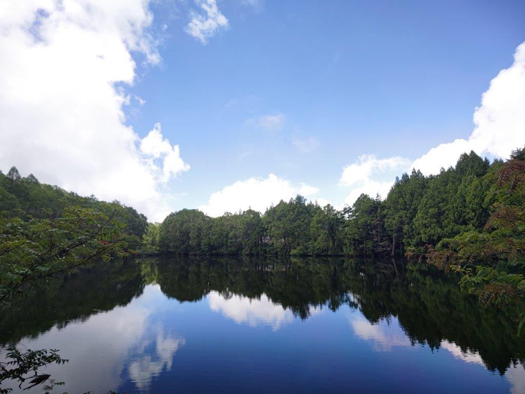
Blue sky reflected in Sankakuike

Shiga Lake Hotel reflected in Hasuike
As I approached the lake, I marveled at the reflection of blue sky and fluffy white clouds on the perfectly still water surface, the low clouds having temporarily parted. I continued along the gently undulating path through thick forest and soon arrived at Kami-no-koike Pond (上の小池 1570m), a lot smaller than the two previous ones. At 12h30, I was walking the length of the narrow Nagaike Pond (長池 1584m, meaning “Long Pond”) while observing the mad dance of the dragon flies.
Today’s mountain, Mt Asahi

Caution: monkey crossing
I took a while to enjoy its mysterious atmosphere: wisps of cloud drifting with the breeze down the opposite slope, creating ripples on the water surface. I crossed another road and arrived at Shimo-no-koike Pond (下の小池 1610m), the smallest pond so far, covered in bright green water plants. Next, I emerged on a steep slope near the top of a chairlift (Shiga-Kogen is also a ski resort). At the bottom, I passed through a tunnel and found myself at Hatsuike Pond (蓮池 1490m, meaning “Lotus pond”). I walked over to the nearby Ariake-no-oka Observatory where I had a view of Mt Terakoka and Higashi-Tateyama.
Sky and clouds reflected in Ichinuma

Monkey enjoying the pond view
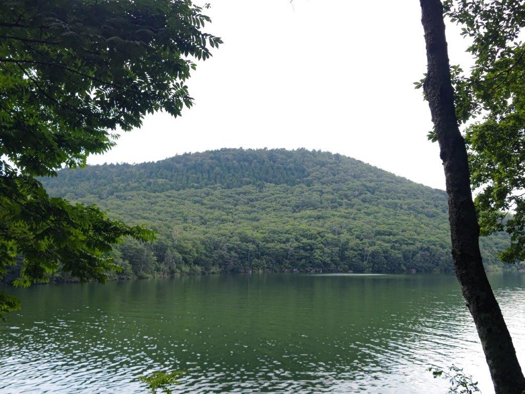
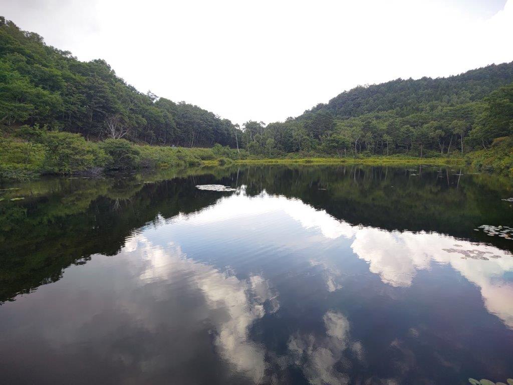
At the other end of the lake, I was mesmerised by the reflection of the white facade of Shiga Lake Hotel. I popped into the nearby Shiga Kogen Yama no Eki (志賀高原山の駅), a mountain roadside station, to check their flower chart. I crossed the road once more, and after descending through the forest, reached Biwaike Pond (琵琶池 1390m), the largest lake so far. Through a gap in the trees, I had my first view of today’s mountain, a flattish peak rising above the opposite shore. I was hoping to have lunch there, it was already 2pm, but before that, I passed by Ichinuma Pond (一沼 1410m), the prettiest pond of the day.
Mt Ura-Shikakogen (left) and Mt Ura-Shigakogen (right)
Last pond of the day, Mizunashiike
As I approached, I was surprised to see a monkey squatting on the wooden walkway, and then two more relaxing in a tree above. In total, I spotted about a dozen, eating various plants, as well as water lily leaves; one brave monkey even went for a dip in the cold water. After they had all left, I resumed my hike up a pleasant path through a forest of Japanese white birch (白樺 shirakaba). A little before 3pm, I reached the summit of Mt Asahi (旭山 あさひやま asahi-yama). It was mostly in the trees, but on the east side the valley bottom was faintly visible; on the west side, I could see Biwa lake, as well as Mt Shiga, Mt Terakoya and Mt Higashi-Tate.

Japanese Monkshood, one of the many flowers of Shiga-Kogen

View of sun rays passing through clouds from near the bus stop
After enjoying the best view of the day, I retraced my steps to a junction I had passed earlier, and took the left branch. I soon emerged from the forest, crossed a road for the last time, and followed a grassy path to the tiny Mizunashiike Pond (水無池 1470m meaning “Pond without water”), the last and lowest pond of the day. I saw some purple bell-shaped flowers, called Yama-Torikabuto (ヤマトリカブト Japanese monkshood). I followed the trail around the marsh, reaching the road and the bus stop just before 4pm. After getting back to Yudanaka, once more on an empty bus, I caught the “Snow Monkey” to Nagano where, after enjoying some local sake inside the station, I boarded the shinkansen for the 90 minute ride back to Tokyo.
See the ponds and monkeys of Shiga-Kogen


Greetings from another fellow hiker in Japan 🇯🇵 I have never hiked in Kanto, but after reading your blog, I’m tempted to do so 😊 Lovely photos, by the way!
Thank you! I see that you are based in Kyushu – some great hiking there as well!