I wanted to do a half-day hike near Tokyo to escape the early summer heat and humidity. Poor weather had prevented me from going as planned on the weekend but fortunately, an opportunity presented itself to go the Monday right after. I decided to visit a viewpoint in Oku-Musashi, which I had last visited about ten years ago. I could take the limited express “Laview” train to Nishi-Agano station; it made a special stop there during spring and autumn. After reaching the highest point, I could descend via a different trail to “Kyuka Mura”, where I could enjoy a hot spring bath; day trippers were only allowed on weekdays, so it was a good chance to drop by. Afterwards, I could use their free shuttle bus to get to Agano station on the Seibu-Chichibu line. The weather was supposed to be cloudy and cool in the early morning, turning sunny and warm in the mid-morning. I hoped that I could reach the top before it got too hot, and was looking forward to revisiting a favorite spot after several years.

Good visibility from the Kanhashu Viewpoint

Looking East towards the Kanto Plain
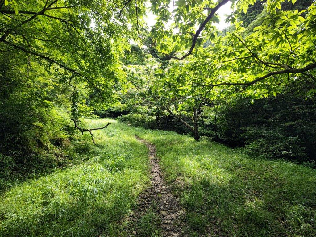
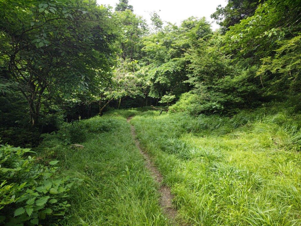
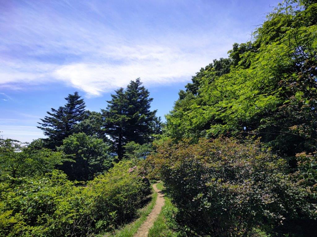
I was slightly disappointed to see that the sky was still completely overcast after arriving at the tiny Nishi-Agano station around 8h30. I walked a short way along the road to the trail entrance and surprised a black and white cat sitting in the tall grass nearby; it escaped into the forest before I could say “hi”. I followed the wide path, labeled as the “Panorama Route” on my map, up a green valley alongside a tiny brook.
An easy path to start the hike with
Although it was called the Panorama route, there were few views
At 9am, I reached an open space offering a view of the forested valley and neighbouring hills. The path narrowed and after a couple of switchbacks up a shoulder of the mountain side, entered the forest and started to climb more steeply; half an hour later, it merged with another path coming from the left and became level. I found this part of the hike very pleasant, as sunshine was now filtering through the trees and the birds had started to sing.
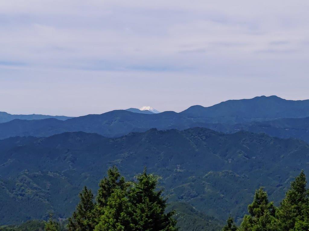
Mt Fuji, barely visible from Takayama

Out of the forest and through the flowers
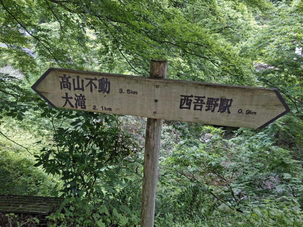
At 10am, I reached a road with a viewpoint and was excited to spot Mt Fuji in the distance. After admiring its still snowy cap, I picked up the next part of the path less than a hundred meters away, opposite a signpost for Takayama (高山), a place I would return to later; I was now on the well-trodden Kanto Fureai no Michi. After crossing the road a second time, the trail finally emerged from the forest and passed through some Kalmia bushes (カルミア) covered in white flowers.

View south towards Okutama, and lost in the clouds, Tanzawa

The Musashi hills fading into Musashi
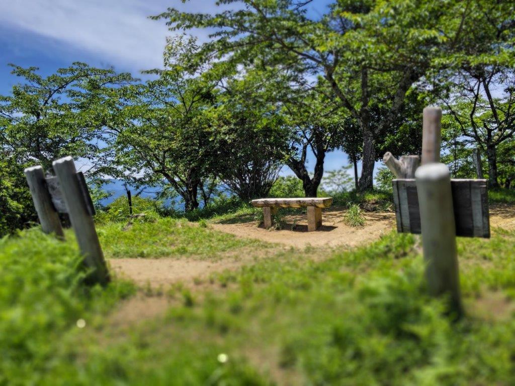
I hoped this was the last climb of the day as the sun was shining directly above and it was starting to feel quite warm. At 10h30, I was relieved to reach the Kanhashu viewpoint (関八州見晴台 かんはっしゅうみはらしだい kanhasshuu-miharashidai), which translates as the Kanto 8 provinces lookout and refers to its historical role. There was an open shelter and a number of trees providing some welcome shade. I took a break on a bench to enjoy the view and a late breakfast.

A better view of Mt Fuji from the highest point of the hike
One of the few paths with a view in Oku-Musashi
The view was better than I had remembered: to the west, the Oku-musashi hills melted into the Kanto plain; to the south, they merged with the Okutama mountains; Mt Fuji was visible behind the long flat summit of Mt Bonomine; closer by were the Hanno Alps on the other side of the Agano valley; supposedly, Mt Akagi and the peaks of Oku-Nikko could be seen on the north side, but today they were lost in the haze. At 11h30, I made my way back to Takayama and Takayama-Fudoson Temple (高山不動尊), just off the main road.

View of Oku-Musashi between Takayama and the Takayama-Fudoson Temple
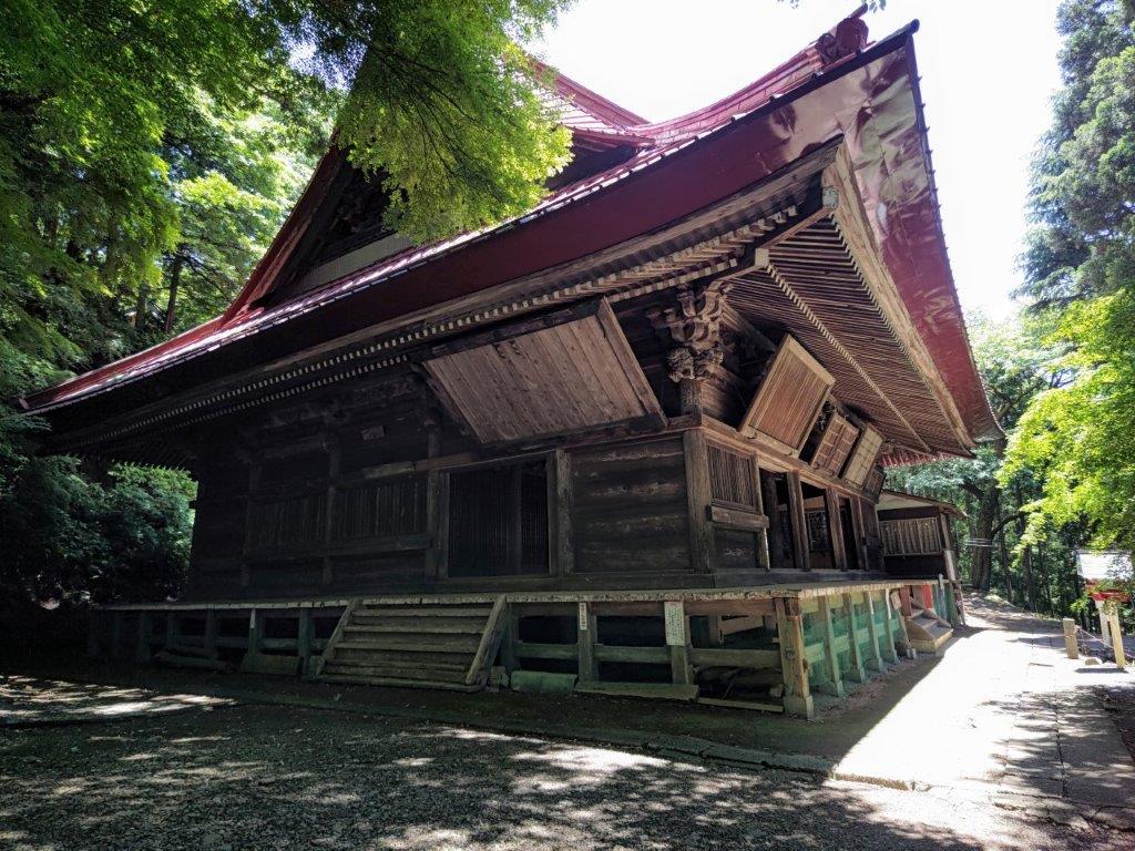
The main building of Takayama-Fudoson Temple
I was astounded to see such a magnificent structure in the middle of the forest; it’s these kind of moments that make hiking in Japan so rewarding. I returned to the road and soon rejoined the hiking trail again, leading back into the forest. After a few minutes, I reached a junction where I turned right. The path was pleasantly level for a while, but then proceeded to rush straight down the mountain, ending at a lovely stream.
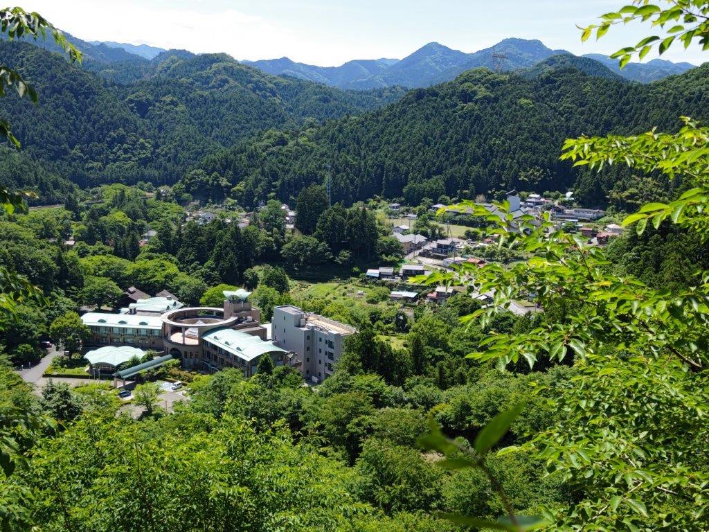
A glimpse of “Holiday Village” (on the left)

Crossing the Koma river
After crossing a rickety bridge, I emerged into a narrow, sunny valley at around 12h30. I noticed a small house on the right, meaning I was getting near the end of today’s walk. However, it took another half hour of small ups and downs, a couple more bridges and road crossings, to finally arrive at Kyuka Mura Hot Spring (休暇村 meaning Holiday Village), nestled in a bend of the Koma river. After an enjoyable hot bath, I hopped on the shuttle bus for Agano, where I boarded the local line to Hanno and then transferred to the limited express for the forty-minute ride back to Tokyo.
See the views from the Kanhashu viewpoint (in 4K)