Due to construction related to the Maglev line, part of the trail past the deforested area (see below) is unpassable till June 2025 (令和 7年6月)
I wanted to do a hike along the Chuo line, because of its easy access from Tokyo and relatively high mountains, perfect for escaping the early summer heat. It seemed like a good time to do a hike I had planned next to Mt Honjagamaru, starting from Sasago station., a couple of stops from Otsuki. However, it was a little on the short side, a shame during the long days of June. Studying my hiking map, I saw that instead of ending back at the Chuo line, I could traverse to the next valley, south of Mt Takagawa. As an added bonus, I could finish at Yorimichi no Yu hot spring near Tsurushi station. The weather forecast was the same as the previous few weeks: sunny and warm, with relatively little humidity. I was looking forward to hiking a local mountain and enjoying a hot bath after a long ramble.

View towards Otsuki city

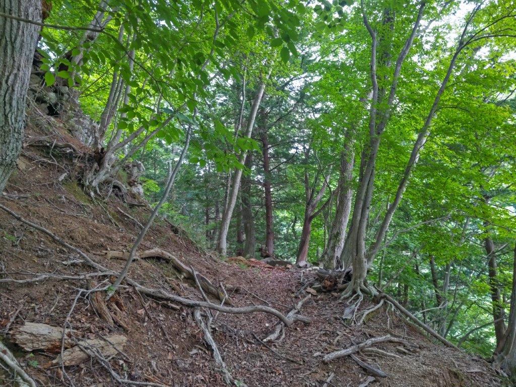
View of the Doshi mountains through the trees
It was a beautiful June day as I rode the limited express to Otsuki, where I changed to the local Chuo line, finally getting off at Sasago station at 10am. Before hitting the hiking trail, I checked out the nearby Sasaichi sake brewery. By 10h30, I was walking up a narrow road through the forest alongside a river. I soon reached the end of the road and continued on a hiking trail, up a beautiful river valley; I was astonished that I had never heard of this spot before. A little after 11am, the path suddenly turned left, zigzagging up the mountain side.

River valley at the start of the hike
Getting close to the top ridge
It was a steep climb, with a couple of flat bits at an electric pylon and a road crossing. At noon, I reached a shoulder and saw movement out of the corner of my eye: I had stumbled on a troop of monkeys. I had not known there were monkeys in this area and spent half and hour observing them. Unlike the Okutama ones, they seemed quite scared of me, and kept a good distance; only one, probably the alpha male, completely ignored me while sitting on a tree stump next to the path (I kept my distance from him). At 12h30, I finally reached a narrow ridgetop, where I turned left.

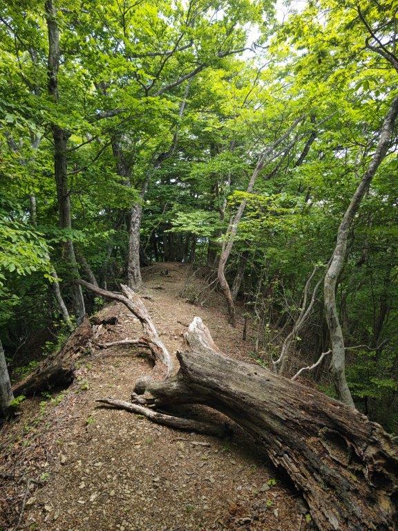
Walking the narrow ridgetop

View towards Mitsutoge
I followed an undulating path through low, bright green trees; I saw no-one and felt far from the world. Just before 1pm, I had a view through a break in the trees: to the west was Mitsutoge, and to the east, the Doshi mountains. I continued on my way, enjoying the peace and quiet of this little hiked trail, and 15 minutes later reached the summit of Mt Tsurugatoya (鶴ヶ鳥屋山 つるがとややま tsurugatoyayama). It was in the trees, so I moved on without a break. The trail headed down steeply, the rocky sections equipped with ropes; I soon emerged onto a road, but picked up the trail again, 50 meters on the right.

Few hikers on this trail

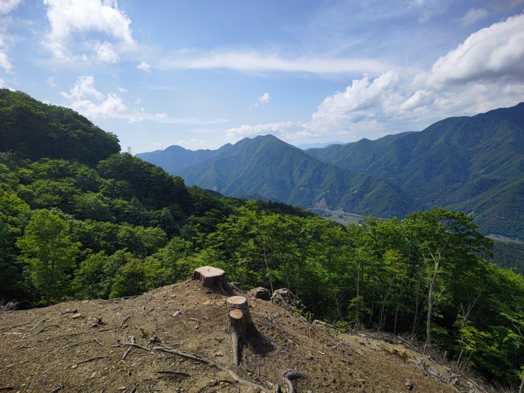
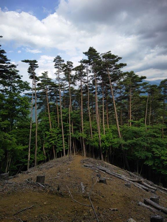
A deforested area half way down the mountain
Here, I had a sweeping view north and east, as the trees had been cut, and upon reaching the top of a knoll, I sat down on a stump for a late lunch. To the north there was Mt Takigo, and behind, its summit in the clouds, Mt Gangaharasuri; to the east Mt Iwadono, Mt Momokura , and Mt Takagawa, surrounding Otsuki city; further south, I spotted Mt Kuki, Mt Imakura, and the Tsuru Alps, beyond Tsuru city. The latter was my final destination and it seemed still quite far; on top of that, many low dark clouds had gathered in that direction, hiding the highest peaks of the Doshi mountains.

Mt Takigo on the other side of the Chuo line
Today’s lunch stump
After lunch, I continued down a winding trail through a lovely pine forest. At 3pm, I reached a road which I followed for about half an hour to the start of Chigasaka Highway (近ヶ坂往還), hidden behind an old person’s home. It was a pleasant trail, gently climbing through mixed forest, although the sections before and after the pass were overgrown with grass, making it hard to follow. A little before 4pm, I arrived at a crossing at Chigasaka Pass (近ヶ坂峠 662m). After enjoying its tranquil atmosphere, I went straight down the other side.

Walking down through the pine trees (left) Heading up to Chigasaka Pass (right)
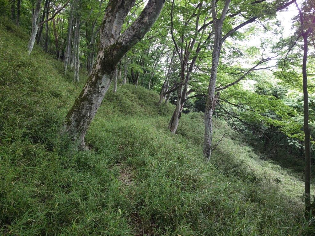
Walking through the tall grass around Chigasaka pass
I descended a grassy gully surrounded by tall trees; this was one of the most beautiful forested areas I had ever seen in the Tokyo area. Around 4pm, I reached a small stream which I followed for a short while, before reaching a house and a road at the edge of the forest. From there, it took less than an hour to reach Yorimicho no Yu onsen, six hours and a half after setting out in the morning; after a satisfying soak, I boarded the Fujikyu line for Otsuki, where I transferred to the limited express for the one hour trip back to Shinjuku.
See the river valley and the monkeys of Mt Tsurugatoya