
There are many “arupusu” (from Alps) hiking trails in Japan. It may seem exaggerated to call a chain of low mountains after the European mountain range, but the name is supposed to reflect the up-and-down nature of the path. The Tsuru Alps Hiking Trail (都留アルプスハイキングコース) was completed in September 2017, and connects Tsurushi and Higashi-Katsura stations on the Fujikyu railway line. Originally, I had wanted to finish at the hot spring near Tsurushi station, but the website recommended starting from there. So I decided to do it that way, and walk back to Tsurushi station since it wasn’t a long hike. On the way back, I could check out some local sights. Initially, I had hoped to take the Fuji Excursion limited express all the way there and back, but it didn’t stop at either station, so I had to change at Otsuki station. The weather forecast called for a sunny day, and I was looking forward to getting a better view of Mt Fuji than I had on my Hakone hike.
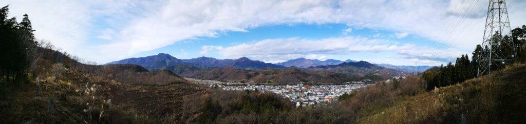
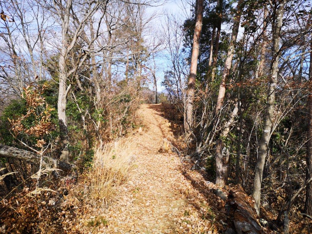
View of Tsurushi from the Tsuru Alps trail
I arrived in Otsuki at 8h30 and transferred to the Naruto-themed Fujikyu railway; I had seen the design before, but it was my first time to ride on it. It was a short ride to Tsurushi station, and by 9h30 I was ready to start hiking. I soon spotted the signs for the Tsurushi Alps, leading me past the hot spring, through the town and to the base of the mountains. The weather was good but cloudier than I had expected.
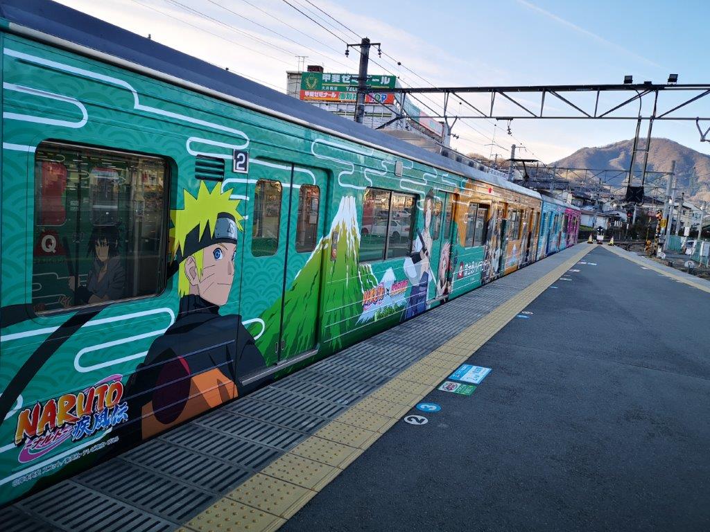
The Naruto-themed Fujikyu railway

First view towards the Oku-Chichibu mountains
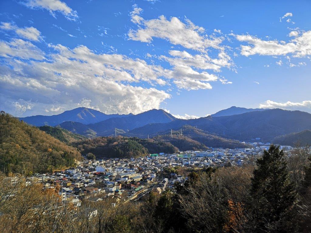
I followed a narrow paved road as it climbed steeply via a series of zig-zags. At the top was a water reservoir and a view of Tsurushi town. I could also see Mt Takagawa, and behind, the mountains of Oku-Chichibu. A few meters to the right was a viewpoint of Mt Fuji. Unfortunately it was half covered in the clouds. Moreover, the uncovered side was almost devoid of snow, very unusual for this time of the year.
The Mt Fuji viewpoint
Walking in the sun on the Tsuru Alps
True to its name, the trail went up and down but was never too steep. At 10h30 I was at the top of Mt Ari (658m 蟻山 ありやま ariyama , meaning Mt Ant). There was a signal tower blocking some of the view, but Mt Fuji, still partly in the clouds, could still be seen straight ahead; on the left was Mt Mishotai, a 200-famous mountain. I continued down the other side, following a series of switchbacks. Next was a fairly level section passing over a couple of minor peaks completely surrounded by trees: Mt Shiraki (白木山 625m) and Mt Choanji (654m 長安寺山).

View from the top of Mt Ari
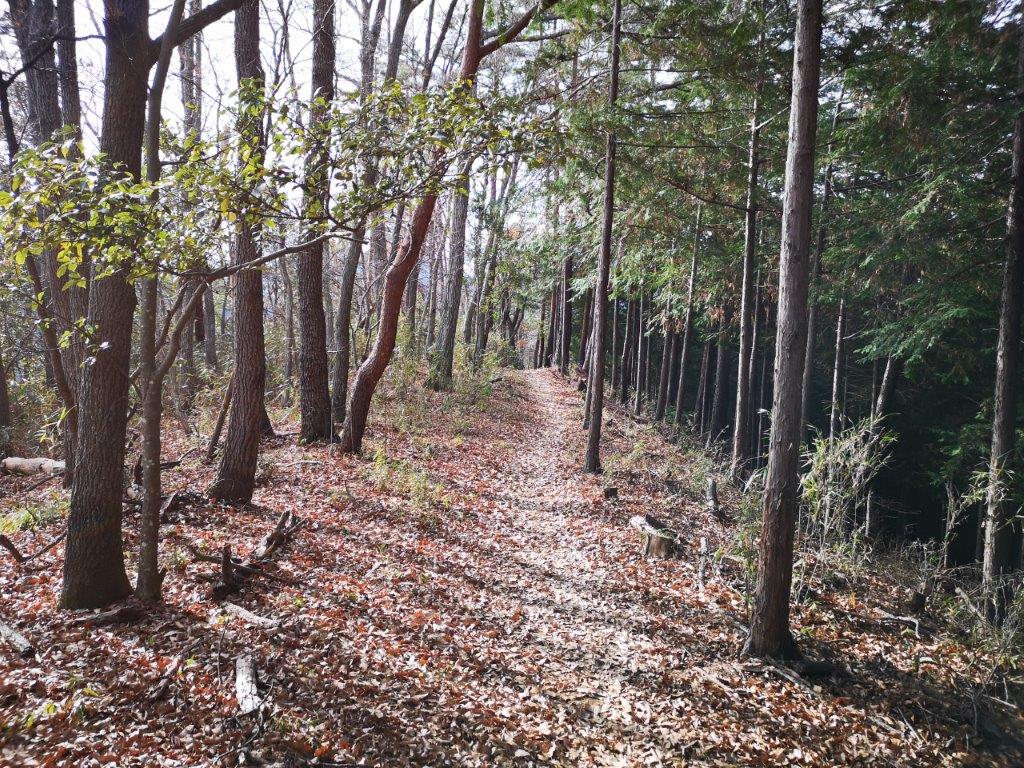
Easy walking along the Tsuru Alps
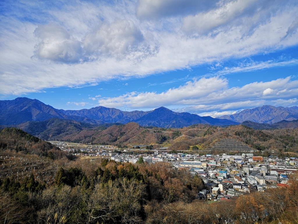
At 11am, I reached the panorama viewpoint. Mt Fuji was now completely lost in the clouds, but the view of the valley was impressive, even if completely urbanized. I sat down to have an early lunch. Seeing the cars move around town made me feel like I was flying in a plane (see video). At 11h30 I was ready to continue. After some downhill, I reached the Kajiya-Zaka aqueduct (鍛冶屋坂水路橋 also called ピーヤ for pier) which used to carry water for generating electricity during the Taisho era. A short climb brought me to the top of Mt Tenshin (天神山 580m).
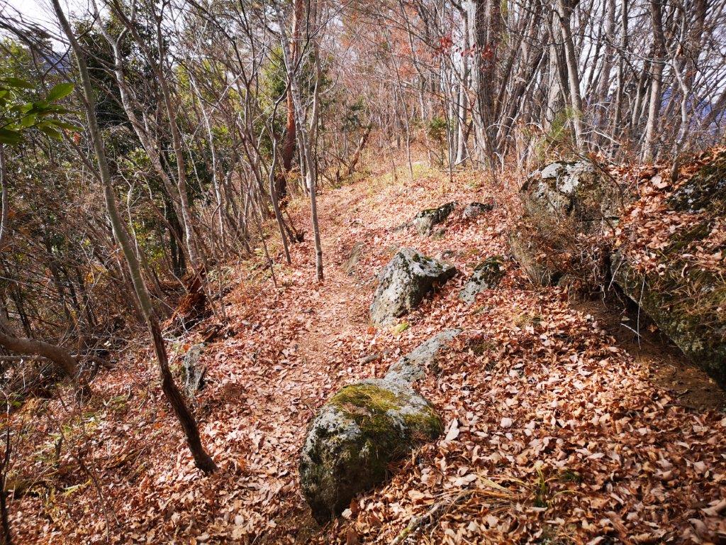
Some rocks to create a mountain-like feel
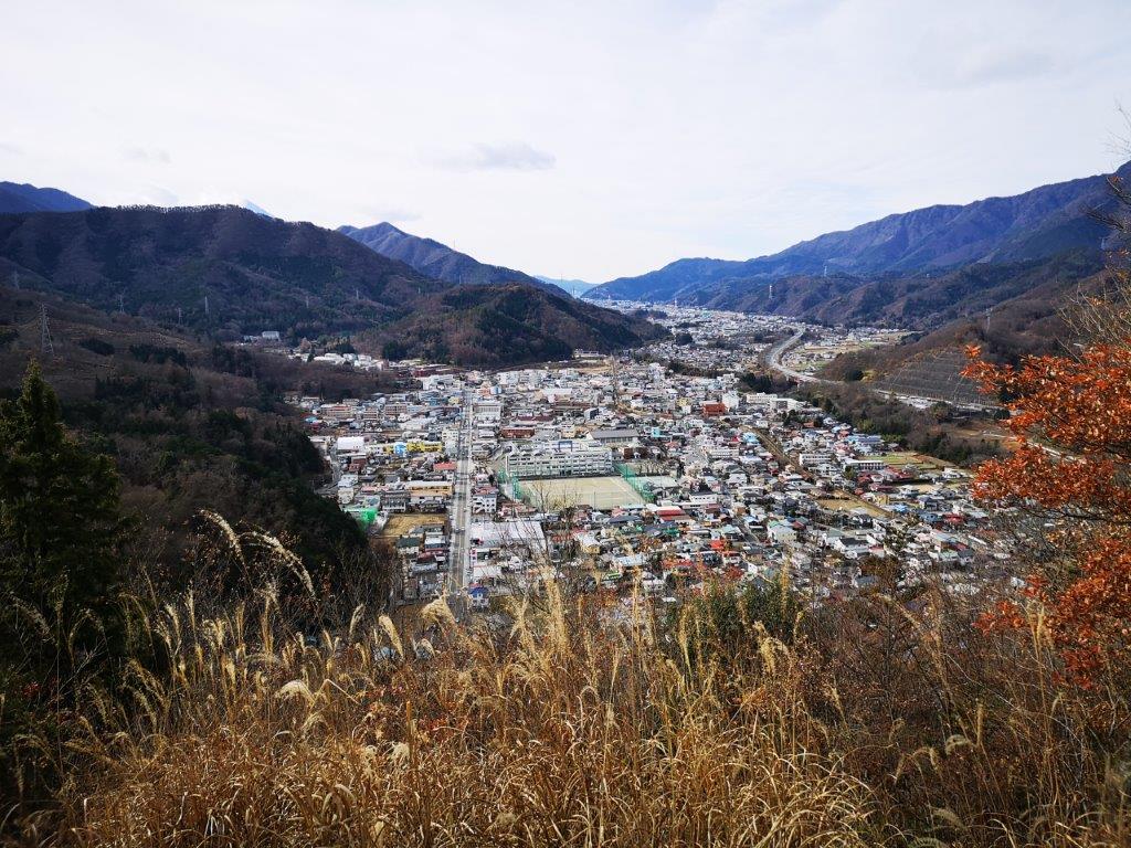
The panorama viewpoint minus Mt Fuji
At noon, I arrived at a wide deforested area with sweeping views from north to south. I could see Mt Mitsutoge, a 200-famous mountain, and Daibosatsurei, a 100-famous mountain. I now entered a forested section, and eventually reached the highest point of the hike at 713m. Although not a summit, it was marked by a signboard. The path then descended all the way to the bottom of the valley, before climbing again via a dried up riverbed. It wasn’t a difficult hike, but it sure was a good workout!

View of Mt Mitsutoge from the deforested area

Looking north up the Tsurushi valley
At 1h30, I found a a nice sunny spot near the trail to finish my lunch. This section was almost entirely in the forest, and although the trees blocked the views, they also blocked the noise from the nearby highway. I was now walking through a forest of red pines, which reminded me of my hike on nearby Mt Kurami. After a few more up-and-downs, I arrived at Mt Kojo (古城山 583m), the final summit of the day. Right next to it was a small shrine called Sumiyoshi-Jinja (住吉神社).

The Tahara waterfall on the way back to Tsurushi station
View of the Tsurushi Alps from the top of Mt Katsu
After one last descent, I was back among the houses. It was now 2pm and I was right on schedule. While walking back to Tsurushi station I passed by Onan Pool (おなん淵), Soryu Gorge (蒼竜峡), and Tahara waterfall (田原の滝). The main road, called Fuji road (“fujimichi“), had a lot of traffic so I escaped to the side streets. My last stop for the day was Mt Katsu, the site of an old castle on a bend of the Katsura river. It was a short and easy climb to the top, and although there was no trace of the castle at the top, I had a good view of the Tsuru Alps on the opposite side of the valley.

Mt Nijuroku in the late afternoon light

Yorimichi no Yu hot spring near Tsurushi station
At 4pm, I finally reached the new hot spring facility of Yorimichi no Yu (より道の湯) inside a modern looking, square shaped building. Unlike the usual hot spring resorts, this one featured a bar with a wine menu, and a relaxation area with hammocks instead of massage chairs. After a refreshing bath, I got on the local train for Otsuki station, where I changed to the limited express for Shinjuku.
Ask for a hiking plan for the Tsuru Alps
Hiking the Tsuru Alps

