

I discovered an interesting hiking area between Kamakura and Yokohama at the end of 2019, and I was keen to return for some more exploring. This time I would start on the east side, from Kanazawa-Bunko station, a mere one-hour train ride from the center of Tokyo. I hadn’t quite worked out where I would finish. There were many trails to choose from and some were still closed due to typhoon damage; a flexible approach seemed best. The weather forecast was good, so I was hoping for better views than last time, and maybe even a glimpse of Mt Fuji!

View from the “Beetles” trail
Since today’s hike was relatively short, I arrived at the station around noon and started with some soba at the nearby Jutokuan (寿徳庵). At 1pm, I was at the entrance of the Rokoku Pass hiking trail (六国峠ハイキングコース meaning “six country pass”). It took me just 15 minutes up a series of logs steps to get to the top of the ridge, and my first viewpoint of the day. Looking south, I could see the hilly outline of the Miura Alps beyond the suburbs of Yokohama city. The easy to walk trail soon reentered the forest, and followed the narrow wooded ridge through the city.

Start of the Rokoku Trail
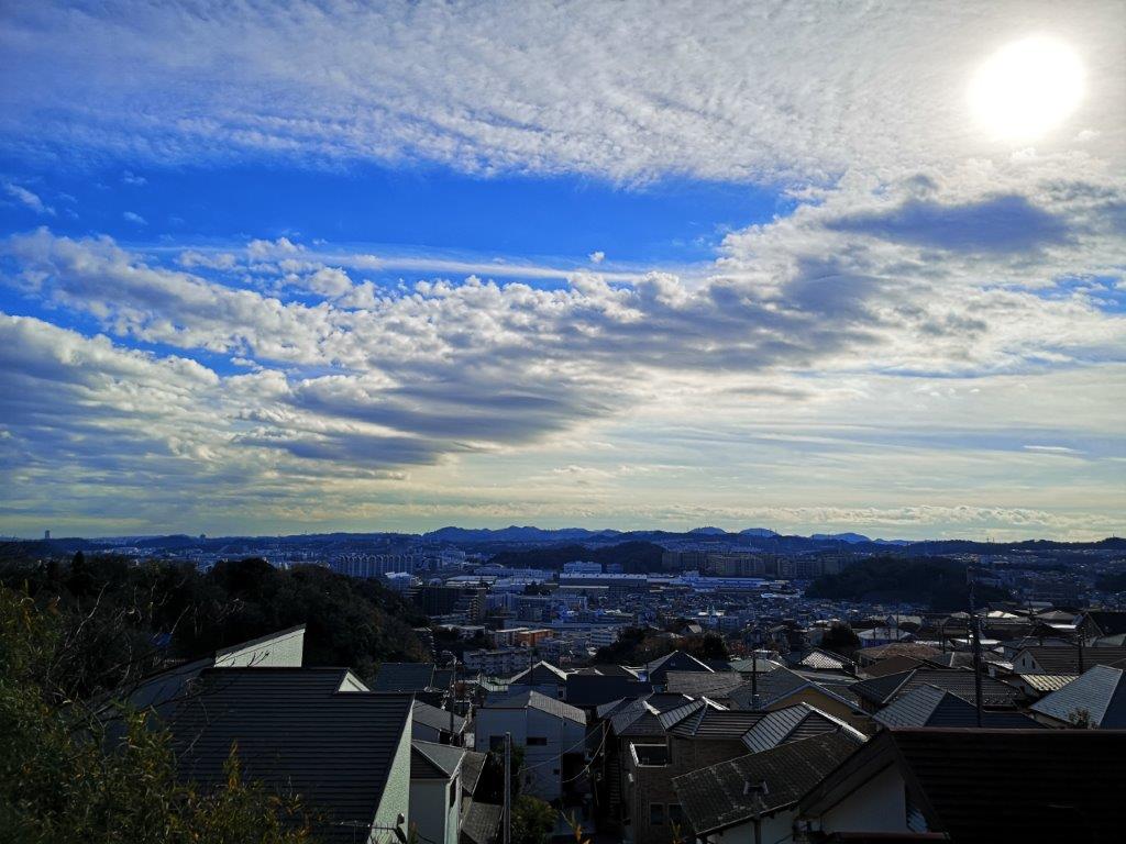
View of the Miura Alps
I wondered whether the city was encroaching on nature or vice versa. It was clear, however, that many locals enjoyed walking this well-maintained trail. Occasionally I heard some rustling from the trees next to the trail. Initially I thought the noise was made by stray cats, but later on I spotted a squirrel scampering along a tree branch. I saw quite a lot of them during the rest of the hike; I had never realised that there were so many squirrels in the Yokohama area! At 2h30, I reached Kanazawa zoo, and located the second half of the trail behind next to the parking area.

An easy to walk and well-maintained hiking trail near the city

Autumn leaves in late December
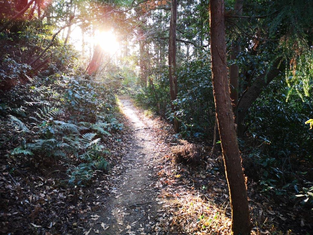
I was now walking a paved path called the “Interesting Nature Route” (おもしろい自然ルート). True to its name, there were many interesting trees along the way, including some that were still dressed in their autumn colours. At the end of “fern valley” (しだの谷), I climbed a long staircase, and then walked along a small road (closed to traffic) next to an elevated toll road. Soon I was back on an up and down hiking trail. The forest crowded in on both sides; it felt like I was in the middle of the jungle, although I was still technically inside Yokohama city. Many trees had labels; I studied each one carefully, since I wanted to learn more about Japanese trees.

The forest crowding in on all sides

Surrounded by nature in Yokohama
After crossing the Yokohama-Yokosuka Toll Road on a pedestrian bridge, and hiking up and down some more through the forest, I reached the Sekiya-Oku Viewpoint (関谷奥展望台) at 3h30. There wasn’t much to see, but there were some benches, so I sat down for a late lunch. Although the Rokoku hiking trail continued further south towards Kamakura, I decided to turn north along the “Ridge Trail” (尾根道), also called the “Beetles Trail” (ビートルズコース). Apparently there are many “kabuto-mushi” (Japanese Rhinoceros beetle) along the trail although I didn’t spot any – just overactive squirrels. This had been the best part of my 2019 hike, and I enjoyed hiking it a second time in better weather.
The days are short in the winter

In the background, the Tanzawa range
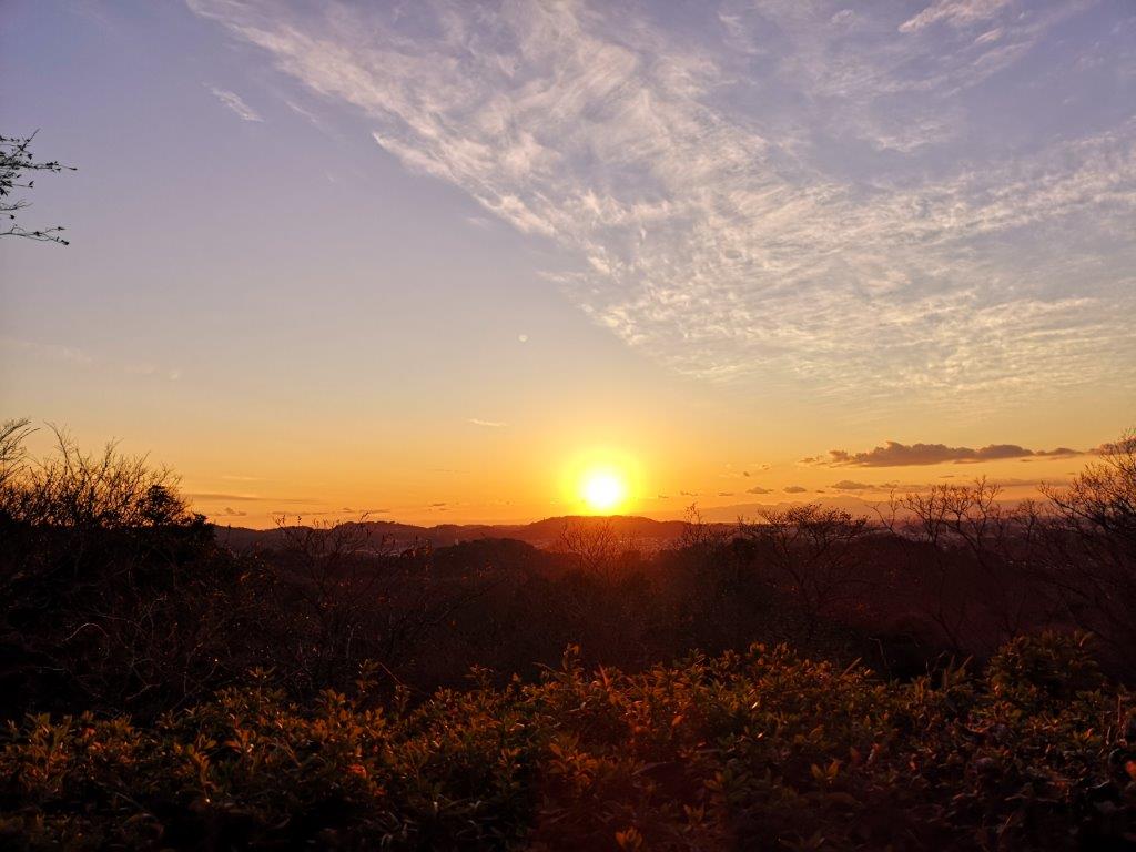
Against the sun, I was able to see the faint outline of Mt Fuji. I was delighted to view Japan’s most famous volcano from a new angle. To the right was the Tanzawa range. It was nearly 4 o’clock and the sun was slowly setting. The squirrels were more active than ever. Earlier on, I had enjoyed seeing them dart through the trees; in the gathering gloom, the crashing noises coming from the dark forest made me jump. I had hoped to walk east through the Hitorizawa Community woods (氷取沢国民の森) but I had to save it for another day. Instead, I continued to Ishindo Plaza. There, I turned left and descended into the valley, along a narrow hiking path.

Mt Fuji at dusk
Goodbye sun!
It was now 4h30 and getting dark quickly. I arrived at at Segami Pond (瀬上池), which I had glimpsed from above on my previous hike. I followed a road at the bottom of the valley next to a stream; it had gotten quite cold after the sun had set. Near a small house, I was joined by what looked like a domestic cat, and was “escorted” to a safe distance past the dwelling. At 5pm, I was back in the city. I jumped on a bus for Konandai station, where I switched to a train for the one-hour ride back to Tokyo.

My escort for the final part of the hike

One thought on “The Rokoku Pass Hiking Trail, Yokohama City, Kanagawa Prefecture, December 2020”