
I had climbed this peak more than ten years ago, starting at Daiyuzan Saiyoji Temple, and finishing at Gora, the last stop on the Hakone Tozan line. This time, I decided to start from the entrance of the hiking trail for Mt Kintoki, and finish on the Daiyuzan train line, meaning that the two hikes would only overlap very slightly. On the up side, this would combine a short climb with a long descent, and an easy return by train. On the down side, there was an hour of road walking at the end and no hot spring. Overall, I was excited to try a new route, in an area I hadn’t visited since February. I had some misgivings about the weather; we were in the middle of a cold snap, and the temperature at the top would be around freezing. I was most concerned about keeping my fingers warm, especially when taking photos. However, no matter how cold it turned out to be, I would be satisfied as long as I could see Mt Fuji in its winter coat.
Hiking in the Fuji-Hakone-Izu National Park
Mt Hakone, the highest peak in the Hakone area

Mt Kintoki, a 300-famous mountain
I rode the Romance Car limited express train under a beautiful blue sky to Odawara, where I transferred to a Hakone Tozan Bus. I got off in Sengokuhara and walked to the closest convenience store to buy supplies for the hike. There I bought a pair of gloves that work with a smartphone touchscreens. I had never used such gloves before, so I hoped they would do the job today. At 10:30, I was finally ready to hike. Thanks to the many signposts, I easily found the start of the trail and was quickly making my way up to the ridgeline, reaching it at around 11am.

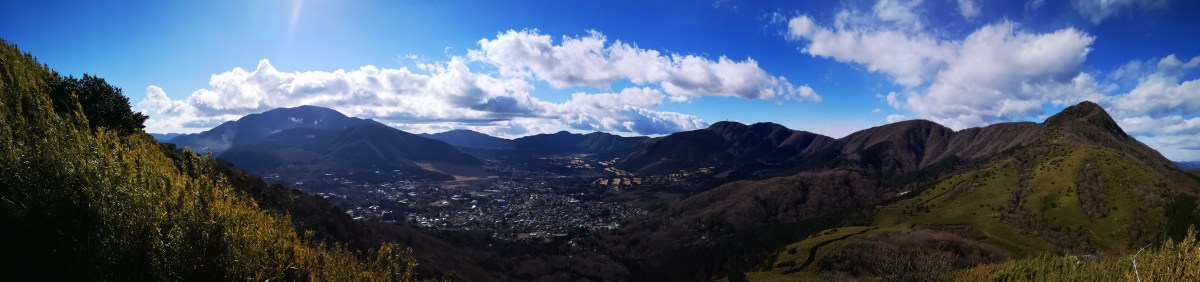
The Sengokuhara plain and part of the Hakone outer caldera rim
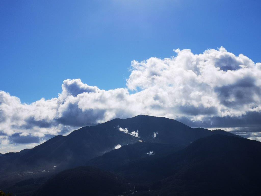
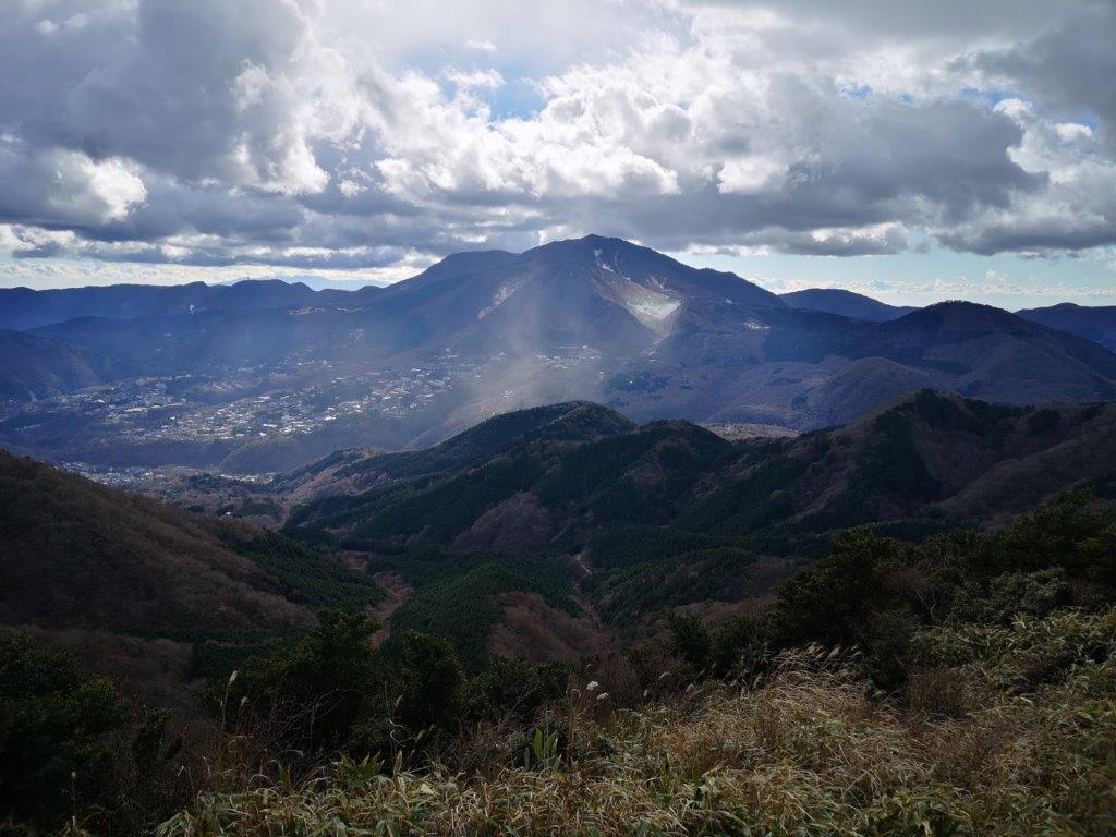
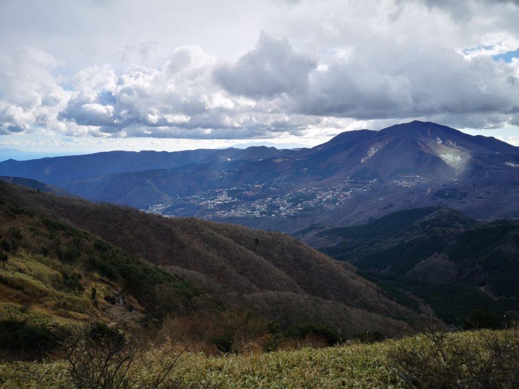
Menacing Mt Hakone
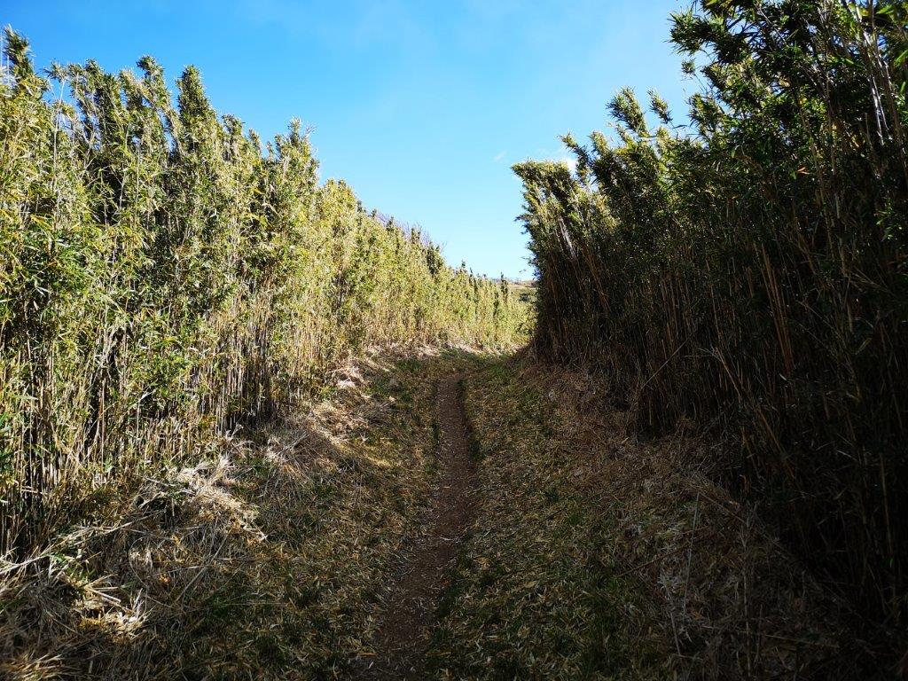
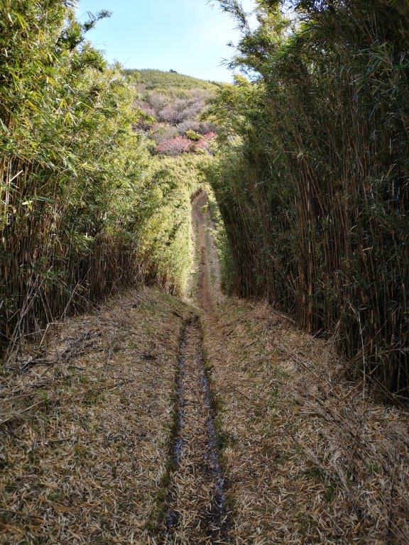
I was now following a path through bamboo grass higher than my head. After some more climbing, I had the first views of the day; to the west, I could see Mt Kintoki; to the south, was Sengokuhara, a vast plain in the middle of the Hakone caldera; behind it was the outer crater rim, curving eastwards; finally, under a dark cloud, and looking like Mordor’s Mount Doom, was Mt Hakone. It was cold and windy but still sunny. The gloves were hit-and-miss; I usually managed to take a picture only after a few tries.
No view but also no wind

Looking ahead and looking back views
Most of the trail was through a bamboo tunnel, like walking in a giant maze. Apart from a few gaps, there were no views, but at least the bamboo kept the wind out. At one point, the trail dipped down through a forest on the north side, to rejoin the ridge near the top of Mt Hiuchiishi 988m (火打石岳) around noon. From there, I had a good view of the last part of the climb to the top of today’s mountain; it looked close but it took me another hour to get there.

Mt Fuji’s “glacier”

Strate visible on the side of the mountain
I finally saw Mt Fuji near the top of the climb, but it was a different view from what I expected; the side facing me had snow halfway down, but the sides were bare, so it looked like a glacier. It was a good addition to my collection of Fuji pictures. To the right, I could see the entire range of the Tanzawa mountains, from Mt Mikuni to Mt Oyama. There was less bamboo grass here, and I had many good views of Mt Hakone, looking more and more menacing. I was now close enough to see the plumes of the sulfur fumes (it is an active volcano).

In the center, Mt Mikuni

Mt Oyama at the very right
The dark clouds over Mt Hakone had extended their reach to include the sky directly above me. I arrived at the summit of Mt Myojin (明神ヶ岳 みょうじんがたけ myoujingadake) at the coldest point of the day. There was no sun and the wind was now blowing hard. I took off my gloves to eat lunch, and my fingers ended up getting a bit numb after all. There were two other hikers, and after one of them complained of the cold, the other one asked if she was sensitive to the cold. In my mind, I was thinking “right now, yes, very much!”
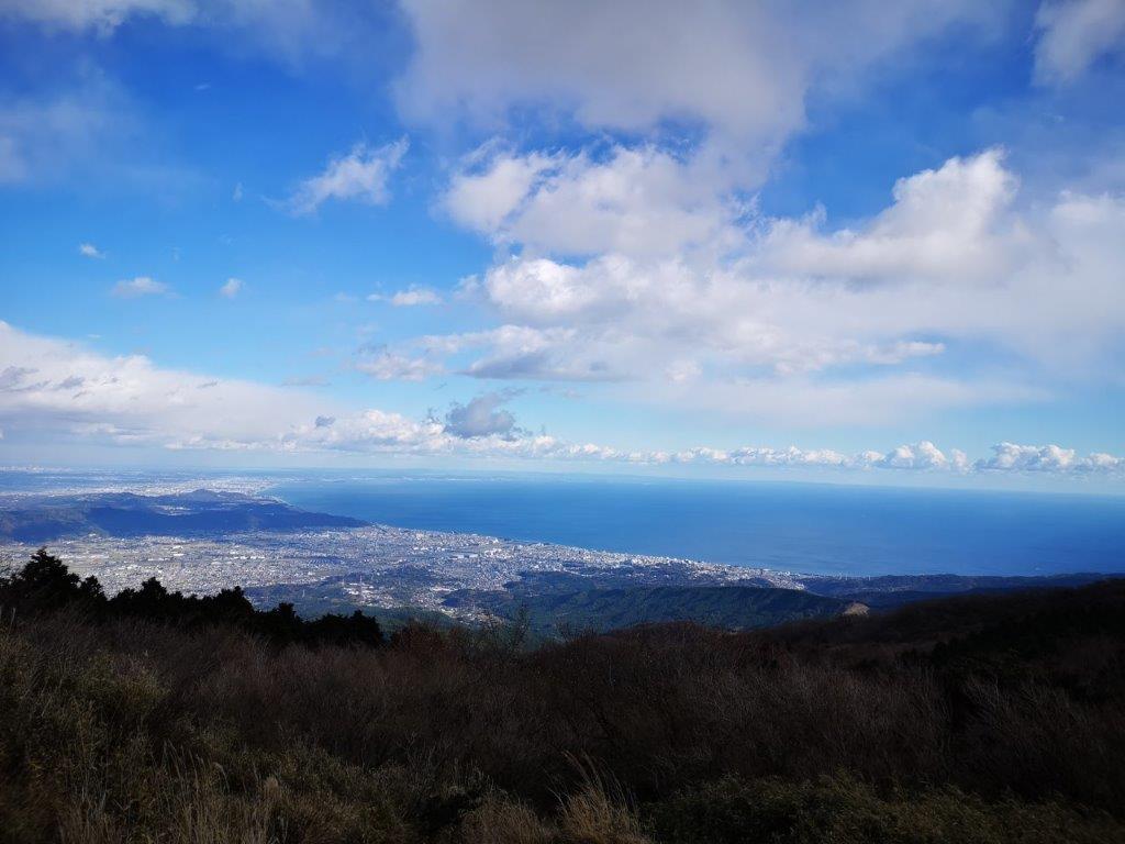
The Shonan coast and Tokyo bay
Mt Hakone with Gora at its feet
The cold finally won over the views, and I moved on quickly, rubbing my hands to warm them up. On the other side of the flat summit, I finally had a view east of the Shonan coast and Tokyo Bay. Ten minutes later, I reached the turn-off for the descent. I launched myself down the path, relieved to be out of the freezing cold wind. The path was easy to walk and not too steep, so I could move at a fast pace. Before long I was feeling more comfortable and was even able to remove a layer of clothing. Although I was now outside the Fuji-Hakone-Izu National Park, the surrounding forest seemed more beautiful than before.
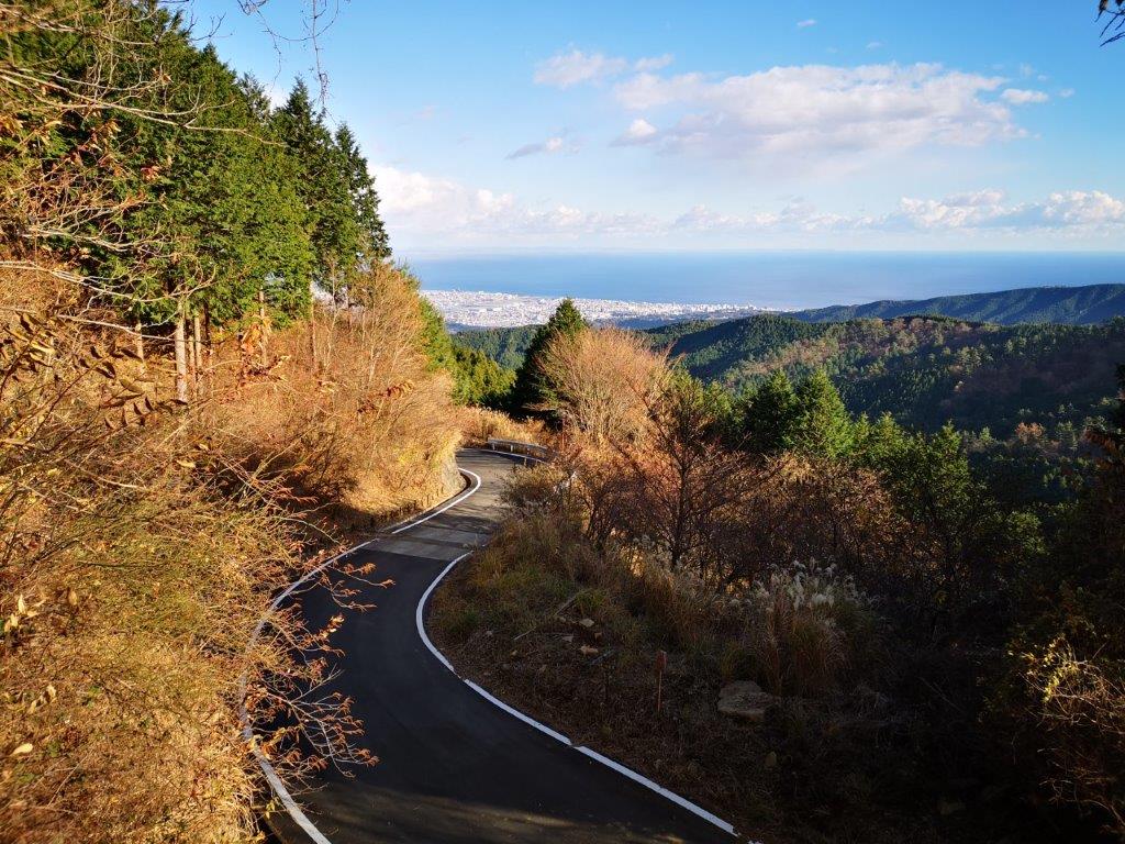
A short section of road before returning to the hiking trail

Two pines marking a view point
I saw no one on the way down and enjoyed the solitude of the mountain. Around 2h30, I popped out on to a road which I followed for a short while, before reaching a couple of pine trees and a view of the Tanzawa mountains to the north. By now, the sun had reappeared, so I stopped to finish the rest of the my lunch in warmer conditions. I set off again at 3pm. The path dived back into the forest, and thirty minutes later I reached the end of the trail and a small road. This was the prettiest section of the hike, and I thought it was a shame it wasn’t mentioned in any of my guidebooks.
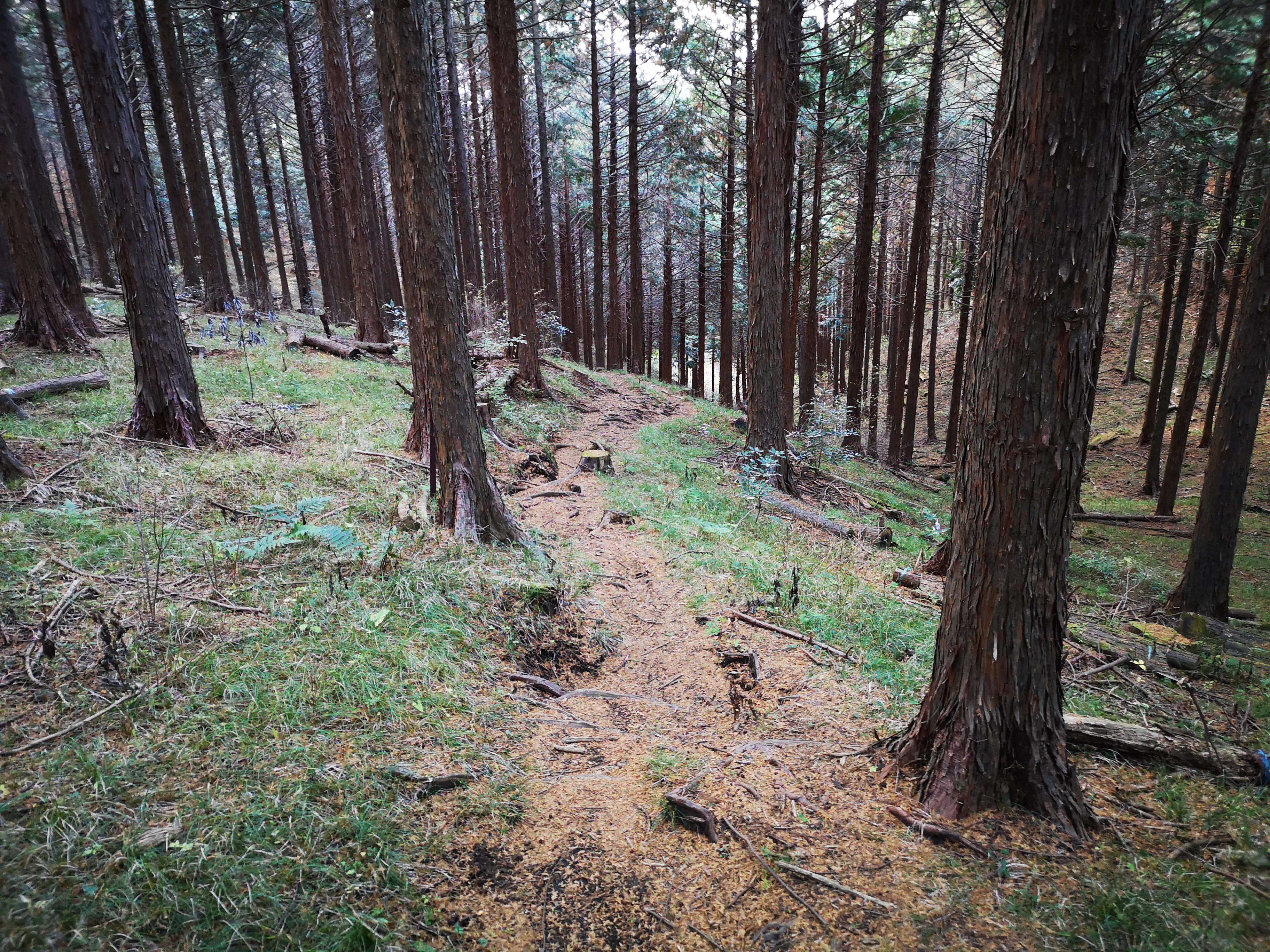
A pleasant forest trail near the end of the hike

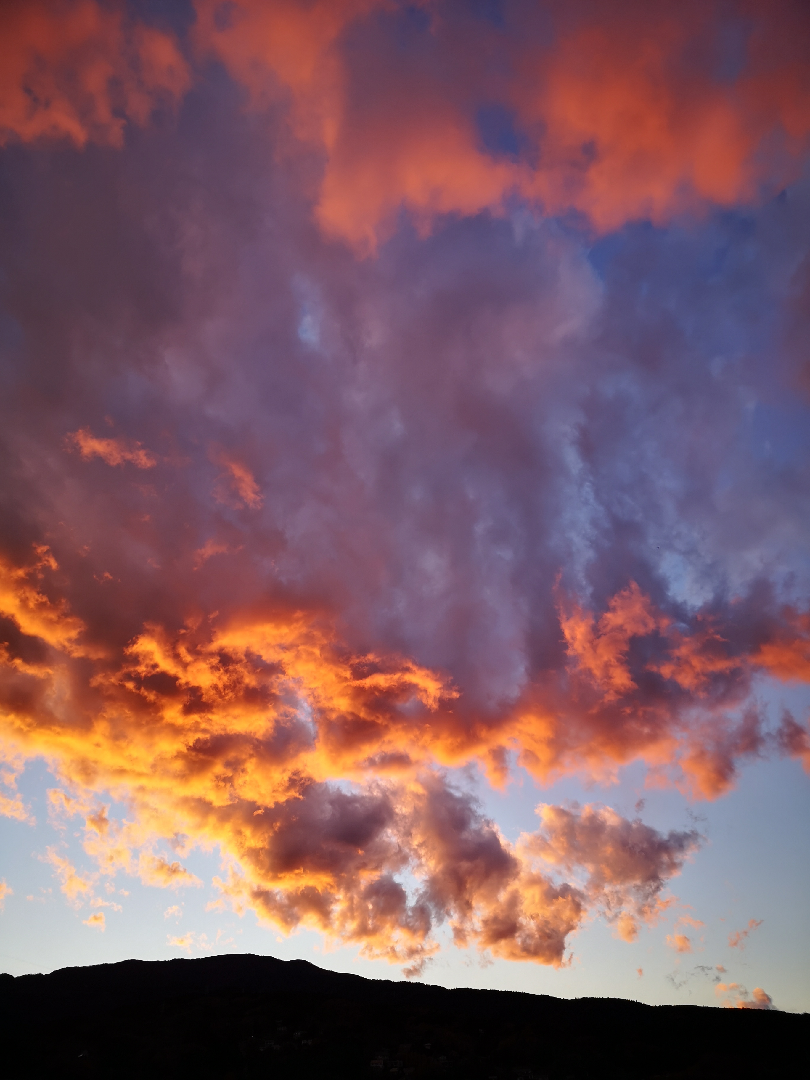
Autumn leaves and a fiery dusk
The walk back to the station turned out to be quite interesting. I passed by some trees still showing off their beautiful autumn colours. I also saw a statue of Ninomiya Sontoku, an important historical figure born in the area. Finally, just after sunset, I saw the Tanzawa mountains (and clouds) tinted in red. I lost some time here taking photos, but I could afford it, since the train ran frequently. I reached the tiny Tsukahara station just before 5pm, from where it was a short ride to Odawara and the Romance Car limited express back to Tokyo.
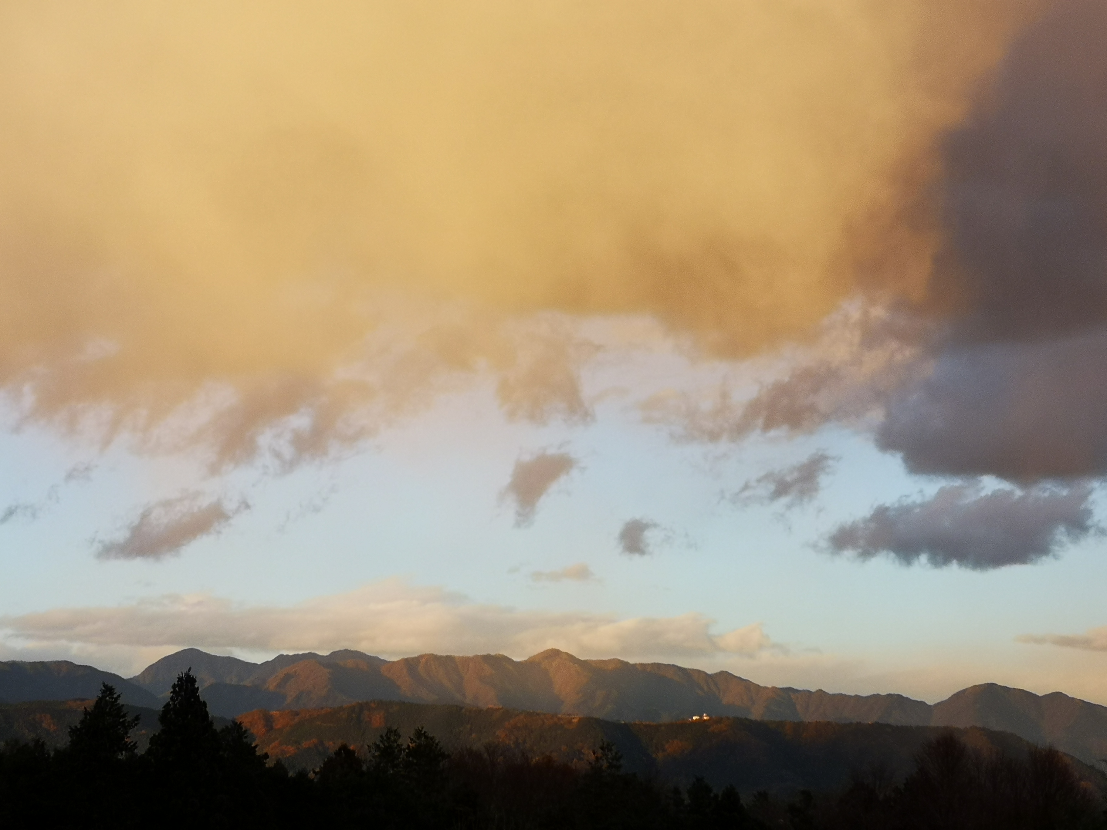
The “red” Tanzawa mountains
See the views from the top, filmed in strong wind (again)


2 thoughts on “Mt Myojin (1169m), Hakone Town, Kanagawa Prefecture, December 2020”