
Hiking in the Nikko National Park 日光国立公園
I was eager to continue my tour of the national parks close to Tokyo. I had last visited Oku-Nikko a little over a year ago, so it seemed like a good choice; I also expected a dip in the crowds between the summer vacation and the Autumn colours season. Looking at my hiking map, I combined some trails northwest of Lake Chuzenji into a loop hike, and although it included no mountains, I hoped it would be more challenging than just a walk in the woods. The area is also the heart of bear territory, with nearly one hundred sightings so far in 2022, so I would need to make sure to pack my bear bell. I would ride the now familiar Nikko limited express from Ikebukuro to Tobu-Nikko, and there switch to a Tobu bus for Yumoto-Onsen, getting off at Akanuma at the edge of the Senjogahara Marshland; the hike would end at the nearby Ryuzu Falls. The weather was supposed to be sunny, with high clouds appearing in the mid-afternoon; the temperatures and humidity were also supposed to be lower, which I hoped would create the ideal conditions for a hike at an average elevation of 1400m. I was looking forward to a nice forest hike, and maybe even catching a glimpse of some animals in the wild.

View of Mt Nantai from Senjugahama

Walking next to Odashirogahara
I left Tokyo under cloudy skies, but fortunately, the sun was shining once I got off the limited express at Tobu-Nikko station. At 11am, I was standing under a light blue sky, opposite Akanuma-Chaya (1390m 赤沼茶屋) at the edge of the Senjogahara Marshsland (戦場ヶ原), ready to start my hike. First, I headed down the “Nature Study Path” (戦場ヶ原自然研究路), the main route leading through the marsh and crowded with other hikers; I soon left it to follow a trail over a wooden bridge and through the forest, a trail I had done previously in the winter on cross-country skis.

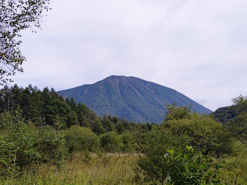
First view of Mt Nantai from the Senjogahara Nature Study Path
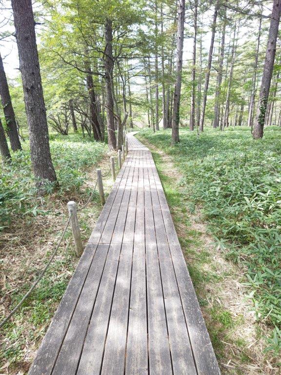
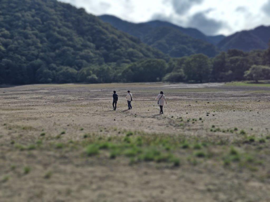
A mix of walkways (left) and hiking trails (right)
At once, I was able to relax and enjoy the surrounding nature as few people ventured this way. After going through a gate in a deer fence, I reached another intersection where I turned right, onto a wooden walkway. I was now walking among tall larches and silver beeches, the autumn colours would probably be wonderful around this area, and soon reached the edge of Odashirogahara (1408m 小田代ヶ原), a smaller, lesser-known marshland. I turned left at the next intersection, following the contour of the marsh, eventually reaching a viewpoint of the Nikko mountains.

View from the start of the loop around Odashirogahara

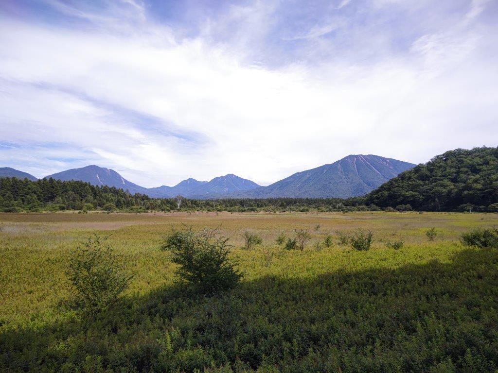
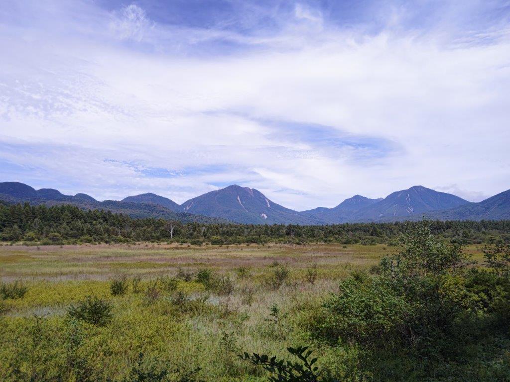
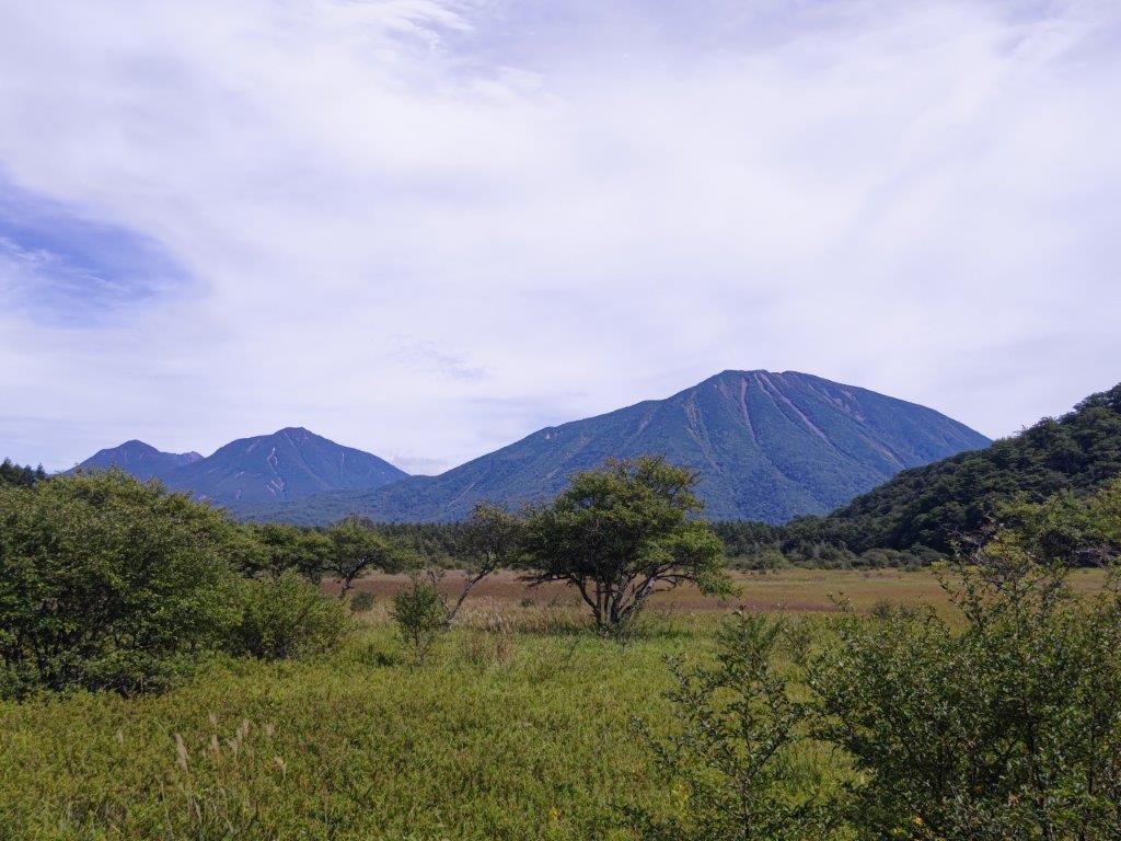
View of the mountains of Oku-Nikko
I was impressed by the sight of these majestic peaks rising above the green-brown marsh. From left to right, I could distinguish Mt Taro, Mt Nyoho, Mt Omanago and Mt Nantai, all free of clouds. It was nearly 1pm so I sat down for lunch at one of the picnic tables. Afterwards, I went to check out the nearby stop of the low-emission bus (低公害バス) that runs through the area I was exploring on foot. On the way, I spotted a longhorn beetle making a difficult ascent of the restroom building (see video). A little after 1pm, I set off again, this time along the bus road, going over Yumihari Pass (1433m 弓張峠), and then re-entering the forest via a path on the right.
This part of the hike is bound to be very crowded in the autumn season

From left to right: Mt Taro, Mt Nyoho, Mt Omanago and…
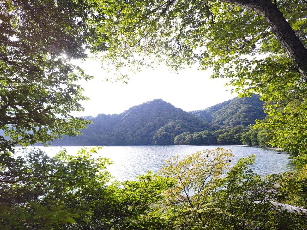
From this point, I enjoyed a solitary ramble through a beautiful forest. This was the best part of the hike, but it was also bear territory, so I tried not to linger. After crossing a bridge over a river, the trail abruptly went up the mountain side, reaching the highest point of the hike, before becoming level again, and finally descending to the valley floor. A little after 2pm, I was again walking on a paved road and soon arrived at another bus stop. It definitely felt weird to see a bus pass by in the middle of a forested valley in the Nikko National Park. Here, I turned right onto a wide, straight track through a larch forest, and half hour later, reached Sainoko Lake (1295m 西ノ湖).

…at the very right, Mt Nantai
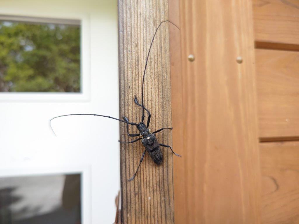
A kind of longhorn beetle having trouble with the polished wood
I was surprised to see that the lake was a lot smaller than it appeared on the map. I had somehow fallen behind schedule, so I didn’t have time to cross the wide sandy beach, formerly the lakebed, to reach the shore of the tiny expanse of water. I had the second half of my lunch on a bench and made my way back to the main trail, heading east at a fast pace through a forest of tall oaks. I suddenly heard a high-pitched shriek and noticed movement near the river on the right side. I moved to the edge of the trail, keeping in mind the signs warning hikers not to leave the trail, and saw a troupe of monkeys foraging for food along the river.

Sunny forest in bear territory

The smaller than expected Sainoko lake
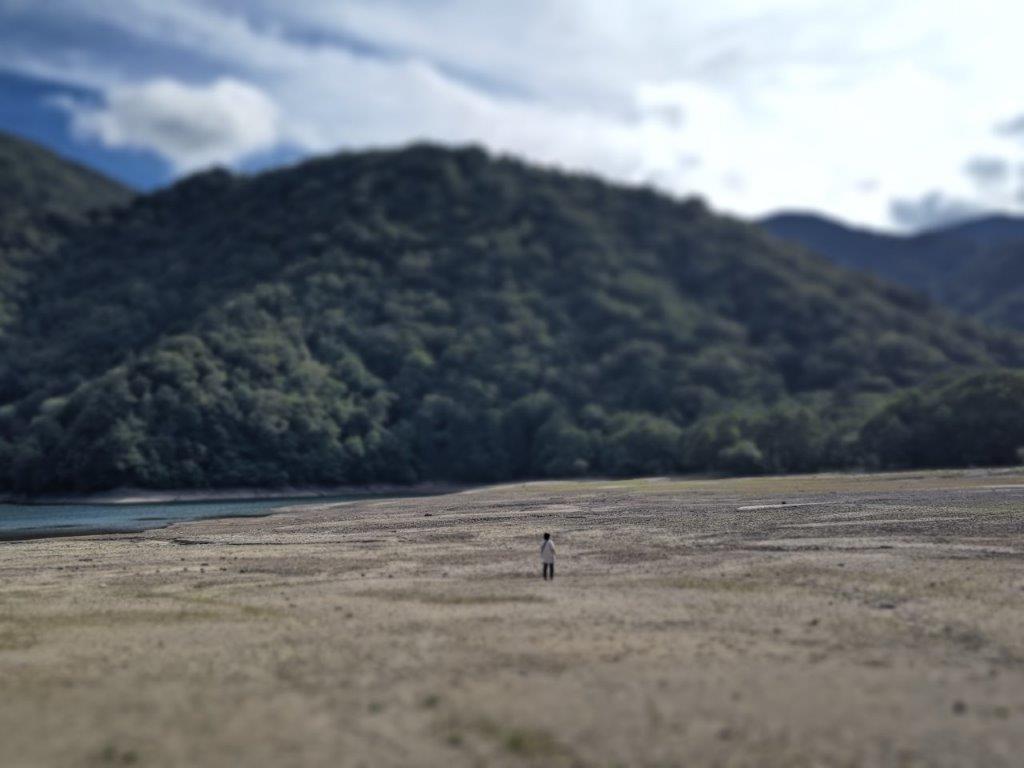
I was delighted to be able to observe wild monkeys for the second time in a month. They weren’t as indifferent as the Shiga-Kogen ones, taking note of my arrival, but not as fearful as the ones I saw near Mt Tsurugatoya, soon resuming their quest for food, a couple even turning over stones in the river in search of some river-dwelling treat (the reflection of the sunlight on the water surface made it hard to film). I wanted to keep on watching them but I had to keep moving if I wanted to catch my bus back. A few minutes later, I reached Senjugahama (1276m 千手ヶ浜) at the western edge of Chuzenji lake, also visited on my previous Oku-Nikko hike.

The furthest pier at Senjugahama
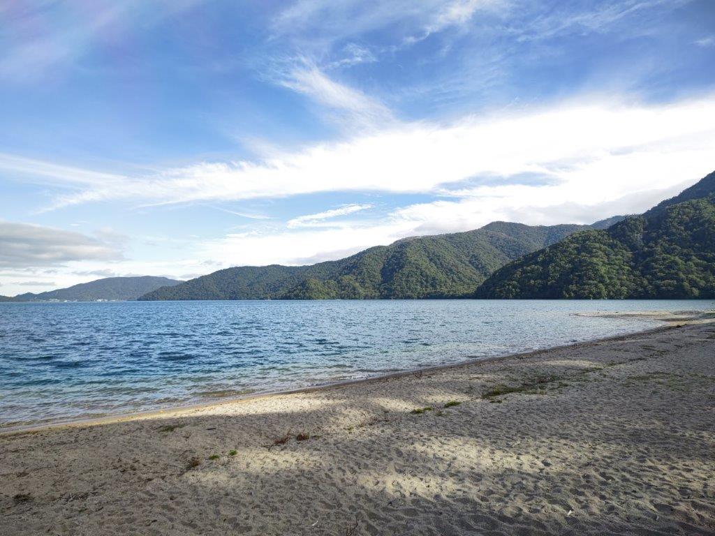
A peaceful place after the crowds have left for the day
This time I could fully appreciate its tranquil atmosphere and the stunning view of Mt Nantai rising above the blue lake waters, as both the last boat and last bus had already left, and I was the last person around. After a few minutes of contemplation, I went left, following the path I had taken last year, but in reverse. I quickly passed the turn-off for Mt Taka, continuing straight ahead. It was nearing 4pm and some altostratus clouds had started to spread from the south, a sign of the approaching typhoon; inside the forest it was already dark, except for breaks in the trees letting in the slanting sunshine. The trail went up and down, accommodating the rocky nature of the shore.

The last part of the hike followed the lake shore
Once of the several views through a gap in the trees
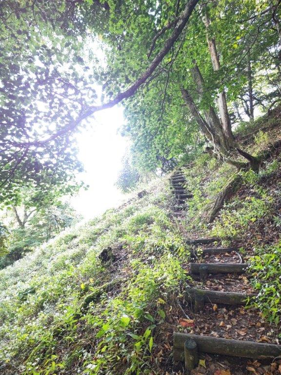
I was glad for the exercise on a hike with no ascents. After a final view of the lake from the top of Akaishi Rock (1312m 赤石), reachable thanks to a brand new wooden staircase, I finally emerged at Shobugahama (12297m 菖蒲ヶ浜), arriving at the bus stop ten minutes before the bus for Tobu-Nikko, nearly five hours after setting off. Although I had considered this an easy hike, the many ups and down made me quite tired at the end. I got to the station one hour later, just in time for the 90-minute ride to Kita-Senju on the Tobu Spacia limited express. In the end, I hadn’t seen or heard any bears (or sign of them), but getting to see monkeys close up was just as rewarding.
See the marshlands, forest, lakes and creatures of Oku-Nikko
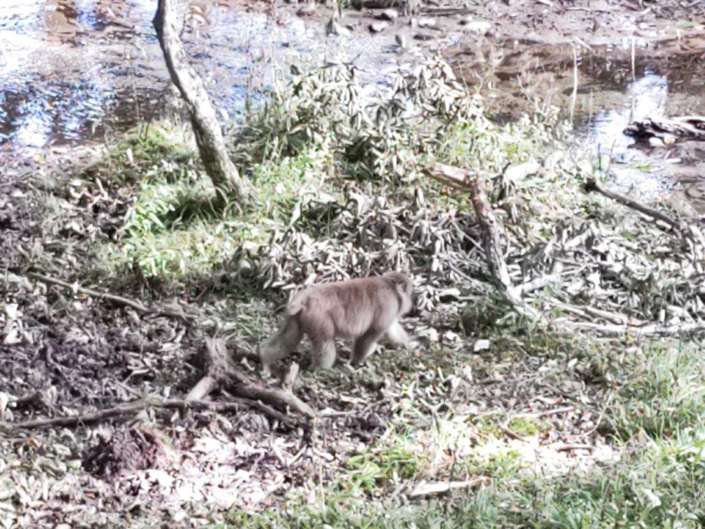
Monkey looking for food between Sainoko and Senjugahama


This place looks lovely! The foliage forecast says we won’t see these beautiful leaves until the end of November here (Kansai), but it’s lovely to see they are in full bloom in the north!
Thank you! actually the blog post is from my trip there last month, at the end of summer. Autumn colours are due to peak there next weekend so there is still time to catch them:
https://weathernews.jp/s/koyo/spot/24104/?fm=area
Hi just found your blog. As someone that lived in Tokyo for 5 years I had no idea there were so many places to hike around there. Great articles.
Thank you! I hope you can have some good hikes during the Autumn leaves season.