
Hiking on Yatsugatake 八ヶ岳
I found out about the Yatsugatake “ondanhodo“ (八ヶ岳横断歩道 meaning “crossing path”) hiking down Mt Gongen. Looking at my hiking map it seemed like a mostly level path following the contour of the mountain. However, I wasn’t sure how well-maintained the hiking path would be, seeing that it didn’t lead to one of the popular summits in the area. Also, I was curious whether there would be any good views along the way. I decided to start from Kiyosato 清里 station, and finish at Kai-Koizumi 甲斐小泉 station, not to be confused with Kai-Oizumi 甲斐大泉, one station away. According to my map, the hike would take over 8 hours, but hopefully it could be done in less.
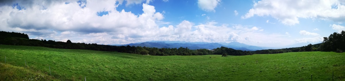
Hiking through the cow pastures
I left Tokyo under grey skies, but I wasn’t worried, since sunny weather was forecasted for Yamanashi; indeed, as soon as I reached Kofu city, the clouds parted and the sun appeared. I was more concerned about the train back being full as well, and I made sure to book my return seat as soon as I got off at Kobuchizawa. I was using the Tokyo Wide Pass which had gone through an upgrade since the last time I had used it. The fancy card format was out, replaced by a ticket similar to a shinkansen ticket, that could be put through the automatic ticket gates. I could also use it to reserve my seat in a ticket machine (I had one of the station staff show me how).

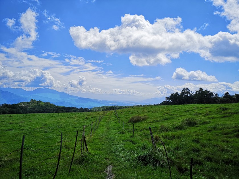
Hiking on the slopes of Yatsugatake

The Kawamata river valley
The Koumi line was also full so I had to stand for the short but exciting ride; the train went up the side of the valley, reaching Kiyosato – altitude 1274 meters – where I got off at 10am; the next stop on the line is Nobeyama 野辺山, the highest train station in Japan at 1345 meters. The air was definitely cooler here, and the village reminded me of Switzerland. To get to the start of the “ondanhodo” trail, I had to walk alongside a busy road for 45 minutes. Then, it was another half an hour of gentle climbing through forest before a short descent led me to Kawamata River. I took a short break here and had a late breakfast, enjoying the warm sun and the sound of the water.
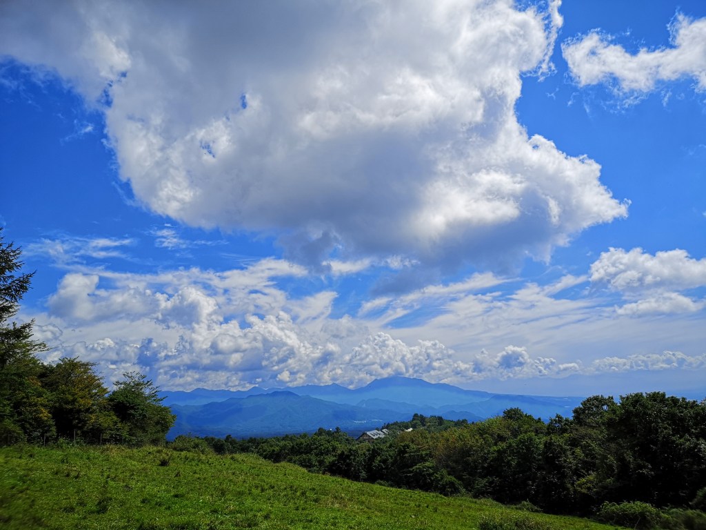
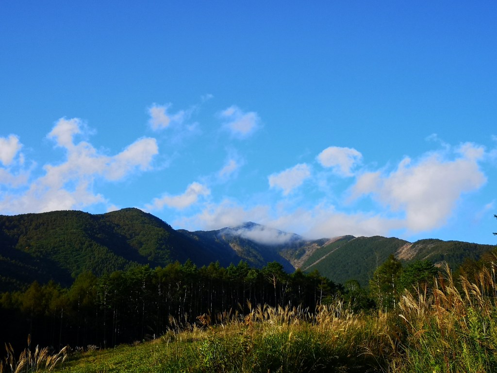
The Oku-Chichibu mountains, in the clouds

Dragonfly taking a break on the top of a signpost
Setting off again, I soon reached wide pastures with a sweeping view of the Oku-Chichibu Mountains, and cows – it’s not often I get to see cows while hiking in Japan. It took me another hour to reach the top of Mt Tennyo (天女山 tennyosan meaning heavenly woman). The view, on the other hand, wasn’t so heavenly and didn’t detain me long. Since there is a bus route and a number of facilities in the area, there were many hikers. However, from then on I had the trail mostly to myself. After a few minutes of climbing I reached a sign for a viewpoint off the main trail. I decided to check it out, but ended up disappointed since trees blocked the view. Probably at one time in the past, it must have been quite spectacular. I retraced my steps, having lost five valuable minutes. The path continued to climb steadily with no end in sight. Since I wasn’t aiming to summit a peak, any meters gained would eventually have to be walked down. It was around this point, that the surrounding forest, a mix of coniferous and deciduous trees, started to get really beautiful.
The Kofu valley with on the left Mt Mizugaki

The “ondanhodo” trail, a pleasant walk through the forest
Eventually I reached the highest point of today’s hike, 1791 meters according to my map, and after a short level bit, I started descending again. This pattern continued for the rest of the hike, although on a smaller scale, as the trail made its way along the natural folds of the mountain. It was tougher than I had imagined but the trail was well-maintained and enjoyable; there were frequent numbered signposts; It made me appreciate the size and complexity of the massive ancient volcano I was walking on. I saw no other hikers and it was very peaceful. There were few viewpoints; I passed another sign of an observatory up a path heading straight up, but decided to skip it since I was still behind (I found out later that there was indeed a view).

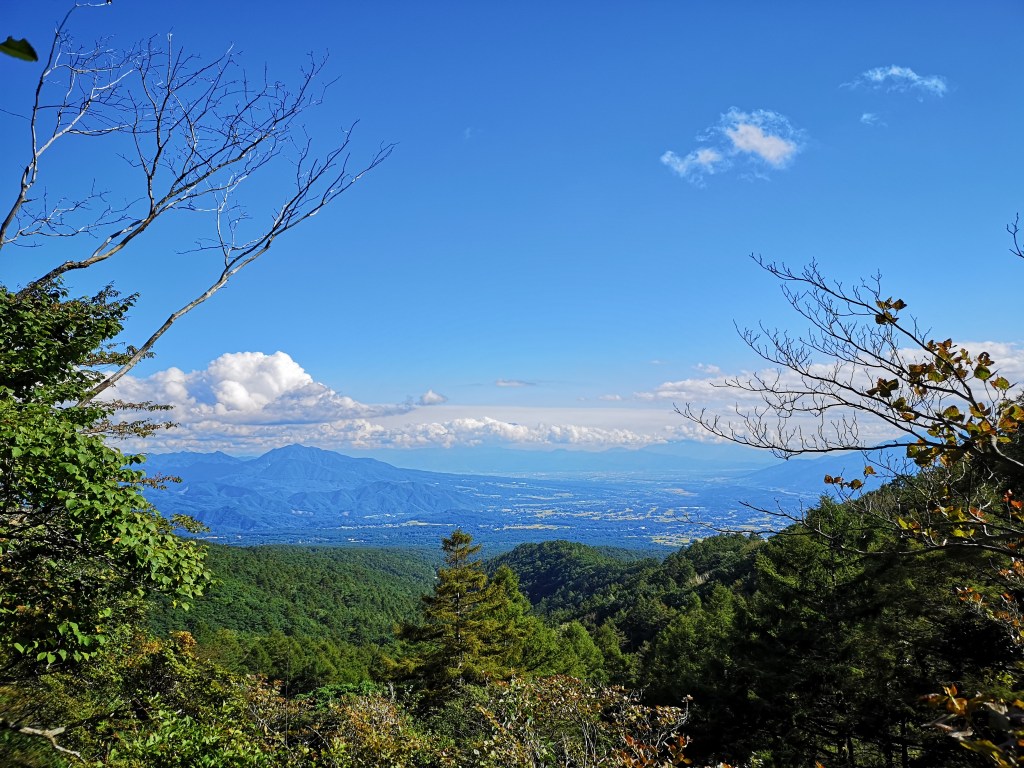
The Minami Alps
Looking back at Yatsugatake
At 2h30, I reached a break in the trees with a nice view Eastwards of Kofu valley. I sat down on the side of the trail and had a late lunch. Mt Fuji was in the clouds with only a part of the summit – still free of snow – visible. Soon after lunch, I reached a detour sign; the trail had collapsed lower down. However, I was grateful for it, as it allowed to avoid one of the many “dips” in the path. At 4pm I reached Samisen Waterfall 三味線滝 (1550m). Here, I turned left, leaving the Yatsugatake “ondanhodo” path, and headed down. The trail soon turned into a narrow paved road with nice views of the South Alps in front, and (part of) Yatsugatake behind. After a good hour of road walking, I reached Kai-Koizumi station a little after 5pm, just in time for the local train back to Kobuchizawa, one stop away. After admiring the dusk view from the the top of Kobuchizawa station, I hopped on the limited express for the two-hour ride back to Tokyo.
Listen to the sounds of Yatsugatake
This section of the path across Yatsugatake turned out to be a beautiful and peaceful hike, even though all the ups and down made it tougher and longer than I had imagined. The second half of the hike had few views, but that’s to be expected when walking the side of the mountain. The trail continues all the way round Yatsugatake – I think this may have been one of the better bits, and the only one that can be done from station to station; I’ll find out by hiking more of it in the future!

