Toryu Valley & Mt Omine (1062m), Chichibu City, Saitama Prefecture, November 2019


Autumn colours along Toryu-Kei

In mid-November, I went on a day-trip to check out the autumn colours in the Oku-Chichibu area. It had been one month since the devastation brought by Typhoon Hagibis, also known as Typhoon #19, and there was a risk that some trails would be damaged or even closed. However, there are many great places to visit in the area, and I was confident I would find somewhere to walk among the autumn leaves.

IMG_20191114_112648

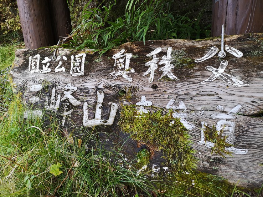
Sign reminding me that I was inside the Oku-Chichibu National Park

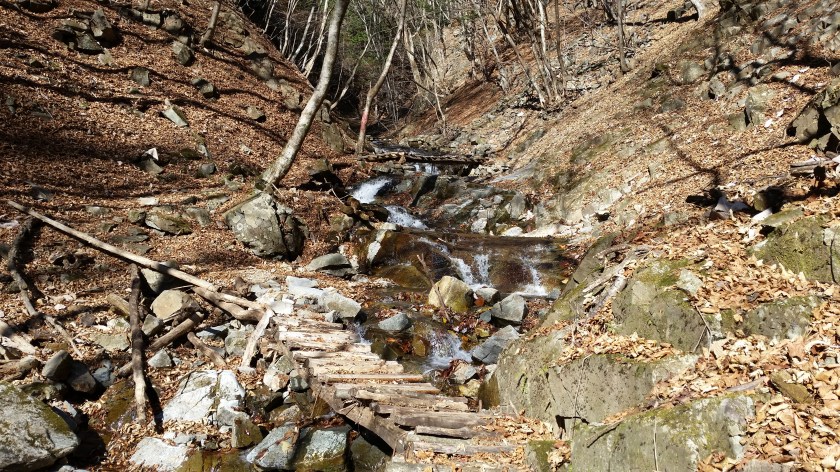
I drove from Seibu-Chichibu station, past Mitsumine-Guchi station, to Toryu Bridge 登竜橋 where I left the car. Past the bridge, it’s possible to walk along the Arakawa river in both directions. I first headed downstream; the path had been partly washed away in several places, and was also obstructed by several fallen trees. Since the path was a dead-end, I quickly gave up, walked back past the bridge, and followed the river upstream.

View from Toryu Bridge

First, I followed a gently climbing road past some ancient gravestones. After a few minutes there was a sign for a trail through the forest on the right. This led back down to the river, round a cliff on a wooden walkway, and finished at Ryumon Waterfall 竜門の滝. I retraced my steps to the start of the wooden walkway, and then followed another path further upstream, a few meters above the rushing river. There was a lot of damage here due to the typhoon. The trail was so washed away, that I soon gave up again. In conclusion, it’s impossible to hike along most of the Toryu valley at the moment. On the way back, I followed the road a little further, and it led to the start of the trail to Mistumine Shrine. Apparently, this trail is open and undamaged.

Entrance to the trail for Mitsumine Shrine

Afterwards, I drove another twenty minutes, past the turn-off for Mitsumine Shrine, all the way to the Irikawa river valley. I was going to leave the car at the Irikawa Camping Ground and explore the river upstream. However, the access road was closed due to typhoon damage, and it wasn’t possible to reach the start of the trail. I had to fallback on plan C: completely avoid river valleys, and drive to nearby Tochimoto Plaza 栃本広場 where I could hike Eastwards along a low ridge sandwiched between two lakes.

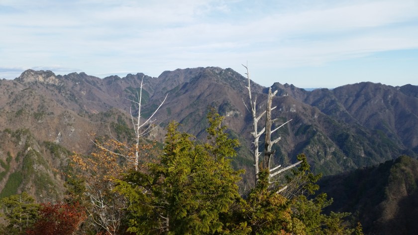
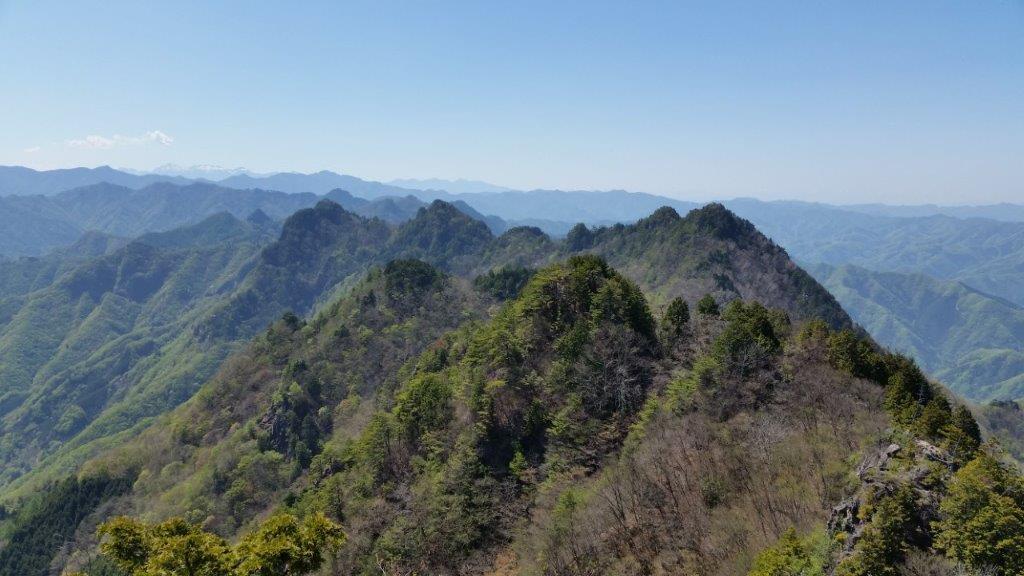
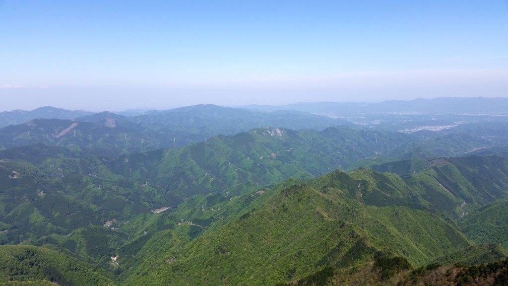
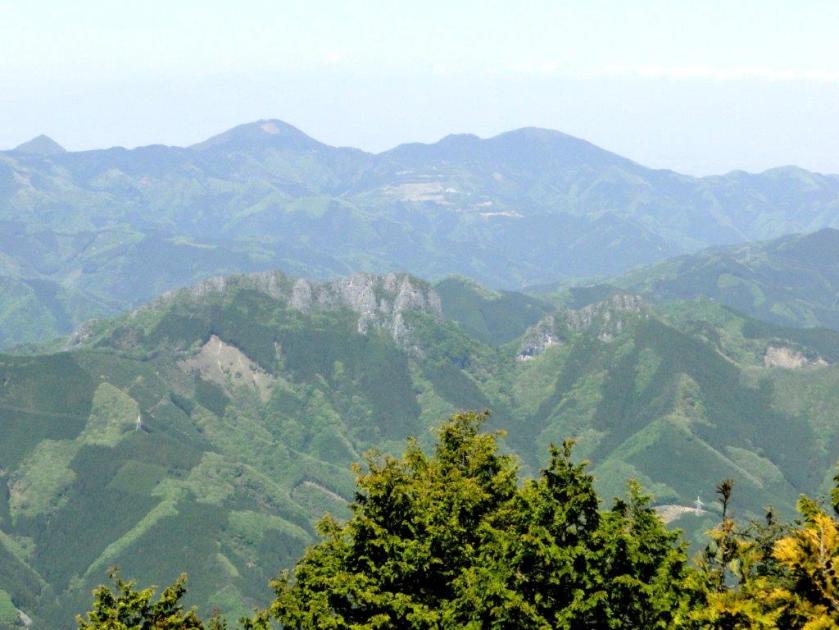
Beautiful autumn colours in “deep Chichibu”

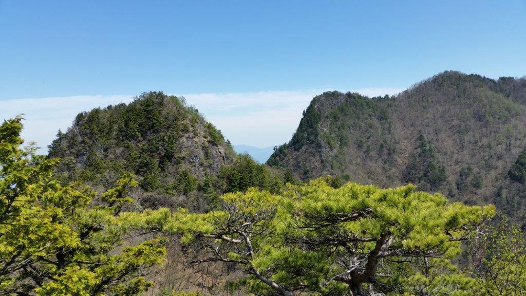
This time I was lucky. The path was easy to hike with no damage at all; the autumn leaves were still at their peak. It took me about thirty minutes to reach the top of Mt Omine 大峰山 completely in by trees. Even the little viewing platform wasn’t high enough to see over them. The path continued along the ridge, but since it was now downhill through a thick cedar forest, and I had get back to the car, I decided not to go any further. Luckily, it was possible to take a slightly different path back, with occasional glimpses of Oku-Chichibu-Momiji lake through the trees.

Easy hiking through the forest

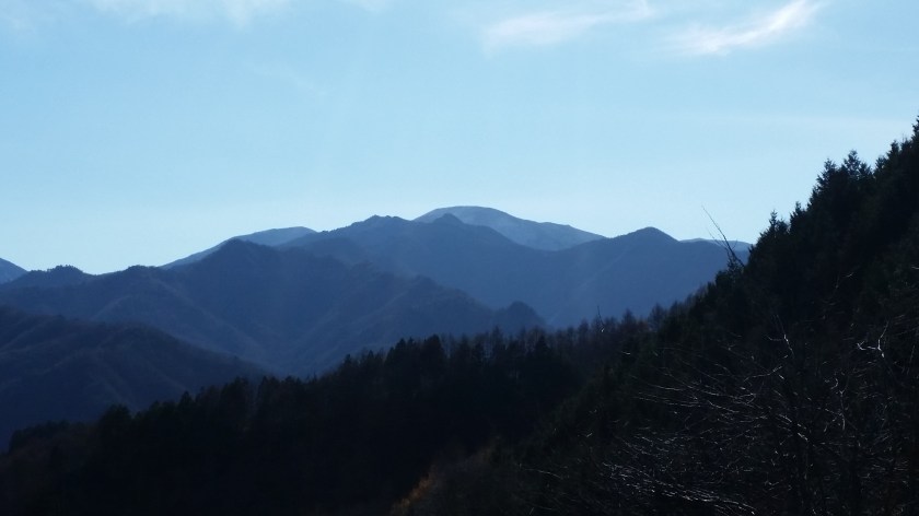
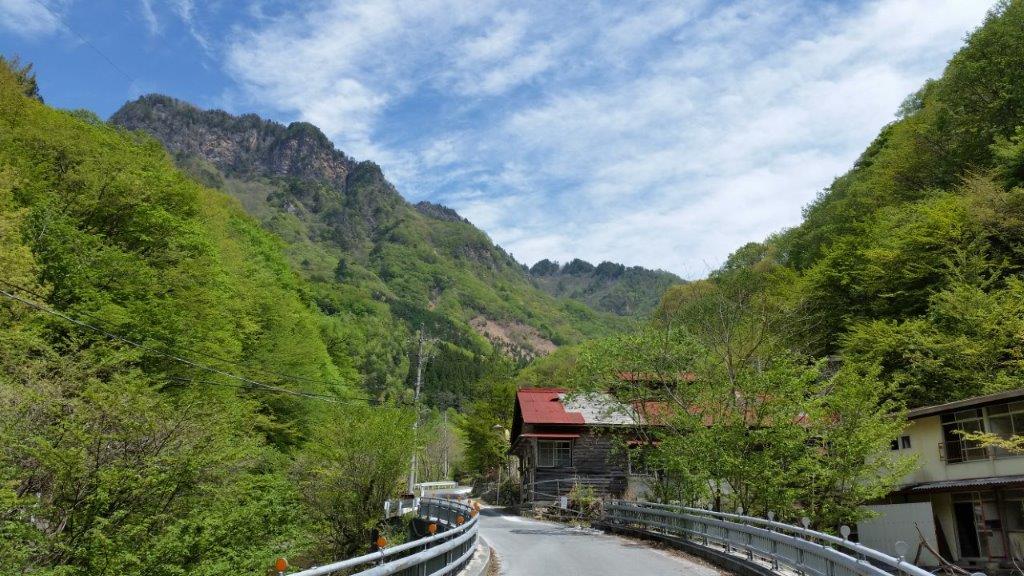
I drove a different way back, following a very picturesque road with good views towards Mt Wanakura. I got back to Seibu-Chichibu station before 4pm where I was able to enjoy a nice hot bath, and taste some local sake inside the station, before taking the brand new and futuristic looking Laview Limited Express train back to Tokyo. After the heavy rains and strong winds that hit the Kanto area last October,  I think that most hiking trails in Tokyo, Saitama and Tochigi prefecture are still hikable, except the ones following river valleys. Those ones may be closed for a while, but hopefully they’ll be restored sometime in the future.

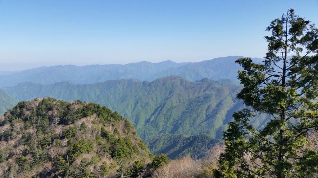
View of Mt Wanakura in the late afternoon
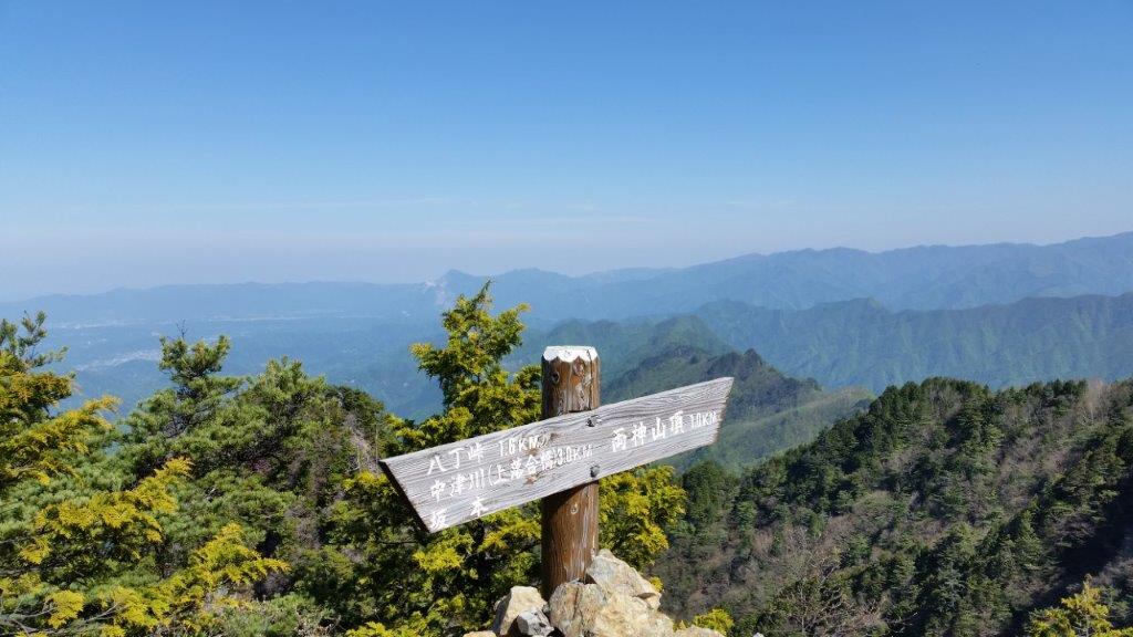
The Furthest Mountain, Mt Nanten (1483m), Chichibu City, Saitama Prefecture, Saturday November 25, 2017

20171125_135627

Hiking in the Chichibu Mountains 秩父山地

Less than 100km away from the capital as the bird flies and smack in the middle of the Oku-Chichibu mountains of Saitama prefecture, lies Mt Nanten 南天山 1483m. Despite its relative closeness, accessing the start of the trail requires patience and a desire to explore new places.

Last Saturday, I rose at 6h30, got a seat on the Seibu line Red arrow limited express leaving around 7h30 from Ikebukuro station, hurried to catch the transfer to the Chichibu railway in the Seibu-chichibu station and got off at the last station, Mitsumineguchi at about 9h15.

Unfortunately the bus connection wasn’t ideal and I had to potter around for 45 minutes for the bus for Nakatsugawa 中津川, also the last stop and one hour away, making my arrival time a little past 11am. However I wasn’t there yet. I still needed to walk 30 minutes along a road which eventually turned into a dirt road, till I finally got to the entrance of the mountain trail, leading up a small river valley cleaved into the side of the mountain.

20171125_123044
The path crossed a stream several times over narrow wooden bridges

After removing my inner layer, fixing my bear bell onto my bag and having a quick bite, I was officially ready to start up the mountain, a little before noon or nearly six hours after getting up. Fortunately, unlike my previous trip the week to Okutama the week before, the further I progressed the less people there were – just one other passenger on the bus who got off before the end. This was probably because the autumn leaves season was already over.

20171125_130744
First views of the highest peaks of the Okuchichibu Area

The valley I walked up following a small stream was one of the most beautiful I’ve ever seen. I could only imagine what it must look like in the spring or the autumn. There was a fair amount of stream crossing along fairly new wooden bridges and the path goes up and down the side of the valley, making for a good warmup. Halfway up the valley, I came upon the spectacular Hojirushi waterfall 法印の滝. Even if you don’t climb to the top, it is well worth walking 20 minutes to check it out.

20171125_121912
The Hojirushi waterfall along the Kamakura River

Twenty minutes further upstream, a zigzagging easy to walk path on the left takes you up to the top ridge where you progressively make your way to the highest point. The last part gets rather rocky and feels rather wild – hard to believe that you are in Saitama, especially when you reach the top and see nothing but mountains in all directions. Directly opposite one could see the massive bulk of Mt Ryokami and in the background Mt Asama already covered in snow,

I headed down a little after 2pm down another zig-zagging path and then joined up with the previous stream valley and legged it back to the road. I was able to take a quick bath before getting on the return bus a little after 4pm. This bus, the last one of the day, took me directly to Seibu Chichibu station in about 90 minutes where after a thirty minute wait, I got the next Red arrow limited express back to Ikebukuro, arriving at 8pm, taking me only a little less time than on the way there.

20171125_135325
The summit marker of Mt Nanten with Mt Ryokami in the background

Enjoy the contrast between the rushing water and the silent summit


Mt Myoho (1332m), Chichibu City, Saitama Prefecture

The starting point for this hike was Mitsumine Shrine, a place I had visited a few times before, but had never really taken the time to explore. Since today’s hike was relatively short, I first took some time to check out the Mitsumine visitor center, one of the starting points for visiting the Chichibu-Tama-Kai National Park. It was a pleasant surprise – I found the displays of mounted animals and the model relief of the area particularly interesting.

View of Mt Wanakura (also known at Mt Shiroishi and climbed in 2018) from Mitsumine Shrine

After spending nearly an hour at the visitor center, I hurriedly set off along the hiking path up Mt Kumotori. The autumn colours were at their peak, and since it was a weekday, I had them mostly to myself. Very soon I reached the turnoff for today’s mountain, located on a small ridge branching left off the main ridgeline. In less than an hour, I reached the small shrine at the top of Mt Myoho 妙法山, from where I got some great views of Oku-Chichibu, with Mt Ryokami in the center.

View of the jagged peak of Mt Ryokami from the summit

After lunch, I headed back to the shrine, and since it was still early in the day, I took some time to check out the shrine grounds – it was beautiful with all the autumn colours. At the back, there was a spectacular view of the mountain I had just climbed as well as Chichibu city.

Good views from the trail heading down from Mt Mitsumine shrine

Afterwards, I located the hiking path leading down the mountain. Although there were a number of people at the shrine, no one seemed interested in hiking down, so once again, I had the path entirely to myself. Unfortunately, it wasn’t possible to hike all the way down to the train station, and the path ended up on the road, from where I caught an express bus back to Seibu-Chichibu station.

Mt Ryokami (1723m), Ogano Town, Saitama Prefecture, Tuesday, May 5 2015 [Hatcho Ridge Route / Map Available]

I had first climbed this mountain in early December 2009; I went up the Hinata-oya route on a beautiful autumn day and enjoyed some great views from the peak. In May 2014, I was invited by a friend to climb it again using the Shiroisazu route. We obtained permission in advance to use this trail, as it goes through private land; however, this time the weather was poor, and we turned back before reaching the exposed, rocky summit. I decided to give it another try the following year, but I wanted to try a different route. Looking at my map, I saw that by walking two hours along a small road, I could traverse from Hatcho Pass to Hinata-oya. The weather was supposed to be good all day, perfect for a long hike along a rocky ridgeline. It would be a success as long as I managed to catch the last bus back from Hinata-oya. I was looking forward to reaching the top for a second time and getting some great views of the Oku-chichibu area.

Hiking in the Chichibu-Tama-Kai National Park

秩父多摩甲斐国立公園

Download a map of the Mt Ryokami hike

This map was developed for Japanwilds with the Hokkaido Cartographer

Find more Japan hiking maps on Avenza

The Hatcho Ridge in Spring

View from Higashi-dake

On a sunny spring morning, I rode the limited express from Ikebukuro to Seibu-Chichibu station, where I switched to the bus for Nakatsugawa. I got off a few stops before the end of the line and, after passing through a short tunnel, followed a road up a green valley next to a small river. Directly ahead, I could see rocky cliffs forming the summit of Mt Akaiwa (赤岩岳).

The ruins of the Nichitsu mine village

Mt Akaiwa from the approach to Hatcho pass

An hour after setting out, I passed the spooky, abandoned houses of the Nichitsu mine village (日窒鉱山), one of the many “haikyo” or urban ruin spots in Japan. I had heard about it before and was glad I had an opportunity to check it out in person. I found the start of the trail at a bend in the road and, just past noon, reached the top of Hactcho pass (八丁峠) and the start of the Hatcho Ridge route (八丁尾根コース).

First views from Hatcho ridge

The big dip between the Nishi and Higashi peaks

Before long, I was getting some fantastic views: northwards, I could see Nishi-joshu, the mountainous area of western Gunma; southwards I was looking at the highest peaks of the Chichibu-Tama-Kai national park; to the west was Yatsugatake, still covered in snow; straight ahead lay the impressive Hatcho ridgeline, leading to the summit. At 1h30, I reached the top of Nishi-dake (西岳 1613m).

Looking north towards the Nishi-Joshu area of Gunma

The steep climb up Nishi-dake, the rocky sections fitted with chains

From here, the trail made an huge dip and then rose again, passing numerous steep rocky sections, fitted with chains for safety. Since it was a long hike, I tried to keep a good pace and was lucky that there were few people on the same route that day. A little before 2h30, I reached the top of Higashi-dake (東岳 1660m), only slightly higher than the previous peak, but demanding quite an effort.

Northwest, Yatsugatake and Asamayama visible in the distance

Looking back at the route hiked so far

Looking north, was like seeing the view from a plane: I could look down on the the rocky summit ridge of Mt Futago half a kilometer below; looking east was the pyramid top of Mt Buko, with Chichibu city spread out at its feet; looking up was blue sky, not a cloud in sight. Even though the elevation was only half of the highest peaks of the Japanese Alps, it felt like alpine trekking, an impression reinforced by the steep rocky slopes covered in pine trees.

A bird’s eye view from the top of Higashi-dake

The striking shape of Mt Daikigi

I took a break on the single bench placed on the narrow summit, and enjoyed the view of the nearby, pillar-shaped Daikigi (大キギ). I soon set off again, and at 3pm, I was standing on the top of Mt Ryokami (両神山 りょうかみさん ryokami-san), a 100 famous mountain of Japan. I was happy to be standing on the top again, and with better weather than the first time round.

On the left, the mountains of Okutama

Westward view from the top of Mt Ryokami

From the summit, I now had great views to the south, including the massive Mt Wanakura; in the opposite direction, I could see the faint outline of Mt Asama, 50 kilometers away; much closer to me was the long ridgeline that had taken nearly 3 hours to traverse. I wanted to enjoy the views some more but I had to move on right away if I wanted to catch my bus.

It was the perfect weather for this hike

A photo of the private shiroisazu route from the previous year

I descended the mountain at a swift pace along the familiar route and arrived at the bus stop a little after 5pm, just as the valley was being engulfed in shadows. I sat down on the bus seat, tired but relieved, and got off at the nearby Yakushi no yu hot spring for a quick bath. Refreshed, I then caught the last bus for Seibu-Chichibu station where I hopped on the limited express for the 80 minute ride back to Ikebukuro.