I had first climbed this mountain in early December 2009; I went up the Hinata-oya route on a beautiful autumn day and enjoyed some great views from the peak. In May 2014, I was invited by a friend to climb it again using the Shiroisazu route. We obtained permission in advance to use this trail, as it goes through private land; however, this time the weather was poor, and we turned back before reaching the exposed, rocky summit. I decided to give it another try the following year, but I wanted to try a different route. Looking at my map, I saw that by walking two hours along a small road, I could traverse from Hatcho Pass to Hinata-oya. The weather was supposed to be good all day, perfect for a long hike along a rocky ridgeline. It would be a success as long as I managed to catch the last bus back from Hinata-oya. I was looking forward to reaching the top for a second time and getting some great views of the Oku-chichibu area.
Hiking in the Chichibu-Tama-Kai National Park
秩父多摩甲斐国立公園
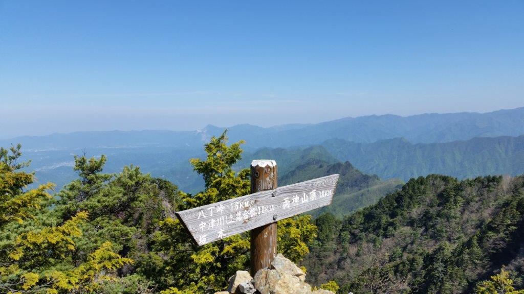
Download a map of the Mt Ryokami hike
This map was developed for Japanwilds with the Hokkaido Cartographer
Find more Japan hiking maps on Avenza

The Hatcho Ridge in Spring

View from Higashi-dake
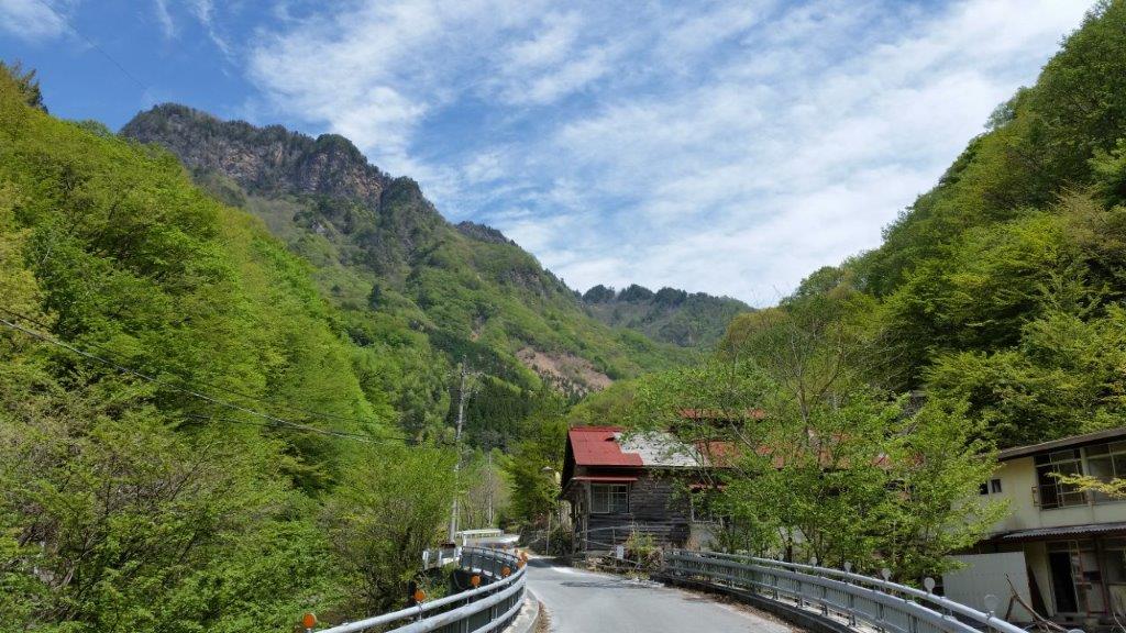
On a sunny spring morning, I rode the limited express from Ikebukuro to Seibu-Chichibu station, where I switched to the bus for Nakatsugawa. I got off a few stops before the end of the line and, after passing through a short tunnel, followed a road up a green valley next to a small river. Directly ahead, I could see rocky cliffs forming the summit of Mt Akaiwa (赤岩岳).
The ruins of the Nichitsu mine village

Mt Akaiwa from the approach to Hatcho pass
An hour after setting out, I passed the spooky, abandoned houses of the Nichitsu mine village (日窒鉱山), one of the many “haikyo” or urban ruin spots in Japan. I had heard about it before and was glad I had an opportunity to check it out in person. I found the start of the trail at a bend in the road and, just past noon, reached the top of Hactcho pass (八丁峠) and the start of the Hatcho Ridge route (八丁尾根コース).

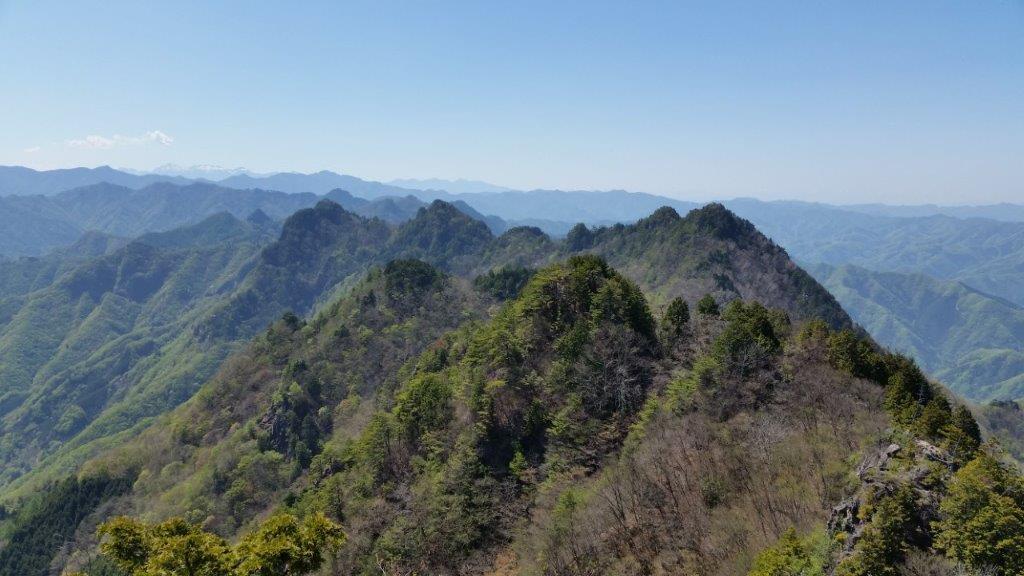
First views from Hatcho ridge
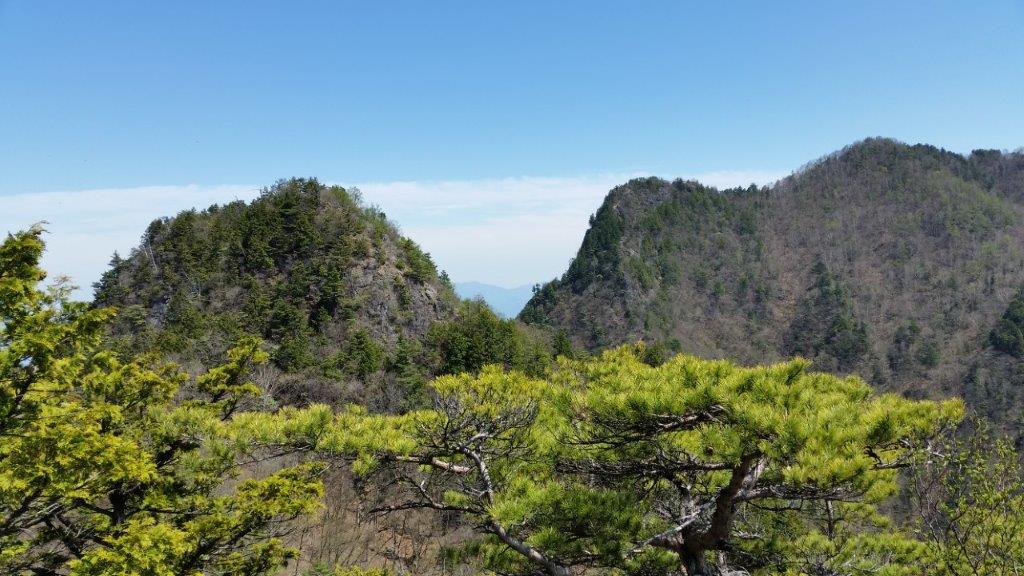
The big dip between the Nishi and Higashi peaks
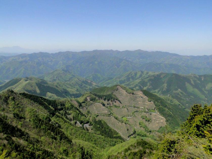
Before long, I was getting some fantastic views: northwards, I could see Nishi-joshu, the mountainous area of western Gunma; southwards I was looking at the highest peaks of the Chichibu-Tama-Kai national park; to the west was Yatsugatake, still covered in snow; straight ahead lay the impressive Hatcho ridgeline, leading to the summit. At 1h30, I reached the top of Nishi-dake (西岳 1613m).

Looking north towards the Nishi-Joshu area of Gunma

The steep climb up Nishi-dake, the rocky sections fitted with chains
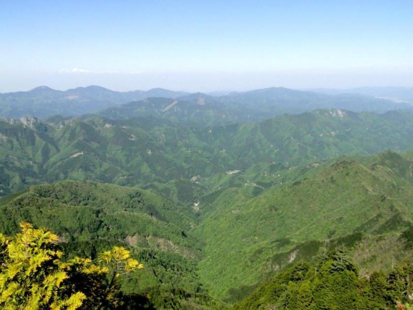
From here, the trail made an huge dip and then rose again, passing numerous steep rocky sections, fitted with chains for safety. Since it was a long hike, I tried to keep a good pace and was lucky that there were few people on the same route that day. A little before 2h30, I reached the top of Higashi-dake (東岳 1660m), only slightly higher than the previous peak, but demanding quite an effort.

Northwest, Yatsugatake and Asamayama visible in the distance
Looking back at the route hiked so far
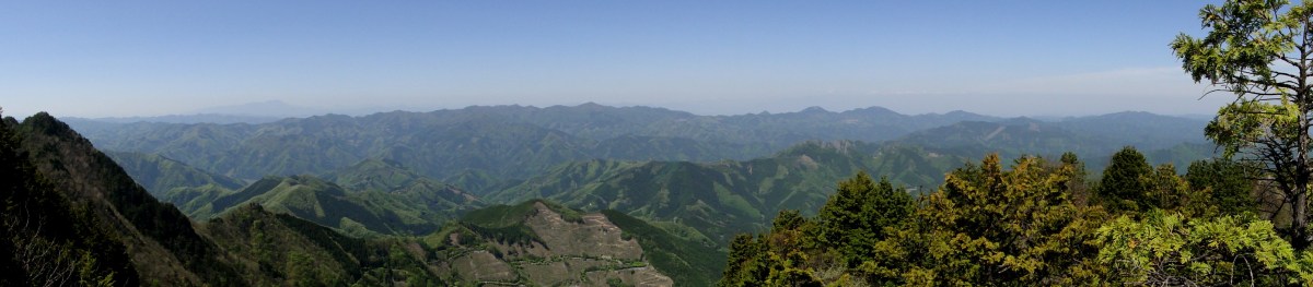
Looking north, was like seeing the view from a plane: I could look down on the the rocky summit ridge of Mt Futago half a kilometer below; looking east was the pyramid top of Mt Buko, with Chichibu city spread out at its feet; looking up was blue sky, not a cloud in sight. Even though the elevation was only half of the highest peaks of the Japanese Alps, it felt like alpine trekking, an impression reinforced by the steep rocky slopes covered in pine trees.
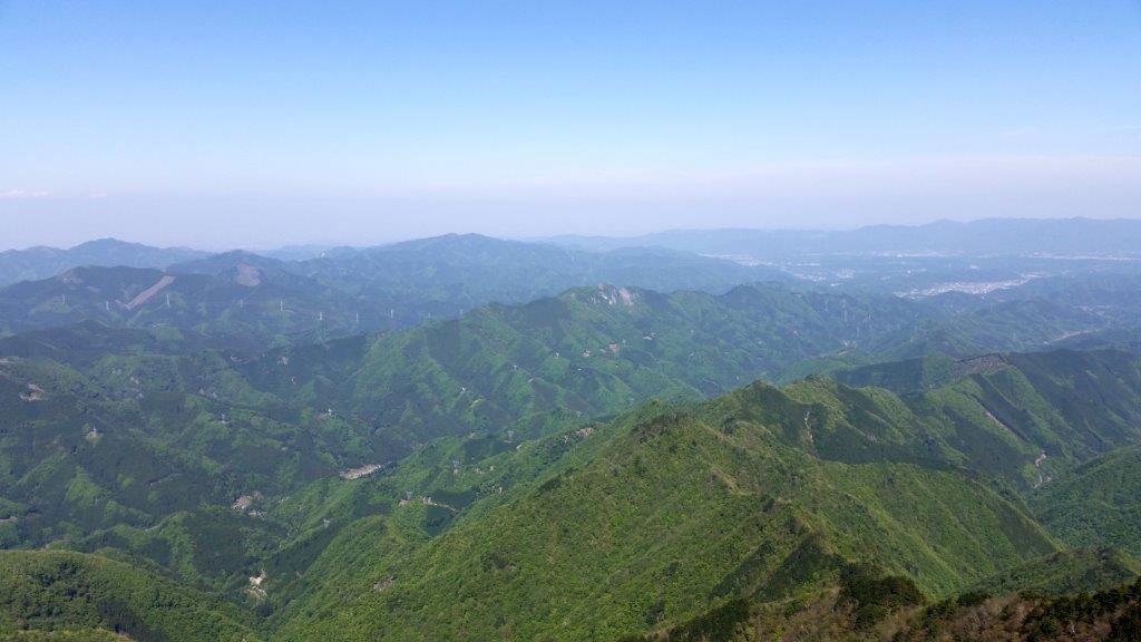
A bird’s eye view from the top of Higashi-dake

The striking shape of Mt Daikigi
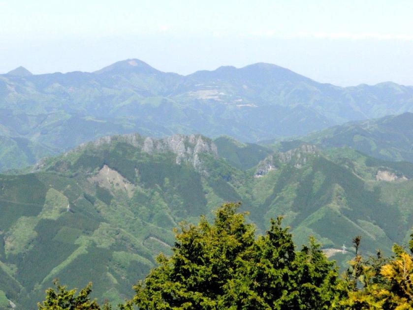
I took a break on the single bench placed on the narrow summit, and enjoyed the view of the nearby, pillar-shaped Daikigi (大キギ). I soon set off again, and at 3pm, I was standing on the top of Mt Ryokami (両神山 りょうかみさん ryokami-san), a 100 famous mountain of Japan. I was happy to be standing on the top again, and with better weather than the first time round.

On the left, the mountains of Okutama

Westward view from the top of Mt Ryokami
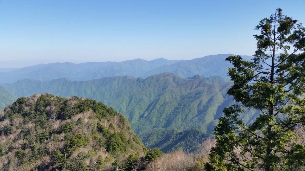
From the summit, I now had great views to the south, including the massive Mt Wanakura; in the opposite direction, I could see the faint outline of Mt Asama, 50 kilometers away; much closer to me was the long ridgeline that had taken nearly 3 hours to traverse. I wanted to enjoy the views some more but I had to move on right away if I wanted to catch my bus.
It was the perfect weather for this hike

A photo of the private shiroisazu route from the previous year
I descended the mountain at a swift pace along the familiar route and arrived at the bus stop a little after 5pm, just as the valley was being engulfed in shadows. I sat down on the bus seat, tired but relieved, and got off at the nearby Yakushi no yu hot spring for a quick bath. Refreshed, I then caught the last bus for Seibu-Chichibu station where I hopped on the limited express for the 80 minute ride back to Ikebukuro.