I climbed these two mountains almost 7 years ago. Back then, the weather had been overcast and so I was hoping to get some better views this time. With a starting point above 1500 meters, it seemed like the ideal place to escape the relentless summer heat. Finally, I was betting that the long access via a winding mountain road would thin the holiday crowds. Since it was on the short side, I decided to combine it with a pre-hike soba lunch at Kamikoji and a post-hike hot spring bath at Hakusan Onsen.
To get to the start of the hike, I’d ride the Chuo line limited express from Shinjuku to Kofu, and then drive a share car to the parking lot near the trail entrance. The weather was supposed to be sunny, turning cloudy in the afternoon; temperatures would be over 30° in the Kofu basin but about 20° in the mountains. I hoped I’d be able to do everything I’d planned for the day and that I’d get a view of Mt Fuji, although my chances were slim according to the When to See Mt Fuji site.
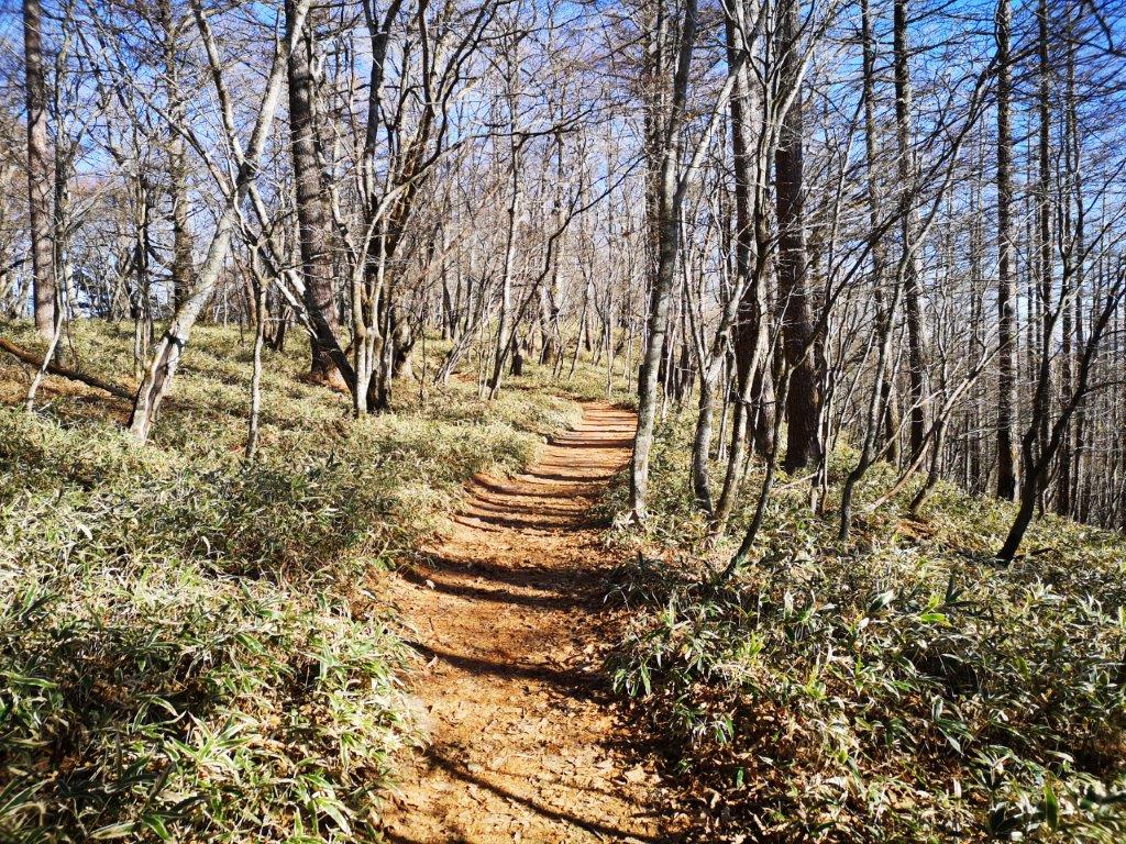
Walkway near the Summit (left) Trail past Mt Amari (right)
Near the End of the Hike (left) Blue Sky at the End of the Day (right)
Thankfully it was a short walk, mostly in the shade, from the Station to the share car. After a one-hour drive, I arrived at Kojiro (上小路) at 1pm, where I enjoyed a delicious zaru-soba with a side of tempura. The onsen for the return was right next to the soba restaurant so it’d be easy to find. At 2pm, I got back behind the wheel, and half an hour later, pulled into the Hirogawara parking lot (広河原駐車場 1643m). I saw few cars meaning I could expect few people on the trail. It felt hot under the sun while I got ready, perhaps another reason for the nearly deserted parking area.
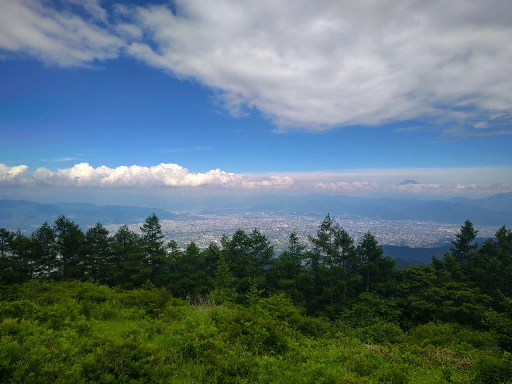
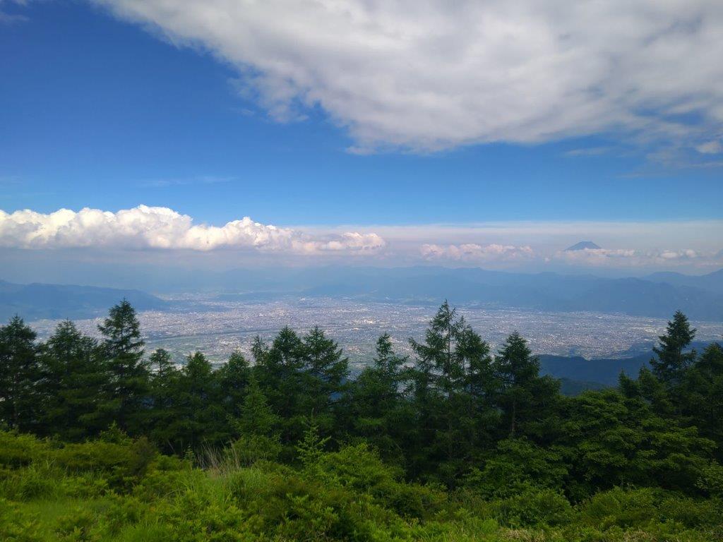
View of the Kofu Basin and Mt Fuji from the Start of the Hike
Trail past the Open Shelter
I felt more comfortable once I started up the trail, tall trees providing welcome shade. Very soon, I arrived at an open shelter, “azumaya“, with a view of the Kofu basin to the north; on the east side was the summit of Mt Fuji poking through the clouds. It was a pleasant surprise since being far away had actually increased my chances of seeing Japan’s most famous mountain. It was already past 3pm so after enjoying the view, I set off again. A short, easy climb up some log steps brought me to a plateau with wooden walkways, a spot famous for its pink Rhododendron (“tsutsuji“) in June. However in mid-July, I found myself walking through green bushes, another reason for the lack of people.
Log Steps leading to the Rhododendron Plateau
Just Green Bushes in this Season
I suddenly felt a cool breeze in this open space. Directly ahead was Mt Houou, a hundred famous mountain, dark clouds appearing from behind and threatening to invade the whole sky. I stepped up the pace, wondering if rain might follow. After another short climb, I arrived at the top of Mt Amari (甘利山 あまりやま amari-yama), a 100 famous mountain of Yamanashi, my second time there. I had a wide view of the Kofu Basin surrounded by the Oku-Chichibu mountains. In the foreground was the plateau I had just crossed, neatly divided in two by the walkway. After a short break, I continued my hike. A little descending, brought me to the start of a switchback trail leading up the steep mountain side.
View of the Plateau and its Walkway
Blue Sky on the Trail for Mt Okuamari
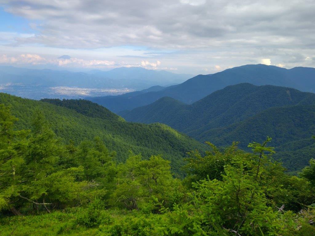
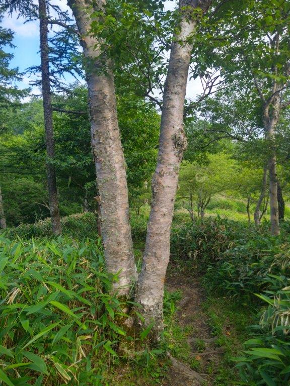
As I gained altitude, I often turned around to admire the views to the south, now including the rounded top of Mt Amari, its north side covered in forest, as well as Mt Kushigata. Here and there, I spotted the pale trunk of an Erman birch, “dakekanba“, which mostly grows above 1500 meters. Looking up, I was glad to see mostly blue sky, the thick grey clouds seemingly confined to the nearby South Alps. Just before 4pm, I turned right at in a fork in the trail, and a few minutes later, arrived at the top of Mt Okuamari (奥甘利山 おくあまりやま okuamari-yama) for the second time. It was surrounded by trees except on the southeast side where I had a view of Mt Fuji, almost completely hidden by clouds.
The Gentle Outline of Mt Kushigata
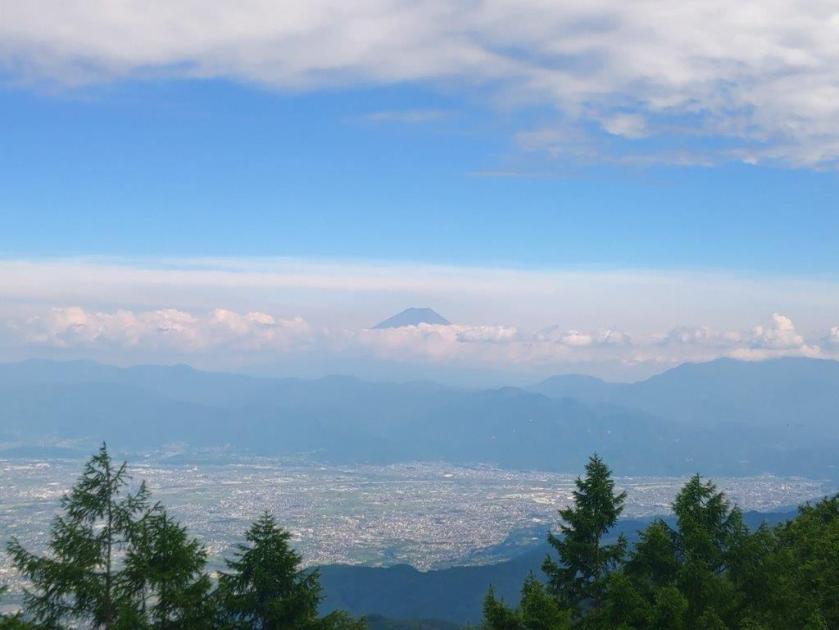
Mt Fuji Disappearing behind the Clouds
After observing a ladybug toddle along the top of a log seat, I headed back to the fork: the left branch continues t0 the next peak, Mt Sentoboshi (千頭星山 2138m), also a 100 famous mountain of Japan, about an hour uphill. I had climbed it back in 2015, and had no desire to visit it again, since it was completely in the trees. Thirty minutes later, just before the summit of Mt Amari, I turned left onto an alternative trail back to the parking. I headed down a grassy path, stopping once to observe a daddy long-legs spider sitting upside down on a tree branch and a second time to check out some bright green “old man’s beard” lichen hanging from the branches of a larch. At 5pm, I arrived back at the parking after a satisfying two hour and a half hike.
Looking back at Mt Amari
Trail near the End of the Hike
I was tempted to hang around to enjoy the now cool mountain air and see the night view of the Kofu basin but I felt it would be wiser to head back while there was still daylight. Half an hour later, I reached Hakusan Onsen (白山温泉). After a relaxing bath, I drove back to Kofu where I boarded the limited express for the 90-minute ride back to Shinjuku. It’d be nice to return one day to see the tsutsuji in full bloom, especially since a seasonal jumbo taxi runs from Nirasaki station to the parking lot. I’d also like to stay in at the Mt Amari Green Lodge (甘利山グリーンロッジ) to see the night view.
This is a mountain that I’ve wanted to climb since I saw it from the top of Mt Amagoi last year; although it’s quite a bit lower, its white summit caught my eye. I found out that by taking a bus from Nirasaki sation on the Chuo line, I could get quite close to the start of the hiking trail and could use the same bus for the return. The trail seemed straightforward: up and down the same way, without any steep sections. The weather was supposed to be sunny but cold. If I had enough time, I would also try to visit the nearby Ojiragawa ravine. Although the autumn colours would be past their peak, I was looking forward to doing a new hike in the Minami Alps.
After a comfortable ride on the Chuo line limited express, I arrived at Nirasaki station around 8h30. I was the sole passenger on the bus and got off at the Hakushu roadside station (白州道の駅) a little before 9h30. I walked along a straight road heading towards the Minami Alps at a right angle, and noticed that snow had fallen on the highest peaks. I finally reached the start of the hiking trail around 10h30.
Some autumn leaves could still be seen at the start of the trail
The trees near the upper part of the trail were completely bare
Most of the leaves had already fallen and the path was a patchwork of colors. The lower part of the trail had many intersections but the way to the top was always clearly signposted; the higher part zigged-zagged up the mountain side through a forest of bare larch trees. At noon, I had a view of Mt Fuji to the east through the bare branches. Although it was a sunny day, the wind felt bitterly cold, and I took a short break to add a layer of clothing.
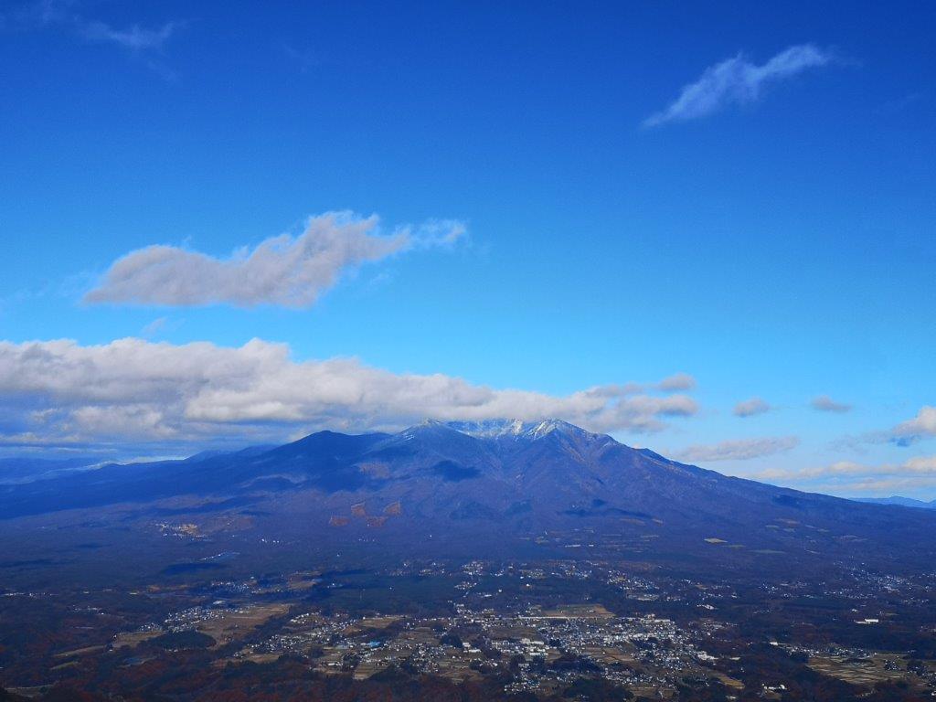
Mt Yatsugatake with the first snow of the season
A beautiful but cold day
At 12h30,I reached a level section within the forest. At the edge of the trees on the west side, I found the summit marker for Mt Hinata (日向山 ひなたやま hinata-yama meaning facing the sun), a Yamanashi 100 famous mountain. Directly ahead I could see the long ridge leading to the summit of Mt Amagoi. North was the extensive bulk of Yatsugatake with a fresh layer of snow, its highest peaks hidden in the clouds. Walking south along the sandy summit, I could admire the dramatic rocky peak of Mt Kaikoma, popping in and out of the clouds.
Mt Kaikoma, one of the highest peaks of the South Alps
The summit has a good view of Mt Fuji
I walked as far as I dared along the ridge before turning back. On the east side, I could see the elongated profile of Mt Hou, as well as Mt Fuji in its winter cap. The sandy summit was buffeted by strong gusts of icy wind forcing me to retreat into the cover of the trees. After a quick lunch, I started to head down at 1h30. It soon felt much warmer and I could remove a layer of clothing. I walked down the same way and reached the base of the mountain before 3pm.
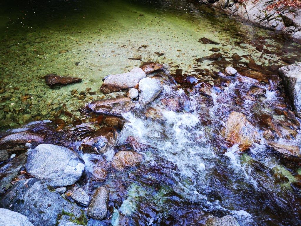
The light green colour of Senga Pool
The pool leads into the fast-flowing Ojiragawa river
It was still early so I had time to quickly check out Ojiragawa Keikoku (尾白川渓谷 ojiragawa-keikoku). I went only as far as Sen-ga-buchi (千ヶ淵) and back. I was impressed by the green colour of the pool at its base. The trail continued further up the valley, and I hope one day to hike it in its entirety. On the way back to the bus stop, I dropped by Ojira no yu hot spring at 4pm for a quick hot bath. Once back at Nirasaki station, I boarded the limited express for the two-hour trip back to Tokyo.
See the sands of Mt Hinata and the turbulent waters of the Ojira river
As the weather becomes hotter and humid, I need to find higher and higher places to go hiking. This also means traveling further from Tokyo, since I have already climbed the highest peaks close to the capital. I had never heard of this Yamanashi 100-famous mountain 140 km West of Tokyo in the Minami Alps, till I saw it listed on a website about Yamanashi prefecture (I was researching river walks). My previous visit to the area was in November 2018 when I climbed Mt Nyukasa, about 10 km to the North.
As usual, access was a bit of a headache; in the end I decided to take a train to Nagasaka station on the Chuo line, then take a taxi from there to the trail entrance, next to the Hakushu Village campsite; other options would have been too long for a daytrip. According to my map, the hike was about 6 hours; since I hadn’t recovered my hiking legs yet, I was curious whether it would be as easy as it seemed. Also, since it was the middle of the rainy season, I wasn’t sure whether I would get any good views.
View of the Minami Alps on the way to the trailhead
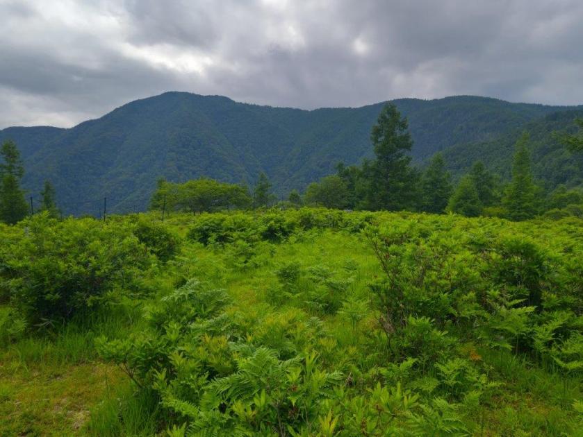
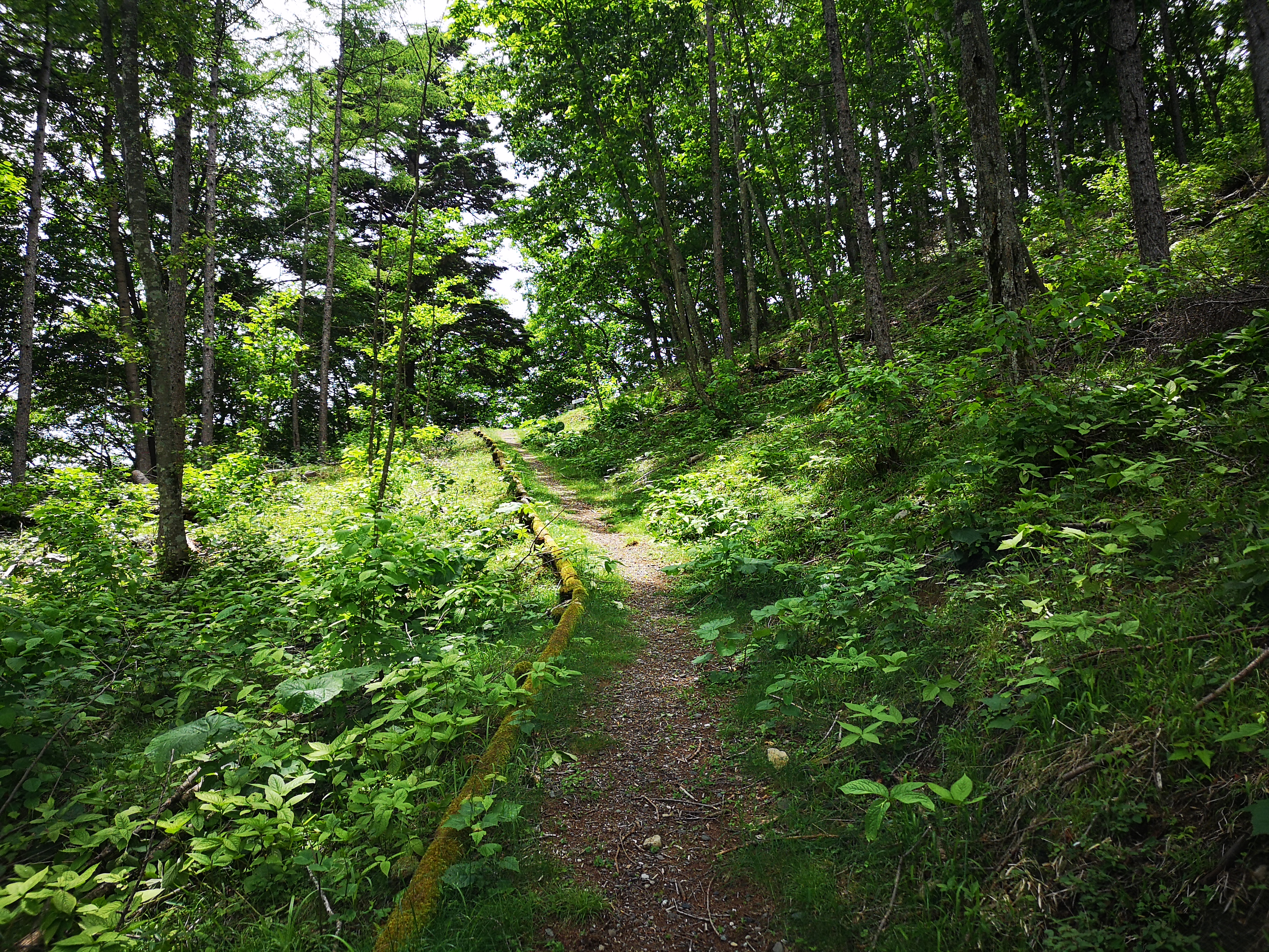
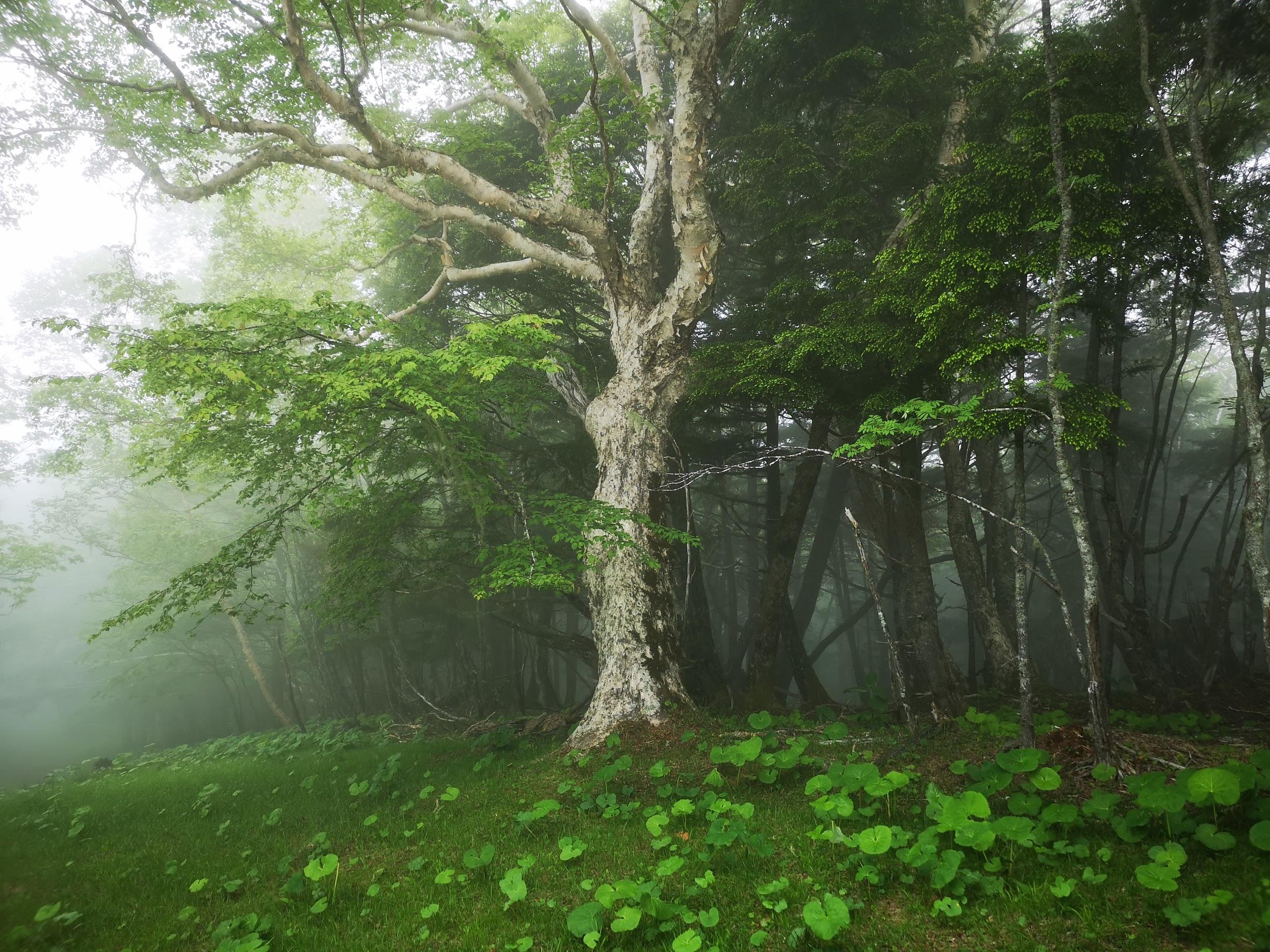
The forest is beautiful this time of the year
The taxi dropped me off right at the trail entrance at 10am, after a long winding drive up a narrow mountain road. I was surprised to see how lush and green the surrounding vegetation was; definitely worth risking a little rain, although today the sun was shining. The start of the trail gently wound up the side of the mountain, packed earth beneath my boots, the rare steep sections offset by low wooden steps. It was very peaceful. The temperature was on the warm side, but since there was no hard climbing, I didn’t break a sweat.
An easy to hike trail going up
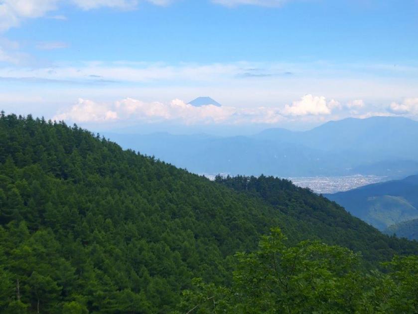
First views of Mt Kaikoma (right) and Mt Hou (left)
Around noon, I got my first views to the South of Mt Kaikoma and Mt Hou, two “hyakumeizan” in the Minami Alps. Slightly to the left, I could make out the triangular outline of Mt Fuji, nearly 70 km away. Much closer, and lower, was the white sandy top of Mt Hinata which I have yet to climb (it had the river valley I was researching). I took a short break and had the first half of my lunch, before setting off again. The trail now alternated climbing and level parts. I had some more views, this time to the East of the Oku-Chichibu mountains. I passed several groups walking down; it seems many people drive to the campsite and just walk up and down the same way.
Some level hiking – are we getting close to the summit?
Mt Kaikoma through the trees
During the climb, I couldn’t see the summit at all, and apart from a stream halfway up, there were no landmarks to tell me how far along I was. Suddenly, at 1pm, I reached the top of Mt Amagoi (雨乞岳 あまごいだけ). There was one other hiker, who left soon after I arrived. I had good views East and South, the Yamanashi side, but the Nagano side was hidden by the trees. Descending a little bit on the other side, I was able to make out Yatsugatake on the left side. While having some lunch sitting on a fallen tree, it was so peaceful that a deer wandered closeby, but ran off immediately after spotting me (I still got a photo).
Hello my dear!
Opposite, the Oku-Chichibu mountains
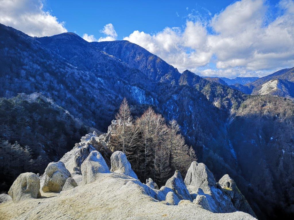
The weather had now turned cloudy, and it felt cool above 2000m. I started to head down after 1h30, along a very steep slope – I was glad I hadn’t climbed this way! At 2pm, the path flattened and led me to a T junction. To the right, it was a short roundtrip to a place called Suisho Nagi 水晶ナギ, a place where crystal used to be mined. In less than 15 minutes I emerged onto an impressive narrow sandy and rocky ridge with surrounded by green forested mountains. I couldn’t see any sign of civilisation, and I felt like I was exploring a new world.
On the right Mt Nokogiri, a 200-famous mountain next to Mt Kaikoma
Going down was also easy (except the bit near the top)
It was getting late so I quickly made my way back to the main trail. From here the path was easy to walk, although there were no more views. It took me an hour and a half to reach the road at the end of the trail, where there is a shrine called Sekison 石尊神社 accessed via a long steep staircase. It was a 20 minute walk to the bus stop opposite a 7/11/ from where I caught a bus around 17h30 for Nirasaki station. Closeby was the Hakushu whisky brewery, normally open to visitors but now closed due to the pandemic. I ended walking nearly 6 hours, and I definitely felt it the next day, although I was glad that I had clear weather and great views!
This is another mountain that was on my must-climb list for ages, in an area relatively close to Tokyo that I had never been to before, between Mt Fuji and the Southern Alps. There is also a ropeway to the summit – I didn’t use it, but it’s nice to have the option. Finally, the temple area at the base of the mountain is the last resting place of the founder of Nichiren Buddhism – less interesting to me, but worth noting.
Above: Summit framed between cedar trees and temple buildings
Below: Significantly less snow on the Western side of Mt Fuji
I rode the Chuo line to Kofu, then changed to the Fujikawa Limited Express to Minobu station, arriving just past 9h30. I hopped onto the bus for the short ride to Minobusan at the base of the mountain. A short walk up the main street brought me to San-Mon 三門, one of the three famous gates of Kanto, according to the information board. It was certainly one of the most impressive gates I’d ever seen. Beyond, was also one of the longest stone staircases I’d ever climbed – a good warm-up for the hike ahead. At the top, I took time to check out the temple area before heading up the narrow paved road to the right of the ropeway, a little after 11am.
(Top Left) San-Mon Gate (Top Right) Kuonji Temple (Bottom Left) Bell Tower (Bottom Right) Random temple building inside the forest
I followed the paved road as it zigzagged up through the forest. There were few views through the cedar trees, almost no signs for the hiking trail, and no people. Occasionally, I could hear buddhist chants drifting up from below. Half an hour later, I emerged onto a shoulder, clear of trees – there was a small temple complex and a view of the summit. The paved road continued into the cool shade of the forest; its condition started to deteriorate, before completely giving up turning into a dirt road. Here, I passed a few hikers (and a dog), but it seemed that the majority of visitors preferred the ropeway. Just before 1pm, I had my first glimpses of Mt Fuji through the trees. A few minutes later, I reached the top of the ropeway, and a fantastic view of Mt Fuji and the Fuji river valley heading Southwards.
(Above) Summit of Mt Fuji behind the Tenshi Mountains (Below) Fuji River flowing into Shizuoka Prefecture
After snapping some pictures, I walked past the summit temple to the other side, where there was the summit marker for Mt Minobu 身延山. I was able to enjoy a great close-up view of the Southern Alps, with the Arakawa-zansan on the left, and the Shirane-zansan on the right, with fresh layers of snow each. Further right was Yatsugatake, in the clouds, and the Oku-Chichibu Mountains, free of clouds. I also had a good view of Mt Shichimen and Mt Fujimi, two mountains I hope to climb next year. Just past the latter was Mt Kushigata which I climbed in June this year.
(Above) Mt Shichimen (Below) Mt Fujimi, two other peaks of the Minobu Mountains
After a short standing lunch – there were no benches – I started walking down. I was supposed to head down the other side of the ridge I had come up, but instead, I seemed to be going down the backside of the mountain. I was the only person hiking down, so there was no one to ask. After triple-checking my map, I decided I was on the right path after all. I was on a paved road again, but I didn’t mind since there were now some good views through a mix of trees. Facing the massive peaks of the South Alps, I felt like I was in the middle of nowhere.
Soon I arrived at a temple manned by a solitary monk. There was an information board with a good map which I studied for a while. The monk hovered nearby. It seemed like he was eager for some conversation but didn’t dare, or wasn’t allowed to initiate it. I noticed Minobu Hot Spring written in English on the map so I asked: “are there any hot springs for day-trippers in Minobu?” “I don’t think so,” he replied. “Do you have to stay here all day?” I asked. “I Yes, but I go back down at nightfall.” He then pointed out the tip of Mt Fuji, above the ridgeline of the mountain behind me. Having run out of questions, I thanked him, snapped a few pictures, and continued along my way.
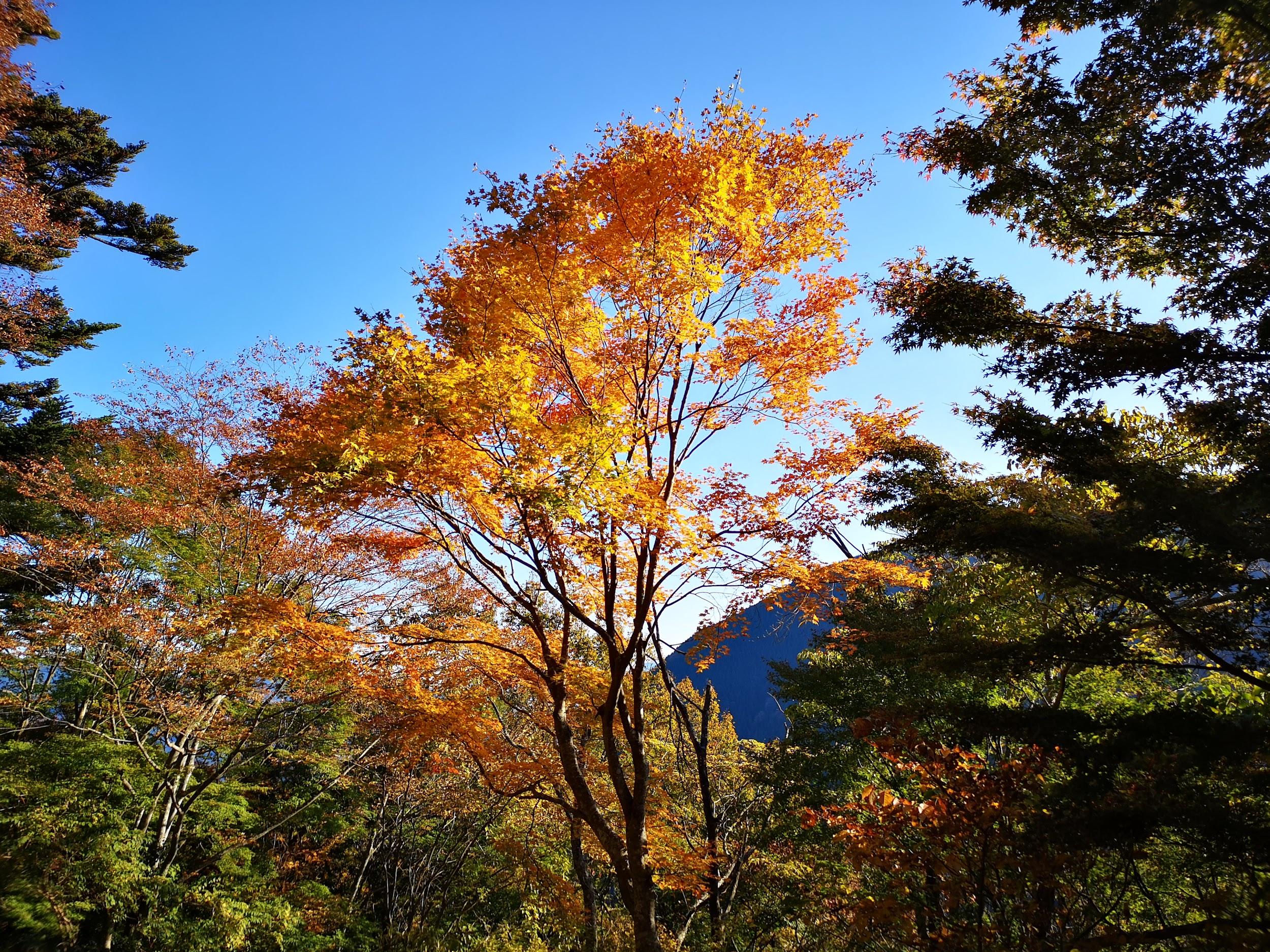
Beautiful autumn colours in the afternoon light on the way down
The path had now turned nearly 180 degrees, and was finally heading the correct way. I soon reached a magical spot, called “senbon-sugi” 千本杉, meaning one thousand cedar trees (in reality just 260 according to the sign). I’ve seen many cedar trees in Japan – I’ve even seen the Yakusugi on Yakushima – but I thought these were really impressive. They went straight up to amazing heights – I estimated over 40 meters, but according to the signboard, some of them topped 60 meters. I spent some time gazing and photographing these awesome trees.
The Japanese Cedar (scientific name: Cryptomeria), also known as the Japanese Redwood, is related to the American Redwood or Sequoia
I finally managed to pull myself away, and continued to head down along the road, still paved. It was now 3pm and I had to speed up if I wanted to get down before dark. There were some good views of Mt Shichimen to the right, with the sun slowly dipping below the ridgeline. I soon reached a viewpoint of the valley below and the turnoff for a hiking trail – finally! The path took me straight down the side of the mountain, cutting across the forest road several times. At one point, I had an excellent view of Minobusan town, and the temple complex perched above. I could again hear the buddhist chants drifting up below, creating a special atmosphere unique to Japan. I hurried on, finally reaching the base of the mountain and Minobu town around 4pm, in the time to catch the bus back to the station. As I was told by the lone monk on the mountain, there were no hot springs for day-trippers anywhere in Minobu. However the town does have a very beautiful five o’clock chime (see Video below) which played while I was waiting for my train back to Tokyo.
Minobusan town and the temple where I started my hike five hours earlier
See the views and listen to the sounds of Minobu
NEXT UP: Mt Sanpobun (Fuji Five Lakes) in Yamanashi
After my foray into the very southern part of the Southern Alps the previous weekend, I decided to go back and do one of the few higher mountains in the Minami Alps that can be done as a day trip from Tokyo. I had been wanting to climb this one for a while but since it requires a car, I kept putting it off (it can be done via public transport but you’d have to stay the night before in the area). The weather wasn’t perfect but I decided to risk it anyway, and I was glad I had!
It was my first time experiencing the new “all seats reserved” Chuo line, and overall, I felt that it was an improvement over the previous system. At least I was guaranteed a seat, which is essential when traveling all the way out to Kofu, where I had reserved a shared car. The trip up to the parking lot at Ikenochaya 池の茶屋 (1860m) was mostly uneventful – the road was pretty bad in some parts, but I had seen worse. I snagged the second to last parking spot. Under a thick cover of clouds, and the odd drop of rain, I was ready to set out at 11h15.
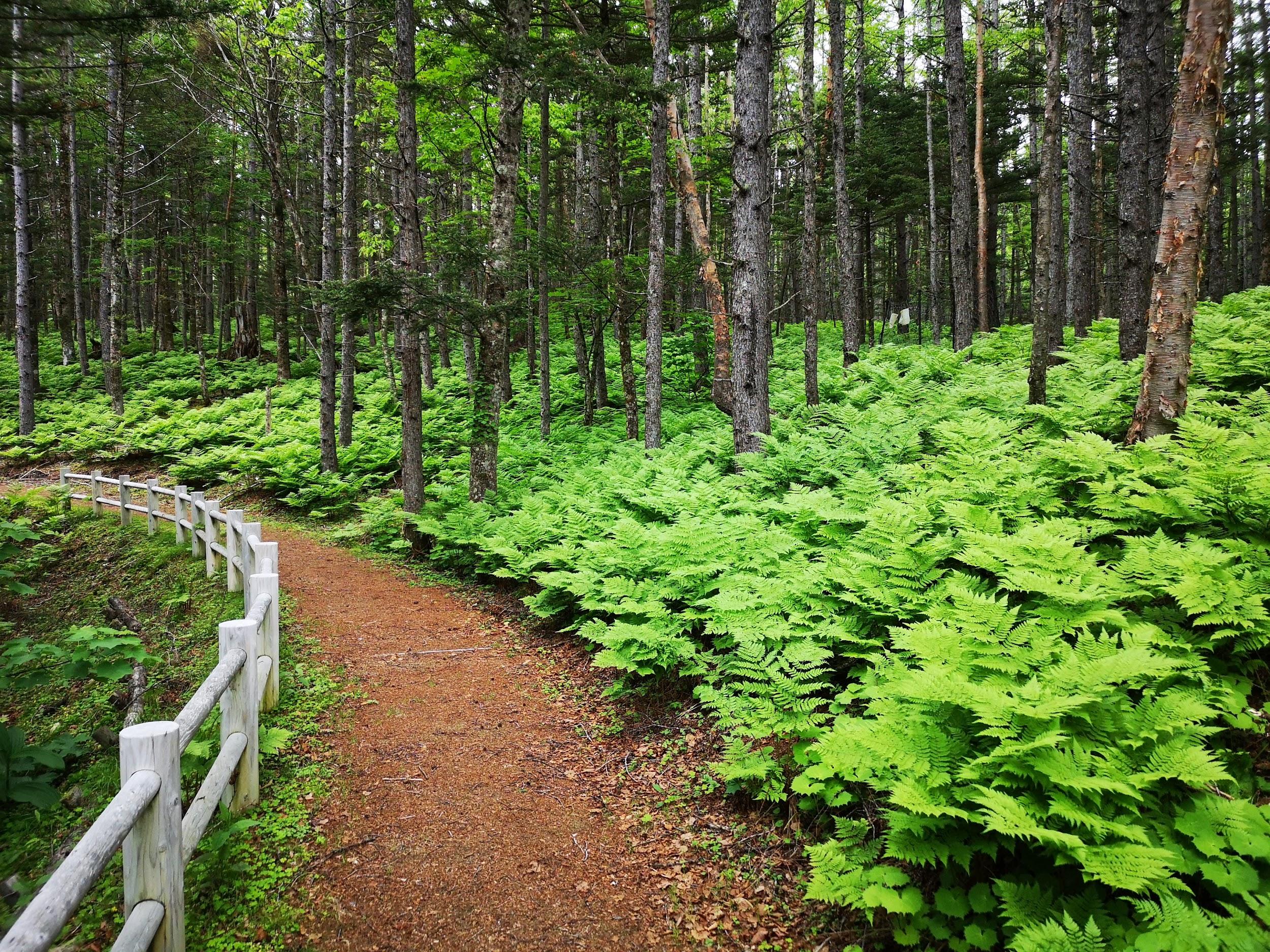
Super easy hiking for the first thirty minutes
The first part of the hike was incredibly easy to hike – a gently sloped series of switchbacks leading to a viewpoint of Mt Kitadake which was unfortunately entirely in the clouds. Rain was falling intermittently, but I didn’t mind since the surrounding vegetation, mostly ferns, was a very beautiful shade of light green. Soon the path started to descend via a series of log staircases. The amount of descent started to alarm me – I should be going up a mountain not down – but my guidebook and the numerous signposts reassured me that I was on the right trail.
Looking back up this long log staircase
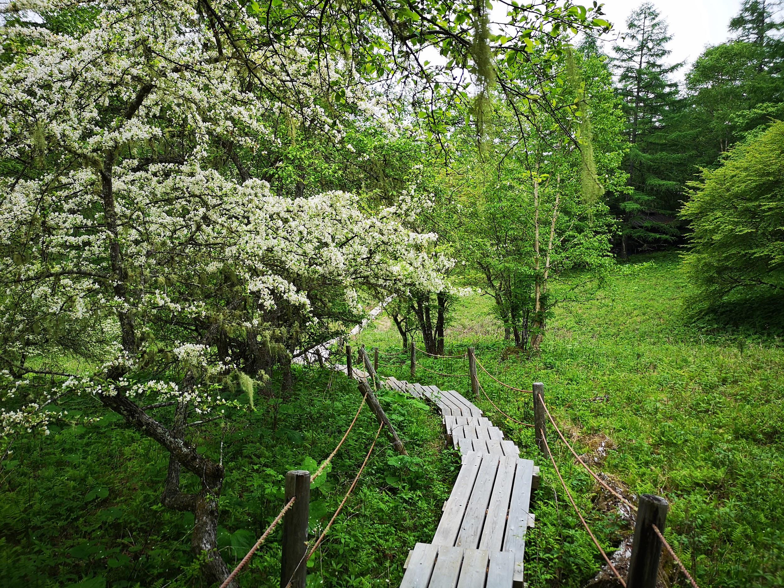
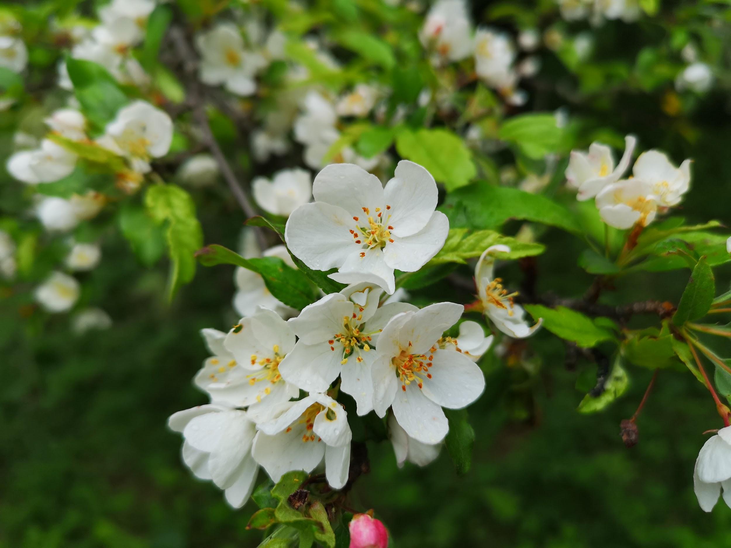
The path soon bottomed out and I was rising again, gently, through beautiful typical Southern Alps forest scenery. At this point I got a bit confused. I pride myself on my sense of direction, but here I will admit I lost track a bit. The path did what I thought was a loop, yet I never crossed my previous path. Eventually I arrived at a flattish area with a wooden walkway, and white flowers that ressembed sakura, but which were in fact oxalis.
An unexpected flower observation section on the hike
Apparently the area is famous for its irises, but they weren’t in bloom yet. In no time, I reached the top of Mt Hadaka (meaning Mt Naked). I was supposed to see the main peaks of the Southern Alps and Mt Fuji but in reality I saw nothing. However the temperature was pleasant, even a little cool, and there was no wind, so I settled down for some lunch.
At first sight I thought these were some really late blooming mountain sakura
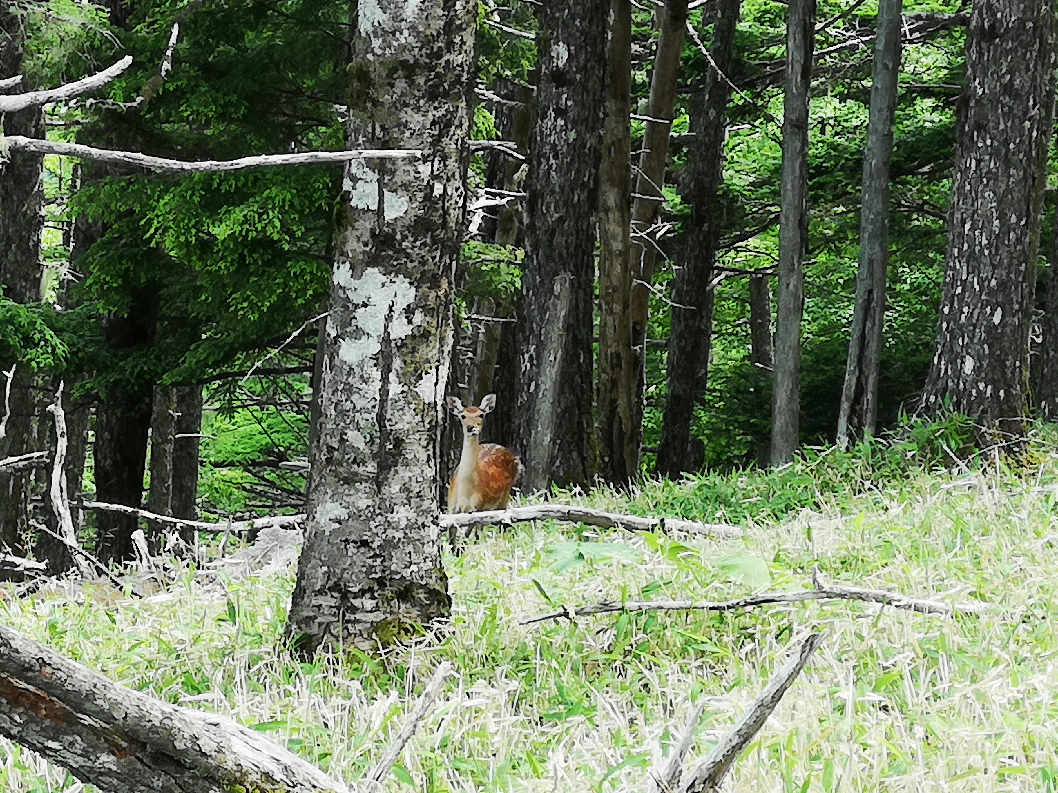
The next section was through amazingly beautiful forest, full of massive camphor trees and moss-covered undergrowth. At one point I spotted a solitary juvenile Kamoshika (Japanese serow), passively munching some grass (see video). I arrived at the top of Mt Kushigata 櫛形, a two-hundred famous mountain, a little after 2h30, where there was a relatively new summit marker, a few meters from the old weather-worn one. The clouds were still in, so no view, but it was very peaceful and quiet. I had not seen anybody in the past hour and a half.
Most of the hike scenery and trail was like this
I set off for the final part of the hike back to the parking area. The mist had rolled in, providing some very nice photo opportunities. At the car park, my car was the only one left – time to head back! Heading down the mountain, the sun broke few in a few places, I was able to get some nice views of the valley below. Instead of taking the train directly back to Tokyo, I got off at Isawa Onsen, less than ten minutes away. It’s a great place to have a hot spring bath, and I got to taste some Yamanashi wines at the wine server in the tourist office below the train station – a great way to finish a Yamanashi hike!
About a couple of months ago just after Golden Week, my friend Kageyama-san, an avid hiker and aspiring mountain guide, asked me if I’d like to join him in climbing Mt Tekari (2591m) in the Japanese South Alps or Minami Alps. As I had yet to climb this Hyakumeizan, I enthusiastically accepted. I had been wanting to climb Mt Tekari for a while but my plans had repeatedly been foiled by the bad weather, relatively short climbing season and difficulty of access.
He suggested going in early July, one week before the official opening of most of the mountain huts in the area. The plan was to stay at Yokokubosawagoya hut (called “Yokokubo” for short) and help the sole hut manager, Kimura-san, clean the hut up and get it ready ahead of the main hiking season, starting July 14th. He had met Kimura-san the previous year and they had hit it off. In return for our help, lodging and board would be free of charge. I was a little nervous about the cleaning up part since it’s is one area I’m not very knowledgeable about!
We departed Tokyo by car at the crack of dawn on July 7th, and finally arrived at Hatanagi dam just after 10am. I say finally because the road after Shizuoka city consists of 2 hours 1/2 of winding mountain road – quite exhausting for the driver! we parked our car by the lake created by the dam, laced up our mountain shoes and shouldered our heavy packs – we were off! After 40 minutes of leisurely strolling along a dirt road, we reached our first challenge – the “Tsuribashi” or suspended bridge. Spanning about a 100 meters, this was the only way of crossing the lake that lay between us and the rest of the route. An idea that had been floated previously by Kageyama-san, would have been to ford the river higher up. However we had to abandon this unofficial crossing since it had rained quite a lot the previous days and the water level was unusually high.
The suspended bridge
Gripping the metallic wire on both sides I proceeded across the bridge at an even pace, keeping my cool as it wobbled more and more as I approached the center. Suddenly I was on the other side, and a few seconds later, so was Kageyama-san. Next challenge was the Yareyare pass. Yareyare in Japanese, is an exclamation of relief, and at first I thought my friend was joking when he called the pass thus. However when I reached the top, I was surprised to see that that was indeed the name of the pass!
After a short bit of downhill, we reached a river swollen by the recent rains. The path went quite close to the edge and if the water level had been any higher, we would have been stuck. Soon we reached bridge one of five. The bridges were a little scary since they were quite basic and in urgent need of repair. On top of that, the raging river made it feel that if you fell in, you were a goner. Finally we reached Usokkosawagoya, an unmanned hut from which the pass climbed unrelentlessly, but away from the river.
Where’s the path?
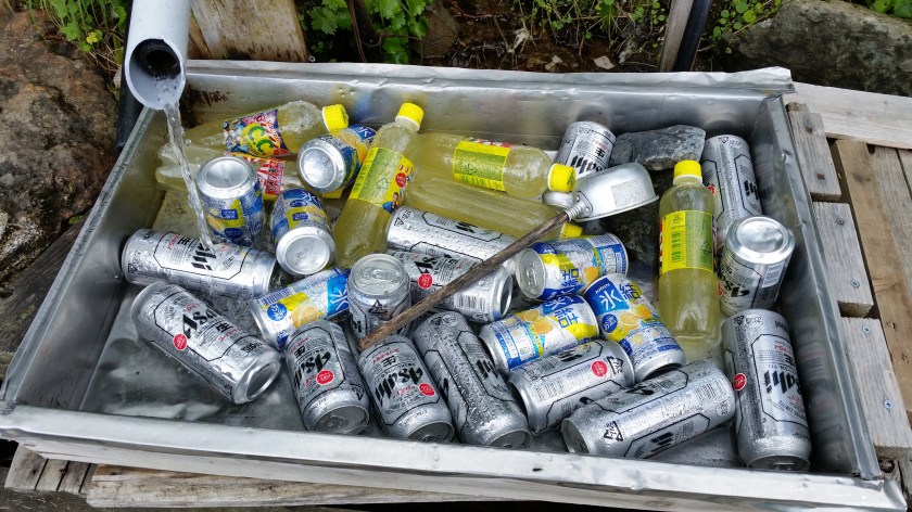
Kimura-san’s “Welcome Beer”
Four hours after leaving the car, we arrived at the Yokokubo hut. We were greeted by Kimura-san and two beers – “Welcome drink” he said. That was going to be the theme for our stay, as our host Kimura-san always made sure we had a beer in hand after hard work. After a second “welcome beer”, our first task awaited us: we had to sweep the sleeping area on the second floor, and lay out the thermal mats, as well as a larger tatami rug on top. Since I was the tallest (by far) I was charged with getting the mats down from the rafters – “how on earth did you manage without me” I asked (they have a stepladder).
After this relatively straightforward task, we were done for the day since it was nearly 5 o’clock. Some rest, more beers were followed by a delicious rice curry dinner courtesy of Kageyama-san. We were 4 people in total since another person had come with Kimura-san to help out – Ozawa-san. We found out that during the rest of the year, Ozawa-san runs a small farm where he mainly grows wasabi and tea. He invited us to visit him one day and we agreed we would. In the mountains it’s early to bed, early to rise, although as no hiking was on the program for the next day we allowed ourselves the small luxury of going to bed a little later (9pm) and getting up a little later (6am) than the norm.
Last year’s beers at Chausu hut
The mouse problem
The next day I was awoken by a rustling sound coming from a plastic bag containing my food supplies, lying near my sleeping spot. I opened my eyes and spotted a small shape moving inside. I shut them again thinking I must be dreaming. However I recalled that the previous day Kimura-san had complained that a mouse had somehow gotten inside the lodge – when he had first entered, earlier the same day, he found a bunch of ramen cups that had been opened in the kitchen. So I reopened my eyes, hopped out of my sleeping bag and tied the plastic bag into a knot “This must be the mouse and I have caught it!” I thought. I took the bag outside and dumped its contents on the ground nearby – no mouse. Either I had dreamed, or either the mouse slipped out in those few seconds I had my eyes closed. A little crestfallen, I returned to my sleeping bag for some more sleep.
During the day we found more traces of the mouse, or mice as we were now starting to think. More destroyed ramen cups, some chewed up pillows, and more annoyingly, the mouse had made a hole in a meat pasta sauce that was in another of my plastic bags (Kageyama-san has told me to get proper sealable cloth bags – I will definitely do so for my next trip). Luckily I had another intact pack of meat sauce, but since I was going to make pasta for the two of us, I had to add another course of dried food to the menu to make up for it.
For Kimura-san something had to be done – the hut would be housing dozens of paying guests a day starting from the following weekend, and he couldn’t have a bunch of mice wrecking havoc. So, since we were unable to locate the mice within the hut, nor their manner of entry and exit, he laid out a number of mouse traps on the first and second floors. The traps were very effective – by the time we went to bed, 3 mice had been caught on the 2nd floor, and overnight 5 more were trapped on the first floor. The mouse problem had been solved (sorry mouse lovers…).
The main cleaning
After breakfast, we cleaned and prepared the sleeping area on the first floor. It involved a lot of chucking mats, tatami rugs, cushions and rolled sleeping bags down the wooden flight of steps connecting the first and second floors. Since we were 4 people in total, we were soon done. Any excess mats were carried back up and placed into the rafters again to serve as spares. Then we moved outside to reconnect the drinking water that came from a source of freshwater, located just across from the mountain torrent that ran next to the hut.
The water came through a pipe, the end of which had been sealed off with some plastic. We connected it to a kind of bathtub we had carried up from next to the hut. The bathtub served as a reservoir – the water would accumulate there and then flow down another tube into a big tank standing right next to the hut. We then uncovered some corrugated metal sheets which we placed on a wooden frame right next to the river. It was fixed in place with a plastic tarp, some rope and stones. The shady area underneath, opposite the flowing river, would create a cool space where vegetables could be kept. These, and the rest of the fresh food would be delivered by helicopter in a couple of days. Kimura-san constantly worried about the weather for that day. If the visibility was bad, the helicopter wouldn’t come, and he would have to make do without any fresh provisions for the start of the hiking season.
After that we uncovered and cleaned the washing basin where campers would have access to running water, which was connected via another hose. A third and last hose ran to a smaller washbasin outside the toilet area about 50 meters away. We cleaned that one too and made sure the water was flowing properly. Next we had to open the window flaps of the small toilet outhouse. Again my height was of great use. Once that task complete, we retreated to the hut for some lunch – leftover curry rice from yesterday’s dinner.
After lunch, our final task awaited us – a thorough cleanup of the dining and kitchen area. Floors were scrubbed and wiped. Dishes were washed and dried. Every flat surface was dusted, and unused or expired items were thrown out. This was perhaps the most exhausting and time-consuming task of them all. Even with the four or us, we were at it for over an hour. Finally it was done – the place was spick-and-span, and we could rest a while before an early dinner and early bedtime, since the next day we would rise at 5am for an early departure up the mountain.
Opening and fastening the rear windows
To Mt Tekari and Back
Our hike the next day, up to the Chausu hut on the ridgeline and then on to the Tekari hut went without hitches. We spent an hour hanging out at Chausu hut chatting with the various people who had come up early to help the hut open, drinking tea and eating snacks. There was Kataoka-san, a mountain guide who I had met on a trip to the South Alps 7 years earlier. There was also a sake brewer who works in the hut in the summer, which is the off-season for sake-making. He showed me the charts he used to keep track of the his latest sake brewing session, with temperature, sake meter value, acidity, alcohol content for each day. I studied them with great interest.
The sake brewer’s hard work
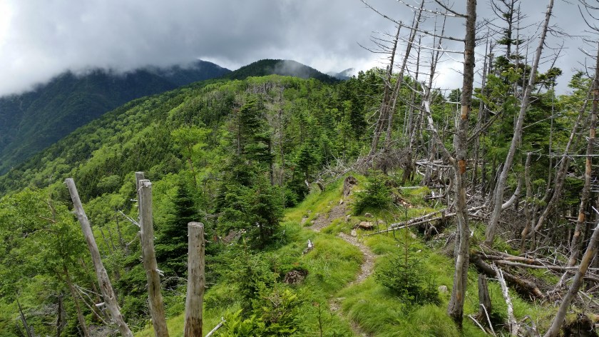
Although the skies were clear in the mornings, the clouds had rolled in once we had left Chausu hut, and the rest of the hike was done with mostly no views. This didn’t matter too much as the surrounding forest was breathtakingly beautiful. Tekari hut wasn’t open yet either, but as with the other huts, the hut manager and staff had already arrived, and were busy getting the place ready. People can stay inside for free but they need to bring their own sleeping bags. The hut manager gave us some basic instructions about eating, lights out and the outdoor toilets but that was it. Snacks and alcohol could be bought if supplies remained from the previous year. Actually, most huts in the South Alps are kept open year round meaning that even if the staff aren’t there, which is usually the case from Early September to end June, the door is open and you can use the space for free as long as you are self-sufficient.
The path to Tekari hut
We didn’t summit Mt Tekari that day since by now it was a whiteout. The next day, the weather was again quite good and the views were amazing, especially of Mt Fuji, which is actually quite close. We made our way back to the Chausu hut, where we got to see the helicopter deliver supplies. Then we made our way back down to the Yokokubo hut, where we picked up some of our extra stuff that we had left during our 2 day-hike. The helicopter had successfully delivered the supplies, and Kimura-san looked quite happy and relieved. I refused a final offer of a beer since we still had a couple of hours of steep downhill hiking. We made it back to the car a little past 4pm. After a refreshing stop at a nearby hot spring, we set off along the very long twisting road back to civilisation. Hitting the highway was a relief, and we finally got back to Tokyo around 10pm.
Sunrise and Mt Fuji near the top of Mt Tekari
It was quite enjoyable to hike the South Alps before the throngs of summer hikers. For most of the way, there and back, we saw almost no one. At one point, we crossed the Tekari hut manager with a chainsaw, but he was just doing trail maintenance. It was also an interesting experience to see how mountain huts in the Japanese Alps get ready for the busy summer season. Finally, I was happy to contribute, even just a little bit, to the massive effort it takes to run the network of mountain huts, which enables the rest of us to enjoy the mountains throughout the year.
Helicopter delivering fresh vegetables to Chausu hut


![Mt Hinata (1660m) & Ojira River Valley, Hokuto City, Yamanashi Prefecture, Tuesday, November 23, 2021 [Map Available]](https://hikingtokyo.com/wp-content/uploads/2021/12/img_20211123_131133.jpg?w=1024)


You must be logged in to post a comment.