I had already climbed this mountain a few years ago, but I wanted to return on a crisp autumn day hoping to get better views. I also wanted to explore the park covering the mostly flat summit area. Finally, I was looking forward to catching the last autumn leaves of the season. Although this mountain is easily accessible by train, I decided to go by car as it would allow me to visit another sightseeing spot on the same day.
View from the one of the summit observation platforms
It was a perfect autumn day as I rode the Laview limited express to Chichibu station, where I switched to a rented car. It was a short drive to the parking lot below Minoyama Park, and an even shorter stroll to the highest point of Mt Mino (蓑山 みのやま minoyama). It’s also known as “Utsukushi no Yama” (美の山) meaning “beautiful mountain”, perhaps referring to its round, regular shape, or perhaps to the springtime views, when the many cherry trees are in full bloom.
The hills of Eastern Chichibu
The broken summit of Mt Ryokami
I checked out the view from each of the 3 observation platforms facing south-west, west and east. West, I could see the wide Chichibu valley surrounded by the Oku-Chichibu mountains and flanked by the triangular summit of Mt Buko on the left, and the jagged top of Mt Ryokami on the right. East, I could see the low mountains of Higashi-Chichibu with Chichibu Highland Farm directly opposite, and in the distance, Mt Akagi and Mt Nantai.
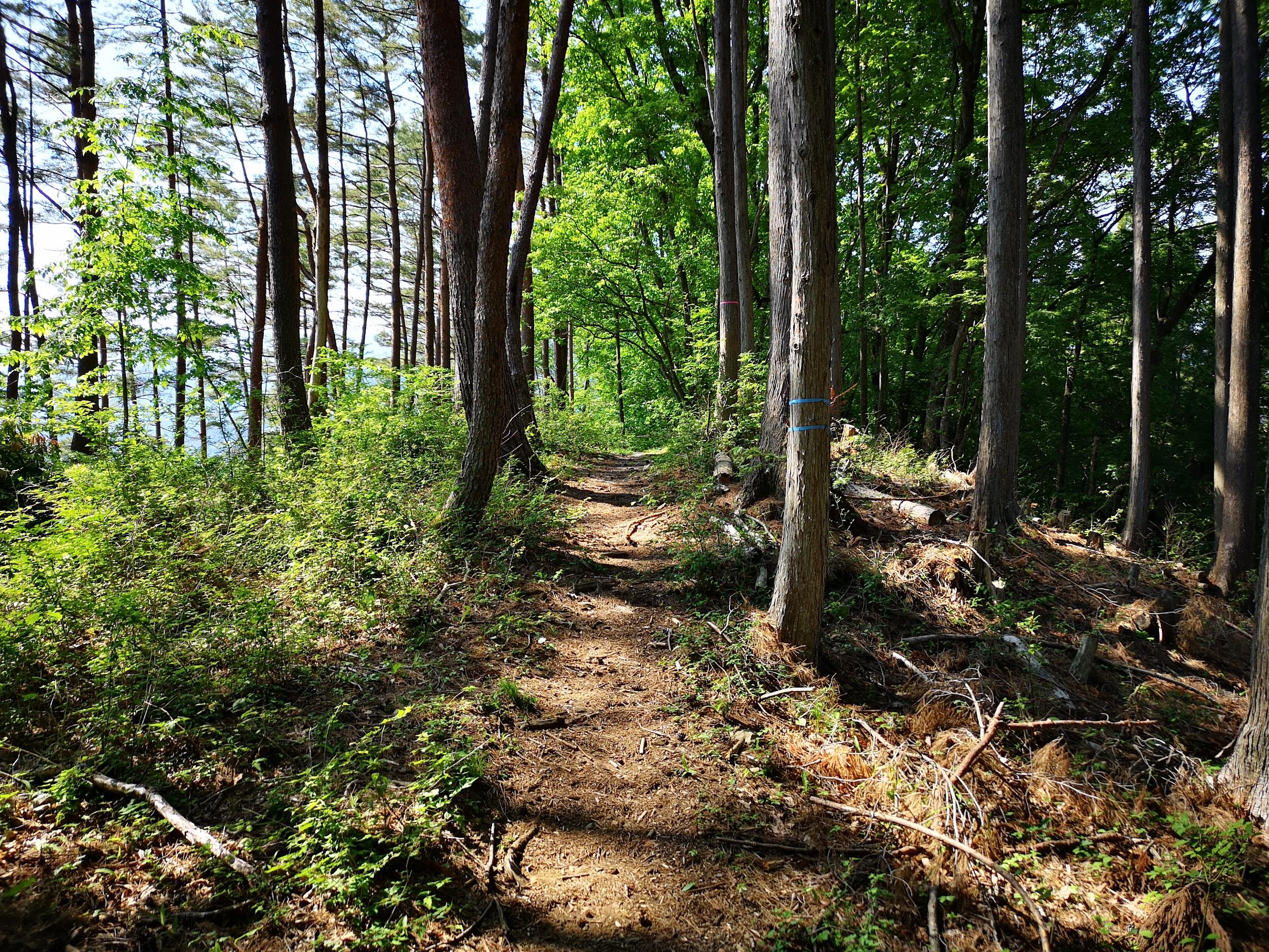
Walking through Minoyama Park
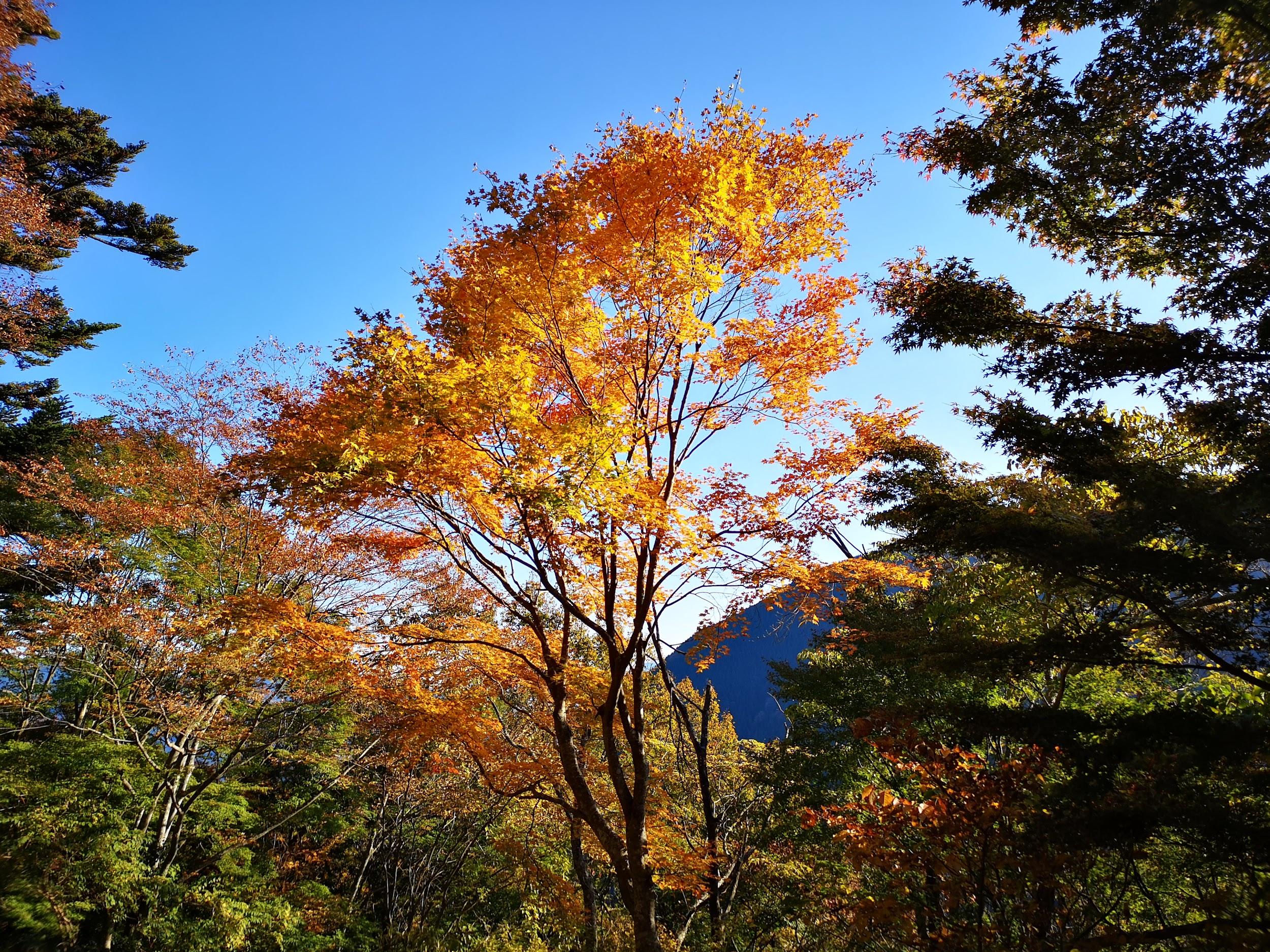
A beautiful day at the end of the autumn season
It took less than an hour of easy hiking to complete the loop of Minoyama Park. Along the way, I came across another observation deck on the north side with a good view of Mt Happu, as well as a maple tree with fiery red autumn leaves. At 12h30, I was back at the parking lot. I drove the winding road down to the bottom of the valley and dropped by Miyabi An (みやび庵) for a tasty soba lunch. Next, I decided to check out the nearby Urayama dam (浦山ダム) and Chichibusakura lake.
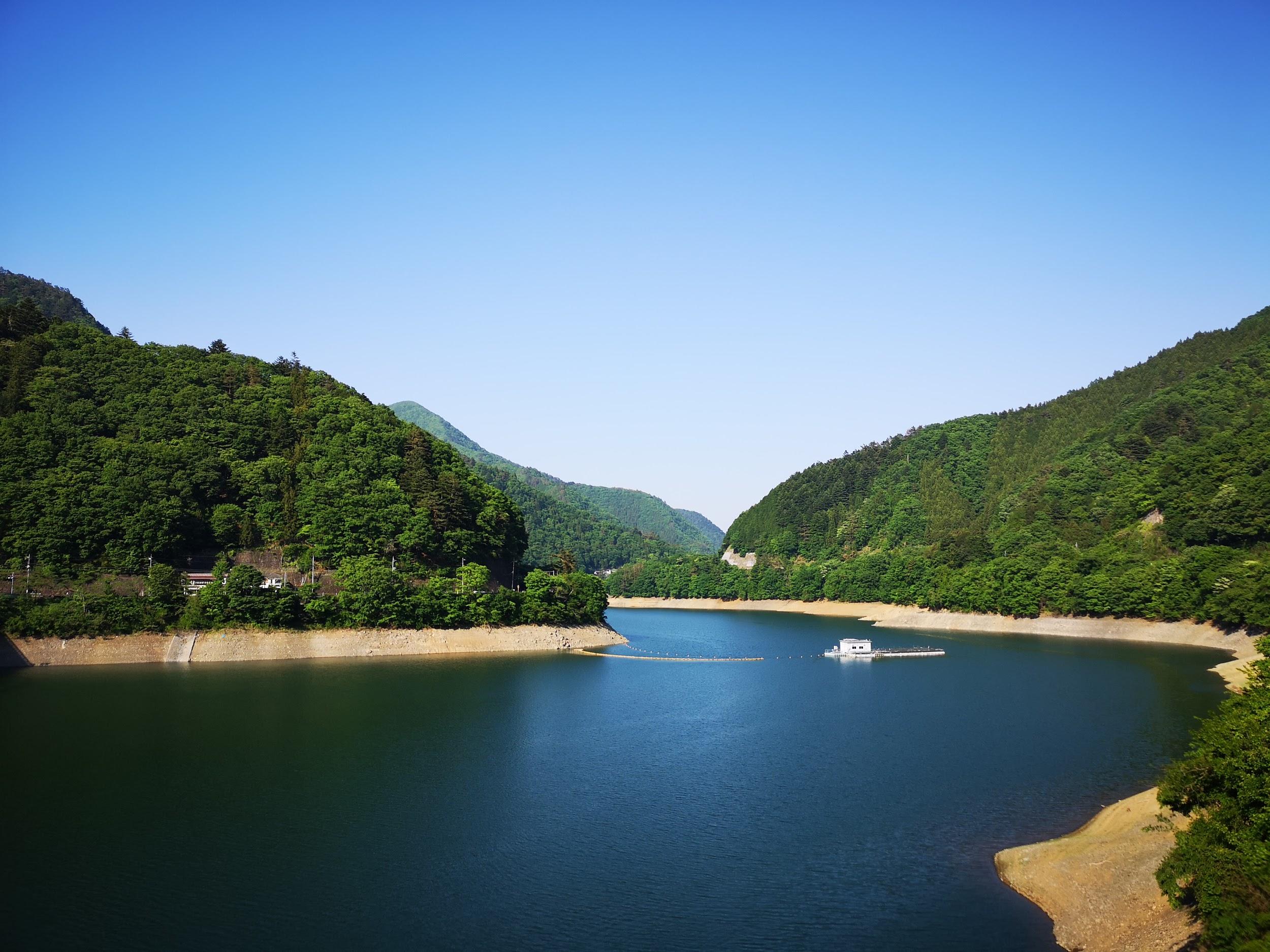
Chichibusakura lake from Urayama Dam
View of Mt Jomine from Urayama Dam
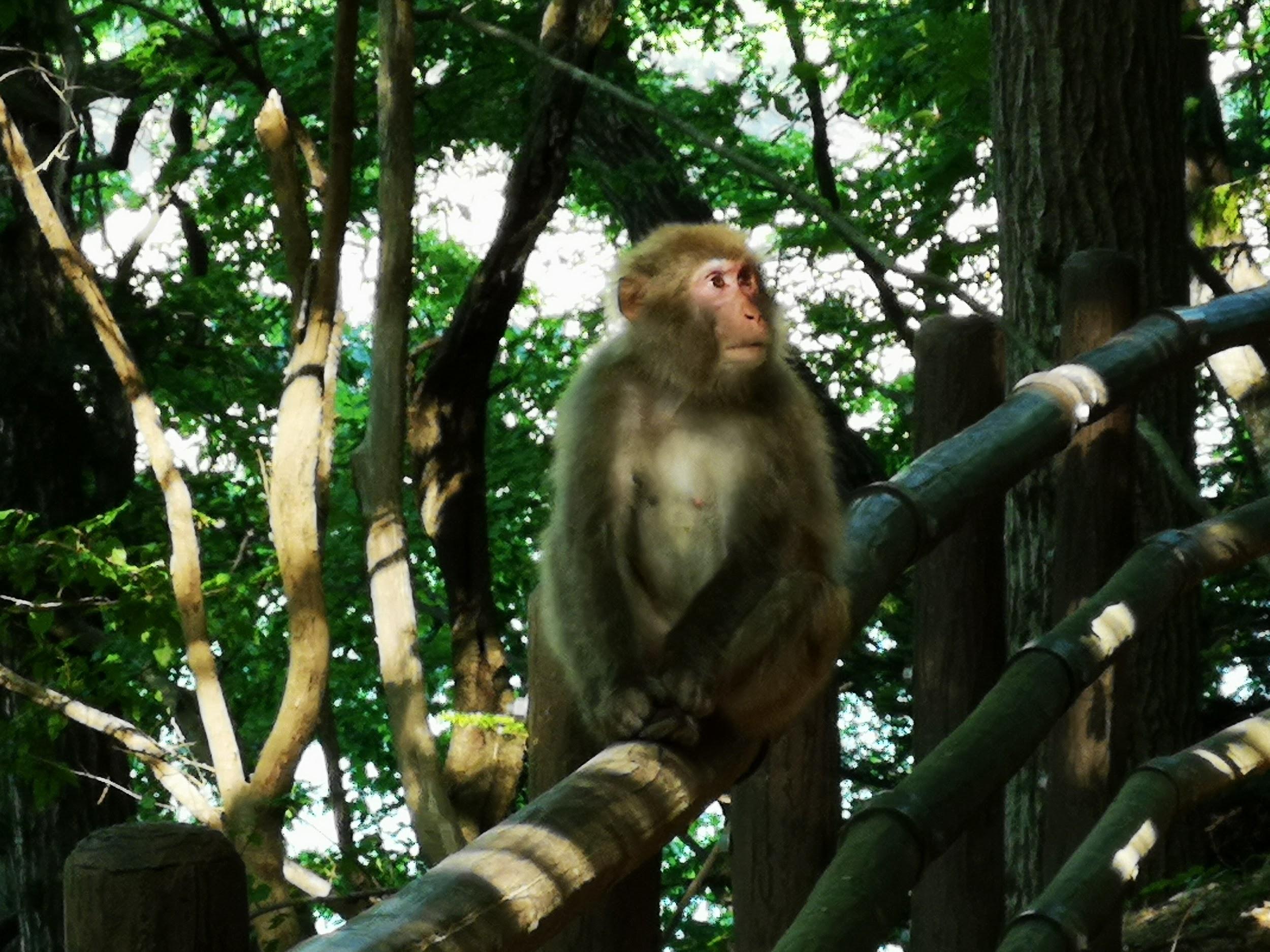
I spotted movement in the trees next to the road after getting out of the car at the dam parking. Peering into the forest I saw a troupe of Japanese macaques foraging for food. I was excited to see monkeys not having encountered any for a long time and spent some time observing them (see video). After a quick tour of the dam, I drove back a short way to Jurin’s Geo coffee shop for a quick break around 3pm, before heading back to Chichibu station and the eighty-minute ride by limited express train back to Tokyo.
See the views from Mt Mino and the monkeys of Chichibu
This is the 200th blog post on Hiking Around Tokyo
I had hiked this Gunma section of the Nakasendo (中山道) in January 2015 using the Tokyo Wide Pass; it’s less well-known than the section in the Kiso valley. I thought it would be interesting to redo it in a different season. First, the autumn leaves would be at their peak around the start of the hike. Next, I hoped that in the warmer weather I would be able to see monkeys along the way. I also wanted to add a side trip to the nearby Megane Bridge. Finally, I was looking forward to using the hot spring near the end of the hike, which was closed on my last visit . Instead of taking the Shinkansen to Karuizawa, I decided use a combination of train and bus, longer but cheaper; then, to make up for the later arrival, I would take another bus up to Usui Pass instead of walking. The forecast was cloudy with a hope for sun, but apart from Usui Pass, there were few views along the way.
The trip to Karuizawa went smoothly: I had good views of Mt Myogi from the train, and saw some nice autumn colours from the bus. From Karuizawa station, I walked to the bus stop of the Red Bus (赤バス aka basu), a small seasonal sightseeing bus. There were few passengers and I was able to enjoy the view from the front of the bus as it zipped through old Karuizawa, and then zoomed up a narrow mountain road to Usui Pass (see video). The clouds were in and the view wasn’t great; in consolation there was a resplendissant Japanese maple tree in orange and red. I finally set off on the Old Nakasendo Highway (旧中山道 kyu-nakasendo) around 12:30.
River crossing along the Nakasendo
After an eroded downhill section, I crossed a small stream, and then followed a narrow level path till it merged with a wider trail heading down again. It was around here that my map reported monkey sightings, so I kept my eyes open and ears peeled. During the Meiji area there also used to be a village around here, and here and there its remains could be seen, making this part of the hike somewhat spooky. Past a rusting bus on one side of the path, and a rotting house on the other side, I heard strange noises coming from the treetops. At first I thought they were monkey noises, but it turned out to be some kind of bird call. I got lucky a little further. After going a little off the trail to investigate some suspicious noises, I stumbled upon a troop of monkeys moving through the forest. Unlike the ones from Okutama lake, these ones were shy and scattered at once, except for a large male, coolly walking away through the trees (see video).
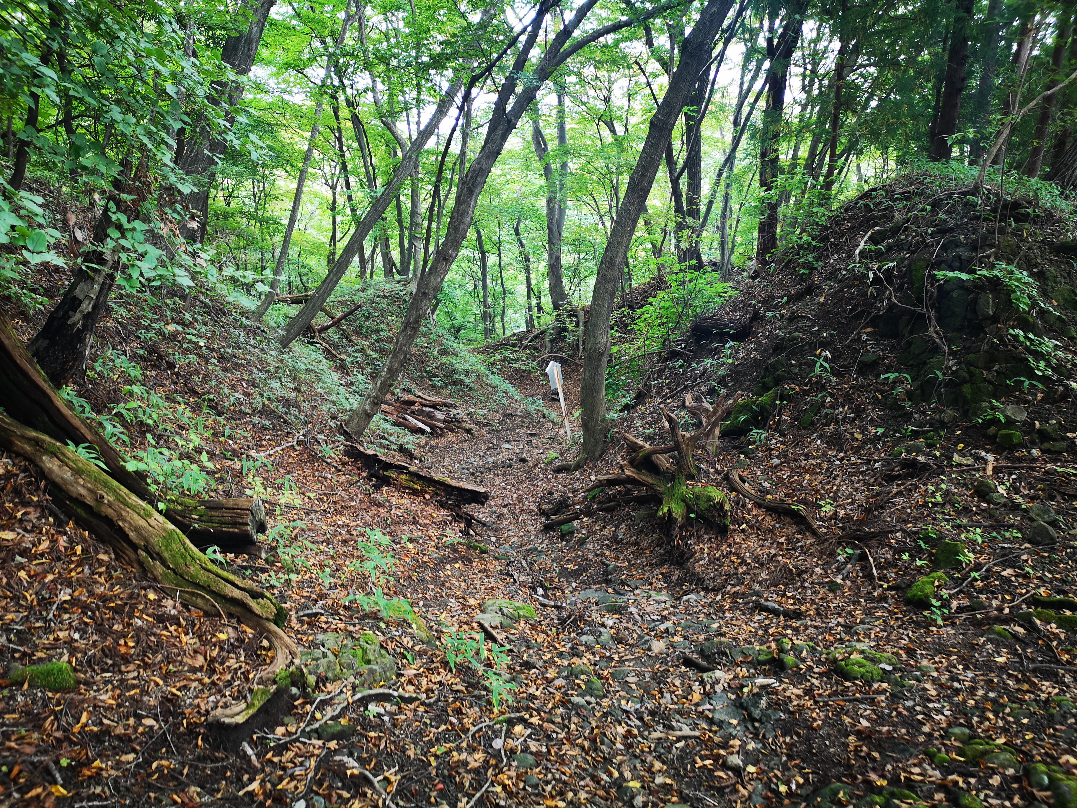
The path followed the natural folds of the mountain
After the excitement of seeing monkeys (second time this year), I resumed my hike along this Edo period highway. The road became level again, and offered glimpses of mountain ridges and river valleys left and right. There were occasional white signs in Japanese, explaining various natural and historical landmarks. Most of this hike was inside the Joshin-Etsu-Kogen National Park and the surrounding nature was wild and beautiful. Soon the road narrowed and turned into a hiking path again; it started to twist and turn, following the natural folds of the mountain ridge as it slowly descended into the valley. For a short while, I walked above a mountain stream tumbling down a small narrow valley. I took a moment to observe a large butterfly return obsessively to a curiously shaped-flower, and feed greedily on its nectar (see video).
A butterfly enjoying a nectar lunch
At 2h30, I finally arrived at a small rest house. I remembered it well from my previous visit. The guest book, slightly moldy despite it’s plastic casing, was still there, sadly devoid of English entries since spring this year. I found my old entry from 5 years ago and added a fresh one. The path turned rocky and started to descend in a series of switchbacks. On my winter hike I had good views of Mt Myogi and Yokokawa town around here; now, however, the view was blocked by tree leaves. Around 3pm, I reached the base of the mountain, and arrived at the modern road connecting Karuizawa and Yokokawa. On the other side and down some steps, I found myself on the “Apto Road” (アプトの道) that went through a tunnel under the road. This pedestrian road is named after the “Abt system”, a rack system, used by the old Usui line to transport passengers up the mountain side to Karuizawa from the middle of the Meiji era till 1963.
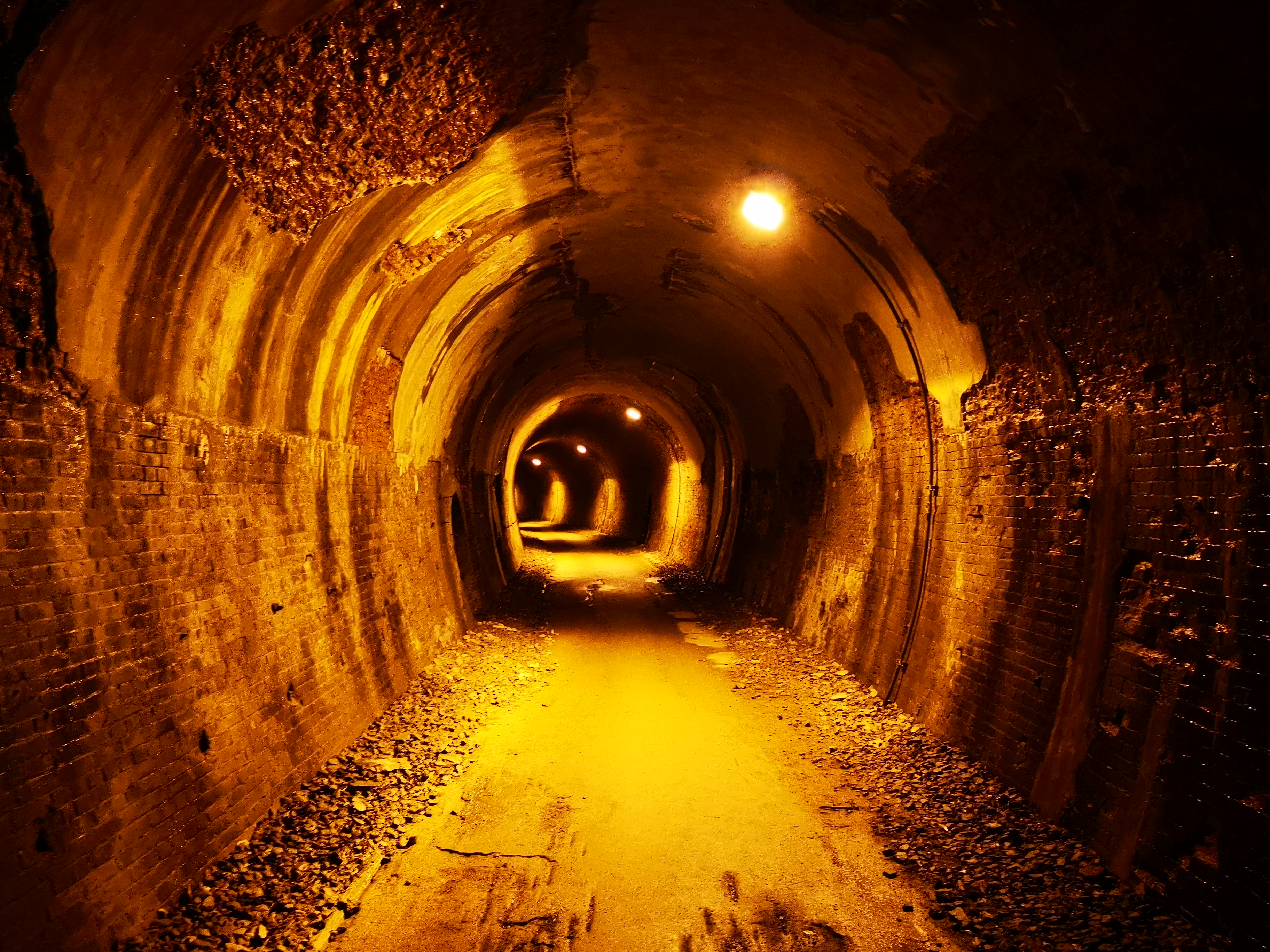
Tunnel number five along the “Abuto Road”
It was getting late but I decided to stick to my plan of exploring this road. Keeping to the day’s theme, it passed through several tunnels, some pitch black and some glowing orange from the interior lighting. Half an hour later at the end of the longest one, I arrived at the highlight of the day, Megane bridge (めがね橋 megane-bashi), the longest brick arch bridge in Japan. It was wonderful to walk on this marvel of Meiji era engineering. Apparently the autumn colours are spectacular here, but I was a couple of weeks early. Past the bridge, the road ducked into yet another dark tunnel. It was possible to continue a few more kilometers to an abandoned railway station, but it was getting late, and I decided to head back. The road ran straight and slightly downhill to Toge-no-yu hot spring which I reached in less than half an hour.
Megane Bridge, one of the wonders of the Meiji Era
After a speedy hot bath, I was ready to continue. By now it was 5h30 and already pitch dark outside. It had also started to drizzle. I was still 3 kilometers from the train station. I had walked it before – the road was straight and paved so there was little risk of getting lost or hurt. I briefly considered calling a taxi, but what better way to finish a spooky hike than a walk in the dark past an abandoned railway station? On the way, I discovered that my headlight only worked intermittently. I hurried past the disused Maruyama station building on the left, a darker shadow among the shadows. At 6pm, I passed the closed Annaka Tourist information office, and was finally walking under street lights. I reached the still-in-use Yokokawa station, well in time for the return train to Takasaki and Tokyo.
The old Maruyama train station (photo taken in January 2015)
Ride the Red bus through Karuizawa up to Usui Pass
From mountain streams to wild monkeys, the Nakasendo has lots to offer
This is another mountain that was on my must-climb list for ages, in an area relatively close to Tokyo that I had never been to before, between Mt Fuji and the Southern Alps. There is also a ropeway to the summit – I didn’t use it, but it’s nice to have the option. Finally, the temple area at the base of the mountain is the last resting place of the founder of Nichiren Buddhism – less interesting to me, but worth noting.
Above: Summit framed between cedar trees and temple buildings
Below: Significantly less snow on the Western side of Mt Fuji
I rode the Chuo line to Kofu, then changed to the Fujikawa Limited Express to Minobu station, arriving just past 9h30. I hopped onto the bus for the short ride to Minobusan at the base of the mountain. A short walk up the main street brought me to San-Mon 三門, one of the three famous gates of Kanto, according to the information board. It was certainly one of the most impressive gates I’d ever seen. Beyond, was also one of the longest stone staircases I’d ever climbed – a good warm-up for the hike ahead. At the top, I took time to check out the temple area before heading up the narrow paved road to the right of the ropeway, a little after 11am.
(Top Left) San-Mon Gate (Top Right) Kuonji Temple (Bottom Left) Bell Tower (Bottom Right) Random temple building inside the forest
I followed the paved road as it zigzagged up through the forest. There were few views through the cedar trees, almost no signs for the hiking trail, and no people. Occasionally, I could hear buddhist chants drifting up from below. Half an hour later, I emerged onto a shoulder, clear of trees – there was a small temple complex and a view of the summit. The paved road continued into the cool shade of the forest; its condition started to deteriorate, before completely giving up turning into a dirt road. Here, I passed a few hikers (and a dog), but it seemed that the majority of visitors preferred the ropeway. Just before 1pm, I had my first glimpses of Mt Fuji through the trees. A few minutes later, I reached the top of the ropeway, and a fantastic view of Mt Fuji and the Fuji river valley heading Southwards.
(Above) Summit of Mt Fuji behind the Tenshi Mountains (Below) Fuji River flowing into Shizuoka Prefecture
After snapping some pictures, I walked past the summit temple to the other side, where there was the summit marker for Mt Minobu 身延山. I was able to enjoy a great close-up view of the Southern Alps, with the Arakawa-zansan on the left, and the Shirane-zansan on the right, with fresh layers of snow each. Further right was Yatsugatake, in the clouds, and the Oku-Chichibu Mountains, free of clouds. I also had a good view of Mt Shichimen and Mt Fujimi, two mountains I hope to climb next year. Just past the latter was Mt Kushigata which I climbed in June this year.
(Above) Mt Shichimen (Below) Mt Fujimi, two other peaks of the Minobu Mountains
After a short standing lunch – there were no benches – I started walking down. I was supposed to head down the other side of the ridge I had come up, but instead, I seemed to be going down the backside of the mountain. I was the only person hiking down, so there was no one to ask. After triple-checking my map, I decided I was on the right path after all. I was on a paved road again, but I didn’t mind since there were now some good views through a mix of trees. Facing the massive peaks of the South Alps, I felt like I was in the middle of nowhere.
Soon I arrived at a temple manned by a solitary monk. There was an information board with a good map which I studied for a while. The monk hovered nearby. It seemed like he was eager for some conversation but didn’t dare, or wasn’t allowed to initiate it. I noticed Minobu Hot Spring written in English on the map so I asked: “are there any hot springs for day-trippers in Minobu?” “I don’t think so,” he replied. “Do you have to stay here all day?” I asked. “I Yes, but I go back down at nightfall.” He then pointed out the tip of Mt Fuji, above the ridgeline of the mountain behind me. Having run out of questions, I thanked him, snapped a few pictures, and continued along my way.
Beautiful autumn colours in the afternoon light on the way down
The path had now turned nearly 180 degrees, and was finally heading the correct way. I soon reached a magical spot, called “senbon-sugi” 千本杉, meaning one thousand cedar trees (in reality just 260 according to the sign). I’ve seen many cedar trees in Japan – I’ve even seen the Yakusugi on Yakushima – but I thought these were really impressive. They went straight up to amazing heights – I estimated over 40 meters, but according to the signboard, some of them topped 60 meters. I spent some time gazing and photographing these awesome trees.
The Japanese Cedar (scientific name: Cryptomeria), also known as the Japanese Redwood, is related to the American Redwood or Sequoia
I finally managed to pull myself away, and continued to head down along the road, still paved. It was now 3pm and I had to speed up if I wanted to get down before dark. There were some good views of Mt Shichimen to the right, with the sun slowly dipping below the ridgeline. I soon reached a viewpoint of the valley below and the turnoff for a hiking trail – finally! The path took me straight down the side of the mountain, cutting across the forest road several times. At one point, I had an excellent view of Minobusan town, and the temple complex perched above. I could again hear the buddhist chants drifting up below, creating a special atmosphere unique to Japan. I hurried on, finally reaching the base of the mountain and Minobu town around 4pm, in the time to catch the bus back to the station. As I was told by the lone monk on the mountain, there were no hot springs for day-trippers anywhere in Minobu. However the town does have a very beautiful five o’clock chime (see Video below) which played while I was waiting for my train back to Tokyo.
Minobusan town and the temple where I started my hike five hours earlier
See the views and listen to the sounds of Minobu
NEXT UP: Mt Sanpobun (Fuji Five Lakes) in Yamanashi
Temperatures were unseasonably hot at the end of May – up to 35 degrees in Tokyo – so it made sense to start my hike from a higher point. I decided to take the bus from Uenohara station to Tsuru Pass 鶴峠, squarely inside Yamanashi prefecture at nearly 900m. On the way, I passed through the charming village of Saihara, one of the area’s hidden wonders. This hike is an original hike not featured in any of my guidebooks. It’s main purpose is to connect two bus stops without passing any major summits on the way (although a detour via Mt Mito can be made).
Once I got off the bus, just below the pass, I couldn’t believe how hot it was at 10am. Luckily it was a dry heat. To reach the start of the hike, I had to cross the road and take a hard-to-spot ascending path. There is another path going up to the left, towards Mt Narakura 奈良倉山 (1349m) which I climbed from the other side the year before. After barely a few minutes, I came across part of a deer leg lying across the path. Just the foreleg, with fur and hoof at the end. “Some animal must have killed the deer and left just this part here” I thought to myself. “…but what animal??”
Pleasant May hiking in the Chichibu-Tama-Kai National Park
Shortly after, the path for Mt Mito 三頭山 branched to the right, and hugged the side of the mountain to the right. It was very peaceful until two ladies popped out of the forest above me – they had mistakenly continued straight along the previous road. After confirming they were now on the correct path, I soon left them behind. The trail gradually rose through the forest. There were few views but I was glad to be in the shade on this hot day.
One of the rare views along the way: Mt Kumotori
After one hour of pleasant and mostly solitary hiking, I reached the junction for Mt Mito and hesitated : should I continue along what had been up to now a nice, quiet and mostly flat path, or should I climb up to the top of Mt Mito, which I had submitted twice before, and where there was bound to be tons of people? I chose the former option, and I was quite glad I did, because it soon became obvious that I wasn’t just following a hiking path. It was actually an old road that had probably been in use for generations; some sections had been propped up with stones. I had already hiked a similar road in the same area a few years before.
It was thrilling to follow the remnants of an old road high up a mountain
After another hour, I reached a second junction with Mt Mito. Here I turned left and headed down the mountain towards lake Okutama and into Tokyo prefecture. I had also entered the Chichibu-Tama-Kai National Park, although there were no markers or signs to indicate this; I only realised this while writing this blog post – a real shame! The descent was gentle at first, but soon there were some steep bits with ropes; these are fine for climbing, but going down them can be quite a pain!
The author posing on a minor summit on the way down to Okutama lake
Soon, Okutama lake came into view and, after a couple of ups and downs, I finally emerged onto a road circling the lake, nearly two hours after I had started down. Here, my plan was to take something called a floating bridge “ukihashi” 浮橋 across the lake, but I was informed via a sign that it was closed at the moment. Nonetheless, I decided to check it out. While following the road, I saw a green snake. After some prodding with a branch, I realised that it was dead, despite looking very much alive. Apparently, it had been hit by a vehicle moving at high speed, and only suffered a “nick” to a part of the body, which was enough to kill it.
Even dead, the snake looked very much alive!
After a while I reached some steps leading towards the lake, and very soon I was able to lay eyes on the floating bridge. It had been detached from the shore I was on, and thus ended in the middle of the lake. The reason given was strong winds. Just opposite, was my bus stop. Now, in order to reach it, I had to circle round, a detour of about half an hour. I wandered back despondly, and decided to continue along the path circling the lake in the opposite direction since I had an hour to kill till the next bus.
The floating bridge floating in the middle of the lake
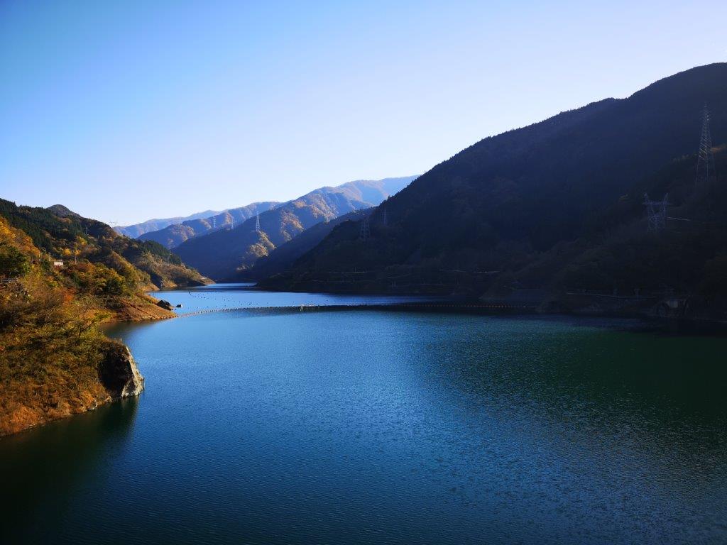
I was glad I did, because I got to see monkeys, lots of them, resting, playing and feeding in the trees. Eventually, one of them was sitting next to the path and I didn’t dare go further. In any case, I was quite content to take photos and videos. Soon my time was up, and I had to rush back along the road in order to catch the bus back to Okutama station. The views of the mountains surrounding the lake were beautiful – I don’t often get to see this area in perfect weather. It was pretty hot around the lake in the late afternoon, and it felt nice to sit inside the air conditioned bus!
View of deep blue Okutama lake under a light blue sky
Monkey in the way!
If you like monkeys, check out this compilation video

![Mt Mino (587m), Chichibu City, Saitama Prefecture, Thursday, November 11, 2021 [Monkeys]](https://hikingtokyo.com/wp-content/uploads/2021/12/img_20211111_115802.jpg?w=1024)


![Hiking the Nakasendo: Usui Pass to Yokokawa Station & Megane Bridge, Gunma Prefecture, October 2020 [2023 Map Available]](https://hikingtokyo.com/wp-content/uploads/2020/11/img_20201014_155721.jpg?w=1200)


You must be logged in to post a comment.