
Winter is in full-swing and for those who are averse to hiking in freezing temperatures or snowy conditions, it’s good to know a few low-altitude spots for hiking. So without further ado, here is a list of hikes that I have done during the winter months (December to March) starting with areas South of Tokyo:
Numazu Alps 沼津アルプス, Shizuoka prefecture
With the highest point being 392m and located right next to Suruga bay, it’s safe to say that snow on the Numazu Alps is a rare affair. However the name “Alps” is well-deserved as there are lots of ups and down, some of which are surprisingly steep (nothing technical though).
PROS: Shinkansen Access, Mt Fuji and sea views, hike can be shortened or lengthened
CONS: Transport cost, Crowds (especially closer to Numazu city), lots of ups and downs.

Mt Higane 日金山, Shizuoka Prefecture
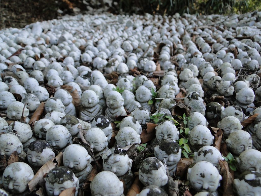
Mt Higane starts at sea-level from Yugawara station and heads inland all the way up to 771m. The latter portions of the trail can have snow but this shouldn’t really be a concern since there are few steep sections. However caution is required when negotiating the icy steps when heading back down to Izuyugawara Onsen 伊豆湯河原温泉, a short bus ride from the station. There is a short cable car near the top of Mt Higane at Jukokkutoge 十国峠 at the bottom of which it is possible to catch a bus.
PROS: Nice Onsen at the end, great views of Mt Fuji, photogenic stone buddhas
CONS: Start of the trail is not well signposted, some portions are on the road, some snow on the higher portions
Mt Nango 南郷山, Mt Maku 幕山 and Mt Shiro 城山, Kanagawa Prefecture
This hike is described in this blog post
These 3 small mountains are located a little North of Mt Higane (described above) in the vicinity of Yugawara station 湯河原. The first 2 are best reached via a short bus ride but Mt Shiro is walkable from the station. They can be done separately or in combination. The highest point is Mt Nango at 610m but since they sit right on Sagami bay, snow is rare.
PROS: Multitude of paths, plum blossoms in February and March, good lunch / break spots at the top of Mt Maku (usually lots of people) and Mt Shiro (less people)
CONS: Crowded bus to the start of the trail during plum blossom season, trail up Mt Nango a little difficult to find, some road-walking when doing Mt Shiroyama
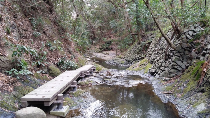
Mt Ogusu 大楠山, Kanagawa Prefecture
Mt Oogusu’s is known as the highest point of the Miura Peninsula 三浦半島 (due South of Yokohama) at 241m. It also happens to be a Kanto hundred famous mountain. So that’s already two good reasons to climb it!
PROS: Observation tower on the top, the lower part is along a river, can be done as a loop hike or a traverse from Kinugasa Station 衣笠 on the Yokosuka line
CONS: Not a full day hike (but possible to combine with other peaks on the peninsula), some road walking necessary, closeness to civilisation
Tenen Hiking Trail 天園ハイキングコース, Kanagawa Prefecture
Topping out at 159m, Mt Oohirayama is the highest point of this trail just East of Kamakura City, and is virtually guaranteed to be snow free throughout winter. The trail is well trodden and most parts are fairly easy making it suitable for beginners. The hike starts and finishes at different temples in the area, accessible from Kita-Kamakura and Kamakura stations.
PROS: Station to station hiking, possible to combine with sightseeing (temples and Daibutsu), views of Mt Fuji and the sea
CONS: Can get crowded, not a full-day hike, surrounded by residential areas

Mt Zukkou 頭高山 and Mt Koubou 弘法山, Kanagawa Prefecture
Located right between Mt Oyama and the Shonan coast, these low hills make up the southern extremities of the Tanzawa mountain range. The highest point is Mt Zukkou at 303m and the entire trail is should be snow free throughout most of the winter. The hike starts from Shibuzawa station and ends at Tsurumaki onsen station, both on the Odakyu line. The hike can be split in two at Hadano station.
PROS: Station to station hiking, panoramic views of the Tanzawa mountain range on Zukkou part of the hike, observation tower on the top of Mt Koubou
CONS: Some road walking at the start, poor signposting on the Zukkou side, crowds around Mt Koubou


Thanks for these. The observation tower at the top of Mt. Ogusu has been closed for some time. It seems to be rusting away.
Indeed. On my last 2 visits in 2023 and 2024 it was closed. The last time I was able to go up was in 2021. The other tower nearby is still open I think.