

Hiking in the Fuji Five Lakes Area
This is one of my favourite areas to hike in the late autumn and early winter since the views of Mt Fuji are so beautiful. Also, since April 2019, there is a direct limited express between Shinjuku and Kawaguchiko that I really wanted to try. It’s the same deal as the Chuo line limited express – all seats are reserved only. However, for the Fuji train, there were no seats to be had on the day itself, and I had to stand most of the way. Although it’s convenient, I probably won’t be using this train again.

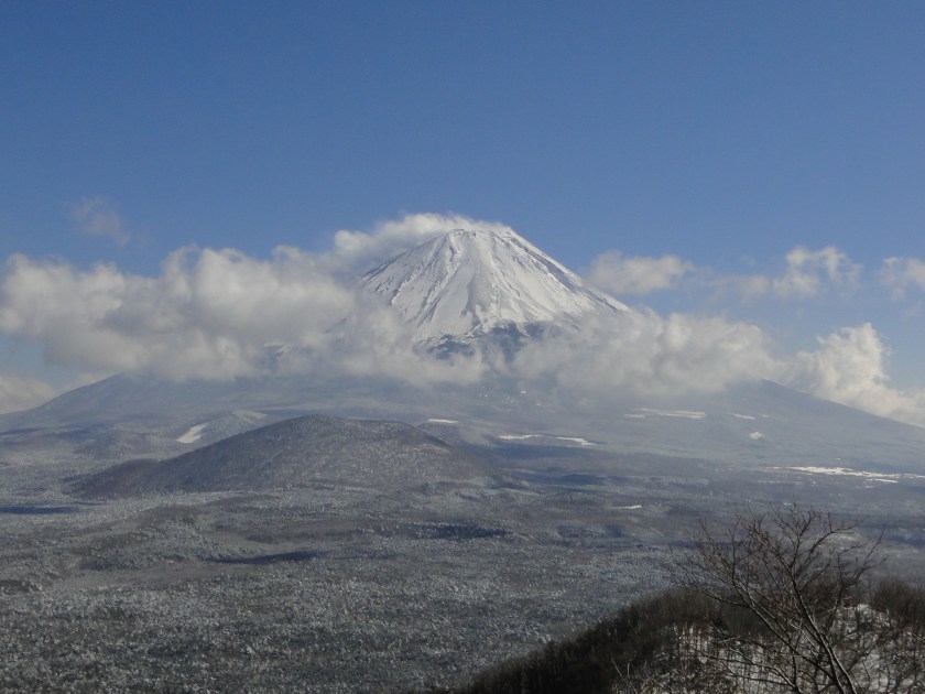
View of Mt Fuji from Yamadaya Hotel
I got off at Fuji station, boarded the bus for Motosu lake, and got off at Yamadaya Hotel next to Shoji lake. The view of Mt Fuji rising from behind the lake was stunning. Originally I wanted to hike all the way to Mt Ou and end at lake Saiko, but considering the fresh layer of snow that covered the higher reaches of the mountain, I decided to shorten the hike, and make a loop back to my starting point. The fact that the Yamadaya hotel also allowed day-trippers to use their hot spring bath was also a factor in that decision.


Already hiking in the snow in November
I started up the hiking path quite late in the day – at 11h15. I had hiked up this path once before in February 2013 in the snow, and there was snow again this time. I met many people coming down – apparently this is a popular hike. I reached Panoramadai パノラマ大 one hour later, and had an early lunch. Six years ago I continued down to lake Motosu on the other side. This time, I retraced my steps to follow the ridgeline Northwards. There were less people, and the path went up and down more steeply. Fortunately, the snow layer was thin, but I had to be careful not to slip on the descending parts. I was glad I had chosen the shorter hike and that I didn’t have to rush!

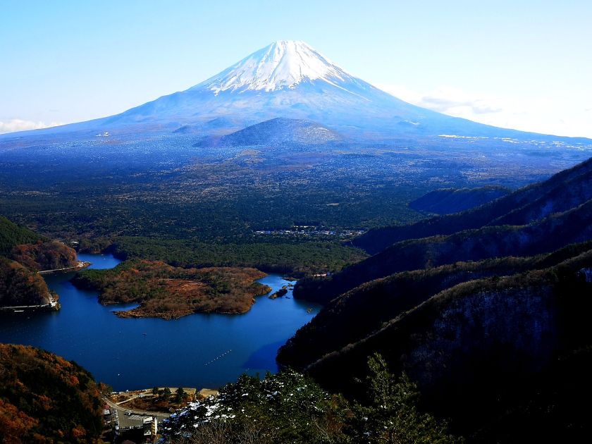
There was a great view of Mt Fuji and Shoji lake, a few meters to the right of the path, just before Shoji pass – I nearly missed it even though it was marked on my map. After that, the path climbed steadily. I reached an area with a small shrine that seemed like the top but wasn’t. It took another five minutes along a level path to reach the true summit of Mt Sanpobun 三方分山. It was surrounded by trees, but there was a nice view of Mt Fuji on the South side.

It was past 2pm and time to head down. On the way, I had some good views of the ridge leading up to Mt Ou – hopefully I can hike it another time. The whole mountainous area spreading North-East, and bound by the Fujikyuko and Chuo lines, is known as the Misaka mountain range. One hour later, I emerged from the forest near the base of the lake. There was an interesting shrine with a couple of very large cedar trees. According to the sign, they were 1200 years old, 10 meters in circumference, and 40m high! A short walk brought me back to my starting point where I was able to take a nice bath with a good view of Mt Fuji in the late afternoon light.

