Mt Tsutsuji (879m) & Mt Maruyama (960m), Hanno & Chichibu Cities, Saitama Prefecture, Sunday, November 4th, 2023

I wanted to go for a hike closer to home, in Oku-Musashi, an area I’ve been to many times before. I found a couple of trails I had yet to explore, and finishing in Chichibu, where I could get a hot bath before returning via the limited express. In the morning, I would take the train to Shomaru station and follow a section of the “Oku-Musashi Long Distance Trail” up to Kabasaka Pass; from there, I would make my way along the Kanto Fureai-no-Michi to the observation tower on top of Mt Maruyama. After enjoying the view, I would continue north, down into the Chichibu Basin, ending at Temple 4 on the Kannon Temple Circuit, a short bus ride from Seibu-Chichibu Station. I hoped the area would be spider-free and full of autumn colours, despite the continuing warm weather. The forecast called for clear skies in the morning, but cloudy from the afternoon. I was looking forward to a relaxing ramble along a route of my own creation.

Read this Blog Post on Hiking Around Tokyo

Hiking in Oku-Musashi 奥武蔵

Hiking on the Kanto Fureai-no-Michi 関東ふれあいの道

Going up the Oku-Musashi Trail to Kabasaka Pass

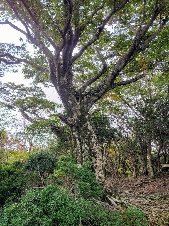
Walking through the Forest on Mt Maruyama

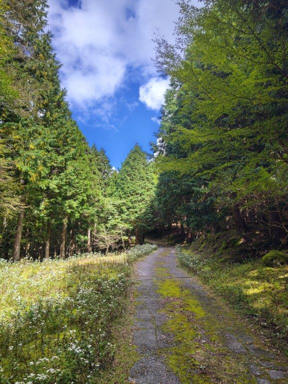
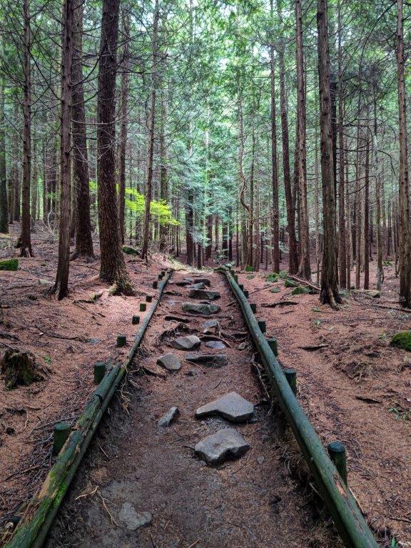
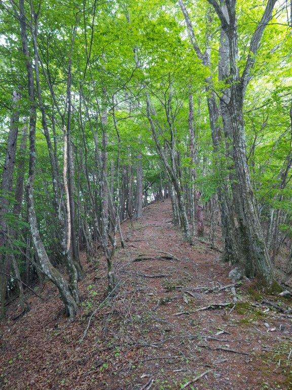
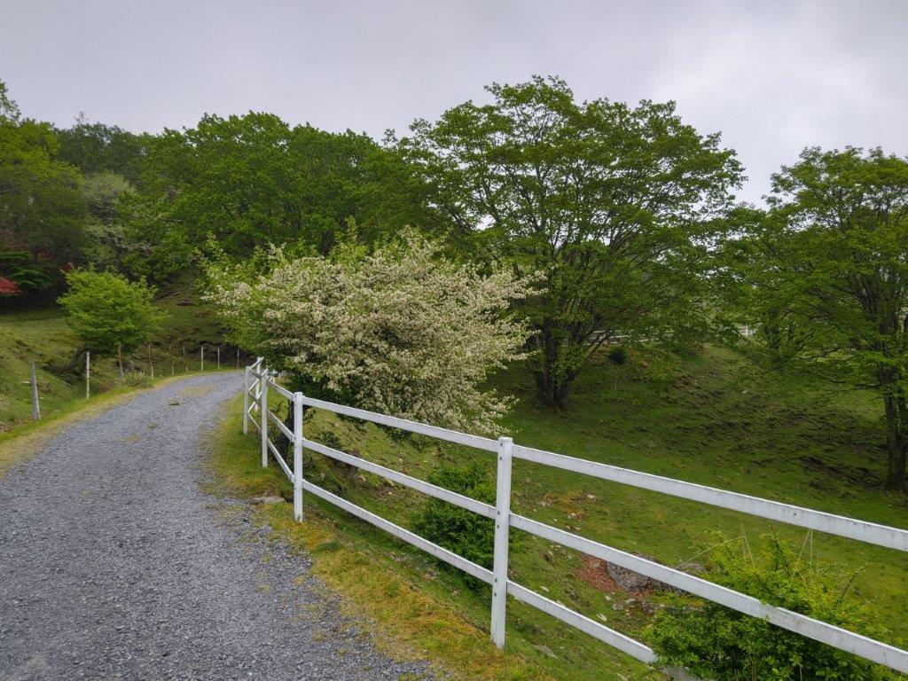
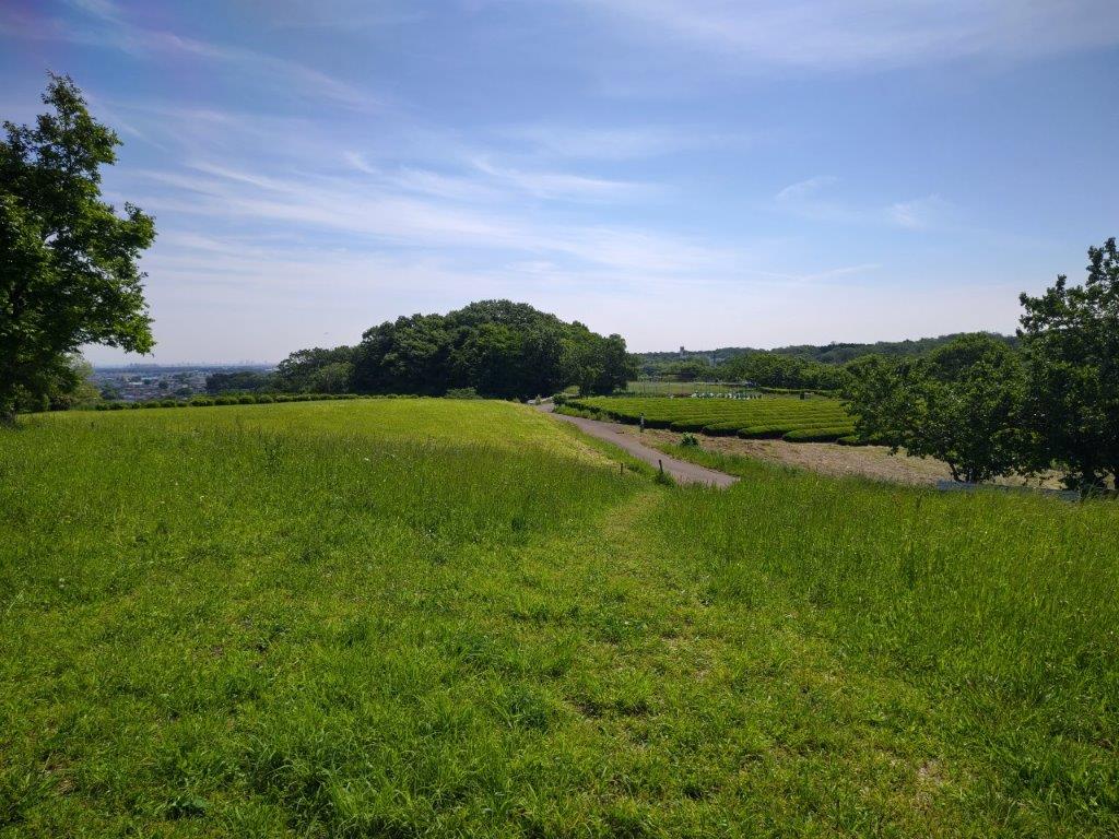
It was a blue sky day as I rode the Laview Limited Express to Hanno station, where I transferred to the local Seibu-Chichibu line, arriving at Shomaru station around 9:30. It felt quite warm as a I got ready for my hike, although cirrus clouds has appeared overhead. After walking along a busy road for a short while, I reached the start of the trail, a little after 10am.

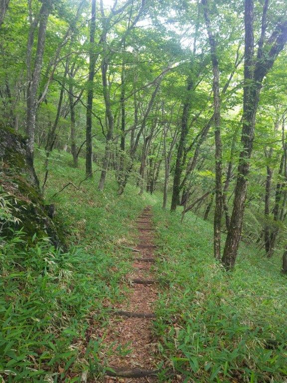
Start of the Trail near Shomaru Station

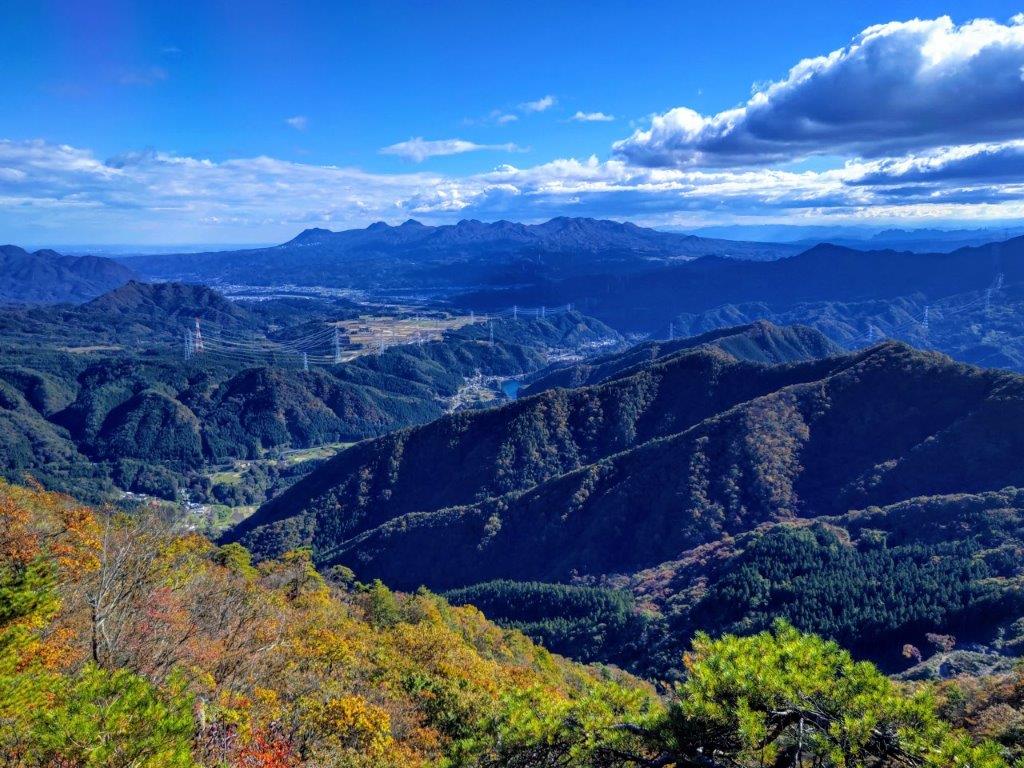
First View of the Day

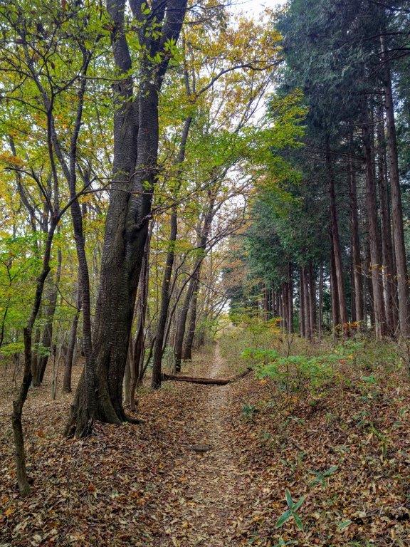
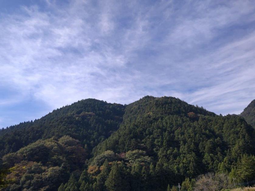
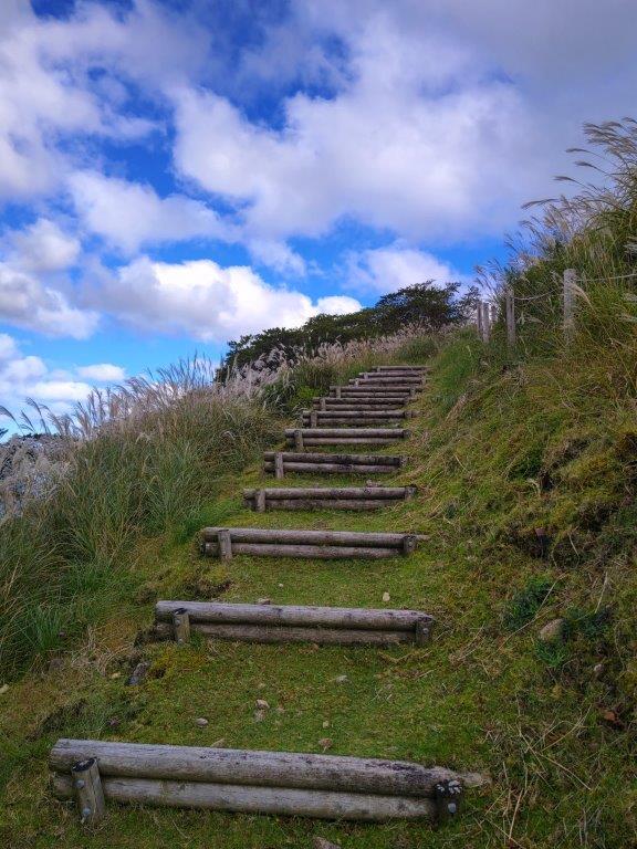
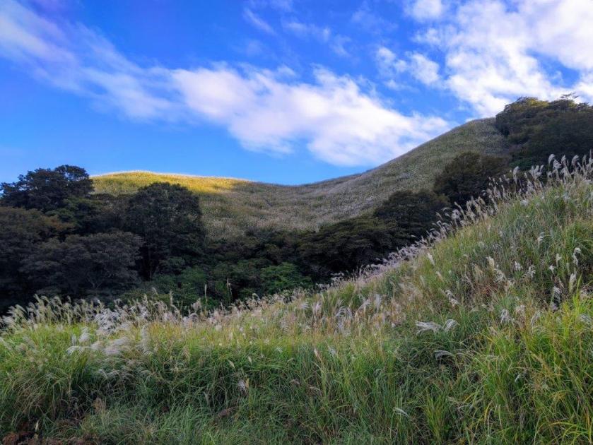
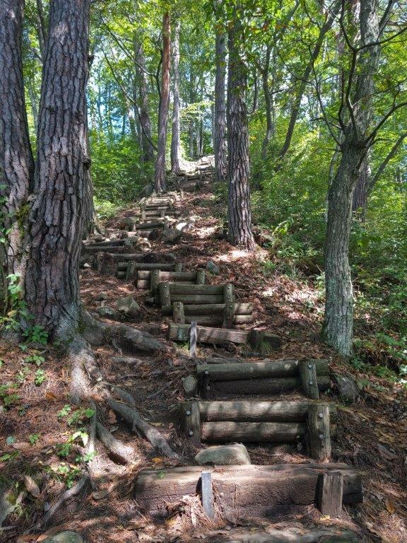
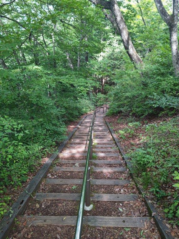
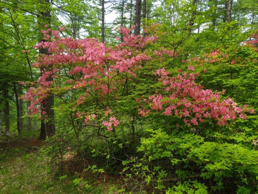
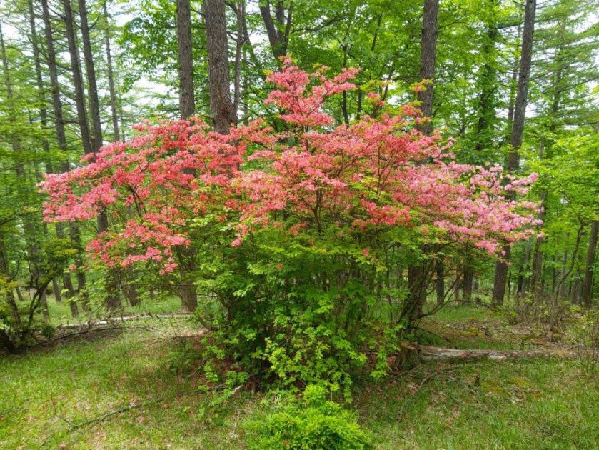
I followed the trail up a narrow valley under the cedars, blissfully quiet after the noisy road. A couple of steep climbs took me past the minor summits of Mt Kotsutsuji (小都津路山 770m) and Mt Otsutsuji (大都津路山 831m). I saw no one on this section, possibly because the trail is marked as difficult to follow on maps, although it was well-signposted the whole way. After a short, level section through the trees, I reached the top of Mt Tsutsuji (ツツジ山), crowned with yellow pampas grass.

Pampas Grass on the Summit of Mt Tsutsuji

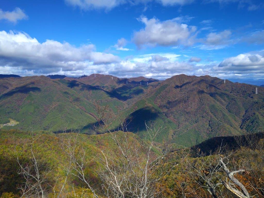
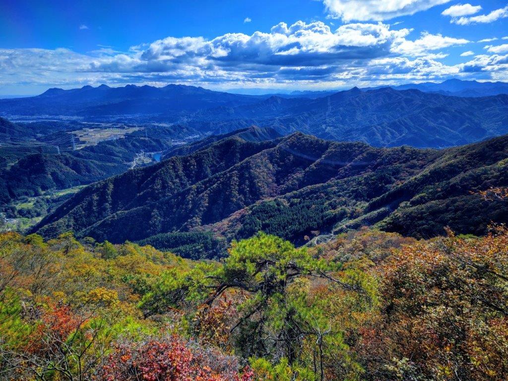
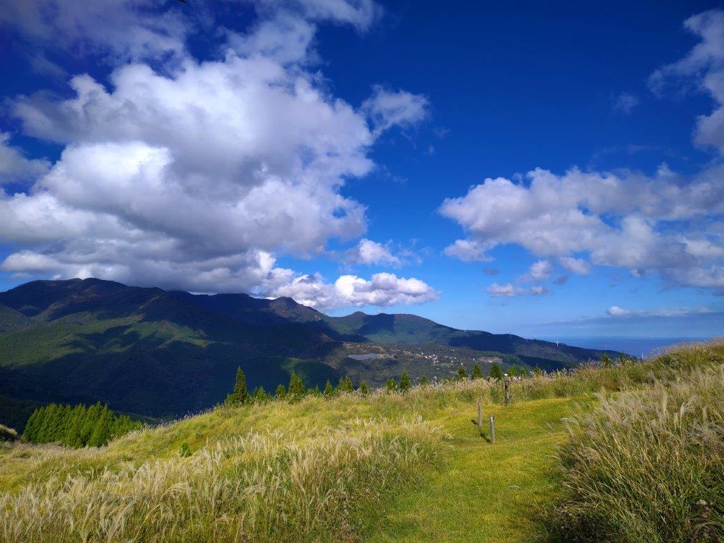
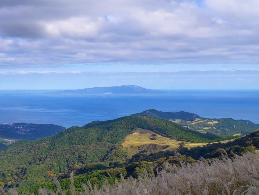
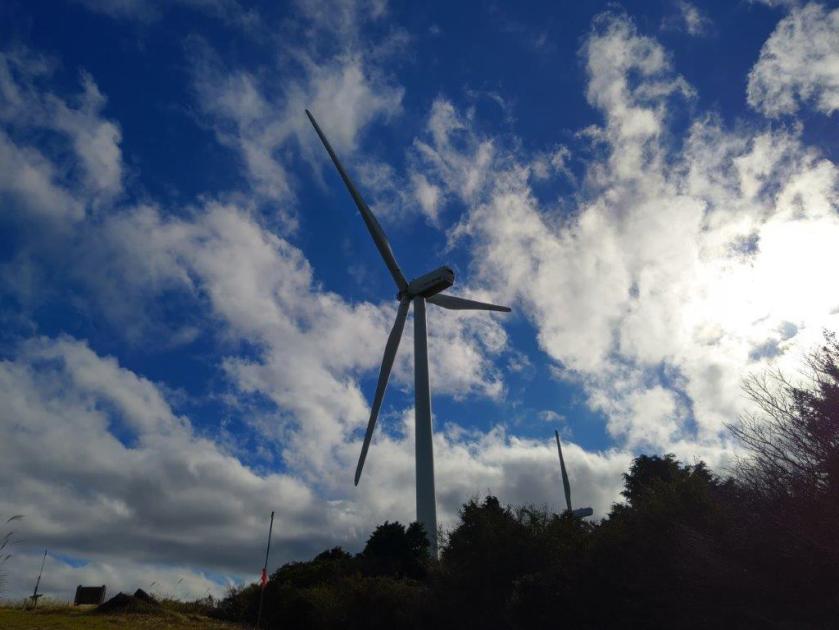
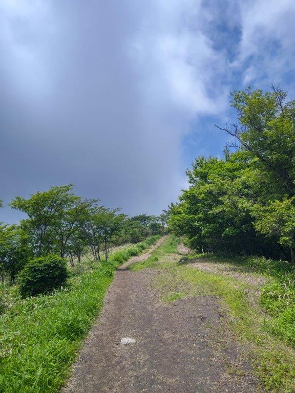
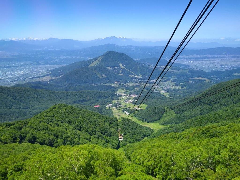
View East from the Paragliding Jump-off Spot

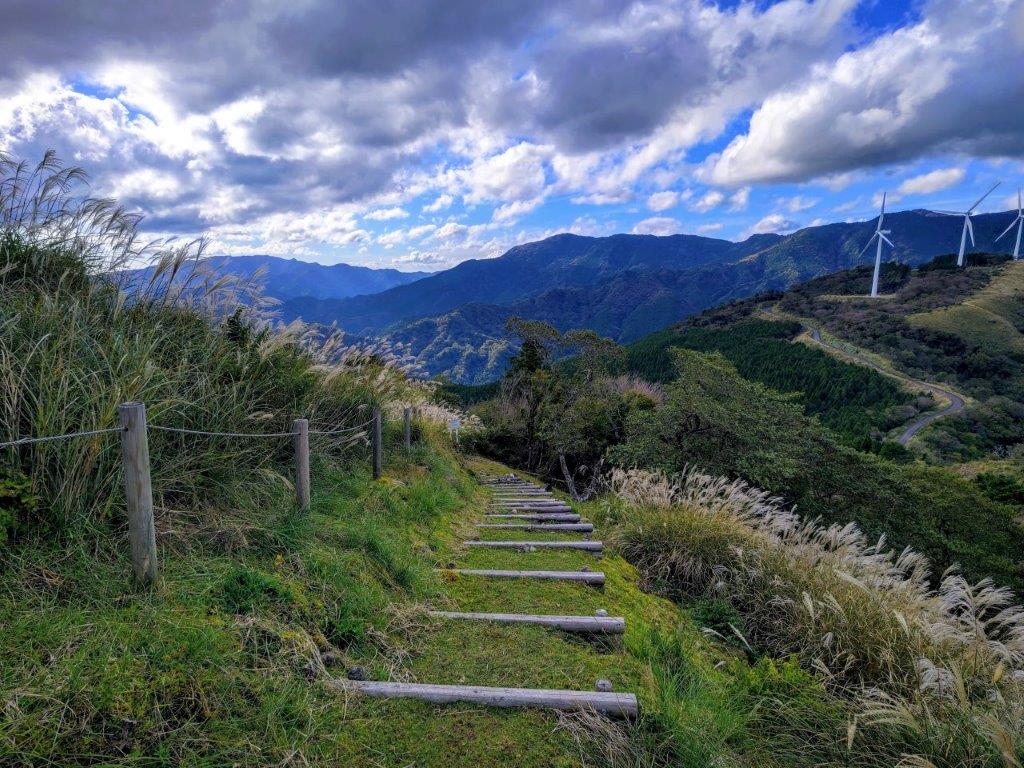
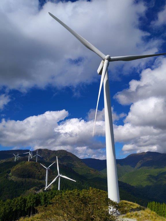
I was stunned by the sight of a bright red Japanese maple, or “momiji” right next to the summit marker, reminding me that it was indeed autumn, despite the short-sleeve temperatures. Since it was noon, I sat down for an early lunch, facing the view on the south side through a break in the trees. I soon set off again and reached Kabasaka Pass (刈場坂峠) just before 12h30, from where I continued to Ono Pass (大野峠). I had hiked this section before, part of the Kanto Fureai no Michi. After climbing a series of steps, I reached am open space, a jump-off spot for paragliders.

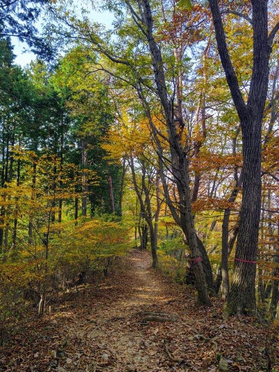
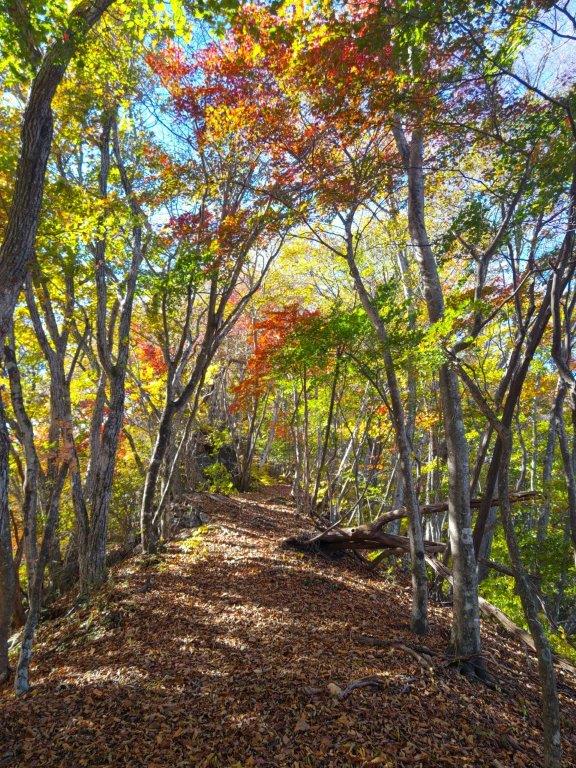
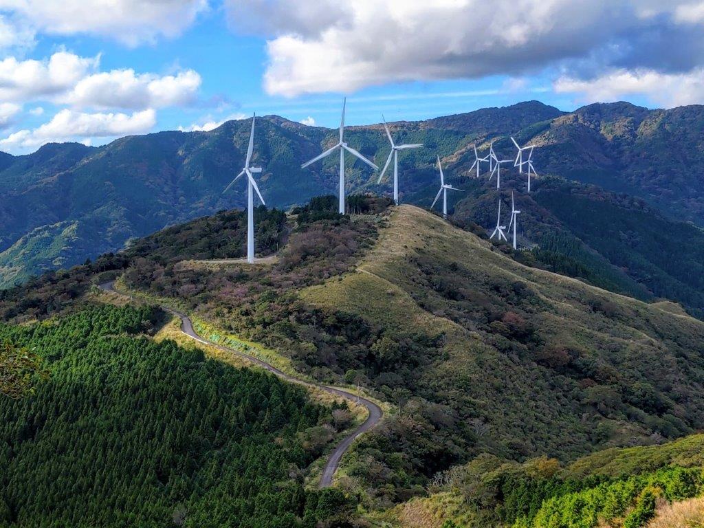
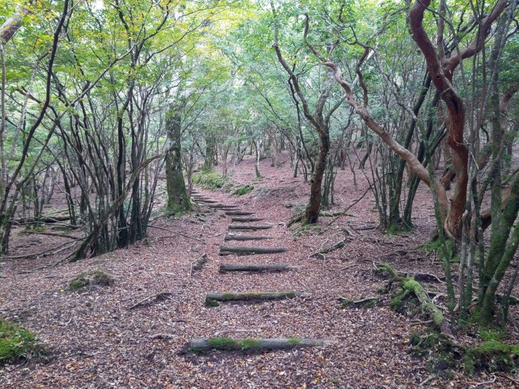
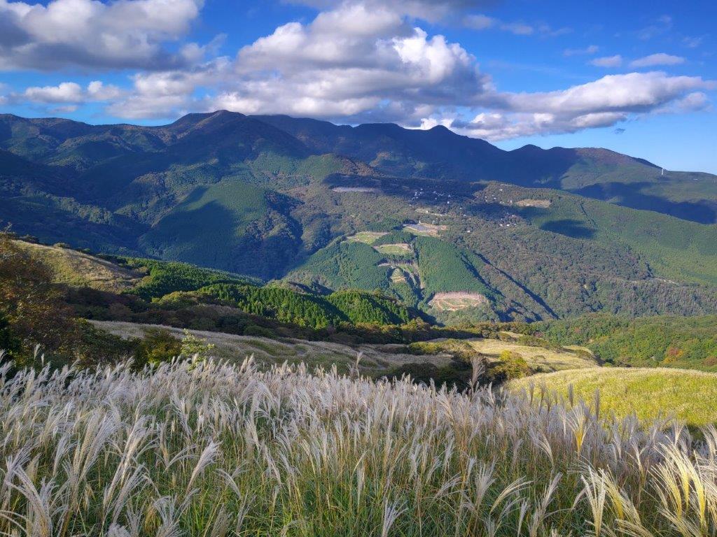
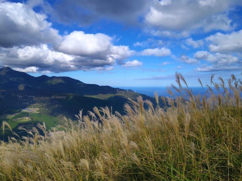
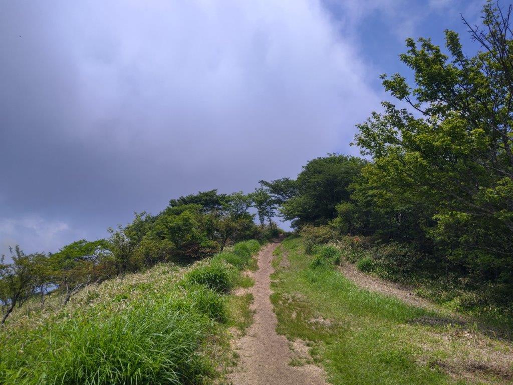
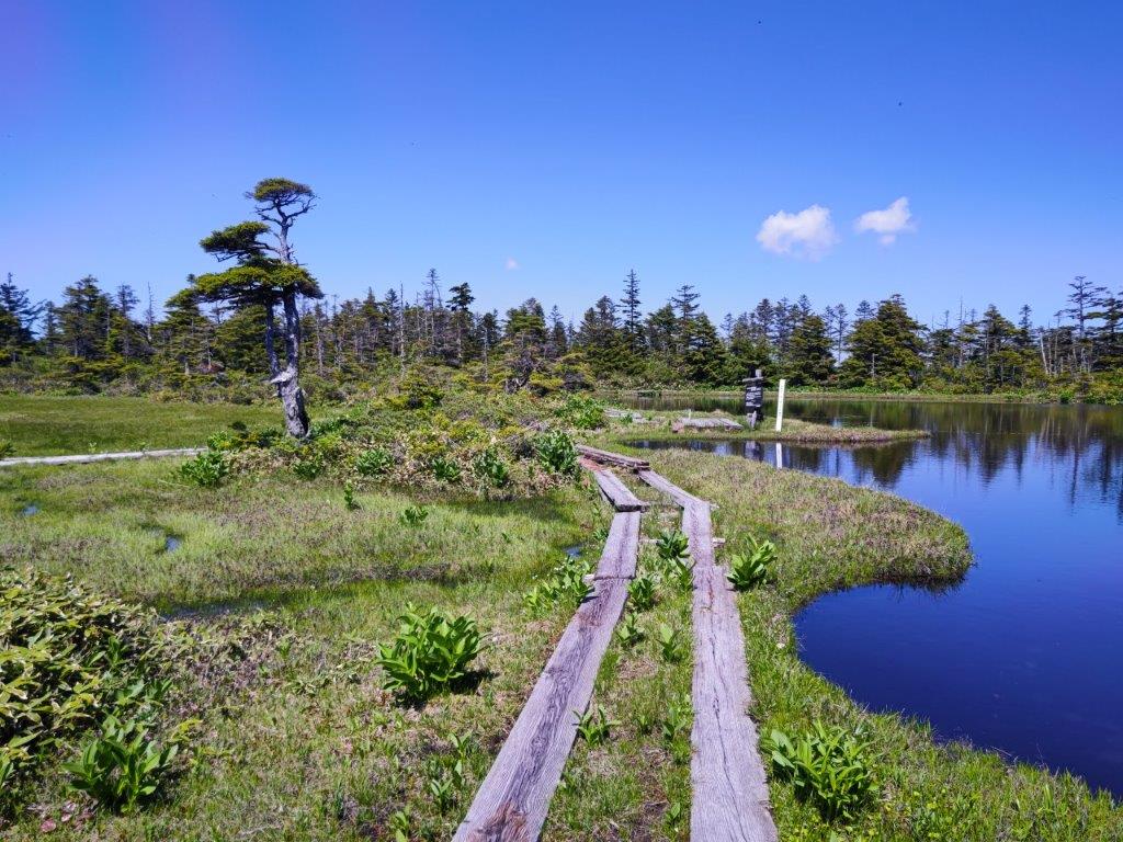
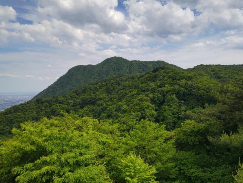
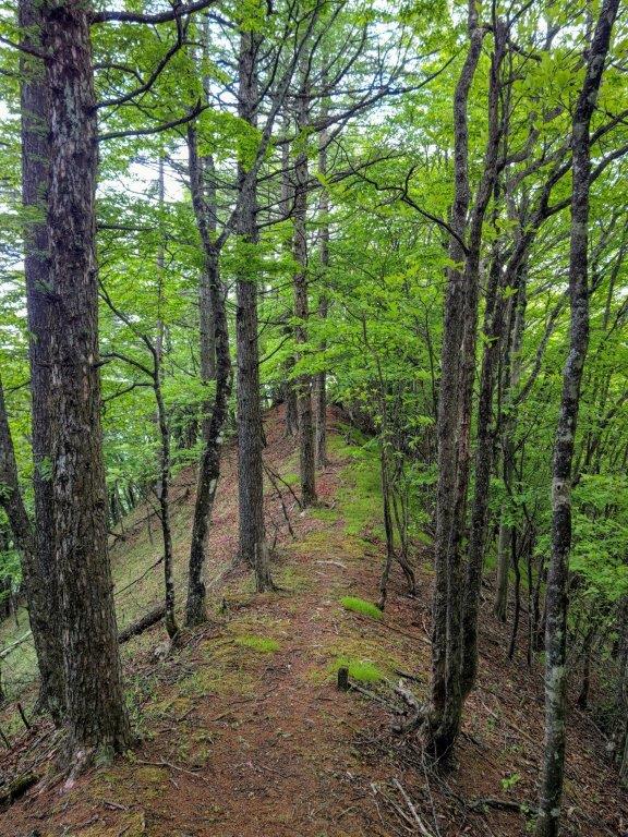
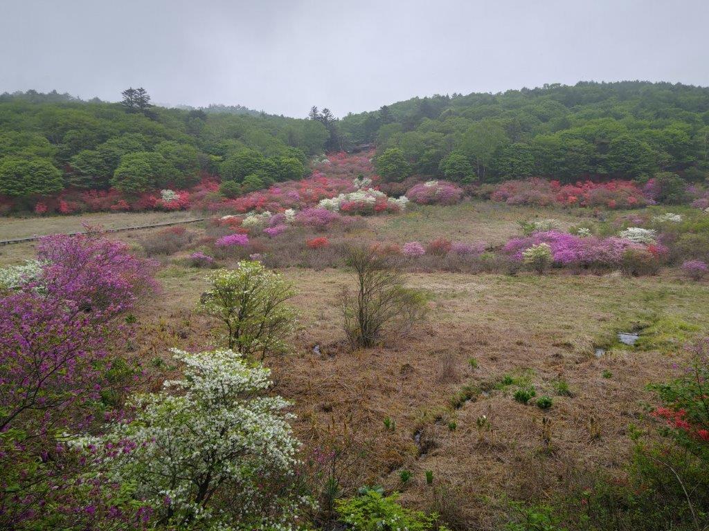
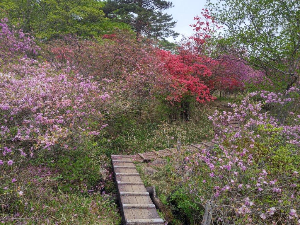
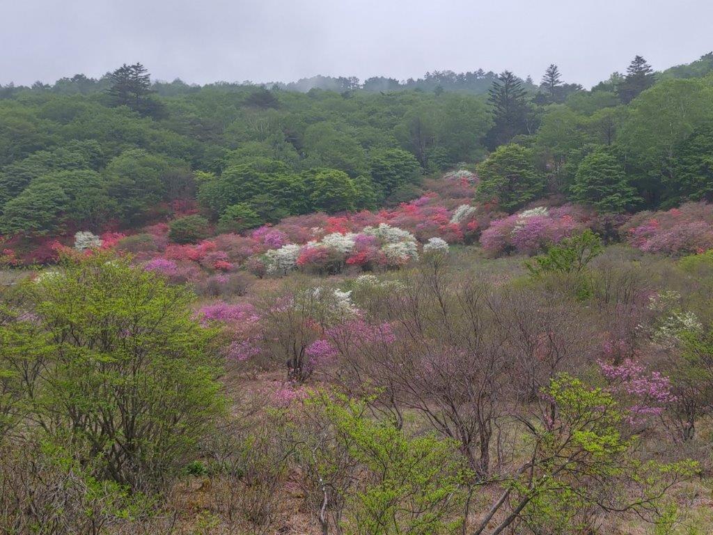
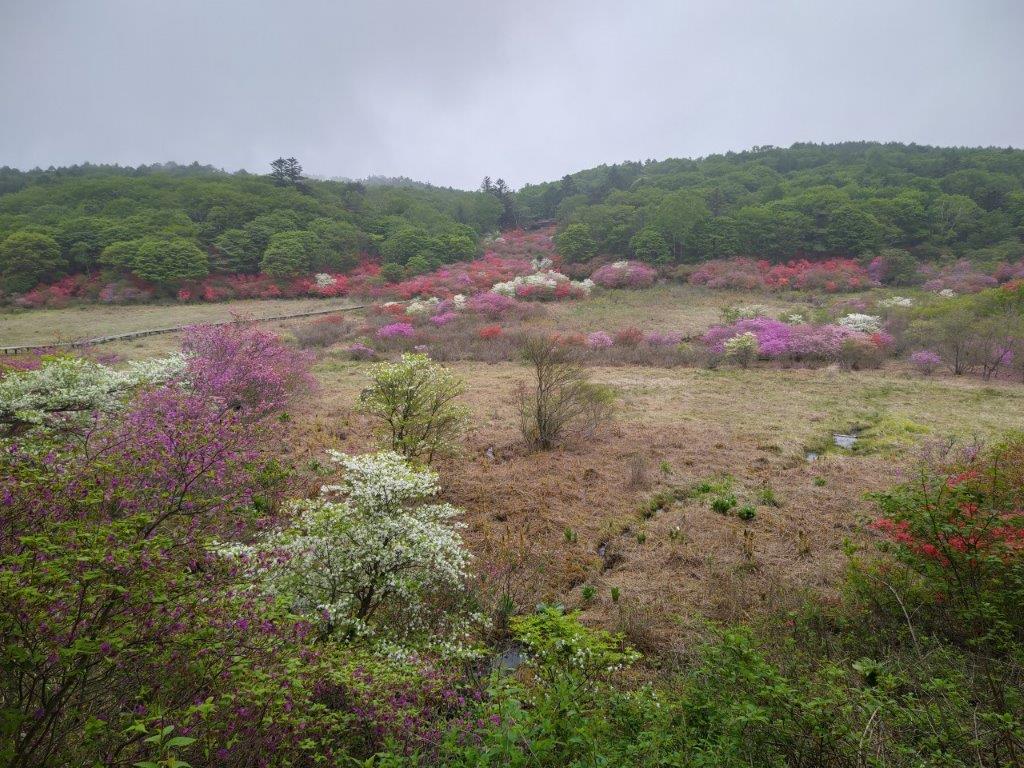
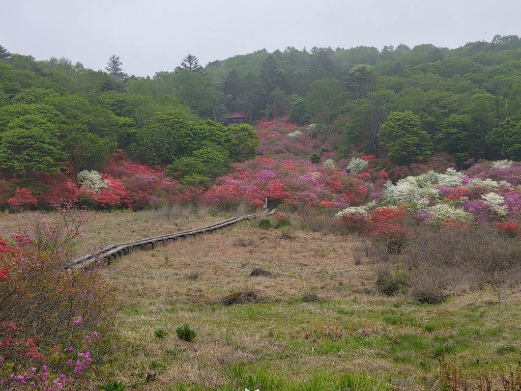
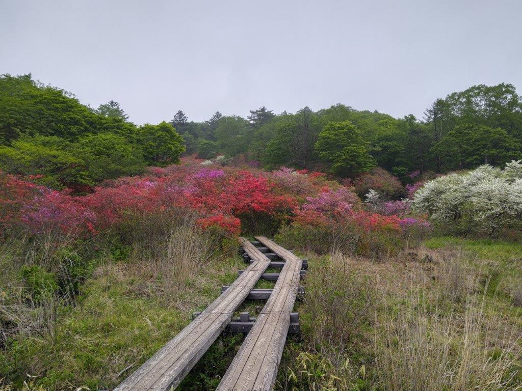
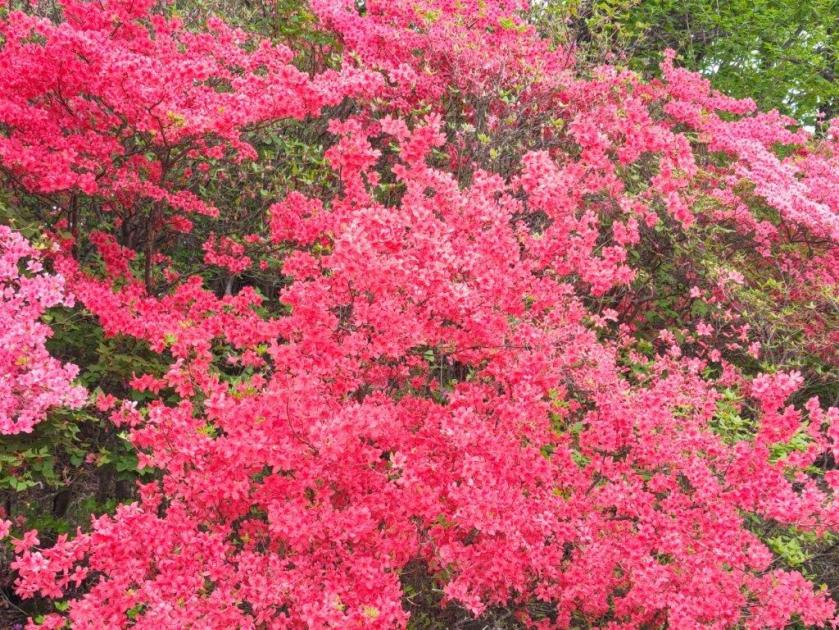
Easy Hiking near Mt Maruyama

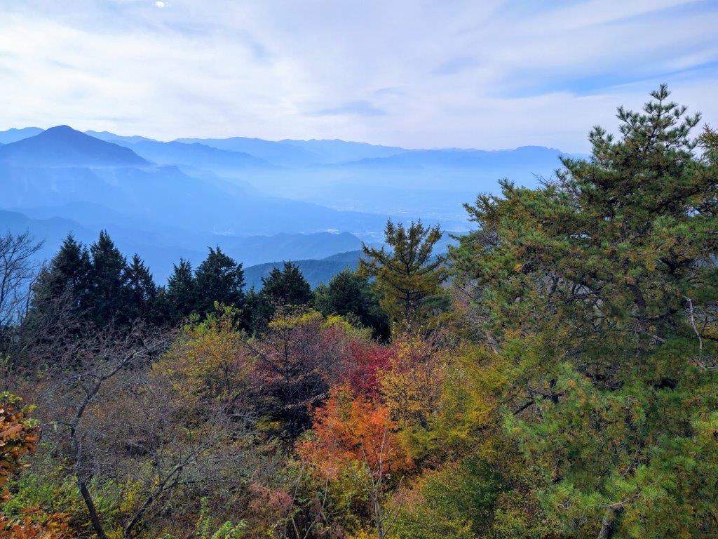
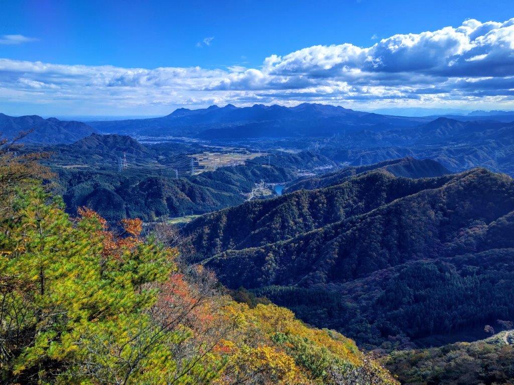
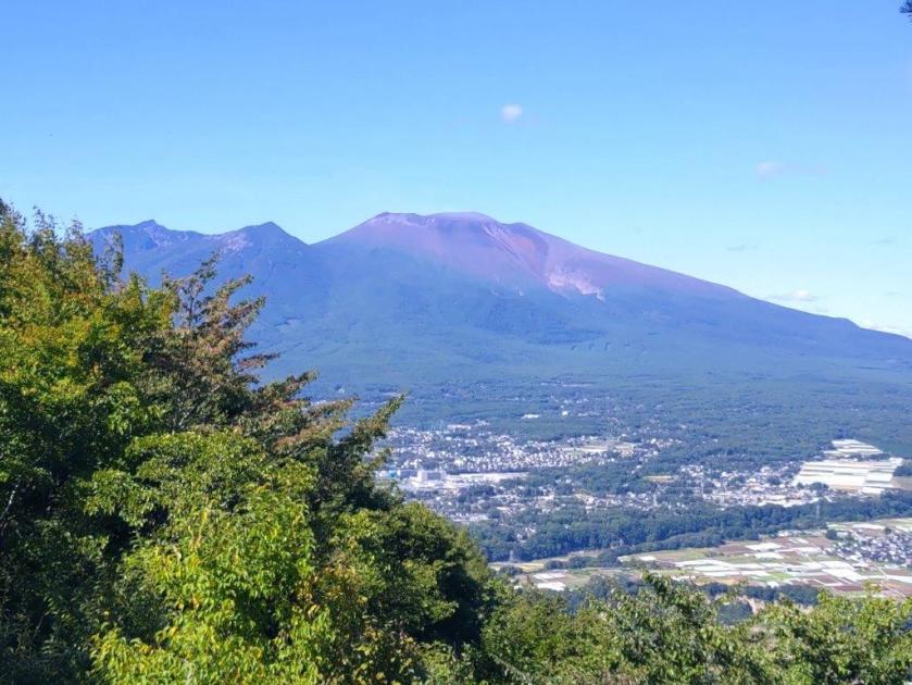
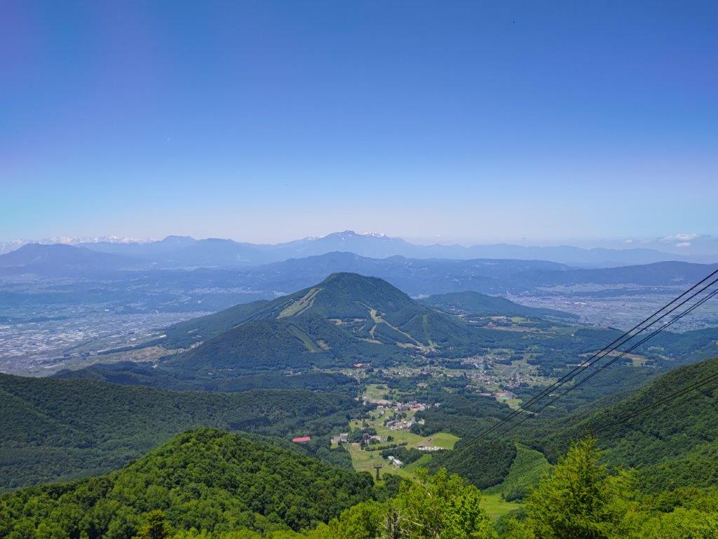
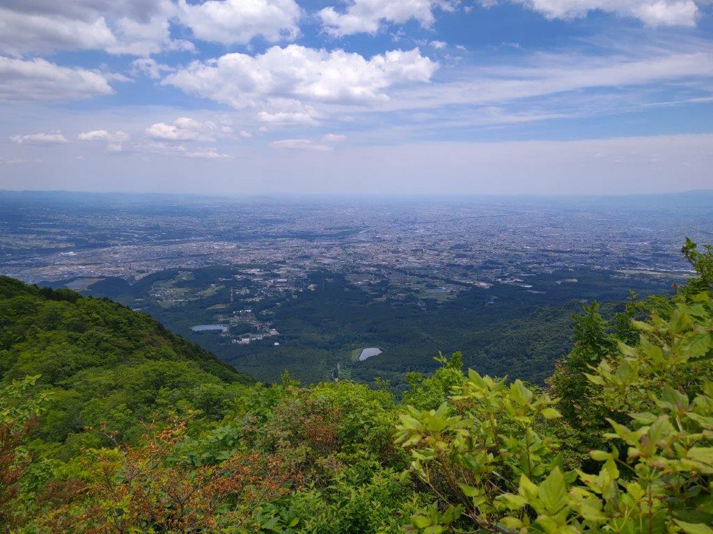
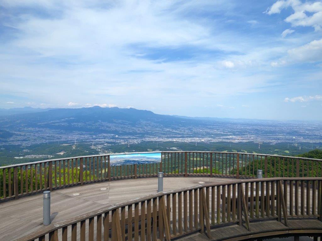
View of Mt Buko from the Maruyama Observation Tower

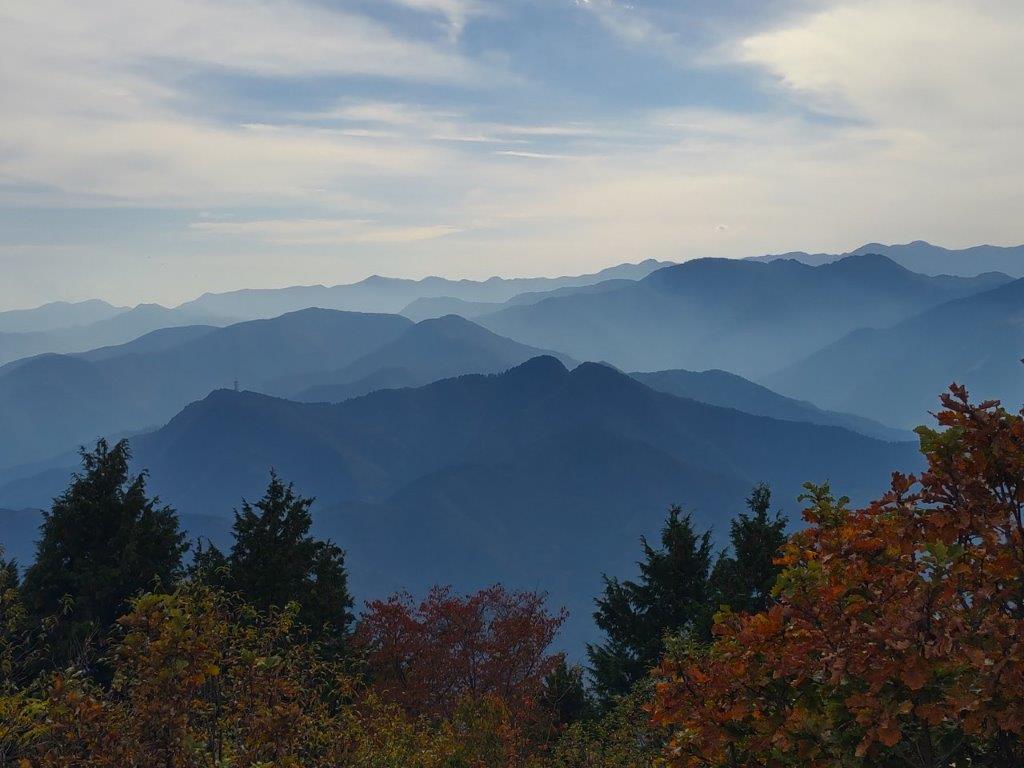
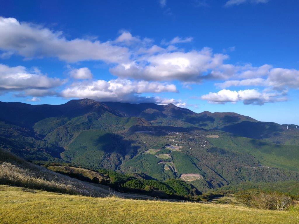
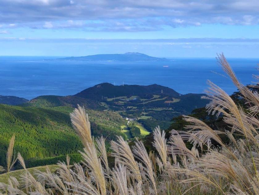
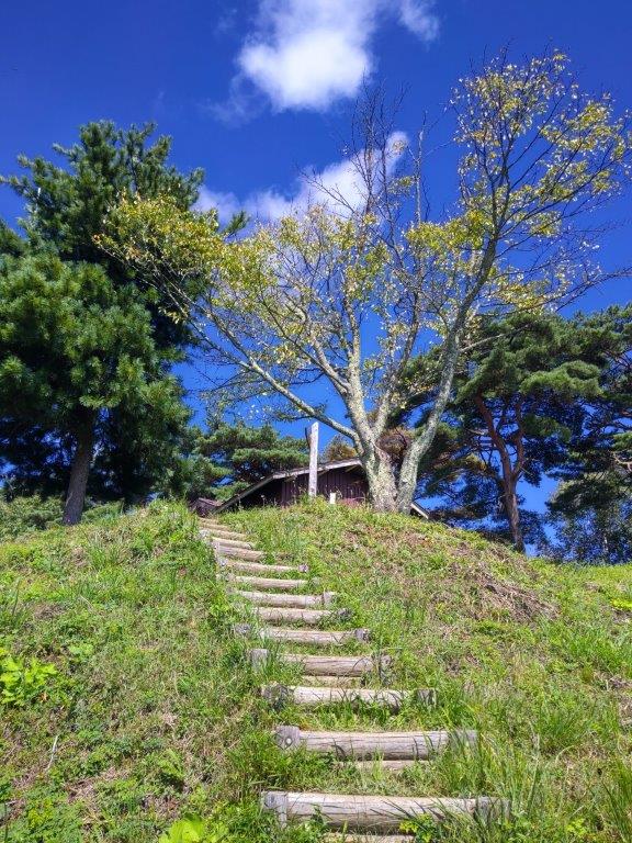
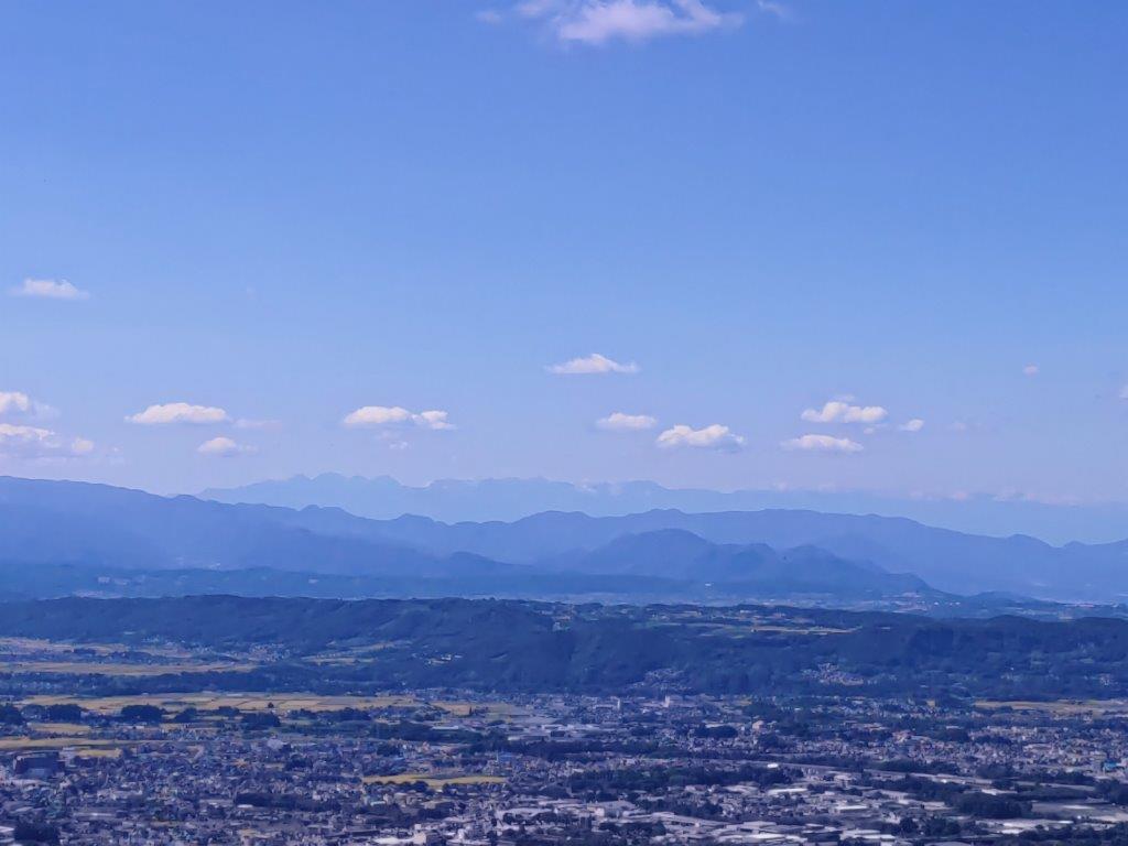
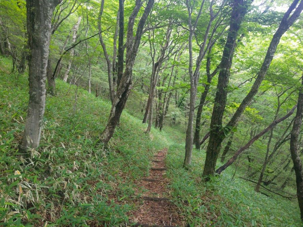
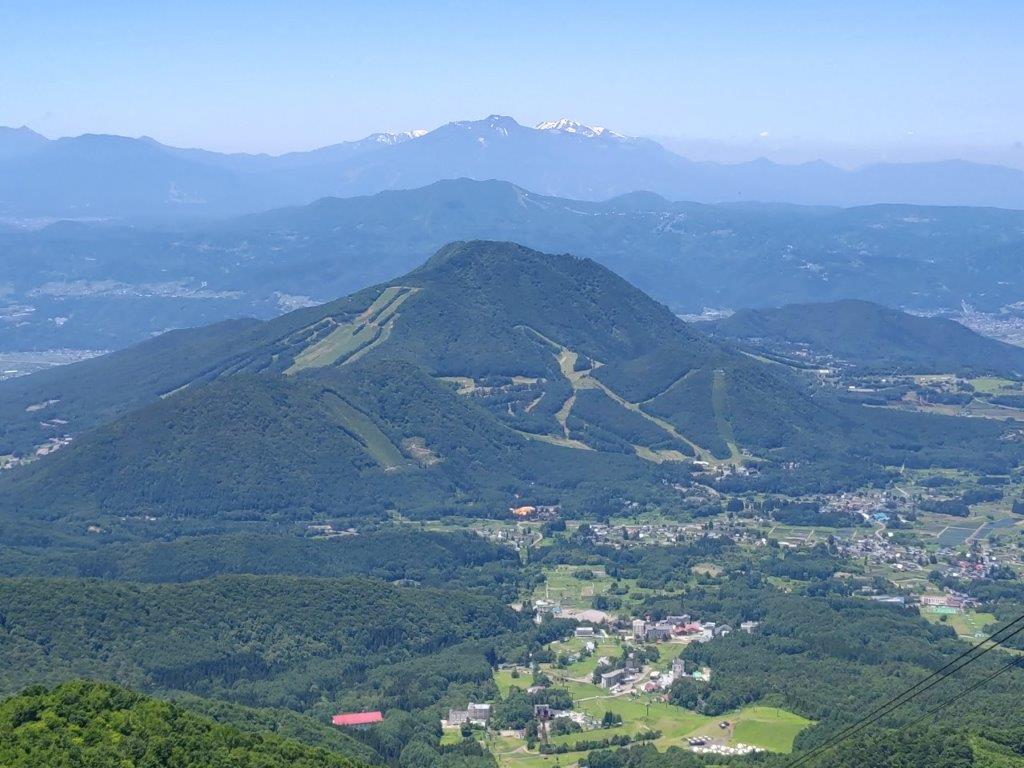
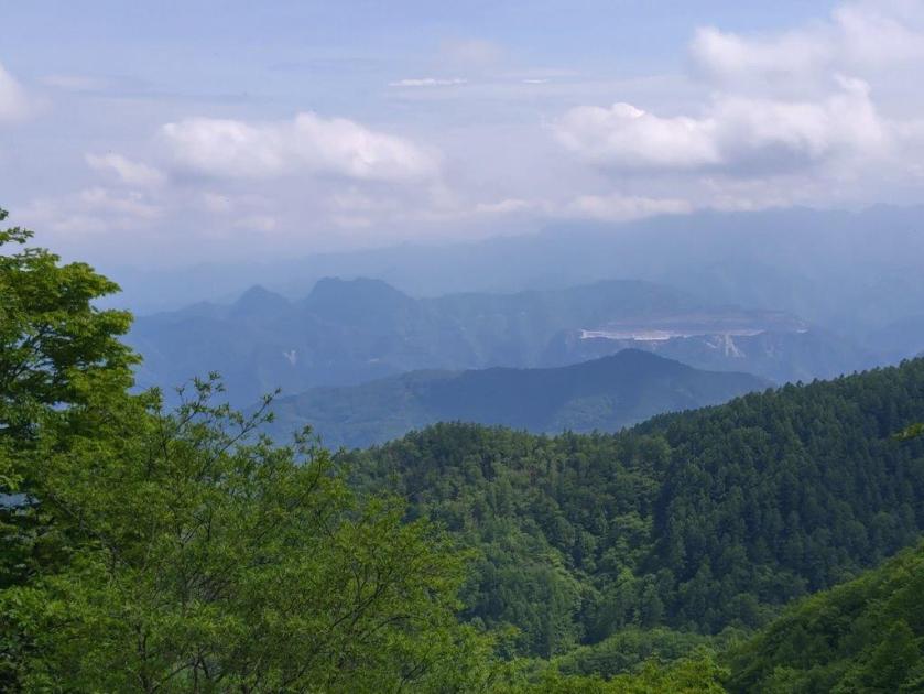
On the east side, I had a view down the valley towards Tokigawa Town, although the visibility was somewhat reduced by high-altitude clouds spread across the sky. I continued along an easy to walk trail through mixed forest, here and there autumn colours already visible. After a short climb, I reached the observation tower at the top of Mt Maruyama (丸山 まるやま maruyama) just before 1h30. I was my third time to visit what is one of the best viewpoints of the Chichibu area.

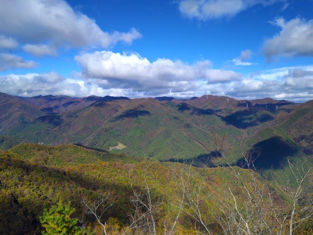
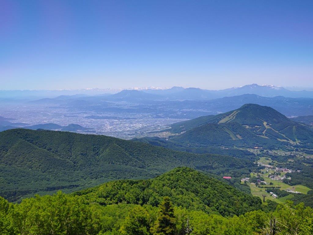
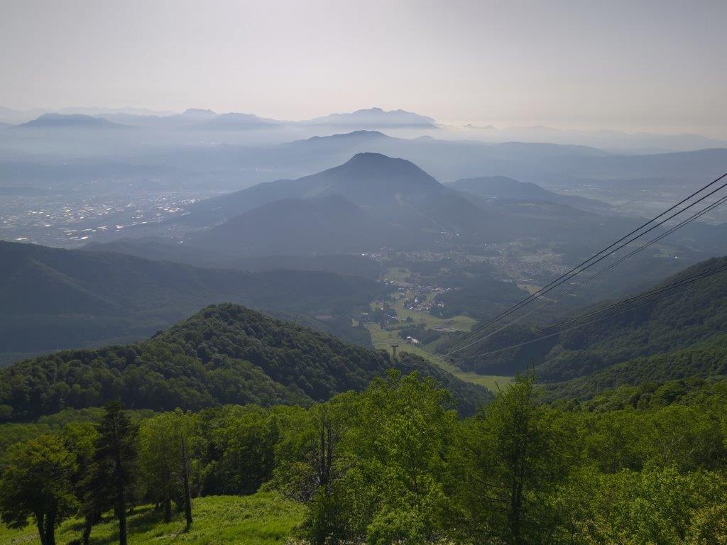
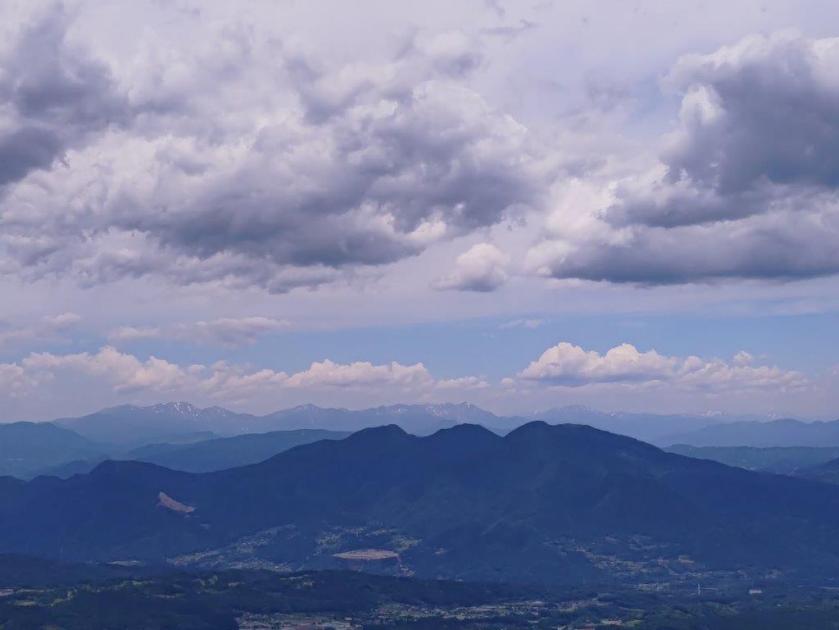
Hazy View of the Chichibu Basin

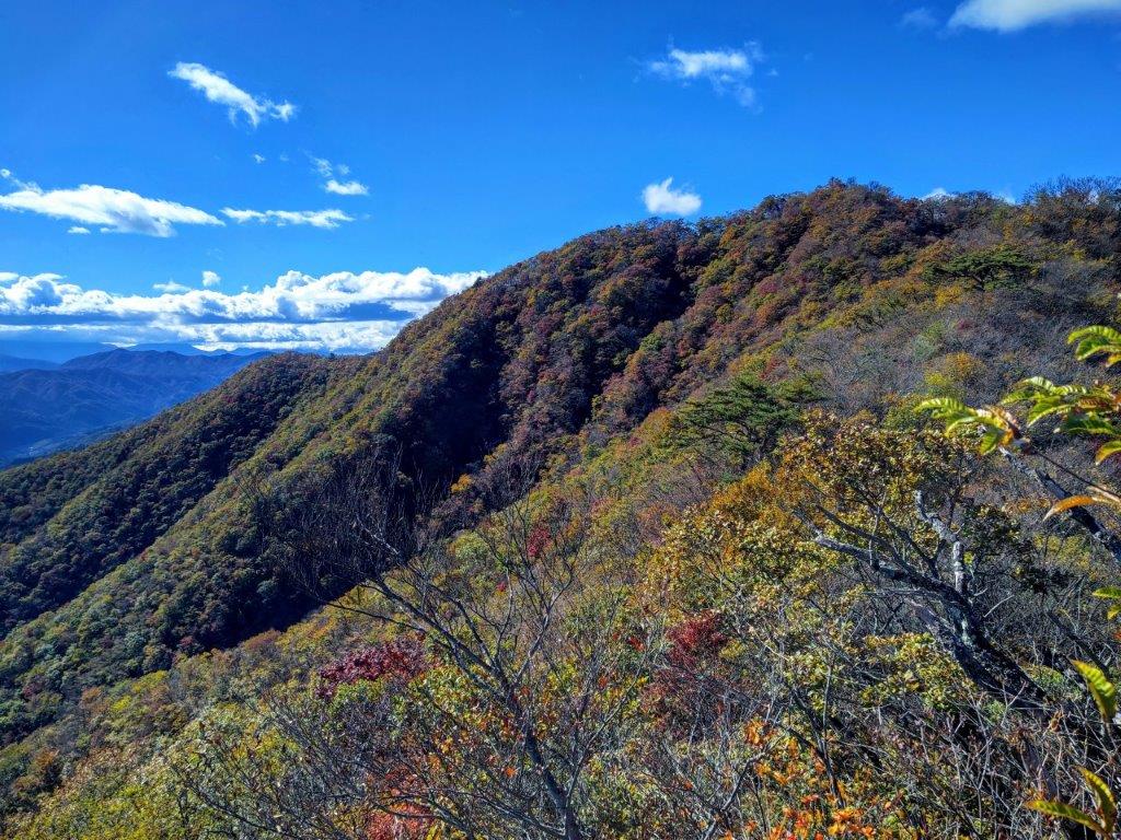
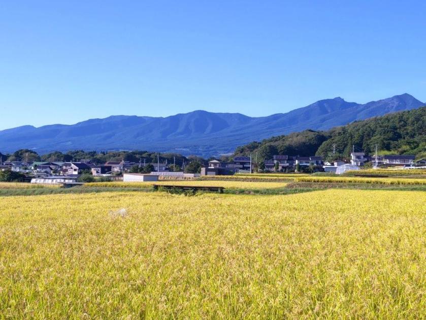
The Low Mountains of Oku-Musashi from Maruyama

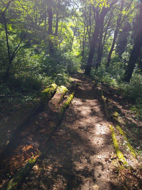
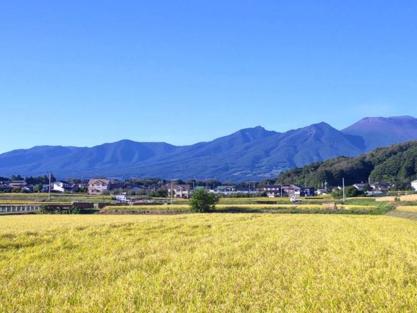
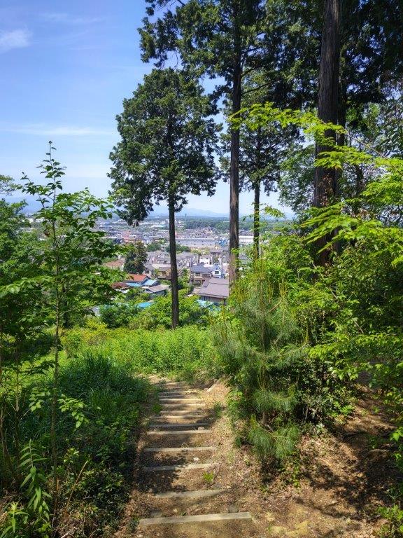
Today’s view was slightly hazy, giving a different impression from my previous visits; on the other hand, I could clearly see I still had some way to go, so I soon moved on. I headed down some steps on the north side, now inside the Saitama Prefectural Forest. At 2pm, I passed the Forest Study Pavilion (森林学習展示館), with a view of Mt Dodaira to the East, and started on the long, gradual descent into the Chichibu Basin ending at Kinsho-ji Temple. The sun was shining again, the clouds kept in check by the Chichibu micro-climate.

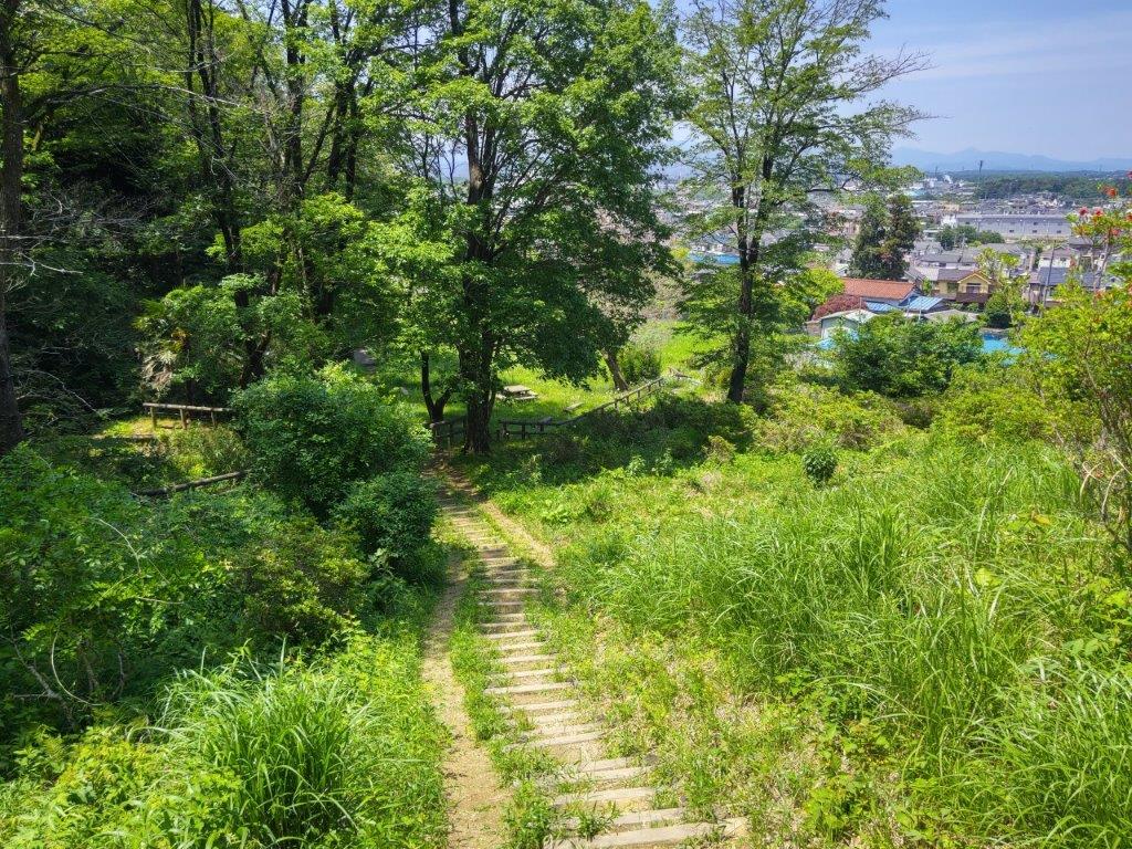
Autumn Leaves on the Descent to Kinsho-ji Temple

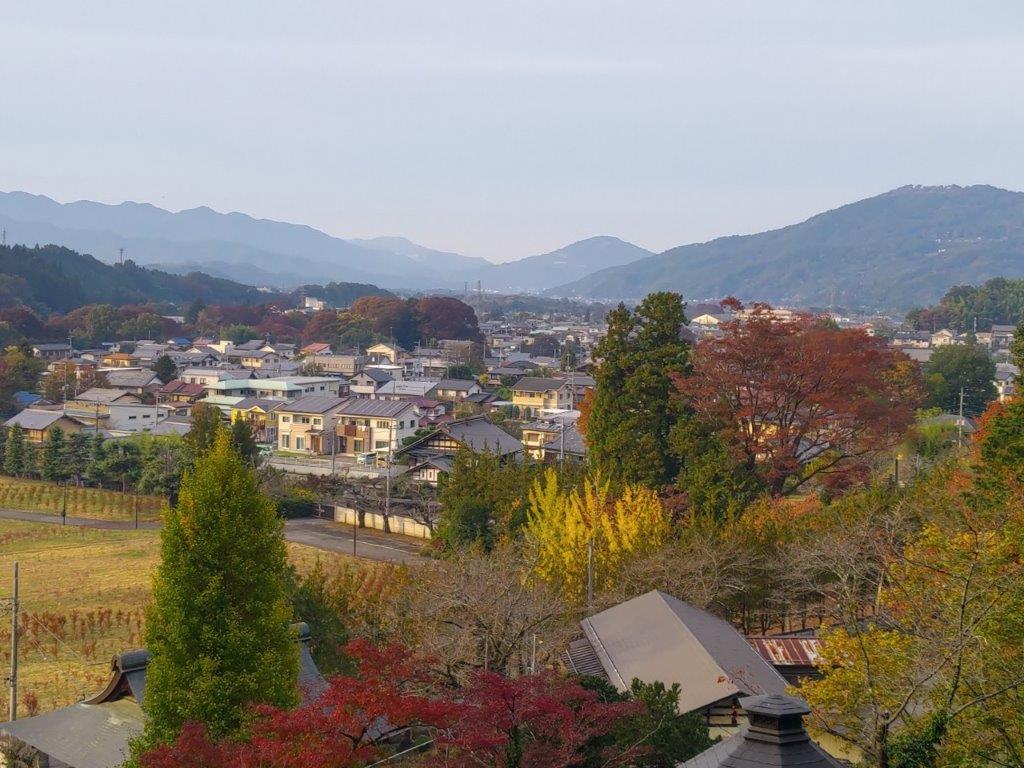
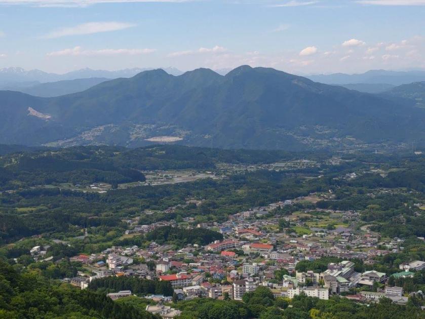
View from Kinsho-ji: Mt Happu (left), Mt Hodo (center) & Minoyama (right)

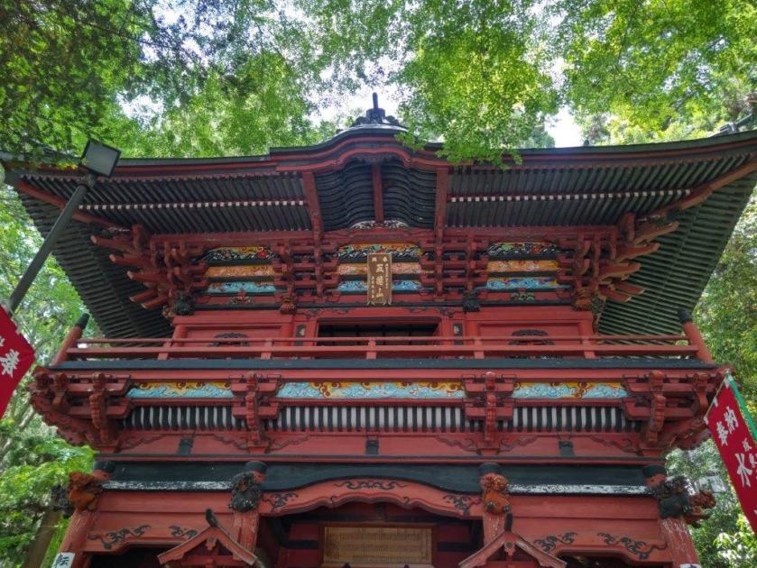
I was happy to be finally walking surrounded by the autumn leaves, the yellows dazzling in the afternoon light. One hour later, I had descended below the reach of the sun rays and was now walking on a switchback trail under the cedars; on each side of the trail, I could see empty spider webs. A little after 3h30, I emerged at Kinsho-ji Temple. I stayed a short while to gaze at its many small stone Buddha statues and huge, red maple tree, before running off to catch the 4pm bus for Seibu-Chichibu station.

Red Momiji and Buddha Statues at Kinsho-ji

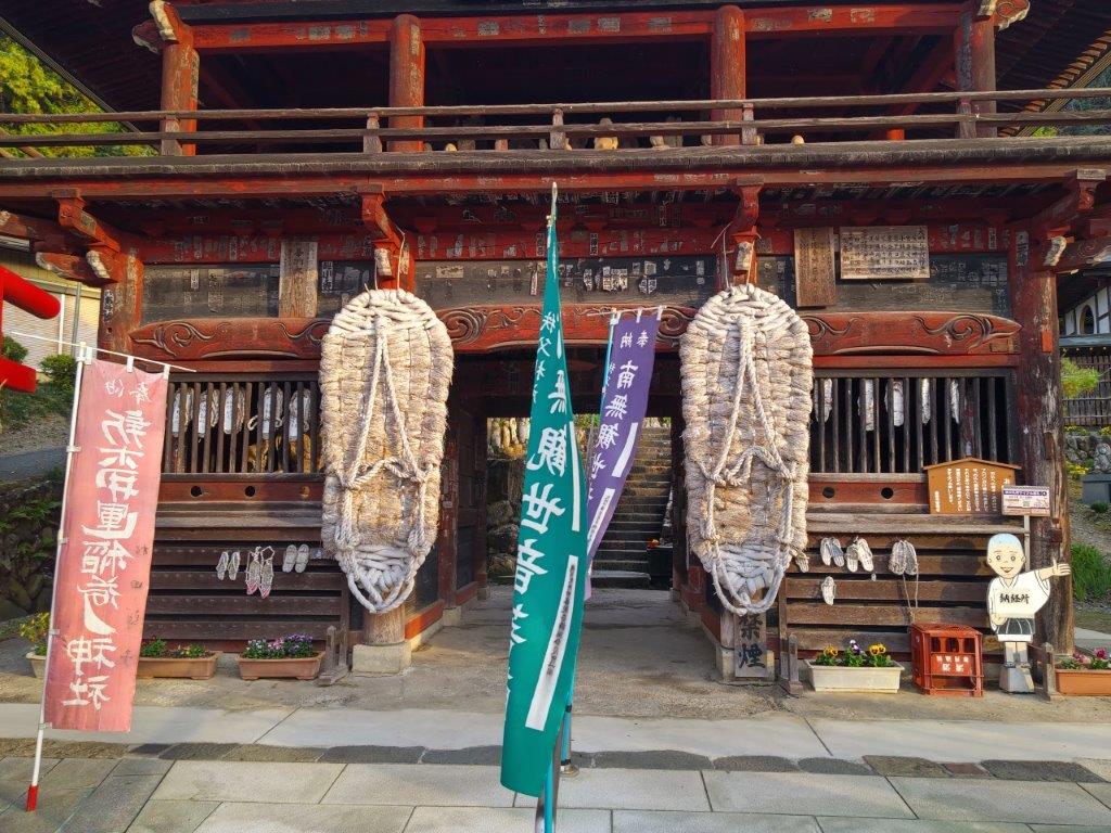
Giant Straw Sandals at the Entrance Gate of Kinsho-ji

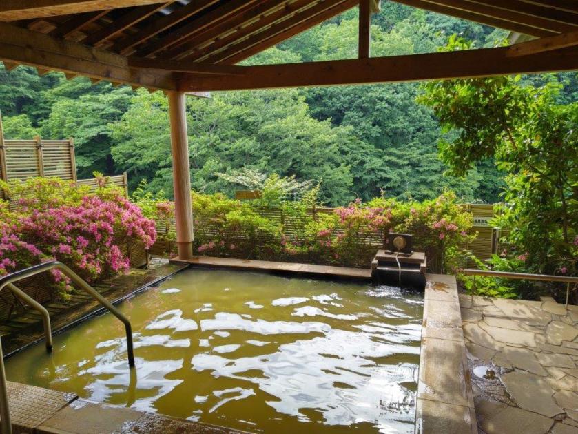
The entire hike took a little under six hours, a little longer than I would have liked, but I was thankful for the hot bath at the end. The weather was also a little warmer than I would have preferred, but as least I didn’t need to put on and take off layers at every break. Finally, I was glad that the two trails I decided to explore were easy to walk and follow, and that I had them entirely to myself. I look forward to creating more of my own Oku-Musashi hikes in the future.

Watch a Video of the Hike

Watch the Video of the Hike on Youtube

Watch a Slideshow of more Pictures of the Hike

Mt Sekison (1049m) & Mt Takada (1212m), Nakanojo Town, Gunma Prefecture, Sunday, October 29, 2023

I wanted to see some autumn colours, and also do a more challenging hike than the previous week. I chose a pair of minor peaks in the Nakanojo area, last visited a year and a half ago, not mentioned in my guidebook, nor shown on my hiking map. I knew about them thanks to a hiking pamphlet I had picked up during my stay at Shima Onsen in 2019. Although it wasn’t a long hike, it started from the valley bottom and seemed to go high enough to satisfy both my conditions. After riding the shinkansen to Takasaki, and then the Agatsuma line to Nakanojo station, I would catch the bus for Shima Onsen to the start of the trail. If I finished early enough, I could get the bus connecting with the Kusatsu limited express, direct for Ueno on the return; otherwise, I would use the same route as in the morning. I was a little concerned about the weather forecast: sunny in the morning but cloudy in the afternoon. I was looking forward to a peaceful hike on a quiet mountain and seeing the first autumn leaves of the season.

Get a Map of the Mt Sekison Hike

This map was developed for Japanwilds with the Hokkaido Cartographer

Find Japan Hiking Maps on Japanwilds

Read this Blog Post on Hiking Around Tokyo

View north towards the Joshin-Etsu Mountain Range

View of Mt Juni, Mt Komochi and Mt Akagi

It was a sunny day with few clouds as I got off the bus around 1030. After getting ready, I found the trail entrance behind Komaiwa village, and started hiking from 11am; according to the locals, I was 3rd person of the day to head up. I followed a gently sloping forest road through the cedars, before reaching a stone “torii” (shinto gate) and the start of a steep slope half an hour later.

First Autumn Colours

I got my wish for a workout as I followed the switchback trail up the mountain side through mixed forest. The leaves hadn’t changed yet this low down, but would probably look spectacular in a couple of weeks. With relief, I reached the top of the long climb just before noon. The trail then curved around the mountain, becoming faint at times, so that the final approach was along a ridge on the north side, buffeted by a cold wind.

Directly opposite, Mt Suisho and Mt Buno

Bird’s-eye view from the Top of Mt Sekison

I spotted the first autumn colours of the day on a bright red “momiji” (Japanese maple), to the right of the trail, as I followed the narrow ridgeline, now heading west. Very soon, I was walking under oranges and yellows, and after scrambling up a short steep bit, I emerged onto the top of Mt Sekison (石尊山 せきそんさん sekison-san), just before 12h30. The narrow summit was mostly free of trees, so I settled down for an early lunch.

View North from the Mt Sekison Summit

Mt Takada seen from Mt Sekison

I was surprised that such a little-known summit had such a great view: on the north side, I could see the foothills of the Joshin-Etsu mountain range; to the south was Mt Haruna; southwest was the pointed shape of Mt Asamakakushi, and behind, Mt Asama, sitting under a dark cloud; looking east, Mt Akagi, Mt Komochi and Mt Juni were lined up; directly below, I had a bird’s-eye view of the mountains and valleys of Nakanojo. At 1pm, I set off for the next summit, looking tantalizingly close further along the ridgeline.

The Mountains and Valleys of Nakanojo

View towards the Joshin-Etsu Kogen National Park

I hadn’t expected the next part to be so challenging: the trail kept on going up and down, and included a short rocky section fitted with rope; on the other hand there were good views to be had in both directions at various points. It took a full half hour to reach the top of Mt Takada (高田山 たかだやま takada-yama). Since it was mostly in the trees, I turned around at once and headed back along the up-and-down ridge, arriving at Mt Sekison around 2pm.

In the background, Mt Haruna

In the foreground, Mt Takeyama

I was amazed by how pleasantly warm it was, the sunny weather outperforming the forecast; since it was now too late to catch the earlier bus, I spent another thirty minutes enjoying the panoramic view. I had the summit to myself, having passed the two other hikers earlier in the day. After descending at a relaxed pace, I was back at the bus stop a little before 4pm.

On the right side, the Agatsuma River Valley and Mt Asamakakushi

Heading down through the Forest

The toughest part of this 4h1/2 hike was without doubt the roundtrip ridge walk between the two peaks: the views were superb but it required surefootedness due to the steep slopes on each side. If I had been faster, I could have enjoyed a comfortable train ride directly back to Tokyo, but since the good weather held throughout the day, it was worth spending more time on the mountain itself. Going a little later in the season, I could have seen more autumn leaves but I was glad I had gone when few other people were on the trail.

Watch a Video of the Mt Takada & Mt Sekison Hike

Watch the Video of the Hike on Youtube

Mt Misuji (822m), Kawazu Town, Shizuoka Prefecture, Sunday, October 22, 2023 [Mt Amagi Hike]

I had wanted to hike the “Amagi Misujiyama Trail”, ever since I had spotted it on my map a few years ago. However, the hike from Amagi Pass all the way down to the coast seemed just too long day for a day hike. On my previous visit there, I realised it was possible to catch a seasonal bus from Showa-no-Mori-Kaikan to Hachoike-Guchi, cutting out the two-hour climb from the pass. I had another breakthrough when I found out about a short-term bus running from Hosono Plateau to the Izu-Inatori station, shortening it by one more hour. With a mostly downhill route with stunning views and a favourable weather forecast, it was the ideal hike after a one-month break. On Mt Noborio, I had a glimpse of the many wind turbines along the trail, and so I was curious to see them close up. It would be my sixth time on Mt Amagi and I looking forward to exploring another side of this ancient volcano range.

Hiking on Mt Amagi 天城山

Read this Blog Post on Hiking Around Tokyo

Looking Back at the Wind Turbines

Wind Turbines from the Top of Mt Misuji

It was a sunny autumn day as I rode the shinkansen to Mishima station, where I changed to the local line for Shuzenji. There I caught a bus for Kawazu, but got off halfway, at Showa-no-Mori-Kaikan, and then boarded the bus for Hachoike-Guchi. I was sole passenger on the half hour ride up the twisting mountain road closed to normal traffic.

Paved Road near the Start of the Hike

Japanese Beech (left) Sarubeni (right)

It was overcast when I finally set off, a little after 11am, along a paved road through the forest. I was the only person on the trail; I supposed that most people had flocked to places with autumn colours. Half an hour later, I reached a clearing from where I could see the ridgeline of Mt Amagi. Through a break in the trees on the right, I had a glimpse of the wind turbines below.

Walking up through the Forest

Flowers Covering the Trail

A little after noon, I reached the summit of a minor peak (東猿山 1127m) and the highest point of the hike, completely in the trees. After taking a short break to enjoy the peace and quiet of the surrounding beeches, I started to descend through the forest. I soon passed a viewpoint on the south side, from where I could see the Izu coastline, beyond golden fields of Japanese Pampas grass.

Highest Point of the Hike

Descending through the Forest

Just before 1pm, I left the forest and reached the start of the wind turbine service road. From this point, I passed beneath several wind turbines, most of them turning at a steady pace despite there being little wind; some stopped turbines, actually started turning while I was walking by, making an eerie noise. I guess there is a mechanism allowing them to be activated depending on demand.

Open Spaces on the Second Half of the Hike

Looking Back at the Windmill Walk

The weather was slowly improving and now the sun had the upper hand over the clouds. The trail alternated between paved road and hiking paths. The view gradually opened up on both sides: turning around, I could see the entire range of the Amagi Volcanic Range on the west and north sides; to the south, I could see the top of Mt Chokuro; looking east, I could see the Pacific Ocean and Oshima Island.

Bench with a View

Wind Turbines on the top of Mt Misuji

After a short climb, I reached a viewpoint with a bench, just before 2pm, where I stopped for a late lunch. Half an hour later, I continued on my way, heading down and then up again. Thirty minutes later, I reached the top of Mt Misuji (三筋山 みすじやま misuji-yama). Here, I finally saw other people, walking up from Hosono-Kogen. From the observation platform, I could see most of the Tokyo Islands, even Kozusima, the first time I had ever been able to see it clearly from the mainland.

Hiking Trail off the Service Road

The Amagi Volcanic Mountain Range

After enjoying the view, I took the left trail heading directly down the grassy side of the mountain; another trail continued south along the wind turbines, but that would be for another day. I met more and more people, who had mostly come to see the autumn “suzuki” or Japanese pampas grass, and had decided to push on to the highest point. Soon I reached another fork where I went left, following the shortest route down.

The Trail Passes directly under the Wind Turbines

Hiking through the Pampas Grass

I was now walking in the midst of the “suzuki”, the main reason to visit Hosono Plateau, and best viewed during the month of October. I had great views north of Mt Amagi and south of Oshima island. The clouds had mostly drifted away and the surrounding landscape was golden in the late afternoon sun. A little before 4pm, I reached a big parking lot, where I caught the nearly empty bus for Izu-Inatori station. There I rode a local trail to Atami station and then transferred to the Shinkansen for the one hour ride back to Tokyo.

Mt Amagi and Suzuki Fields

Looking Down at Inatori on the Izu Coast

I had high hopes for this hike and I wasn’t disappointed. It took less than 4 hours 1/2 to complete, leaving me ample time to catch the bus at the end; however this is only possible in October, otherwise it takes 7 hours. The views were amazing, mainly thanks to the clearings due to the service road. I enjoyed getting a close-up view of the wind turbines, and they also made for some dramatic shots. Finally, between Hatchoike-Guchi and Mt Misuji, I had the path entirely to myself, a rarity during the autumn leaves season.

Easy Hiking on Hosono-Kogen

Last View of the Wind Turbines

Watch a Video of the Amagi Misujiyama Trail

Watch the Video of the Hike on Youtube

See a Slideshow of more Pictures of the Hike

Mt Hirao (1155m), Saku City, Nagano Prefecture, Sunday, September 24, 2023 [Map Available]

I needed a short, easy hike after my three-month summer break; I also needed to get above one thousand meters, free of the spiders and their webs, seemingly everywhere at this time of year. I decided to go to the Saku, a plateau between Asamayama and Yatsugatake; there, I would go up a mountain spotted on my hiking map while researching Golden Week hikes. Although the hike was under two hours, it promised a great view from the top and a hot spring bath at the base.

Read this Blog Post on Hiking Around Tokyo

I would ride the shinkansen from Omiya to Saku-Daira, and from there, take a taxi to Parada, a ski resort turned amusement park in the warmer months; at the end, I would need to walk one hour back to the shinkansen station. It was supposed to be a warm, sunny day, and so I was looking forward to my first hike of the autumn season.

Get a map of the Mt Hirao hike

This map was developed for Japanwilds with the Hokkaido Cartographer

Find Japan Hiking Maps on Japanwilds

View of Yatsugatake from Hirao Onsen

View of Asamaya from behind the summit of Mt Hirao

It was slightly overcast as I rode the shinkansen from Omiya, but after passing Karuizawa town, blue skies stretched away in all directions. I got off at Saku-Daira station a little before 1030, and there, caught a taxi for the short ride to Hirao Onsen. Perched a little way up the mountain side, I already had a great view of the Saku plateau, and the Yatsugatake range directly ahead. I found a 200 yen locker to store the things I didn’t need for the hike itself, and shortly before 1130, started up the Hirao Forest “Therapy Road”.

Pines Trees (left) and Log Steps (right) on the Therapy Road

Looking up at Mt Hirao (left) Looking down from Mt Hirao (right)

I climbed through beautiful, spider-free forest, up the “Path of Endurance” (忍耐の小径); at the top of a steep log staircase, I reached the top of Mt Hirao, also known as Hirao-Fuji (平尾富士 ひらおふじ hirao-fuji). It was nearly 12h30 so I sat down on one of the several west-facing benches for lunch with a view. To the south, were the mountains of Oku-Chichibu, Mt Ogura visible in the far distance; opposite was a sideview of Yatsugatake, stretching from Mt Aka to Mt Tateshina; further west, I could see the entire range of the North Alps, extending from Mt Yari to Mt Shirouma, free of clouds and snow; on the north side, the crater of Asamayama, as well as the long, flat top of Mt Hanamagari were both visible.

Log Steps near the Top of Hirao Forest

The Summit of Hirao-Fuji

I had never seen so many butterflies flutter around before, flying together in complex patterns. At 1pm, I left my pack on the bench, and went to explore a trail along the southern ridge. After going up and down a small summit completely in the trees, I reached a T-junction where I turned left. After following the slightly descending trail for a short while, I reached a clearing at a forest road. There, I had one of the best views of Mt Asama I’ve ever had, the entire range extending from east to west, completely free of clouds. I then retraced my steps back to Mt Hirao, and after picking up my pack, headed down the mountain.

View of Yatsugatake from the Summit

View of the North Alps from the Summit

I descended through the forest, chestnut burrs thick underfoot, occasionally dropping to the ground with a “plonk”. I first followed the “Path of Nostalgia” (郷愁の小径) and then the “Red Pine Path” (あかまつの小径), before reaching Ryujin-Ike pond (竜神池), a little after 2pm. Along the way, I passed another viewpoint, just off the trail, the landing spot for a pair of chairlifts, not in operation during the summer season. Beyond the “susuki” waving in the autumn breeze, I could see Mt Tateshina wearing its crown of clouds. From the pond, I reconnected with the “Path of Endurance” which I then followed back to Hirao Onsen.

View of the Crater of Mt Asama (left) and Mt Hanamagari (right)

Side view of Mt Asama from the Clearing on the Forest Road

Although it was only 2h30, I wasted no time entering the onsen, also known as “Miharashi no yu“, meaning hot bath with a view; indeed, I immensely enjoyed sitting in the “rotemburo”, or outdoor bath, gazing at the view of the surrounding mountains. At 3h30, I set off again, down a long escalator to the nearby Sakudaira parking area. From there, I followed a road down into the valley, and then walked among the golden fields, ready to be harvested. I was glad I had chosen to walk rather than take a taxi, since I had good views of Asamayama and Mt Hirao along the way. I arrived at Saku-Daira station a little before 5pm, and caught the shinkansen for Tokyo shortly after.

Last Steps of the Endurance Path (right) Walking the Red Pine Path (right)

Golden Fields Ripe for Harvest

Although on paper it seemed a long way to travel for a short hike, it turned out to be very satisfactory and an excellent way to restart hiking after a long break. Ideally, I would have used the Tokyo Wide Pass and combined it with another hike but the opportunity just didn’t present itself. Basically, I was glad I had several viewpoints, the hot spring wasn’t too crowded, and the spiders were nowhere to be seen along the hiking trail. I would like to return one day for a longer hike along some of the forest roads in the area, and during the colder months for a clearer view of the North Alps.

Watch a Video of the Mt Hirao Hike

Watch the Video of the Hike on Youtube

See a Slideshow of More Pictures of the Hike

Mt Nabewari (1332m), Maebashi City, Gunma Prefecture, Sunday, June 25, 2023

I wanted to do one last hike before the hot and humid summer. I found a peak I had never climbed before on Mt Akagi, last visited three years ago. It promised good views, but the roundtrip to the summit was on the short side. I saw on my map that I could combine it with the Kanto Fureai no Michi and end at Fudo-daki waterfall. Since it was mostly along a level trail on the south side of the volcano, it seemed ideal for a warm summer day. I would take a bus from Maebashi station for the Akagi Visitor Center and get off at a stop half way up the mountain. For the return, I planned to use the “furusato basu” to get to the nearest train station, an on-demand bus system requiring me to request a pickup before the end of my hike. I had never used such a system before, and if for some reason it didn’t work, I would have to call an expensive taxi instead. The weather was supposed to be overcast in the morning, then sunny in the afternoon, the temperatures comfortable enough for hiking. I wasn’t sure I would get any views this time, but I hoped to have one last satisfying hike before the long summer break.

Hiking on Mt Akagi and the Fureai no Michi

赤城山 ・ 関東ふれあいの道

Read this Blog Post on Hiking Around Tokyo

View Towards Mt Akagi on the Way Back from Mt Nabewari

Start of the Ridge Leading to Mt Nabewari

It was a cloudy morning as I got off the train at Maebashi station around 9am. I was surprised how few people boarded the bus for the one hour ride to Akagi mountain, although the parking lot next to the trail entrance was packed with cars. I set off a little before 11am, up a wide, gently sloping trail through the forest; rays of sunshine pierced the clouds, a sign of improving weather. Half an hour later, I reached Arayama Highland (荒山高原). To the south, I had a view of the head of the ridge leading to today’s summit. Many hikers were taking a break, so I quickly moved on. After a short climb, I reached a level path along a bare ridgeline.

Start of the Hike (left) Easy Walking through the Forest (right)

Near the Top of the Ridge (left) Just Before the Summit (right)

I was amazed to find such an exposed ridgeline at a relatively low altitude, although the surrounding views were hidden by the clouds. After passing two minor summits, Mt Hiokoshi (火起山) and Mt Kamado (竈山), the path reentered the forest and descended for a short while, before reaching another section of the ridgeline out of the trees. At noon, I arrived at the top of Mt Nabewari (鍋割山 なべわりやま nabewari-yama). Looking south, I could barely make out the Kanto plain through the haze; in clear weather, one can see Mt Fuji, Tanzawa, Oku-Chichibu, the South Alps and Yatsugatake. Patches of blue sky above gave me hope for the rest of the day. I sat on a bench for some lunch, before retracing my steps half an hour later.

Jumble of Rocks on the way to Arayama Kogen

Walking the Exposed Ridgeline

I was lucky to get some views on the return on the north side: I could see the long ridgeline on the west side of the volcano, ending at the rounded peak of Mt Suzu. Directly ahead, I could see Mt Ara and Mt Jizo, two other peaks of Mt Akagi (climbed in September 2015), slowly emerging from the mist. On a clear day, it would have been possible to see the North Alps, Mt Asama, Mt Azuma, Mt Kusatsu-Shirane, Mt Naeba, Mt Tanigawa, and Mt Hotaka. At 1pm, I was back at Arayama Kogen, where I joined the “Fureai no Michi”, heading west through the forest. From this point, I saw no other hikers, the sound of voices replaced by the buzzing of insects.

Some Blue Sky Above

On the Right, Mt Suzu

This was by far the best part of today’s hike, as I could totally immerse myself in the surrounding nature. The sun had finally come out but it remained tolerably cool under the tree shade. It took me about three hours of pleasant hiking to reach the trail entrance for Fudo-daki waterfall (不動滝).

I checked it out myself: it was indeed impassible, but I was rewarded with a close-up encounter with a deer. The short trail to the waterfall followed a rushing river, requiring some surefootedness along a rocky section, equipped with a small ladder for safety.

Heading back to Arayama Highland

Following the Fureai no Michi

I was stunned by how high this waterfall was, as it suddenly appeared past a rocky cliff in a bend in the river; according to a nearby information board, it was 32 meters tall. I got as close as I could to the thundering water, the cold splashing water welcome on this warm summer day. At 4h30 I turned back, and after reaching the road at the trail entrance, turned left. From here, it was about an hour walk down the mountain. As soon as I was back within phone range, I dialed the “furusato bus” number. After several long rings, my call was answered. I requested to be picked up from Nakanosawa Museum, the closest stop to the mountain.

Walking in the shade (left) Staircase at the End of the Fureai no Michi (right)

First view of Fudo-daki Waterfall (left) Close-up view of the Waterfall (right)

I was relieved when my request was accepted without any hesitation. I arrived at the museum just before 5h30, and a few anxious minutes later, a minibus arrived, dot on time. After a short ride through the countryside (total cost 210 yen), I was dropped off at Ogo station on the Jomo railway, a 15 minute train ride from Chuo-Maebashi station, which in turn is a ten minute bus ride from Maebashi station. I was glad I could experience a new form of transport, although on a busier day it would have taken longer to accommodate more passengers. I hope to redo this hike one day on a clear winter day so I can see all the views along the ridgeline and from the summit.

Watch a Video of the Mt Nabewari Hike

Watch the Video of the Hike on Youtube

Mt Yakebitai (2009m) & Mt Ryuo (1900m), Yamanouchi Town, Nagano Prefecture, Saturday, June 17, 2023

Read this Blog Post on Hiking Around Tokyo

I wanted to make another trip to Shiga Highland since I had such a great hike there last year. I had been planning to use the Ryuo ropeway for a while, but needed good weather to justify the expense. I had my chance after a typhoon passed over East Japan, bringing clear blue skies in its wake. My hiking map from ten years ago showed a trail between the ropeway and the Oku-Shiga ski resort; however, it was absent in future versions. Looking at online reports, I saw that a trail still existed and that I could do a roundtrip to the highest point, although it was hard to tell the duration. I would take the shinkansen to Nagano and then the Nagano Dentetsu line to Yudanaka; there, I could catch a free shuttle bus to the base of the ropeway. For the return, I had to make sure to catch the last ropeway at 5pm. It was supposed to be quite hot, but hopefully it wouldn’t affect me much, since the hike would be mostly above 1800 meters. I was looking forward to visiting a new part of Shiga Kogen and getting some great views on a clear day.

Hiking in the Joshin-Estu Kogen National Park

上信越高原国立公園

Chigoike Wetland, near the top of Mt Yakebitai

View of Togakushi Kogen from Sora Terrace

It was the perfect day as I rode the shinkansen to Nagano, where I caught the limited express “Snow Monkey”, arriving at Yudanaka around 1030. I was one of the few people to board the minivan, departing opposite the station, for the half an hour ride to the ropeway, located in the North part of Shiga-Kogen. At 1130, I finally reached Sora Terrace at the top of the ropeway, where I had a sweeping view of the mountains of Nagano, completely free of clouds. In the background, was the entire range of the North Alps, the highest peaks still covered in snow. In the foreground, was Togakushi Highland and its many volcanoes: Mt Takatsuma, Mt Iizuna, Mt Kurohime, Mt Myoko, and its highest peak crowned in white, Mt Hiuchi; closer still was Mt Madarao, climbed in the summer and skied in the winter; directly opposite was Mt Kosha, a summit I hope to climb soon.

View towards Nagano

View of the Ryuo Ropeway

I was surprised by how warm it felt, even though I was 1770 meters high. After admiring the view, I set off just before noon. First, I followed a gently climbing ski slope through the forest, wide enough to be out of the shade; I was feeling pretty hot and wondered if I had enough water. I soon reached the start of a short loop through the Ryuo summit wetland (竜王山頂湿原), along a wooden walkway on the left side. It took about ten minutes, but gave me a close look at the natural beauty of the Joshin-Etsu Kogen National Park. I resumed my hike and soon made my way up a steeper slope, eventually reaching a (closed) restaurant at the top of the Ryuo ski resort.

The North Alps still covered in snow

Close to Far: Mt Kosha, Mt Madarao and Mt Myoko

Turning around, I had a view of the North Alps framed by pines, as well as the round top of Mt Yakebitai, to be climbed on the return. I soon located the start of the trail on the right side: although there were no signposts, pink ribbons were attached to trees at regular intervals; thick forest on both sides made the use of a GPS device superfluous. The path descended into a broad valley, completely hidden from the outside world; above the trees, I had my first view of today’s highest peak. Very soon, I was climbing up a steep slope, sweating a lot in the heat; I had to use my head net to keep out the many insects. A little before 1pm, the slope leveled and a wooden walkway suddenly appeared.

A short loop through the Ryuosancho-Shitsugen

Looking back at the summit of Mt Ryuo

I soon arrived at a stunningly beautiful pond, chigoike wetland (稚児池湿原); although it was shown on my map, I hadn’t expected anything like this. I had also arrived at the summit of Mt Yakebitai (焼額山 やけびたいやま yakebitaiyama). After some lunch, I dropped my pack and did tour of the wetland, following the walkway counterclockwise. On the west side, Mt Kurohime and Mt Myoko rose majestically from the edge of the grassy wetland. On the east side, I emerged from the forest onto another ski slope, looking totally different from the time I was there on skis.

The summit of Mt Yakebitai, across the hidden valley

Wooden Shinto Gate at Chigoike Wetland

I had another amazing view, this time of the mountains of Niigata, many of them yet to be climbed. From left to right, I could see Mt Torikabuto, Mt Naeba, Mt Shirasuna and Mt Iwasuge, its side view resembling a ship. It was already 2h30 so I quickly completed the loop, passing near a small shrine and its wooden “torii” (Shinto Gate), looking quite magical among the pines, next to the pond. A little before 3pm, I set off for the return, reaching the top of Mt Ryuo (竜王山 りゅうおうさん ryuuousan) less than an an hour later. Sadly the path to the summit was overgrown by vegetation and view of Shiga Kogen to the south was mostly hidden by trees. I could only stay a few minutes till swarms of insects forced me to retreat.

Mt Kurohime and Mt Myoko rising from the wetland

Top of the Oku-Shiga Ski Resort

I was absolutely astounded that the trail I used on the return was not better known. I had frequent views on the left side through breaks in the vegetation. Fortunately I was ahead of schedule, so I could take my time. After the peaks of Shiga Kogen, including Mt Kasa, Mt Kusatsu-Shirane and Mt Azumaya, I also had a magical view of Mt Kosha, Mt Madarao and Mt Myoko, lined up and shrouded in the afternoon haze. I arrived back at the ropeway just before 4h30, relieved that I had made it back with time to spare. Once back at Yudanaka, I regretfully had to skip the hot spring next to the station, as I wanted to catch the last limited express for Nagano, where I then hopped onto the shinkansen for the 90 minute ride back to Tokyo.

View of Shiga-kogen from the path between Mt Ryuo and the ropeway

Magical view of Mt Kosha, Mt Madarao and Mt Myoko

I was glad I was able to complete the roundtrip to Mt Yakebitai as a daytrip from Tokyo, in less than 5 hours at a relatively fast pace. I was also pleased to discover the beautiful Chigo Pond; I couldn’t believe I had it totally to myself. It’s a total mystery why the trail has been abandoned and this place isn’t better known. I was also surprised that the ropeway itself didn’t have more people, although the rainy season might have something to do with this. From the pond, I found a signposted trail heading down into Oku-Shiga, so I hope I can return to do it one day.

Watch a Video of the Mt Yakebitai and Mt Ryuou Hike

Watch the Video of the Hike on Youtube

Watch a Slideshow of More Pictures of the Hike

Mt Mizusawa (1194m), Shibukawa City, Gunma Prefecture, Monday, June 5th, 2023

I had a chance to go hiking on a weekday, so for once, I wanted to visit a popular mountain. I decided to redo one of the peaks on Mt Haruna, first climbed during Golden Week 2016, via a different route. Back then, it was a short roundtrip off the main trail between Mt Soma, the 2nd highest peak, and Ikaho Hot Spring. This time, I would start from Mizusawa-dera Temple, on the east side of the volcano, and finish again at Ikaho Onsen, since I could get a hot spring bath before heading back. I would take the shinkansen to Takasaki station, and there catch a bus to the temple, my first time to use this bus line. For the return, I could take a bus to Shibukawa station, from where I could catch the Kusatsu Limited Express for Ueno, also my first time to return this way. The weather was supposed to be sunny with some clouds, warm but not too hot, typical for this time of the year. I was looking forward to my first visit to Mt Haruna in nearly 4 years, and what would probably be my last hike before the start of the rainy season.

Hiking on Mt Haruna 榛名山

Read this Blog Post on Hiking Around Tokyo

View of Mt Komochi (left) and Mt Akagi (right) from near the Summit

Side view of the Steep climb up Mt Mizusawa

It was already very warm as I got off the nearly empty bus at 10am, after a one hour ride from Takasaki. I quickly walked past some Udon restaurants and up a steep staircase. I was impressed by the massive Buddhist gate leading to the 1300 year-old Mizusawa-dera 水沢寺, quite busy with sightseers despite the mid-morning heat. I sat on a bench next to a ancient cedar and got ready for my hike. At 10h30, I ducked under a small red Shinto gate and climbed another steep staircase, as chanting from some Buddhist ceremony drifted up from below.

Walking under Towering Cedars (left) Climbing Log Steps (right)

Steps Difficulty Level 2 (left) Steps Difficulty Level 3 (right)

I followed a path in the shade of towering cedars before finally reaching the start of the trail. At first the logs steps were easy to climb, but they gradually got more chaotic as I reached the steepest part of the climb. However, it never got so tough that I couldn’t enjoy the green spring forest. Just past 11h30, I reached the first viewpoint of the day, on the east side, near a row of small Buddhist statues.

Transition between Levels 1 and 2

Viewpoint near the Buddhist Statues

I had a bird’s-eye view of the wide valley between Mt Haruna and Mt Akagi. On the left side, I could also see Mt Onoko (climbed in January 2016), Mt Komochi, and behind it, Mt Hodaka (climbed in September 2015). After a short break, I continued my hike. Although I passed several people on the way up, I still had long stretches of the trail to myself. I soon passed another viewpoint on the south side, the flat Kanto plan stretching away into the distance; after a short scramble up a rocky section, equipped with ropes for safety, I reached one more viewpoint on the north side, near a pair of tiny shrines.

The Kanto Plain Stretching South

Looking down at the Shoulder

In the distance, I was surprised I could make out Mt Sennokura and Mt Tanigawa, still wearing their winter coats, the haze having already returned just two days after heavy rain. A little further, I reached the top of Mt Mizusawa (水沢山 みずさわやま mizusawa-yama), its prominence barely noticeable along the ridgeline, but with a spectacular 360° panorama. Directly ahead on the west side, I could see the highest peaks of Mt Haruna. To the southwest, were the Chichibu mountains, and to the southeast were Mt Kusatsu-Shirane, Mt Shirasuna and Mt Naeba (climbed in June 2015), its white, flat peak only just visible. It was past noon, so I sat down for some lunch.

The Chichibu Mountains on the Southwest Side

The Highest Peaks of Mt Haruna

After I had my full of the spectacular view on this sunny day, I set off again, around 1h30. After some descending along the forested, rocky ridge, I reached a paved road, and there, turned right along the path for “Tsutsuji-ga-oka”, or Azalea hill, although they were now out of season and no flowers could be seen. I soon reached an open shelter before another road crossing, where I had an impressive side view of the peak I had just climbed. I continued along the easy-to-walk trail, and at 2h30, arrived at the “Tokimeki Deck”, a wooden observation deck near the top of the Haruna Ropeway.

View of Mt Akagi from the Tokimeki Observation Deck

View of Mt Mizusawa from the Tokimeki Observation Deck

I enjoyed this view more than during my two previous visits, since not only had I now crossed the entire Mt Mizusawa ridge on the south side, but also many of the other peaks in the area. Looking north, I could see the hot spring town of Ikaho Onsen, nestled at the base of the mountain. I skipped the ropeway and followed the Fureai no Michi for the last part of the hike. At 3pm, I reached Ikako Shrine, at the top of the famous stone steps that cross the entire town. Almost immediately, I found a hot spring accepting day trippers. After a relaxing bath, I boarded the bus for the short ride to Shibukawa station, where I caught the limited express for the 100-minute comfortable ride back to Tokyo.

Trail past Tsutsuji-ga-oka (left) Staircase leading to Haruna-jinja (right)

Looking down at Ikaho Onsen from Tokimeki Deck

I was glad I could squeeze in this short hike, around 4 hours, just before the start of the rainy season. Although many people were hiking up and down the east side of Mt Mizusawa, there were a lot less people on the west side, so the second half of the hike was more peaceful. I’d like to return in the future to try some more hikes on Mt Haruna, especially now that I discovered the bus from Takasaki and the limited express from Shibukawa; however, whatever route I choose, I am sure I’ll always end with a hot spring bath at Ikaho Onsen.

Watch a Video of the Mt Mizusawa Hike

Watch a Slideshow of more Photos of the Mt Mizusawa Hike

Watch the Video of the Hike on Youtube

Mt Akaguna (1523m), Kanna Town, Gunma Prefecture, Sunday, May 28, 2023 [Mikabo Super Forest Road]

I had been wanting to climb this mountain for a several years, but couldn’t figure out a way to do it as a day trip by bus; even using a share car to reach the trailhead at the Hayataki car park meant a long hike combined with a long drive. In the end, I decided to approach via the “Mikabo Super Rindo”, a 67km forest road that follows the ridgeline from east to west, and passes just below the summit, on the north side. Looking at my hiking map, I noticed I could return via a logging road road on the south side, and thus do a loop hike; it seemed a bit adventurous, requiring me to reply on my GPS. I would take the Takasaki line to Honjo station, where I would switch to a car, and then drive to Shiozawa Pass; I would return via the same route. The weather was supposed to be cloudy most of the day; since no rain was forecast, I still hoped to get some good views. I was looking forward to doing some more exploring of one of the less accessible hiking areas around Tokyo.

First View of Mt Akaguna from the Hiking Trail

Hiking through Green Forest below the Summit

The weather was definitely cloudy as I got off the train at Honjo station around 9am, dashing any hope of sun. Despite the gloomy skies, I enjoyed the drive through Onishi Town and past Kanna Lake, places I had visited on previous hikes. I passed the trail entrances for Mt Mikabo and Mt Tetemiezu, reflecting on how the weather had also been poor on those two hikes. After Kanna Town, I turned right, onto a smaller road leading up the mountain, and parked my car at Shiozawa Pass (塩沢峠), near the junction with the Mikabo Super Rindo (御荷鉾スーパー林道).

The Mikabo Super Forest Road near Mt Akaguna

Green Path and Pink Flowers

I enjoyed the wide view across the valley on the south side: I could see the rounded top of Mt Tetemiezu and the twin peaks of Mt Futago, both on the border of Gunma and Saitama; behind Mt Futago, the summit ridge of Mt Ryokami was hidden in the clouds. I set off at 11h30, and and soon reached the turnoff for the “super-rindo” on the left side. I was glad I had opted to leave my car at the pass; although I could have parked closer to the summit, this gravel road was better suited to walking, bicycling or motorcycling. At noon, I arrived at the trail entrance on the left, as well as an open shelter with a viewpoint.

Light Green Above (left) Light Green Below (right)

Following a Narrow Ridge (left) Walking among the Birches (right)

The view of the Kanto Plain to the east was completely in the clouds; I could only imagine what it looked like on a clear day. I followed the up and down ridge trail westwards, through light green forest; occasionally the vroom of a motorcycle interrupted the background noise of buzzing insects, a reminder of the nearby forest road, mostly hidden by the trees. At the top of a grassy slope, I stumbled upon a cluster of bright red azalea (“tsutsuji“), always a nice surprise, even though I had seen hundreds the previous week.

View of the Top of Mt Akaguna from the Forest Road

Pylon next to the Forest Road (left) Surrounded by Green (right)

I reached the best viewpoint of the day just before 1pm, as I passed through an area clear of trees on the south side. The clouds had thinned and the sun was now shining on the rolling, forested mountains; Mt Ryokami’s ragged ridgetop was now visible; a power line stretched down into the valley, suspended between giant pylons, creating a dramatic effect from where I stood; directly ahead, at the end of a long ridge, was the tree-covered top of Mt Akaguna. Past a pylon, the trail merged with the forest road, but after a short distance, headed up the ridgeline again, along the East Route (東コース).

Power Line Diving into the Valley

Ridgeline Leading to the Summit of Mt Akaguna

This was by far the nicest section of today’s hike, the trail alternating between level and gently climbing portions, giving me ample time to take in the surrounding scenery. After a steep section, the trail merged with the North Route (北コース); a few minutes later, I reached the summit of Mt Akaguna (赤久縄山 あかぐなやま akaguna-yama), a Gunma and a Kanto 100 famous mountain. It was about 1h30, so I sat on a low bench for some lunch; although there was no view, looking up, I could see a huge patch of blue sky. At 2pm, I headed back down the West Route, and then followed the Forest Road till the start of the alternate trail back to Shiozawa Pass.

The Usual Hiking Trail is along this Ridge

Walking through a Green Wonderland

It was a challenge to find the main logging road after leaving the Super-Rindo, even with using the GPS on my phone, as many minor offshoots crisscrossed the mountain side. I was relieved when I finally reached one with a signpost for Shiozawa Pass, a little before 3pm. After an easy, slightly downhill stroll, I was back at my parked car, less than half an hour later. As it was still early, I drove a short way to the start of the trail of Mt Odoke (オドケ山). It took 30 minutes to complete the loop hike; although the summit was in the trees, I was impressed by the fancy new, bright red signposts. At 4pm, I set off for the return drive, arriving back at Honjo station just before 6pm.

Walking back along the Mikabo Super Forest Road

One of the many Logging Roads in the Area

I was glad to be able to check this mountain off my to-climb list after so many years, even though I had to settle for a 3h30 hike, about half the time it would have taken from the trailhead at the base; maybe one day I’ll return to do the whole hike, although it would require an overnight stay. I’d also like to explore more of the Mikabo Super Forest Road, on foot or by bicycle, as there are many viewpoints along the way. Hopefully I can do this on a blue sky day.

Watch a Video of the Mt Akaguna Hike

See a Slideshow of More Photos of Mt Akaguna

Ido Marsh (1278m), Kanuma City, Tochigi Prefecture, Sunday, May 21, 2023

I discovered this spot in Mae-Nikko on a hike in December 2018, and since then, had wanted to visit again, but in a different season. However, as it took 4 hours of uphill walking to reach from the closest bus stop at Furumine Shrine, this time I decided to go by car; I could park at the Mae-Nikko Highland lodge, just a short distance from the trail entrance. As the loop of the marsh was relatively short, I also decided to combine it with lunch at a famous soba restaurant in the area. I would take the Utsunomiya line to Oyama station, and there change to the Ryoma line for the short ride to Tochigi station, where I would switch to a share car. It was supposed to be a sunny and warm spring day, and so I was looking forward to an easy, relaxing hike in a secluded area deep in the mountains of Tochigi.

View this Blog Post on Hiking Around Tokyo

View of Ido Marsh from the South Side

Walkway Through the Marsh

I drove for about an hour under grey skies, reaching Kamiyama, a soba restaurant situated at the end of a valley, far from any populated areas. Despite its remote location, a line of people was already waiting outside at 11h30; it took nearly an hour before I was seated. Fortunately it was worth the wait: I enjoyed some of the best soba I had ever had. At 1pm, I drove back down the valley, and then up a parallel one towards Kasuo Pass (粕尾峠), hoping that the sun would come out soon.

Gravel Path Through Mae-Nikko Highland

Bright Red Azalea on the way to Ido Marsh

Mist blocked the view in every direction, as I parked the car at the Mae-Nikko Highland Lodge’前日光ハイランドロッジ) parking just after 2pm; I was grateful that I had had clear weather on my last visit. I strolled along a gravel road, pastures on each side, no cows in sight though; after passing an open shelter, I arrived at the trail entrance on the left side around 3pm.

Walkway Leading to Godan-no-Taki Falls

Tsutsuji Flowers of Every Colour

I was stunned by the azelea (tsutsuji) in full bloom; until now I had never realised that they existed in such a wide range of colors, from white to pink to bright red. The trail soon started to descend; after crossing a stream, I had my first glimpse of the day of Ido Marsh (井戸湿原 ido-shitsugen), next to another open shelter. It felt like I had entered a colourful, magical fantasyland, and I could only imagine what this fantastic scenery would be like on a sunny day.

View of Ido Marsh from the South Side

Walkway Crossing the Marsh

I was surprised by how few people were on the trail, as I made my way clockwise around the marsh. Around 3h30, I reached Godan-no-taki (五段の滝), a small waterfall with 5 “steps”, and the lowest point of today’s hike. After a short climb, I reached a section free of trees on the south side of the marsh, from where I had some best views of the day. At 4pm, I reached a wooden walkway cutting across the marshland; I decided to head back along it, rather than continue to the Zoonohana observation deck (象の鼻展望台 meaning the elephant’s trunk) as no would view would be had today.

A Secret Spot of Mae-Nikko

Most of the Hike is on Walkways (left) Entrance of Ido Marsh (right)

I was able to enjoy the splendour of the azaleas again, as I did the trail in reverse, sometimes passing through actual tunnels of flowers, the surrounding mist enhancing the magical atmosphere. At 4h30, I was back at the parking lot, my car being one of the last left. I decided to return via a different route, past Furumine shrine, and was rewarded with a view of a monkey walking near the road; on the way up, I had also spotted a racoon crossing the road. At 6pm, I was back at Tochigi station, from where it was a one hour ride back to Ikebukuro with the Tobu Revaty limited express train.

Nearing the End of the Hike

Entrance to the “Azalea Tunnel

At around two hours, this was one of my shorter hikes, and even if I had included the observation desk, it would not have been much longer. Even though the mist was in, hiding the view of the Oku-Nikko mountains, the flowers in full bloom made the 3 hour trip each way worthwhile. I’d like to return in the future to do the “fureai no michi” trail that passes through the area, as well as check out another local soba restaurant.

Watch a Video of the Ido Marsh Hike

See the video of the hike on Youtube

See a Slideshow with more Pictures of the Ido Marsh Hike

Sayama Hills (Highest Point 194m), Tokyo & Saitama Prefectures, Tuesday, May 9, 2023 [Nawatake Forest Road]

I had visited the forested hills around Sayama Lake earlier in the year, but felt like exploring the area some more; I decided to do a morning hike since the parks sit comfortably within the city. I would start from a prominent hill on the north side, then follow a forest road leading to the south side, a shortcut for the perimeter road I followed in January; from there, I would go up and down some hills in the southwest corner of the park; finally, I would leave the hills on the west side, hopefully reaching a bus stop by noon. It was supposed to be fine spring day, sunny with comfortable temperatures; it had rained hard the day before, so the air would be crisp and clear. As before, I would take the local Seibu line to Kotesashi station, and then a bus along the north side of the lake; I could catch the same bus back from the end of the line. I was looking forward to an easy morning hike through a nature park within Tokyo.

Hiking in the Sayama Natural Park 都立狭山自然公園

May 2024 update: the Nawatake Forest Road is closed till at least 2026 due to fallen trees from typhoons in 2023

View this Blog Post on Hiking Around Tokyo

Trail Leading to Akasaka

Top of Hira Hill

It was still pleasantly cool when I got off the bus at 9am next to a small shrine shrine under some cedars. After passing Kinsenji Temple, I turned left onto a lane leading up a hill, called Hira Hill (比良の丘 ひらのおか 155m), next to Midori no Mori Nature Park. The flat top area is used for farming, and walking among the fields, it felt like I had suddenly been transported to the countryside. It was now 9h30 so I had breakfast at a table under a huge Japanese Bird Cherry, probably a nice place for a picnic during the sakura season.

Signboard for Totoro’s Forest

Flower Field at the Top of Hira Hill

I was impressed by the serenity of this spot so close to the city. Nearby was a signboard for Totoro’s Forest #13, # 18 and #49. At the moment, there are 57 off these protected parcels of forestland. To the north, I had a view of the city between two wooded areas; on the south side, Sayama lake was hidden behind a forested ridge. This whole area of hills and forests surrounding the lake is known as the Sayama Hills (狭山丘陵), one of the main features of the Musashino Plateau. I soon set off in the direction of the lake, heading down a faint footpath, and entering the forest, past a bridge across a creek.

Cherry Tree on Hira Hill (left) Forest Path to the Perimeter Road (right)

Walking the Nawatake Forest Road

I was stunned by the beauty of the forest, enhanced by the play of sunlight on the light green leaves, as I made my way up a switchback path. A little before 1oam, I reached the top of the ridge and the Sayama Perimeter road. I turned right, and after a few minutes, arrived at the gated entrance of the Nawatake Forest road on the left side. After passing through the door on the side, I made my way along the gravel path, surrounded by thick forest and silence, punctuated by intermittent birdsong.

A Green Corridor Within the City

South Side of the Sayama Perimeter Road

It felt like I had entered a secret section of the park: I saw few other people, birdwatchers with huge cameras, walking under the shade of trees crowding in on each side. Past Nawatake bridge (縄竹橋), where I had glimpse of the lake on the left, the path headed gently uphill for a while; less than half an hour later, I arrived at another gate, where the forest road rejoined the Perimeter Road. I soon ducked down a path on the right side, and at a parking lot, turned right onto a wooden walkway along Akasaka-yato (赤坂谷戸), a marshy area at the bottom of a valley.

Path Leading to Akasaka

Walking in the Akasaka Valley (left) Walking Down the Western Side (right)

It felt like I was walking through a hidden valley, lush vegetation on both sides. After some ups and downs, I arrived at Satoyama-minka (里山民家), a recreated traditional farmhouse from the Edo era, at the edge of the forest. It was past 11am, and I was behind schedule, so I skipped a visit, and headed up a charming valley, filled with paddy fields, and frogs, judging from the croaking noises. After a short climb through forest, I reached the observatory at the top of Mt Rokudo, merging with my previous hike. Heading west, I passed the triangulation point, and soon turned left onto a path down the hill side.

Viewpoint of the Okutama Mountains

End of the Hike at Takane

I arrived at a viewpoint of the Okutama mountains, the outlook partially obscured by trees, but I could still make out Mt Kawanori in the middle. After descending a log staircase, I reached the Takane residential area at the base of the hill, and after walking along a road for a short while, made it to the bus stop at Miyadera-Nishi just before noon. The hike had taken 3 hours as planned, although I had to speed up the pace at the end. I’d definitely like to return in the autumn to explore more trails, as well as visit the Satoyama Farmhouse.

See a video of the Sayama Hills Hike

See the video of the hike on Youtube