This was the main purpose of my overnight trip to the northern section of the Yatsugatake mountain range. Taking advantage of the ropeway, I could avoid a huge climb and also stay at the quieter Shimagare lodge, although I would end up with a longer but more scenic hike. On the first day, I did a loop via Mt Shimagare and Mt Chausu on the south side. On the second day, I would head head north, passing five huts, 3 peaks and three ponds. After the last summit, I would head straight down the southwest side to a road and parking lot, from where I could walk back to the base of the ropeway and the bus stop for the train station. The clear weather was supposed to hold for both days, so I was looking forward to some more amazing views, and also finding out more about the earthquake that struck the area the previous night.
Hiking on Yatsugatake 八ヶ岳
Download a map of the Mt Tateshina hike
This map was developed for Japanwilds with the Hokkaido Cartographer
Find more Japan hiking maps on Avenza

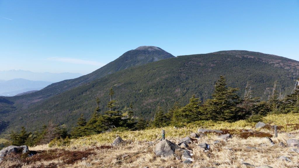
Mt Tateshina from near Mt Futago

Looking back at the route hiked so far
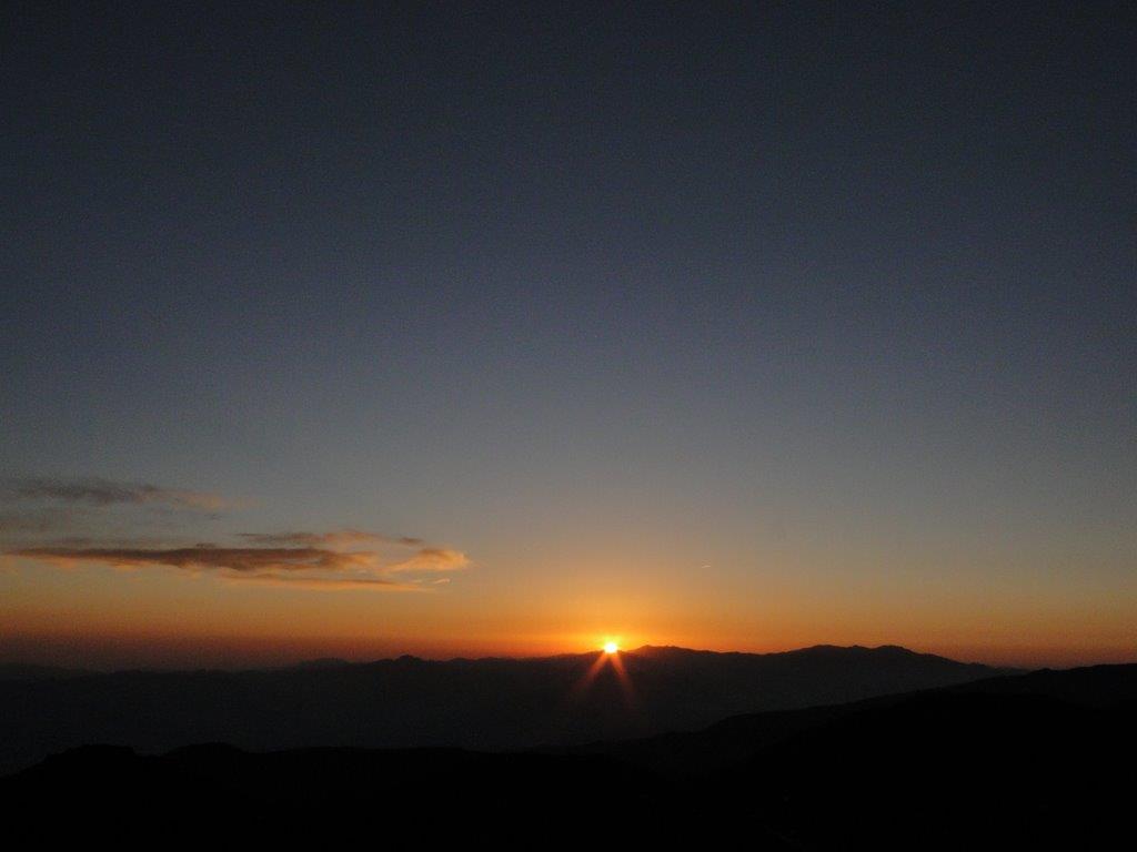
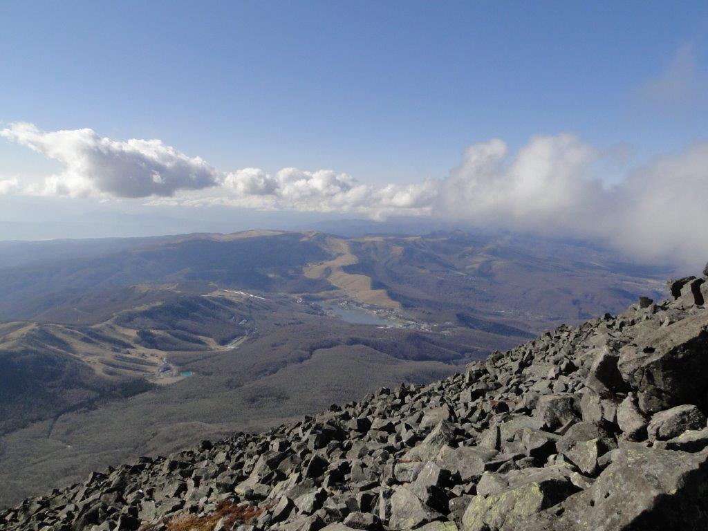
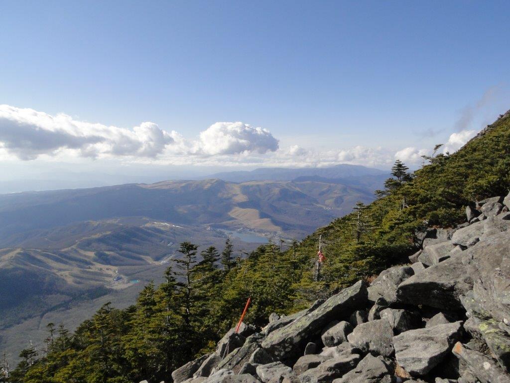
I awoke before dawn, relieved not to feel my muscles aching, which was lucky since I had a long day ahead. I walked as fast as I dared on the icy walkway, lit up by my headlight, and shortly after passing the Kitayoko-dake hut, reached the top of Mt Kitayoko (北横岳 きたよこだけ kitayoko-dake). It was 6h30 and the sun was rising above the Oku-Chichibu mountains. As it grew lighter, I had a superb view of the peaks of Southern Yatsugatake and the South Alps; turning around, I could see the rounded top of today’s mountain, looking deceptively close. It also looked like it would be another beautiful day, so I would definitely be getting my views.

Early morning Yatsugatake

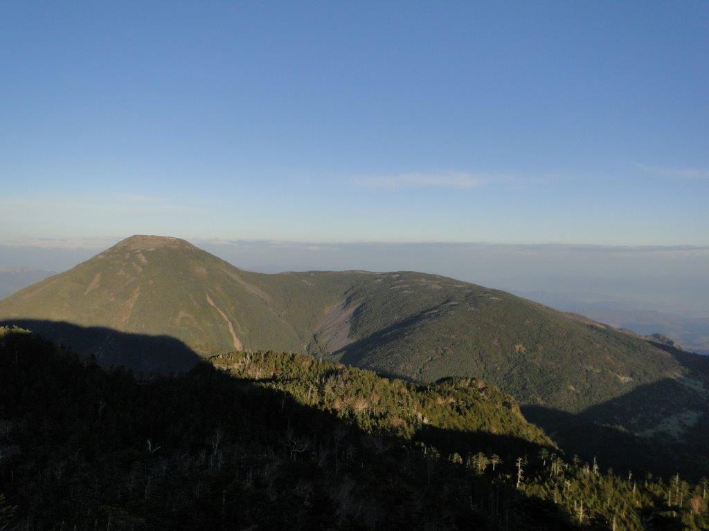
The rounded top of the Tateshina volcano from Mt Kitayoko
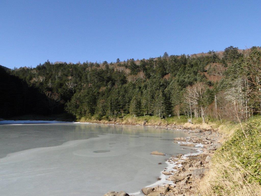
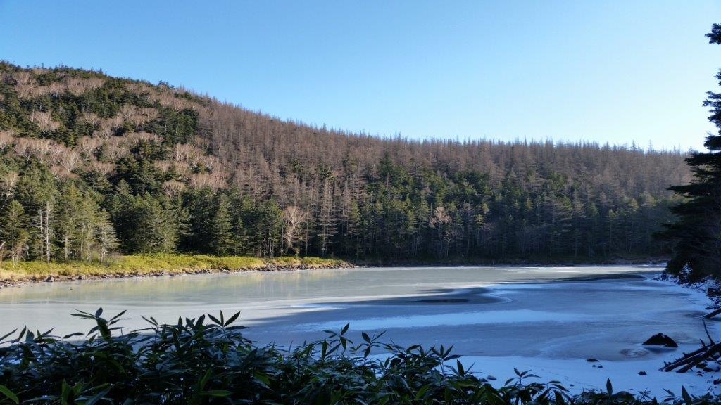
I was now back within phone range so I checked for news about the earthquake and saw that the epicenter was in Hakuba, less than a 100 kilometers away; fortunately damage seemed relatively minimal. At 7am, I headed down into the valley separating the two peaks, along a snowy trail through a pine forest. Progress was slow since the snow here was deeper and more slippery than the previous day. One hour later, I arrived at Kiko pond (亀甲池), surrounded by trees and completely covered in ice. After a short flat section, I reached Futago pond (双子池), meaning twin pond, and actually formed by two ponds, with the Futago-ike hut between them.
One of the twin lakes of Futago-ike
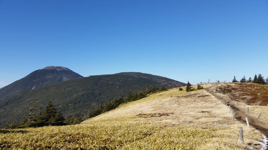
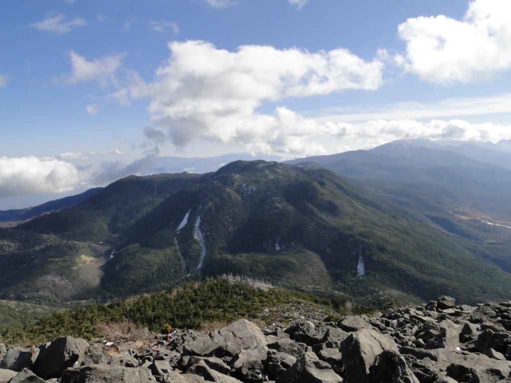
The wide open summit of Mt Futago
The twin ponds were also frozen, but the sun was now shining above, so I stopped for a short break. At 9am, I started going up the other side of the valley, and half an hour later arrived at a flat open space, the top of Mt Futago (双子山 ふたごやま futago-yama), with a view of the highest point of today’s hike directly ahead. After passing the Ogawara hut, the trail became rocky and snowy again as it reentered the forest for the final climb towards the summit. I was stunned by the contrast of the white trunks of the green pine trees against the light blue sky. At noon, after passing the Tateshina lodge and the Tateshina Summit hut, I was finally standing on top of Mt Tateshina (蓼科山 たてしなやま tateshina-yama), a volcano and a hundred famous mountain of Japan.

Walking among the pine trees

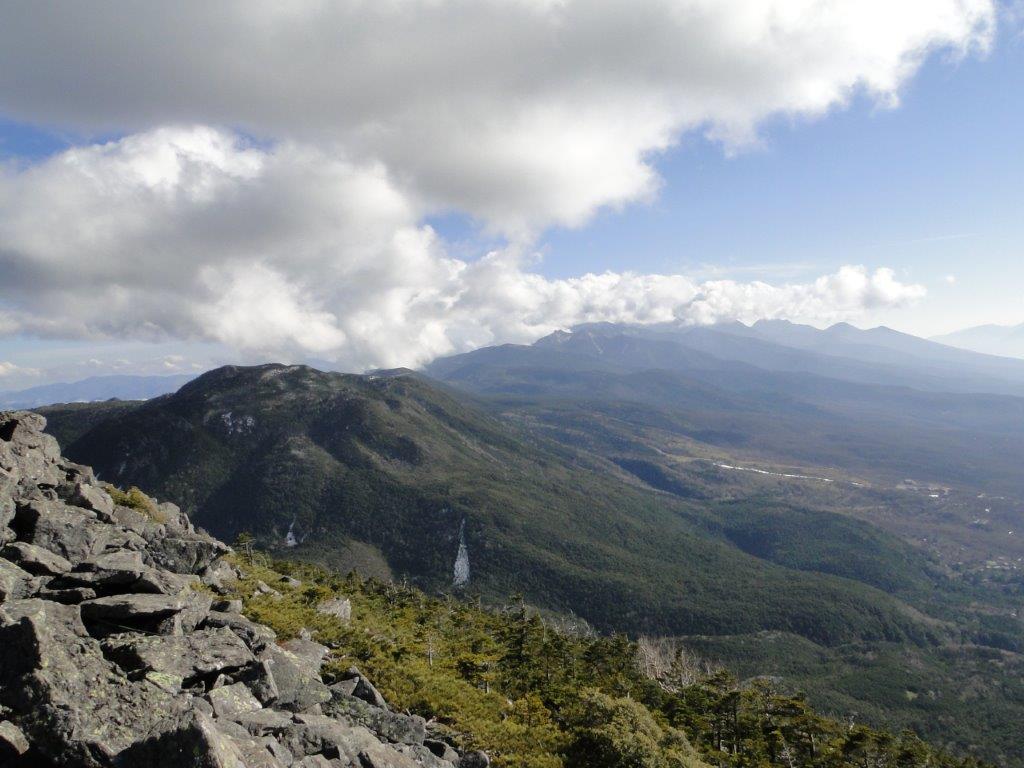
Mt Kitayoko from where I saw the sunrise
The summit was relatively wide, which was good, since for the first time on my trip, I had the company of other hikers; I guessed they had climbed via “nanagome” (七合目), the shortest route. I could see a red shinto gate a short distance from the summit, part of the Tateshina shrine complex. The summit area was covered by grey volcanic rocks, so I found a reasonably flat one and sat down for lunch. Some clouds had rolled in but couldn’t spoil the panoramic view: directly below I could see Shirakaba lake, as well as Mt Kuruma, another 100 famous mountain.
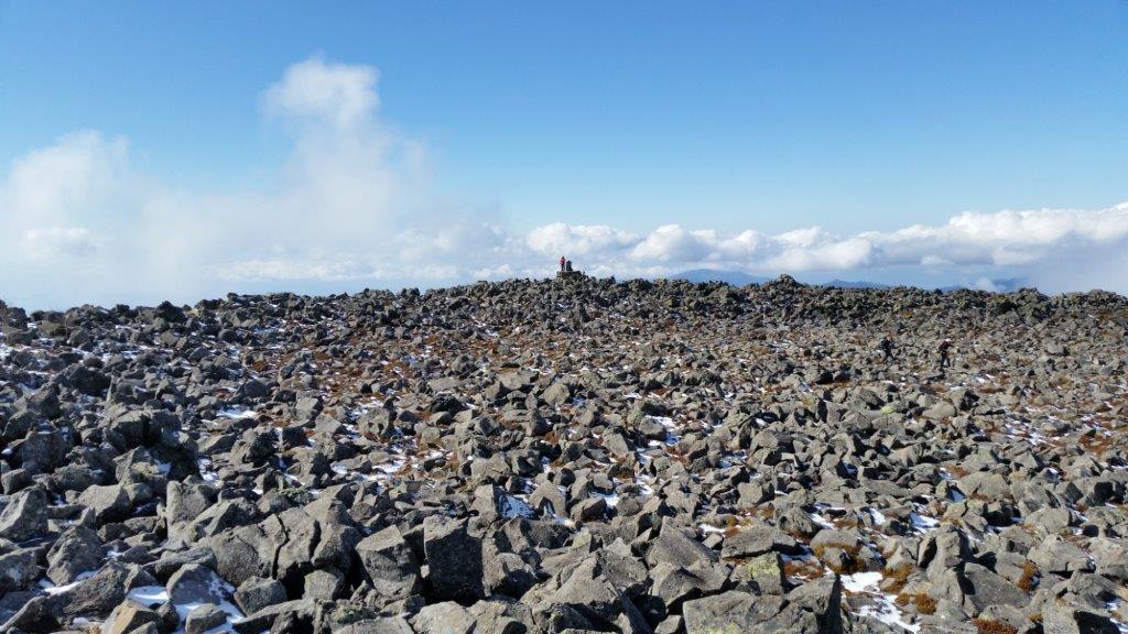
The wide, rocky summit of Mt Tateshina

A stunning scenery of white tree trunks against a blue sky on the way down
At 1h30, I tore myself away from the view and started to head down a steep, rocky path, with a bird’s eye view of the Tateshina highland before re-entering the forest of pine trees with their stunning white trunks. One hour later, the trail became level and easier to walk on. After arriving at the Tateshina mountain trail entrance, a kind couple offered to drop me off at the ropeway bus stop, meaning I was able to catch an earlier bus for Chino, where I boarded the limited express for the two-hour ride back to Tokyo, after a successful two-day hike on Yatsugatake.