

My plan was to climb Mt Tateshina but since it was tricky to do from Tokyo in one day, I decided to spend one night at a lodge and turn my trip into two separate hikes. The weather was supposed to be good both days so this seemed like the best choice. Looking at my map, I saw I could head south, passing my two minor summits with viewpoints, and circle back clockwise to my starting point. I was going at the end of the season and expected a little snow on the trails, although nothing technical. I could get to the lodge and start of the first hike by limited express train, local bus and ropeway. I was looking forward to hiking through the alpine landscape of the northern Yatsugatake mountain range, getting some good views of the surrounding peaks and, hopefully, seeing the sunset and the sunrise.
Hiking on Yatsugatake 八ヶ岳
Download a map of the Mt Shimagare & Mt Chausu hike
This map was developed for Japanwilds with the Hokkaido Cartographer
Find more Japan hiking maps on Avenza

View from between the two summits
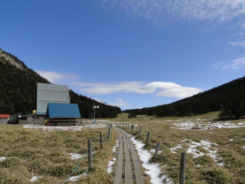
It was a beautiful autumn day as I rode the Chuo line limited express from Shinjuku to Chino station, where I switched to an Alpico group bus for the one hour ride to the Kita-Yatsugatake ropeway (北八ヶ岳ロープウェイ). I was happy to see few people waiting to go up, which meant I could quickly get to the top station, 2230 meters high. I walked for twenty minutes along a level walkway covered in a thin layer of snow, reaching the Shimagare hut (縞枯山荘) around noon. After checking in, I quickly set off again; wisps of clouds had appeared in the northern sky, making me worry that the good weather might not hold.

Hiking from the ropeway to the lodge
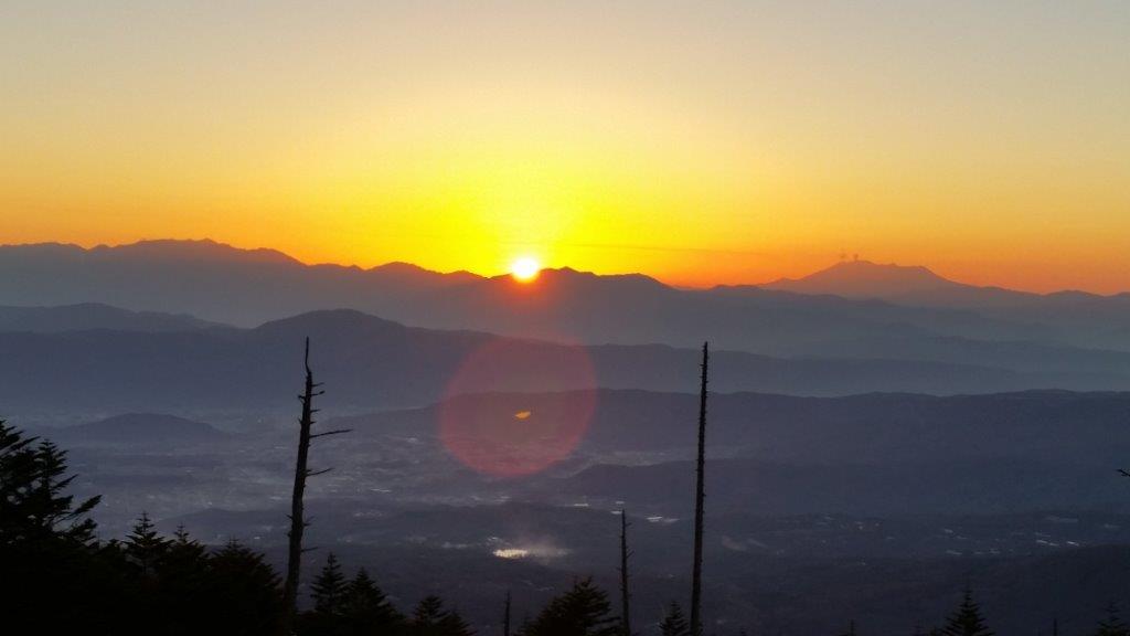
Dusk view near the end of the loop hike
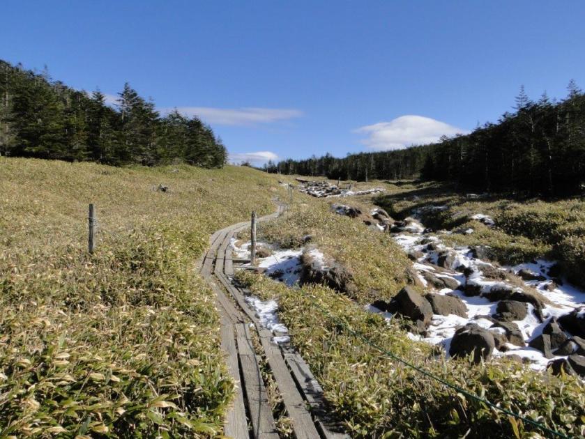
I continued along the walkway, now in the sun and free of snow, and soon reached a junction where I turned right up a rocky path through a pine forest. The trail had snow, but not ice, so crampons weren’t needed. Half an hour later, I reached the top of Mt Shimagare (縞枯山 しまがれやま shimagare-yama). Next, I passed through several clearings with views in different directions: the entire range of Yatsugatake was visible, extending north to Tateshina, and south to Mt Aka; further away, I could see Mt Asama (north), the North and Central Alps (west), the South Alps (south) and the Oku-Chichibu mountains (east). At 2pm, I reached the top of Mt Chausu (茶臼山 ちゃうすやま chausu-yama).


Some snow on the trail but nothing technical
I had the best view of the day from a rocky area near the summit marker (called the Mt Chausu viewpoint 茶臼山展望台). By now, most clouds, and snow, had vanished; it was quite windy but no one else was around, so I felt I had been lucky with the timing of my trip. I was now at the furthest point from the hut and had to get back before the sun set in less than 2 hours. I walked down and around the south side of the rounded peak and was soon walking in the forest again. As the path led northwards, I encountered snow again; luckily the walkway also reappeared making the trail easy to follow.

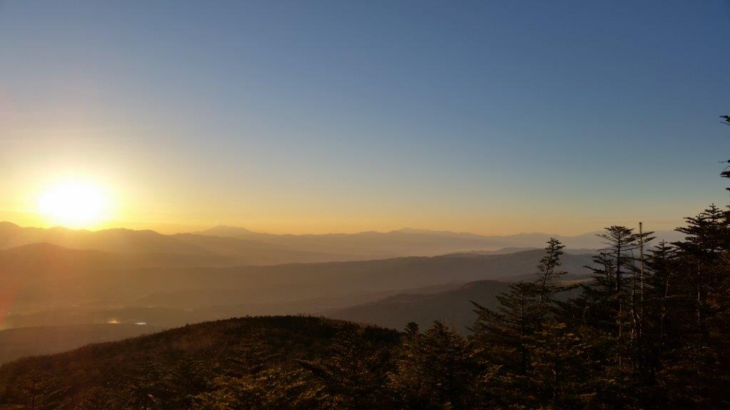
Sun setting behind the Chuo Alps

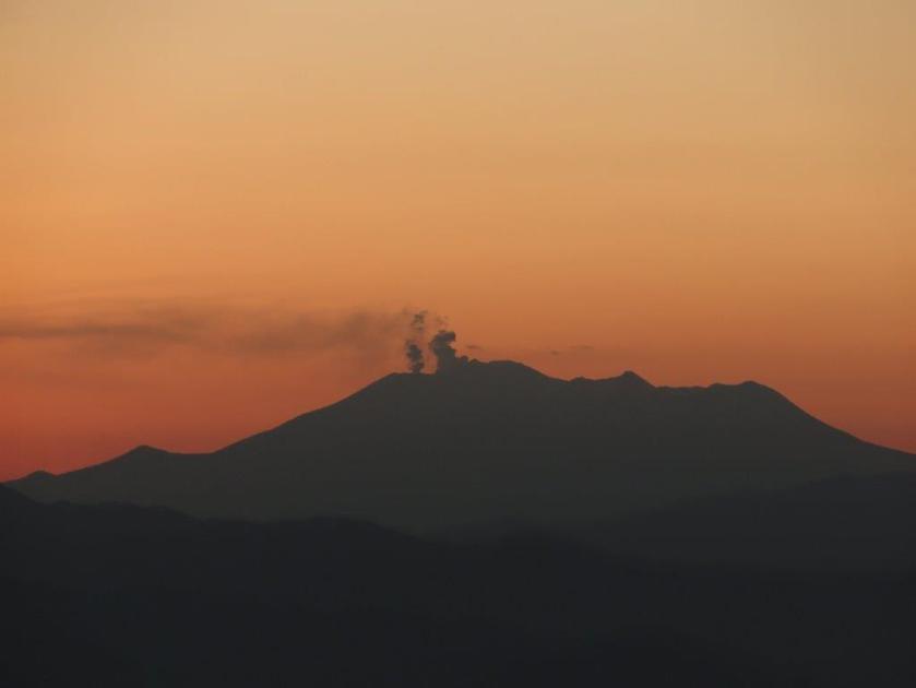
Mt Ontake, still smoking one month after the eruption
At 4h30, I reached the top of the ropeway just as the sun was dipping beyond the Chuo Alps; to the right, I could see the impressive outline of Mt Ontake, smoke rising from its summit crater, a vivid reminder of its deadly eruption less than a month earlier. By 5pm, I was back inside the warm and comfy Shimagare hut. One more event marked this first day: unable to sleep, I went down to the main room around 10pm, to read, and shortly after, I felt some strong shaking. Fortunately, the hut was solidly build and all was OK. I was outside phone coverage, and so, as I drifted into sleep, I wondered whether this was a local quake or a more distant and powerful one.
Experience the hike on Mt Shimagare and Mt Chausu


Great post, you must collaborate with hikepackers.com
Thanks! I’ll check it out.