Yanagisawa Pass to Shirasawa Pass, Koshu City, Yamanashi Prefecture, Saturday, September 7 2019

Coincidentally, I ended up hiking in another national park, this time the Chichibu-Tama-Kai National Park, the closest one to Tokyo. I took the limited express Chuo line all the way to Enzan – they updated this line to all reserved seating earlier this year, and I have to admit that so far it’s a positive change, since I’ve been able to get a seat every time, which wasn’t the case with the old system.

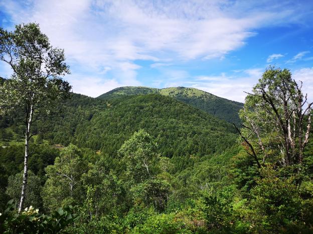
From Enzan station, I took a bus all the way up to Yanagisawa pass at nearly 1500m. After I got the bus I was able to see a good view of Mt Fuji, as well as some classic cars parked just behind the viewpoint. The last time I was there, I went East towards Mt Keikan and Daibosatsu Rei. This time I made my way first West, then North, along an easy to hike path through beautiful forest. I could hear deer but I couldn’t see them – I did see a toad though. Since there were no major peaks along the way, I saw almost no other hikers, and the weather was a lot better than I had expected – sun and clouds, but no mist.

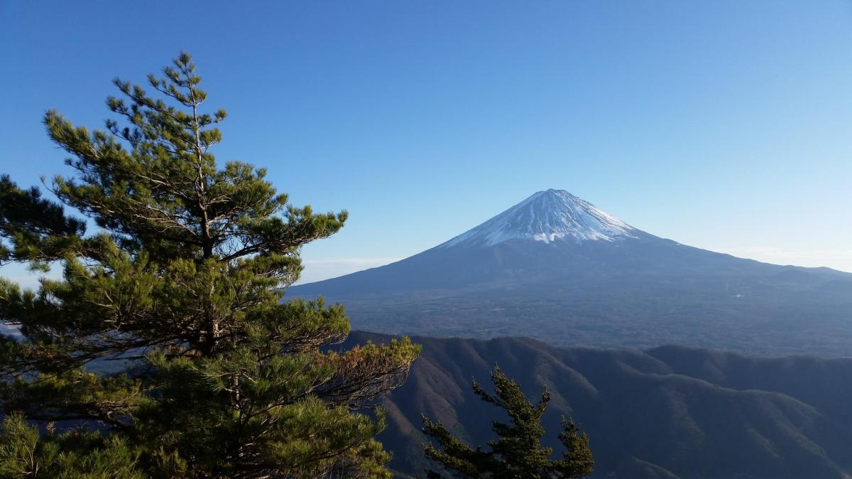
Mt Fuji from Yanagisawa pass

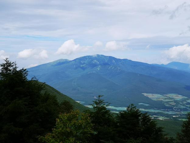
I soon reached Yanagisawa no Tou 栁沢の頭 where there was another view, and a little further, I got to an even better viewpoint, Hanze no Tou ハンゼの頭 (1681m). I could see Mt Daibosatsu Rei, Mt Fuji, the Kofu valley and the entire range of the South Alps. Another hiker even pointed out the pointed peak of Mt Kinpu which I had completely missed. One of the best views in the area and almost completely deserted!

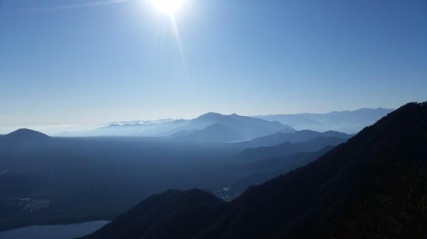
Mt Fuji with blue mountains in the foreground

After an enjoyable lunch, I continued along the long ridge that forms part of the backbone of the Koshu Alps, as the mountains of Yamanashi are called. I soon reached the Kasatori forest path – there was no signpost, but I instinctively turned left, and found the continuation of the hiking path a little further, just beyond the NTT antenna.

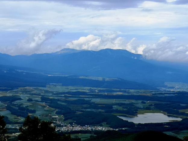
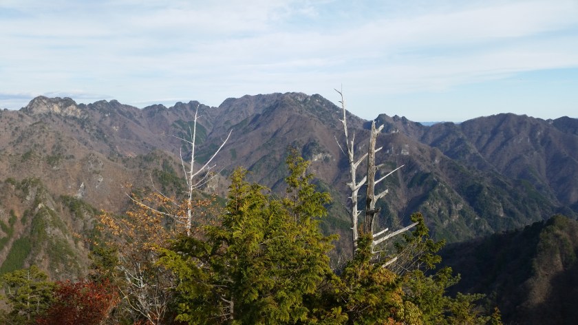
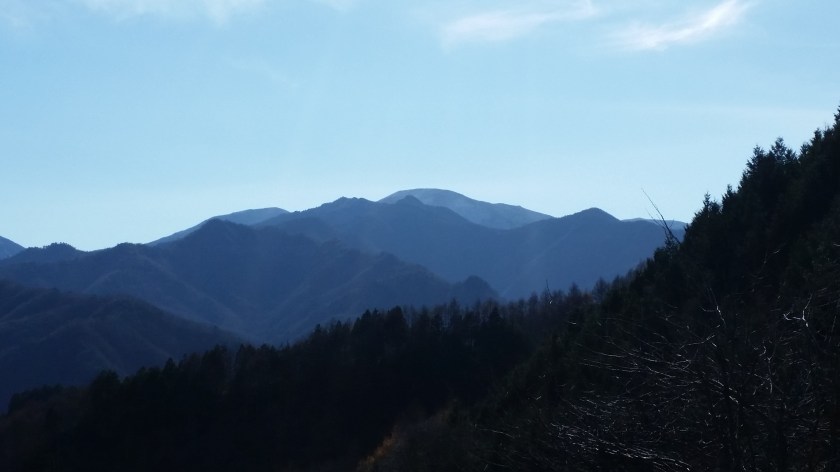
The South Alps – notice the pointy peak of Mt Shiomi in the middle

The path was flat and easy to hike, but as most paths in Japan, it didn’t last. I soon reached a steep downhill which took me to a construction site, a little surprising high up on the mountain. They were installing solar panels, something I’ve been seeing more and more on my hikes. Past the solar panels, I lost the path for a short while, but managed to get back on it soon enough. This is a trail that could certainly do with more signposting.

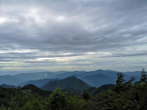
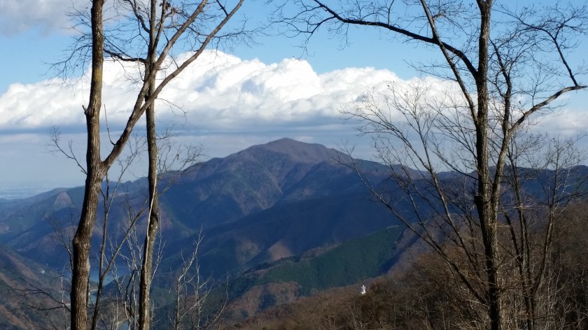
Clouds converging on Mt Daibosatsu Rei

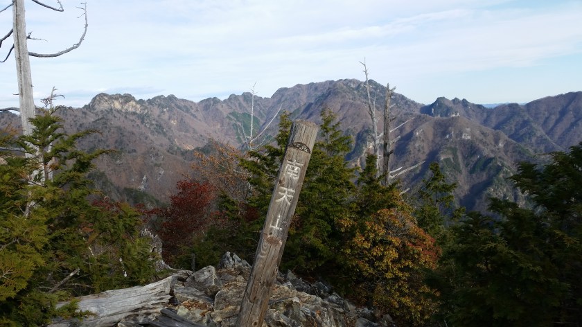
Soon the path begun a series of steep uphills and downhills. I would love to recommend this hike to people who are looking for a not-so-challenging hike, but although the climbs and descents aren’t long, they were pretty steep! I got some nice views Eastwards of Mt Keikan and Daibosatsu Rei, as well as the triangular summit of Mt Kumotori further in the distance. In front of me was Mt Kasatori, and to the West was Mt Kobushi and Mt Kentoku. I had already hiked all these peaks and connecting ridges, so it was enjoyable to view them from a distance.

Looking back towards Tokyo

I was starting to wonder when I would arrive at Shirasawa pass 白沢峠 when I suddenly spotted a couple of people sitting in chairs in a clearing ahead. It was quite surreal since I hadn’t seen anybody for the past 3 hours. But here they were relaxing and smoking cigarettes in the middle of nowhere, as if they were at some campsite. There was also an abandoned vehicle in the middle of the clearing with a tree growing in the middle of it. I wasn’t too surprised to see it there, since I had seen photos of it while researching the hike.

It’s like something from a Ghibli movie!

There was a jumble of signs nearby and I couldn’t quite make out where I was, but surely not Shirasawa-toge! first I wasn’t at a pass; second there was no path heading down to the East. I asked the two people, not hikers, relaxing near the abandoned truck but they had no idea. The younger of the two vaguely gestured to the right saying that they had come up through the forest, but I couldn’t see a path. I decided to continue along the main trail.

Solar panels with Mt Kobushi in the background

I continued for nearly half an hour, during which the path went down a bit, and then started to climb again. It had turned into a wide and not so nice forest path. I was starting to wonder when I would get to the pass, when it suddenly hit me – the grassy area with the two guys and the car was the pass! I immediately turned around and started to run back. When I got back, the 2 guys had gone, and I found the path down to the bus stop – it was really faint and hard to see, but it was a proper trail.

Luckily it was easy to run and I sped down it as fast as I could. Soon I was following a mountain stream, and then I reached a dirt road, where I passed the two guys who were in fact motorcyclists. I half hiked and half ran, and finally reached the Koshu Kaido (which runs all the way from Tokyo) where I caught the bus (the same one as in the morning) back to Enzan station.

Japanese toad I spotted on the trail

Next up: Mt Mikuni in Gunma prefecture

Mt Sajiki (1915m), Mt Murakami (1746m) and Mt Kakuma (1980m), Gunma Prefecture, Sunday, September 1st 2019

Continuing my tour of Japan’s National Parks, I next visited the Joshin-Etsu-Kogen National Park in Gunma prefecture. Despite the poor weather forecast, I decided to risk taking the shinkansen to Ueda city. There, I rented a car and drove up the Western part of Mt Asama. I had been there a few years ago to climb Mt Yunomaru and Mt Eboshi, but there were a few more peaks that had remained unclimbed.

The balding top of Mt Yunomaru, climbed in November 2015

From Ueda station, I could see that the mountains were in the clouds, and on the way up I encountered thick mist. Fortunately, I broke through it before I reached Yunomaru Kogen above 1700m, and I even had some sun after I parked my car. I immediately rushed up the hiking trail, since I knew that the blue sky that had opened up overhead wouldn’t last. The path was quite nice, and I reached the top of Mt Sajiki 棧敷山 at exactly 11 o’clock. I had an excellent view of Mt Azuma and Mt Kusatsu-Shirane, hundred famous mountains I had already climbed.

Mt Azuma, climbed at the end of May 2012

I retraced my steps for a few minutes, and turned left to take an alternative path down. I soon reached a lookout point towards Yunomaru Kogen. At this point, the weather had become overcast, but luckily the clouds were quite high, and I could make out the Japanese Alps in the distance. The path then descended quite steeply. After it bottomed out, I was walking in a spooky, dark forest . I soon arrived at an intersection for the small brother of Mt Sajiki – I decided to check it out. I soon reached the top of Mt Kosajiki 小棧敷山 but the views were limited. Fortunately, it didn’t take me long to get back to my car.

The highest point of Mt Asama

I drove on to my next target at Kazawa Kogen 鹿沢高原. This time, I simply had to go up and down the same trail. I walked as fast as I could up the relatively easy path and reached the summit of Mt Murakami 村上山 just before noon. I was greeted by a vast panorama of Western Gunma, centered on Tashiro Lake. The views were wider than the previous summit and it was a good place to enjoy some lunch.


Mt Kusatsu-Shirane and Tashiro Lake

I quickly made my way back down and drove back up to Kazawa Onsen 鹿沢温泉. It was 2h30 and I had one more peak to climb, but I had to be back by 4h30 for the last entry at the hot spring. I raced up and reached the top of Mt Kakuma 角間山 a little after 3h30. Nearing 2000m, the vegetation had become alpine. While I was taking pictures of the view, it suddenly started raining, which for once was a good thing, since it forced me to head back down rather quickly. I half ran back the same way, and made it to the onsen with a few minutes to spare.


View Westwards from the top of Mt Kakuma

NEXT UP: Hiking from Yanagisawa Pass to Shirasawa Pass (Yamanashi Prefecture)

Mt Higashi-Azuma (1975m), Fukushima City, Fukushima Prefecture, Sunday, August 25 2019

After a one-month break, I’ve resumed my hiking activities, despite an ankle that hadn’t really healed. I needed something easy to allow me to get back into the groove, and also at a high elevation, since it was still quite hot and humid. With the weather forecast looking good, I decided to take the shinkansen all the way to Fukushima city, and then drive up the Eastern side of Mt Azuma, a hyakumeizan inside the Bandai-Asahi National Park about 230 km North of Tokyo.

Technically, the highest point is the Western summit about ten-kilometers away, so summiting the Eastern summit doesn’t really count towards increasing my tally of hundred famous mountains, stuck at 81 since last July. Although there is a bus from Fukushima city, the return is quite early, and doesn’t allow enough time to hike to the top and back.


Part I: Usagi-daira – Toriko-daira – Mt Higashi-Azuma

The top of Mt Higashi-Azuma in good weather

After parking my car at the free parking at Usagidaira 兎平, just a few minutes from the huge paying parking in front of the Jododaira visitor center, I set off on a small path that went through the campsite on the other side of the road. Apart from a few nice sections, I didn’t enjoy it very much. The path was tricky to walk, and was in dire need of maintenance. It was a relief when I finally reached Toriko-daira 鳥小平 with its wooden walkways and many dragonflies.

Here I turned right instead of going straight

Instead of heading up Mt Takayama straight ahead, I turned right, crossed the Bandai-Azuma Skyline, and slowly started climbing. Shortly, I reached a kind of plateau where I had great views of the summit, as well as a small lake. I was at the same height as the clouds and it was fascinating to watch them drift by. I soon resumed my climb. As I gained more altitude, the weather started to worsen, and by the time I reached the observation point near the top, I was, to my great despair, in the cloud with almost no visibility.

I continued somewhat dejected towards the highest point, but by now it had started raining. I took refuge under the trees just a few meters short of the summit. I put on my rain gear and proceeded to have some lunch. I was hoping the rain would let up, but it only seemed to pound down harder. The wind was blowing, and it felt cold even though it was still August. Finally I gave up and made a dash for the exposed summit of Higashi-Azuma 東吾妻山. I took a quick summit pic, and immediately headed down the other side.

Blue skies and clouds reflected in a pond

I was glad I had put on my rain clothes, as they soon got soaking wet, partly due to the rain, and partly from brushing against wet vegetation. The rain eventually stopped and the sun came out, but I had already descended too far to return to the summit. I didn’t like the path down very much: lots of roots and rock, making it tricky with my bad ankle.


Part 2: Uba-ga-hara – Kama-Numa Pond

A beautiful lake high up in the mountains

Eventually, I emerged at Uba-ga-hara 姥ケ原 where I was faced with a crossroads. I decided to head straight rather than head back straight to Jododaira. Very quickly, I reached Kama-Numa Pond 鎌沼池 which was quite a breath-catching sight. The dark blue water and light sky perfectly complemented the light green grassy rocks near the shore, and the dark green forested hills opposite. Definitely a landscape that would be worth painting.

The path leading down and back to the visitor center

Initially I thought I would walk clockwise around the lake, but my footsteps somehow took me counter-clockwise. I hope to come back some day and climb the remaining peaks on the other side of the lake. Eventually I left the lake behind me, and started to head back towards the visitor center. The weather had completely recovered. Descending in the sunshine, it was hard to believe that only one hour earlier I was sheltering from the wind and the rain near the summit!


Part 3: Jododaira – Mt Azuma-Kofuji

Spectacular view of “small Fuji” on the side of Mt Azuma

I was behind schedule, so I started to hurry towards Jododaira 浄土平. Although I had come by car, according to signs I had seen on the way up, the road back to Fukushima city closed at 5pm, so I had to make sure I was gone by them. My pace slowed somewhat after I started getting some jaw-dropping views of Mt Azuma-Kofuji 吾妻小富士, the mini-volcano sprouting from the side of Mt Azuma like a pimple. I definitely wanted to walk around the rim!

Walking above the clouds…

Although some sections had steps and walkways, a lot didn’t, so my ankle suffered some more. To my right, steam was venting out of the side of Mt Issaikyo. It was with great relief that I finally reached the visitor center. I took off my rain gear, and then rushed up the side of the mini-volcano and was standing at the edge of the crater less than five minutes later. I managed to walk around it in less than half an hour, enjoying the stunning views in every direction. It’s a pretty easy walk and anyone can do it. I managed to be back at the car before 4h30 and was happily driving back to the train station by 5pm. On the way, I had a quick bath at the very nice public onsen Attakayu.

Next up: Hiking at Yu no Maru, on Mt Asama (Nagano prefecture)


Clouds rolling by at nearly 2000m elevation

Karikomi Lake, Nikko City, Tochigi Prefecture, Sunday, July 21, 2019

The very long rainy season had put a premature end to the first half of the 2019 hiking season…but I was determined to get one more hike in before the hot and busy (for me) summer arrived – my next chance would probably not be till September. Since I was a little out of shape, I chose a short and easy one in Nikko, hoping that the overcast skies, and voting for the national elections, would keep the crowds away. I was looking forward to visiting the Oku-Nikko area since I hadn’t been there since my climb of Mt Nyoho two years ago.

Lake Karikomi and Mt Taro in the background

I took advantage of the more expensive, but direct Tobu Nikko line train – being able to sit and sleep during the 2 hour trip was definitely worth the express surcharge. In Nikko there was a light drizzle. I didn’t fancy walking in the rain but I couldn’t turn back now. Going up “Irozaka slope”, the bus was enveloped in thick mist. Fortunately, once we emerged at Chuzenji lake, we were above the mist and I could see the lake and mountain sides – the sky overhead was overcast and the peaks were in the cloud though.

Today’s hike was through green mossy forest

I got off at the very last stop, Yumoto-onsen. This small, somewhat run-down, onsen town town seemed totally deserted, 11am on a Sunday morning. Was the town in decline or was my timing bad, I wondered to myself. I made my way to the start of the hiking path behind the town, also the source of it’s hot springs. There is a wooden observation path, and two small pools of bubbling water – not the most exciting tourist attraction but it’s always cool to see hot water coming out of the ground.

See the hot spring water bubbling up and hear the birds chirping near Karikomi lake

The path climbed for a few minutes, then crossed a road, before heading along the side of small forested valley. Despite being at 1500m, the air felt unpleasantly heavy – very different from my previous hike 2 weeks earlier, and one thousand meters lower. It took me less than an hour to reach a pass, where I took a short break. Afterwards, the hiking was mostly level and along a broad easy-to-walk path. I took off my bear bell so that I could enjoy the intense chirping of birds.

A signpost in the forest

After some descending along wooden staircases through a thick moss covered forest, I arrived at Karikomi Lake (刈込湖) just before one o’clock. After checking out the view and having a quick lunch, I set off along the path through beautiful forest, passing another small lake, and finally arriving in a wide grassy valley. Since I needed to catch the 3pm bus from the Astoria Hotel I couldn’t linger and I powered up the mountainside opposite and over another pass, with Mt Taro on my left, a 300 famous mountain that I have yet to climb.

A grassy field suddenly appeared

A hidden valley in the middle of the Nikko National Park

From there it was a quick and easy thirty minute descent to the hotel – I had to overtake a very big group of elementary school children on the way. I made the bus but had to forego the onsen, otherwise I would miss the last express train back, and that would mean getting to Tokyo really late. By the way, this place would have snagged fourth place on my list of places to go when it’s hot and humid, except that the traveling time is too long for a daytrip – seven hours for only four hours of hiking.

On the shore of Karikomi Lake

Hossawa Falls to Musashi-Itsukaichi Station, Hinohara Village, Tokyo Prefecture, Friday, July 5, 2019

Despite the long rainy season this year, I managed to squeeze in a short hike on a cloudy, rain-free day. Although the elevation of the walk was relatively low – between 400m and 200m – the temperature and humidity were also low for July, so conditions were quite pleasant throughout the day. In general, this hike is best attempted in the spring and autumn.

I had last been to Hossowa falls 払沢の滝, one of the hundred famous waterfalls in Japan, located inside the Chichibu-Tama-Kai National Park, after hiking Mt Sengen 浅間山 a few years ago. Then, Autumn was in full swing and I got to see some beautiful autumn leaves along the short trail to the waterfall. This time, the surrounding trees were lush with green leaves, and hydrangea flowers (ajisai アジサイ) were still in full bloom. The river and small falls leading up to the waterfall were wider and bigger that I had remembered, perhaps due to the high amount of rain that had fallen in recent weeks.

Smaller falls on the way to the main attraction

I had set off late and so I arrived at the Hossawa Falls entrance bus stop 払沢の滝入口, just after noon, and promptly started up the narrow climbing road to the left of Hinohara Tofu – their tofu donut makes an excellent snack! I soon reached an information board that showed the details of the whole area, and another one showing the location of 13 (!) waterfalls in the area of Hinohara Village, Hossawa falls being the most impressive one.

Entrance to the path to the waterfalls

Hossowa waterfall is located at the Eastern base of a narrow ridgeline wedged between the Kita Aki river to the North, and the Minami Aki river to the South. The latter is the longer of the two, and takes its source at the base of Mt Mito. The Kita Aki river joins the Minami Aki river just before the falls. Further downstream, it joins up with the Yozowa river (coming down from Mt Mitake to the North), and finally becomes the Akigawa river (which later merges with the Tamagawa further East).

The Minami Aki river after merging with the Kita Aki river

Since I was taking many photos of the river and flowers, it took me nearly half an hour to reach the waterfall, along an easy-to-walk path with no steep inclines. Along the way there were good views of the rushing stream below.

Not a real hiking trail but more of a walking path

On the left, a ravine, on the right, a cliff

There is a wooden sloping section that can get slippery when wet – someone took a tumble just as I was approaching! According to Wikipedia, the total length of the falls is 60m, divided into four sections – it was indeed an impressive sight to behold. You can get relatively close to the base pool, but the best shots can be obtained next to the stream, a little further away. After comparing with photos from my previous visit, I can confirm the falls are much bigger in the rainy season than in the autumn.

You can even feel the wind blowing from the force of the falling water

The return was much faster, and it only took me 15 minutes to get back to the main road. There were few people on a weekday, but I expect there would be a lot more people visiting on the weekend. There is also a cafe at the start of the path but it was closed on Friday.

Racing the stream on the return

Watch out for this interesting chap on the way back

Once back at the Tofu shop, I made my way back to Musashi-Itsukaichi station, sometimes following the main road, and sometimes following smaller and quieter roads on the other side of the river. The various bridges offered nice views of the Minami Aki river. The parts on the left side of the river made for a pleasant ramble through nice countryside with occasional glimpses of the river through the trees.

The sign says “Have a seat!”

Just before Sawato Bridge 沢戸橋, about two kilometers from the station, I stumbled upon a small path heading down on the right. According to the information board, it was the Akigawa Kyuryo Trail 秋川丘陵コース, a very nice discovery! I crossed the Bonbori river on a small wooden bridge, and then followed a very nice hiking path along the right side of the Akigawa river.

Careful not to take a tumble into the river!

Too soon the path joined up with the road again. There a small detour away from the river was needed, but soon I was walking next to the Akigawa again with good views of the surrounding hills. I reached the train station just after 5pm. Hopefully, I’ll be able to return sometime and continue hiking East along the Akigawa!

I found this little fella along the path

The “ajisai”, the symbol of Japan’s rainy season

Check out the power of water

Mt Maruyama (1098m), Hinohara Village, Yamanashi & Tokyo Prefectures, Saturday, June 1st, 2019

I decided to return to the same area as the previous week, and do a portion of the Mitosan-Takosan ridge that I had never hiked before. It contains no major summits, but since it was featured in my Tokyo prefecture hiking book, I thought it would be make a nice ramble. Also, the weather was cooler, so I could start later and lower down. This time I was hiking South and East of Mt Mito, as opposed to the West and North the week before.

Iris season has started!

I took the bus from Uenohara station, but one hour later than the week before. Since the bus didn’t go all the way to Matsuhime pass, I was the only passenger. I got off at Gobara, in the charming village of Saihara 西原村. At 10:40 on a Saturday Morning it was completely deserted, and I wondered where everybody was. The hike was fairly well-signposted, and soon I was climbing up the side of the valley through forest.

Easy-to-hike: I passed a mountain biker coming down around here

It was cloudy and sunny but temperature-wise, perfect for hiking. The climb up was surprisingly beautiful: the path was easy to hike, and the surrounding forest felt wild and untouched – exactly what I crave for in a hike. Apart from a mountain biker, I saw no-else on the climb up. Halfway up, there was a nice viewpoint of Nishihara village, and the ridge I had hiked down from Matsuhime toge, 3 years ago.

After an hour and a half I reached Nishihara pass, and other hikers. I made a quick roundtrip to the top of Mt Makiyose 槇寄山 (1188) less than a minute away. I had been there once before when I had hiked down from Mt Mito years ago. I had a quick bite since there were a couple of benches and admired the view to the South – I could make out the shape of Mt Gongen, another peak climbed years ago.

I then retraced my steps and followed the ridge Southeast. The forest was beautiful and peaceful, with few people. I couldn’t quite decide if the area reminded me of the mountains directly south of the Chuo line, or of the ridge on the opposite of the Akigawa river valley. In any case, the ridge was wide and easy to walk, very unlike the section further down, around Mt Shoto, where it gets really narrow and tricky.

An enjoyable hike in the late spring

Eventually I reached another pass, Kazuma Pass, with benches and a viewpoint to the South. This was the point I had left the ridge on my previous hike down from Mt Mito, so from now on it was new territory. The weather had turned definitely cloudy, not a big problem in the pleasant June temperature. It was past one, so I sat down for the second part of my lunch.

The long ridge leading to the top of Mt Gongen

Another hour of hiking brought me to the top of Mt Maruyama 丸山 – no view unfortunately. I didn’t linger, and the path which had been fairly level up to now, started to descend. Oddly enough, English translations on the signposts appeared around here – I guess I was officially in Tokyo territory. I emerged at Asama Pass, and joined up with the “Kanto Fureai no Michi” about one hour later. I had been here when I climbed Mt Shoto. I had now officially hiked the entire ridge from Mt Mito to Mt Takao.

The sun made it through the clouds from time to time

From here, I turned left and started to head down to the Akigawa river valley and the bus stop for Musashi-Itsukaichi Station. I was one hundred meters from the stop and five minutes before the bus was scheduled to arrive, when it suddenly careened around a corner at top speed! I ran desperately after it waving my hand, but once I reached the bus stop, I wasn’t allowed to board! It turned out that it was a “zouhatsu” 増発 or extra bus which runs in the high season. Another, half empty, bus came along a few seconds later – I guess the Nishitokyo bus company likes its passengers to travel comfortably!

Off-the-beaten-track: Saihara Village

Tsuru Pass to Okutama Lake & Monkeys, Yamanashi & Tokyo Prefectures, Sat May 25 2019


Temperatures were unseasonably hot at the end of May – up to 35 degrees in Tokyo – so it made sense to start my hike from a higher point. I decided to take the bus from Uenohara station to Tsuru Pass 鶴峠, squarely inside Yamanashi prefecture at nearly 900m. On the way, I passed through the charming village of Saihara, one of the area’s hidden wonders. This hike is an original hike not featured in any of my guidebooks. It’s main purpose is to connect two bus stops without passing any major summits on the way (although a detour via Mt Mito can be made).

Once I got off the bus, just below the pass, I couldn’t believe how hot it was at 10am. Luckily it was a dry heat. To reach the start of the hike, I had to cross the road and take a hard-to-spot ascending path. There is another path going up to the left, towards Mt Narakura 奈良倉山 (1349m) which I climbed from the other side the year before. After barely a few minutes, I came across part of a deer leg lying across the path. Just the foreleg, with fur and hoof at the end. “Some animal must have killed the deer and left just this part here” I thought to myself. “…but what animal??”

Pleasant May hiking in the Chichibu-Tama-Kai National Park

Shortly after, the path for Mt Mito 三頭山 branched to the right, and hugged the side of the mountain to the right. It was very peaceful until two ladies popped out of the forest above me – they had mistakenly continued straight along the previous road. After confirming they were now on the correct path, I soon left them behind. The trail gradually rose through the forest. There were few views but I was glad to be in the shade on this hot day.

One of the rare views along the way: Mt Kumotori

After one hour of pleasant and mostly solitary hiking, I reached the junction for Mt Mito and hesitated : should I continue along what had been up to now a nice, quiet and mostly flat path, or should I climb up to the top of Mt Mito, which I had submitted twice before, and where there was bound to be tons of people? I chose the former option, and I was quite glad I did, because it soon became obvious that I wasn’t just following a hiking path. It was actually an old road that had probably been in use for generations; some sections had been propped up with stones. I had already hiked a similar road in the same area a few years before.

It was thrilling to follow the remnants of an old road high up a mountain

After another hour, I reached a second junction with Mt Mito. Here I turned left and headed down the mountain towards lake Okutama and into Tokyo prefecture. I had also entered the Chichibu-Tama-Kai National Park, although there were no markers or signs to indicate this; I only realised this while writing this blog post – a real shame! The descent was gentle at first, but soon there were some steep bits with ropes; these are fine for climbing, but going down them can be quite a pain!

The author posing on a minor summit on the way down to Okutama lake

Soon, Okutama lake came into view and, after a couple of ups and downs, I finally emerged onto a road circling the lake, nearly two hours after I had started down. Here, my plan was to take something called a floating bridge “ukihashi” 浮橋 across the lake, but I was informed via a sign that it was closed at the moment. Nonetheless, I decided to check it out. While following the road, I saw a green snake. After some prodding with a branch, I realised that it was dead, despite looking very much alive. Apparently, it had been hit by a vehicle moving at high speed, and only suffered a “nick” to a part of the body, which was enough to kill it.

Even dead, the snake looked very much alive!

After a while I reached some steps leading towards the lake, and very soon I was able to lay eyes on the floating bridge. It had been detached from the shore I was on, and thus ended in the middle of the lake. The reason given was strong winds. Just opposite, was my bus stop. Now, in order to reach it, I had to circle round, a detour of about half an hour. I wandered back despondly, and decided to continue along the path circling the lake in the opposite direction since I had an hour to kill till the next bus.

The floating bridge floating in the middle of the lake

I was glad I did, because I got to see monkeys, lots of them, resting, playing and feeding in the trees. Eventually, one of them was sitting next to the path and I didn’t dare go further. In any case, I was quite content to take photos and videos. Soon my time was up, and I had to rush back along the road in order to catch the bus back to Okutama station. The views of the mountains surrounding the lake were beautiful – I don’t often get to see this area in perfect weather. It was pretty hot around the lake in the late afternoon, and it felt nice to sit inside the air conditioned bus!

View of deep blue Okutama lake under a light blue sky

Monkey in the way!

If you like monkeys, check out this compilation video


Mt Settou (1736m), Mt Junigadake (1683m) Kawaguchiko Town, Yamanashi Prefecture

I had already hiked parts of the Misaka mountains – the mountainous area between Mt Fuji and the Oku-Chichibu mountains (for example Mt Ou to Mt Oni). However, I had never hiked the central part, between Kawaguchi and Saiko lakes. I decided to approach from Ashigawa valley on the North side, and finish at lake Saiko, on the South side. I took the Chuo line to Isawa Onsen station, and then the bus to the farmer’s market in Ashigawa 芦川. I had a very good impression of the place since they offered me free tea while I got ready for my hike!

The Fujikyu bus from Isawa Onsen to Ogossoya (the Ashigawa farmer’s market) was discontinued in 2024. Access is now via car, or by bus from Kawaguchiko Station. However, since 2024, a free shuttle bus runs on weekends between Ogossoya and Suzuran.

Kawaguchiko City surrounded by nature

I started out after 10am, and walked along the road for about 20 minutes to the start of the trail, which then went straight up the side of the mountain, through trees completely bare of leaves. I reached Oishi pass (1515m) 大石峠 around noon. I had been there once before when hiking from Mt Kuro further to the East. This time I turned right and continued Westards along the ridge.

Kofu valley and beyond the Oku-chichibu mountains

The hiking path went up and down a wide ridge through beautiful evergreen forest. I had occasional views of Mt Fuji to my left, lake Kawaguchi behind me, and the Ashigawa valley to my right. I soon reached the top of Mt Settou 節刀ヶ岳 the third highest mountain along the ridge, after Mt Mitsumine and Mt Oni. From there I could see all the way to the Southern Alps, and the Kofu valley.

Against the sun, looking back towards Minobu

After admiring the view, I started to head down towards Saiko lake. Soon, I had to negotiate a slightly tricky bit involving some rocks and chains. After that, I arrived at the top of Mt Junigadake 十二ヶ岳 which translates simply as “Peak 12”, from where I had some more great views of Mt Fuji ahead of me. I now had two options. The path to the left was an exciting ridge including suspended bridges. Alternatively, I could head straight down to Izumi no Yu, a hot spring on the side of Saiko Lake. Since it was already 3pm, I decided to head down, and leave the exciting ridge for another hike.

The Furthest Mountain, Mt Nanten (1483m), Chichibu City, Saitama Prefecture, Saturday November 25, 2017

20171125_135627

Hiking in the Chichibu Mountains 秩父山地

Less than 100km away from the capital as the bird flies and smack in the middle of the Oku-Chichibu mountains of Saitama prefecture, lies Mt Nanten 南天山 1483m. Despite its relative closeness, accessing the start of the trail requires patience and a desire to explore new places.

Last Saturday, I rose at 6h30, got a seat on the Seibu line Red arrow limited express leaving around 7h30 from Ikebukuro station, hurried to catch the transfer to the Chichibu railway in the Seibu-chichibu station and got off at the last station, Mitsumineguchi at about 9h15.

Unfortunately the bus connection wasn’t ideal and I had to potter around for 45 minutes for the bus for Nakatsugawa 中津川, also the last stop and one hour away, making my arrival time a little past 11am. However I wasn’t there yet. I still needed to walk 30 minutes along a road which eventually turned into a dirt road, till I finally got to the entrance of the mountain trail, leading up a small river valley cleaved into the side of the mountain.

20171125_123044
The path crossed a stream several times over narrow wooden bridges

After removing my inner layer, fixing my bear bell onto my bag and having a quick bite, I was officially ready to start up the mountain, a little before noon or nearly six hours after getting up. Fortunately, unlike my previous trip the week to Okutama the week before, the further I progressed the less people there were – just one other passenger on the bus who got off before the end. This was probably because the autumn leaves season was already over.

20171125_130744
First views of the highest peaks of the Okuchichibu Area

The valley I walked up following a small stream was one of the most beautiful I’ve ever seen. I could only imagine what it must look like in the spring or the autumn. There was a fair amount of stream crossing along fairly new wooden bridges and the path goes up and down the side of the valley, making for a good warmup. Halfway up the valley, I came upon the spectacular Hojirushi waterfall 法印の滝. Even if you don’t climb to the top, it is well worth walking 20 minutes to check it out.

20171125_121912
The Hojirushi waterfall along the Kamakura River

Twenty minutes further upstream, a zigzagging easy to walk path on the left takes you up to the top ridge where you progressively make your way to the highest point. The last part gets rather rocky and feels rather wild – hard to believe that you are in Saitama, especially when you reach the top and see nothing but mountains in all directions. Directly opposite one could see the massive bulk of Mt Ryokami and in the background Mt Asama already covered in snow,

I headed down a little after 2pm down another zig-zagging path and then joined up with the previous stream valley and legged it back to the road. I was able to take a quick bath before getting on the return bus a little after 4pm. This bus, the last one of the day, took me directly to Seibu Chichibu station in about 90 minutes where after a thirty minute wait, I got the next Red arrow limited express back to Ikebukuro, arriving at 8pm, taking me only a little less time than on the way there.

20171125_135325
The summit marker of Mt Nanten with Mt Ryokami in the background

Enjoy the contrast between the rushing water and the silent summit


Overcoming travel trouble in Okutama

Mt Shishigura (1288m), Okutama Town and Tabayama Village, Tokyo & Yamanashi Prefectures, Sunday November 19, 2017

20171119_105526

Hiking in Okutama 奥多摩

Yesterday I went for a hike in the Okutama area, starting from the Western edge of Okutama lake at  Miyama Bridge 深山橋, going up Mt Shishigura 鹿倉山 1288m (not Shikakura as the Kanji suggests), and ending up at the Nomekoiyu のめこい湯 hot spring.

However it isn’t about the hike itself that I wish to write but rather about getting to and back from the area in the general. The trouble with Okutama is that it mostly sits within the Tokyo prefecture, one of the most populated areas in the world, and thus the trains and buses are packed, especially during the autumn foliage season.

Fortunately when I went out there on a whim yesterday (bad weather threatened my preferred options), I was able to sit all the way there and back. Seeing that the total travel time was nearly 5 hours, I feel that this considerably enhanced my experience, and it only required a little planning and some luck.

First, I turned up at Shinjuku station 20 minutes before the scheduled departure time of the direct train to Okutama and positioned myself first in line at the appropriate spot on the platform (indicated by an overhead sign). The train pulls in ten minutes early since it starts from Shinjuku so the rest of the waiting time is spent sitting comfortably.

After arriving in Okutama, I got off as quickly as possible and lined up for the bus. Despite the crowds it only took me a few minutes since I had previously charged my Pasmo with a generous amount of money and skipped the bathroom. Once out of the station I swooped onto the first bus attendant I saw to confirm where I should line up for my bus (the one for Kosuge no Yu 小菅の湯). I had perhaps a dozen people ahead of me but I still managed to snag one of the last seats.

On the return, I sacrificed some bath time in order to get to the bus stop ten minutes early. I was third in line which doesn’t necessarily guarantee a seat since the bus starts further up the valley. When the bus turned up, the line behind me had grown to a dozen people and there were only about 5 seats left. My gamble had paid off and I got a good seat too, one with space for my long legs.

There was some traffic on the way back and I was worried that I would miss the last direct train back to Shinjuku but thanks to the experienced driver we got to the station with time to spare. Repeating the same strategy as in the morning (move quickly, well-charged pasmo, skip bathroom break) I got a good seat on the train and the return was as smooth as one could hope for. Obviously these tricks only work if you are hiking by yourself or maybe as a pair (or you have good bladder control).

20171119_131529
Mt Odake, one of the three famous peaks of the Okutama area

As for the hike itself, it was the kind I like. Steep ascents at the beginning, gently sloping ridge line in the middle, alternating views of forest and mountains, and a good wide path for most of the descent. I only crossed a small group of people during the whole hike. Unfortunately I can’t recommend this hike since at times the trail was hard to find / follow and the last part of the trail had somewhat collapsed and was difficult to walk. I hope they repair it soon and also put up more trail makers.

One final note: the Nomekoi Hot spring is only 300 yen but at present the rotemburo (outside bath) is closed for construction. However the inside bath has a high wooden slanting roof which gives it a traditional feel so it is definitely worth taking a bath there.

20171119_131007
The long ridge leading to the summit of My Kumotori (on the left), the highest point in the Tokyo prefecture, as seen from the ridge below the top of Mt Shishigura.