Mt Hinata (404m) & Mt Mijo (237m), Isehara & Atsugi Cities, Kanagawa Prefecture

There is a section of the Kanto Fureai no Michi that passes by Mt Oyama. It doesn’t go all the way to the summit, but goes past the top of the cable car halfway up the mountain. I had hiked the section on the Southern side a few years ago, and I had always wanted to return and hike the Northern section. It continues to Nanasawa onsen 七沢温泉 which seemed like a good place to finish. Mt Oyama, a 300 famous mountain, is a popular hiking spot close to Tokyo, but since I went on a weekday there were relatively few people.

null

View halfway up Mt Oyama from Afuri Jinja Shrine 

null

Viewpoint of Mt Oyama and mostly empty benches

I took the Odakyu Romancecar to Isehara, where I transferred to one of the frequent buses for the Oyama Cable car. For once, the bus was nearly full. Since it was a short hike, I left later than usual, and got there around 11am. It had been a few years since my last visit, and I had forgotten that it was a twenty minute-walk up the Koma Sando コマ参道 shopping street to the cable car station. Since the next one was leaving at 11h20, I flew up the flights of steps, past the shops selling spinning tops, and hopped on to the green cable car just before they closed the doors.

null

Cable car up Mt Oyama

null

View from the top of the cable car

After getting off, I decided to walk up the steps to Afuri-Jinja Shrine 阿夫利神社 to check out the view. It was a bit hazy in the late morning but I could just make out the boso peninsula in the far distance. The path up Mt Oyama is behind the shrine, but the Fureai no Michi trail is at the base of the steps, so I headed back down, and it was around noon when I finally started hiking. The first part was mostly flat, hugging the side of the mountain. The surrounding trees were very beautiful, and I saw a giant cedar tree soaring up into the sky next to a tiny shrine.

A couple of impressive trees along the trail

null

Few people hiking on a weekday

Half an hour later, I reached a viewpoint with a dozen benches, to accommodate the weekend crowds. I could see the triangular summit of Mt Oyama, as well as the urban spread to the North. After a short break, I set off for Hinata-Yakushi Temple 日向薬師寺, in the opposite direction of the trail for Mt Oyama, heading down the mountain. Some workers were doing maintenance on the trail, due to be completed today according to a sign I saw lower down. I had some good views Southwards of the Izu peninsula. Past a rather large jizo statue, which I first mistook for a person, the path turned sharply off the ridge and went downhill via a series of switchbacks.

null

View of the Izu Peninsula

null

Jizo statue protecting the traveler

Around 1h30, I emerged onto a road, but I soon turned left onto a small trail to Johotsuganji Temple. At this point, I had left the Fureai no Michi. After about ten minutes, I arrived at a small cave at the base of a cliff. It contained some Buddhist statues, and from the croaks I was hearing, some frogs as well! The trail continued up the mountain, along a ridge crisscrossed with tree roots, making it a little difficult to follow. Before reaching the highest point, the path turned right and followed the side of the valley. Here the path showed signs of maintenance, and was much easier to follow. Around 2pm I reached an old bench, a good place for a break and a late lunch. There was no view, but the surrounding was very peaceful save for the chirping of birds. The path continued, along a level ridge extending northwards.

null

The roots along this ridge made for tricky walking

null

Easier level ridge after lunch

This was my favourite part of the hike. It felt very wild and isolated; it was hard to believe that I was less than 10km from Hon-Atsugi station. I was also surprised that I had never heard about it before; perhaps the locals wanted to keep it a secret. After some descending, and then a short climb via log steps, I reached the summit of Mt Hinata 日向山. Through a break in the trees, I could see the flat expanse of Tokyo. The weather which had been sunny and warm in the morning, was now overcast and windy. I continued along the trail downhill, and soon reached an intersection. I continued straight up the other side to the top of Mt Mijo 見城山, the site of an ancient castle. The view was much better here; below was Nanasawa onsen, and the forested hills separating it from Tokyo.

null

A 120 year-old Ryokan in Nanasawa Onsen

null

A rare but no longer functional rotary phone

Since the trail ended here, I retraced my steps to the intersection, only a few minutes away, and turned left down the mountain, following the sign for the intriguingly named Turtle Rock 亀岩 (in English on the sign). I spotted it, just before arriving at a road, a massive moss-covered boulder in the midst of the cedar forest beyond a small stream. I walked up the road for a few minutes to check out the Nanasawa Observatory. It was a worn-out structure with an unimpressive view, a curiosity from past times. However, I did get a glimpse of the first signs of spring on the branches of the nearby trees. I continued down the road, and just after 4pm, I arrived at Tamagawakan, a Ryokan more than 100 years old; it even had an old rotary public phone near the lobby. After a short hot spring bath, I caught the bus for Hon-Atsugi station from the nearby bus stop, and from there, I took the Romancecar for the short trip back to Tokyo.

null

Mt Sashiro (205m), Kasama City, Ibaraki Prefecture, Saturday, March 7, 2020

This hike was also different from usual, since it was more walking and sightseeing than pure hiking, albeit with a couple of summits and some views. I had hiked nearly all the mountains near the Mito and Joban lines, except for the ones near Kasama station. The hike described in my “Mountains of Ibaraki” was only 3 hours long . However, it followed the Kanto Fureai no Michi, and I was confident that there would be some interesting sights along the way enabling me to stretch the hike to a full day.

S__82034690

Nearing the top of the castle

After a later than usual departure, I transferred to the Mito line in Oyama, and reached Kasama station a little before 11am. There was a tiny tourist information office outside, where I picked up some good maps of the area. It took half an hour through town to reach the Kasama Inari Shrine, the main attraction of the area. I spent some time exploring the shrine and the main shopping street in front of it, and I only started up the hiking trail, ten minutes East of the shrine, around 1pm.

Kasama Inari Shrine is dedicated to the fox god

The first part was a short climb up a rounded hill called Fujiyama (143m) 富士山, quite a common mountain name in Japan. It was an azalea park, but none were in flower at this time of the year. Although there was no summit marker, there was an observatory platform with a 360 degree panorama of the entire area. Looking South, I could see Mt Wagakuni, climbed in 2017, and West, Mt Takamine and Mt Bucho, climbed in 2018. The skies were overcast, but I am sure the view must be spectacular on a cloudless day.

Mt Takamine (left) and Mt Bucho (right)

I followed the road down the other side, crossed a larger road, and continued up a small road into a cedar forest. On the side of the road, there was a large boulder known as “Daikokuseki” (大黒石 or big black rock), which had been rolled down from above on castle attackers. A little further on the right, was the start of the road up to the ruins of Kasama castle. Halfway up, I took a shortcut via a flight of moss-covered stairs, to reach a flat grassy space. It was hard to figure out the way when looking at the map, but it was easier while walking it because there were frequent signposts of the Fureai no Michi.

Leafy and mossy steps leading to the ruins of Kasama castle

As with many old Japanese castles, there wasn’t much left to see, just traces of the foundations overgrown by grass. At the back, there was another staircase leading to the shrine at the very top of Mt Sashiro 佐白山, which I reached just after 2pm. It was completely in the trees, except for a small gap to the West. Behind the shrine, was an alternate path going down. It was steep and rocky, but there were some chains for steadying oneself. It led to a place with some big boulders, called ishikura (石倉 or rock cellar). I climbed on top of one of them to see the view to the East. A mostly level path through the forest brought me back to the castle ruins.

Stone steps leading to the top of Mt Sashiro

On the other side, there was a hiking path leading down the mountain through the forest. I arrived at Sashirosanroku park after 3pm. At this point I felt quite satisfied with today’s hiking, and since I was close to the city, I decided to have a late soba lunch. I chose Sobakiri Ichibee そば切り一兵衛, fifteen minutes away on foot. It seemed quite a famous place, judging from the autographs of celebrities covering the walls. After a satisfying meal of soba and tempura, I made my way back to Kasama station, twenty minutes away. There I got the local train for Tomobe, where I switched to the limited express for Ueno.

Soba lunch at Sobakiri Ichibee

NEXT UP: Mt Hinata & Mt Mijo in Tanzawa (Kanagawa)

Mt Sakura (591m), Fujioka City, Gunma Prefecture, Saturday, February 29, 2020

Unlike my other hikes, this one took me up a mountain I hadn’t known existed till recently. I found out about it during my research on the Gunma Fureai no Michi trail. I saw it again the previous week, on the map of the Gunma-Fujioka area outside the station, and I noticed that a loop hike was possible using local trails. Since it wasn’t mentioned in my “Mountains of Gunma” guidebook, I found all the necessary information on the Fujioka City website.

Mountain panorama, less than 100km from Tokyo

Although today’s starting point was less than ten kilometers away from where I started last week, it was in a different valley, so I needed to take a different bus, from Honjo station, a few stops before Takasaki. The nearly empty bus took me to Onishi 鬼石, a charming little town in a valley encircled by mountains. The main street was lined with wooden lanterns, called “joyato”, a kind of nightlight, giving the town a traditional feel. I’d love to see the city in the nighttime.

View of Onishi Town in the morning

Same view but in the afternoon

I chose to go up via the Onishi Route. It took me thirty minutes along a small road to reach the start of the hiking trail. I wasn’t sure that I was in the right place because the signpost had fallen down, and was lying on the road about fifty meters away, an ominous sign. I decided to push ahead anyway. I was following a fairly new forest road as it wound up the mountain. There were no other signposts, but the general direction seemed to match my map.

Solar panels are everywhere in the Japanese countryside

Looking Southwards to Chichibu

At 11am, I emerged into a clearing that was covered with solar panels, the reason for the new forest road. To the West, I had a view of the Kanto plain, and to the East, I was able to spot my target mountain, still relatively far away. I still wasn’t 100% sure I was on the hiking trail. I continued on the forest road down the other side, and it was with relief that I finally spotted a hiking signpost. I now continued with a spring in my step, past more solar panels, and onto a level forest road following the side of the mountain through the forest. From this point, signs and signposts were a lot more frequent. I have mixed feelings about walking on forest roads. They are easy to walk, but since they are wide and mostly straight, you don’t have the constant changing scenery you get on the smaller trails.

Sunny section of the forest road

Less sunny section of the forest road

Just after noon, the trail intersected briefly with the road going to the top of the mountain, but then continued as a steep path next to an interesting wooden house. As I passed in front, the owner, a man in his sixties, came out. We started chatting, and he invited me into his home for some “ocha”. For once, I wasn’t behind schedule, and since I was curious about his house, I decided to accept. We had an interesting chat over tea and “dorayaki”. Finally, it was time to go. He offered to drive me to the park near the top of the mountain, since the last part was mainly on the road. It seemed like a good idea, and it allowed me to make up some time.

The area is famous for sakura in the spring, and autumn

The views are better when walking around the side

At 1pm, I was standing at the entrance of Sakurayama Park, famous for its winter cherry blossoms or “fuyuzakura”. Apparently, you can enjoy sakura twice a year. However, at the end of February, the buds were still firmly closed, and the park was almost deserted. I started up one of the staircases leading to the summit, and soon reached the top of Sakurayama 桜山. Unfortunately there was no summit marker and no view. I went down the other side, where there was a grassy space with benches and a good view – a great place for a late lunch. From right to left, I could see Mt Mikabo, one of the highest mountains in the area, Mt Jomine, at the edge of the Chichibu basin, and Onishi town.

The highest peak in the background is Mt Mikabo

Looking South to Saitama from Sakurayama

It was already past two o’clock, and time to continue my hike. Rather than walk back up, I followed a path around the mountain, hoping to get better views. By the time I was back at the entrance of the park, the sunny weather from the morning had turned cloudy. For the descent, I chose the Yashio Route, ending at Yashio Onsen 八塩温泉. It started out as a mostly level forest road, similar to the way up, but after half an hour, it turned into a nice little hiking trail through the woods. There were no other hikers, so it was very peaceful.

Nice hiking trail on the return

Walking between the cedar trees

After another thirty minutes, I reached a great viewpoint of the Kanto plain, just past a shrine to Benzaiten. By now, the visibility was a bit hazy, but it should be spectacular on a clear day. I continued down, and reached the end of the trail and the road after 4pm. I walked ten minutes to Sakurayama Onsen, where I had a quick hot spring bath, before catching the bus back to Shinmachi station and the train home.

On the right is Mt Mitake in Saitama, climbed several years ago

NEXT UP: Mt Sashiro in Ibaraki

Mt Ushibuse (491m), Takasaki City, Gunma Prefecture, Monday, February 24, 2020

Hiking the Kanto Fureai no Michi 関東ふれあいの道

It was my first time to do a full hike along the Kanto Fureai No Michi, also known as the Metropolitan Area Trail, following section four of the Gunma portion. I chose it because it seemed to mostly follow a hiking path through the mountains. Also, it was in an area I had never been to before, but that I had seen many times while taking the train to Takasaki.

Castle-shaped Observatory near the summit

In Takasaki station, I transferred to the Hachiko line, a small railway running parallel to the Chichibu mountains, all the way to Hachioji. A sign told me that it was leaving from track 3, located between tracks 2 and 4. That seemed obvious, but it also indicated that it shared the same platform, seemingly impossible. However before I could inquire, I spotted track 3 starting at the end of the platform, and it was with relief that I boarded the train. It’s never easy to handle these complicated train situations first thing in the morning!

The Hachiko line platform

The plum blossoms were out

I got off at Gunma-Fujioka station just a few stops away, and waited half an hour for the mini-bus that would take me to the Kami-Kashima bus stop. I was of course the only passenger. The bus headed West following the Ayu river. I got off shortly after 9am, and found myself standing next to the road in a narrow valley under blue skies. It was hard to believe that I had l left the heart of Tokyo only a couple of hours earlier. I quickly located the start of the trail, and made my way up the side of the valley. I passed plum blossom trees, solar panels, and slightly startled locals. Turning around, I saw the rounded peak of Mt Mikabo, which I climbed in 2016. Soon, I was walking along a dirt road through the forest, and I reached Konashi Pass 小梨峠 (584m) just before 10h30.


First views of Mt Haruna past Konashi Pass

At the very right, Mt Shirasuna, which I climbed last year in October

From there it was a long walk downhill into the valley on the other side. At the bottom of the wide valley was the Joshin Dentetsu line, which connects Takasaki with Shimonita, and Tomioka city. This part was very peaceful, and had some good views of Mt Asama, Mt Haruna and Mt Akagi. In the background were the snowy peaks of the Joshin-Estu. There was some trail damage here, probably due to last year’s typhoons, minor at first, but more significant lower down. At one point, I had to clamber over some boulders and fallen trees. I hope that it will eventually get cleared up. As I walked down the valley, the forest road turned from dirt to paved, and ran parallel to a stream, and at 11h30 I emerged onto an asphalt road.

Good hiking trail past around Konashi Pass

No so good trail lower down

I followed the road for a while, before turning left onto a tiny hiking path, up a small forested hill. All too soon I reached another road leading down the other side, through what seemed like an abandoned hamlet. Just after the road started climbing again, I heard a crashing noise coming from the forest to my left. While I was trying to process what it could be, a stag with fully-grown antlers crossed the road a few meters ahead of me. For a few seconds, I remained rooted in place; I had only seen a stag close up once before, while hiking in the Koshu Alps a few years ago. I continued up the road, slowly gaining altitude, and spotted a small hiking path on the left. I decided to check it out quickly. It led me to a bench and a fantastic lookout point. The trail continued down to the base of the mountain. I decided to stop and have some lunch. Afterwards, I retraced my steps, and found that the hiking trail continued straight up the mountain. I decided to leave the road for a while, since I would meet up with it again near the top.

View of Mt Asama

Direct hiking path to the summit

It was a pleasant hike along a sunny ridge. Through the bare trees, I could see the pass I had walked down earlier. The silence was broken by three successive gunshots, and I hoped they weren’t aimed at the stag I had seen earlier. At 13h30, I reached the top of Mt Ushibuse 牛伏山, a Gunma hundred famous mountain. Although the name means “cow sitting on the ground”, I couldn’t see any bovians nearby. There was a small shrine with a bell, a rest house and an NHK antenna. I gave the bell a ring, and then proceeded to the observatory at the top of a Japanese castle replica a few minutes away. I had great views of the Northern part of the Kanto plain and surrounding mountains. Behind, was the were the Oku-Chichibu mountains. Inside the castle were interesting pictures of birds of prey taken in the area.

Mt Haruna in perfect weather

In the background, the Tanigawa mountain range

It was starting to get late, so I started to head down the mountain. The first part was along hiking trails and a second part along a road. At 3pm, I reached Yubata Onsen. I had hoped to take a hot spring bath there, but unfortunately they had a reservation-only system, and the bath was already reserved till 4pm. The owner let me wait on the balcony in case the person left early, but it was not to be. Originally I had planned to take a bus back to the station but since I had some extra time, I decided to walk all the way back following the Fureai no Michi. There were some good views of Mt Haruna and the surrounding countryside. I reached Maniwa station around sunset just after 5pm.

Hiking down Mt Ushibuse


Maniwa station just before sunset

NEXT UP: Sakurayama in Gunma

Mt Byobu (948m) & Mt Sengen (804m), Hakone Town, Kanagawa Prefecture, Saturday, February 15, 2020

Hiking in the Hakone Mountains

My last visit to Hakone was in December 2014 when I hiked the mountains around Lake Ashi. The area is close to Tokyo, offers good hiking and sightseeing at the same time. However, like Mt Fuji and Nikko, it sits right on the tourist trail, so buses, and hot springs, are usually crowded. The recent, and unfortunate, drop in the number of tourists was a good chance to do some hiking there, as well as support the area. There was a hike in my “Mountains of Kanagawa” that I had been wanting to do for a while. However, it was a bit short (3 hours), so using my Hakone hiking map, I built a longer hike that would take me from Hakone Town on Lake Ashi, all the way down to Hakone-Yumoto station. There were few views, and no sun, so I wasn’t able to get many good pictures. Nevertheless it was a good ramble.

Shy Fuji on a grey day

I used the comfortable Romancecar from Shinjuku, but got off at Odawara, one stop before Hakone-Yumoto. Since most buses start from there, I thought I would have a better chance of getting a seat. To my surprise, the driver wouldn’t let me board till I told him my exact destination. I had memorised the kanji, but couldn’t recall how to say them, so I just said “Hakone”. The driver replied, in English, “Hakone is wide.” Suddenly the name popped into my head. “Sekisho-ato!” I blurted out; the driver acknowledged it as a valid bus stop, and I was finally allowed to board the completely empty bus.

Start of the trail among the bamboo bushes

The bus remained mostly empty, even after passing Hakone-Yumoto. I could see the usual line of sightseers at the bus stop, but for some mysterious reason they didn’t get on. The bus passed by the Yusaka trail 湯坂道, the starting point of the second part of today’s hike. As was established earlier, I got off at Sekisho-ato 関所跡, meaning “checkpoint ruins”, the start of the Hakone section of the Old Tokaido Road (more on that later), and popped into a nearby souvenir shop. On the other side, there was a view of Lake Ashi, with Mt Fuji partially hidden by Mt Mikuni.

IMG_20200215_102243

Steep climbing on Mt Byobu

At 10 o’clock I finally set off. I found the start of the trail indicated by a signpost near the bus stop. Very soon I reached some steps going straight up the mountain side. They were so steep that at one point it felt like a ladder would have been more appropriate. Thankfully it didn’t take long to reach the top of the ridge, after which it was pleasant stroll along a mostly level trail to the top of Mt Byobu 屛風山, part of the outer crater rim of Mt Hakone.

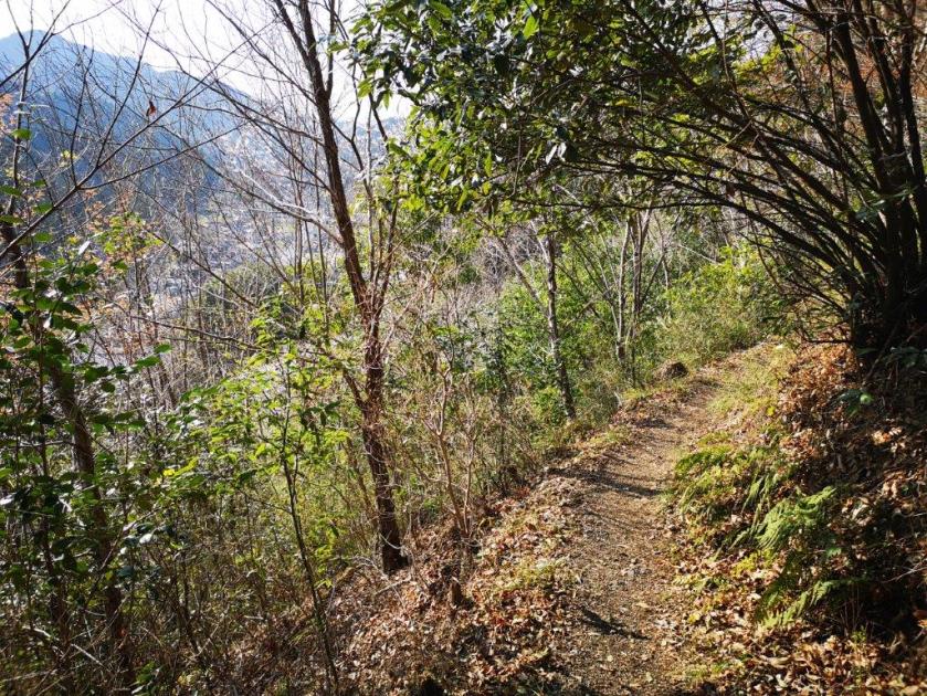
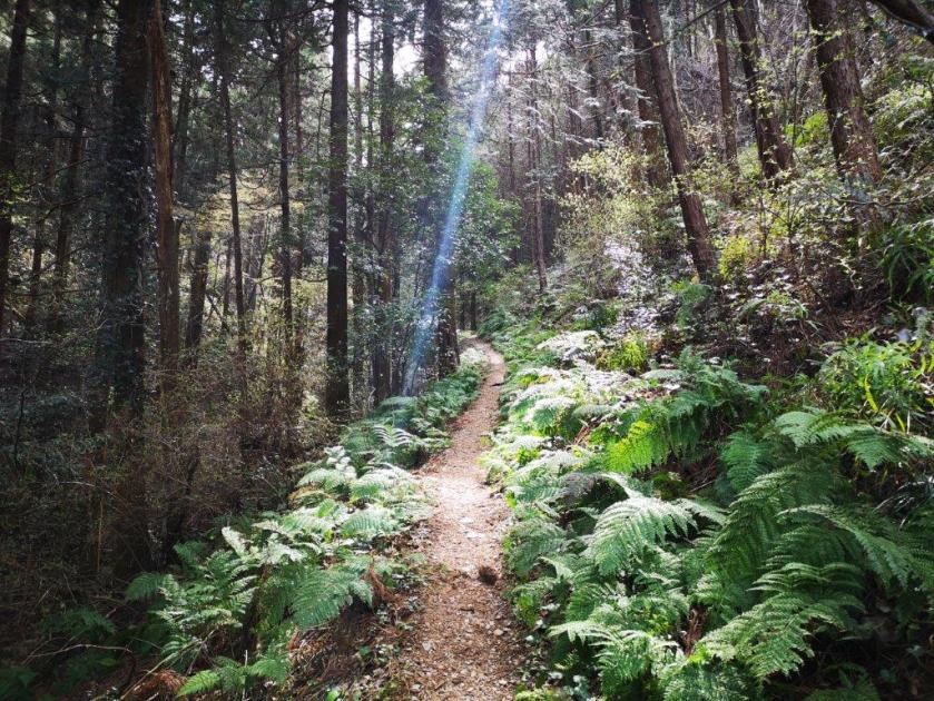
Walking through thick vegetation above Hakone Town

It was entirely surrounded by trees, so I didn’t linger, and followed the path down the other side. There were some glimpses of the surrounding mountains through the trees. Even though I was close to a major hot spring resort, I couldn’t see any buildings nor hear any noise. It felt like I was exploring a hidden valley. Less than thirty minutes later, I reached the Tokaido road, connecting Hakone-Yumoto with Hakone Town, and the Amazake-Chaya Teahouse. I decided to take a short break and have some of their famous non-alcoholic sweet sake with “chikara-mochi” meaning “power rice cake”. This was a welcome break, since I had forgotten half of my lunch at home.

Refueling with some sweet sake and power mochi

At noon, I was powered up and ready to continue hiking. I was now walking the Old Tokaido Road to Hatajuku 畑宿. I could have followed it all the way from Hakone Town, since it started near the bus stop I got off. However, it seemed that, apart from the historical aspect, it wouldn’t make for an interesting hike, so I preferred the detour through the mountains. The Tokaido used to connect Tokyo and Kyoto during the Edo period. Most of it has disappeared, but some sections have been restored along the Hakone part.

An ancient road dating back to the 17th century

It’s stone-paved, so it was easy to mentally travel back in time, and imagine what it must have been like to walk this road 400 years ago. However, it wasn’t easy to walk on the stones. At first it ran parallel to the modern Tokaido road, so the noise of cars was never far away. When the modern road made a series of switchbacks down the side of the mountain, the ancient one descended directly via a series of stone steps, at the end of which was a short section of road-walking.

A not so old staircase on the Old Tokaido Road

At one point there was a view of the Shonan coast and Odawara city below, probably quite spectacular on days with better visibility. Half an hour later, I reached Hatajuku, a center for traditional handicrafts, and left the Old Tokaido Road. It continues all the way down to Hakone-Yumoto, but I wouldn’t recommend it, unless you are into Historical reenactment.

Turn right here to return to the paved road

I walked up the Hakone Shindo Road for a few minutes till the start of the trail for the Hiryu falls 飛龍の滝 up the other side of the mountain. The first part was punishingly steep. The next part, following a rushing stream, was more level but surprisingly rocky at times, especially for regular sightseers who just wanted to see the falls, not experience a full-blown hike. I got to the observation platform base of the falls at 1h30, and was underwhelmed by what I observed. The water rushing down the rocky side of the mountains never really “fell”, but I figured it would look more impressive after a big rainfall. However, the picturesque Hiryu river made the climb worthwhile.

Hiryu river valley, just below the falls

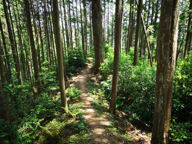
The next part of the trail was badly damaged, probably due to last year’s typhoons. A little higher up were signs that the trail was being repaired, and the next part was a lot better. The trail climbed steadily through thick forest along steps built into the gentle slope. I was now all alone as most people turn back at the waterfalls.

IMG_20200215_135335

Trail after the waterfall

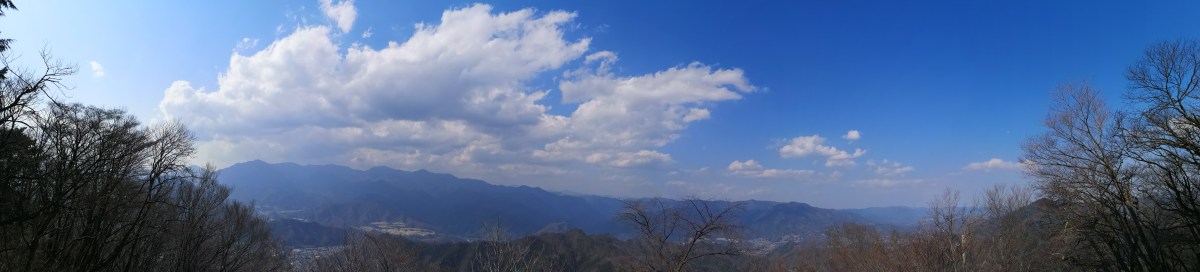
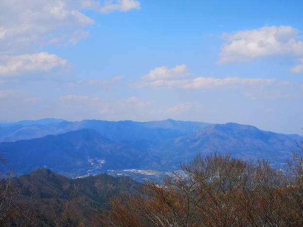
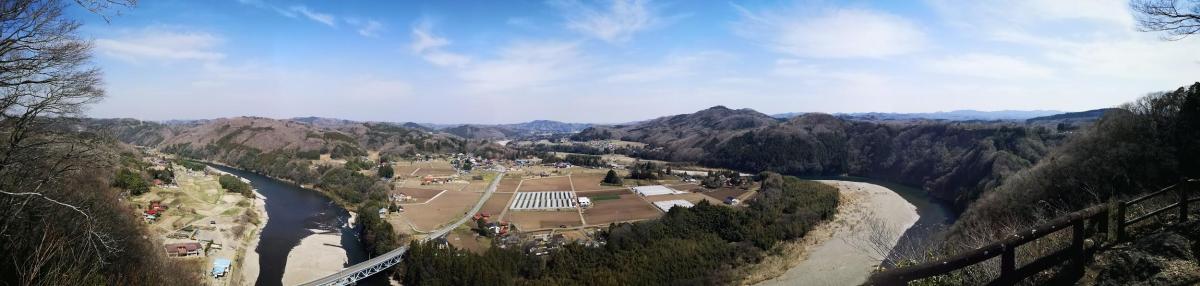
At 2pm, I reached the Yusaka hiking trail. To the left was the road I had taken earlier by bus. Turning around, I saw a sign on the trail I had just come up, reminding me that I was inside the Fuji-Hakone-Izu National Park. I headed right along a wide path, doubling as a firebreak. I soon reached a table on top of a grassy mound. According to my map, this was the top of Mt Takanosu 鷹ノ巣山 (834m). There was no summit marker, but instead there was a sign saying this was the location of the ruins of Takanosu castle. A little further was a steep and short descent, followed by a gentle climb. I had some views of the Gora area of Hakone (cable car service should resume on March 20) and Mt Kintoki in the background (Mt Ashigara on some maps). Before I knew it, I was at the top of Mt Sengen 浅間山. There was another table, but no view.

A glimpse of Gora with Mt Kintoki in the background

The final section of the hike followed the firebreak along a ridge, all the way back down to Hakone-Yumoto. I am sure this would be a nice hike on a sunny spring or autumn day, but today under a grey sky and surrounded by leafless trees, it felt rather bleak. However it was quite warm for the time of the year, around 15 degrees, so it was odd walking in a winter landscape in spring-like temperatures. I reached the ruins of Yusaka castle a little before 4pm. Apart from a signboard there wasn’t much to see. A few minutes later, I popped out onto the main road next to a river. I had a hot spring bath at nearby Izumi, before walking the 5 minutes back to the train station, where I caught the Romancecar back to Tokyo.

NEXT UP: Mt Ushibuse in Gunma

Jogasaki Coast & Mt Omuro (580m), Ito City, Shizuoka Prefecture, Tuesday, February 11, 2020

This hike was unusual because I wasn’t hiking up and down mountains, but along a beautiful coastline. The suspended bridge on the Northern end is a popular sightseeing spot, however few people wander down the hiking trail that extends Southwards along the coast. It took me five hours at a leisurely pace to reach a second suspended bridge near the end of the trail. Although there are no mountains, there were many small ups and downs along the way, and lots of great views of the ragged coastline.


Halfway point of the jagged Jogasaki Coast

I took the Odoriko Limited Express from Tokyo station to Izu-Kogen (2 hours), and then hopped onto a local train to travel back one station to Jogasaki-Kaigan station. This small charming station was entirely made of wood and had a spacious comfortable waiting room. There was a small foot bath next to the platform, and a view of Sagami Bay and Oshima Island from the entrance. The famous early blooming cherry trees were still completely closed, but would be opening very soon.

IMG_20200211_095911

Oshima Island from Jogasaki-Kaigan station

Kadowaki Suspension Bridge with Oshima island in the background

I walked 20 minutes to the Boranaya restaurant, which is right next to the start of the Northern end of the trail. Across the bay, I had good views of Futo Hot spring, the next stop after Jogasaki-Kaigan. In the far distance, I could make out the faint outline of the Boso peninsula. It took me less than 30 minutes to reach the wobbly Kadowaki Suspended Bridge 門脇つり橋 (48 meters long and 23 meters high). A little further was the Kadowaki Lighthouse 門脇埼灯台 (25 meters high). I climbed the narrow spiral staircase to the observation floor (17 meters high), but since it was indoors, I couldn’t get any good photos through the glass.

Spectacular rocks near the Kadowaki Suspension Bridge

Grey cliffs and blue sea

It was already past 11am, so I quickly started hiking South along the coastal trail, leaving the sightseers behind. It was a warm sunny winter day; to my left was the dark blue sea sending its foamy waves roaring and crashing onto the ragged coastline; to the left were the mountains of central Izu, under the shadow of thick grey clouds. There were few other hikers, and most of the time I had the trail to myself.

The sparkling sea in the morning

Dark clouds got the upperhand in the afternoon

According to my map, the trail should take about 4 hours. However, every rocky promontory had a small path, branching off the main trail, going to its very tip. Since it would have taken too much time to explore them all, I had to decide which ones would yield the best views, and which ones to skip. I had just started down one such small path, when I was rewarded with a glimpse of a squirrel scampering through the trees. Walking another one, I spotted a couple of adventurous rock climbers on a secluded cliff. There were other climbers in several spots along the way, and I was reminded that the Jogasaki Coast 城ヶ崎海岸 was a popular place for this activity. A lot of these paths went close to the edge of cliffs, so I had to be careful, since unlike the rock climbers, I had nothing to protect myself from a fall!

This squirrel posed for a few seconds so I could take its picture

Climber nearing the top of the cliff

The trail was very well maintained. Fallen trees, no doubt from last year’s powerful typhoons, had been sawn through and removed from the path. There were frequent excellent Japanese / English signposts along the way, as well as information signboards on the various local sights, like the jagged Igaigaine いがいが根 rock formation. The main thing I learned was that the rugged coastline was created from lava flow when nearby Mt Omuro erupted long ago. When exploring the rocky terrain off the trail, I had to be careful not to trip and fall on the sharp lava rock!

Most of the time, the trail was easy to walk

Fallen trees have been removed from the trail

Around noon I passed by Renchaku-ji temple, and was lucky to finally see some early blooming cherry trees. At 2h30, I reached the Tajima no Taki observation platform, from where I could see quite a unique sight: a waterfall over the sea. A little further away, I could see a rock bridge with waves washing through it from both sides, and meeting at the center with a thunderous crash (see video below).

Pink cherry blossoms with a background of blue sky

The rock bridge surrounded by frothy waves

Along the trail there were many beautiful pine trees, possibly Japanese red pine. They were especially prominent along the second half, soaring high in the sky above. According to Wikipedia, they can grow up to 35 meters in height!

Many pine trees along the trail

Walking among the tall pine trees

A few minutes later I reached the Hashidate Suspension bridge 橋立吊橋 (60 meters long and 18 meters high). The trail ends just a little further at a small fishing village. I retraced my steps to the river above the waterfall, and followed it to a parking area and Izu-Kogen station, less than thirty minutes away.

The Hashidate Suspension Bridge

Mt Mihara on Oshima island, an active volcano that last erupted in 1986

One constant throughout the hike was the view of Oshima Island directly opposite and only 20 km away. Some of the other Tokyo islands (Toshima and Ni-jima) were faintly visible further to the South. I could even make out the outline of Kozu-jima about 75 km away. As the day progressed, and the sun moved further west, the details of Mihara volcano on Oshima island became more clearly visible, and I was reminded of my trip there in 2018.

Mt Omuro (580m) Crater Walk

Before heading back to Tokyo, I decided to make a quick visit to Mt Omuro 大室山 (580m), a short bus ride from the station, and the reason the Jogasaki coast exists in the first place. It has a perfect conical shape and is visible from nearly everywhere on the Izu Plateau. Unfortunately, it isn’t possible to hike to the top. I rode the chairlift up and walked around the top crater in twenty minutes. There was a spectacular 360 degree panorama of the entire area. I could see Mt Fuji (60 km away), the Hakone mountains, the Tanzawa mountains, the Miura peninsula, Sagami and Tokyo B\bays, the whole Izu-Kogen, the Tokyo Islands and Mt Amagi.

I made another visit to Mt Omuro in Dec 2022

Mt Fuji, Hakone, Tanzawa

After taking the chairlift back down just before closing, and catching the last bus back, I stopped by Izukogen no Yu Onsen. After a relaxing hot spring bath, I hopped onto the Odoriko limited express headed for Tokyo.


Mt Fuji, clear of clouds in the late afternoon

Watch the crashing waves along the Jogasaki Coast

See the views from the Mt Omuro crater (Dec 2022)

Below: slideshow of photos from the Mt Omuro crater walk (Dec 2022)

Mt Kamine (598m), Mt Oiwa (530m), Mt Takasuzu (632m), and Mt Sukegawa (328m), Hitachi City, Ibaraki Prefecture, Sunday, February 9, 2020

Hiking in the Hitachi Alps 日立アルプス

This was my first time hiking in the Hitachi Alps 日立アルプス, but traversing the entire range in one day seemed too long, so I decided to go up the West side, do a round trip to a peak on the North end, then head to another peak on the South end, and finally walk down the East side. This was a combination of two hikes from my Mountains of Ibaraki hiking book.

View of the Pacific Ocean near the end of the hike

Using the Tokyo Wide Pass, it took me less than 2 hours to reach Hitachi City from Ueno station. I was impressed by the view of the blue sparkling sea through the wide station windows, but I had to hurry since I only had a few minutes to catch the bus for Oiwa Shrine 御岩神社. It took about half an hour on a nearly empty bus to reach the shrine, known in the area as a power spot. I was fascinated by the many tall cedar trees within the shrine grounds, especially the group of three towering up to 50 meters near the entrance gate.  Apparently it’s one of the one hundred forests of giant trees in Japan. I definitely felt like I was inside some enchanted world!

IMG_20200209_094619

Walking among the tall cedar trees inside Oiwa shrine

I found the entrance to the hiking trail behind the main shrine building. For once, I wasn’t hiking alone, since most visitors to the shrine continue up to the mountain directly above. The straightest route to the summit was closed due to typhoon damage (predating 2019), but the detour path is clearly indicated. I reached the top ridge before 10h30, and turned left along a mostly level path. There were a couple of ups and downs, but each can be avoided by taking an alternate path on the right (something I confirmed on the return). I reached the top of Mt Kamine 神峰山 just after 11pm. The view of the coast stretching Southwards and the Pacific Ocean was stunning.

View of the sea from the top of Mt Kamine

I enjoyed a late breakfast sitting on the ground under a tree, since the bench was taken by another hiker. It’s possible to continue beyond Mt Kamine, and back down to Ogitsu station (one stop from Hitachi station), but today I retraced my steps to where I had reached the top of the ridge one hour earlier. I continued up a short rocky path to Mt Oiwa 御岩山. It wasn’t the highest point of the ridge, and it didn’t feel like a mountain top, but there was a wide view to the West of the forested hills of Ibaraki, including Mt Nantai and Mt Yamizo, as well as the snowy mountains of Tochigi in the distance, so who am I to complain?

Panoramic view from Mt Oiwa

Unsurprisingly, there were quite a few people, and there was even an interesting sign forbidding people to eat rice balls (see below), so after checking out the views, I moved on quickly since it was nearly 1pm. There were multiple paths, but they all joined up eventually. The next part was easy to walk, and quite peaceful as there were few hikers.

Pleasant winter hiking after Mt Oiwa

I soon reached the top of Mt Takasuzu 高鈴山, the highest point of the hike. There was a sixty meter high white tower for measuring rainfall on the Eastern side (no view), and a wooden observation platform on the West side, with similar views as before, plus Mt Kamine to the North.

Observation platform at the top of Mt Takasuzu

I had my lunch, and set off again at 1h30. The path continued Southwards, but I backtracked a few minutes till a road signposted for the ruins of Sukegawa castle 助川城跡 which I had crossed a little earlier. After a few turns, it joined up with a hiking path on the right. This section was very enjoyable. I saw no one while I made my way down the mountain, and it felt like a secret path. I sometimes wondered if I was on the right trail, and was relieved everytime I spotted a signpost!

Hiking down from Mt Takasuzu along a narrow path

I reached Omusubi pond おむすび池 before 3pm. It was part of a wide park, nearly completely deserted in the middle of winter. Fifteen minutes later I reached the top of Mt Sukegawa 助川山 with a superb 360 degree view.

Arbour and lookout point at the top of Mt Sukegawa

I could see the entire range of the Hitachi Alps, Iwaki to the North, Chosi to the South, and the Pacific Ocean. It was hard to believe that San Francisco lay 8000 km straight ahead with nothing in between but the ocean.

In clear weather, one can see all the way to Choshi

It was windy and cold, and already past 3h30, so I took off again for the last part of the hike. At the edge of the park the signposting was a little confusing, but thanks to Google Maps, I managed to find my way to the ruins of Sukegawa castle, and the edge of Hitachi city. There I caught a bus back to the station, and the comfortable limited express train back to Ueno and Tokyo.

Looking back at Mt Kamine

IMG_20200209_122452

NEXT UP: Jogasaki in Coast Shizuoka

Skiing in Nagano: Madarao Kogen (900m-1300m) Part II

Looking up at Madarao mountain

View of Mt Myoko from the Tangram area

I was lucky to be able to do another daytrip to Madarao Kogen, this time with sunny blue skies and colder temperatures, suitable for skiing. It had snowed the previous night, and all the trees were covered in a thin layer of snow, giving the entire resort a fairy world quality. The weather only turned cloudy later in the afternoon, making it easier to stop skiing in time.

Directly opposite is Nozawa Onsen

A small resort with steep slopes

This time, I ventured to the very top of the resort. I rode what was possibly the smallest chairlift I had ever taken (see video), to the spot where I had eaten lunch on my last year’s hike. I had an amazing view of Mt Myoko, as well as the southern part of Niigata prefecture stretching all the way to the Japan sea. Heading down, I followed a fun red slope, called “Ocean View”, that zigzagged through the forest.

Nearing the top of Madarao ski resort

In the distance, the sea of Japan

I had a late lunch and decided to have pizza again at Aki’s Pub & Cafe’s. This time, I could sit outside in the afternoon sun. The pizza was as good as I had remembered; I especially enjoyed the chewy, tasty dough. Since I had another hour of skiing, I ordered a tall black coffee to help speed up my digestion (or help me forget about it).

Aki’s Pub & Cafe, the best pizza in Madarao

Enjoying pizza outside is the best

The most remarkable part of the day were the views, missed on my previous ski trip. Although I also had good views on my hike, the winter air is a lot clearer and crisper than in the autumn. Since Mt Madarao is a minor peak sitting between the Myoko-Togakushi Renzan and Joshin-Etsu Kogen National Parks, it has a front row seat to all the major mountains of the area, and it would take too long to list them all here.

The mountains of Nagano part I

The mountains of Nagano part II

Interestingly, I could see exactly where the snow line ended between the wet coastal area and the dry interior. After a few last runs near the bottom of the resort, I returned my ski gear at 4h30. This time I had tried the other ski rental shop, Shirakaba. They didn’t have my ski size, so they gave me “fat demo” skis instead. I could do curves really well but skiing fast was less easy. One could say I wasn’t convinced by the demonstration!

On the left, the wet coastal area, on the right, the dry interior

Good skiing can be had at Madarao

Of all the resorts, Madarao Kogen offered me the most satisfying day-trip from Tokyo. It might not have had the most slopes, nor the highest ones, but it had the perfect combination of easy access and good-quality skiing. Hopefully, I will be able to return next season, on another blue-sky day to enjoy the amazing views.

Skiing at Madarao Kogen in good weather

Skiing in Nagano: Togakushi Ski Resort (1300m-1800m)

For my last ski trip of the season, I headed to a place I hadn’t really considered until recently. While shopping for a ski mask, I picked up a brochure for the Togakushi Ski Resort (also called Togakushi Ski Field or Togakushi Snow World). I read online that it was an old-fashioned, smaller resort off the beaten track, and I decided to keep it in reserve. With the good February weather continuing, it’s number came up. Access was straightforward, since I had been to Togakushi highland many times before. I had even crossed a part of the resort when hiking Mt Iizuna a few years ago. The Alpico bus company even sold a combined bus roundtrip / ski pass for 5500 yen. I had to choose between leaving at 6am or 7am. The weather forecast was cloudy in the morning with sun and blue skies arriving around 2pm, so I opted for the later departure. If the Japanese Meteorological Agency was right, I would get to see what Togakushi Kogen looked like in the winter.

Early afternoon view

Late afternoon view

It was a shock to see that it was snowing lightly when I arrived at Nagano station . There wasn’t much I could do about it, but since I had half an hour before the bus left, I decided to change into my warmer ski clothes inside the station. It continued to snow during the entire bus ride, and I was starting to feel pessimistic about the day’s prospects. I arrived at the ski resort at 11am and decided to have an early lunch at Charmant restaurant. Afterwards, I would get my gear from the rental shop on the second floor or the Guest House, since starting from noon, the day prices were 1000 yen cheaper. I got the cheese burger and fries, filling but not too heavy; a good thing, since I had a full afternoon of skiing ahead of me.

View of the North Alps from the panorama slope

Dramatic view of Mt Togakushi

It was still snowing when I took my first chairlift at 12h30. I had planned to head to the highest point of the resort, Mt Menou (1748m), but it was still in the clouds. Instead, I headed to the top of Mt Kenashi (1549m – no relation to the one in Nozawa Onsen). Most people seemed to be skiing the black slopes on the West side. I was more interested in the “Sweet” slope, a red that zigzagged through the forest on the South side. It felt like a blue, except for the hairpin curves – I had to be careful not to ski straight into the forest!

Skiing the Shakunage slope

A view you might get in the Swiss Alps

I then decided to try the black “panorama” slope, also on the south side. I found out why few people were skiing it – the top layer was frozen snow, and instead of biting into the slope, my skis skidded over them helplessly. Although it was still snowing gently, the weather was slowly improving, and I could now see the northern part of the North Alps ahead. I decided that it was about time to move to the other side of the resort.

View from the top of Mt Menou

Skiing the Menou slope

The sun was shining by the time I reached the top of Mt Menou. Opposite, I could see the jagged summit ridge of Mt Togakushi. To the right was the peak of Mt Takatsuma, a hundred famous mountain, its highest point popping through the clouds. I had climbed this peak twice, once in bad weather and once in good weather. As I skied down the “shakunage” slope (meaning rhododendron), I was awed by the dramatic views of the Togakushi mountains – it reminded me of skiing in the Swiss Alps.

The views were also great at the bottom of the resort

The black slopes of Mt Kenashi

The weather kept steadily improving during the afternoon, and eventually all the clouds disappeared from the surrounding mountains. Looking north, I could also see Mt Kurohime, with Mt Myoko visible just behind, Mt Hiuchi and Mt Yake. After enjoying the “shakunage” run a few more times, I made my way back to the base of the resort to return my skis. At 5pm I was back on the bus for Nagano station, and by 6h30 I was speeding back to Tokyo on the shinkansen.

See the views of the Togakushi Ski Resort

Skiing in Nagano: Nozawa Onsen (600m-1600m)

This was the only resort I knew well since I had skied there several times during my first years in Japan. Back then, the shinkansen ended at Nagano station, and I used to go there via overnight bus from Tokyo. Nowadays, Nozawa Onsen is just a short bus ride from Iiyama station on the Hokuriku shinkansen, and is included in the Welcome Japan JR East pass. I was curious to see how the resort had changed since my last visit about ten years ago. I knew for sure that the easier access had made it more crowed. The weather forecast was sunny blue skies but with unseasonably warm temperatures – about 12 °C at the base and 7 °C near the top. I was worried that the conditions wouldn’t really be suitable for skiing. However, I couldn’t resist the chance to check out the views, and also ski the “skyline”, one of the best slopes I’ve ever done in Japan.

Nozawa Onsen Village from near the end of the skyline

I was first in line for the Nozawa Onsen liner departing at 10am sharp. It took less than half an hour to reach the bus terminal in the middle of the village. Unlike other resorts, I had to catch a (free) shuttle bus to get to the rental shops and lifts. After renting my gear from Sports Thanx, I was finally ready to take the Nagazaka gondola up at 11h30. It felt late, but at least I knew which slopes I wanted to spend time on. First, I headed to the Yamabiko area, the highest part of the resort, and also the summit of Mt Kenashi (1650m) where I was sure to get the best views. Also, since it was such a fine day, I thought the snow condition would be better high up.

View of Niigata form the top of the Yamabiko area

Halfway down the “skyline”

There was a huge line for my second chairlift of the day. Apparently, everybody else had had the same idea! Regretfully, I decided to flee the top area and head straight for the “skyline” before it got crowded as well. The “skyline” is a long slope following a narrow ridgeline from the top of the resort down to the village, alternating steep and flat sections. It has unobstructed views of the entire valley which is why it is such a spectacular and popular run. Luckily for me, it was now lunchtime, and I had several sections entirely to myself. After going back up with the gondola, I descended towards the Uenotaira area and did the “Challenge” slope, a nice red, a few times in the sun.

Skiing an easier slope lower down the mountain

Skiing a more challenging slope higher up

It was now past 2pm, and time to get some lunch. I decided to try the pizza at the recently opened Yamabiko Rest House. There was no easy way back to the Yamabiko area, and I had to combine a gondola and two chairlifts. However at the second chairlift, I encountered another long line, meaning that I would not make it to the restaurant before closing time. Instead, I headed to Panorama House Buna, where, true to its name, I could sit outside and enjoy the panorama. I had an excellent mushroom curry, the house specialty. Straight ahead, and hazy in the afternoon sun, I could make out the majestic shape of Mt Myoko where I had been on my previous ski trip.

View from Panorama House Buna in the Uenotaira area

Riding the Hikage gondola

I almost wanted to spend the rest of the afternoon lounging in the sun, but I was worried about getting sunburnt; I also wanted to get some more skiing in before the end of the day. It was 3pm and I had less than two hours before the bus back. I did one more “Challenge” run, at a slower pace on a full stomach, and then headed back to the Yamabiko area to finish with the skyline. Once again, I wasn’t the only person with this idea. Fortunately, I had been conservative with my timing, and I could afford to hang around waiting for the slope to clear while enjoying the views. Despite the warm temperatures, the snow never got slushy and wet (except at the base of the gondola), and I just had to remove one layer of clothing to ski in comfort.

The Uenotaira course, half-way up the mountain

Back at the top for the last run of the day

After returning my skis, I decided to skip the shuttle, and walk to the bus terminal less than 15 minutes away. One of the attractive features of Nozawa Onsen is its village, a maze of streets lined with traditional houses, with several public bathhouses spread throughout. It looks especially beautiful in the winter under several meters of snow. Today, however, a lot of the snow had already melted, and the scenery wasn’t quite as charming as I had remembered. I skipped the hot bath so that I could claim a good seat on the bus. There was nearly an hour wait for the shinkansen back to Tokyo, and I hung out at the small cafe inside Iiyama station enjoying Nozawa Onsen craft beer.

See what it’s like to ski at Nozawa Onsen