Yatsugatake Sanroku Super Trail (Highest Point 1410m), Minami-maki & Koumi Towns, Nagano Prefecture, Sunday, November 2, 2025

I had previously walked several sections of the Yatsugatake Sanroku Super Trail, from Kiyosato station to Kai-koizumi station (sections 5 & 6), from Nobeyama station to Kiyosato station (sections 7 & 8) and the Kirigamine Highland loop (#15); I was reminded of this long distance trail earlier this year when I passed by the head office of the Japan Long Trail Association at the Momofuku Ando Center. I felt it was time to explore another section of this multi-day trail around the foothills of the Yatsugatake mountain range. Looking at my map, it seemed that section 9, between Nobeyama station and Matsubara Lake, could be done as a day trip from Tokyo. It was on the long side, and although the elevation change was modest, I would need to walk fast with few breaks to complete it before dark.

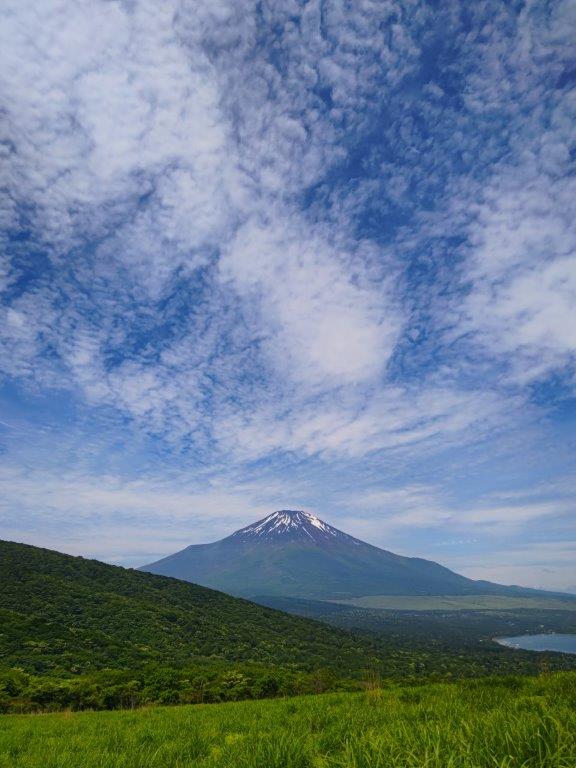
Hiking on Yatsugatake 八ヶ岳

To get to the start of the hike, I would ride the Chuo line limited express to Kobuchizawa, and there, change to the Koumi lime for the half an hour 500 meter ascent to Nobeyama station. At the end of the hike, I could catch a bus from Matsubara Lake and get off at Yahho Onsen. After a hot bath, I could use the same bus in the opposite direction to get to Matsubarako Station; there, I could board the Koumi line for the one hour trip to Sakudaira station where I could hop on the shinkansen for Tokyo. The weather was supposed to be sunny, and although the temperatures would reach 20°C in the lowlands, they would remain under 10°C in the highlands. I was looking forward to a countryside ramble with views of the Nagano mountains.

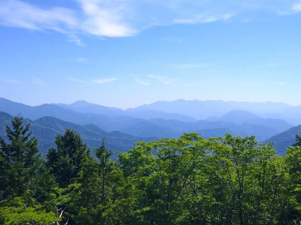
Oku-Chichibu Mountains (left) Mt Ogura (right)

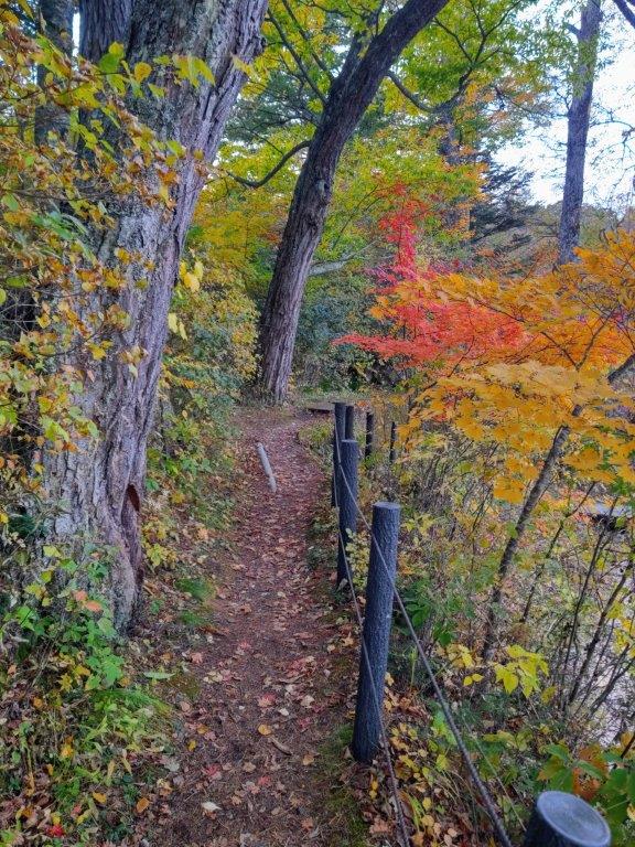
Japanese Maple (left) Matsubara Lake Path (right)

It was a sunny Autumn day as I rode the Azusa Limited Express to Kobuchizawa (887m), where I transferred to the packed two-car Koumi line train bound for Komoro. It was only from Kiyosato station that I could get a seat on the last section of the ride up the southeastern edge of Yatsugatake. A little before 11am, I stepped off the train at Nobeyama station (1345m), the highest train station in Japan, also the start of today’s section of the Yatsugatake Sanroku Super Trail (八ヶ岳山麓スーパートレイル) or Super Trail of the Mt Yatsu Foothills.

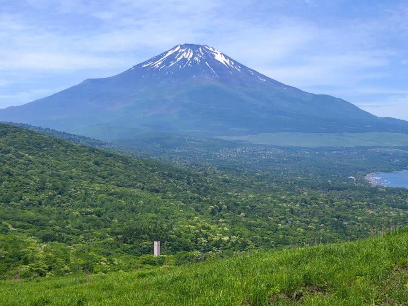
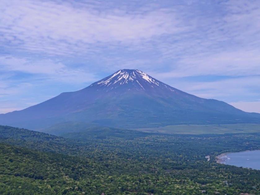
View of Yatsugatake from the Makiba Line
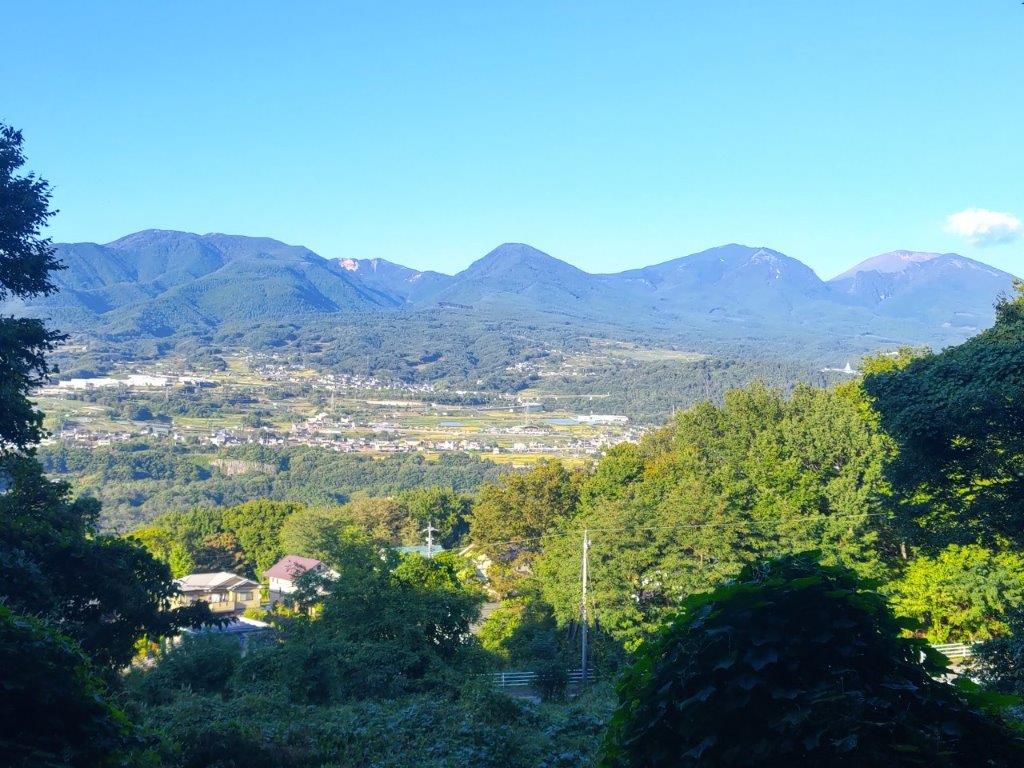
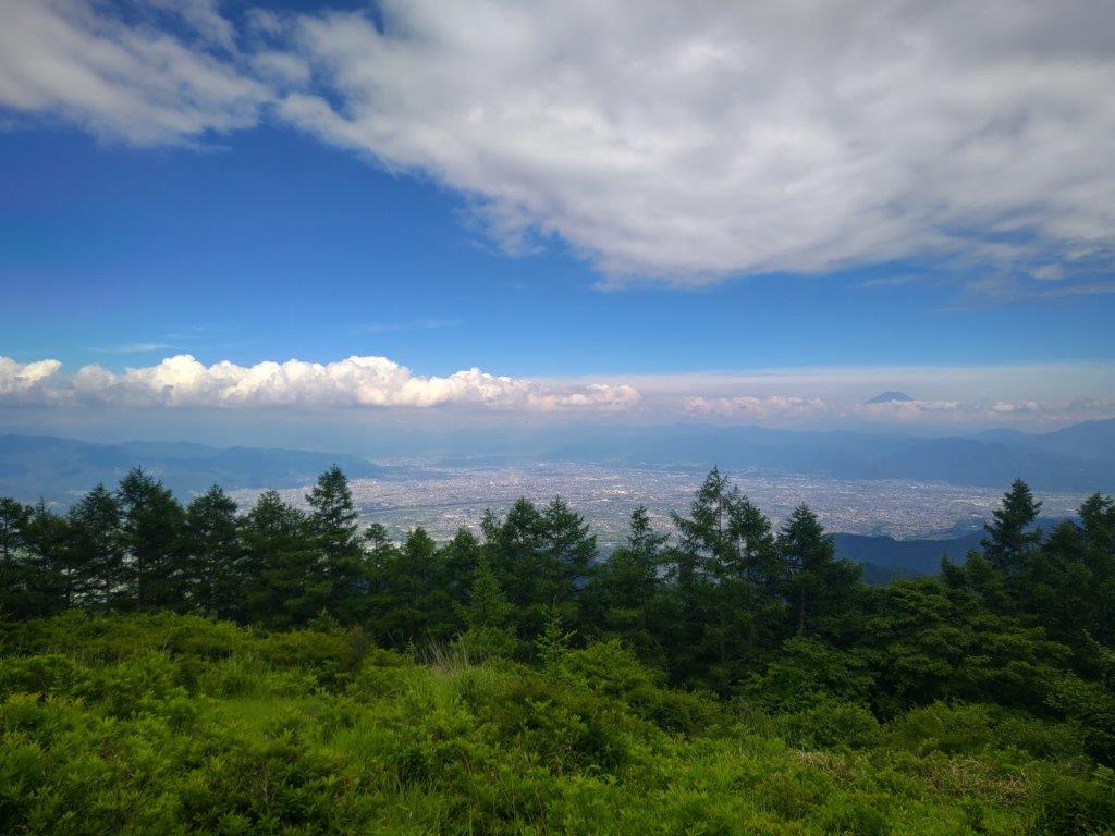
Nagano Autumn View

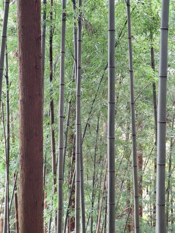
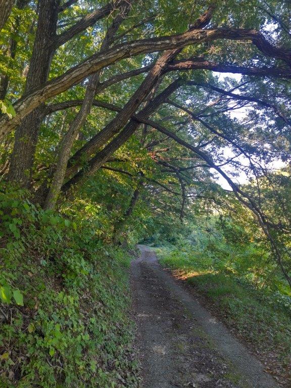
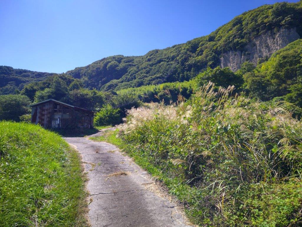
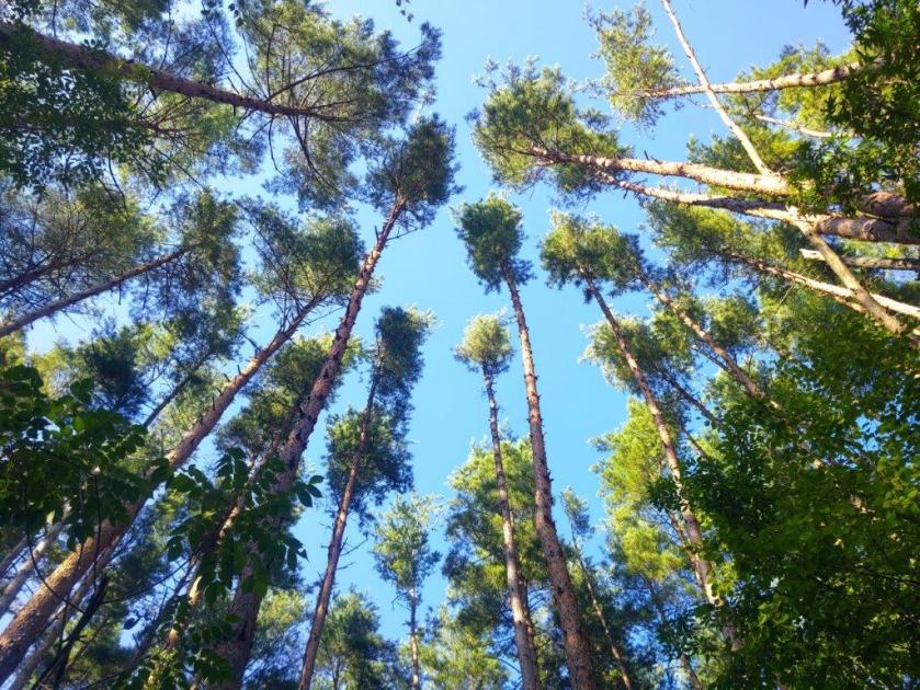
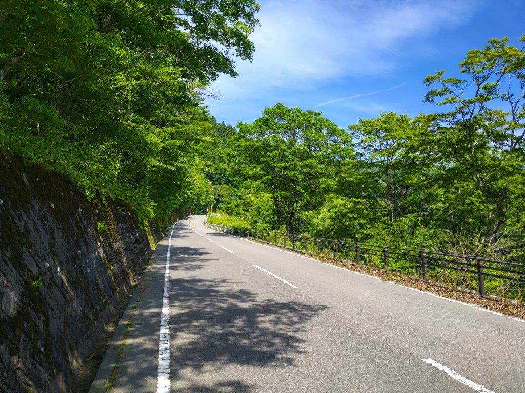
I was immediately chilled by the mountain breeze, as well as the freezing wind blowing from the Yatsugatake mountains directly opposite. After bundling up, I set off along a busy road past an equally busy dairy farm, but soon turned right onto a quiet countryside lane through mixed forest, the Yatsugatake Makiba Line (八ヶ岳まきばライン) which I’d follow for most of the hike. I soon reached an open section with pastures on each side of the road and wide views in both directions.

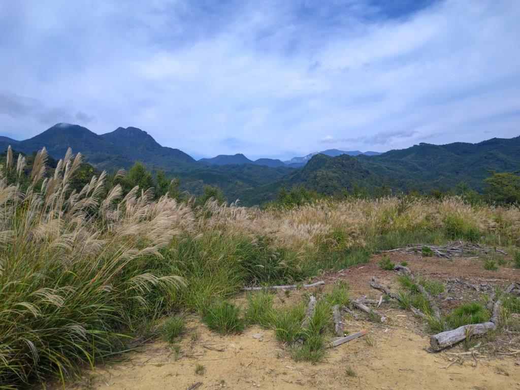
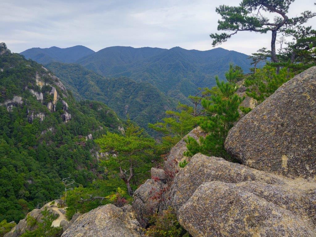
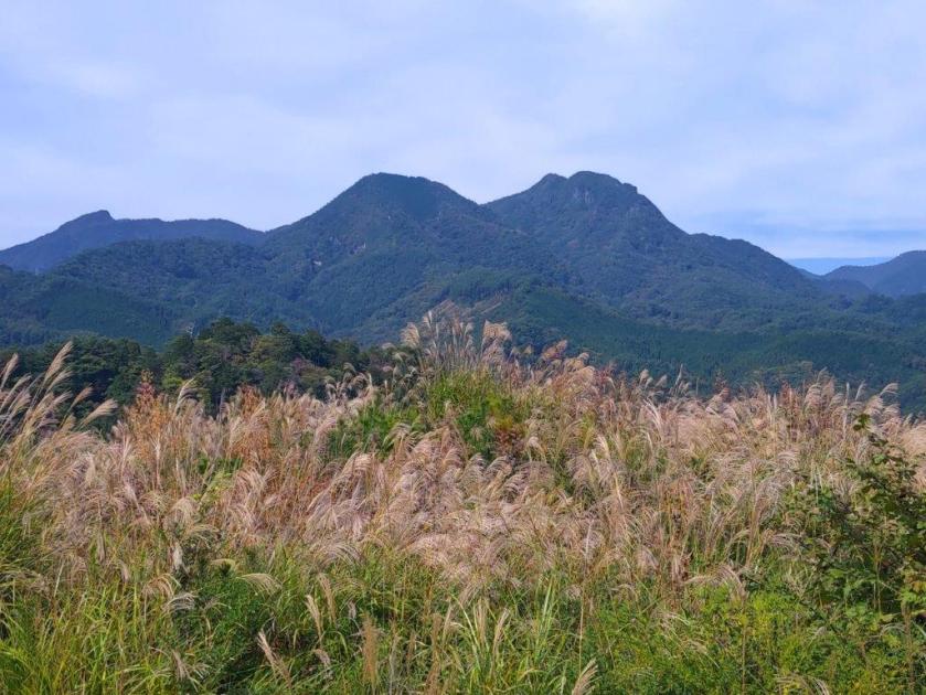
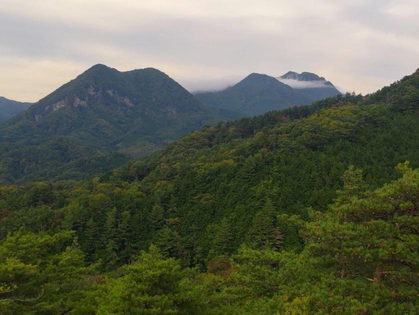
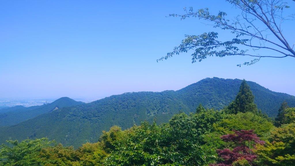
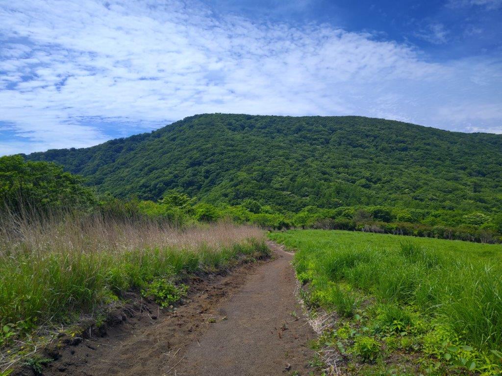
Mt Ogura (left), Mt Otoko (center) & Mt Tengu (right)

Autumn Leaves near Senga Falls

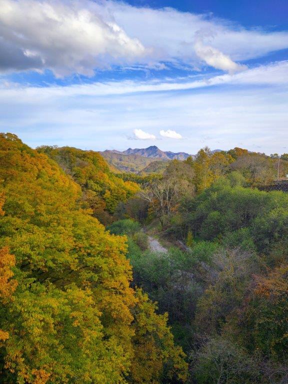
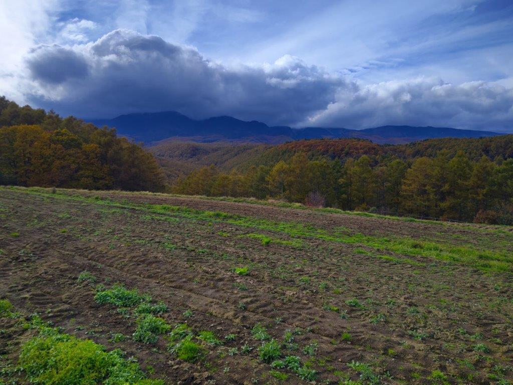
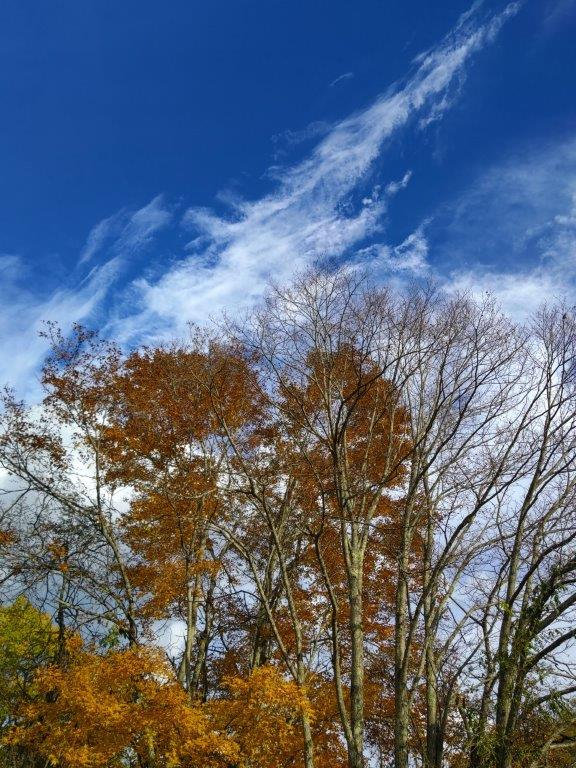
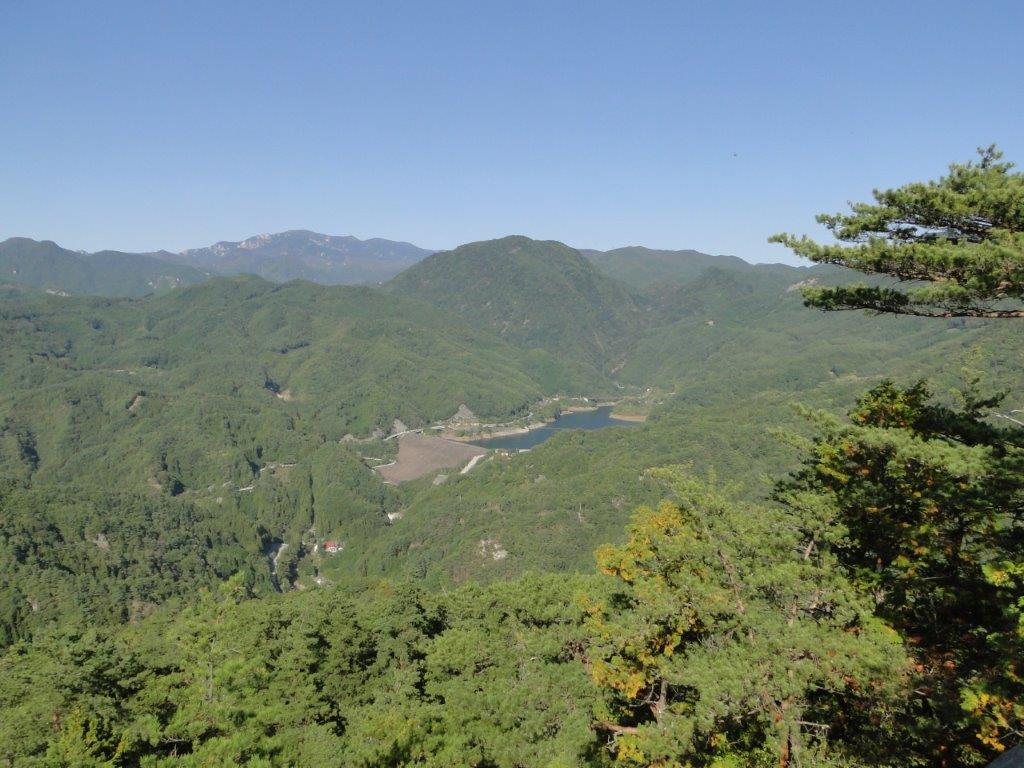
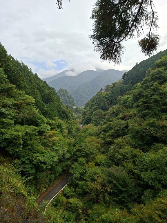
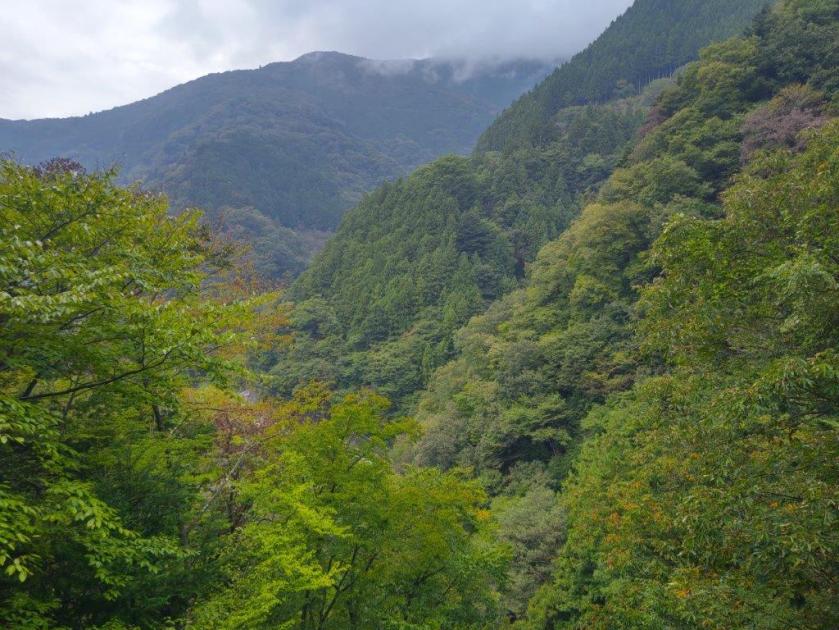
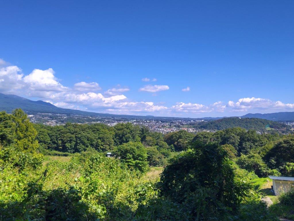
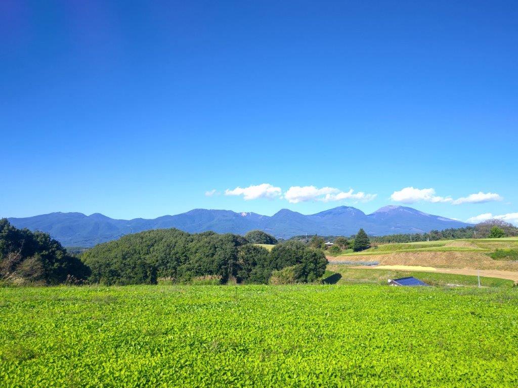
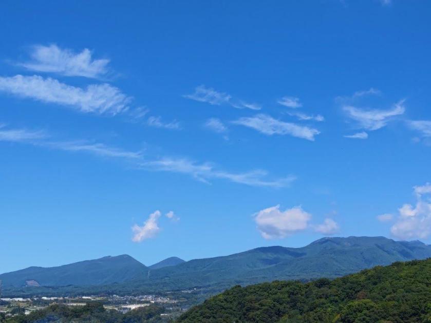
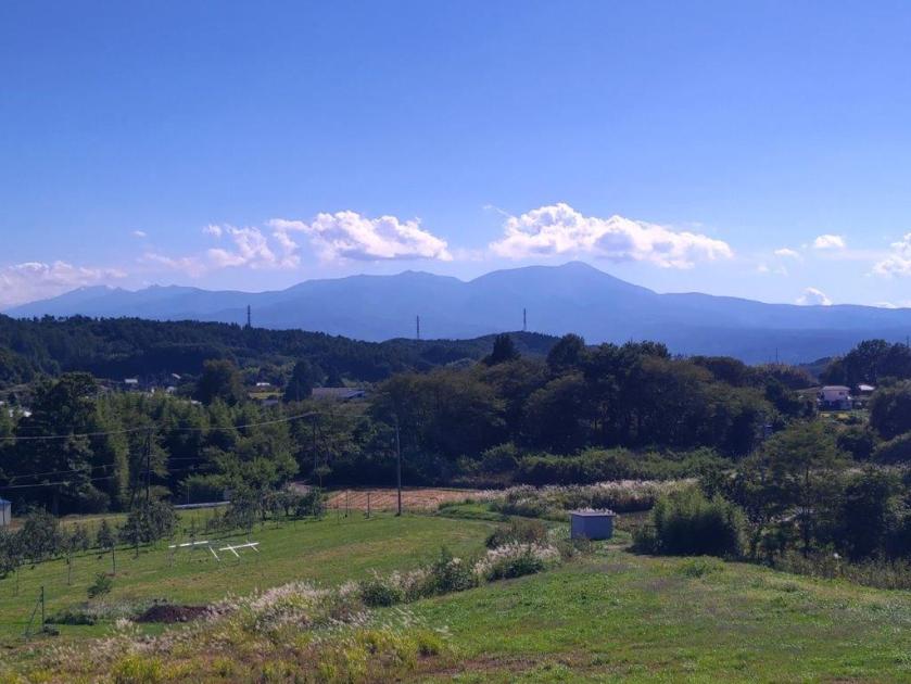
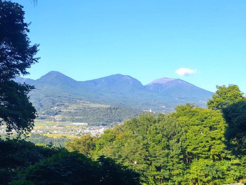
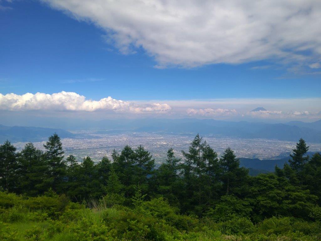
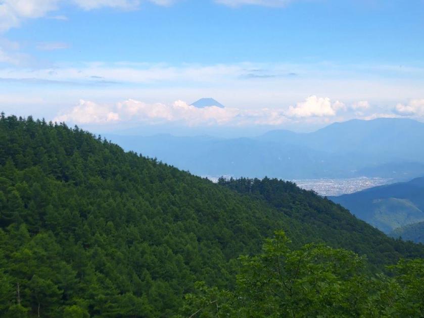
I was glad to get a view so soon on the hike. Looking west, I could see the Southern Yatsugatake mountains, its peaks tinged in white and its foothills tinted red; on the east side were the lower but more numerous peaks of the Oku-Chichibu mountains. Low clouds had appeared directly above Yatsugatake, casting shade on its steep rocky flanks; it made me wonder if the sunny weather would hold. The road dipped into a shallow valley and after crossing a bridge, I reached another viewpoint of the Oku-Chichibu mountains.

Autumn Colours above Senga Falls

Metal Staircase for Senga Falls

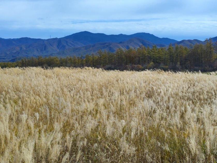
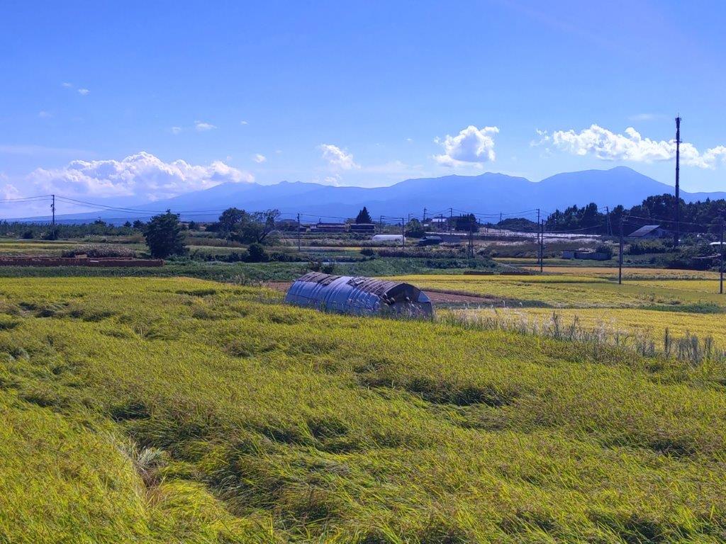
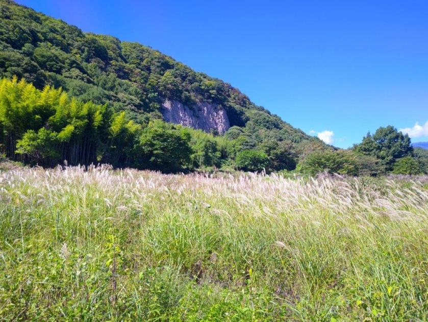
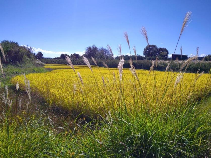
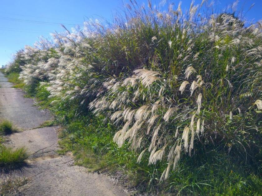
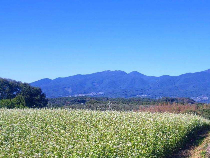
I was stunned by the contrast of light blue sky and pale yellow susuki grass. In the distance, I could make out, from left to right, Mt Ogura, Mt Otoko, Mt Tengu, Mt Yokoo and Mt Meshimori. The susuki was swaying in successive breezes, fluffy clouds moving south to north along the valley between the two mountain ranges. As the noon chime played, I remembered I was on a tight schedule and set off again, the occasional passing car interrupting the peaceful surroundings. I turned left at a junction with another road, staying on the Makiba line, and followed the road as it descended into a forested valley.

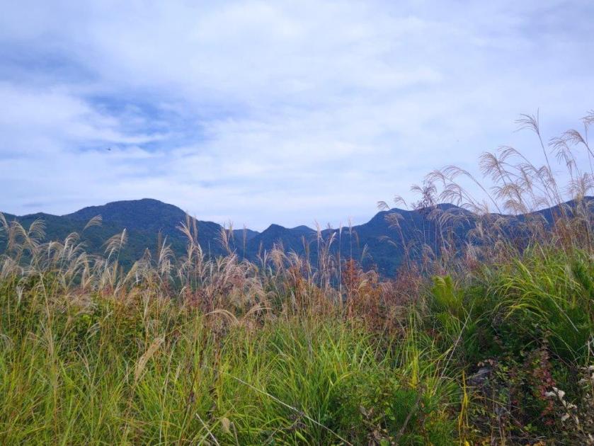
The Okuchichibu mountains with pastures in the foreground

Heading down into the Chikuma River Valley

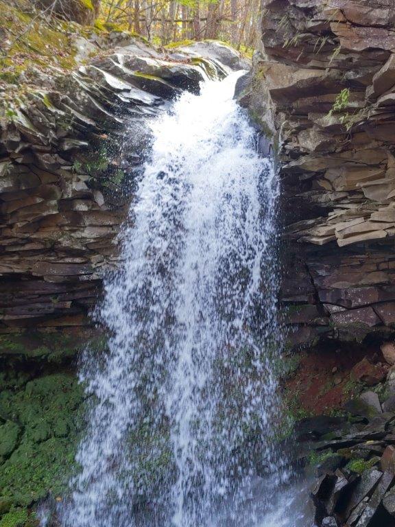
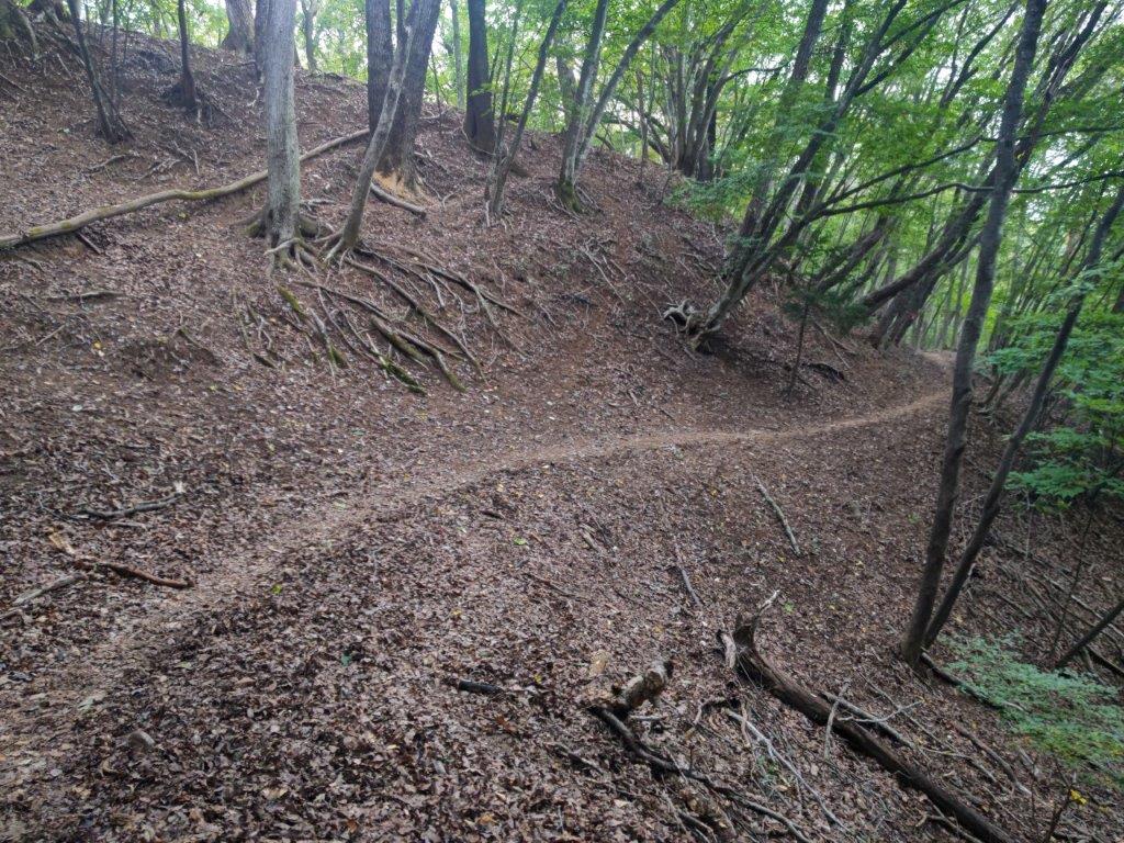
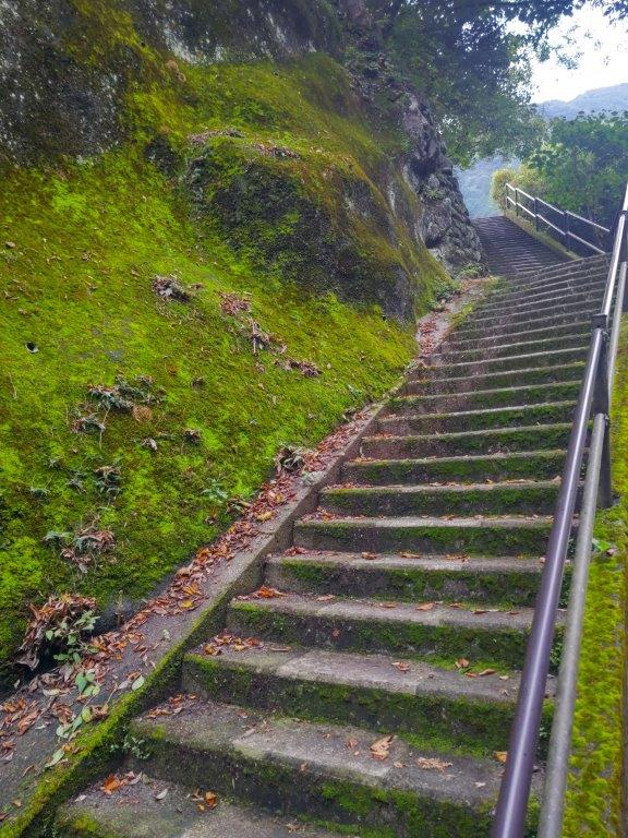
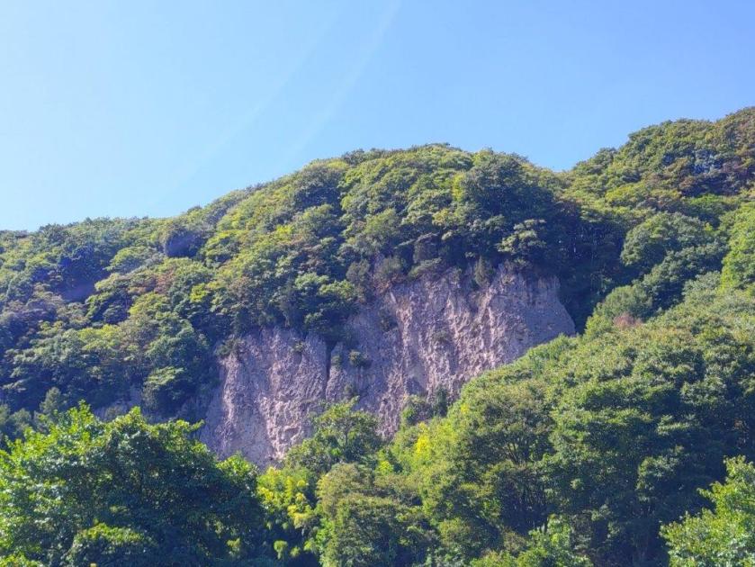
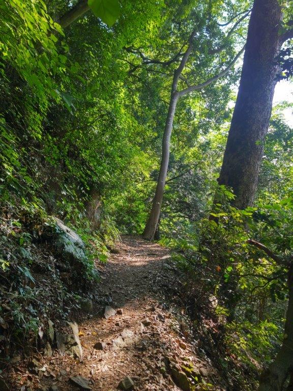
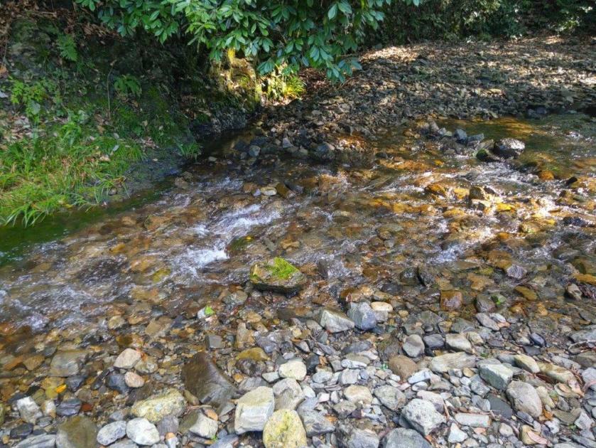
I was pleased to discover the entrance to a hiking trail just past a bridge over a river. It was signposted for a waterfall and although time was short today, I decided to check it out. After a five-minute walk along a rough path, I reached the top of a metal staircase. From the base, it was a short distance to the roaring Senga Falls (千ヶ滝), its flow likely inflated due to the recent rains. After taking a while to admire the tumbling water, I retraced my steps to a spot next to the river where I sat on a boulder for a lunch break.

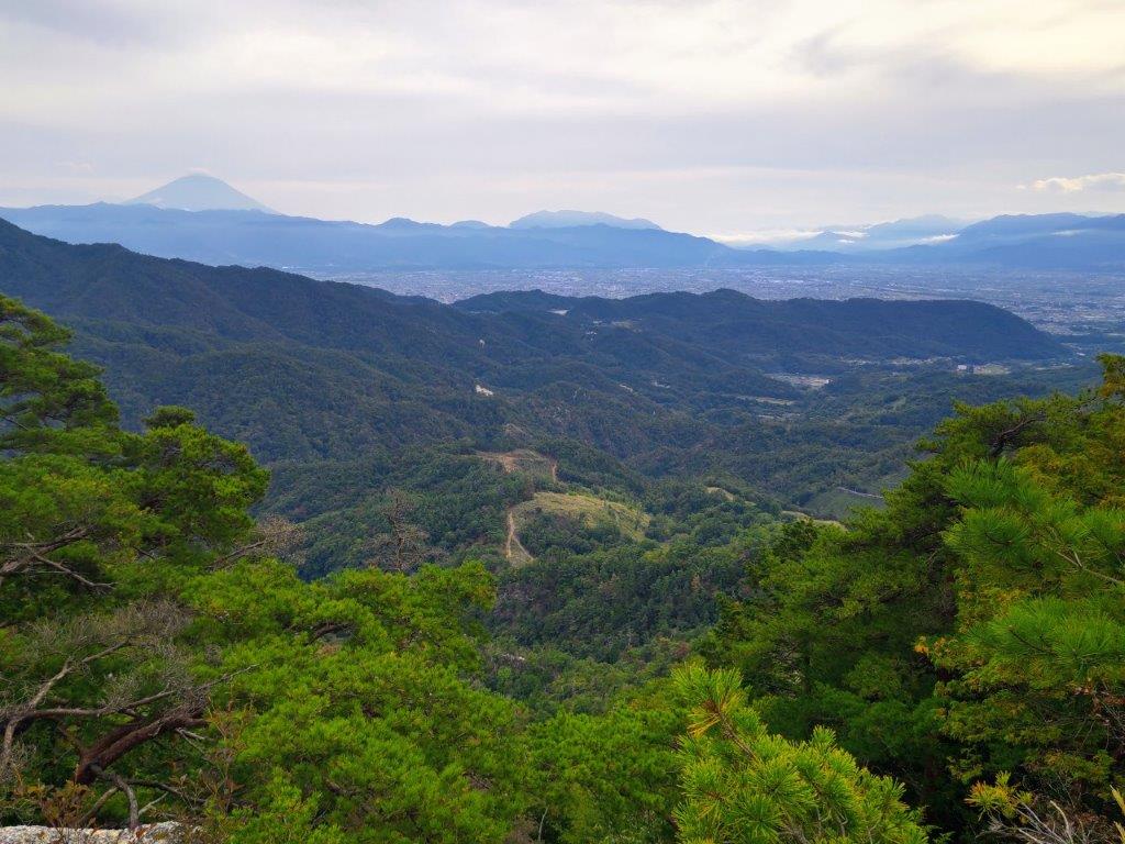
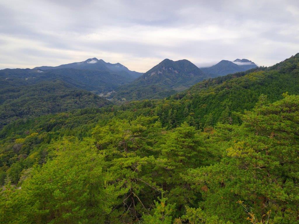
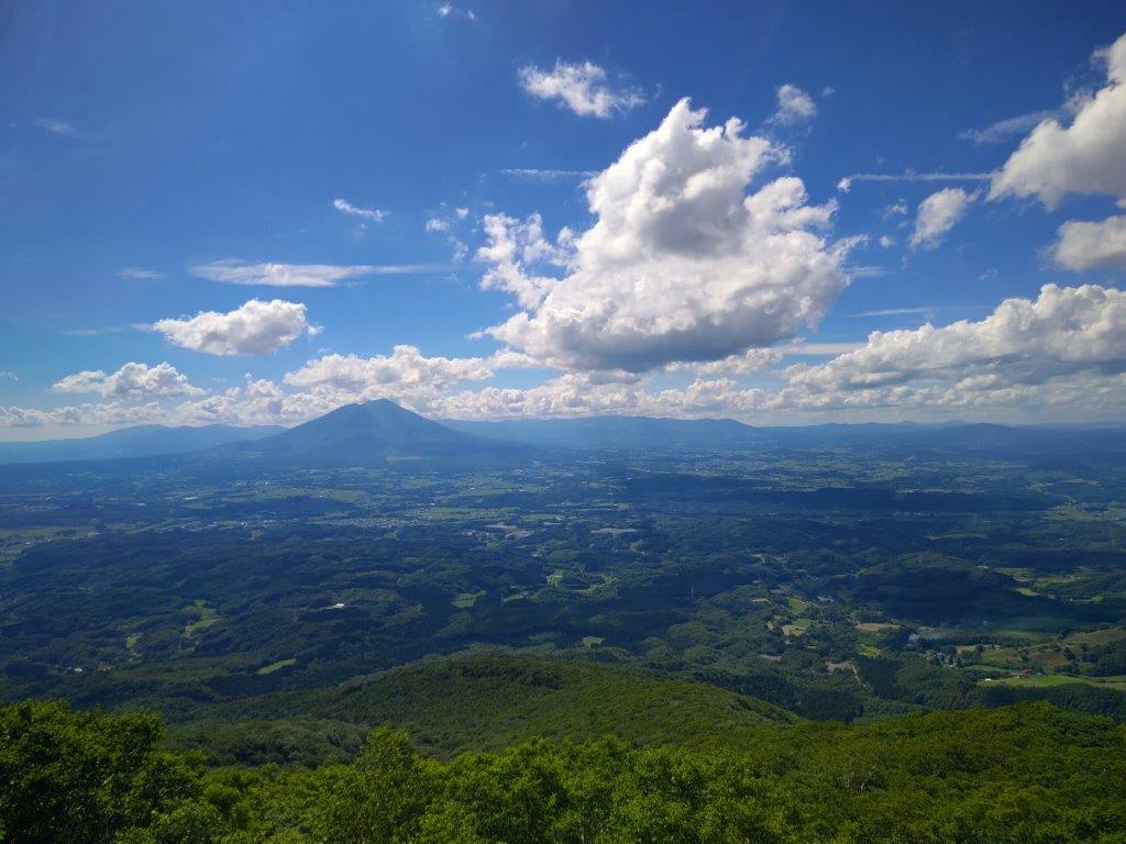
Clouds heading towards Mt Asama

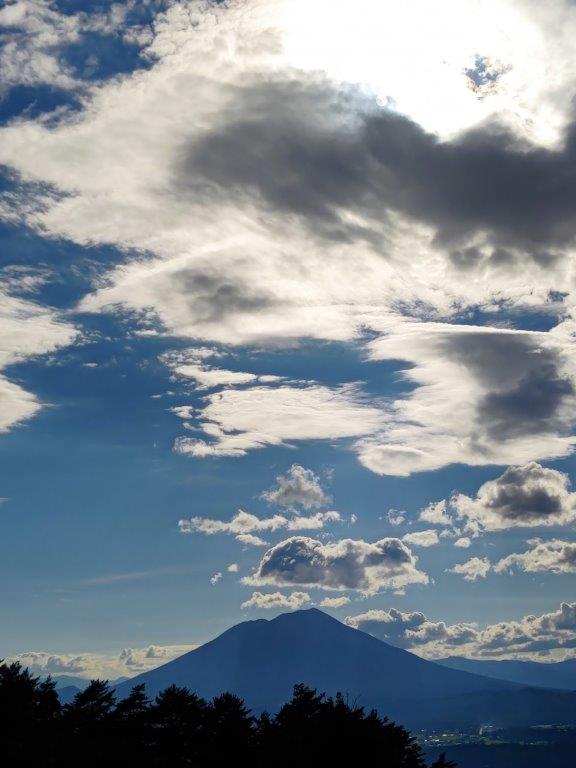
Dark Clouds above Yatsugatake

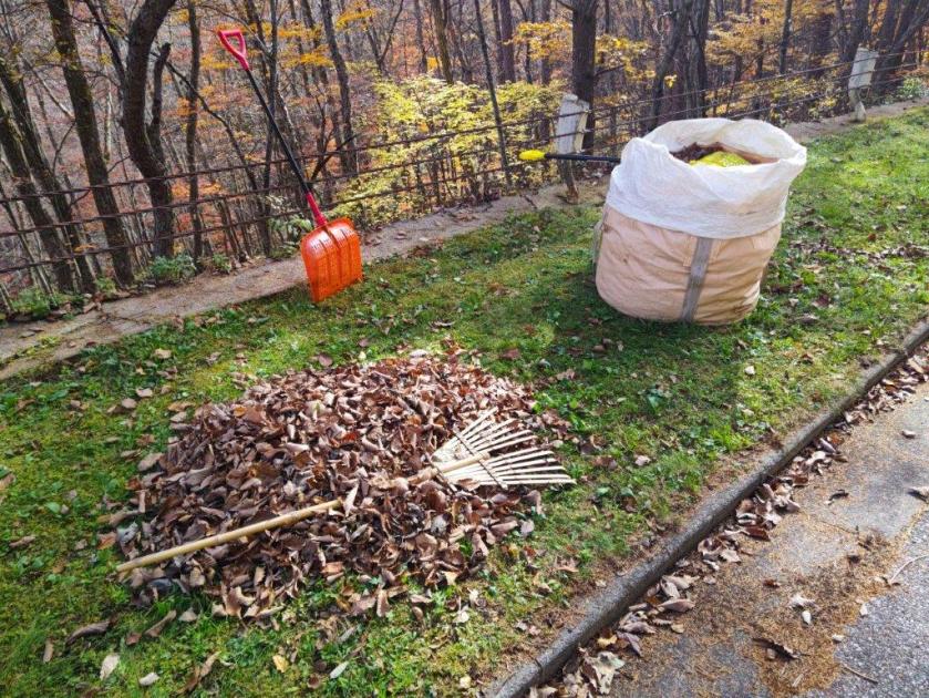
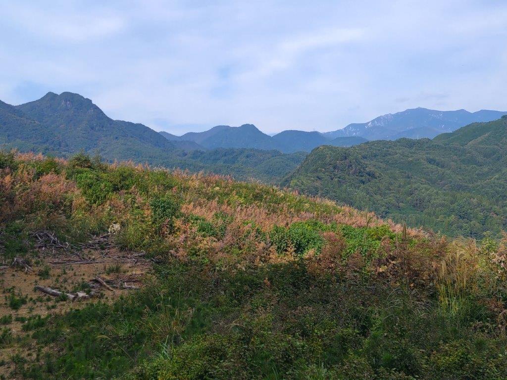
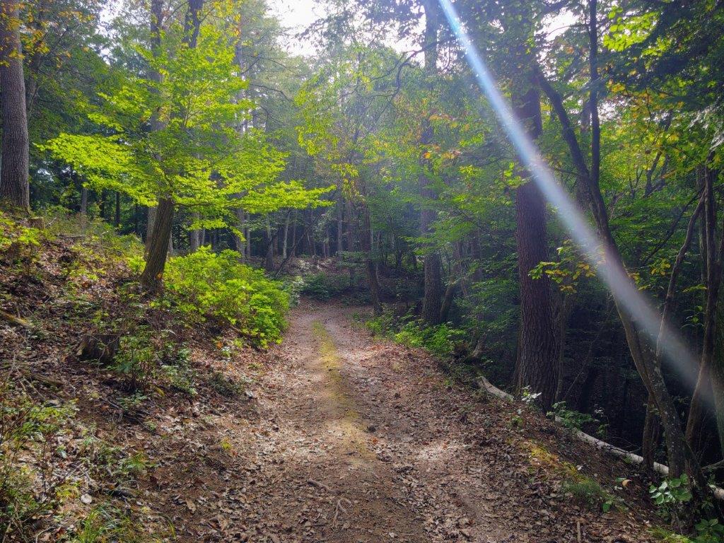
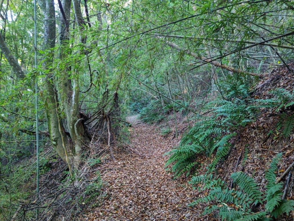
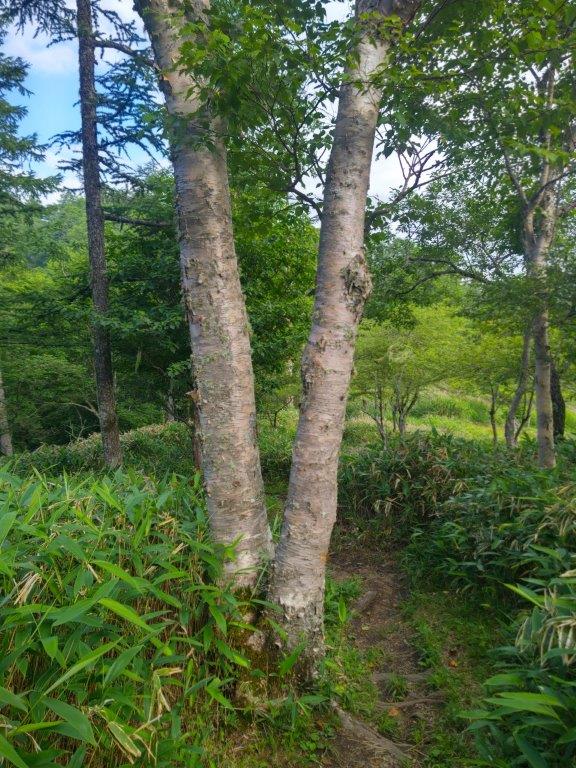
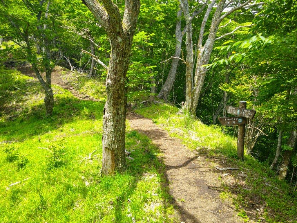
I was treated to a magical scenery of falling leaves with every gust of wind. The background music of rushing water nearly nursed me to sleep but I had to move along as it was nearly 1pm. Back on the road, I was surprised to see workers in uniform sweeping and raking the fallen leaves in the middle of nowhere. I turned right at a junction, staying on the main road. After another straight section with pastures and a view of the Oku-chichibu mountains, I turned left at the next junction, leaving the main road for a lane, also part of the Makiba line, going up through mixed forest.

Autumn Colours along the Chikuma River Valley

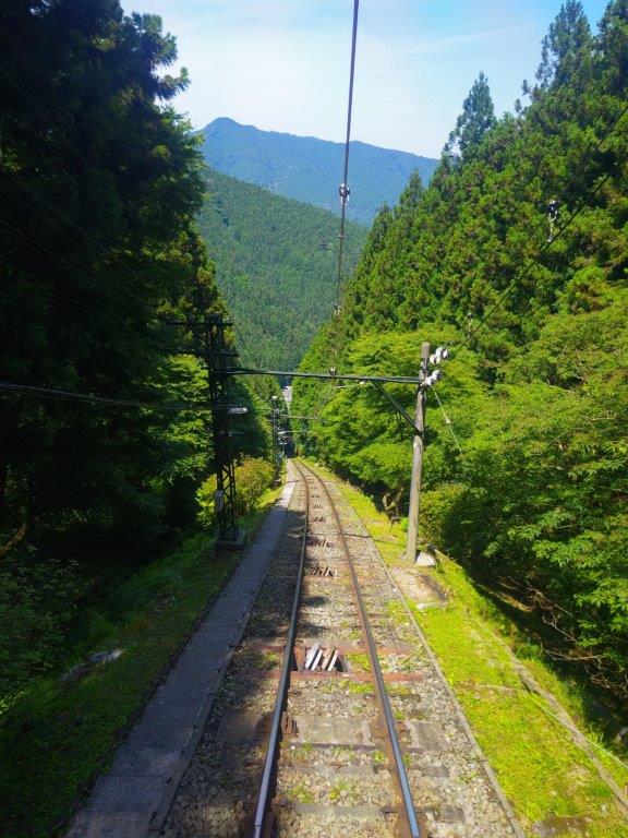
Koumi Line before Umijiri Station

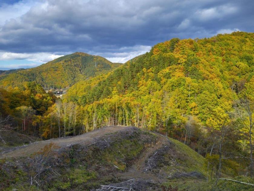
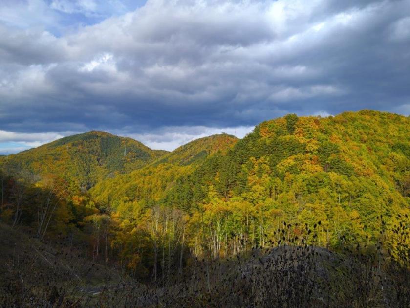
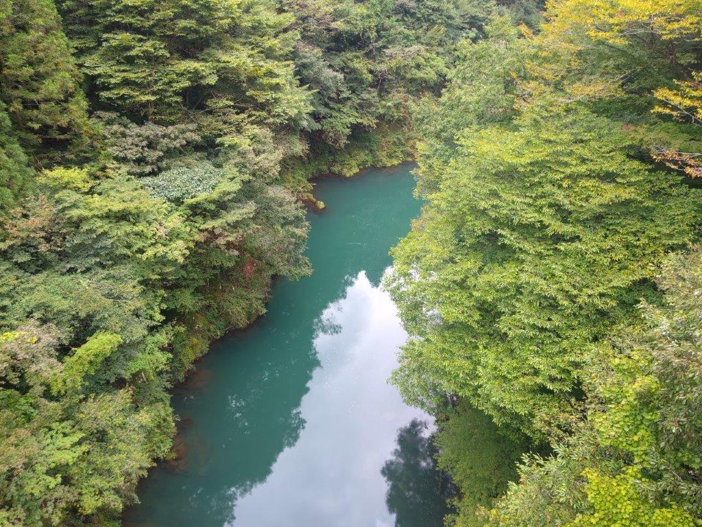
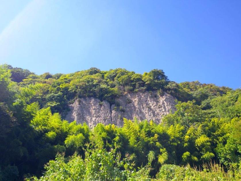
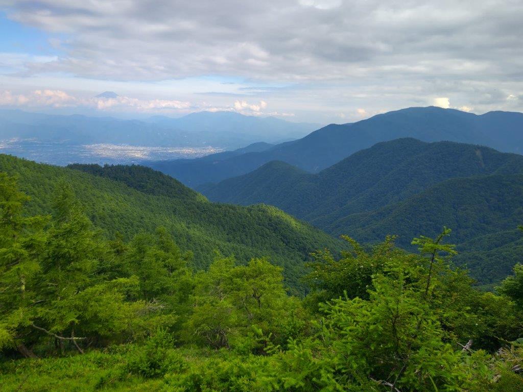
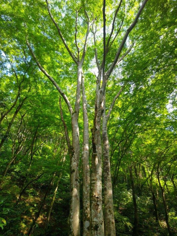
I now passed the highest point of today’s hike (1410m) completely surrounded by orange larches. I caught some movement in the forest and spotted a pair of deer before they bounded away. Soon the road veered right, exited the forest, and descended through farmland where people were busy working the fields. Far away to the north, beyond the green lettuce fields, was Mt Asama; turning around, dark menacing clouds threatened to engulf Yatsugatake. I continued downhill and soon the sound of rushing water could be heard; peering through the trees on the left side, I spotted a river flowing through a forested valley. Beyond a bridge the valley deepened, offering sweeping views of the opposite ridge.

Autumn Colours at Ioin Temple

Footbridge over Otsuki River

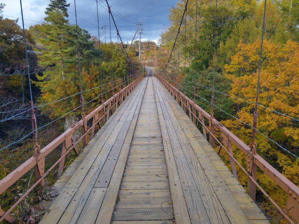
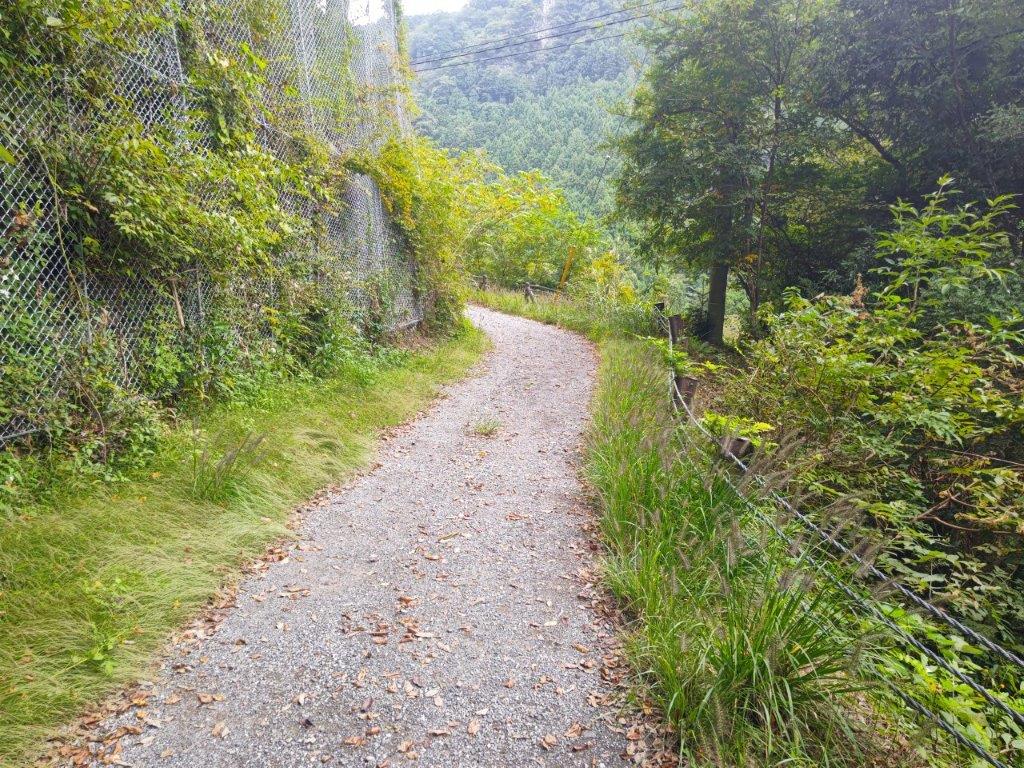
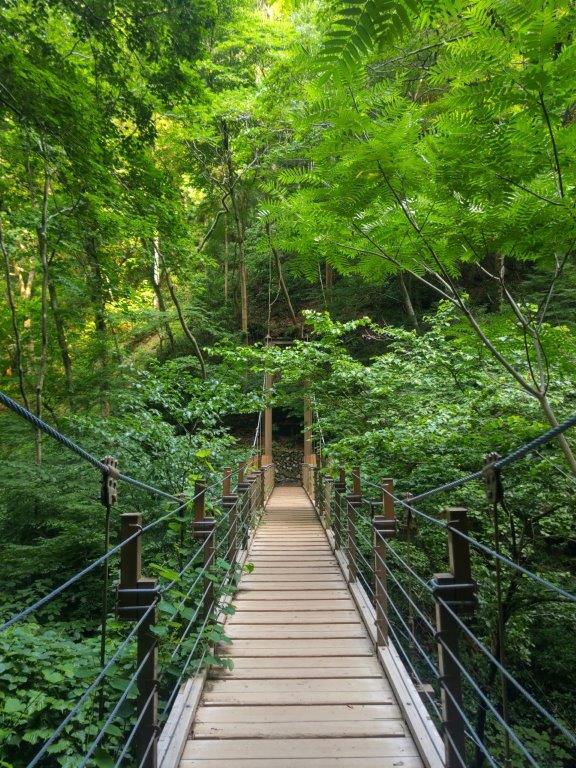
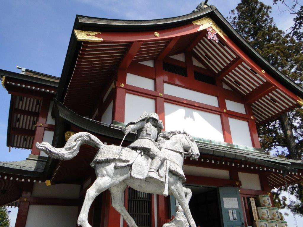
This was the most beautiful section of the hike, the mountainside across the valley resplendent with Autumn colours and enhanced by the afternoon sun. Around 2h30, I reached the base of the valley and crossed the Chikuma river, the longest river in Japan; a little later, I passed through the small town around Umijiri station (1035m), the lowest point of today’s hike. After quickly checking out Ioin Temple, I followed a road heading back up into the mountains. Upon reaching a plateau, I turned right through a small community, and crossed a wooden footbridge high above a river.

Mt Ogura from the Footbridge over Mt Otsuki

Fiery Maple Leaf at Matsubara Lake

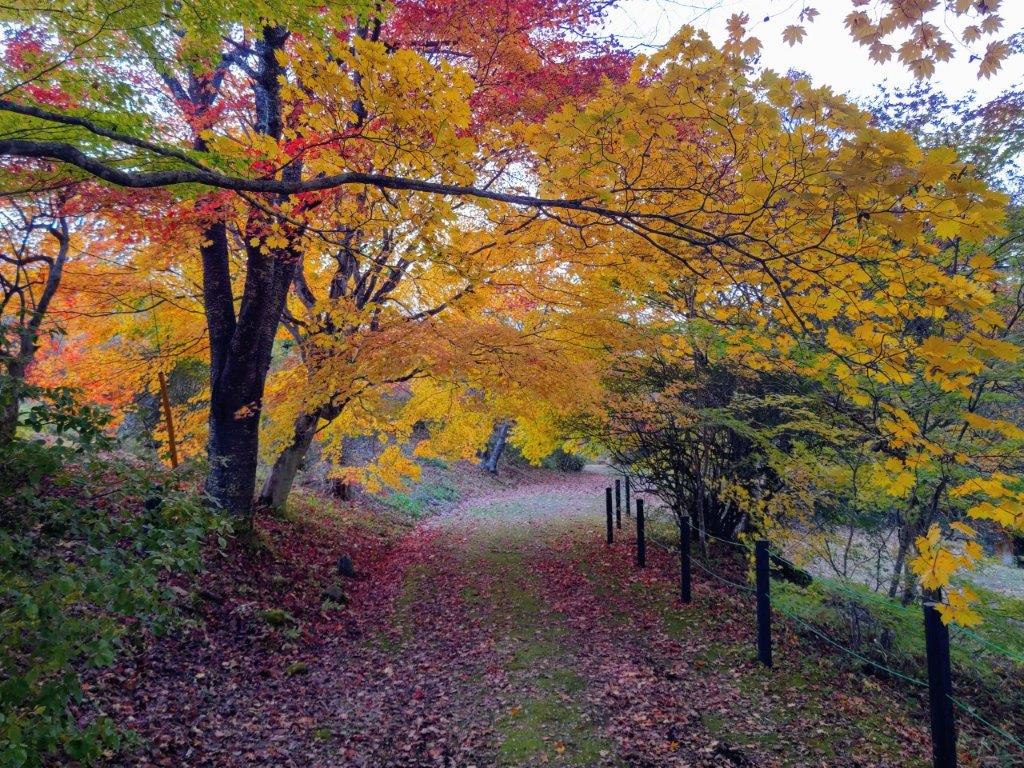
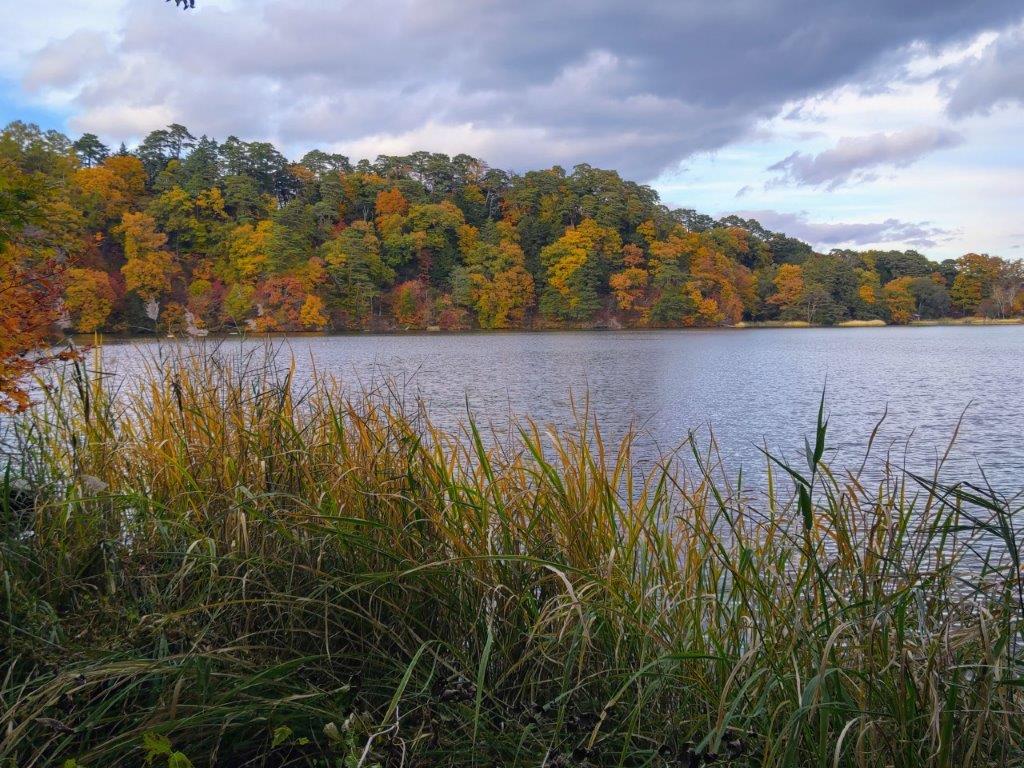
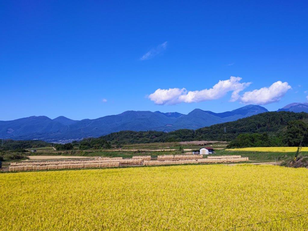
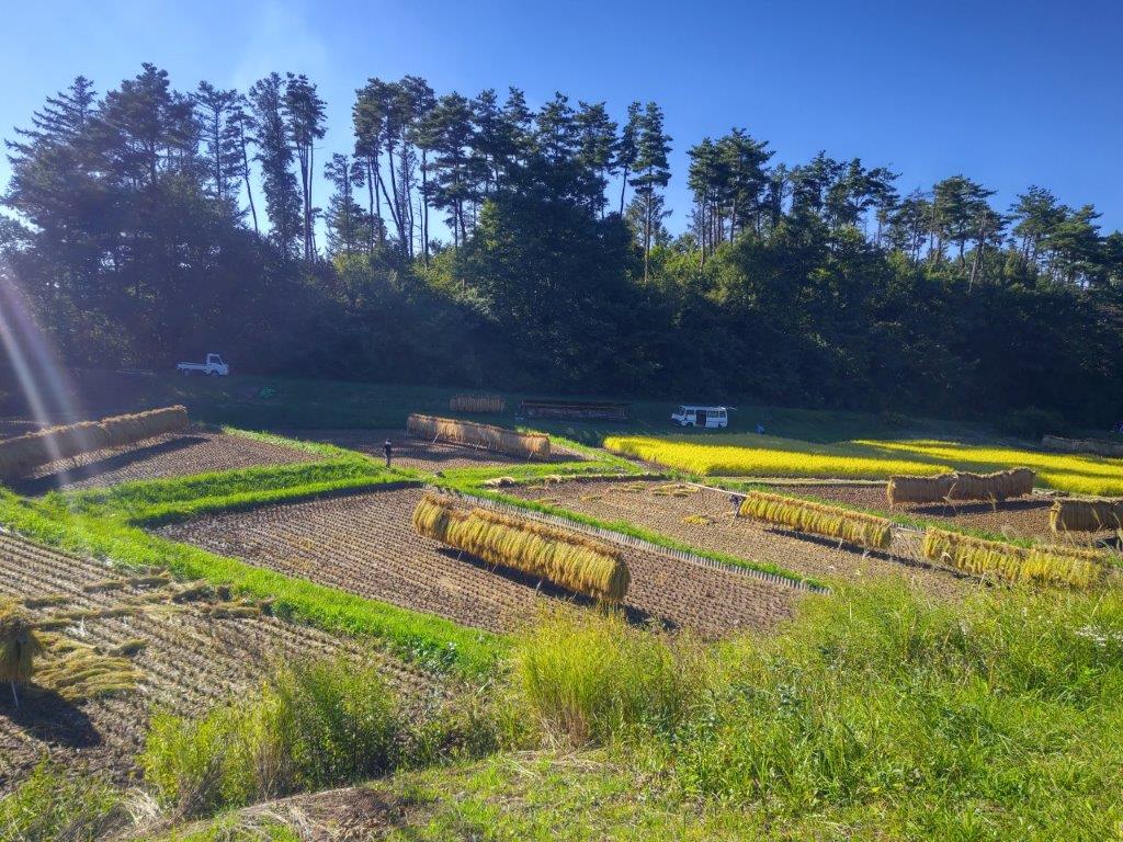
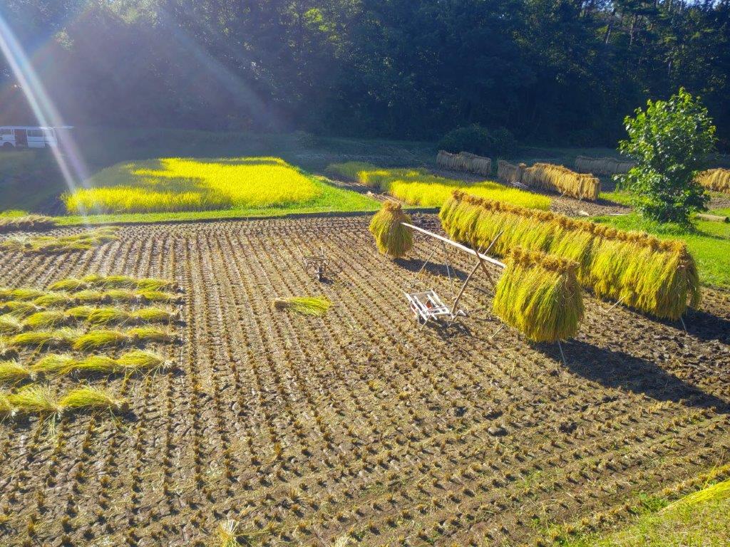
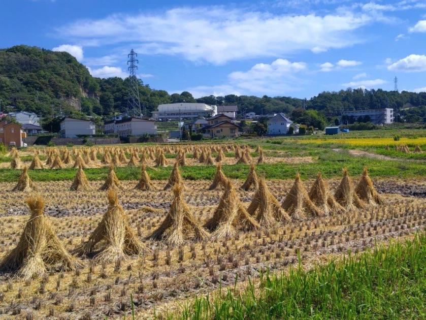
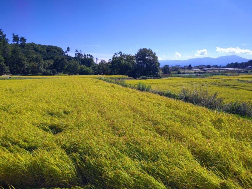
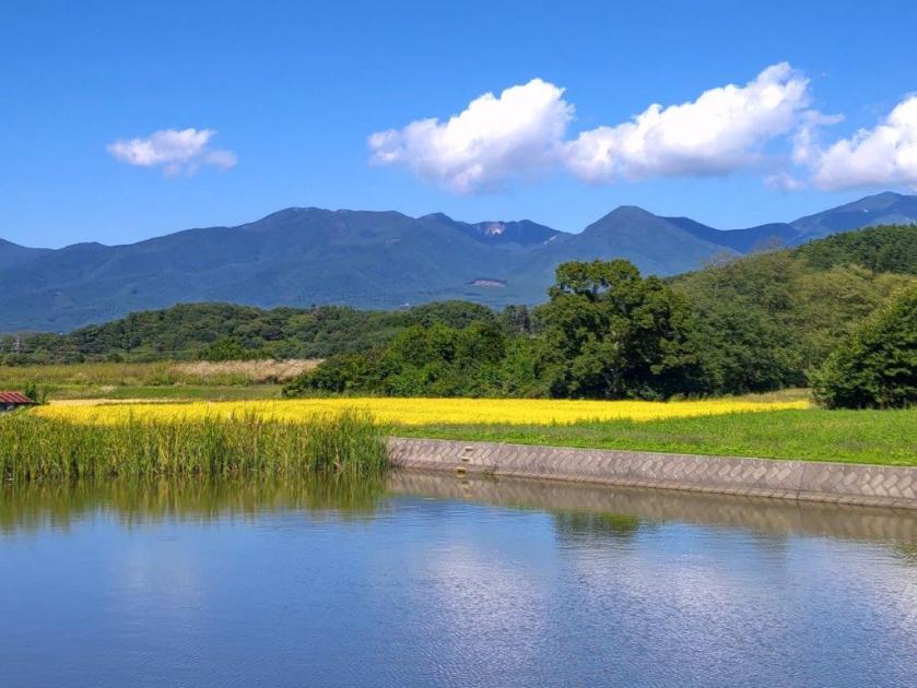
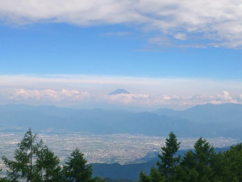
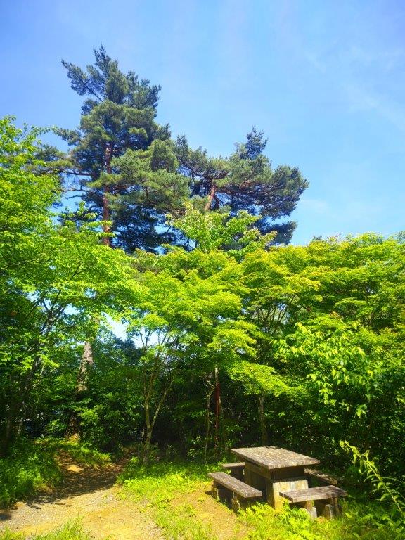
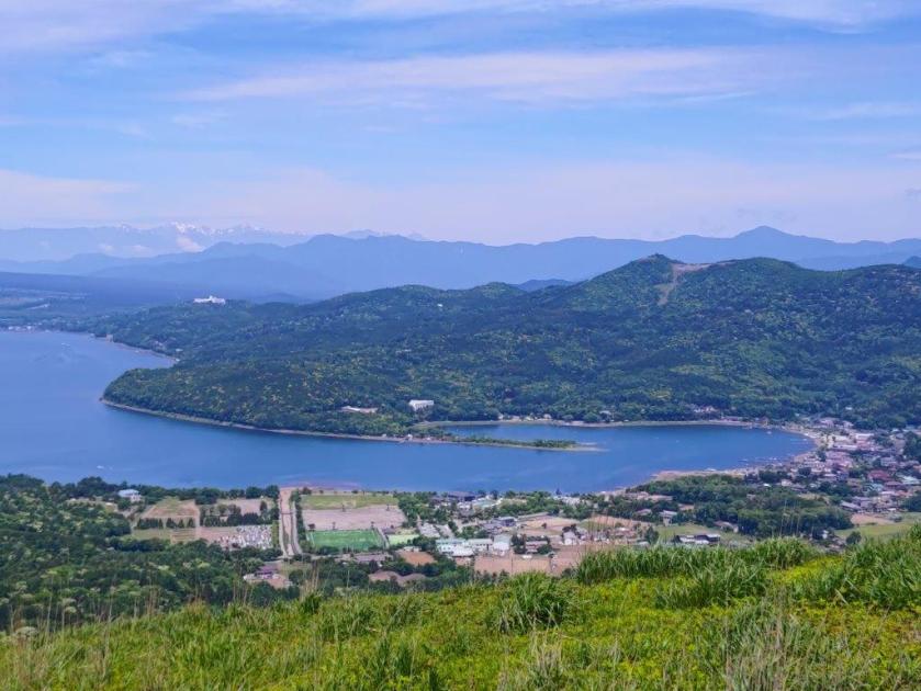
At the midway point, I had an impressive view of the orange-hued river valley, with Mt Ogura in the far distance, two puffy clouds floating overhead. It was now past 3pm so I hurried along, anxious to catch my bus. Here and there rice was still being harvested in individual fields, sharing the land with solar farms. The sun had sunk below the clouds on the west side, muting the colours of Cho Lake along the way. Soon after, I finally arrived at Matsubara Lake (松原湖), the main attraction of Matsubara Highland (松原湖高原). I followed a path along the lakeshore admiring the red and yellow colours along the way, before hopping on the bus for Yahho Hot spring. After a short but refreshing bath, I boarded the bus on its return trip to Matsubarako station.

Autumn Colours at Matsubara Lake

Lake View at the End of the Hike

In total, the hike took nearly five hours, mostly along paved roads which enabled me to walk at a fast pace. I was glad to have caught the Autumn colours at their peak, the first time for me to see them this season. Unlike the Asama-Yatsugatake Panorama Trail, signposting was non-existent and I had to rely on my phone GPS to find my way. This could explain why I saw no other hikers along the way. In the future I hope to be able to do sections 1 and 11, as they also seem doable as one day trips via public transport, and perhaps in a different season.

Watch a Video of the Hike

See More Pictures of the Hike

Mt Rakanji (1058m) & Mt Shirosuna (920m), Kofu City, Yamanashi Prefecture, Sunday, October 12, 2025

I had been up Mt Rakanji once before when I visited Shosenkyo in October 2013. Back then, I drove from Kofu and used the ropeway, since the main purpose was to explore the spectacular Mitake-Shosenkyo gorge. I was reminded of this interesting peak when I saw it from Mt Shiro last year. Looking at my Mountains of Yamanashi guidebook, I found a relatively easy hike traversing this mountain from north to south, including another peak I had never climbed. As an added bonus, I’d also be able to check out the nearby Kanazakura Shrine.

Hiking in the Chichibu-Tama-Kai National Park

秩父多摩甲斐国立公園

To get to the start of the hike, I’d take the Chuo line limited express to Kofu, and then ride a bus to Shosenkyo, getting off at the end of the line. From there, I’d follow a paved road on foot for another 30 minutes to get to the trail entrance. For the return, I’d catch the same bus, two stops up the line at the entrance of the gorge. I planned to get off at Yumura Onsen, on the bus route and inside Kofu city, for a quick hot spring bath at Yumura Hotel before catching the train back.

Trail before the the Top of the Ropeway (left) Trail for Mt Rakanji (right)

Stone Steps & Chains on Mt Rakanji (left) View from Mt Shirosuna (right)

The weather was supposed to be clear in the morning and overcast in the afternoon, with temperatures approaching 30° in the Kofu basin, unusually high for the season. I hoped it would feel cooler up the mountains; I also hoped I’d be able to get a glimpse of Mt Fuji and the South Alps before the clouds rolled in; finally, since the Autumn leaves were only due next month, I was counting on smaller crowds than usual. I was looking forward to a relaxing early Autumn hike in a familiar area.

Shinto Gate at the Entrance of Kanazakura Shrine

View of the Oku-Chichibu Mountains near the Start of the Hike

It was a cloudy morning as I left Tokyo but after entering the Kofu Basin, I was greeted with blue skies and a view of the South Alps, still clear of snow. I arrived at Kofu station just after 10am, and after standing in line waiting for the “Green Line” (グリーンライン), felt lucky to be seated on the crowded bus for the fifty-minute ride to Shosenkyo-Takiue, five minutes on foot from the Shosenkyo ropeway (昇仙峡ロープウェイ). After observing hoverflies busily nectaring at purple Asters and Jorogumo spiders hungrily eating their prey, I set off along the Shosenkyo Line road and away from the various tourist attractions surrounding Sengataki station (仙娥滝駅) at the base of the ropeway. A little before noon, I arrived at a shrine entrance at a bend in the road.

View of Mt Kenashi (left) and the South Alps (right)

Start of the Dirt Road for Mt Rakanji

I was impressed by the bright red Shinto gate (“torii”), surrounded by colourful pennants flapping in the breeze, and also by several towering cedars at the top of a steep flight of steps. A small sign propped at the base of one of them indicated it was part of the 100 trees of historical interest in Yamanashi prefecture, although I couldn’t tell whether it was taller than its neighbours. At the top of another flight of steps, I reached the main building of Kanazakura Shrine (金桜神社), another striking bright red structure. On the opposite side was a gravel path with an enticing sign for a nearby viewpoint of Mt Fuji.

Wooden Walkway on the Way to Mt Rakanji

View of Kurofuji (left) and Mt Kinpu (right)

I couldn’t resist making the short round-trip, especially since the sun was shining and the trail seemed easy to walk. After a 10-minute walk through tall cedars, I arrived at an open space with a view of Mt Fuji framed by pines to the south; looking north, I could make out the broad summit ridge of Mt Kinpu, recognisable by the manmade boulder formation protruding from its highest point. After a short break to enjoy the peaceful surroundings, I retraced my steps to the base of the shrine, and a short distance away, turned right up a road signposted for today’s mountain. After a few bends, I reached the end of the paved road and entered an open space with a view to the northeast.

Forest Road along the Level Ridgetop

Mt Kaya (left), Mt Tachioka (center) and Kurofuji (right)

I was glad to get such a wide view so soon on the hike. On the left side, I could see Kurofuji, its cone-shaped summit not visible from this angle, and on the right side, was Mt Kinpu again, its rocky flanks now visible from this higher elevation. I followed a path for a few minutes westwards and off the main trail, to get a view of the South Alps, hazy blue in the far distance and with golden yellow Japanese Pampas grass (“susuki”) in the foreground. I made my way back through the “susuki” field and turned right up a dirt road. I soon reached a cleared area at the edge of the forest with a view on the north and east sides.

Mt Fuji from near the Panorama-dai Station (2013 photo)

Mt Kinpu and Lake Nosen from the Panorama-dai Viewpoint (2013 photo)

I was pleasantly surprised to get such a wide view on this side of the mountain, which now included Mt Tachioka at the very left and Lake Nosen at the very right. Mt Kinpu rose prominently in the background, the second highest peak in the Chichibu-Tama-Kai National Park and a 100 famous mountain of Japan. Since it was nearly 1h30, I found a suitable tree stump to sit on for a late lunch break. As forecast, the clouds had spread across the sky from the south, providing some welcome shade on a warm Autumn day. I set off again along a winding track sticking close to the level ridgeline, and just before 2pm, exited the forest just below the Panorama-dai Station (パノラマ台駅) of the Shosenkyo ropeway.

Mt Fuji (left) and Mt Kenashi (right) on the way to Mr Rakanji

Mt Shirosuna from Mt Rakanji

I sped through the sightseeing spots around the ropeway and up the trail for today’s first peak, taking care in the rocky sections and making good use of the safety chains; luckily, the thin pre-autumn leaves crowds meant I could make good time, and at 2h30, I reached the summit of Mt Rakanji (羅漢寺山 らかんじやま rakanjiyama) also known as Mt Yasaburo (弥三郎岳 やさぶろうだけ yasaburoyama), a famous 100 mountain of Yamanashi. I took a moment to enjoy the alpine-like scenery of white smooth rocks and pine trees, as well as the 360° view from the top; Mt Fuji now had a cloud perched on its summit crater in lieu of snow. I then retraced my steps back to the ropeway area and headed down a half-hidden path on the south side.

South View from the Top of Mt Rakanji

Between Mt Fuji and Mt Kenashi lies Kofu City

I was happy to leave the crowds behind although I now found myself walking all alone through forest in the middle of the afternoon. Fortunately the path was easy to follow, and at 3pm, I arrived at the turn-off on the left side for today’s next peak. It took me about ten minutes of climbing to reach an exposed rocky area with a view of the ridge leading to Mt Rakanji. A few more minutes brought me to another such place but with a view southwards of Mt Fuji and the Kofu basin. Finally, after a couple more minutes of walking through the smooth white boulders and gnarly pines, I arrived at the top of Mt Shirosuna (白砂山 しろすなやま shirosunayama), aptly translated as white sand mountain.

Trail below the Shosenkyo Panorama-dai Station

Trail for Mt Shirosuna

I was delighted to get a view of the peak I had been standing on a short while ago, allowing me to appreciate its steep and rugged shape. I had now fallen behind schedule so I retraced my steps to the main trail without a break. It took me just 15 minutes to reach another turn-off, this time to the right. A few seconds later, I reached the Mt Shiro (白山 900m) viewpoint, a minor peak with a view of the South Alps, now partially hidden by clouds, as well as the Kurofuji Volcanic group, its highest peaks wrapped in mist. I continued on my way, following the level path through mixed forest as it hugged the mountain side, the late afternoon gloom gradually increasing.

View of the Kofu Basin on the way to Mt Shirosuna

Alpine” Scenery near the Top of Mt Shirasuna

I wondered if I’d reach the base before sunset, quite early at this time of the year. I picked up the pace and around 4pm I reached a junction: the Furusato Nature Observation Trail (ふるさと自然観察路) which I had been following since the ropeway went right; however, I went down the left trail, leaving the ridgeline. Interestingly the signage around this point was a lot more polished than before even though I was far from any sightseeing spots. I also saw no other hikers during this section, possibly because most people planned to visit next month when the Autumn colours would be at their peak.

White Sand Rock near the Top of Mt Shirasuna

Mt Rakanji from the Top of Mt Shirosuna

I felt relief when I popped out of the dark forest onto a paved road. About a hundred meters further the trail dived back into the forest, but I could now hear the sound of a busy road in the valley below. At 4h30, I passed through a wildlife gate next to a spooky abandoned building, and arrived back on the Shosenkyo Line Road and Nagatoro Bridge (長潭橋), beyond which was the Shosenkyo Entrance bus stop. Including the one-hour Shrine visit the entire hike had taken 5 hours, and could have been extended with a walk up the gorge at the start.

A Level Trail Hugging the Mountain Side

The Kurofuji Volcanic Group from Mt Shiro

Sunset was still half an hour away but the sun had already vanished behind the mountain ridges casting the valley bottoms into premature darkness. It took just twenty-minutes on a mostly empty bus to reach Yumura Onsen; after a refreshing hot bath, I caught a city bus for the ten-minute ride to Kofu station, from where it was a 90-minute comfortable ride on the limited express train back to Tokyo.

Watch a Video of the Hike

See More Pictures of the Hike

Okutama Old Road (Highest Point 619m), Okutama Town, Tokyo Prefecture, Sunday, October 5, 2025

I had already walked the Okutama Old Road, also known as the Okutama Historical Road, twice before; however, it had been 8 years since my last visit, so I decided to hike it again to refresh my memory of this interesting trail. I would start from Okutama Lake and walk mostly downhill to Okutama station; by doing it in this direction, I could tackle the steeper sections near the lake first, and also get better views of the Tama river valley.

Hiking in the Chichibu-Tama-Kai National Park

秩父多摩甲斐国立公園

Start of the Hiking Trail (left) Short Uphill Section (right)

Level Section (left) Near the Highest Section (right)

To get to the start of the hike, I would ride the green car on the Ome line from Shinjuku, and then change to a regular car on the Okutama line at Ome station; from Okutama station, it was a short bus ride to the lake. The weather was supposed to be mostly cloudy without rain and temperatures in the low twenties, ideal for some light hiking. I was looking forward to a relaxing, and hopefully spider-free, hike in the mountains west of Tokyo.

Trail before the Rest Spot (left) Road after the Rest Spot (right)

Steps (left) and Forest Section (right) near the End of the Hike

I was delighted to ride a mostly empty bus to Okutama lake, possibly because in this season most hikers prefer to head to higher destinations. After a quick lunch at a picnic table with a view of Okutama Lake and Oguchi Dam, I set off at 12h30. Soon after, I reached the entrance of the “Old Road” (むかし道 mukashi michi), hidden behind the Mizune Parking lot. After carefully crossing the busy Ome-Kaido Avenue, I headed up a steep paved road.

View of Okutama Lake and Ogouchi Dam

The Okutama mountains from the “Old Road” (2012 Photo)

I was startled to feel some raindrops as I reached a fork; I opted for the shorter, right branch, in case it turned into a downpour, which happened in 2017. Fortunately it soon let up, and after passing a bamboo grove and a view of Okutama lake on the right side, I arrived at the start of a hiking trail; this is also where it meets up with the longer, left branch. After a short uphill section, the trail descended steeply through thick forest, but became level after crossing a stream on a moss-covered concrete bridge.

View of the Tama River from the “Old Road” (2012 Photo)

Paved Part of the Okutama Old Road

I had forgotten the first part of the trail was so narrow, hugging a steep mountainside; however, a metal railing on the valley side ensured it could be walked safely. After some ascending, I reached a metal cross at the highest point of today’s hike, also the turnoff for Mt Mutsuishi; beyond this point, the trail descended into the valley; on the way down, I had another glimpse of the Ogouchi dam through a gap in the vegetation.

Some Sun on a Cloudy Day

Shidakura Bridge across Tama River

I was shocked how close the dam still was after one hour of hiking; however from now I’d be following the Tama river, moving in a mostly straight line towards my destination. I eventually reached the end of the trail near a rest spot with picnic benches and momiji trees; I now found myself walking along a paved road, the river at times visible through the tree branches. At 2h30, I passed Shidakura bridge (しだくら橋), the second of two suspended footbridges; I walked to the halfway point although it’s not part of the Old Road.

View of the Tama River from Shidakura Bridge

Walking on a Gravel Road

I enjoyed views of the Tama River looking down from the bridge; I also had views of spiders when looking up through the steel wires supporting the bridge. At 3pm, I passed by a modern, clean bathroom inside a traditional building, courtesy of OPT or Okutama Pikapika Toilet (“pikapika” means “with a sparkle”). In total, I saw three such toilet buildings, each as sparkling clean as the other; apparently they are also in charge of the one next to Okutama station.

Modern Bathroom inside a Traditional Building

Traces of the Old Railway Line

Past a house with a huge firewood stack, I saw remains of the railway that used to run through the valley; it was abandoned 80 years ago after the completion of the present-day road. At a bend in the road, a signpost guided me onto a footpath on the right side; I followed it through tall cedars, down a small valley, across a narrow bridge, and around a rocky outcrop, after which I found myself walking on a stone-paved path.

Footpath near the End of the Hike

Stone-paved Section Near the End of the “Old Road” (2012 photo)

I stepped up the pace as the light was starting to fade quickly on this cloudy day. Shortly after crossing another disused railway section half-hidden by grass, I arrived back at the Ome-Kaido Avenue at 4h30, also the trailhead of the Okutama Old Road. It took another 5 minutes to get to Okutama Station, from where it was a ninety-minute ride back to Shinjuku.

Watch a Video of the Old Okutama Road Hike

See More Pictures of the Hike

The Asama-Yatsugatake Panorama Trail Part 2 (highest point 830m), Komoro City, Nagano Prefecture, Saturday, September 27, 2025

I had been looking forward to exploring more of the Asama-Yatsugatake Panorama Trail since my hike there nearly one year ago. Originally, I had wanted to go later in Autumn, to enjoy cooler and clearer weather; however, I realised that if I wanted to see the scenery of golden rice fields, I needed to get there before the end of the harvest, roughly the end of September. I had recently acquired a lightweight foldable umbrella that doubled as a parasol, to protect myself from the sun on long road sections, so I felt well equipped to return earlier than planned.

Above the Chikuma River (left) Through a Bamboo Grove (right)

Up a Country Lane (left) In the Shade of Trees (right)

This time, I’d head south from Komoro station, making a wide circle combining the Chikumagahara and Mimakigahara routes, and ending at Aguri no Yu like last time. I had ample time to complete this clockwise loop through the Nagano countryside; however, I already knew that the many views along this panoramic trail would delay me, especially since the weather was supposed to be clear and sunny all day, a perfect Autumn weather according to the weather forecast.  

Chikuma River from Modori Bridge

Mt Asama from Modori Bridge

It felt pleasantly cool as I stepped off the train at Komoro station a little after 1030. After picking up some supplies at a nearby convenience store, I ducked into a tunnel under the Shinano railway line and headed down a road into the Chikuma River valley. At a bend in the road, I turned right onto a track partially hidden by vegetation, following a sign for the Asama-Yatsugatake Panorama Trail (浅間・八ヶ岳パノラマトレイル). At the bottom of a steep staircase, I passed an open-air exhibition of an old water wheel (“suisha“), used for generating electricity from 1919 to 1995.

Mt Asama from Kubo Village

Cliffs above the Chikuma River

I briefly inspected this curious relic from the past, and then turned left onto a small paved road, past Nishiura dam, a modern replacement for the water wheel. I was walking with the Chikuma river on my right, and harvested fields on my left. I wondered if I had missed the harvest completely but marvelled at the interesting shape of the rice bundles, resembling tiny straw huts. At 1130, I crossed the Modori Bridge (もどり橋), from where I had a sweeping view of the entire Asama mountain range, almost entirely clear of clouds. I then headed up a steep road and at the top turned left onto a main road which I left almost immediately for a dirt road alongside a bamboo grove.

Country Lane leading to the Base of the Cliffs

View East towards Karuizawa

I was glad to be walking under the shade of trees, above the cliffs on the south bank of the Chikuma river, as the sun was getting hotter and hotter. I had reached another viewpoint of Mt Asama, just as the noon chime echoed throughout the area. Closer by, I could see the impressive bluffs on the north bank of the river. After passing through Kubo village (久保集落), the path headed uphill steeply and reentered the forest.

Hidden Plateau above Kubo Village

Switchback Path up the bluff

I soon emerged into a kind of hidden plateau at the base of some bluffs. I made a detour to get a closer look, and also happened to get a good view of Karuizawa to the east. I knew I’d have to get above these cliffs but for now the trail headed lazily southwards; around this point I nearly stepped on a snake sunbathing on the hot road. I eventually reached Iwane (岩根) and here the path turned sharply right and uphill again, through a dark bamboo forest.

Closeup Look at the Bluff above Iwane

Yatsugake from Mimaki Plateau

I recoiled in fear as I spotted the webs of the Jorogumo spider strung between the bamboo, its yellow and black owners hanging lazily in the air at head height above the path. Sometimes ducking and sometimes clearing a way with a stick, I quickly reached a switchback path climbing through mixed forest, thankfully free of spiders. One bend took me directly to the base of a huge porous rock face, rising out of the forest. At 1pm, I exited the forest into the sunlit Mimaki Plateau (御牧ヶ原 mimakigahara). Almost immediately I came upon a harvest in progress on the left side.

Mt Asama from Mimaki Plateau

Blue Asama with Yellow and Green Fields

I was delighted to see the rice being harvested, an even rarer sight than the golden rice fields. I continued on my way, now walking between small blue ponds and yellow rice stalks; the outline of Yatsugatake, mostly clear of clouds, was visible against the sun on the south side. After a short descent, I reached Himamu-ike Pond (干間無池), which I had also visited on last year’s hike. Here I left the Chikuma River Trail (千曲川コース) and joined the Mimaki Plateau Trail (御牧ヶ原コース), first heading west and then south through farmed countryside dotted with small blue ponds.

Clouds Reflected in one of the Ponds of Mimaki Plateau

Golden Rice Fields and Blue Autumn Sky

Along the way, I had some superb views of Mt Asama, with an ever-changing scenery of already harvested and yet to be harvested fields, as well as blue rounded ponds, in the foreground. At 2pm, I arrived at the highest point of the hike, a mostly level area above the Prefecture Agricultural University; oddly enough, it was also the location of a driving school. It was also the southernmost point of the hike, and I had another view of Yatsugatake southwards between the hills, as well as the Chichibu mountains to the east. I sat in the grass in the shade of a couple of conifers for a late lunch with a view. After half an hour, I resumed my hike, now heading northwards and downhill, and soon passed another bucolic rice harvest scene.

Harvested Rice Drying on Racks

Drying Rice with Mt Asama in the background

I spent a few minutes observing this seasonal human activity taking place along a narrow valley protected by tall pines on the far side. From my higher vantage point, I could see the various stages of the harvest: the cutting, the bundling and finally drying on racks. I continued on my way and after passing through a tunnel under the Chikuma Viewline, turned left up a slope and soon reached another viewpoint near the crest of a small hill called “viewpoint hill” (展望の丘). To the north was Mt Asama again, the features of its various peaks clearly visible on this fine day.

Lunch Spot under a Couple of Conifers

Lily-covered Maki Pond

For the first time of the day, I had a wide view on the west side: I could see the gentle ridgelines of Northern Yatsugatake, as well as the lower mountains of central Nagano; however the North Alps were hidden in the clouds. It was now 3pm and I had to quicken the pace to stay on schedule. I headed down the other side of the hill, and then turned right onto a bigger road which I followed for a while, down into a small forested river valley dividing the plateau into two halves. After a shorter climb up the other side, I merged with last year’s hike, although from the opposite direction.

Rice Harvest Scene on the Asama-Yatsugatake Panorama Trail

Freshly Cut Rice (left) and Drying Rice on Racks (right)

After walking under some dizzyingly tall larches, needles still green in this season, I turned right onto a trail heading downhill towards the Chikuma River Valley, leaving behind the Mimaki Plateau Trail, as well as last year’s route. It ended at a road at a point somewhat below my final destination; however, I noticed another path on the right, running through the woods and parallel to the road. I still had a little way to go so I rushed up it and soon passed a sign for the Asama-Yatsugatake Panorama Trail, meaning I was headed in the right direction.

View West towards Northern Yatsugatake

Mt Asama from Viewpoint Hill

I had one more view of the highest peaks of Mt Asama through a gap in the trees on the left side. Soon after, I emerged onto a road where I turned left, and after a few more minutes, arrived at Aguri no Yu just after 4pm. After a refreshing bath with a view of Mt Asama, I called a taxi for the ten-minute ride back to Komori station. It was a short ride on the Koumi line to Saku-daira station where I hopped on the shinkansen for the one-hour ride back to Tokyo.

Green Fields with Mt Asama in the background

View of Mt Asama from near the end of the Hike

This second hike along the Asama-Yatsugatake Panorama Trail took five hours, slightly shorter than last year. Although it had less cultural highlights, the views were better. I was also lucky with my timing that allowed me to catch the rice harvest in progress, not to mention the superb weather. Amazingly I saw no other hikers the whole day, maybe because everyone was hiking on Mt Asama and Yatsugatake, and other high-altitude mountains. For now, I’ve completed most of this trail but in the future I’d like to explore more Long Trails in Japan.

Watch a Video of the Hike

See More Pictures of the Hike

Mt Himekami (1123m), Morioka City, Iwate Prefecture, Sunday, July 20, 2025

I wanted to do one last hike before my summer break. I decided to head up to Tohoku, northeast Japan, hoping it would be cooler than the Kanto area. I had been wanting to climb this 200 famous mountain since my last visit to Iwate five years ago. It promised 360° views from the summit on a clear day and some beautiful forest on the way up and down. Looking at my map, I saw I could take the most direct route up, and if time allowed, take a slightly longer route on the descent.

To get to the start of the hike, I’d ride the Tohoku shinkansen to Morioka, and then change to the local Iwate Galaxy Railway for the short ride to Koma station. There, I’d call a taxi to get to the parking near the trailhead. Since the shinkansen was reserved seating only, I purchased an e-ticket for my mobile Suica in advance. The weather was supposed to be sunny with temperatures around 30° at the base and 20° at the top. I was looking forward to the views and hoped the tree shade would keep me cool on the way up.

Cedars at the Start of the Hike (left) Log Steps Halfway up (right)

Rocky Path near the Top (left) Larches at the end of the Hike (right)

After a 2-hour lightning speed trip under mostly sunny skies, I arrived in Morioka just after 11am. It felt quite warm as I waited on the platform for the excitingly named Galaxy Railway (銀河鉄道) train. The ride to Koma station (好摩駅) itself was quite normal except for the enchanting flute theme that announced each station. After a 10-minute wait under the boiling sun for my taxi, and a 20-minute ride through the charming Iwate countryside, I reached the large but mostly empty parking lot near the Ipponsugi-enchi Campground (一本杉園地キャンプ場), a little after noon.

Impressive Clouds above Mt Iwate from Koma Station

Start of the Ipponsugi Trail

After getting ready, I walked up a grassy slope to some benches at the edge of the forest, the start of the Ipponsugi Trail (一本杉コース). Turning around, I had a startling view of Mt Iwate under dark menacing clouds. After passing an intersection with a forest road, I found myself walking along a narrow dirt path between tall cedars at 1230, happy to be in their shade. As the path started to climb gently, I reached a sign for Ipponsugi (一本杉) a solitary giant cedar, a few meters off the trail. After admiring this giant of nature, I continued on my way.

Rocky Section near the Top of the Trail

View of Mt Iwate near the Top of Mt Himekami

I soon arrived at the start of a series of steep log steps, a tough slog on what was turning out to be quite a hot day. I took my first break a little before 1pm at the 5th station (五合目), a level area half way to the top in distance, but only one third in elevation gain. The next section, covered in roots and rocks, was harder and more slippery to walk, and I was grateful when the steps reappeared further along. I spotted the occasional pale white trunks of birches (シラカンバ 白樺), a common mountain tree in northern Japan. Half an hour later, I reached another level area at the 7th station (七合目) where I settled on a large rock for the second break of the climb.

Huge Cloud Floating through the Sky

Boulder Hopping Section Close to the Summit

For the first time of the day, I felt a breeze blow through the trees, helping me to cool off before the final summit push. The rocks on the trail became bigger and bigger, forcing me to use my hands to haul myself over the largest ones. I suddenly emerged from the vegetation, blue sky with wisps of white cloud overhead. Standing on a flat rock, I had a wide view of Mt Iwate and Mt Hachimantai to the west. Just beyond, the trail split into two: the left fork went directly to the summit through the forest; however, I choose the panoramic right fork, hopping boulder to boulder, till it merged with the Jonai Trail (城内コース) on the southwest side.

View Northeast from the Top of the Ipponsugi Trail

View of Mt Iwate and Mt Hachimantai from Mt Himekami

It had been a while since I had done such an adventurous trail and I had to watch out for the gaps between the flat slabs of rock. Once I was safely back on a proper trail, it took just a couple of minutes to reach the summit of Mt Himekami (姫神山 ひめかみさん himekami-san), meaning “princess god”. The view was stunning in all directions although I could only confidently identify Mt Hayachine to the south. Since it was past 2pm, I found a good rock to sit on for a late lunch with a view.

View South of Wind Turbines and Mt Hayachine (left)

View Southeast from Mt Himekami

I wanted to stay longer to admire the stunning view, as well as enjoy the spectacular clouds floating through the sky, but I had to allow enough time to catch my shinkansen for the return (also reserved). At 3pm, I dived back into the forest, down the Kowasaka Trail (こわ坂コース) on the northwest side. The first section headed down quite steeply, with ropes attached to the side for safety, but fortunately rock-free. I saw perhaps a dozen people on the ascent but passed no one on the descent. I enjoyed the solitude, making just a little noise in case a bear was lurking in the woods.

View East from the Top of Mt Himekami

Last View of Mt Iwate before Heading down

The surrounding forest was just as beautiful on this side, and lower down, I found myself walking through larches, a nice change from the cedars and birches. At 4pm, I reached the trail entrance where I turned left onto a paved road. The final section is one reason people avoid the Kowasaka trail (the other being it is less well-maintained), but it’s only a fifteen-minute walk back to the start of the Ipponsugi trail entrance. Along the way I was startled by a snake on the road; a closer inspection revealed that it was dead, perhaps hit by a car, but it was in perfect condition and extremely lifelike even in death.

Mt Iwate against the Late Afternoon Sun

The Prince God of Mt Himekani?

I was delighted to come upon a tube channeling ice cold water close to the end of the hike. After dousing my face and head several times, I called this morning’s taxi company, asking them to pick me up. I got dropped off at Koma station a little before 5pm, and half an hour later, was at Morioka Station with one hour to spare before my train back to Tokyo. After sampling some local Japanese sake from Kikizakeya, I boarded the shinkansen for the comfortable 2-hour ride back home.

Watch a Video of the Hike

See More Pictures of the Hike

Mt Amari (1731) & Mt Okuamari (1843m), Nirasaki City, Yamanashi Prefecture, Sunday, July 13, 2025

I climbed these two mountains almost 7 years ago. Back then, the weather had been overcast and so I was hoping to get some better views this time. With a starting point above 1500 meters, it seemed like the ideal place to escape the relentless summer heat. Finally, I was betting that the long access via a winding mountain road would thin the holiday crowds. Since it was on the short side, I decided to combine it with a pre-hike soba lunch at Kamikoji and a post-hike hot spring bath at Hakusan Onsen.

To get to the start of the hike, I’d ride the Chuo line limited express from Shinjuku to Kofu, and then drive a share car to the parking lot near the trail entrance. The weather was supposed to be sunny, turning cloudy in the afternoon; temperatures would be over 30° in the Kofu basin but about 20° in the mountains. I hoped I’d be able to do everything I’d planned for the day and that I’d get a view of Mt Fuji, although my chances were slim according to the When to See Mt Fuji site.

Walkway near the Summit (left) Trail past Mt Amari (right)

Near the End of the Hike (left) Blue Sky at the End of the Day (right)

Thankfully it was a short walk, mostly in the shade, from the Station to the share car. After a one-hour drive, I arrived at Kojiro (上小路) at 1pm, where I enjoyed a delicious zaru-soba with a side of tempura. The onsen for the return was right next to the soba restaurant so it’d be easy to find. At 2pm, I got back behind the wheel, and half an hour later, pulled into the Hirogawara parking lot (広河原駐車場 1643m). I saw few cars meaning I could expect few people on the trail. It felt hot under the sun while I got ready, perhaps another reason for the nearly deserted parking area.

View of the Kofu Basin and Mt Fuji from the Start of the Hike

Trail past the Open Shelter

I felt more comfortable once I started up the trail, tall trees providing welcome shade. Very soon, I arrived at an open shelter, “azumaya“, with a view of the Kofu basin to the north; on the east side was the summit of Mt Fuji poking through the clouds. It was a pleasant surprise since being far away had actually increased my chances of seeing Japan’s most famous mountain. It was already past 3pm so after enjoying the view, I set off again. A short, easy climb up some log steps brought me to a plateau with wooden walkways, a spot famous for its pink Rhododendron (“tsutsuji“) in June. However in mid-July, I found myself walking through green bushes, another reason for the lack of people.

Log Steps leading to the Rhododendron Plateau

Just Green Bushes in this Season

I suddenly felt a cool breeze in this open space. Directly ahead was Mt Houou, a hundred famous mountain, dark clouds appearing from behind and threatening to invade the whole sky. I stepped up the pace, wondering if rain might follow. After another short climb, I arrived at the top of Mt Amari (甘利山 あまりやま amari-yama), a 100 famous mountain of Yamanashi, my second time there. I had a wide view of the Kofu Basin surrounded by the Oku-Chichibu mountains. In the foreground was the plateau I had just crossed, neatly divided in two by the walkway. After a short break, I continued my hike. A little descending, brought me to the start of a switchback trail leading up the steep mountain side.

View of the Plateau and its Walkway

Blue Sky on the Trail for Mt Okuamari

As I gained altitude, I often turned around to admire the views to the south, now including the rounded top of Mt Amari, its north side covered in forest, as well as Mt Kushigata. Here and there, I spotted the pale trunk of an Erman birch, “dakekanba“, which mostly grows above 1500 meters. Looking up, I was glad to see mostly blue sky, the thick grey clouds seemingly confined to the nearby South Alps. Just before 4pm, I turned right at in a fork in the trail, and a few minutes later, arrived at the top of Mt Okuamari (奥甘利山 おくあまりやま okuamari-yama) for the second time. It was surrounded by trees except on the southeast side where I had a view of Mt Fuji, almost completely hidden by clouds.

The Gentle Outline of Mt Kushigata

Mt Fuji Disappearing behind the Clouds

After observing a ladybug toddle along the top of a log seat, I headed back to the fork: the left branch continues t0 the next peak, Mt Sentoboshi (千頭星山 2138m), also a 100 famous mountain of Japan, about an hour uphill. I had climbed it back in 2015, and had no desire to visit it again, since it was completely in the trees. Thirty minutes later, just before the summit of Mt Amari, I turned left onto an alternative trail back to the parking. I headed down a grassy path, stopping once to observe a daddy long-legs spider sitting upside down on a tree branch and a second time to check out some bright green “old man’s beard” lichen hanging from the branches of a larch. At 5pm, I arrived back at the parking after a satisfying two hour and a half hike.

Looking back at Mt Amari

Trail near the End of the Hike

I was tempted to hang around to enjoy the now cool mountain air and see the night view of the Kofu basin but I felt it would be wiser to head back while there was still daylight. Half an hour later, I reached Hakusan Onsen (白山温泉). After a relaxing bath, I drove back to Kofu where I boarded the limited express for the 90-minute ride back to Shinjuku. It’d be nice to return one day to see the tsutsuji in full bloom, especially since a seasonal jumbo taxi runs from Nirasaki station to the parking lot. I’d also like to stay in at the Mt Amari Green Lodge (甘利山グリーンロッジ) to see the night view.

Watch a Video of the Hike

See More Pictures of the Hike

Mt Takao (599m), Hachioji City, Tokyo Prefecture, Saturday, July 5, 2025 [Jataki to Biwa Falls]

I had been to Mt Takao less than a year ago but wanted to return for several reasons. First, the recently introduced “green cars” on the Chuo line, would allow me to ride to Takao station and back in comfort; next, its proximity to the city and public transport meant it was ideal for a late afternoon hike, allowing me to avoid the intense daytime heat in this season; finally, I could wash off the sweat at Gokuraku-yu conveniently located next to Takaosanguchi station.

Hiking in the Meiji no Mori Takao Quasi-National Park

明治の森高尾国定公園

I decided to go up the Jataki falls trail, the only trail I had yet to walk on the mountain; after a quick visit to the summit via the Suspension Bridge Trail, I had originally planned to descend via the Biwa waterfall trail. However, due to the current restriction (see below), I decided to head down the Katsura Forest trail instead; from the ropeway top station, I’d then follow a connecting trail down to Biwa Falls, allowing me to complete a waterfall to waterfall hike.

As of January 2026, the Inariyama trail is open again. However, it seems the Biwa Falls trail has be kept as a one-way ascending-only trail to prevent accidents and traffic jams due to overcrowding. This restriction is in place all day; trail running (in either direction) is also prohibited. In other words, it’s not possible to hike down this trail for the time being (no end date to the restriction has been given). Multiple signs in Japanese and English have been placed at the bottom and top of the trail, as well as along the other trails. Please take this into account when planning your hike.

To get to the start of the hike, I’d ride the Chuo line to Takao station; from there I’d catch one of the frequent buses for Kobotoke (小仏) and get off at Jataki-guchi (蛇滝口), a short distance away. For the return, I could ride the Keio line one stop to Takao station and there transfer to the Chuo line. Although the weather was supposed to be quite hot again, I hoped it would start to get cooler after 3pm. I also hoped I could get a glimpse of Mt Fuji from the top, on my third visit in three years.

Find Japan Hiking Maps on Japanwilds and subscribe to our newsletter

Looking back towards Jataki Falls (left) Jataki Trail (right)

Looking back at the Suspension Bridge (left) Suspension Bridge Trail (right)

It still felt way too hot for any outdoor activity after arriving at Takao station just before 2pm. I decided to hang out for a short while at Ichigendo, the small cafe attached to the station. Even with the added delay, I started to have doubts about today’s hike as I walked up the Old Koshu Highway (旧甲州街道), the Ura-Takao bridge (裏高尾橋) providing the only shade from the punishing sun. I reached the trail entrance a little before 3pm; to further delay the start of my hike, I decided to check out the Ura-Takao Stream Path (裏高尾渓流線歩道) along the Kobotoke River.

Ura-Takao Bridge from near the Bus Stop

Walking under the Ura-Takao Bridge

I was surprised to see such a clean river close to the city. At one point, a group of children were noisily playing in the water; nearby a couple of adults were lying in a deeper, narrow section, completely submerged by the cool rushing water. A little further, I reached a bridge where I had a good view of the river itself. As I continued along the trail on the other side, a green-coloured snake slowly slithered away into the bushes. At this point I decided to turn back, and a little after 3pm, I found myself slowly making my way up a paved incline, the start of the 蛇滝線線歩道 (the Jataki trail).

Kobotoke River from the Ura-Takao Stream Path

A popular Spot for Cooling Off in the Summer

Fortunately this section was in the shade and a small brook running parallel to the road also had, I hoped, a cooling effect; here and there tall birches reached upwards, reminding me I was now inside the Meiji no Mori Takao Quasi-National Park. I soon reached a series of stone steps leading to a small Inari shrine near Jataki Falls (蛇滝 meaning “snake waterfall”). I was unable to spot the falls, most likely hidden by the mountain side and seemingly off limits to hikers. On the other hand, it seemed like a peaceful spot off the beaten trail, lush vegetation crowding in from all sides. Around now, I was starting to feel the effect of the heat so I soon continued on my way, slowly following the switchback trail up the north side of the mountain.

Stone Staircase past Jataki Falls

View South from the Monkey Park

I was relieved when I emerged onto the main ridge near the top station of the ropeway. I went straight to the restrooms to pour some cold water over my head. Feeling better I headed up the Kasumidai Loop and soon arrived at the entrance of the Takao Monkey Park. Although I prefer to see monkeys in the wild, I felt I needed another delay to allow the sun to get closer to the horizon. Inside, I was rewarded with a view south from the observation deck on top of the monkey house, as well as a surprising number of monkeys. After a short walk through the wildflower garden, I resumed my hike, now following the Suspension Bridge Trail. It was past 4pm, and for the first time of the day, the temperature felt bearable, as the sun sunk below the clouds on the horizon.

View of the Tanzawa Mountains from the Top of Mt Takao

Walking along the Katsura Forest Trail

So far I had seen few people but this section was surprisingly crowded, probably because of the current trail closures. A little before 5pm, I reached the top of Mt Takao (高尾山 たかおさん takao-san) for the tenth time. Clouds had already swallowed up Mt Fuji to the southwest but I still had a view of the Tanzawa mountains, an improvement over my last visit. After a short break, I started to head towards the entrance of the Katsura Forest Trail. Although the sun wouldn’t set for another two hours, it was surprisingly gloomy under the cover of the forest canopy, almost a repeat of my previous experience on this path. I quickened the pace, stopping briefly to observe a hairy caterpillar crawl across the trail. I was relieved again to be back on the Kasumidai loop and without hesitation, darted down a wide path signposted for Biwa Falls.

One of the several Bridges on the Katsura Forest Trail

Wide Path down to Biwa Falls

I was glad this section had better visibility, pieces of sky now visible overhead. The trail turned rocky and forced me to slow my pace. Once or twice I spotted a brief pinpoint of light, possibly fireflies since a stream was nearby. At 6h30, I reached Biwa Falls (琵琶滝), the lit-up red-coloured lanterns an indication of the late hour. Since it was truly getting dark, I completed the final section at top speed, reaching Gokuraku-yu exactly at 7pm. While I was enjoying a hot bath, a tremendous downpour started; towards the end, I had passed a few people heading up in the semi-darkness and wondered if they would be alright. At 7h30, I boarded the train for the one-hour ride back to Shinjuku.

Watch a Video of the Hike

See a Slideshow of More Pictures of the Hike

Mt Mitake (929m) & Mt Hinode, (902m), Ome City & Hinode Town, Tokyo Prefecture, Sunday, June 22, 2025


I had hiked Mt Hinode one year ago but wanted to return for several reasons. First, the recently introduced “green cars” on the Chuo and Ome lines, would make the ride there and back more comfortable; next, the Mitake ropeway would allow me to start hiking from a higher elevation, essential in this season; finally, I could wash off the sweat at Tsuru Tsuru onsen conveniently located near the end of the trail. This time I’d include the summit of Mt Mitake and descend via the shorter Mt Hinode Hiking Trail.

Hiking in the Chichibu-Tama-Kai National Park

秩父多摩甲斐国立公園

Near the Start (left) Near the End (right) of the Ropeway

To get there, I’d ride the JR Ome line from Shinjuku station to Ome station, and change to the JR Okutama line for the 15-minute ride to Mitake station. There, I’d catch a bus for the short trip to the base of the Mitake Ropeway. For the return, I’d ride the bus from Tsuru Tsuru Onsen to Musashi-Itsukaichi station and take the JR Itsukaichi line to Tachikawa. There, I’d transfer to a “green car” on the JR Chuo line for the thirty-minute ride back to Shinjuku.

Hiking in Okutama 奥多摩

Hiking the Kanto Fureai no Michi 関東ふれあいの道

Bench at Fuji-mine Park (left) Steps up Mt Mitake (left)

The weather was supposed to be sunny but quite hot. I decided to leave late in the morning and start hiking in the early afternoon to avoid the time when the sun is highest in the sky; I’d also reach the onsen in the late afternoon, a good time for a relaxing bath and perhaps an early dinner afterwards. I hoped the high temperatures, as well as the Tokyo prefectural elections held the same day, would reduce the number of people who usually visit this popular Tokyo hiking spot.

Find Japan Hiking Maps on Japanwilds and subscribe to our newsletter

Kanto Plain from Mitake Shrine

Mt Hinode from Mitakesan Station

It was a shock to the system to step out of the air-conditioned train into thirty-something degrees outside Mitake station. Surrounded by the mountains of the Chichibu-Tama-Kai National Park it was hard to believe how hot it was but I hoped the temperature would be more bearable six hundred meters higher up, at the top of the ropeway. The five-minute walk between the bus stop and Takimoto station (滝本駅), the ropeway base station, was particularly tough, a steep paved road directly under the sun.

Riding the Mitake Ropeway

View East from the Top of the Mitake Ropeway

Thankfully few people boarded the ropeway. I got a good spot at the back of the car allowing me to enjoy the view as the ropeway gradually gained altitude. It felt less hot at the top station but I knew that the temperature would still continue to rise. At 2pm, I set off through Fuji-mine Park (富士根園地), a green oasis above the ropeway, mostly deserted on this hot day. Half an hour later, I reached the Mitake Visitor Center (都御岳ビジターセンター) where I examined the exhibits and chatted with the friendly staff, glad to be in a cool space for a short while. After setting off again, now on the Kanto Fureai no Michi, I soon reached the turnoff for the first mountain of the day.

Mt Hinode from the Entrance of Fuji-mine Park

View East from the Entrance of Fuji-mine Park

After making my way up a steep slope and then through a street lined with souvenir shops, I reached a stone “torii” and the first of the several flights of steps leading to the top of this sacred mountain. I questioned the wisdom of going up on the hottest day of the year so far, but it had been 11 years since my last visit and I wanted to refresh my memory of this popular sightseeing spot. At 3pm, I arrived at the red and gold Mitake Shrine (御岳神社), where I had a view of the Okutama mountains on the south side. Slightly behind the main shrine building was the summit marker of Mt Mitake (御岳山 みたけさん mitake-san), a Kanto 100 famous mountain. I was so focused on climbing in the heat that I missed the demons carved into the stone steps.

View South from Mitake Shrine

Open Shelter at the Top of Mt Hinode

I was surprised to have the summit to myself as most people seemed to turn back at the shrine. The small auxiliary shrine on this side of the flat summit area seemed to be undergoing some renovation work, blue tarp somewhat spoiling the mystical shrine scenery. It was my third visit, and I had always thought it was completely in the trees, so I was glad to discover that a gap between the cedars allowed for a view of a conical-shaped peak on the west side (possibly Mt Nabewari). I descended back to the junction with the Kanto Fureai no Michi and headed in the direction of Mt Hinode.

View of the Tanzawa Mountains from Mt Hinode

View South from Kuromo Rock

I saw very few people during the next section of the hike, although I did count one cat and one domestic goat. At the top of some log steps I emerged from the shade of the forest onto the sunny summit of Mt Hinode (日の出山 ひのでやま hinode-yama), my fourth time on this Tokyo 100 famous mountain. The view was better than last year, mostly blue sky in all directions. Since it was past 4pm, I retreated to the benches on the east side, out of the sun at this time of the day, for a late lunch break. By now I was starting to feel the effect of the heat so I soon continued my hike. I made my way down some steep log steps, and then turned left onto the Mt Hinode Hiking Trail (日の出山ハイキングコース), a gently descending path on the south side of the mountain.

Mitake Shrine (photo from 2014)

Mitake Shrine (photo from 2014)

I had the final view of the day from Kuromo Rock (クロモ岩) from where I could see a section of the Shirataki Hiking Trail I had taken last June. After passing the junction with the New Mt Hinode Hiking Trail, which mostly follows a paved road, the trail reentered the forest. After a thirty minute descent in semi-darkness through a dense cedar forest, I was relieved to reach a paved road and be back in the daylight; by now the sun was low enough so that the valley was entirely in the shade. At 5h30, I arrived at Tsuru Tsuru onsen, where I made sure to take a nice cold bath, a necessity after hiking on such a hot day. After a light meal and a cold beer, I boarded the bus waiting outside the hot spring facility for the short trip to the train station.

Watch a Video of the Hike

See a Slideshow of More Pictures of the Hike (including 2014 ones)

Noyamakita-Rokudoyama Park (Highest Point 194m), Higashi-Murayama City and Mizuho Town, Tokyo Prefecture, Sunday, June 15, 2025

I’d been wanting to explore more of Tokyo largest park since my last visit a couple of years ago. I especially wanted to visit later in Spring to see the Kishi rice fields after planting; I also wanted to check out the “Satoyama Minka”, a traditional farmhouse; finally, I wanted to get a view from one of the several observation points on the western edge of the park. It would be a short hike which I could extend by making one or two detours along the park’s many footpaths.

Hiking in the Sayama Hills 狭山丘陵

To get there, I’d ride the Laview limited express to Hanno, and then take a local train one stop to Higashi-Hanno. There, I’d transfer to the Hachiko line for just two stops and get off at Hakonegasaki station, where a bus would take me to a stop near the park entrance. For the return, I could walk back to Hakonegasaki and do the same route in reverse. The weather was supposed to be cloudy but dry; I’d have to be careful of the muddy, slippery trails after heavy rain the previous day. I was looking forward to a relaxing hike near the center of Tokyo.

Find Japan Hiking Maps on Japanwilds and subscribe to our newsletter

Start of the hike (left) Trail on Maruyama (right)

Path for Kishi Rice Fields (left) Path for Sakurazawa Pond (right)

I had chosen a roundabout way to get to the start of today’s hike so that I could ride in comfort most of the way; thick clouds during the entire trip made me wonder about the wisdom of going out on such a day. The bus ride to Kishi bus stop was only a few minutes but saved me from walking along the busy Ome-kaido avenue. After a short walk through a residential neighbourhood I arrived at a staircase leading up to Suga Shrine ( 須賀神社) at the edge of Noyamakita-Rokudoyama Park (野山北・六道山公園). Past the shrine was a lane leading to Satoyama-Minka (里山民家), fronted by a small marsh, alive with the sound of croaking frogs.

Hiking Trail along the Rice Fields

The Freshly Planted Kishi Fields

I was amazed by the quick transition from city to nature, all buildings, except the farmhouse with its thatched roof, hidden by the trees. The visit of the interior only took a short time, the rustic atmosphere recreated by the crackling fire in the sunken hearth (“irori”). After quickly walking the path circling the marsh, I headed over to the freshly planted Kishi rice fields (岸田んぼ). I made my way up the left side but soon had to head back due to a trail closure. I crossed between two fields to the right side and headed back to the entrance of Maruyama (丸山), a small hill with several hiking trails. I hadn’t had time to explore it on my last visit so I eagerly made my way up the small path into the green forest, the first of my planned detours.

Looking back towards the Satoyama Farmhouse

Walking through Maruyama

I was surprised by the well-maintained trails and relatively new signposts, although since the trail soon reached a dead-end at Yuzuriha Square (ユズリハ広場), a level space with a couple of benches surrounded by forest. I retraced my steps to a junction and followed the ridge north. I was the only person hiking these trails on what was so far a muggy, overcast day but fortunately I had the company of some very musical birds. I had to be careful not to step off the trail as the ankle-hike grass lining it was still wet from last night’s rain. After a short descent, I arrived back at the Kishi rice fields, just before noon. Instead of following the trail up to Mt Rokudo, which I had done before, I decided to cross the fields again and head up the ridge on the left side.

Heading North along Maruyama

Steps for Sakurazawa Pond

Soon after passing a pond with a tortoise swimming in the middle, I turned left and followed the path up a slope till it merged with the Obikiyama walking trail (尾引山遊歩道) where I turned right. I soon left this level ridge trail for some steep steps heading down on the right side, my second detour of the day. I was fascinated by the surrounding forest, tall trees wrapped by a species of vine . Here I finally met the first people of the day, solitary walkers enjoying some time in nature. At 12h30, I reached Sakurazawa Pond (桜沢池) where I was greeted by a new outburst of birdsong.

Path along Sakurazawa Pond

Some Blue Sky near Sakurazawa Pond

After heading up some steps to a wooden observation deck opposite the pond, I turned around and saw patches of blue sky for the first time of the day, giving me hope for the afternoon. I now followed another trail that soon merged with the Obikiyama trail from before. I was intrigued by the old worn-out signposts on this side of the valley, possibly because they were still in the middle of replacing the park signs. A little before 1pm, I arrived at the observation tower on top of Mt Rokudo (六道山 194m), my fourth time there.

Looking down at Sakurazawa Pond

Blue Sky from the Top of the Mt Rokudo Observation Tower

I could barely make out the Okutama and Tanzawa mountains from the top of the tower, Mt Fuji completely hidden behind the clouds. On the other hand, yesterday’s rain had thoroughly cleaned the air of smog, creating a surreal vision of the clouds above, their outline sharp and clear against the ever-expanding blue sky. I soon made my way back down the tower and followed a paved road towards Fujimidai square (富士見台広場), admiring purple and pink azaleas along the way. After reaching the wide grassy area of the square, I was faced with a choice of three trails for the final part of today’s hike.

Heading down to Yuhidai Playground

End of the Hike on the Tennozan Walking Trail

I opted for the middle one, the only one that was an actual hiking path, the Tennozan walking trail (天王山遊歩道); the other two, Daisaka (台坂) and Dainichiyama (大日山), were along paved roads. After passing another Suga Shrine (須賀神社), I followed some log steps down the mountain side; it abruptly ending at a steep embankment ramp, but luckily some steps on the left side, saved me the effort of having to rappel using the fixed rope. I had stumbled into the Yuhidai play equipment square (夕日台遊具広場), a kind of adventure playground, deserted on this warm humid day. Next up was a zip line, followed by a rope bridge, both looking eerily out of place in the middle of the forest.

Observation Square on the Tennozan Walking Trail

View of the Okutama Mountains with Mt Odake on the left

I suddenly emerged into a wide grassy space at the base of the hills. Making my way through the damp tall grass, I rejoined another section of the Tennozan trail but soon turned left up a log staircase ending at an Observation square with a view southwest. Through the mist, I could still make out the outline of Mt Odake and Mt Mitake. It was past 3h30, so I hurried down the road on the left side. I was soon walking among houses, and at 4pm, I was back at the station. While riding the Hachiko line to Hanno, the weather cleared up somewhat, giving me a closeup view of the Okutama mountains on the west side, a fitting end to today’s hike.

Watch a Video of the Hike

See a Slideshow of More Pictures of the Hike

Mt Teppogi (1291m) & Mt Takazasu (1174m), Oyama Town & Yamanakako Village, Shizuoka & Yamanashi Prefectures, Saturday, June 7, 2025

I found out about this mountain in one of my guidebooks. I had hiked Mt Ishiwari and Mt Mikuni, north and south of it respectively, but never the section in-between. Looking at my map, I saw that I could traverse from Myojin Pass in Shizuoka to Yamanaka lake in Yamanashi. For the first part, I’d follow my 2019 hike but I’d skip Mt Mikuni, entirely in the trees, by following a road to Mikuni Pass. From there, I would head north, passing 3 peaks, before heading down into the Fuji Five Lake Area; Once I reached the end of the trail, I’d follow another road and end the hike at Ishiwarinoyu hot spring.

Hiking in the Fuji-Hakone-Izu National Park

富士箱根伊豆国立公園

Start of the Hike (left) Road for Mikuni Pass (right)

Trail for Mt Teppogi (left) Trail for Mt Takazasu (right)

To get to the start of the hike, I’d ride the first “Mt Fuji” limited express from Shinjuku to Suruga-Oyama, and there catch a Fujikyu seasonal bus for Myojin Pass. For the return, Google Maps suggested going through Kawaguchiko, but I knew from past experience that the Fuji excursion limited express trains would be fully booked far in advance. Instead, I decided to use a taxi to get to Asahigaoka where I could catch a bus for Gotemba station and ride the last “Mt Fuji” limited express back to Shinjuku. The weather was supposed to clear in the morning, turning cloudy in the afternoon, in tune with my early start and early finish plan. I was looking forward to a hike far from Tokyo and hoped I’d get a view of Mt Fuji before it vanished in the clouds.

Find Japan Hiking Maps on Japanwilds and subscribe to our newsletter

View of Hakone from near Myojin Pass

Trail between Myojin Pass and Mt Mikuni

The sun was already high in the sky at 7am as the limited express made its way through Tokyo. After getting off at Suruga-Oyama station at 8am, I hurried to the bus stop but still found myself standing for the 3o-minute ride to the pass, as many people had arrived just before me on the local train. Surprisingly, I had the trail mostly to myself after starting out from Myojin Pass (明神峠 900m) at 9am, since most people first headed to nearby Mt Yubune (I had done the same 6 years ago).

Road leading to Mikuni Pass

View of the Tanzawa Mountains

I soon had a view on Mt Ashitaka and the Hakone mountains through the trees on the left side. It was already quite warm but fortunately most of this section was in the tree shade. At 9h30, I reached a paved road beyond which the trail for Mt Mikuni rose steeply through the forest. A signpost with a small metal figure of Kintaro perched on top told me I was at the halfway point between the Myojin and Mikuni passes. I turned right onto the paved road, now entering Kanagawa prefecture.

Looking ahead at Mt Teppogi

Looking back at Mt Mikuni

Almost immediately, I got a view of the Tanzawa mountains on the right side, my first time to see them from this angle. Further along, the view was lost behind trees; I picked up the pace to get this boring section quickly behind me, unexpectedly busy with cars and motorcycles. Half an hour later, I reached a huge parking lot at Mikuni Pass (三国峠 1164m), completely filled with cars; apparently this is a popular spot for hiking and escaping the early summer heat. Here, I left the road and turned right onto a trail, now entering Yamanashi prefecture as well as the Fuji-Hakone-Izu National Park.

First View of Mt Fuji above Mikuni Pass

The Climbing Season Starts Soon

After a few minutes, I had my first Fuji view of the day, as I left the forest for a grassy area that continued all the way up the mountainside. Mt Fuji was mostly bare of snow with only a few white streaks around the summit crater, the climbing season less than a month away. I headed up the dirt path as it went straight up, getting steeper and steeper, passing several people on their way down. The grassy surroundings, due to past volcanic eruptions, offered plenty of wonderful views of the Fuji Five Lake Area. Less than half an hour after leaving Mikuni Pass, I reached the summit of Mt Teppogi (鉄砲木ノ頭 てっぽうぎのあたま teppougi-n0-atama also known as Mt Myojin 明神山), marked by a stone shrine; instead of “Mt” the Japanese name uses “head”, an apt description of the wide and slight rounded summit area.

Heading straight up Mt Teppogi

View of Mt Fuji and Yamanaka Lake

The panoramic view was stunning, one of the best I had seen in a while; I was glad I had woken up early today to travel so far. The high-altitude clouds that had appeared one hour ago were getting blown away by high-altitude winds, creating fantastic patterns in the sky above Fuji. On the south side was Mt Mikuni, covered in green forest; looking west, I could see Mt Fuji and Yamanaka Lake with the white peaks of the South Alps visible in the distance; to the north was Mt Ishiwari, with behind it, Mt Mitsutoge and Mt Mishotai, left and right respectively. It was too early for a lunch break, only 11am, so after enjoying the view, I set off again.

View from the Summit of Mt Teppogi

A Popular Spot to See Mt Fuji

The path headed straight down, through thick forest covering the east side. I moved quickly with no views to distract me, and half an hour later, passed Kiridoshi Pass (切通峠 1050m), after which the path started to climb gently. The trees thinned, allowing some green grass and blue sky to gradually reappear. I was now walking along the Tokai Nature Trail (東海自然歩道), which I had last followed just 6 months ago. As the noon chime started to play through the valley, I arrived at Mt Takazasu (高指山 たかざすやま takazasu-yama). The view on the west side, beyond dried stalks of pampas grass (“susuki“), was similar to the previous one, although with more clouds. Since it was noon, I sat on the shaded side of a wooden platform for an early lunch break.

Mt Ishiwari (Center), Mitsutoge (back left) & Mt Mishotai (back right)

Clouds Spreading through the Sky

After setting off again, I found myself walking through more thick forest, along a mostly level path; although I was deprived of views in all directions, I was glad to be in shade at the hottest time of the day. Very soon, I reached the third and final summit of the day, Fujimisaki-daira (富士岬平 1170m); this time, the “Mt” was replaced by “plateau”, indicating its relatively small prominence along the ridgeline. By now, puffs of cloud were covering the highest part of Mt Fuji, giving it kind of retro hairstyle. After a short break, I headed down a path on west side, leaving behind the Tokai Nature Trail.

Mid-morning Blue Skies

Grass Reappearing below Mt Takazasu

The path was steep and eroded making this descent the toughest part of today’s hike. Fortunately, I soon reached a road leading through an area of mostly deserted villas. I always enjoy walking past holiday homes, trying to imagine what it must be like to spend a summer weekend there. I eventually reached a main road where I turned left. After a 15-minute walk, I reached the entrance to the hot spring and was disappointed to find out that it was closed. Apparently they were doing some temporary renovations, which wasn’t the case when I first planned the hike a few weeks ago. I was confident I could find some alternative and marched on under the hot sun to the Yamanakako Hirano tourist office.

View from Mt Takazasu

The Clouds have Reappeared

I was delighted when the lady from the tourist office told me there was a a hot spring hotel just down the street that accepted day trippers. Although it didn’t have an outdoor bath, I was happy to be able to wash off the sweat and change into some fresh clothes. At 2pm, I had the bath to myself, with a view of the ridge I had just hiked on the west side. One hour later, a taxi dropped me off at the Asahigaoka bus terminal. Although, the bus for Gotemba showed up late, typical for the Fuji Five Lake area, I still arrived at the station with plenty of time to spare, and a little before 5h30, I boarded the limited express for the comfortable ride back to Shinjuku.

Trail between Mt Takazasu and Fujimisaki-daira

Mt Fuji in the Clouds

In total this hike took about 5 hours, with little ascending and descending, although including travel time, it was nearly a 14-hour outing. This was mainly because I took a longer way back to avoid the masses of tourists heading back from Kawaguchiko, and also because of my preference for limited express trains and post-hike hot spring baths. Catching the seasonal bus to Myojin Pass was also a great way to get to the area, although it requires a very early departure (in my case, 6am); in this case I was rewarded with great views that I may not have gotten with a later departure. Hopefully, I can redo this hike, or a variant, in a different season when the Ishiwariyu hot spring is open.

Watch a Video of the Hike

See a Slideshow of More Pictures of the Hike