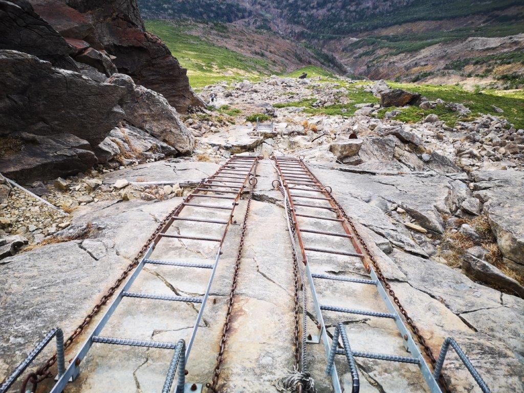
Every year, I try to make at least one hiking trip to northeastern Japan. In 2020, I was able to visit the area several times thanks to the now discontinued JR East Welcome Rail Pass. On this first trip of the season, after climbing Mt Iwate on the first day, the next day I headed south to tackle the prefecture’s second highest peak. As on the previous day, I went by car, the only option, since the bus to the trailhead had already stopped running for the year. It was just as well because of the 4 trails leading to the summit, the ones from Kadoma and Kawaranobo were currently closed, and the one from Take was too long for a daytrip, meaning that a traverse of the mountain was out of the question. I was happy to go up and down the same trail, although I would have to be extra careful on the rocky section fitted with a long ladder just above the 5th station. The clear autumn weather was supposed to continue for another day, although strong wind and some clouds were expected in the afternoon. I was looking forward to seeing the great views from the summit, as well as catching the last of the autumn colours around the mountain base.
Hiking in the Hayachine Quasi-National Park 早池峰国定公園
Download a map of the Mt Hayachine Hike
This map was developed for Japanwilds with the Hokkaido Cartographer
Find more Japan hiking maps on Avenza

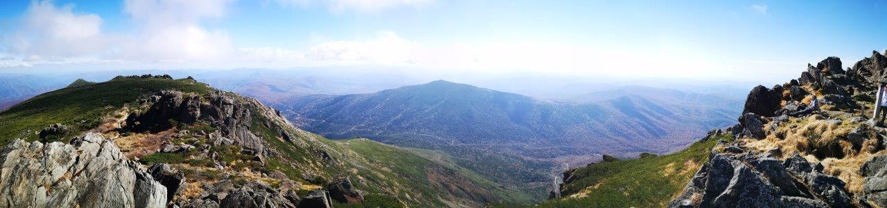
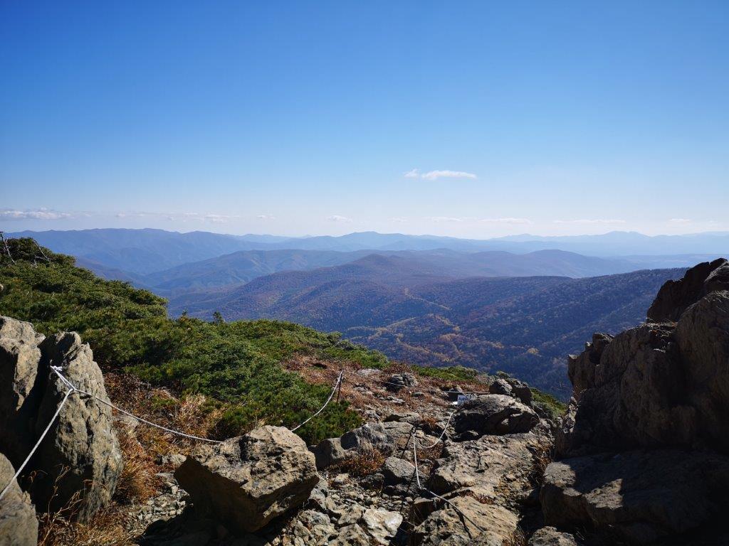
Looking westwards from the halfway point
Heading down in the afternoon
I left Morioka city just after sunrise on a cloudless day and arrived at the Kawaranobo (河原の坊) parking area a couple of hours later. The last few kilometers were along a narrow road surrounded by beautiful autumn colours; since it was a weekday, I met no other cars coming in the other direction. After getting ready, I walked up the road to Odagoe (小田越) and the start of the trail. I arrived there just on time to witness the removal of the portable toilets (see video), a strong hint that the hiking season was nearly at its end.
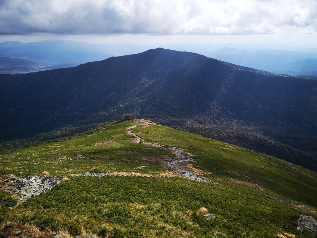
Hiking above the treeline
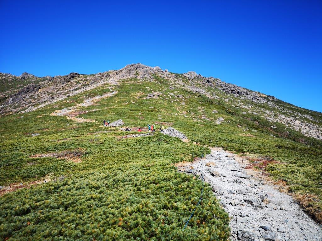
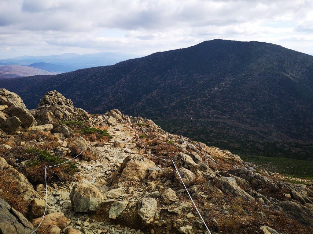
The ropes help the hikers stay on the trail
At 9h30, I stepped onto a wooden walkway leading into the forest in the heart of the Hayachine Quasi-National Park (早池峰国定公園). The path soon started to ascend; half an hour later, I emerged from the trees into an alpine landscape of rocks and ground-hugging creeping pine; turning around, I had a good view of Mt Yakushi (薬師岳), the other main peak of the quasi-national park. The path was easy to follow with good signposts, the sides roped off to prevent hikers from straying in case of a whiteout.

The biggest challenge: the long ladder!
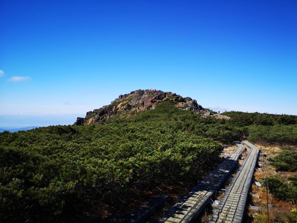
More relaxed hiking close to the summit
I had impressive views of the long valley running east to west, thanks to the perfect weather and absence of trees. I reached the rocky area just before 11am and made my way carefully up the long metal ladder. Shortly after, I reached the the flat summit ridge. I turned left, and ten minutes later, I was standing on the top of Mt Hayachine (早池峰山 はやちねさん hayachine-san), a 100 famous mountain of Japan. Since it’s the highest peak in the whole area, I had a bird’s eye view of the mountains of Iwate prefecture in all directions. To the northwest, 50km away, I could make out the triangular outline of Mt Iwate.

View from next to the summit hut

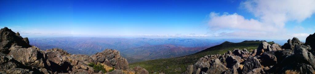
The views were quite different on the way down
The wind had started to blow and low clouds rolled in overhead. After exploring the summit area, I found a sheltered spot to sit down for an early lunch. At 12h30, I headed back along the top ridge, and continued past the trail junction to a viewpoint on the east side, just beyond a rocky outcrop. I had a fantastic view of autumn colours below, occasionally lit up the sun, now playing hide and seek in the clouds. At 1pm, I started to head down the same way, once again tackling the ladder section with great care.
Climbing down with care
Mt Yakushi, opposite, is also part of the Hayachine quasi-national park
The views of the valley in the afternoon were even more impressive, although it was now mostly overcast; below the top ridge, the wind had abated and the conditions were ideal for a more leisurely pace. One hour after starting the descent, I reached the tree line, and I was back at my car before 3pm. On the way back, I made a brief stop to see the views of Hayachine lake (早池峰湖). I was back at Morioka by 5pm, and after returning the car, I hopped on the shinkansen for the two-ride back to Tokyo.
See the views from the top of Mt Hayachine