
Every year, I try to make at least one hiking trip to northeastern Japan. In 2020, I was able to visit the area several times thanks to the now discontinued JR East Welcome Rail Pass. On this first trip of the season, I rode the shinkansen 450 kilometers to Morioka city, where I spent the night. The next day, I would drive to the eastern side of the volcano, and go up and down the Uwabo Trail, one of the 7 trails leading up to summit crater. Going by bus would allow for a traverse, but would also require an overnight stay at a hut. According to the forecast, the weather was supposed to be mostly clear and not too windy, perfect conditions, since the top part was completely exposed. I was feeling fit and ready for the big climb and descent, and was looking forward to seeing the panoramic views from Iwate prefecture’s highest peak.
Hiking in the Towada-Hachimantai National Park
十和田八幡平国立公園

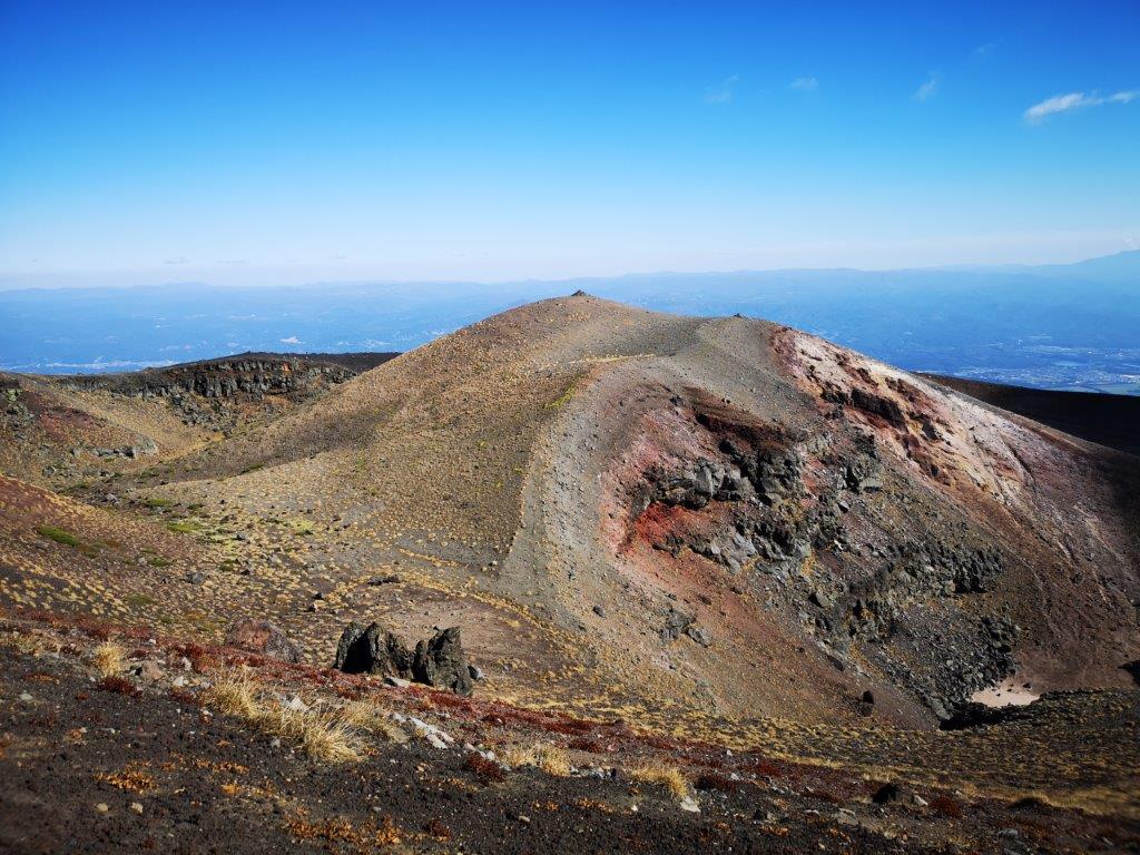
The summit crater of Mt Iwate

Looking down at Onawashiro Lake
I could see the conical shape of Mt Iwate just 20 kilometers away, from the bridge over Kitakami river, on the way to pick up my car. A little after 8am, I parked on the forest road behind Uwabo shrine (上坊神社). Looking straight ahead, I could already see the flat crater summit above the trees. I quickly set off on the well sign-posted Uwabo Trail (上坊コース). Shortly after entering the forest, I came upon a huge bear bell and gave it hearty gong. I followed the path straight up the volcano side through a beautiful forest, and at 10am, reached Tsuruhashi junction (ツルハシ分れ), where it merged with the Sunabashiri trail (砂走コース).

First close-up view of the volcano

Below the crater
I had my first views of the flat valley to the east, giving me a preview of what to expect higher up. I followed the now level trail as it headed north, hugging the volcano side and passing under some ghostly white beech tree branches, already bare of leaves. At 10h30, the tree cover suddenly disappeared; I could see the summit crater again, a dark outline against the mid-morning sun. A few minutes later, I reached the comfortable-looking Hirakasafudo emergency hut (平笠不動避難小屋). From here the views widened, the vegetation mostly consisting of creeping pine; northwards, I could see the Hachimantai plateau, covered with thick forest.
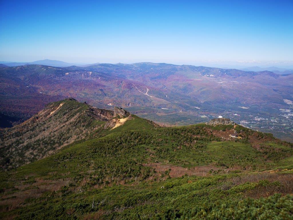
Looking north towards Hachimantai

Walking the crater rim
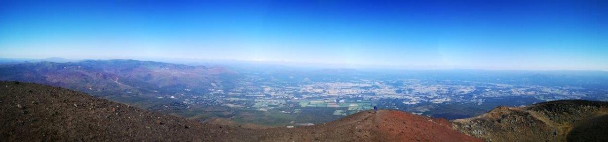
I started to climb the steep, inner crater, the path heading straight up under the high sun, the low vegetation gradually replaced by volcanic rock and sand. I could now see the tear-shaped Onawashiro lake (御苗代湖), encircled by trees and enclosed by the outer crater; beyond, views of the Towada-Hachimantai National Park extended northwards. After reaching the rim, I turned left for the final, gentler climb to the highest point. A little after 11am, I was standing on the summit of Mt Iwate (岩手山(いわてさん iwate-san), a Japan 100 famous mountain. Huge clouds floated past overhead, blocking the view of Akita to the west.
The top of Mt Iwate, like a different world

Completing the tour of the crater
Looking east, however, was like looking out of the window of a plane, the buildings and roads of the flat plain barely discernable, 1500 meters below. I made my way around the crater rim in a clockwise direction, enjoying the desert-like views, and at 12h30, I started my descent. One hour later, I was back at the Tsuruhashi junction, and by 3pm I was back at my car. Before heading to my hotel in Morioka, I dropped by the Yakehashiri-no-Yu (焼け走りの湯) for a well-deserved hot spring bath.
See the views from the top of Mt Iwate volcano


