

I climbed the highest peak of this mountain two years ago in June, the “back peak”. I had planned to climb the lower “front peak” last year but it kept on getting postponed. At just 100 km from Tokyo, it’s closer than many other peaks I’ve easily climbed as day trips. However, the trail entrance is a two-hour drive from the closest city. Apart from the long drive, the hike itself seemed straightforward, going up and down the same way. The front and back peaks used to be connected by a trail, but over time it has “weathered” and it’s now officially closed. The weather was supposed to be good, but since I would be hiking inside the Nikko National Park, I knew the weather could be changeable. For the effort of going to the same mountain, I was hoping I would get a different view from last time.
Hiking in the Ashio Mountains 足尾山地

The Southern section of the Nikko National Park
I arrived at Maebashi station around 8h30 and was on the road by 9am. Once I arrived in the Watarase river valley, there were fewer cars and I enjoyed the drive. Just before Sori station, I turned left up a narrow mountain road. The road was in rather bad condition, with potholes, fallen rocks and branches on the road, and I had to drive really slowly till the parking lot next to the trail entrance (elevation 1200m). It was 11am and there were three ladies enjoying a break at the resthouse. I asked them whether they had just come down the mountain; they told me they were volunteers who cleaned the parking toilet. They offered me some snacks, and then drove off.

Turning around, Mt Akagi
A nice ridge walk, not easy to find in the area
Twenty minutes later, I started up the staircase at the start of the hike. After a short climb, the path leveled as it followed a narrow ridge. The thick forest blocked out the sunlight, and the trail was faint and hard to follow. I was soon back in the sun after one side of the ridge became a grassy slope, giving me a great profile view of today’s mountain. Turning around, I saw Mt Akagi where I was hiking less than two months ago. As I climbed, the grassy slope got steeper and steeper, but soon I was back in the forest and on a level track.

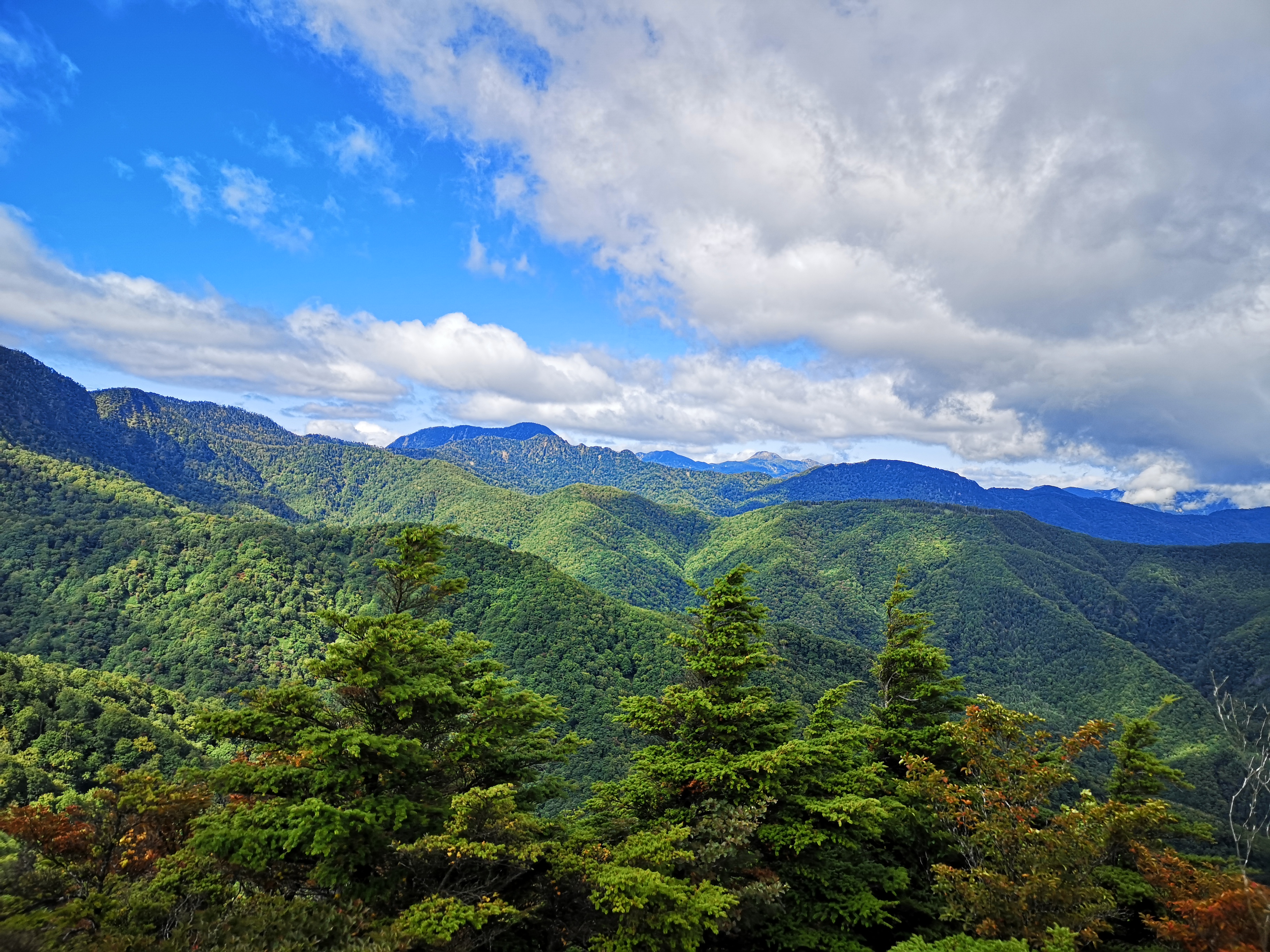
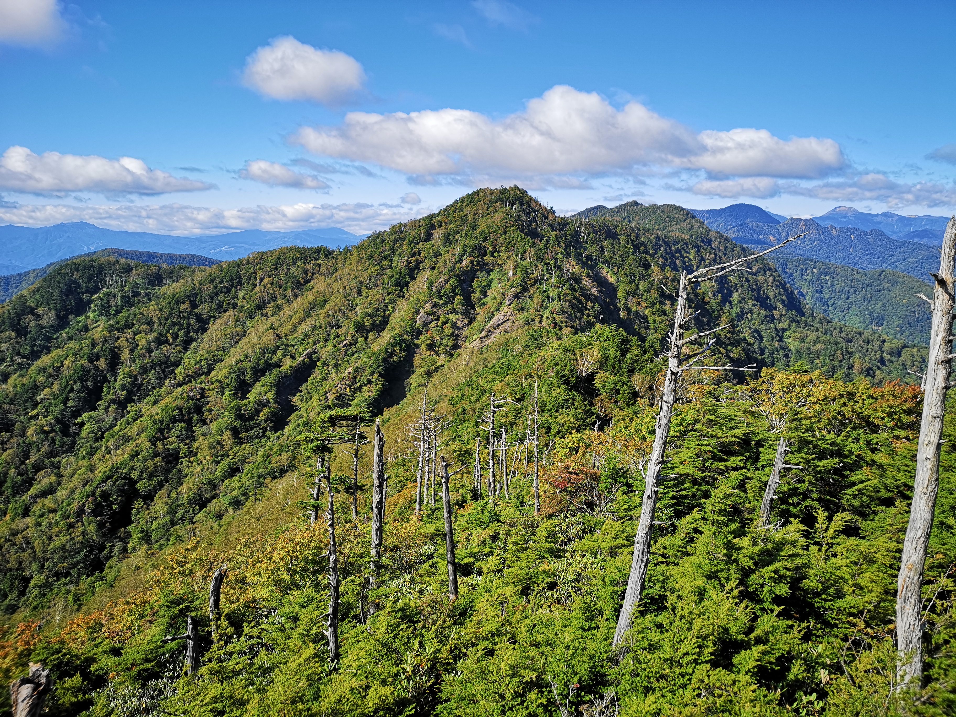
The Ashio mountains, beautiful and hard to reach
From left to right: Mt Sukai, Mt Nikko-Shirane and Mt Koshin
A little past noon, I reached a wooden lookout tower and a marker for the Kanto Fureai no Michi. The tower was disappointing as the view was mostly blocked by trees – not really surprising since it was built 25 years ago. However I was alarmed to see lots of big dark clouds gathering on the other side of the ridge; there was no time to dawdle. Luckily the next section was mostly flat. At a clearing I passed the turnoff for the emergency hut; there were many rock cairns, and it felt a bit spooky. Further on, there was another clearing filled with rock cairns. It was odd to see so many of them since the trail was well below the tree limit and there was no risk of getting lost.
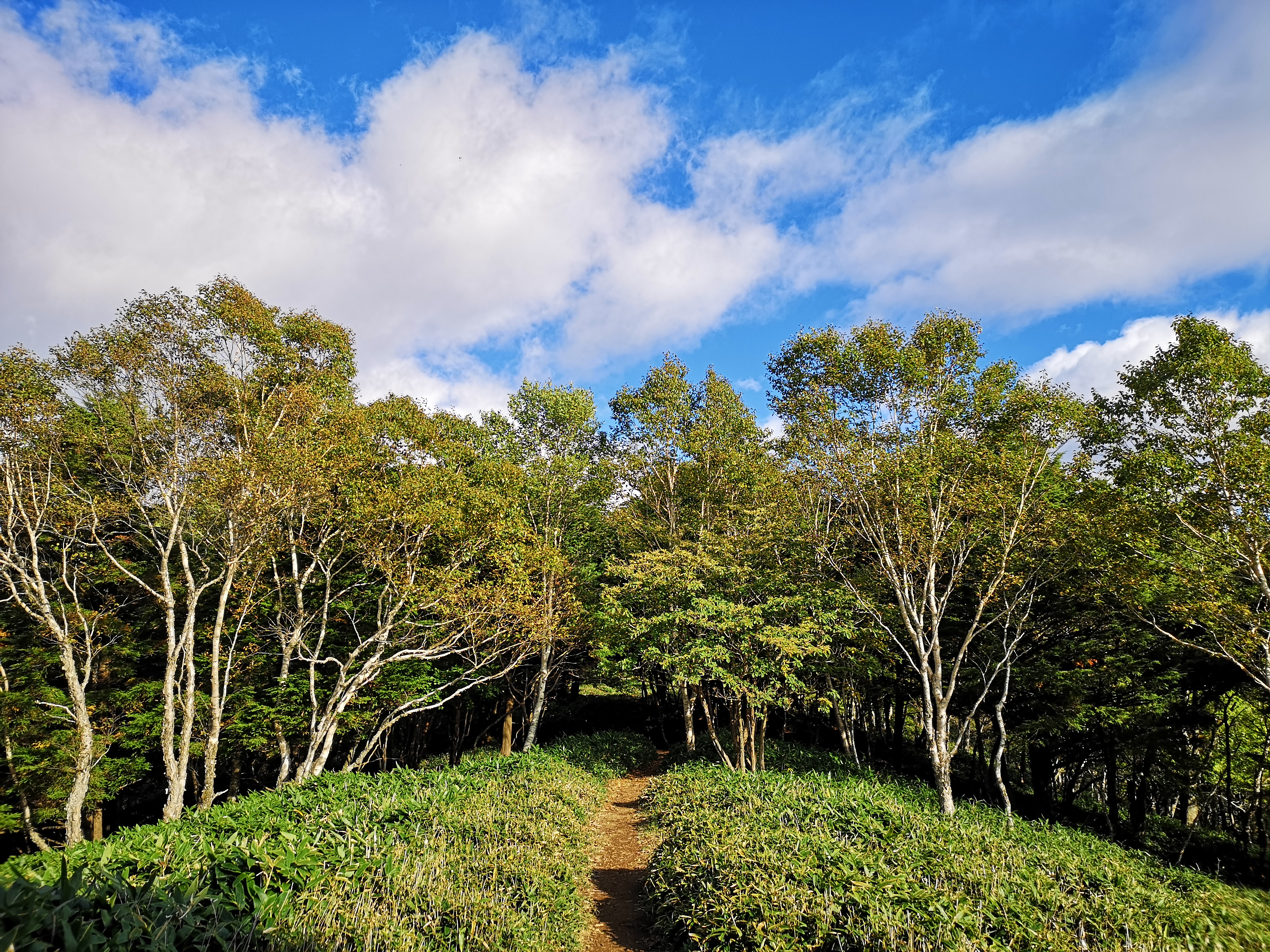
Walking through the birch trees

Withered pine trees near the top
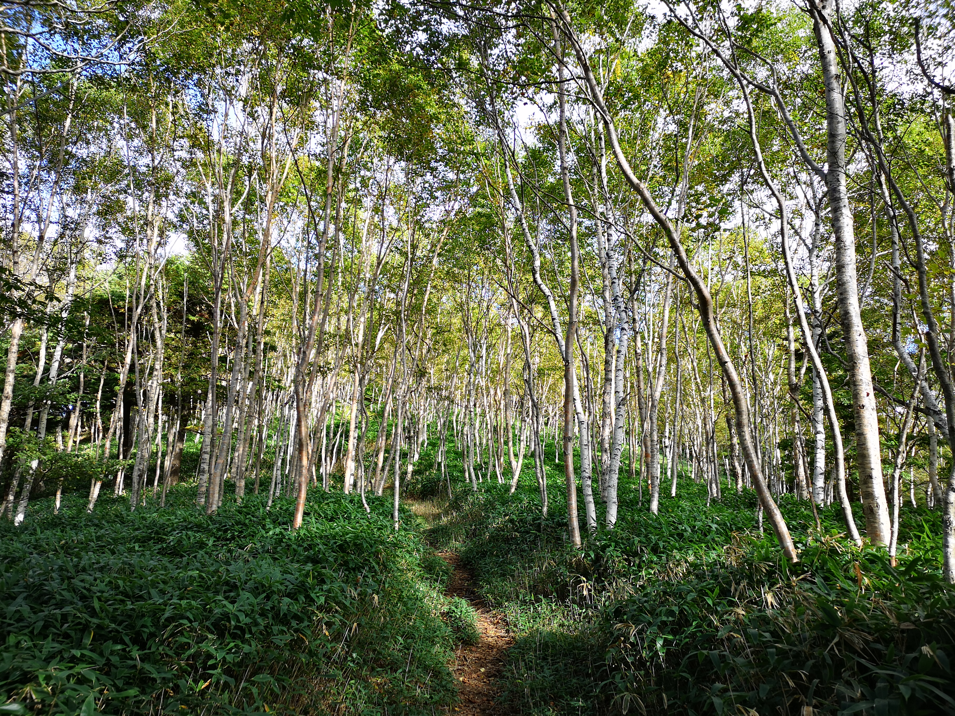
After some gently climbing, I reached the top of Mt Komaru 1676m (小丸山 komaruyama). The clouds had temporarily moved away, and I had an excellent view of the Ashio mountains (足尾山地) stretching northwards all the way to Mt Koshin, Mt Sukai and Mt Nikko-Shirane to the North. After a short break, I continued along the path, going down for a bit, and then past a very dodgy emergency yellow-coloured shelter – it would have to be a very big emergency for me to stay there! the path then climbed again, through a forest of white-barked birch trees. I soon reached the base of a very steep climb below the summit. Grabbing ropes, rocks and branches, I pulled myself up and up. It wasn’t dangerous, but it was quite a workout.
Below, a great hiking area closer to Tokyo
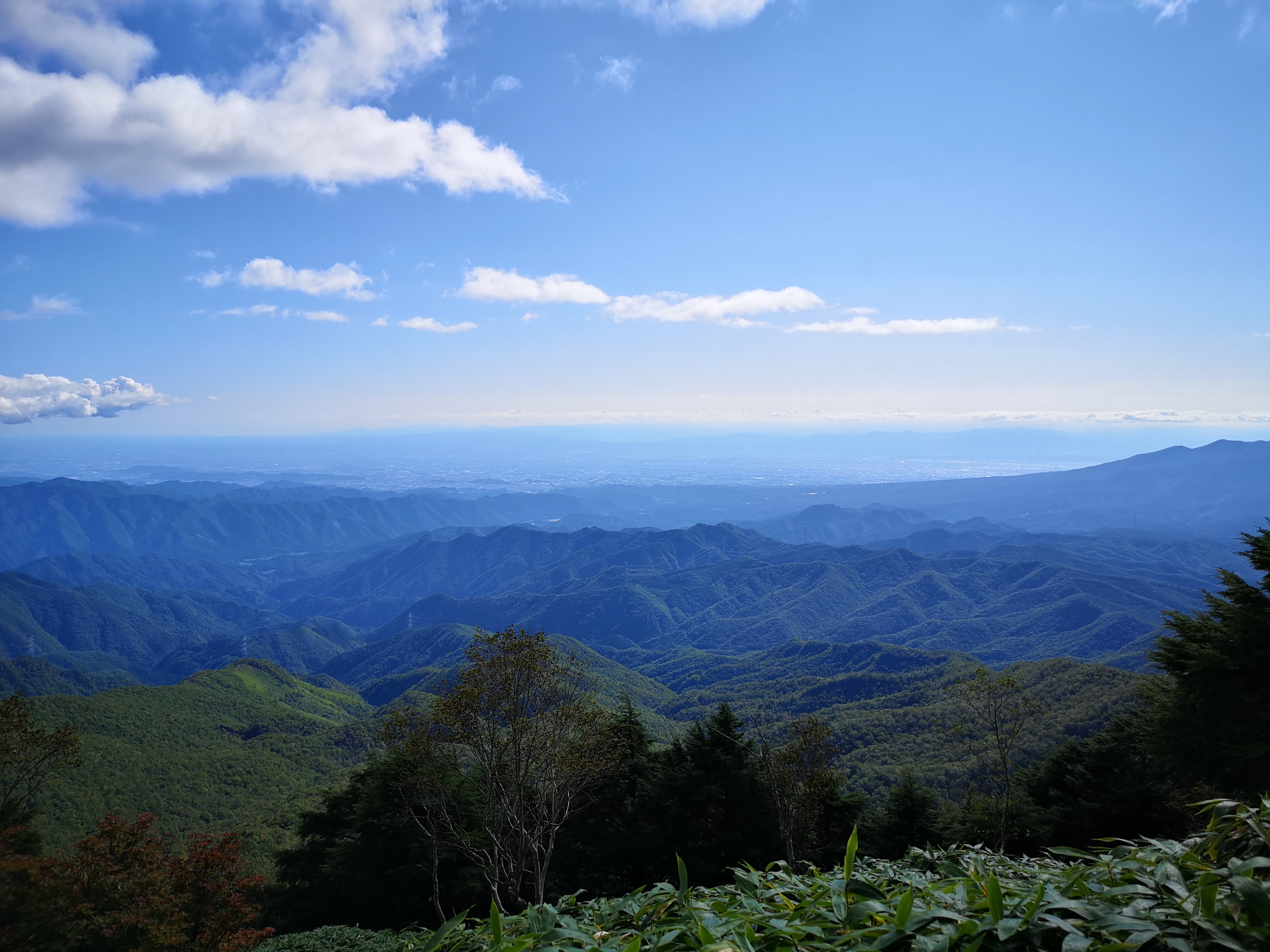
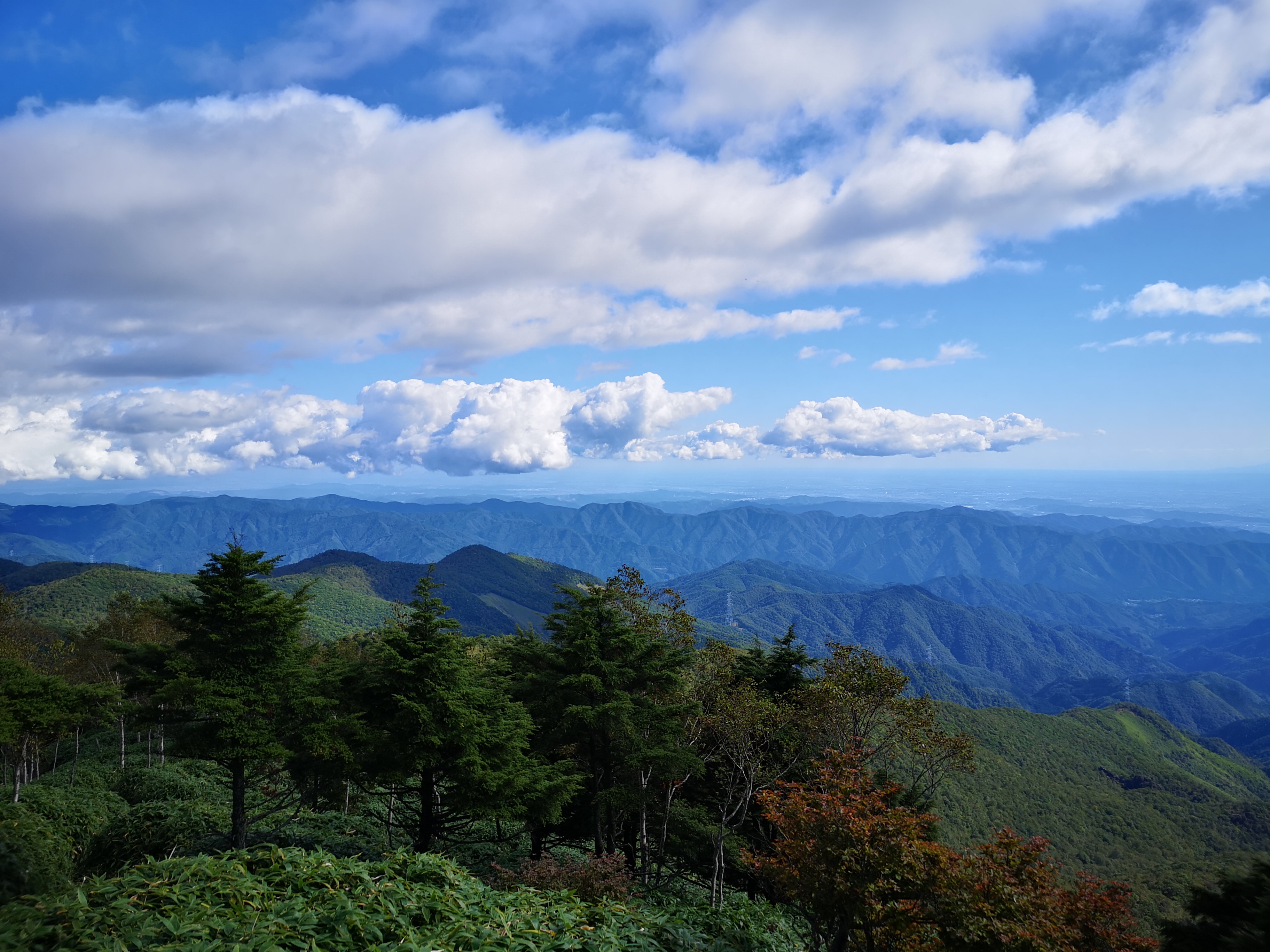
Stretching into the distance, the Kanto Plain
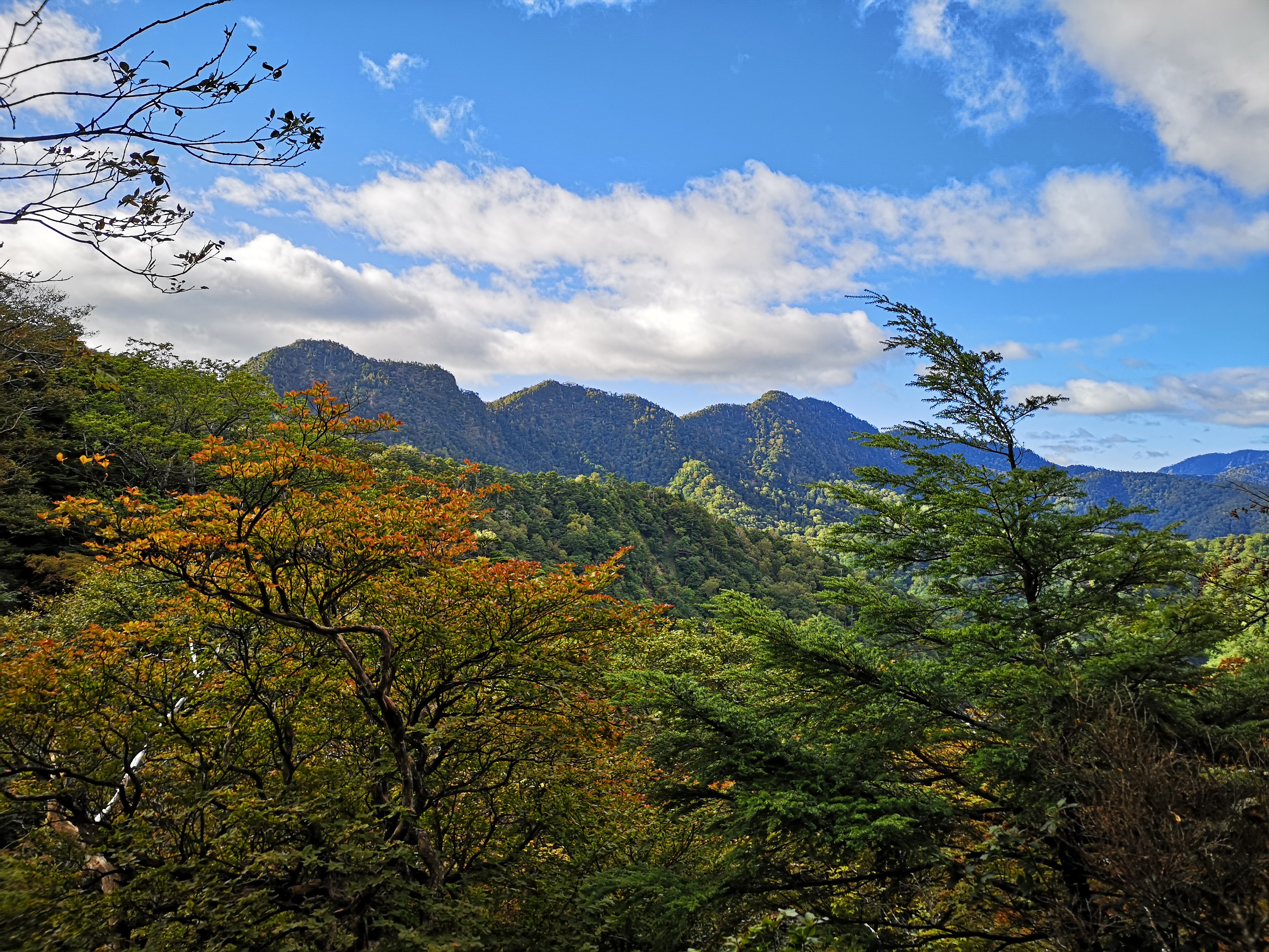
After the path flattened and started to curve around the round summit, I was rewarded with sweeping views to the West. I could see the low mountains of Southern Tochigi and Eastern Gunma, the Kanto plain and Mt Akagi. Since the Kanto plain is flat and wide, it felt like being on a plane. At 2pm I was standing on the top of Mt Mae-Kesamaru 1878m (前袈裟丸山 maekesamaruyama). The view from the summit marker was so-so, but moving through the trees towards the start of the closed trail for Mt Ato-Kesamaru, gave me a much better view. Straight ahead was the other Kesamaru mountain; to the right were the Ashio mountains and the Nikko National Park; to the left the mountains of Northern Gunma. Maybe it was due to climbing in a different season, but I felt that the views on this Kesamaru mountain were better.
Looking at “back Kesamaru” from “front Kesamaru”
Autumn is around the corner
I started down at 2h30. I was anxious to get to my car as soon as possible; I wanted to get back to Maebashi before dark. Also, since I was heading back the same way, I knew I was alone on the mountain. Actually, I was wrong; once I reached the grassy slope close the parking area, I saw, and heard, several deer jumping through the forest. After observing and listening to the deer, I moved on, and was back at my car less than 2 hours after leaving the top. It was still sunny; I was relieved that the weather had held all day. I drove back the same way, and got back to Maebashi station around 6h30 before it got completely dark. I caught the train for Takasaki, and then jumped on the direct train for Tokyo.

Mt Mae-Kesamaru in the late afternoon sun

