Honjagamaru (1631m), Otsuki City, Yamanashi Prefecture

This 100 famous mountain of Yamanashi would deserve a place among the 200 or 300 famous mountains of Japan. It offers a challenging climb and a wide view from the top, including Mt Fuji and the South Alps. The trail is also easily accessible on foot from Sasago station on the Chuo line. Funnily enough, it’s not called a “yama” (mountain), but a “maru” (circle).

HOW TO GET THERE: Take the Chuo line from Shinjuku station and get off at Sasago station a couple of stops past Otsuki station. Don’t do like me: fall asleep and miss your stop. I was lucky to be able to get off two stations later, and catch a train back within ten minutes – there are only about 2 trains an hour out there.

Ask for a hiking map for Honjagamaru

THE ROUTE: From Sasago station’s sole exit, walk up the road on the right. Within 50 meters you will reach a T-Junction. This was probably the most confusing part of the hike, since the hiking sign clearly points to the left, whereas my map indicated a right turn. According to the map the left trail was a hard to follow route to another summit on the same ridge. Since it was published 3 years ago, things may have changed.

I decided to go right anyway, and after walking along a dirt road for about 15 minutes, I was relieved to spot a sign for the trail entrance, pointing to a dirt trail going up the mountain on the left. I set off along it with renewed confidence, only to reach an unmarked branching barely ten meters further. The left branch followed the bottom of the valley, and the right one went literally straight up the mountain side.

The beautiful ridge line path

Having already lost a significant amount of time by missing my station, and locating the trail entrance, I followed my gut instinct and went right. I guessed that the paths would probably join up later, as it often happens when you encounter an unmarked branching. They never did, and for the time being it was a mystery.

I quickly discovered that my chosen path was extremely steep – so steep that a couple of times I had to kick in the dirt with the tip of my hiking shoes to get a grip. The path was also very faint; I was starting to wonder whether it was the right choice after all when suddenly I saw a pink ribbon attached to a low branch, the unofficial trail marker throughout the area. The climb to the first shelf was intense, and left me gasping my breath at an electric pylon. After that it was easier going. The surrounding forest was beautiful and felt quite wild.
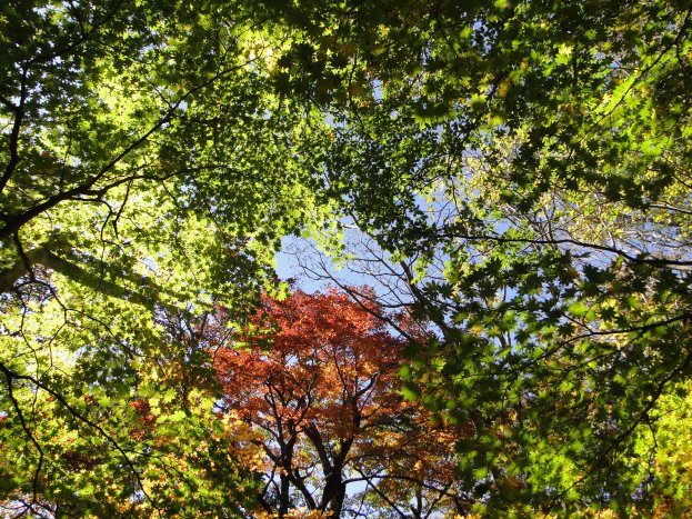
Some autumn colours

There was another confusing part about an hour after I started climbing, when the path disappeared into some dense vegetation, some sort of grass that had grown out of control. There wasn’t a clear path leading around it, so in the end I picked up a stick and literally beat a path through it myself. I finally emerged onto a road on the other side, as predicted by my map, and thus confirming that I was on the right path.

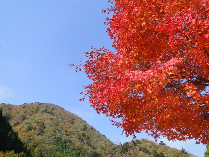
After the road, there was another very steep dirt path requiring more kicking. Eventually big rocks and boulders started appearing on either side of the path, a sure sign I was approaching the summit ridge. At last, I reached a minor summit 1377 meters high, but there wasn’t much of a view, so I soon continued along the ridge line.  After a while I got to see some beautiful autumn colours, looking amazing with the blue sky in the background.

More autumn colours

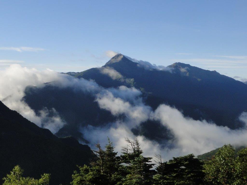
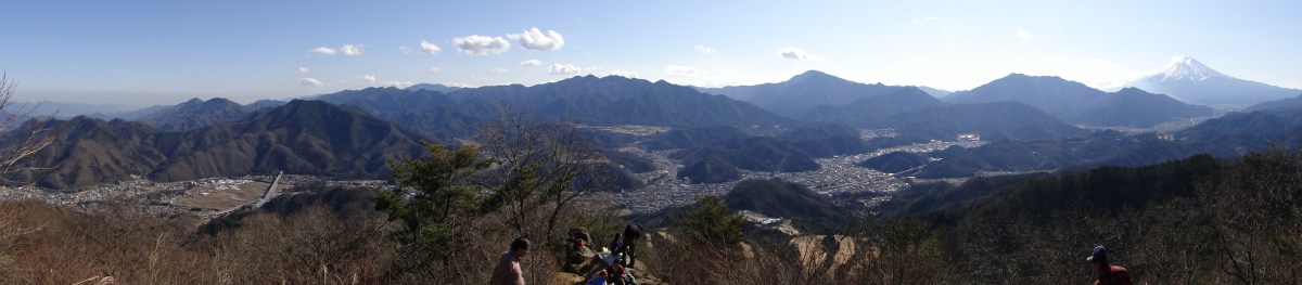
Finally I started getting some glimpses of Mt Fuji. After confirming with a descending hiker that the summit had a clear view of Mt Fuji, I hurried along till I reached the summit of Honja-ga-maru 本社ヶ丸, and a stunning view. To the south was glorious Mt Fuji, so close I felt could touch it; in front and to the left was Mt Mitsutoge, a 200-famous mountain; to the West were the South Alps; to the North were Yatsugatake and the mountains of the Chichibu-Tama-Kai national park; the view to the East was hidden by trees. I found a good sitting spot on a rock with a view of Mt Fuji, and had by lunch.

After lingering as long as I dared, I started downhill, continuing along the ridge. There were several more excellent viewpoints on the way. The surrounding rocky scenery felt very wild. On the way, I scared away a family of partridges. At one point, there was a path leading down to Sasago station to the right. I ignored it since I intended to follow the ridge lime for some more time before heading down.

Mt Fuji in the autumn

Just after that there was another tricky part – the path switches back and goes down the opposite side of the mountain. This is the path to Mt Mitsutoge. Shortly after you go under the trees, there is small path leading right and following the ridge again. The sign has fallen down so it is easy to miss. At the fork for Mt Haccho (八丁山 haccho-yama), I turned right to get off the mountain. The round-trip to the top of this mountain takes barely 15 minutes, but I had to drop it since I had lingered too long at the summit, and was in a hurry to get down before it got dark.
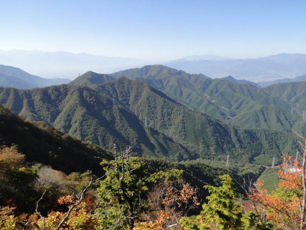
View south from the top

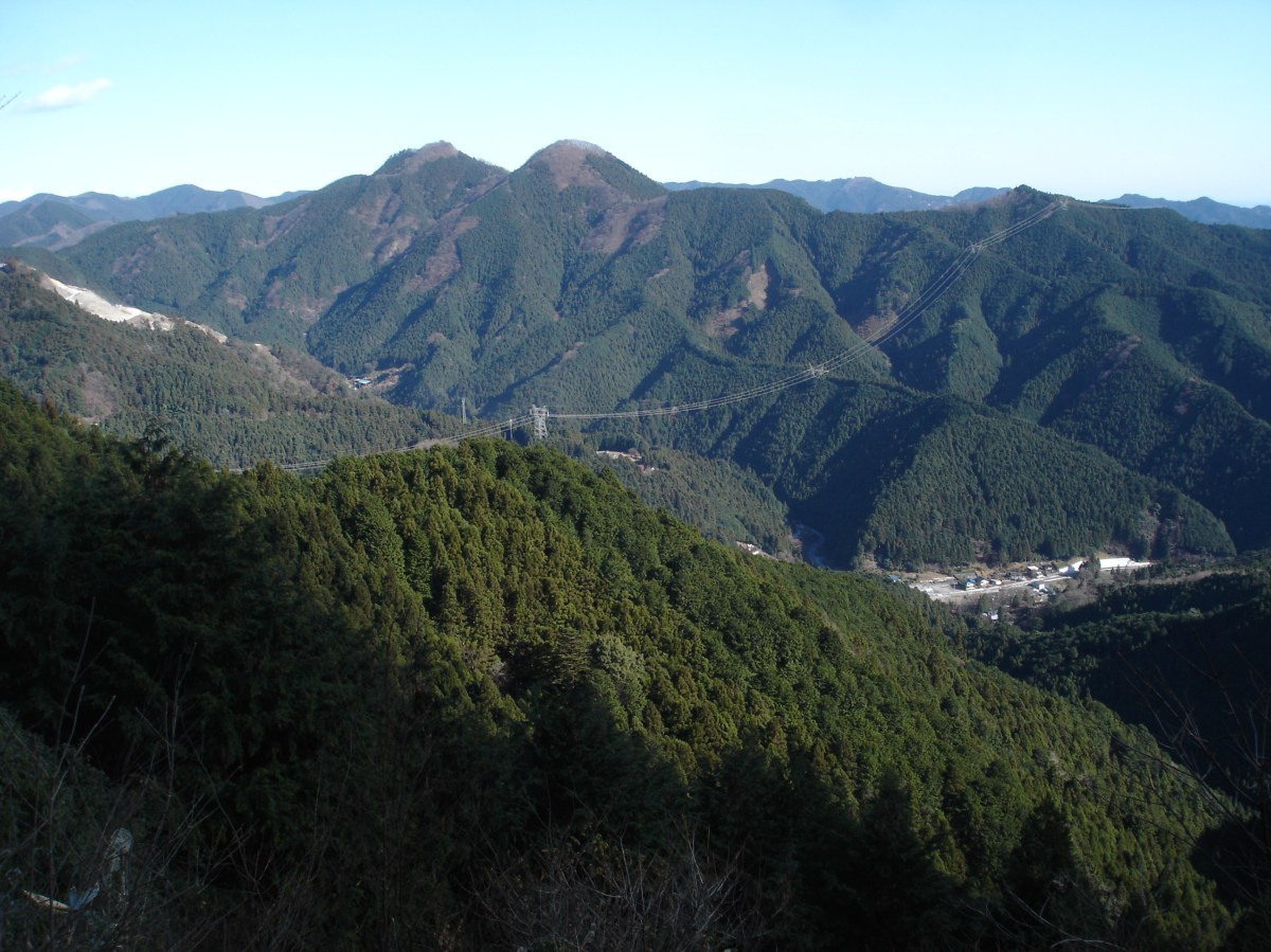
A little further there was yet another tricky part. A little before Onna-zaka Pass (女坂峠 onnazaka-toge), there was a path to the right for Sasago station that wasn’t on the map. The route through 女坂峠 was longer and involved an up and down, whilst this new route was more direct. Actually, we were 3 hikers hesitating at this sign. In the end, as evening was arriving quickly, we all chose caution over adventure, and took the fastest route back to the station. Unfortunately, it was also probably the least beautiful option as it descended quickly through secondary forest. As a consolation, it did offer some nice views of Honja-ga-maru and the surrounding peaks.
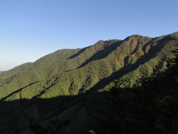
Honjagamaru from near the end of the hike

Finally after going back and forth through some newly planted pines trees, the path joined up with the official map path. This was the path to the station I had ignored earlier. I was glad I had taken the ridge line path on the way up, since it was truly beautiful with many views. Soon after, the road became paved, and it was a pretty boring 40 minute-walk to the station. According to the map there was supposed to be a bath near the end of the hike. However the locals told me it had closed.

CONCLUSION: Strongly recommended if you are looking for a station to station quiet hike in beautiful forest with great views within 2 hours from Tokyo. The main drawbacks are some navigational difficulties and no onsen at the end.
Ask for a hiking map for Honjagamaru

Mt Kita (3193m), Mt Aino (3189m), Mt Notori (3026m) & Mt Shiomi (3047m), Yamanashi, Nagano and Shizuoka Prefectures, September 2010 [Map Available]

Mt Kita seen from Mt Kaikoma

Hiking the hundred famous mountains of Japan 日本百名山

Hiking in the Minami Alps National Park 南アルプス国立公園

北岳 (きただけ kitadake)

間ノ岳 (あいのだけ ainodake)

農鳥岳 (のうとりだけ noutoridake)

塩見岳 (しおみだけ shiomidake)

Download a map of the Mt Kita hike

This map was developed for Japanwilds with the Hokkaido Cartographer

Find more Japan hiking maps on Avenza

Mt Omuro (1587m) & Mt Kanyudo (1418m), Sagamihara City, Kanagawa Prefecture

These mountains are located in the Western half of the Tanzawa mountains, and harder to access than those in the Eastern half like Mt Tanzawa and Mt Oyama. I  rode the bus from Shin-Matsuda station for over an hour, past Tanzawa lake, all the way to the last stop, the Nishi-Tanzawa Visitor Center 西丹沢ビジターセンター, a great starting or ending point for hikes in the area. It was the second week of November, which was rather late in the season; the autumn colours had already crept down the mountain sides into the valley. I was told by the staff at the visitor center to start heading down by 1pm at the latest, to avoid getting caught in the dark.

Hiking in the Tanzawa Mountains

丹沢山地

Ask for a hiking map for Mt Omuro

In the back hidden in the clouds is Mt Fuji

I set off at 10am under blue skies. The first part of the hike was along a small road that followed the river valley past a couple of camping sites. At the first junction, I headed right – I would be descending via the left junction. Here I finally entered the hiking trail proper, also part of the Tokai Nature Trail 東海自然歩道. I followed a narrow valley alongside a rocky river. Looking up, I could admire autumn colours in all directions. After an hour of climbing, I reached a pass, an Emergency hut, and the first views. However by now, grey clouds had rolled in hiding the ridgelines.

The brilliant red of the “momiji” tree

Climbing up through a “koyo” tunnel

I still needed another hour an hour of tough climbing to reach the summit of Mt Omuro (大室山 oomuroyama), a 100-famous mountain of Yamanashi and the 3rd highest peak of the Tanzawa mountains. Here, the trees were already bare of leaves, a strong hint that winter was just around the corner. I was now mostly above the clouds that had gathered on the Southern side, with just a few milky strands of mist left. I had great views North of Doshi Valley and the Doshi Sankai mountains. Since it was nearly 1pm, I had a quick lunch, and made my way Westwards along the ridgeline to the next peak Mt Kanyudo (加入道山 kanyuudouyama).

Mist and leafless trees near the summit

Doshi valley and Doshi mountains

There was another emergency hut here, but fortunately I still had enough time to descend safely.  Soon, I was walking on a wooden path alongside a beautiful mountain stream with a carpet of colourful fallen leaves on both sides. Suddenly the path and the stream parted ways. A few minutes later, I caught a glimpse of an impressive waterfall to my right. By now the clouds had disappeared and the blue skies were back. The sun had already disappeared behind the mountain ridge behind me. I emerged into a river valley with rocky banks, which I crossed several times on small wooden bridges, and finally got back to the visitor center by 4pm.

Easy walking on the way down

Ask for a hiking map for Mt Omuro

Mt Izu (851m), Hanno City, Saitama Prefecture

Mt Izu is one of the main peaks of the Oku-Chichibu area and was mentioned in my Kanto hiking book. It took me about an hour and a half from Shomaru station on the Chichibu line to reach the rocky area just below the top. The final part was a scramble and there was a chain to assist hikers. It wasn’t dangerous, but I was surprised to discover such an exciting section in an area consisting of low mountains.

Ask for a hiking map for Mt Izu

Climbing the “easy way” (left) and the “hard way” (right)

The summit of Mt Izu (伊豆ヶ岳 izugatake) was narrow and crammed with hikers, but I was able to find a small spot with a view to sit down and have lunch. On one side, there was a cliff with a group of people climbing up via a rope. From the top, I could see the green ridges of Oku-Musashi. At noon, I set off again in a Southward direction, hoping to stay ahead of all the other hikers.

Looking North towards Chichibu

The trail followed the narrow ridge as it curved Eastwards. There were few views and lots of ups and downs; however there were few other hikers, so it was quite peaceful. Two hours later I reached an intersection and an interesting temple with some panoramic views and lots of iris flowers. Here I took the middle path, and I soon emerged onto a road next to a beautiful stream. It took an hour to reach Agano station where I caught a train back to Tokyo.

Mt Warabi (1044m), Hanno City, Saitama Prefecture

For this hike I took a bus from Hanno Station to Nago, a few stops past Sawarabi no Yu. I crossed the bridge behind the bus stop, and followed the road for about twenty minutes to the entrance of the hiking trail. The path started to climb steeply up a forested valley, and very soon I had my first views of the green hills of Oku-Musashi.

Ask for a hiking map for Mt Warabi

I reached the top of Mt Warabi  (蕨山 warabiyama) a little before noon., a couple of hours after setting off. I hadn’t expected it, but from the top I could see all the way to Tokyo. After lunch, I took a path heading Eastwards. It was possible to continue in the opposite direction towards Mt Arima, but today I didn’t have enough time.

The descent following a long and gently sloping ridge was very enjoyable. There were no other hikers and it was very peaceful. It took me another two hours to reach Sawarabi no Yu where I could enjoy a nice hot bath before hopping onto the bus back to Hanno.

Mt Kintoki (1212m), Minami-Ashigara City, Kanagawa & Shizuoka Prefectures

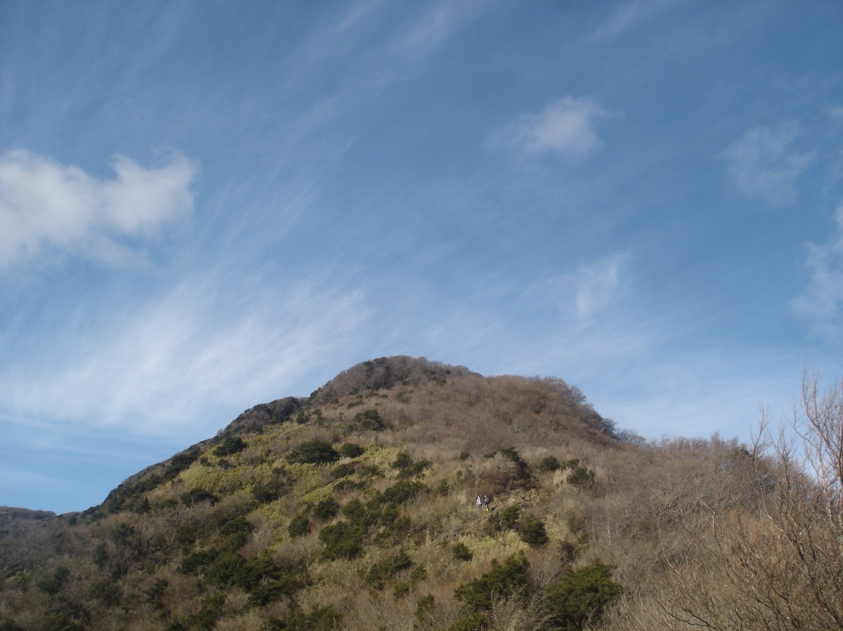
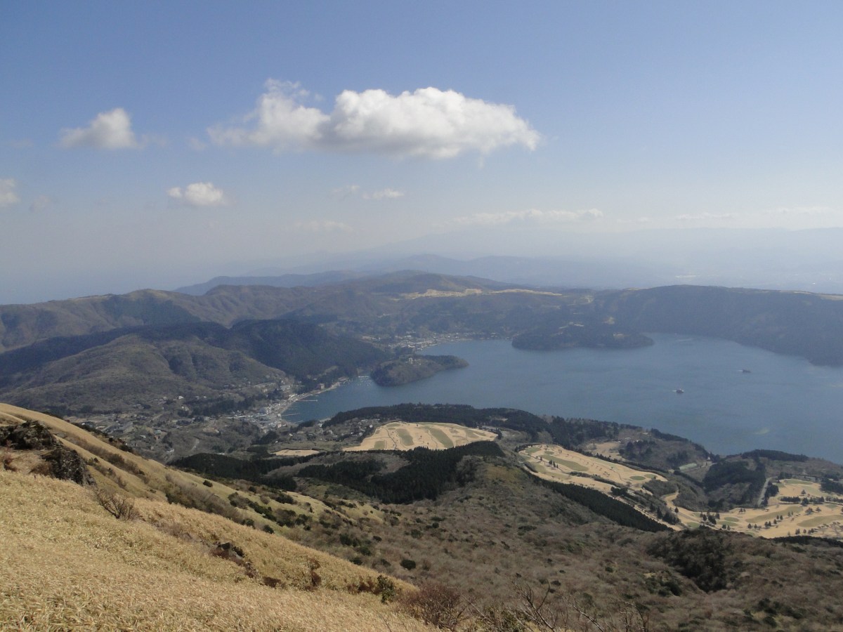
This 300-famous mountain jutting out of the Northern tip of the Hakone outer crater, is one of the easiest, and most popular, climbs in the area. I first found out about it from my Kanto hiking book, and realised that I had already seen its pointy top from the train while traveling by train along the Shonan coast. The main attraction seemed to be the unobstructed view of Mt Fuji from the top, but would Japan’s famous volcano be clear of clouds the day of my hike? and with how many other hikers would I have to share the summit with?

Hiking in the Fuji-Hakone-Izu National Park

富士箱根伊豆国立公園

Ask for a hiking map for Mt Kintoki

I took a bus from Hakone-Yumoto station bound for Gotemba, but got off around 9am at the entrance of Kintoki Shrine 金時神社 about 30 minutes later (it’s before the tunnel that passes under the outer crater). The bus was fairly empty, slightly unusual for Hakone. However the parking lot next to the shrine was nearly full. These were the days when the highway toll was a flat fee of 1000 yen on weekends, a kind of stimulus put in place after the Lehman shock (as it is called here). The first part of the hike was fairly easy; it took one hour along a winding trail to reach the top of the rim.  There were some nice views of the outer crater, with Mt Mikuni above lake Ashi directly opposite, and Mt Koma to its left.

My best shot of Mt Fuji 

Turning left, it took another 20 minutes of steep climbing to reach the top of Mt Kintoki 金時山 (kintokiyama or kintokizan). The trees on this section were small, rather like big bushes, and bare of leaves since it was the middle of December. As expected, the top was packed with people and nearly all benches were taken. It seemed to be a popular place to have lunch while enjoying the view of majestic Fuji. Today, the giant was wrapped in grey clouds,  with only its white top showing itself.  It wasn’t the best view I had ever had, but it was still impressive.

Another hiker gazing at Mt Koma, the highest point of Hakone

I found a spot to sit for lunch. In all directions it was mostly blue skies, and I had a great view of the impressive Hakone crater with the Suruga Bay in the background. This was undoubtedly one of the best views of the Kanto area within close reach of Tokyo. After lunch, I went back down the same way but instead of going back to the shrine, I followed the rim a little further East. The path was lined with tall bamboo grass on both sides, but it wasn’t high enough to block out the view of Mt Myojin ahead. At Yagurasawa Pass 矢倉沢峠, I turned right and headed down. The trail was steep this time, and I had to be careful not to slip. Half an hour later, I was back on the road.

Mt Myojin, another great mountain to climb

Although it was a short hike, I didn’t mind since December days are also short. I definitely want to try my luck again to see Mt Fuji completely free of clouds from the top. One more good point about Hakone, is that there are many hot spring hotels. So after completing the hike in about four hours, I was able to have a nice hot soak before making my way back to Tokyo.

Ask for a hiking map for Mt Kintoki

See the panoramic view from the top of Mt Kintoki

Mt Buko (1304m), Yokoze Town, Saitama Prefecture [MAP AVAILABLE]

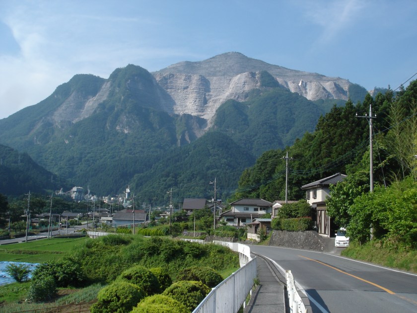
This was one of the first mountains I climbed in Chichibu. I was intrigued by its pyramid-shaped top, spotted on my previous visits to the area. Could it be easily climbed? why was it two-thirds bare of trees despite being way below the treeline? I decided to go on a hot sunny day in the middle of June; in fact it was the day Michael Jackson passed away. The sky was hazy and the view from the top wasn’t great, so I have always been wanting to make another attempt in the cooler months.

Get a Map of the Mt Buko Hike

This map was developed for Japanwilds with the Hokkaido Cartographer

Find more Japan Hiking Maps on Avenza

Although technically a station to station hike, it’s an hour and a half walk along a paved road from Yokoze station, so getting a taxi to the trailhead is a good option, especially if you’re in a group (it might require prior reservation). I got off the train station at the very early time of 7am so I decided to go on foot. On the way, I got some dramatic views of today’s mountain. It soon became clear that the triangular treeless summit wasn’t natural, but formed through mining – ir was one big quarry. I passed by several factories that seemed to belong to a Hayao Miyazaki movie; they’re probably used to process the mined rock. Further on, the road started to climb, and a beautiful mountain stream appeared on the left side.

The Ghibli-like factories at the base of Mt Buko

I arrived at the “torii” marking the trail entrance at 8h45. It was flanked by a pair of dog or wolf guardians, something I don’t usually see. There are rumours that wolves still exist in Chichibu; perhaps this is where there used to live. Beyond was an extremely steep mossy concrete road heading straight up the mountain through dense cedar forest. Every time I consider redoing this hike, this part comes to mind. Thankfully it was soon over, and I was following a regular hiking path. Half an hour later I reached a waterfall called “fudotaki” 不動滝. Past it was a small log bridge crossing a narrow ravine, adding a little bit of a excitement to the day.

Wolf deity shrine statue

Another hour of hot and sweating climbing brought me to a log staircase that seemed to go on and on, but with some views to the South at the top. Fortunately most of the hike so far had been under the trees. From this point, it was a short walk to the highest point of Mt Buko 武甲山 (bukozan), the height of which seemed to be under a fierce debate judging from a very basic map I saw there – it had 3 different heights with one crossed out! I was surprised to see that the summit area was covered in forest. However, the North side was completely open, and was guarded by a low fence. As I walked up to it, I saw that I was standing at the top of a cliff. Far below was a flat area with tracks for vehicles; below that the forest reappeared. The mining seemed to be making its way from the top of the mountain to the bottom. So far it was one third down but I wonder how low they will go?

The log bridge hidden among the trees 

As I mentioned before, the views were hazy, but in clear weather, the view of the Chichibu valley must be amazing. I checked my phone, and was stunned by the news of Michael Jackson’s death. It was nearly noon and, despite the elevation, I was getting quite hot, so I decided to head down and take advantage of the tree shade. I enjoyed this section very much. The path was easy to walk and there good views through the trees. Since it was a weekday, mining was going on, and the mountain was rocked by a couple of explosions just past noon. Probably no risk to hikers, but I was glad to be on the opposite side.

A cool dipping spot (beware of snakes!)

After an hour of downhill, I reached a mountain stream with a small waterfall, next to which was a shallow basin of clear water. I couldn’t resist so I took off my shoes and waded in. After my dip, I spotted a snake nearby so in hindsight it probably wasn’t a good idea! The next part was another hour walking along a forest road. However, a pickup truck suddenly arrived behind me; the driver stopped and kindly offered to drive me to the station. I had this kind of experience more than once in Chichibu, and it speaks volumes of the kindness of its people. Since there were 2 people in the cab, I sat on the flatbed, and was able to enjoy the surrounding nature as we drove off the mountain. I reached the station by 4pm. It was still early, so I decided to take a hot bath before the two-hour train ride back to Ikebukuro.

Japanese rat snake (harmless) or Japanese pit viper (dangerous)?

The puzzle of Mt Buko was now solved to my satisfaction (also thanks to some online information). I have mixed thoughts about mining mountains, especially ones that are so prominent. Although it would be nicer to keep them in their natural shape, there is no denying that this one has become more recognisable and famous, thus attracting more hikers.

Ask for a hiking map for Mt Buko

Check out the mountain stream with its double waterfall