Jogasaki Coast & Mt Omuro (580m), Ito City, Shizuoka Prefecture, Tuesday, February 11, 2020

This hike was unusual because I wasn’t hiking up and down mountains, but along a beautiful coastline. The suspended bridge on the Northern end is a popular sightseeing spot, however few people wander down the hiking trail that extends Southwards along the coast. It took me five hours at a leisurely pace to reach a second suspended bridge near the end of the trail. Although there are no mountains, there were many small ups and downs along the way, and lots of great views of the ragged coastline.


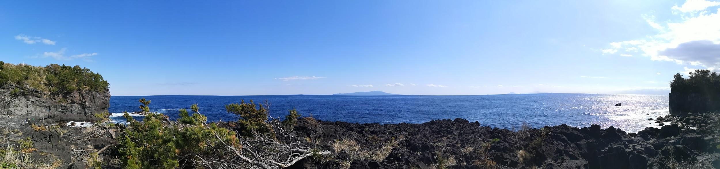
Halfway point of the jagged Jogasaki Coast

I took the Odoriko Limited Express from Tokyo station to Izu-Kogen (2 hours), and then hopped onto a local train to travel back one station to Jogasaki-Kaigan station. This small charming station was entirely made of wood and had a spacious comfortable waiting room. There was a small foot bath next to the platform, and a view of Sagami Bay and Oshima Island from the entrance. The famous early blooming cherry trees were still completely closed, but would be opening very soon.

IMG_20200211_095911

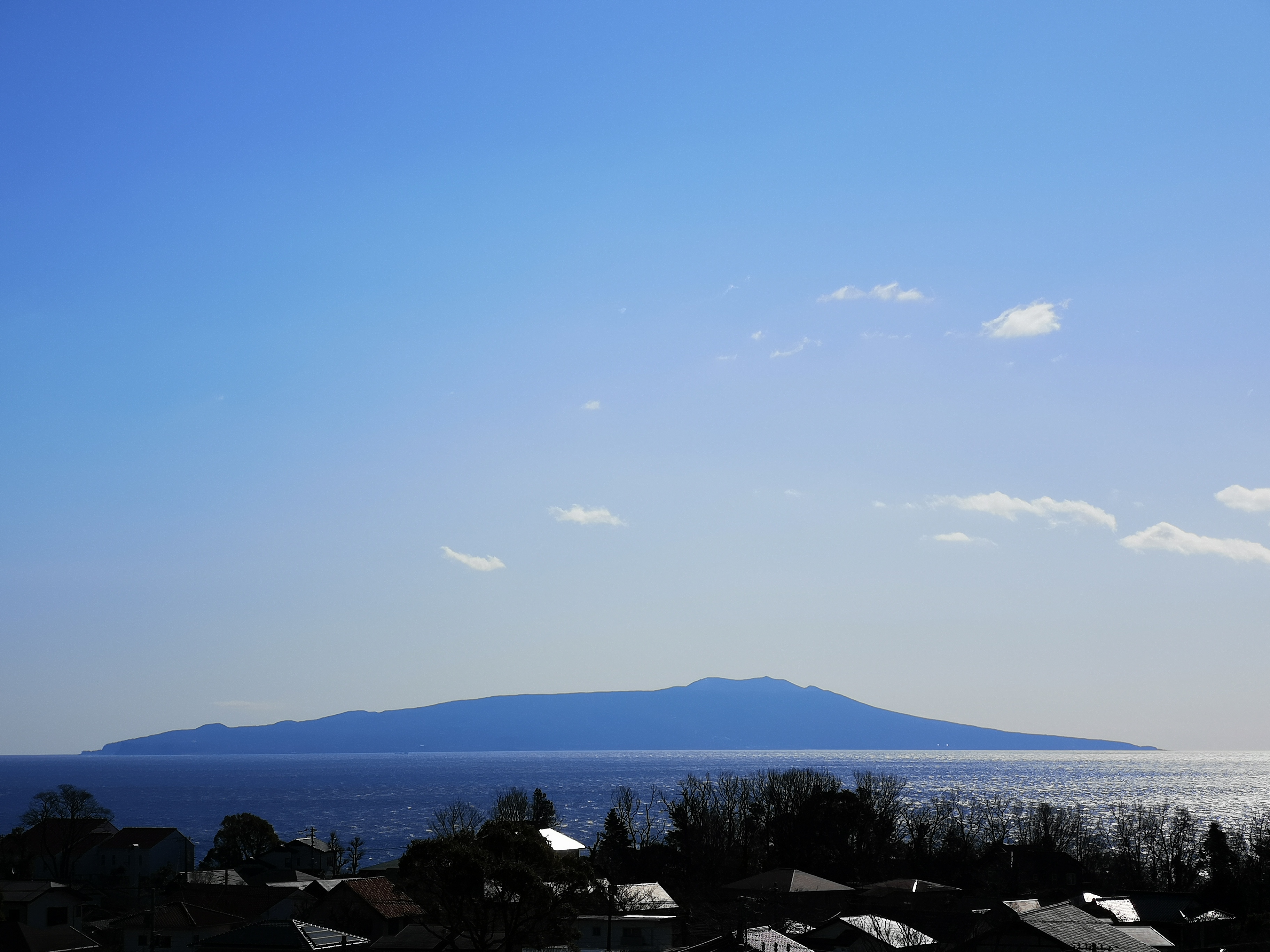
Oshima Island from Jogasaki-Kaigan station

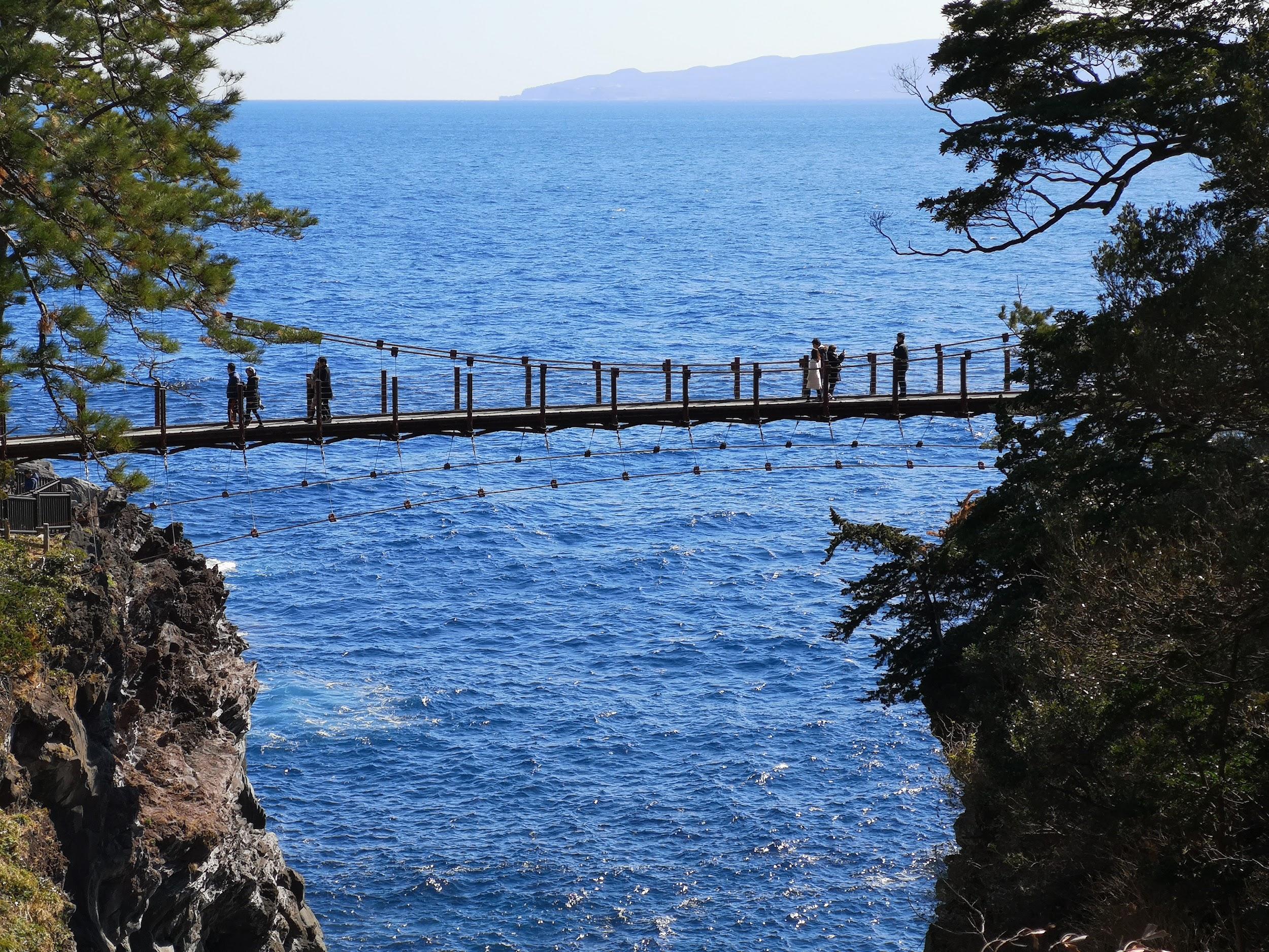
Kadowaki Suspension Bridge with Oshima island in the background

I walked 20 minutes to the Boranaya restaurant, which is right next to the start of the Northern end of the trail. Across the bay, I had good views of Futo Hot spring, the next stop after Jogasaki-Kaigan. In the far distance, I could make out the faint outline of the Boso peninsula. It took me less than 30 minutes to reach the wobbly Kadowaki Suspended Bridge 門脇つり橋 (48 meters long and 23 meters high). A little further was the Kadowaki Lighthouse 門脇埼灯台 (25 meters high). I climbed the narrow spiral staircase to the observation floor (17 meters high), but since it was indoors, I couldn’t get any good photos through the glass.

Spectacular rocks near the Kadowaki Suspension Bridge

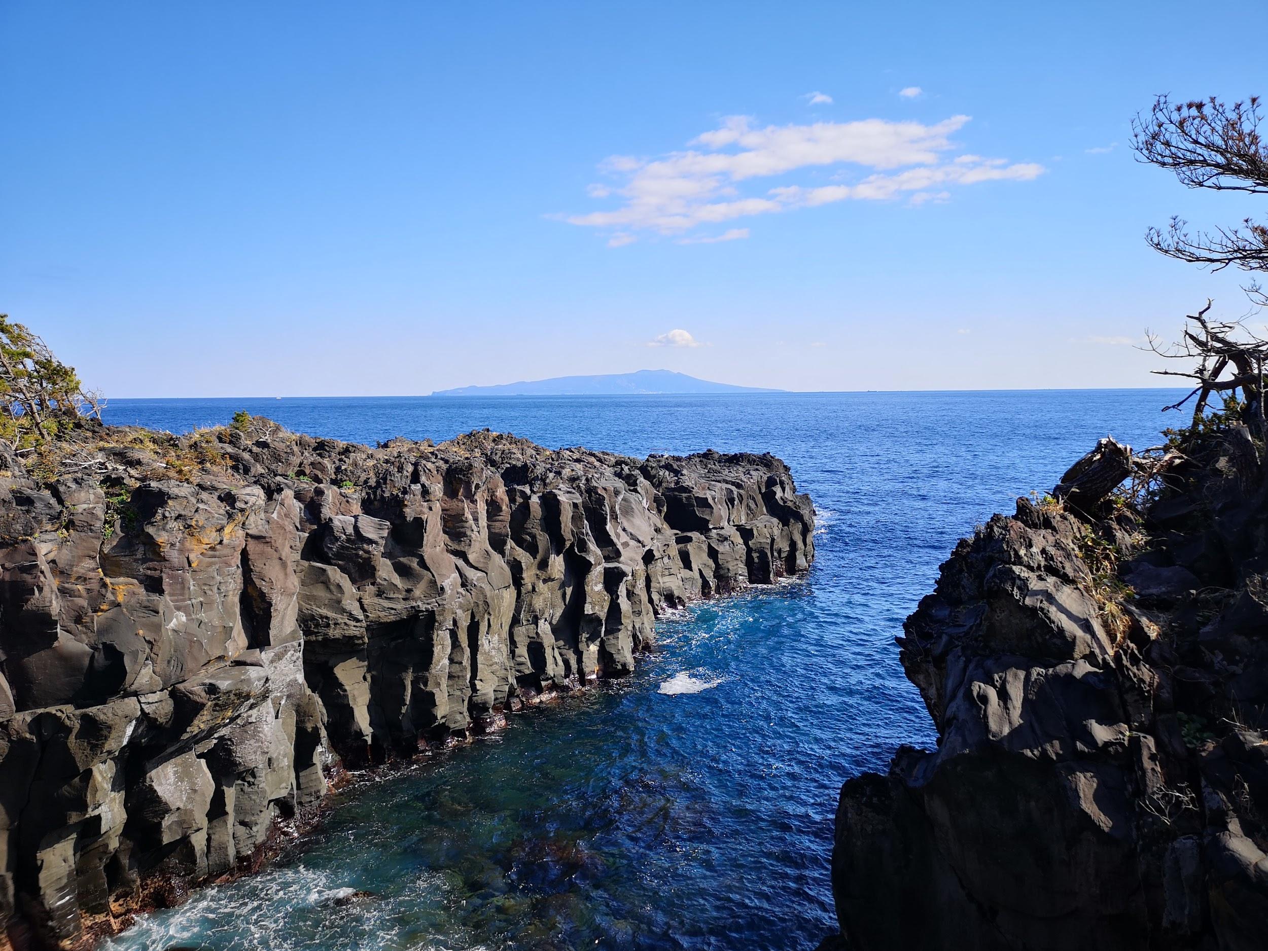
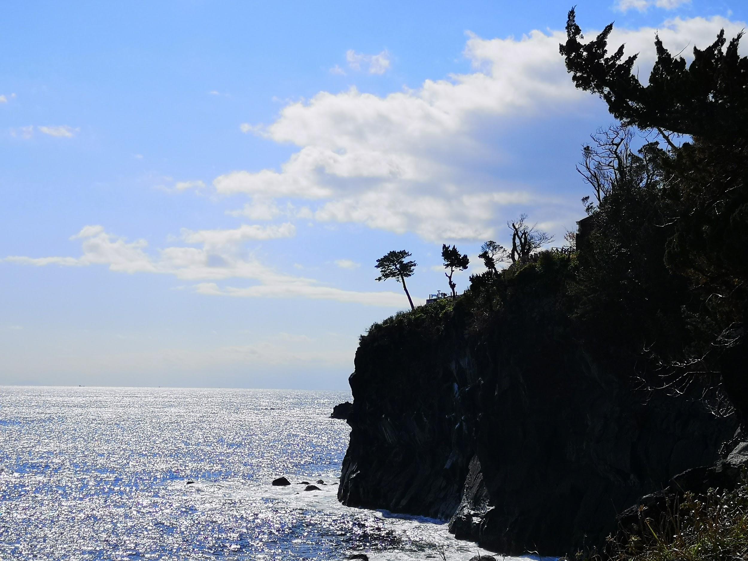
Grey cliffs and blue sea

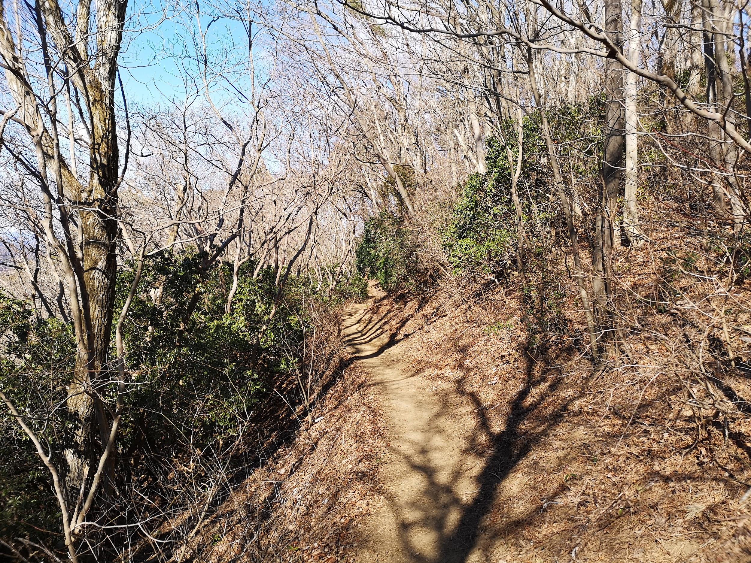
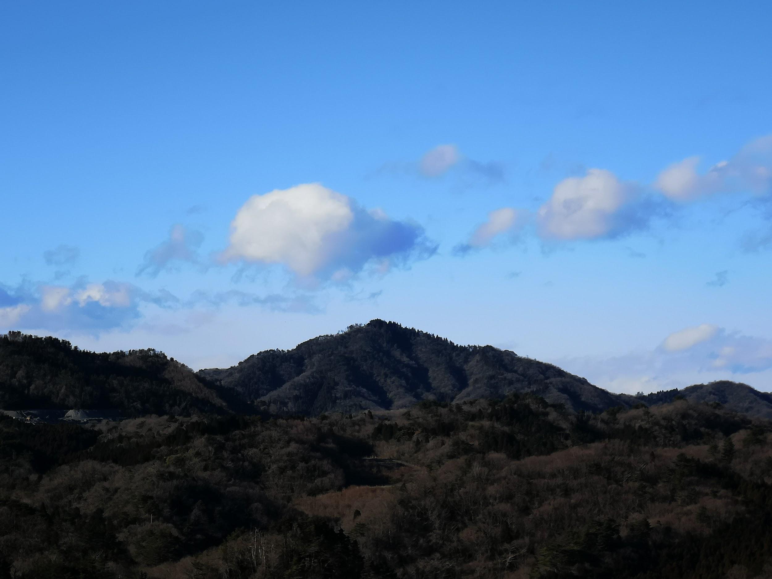
It was already past 11am, so I quickly started hiking South along the coastal trail, leaving the sightseers behind. It was a warm sunny winter day; to my left was the dark blue sea sending its foamy waves roaring and crashing onto the ragged coastline; to the left were the mountains of central Izu, under the shadow of thick grey clouds. There were few other hikers, and most of the time I had the trail to myself.

The sparkling sea in the morning

Dark clouds got the upperhand in the afternoon

According to my map, the trail should take about 4 hours. However, every rocky promontory had a small path, branching off the main trail, going to its very tip. Since it would have taken too much time to explore them all, I had to decide which ones would yield the best views, and which ones to skip. I had just started down one such small path, when I was rewarded with a glimpse of a squirrel scampering through the trees. Walking another one, I spotted a couple of adventurous rock climbers on a secluded cliff. There were other climbers in several spots along the way, and I was reminded that the Jogasaki Coast 城ヶ崎海岸 was a popular place for this activity. A lot of these paths went close to the edge of cliffs, so I had to be careful, since unlike the rock climbers, I had nothing to protect myself from a fall!

This squirrel posed for a few seconds so I could take its picture

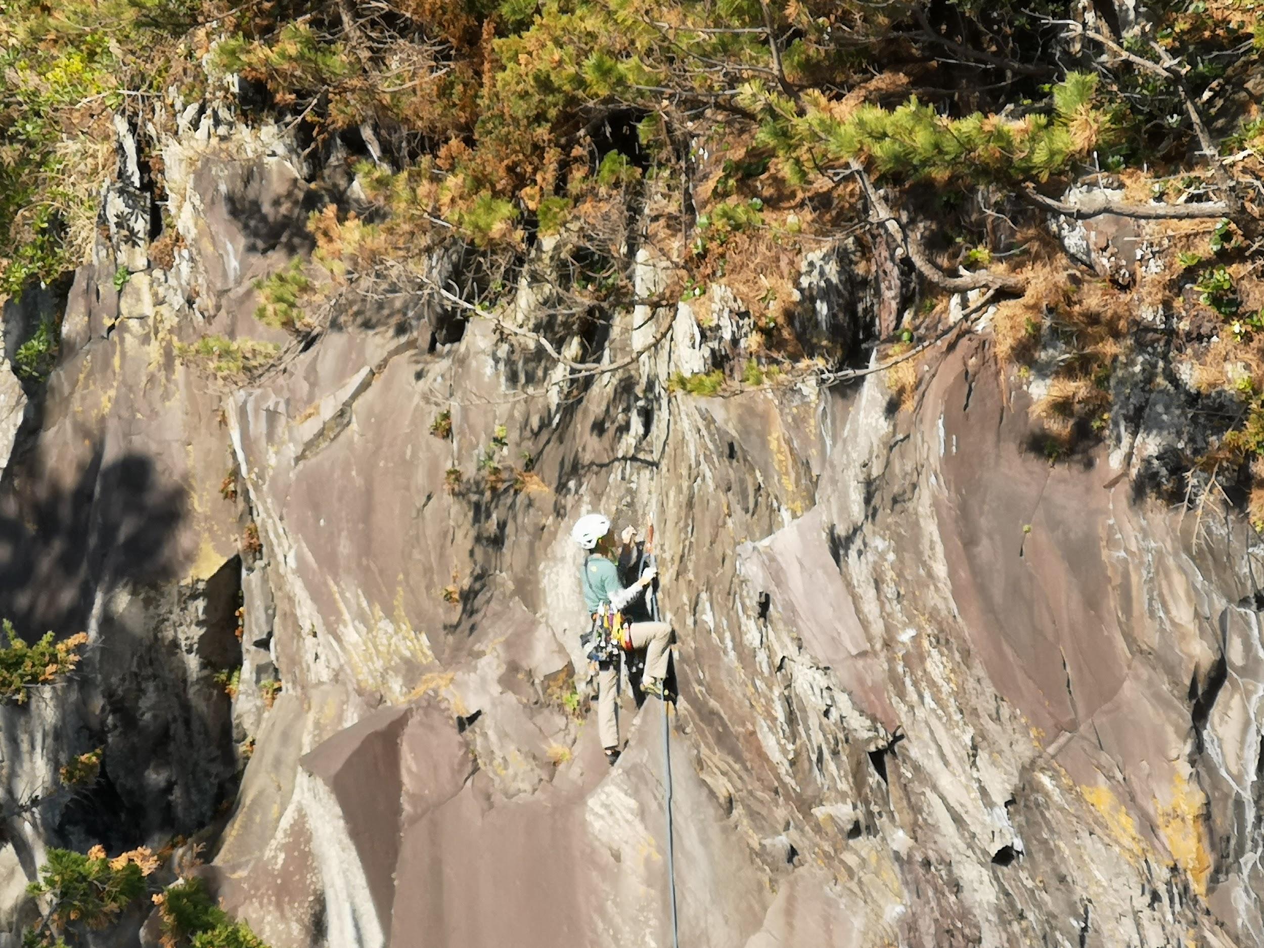
Climber nearing the top of the cliff

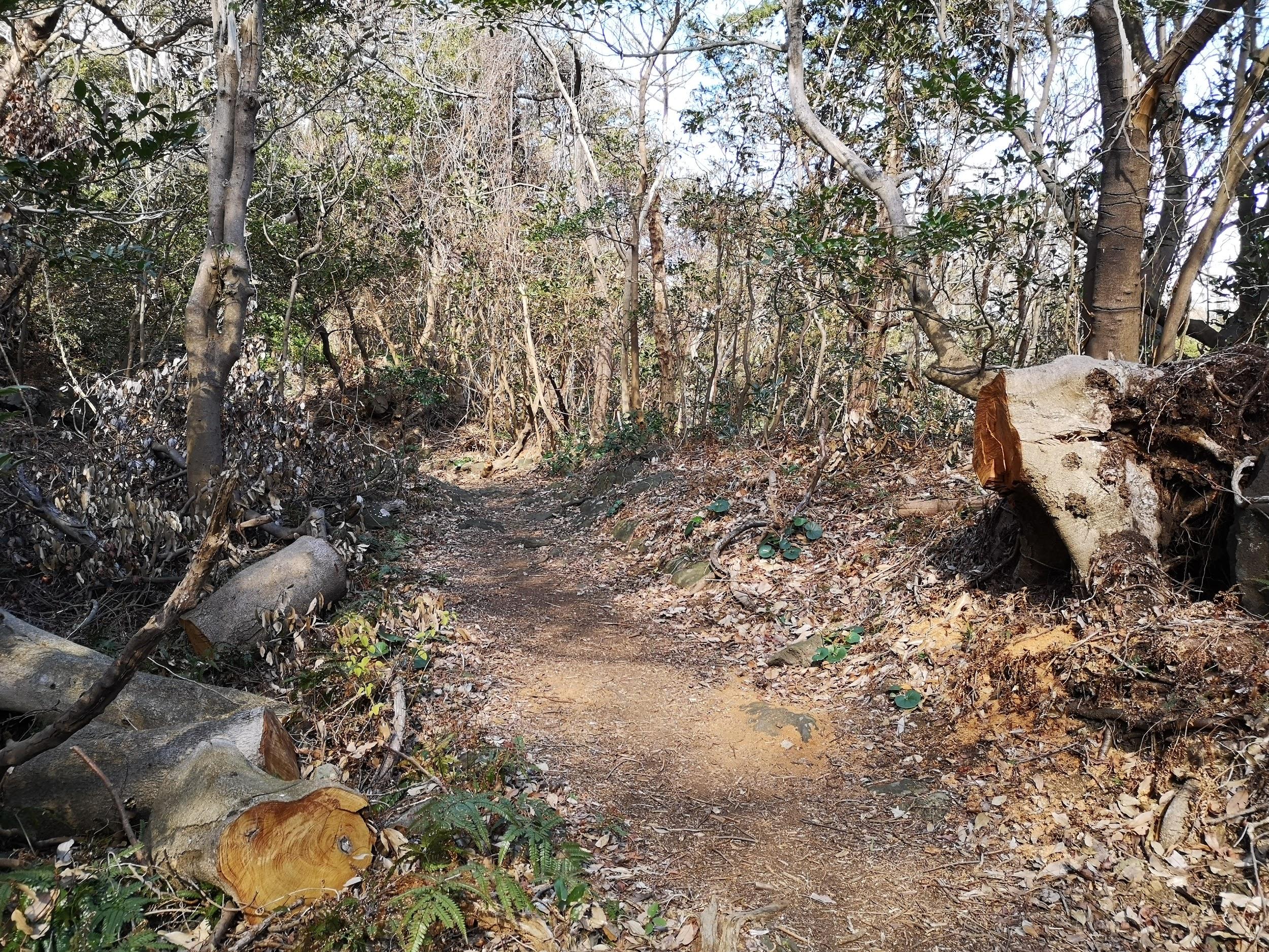
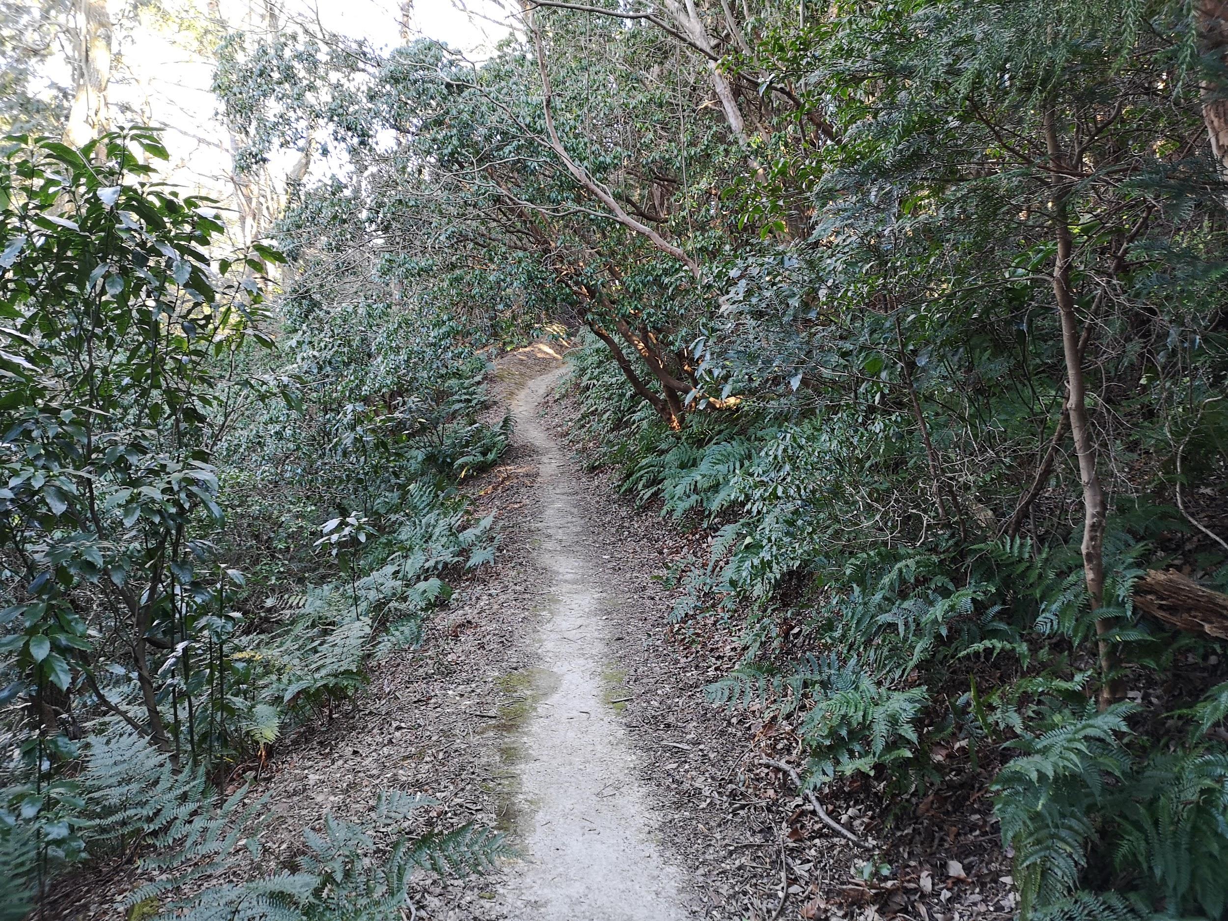
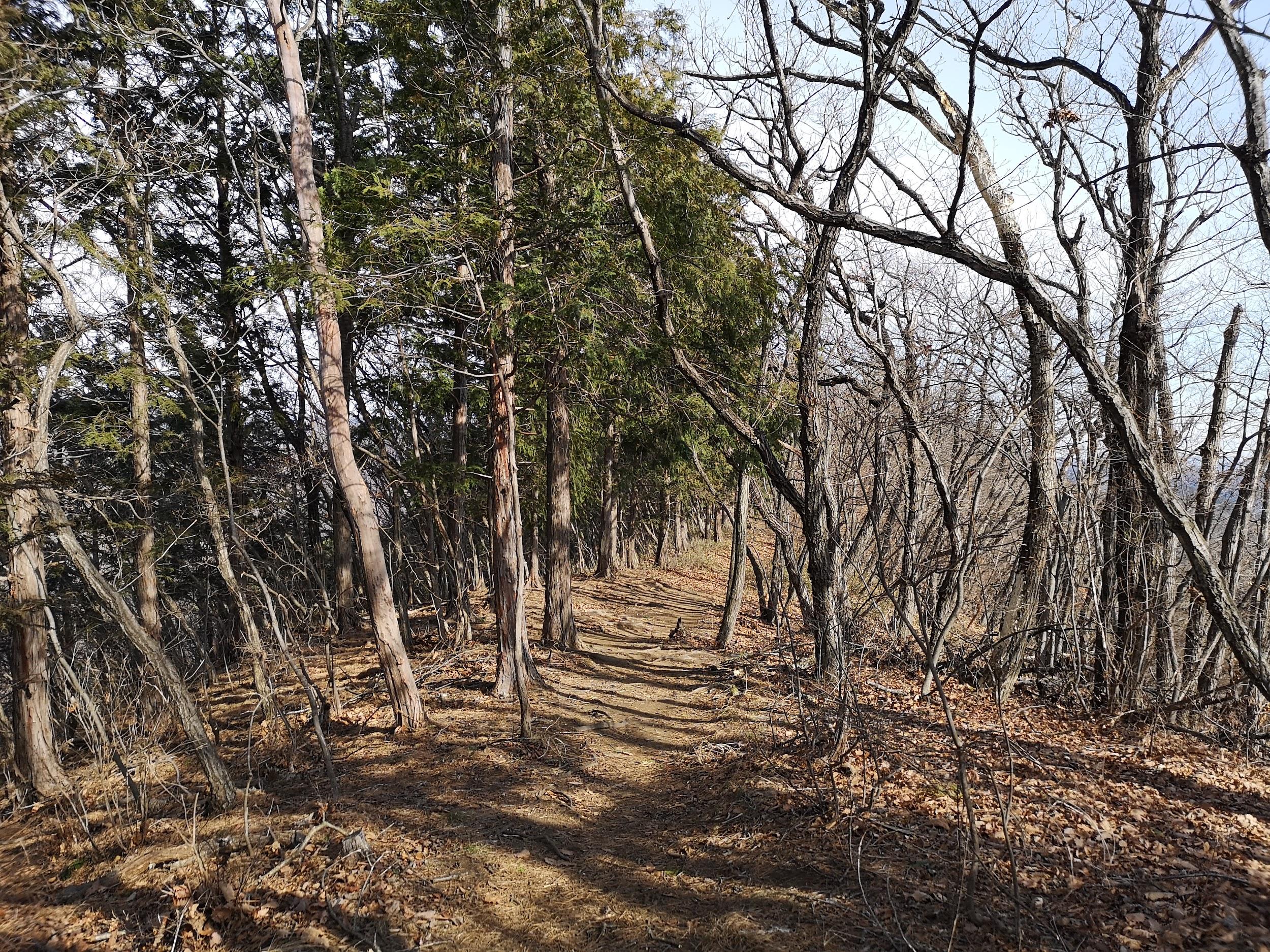
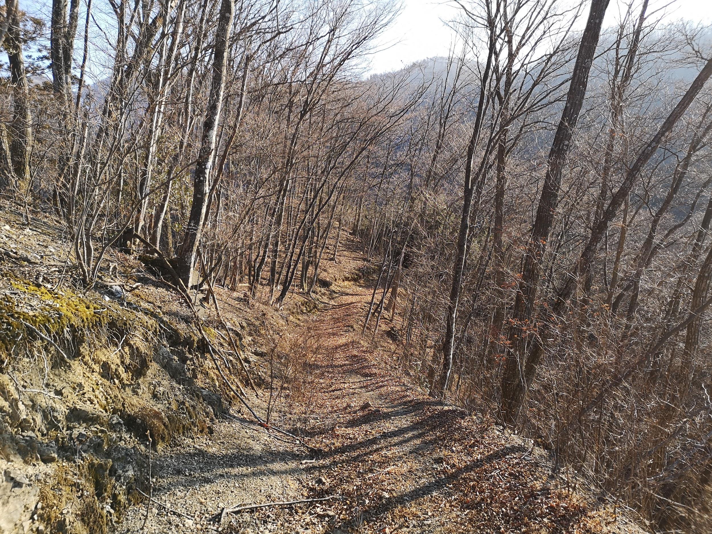
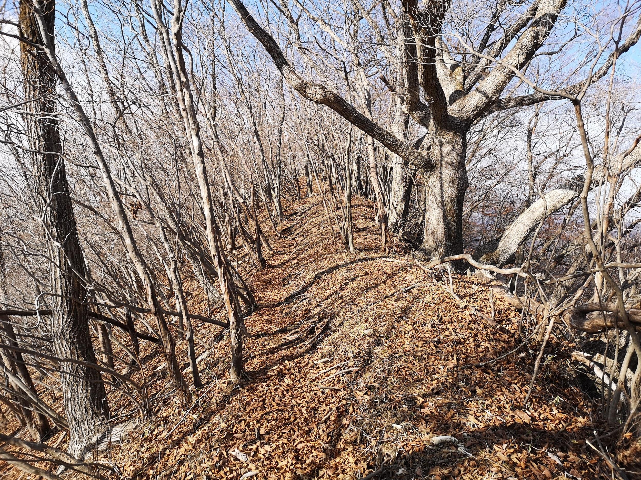
The trail was very well maintained. Fallen trees, no doubt from last year’s powerful typhoons, had been sawn through and removed from the path. There were frequent excellent Japanese / English signposts along the way, as well as information signboards on the various local sights, like the jagged Igaigaine いがいが根 rock formation. The main thing I learned was that the rugged coastline was created from lava flow when nearby Mt Omuro erupted long ago. When exploring the rocky terrain off the trail, I had to be careful not to trip and fall on the sharp lava rock!

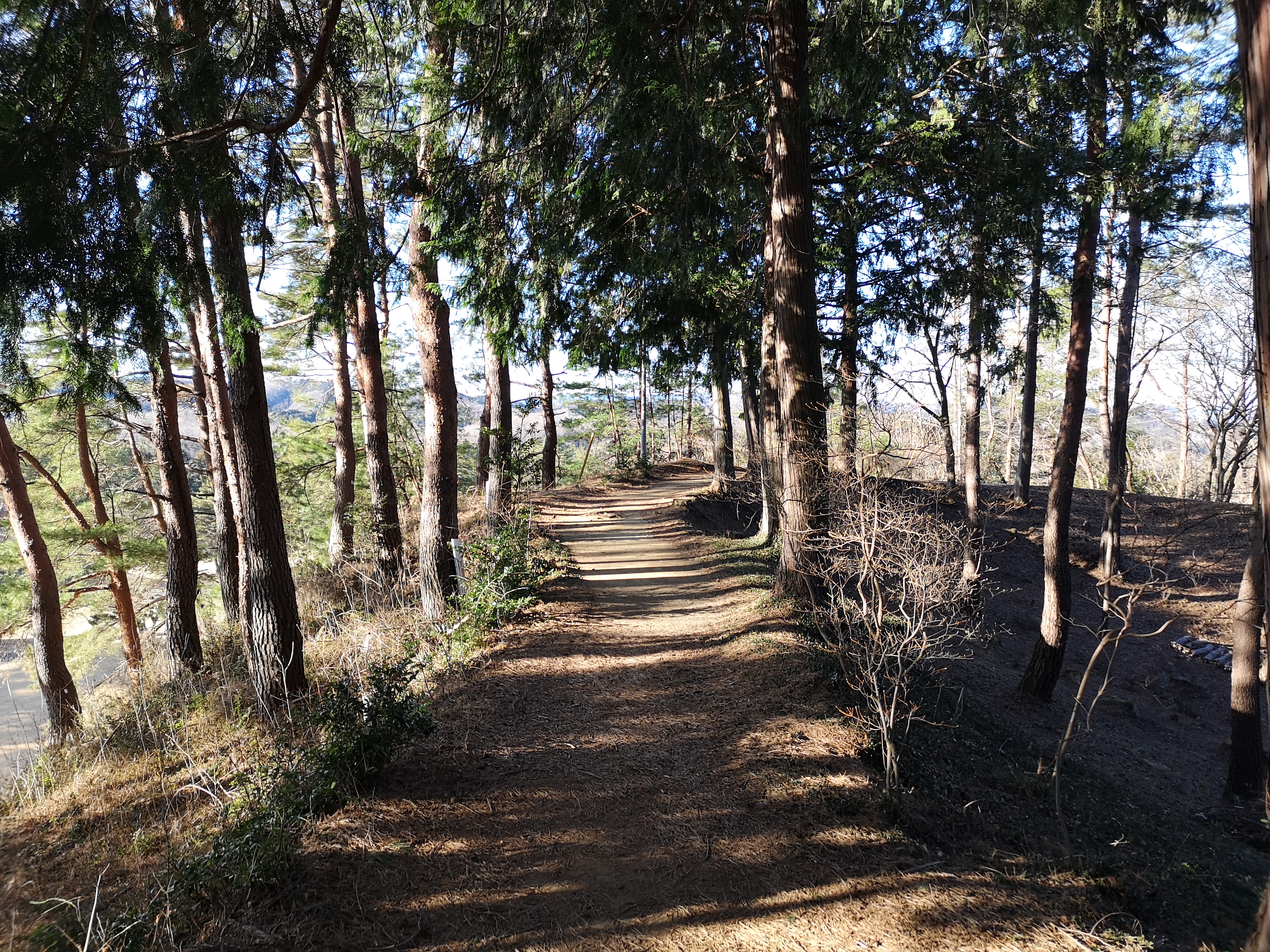
Most of the time, the trail was easy to walk

Fallen trees have been removed from the trail

Around noon I passed by Renchaku-ji temple, and was lucky to finally see some early blooming cherry trees. At 2h30, I reached the Tajima no Taki observation platform, from where I could see quite a unique sight: a waterfall over the sea. A little further away, I could see a rock bridge with waves washing through it from both sides, and meeting at the center with a thunderous crash (see video below).

Pink cherry blossoms with a background of blue sky

The rock bridge surrounded by frothy waves

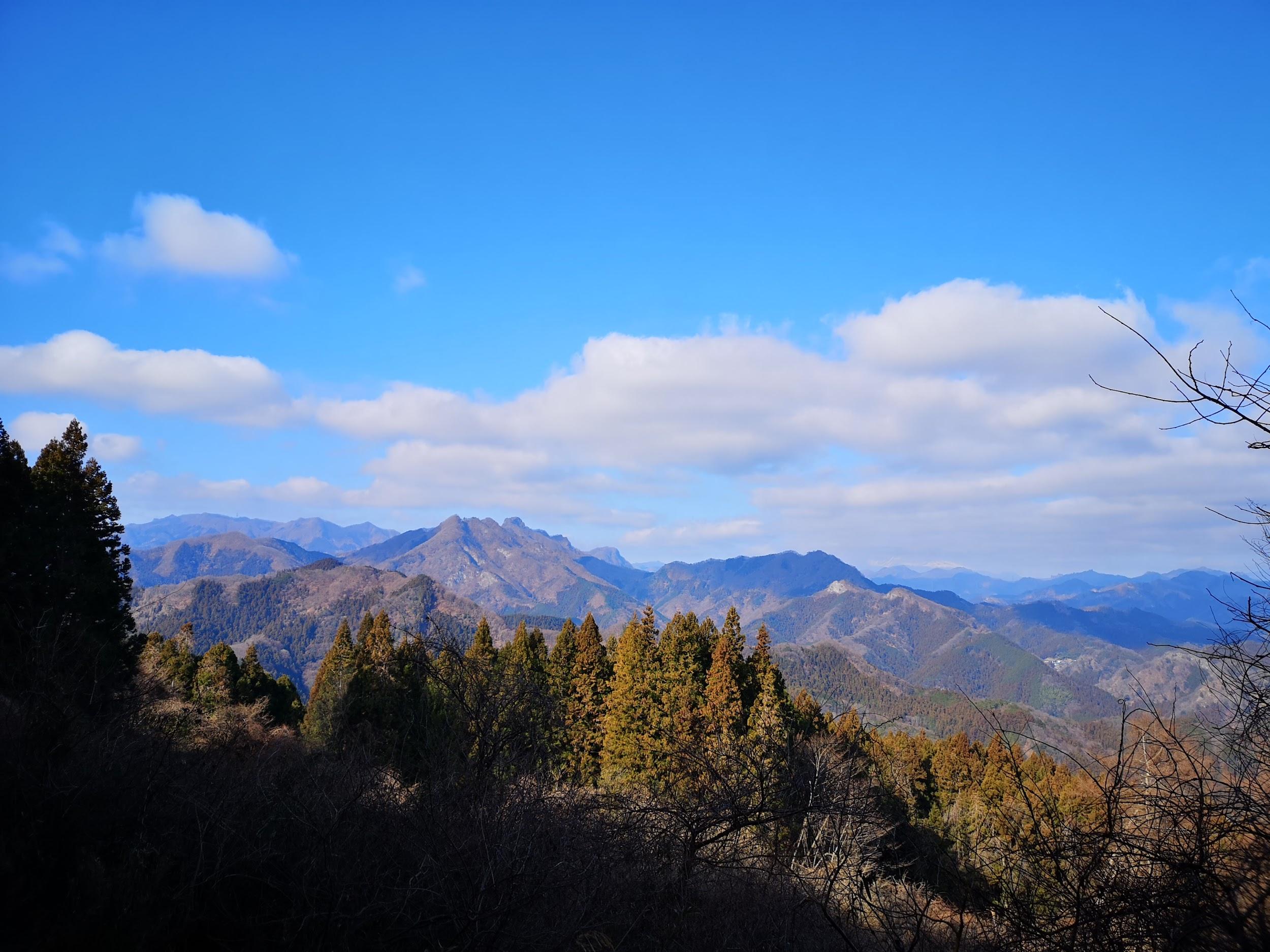
Along the trail there were many beautiful pine trees, possibly Japanese red pine. They were especially prominent along the second half, soaring high in the sky above. According to Wikipedia, they can grow up to 35 meters in height!

Many pine trees along the trail

Walking among the tall pine trees

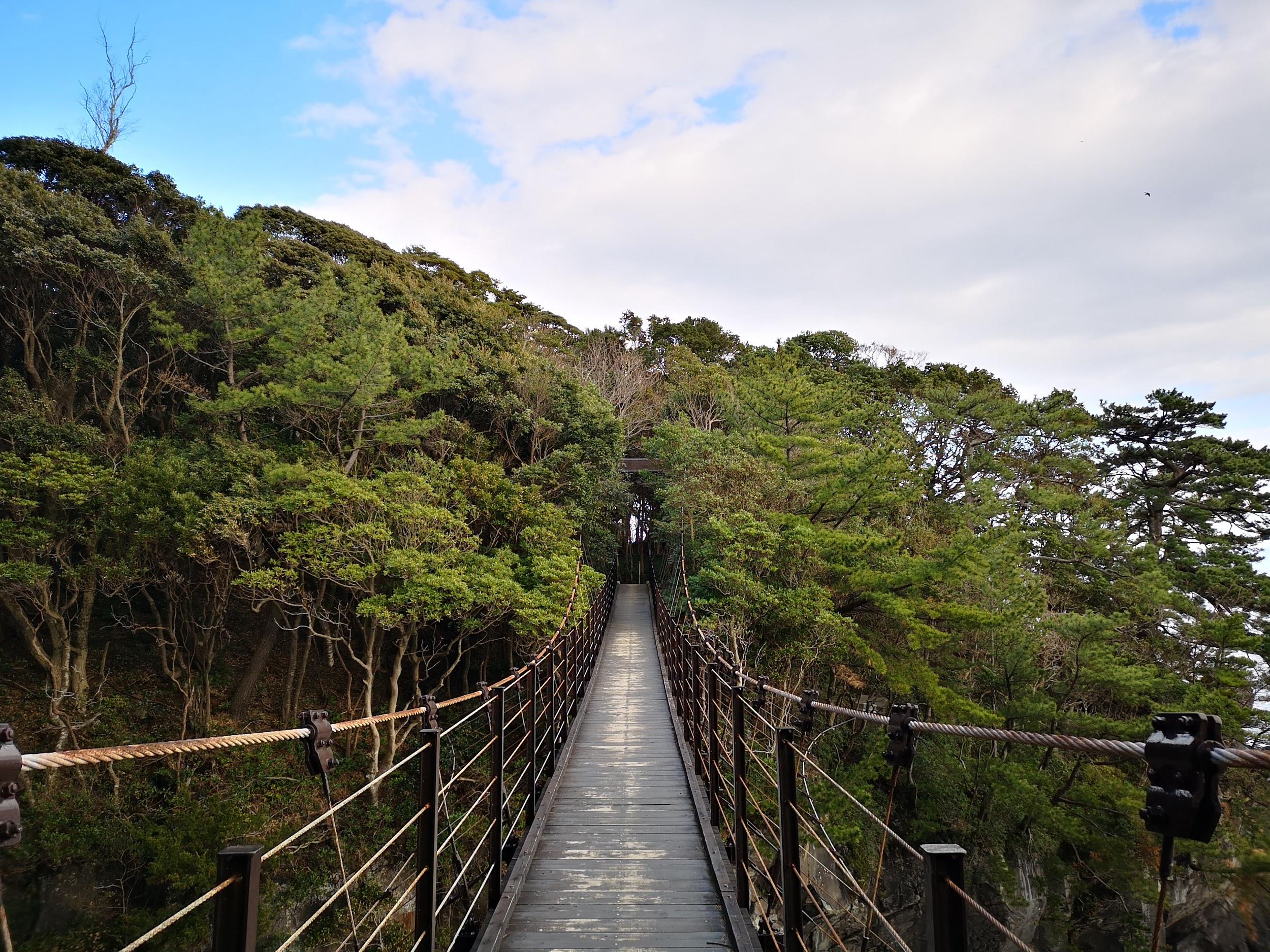
A few minutes later I reached the Hashidate Suspension bridge 橋立吊橋 (60 meters long and 18 meters high). The trail ends just a little further at a small fishing village. I retraced my steps to the river above the waterfall, and followed it to a parking area and Izu-Kogen station, less than thirty minutes away.

The Hashidate Suspension Bridge

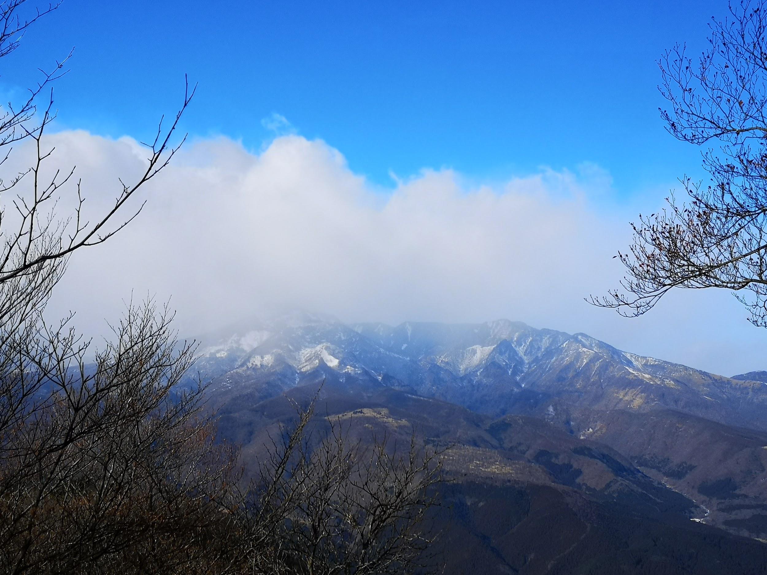
Mt Mihara on Oshima island, an active volcano that last erupted in 1986

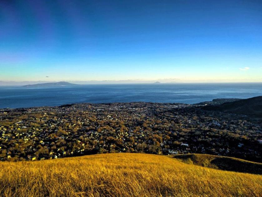
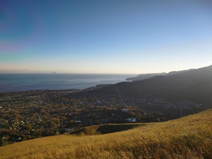
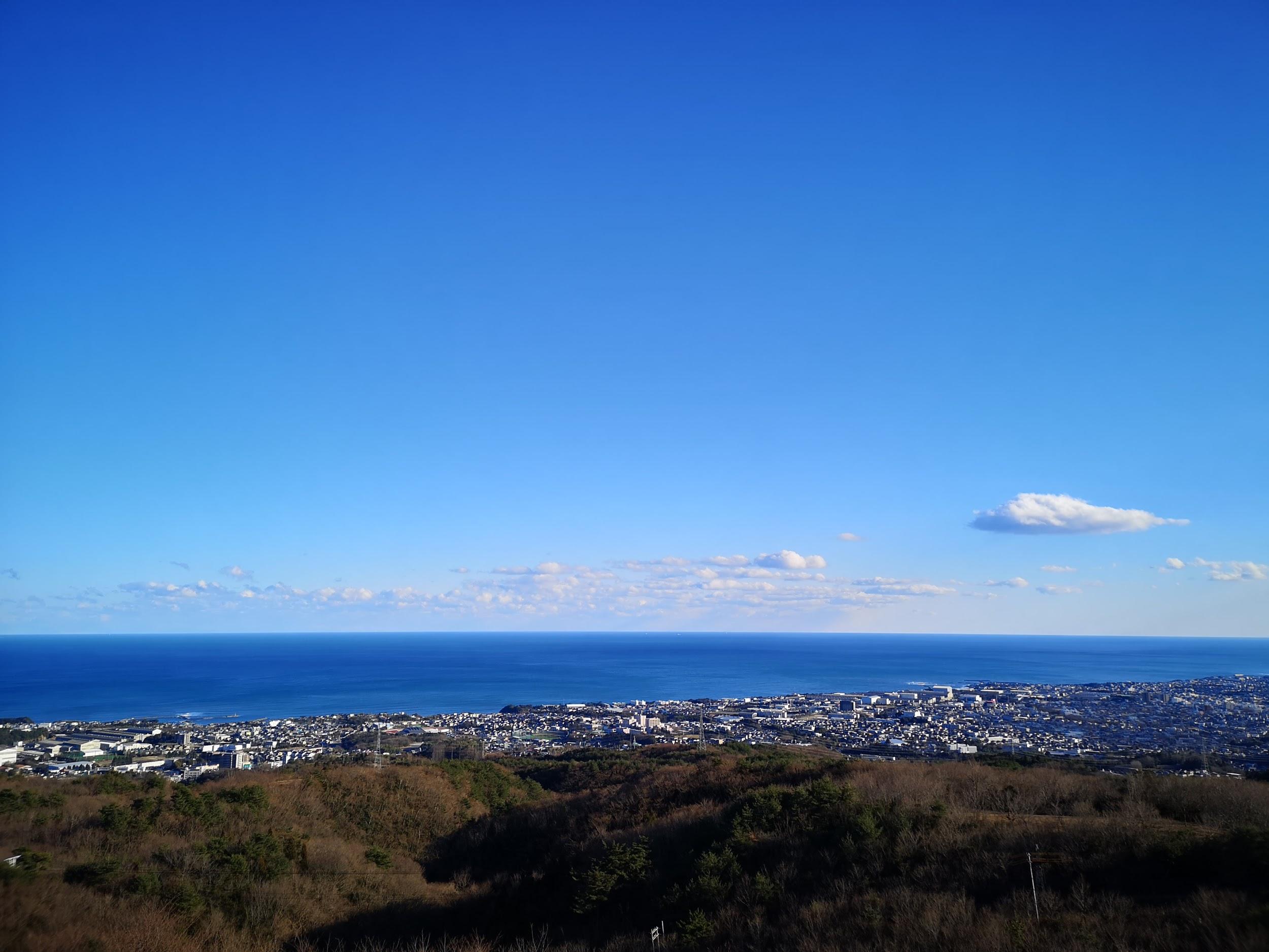
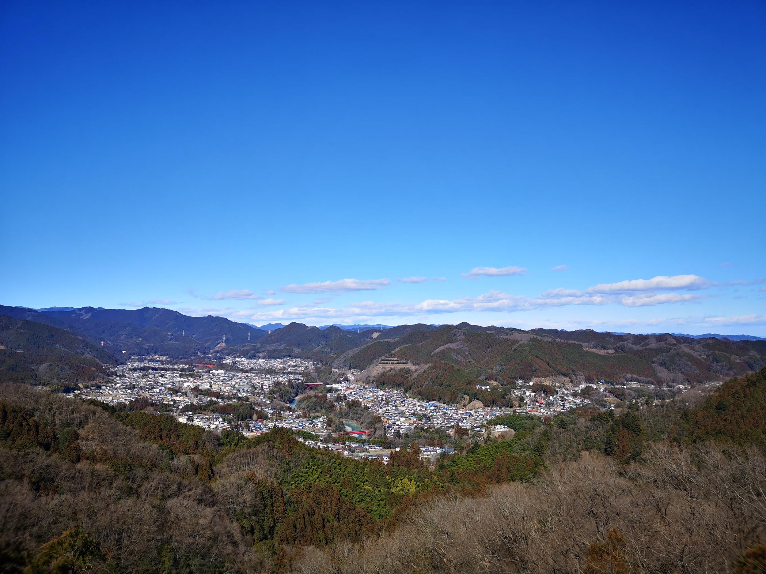
One constant throughout the hike was the view of Oshima Island directly opposite and only 20 km away. Some of the other Tokyo islands (Toshima and Ni-jima) were faintly visible further to the South. I could even make out the outline of Kozu-jima about 75 km away. As the day progressed, and the sun moved further west, the details of Mihara volcano on Oshima island became more clearly visible, and I was reminded of my trip there in 2018.

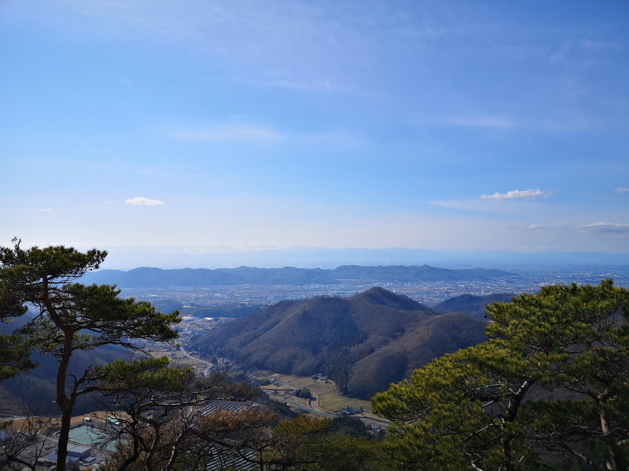
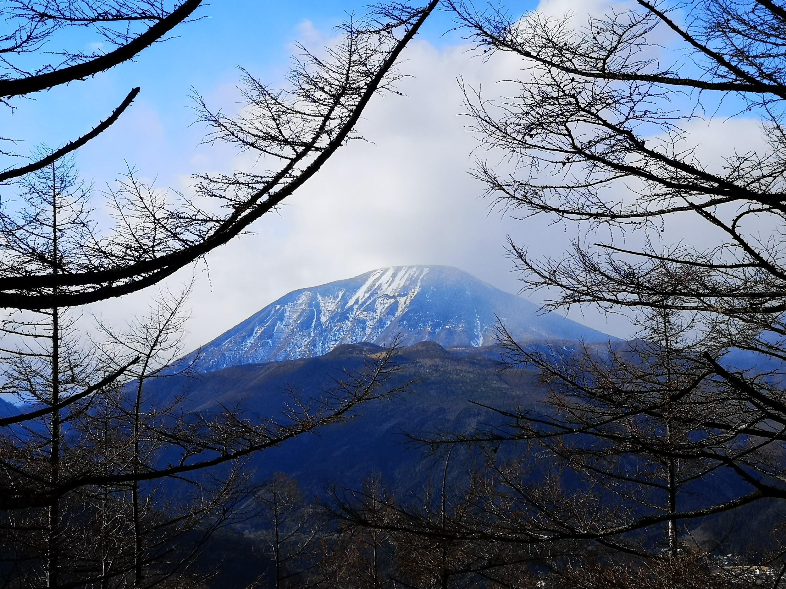
Mt Omuro (580m) Crater Walk

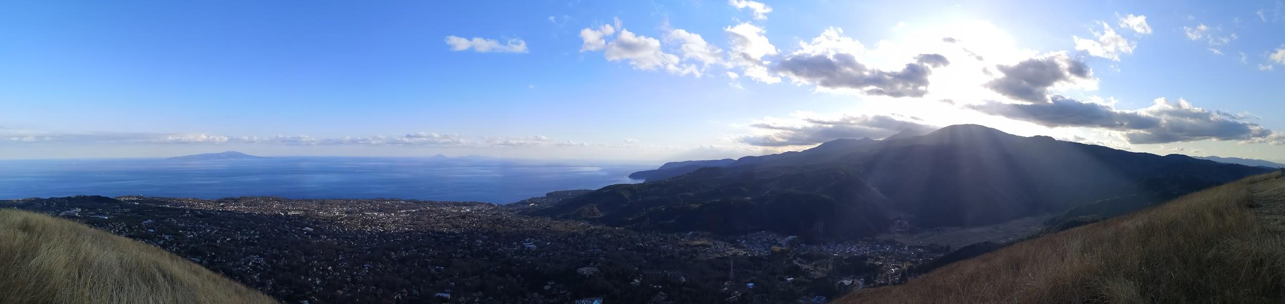
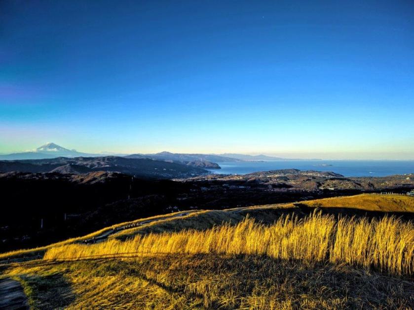
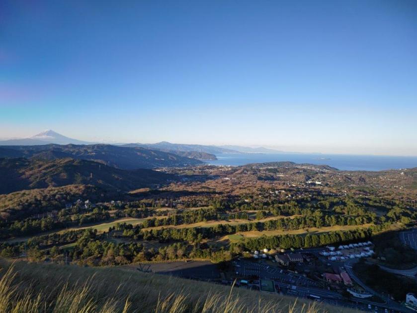
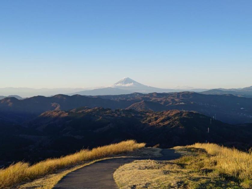
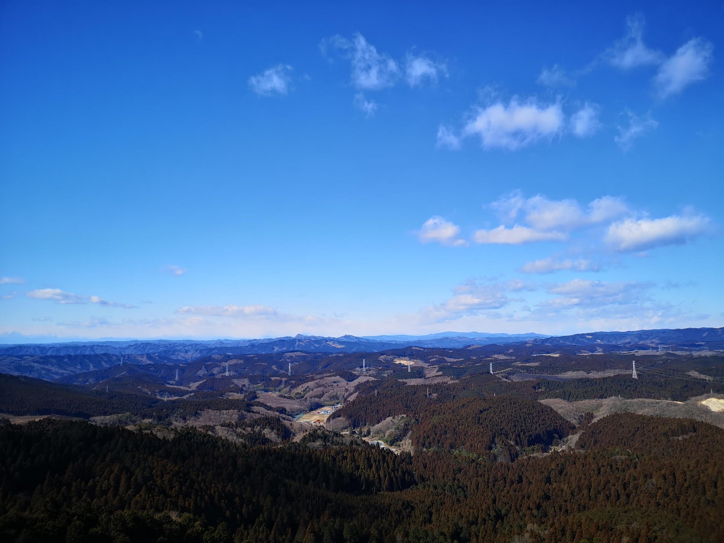
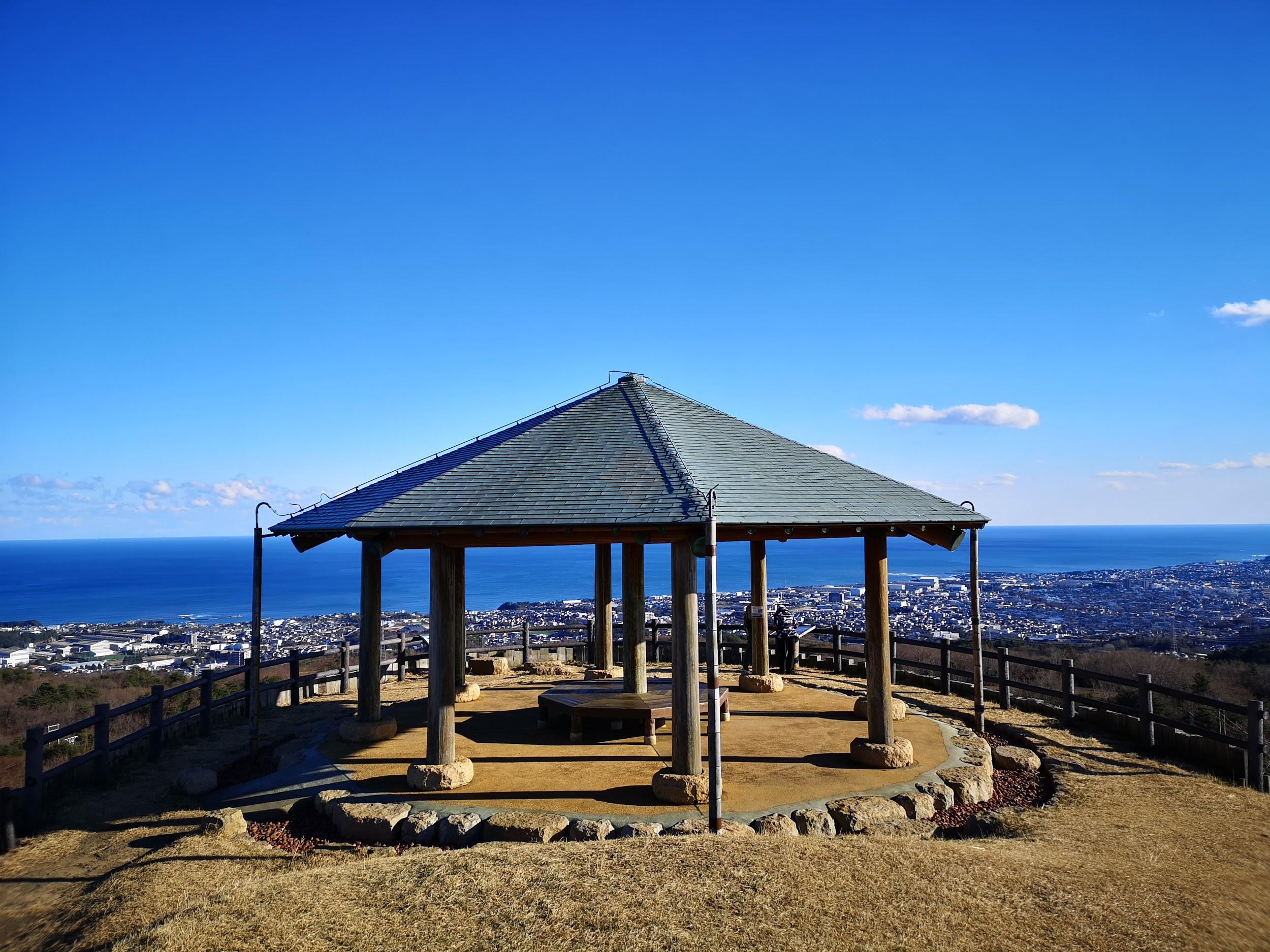
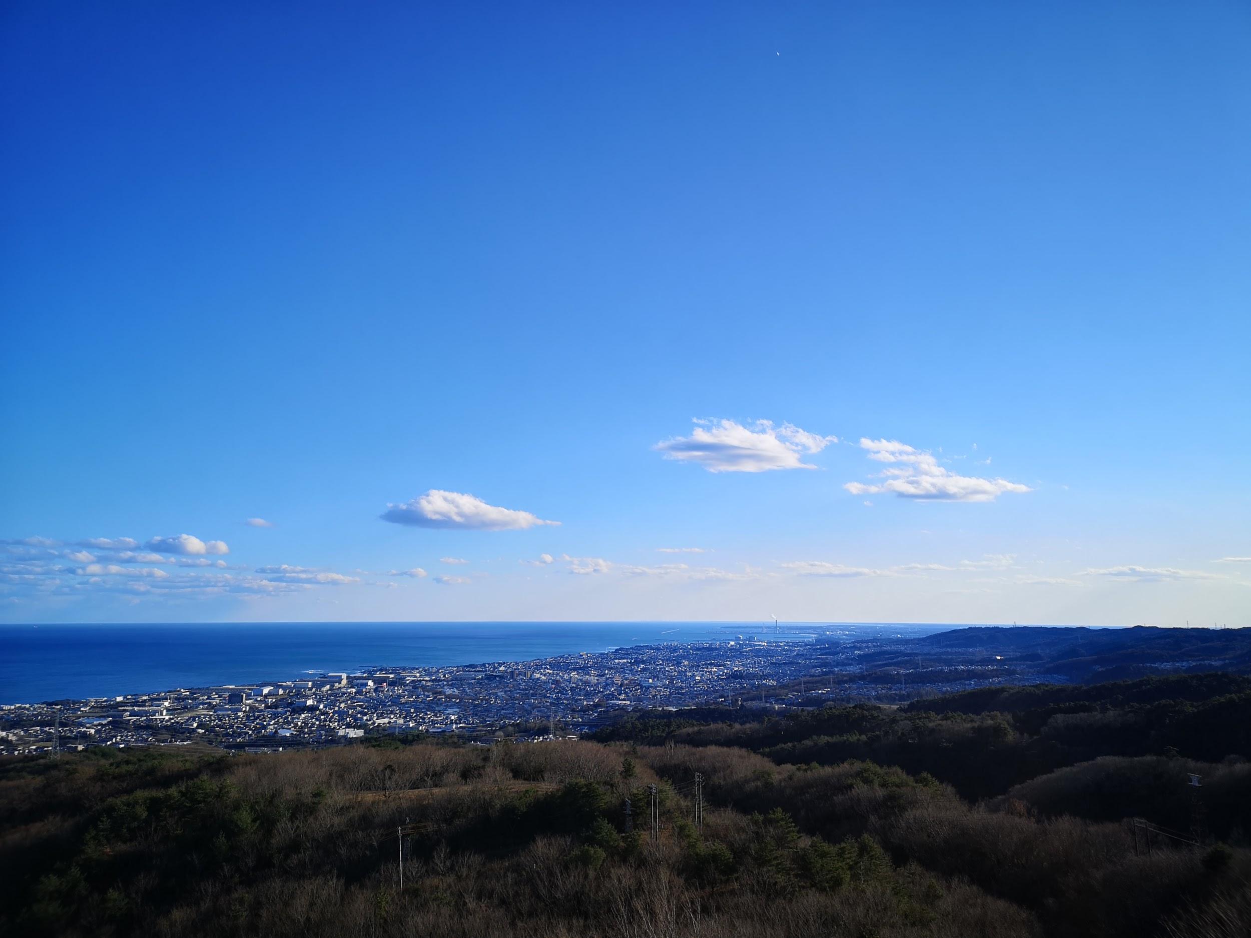
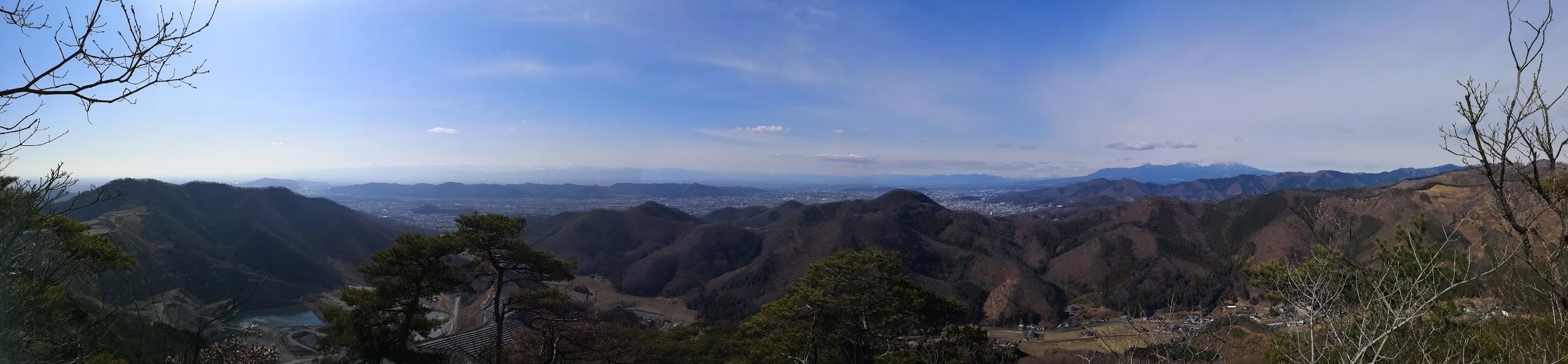
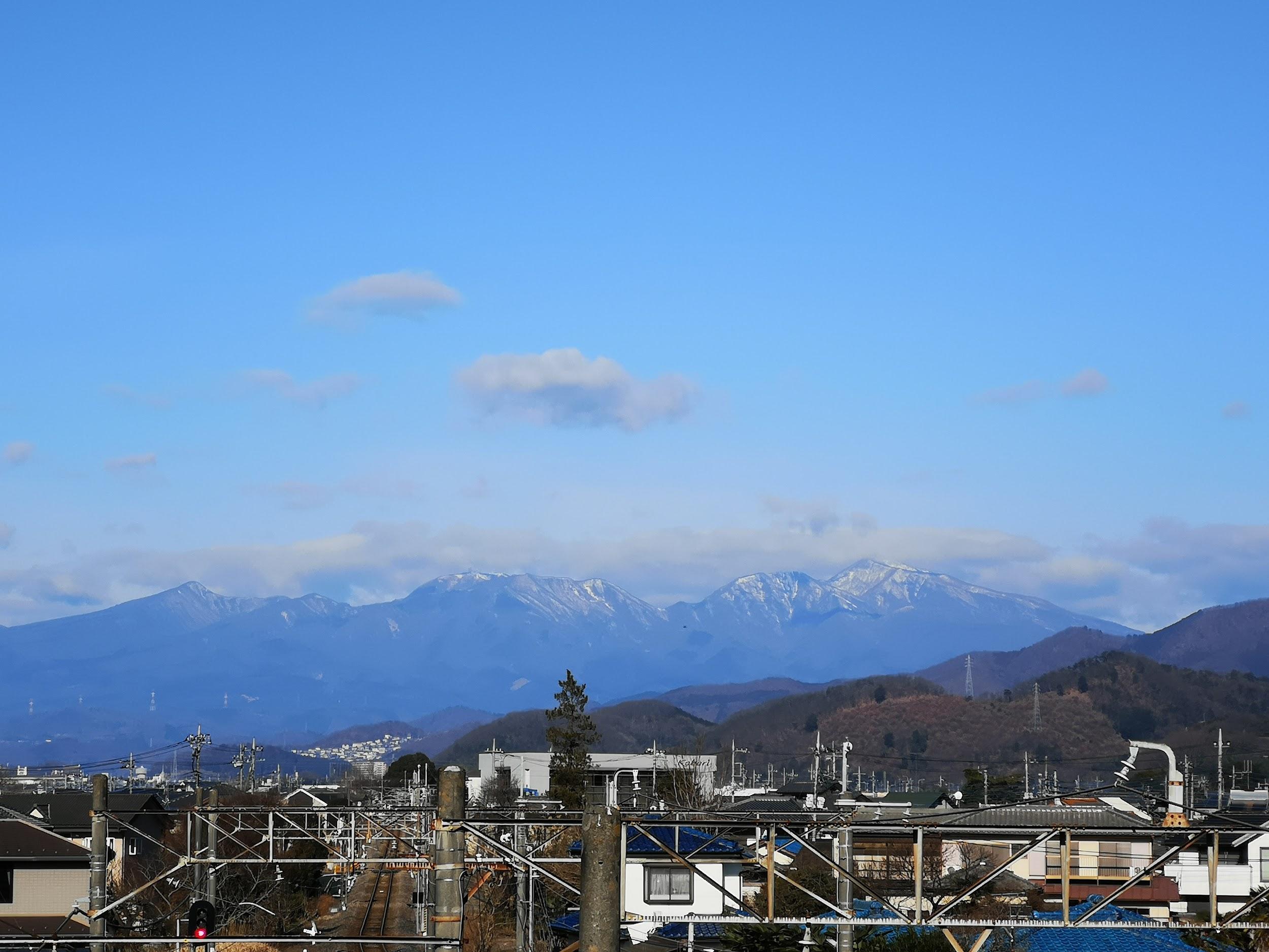
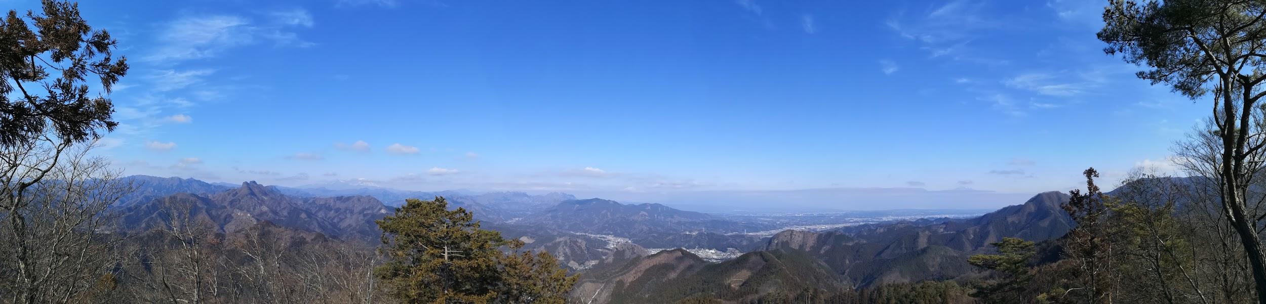
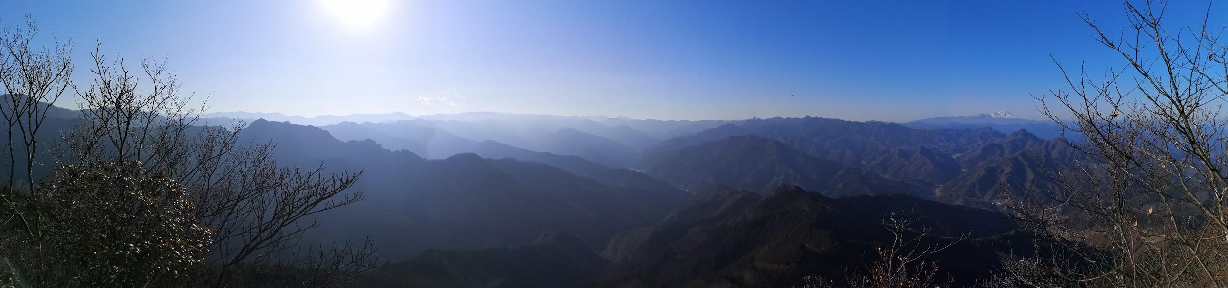
Before heading back to Tokyo, I decided to make a quick visit to Mt Omuro 大室山 (580m), a short bus ride from the station, and the reason the Jogasaki coast exists in the first place. It has a perfect conical shape and is visible from nearly everywhere on the Izu Plateau. Unfortunately, it isn’t possible to hike to the top. I rode the chairlift up and walked around the top crater in twenty minutes. There was a spectacular 360 degree panorama of the entire area. I could see Mt Fuji (60 km away), the Hakone mountains, the Tanzawa mountains, the Miura peninsula, Sagami and Tokyo B\bays, the whole Izu-Kogen, the Tokyo Islands and Mt Amagi.

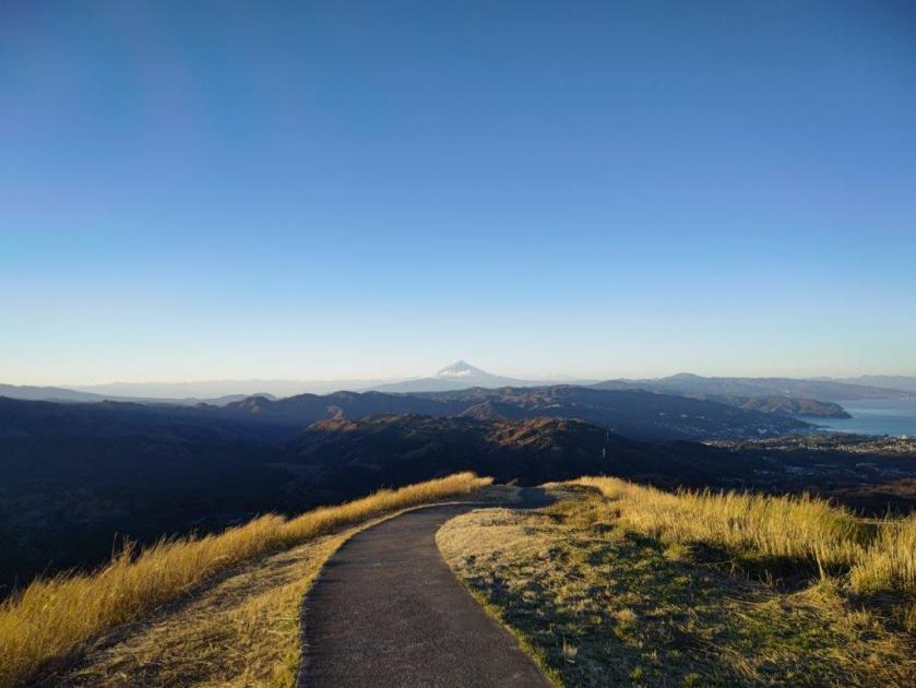
I made another visit to Mt Omuro in Dec 2022

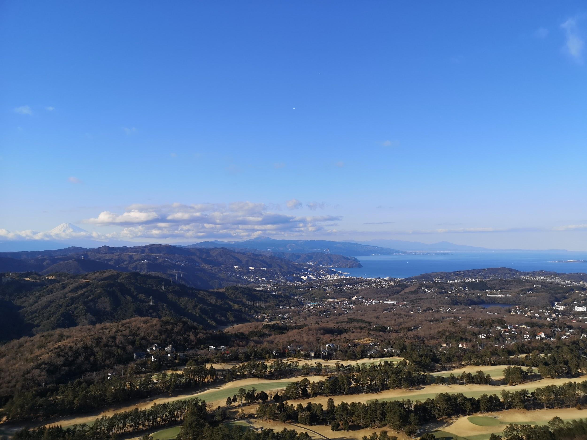
Mt Fuji, Hakone, Tanzawa

After taking the chairlift back down just before closing, and catching the last bus back, I stopped by Izukogen no Yu Onsen. After a relaxing hot spring bath, I hopped onto the Odoriko limited express headed for Tokyo.


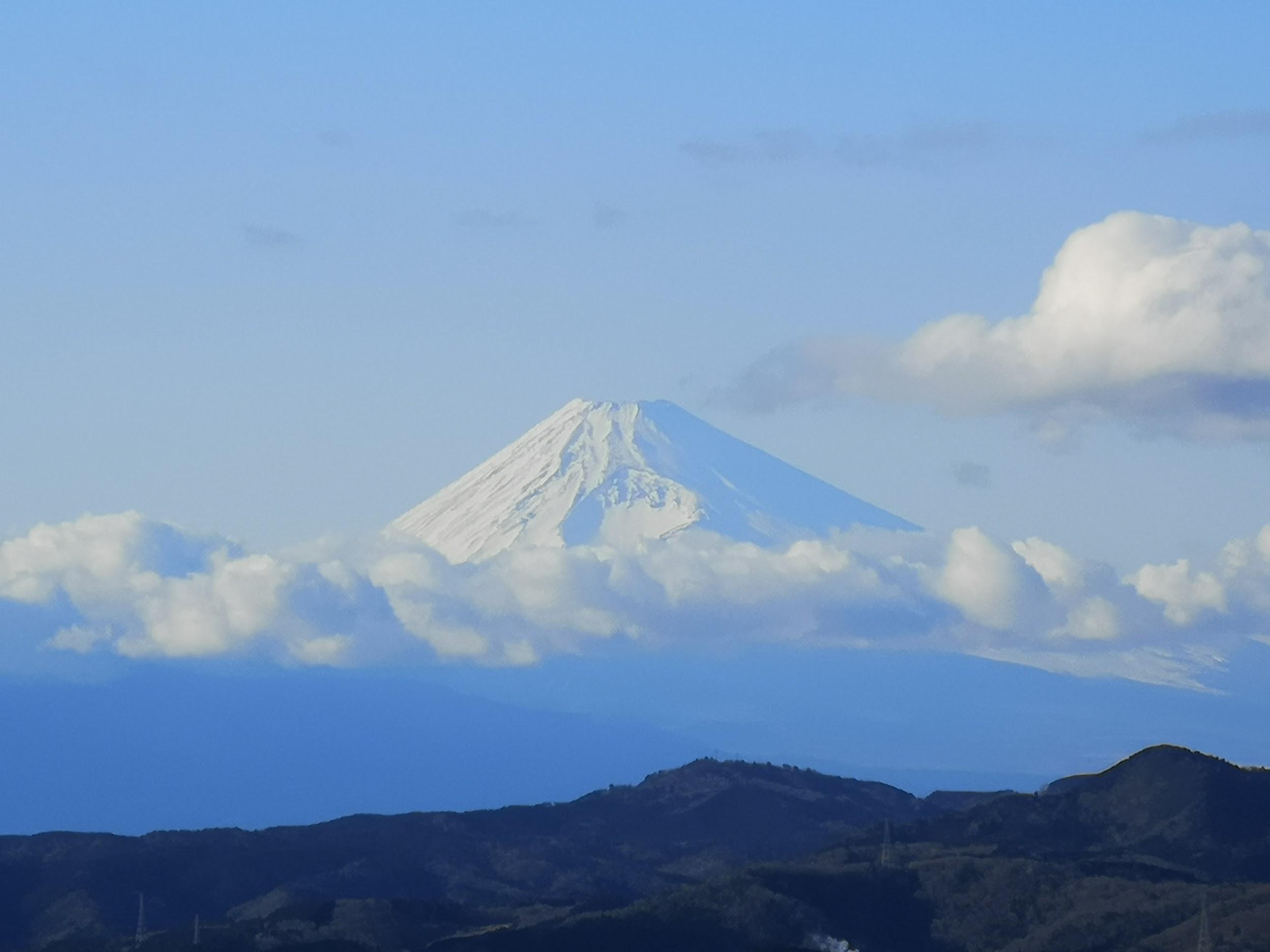
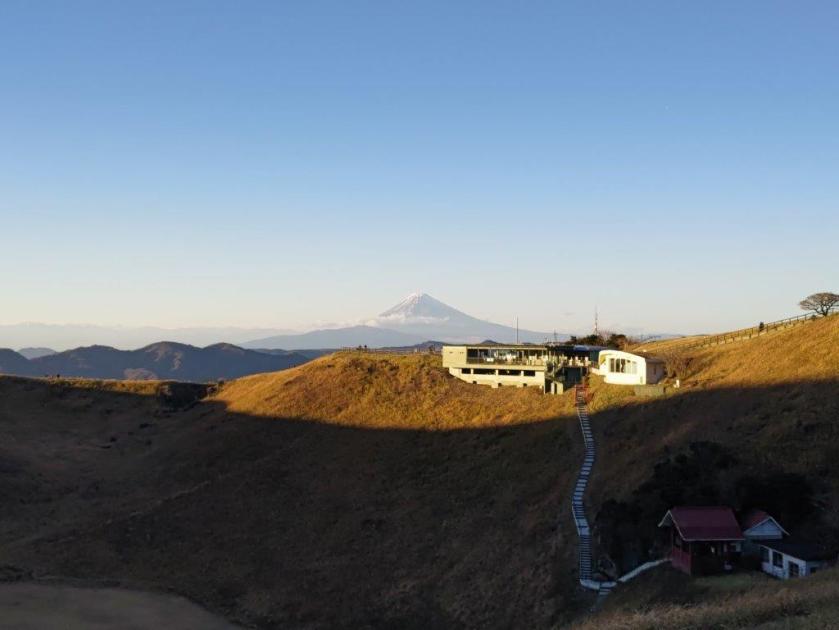
Mt Fuji, clear of clouds in the late afternoon

Watch the crashing waves along the Jogasaki Coast

See the views from the Mt Omuro crater (Dec 2022)

Below: slideshow of photos from the Mt Omuro crater walk (Dec 2022)

Mt Kamine (598m), Mt Oiwa (530m), Mt Takasuzu (632m), and Mt Sukegawa (328m), Hitachi City, Ibaraki Prefecture, Sunday, February 9, 2020

Hiking in the Hitachi Alps 日立アルプス

This was my first time hiking in the Hitachi Alps 日立アルプス, but traversing the entire range in one day seemed too long, so I decided to go up the West side, do a round trip to a peak on the North end, then head to another peak on the South end, and finally walk down the East side. This was a combination of two hikes from my Mountains of Ibaraki hiking book.

View of the Pacific Ocean near the end of the hike

Using the Tokyo Wide Pass, it took me less than 2 hours to reach Hitachi City from Ueno station. I was impressed by the view of the blue sparkling sea through the wide station windows, but I had to hurry since I only had a few minutes to catch the bus for Oiwa Shrine 御岩神社. It took about half an hour on a nearly empty bus to reach the shrine, known in the area as a power spot. I was fascinated by the many tall cedar trees within the shrine grounds, especially the group of three towering up to 50 meters near the entrance gate.  Apparently it’s one of the one hundred forests of giant trees in Japan. I definitely felt like I was inside some enchanted world!

IMG_20200209_094619

Walking among the tall cedar trees inside Oiwa shrine

I found the entrance to the hiking trail behind the main shrine building. For once, I wasn’t hiking alone, since most visitors to the shrine continue up to the mountain directly above. The straightest route to the summit was closed due to typhoon damage (predating 2019), but the detour path is clearly indicated. I reached the top ridge before 10h30, and turned left along a mostly level path. There were a couple of ups and downs, but each can be avoided by taking an alternate path on the right (something I confirmed on the return). I reached the top of Mt Kamine 神峰山 just after 11pm. The view of the coast stretching Southwards and the Pacific Ocean was stunning.

View of the sea from the top of Mt Kamine

I enjoyed a late breakfast sitting on the ground under a tree, since the bench was taken by another hiker. It’s possible to continue beyond Mt Kamine, and back down to Ogitsu station (one stop from Hitachi station), but today I retraced my steps to where I had reached the top of the ridge one hour earlier. I continued up a short rocky path to Mt Oiwa 御岩山. It wasn’t the highest point of the ridge, and it didn’t feel like a mountain top, but there was a wide view to the West of the forested hills of Ibaraki, including Mt Nantai and Mt Yamizo, as well as the snowy mountains of Tochigi in the distance, so who am I to complain?

Panoramic view from Mt Oiwa

Unsurprisingly, there were quite a few people, and there was even an interesting sign forbidding people to eat rice balls (see below), so after checking out the views, I moved on quickly since it was nearly 1pm. There were multiple paths, but they all joined up eventually. The next part was easy to walk, and quite peaceful as there were few hikers.

Pleasant winter hiking after Mt Oiwa

I soon reached the top of Mt Takasuzu 高鈴山, the highest point of the hike. There was a sixty meter high white tower for measuring rainfall on the Eastern side (no view), and a wooden observation platform on the West side, with similar views as before, plus Mt Kamine to the North.

Observation platform at the top of Mt Takasuzu

I had my lunch, and set off again at 1h30. The path continued Southwards, but I backtracked a few minutes till a road signposted for the ruins of Sukegawa castle 助川城跡 which I had crossed a little earlier. After a few turns, it joined up with a hiking path on the right. This section was very enjoyable. I saw no one while I made my way down the mountain, and it felt like a secret path. I sometimes wondered if I was on the right trail, and was relieved everytime I spotted a signpost!

Hiking down from Mt Takasuzu along a narrow path

I reached Omusubi pond おむすび池 before 3pm. It was part of a wide park, nearly completely deserted in the middle of winter. Fifteen minutes later I reached the top of Mt Sukegawa 助川山 with a superb 360 degree view.

Arbour and lookout point at the top of Mt Sukegawa

I could see the entire range of the Hitachi Alps, Iwaki to the North, Chosi to the South, and the Pacific Ocean. It was hard to believe that San Francisco lay 8000 km straight ahead with nothing in between but the ocean.

In clear weather, one can see all the way to Choshi

It was windy and cold, and already past 3h30, so I took off again for the last part of the hike. At the edge of the park the signposting was a little confusing, but thanks to Google Maps, I managed to find my way to the ruins of Sukegawa castle, and the edge of Hitachi city. There I caught a bus back to the station, and the comfortable limited express train back to Ueno and Tokyo.

Looking back at Mt Kamine

IMG_20200209_122452

NEXT UP: Jogasaki in Coast Shizuoka

Skiing in Nagano: Madarao Kogen (900m-1300m) Part II

Looking up at Madarao mountain

View of Mt Myoko from the Tangram area

I was lucky to be able to do another daytrip to Madarao Kogen, this time with sunny blue skies and colder temperatures, suitable for skiing. It had snowed the previous night, and all the trees were covered in a thin layer of snow, giving the entire resort a fairy world quality. The weather only turned cloudy later in the afternoon, making it easier to stop skiing in time.

Directly opposite is Nozawa Onsen

A small resort with steep slopes

This time, I ventured to the very top of the resort. I rode what was possibly the smallest chairlift I had ever taken (see video), to the spot where I had eaten lunch on my last year’s hike. I had an amazing view of Mt Myoko, as well as the southern part of Niigata prefecture stretching all the way to the Japan sea. Heading down, I followed a fun red slope, called “Ocean View”, that zigzagged through the forest.

Nearing the top of Madarao ski resort

In the distance, the sea of Japan

I had a late lunch and decided to have pizza again at Aki’s Pub & Cafe’s. This time, I could sit outside in the afternoon sun. The pizza was as good as I had remembered; I especially enjoyed the chewy, tasty dough. Since I had another hour of skiing, I ordered a tall black coffee to help speed up my digestion (or help me forget about it).

Aki’s Pub & Cafe, the best pizza in Madarao

Enjoying pizza outside is the best

The most remarkable part of the day were the views, missed on my previous ski trip. Although I also had good views on my hike, the winter air is a lot clearer and crisper than in the autumn. Since Mt Madarao is a minor peak sitting between the Myoko-Togakushi Renzan and Joshin-Etsu Kogen National Parks, it has a front row seat to all the major mountains of the area, and it would take too long to list them all here.

The mountains of Nagano part I

The mountains of Nagano part II

Interestingly, I could see exactly where the snow line ended between the wet coastal area and the dry interior. After a few last runs near the bottom of the resort, I returned my ski gear at 4h30. This time I had tried the other ski rental shop, Shirakaba. They didn’t have my ski size, so they gave me “fat demo” skis instead. I could do curves really well but skiing fast was less easy. One could say I wasn’t convinced by the demonstration!

On the left, the wet coastal area, on the right, the dry interior

Good skiing can be had at Madarao

Of all the resorts, Madarao Kogen offered me the most satisfying day-trip from Tokyo. It might not have had the most slopes, nor the highest ones, but it had the perfect combination of easy access and good-quality skiing. Hopefully, I will be able to return next season, on another blue-sky day to enjoy the amazing views.

Skiing at Madarao Kogen in good weather

Skiing in Nagano: Togakushi Ski Resort (1300m-1800m)

For my last ski trip of the season, I headed to a place I hadn’t really considered until recently. While shopping for a ski mask, I picked up a brochure for the Togakushi Ski Resort (also called Togakushi Ski Field or Togakushi Snow World). I read online that it was an old-fashioned, smaller resort off the beaten track, and I decided to keep it in reserve. With the good February weather continuing, it’s number came up. Access was straightforward, since I had been to Togakushi highland many times before. I had even crossed a part of the resort when hiking Mt Iizuna a few years ago. The Alpico bus company even sold a combined bus roundtrip / ski pass for 5500 yen. I had to choose between leaving at 6am or 7am. The weather forecast was cloudy in the morning with sun and blue skies arriving around 2pm, so I opted for the later departure. If the Japanese Meteorological Agency was right, I would get to see what Togakushi Kogen looked like in the winter.

Early afternoon view

Late afternoon view

It was a shock to see that it was snowing lightly when I arrived at Nagano station . There wasn’t much I could do about it, but since I had half an hour before the bus left, I decided to change into my warmer ski clothes inside the station. It continued to snow during the entire bus ride, and I was starting to feel pessimistic about the day’s prospects. I arrived at the ski resort at 11am and decided to have an early lunch at Charmant restaurant. Afterwards, I would get my gear from the rental shop on the second floor or the Guest House, since starting from noon, the day prices were 1000 yen cheaper. I got the cheese burger and fries, filling but not too heavy; a good thing, since I had a full afternoon of skiing ahead of me.

View of the North Alps from the panorama slope

Dramatic view of Mt Togakushi

It was still snowing when I took my first chairlift at 12h30. I had planned to head to the highest point of the resort, Mt Menou (1748m), but it was still in the clouds. Instead, I headed to the top of Mt Kenashi (1549m – no relation to the one in Nozawa Onsen). Most people seemed to be skiing the black slopes on the West side. I was more interested in the “Sweet” slope, a red that zigzagged through the forest on the South side. It felt like a blue, except for the hairpin curves – I had to be careful not to ski straight into the forest!

Skiing the Shakunage slope

A view you might get in the Swiss Alps

I then decided to try the black “panorama” slope, also on the south side. I found out why few people were skiing it – the top layer was frozen snow, and instead of biting into the slope, my skis skidded over them helplessly. Although it was still snowing gently, the weather was slowly improving, and I could now see the northern part of the North Alps ahead. I decided that it was about time to move to the other side of the resort.

View from the top of Mt Menou

Skiing the Menou slope

The sun was shining by the time I reached the top of Mt Menou. Opposite, I could see the jagged summit ridge of Mt Togakushi. To the right was the peak of Mt Takatsuma, a hundred famous mountain, its highest point popping through the clouds. I had climbed this peak twice, once in bad weather and once in good weather. As I skied down the “shakunage” slope (meaning rhododendron), I was awed by the dramatic views of the Togakushi mountains – it reminded me of skiing in the Swiss Alps.

The views were also great at the bottom of the resort

The black slopes of Mt Kenashi

The weather kept steadily improving during the afternoon, and eventually all the clouds disappeared from the surrounding mountains. Looking north, I could also see Mt Kurohime, with Mt Myoko visible just behind, Mt Hiuchi and Mt Yake. After enjoying the “shakunage” run a few more times, I made my way back to the base of the resort to return my skis. At 5pm I was back on the bus for Nagano station, and by 6h30 I was speeding back to Tokyo on the shinkansen.

See the views of the Togakushi Ski Resort

Skiing in Nagano: Nozawa Onsen (600m-1600m)

This was the only resort I knew well since I had skied there several times during my first years in Japan. Back then, the shinkansen ended at Nagano station, and I used to go there via overnight bus from Tokyo. Nowadays, Nozawa Onsen is just a short bus ride from Iiyama station on the Hokuriku shinkansen, and is included in the Welcome Japan JR East pass. I was curious to see how the resort had changed since my last visit about ten years ago. I knew for sure that the easier access had made it more crowed. The weather forecast was sunny blue skies but with unseasonably warm temperatures – about 12 °C at the base and 7 °C near the top. I was worried that the conditions wouldn’t really be suitable for skiing. However, I couldn’t resist the chance to check out the views, and also ski the “skyline”, one of the best slopes I’ve ever done in Japan.

Nozawa Onsen Village from near the end of the skyline

I was first in line for the Nozawa Onsen liner departing at 10am sharp. It took less than half an hour to reach the bus terminal in the middle of the village. Unlike other resorts, I had to catch a (free) shuttle bus to get to the rental shops and lifts. After renting my gear from Sports Thanx, I was finally ready to take the Nagazaka gondola up at 11h30. It felt late, but at least I knew which slopes I wanted to spend time on. First, I headed to the Yamabiko area, the highest part of the resort, and also the summit of Mt Kenashi (1650m) where I was sure to get the best views. Also, since it was such a fine day, I thought the snow condition would be better high up.

View of Niigata form the top of the Yamabiko area

Halfway down the “skyline”

There was a huge line for my second chairlift of the day. Apparently, everybody else had had the same idea! Regretfully, I decided to flee the top area and head straight for the “skyline” before it got crowded as well. The “skyline” is a long slope following a narrow ridgeline from the top of the resort down to the village, alternating steep and flat sections. It has unobstructed views of the entire valley which is why it is such a spectacular and popular run. Luckily for me, it was now lunchtime, and I had several sections entirely to myself. After going back up with the gondola, I descended towards the Uenotaira area and did the “Challenge” slope, a nice red, a few times in the sun.

Skiing an easier slope lower down the mountain

Skiing a more challenging slope higher up

It was now past 2pm, and time to get some lunch. I decided to try the pizza at the recently opened Yamabiko Rest House. There was no easy way back to the Yamabiko area, and I had to combine a gondola and two chairlifts. However at the second chairlift, I encountered another long line, meaning that I would not make it to the restaurant before closing time. Instead, I headed to Panorama House Buna, where, true to its name, I could sit outside and enjoy the panorama. I had an excellent mushroom curry, the house specialty. Straight ahead, and hazy in the afternoon sun, I could make out the majestic shape of Mt Myoko where I had been on my previous ski trip.

View from Panorama House Buna in the Uenotaira area

Riding the Hikage gondola

I almost wanted to spend the rest of the afternoon lounging in the sun, but I was worried about getting sunburnt; I also wanted to get some more skiing in before the end of the day. It was 3pm and I had less than two hours before the bus back. I did one more “Challenge” run, at a slower pace on a full stomach, and then headed back to the Yamabiko area to finish with the skyline. Once again, I wasn’t the only person with this idea. Fortunately, I had been conservative with my timing, and I could afford to hang around waiting for the slope to clear while enjoying the views. Despite the warm temperatures, the snow never got slushy and wet (except at the base of the gondola), and I just had to remove one layer of clothing to ski in comfort.

The Uenotaira course, half-way up the mountain

Back at the top for the last run of the day

After returning my skis, I decided to skip the shuttle, and walk to the bus terminal less than 15 minutes away. One of the attractive features of Nozawa Onsen is its village, a maze of streets lined with traditional houses, with several public bathhouses spread throughout. It looks especially beautiful in the winter under several meters of snow. Today, however, a lot of the snow had already melted, and the scenery wasn’t quite as charming as I had remembered. I skipped the hot bath so that I could claim a good seat on the bus. There was nearly an hour wait for the shinkansen back to Tokyo, and I hung out at the small cafe inside Iiyama station enjoying Nozawa Onsen craft beer.

See what it’s like to ski at Nozawa Onsen

Skiing in Niigata: Myoko Kogen (800m-1800m)

Since the start of the season, this ski resort had been at the back of my mind as a potential day-trip. Famous for getting lots of snow and having a very long season, it’s nearly 200 km from Tokyo, and would be the furthest resort for me so far. Most people take a local train from Nagano station, about 30 kilometers south. Since I was using the Welcome Japan JR East rail pass, I decided to ride the shinkansen to the new Joetsu-Myoko station, 20 kilometers north; there, I would catch a bus for Akakura Onsen (赤倉温泉), part of the Myoko-Kogen Ski Resort. Although I needed to leave before 6am, I would arrive before 10am; for once, I would be able to hit the slopes early. The weather was supposed to be overcast in the morning, before turning sunny after lunchtime. I had climbed Mt Myoko (2454m) several years ago in thick mist, so I was looking forward to finally seeing the views from the slopes of a hundred famous mountain of Japan.

View from the top of the Akakura Kanko ski resort

At 8h30, I arrived at Joetsu-Myoko station in Japan’s snow country (“yukiguni“). There was over a meter of snow and little sprinklers placed on the roads were preventing them from freezing (see video). I boarded the bus outside the station, and arrived at Akakura Onsen at 9h30, just as the sun was coming out. I headed at once for Yukibancho rentals on the main street. Erika, from Australia I think, set me up with skis and boots; I appreciated the explanations about my gear, which I had never gotten before. As I was about to walk out of the store, I realised that I had mistakenly brought two left-hand gloves. Without hesitation, she lent me a pair for the day – I was glad I didn’t have to start my day with a shopping trip!

The start of the Akakura Onsen ski resort

First stop: the ski rental shop

The Akakura Onsen ski area was just a few minutes down the road. For an extra 1000 yen, I bought a combined ticket that included the neighbouring Akakura Kanko ski area. I then stepped onto a short moving belt that took me through a tunnel to my first chairlift of the day. I decided to move to Akakura Kanko (赤倉観光) as soon as possible, ski over there for a while, then move back to Akakura Onsen and finish the day there. I had learned from my Shiga Kogen experience that moving between areas inside the same resort can be confusing and time-consuming!

Still overcast in the morning

…but starting to clear later in the day

I soon felt that Akakura Kanko was the better of the two areas. Not only did it have the resort’s sole gondola lift, it also had the highest lift and longest run. Getting to the highest point, however, required some maneuvering. First, I had to take the gondola; then ski down one third of the way to a chairlift; after that, ski down a few seconds to another chairlift that would finally take me to the top. After two hours of skiing, I stopped for lunch at Burnet, a kebab place right on the slopes. I was surprised to see a huge cone of meat behind the counter, and even more surprised to see the Japanese guy serving the food wearing a tall turban. I had a satisfying “kebaboo” with “caesar cream” topped with egg and tomato for 7oo yen.

A quick stop for lunch

Great weather in the afternoon

At 1pm, the sun had come fully out of the clouds, and I was ready to hit the slopes again. Now that the morning clouds had lifted, I was able to enjoy some amazing views. Northwards was the flat coastal plain of Niigata; westwards, I could see the mountains of the Joshin-Etsu Kogen National Park in the background, and Mt Madarao and lake Nojiri in the foreground; behind me, was Mt Myoko, one of the highest peaks of the Myoko-Togakushi Renzan National Park. I had been to the area several times before, but this was the first time I saw the snow-covered mountains in clear weather.

The Akakura Kanko hotel

The mountains of Joshin-Etsu

At 2h30, I dropped by the bakery at the Akakura Kanko hotel; there, I had an amazing chocolate “melon pan“, a type of sweet bun. I suddenly realised that it was already 3 pm, and I had less than an hour to catch the bus back. I had been having such a fun time skiing in the Kanko area that I hadn’t left any time for the other half of the resort. I crossed over, and managed one more run before it was time to return the skis. At 5pm, I was back at Joetsu-Myoko station, where I checked out their well-stocked Japanese sake shop while waiting for my high-speed ride back to Tokyo.

See what it is like to ski at Myoko Kogen

Mt Atago (394m), Akaboko (409m) & Kasumi Hills, Ome City, Tokyo Prefecture, Saturday, February 1, 2020


While trying to find some new hikes to do in the Tokyo area, I came across the Kasumi Hills (kasumi kyuryo 霞丘陵) in my guidebook. Starting from Higashi-Ome station, it ended at Iwakura Onsen 岩蔵温泉, halfway between Ome and Hanno cities. It seemed like the perfect hike except that it was only three hours long. After studying my Okutama hiking map, I saw that it was possible to extend it by hiking some minor peaks South of Ome city.

Ome city and the Okutama mountains

At 9am on a sunny morning, I got off at Miyanohira station on the Ome line. Each carriage was decorated with a Flying Squirrel or musasabi ムササビ theme. The hiking trail started on the other side of the Tama river, across Wada bridge, and was indicated by a signpost. Soon, I was walking along a path that went through a thick bamboo forest alongside a small creek, then climbed to the top of a low ridge. There, another signpost told me to turn right. Before that, I decided to investigate the path heading left. It turned out to be a very nice, not-on-my-map, alternate start to the hike, from Shinmei Shrine 神明神社.

Another path leading to the start of the hike

I retraced my steps and started to head up the ridge. Very soon, I reached another junction and a viewpoint of the Okutama mountains. The main trail continued to the left. I turned right instead, going downhill, then back up, reaching the top of Mt Atago 愛宕山 at 10h30. This section isn’t signposted, and I had to figure it out from Google Maps. The view is mostly obstructed by trees – even standing on a tree stump I couldn’t make out much.

Top of Mt Atago marked by a huge tree

Although the path continued down towards Ume no Koen, I returned to the previous junction, and took the path heading left. I was a little behind schedule so I picked up the pace and, consequently completely missed a great viewpoint that was indicated on my map. The path continued through beautiful and peaceful forest. It was hard to believe I was still inside Tokyo prefecture.

Beautiful scenery at the edge of Tokyo

It took me less than an hour to reach Tengu Rock or Tengu-iwa 天狗岩 , a spectacular viewpoint of the Tama river valley and Ome city. It was also the perfect place for an early lunch. No sooner had I set off again, that I reached another amazing viewpoint, Akaboko 赤ぼっこ. I could see the Okutama mountains to the left, the Oku-Musashi mountains in the center, and the skyscrapers of central Tokyo to the right.

This slideshow requires JavaScript.

View from Akaboko

I resumed hiking at 12h45, now very much behind schedule. I had planned to reach Ome city, and start the second half of my hike around 1pm. I half walked, half ran down the mountain; fortunately the trail was wide and not too steep. I recrossed the Tama river at 13h45. It took me another hour of road walking to reach Shiofune-Kannon-ji Temple, famous for its Azalea flowers in May.

This popular flower garden was almost empty in the middle of winter

Even in winter, it’s worth a visit. I saw a couple of giant cedars, the tallest one rising up to 43m high! All the buildings had impressive thatched roofs. There is also a huge statue of Kannon at the highest point of the park. I made my way up there, and was rewarded with a view of Mt Fuji, just before it wrapped itself up in clouds. The Kasumi Hills 霞丘陵 hiking trail started just behind the statue, sandwiched between Ome Golf Club and Ome City. I had lost track of time and it was already 3h30.

IMG_20200201_152413

Start of the Kasumi Hills hiking trail

I jogged along the easy to follow and well signposted path. I soon reached a road near an athletic park, which took me to Iwakura-kaido Avenue. I needed another hour to do the last part of the hike through Shichikoku-toge 七国峠 (meaning “seven country pass”), but since the onsen was closed to day-trippers after 5pm, I decided to leave it for another day, and follow the road directly to the hot spring. I was able to take a hot bath at the very charming Mamada Ryokan before heading back home.

The signposts were decorated with these painted stones

Mt Sekison (486m) & Mt Shinko (506m), Ashikaga City, Tochigi Prefecture, Sunday, January 19, 2020

This was a short hike with easy access from Tokyo, perfect for the winter season. I took a train to Omata station on the Ryomo line, from where I walked about 45 minutes to the start of the trail, since there were no suitable buses in the morning. It was mostly straight ahead, with a view of today’s mountain: a long thin rocky ridge stretching Southwest to Northeast.

View of Mt Akagi from Omata station

The start of the trail was near a small shrine, and I set off quickly since it was already past 11am. There was a notice saying that one of the trails down nearby Mt Senjin was closed due to fallen trees – I had walked that down path in 2018 and it was indeed nearly impassable! The climb up was through nice forest. Soon, it became steep and rocky. Turning around, I got some nice views of the Hachioji Hills and Mt Asama. Northwards, I could see Mt Akagi with snow on the upper reaches.

Steep climbing near the top

These were the only views I would get during the hike. If I had known, I would have sat down on those rocks and had an early lunch there. Further on, I could only get fleeting glances through the bare branches of the trees, even though my guidebook promised good views. The climb ended at a small shrine, and a nice flat area with a bench. It was already occupied by a group, so I continued along a level path.

View of the Hachioji Hills halfway up the mountain

From this point the hike was fairly easy. I reached the top of Mt Sekison 石尊山, a combination of the characters for rock and respect, just after noon. Trees obstructed most of the view. Even though they were bare of leaves, it was impossible to take any good photos. I found a sunlit rock and sat down to have some lunch. It took me another thirty minutes along the summit ridge to reach the top of Mt Shinko 深高山, a combination of the characters for deep and high, another viewless summit.

View of Mt Akagi from the steep and rocky climb

I found another rock in the sun to sit on, and finished my lunch. From here, the trail went down steeply for a while, before becoming level again. Just before 2pm, I reached a crossroads above Inoko tunnel, very close to the end of the hike. There were two options for finishing the hike, to the left and the right, both about the same distance. I was headed right towards Matsuda, to the right, since there was a bus in about one hour. Since it was only 30 minutes away, I decided to check out the connecting trail for Mt Senjin which was straight ahead.

Mostly easy hiking on Mt Sekison

I hadn’t realised I could cross over to Mt Senjin, and I might have attempted it, if it had been earlier in the day. The path climbed steeply and I was hoping for some views. However, they didn’t materialise, and I finally turned back. Hopefully I can hike this trail in the future. I retraced my steps and took the path for Matsuda. At 2h30 I was out of the forest and on a road, and I reached the bus stop with time to spare. By the way, buses in the Ashikaga area costs a flat fee of 200 yen – a very good deal for hikers!

IMG_20200119_115443b

Mt Asama with its winter coat

NEXT UP: Tengu Rock & Akaboko in Tokyo

Mt Kongogaya (788m) & Mt Ozawa (1089m), Nanmoku Village, Gunma Prefecture, Saturday, January 11, 2020

I hadn’t been to Shimonita for a whole year so it was time to visit again. Since it was a 3-day weekend, I bought the Tokyo Wide Pass, and used the shinkansen to get an early start. My target mountain wasn’t enough for a whole day hike, so I decided to climb another small peak on the way. I had to walk thirty minutes to the start of the trail since I wasn’t there early enough to get the bus connection – it’s also possible to go by taxi.

Ridge trail leading to the summit

I started climbing around 10am along a forest road that went back and forth up the mountain. Along the way, I had some nice views of Mt Myogi to the North. I soon reached the summit ridgeline, turned right, and followed the narrowest of trails to the highest point of Mt Kongogaya 金剛萱. The summit was crowded with buddhist statues, but since I was the only person there, I had enough space for myself.

The summit was pretty crowded

I had an excellent view of the mountains of Western Gunma or the “Nishijoshu” 西上州. In the background, Mt Asama was flirting with the clouds. To the South, against the sun, loomed the Oku-chichibu mountains, and deep dramatic valleys. I had reached the summit after 11am, later than I had planned, so after a late breakfast, I hurried down the other side.

Southwards are the Oku-chichibu mountains

This slideshow requires JavaScript.

Panoramic view from the top of Kongogaya

The path was steep and at times hard to follow – my map sensibly recommended to only use it for descending. I finally reached a level forest road, which, after a lot of switchbacking, got me back to the road at the base of the mountain, but too late to catch the bus to my next destination.

I walked one hour to reach a smaller road, along a beautiful river valley, with towering cliffs on the opposite side. It took me another 45 minutes to reach the actual start of the trail, another forest road. Here there was some damage caused by last year’s powerful typhoons, and for a short section, the trail was difficult to walk.

Some of the trail was damaged due to last year’s typhoons

The forest road started to climb, and soon I reached a pass. To the right, was the start of a proper hiking path that headed South along a ridge. There were good views of the valley I had just walked up. To the right, I could also make out the summit of Mt Inafukumi, climbed just one year ago. The path went up and down along several minor peaks, and as I slowly gained elevation, I started to feel the freezing cold of January. After one last uphill scramble, I finally emerged onto the summit of Mt Ozawa 小沢岳 just after 2pm.

On the right, Mt Inafukumi, one of the highest mountains in the area

The view South near the summit marker was a little obstructed by the top of the trees, but once I moved, with extreme caution, close to the edge of a cliff on the West side, I could clearly see the many ridges and valleys of Western Gunma. Nestled deep below was the small village of Nanmoku. Mt Asamaya was now totally clear of clouds. I could also see the summit of Yatsugatake to the West. I could even see the North Alps through a gap of the mountains. Although it felt chilly while climbing through the shady forest, it was nice and warm in the sun. There was almost no wind and It was very silent. I sat down, laid back, and enjoyed the peace and quiet for a short while.

Mt Asama, a magnificent volcano straddling Gunma and Nagano prefectures

This slideshow requires JavaScript.

Some of the views from the top of Mt Ozawa

It was nearly 3pm, and it was time to head down. I had given up on catching the last bus back, and I would have to walk one hour back to the station along the road. I started to jog back down the same way, since there was no other path on the mountain. However, there was a forest road running parallel to the ridge trail, so I decided to follow that for some variety. The road had partially collapsed at one point, and some parts were covered with brambles, so I couldn’t go as fast as I wanted.

Nice view of Mt Asama from the alternate return via the neglected forest road

Most parts of the forest road were quite walkable

The return was uneventful, and I was back on the main road by 4pm. This was one of those rare hikes where I met no other hikers. I didn’t even encounter any animals. Thirty minutes later I passed in front of a factory that looked like something out of Ghibli animation. Shortly after, I got picked up by a passing car. The driver kindly offered to drive me to the train station, even though it was a small detour for him – not the first time I have encountered the kindness of the people of Gunma Prefecture. The driver was employed at the factory, so we had an interesting chat about that. Thanks to him, I was back on a train bound for Takasaki by 5pm.

Dramatic view of Mt Asama the top of Mt Ozawa

NEXT UP: Mt Sekison in Tochigi Prefecture

Mt Nakimushi (1103m), Nikko City, Tochigi Prefecture, Friday, January 3, 2020

Mt Nyoho in a veil of clouds

For my first hike of 2020, I decided to head to Nikko. Not only is access easy thanks to the JR Nikko line, but since it’s a major sightseeing spot with a famous shrine, most places are open during the Japanese new year. The mountain I chose can be reached on foot from the train station, so I didn’t need to depend on any buses. Sadly, a French woman disappeared while hiking it a few years ago, and I saw several missing posters during the hike.

A glimpse of Mt Nantai through the trees

I arrived in Nikko at 10am, but since it was a short hike, I took my time getting ready, and only set off a little before 11am. It was a nice day and the view of Kirifuri Highland covered in the snow from Nikko city was quite spectacular. The start of the hike climbed relentlessly through thick forest. Less than an hour later, I reached the minor peak of Mt Konosu 神ノ主山 (842), and there was a glimpse of the surrounding mountains through a break in the trees.

A steep climb just before the top (left) and a steep descent just after (right)

It took me another hour of determined climbing to reach the top of Mt Nakimushi 鳴虫山 (meaning crying insect). There should have been a good view of the main peaks of Nikko from the top, but today they were hidden behind the clouds. It was pretty cold at the top – despite the sunny weather, a few snowflakes floated down. After a quick lunch, I started to head down a steep staircase on the other side of the mountain just after 1pm.

Sunny ridge on the way down

It took me about an hour and a half to reach the base of the mountain. I saw few people during the hike, and it was very quiet and peaceful. Although it’s not a difficult hike, the mountain is very steep on both sides of the path. Also, there are many points where one can easily lose the trail. There were warnings in Japanese and English, but they seemed fairly new. Having hiked the path myself, I can understand a little better how someone could go missing there.

Returning to Nikko station along the Daiya river

After reaching the base of the mountain, I walked along a narrow road to the nearby Yashio Hot Spring. I saw a monkey on the way. I am not sure if that brings good luck, but I’d like to think so. After a nice hot bath, I decided to walk back to Nikko station since it was still early. It took less than an hour following the river, and by 5pm I was on the express train back to Tokyo.

First monkey sighting of 2020

Watch a video of a wild monkey in Nikko

NEXT UP: Mt Ozawa in Gunma