Thank you for following and subscribing to Hiking Around Tokyo in 2024, as well as liking and commenting on blog posts. It’s always a pleasure to get feedback on hike writeups and help fellow hikers get into the mountains.
This year saw the launch of Japanwilds, where you can find high-quality digital maps for hiking in Japan, as well as hike descriptions from bloggers around Japan. Please make sure to have a look and subscribe for future updates, thank you!
The Japanwilds Logo
Below are some numbers from the past year:
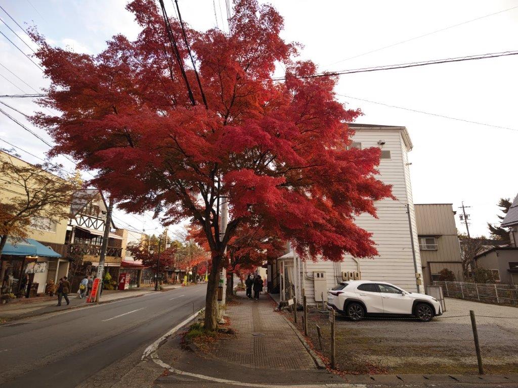
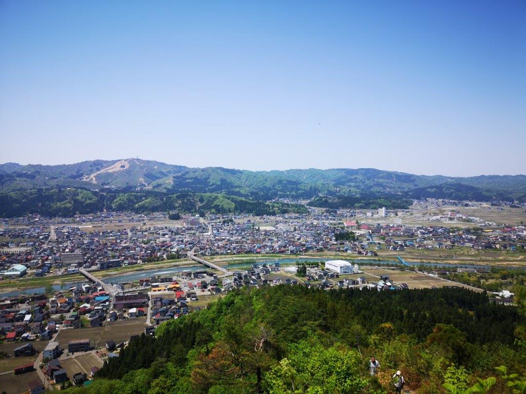
In 2024, I completed 33 day hikes (7 are yet to be published), the same number as in 2023, down from 38 in 2022 and 2021. I missed a handful of weekends in the early spring due to rainy weather, as well as a bunch in the summer due to high temperatures and humidity. On the bright side, I was able to hike every weekend from October till the end of the year, thanks to better weather in Autumn.
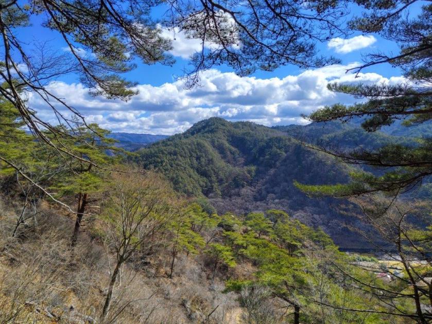
Saitama and Kanagawa had the most hikes, six each, followed by Yamanashi (5), Tokyo (4), Tochigi (3), Nagano (3), Shizuoka (2), Chiba (2), Gunma (1) and Fukushima (1). Sadly, no hikes in Niigata, nor Ibaraki this year; however, a couple were close to Ibaraki, with good views of the Abukuma Mountains. Ease of access and an abundance of mountains and trails explains why Saitama, Kanagawa and Yamanashi top this list.
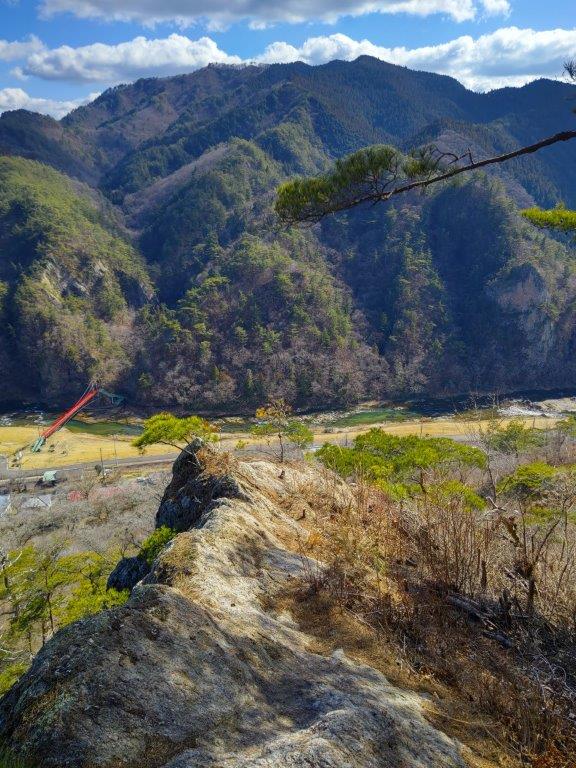
The furthest location reached by train was Koriyama Station (200km) in Fukushima, followed by Kamisuwa Station in Nagano and Shizuoka station (both 150km). I used limited express trains for 14 hikes, local lines for 12 and the shinkansen for 7. I’m using bullet and express trains more and more, as they enable me to comfortably reach new destinations. From stations, I used local buses for 21 hikes, taxis and share cars 5 times each. I could still find 4 excellent station to station hikes.
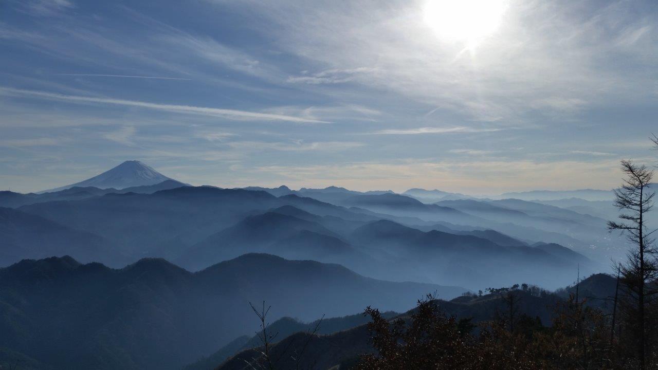
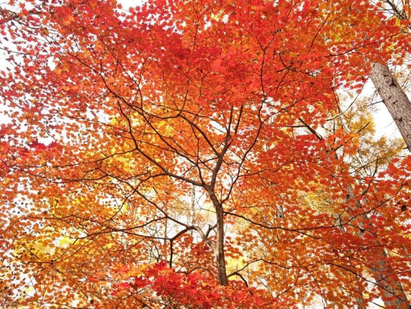
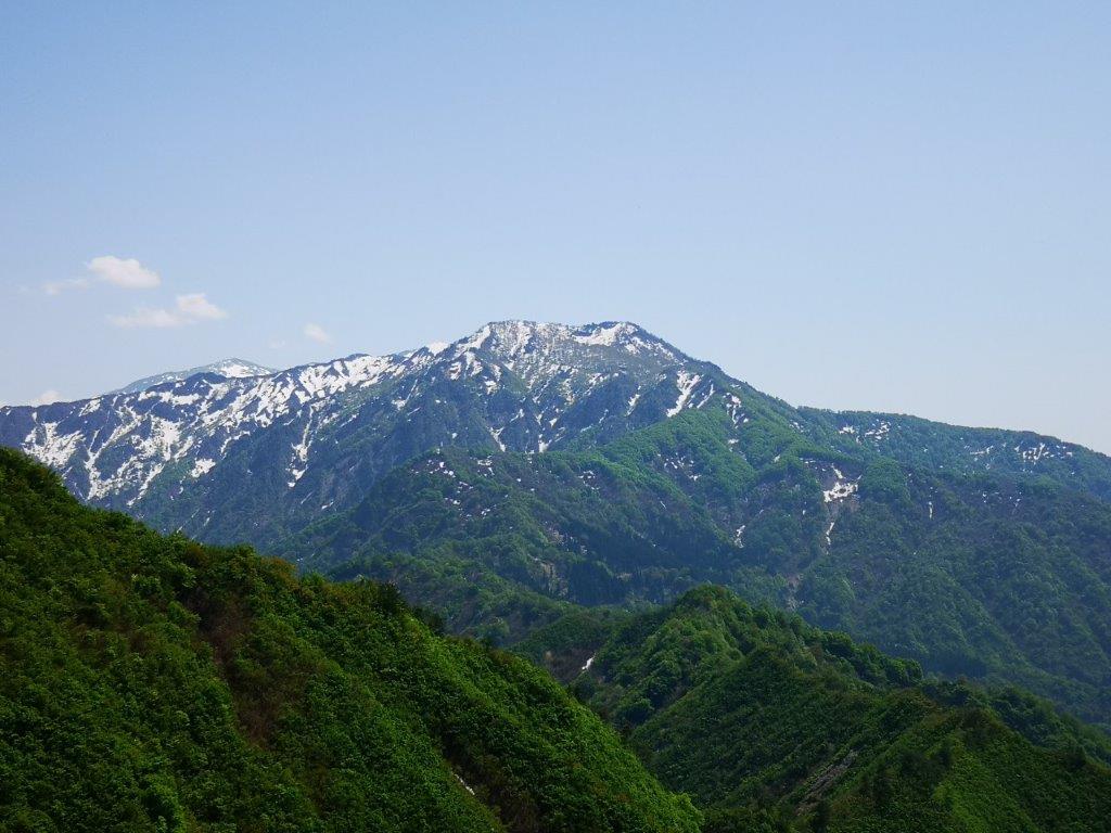
The highest peak was Mt Washi (1798m), also the best 360° view of the year, and the highest elevation was Ama-ike Pass (2241m), both in Northern Yatsugatake. The lowest mountain was Mt Kinugasa (134m) on the Miura Peninsula. I reached about 50 summits, the tally varying on whether minor mountains are included or not; Mt Takao and Mt Ogusu were summited twice via different routes. Twelve of those peaks were repeats, also via different routes. I saw Mt Fuji six times and climbed 3 peaks with “Fuji” in their name. I visited 12 hot springs, among which 5 were first-time visits. Finally, I saw 3 snakes, leading up to year of the Snake.
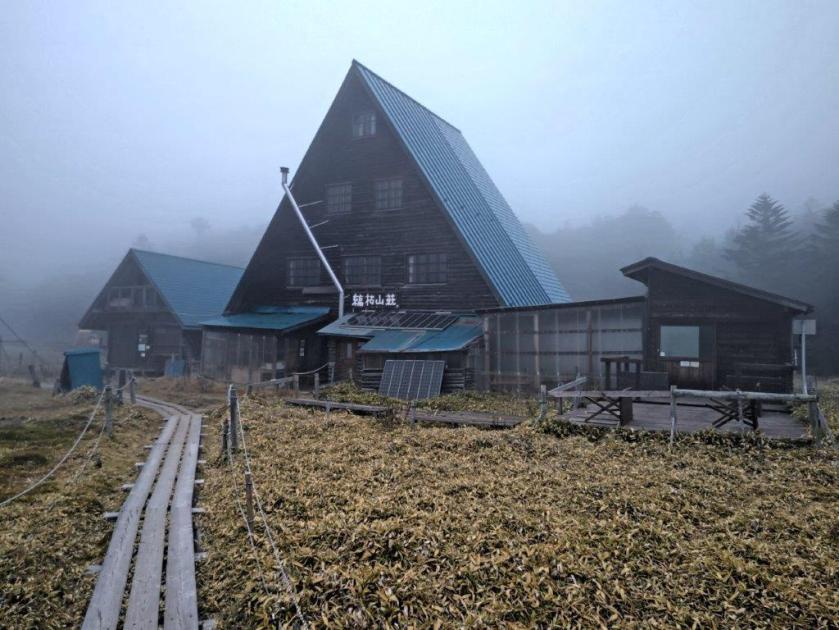
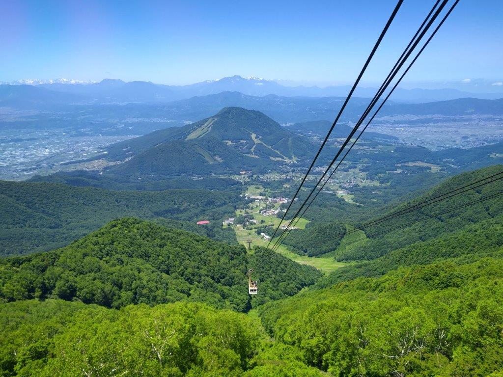
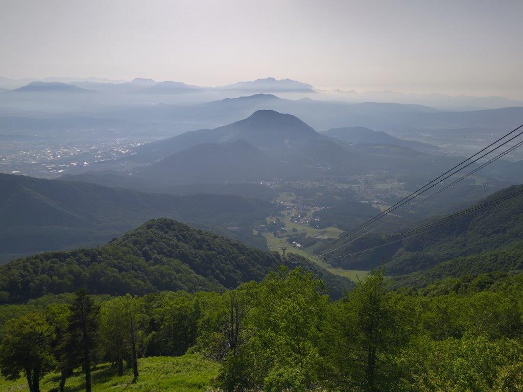
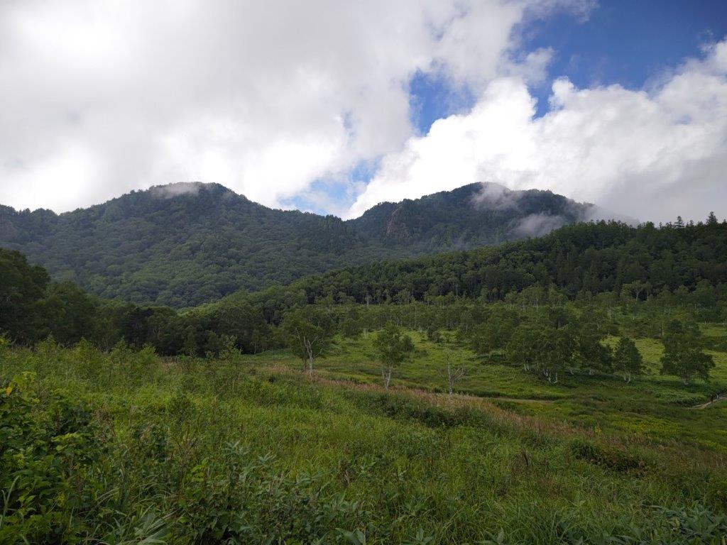
I had last visited the Northern Yatsugatake Mountains 6 years ago. This time, I wanted to check out two small lakes above 2000m and situated between Mt Tengu and Mt Kitayoko; I also wanted to explore the “Moss Path” near Mugikusa Pass. I’d start from the top of the Kita-Yatsugatake ropeway and walk counterclockwise around Mt Shimagare and Mt Chausu, climbed 10 years ago. Back then I stayed overnight at the Shimagare Lodge. However, in October the ropeway operated till 5pm, late enough for a day trip.
Hiking in the Yatsugatake-Chushin Kogen Quasi-National Park八ヶ岳中信高原国定公園
Hiking on Kita-Yatsugatake 北八ヶ岳
To get to the start of my hike, I’d take the Chuo line limited express to Chino station and then catch an Alpico bus for the 40-minute ride to the ropeway; I’d use the same route for the return. The weather was supposed to be mostly cloudy, but no rain was forecast, maybe even a little sunshine in the late morning. I decided to head out as the next weekend the ropeway would run only till 4pm; also my main purpose was to see the lakes and mossy undergrowth. I was looking forward to what would probably be the last high-altitude hike of the year.
For subscribers, read this Blog Post on Hiking Around Tokyo for a better viewing experience and the latest updates
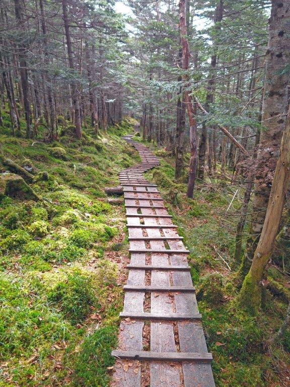
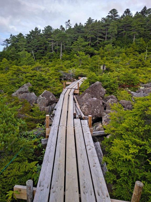
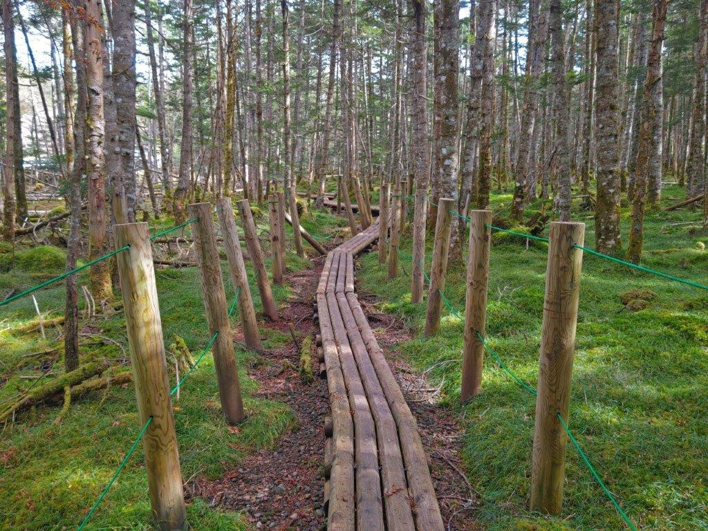
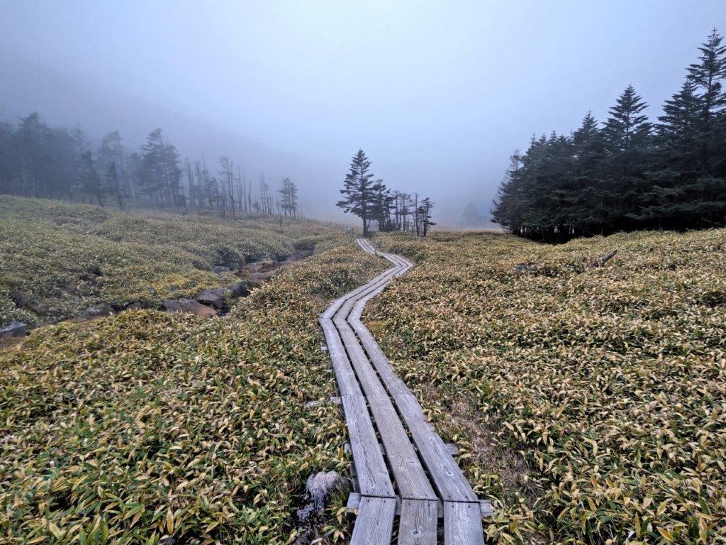
Forest Bathing Observation Deck Route from the Kita-Yatsugatake Ropeway (left) Moss Path in the Yatsugatake Nature Recreation Forest (right)
Moss Path in Onodachi Forest (left) Walkway in Kokuyo Forest(right)
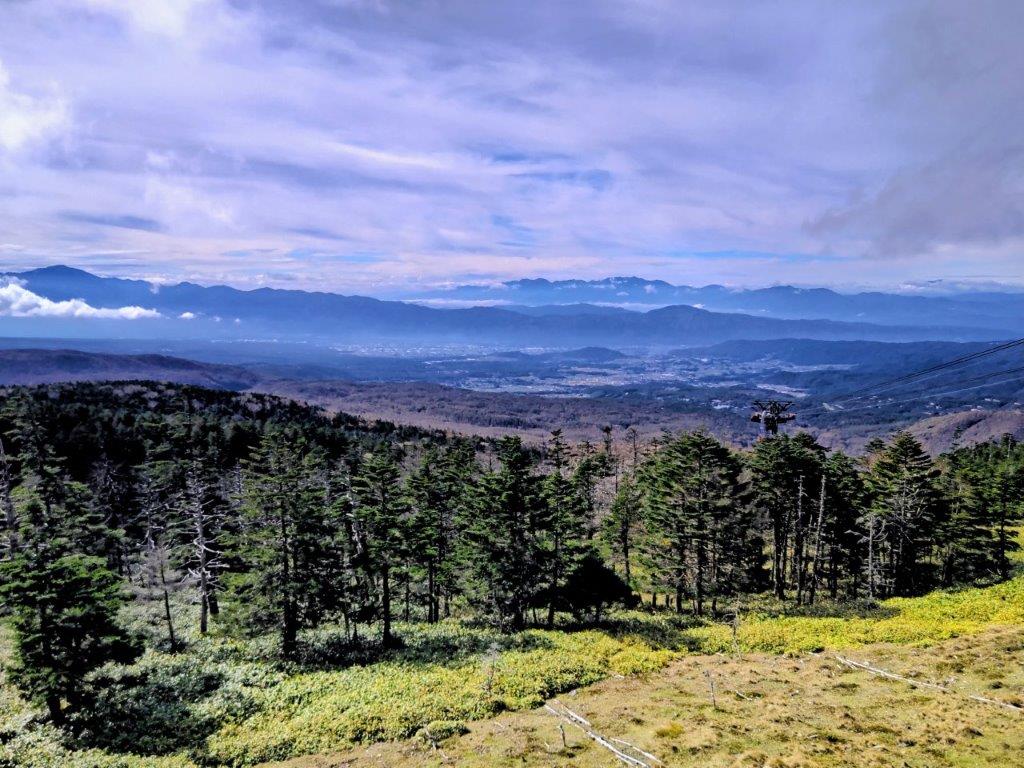
The sun was still shining as I rode the limited express to Chino, arriving there a little past 9am. From the bus, I could see the autumn colours around Tateshina lake, and I made a mental note to plan a hike there next year. Shortly after 10am, I was standing inside the full ropeway cabin (fits 100 people) as it rose from 1800m to over 2200m. After getting ready, I took a few minutes to enjoy the view of the South and Central Alps from the outside terrace; directly behind was the rounded top of Mt Shimagare.
Shirakoma Inner Garden (left) Walkway through Chamizu Forest (right)
The Ogawara Pass Forest Road (left) Walkway to Ama-ike Pond (right)
The mists had started to roll in, Mt Kitayoko and Mt Tateshina were already hidden in thick clouds. I set off before the next load of ropeway passengers arrived at 11am, and made my way along the Forest Bathing Observation Deck Route (森林浴展望台コース shinrinnyoku tenbodai kosu). I had done this route before but in reverse. I soon reached an open space where I had a view of the grassy highland of Kirigamine. After 11am, I passed the observation deck, the view partly obscured by trees, and left the wooden walkway for a proper hiking trail.
Walkway to Ama-ike Pond (left) Path for Amaike-toge (right)
Before Amaike-toge (right) After Amaike-toge (left)
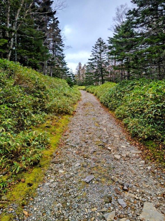
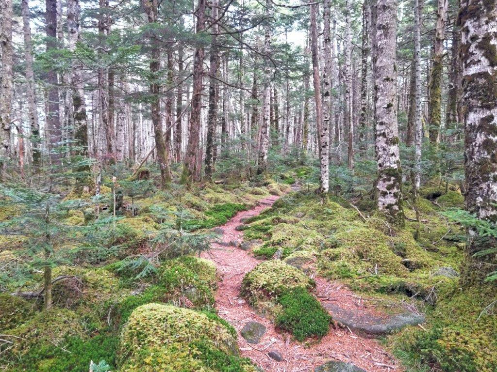
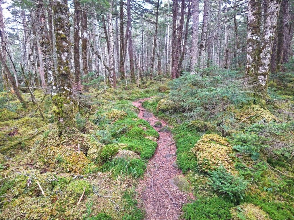
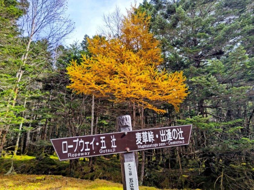
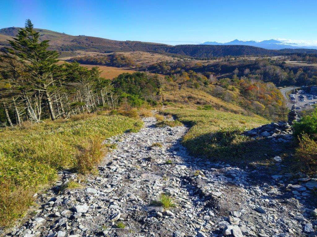
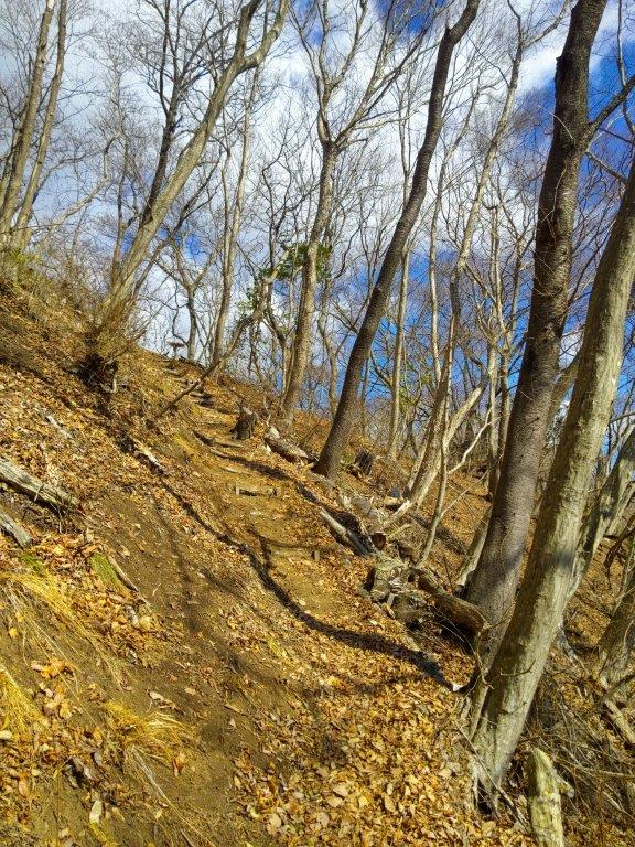
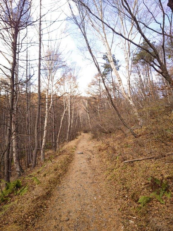
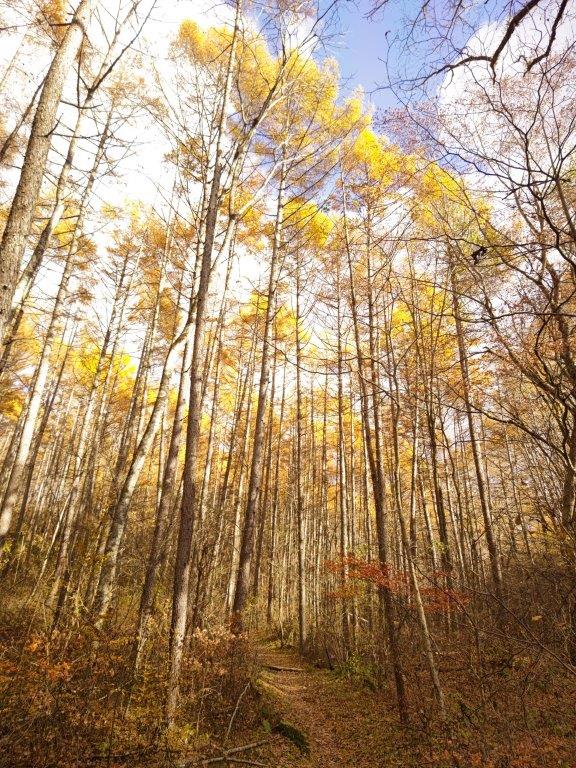
The trail was rockier than I had remembered and my progress was slower than expected. At 1130, just past the Go-Tsuji intersection, I arrived at an open rest place opposite a beautiful bright orange larch, one of the few autumn leaves I saw on today’s hike. Soon after, I entered the Yatsugatake Nature Recreation Forest (八ヶ岳自然休養林 Yatsugatake shizen-kyuyo-rin) and I found myself walking through an enchanting forest with mossy undergrowth, the path now aptly named “Koke no Michi” (苔の道) or the Moss Path. Around this point, today’s hike diverged from the one I had done ten years ago.
Central Alps from the Top of the Kita-Yatsugatake Ropeway
Start of the Shinrinyoku Tenbodai Route
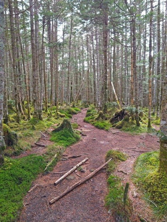
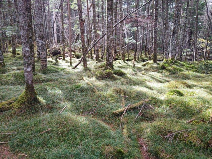
I was amazed by the sheer amount of bright green moss covering everything close to the ground; perhaps there was more than usual due to the higher than average rainfall this year. At noon, I crossed the busy Marchen Road connecting Chino city with Sakuho town, and continued along the Moss Path, now inside the Mist Garden (狭霧園地 sagiri-enchi), although no mist was hanging around at the time. After a short climb, I arrived at Onodachi Forest (斧断ちの森), mostly made up of slender birches.
Walking through the Mist Garden
Passing through Onodachi Forest
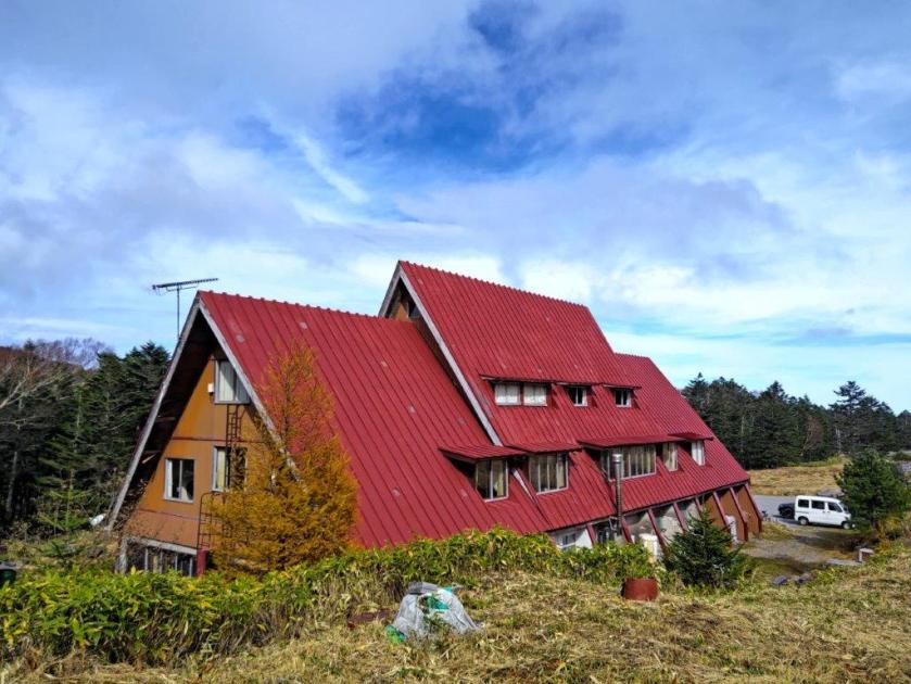
I enjoyed the combined effect of the white birch trunks and light green moss on my solitary stroll through the higher reaches of the Yatsugatake-Chushin Kogen Quasi-National Park (八ヶ岳中信高原国定公園). At 1230, I passed the bright red roof of the Mugikusa Hut; beyond, the top of Mt Chausu was temporarily free of clouds. I turned left onto a side trail leading through Kokuyo Forest (黒曜の森), the name referring to a dark green coloured moss. I then exited the forest and entered the Shirakoma Inner Garden (白駒中庭), blue patches appearing in the sky above, giving me hope for the afternoon.
Following the Moss Path
Entering the Shirakoma Inner Garden
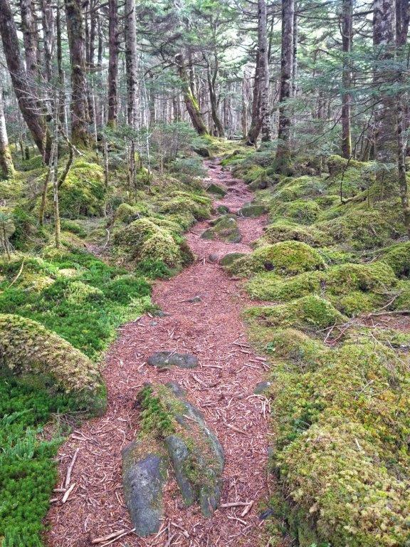
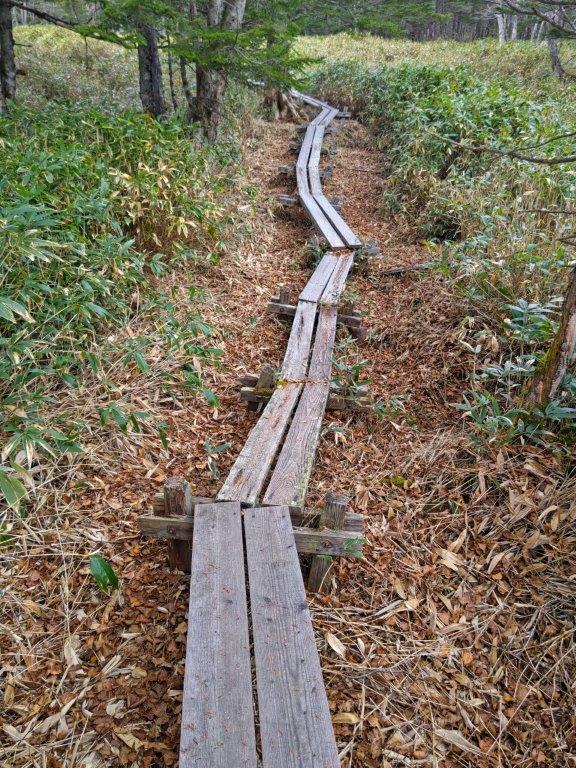
I was thankful for the wooden walkway allowing me an easy passage above a tangle of rocks and creeping pine (這い松). After a short up and down through Shirakoma Forest, I finally arrived at Shirakoma Pond (白駒池). It was past 1pm so I took a lunch break inside a pond-side open shelter. Here, I had rejoined the crowds so I decided to skip a walk around the pond, and quickly headed back to Marchen Road which I followed to Mugikusa Pass. There, I ducked down a small trail on the right, leading through Chamizu Forest (茶水の森), all by myself once again.
Beyond is Shirakoma Forest and Shirakoma Pond
Grey Clouds above Shirakoma-ike Pond
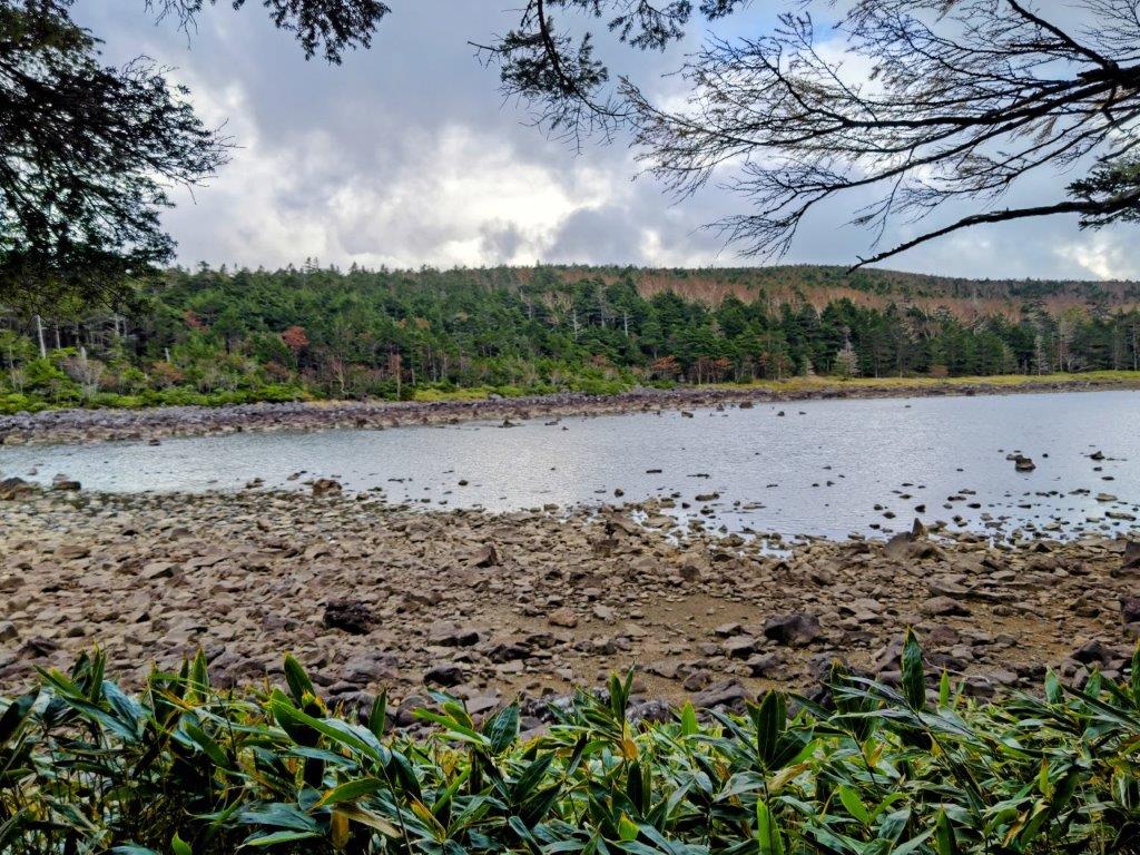
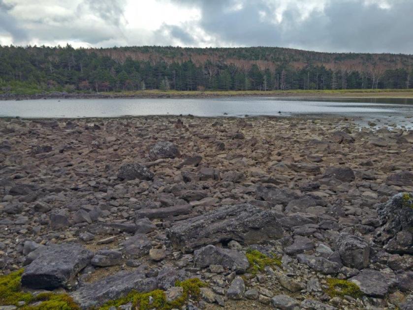
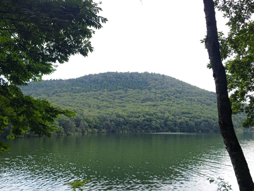
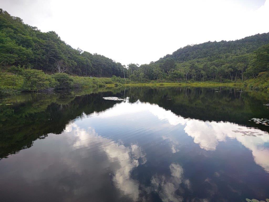
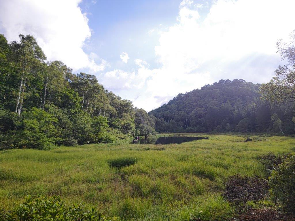
The clouds had wrestled back control of the skies and it started to look like it might rain after all; this was also the most isolated part of the hike through somber and silent forest. I quickened my pace and by 2pm reached the Ogawara Forest Road (大河原林道) although I left it shortly after for yet another walkway. Half an hour later, I reached the far side of Ama Pond (雨池), meaning rain pond. It was smaller than indicated on my map and most likely reaches its full size after heavy rain or the spring snowmelt.
Walkway to Ama-ike Pond
Far Side of Ama-ike Pond
I was startled by a loud barking noise and looking at the opposite shore, I saw deer jump away into the forest; I wasn’t alone after all. I was back on schedule so I decided to walk around this pond. On the other side, I had a better view of the blue pond water; above the trees on the opposite bank, low clouds were blowing by quickly, a sure sign of a change in weather. As I started to climb up through the forest, I suddenly caught sight of a majestic stag with huge antlers; it was standing guard while his doe escaped. I rejoined the forest road but soon turned left up a steep trail through thick forest.
Near Side of Ama-ike Pond
Mist on Amaike-toge
I found myself surrounded by swirling white mist as I emerged from the forest at Amaike Pass (雨池峠). It was now 3h30, leaving me ample time before the last ropeway. I followed the final walkway of the day, down a small valley past Shimagare Lodge where I spent the night ten years ago, merging with my previous hike in the area. At 4pm I was back at the top of the ropeway; half an hour later I was riding a mostly empty bus back to Chino station where I boarded the limited express for the 2-hour trip back to Tokyo.
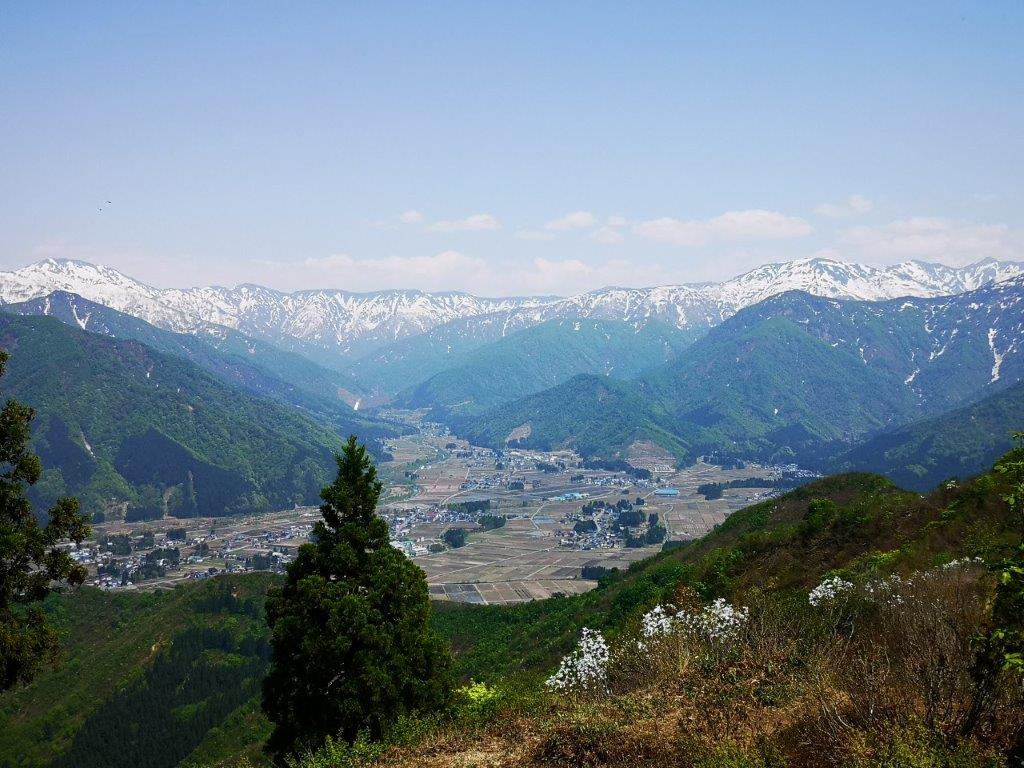
I had been to the Kirigamine Highlands about eight years ago so I felt it was time for another visit. Back then, I had rented a car from Kofu and summited the highest point, Mt Kuruma, a 100 famous mountain of Japan; this time, I decided to go by bus and up a couple of minor peaks on both sides of the Yashimagara Marsh. I was hoping to catch the autumn colours at their peak, at the risk of encountering crowds of people.
For subscribers, read this Blog Post on Hiking Around Tokyo for a better viewing experience and the latest updates
To get the start of the hike, I’d ride the Chuo line limited express to Kami-Suwa, a little over 2 hours from Shinjuku, and there, catch an Alpico bus for Kuruma Highland; I’d use the same bus for the return. The weather was supposed to be sunny all day but cold for the season. On top of the autumn scenery, I was looking forward to getting some good views of the mountains of Nagano.
Hiking in the Kirigamine Highlands
霧ヶ峰高原
Hiking in the Yatsugatake-Chūshin Kōgen Quasi-National Park八ヶ岳中信高原国定公園
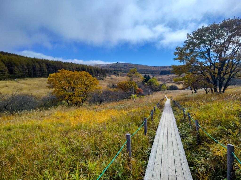
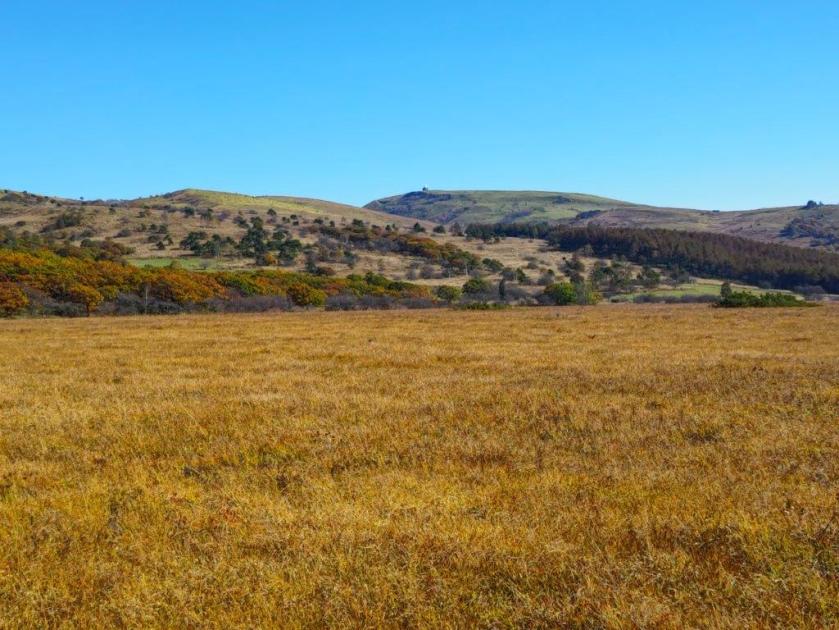
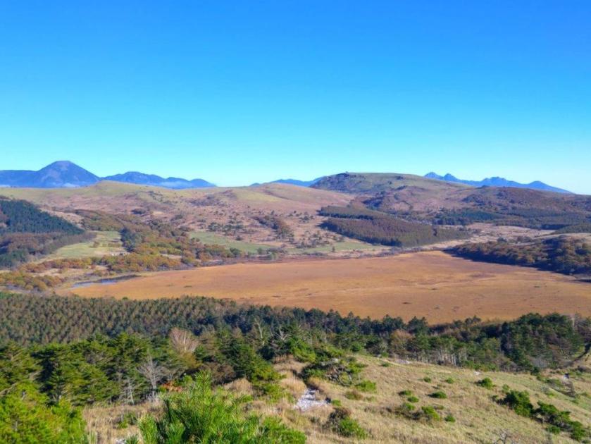
Autumn Colours at Yashima-ga-Hara Marsh
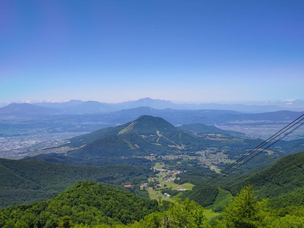
View towards Kuruma Kogen
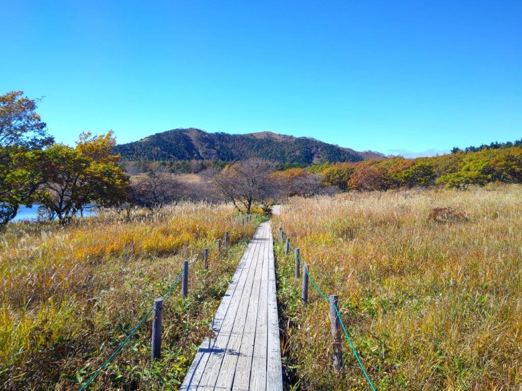
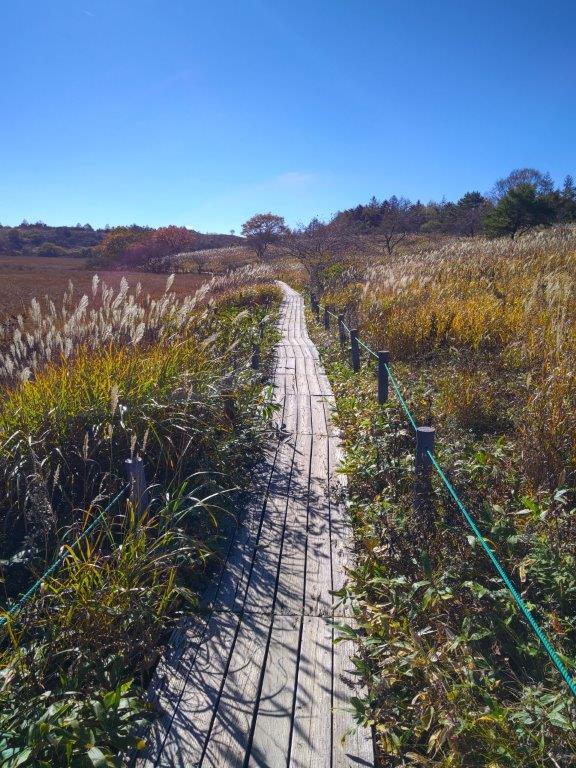
It was a surprisingly cloudy day as I rode the limited express towards Nagano, although the updated weather forecast announced that the clouds would melt away by noon. It felt really cold as I got off at Yashimagara-shitsugen (八島ヶ原湿原), after a 45-minute ride on a packed bus. I popped into the Yashima Visitor Center to check out the exhibits and warm up, before heading to the wooden walkway circling the marshland at 11am, under leaden skies.
Kuruma Kogen from Mt Zebra
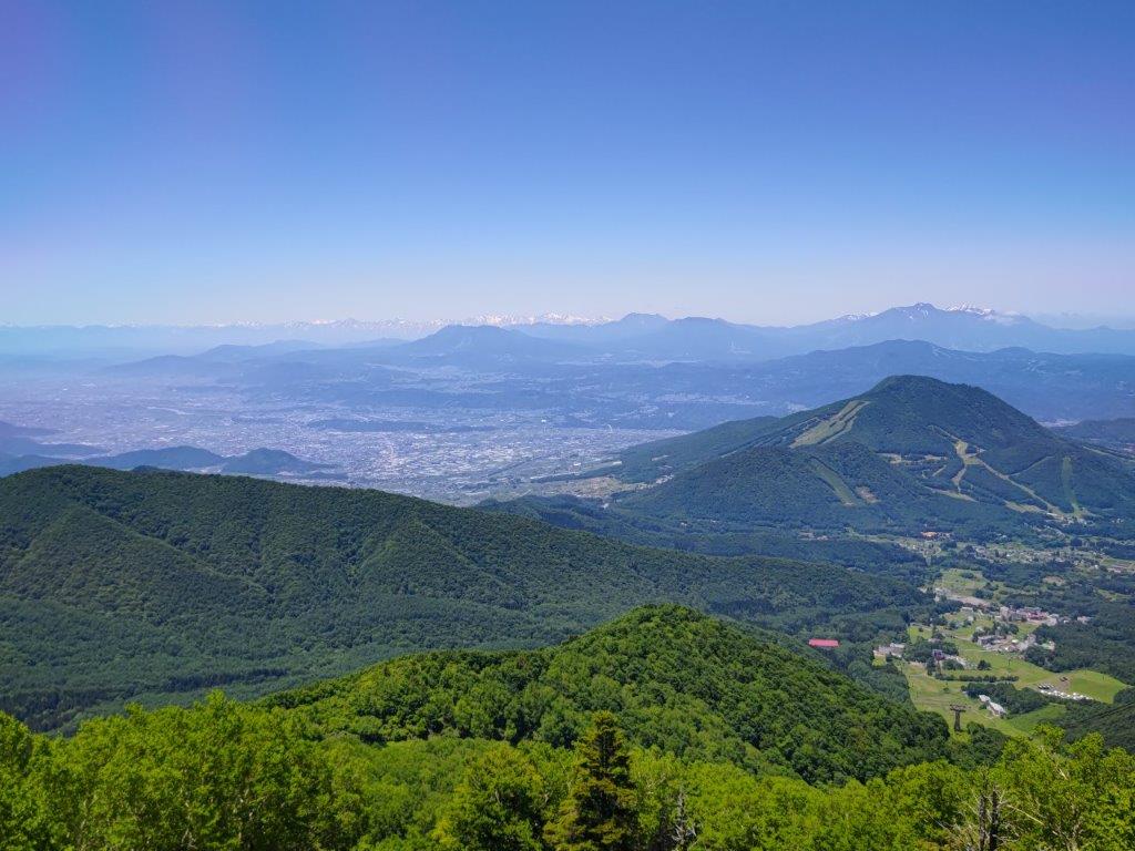
Yashima-ga-Hara Marsh from Mt Zebra
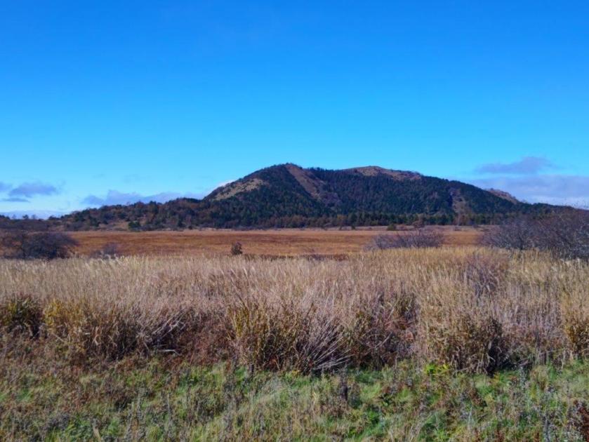
I was glad to see that autumn colours were on schedule, despite the warmer than average temperatures of the past few weeks, somewhat muted due to the overcast sky. I set off at a brisk pace to warm up, counter-clockwise around the marshland; I passed by the Okugiri Hut around noon, now walking under blue skies. I followed the main trail for Mt Kuruma for a short while before turning left onto a small path leading to today’s first summit.
Heading back to Yashima-ga-Hara Marsh
Heading towards Mt Washi
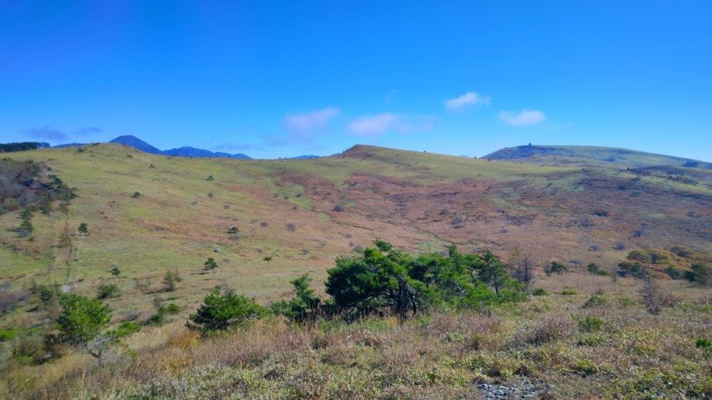
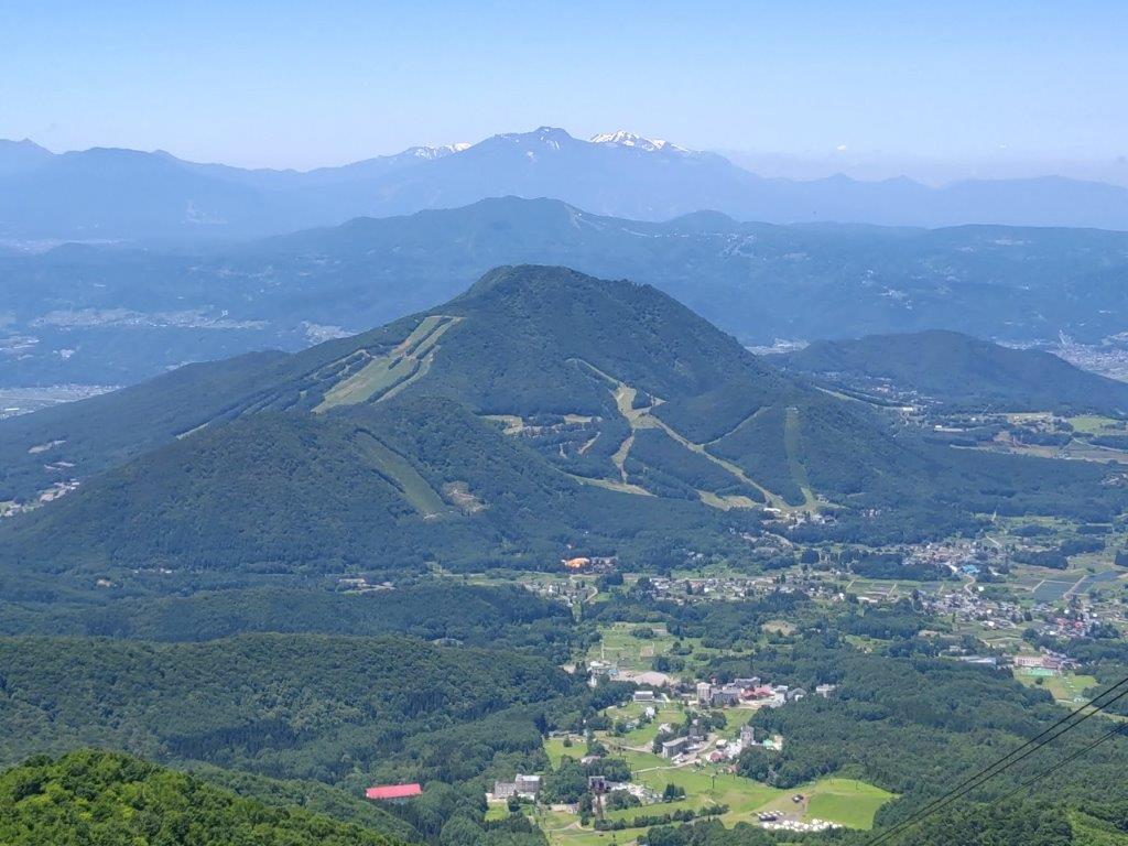
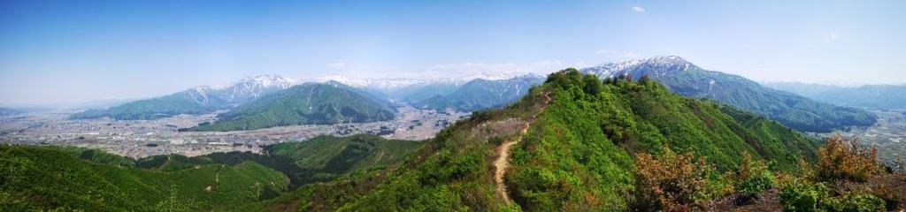
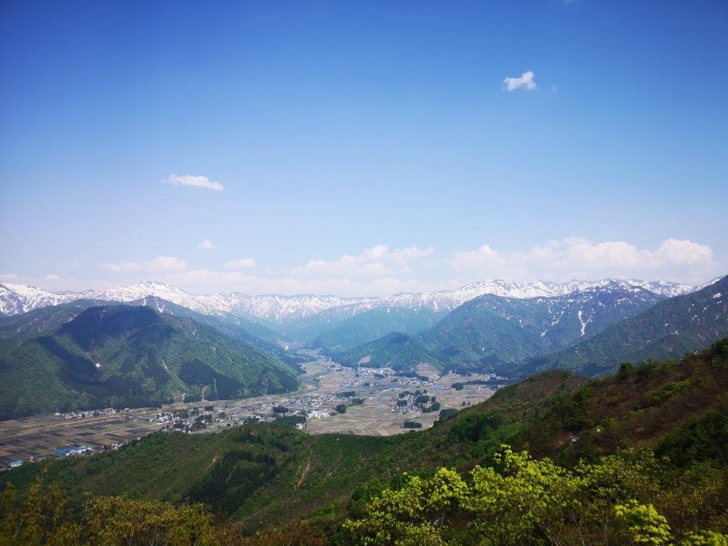
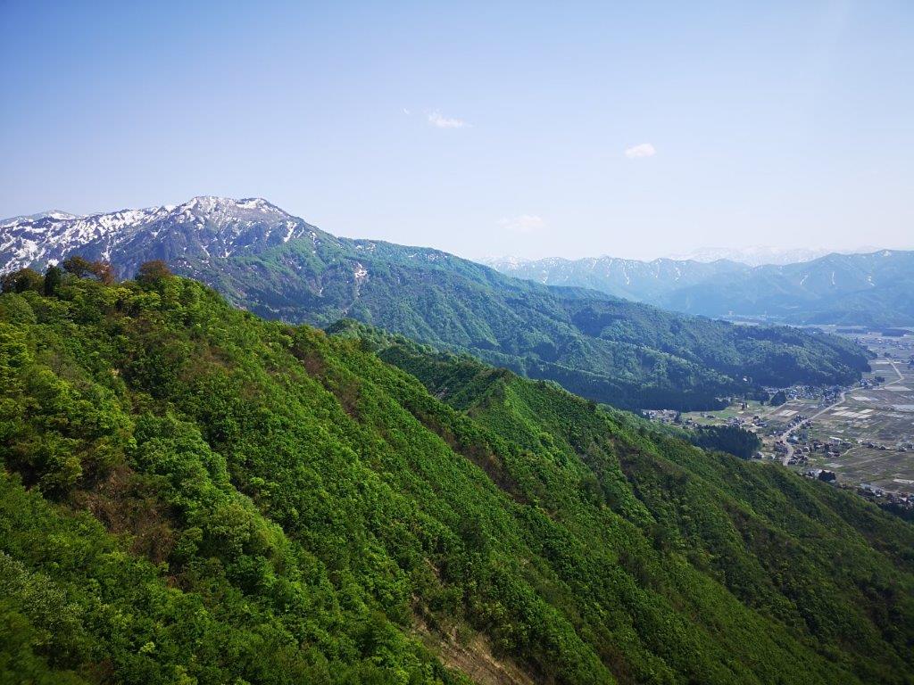
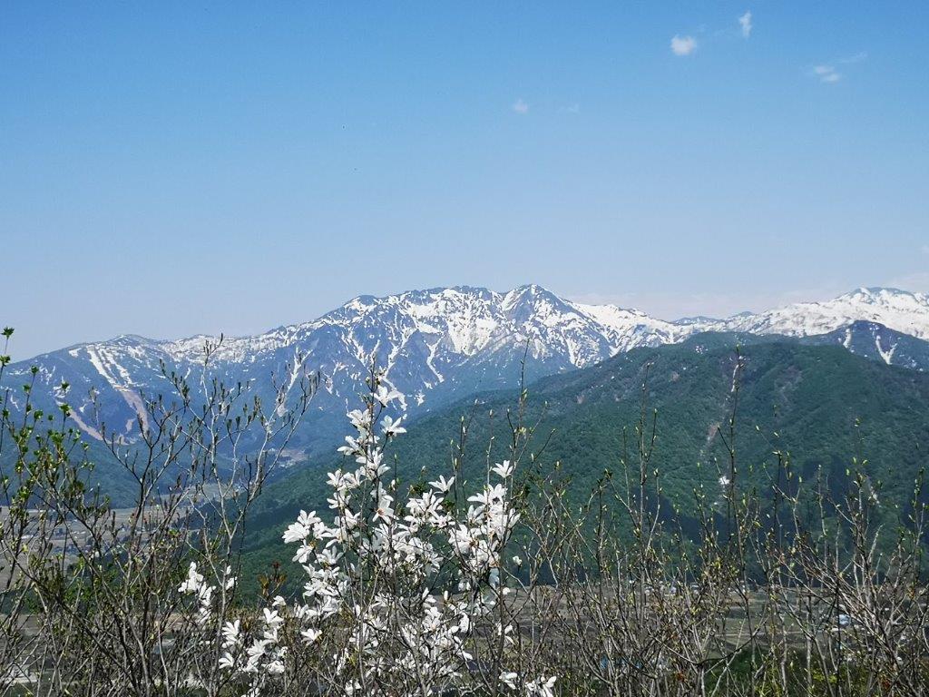
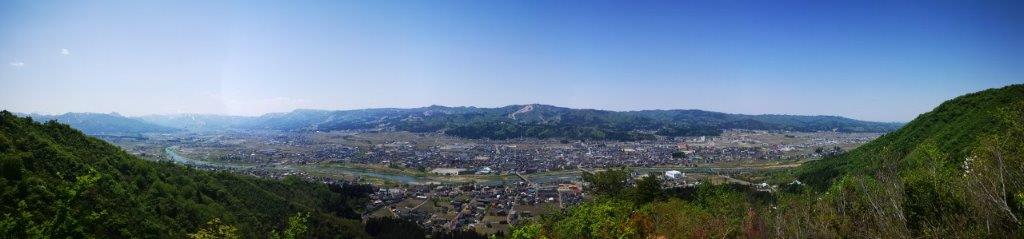
I felt energised by the shining sun, enabling me to keep a fast pace up the mountain, reaching the top of Mt Zebra (ゼブラ山 zebura-yama also known as Mt Omekura 男女倉山 おめくらやま) at 12h30. Apparently melting snow in the spring looks likes Zebra stripes. I could see the crown of Mt Tateshina rising above the grasslands of Kuruma Highland; looking north, I could see the flat top of Utsukushigahara, and the long ridgeline connecting it to Kirigamine. Looking south, I could see the highest points of Mt Ontake, the Central and South Alps floating above the clouds; directly below, was Yashimagahara Marsh.
Approaching Kama Pond on Yashima-ga-Hara
Oni-no-sensui Pond on Yashima-ga-Hara Marsh
I was stunned by the bird’s eye view of the rusty red marsh. I hurried down the same way, feeling warm under the midday sun, and was soon back on the marsh-side walkway. After passing Kama and Oni-no-sensui Ponds, I reached an open area with a view of the entire marsh, as well as the rolling hills of Kuruma Highland in the background. At 1h30, I turned left onto a hiking trail, leaving the marsh behind. After a short climb, I reached the trailhead for today’s second peak.
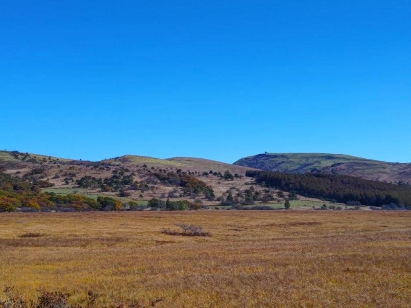
Yashima-ga-Hara Marsh and Kuruma Kogen
Start of the Hike for Mt Washi
I was surprised by the alpine beauty of the surrounding landscape as I made my way up the rocky path though pines, especially since I was on a day trip from Tokyo. Very soon, I had another bird’s eye view of the marsh, this time with the highest peaks of the Yatsugatake range visible in the background. To its right was the Yashima Visitor Center, and looming up directly behind it, was the outline of the South Alps, now nearly completely free of clouds.
View of Yashima-ga-Hara Marsh from the Mt Washi Trail
The Yashima Visitor Center and the South Alps
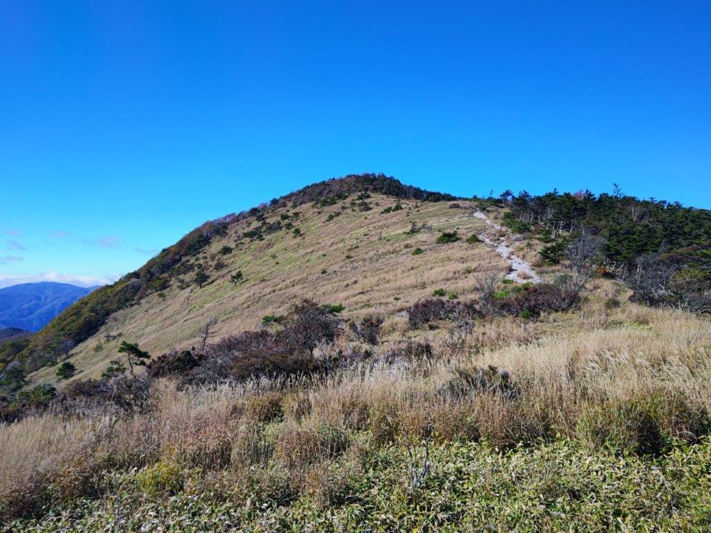
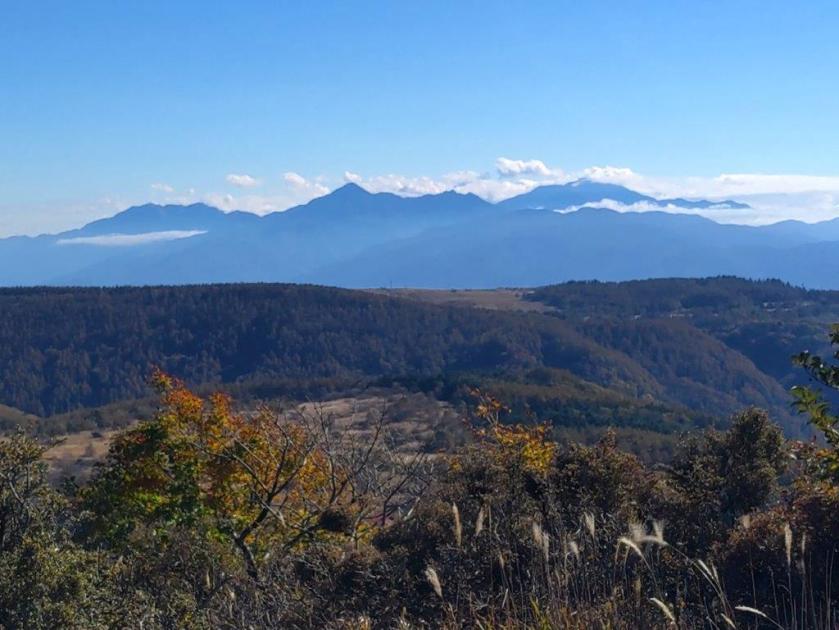
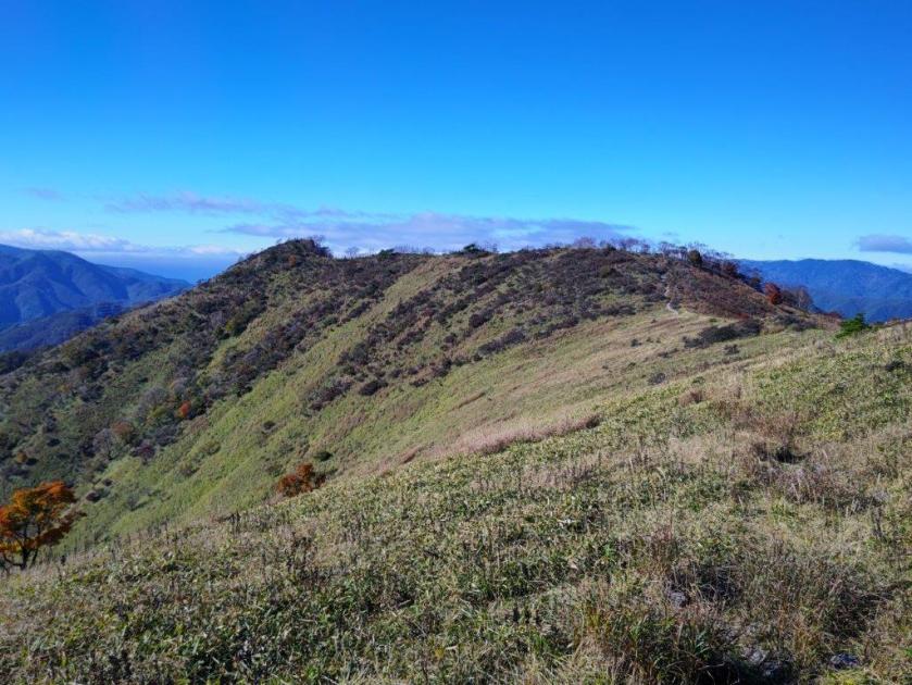
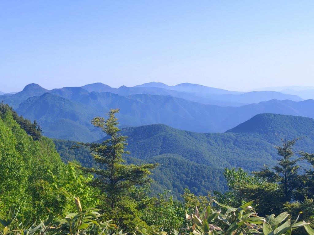
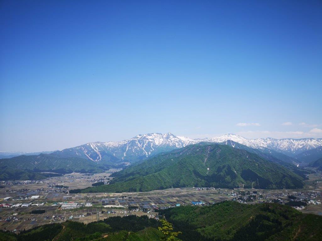
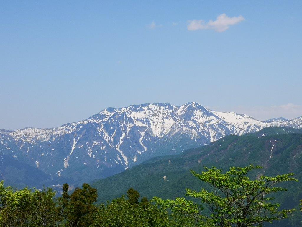
It was short but pleasant hike along the top ridge with sweeping views on both sides. Shortly after 2pm, I arrived at the summit of Mt Washi (鷲ヶ峰 わしがみね washigamine). The name could translate as “Eagle Peak” and the panorama certainly made me feel like an eagle soaring high in the sky. Looking north, I could now see the rounded top of Mt Asama, as well as the flat top of Mt Arafune; westwards, in addition to Utsukushigahara, I could also see Mt Hachibuse, and in the far distance, poking out of the clouds, Mt Hotaka, Mt Tsurugi and Mt Shirouma, three famous peaks from the North Alps.
Mt Tateshina from the Mt WashiTrail
Ridgeline leading to Mt Washi
Looking south, I was most impressed by the view of Suwa lake with the Central Alps in the background, against the sun so challenging to take in photo. Suwa lake inspired the lake in the Your Name movie so I was glad to see it from above. Between the Yatsugatake range and the South Alps, I was surprised to spot the conical summit of Mt Fuji, rising from the clouds. After a short lunch break, I headed back the same way.
View of Suwa Lake from Mt Washi
Yatsugatake from Mt Washi
Mt Fuji between Yatsugatake and the South Alps
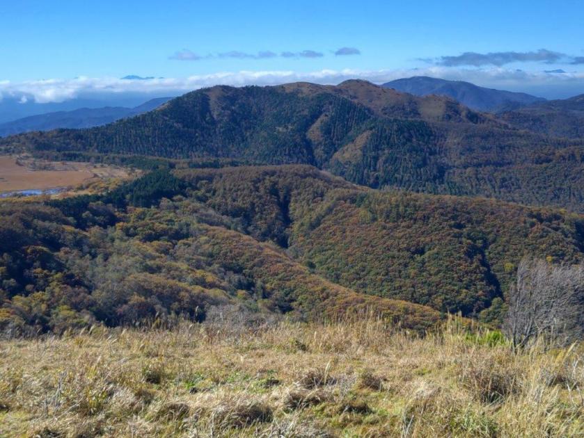
I had fantastic views of the entire range of the Yatsugatake range doing the path in reverse. After one last look at the triangular shape of Yashimagahara Marsh, I made my way down the last part of the trail, arriving back at the Yashima Visitor Center a little before 3h30, well on time for the return bus. One hour later, I was at Suwa station where I could take a foot bath directly on the platform while waiting for the limited express that would whisk me back to Tokyo.
Heading back to the Yashima Visitor Center
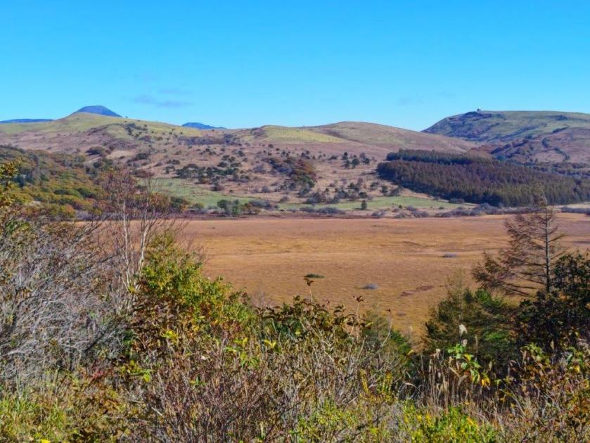
Yashima-ga-Hara Marsh and Yatsugatake
This hike took about 4 hours, shorter than expected, giving me plenty of time to enjoy the stunning views. I passed fewer people than expected, maybe because the area is more famous for its spring and summer flowers. I felt lucky with the timing of the Autumn leaves and the excellent weather. I’d like to return to the area in the future to hike more of the ridgeline towards Utsukushigahara, although I’d probably have to rent a car for this.
I wanted to do another hike on the Abukuma Plateau after seeing it from afar on my previous hike. Looking at my Mountains of Fukushima guidebook, I found two short loop hikes on opposite sides of the Kuji river, just across the border with Ibaraki prefecture. It was similar to a hike I had done in 2019, but somewhat further up the valley. Looking online, it seemed I could get some great views of the whole area; at the end, I could visit a nearby waterfall, if time allowed.
Hiking in Tohoku 東北
I would ride the Hitachi Limited Express from Ueno to Mito, and there transfer to the Suigun line, getting off at Yamatsuri station, two stops past Hitachi-Daigo. For the return, I could continue along the same line, all the way to Koriyama, the last station, from where I could catch the shinkansen back. The weather was supposed to be sunny and cloudy, with temperatures above average for the season. I was looking forward to riding the entire length of the Suigun line for the first time, and getting some new views of the Abukuma Mountains.
For subscribers, read this Blog Post on Hiking Around Tokyo for a better viewing experience and the latest updates
Start of the hike (left) Near the Top of Mt Yamatsuri (right)
Heading Down Mt Yamatsuri (left) and Mt Hiyama (right)
It was a blue sky day as I got off the colourful train car just before 11am, the other cars having been left behind a few stations back. I immediately headed to the nearby trail entrance, and soon reached the first viewpoint of the day, on a rocky ridge slightly off the main path. After taking in the views of the river valley below, I made my way up some log steps leading to a paved path. Shortly after a viewpoint of Hizuki Rock (日月岩 hizuki-iwa) to the south, I reached the start of the hiking trail on the right. In almost no time I reached a treeless ridgeline, from where I had a view of the Abukuma plateau to the north.
View North of Abukuma-kochi from below Mt Yamatsuri
View North of Abukuma-kochifrom Tendozuka
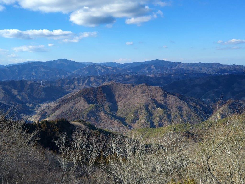
I was amazed by the bird’s-eye view of the valley and hills below, especially since my elevation was relatively low. A few minutes later, I arrived at the summit of Mt Yamatsuri (矢祭山 やまつりやま yamatsuri-yama). Northeast, I could see Mt Yamizo. The clouds had started to roll in, creating alternating patches of light and dark on the scenery. I quickly moved on, and after a short up and down, reached the flat top of Tendozuka (402m 天道塚 てんどうづか) from where I had a nearly 360° view of the entire area.
Looking down from Hizuki-iwa
Looking East towards Mt Hiyama
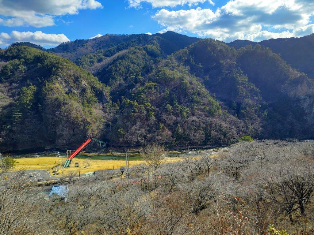
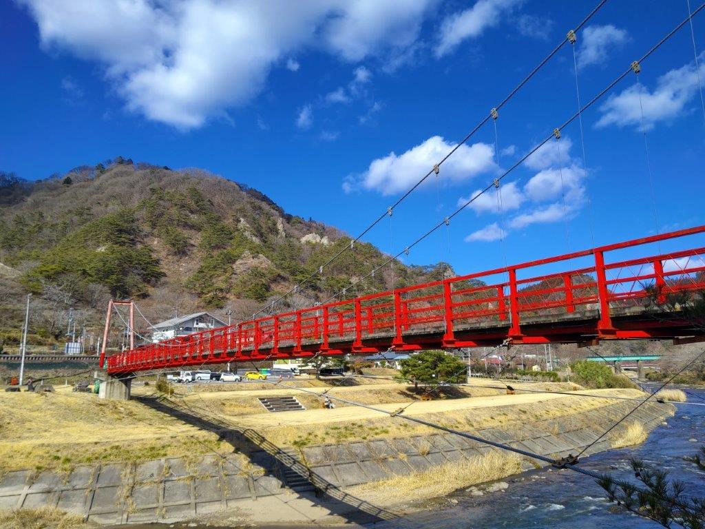
I was stunned by the vast panorama, most of the surrounding mountains new to me; apparently even Mt Fuji could be seen, although not today. It was just past noon so I had sat on one of the many benches for an early lunch. At 12h30, I started to head down. On the way, I passed a viewpoint on the side of Hizuki Rock. From the rocky outcrop, I could see the meandering Kuji river below. The trail now hugged steep mountain side, mostly out of the trees, and it felt very warm under the sun. At 1pm, I reached the base, and after crossing a red hanging bridge, headed up a trail through the cedars. I soon turned left onto a forest road which I followed for a while, before leaving it for a path on the right.
Red Hanging Bridge over Kuji River
View North of the Kuji River Valley
At 2pm, I reached a level area with a bench and a wide view. Directly ahead, the Kuji river valley extended northwards. On the west side, I was looking down at the loop hike I had walked earlier in the day, with the bulk of Mt Yamizo spreading out in the background. A few more minutes of walking brought me to the top of Mt Hiyama (檜山 ひやま hiyama) where I finally a had a good view on the south side. I could see the rugged outline of Mt Nantai, the most famous peak in the area. After a short break, I headed back down the same way. Since I was on schedule, I made a detour via Muso Taki (夢想滝 dream waterfall), which I reached at the end of a narrow ravine.
Mt Nantai (left) from the top of Mt Hiyama
In the foreground, Mt Yamatsuri, in the background, Mt Yamizo
Although the waterfall in this season was rather small, I was impressedwith the huge overhanging cliff right next to it. It was nearly 3h30 so I made my way back to the station to catch one of the few afternoon trains for the one hour and a half ride to Koriyama. Along the way, I enjoyed some views of the higher mountains of Fukushima prefecture on the west side. After arriving in Koriyama, I boarded the shinkansen for the one hour ride back to Tokyo. I saw few people and had lots of great views on today’s hike so I was glad I had gone all the way to a little visited in area northeastern Japan.
Watch a Video of the Mt Yamatsuri & Mt Hiyama Hike
I needed a short, easy hike after my three-month summer break; I also needed to get above one thousand meters, free of the spiders and their webs, seemingly everywhere at this time of year. I decided to go to the Saku, a plateau between Asamayama and Yatsugatake; there, I would go up a mountain spotted on my hiking map while researching Golden Week hikes. Although the hike was under two hours, it promised a great view from the top and a hot spring bath at the base.
I would ride the shinkansen from Omiya to Saku-Daira, and from there, take a taxi to Parada, a ski resort turned amusement park in the warmer months; at the end, I would need to walk one hour back to the shinkansen station. It was supposed to be a warm, sunny day, and so I was looking forward to my first hike of the autumn season.
View of Asamaya from behind the summit of Mt Hirao
It was slightly overcast as I rode the shinkansen from Omiya, but after passing Karuizawa town, blue skies stretched away in all directions. I got off at Saku-Daira station a little before 1030, and there, caught a taxi for the short ride to Hirao Onsen. Perched a little way up the mountain side, I already had a great view of the Saku plateau, and the Yatsugatake range directly ahead. I found a 200 yen locker to store the things I didn’t need for the hike itself, and shortly before 1130, started up the Hirao Forest “Therapy Road”.
Pines Trees (left) and Log Steps (right) on the Therapy Road
Looking up at Mt Hirao (left) Looking down from Mt Hirao (right)
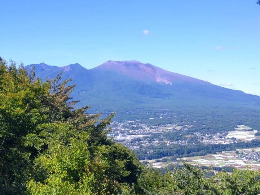
I climbed through beautiful, spider-free forest, up the “Path of Endurance” (忍耐の小径); at the top of a steep log staircase, I reached the top of Mt Hirao, also known as Hirao-Fuji (平尾富士 ひらおふじ hirao-fuji). It was nearly 12h30 so I sat down on one of the several west-facing benches for lunch with a view. To the south, were the mountains of Oku-Chichibu, Mt Ogura visible in the far distance; opposite was a sideview of Yatsugatake, stretching from Mt Aka to Mt Tateshina; further west, I could see the entire range of the North Alps, extending from Mt Yari to Mt Shirouma, free of clouds and snow; on the north side, the crater of Asamayama, as well as the long, flat top of Mt Hanamagari were both visible.
Log Steps near the Top of Hirao Forest
The Summit of Hirao-Fuji
I had never seen so many butterflies flutter around before, flying together in complex patterns. At 1pm, I left my pack on the bench, and went to explore a trail along the southern ridge. After going up and down a small summit completely in the trees, I reached a T-junction where I turned left. After following the slightly descending trail for a short while, I reached a clearing at a forest road. There, I had one of the best views of Mt Asama I’ve ever had, the entire range extending from east to west, completely free of clouds. I then retraced my steps back to Mt Hirao, and after picking up my pack, headed down the mountain.
View of Yatsugatake from the Summit
View of the North Alps from the Summit
I descended through the forest, chestnut burrs thick underfoot, occasionally dropping to the ground with a “plonk”. I first followed the “Path of Nostalgia” (郷愁の小径) and then the “Red Pine Path” (あかまつの小径), before reaching Ryujin-Ike pond (竜神池), a little after 2pm. Along the way, I passed another viewpoint, just off the trail, the landing spot for a pair of chairlifts, not in operation during the summer season. Beyond the “susuki” waving in the autumn breeze, I could see Mt Tateshina wearing its crown of clouds. From the pond, I reconnected with the “Path of Endurance” which I then followed back to Hirao Onsen.
View of the Crater of Mt Asama (left) and Mt Hanamagari (right)
Side view of Mt Asama from the Clearing on the Forest Road
Although it was only 2h30, I wasted no time entering the onsen, also known as “Miharashi no yu“, meaning hot bath with a view; indeed, I immensely enjoyed sitting in the “rotemburo”, or outdoor bath, gazing at the view of the surrounding mountains. At 3h30, I set off again, down a long escalator to the nearby Sakudaira parking area. From there, I followed a road down into the valley, and then walked among the golden fields, ready to be harvested. I was glad I had chosen to walk rather than take a taxi, since I had good views of Asamayama and Mt Hirao along the way. I arrived at Saku-Daira station a little before 5pm, and caught the shinkansen for Tokyo shortly after.
Last Steps of the Endurance Path (right) Walking the Red Pine Path (right)
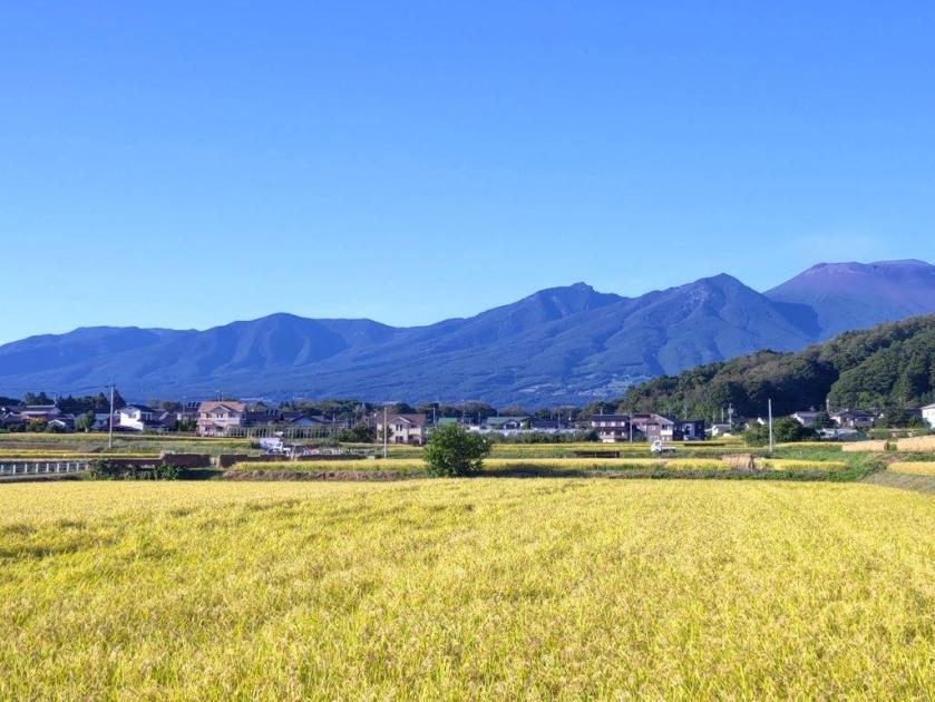
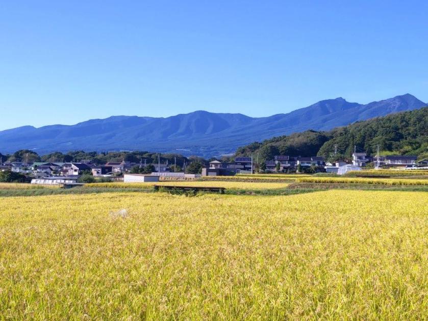
Golden Fields Ripe for Harvest
Although on paper it seemed a long way to travel for a short hike, it turned out to be very satisfactory and an excellent way to restart hiking after a long break. Ideally, I would have used the Tokyo Wide Pass and combined it with another hike but the opportunity just didn’t present itself. Basically, I was glad I had several viewpoints, the hot spring wasn’t too crowded, and the spiders were nowhere to be seen along the hiking trail. I would like to return one day for a longer hike along some of the forest roads in the area, and during the colder months for a clearer view of the North Alps.
I wanted to make another trip to Shiga Highland since I had such a great hike there last year. I had been planning to use the Ryuo ropeway for a while, but needed good weather to justify the expense. I had my chance after a typhoon passed over East Japan, bringing clear blue skies in its wake. My hiking map from ten years ago showed a trail between the ropeway and the Oku-Shiga ski resort; however, it was absent in future versions. Looking at online reports, I saw that a trail still existed and that I could do a roundtrip to the highest point, although it was hard to tell the duration. I would take the shinkansen to Nagano and then the Nagano Dentetsu line to Yudanaka; there, I could catch a free shuttle bus to the base of the ropeway. For the return, I had to make sure to catch the last ropeway at 5pm. It was supposed to be quite hot, but hopefully it wouldn’t affect me much, since the hike would be mostly above 1800 meters. I was looking forward to visiting a new part of Shiga Kogen and getting some great views on a clear day.
Hiking in the Joshin-Estu Kogen National Park
上信越高原国立公園
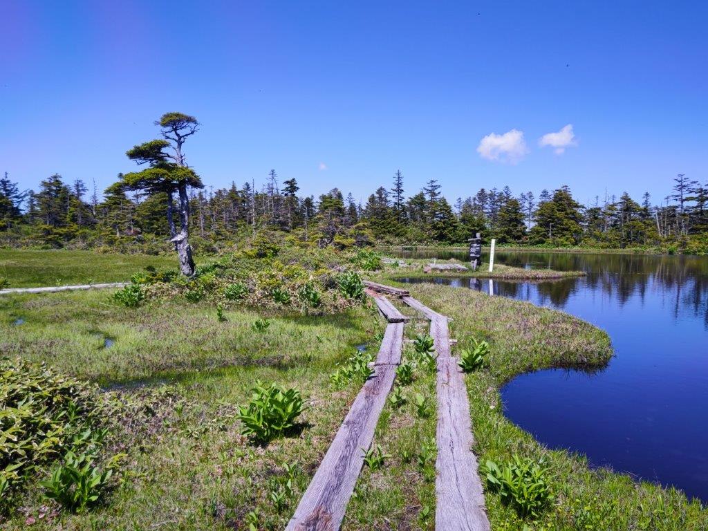
Chigoike Wetland, near the top of Mt Yakebitai
View of Togakushi Kogen from Sora Terrace
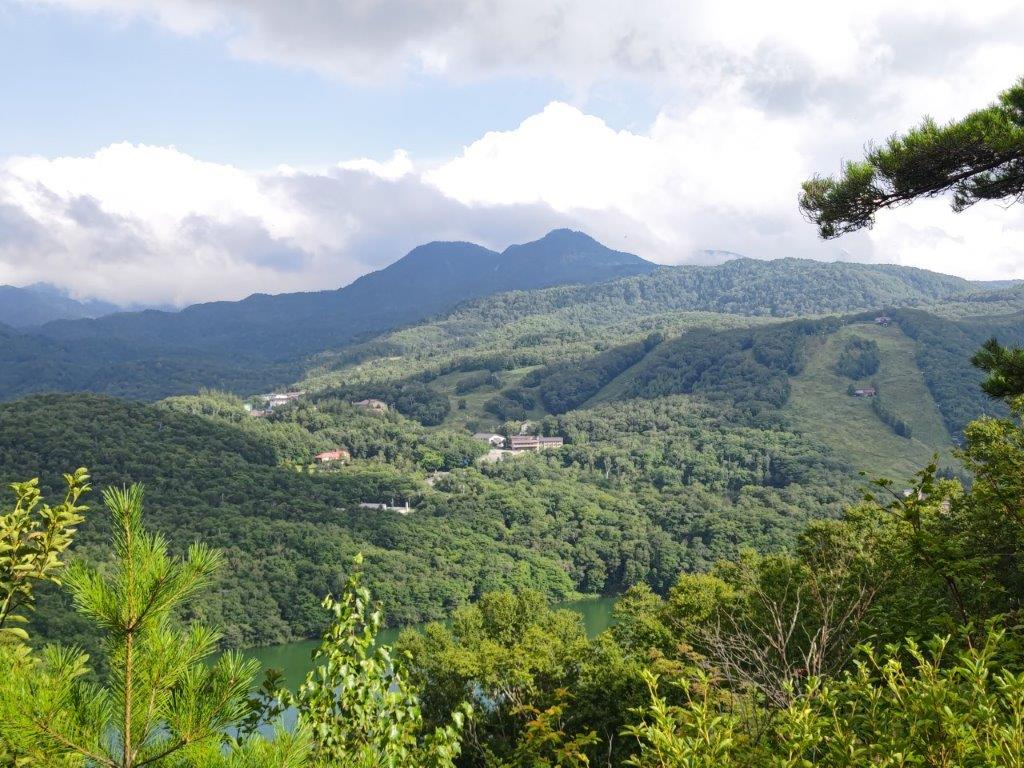
It was the perfect day as I rode the shinkansen to Nagano, where I caught the limited express “Snow Monkey”, arriving at Yudanaka around 1030. I was one of the few people to board the minivan, departing opposite the station, for the half an hour ride to the ropeway, located in the North part of Shiga-Kogen. At 1130, I finally reached Sora Terrace at the top of the ropeway, where I had a sweeping view of the mountains of Nagano, completely free of clouds. In the background, was the entire range of the North Alps, the highest peaks still covered in snow. In the foreground, was Togakushi Highland and its many volcanoes: Mt Takatsuma, Mt Iizuna, Mt Kurohime, Mt Myoko, and its highest peak crowned in white, Mt Hiuchi; closer still was Mt Madarao, climbed in the summer and skied in the winter; directly opposite was Mt Kosha, a summit I hope to climb soon.
View towards Nagano
View of the Ryuo Ropeway
I was surprised by how warm it felt, even though I was 1770 meters high. After admiring the view, I set off just before noon. First, I followed a gently climbing ski slope through the forest, wide enough to be out of the shade; I was feeling pretty hot and wondered if I had enough water. I soon reached the start of a short loop through the Ryuo summit wetland (竜王山頂湿原), along a wooden walkway on the left side. It took about ten minutes, but gave me a close look at the natural beauty of the Joshin-Etsu Kogen National Park. I resumed my hike and soon made my way up a steeper slope, eventually reaching a (closed) restaurant at the top of the Ryuo ski resort.
The North Alps still covered in snow
Close to Far: Mt Kosha, Mt Madarao and Mt Myoko
Turning around, I had a view of the North Alpsframed by pines, as well as the round top of Mt Yakebitai, to be climbed on the return. I soon located the start of the trail on the right side: although there were no signposts, pink ribbons were attached to trees at regular intervals; thick forest on both sides made the use of a GPS device superfluous. The path descended into a broad valley, completely hidden from the outside world; above the trees, I had my first view of today’s highest peak. Very soon, I was climbing up a steep slope, sweating a lot in the heat; I had to use my head net to keep out the many insects. A little before 1pm, the slope leveled and a wooden walkway suddenly appeared.
A short loop through the Ryuosancho-Shitsugen
Looking back at the summit of Mt Ryuo
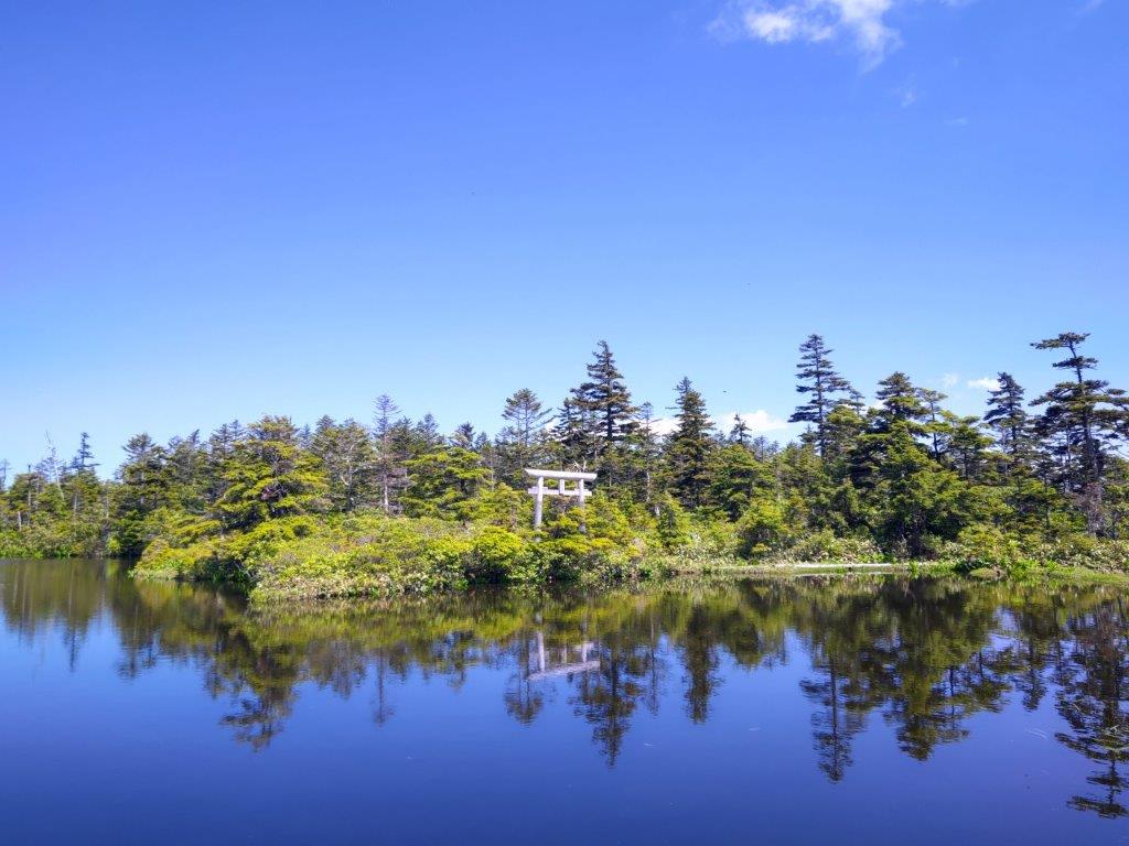
I soon arrived at a stunningly beautiful pond, chigoike wetland (稚児池湿原); although it was shown on my map, I hadn’t expected anything like this. I had also arrived at the summit of Mt Yakebitai (焼額山 やけびたいやま yakebitaiyama). After some lunch, I dropped my pack and did tour of the wetland, following the walkway counterclockwise. On the west side, Mt Kurohime and Mt Myoko rose majestically from the edge of the grassy wetland. On the east side, I emerged from the forest onto another ski slope, looking totally different from the time I was there on skis.
The summit of Mt Yakebitai, across the hidden valley
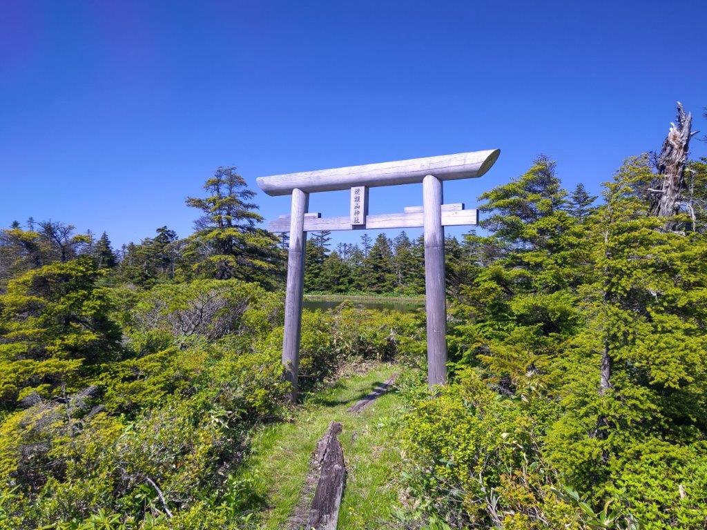
Wooden Shinto Gate at Chigoike Wetland
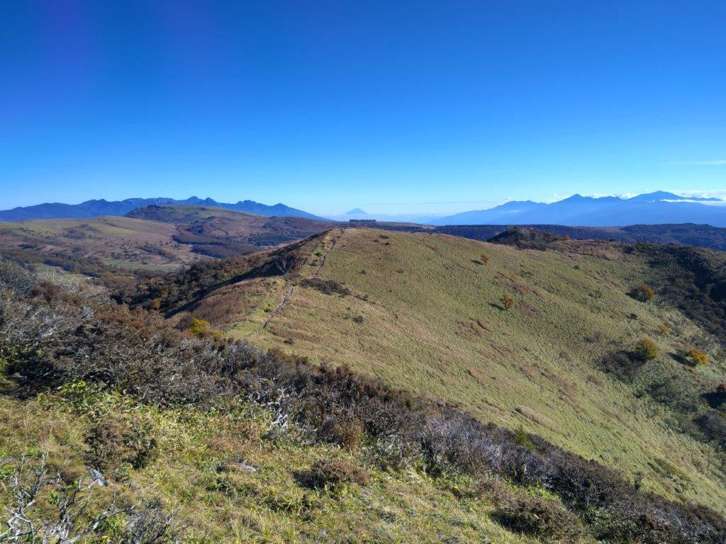
I had another amazing view, this time of the mountains of Niigata, many of them yet to be climbed. From left to right, I could see Mt Torikabuto, Mt Naeba, Mt Shirasuna and Mt Iwasuge, its side view resembling a ship. It was already 2h30 so I quickly completed the loop, passing near a small shrine and its wooden “torii” (Shinto Gate), looking quite magical among the pines, next to the pond. A little before 3pm, I set off for the return, reaching the top of Mt Ryuo (竜王山 りゅうおうさん ryuuousan) less than an an hour later. Sadly the path to the summit was overgrown by vegetation and view of Shiga Kogen to the south was mostly hidden by trees. I could only stay a few minutes till swarms of insects forced me to retreat.
Mt Kurohime and Mt Myoko rising from the wetland
Top of the Oku-Shiga Ski Resort
I was absolutely astounded that the trail I used on the return was not better known. I had frequent views on the left side through breaks in the vegetation. Fortunately I was ahead of schedule, so I could take my time. After the peaks of Shiga Kogen, including Mt Kasa, Mt Kusatsu-Shirane and Mt Azumaya, I also had a magical view of Mt Kosha, Mt Madarao and Mt Myoko, lined up and shrouded in the afternoon haze. I arrived back at the ropeway just before 4h30, relieved that I had made it back with time to spare. Once back at Yudanaka, I regretfully had to skip the hot spring next to the station, as I wanted to catch the last limited express for Nagano, where I then hopped onto the shinkansen for the 90 minute ride back to Tokyo.
View of Shiga-kogen from the path between Mt Ryuo and the ropeway
Magical view of Mt Kosha, Mt Madarao and Mt Myoko
I was glad I was able to complete the roundtrip to Mt Yakebitai as a daytrip from Tokyo, in less than 5 hours at a relatively fast pace. I was also pleased to discover the beautiful Chigo Pond; I couldn’t believe I had it totally to myself. It’s a total mystery why the trail has been abandoned and this place isn’t better known. I was also surprised that the ropeway itself didn’t have more people, although the rainy season might have something to do with this. From the pond, I found a signposted trail heading down into Oku-Shiga, so I hope I can return to do it one day.
Watch a Video of the Mt Yakebitai and Mt Ryuou Hike
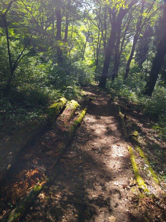
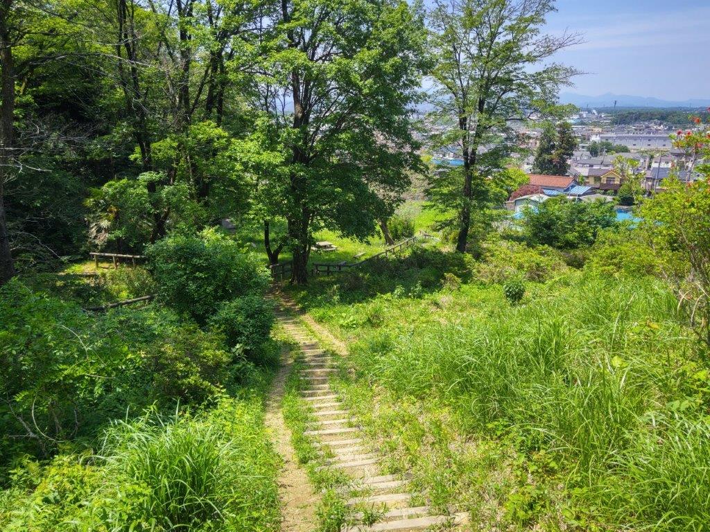
I had visited the forested hills around Sayama Lake earlier in the year, but felt like exploring the area some more; I decided to do a morning hike since the parks sit comfortably within the city. I would start from a prominent hill on the north side, then follow a forest road leading to the south side, a shortcut for the perimeter road I followed in January; from there, I would go up and down some hills in the southwest corner of the park; finally, I would leave the hills on the west side, hopefully reaching a bus stop by noon. It was supposed to be fine spring day, sunny with comfortable temperatures; it had rained hard the day before, so the air would be crisp and clear. As before, I would take the local Seibu line to Kotesashi station, and then a bus along the north side of the lake; I could catch the same bus back from the end of the line. I was looking forward to an easy morning hike through a nature park within Tokyo.
Hiking in the Sayama Natural Park 都立狭山自然公園
May 2024 update: the Nawatake Forest Road is closed till at least 2026 due to fallen trees from typhoons in 2023
It was still pleasantly cool when I got off the bus at 9am next to a small shrine shrine under some cedars. After passing Kinsenji Temple, I turned left onto a lane leading up a hill, called Hira Hill (比良の丘 ひらのおか 155m), next to Midori no Mori Nature Park. The flat top area is used for farming, and walking among the fields, it felt like I had suddenly been transported to the countryside. It was now 9h30 so I had breakfast at a table under a huge Japanese Bird Cherry, probably a nice place for a picnic during the sakura season.
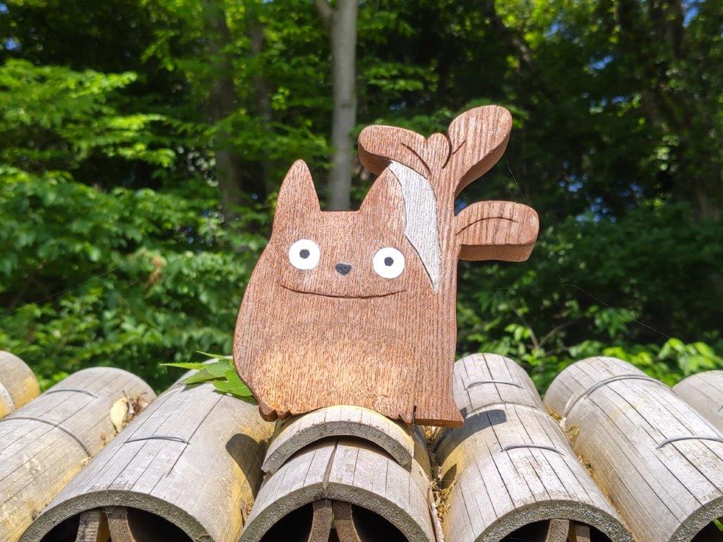
Signboard for Totoro’s Forest
Flower Field at the Top of Hira Hill
I was impressed by the serenity of this spot so close to the city. Nearby was a signboard for Totoro’s Forest #13, # 18 and #49. At the moment, there are 57 off these protected parcels of forestland. To the north, I had a view of the city between two wooded areas; on the south side, Sayama lake was hidden behind a forested ridge. This whole area of hills and forests surrounding the lake is known as the Sayama Hills (狭山丘陵), one of the main features of the Musashino Plateau. I soon set off in the direction of the lake, heading down a faint footpath, and entering the forest, past a bridge across a creek.
Cherry Tree on Hira Hill (left) Forest Path to the Perimeter Road (right)
Walking the Nawatake Forest Road
I was stunned by the beauty of the forest, enhanced by the play of sunlight on the light green leaves, as I made my way up a switchback path. A little before 1oam, I reached the top of the ridge and the Sayama Perimeter road. I turned right, and after a few minutes, arrived at the gated entrance of the Nawatake Forest road on the left side. After passing through the door on the side, I made my way along the gravel path, surrounded by thick forest and silence, punctuated by intermittent birdsong.
A Green Corridor Within the City
South Side of the Sayama Perimeter Road
It felt like I had entered a secret section of the park: I saw few other people, birdwatchers with huge cameras, walking under the shade of trees crowding in on each side. Past Nawatake bridge (縄竹橋), where I had glimpse of the lake on the left, the path headed gently uphill for a while; less than half an hour later, I arrived at another gate, where the forest road rejoined the Perimeter Road. I soon ducked down a path on the right side, and at a parking lot, turned right onto a wooden walkway along Akasaka-yato (赤坂谷戸), a marshy area at the bottom of a valley.
Path Leading to Akasaka
Walking in the Akasaka Valley (left) Walking Down the Western Side (right)
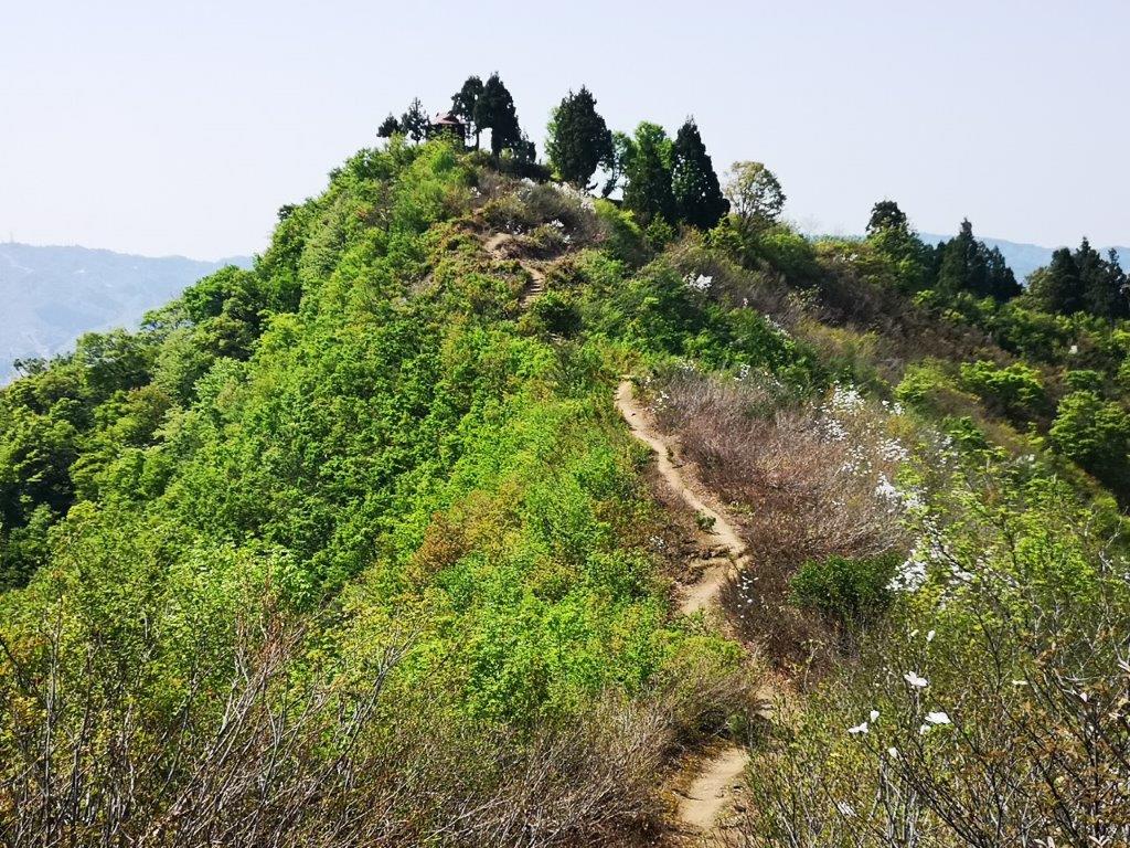
It felt like I was walking through a hidden valley, lush vegetation on both sides. After some ups and downs, I arrived at Satoyama-minka (里山民家), a recreated traditional farmhouse from the Edo era, at the edge of the forest. It was past 11am, and I was behind schedule, so I skipped a visit, and headed up a charming valley, filled with paddy fields, and frogs, judging from the croaking noises. After a short climb through forest, I reached the observatory at the top of Mt Rokudo, merging with my previous hike. Heading west, I passed the triangulation point, and soon turned left onto a path down the hill side.
Viewpoint of the Okutama Mountains
End of the Hike at Takane
I arrived at a viewpoint of the Okutama mountains, the outlook partially obscured by trees, but I could still make out Mt Kawanori in the middle. After descending a log staircase, I reached the Takane residential area at the base of the hill, and after walking along a road for a short while, made it to the bus stop at Miyadera-Nishi just before noon. The hike had taken 3 hours as planned, although I had to speed up the pace at the end. I’d definitely like to return in the autumn to explore more trails, as well as visit the Satoyama Farmhouse.
Autumn colours were at their peak on the Shinano Nature Trail
This was the second of two hikes using the Tokyo Wide Pass. On the first trip, I went to Shiobara. This time, I decided to visit the Karuizawa area; I created my own hike, since I couldn’t find anything suitable near a shinkansen station in my hiking books. I would ride a bus to the east side of Mt Asama, go up and down a small protrusion there (I did one on the south side during Golden week), and then follow the Shinano Nature Trail back to the outskirts of Karuizawa town; on the way, I would pass by the Shiraito Falls. It was my first time to visit Karuizawa in November, and although I was concerned about crowds, I was looking forward to seeing its beautiful autumn colours.
View of Mt Hanamagari (left) and Mt Myogi (right)
View of Mt Asamakakushi (left) and Mt Haruna (center)
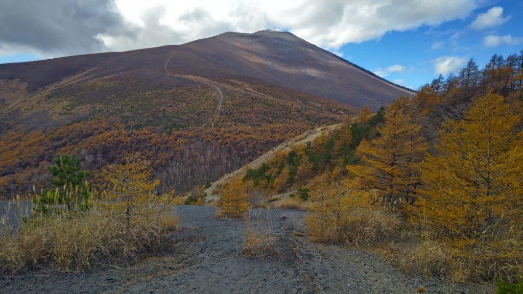
It was overcast and cold when I reached the start of the trail near Mine-no-Chaya (峰の茶屋) at 11am, after a 30 minute bus ride from the station. At 1400m high, autumn was already over. I followed a gently rising trail through leafless birches up the side of the miniature volcano. Very soon, I was scrambling up the exposed, rocky summit cone, and just before noon, I was standing on top of Mt Koasama (小浅間山 こあさまやま koasamayama). The name means “little Asama” and turning around, I could see the much bigger summit cone of Mt Asama opposite, its tip already covered with specks of snow.
View of the eastern side of Mt Asama from Mt Koasama
Trail for Mt Koasama (left) / The Shinano Nature Trail (right)
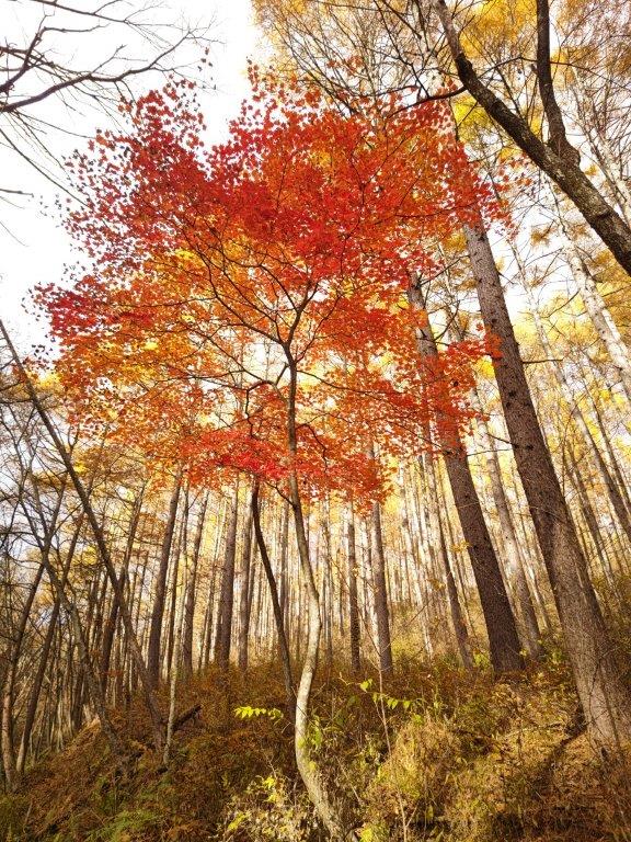
I had a glorious view of the surrounding forest, forming a multicolour patchwork of red, orange and yellow. To the south, I could see the mountains of Nishi-Joshu fading into the midday haze, although the jagged top of Mt Myogi was clearly visible. After enjoying the panoramic view, I retreated to the relative warmth of the forested lower section. By 1pm, I was at the start of the Shinano Nature Trail (信濃路自然歩道 shinanoji shizen hodo), just a few minutes from the base of the mini-volcano. It felt even colder than before, and I was surprised to see a few snowflakes float down from the sky.
Yellow larches along the Shinano Nature Trail
A relaxing hike along the side of a river valley
I followed a well-maintained and easy to hike trail through a wintry white-birch forest (白樺 shira-kaba), and after descending a series of log steps, reached the the Shiraito Falls (白糸の滝 shiraito-no-taki, meaning “white thread”). There were quite a few people here so I didn’t linger. I continued along the trail, as it followed the side of a narrow river valley, occasionally crossing the water over small wooden bridges, the sound of rushing water always in the background.
The Shiraito falls, the highlight of the Shinano Nature Trail
Walking next to a river (left) / Walking among the autumn leaves (right)
I was surrounded by towering yellow larches, and it felt like autumn had suddenly returned. At 3pm, I took a break at Ryugaeshi no taki (竜返しの滝), a few minutes off the main trail. As the hiking path gradually descended, the trees regained their colours and the sunlight burst through the clouds. I met few other hikers, and after another hour of relaxing and peaceful hiking, arrived at the Mikasa (三笠) bus stop. There, I caught a bus just after 4pm for the short ride back to Karuizawa station, where I boarded the shinkansen for the one-hour trip back to Tokyo.
See the views from the top of Mt Kosama and along the Shinano Nature Trail
After a two-month break, I was looking for an easy hike to get back in shape. I also wanted to visit a national park for a total immersion in nature. Shiga-Kogen, last visited two years ago, seemed like the ideal choice, since it had mostly level hiking trails passing next to small lakes, as well as a minor summit. I could get there by taking the shinkansen to Nagano city, then ride the “snow monkey” limited express to Yudanaka, and finally board a bus for the last leg of the trip. For the return, I would catch the same bus but from a slightly lower elevation. The weather was supposed to be sunny with some clouds; hopefully the sun would have the upper hand. I knew that Yudanaka is famous for its snow monkeys bathing in hot water in winter; in summer, however, they tend to roam further away, so I thought I might catch a glimpse of them along the way.
View of Biwaike and the peaks of Shiga-Kogen from Mt Asahi
Clouds slowing vanishing above Tanohara Marshland
I rode the Hokuriku shinkansen under blue skies, enjoying the views of the mountains surrounding the Kanto Plain. After getting off at Nagano station, I boarded the limited express for the one hour ride to Yudanaka, where I switched to a surprisingly empty bus for Shibutoge (渋峠); a little before 11h30, I finally got off at Kidoike Pond (木戸池 1620m, meaning “Wooden Door Pond”). After getting ready, I set off on a wooden walkway next to the lake side, but very soon made a sharp right up a short slope, leading to the top of a grassy rise.
Kidoike at the start of today’s hike
Looking back at Tanohara Marsh
I enjoyed a fantastic view of two peaks emerging from the clouds and a wide grassy area directly below; I felt I had made the right choice by visiting Shiga-Kogen (志賀高原) and the Joshin-Etsu National Park (上信越高原国立公園) on my first Autumn hike, even though at the moment, the lower sections were still in the mist. I made my way down to Tanohara Marsh (田ノ原湿原 1610m), and followed another wooden walkway to the forest on the other side; after crossing a road and descending along a rocky trail, I reached Sankakuike Pond(三角池 1630m, meaning “Triangle Pond”), a little after noon.
Blue sky reflected in Sankakuike
Shiga Lake Hotel reflected in Hasuike
As I approached the lake, I marveled at the reflection of blue sky and fluffy white clouds on the perfectly still water surface, the low clouds having temporarily parted. I continued along the gently undulating path through thick forest and soon arrived at Kami-no-koike Pond (上の小池 1570m), a lot smaller than the two previous ones. At 12h30, I was walking the length of the narrow Nagaike Pond (長池 1584m, meaning “Long Pond”) while observing the mad dance of the dragon flies.
Today’s mountain, Mt Asahi
Caution: monkey crossing
I took a while to enjoy its mysterious atmosphere: wisps of cloud drifting with the breeze down the opposite slope, creating ripples on the water surface. I crossed another road and arrived at Shimo-no-koike Pond (下の小池 1610m), the smallest pond so far, covered in bright green water plants. Next, I emerged on a steep slope near the top of a chairlift (Shiga-Kogen is also a ski resort). At the bottom, I passed through a tunnel and found myself at Hatsuike Pond (蓮池 1490m, meaning “Lotus pond”). I walked over to the nearby Ariake-no-oka Observatory where I had a view of Mt Terakoka and Higashi-Tateyama.
Sky and clouds reflected in Ichinuma
Monkey enjoying the pond view
At the other end of the lake, I was mesmerised by the reflection of the white facade of Shiga Lake Hotel. I popped into the nearby Shiga Kogen Yama no Eki (志賀高原山の駅), a mountain roadside station, to check their flower chart. I crossed the road once more, and after descending through the forest, reached Biwaike Pond (琵琶池 1390m), the largest lake so far. Through a gap in the trees, I had my first view of today’s mountain, a flattish peak rising above the opposite shore. I was hoping to have lunch there, it was already 2pm, but before that, I passed by Ichinuma Pond (一沼 1410m), the prettiest pond of the day.
Mt Ura-Shikakogen (left) and Mt Ura-Shigakogen (right)
Last pond of the day, Mizunashiike
As I approached, I was surprised to see a monkey squatting on the wooden walkway, and then two more relaxing in a tree above. In total, I spotted about a dozen, eating various plants, as well as water lily leaves; one brave monkey even went for a dip in the cold water. After they had all left, I resumed my hike up a pleasant path through a forest of Japanese white birch (白樺 shirakaba). A little before 3pm, I reached the summit of Mt Asahi (旭山 あさひやま asahi-yama). It was mostly in the trees, but on the east side the valley bottom was faintly visible; on the west side, I could see Biwa lake, as well as Mt Shiga, Mt Terakoya and Mt Higashi-Tate.
Japanese Monkshood, one of the many flowers of Shiga-Kogen
View of sun rays passing through clouds from near the bus stop
After enjoying the best view of the day, I retraced my steps to a junction I had passed earlier, and took the left branch. I soon emerged from the forest, crossed a road for the last time, and followed a grassy path to the tiny Mizunashiike Pond (水無池 1470m meaning “Pond without water”), the last and lowest pond of the day. I saw some purple bell-shaped flowers, called Yama-Torikabuto (ヤマトリカブト Japanese monkshood). I followed the trail around the marsh, reaching the road and the bus stop just before 4pm. After getting back to Yudanaka, once more on an empty bus, I caught the “Snow Monkey” to Nagano where, after enjoying some local sake inside the station, I boarded the shinkansen for the 90 minute ride back to Tokyo.
For my third trip using the Tokyo Wide Pass, I decided to head north to Niigata: reachable via shinkansen and covered by the pass; the beautiful May weather was supposed to last for one more day in the Yuzawa area. Looking at my hiking map, I found a suitable mountain that promised some good views, also the site of an ancient castle, and close to a train station. The hike was under three hours, which was fine, since it would be my third one in as many days. From Echigo-Yuzawa station, I would ride a local line for a few stops, and then walk to the start of the trail; since it was a loop hike, I could travel the same way back. The forecast announced blue skies again, but also summer-like temperatures. I was a little concerned as this hike was 1000 meters lower than the two previous ones, but I was excited about visiting Niigata again after nearly two years and seeing the Echigo mountains in spring.
The Echigo mountains in spring
Mt Kinjo, climbed two years ago
It was another beautiful May day as I rode the nearly empty shinkansen to Echigo-Yuzwa, where I transferred to the JR line for the short ride to Muikamachi. Standing outside the station, I had a view of today’s mountain, looking more impressive than it had on paper. I walked through the town and over the Uono river, reaching the trailhead at Torisaka Shrine (鳥坂神社) just before 11am. I was surprised to see some snow in the shade, even though I was only 200 meters above sea level. I didn’t make me feel any cooler as I started up the Yakushi Ridge Route (薬師尾根コース) on what was so far the hottest day of the year.
First view to the south of the Joshin-Etsu mountains
Climbing the log steps under the midday sun
I made my way up a grassy slope, lined with a handful of Buddhist statuettes. I soon reached the first viewpoint of the day: looking south, I could make out Mt Tanigawa and Mt Naeba in the midday haze, still white with snow. Contrary to my expectations, from this point forward the path was out of the tree cover, and it felt very hot under the midday sun. On the other hand, thanks to the clear weather, I enjoyed amazing views back of the flat Yuzawa valley, as the path followed a narrow ridge, that eventually merged with the summit ridgeline. Looking south again, I could now see Mt Kinjo, patches of snow still covering its top half.
Looking back at Muikamachi Town
One of the flat sections of the Yaukushi Ridge Route
The steeper sections of the trail were fitted with log steps, making it easy to climb; higher up, there was even a metal staircase. Just before 1pm, I arrived at the small wooden shrine marking the summit of Mt Sakado 坂戸山(さかどやま sakado-yama). Although the summit of yesterday’s mountain seemed artificial, today’s summit was man-made, all that was left of the highest point of Sakado castle. On the north and east sides, I had a spectacular view of the 3 great mountains of Echigo covered in snow: Mt Hakkai, Mt Echigo-Koma and Mt Naka. I found a spot in the shade and sat down for lunch. Once done, I made a short round-trip to a couple more grassy mounds along the eastern ridge, also part of the castle ruins.
The steeper bits were fitted with log steps (left) and metal ones (right)
Looking down at Minami-Uonuma City
I was rewarded with amazing views in all directions; it almost felt like I was hiking in Switzerland. I also saw many Mangolia flowers (tamushiba) along the path. At 2pm, I started to head down the Shirosaka Route (城坂コース). Very quickly the path dived into the forest, the cool shade a welcome relief; however, I was soon out of the trees again at the top of a steep valley. I followed a switchback path while enjoying the bird’s eye views of the flat valley below, framed on both sides by bright green ridges. It was the hottest time of the day and amazingly many people were still going up. Half an hour later, I reached a famous cherry blossom spot near the flatter base of the mountain.
A side view of Mt Hakkai
Making the roundtrip along the east-west ridge
I was shocked to see many trees broken in half: apparently an avalanche had swept down the steep mountain side during the winter. However, I was amazed to see some flowers still in full bloom on one of the damaged trees (see video), a sign of hope among the destruction; this also meant that I had seen cherry blossoms on all 3 hikes. I followed the now level path, and after passing under some cedar trees, I was back at my starting point by 3pm. It took about an hour for the return to Echigo-Yuzawa station, where I enjoyed a hot spring bath and some local sake, before boarding the shinkansen for the eighty minute ride to Tokyo.
A switchback path down the Shirosaka Route
See the views of Mt Sakado in the spring
A slideshow of some more photos of the Mt Sakado hike


![Mt Hirao (1155m), Saku City, Nagano Prefecture, Sunday, September 24, 2023 [Map Available]](https://hikingtokyo.com/wp-content/uploads/2023/09/hirafouji.jpg?w=1200)


![Sayama Hills (Highest Point 194m), Tokyo & Saitama Prefectures, Tuesday, May 9, 2023 [Nawatake Forest Road]](https://hikingtokyo.com/wp-content/uploads/2023/07/dsc_7188.jpg?w=1024)


![Shiga-Kogen & Mt Asahi (1524m), Yamanouchi Town, Nagano Prefecture, Sunday, September 4, 2022 [Monkeys]](https://hikingtokyo.com/wp-content/uploads/2022/09/img_20220904_121427.jpg?w=1024)


You must be logged in to post a comment.