This mountain came to my attention quite recently, while watching the anime Yuru-Kyan (Laid-back Camp). One of the characters goes solo camping at Takapotchi Highland (高ボッチ高原), a place in Nagano prefecture I had never heard of before. So I looked it up on my map, and although it didn’t seem to have much hiking potential, the mountain north of it seemed worth a visit; even more since there was an onsen near the start of the trail. The main issue was access, since there was no public transport. In the end, I decided to rent a car, since it was less than an hour drive from Matsumoto. I would need to walk up and down the same way, but I didn’t mind, since the highlight of the hike was the panoramic view of the North Alps from the summit. This meant that I had to make sure to go on a day with clear weather. That day also turned out to have a strong wind forecast, so I mentally prepared myself for being buffeted by winter gusts on the treeless summit.
View towards the North Alps and Utsukushigahara
There was almost no traffic on the way there, which was a relief, since the last part was along a narrow mountain road. I arrived at 11am, and after getting ready, set off at 11h30. Fifteen minutes later, I reached a river and a bridge. I crossed the bridge and followed the river for a short while before climbing up the mountainside through forest. There is a distinct feeling about hiking in Nagano, that is different from the Kanto area. The forest feels wild and untouched; there is moss everywhere growing on rocks and fallen trees, probably because of the colder, wetter weather. The sun was shining, and although the autumn leaves season was already over, the surrounding forest was still beautiful. At this late hour, I was the only person on the trail.
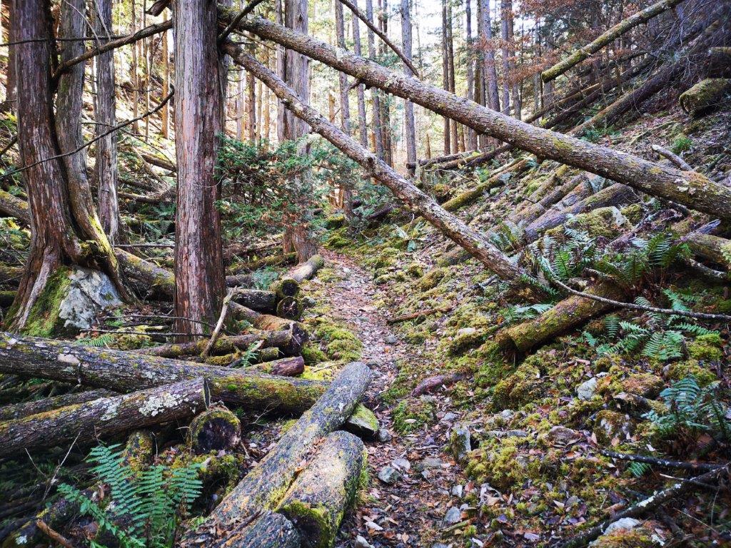
Start of the hike through a mossy forest
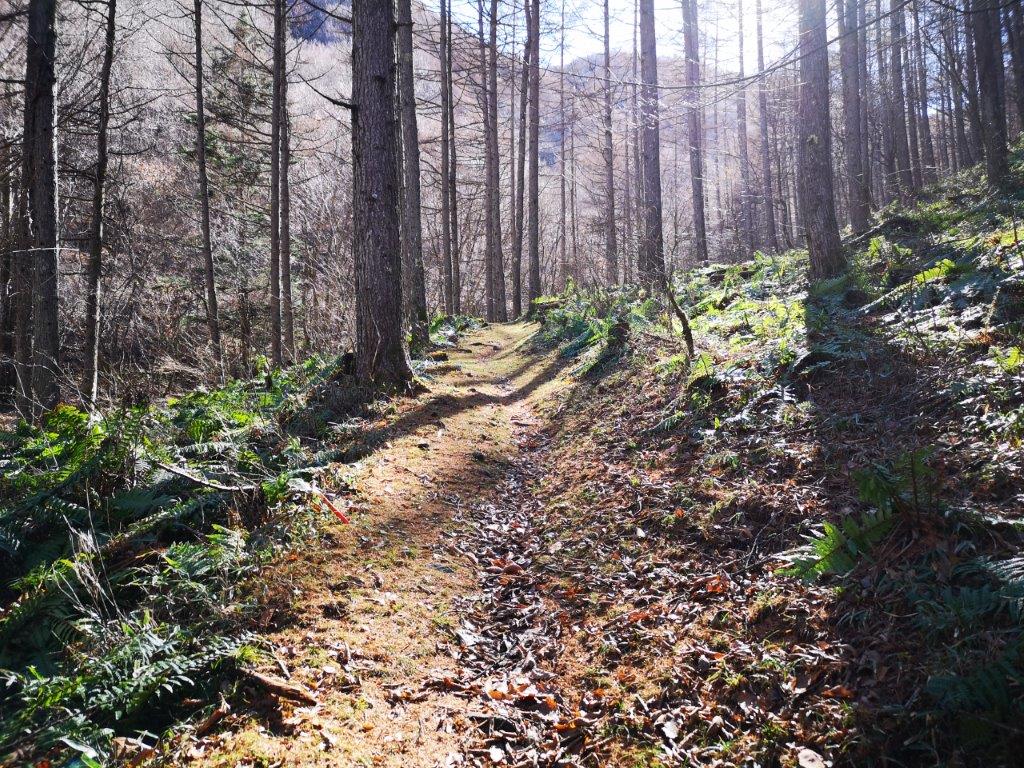
Late morning sunny hiking
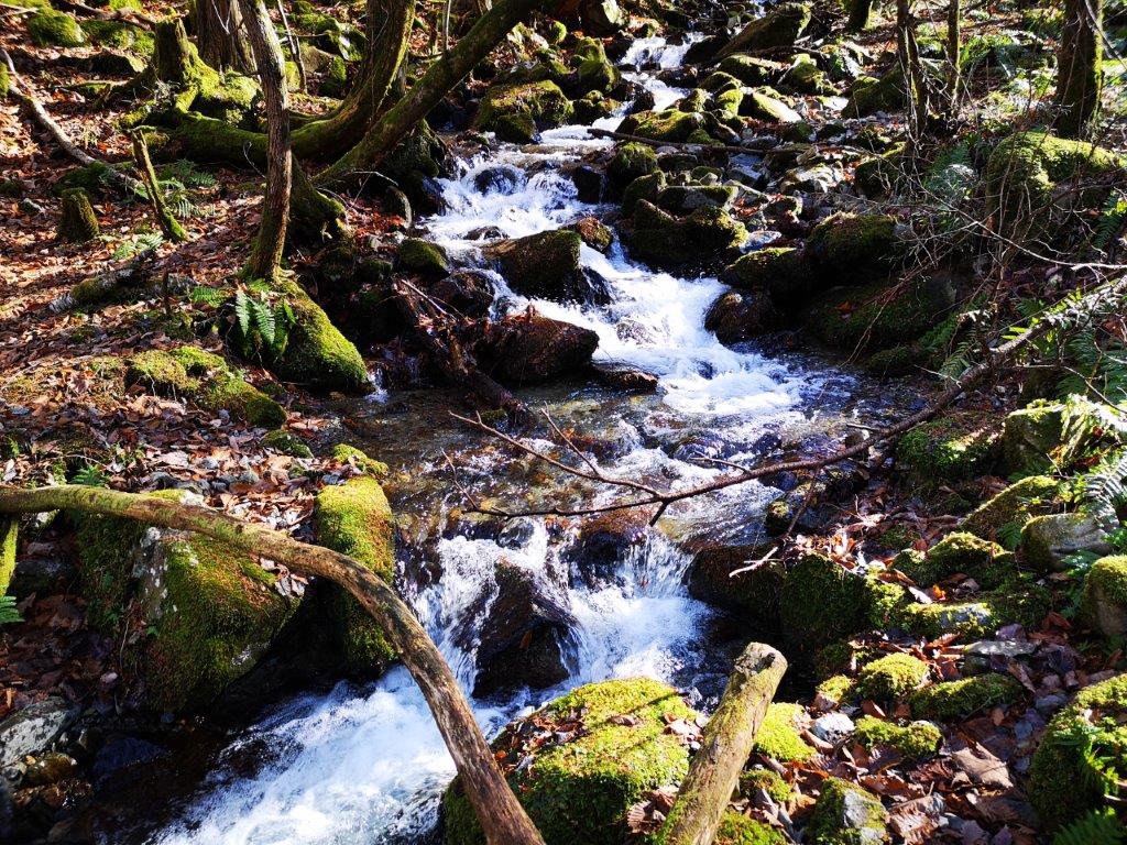
The trail met up with the river again about twenty minutes later and followed it for the next hour. It might have taken me less time, except that the river was so beautiful in the sunlight that I spent a lot of time taking photos and shooting movies. It was probably one of the most beautiful river walks I had ever done, almost rivaling Tokuwa river valley from a few weeks before. I could only imagine how beautiful it was in the spring or autumn. Around 1pm, the path and river finally parted ways. I walked as fast as I could to make up for lost time, as the path now zigzagged up the side of the mountain.
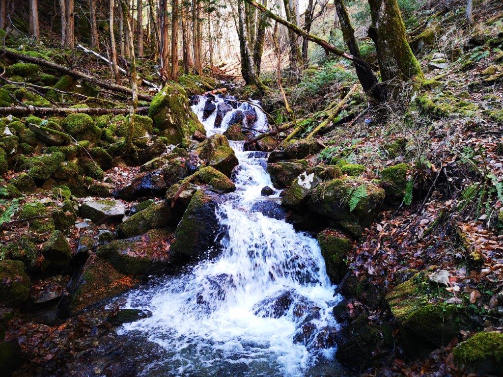
Lots of great river views on the way up

The perfect hike for river lovers
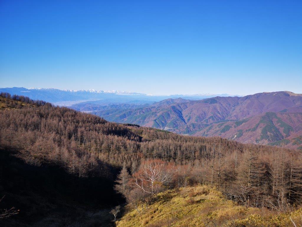
I had my first views of Utsukushigara Highland (美ヶ原高原) About half an hour later, rising above the trees. I also got blasted with an icy cold wind forcing me to stop and add a layer of clothing. A few meters further, I got the view I had come for: the entire range of the North Alps, also known as the spine of Japan, stretching south to north, from Mt Hotaka, all the way to Mt Shirouma. It sometimes seems exaggerated to compare the Japan Alps with the Swiss Alps; today, however, the appellation was justified, as the entire range was crowned in snow. I had seen this view before, but from further away, and this might be the best view one can get of the North Alps.
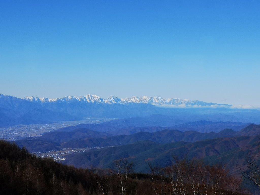
The northern half of the North Alps
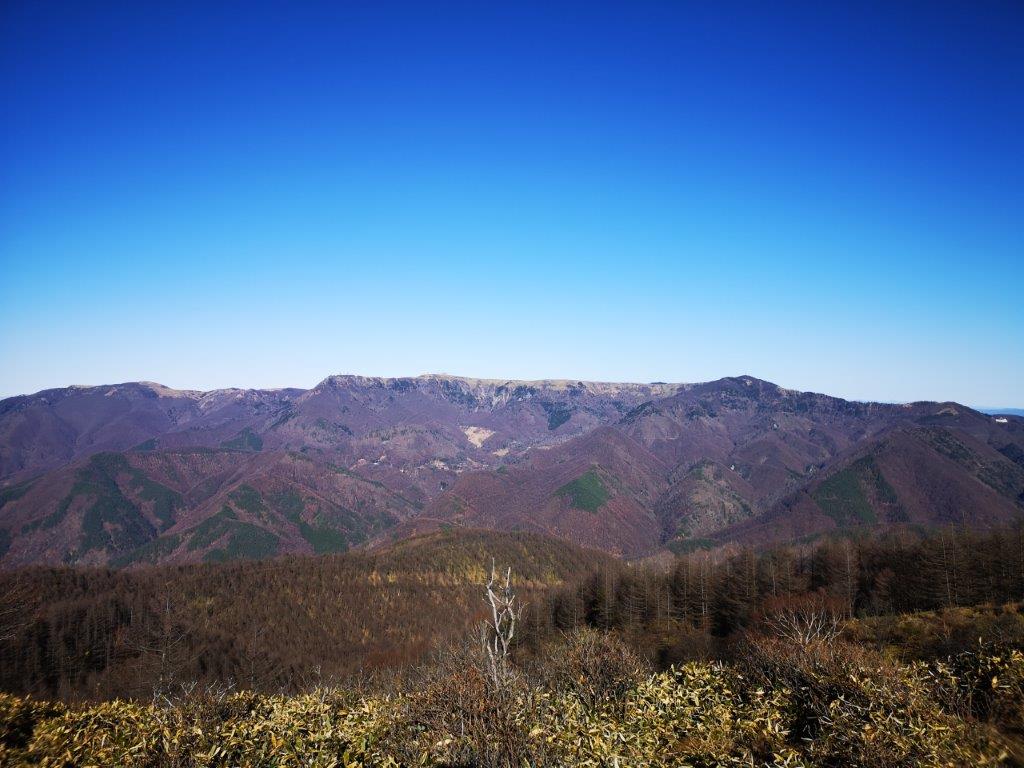
Utsukushigahara, one of the hundred famous mountains of Japan
Just before 2pm, I reached a crossroads. I turned right and a few minutes later I was standing on top of Mt Mae-Hachibuse (前鉢伏山 まえはちぶせやま maehachibuseyama). The wind wasn’t too strong here, so I decided to have lunch. I then retraced my steps to the intersection, and walked up a wide gravel path with sweeping views of the whole area. Shortly afterwards, I reached the summit of Mt Hachibuse (鉢伏山 はちぶせやま hachibuseyama), a 300-famous mountain of Japan. On the other side, there was a tiny shrine and a shinto gate, which looked quite spectacular with the North Alps in the background. There was also a small observation tower, which seemed quite pointless seeing that there were no trees around to obscure the view. Nonetheless, I climbed the ladder to the top.

Shinto shrine near the top of Mt Hachibuse

Observation tower near the top of Mt Hachibuse
Just as I stood on the top, the wind suddenly picked up. I had a great view of Yatsugatake, Mt Fuji, Suwa lake, the Central Alps, the South Alps, as well as the North Alps. As I was filming the view, my smartphone nearly got blown out of my hands. It was getting cold and it was already past 3pm. I decided to quickly head back. Although I had no bus to catch, I preferred to avoid driving in the dark along narrow mountain roads. I was back at my car 90 minutes later, and after a nice soak at Hinoki no Yu, I was driving back to Matsumoto city, where I caught the Chuo limited express for the 2h40 train ride back to Tokyo.
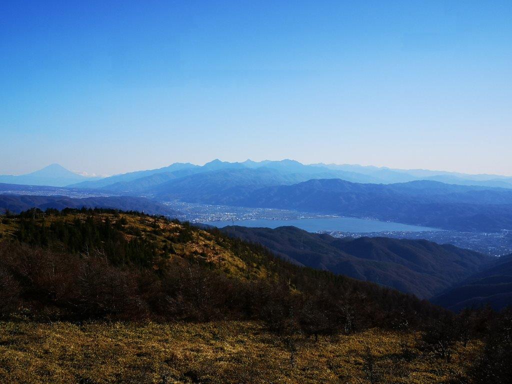
Mt Fuji, the South Alps and Suwa lake
Check out the river running down the slopes of Mt Hachibuse
See the view of the North Alps from the top of Mt Hachibuse