
I had visited this Kanto 100-famous mountain twice before, in the winter and in the spring. Although it was early December and the leaves had already fallen in the mountains, it was sunny and pleasant in the daytime – so in my mind this would count as an autumn trip. My plan was to ascend the same route as in 2015, but without snow this time, and then descend via the South Ridge route (南尾根コース). The previous time I had used the Omotesando route (表参道コース), so I was looking forward to hiking a new trail. I could see on the map that it had a viewpoint along the way, and ended further down the mountain than the other trail, although it was still a 40 minute walk on a paved road to the bus stop. One concern was that the bus to the start of the trail left rather late in the morning. Since the days were shorter now, I would probably have to wait for the return bus in the dark; luckily, there was an excellent hot spring at Seibu-Chichibu station to warm myself up at the end of the day.
Get a map of the Mt Jomine hike
This map was developed for Japanwilds with the Hokkaido Cartographer
Find more Japan hiking maps on Avenza

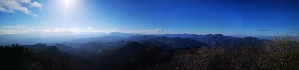
Left back, Mt Ryokami, and right back, Mt Akaguna
The sky was worryingly overcast as I left Tokyo with the Seibu line. Fortunately, the clouds ended over Chichibu, and there was beautiful blue sky above the mountains on the Saitama-Gunma border. At Seibu-Chichibu station, I changed to the Chichibu line, and got off at Minano, four stations away, where I caught a mini-bus for the start of the trail. There was a group of hikers at the bus stop, and they graciously let me board first. They got off near Mt Happu, and I was alone for the last part of the ride, along a narrow winding road. I was surprised that a bus service was needed in such a remote area, but occasionally a clearing and a house appeared after a sharp bend. I got off at 11am, and walked up to the shelter above the road to get ready for hiking.
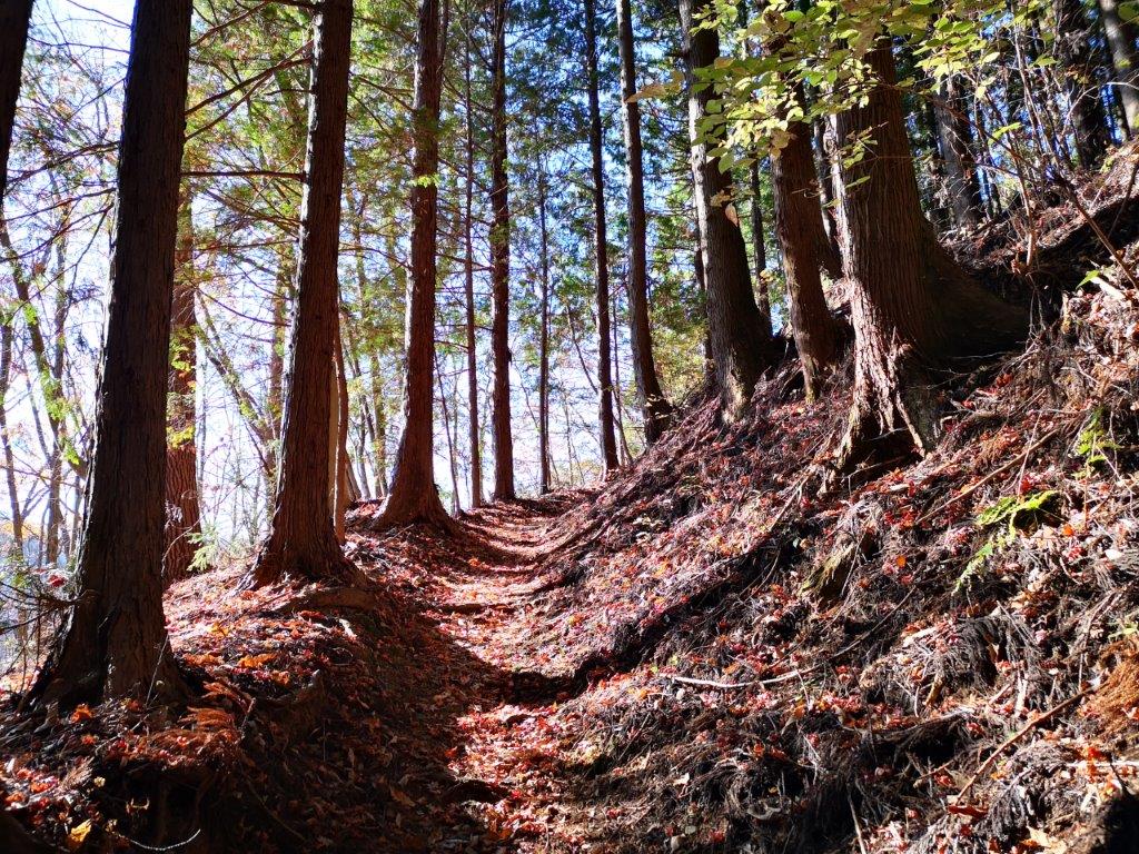
Following the Fureai no Michi up the mountain
Several large “jorogumo” spiders were hanging from the rafters, so I had to be careful not to disturb their webs with my head. At 11h30, I set off along the road, and soon spotted the turn-off for the Kanto Fureai no Michi, which I would follow to the pass just below the summit. I enjoyed the trail as it wound slowly up a narrow valley through beautiful and peaceful forest. I noticed that the signposts were worn-out and hard to read. Many years ago, the Fureai no Michi trails might have been quite popular. However, nowadays, interest had waned for some reason – perhaps hikers are more interested in reaching summits than walking long-distance trails. As far as I know, there is no published book on these trails.

Clouds over Higashi-Chichibu
I reached the first viewpoint of the day at 12h15, next to a white electric pylon. I could see the Chichibu valley to the south, and behind it, Mt Buko and the mountains of Higashi-Chichibu. Nearby was a bench, but it was too early to take a break. Along the way I passed a couple of junctions. Each time I took the left, level branch, avoiding the minor summits on the right, since I knew there was no view. It took me half an hour to reach the road at Isama pass (石間峠). Here I said goodbye to the Fureai no Michi. I would have liked to continue along it, but it now followed the road down to Kanna Lake in Gunma. Although it was closed to traffic, I preferred stick to dirt trails whenever possible.

The final steps before the summit
After hiking up a series of staircases, I reached the observation tower and the top of Mt Jomine (城峯山じょうみねさん jominesan) at 1pm. The Japanese name means “Castle Peak”, perhaps a reference to the rocky section further west along the top ridge. It seemed to double as a communication tower as there were several satellite dishes attached to it. Although the Saitama side was cloudy – no chance of seeing Mt Fuji – there was nothing but blue sky on the Gunma side. This is probably one of the best views in the area, and also one of the easiest to access.
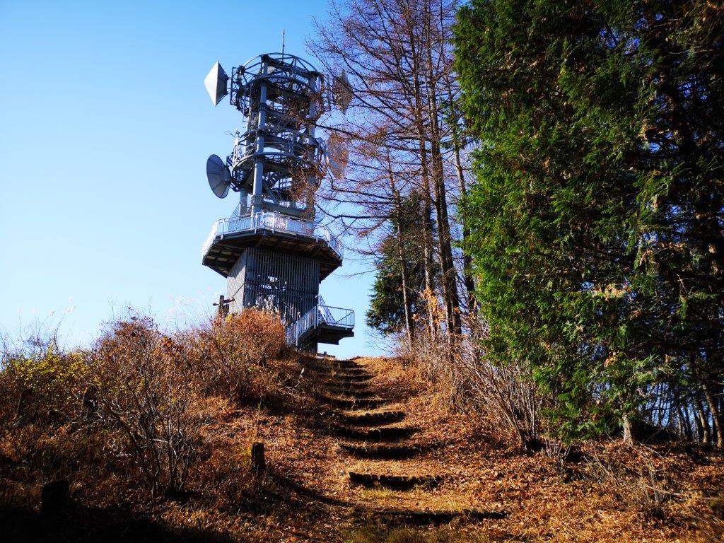
The observation and communication tower
Looking at the view, I could recall many of my past climbs in the area: Mt Mikabo (climbed in 2016), Mt Inafukumi (2019), Mt Akaguma (not yet climbed), Mt Tetemiezu (2017), Mt Futago (2017) and Mt Ogura (2018). In the distance, I could also make out several 100 famous mountains of Japan: Mt Asama, Yatsugatake, Mt Ryokami, Mt Kobushi, and Mt Kumotori, its peak lost in the clouds. Despite the height of the tower, the the Kanto plain to the east was hidden by trees. As I was busy checking out the view and taking photos, I didn’t mind eating my lunch standing as there were no seats.

Blue skies over Gunma
I managed to tear myself from the view at 2pm, and headed down the South Ridge trail. The first part was quite steep and lined with ropes; afterwards, the trail became less steep, but remained narrow and adventurous; overall it was a lot more fun than the Omotesando trail. There were a couple of junctions without signposts, meaning that the branches would join up again; both times I took the right ones, as they seemed more interesting. There were a couple of openings through the trees to the south, but the superb westward view promised by my map never appeared. I had planned to take a break there – I hadn’t sat down once so far today – but that would have to be wait a bit longer as there were no other good spots.
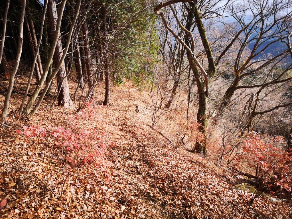
Heading down the South Ridge trail
I saw no-one else on the trail and I was able to enjoy the quiet solitude of walking in the mountains. I finally popped out onto the road at 3h30. The valley was already in the shade and getting chilly. I made my way down to the river next to the road, and sat on a large rock for a late break. I had an hour and half till my bus so for once I could take my time. I spotted many spiders – I was amazed that they could survive the night in sub-zero temperatures. I strolled down the road, admiring the small houses of the Saitama countryside. I saw several huge “kaki” (Japanese persimmon trees). Although it’s the national fruit of Japan, I rarely see it growing in the wild. I reached the bus stop at 16h45, and after a short wait in the cold, I hopped on the empty bus for Seibu-Chichibu station and a hot bath.

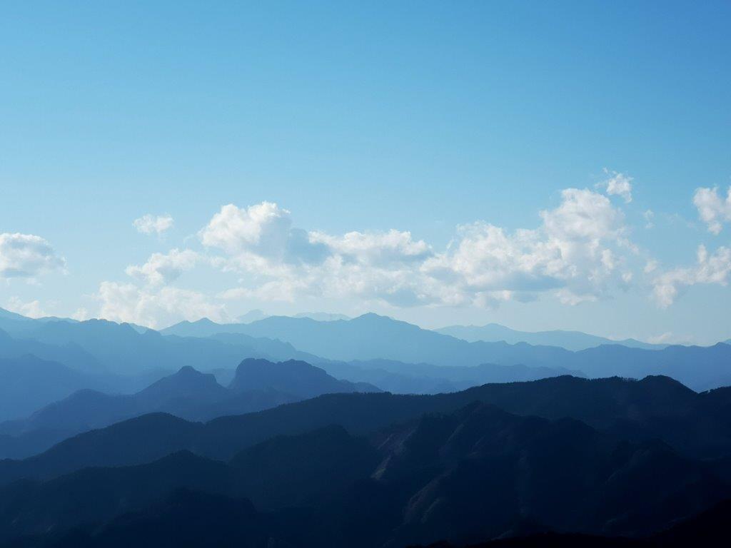
Mt Kobushi (left) and Mt Ryokami (right)
Mt Ogura (front) and Yatsugatake (behind)

2 thoughts on “Mt Jomine (1038), Chichibu City, Saitama Prefecture, December 2020 [South Ridge Route / Map Available]”