
I had good memories hiking this ridgeline in 2014, so I was keen to redo it. This time, instead of starting from the bottom of the valley, I decided to start from near the base of Mt Mito. I would mostly be walking on level or downhill terrain, a rare thing in Japan, so I was looking forward to a relaxing ramble. Last time, I had still been able to see some autumn colours, so I was hoping I would be lucky again, even though the season was nearly over. I also decided to skip the Hossawa falls at the end, since I knew there was less water at this time of the year. The weather forecast was perfect: blue skies and higher than average temperatures. I wasn’t sure if anything could make this hike better.
Hiking in the Chichibu-Tama-Kai National Park
Ask for a hiking plan for Sengenrei

View of Mt Gozen from the top of Sengenrei
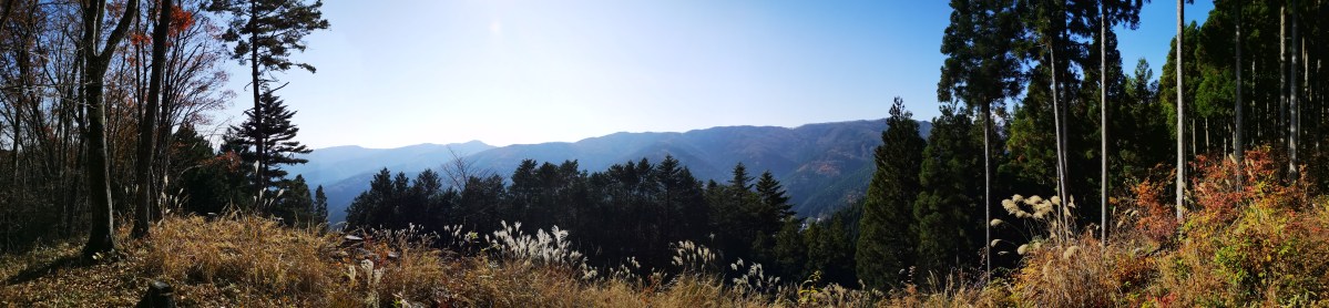
It was still early when I got off the bus at the Citizen’s forest (都民の森). While the other passengers headed up Mt Mito, I continued on the sidewalk next to the road for Okutama lake. After it ended abrubtly, I was forced to walk on the winding but busy mountain road. It didn’t feel very safe, but fortunately, I soon arrived at the Sengenone parking lot, where there was an excellent view of the ridgeline I would be following today. After getting ready, I walked past a sign informing me that I was inside the Chichibu-Tama-Kai National Park, and entered the hiking trail a little after 10am.
The Sengen Ridge in the autumn
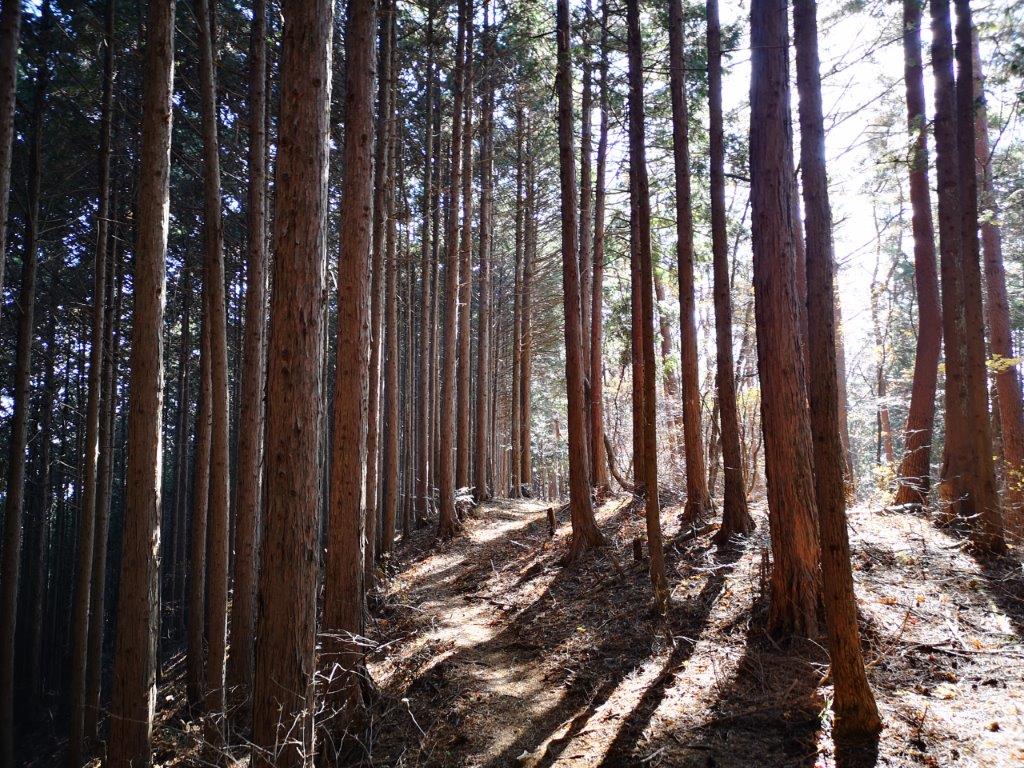
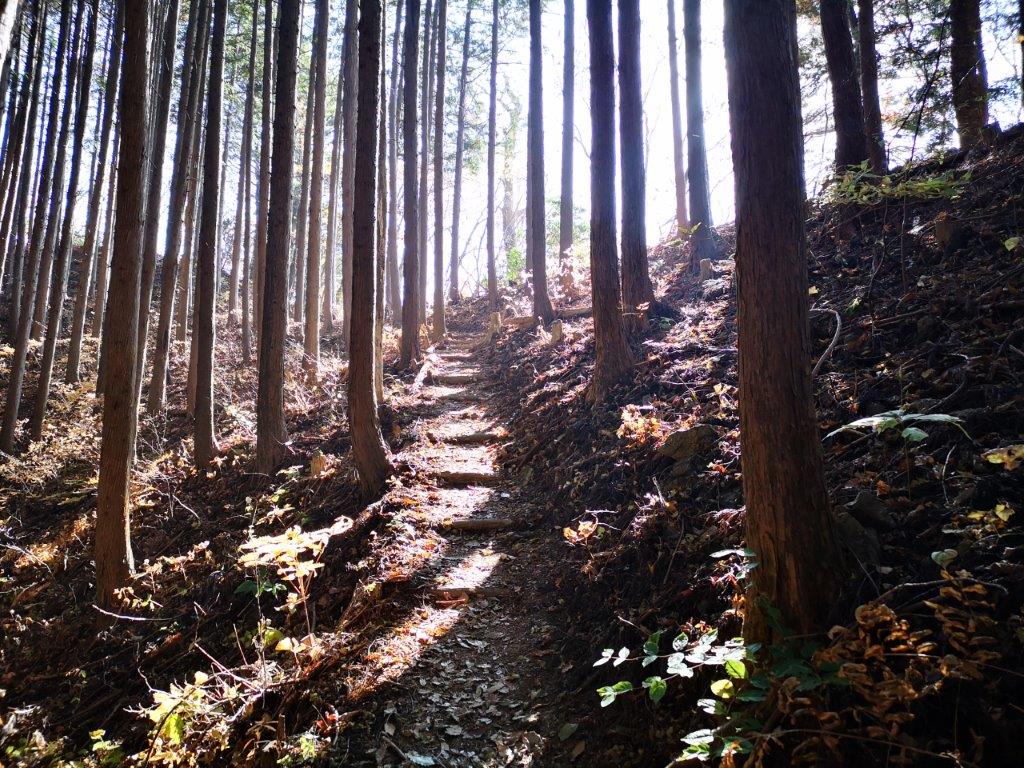
Hiking a level trail through the forest
Barely 15 minutes later, I reached the first peak of the day, Mt Obayashi 1078m (御林山 おばやしやま obayashiyama). Some trees had been cut down so it was possible to see the view southwards – I recognised the ridge I had hike over a year ago. There was no wind, and no noise, except for the song of a nearby bird. Even though I had just set out, I sat down for a few minutes to enjoy the peace and quiet. After setting off, I quickly reached another clearing with an even better view to the south. The trail was mostly level, with some small ups and down and frequent signposts. Half an hour later, I reached the trail junction I had hiked up 6 years ago; from now, the trail would be more familiar.

The ridge I hiked in June 2019
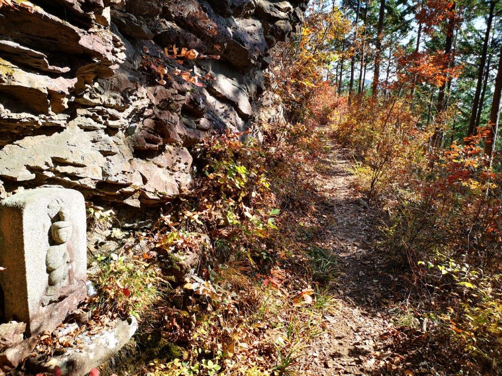
There were many statues and other religious icons along the trail
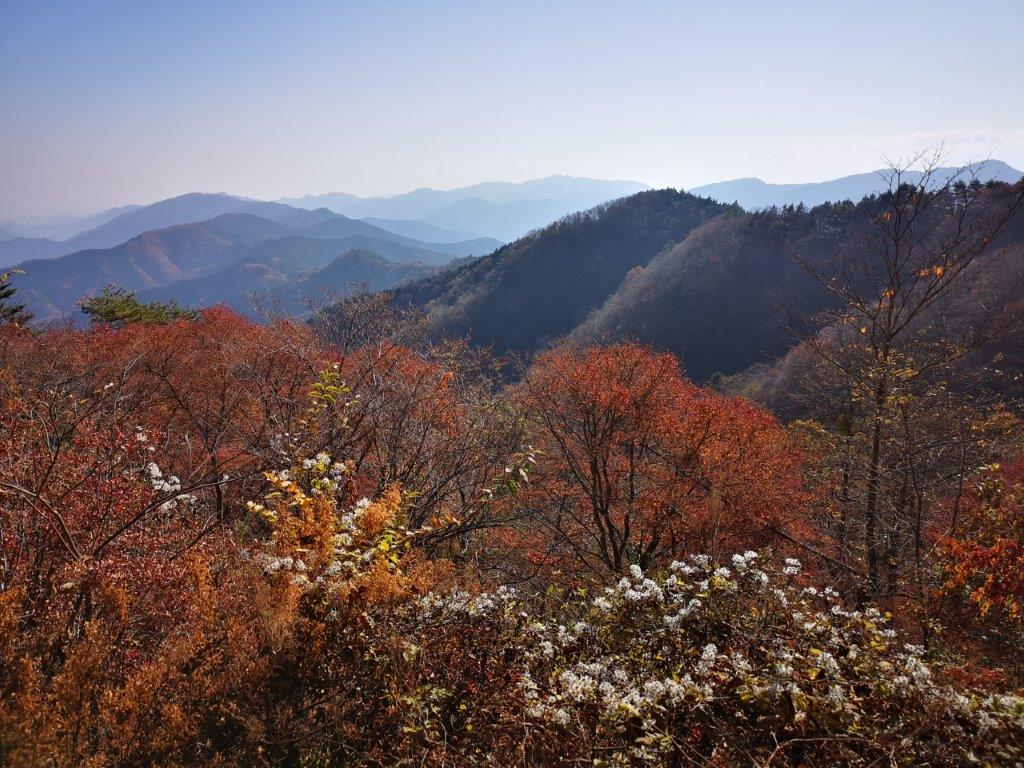
I passed a good viewpoint of Mt Gozen on the left, one of the 3 mountains of Okutama. A little further, I arrived at a huge boulder called Saru-Ishi (サル石) because the pattern on the face of the rock resembles the handprint of a monkey. Just before 1pm, I reached a wide deforested area on the left. I had an excellent view of Mt Gozen, Mt Odake (another of the 3 Okutama mountains), and Mt Mitake. In the distance, I could also see Mt Kumotori, the highest point of Tokyo prefecture, and a hundred famous mountain of Japan. I was tempted the stop for lunch, but I knew that the summit with an equally good view, wasn’t far away.

A narrow path following the mountainside
Climbing towards the sun
I reached a junction where both branches were signposted for the summit. On my previous hike I had taken the level path on the left. This time, I took the right branch for the summit of Koiwa-Sengen 908m (小岩浅間). The trail was rather faint and there was no view, so I concluded that the left path was probably the better of the two. Walking down the other side, I soon reached the Sengen Ridge Rest Area (浅間尾根休憩所) where a group of people were having lunch. This is also where the trail merged with the Kanto Fureai no Michi climbing up from the valley on the right. I continued without stopping to the Sengenrei viewpoint just a few minutes away.

Mt Gozen, with Mt Kumotori behind on the left

Mt Odake with a white leafless birch tree in the front
I had the viewpoint entirely to myself. Since it was already 1h30, I sat down on one of the benches surrounded by the pale yellow “suzuki” and enjoyed lunch with a view. Although Sengenrei (浅間嶺 せんげんれい) felt more like a ridgeline, it had a proper summit marker at the highest point. Thin wisps of white cloud had now appeared in the sky, but it was still warm under the late autumn sun. I set off again just before 2pm. After passing a flat area with some beautiful autumn colours, the path started to descend. Suddenly, a helicopter flew by overhead, disturbing the quiet of the forest. I supposed it was bringing supplies to the mountain huts in the area.

Double view of Mt Gozen and Mt Odake with autumn leaves in the foreground
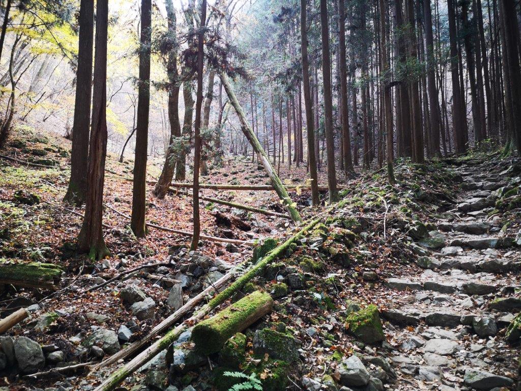
Rocky path down the mountain
The trail left the ridgeline and followed a rocky path next to a small stream. Eventually, I arrived at a soba restaurant (closed today), on the bend of a paved road, which I now had to walk on for a short while. Fortunately, there was no traffic. I walked past a small shrine and a good view of Mt Odake, and arrived at Tokisaka pass (時坂峠) just before 3pm. Here, I ducked down a small hiking path on the right, under a huge fiery red maple tree. The path descended quickly and soon I was walking among small fields and small houses. After walking down a staircase covered in fallen leaves, I joined a paved road leading to the Hossawa Falls marking the end of the hike.

One of the short road sections along the hike

Huge maple tree at Tokisaka Pass
I noticed some movement on the left side just as I walked through Hossawa Falls parking lot. Taking a closer look, I saw a couple of monkeys scampering besides the small river below. I was pretty excited, since it was only my third time seeing wild monkeys this year. Scanning the side of the mountain, I realised that that there was a whole troop of them in the forest above the river. They were shier than the ones I had seen next to Okutama lake the previous year, but I was still able to film them at a distance (see video). I wanted to linger there longer, but it was nearly 3h30, and I had a bus to catch. Since I hadn’t expected to see any monkeys today, I felt quite satisfied with my hike inside the National Park closest to Tokyo.
Ask for a hiking plan for Sengenrei
Check out the monkeys of the Chichibu-Tama-Kai National Park


