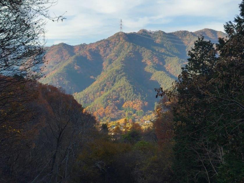
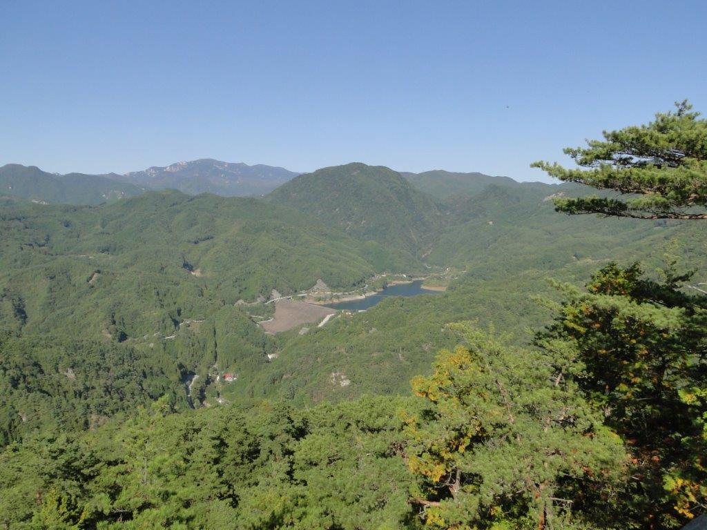
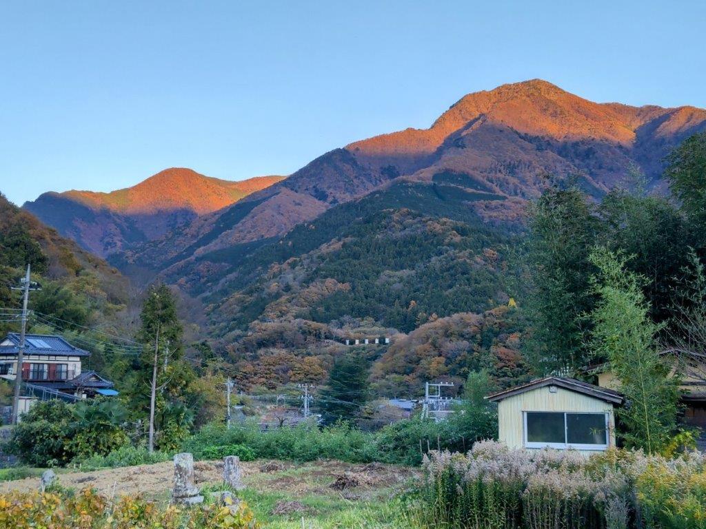
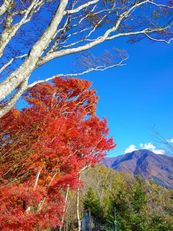
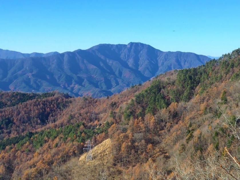
I wanted to do another hike in Yamanashi that could be done by car. Looking at my hiking map, I found a mountain north of Yamanashi city, nearly halfway between Mt Daibosatsu and Mt Obina. It was a relatively short loop with a view of the South Alps and Mt Fuji from the observation tower from the summit. Known for its skunk cabbage fields in early spring, I hoped to have the trails mostly to myself in this season.
To get to the hike, I’d drive a share car from Kofu station to a parking lot at Tamamiya Zazenso Park. On the way there, I would stop by Soba Maru, last visited 5 years ago, for a pre-hike lunch. The weather was supposed to be sunny all day with temperatures average for the season. I was looking forward to a pleasant Autumn hike in the mountains of Yamanashi and hoped to get a glimpse of snow-capped Fuji.
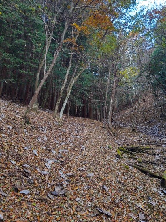
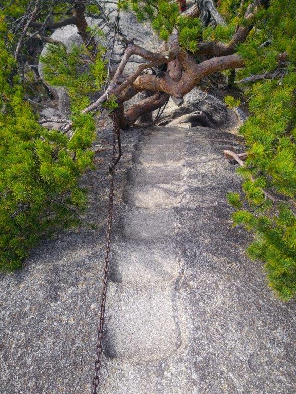
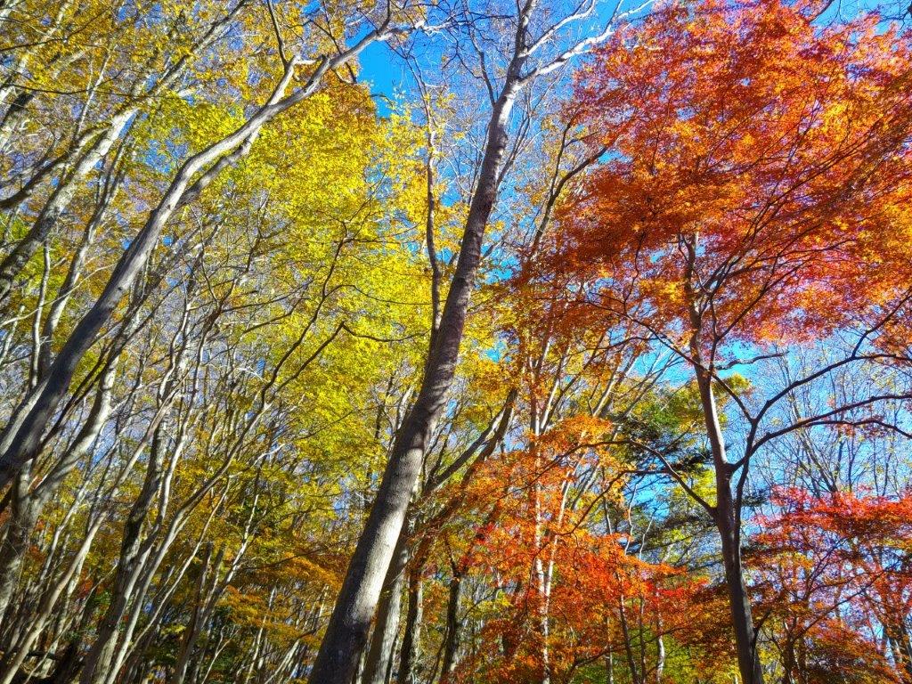
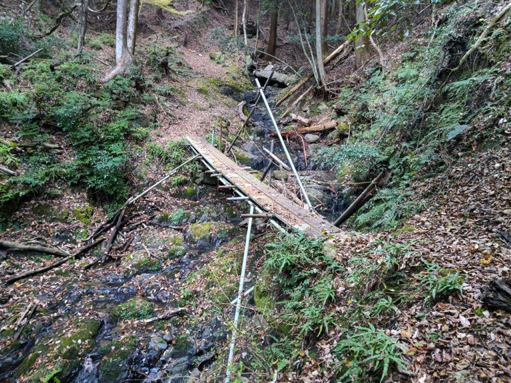
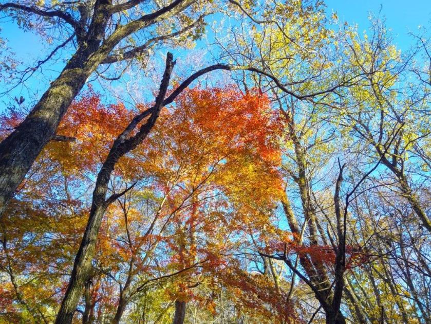
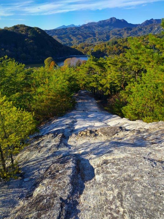
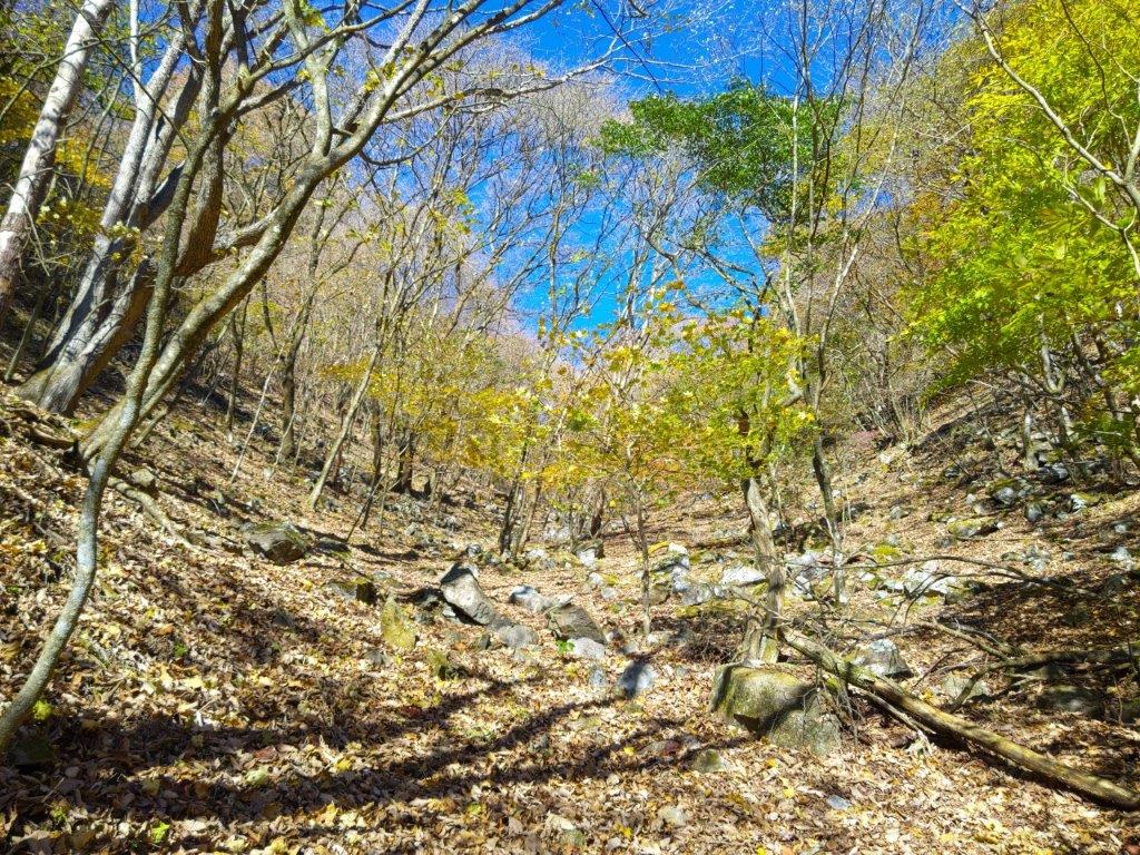
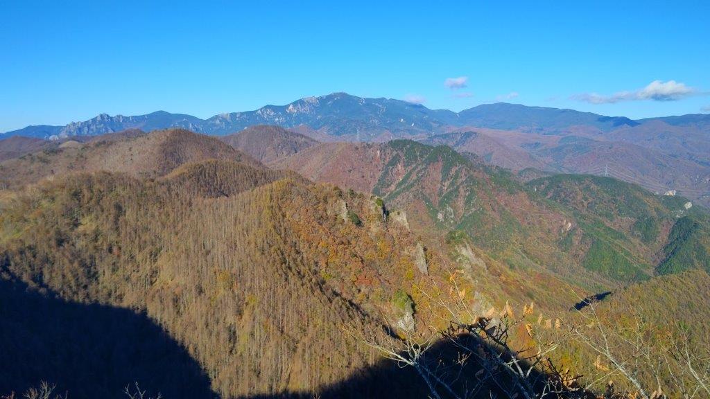
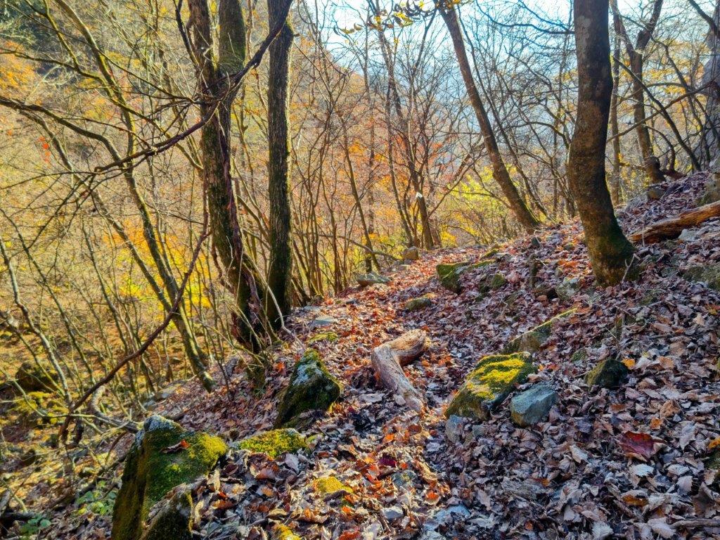
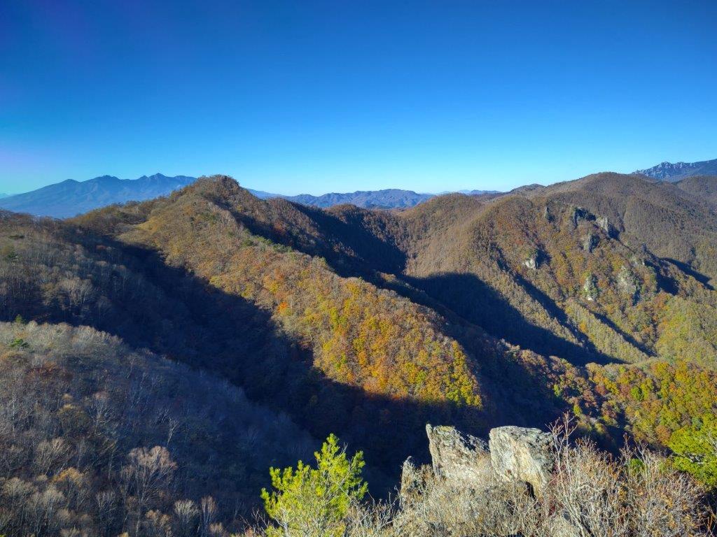
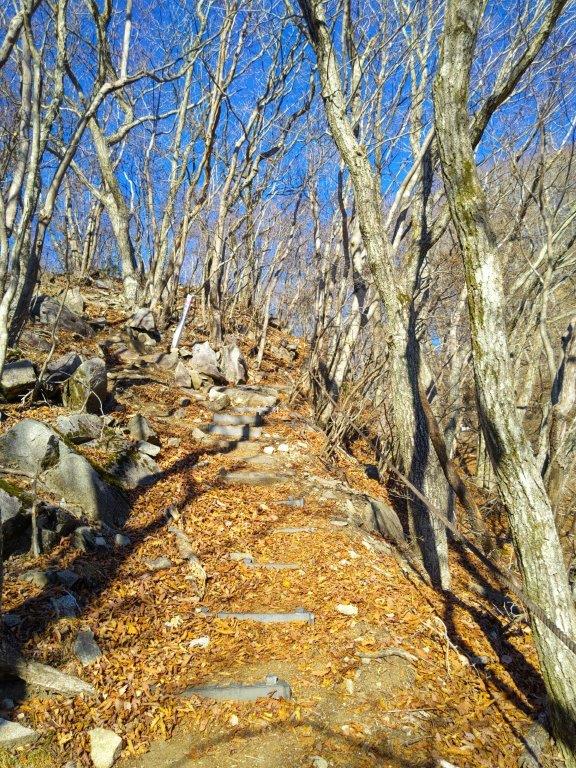
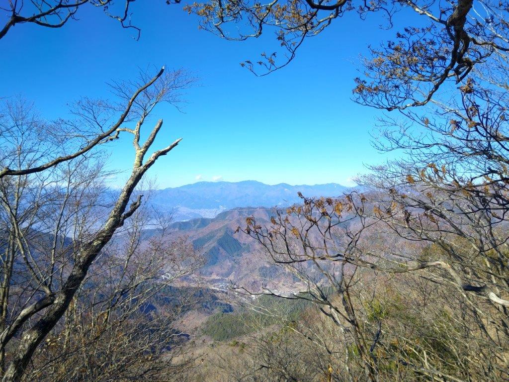
Trail between the Skunk Cabbage Fields and the Ridgeline
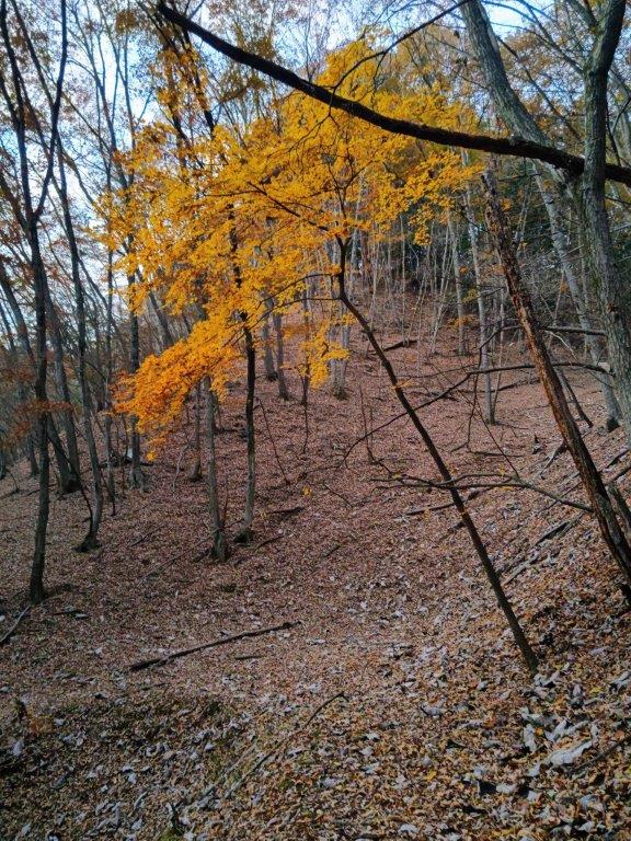
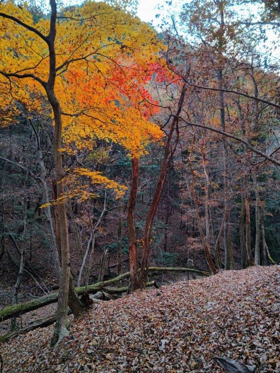
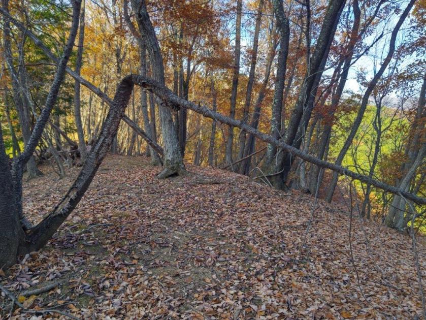
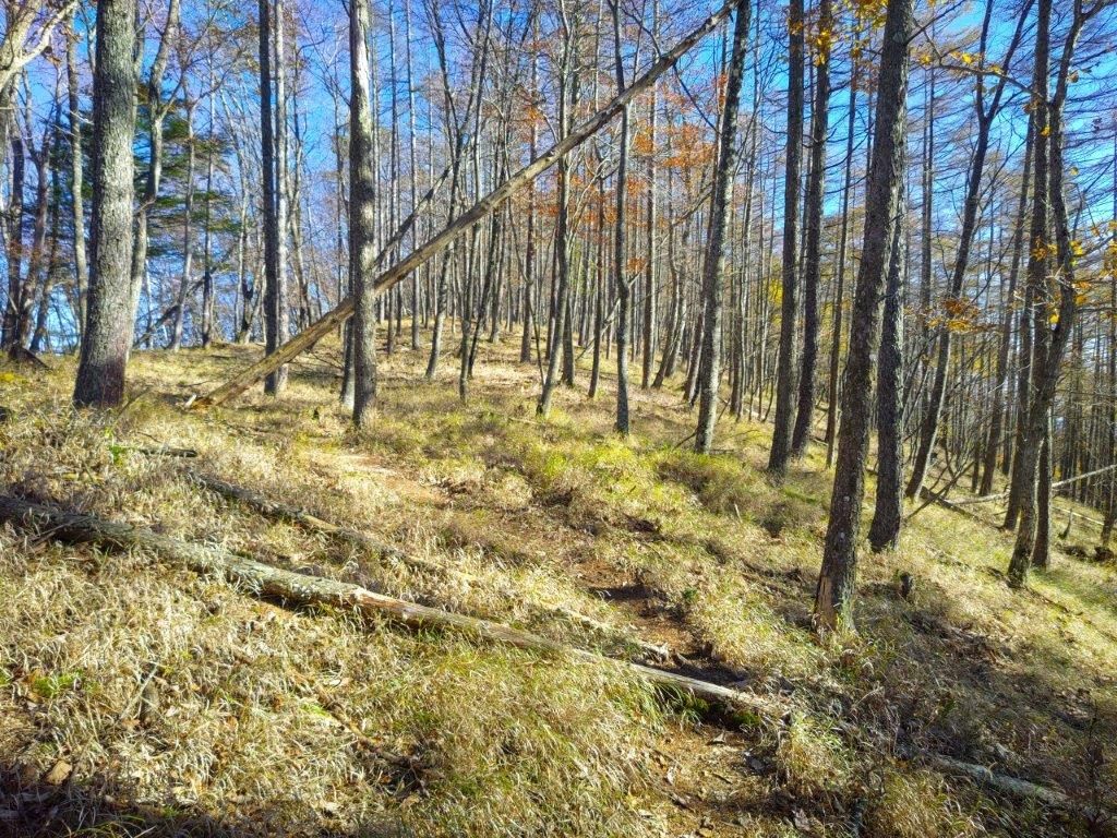
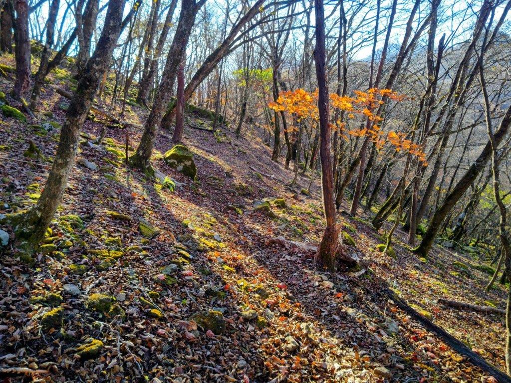
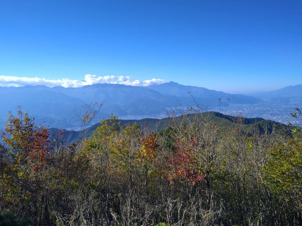
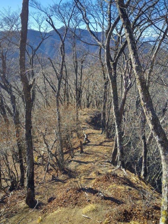
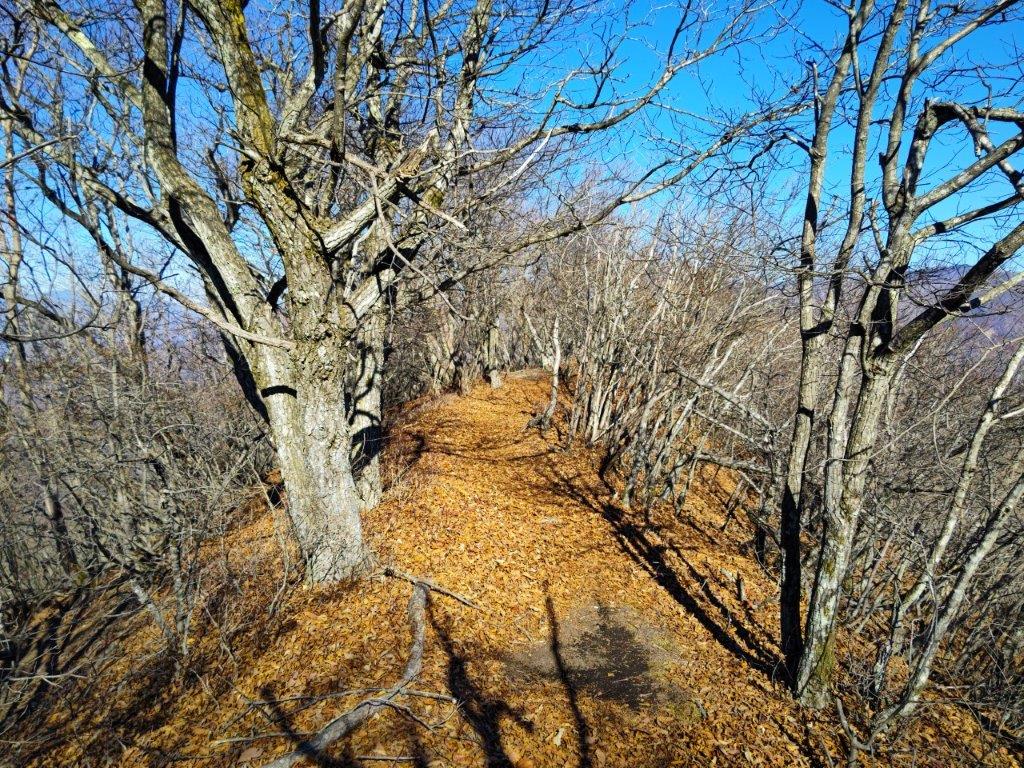
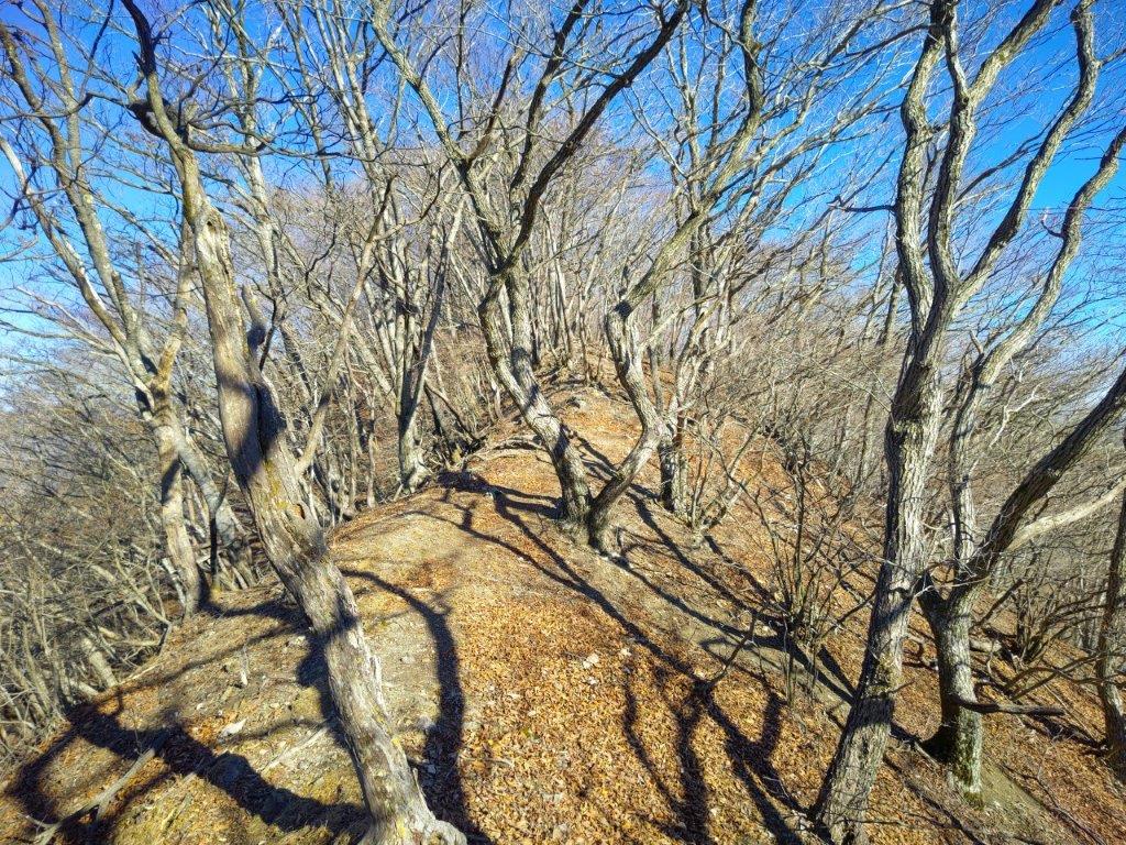
Some Colours on the Descent
It was a beautiful Autumn day as I rode the Chuo limited express to Kofu city. It was a pleasant drive to Soba Maru, trees lining the roads resplendent in their Autumn colours. At 1230, it was the middle of the lunch rush hour and it took about an hour before I was seated; while waiting, I was able to admire the view of the mountains of Oku-Chichibu, clearly visible at this time of the year. After a satisfying lunch, I quickly set off again, arriving at Tamamiya Zazenso Park (玉宮ざぜん草公園 ) at 2h30, one hour behind schedule.
View towards Mt Konara (right) from Soba Maru
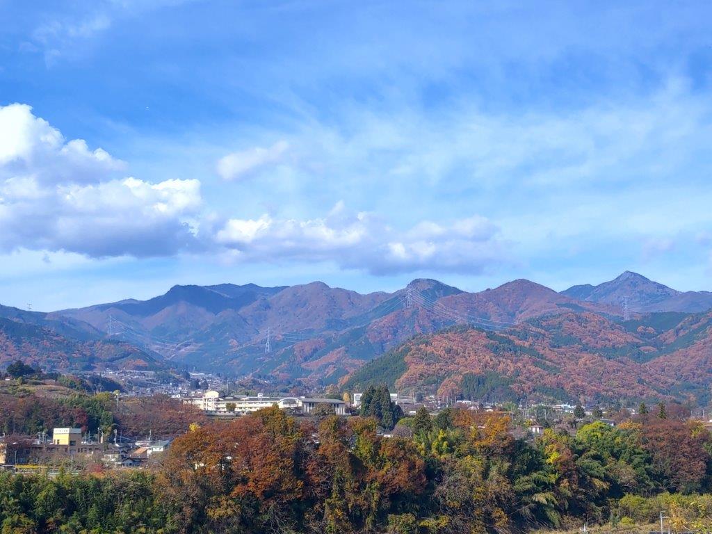
View of the Oku-Chichibu Mountains from Soba Maru
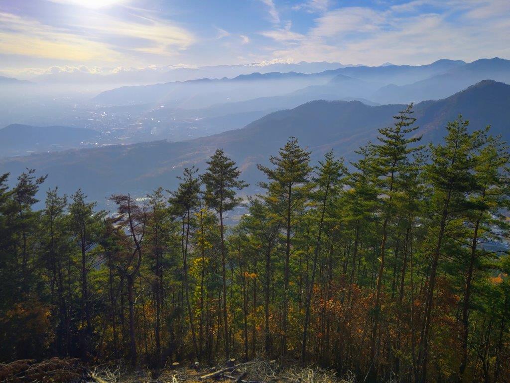
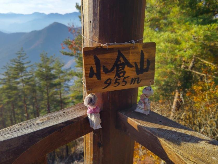
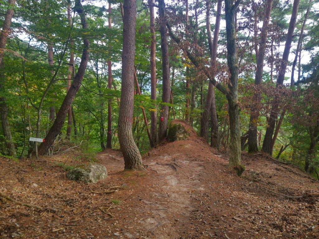
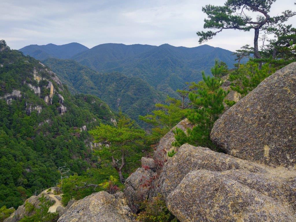
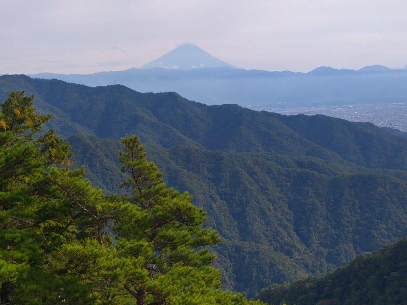
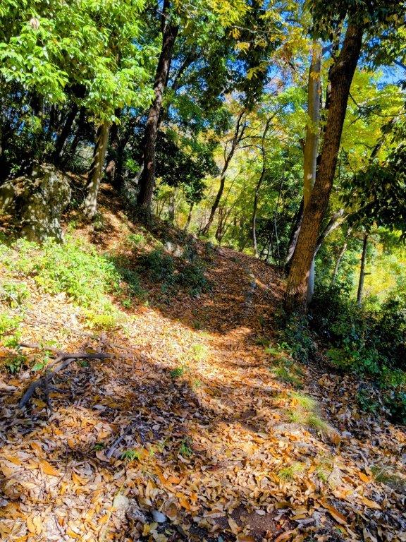
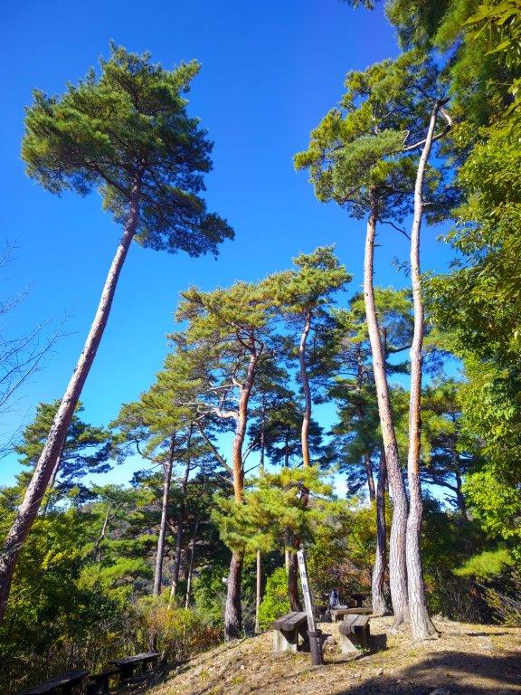
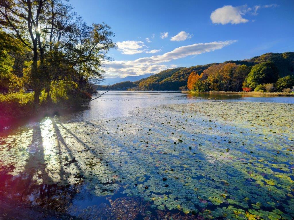
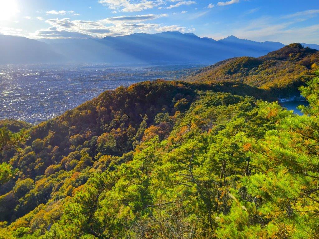
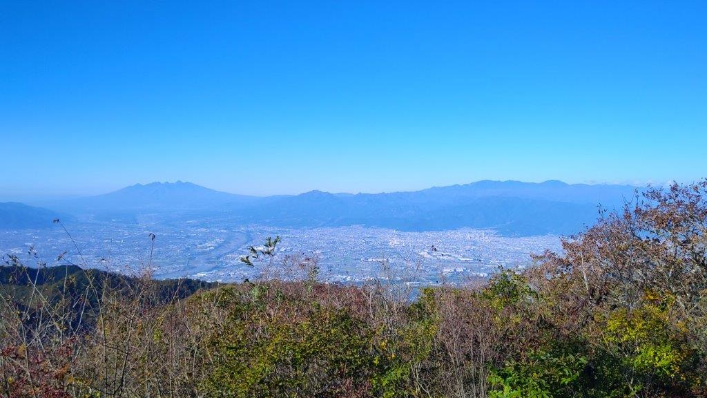
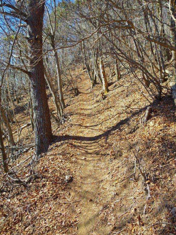
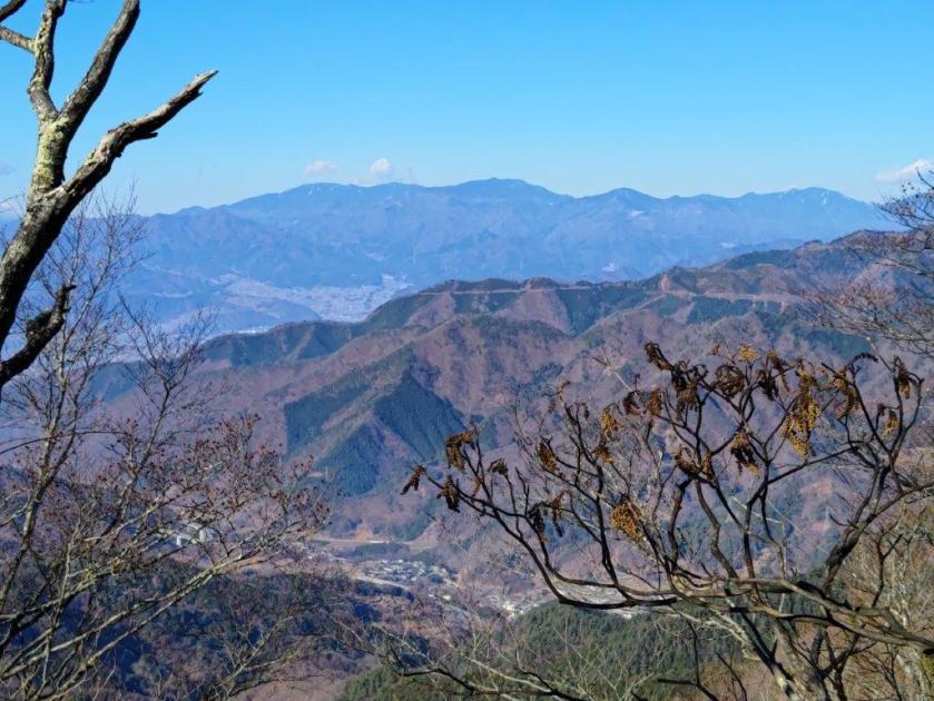
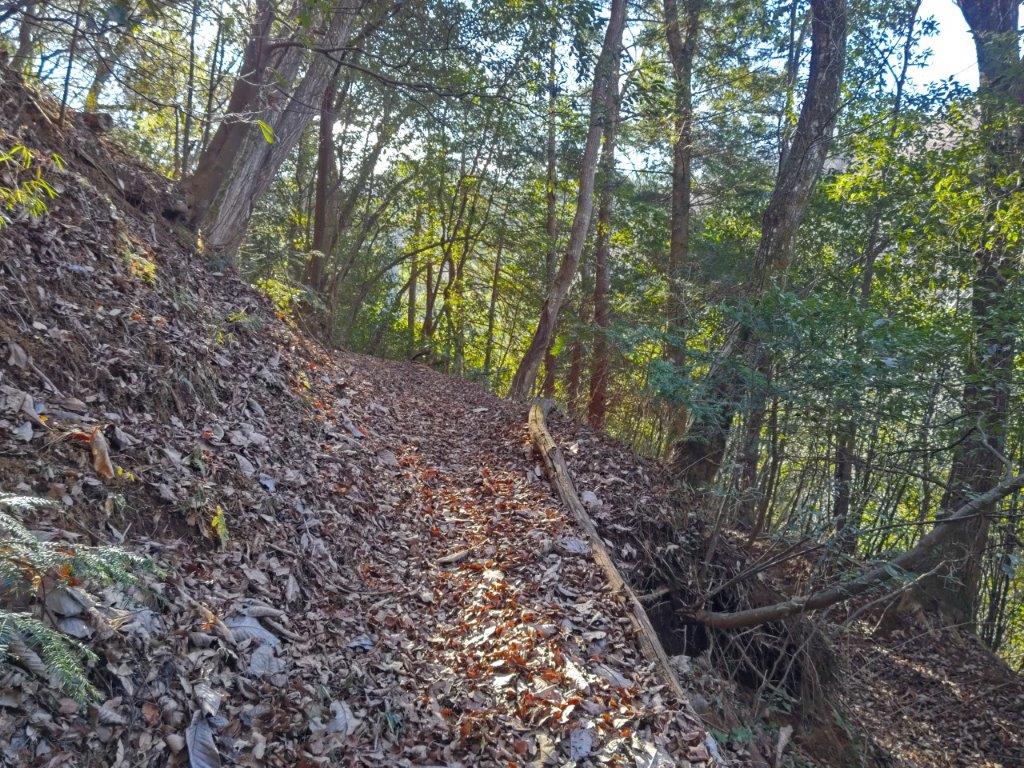
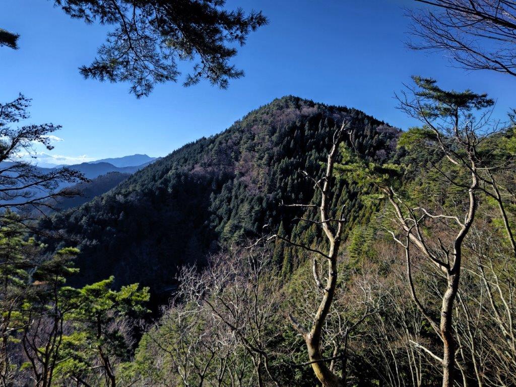
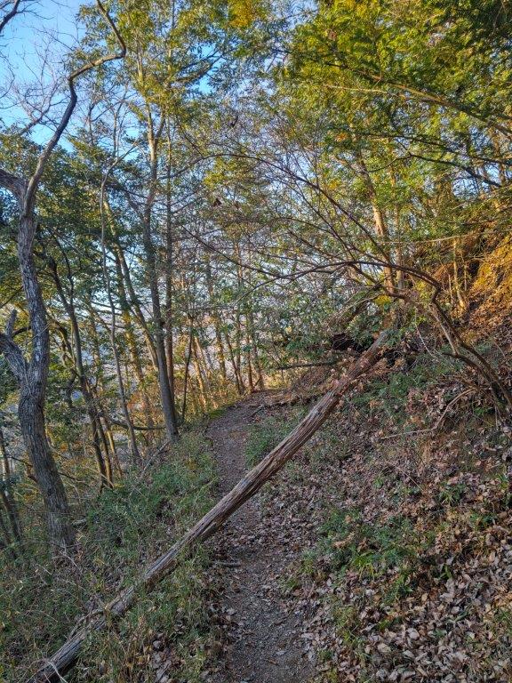
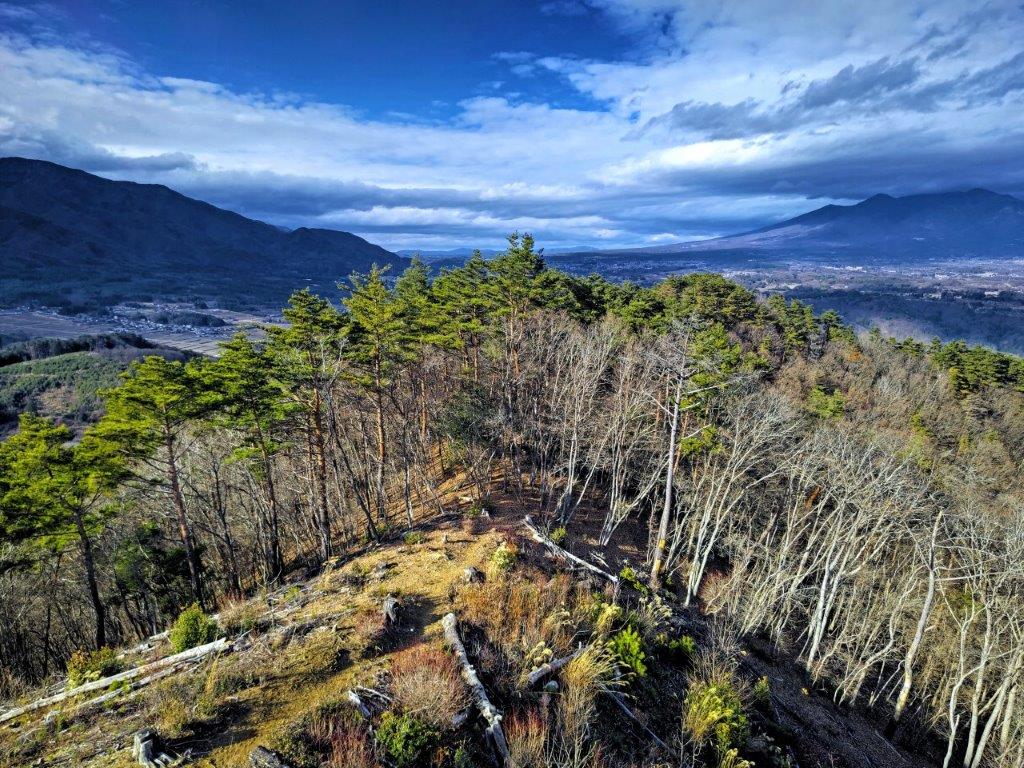
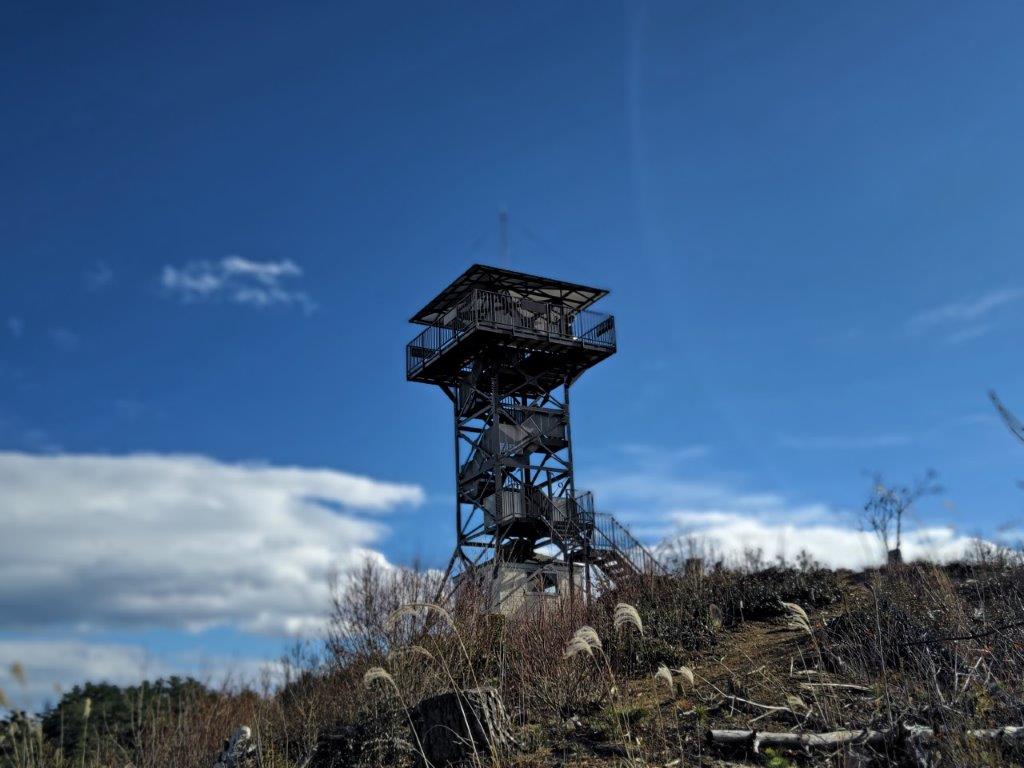
I headed up the main trail, ignoring the wooden walkways on each side as the Skunk Cabbage fields lay dormant in this season. The trail headed straight up a valley already in the shade; the path was covered in yellow leaves, Autumn nearly over at this elevation. At 3pm, I reached the sunny ridgeline, where I turned right. After ten minutes of climbing through dark cedars, I reached the wooden observation tower at the top of Mt Ogura (小倉山 おぐらやまogura-yama) with a view on the South side.
Trail below the Sunlit Ridgeline
Climbing through Dark Cedars
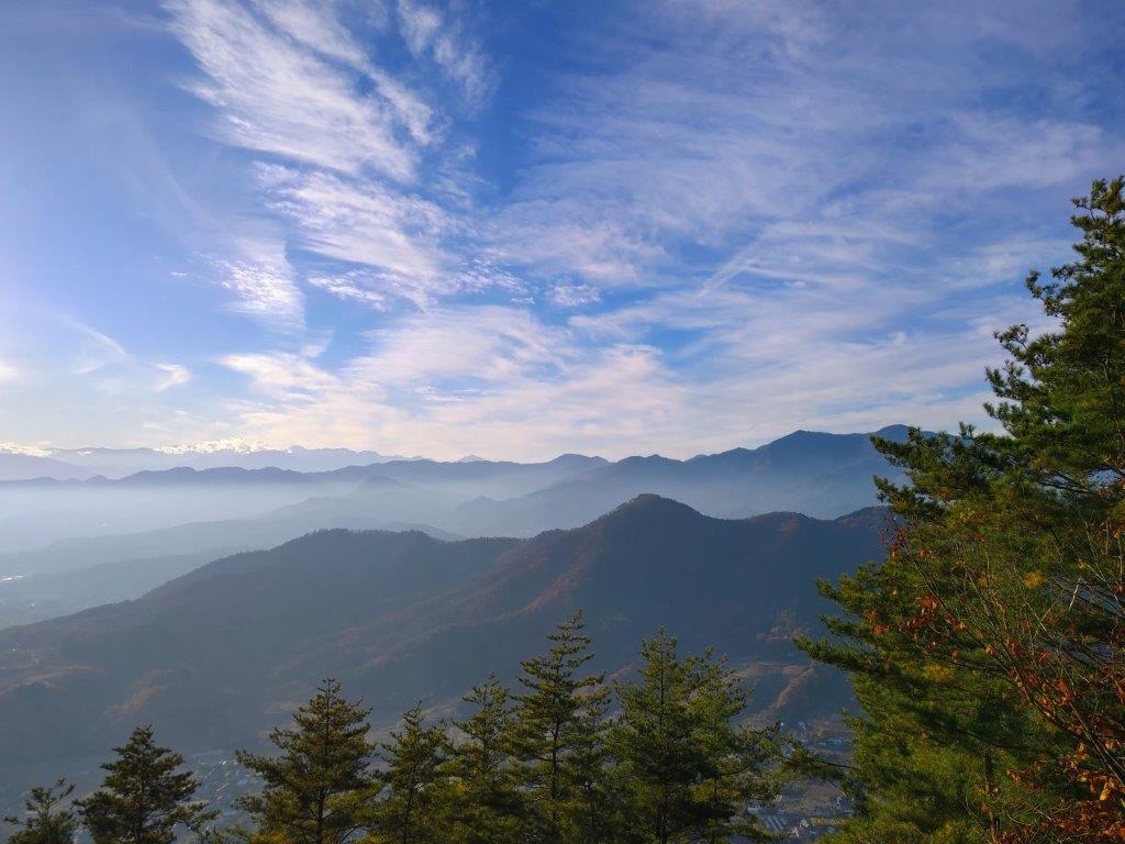
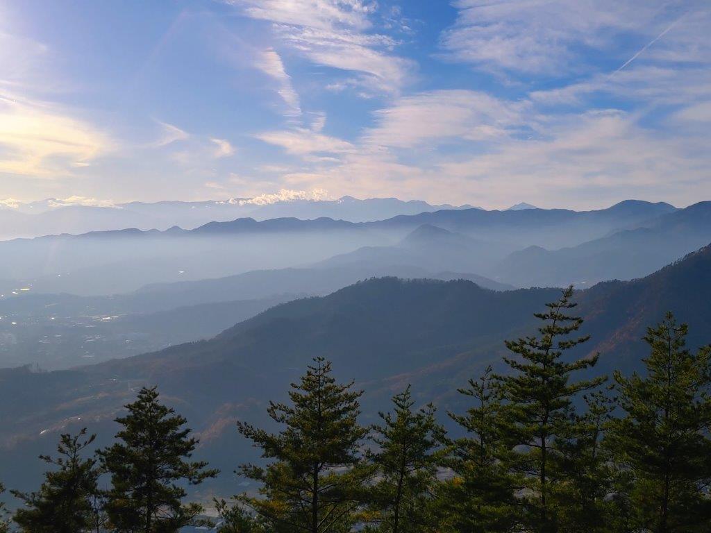
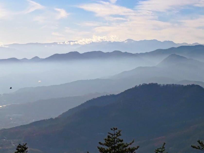
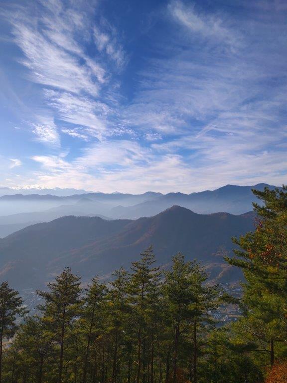
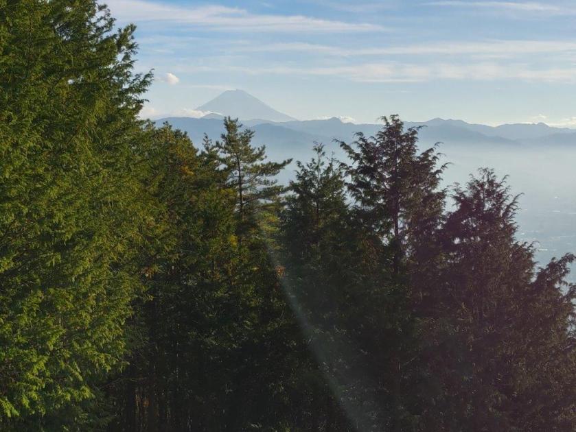
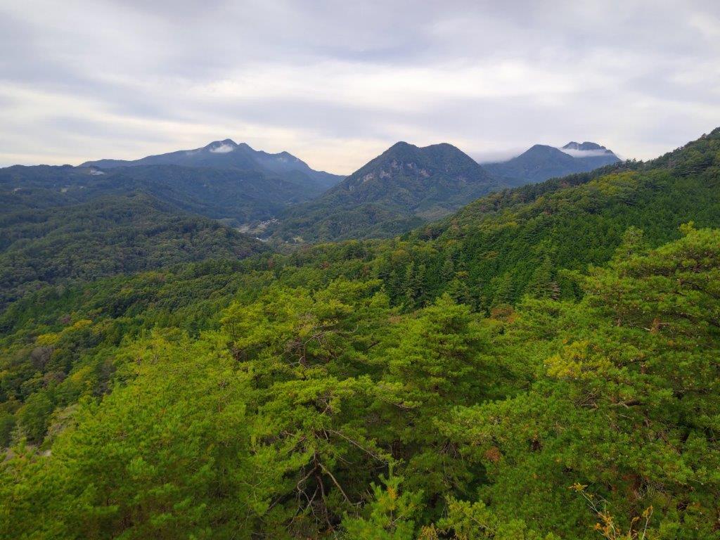
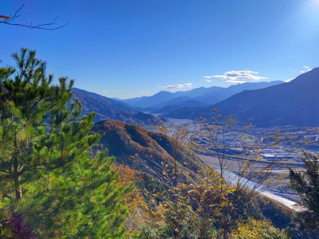
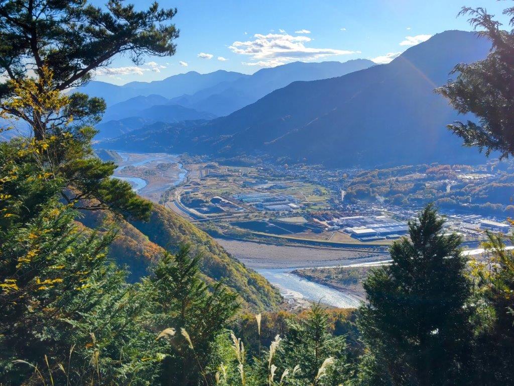
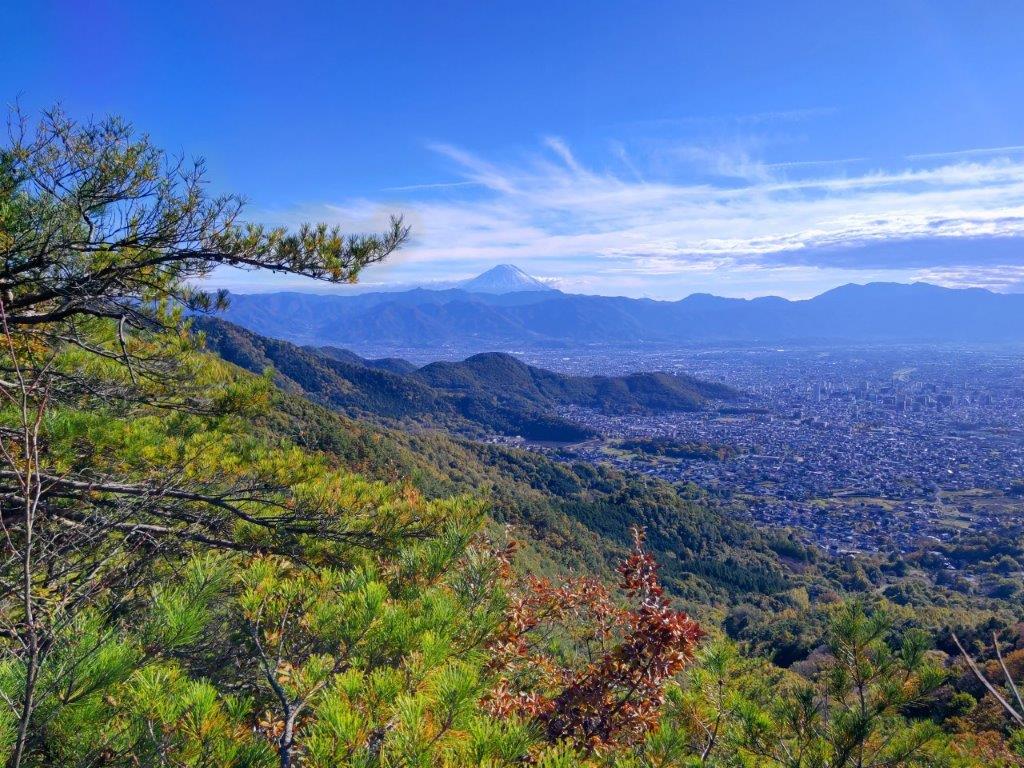
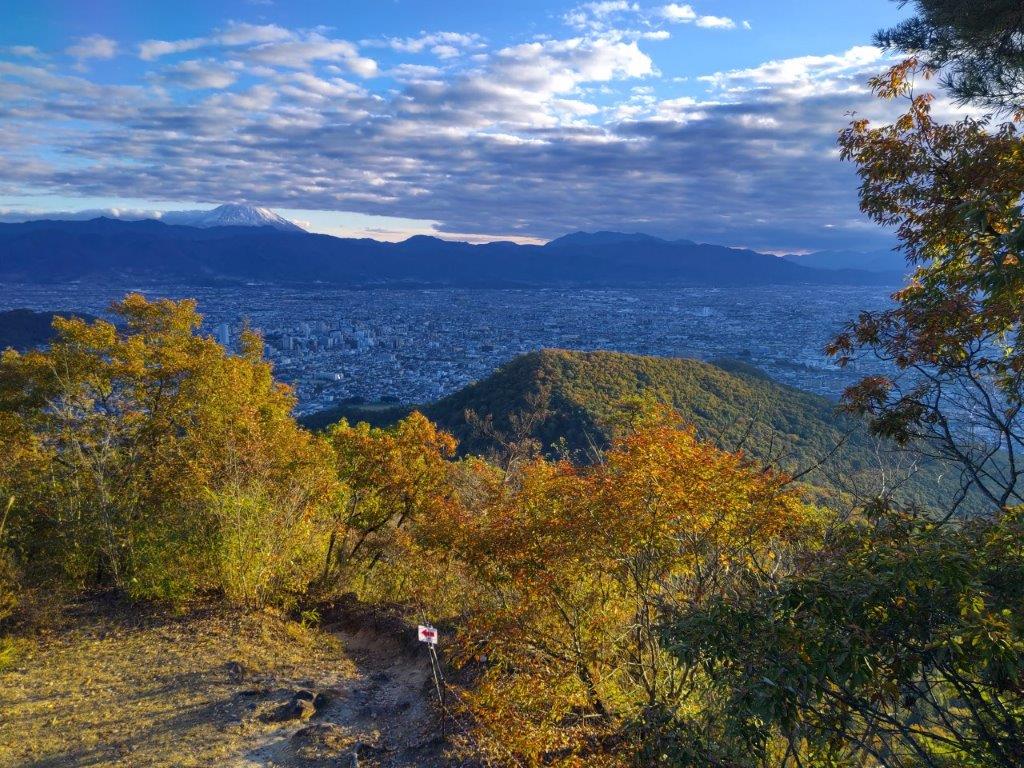
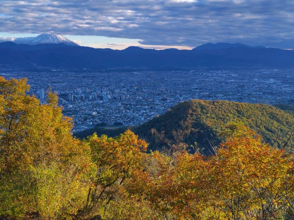
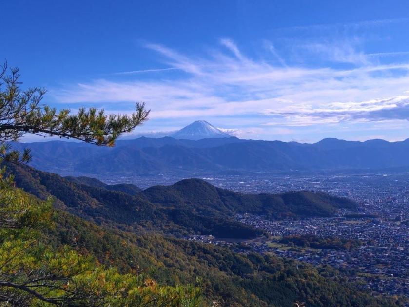
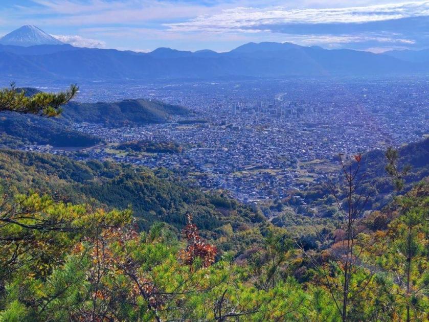
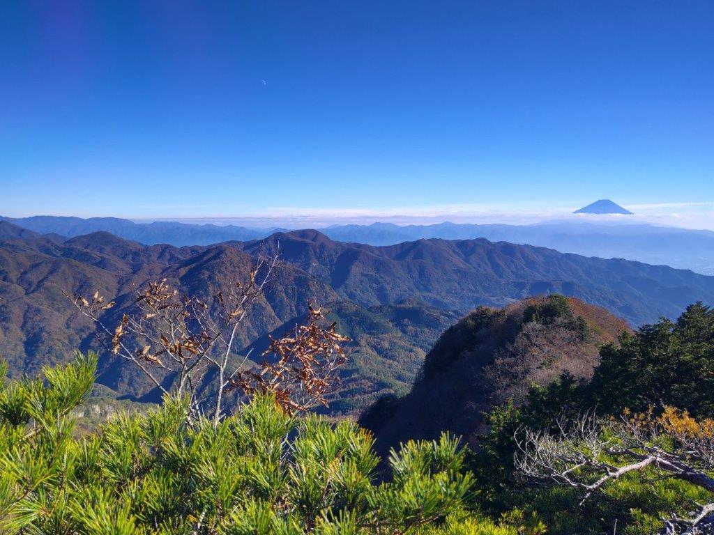
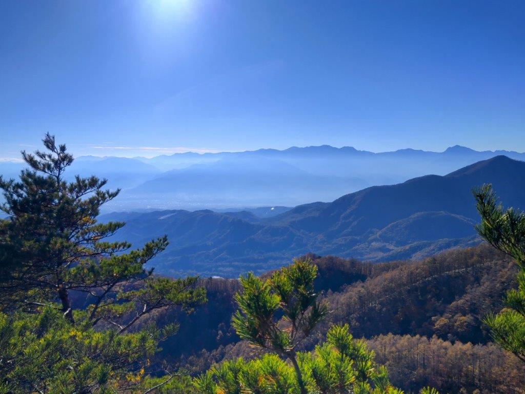
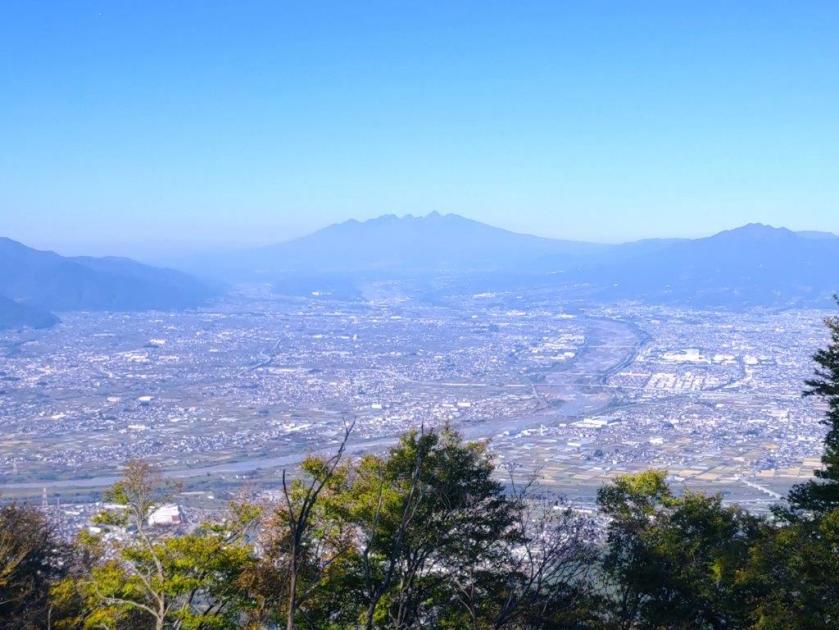
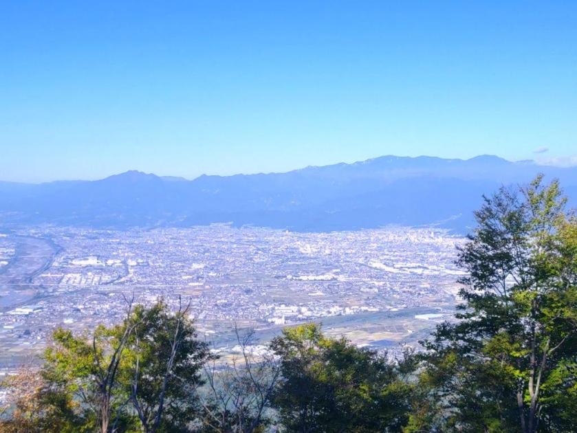
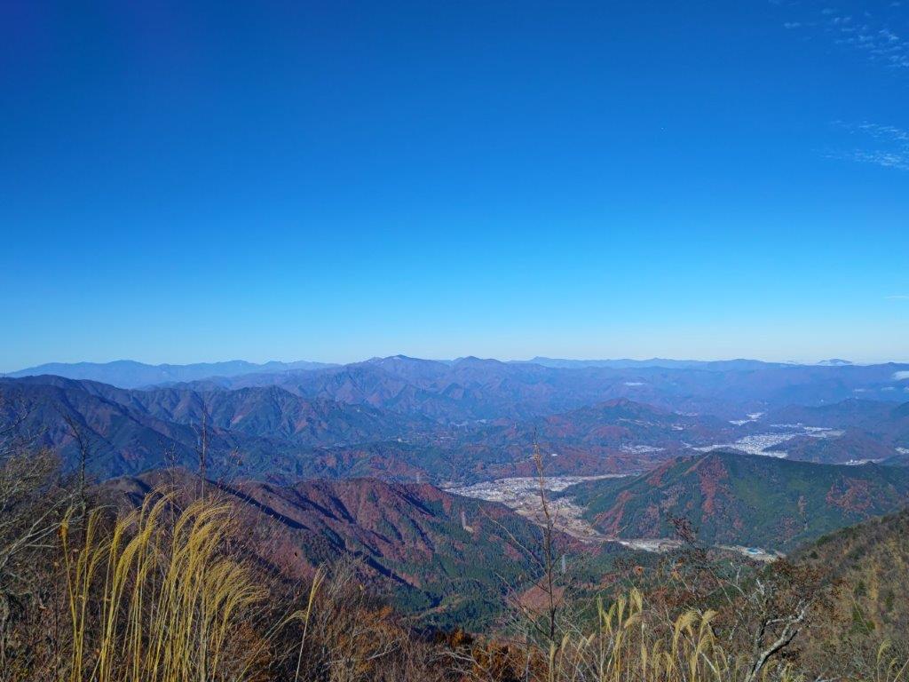
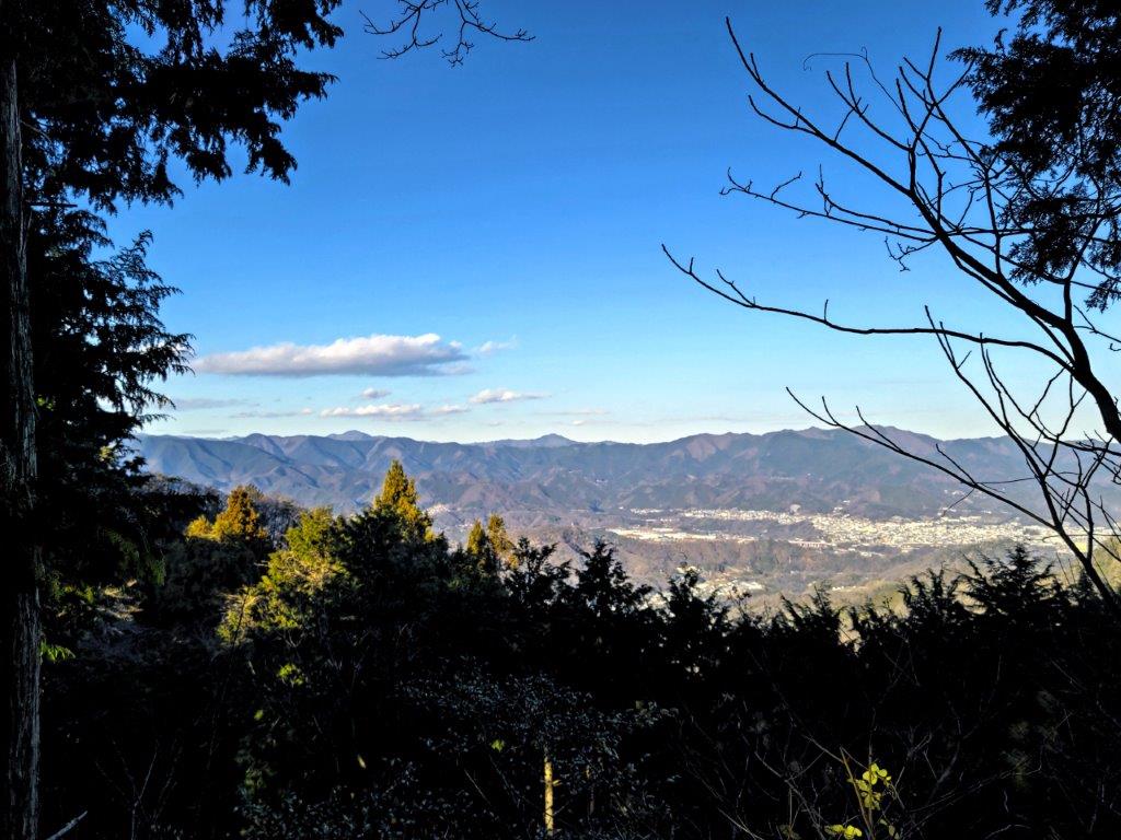
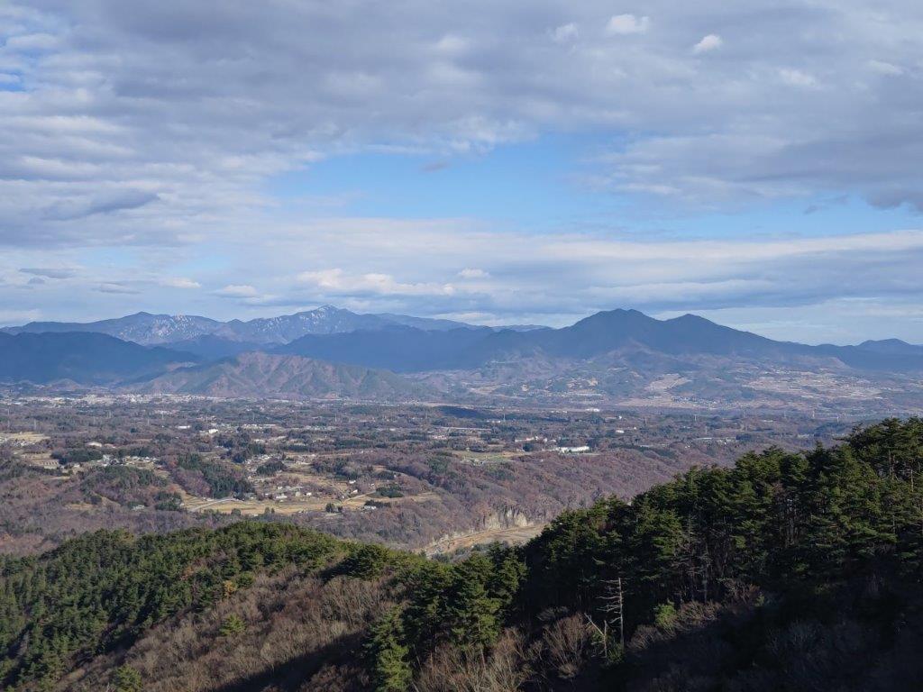
The sun hung low above the horizon, highlighting the misty valleys between rows of mountains, with the South Alps throning in the background, Mt Kita clearly visible in the center. Leaning over the balcony and looking left, I could see Mt Fuji, although its snowcap wasn’t discernable from this distance and at this time of the day. After this magical view, I retraced my steps and continued straight along the ridge, heading northwards. Under cover of another cedar forest, the trail narrowed and became less distinct.
The Ogura Observation Tower
Misty View of the Yamanashi Mountains
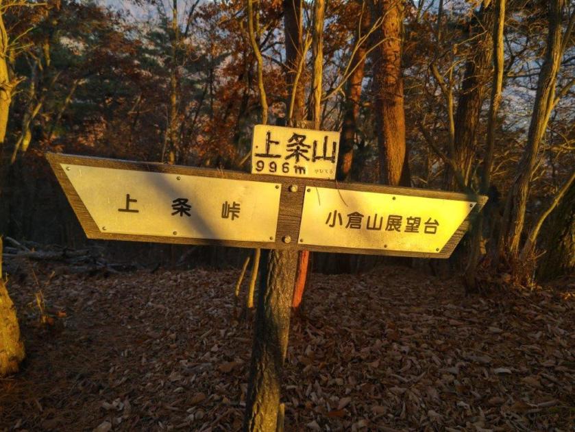
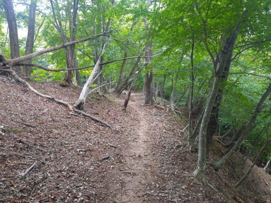
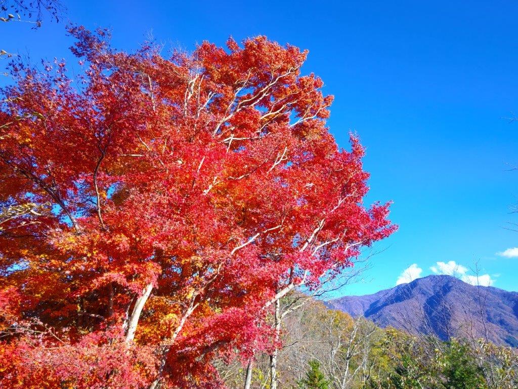
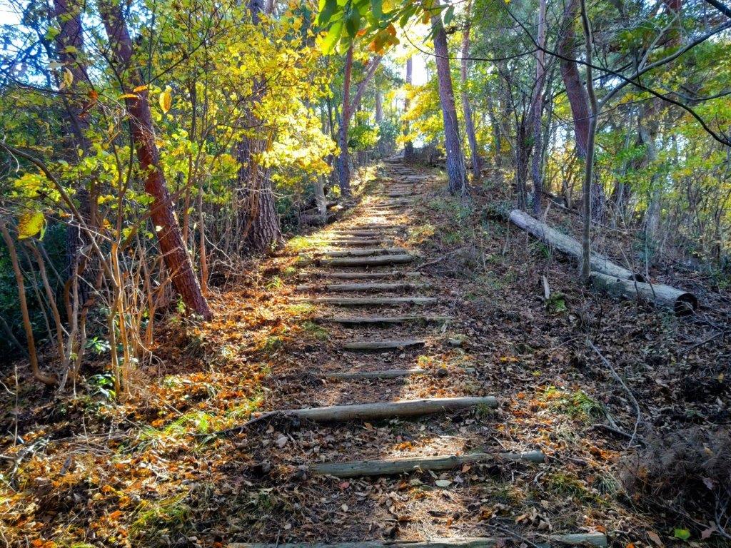
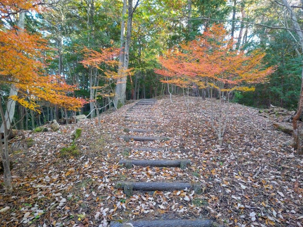
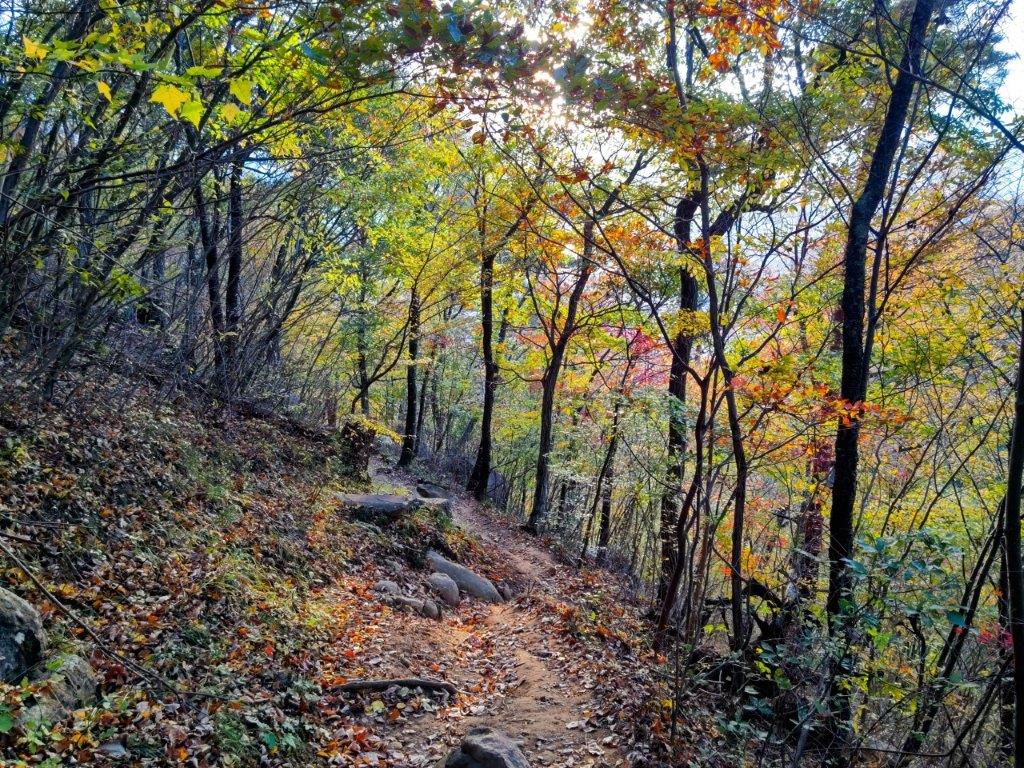
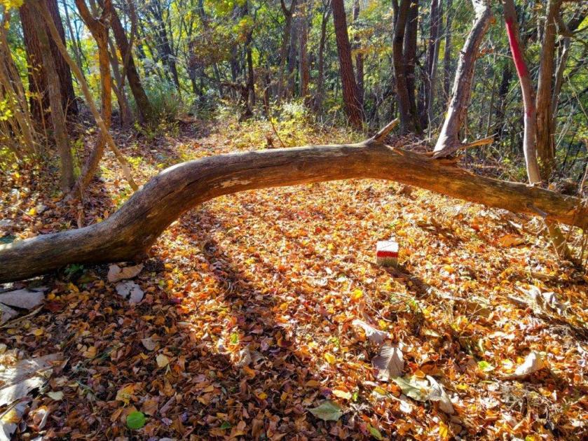
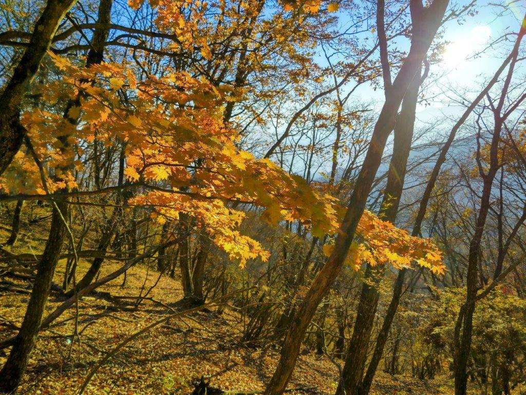
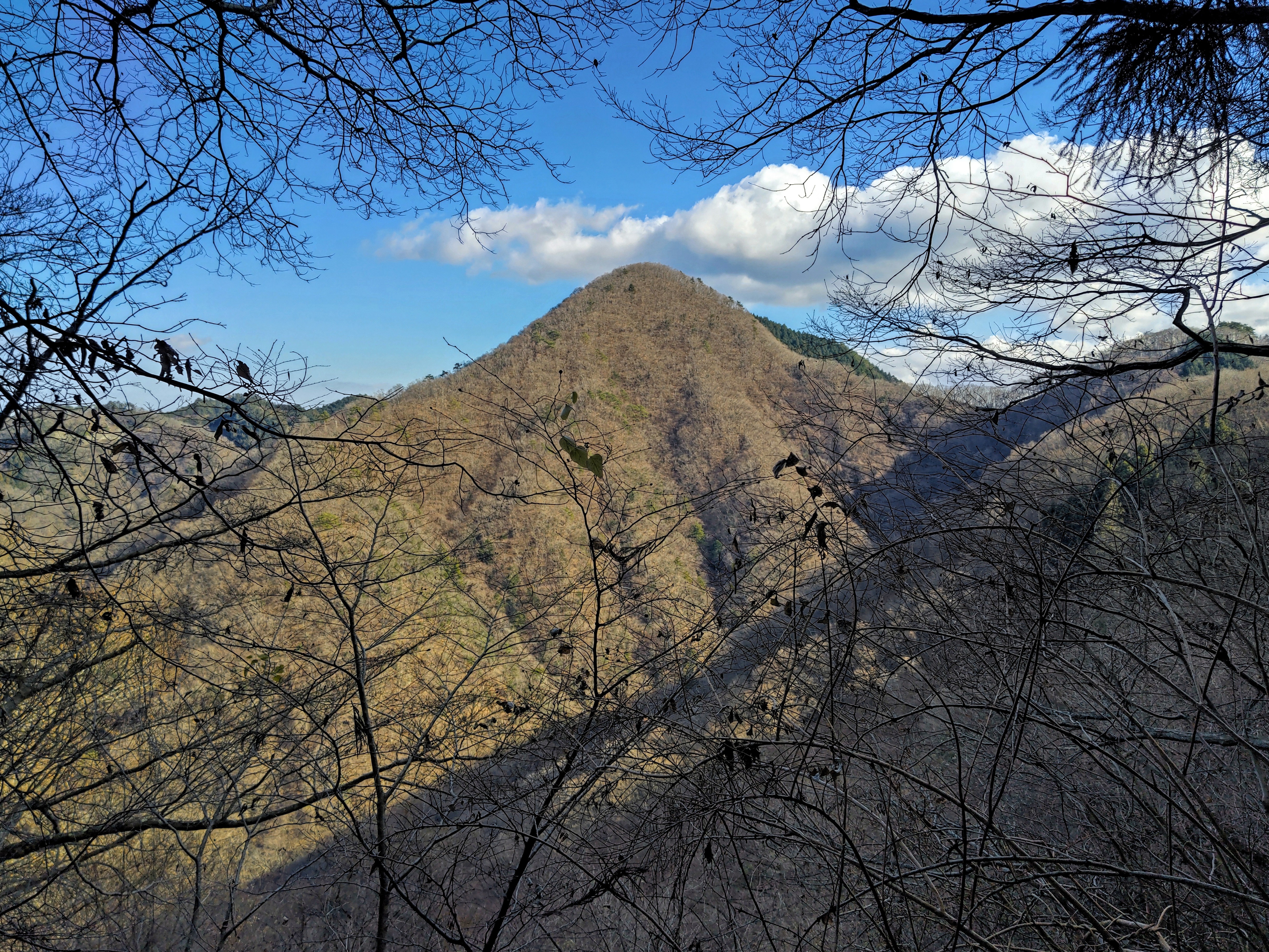
I stepped up the pace, concerned about the late hour. At 4pm, I was once again walking under leafless trees, relieved to be back in the sunlight. At the top of a steep section, interspersed with rocks and lined with roped to indicate the way, I arrived at the minor summit Mt Kamijo (上条山 かみじょうやま kamijo-yama 996m). Although it was completely in the trees, the summit marker was golden in the final sun rays of the day. After a short break, I headed down the north side, descending carefully the steep and slippery, leaf-covered slope.
The South Alps with Mt Kita in the Middle
Stream near the End of the Hike
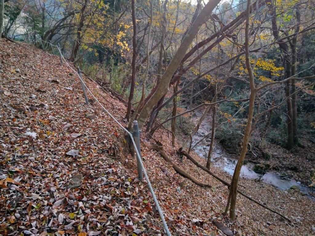
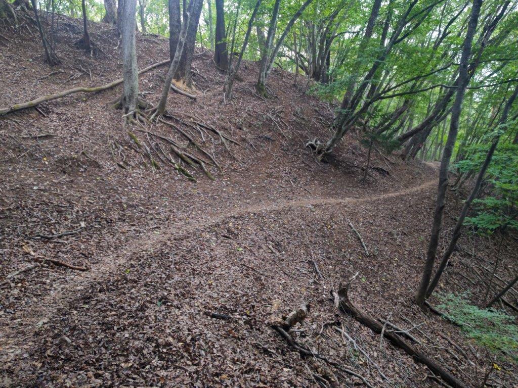
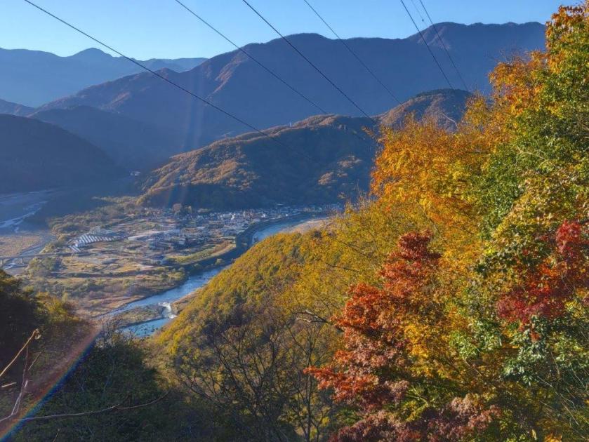
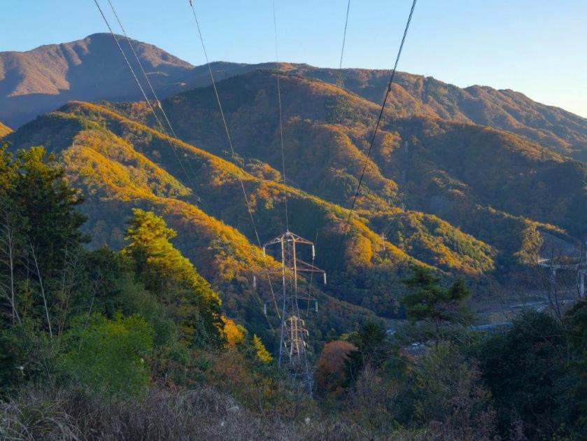
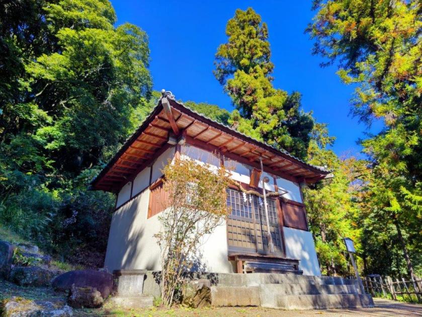
The trail became hard to pick out, forcing me to rely on my GPS and pink strips attached to tree branches. At 4h30, I turned left at Kamijo Pass (上条峠), and headed down a wide valley; here and there, some Autumn leaves remained, adding colour to the early evening darkness. As the valley deepened, the trail gradually became more defined. I soon arrived at a stream where I turned left, now on the last section of the loop. I turned right just before a solar farm, and past Funamiya Shrine (船宮神社), crossed a bridge over the stream. Just beyond was the road, a short walk from the parking which I reached a little after 5pm, just as the last traces of light faded from above the Kofu basin to the south.
I had been up Mt Rakanji once before when I visited Shosenkyo in October 2013. Back then, I drove from Kofu and used the ropeway, since the main purpose was to explore the spectacular Mitake-Shosenkyo gorge. I was reminded of this interesting peak when I saw it from Mt Shiro last year. Looking at my Mountains of Yamanashi guidebook, I found a relatively easy hike traversing this mountain from north to south, including another peak I had never climbed. As an added bonus, I’d also be able to check out the nearby Kanazakura Shrine.
Hiking in the Chichibu-Tama-Kai National Park
秩父多摩甲斐国立公園
To get to the start of the hike, I’d take the Chuo line limited express to Kofu, and then ride a bus to Shosenkyo, getting off at the end of the line. From there, I’d follow a paved road on foot for another 30 minutes to get to the trail entrance. For the return, I’d catch the same bus, two stops up the line at the entrance of the gorge. I planned to get off at Yumura Onsen, on the bus route and inside Kofu city, for a quick hot spring bath at Yumura Hotel before catching the train back.
Trail before the the Top of the Ropeway (left) Trail for Mt Rakanji (right)
Stone Steps & Chains on Mt Rakanji (left) View from Mt Shirosuna (right)
The weather was supposed to be clear in the morning and overcast in the afternoon, with temperatures approaching 30° in the Kofu basin, unusually high for the season. I hoped it would feel cooler up the mountains; I also hoped I’d be able to get a glimpse of Mt Fuji and the South Alps before the clouds rolled in; finally, since the Autumn leaves were only due next month, I was counting on smaller crowds than usual. I was looking forward to a relaxing early Autumn hike in a familiar area.
Shinto Gate at the Entrance of Kanazakura Shrine
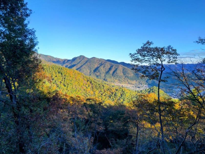
View of the Oku-Chichibu Mountains near the Start of the Hike
It was a cloudy morning as I left Tokyo but after entering the Kofu Basin, I was greeted with blue skies and a view of the South Alps, still clear of snow. I arrived at Kofu station just after 10am, and after standing in line waiting for the “Green Line” (グリーンライン), felt lucky to be seated on the crowded bus for the fifty-minute ride to Shosenkyo-Takiue, five minutes on foot from the Shosenkyo ropeway (昇仙峡ロープウェイ). After observing hoverflies busily nectaring at purple Asters and Jorogumo spiders hungrily eating their prey, I set off along the Shosenkyo Line road and away from the various tourist attractions surrounding Sengataki station (仙娥滝駅) at the base of the ropeway. A little before noon, I arrived at a shrine entrance at a bend in the road.
View of Mt Kenashi (left) and the South Alps (right)
Start of the Dirt Road for Mt Rakanji
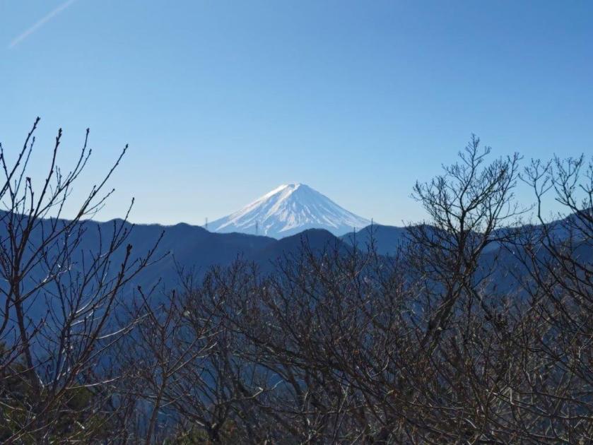
I was impressed by the bright red Shinto gate(“torii”), surrounded by colourful pennants flapping in the breeze, and also by several towering cedars at the top of a steep flight of steps. A small sign propped at the base of one of them indicated it was part of the 100 trees of historical interest in Yamanashi prefecture, although I couldn’t tell whether it was taller than its neighbours. At the top of another flight of steps, I reached the main building of Kanazakura Shrine (金桜神社), another striking bright red structure. On the opposite side was a gravel path with an enticing sign for a nearby viewpoint of Mt Fuji.
Wooden Walkway on the Way to Mt Rakanji
View of Kurofuji (left) and Mt Kinpu (right)
I couldn’t resist making the short round-trip, especially since the sun was shining and the trail seemed easy to walk. After a 10-minute walk through tall cedars, I arrived at an open space with a view of Mt Fuji framed by pines to the south; looking north, I could make out the broad summit ridge of Mt Kinpu, recognisable by the manmade boulder formation protruding from its highest point. After a short break to enjoy the peaceful surroundings, I retraced my steps to the base of the shrine, and a short distance away, turned right up a road signposted for today’s mountain. After a few bends, I reached the end of the paved road and entered an open space with a view to the northeast.
Forest Road along the Level Ridgetop
Mt Kaya (left), Mt Tachioka (center) and Kurofuji (right)
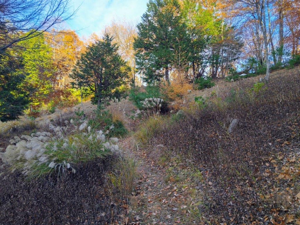
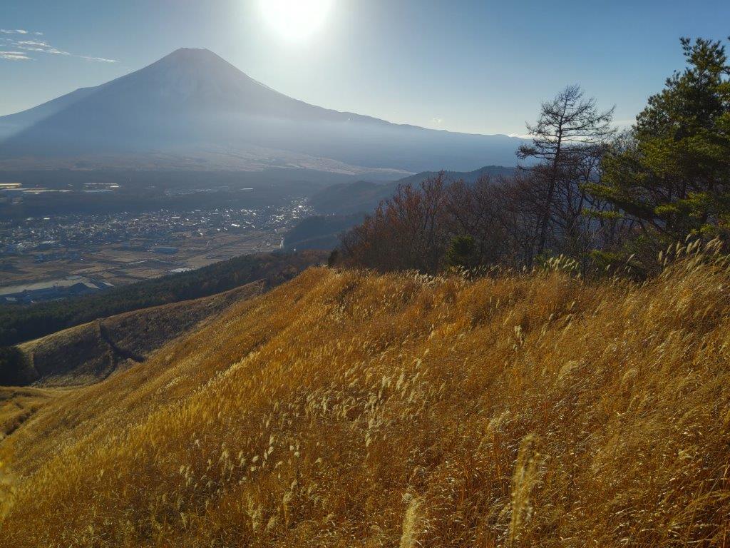
I was glad to get such a wide view so soon on the hike. On the left side, I could see Kurofuji, its cone-shaped summit not visible from this angle, and on the right side, was Mt Kinpu again, its rocky flanks now visible from this higher elevation. I followed a path for a few minutes westwards and off the main trail, to get a view of the South Alps, hazy blue in the far distance and with golden yellow Japanese Pampas grass (“susuki”) in the foreground. I made my way back through the “susuki” field and turned right up a dirt road. I soon reached a cleared area at the edge of the forest with a view on the north and east sides.
Mt Fuji from near the Panorama-dai Station(2013 photo)
Mt Kinpu and Lake Nosen from the Panorama-dai Viewpoint(2013 photo)
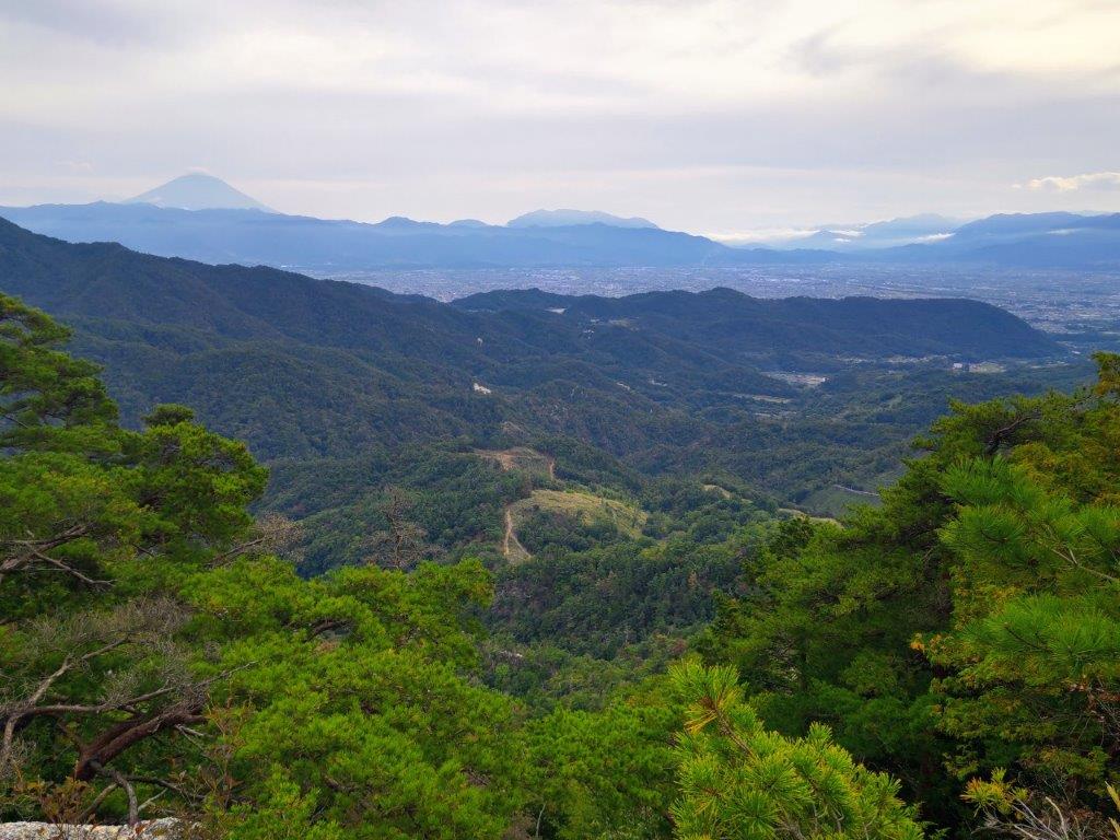
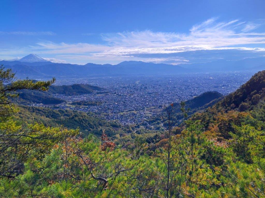
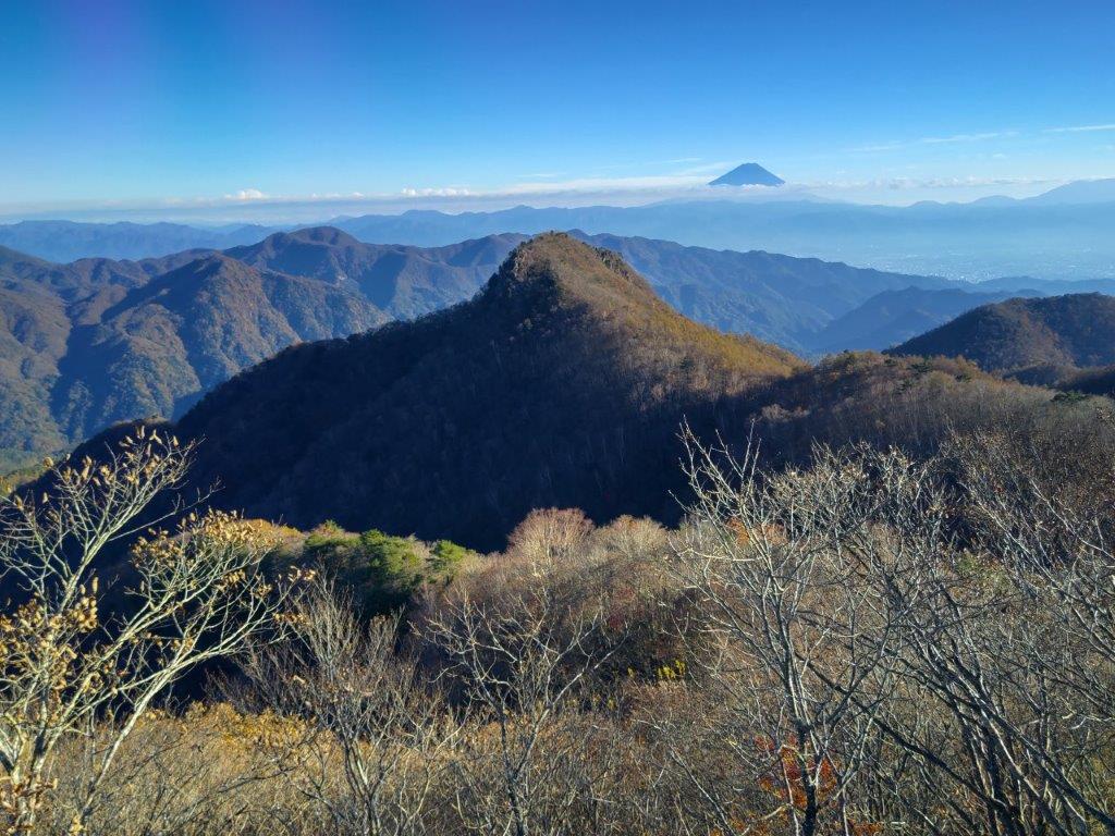
I was pleasantly surprised to get such a wide view on this side of the mountain, which now included Mt Tachioka at the very left and Lake Nosen at the very right. Mt Kinpu rose prominently in the background, the second highest peak in the Chichibu-Tama-Kai National Park and a 100 famous mountain of Japan. Since it was nearly 1h30, I found a suitable tree stump to sit on for a late lunch break. As forecast, the clouds had spread across the sky from the south, providing some welcome shade on a warm Autumn day. I set off again along a winding track sticking close to the level ridgeline, and just before 2pm, exited the forest just below the Panorama-dai Station (パノラマ台駅) of the Shosenkyo ropeway.
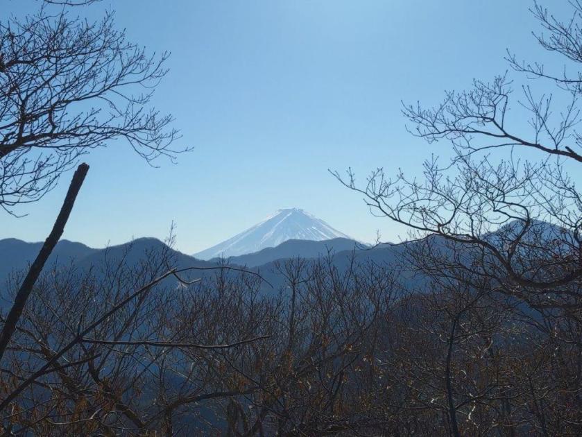
Mt Fuji (left) and Mt Kenashi (right) on the way to Mr Rakanji
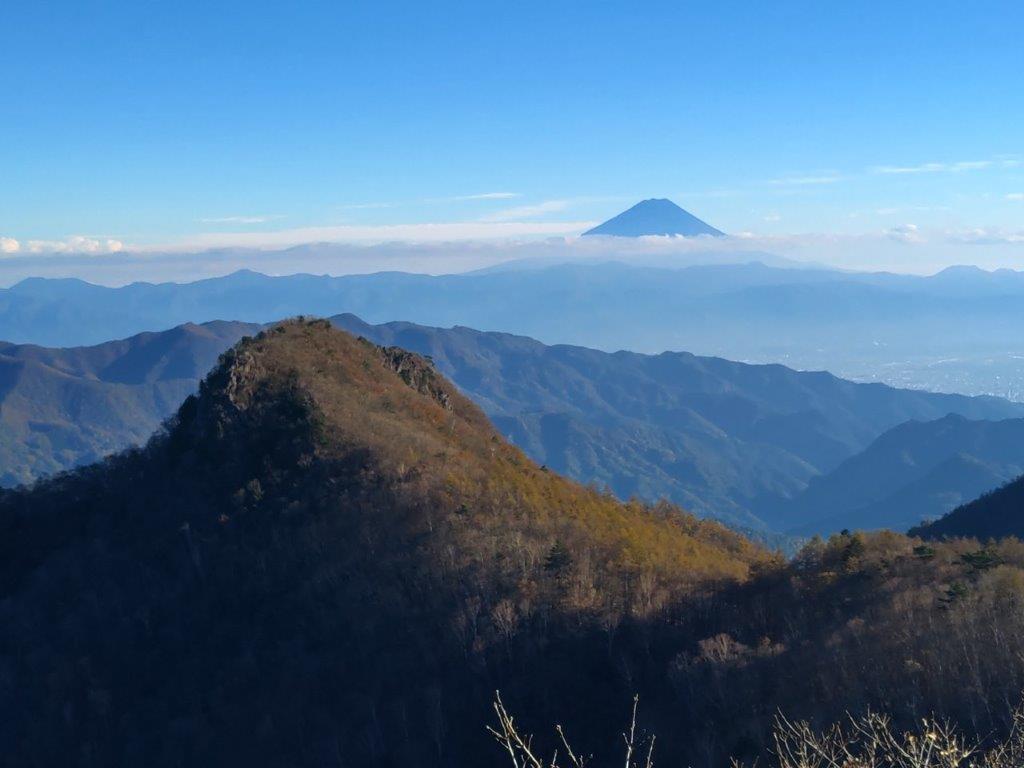
Mt Shirosuna from Mt Rakanji
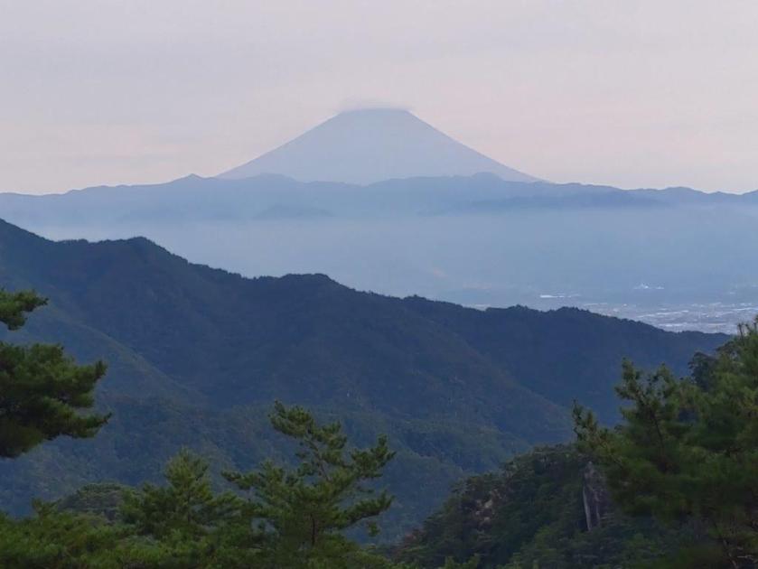
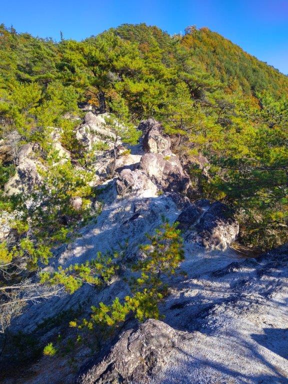
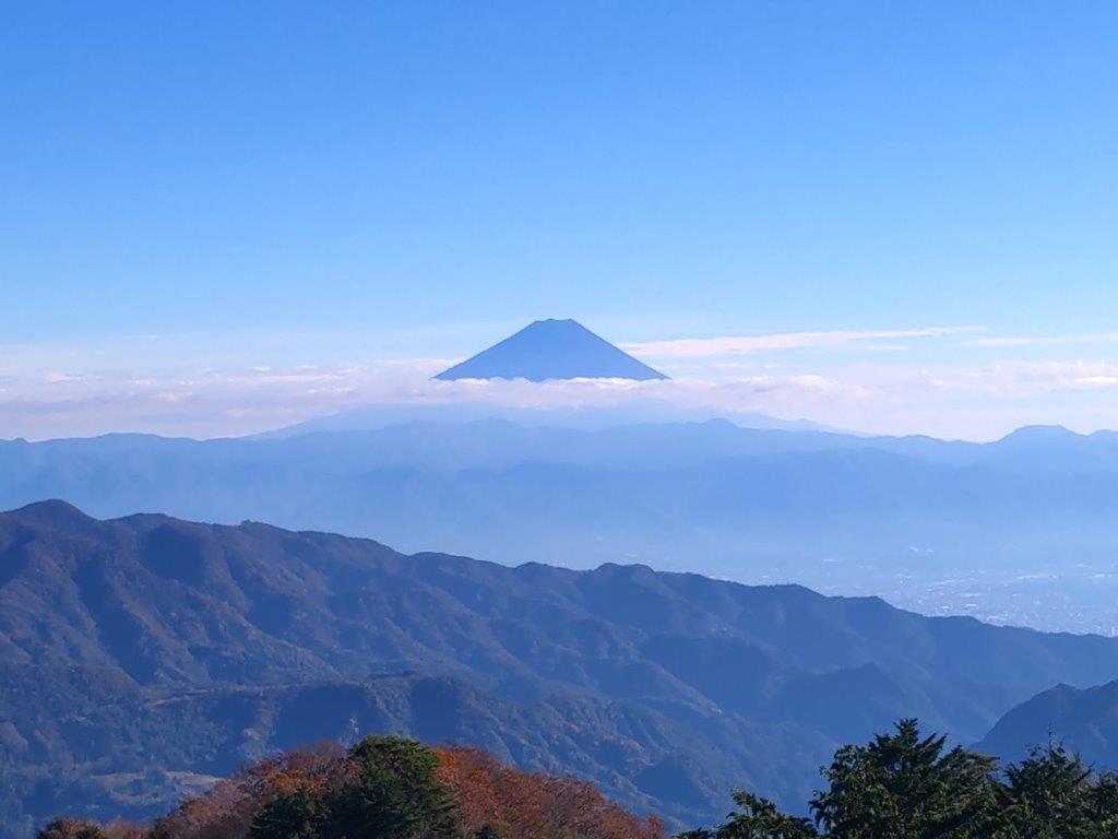
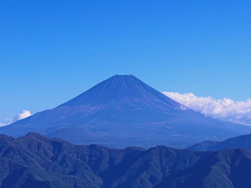
I sped through the sightseeing spots around the ropeway and up the trail for today’s first peak, taking care in the rocky sections and making good use of the safety chains; luckily, the thin pre-autumn leaves crowds meant I could make good time, and at 2h30, I reached the summit of Mt Rakanji (羅漢寺山 らかんじやま rakanjiyama) also known as Mt Yasaburo (弥三郎岳 やさぶろうだけ yasaburoyama), a famous 100 mountain of Yamanashi. I took a moment to enjoy the alpine-like scenery of white smooth rocks and pine trees, as well as the 360° view from the top; Mt Fuji now had a cloud perched on its summit crater in lieu of snow. I then retraced my steps back to the ropeway area and headed down a half-hidden path on the south side.
South View from the Top of Mt Rakanji
Between Mt Fuji and Mt Kenashi lies Kofu City
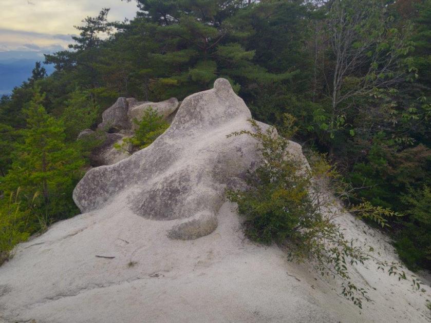
I was happy to leave the crowds behind although I now found myself walking all alone through forest in the middle of the afternoon. Fortunately the path was easy to follow, and at 3pm, I arrived at the turn-off on the left side for today’s next peak. It took me about ten minutes of climbing to reach an exposed rocky area with a view of the ridge leading to Mt Rakanji. A few more minutes brought me to another such place but with a view southwards of Mt Fuji and the Kofu basin. Finally, after a couple more minutes of walking through the smooth white boulders and gnarly pines, I arrived at the top of Mt Shirosuna (白砂山 しろすなやま shirosunayama), aptly translated as white sand mountain.
Trail below the Shosenkyo Panorama-dai Station
Trail for Mt Shirosuna
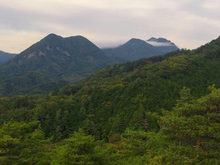
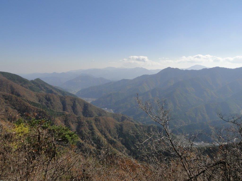
I was delighted to get a view of the peak I had been standing on a short while ago, allowing me to appreciate its steep and rugged shape. I had now fallen behind schedule so I retraced my steps to the main trail without a break. It took me just 15 minutes to reach another turn-off, this time to the right. A few seconds later, I reached the Mt Shiro (白山 900m) viewpoint, a minor peak with a view of the South Alps, now partially hidden by clouds, as well as the Kurofuji Volcanic group, its highest peaks wrapped in mist. I continued on my way, following the level path through mixed forest as it hugged the mountain side, the late afternoon gloom gradually increasing.
View of the Kofu Basin on the way to Mt Shirosuna
“Alpine” Scenery near the Top of Mt Shirasuna
I wondered if I’d reach the base before sunset, quite early at this time of the year. I picked up the pace and around 4pm I reached a junction: the Furusato Nature Observation Trail (ふるさと自然観察路) which I had been following since the ropeway went right; however, I went down the left trail, leaving the ridgeline. Interestingly the signage around this point was a lot more polished than before even though I was far from any sightseeing spots. I also saw no other hikers during this section, possibly because most people planned to visit next month when the Autumn colours would be at their peak.
White Sand Rock near the Top of Mt Shirasuna
Mt Rakanji from the Top of Mt Shirosuna
I felt relief when I popped out of the dark forest onto a paved road. About a hundred meters further the trail dived back into the forest, but I could now hear the sound of a busy road in the valley below. At 4h30, I passed through a wildlife gate next to a spooky abandoned building, and arrived back on the Shosenkyo Line Road and Nagatoro Bridge (長潭橋), beyond which was the Shosenkyo Entrance bus stop. Including the one-hour Shrine visit the entire hike had taken 5 hours, and could have been extended with a walk up the gorge at the start.
A Level Trail Hugging the Mountain Side
The Kurofuji Volcanic Group from Mt Shiro
Sunset was still half an hour away but the sun had already vanished behind the mountain ridges casting the valley bottoms into premature darkness. It took just twenty-minutes on a mostly empty bus to reach Yumura Onsen; after a refreshing hot bath, I caught a city bus for the ten-minute ride to Kofu station, from where it was a 90-minute comfortable ride on the limited express train back to Tokyo.
I had spotted this station to station trail the previous year while searching online maps for new hikes; although mostly in the forest, it had one good viewpoint of the Southern Alps on the west side. Online reports showed that the Autumn leaves had reached their peak in the area, and with the excellent weather forecast for Sunday, sunny with little wind, I decided it was time to make the long trip to this remote corner of Yamanashi prefecture, last visited in 2019.
For subscribers, read this Blog Post on Hiking Around Tokyo for a better viewing experience and the latest updates
To get to the start of the hike, I’d once again ride the Chuo line Limited express to Kofu, and there, transfer to the infrequent Minobu line. I’d arrive around noon, but this was fine since the hike was on the short side and ended at Shimobe Onsen, where I could relax in a hot bath while waiting for the train back to Kofu. Incidentally, Minobu Town is where Yuru Camp mostly takes place, so I was looking forward to revisiting an area I’d become familiar with through the Yuru Camp manga and anime.
Near the Start of the Hike (left) Past the Mt Goro Viewpoint (right)
Early Afternoon light (left) Leaning Trees (right)
It was another blue-sky day as I rode the limited express in a straight line westwards, from the Kanto Plain to the Kofu Basin. After transferring to a local train on the Minobu line, it was another one hour ride, this time southwest and then south, the railway following the Kamanashi river, as it squeezes between the Southern Alps and the Misaka Mountains. I was the only passenger to get off at the unmanned Kai-Tokiwa station around noon. I quickly found my bearings and followed a road westwards, to a small graveyard with a Kannon Statue.
View of the Tokiwa Area and Mt Goro from the Kannon Statue
Afternoon Sun and Autumn Leaves
Turning around, I enjoyed the first view of the day: the Tokiwa area with the summit of Mt Goro (五老峰 goroubou) rising behind. I located the start of the hiking trail and headed up the mountain side through the forest. The trail soon leveled and was bathed in the afternoon sun, enhancing the yellow colours of the surrounding Autumn leaves. I wondered why no one else was walking this path as it seemed like the perfect time of the year for this hike. I soon passed Hatouchi Pass (鳩打峠), and at 1pm, arrived at a bench with a view on the east side.
View of Mt Goro past Hatouchi-toge
View of Yatsugatake below the Summit of Mt Daigo
From this higher vantage point, I now had a proper view of Mt Goro. For such a local trail, I was surprised to see how well-maintained it was, with good quality signposts, panels with tree names and even distance markers to the top. I heard deer sounds nearby but never saw any, an indication of how few people pass through. I had another view, southwards this time, of the foothills of the Southern Alps, Yatsugatake, its highest peaks white with snow, and Mt Kaya. After a steep but short climb, I reached the top of Mt Daigo (醍醐山 だいごやま daigo-yama), a Buddhist term meaning nirvana.
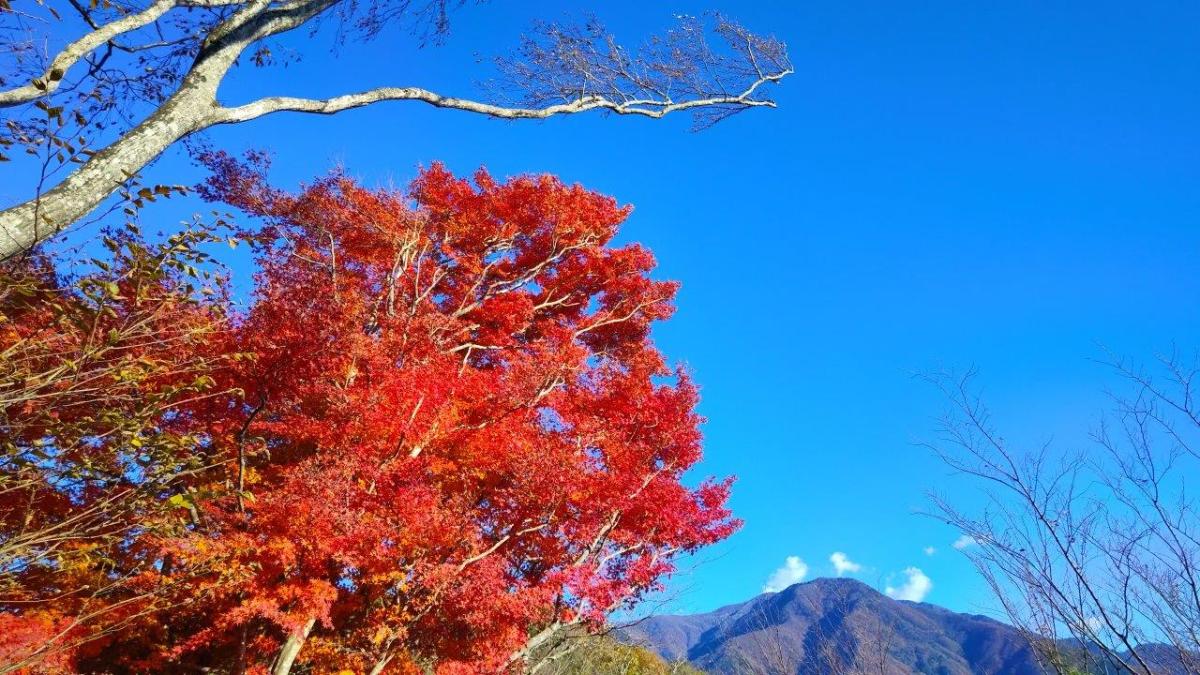
Yellow and Red Leaves near the Summit of Mt Daigo
Red Maple & Mt Goro near the Mt Daigo Viewpoint
Standing on top of “Mt Nirvana”, I didn’t feel especially enlightened, under the shade of trees with not even a hint of a view. I was delighted by the signboard showing a hand-drawn bird’s-eye view of Mt Daigo (also online, Japanese only). Following the signs for the observatory, I walked downhill in a westward direction, surrounded by stunning autumn leaves, the reds and yellows swaying in the breeze. I reached a narrow ridge, the vegetation shrinking away on both sides and letting the sunlight through. I stopped near a huge “momiji” (Japanese maple) and turned around.
View of Mt Minobu (left) & Mt Shichimen (right) from the Mt Daigo Observatory
View of the Fuji River Valley from the Mt Daigo Observatory
I had probably the best view of the day, the vivid red leaves sharply contrasting with the light blue sky, the now familiar triangular summit of Mt Goro in the background. I moved further along the ridgeline till I reached a signboard next to a gap in the vegetation on the south side, the Mt Daigo Observatory (醍醐山展望台), in truth more of a viewpoint. Directly ahead was Mt Minobu with the massive bulk of Mt Shichimen lurking behind; on the west side was Mt Zaru, the highest peak in the vicinity; far away to the south, I could just make out the top of Mt Takadokkyo. It was already 2pm, so I settled on a comfortable rock for a lunch break.
View South of the Japanese Southern Alps
View Northwest of Mt Fujimi from Daigo-toge
I enjoyed the view of the Fuji river sparkling under the sun, as it snaked its way towards Suruga Bay. Sadly, Mt Fuji was missing, so close yet invisible, one of the rare blind spots in the area. I was only halfway through my hike so at 2h30, I set off again, retracing my steps to the summit and heading down a faint path on the south side. The descent turned steep, down log steps half buried in dead leaves, rope attached to adjacent trees for safety. A little after 3pm, I reached the lonely Yama-jinja shrine, its access blocked by the huge trunk of a fallen tree. This was also the junction for the second mountain of the day; I went right, along a path through some bamboos, leading to Daigo Pass (醍醐峠) and the final viewpoint of the day.
Mt Daigo in Orange near Mt Nishi
Looking north, I had an amazing view of the orange-coloured mountain side of Mt Daigo with the dark shape of Mt Fujimi rising like a wall in the background; in the valley below, houses filled the narrow space between the Fuji river and the foothills. To the south was Mt Goro again, small puffy clouds passing over its summit. I dived back into the forest, and soon reached the flat top of Mt Nishi (西山 にしやま nishi-yama), completely in the trees. It was 3h30, just one hour to sunset, so I hurried back to the junction and headed down, past an abandoned house, down a switchback path through a dark forest, along a stream over a couple of wobbly bridges and out through an electric gate. At 4pm, I emerged onto a road where I turned left, soon walking through an inhabited area.
Spooky Bridge near the End of the Hike
Today’s “beacon”, Mt Goro near Shimobe Onsen
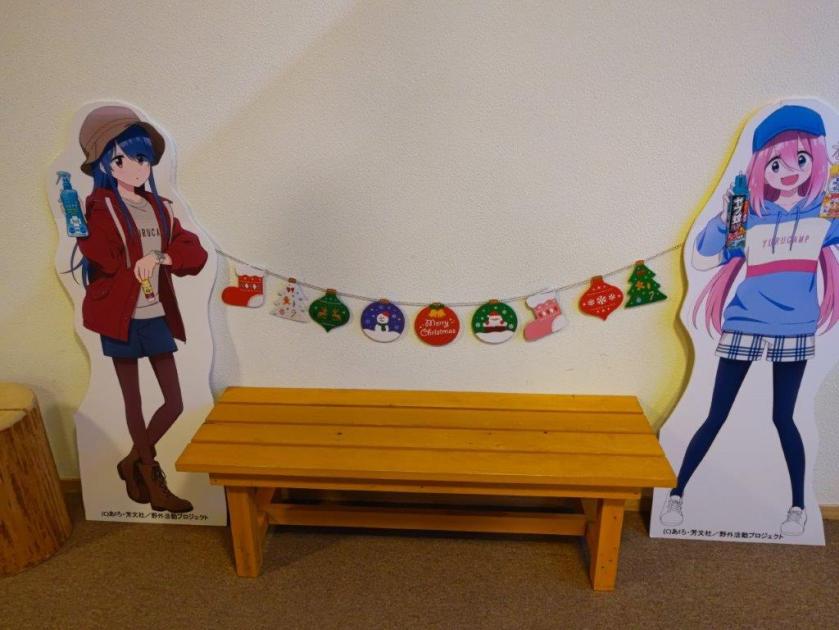
I was now walking straight towards Mt Goro, its tip lit up light red in the last light of the day, looking very much like the beacon that had guided me throughout the day. I turned left onto a main road, and after crossing a bridge over the Fuji river, arrived at Shimobe onsen, where I indulged in a hot spring bath at the modern Shimobe no Yu, just across the tracks from the train station. As I exited the hot spring facility, I was delighted to see life-size cutouts of characters from Yuru Camp. A little after 5pm, I boarded the faster express train for Kofu, and there, transferred to the limited express for the 90-minute ride back to Shinjuku.
Thank you for reading – make sure to check out the Japanwilds website for more hiking blogs and maps
I was looking for another hike in Yamanashi before the arrival of the snow. I also wanted to stay relatively low since the temperatures had plummeted since the previous week. Looking at my map, I spotted a group of suitable mountains just north of Kofu. I had already done a great hike on the northeast side so I was keen to explore the area more. I saw that I could make an open loop passing by several viewpoints, including an interesting rock formation and a lake, within a reasonable amount of time.
Hiking in the Chichibu-Tama-Kai National Park
秩父多摩甲斐国立公園
To get to the start of the hike near Suwa Shrine, I’d ride the Chuo limited express to Kofu station, and from there, ride a bus to a stop within walking distance of the shrine. I’d finish the hike at Yumura Onsen in northwest Kofu, and after a hot spring bath, ride a bus back to the station. The weather was supposed to be clear but cold. I hoped I could get some good views of the surrounding mountains, including Mt Fuji, and still catch the Autumn leaves at their best.
For subscribers, read this Blog Post on Hiking Around Tokyo for a better viewing experience and the latest updates
Start of the Hike near Suwa Shrine (left) Tall Pines on Mt Komatsu (right)
Exposed Rocks above Kinsu-toge (left) Autumn Colours near Chiyoda Lake (right)
It was a cloudless, blue-sky day as I stepped off the limited express in Kofu station at 10am. I boarded a local bus, the driver even kindly confirmed my destination, and after a short ride, I got off at a stop still within the confines of the city. A few minutes of walking brought me to the foot of the mountains, and after a short climb, I arrived at Hizakutsu-suwa Shrine (膝屈諏訪神社). It was just after 11am as I passed under the stone shinto gate next to an impressive yellow gingko-tree.
Trail below Mt Shiro (left) Trail past Mt Hosenji (right)
Path for Mt Yumura (left) Flagstones for Yumura Castle Ruins (right)
Turning around, I was rewarded with a view of snow-capped Fuji. I made my way to the white shrine building surrounded by tall cedars, and after taking a few minutes to adjust my gear, set off along a level trail at the far end of the shrine grounds. I soon emerged from the trees onto a sports field, and after crossing a busy road, followed a residential street up the mountain side to a staircase below the trail entrance. This section has no signposts and I had to rely entirely on my phone GPS.
Log Steps Leading to the Top of Mt Komatsu
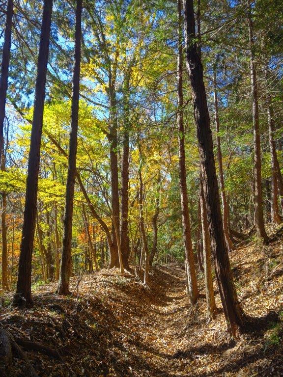
Walking the Takeda no Mori Promenade
I was surprised to see that the trail was partly overgrown, a sign that it was little used in this season; I was even more surprised to notice spiders again, a sign of their resilience to cold weather. Once the path started to climb, the trail became better defined; I saw the first signpost of the day upon reaching a wide path along the top ridge. I turned right, and after climbing a series of log steps, arrived at the top of Mt Komatsu (小松山 こまつやま komatsu-yama), the promised view mostly blocked by vegetation.
Heading up to Kinsu-toge
The exposed rocks of Mt Awayuki
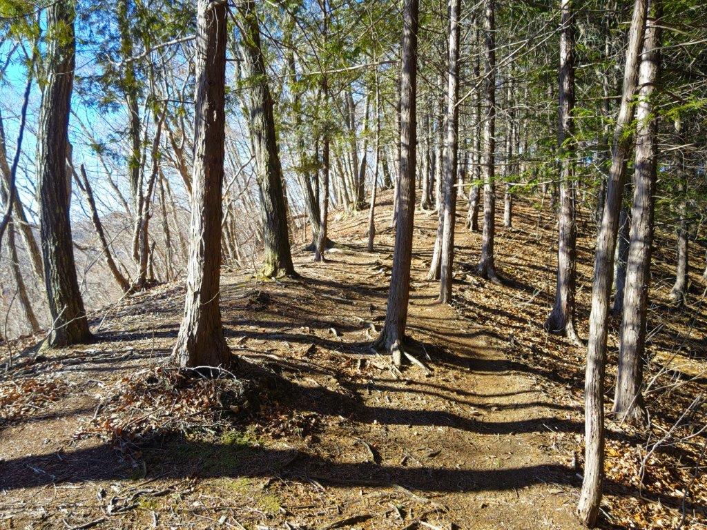
I was tempted to take a break at one of the sunny summit picnic tables but since it was barely noon, I decided to press on. Even though the mountain name means “little pine”, it was home to some very tall red pines, one of the 100 famous forests of Yamanashi. I went back down the steps and followed the ridge northwards, soon merging with the Takeda Forest Promenade (武田の森遊歩道 takeda-no-mori-yuhodo named after Takeda Shingen, a famous feudal lord from the Sengoku era), an ancient road connecting Wada and Iwado passes; I had already walked the latter part on my Mt Yogai hike. I strolled along the wide, level path as it followed the mountain side eastwards through the forest.
First view of the day near Kinsu-toge
Mt Fuji, the Misaka Mountains and the Kofu Basin
From time to time, I waved a stick to clear the stubborn spider webs that were too low to duck under, their occupants groggily moving out of the way. Shortly before 1pm, I left the promenade and turned left onto a wide path leading up the mountain side, the webs now thankfully gone. I soon reached Kinsu Pass (679m 金子峠) where I had a view of Mt Fuji between a gap in the trees. I now rejoined a hiking trail, and continued eastwards, soon arriving at a group of white-coloured rocks, called “Exposed Rocks of Mt Awayuki” (702m 淡雪山の露岩 あわゆきやまのつゆいわ), similar to the scenery one can find at the nearby Shosenkyo. It was also the highest point of today’s hike.
Mt Kaikoma from the Exposed Rocks
Afternoon Light at Chiyoda Lake
I felt lucky to have such a spot all to myself. Above the pines on the south side, I had a fantastic view of Mt Fuji and the Kofu basin. To the west, I could see Mt Kaikoma, also known for its white rocks, and the long summit ridge of Mt Houou. After taking a few minutes to explore and take photos, I selected a suitable rock to sit on for a lunch break. A little after 2pm, I headed back to Kinsu Pass, and followed the ridge westwards. Here the trail became faint and I had to rely on my phone GPS and the occasional pink ribbon. After a short descent, I reached a proper trail which soon turned into a road through a residential area; at 3pm, I arrived at the edge of Chiyoda lake.
Autumn Colours on the way to the Mt Shiro Viewpoint
Chiyoda Lake from the Mt Shiro Viewpoint
I was dazzled by the reflection of sunlight on the blue water surface and green water plants. I headed up log steps surrounded by red and orange leaves, happy to be back on a hiking trail. After a short climb, I reached an open shelter at the Shiroyama Viewpoint (白山展望台). Directly below was Chiyoda lake; to the west, I could the see the outline of Mt Houu against the fast sinking sun; looking north, I spotted Mt Kaya and the Kurofuji volcanic group, with the white rocks of Shosenkyo in the foreground and the peaks of Yatsugatake in the background. I still had a little way to go to the next summit, so after a short break, I set off again. The up and down trail was easy to follow, and at 3h30, I reached the Hachioji shrine (八王子神社) at the top of Mt Shiroyama (白山 しろやま), meaning “white mountain”.
View of Kofu from the top of Mt Shiro
Dark Clouds and Yellow Leaves from Mt Shiro
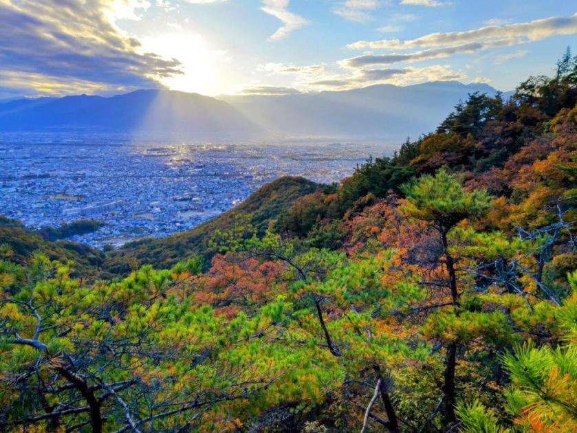
I was stunned by the view of fleecy clouds spreading from the snowy slopes of Mt Fuji, casting shade over Kofu city’s urban sprawl; luckily, the light still reached the surrounding slopes, lighting them up in gold. I quickly admired the view of the South Alps on the other side of the shrine, before moving on, picking up the pace as I wanted to get down before dark. I descended a steep, sandy trail, the rocky outcroppings and gnarly pines along the way feeling quite typical of the Chichibu-Tama-Kai national park. I was delayed by two more superb viewpoints, the setting sun creating a striking contrast of light and shade, before reaching a level trail, now in the shade. At 4pm, I passed the minor summit of Mt Hosenji (539m 法泉寺山 ほうせんじやま), completely within the trees.
The Tip of Mt Fuji hidden by the Clouds
The South Alps from the Top of Mt Shiro
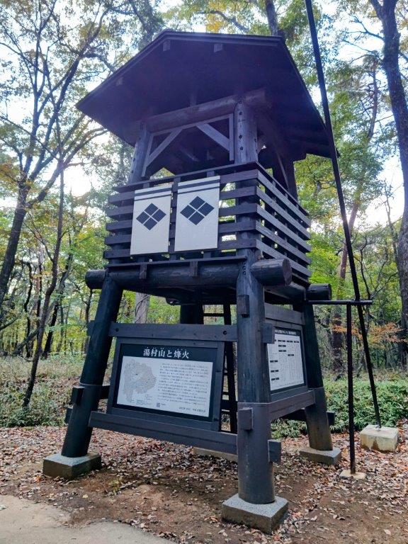
I was suddenly walking on flagstones (“ishidatami), a reminder that today’s last summit was also the location of Yumura castle (湯村城), although only some stone foundations remain today; I had to be careful not to miss my step, especially since the visibility was starting to fade. After a short descent, I reached a fire beacon (“noroshi“), a recent reconstruction of one of the many that used to exist during the Edo period, creating an ancient communication system. One final effort brought me to the open shelter at the top of Mt Yumura (湯村山 ゆむらやま yumura-yama), meaning “hot spring village”.
Sun Setting behind Mt Houou
Trail between Mt Shiro and Mt Yumura
I had one last view of Mt Fuji, its top half truncated by a layer of grey clouds. It was 4h30, so I sped back to the fire beacon and headed down a switchback trail on the west side, occasionally taking the well-worn short cuts between the bends. I was relieved to reach Yumura Onsen (湯村温泉) before it was completely dark, arriving at Yumura Hotel just before 5pm. After a refreshing hot spring bath, I caught a bus for Kofu station, where I boarded the limited express for the 90-minute ride back to Shinjuku.
Easy to Follow Trail below Mt Shiro
Last View of the day from Mt Yumura
This hike ended up taking 6 hours, a bit longer than planned, mainly because of the superb views along the way. The section around Mt Shiro was especially stunning, and I’d like a chance to redo in lighter conditions. It deserves to be better known, and it’s a mystery why I saw no other hikers the whole day. In the future, I’d also like to climb Mt Kata (片山) on the other side of Chiyoda lake and also explore more of the Takeda Forest Promenade towards Yogai Onsen. Before that, I definitely want to revisit the white rocks of nearby Shosenkyo.
I wanted to do another hike in the mountains of Yamanashi, as well as get some more views of Mt Fuji; I also wanted to go driving one last time before the mountains roads closed for winter. I decided to head to the southwestern Oku-Chichibu mountains, last visited in 2017 when I climbed Mt Kaya. Last year, I had planned, but not done, a hike in that area, a roundtrip to two neighbouring peaks of the Kurofuji volcanic group. They were featured in my guidebook but with a different route up the northeast side that was no longer used; for my hike, I’d go up and down the same route via Hatcho Pass on the southwest side.
For subscribers, read this Blog Post on Hiking Around Tokyo for a better viewing experience and the latest updates
To get to the trail entrance, I’d take the Chuo line limited express to Kofu, and then, since Kai city buses only run to the area on weekdays, drive a share car to a parking spot near Kurofuji Farm. The weather was supposed to be sunny with mild temperatures, usual for this time of the year. As to the mountain name Kurofuji (“black Fuji”), apparently when seen from its neighbour peak on the north side, it looks like a dark version of Mt Fuji (also visible in the background). I was looking forward to seeing this effect with my own eyes, as well as enjoying the autumn colours, which I hoped would now be at their best.
Hiking in the Chichibu-Tama-Kai National Park
秩父多摩甲斐国立公園
Autumn Colours and Blue Sky just below Hacho-toge
Larches and Grass on the way to Kurofuji
It was a perfect autumn day as I arrived in Kofu around 10am. After locating my share car, it took about an hour to drive to the small parking area near the start of the hike. After getting ready, I finally set off just as the noon chime was ringing. After walking past Kurofuji Farm, I left the paved road for a signposted trail on the right. I soon found myself walking up a narrow valley along a mountain stream, the rushing sound of water soothing the mind. At one point, I saw a white deer skull on the ground. After crossing the stream on a flimsy log bridge, I passed a couple of hikers heading down, the only other people I saw on today’s hike.
View of Mt Fuji from the South Side of Kurofuji
Southwest Oku-Chichibu with Mt Obina (center)
I was surprised by how quickly the trail became hard to follow; even with my phone GPS, I found myself off the path a couple of times. Fortunately, since it simply followed the valley all the way to the top of this ancient crater, I was soon back on track. About an hour after setting off, I reached a steeper, rockier area, a sure sign that was nearing the rim. The beautiful scenery of yellow leaves with a blue sky background slowed me down a bit, but at 1h30, I reached Hacho-toge (八丁峠) where I turned right along a well-trodden and gently rising trail, mixed forest giving way to tall larches.
This was perhaps the nicest part of the hike, the evenly spaced larches and grassy terrain giving an impression of wide open space, even though the trees had already lost most of their needles. I was reminded that I was now inside the western edge of the Chichibu-Tama-Kai National Park. After a short while, I was again climbing through bare trees and over rocky terrain, and at 2pm, reached the summit of Kurofuji (黒富士 くろふじ), a hundred famous mountain of Yamanashi. I could see the South Alps and Mt Kaya to the southwest, but the other directions were blocked by trees. My guidebook mentioned that a better view could be had just below the highest point so I headed down a path on the south side leading to a superb viewpoint at the top of a cliff.
Kurofuji (left) and Mt Fuji (right) from the trail for Mt Masugata
Yatsugatake (left) and Mt Meshimori (right) from Mt Masugata
I carefully sat on a rocky ledge with a small, gnarly pine at my back, keeping a safe distance from the edge. From my perch, I could see Mt Fuji directly ahead; against the sun, it appeared as a black triangle, and I couldn’t tell whether the first snow of the season had fallen. To its right, were the Central Alps, and to its left were the Oku-Chichibu mountains, Mt Obina being the sole recognisable peak. After a short lunch break, I retraced my steps, and followed the summit ridge to another breathtaking viewpoint on the north side, on top of some large rocks protruding from the mountain side.
Mt Kinpu from Mt Masugata
The Oku-Chichibu Mountains from the top of Mt Masugata
Standing on top of one of these rocks, I was astounded by the golden colours covering the mountains sides directly below, patches of grey indicating that the leaves were already past their peak at this elevation. I could see Mt Magari and Mt Marugata, and between them, Yastugatake in the far distance. Turning to the north side, I could see some of the highest summits of the Oku-Chichibu mountains: Mt Mizugaki, Mt Kinpu and Mt Kokushi. Amazingly, the area in-between has almost no hiking trails and few access roads, one of the few wild places in the Tokyo area. I was starting to fall behind schedule so I pulled myself away from the view and headed back the same way; I soon arrived at the intersection for today’s next peak, where I turned right. As I walked up the grassy path, Kurofuji suddenly came into view on the right side.
“Black Fuji” view from the Summit of Mt Masugata
Kurofuji with Mt Fuji in the background
I was excited to already have a view of “black fuji” even before reaching the second summit; viewed from the north side, the conical shape of Kurofuji was nearly entirely in the shade. To its right, I could see the top of Mt Fuji popping up through the clouds; in foreground, golden “susuki” swayed in the light breeze. I continued at a fast pace up the switchback trail, and at 3pm, reached the base of a huge rock. A quick scramble up some natural steps brought me to the narrow, flat top of Mt Masugata (升形山 ますがたやま masugata-yama), the name meaning shaped like a “masu” (a square wooden box used for drinking sake), an apt description for this summit.
Late Afternoon Light just before Hatcho Pass
Late Atfernoon Light just after Hatcho Pass
I was glad to have the summit to myself, as there wasn’t much space on top of the “masu“; I could also enjoy the breathtaking 360° view in perfect silence. To the west was Mt Yatsugatake; on the north side, I could see Mt Kinpu; and finally, turning southwards, was the view of Kurofuji with Mt Fuji in the background. It was only partially dark; perhaps a different time or season is needed for a full blackout. It was now 3h30, so I carefully got off the “masu” and quickly made my way back to Hacho Pass and then down the steep valley. The Autumn colours were even more beautiful in the late afternoon light and the trail was easier to follow on the return even after the sun had dipped below the ridgeline. Shortly before recrossing the stream, I spotted a white antler on the ground, to complement the skull I saw on the way up. At 4h30 I was back at my car, and by 5pm, I was on my way back to Kofu city just as it was getting dark.
I had wanted to visit Shibireko Lake ever since I’d found out about it from the Yuru Camp anime. Looking online, I recently found out that it was possible to hike from the lake to a nearby mountain with a view of Mt Fuji. Along the way, it was also possible to make a short detour to another summit with a view of the Kofu basin. Outside these two viewpoints, the hike was mostly in the trees, perfect for seeing the autumn leaves, hopefully at their peak. The hike, up and down the same way, was on the short side, ideal for the shorter days of Autumn.
Hiking in the Misaka Mountains 御坂山地
To reach the start of the trail, I’d ride the Chuo line Limited Express to Kofu, and then drive the rest of the way, as there is no public transport to the lake. The weather was supposed to be sunny all day with temperatures warm for the season. I was looking forward to seeing Mt Fuji with new snow on its summit and hoped that, although the lake was no longer a secret due to the recent camping boom, the trail would still be relatively unknown.
For subscribers, read this Post on Hiking Around Tokyo for a better viewing experience and the latest updates
Yatsugatake (left), Oku-Chichibu (right) & Kofu Basin from Obatakeyama
It was a beautiful Autumn day as I rode the limited express, arriving at Kofu station at 1030. By 11am, I was driving south, towards the South Alps, still completely free of snow. Shortly after noon, I pulled into the large parking lot belonging to Sumeiso Lodge, also available to day-trippers for a small fee; I had passed almost no cars during the drive up the two-lane Shibireko-koen line, a good sign for today’s hike. After getting ready, I set off at 1230, walking up the mountain side and away from the lake, hidden from view by the thick forest.
Narrow Section of the Hirugatake Trail
Sun Shining through the Trees Halfway to Hirugatake
It was a steep but short climb to the ridgetop, where I turned left along a level trail. At 1pm, I emerged onto the flat top of Mt Obatake (大畠山 oobatakeyama), with a bench and a view on the west side, as well as a telecommunication tower. I could see the South Alps, Yatsugatake and the Oku-Chichibu mountains; directly below, was the triangular-shaped Kofu Basin (kofu-bonchi), the urban sprawl running right up to the base of the mountains and the blue ribbon of the Kamanashi river splitting it in half. I settled on the summit bench for a thirty-minute lunch break then retraced my steps to the ridgetop intersection.
I was relieved to see that this trail was still a well-kept secret as I saw few hikers along the way. The trail alternated between level and gently climbing sections; a couple of narrow traverses required careful walking. The Autumn leaves were still turning at this elevation but the surrounding forest was beautiful. A little after 2pm, I reached Nishikata Pass (西肩峠) where I turned left for the final climb to the summit. At 2h30, I was standing at the top of Mt Hiru (蛾ヶ岳 ひるがたけ hirugatake meaning Mt Moth), a Yamanashi 100-famous mountain. Although the name sounds the same as the highest peak of the Tanzawa mountains, it’s written with a different Chinese character.
Closeup of Mt Fuji from Hirugatake
Autumn Colours at their Peak around the Top of Hirugatake
I was stunned to see that Mt Fuji still was completely snowless. However, its perfect cone on a blue sky background was beautiful even without its trademark white cap. To its right, I could see Mt Ryu and the long summit ridge of Mt Kenashi, with splendid autumn colours in the foreground; on the west side, I had a view similar to the one from the previous peak, but from a higher vantage point; I could also see the ridgeline I had walked between today’s two mountains. After a short break on the summit bench, enjoying the gorgeous view all by myself, I headed back down the same way.
Mt Kenashi from Hirugatake
The Minami Alps from Hirugatake
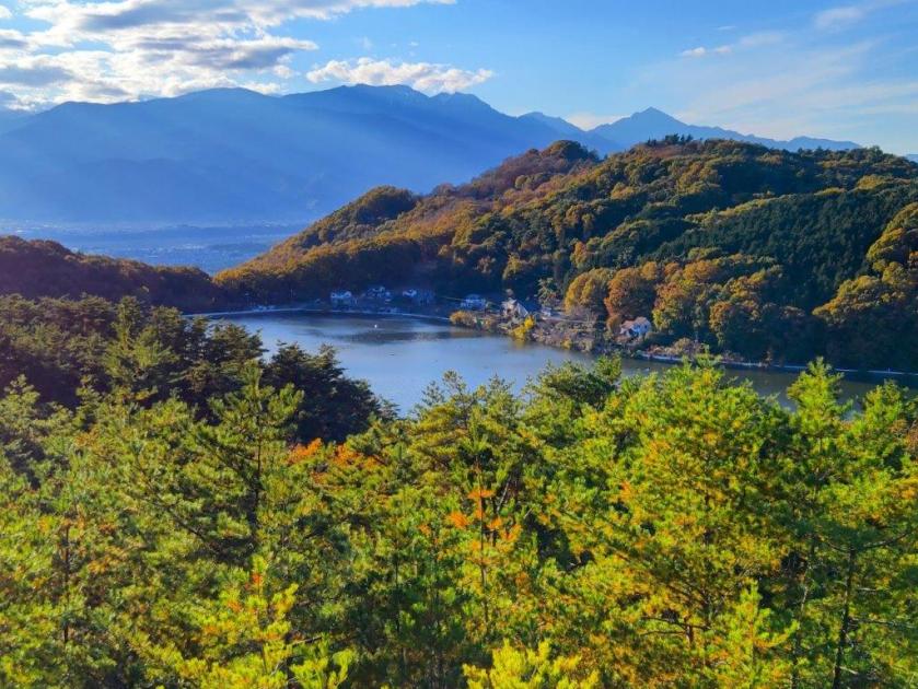
I enjoyed the solitary stroll back through the forest, the scenery looking slightly different in reverse. Through gaps in the trees, I had views of the Misaka mountains on the north side. One hour later, I was back at the nearly empty parking lot. Since I still had half an hour before sunset, I decided to quickly walk around Shibireko Lake (四尾連湖) before heading back.
Walking back to Shibireko Lake
Walking around Shibireko Lake
I was surprised to see that the campsite extended around the entire south half of the lake; some spots almost felt like wild camping. Even at dusk, people were still rowing boats across the lake. Half an hour later, I had completed my tour. After checking out the Yuru Camp related exhibits inside Sumeiso Lodge, I hurried back to my share car for the one hour drive back to Kofu station. There I boarded the limited express for the 90-minute ride back to Tokyo.
Shibireko Sumeiso Lodge
After Sunset at Shibireko Lake
The entire hike, including the lake loop, took about 4 hours. The view from the top of Mt Hiru was much better than I had imagined and deserves a place among the best mountain tops to view Mt Fuji. The hiking trail extends west from Mt Obatake and east from Mt Hiru and I hope to explore them one day in the future. This was my third Yuru Camp inspired hike, the first two being Takapotchi Highland and Hottarakashi Onsen. This was also my first proper sighting of Mt Fuji since Mt Sasagogangaharasuri in January of this year, and hopefully not the last one!
I wanted to see Mt Fuji on my first hike of the year. I had already climbed this peak, just over 10 years ago. Back then, I had made a long loop, along a hard to follow trail on the south side. I was inspired to redo this mountain thanks to a JR East hiking map showing a shorter loop hike: up the same way, but down a different trail on the east side, and passing by a giant cedar tree. I would take the Chuo limited express to Ostuki, and then continue by bus to the trailhead. I would have to leave relatively early to catch the sole morning bus. For the return, I could catch the only mid-afternoon bus back, or walk downhill to Sasago station, a couple of kilometers away, and a short ride on the local Chuo line to Otsuki. The weather was supposed to be sunny all day, meaning Fuji would be clearly visible. The temperatures would be lower than on my December trips, and I hoped it wouldn’t get too cold above 1000 meters. I was looking forward to my first hike and Fuji views of 2024.
Hiking in the Misaka Mountains 御坂山地
Hiking along the Chuo Line 中央線
Descent from the Summit (left) Ridge Trail to Sasago Pass (right)
Walking the Ridge Trail (left) Steps for Sasago Pass (right)
It was still very cold after I got off the bus just after 9am, near the entrance of Sasago tunnel. I found a sunny bench opposite the start of the trail and slowly got ready. A little after 9h30, I set off up a valley, walking in the shade of the cedars. At 10am, I reached an electric pylon out of the trees and with a view southeast towards Mt Tsurugatoya. I continued east, up a ridgeline within a valley enclosed on three sides. At 11am, I spotted the white top of Mt Fuji above the southern side. Shortly after, I was blasted by a biting cold wind blowing over the eastern ridgeline from the Kofu basin. Through the trees, I also had a glimpse of the South Alps, the highest peaks capped in snow. I found a sheltered spot and bundled up. At 1130, I reached an open space near a reflector.
Back into the Sun just below the Electric Pylon
Following the Ridgeline to the Summit
Turning around I had the best view of the day: directly south was the white cone of Mt Fuji, shining in the midday sun; to the southeast, I could see Mt Imakura, the 4th highest peak of the Doshi mountains, as well as Mt Omuro in the Tanzawa mountains. A few more minutes of climbing brought me to the summit of Mt Sasago-Gangaharasuri (笹子雁ヶ腹摺山 ささごがんがはらすりやま sasagogangaharasuriyama), a Yamanashi 100-famous mountain and one of the 12 beautiful views of Mt Fuji (秀麗富嶽十二景). Through the bare trees on the southwest side, I spotted Mt Houou, Mt Kita and Mt Aino, some of the main peaks of the South Alps, before they were engulfed by the clouds.
Last Stretch before the Summit
Checking out the Trail for Mt Komezawa
I was surprised to see traces of snow on the path leading northwards towards Mt Komezawa, in the opposite direction of my hike. I sat down on a bench near the summit marker, facing the sun and Mt Fuji, for an early lunch; about half a kilometer below was the busy Sasago Tunnel. The wind had died down but it was still chilly, and around noon, I set off again, down a steep path, heading west along the narrow ridge separating the Kofu and Otsuki valleys. The path soon became level. After passing a second pylon, I arrived at a fork in the trail, where I took the the “ridge route” on the right. According to my map, it would join up with the “new route” on the left, shortly before Sasago pass.
Following the Ridgeline to Sasago Pass
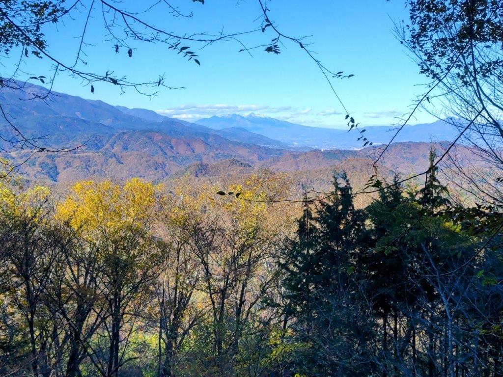
View Northwest of the Okuchichibu Mountains
I was glad with my choice since I was rewarded by views of Mt Koshu-Takao, Mt Konara, Mt Daibosatsurei, and Mt Okuratakamaru to my right, and glimpses of Mt Fuji to my left. Since I was well on schedule, I took my time peering at the views between the leafless trees. Soon after the two routes merged, I arrived at the third pylon of the day, beyond which the trail headed down a series of steps ending at Sasago Pass (笹子峠) completely in the trees. It was nearly 2pm, and the sun had just dipped behind the ridge rising steeply on the opposite side. I turned left down a shaded valley, and soon reached a road at the end of the old Sasago tunnel (Sasago-zuido 笹子隧道). I followed the road for a short while before getting back on the hiking trail. I soon arrived at Yatate-no-Sugi (矢立の杉), a giant cedar tree, and one of the 100 famous trees of Yamanashi.
Leafless Trees along the Ridge Trail
Heading Down from Sasago Pass
I spent a few minutes gazing at the thousand-year-old tree, nearly 30 meters high, its crown lost from sight, before leaving the viewing platform. After crossing Sasago River on a couple of wooden bridges, the trail widened and hugged the steep mountain side; the valley was bathed in sun again and the rushing river could be heard below on the right. After another short road section, I rejoined the trail again, this time the river on my left side. At 3pm, I reached a gate, beyond which was the main road and the bus stop. It was too early for the bus so I speed walked back to the Sasago station so that I could get the 3h30 train for Otsuki. There, I transferred to the limited express for the comfortable one-hour ride back to Shinjuku.
Wooden Bridge Crossing over Sasago River
Wide Trail in the Sun above Sasago River
Although the whole hike took six me hours, I did it at a fairly leisurely pace, hoping to match my arrival time with the return bus, but ended up an hour too early. In warmer weather it might be possible to take longer breaks but this is definitely a hike that should be done in the winter months; otherwise the views will be blocked by the leaves. The hike can be extended north or south along the ridgeline, but there are big up and downs on both sides, requiring more time and energy. I saw only one other hiker and he told me he had seen a bear run away, up the steep slope on the other side of Sasago river, barely seconds before I caught up with him. It seems like this bear had been spotted before and may the reason for the absence of other hikers, so a bear bell or other noise-emitting device would also be a good idea.
I had climbed this mountain once before but I wanted to redo it via a different route. This would be my first trip to the Fuji Five Lake Region since 2022. I decided to go up via the Asumi ridge; it was mostly in the trees but had a couple of viewpoints on the Fuji side. Looking at my map, I realised that going down via the Japanese Pampas grass (“susuki“) field, as I had done previously, was the best option, as it offered plenty of views of Mt Fuji.
I would take the Chuo Limited Express to Fujisan station, although the section past Otsuki would be standing room only. From the station, I would ride a taxi to Fudoyu Inn, next to the trail entrance. For the return from Oshino village, I could take a bus or a taxi back to the station, depending on the timing. The weather was supposed to be sunny with average temperatures for the season. I was looking forward to getting some closeup views of Mt Fuji and walking through the “susuki” field.
Hiking in the Doshi Mountains 道志山地
Hiking in the Fuji Five Lake Region 富士五湖
Heading Up the Z Trail (left) and the Asumi Ridge (right)
Looking Down (left) and Up (right) the Steps to Ozasu Pass
The grey skies hanging over Tokyo turned into blue skies as the limited express entered Yamanashi. At Otsuki station, I gave up my comfortable seat and squeezed into the front car, the train packed with tourists. Fortunately, few people got off at Fujisan station, and after a short taxi ride, I arrived at Fudoyu Inn. After getting ready, I set off at 11am, up a trail through a deforested area.
The top of Mt Fuji is only 20 kilometers away
Hiking through the Japanese Pampas Grass Fields
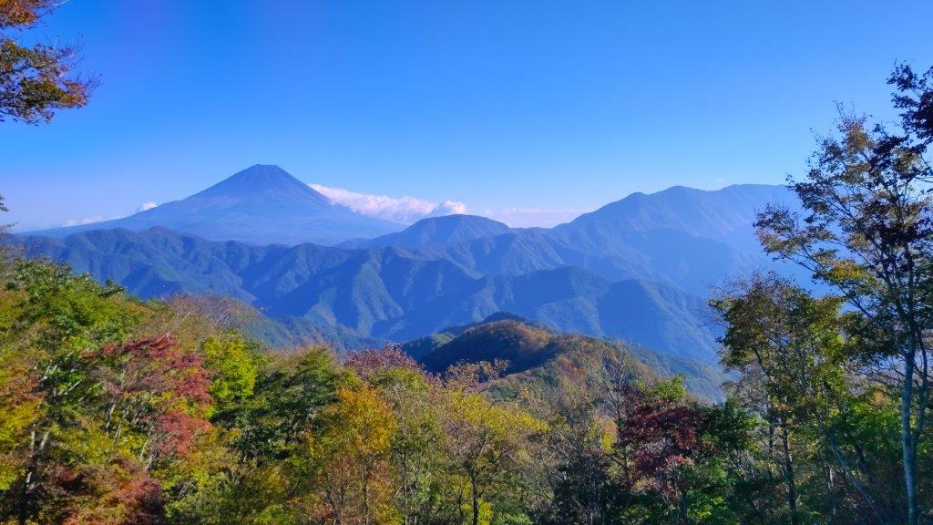
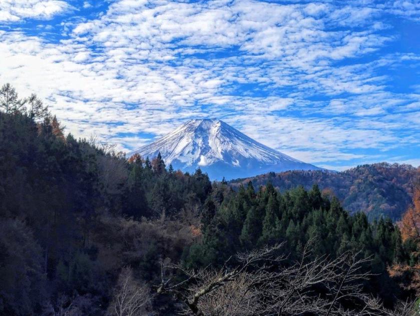
Turning around, I had a superb view of Mt Fuji, my first since April. The sky was streaked with cirrus clouds but Mt Fuji was clearly visible, its distinctive snowcap shining in the morning light. After a couple of switchbacks, I arrived at the entrance of the Z trail (Zコース), a gentle slope through the forest. At 1130, I reached the Ridge Trail (尾根コース), on Asumi-One (明見尾根). Through the bare trees on the north side, I had a glimpse of next valley. After a few minutes of level walking, I reached a viewpoint.
Mt Fuji viewpoint just above Fudoyu Inn
Deforested Area at the Start of the Hike
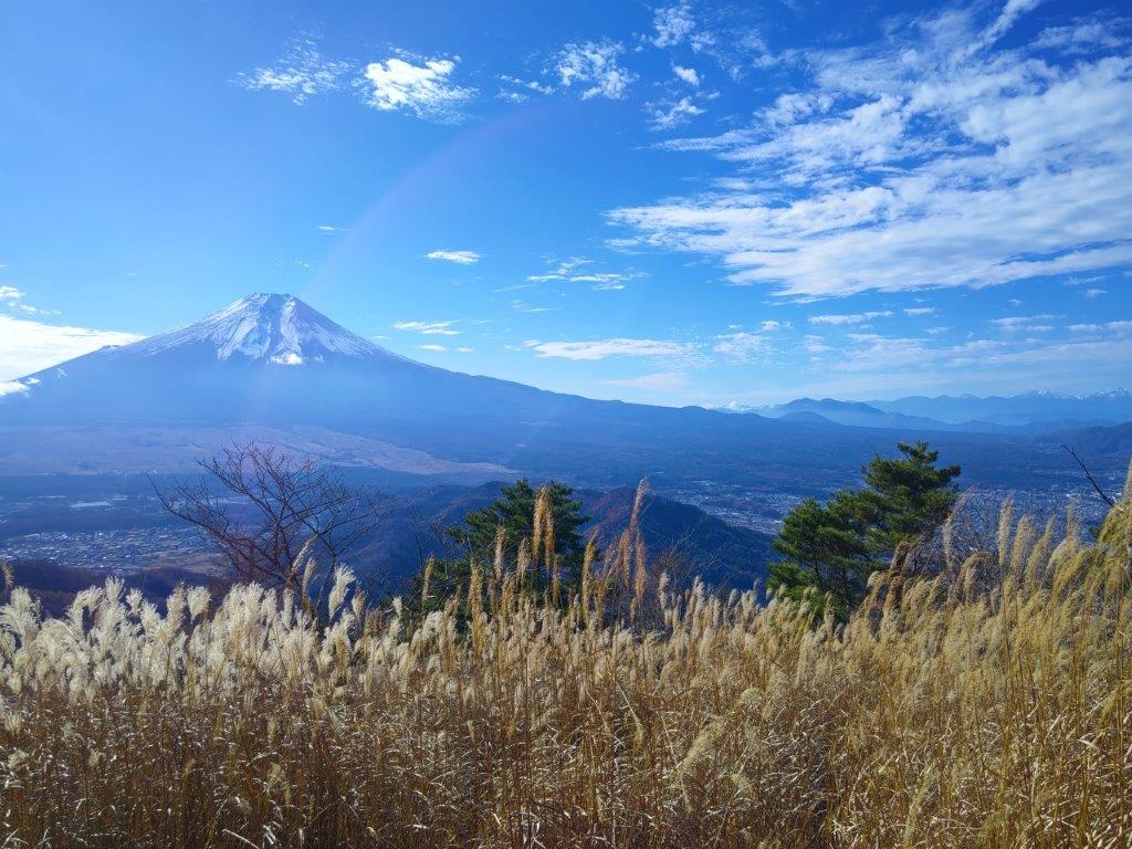
This was the best view of Mt Fuji of the day: it was framed by green cedars on both sides, with golden “susuki” below and white clouds above. I was resolved to enjoy the Fuji views early in the day; later on, the sun would move behind, leaving just a dark outline. The path suddenly became quite steep, some parts lined with rope for safety. I climbed as quickly as I could, passing many hikers on their way down. Just before 1230, I reached the second viewpoint of the climb.
Autumn Colours on the Lower Hills
Best Fuji View of the Day
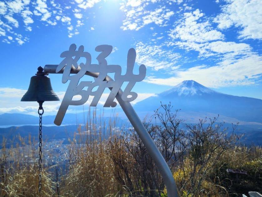
I took a few minutes to enjoy the view of Mt Fuji, beyond the “susuki” swaying in the wind. To the west, I could see Kawaguchiko City, and far behind, Mt Warusawa and Mt Akaishi, two prominent peaks in the South Alps. One last effort brought me to the top of Mt Shakushi (杓子山 しゃくしやま shakushi-yama), a Yamanashi 100-famous mountain. To the left of Mt Fuji was Yamanaka lake and to the right was the entire range of the South Alps, from the Shirane-Sanzan to Mt Hijiri; on the north side were the Oku-Chichibu mountains; on the right side, the Kanto plain was still hidden by the clouds. It was just past 1pm so I sat at at a bench for a lunch with a view.
Mt Fuji and the South Alps from the Asumi Ridge
Looking back at Mt Fuji
I was amazed to see a paraglider fly at high altitude, back and forth past the summit of Mt Fuji, at one point passing above my lunch spot. The jump-off point being much lower down on the mountain, it must have caught the perfect updraft. A little after 1h30, I set off again, heading down the steep south side. I soon re-entered the trees, and less than half an hour later, reached Ozasu Pass and the paragliding launch spot. I continued straight ahead, following an up and down trail; near an electric pylon, I passed a viewpoint of Mt Mitsutoge.
The Oku-Chichibu Mountains from the Top of Mt Shakushi
Kawaguchiko City and the South Alps from the Top of Mt Shakushi
I was surprised by how demanding this section was, with short rocky sections lined with rope for safety, even though I had done it once before some years ago. One hour after leaving the top of Mt Shakushi, I arrived at the summit of Mt Takazasu (高座山 たかざすさん takazasu-san). Mt Fuji was visible once again, its north face now mostly in the shade. After a short break, I continued my descent, and very soon I was walking above a huge field of Japanese pampas grass (“susuki“) covering most of the mountain side.
View of Mt Mitsutoge between Ozasu Pass and Mt Takazasu
View of Mt Fuji from the Top of Mt Takazasu
I enjoyed unobstructed views of Mt Fuji for the next half an hour but since it was past 3pm, the low sun made it difficult to get good photos. On the other hand, the “susuki” were at their best, shining golden in the mid-afternoon light. At 3h30, I reached a forest road leading to a paved road at Toriichi Pass. There, I turned left, and after walking downhill for a short while, arrived at Oshino Village. Since it was still early, I decided to walk to nearby Oshino Hakkai. Once there, I was lucky to be able to flag down a passing taxi, allowing me to quickly get back to Fujisan station. After riding the Fujikyuko line to Otsuki, I boarding the limited express for the one-hour ride back to Shinjuku.
Susuki field below the Mt Takazasu
Heading towards Toriichi Pass
The entire hike took about 5 hours, roughly the same time as my previous hike along a slightly longer route. I was glad that for the extra expense of taking a taxi to the trailhead, I got several good viewpoints of Mt Fuji along the way. Although I saw a number of people while going up the Asumi ridge, I saw no one during the entire descent, a shame considering the amazing Japanese pampas grass field on the way. Late autumn is definitely the best time to visit this mountain, although I’d love to attempt this hike earlier in the day to get clearer views of Mt Fuji.
For my last climb of the year, I wanted to do a station to station hike close to Tokyo, and on local lines, since I was worried about the reduced, year-end bus schedules and holiday travelers. I had walked most of the entire ridge south of the Chuo line, but, earlier in the year, I found a JR East hiking map, reminding me of an unexplored section between Yanagawa and Shiotsu stations. With a total time of around 5 hours and a chance to spot Mt Fuji from the summit, it seemed ideal for the last outing of 2022.
The summit of Mt Yadaira, just before Terashita Pass
I arrived under cloudy skies at Yanagawa station around 10am. After getting ready, I set off for the trail entrance, past a bridge on the other side of the Katsura river valley, reaching it at 11am. The sun had come out by now and sunlight was shining through the trees. The path followed a narrow valley along a dried-up riverbed; I was walking in the shade, since the winter sun was now hidden by the steep mountain-sides.
View of the Katsura river
Start of the hiking trail
I found it challenging to walk on the layer of dead leaves that had piled up during the autumn: it was like walking through ankle-deep snow. I was able to follow the trail thanks to the presence of fixed ropes, even on the level sections. My stick, which I mainly use for descending, helped me keep my balance. When the path started to zigzag up the mountain side, I had to be doubly careful not to slip on the dead foliage.
First views through the winter trees
The steepest section of the hike (left) / Approaching the summit (right)
I was relieved to be back on a sunny, leaf-free path, a little after noon, after rounding a bend. Looking north through the bare trees, I had a view of the mountains on the north side of the Chuo valley. I followed the now easy to walk trail southwards, merging with the ridgetop trail at Terashita Pass (寺下峠), half an hour later. On the way, I had a view of the rounded top of today’s peak, the curving ridgeline making it look deceptively close.
View of the Tanzawa mountains
Closeup of Mt Hiru, the highest peak of Tanzawa
I next went up the steepest section of today’s hike, and soon reached the summit of Mt Marutsuzuku (763m 丸ツヅク山(まるつづくやま marutsuzukuyama). It was completely in the trees so I quickly moved on. Very soon, I arrived at a short rocky section, that required some scrambling. Halfway up, I turned around and got a glimpse of the Doshi mountains on the south side. Turning around again, I suddenly spotted a black thing, slowly rising above the bushes.
View of Mt Omuro through the pines
Sun on the ascent (left) / View of Mt Jinnohako (right)
I thought it was a bear, but it turned out to be a camera on a tripod. It belonged to the only person I met today; he had been so quiet, that I had no idea he was nearby. I continued past him, and shortly after, arrived at the summit of Mt Yadaira (矢平山 やだいろやま yadairayama). It was also surrounded by trees, but a little further along the trail, was a clearing with a view of the Tanzawa mountains on the south side. Directly opposite, was Mt Omuro, dark and dramatic against the afternoon sun; Mt Fuji was hiding in the clouds. Since it was 1h30, I sat on a tree stump for a short lunch break.
Looking back at Mt Marutsuzuku
The Kanto mountains from just below Shinochi Pass
I resumed my hike and had an impressive view of a pine covered, solitary peak through a gap in the trees, slightly off the main ridge. The summit could be reached via a short roundtrip, so I decided to check it out quickly. The top of Mt Jin-no-Hako (810m 甚之函山 じんのはこやま jinnohakoyama) was again in the forest, but midway up, I had a view west of today’s summit, with Mt Mitsutoge in the background. Back on the main trail, I soon reached Shin-Ochi Pass 新大地峠), just after 2h30, where I turned left and headed down the mountain.
Descending through the forest
The surrounding landscape was golden in the late afternoon sun
I soon had a stunning view of the Kanto mountains, the triangular summits of Mt Mito and Mt Odake clearly visible below the blue winter sky. I crossed a road and then followed a gently descending trail westwards through the forest. This was the most pleasant part of the hike, the surroundings golden and peaceful in the late afternoon sun, except for the regular tap tap of a solitary woodpecker.
Mt Ogi (left) and Mt Gongen (right) in the late afternoon light
Arriving at the end of the hike
Before the trail curved north, I had one last view of Mt Ogi and Mt Gonzen, framed by two tree trunks, their features highlighted by the late afternoon light. At 4pm, I emerged from the forest, onto a road through a village, just as the last rays of sun vanished from the valley. It took another 15 minutes to reach Shiotsu station, from where it was a one hour ride back to Shinjuku.
The starting point for this hike was a famous soba restaurant I had been meaning to visit for a while. Looking at my map, I found an easy loop hike nearby, ideal for the short, cold days of December: up and down a relatively low mountain, at the junction of two rivers, with an observation tower at the top. I was familiar with the area since I had hiked there twice before, once on Mt Amagoi and once on Mt Hinata. The forecast called for sun in the morning, with clouds rolling in from the afternoon; I was looking forward to the views of the mountains of Yamanashi before the weather went downhill.
A steep climb (left) Walking along the top ridge (right)
Walking among the pines
I rode the Chuo limited express to Kofustation and then drove an hour to Okina (翁), located in a hilly, wooded area, wild monkeys occasionally crossing the winding road. I arrived exactly at 11am, just ahead of the weekend lunch crowd. After a satisfying soba meal, I drove a short way to the free, and nearly empty, municipal parking lot of Dai-ga-harajuku (台ヶ原宿), an old post town on the Koshu Kaido Highway.
Dark clouds above the South Alps
Mt Kaikoma (left) and Mt Hinata and Mt Amagoi (right)
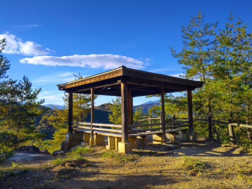
I set off a little after noon and followed a small road up the wooded mountainside, reaching Nakayama Pass (中山峠) just before 1pm. From there it was a steep, short climb up wooden log steps, the outline of the South Alps forming a dramatic backdrop. The path then followed the undulating ridge through a forest of red pines. At 1h30, I reached a clearing, in the middle of which stood the observation tower; although it was the highest point, the official summit was a little further along the ridge.
Looking down at the clearing at the base of the tower
A huge cloud perched on top of Mt Yatsu
From the tower, I was relieved to the see that most of the sky was still clear, although dark clouds had started to gather on the west side, giving Mt Kaikoma a menacing look. From its snow-freckled peak, a ridgeline extended northwards, ending at Mt Hinata, with Mt Amagoi lurking behind. On the north side was Mt Yatsugatake, with a huge cloud sitting on its head. To the east, the grey rocks of Mt Mizugaki and Mt Kinpu shone under the sun, while the twin peaks of Mt Kaya next to them were in the shade. Southwards, the white streaked cone of Mt Fuji was still clearly visible.
The mountains of Oku-Chichibu
Heading towards the official summit
Once I had finished enjoying the panoramic view, I continued along the top ridge, now heading eastwards, and 5 minutes later, arrived at the summit marker of Mt Naka (中山 なかやま nakayama, meaning “middle mountain”), completely in the trees. From there, the path descended through the forest, and half an hour later I reached a road at the base of the mountain. At 3pm, I was back at the parking lot. The clouds had finally filled the whole sky, throwing a gloomy chill on the afternoon.
Walking down through the forest
Nearing the end of a short hike
Since it was still early, I decided to check out the nearby Shichiken sake brewery shop. During the drive back, I enjoyed some fantastic views of Mt Fuji from the highway. After returning the car in Kofu, I boarded the limited express for the 90 minute ride back to Shinjuku.


![Mt Shakushi (1597m) & Mt Takazasu (1304m), Fujiyoshida City, Yamanashi Prefecture, Sunday, November 26, 2023 [MAP AVAILABLE]](https://hikingtokyo.com/wp-content/uploads/2023/12/dsc_1408.jpg?w=1024)


![Mt Yadaira (860m), Otsuki and Uenohara Cities, Yamanashi Prefecture, Friday, December 30, 2022 [Map Available]](https://hikingtokyo.com/wp-content/uploads/2023/04/dsc_28292.jpg?w=1024)


You must be logged in to post a comment.