
Author: David

Mt Sasago-Gangaharasuri (1358m), Otsuki City, Yamanashi Prefecture

Ask for a hiking map for Mt Sasago-Gangaharasuri
笹子雁ヶ腹摺山 sasagogangaharasuriyama
中尾根ノ頭 1278m 大洞山 1402m 大沢山 1460m
Mt Asama (2568m), Komoro City, Nagano Prefecture, Saturday, October 12, 2013 [Map Available]
Hiking the hundred famous mountains of Japan 日本百名山
Hiking in the Joshin-Etsu-Kogen National Park
浅間山 (あさまやま asamayama)
Download a map of the Mt Asama hike
This map was developed for Japanwilds with the Hokkaido Cartographer
Find more Japan hiking maps on Avenza
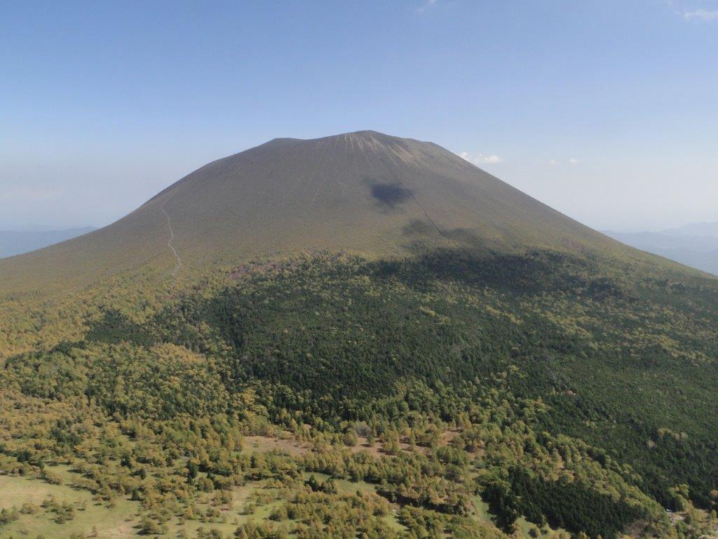
View of the summit of Mt Asama from near Mt Kurofu
Mt Kawanori (1363m), Okutama Town, Tokyo Prefecture
Hiking the Chichibu-Tama-Kai National Park
秩父多摩甲斐国立公園
Ask for a hiking map for Mt Kawanori
川苔山 kawanoriyama
Mt Gozen (1405), Okutama Town, Tokyo Prefecture

Hiking the Chichibu-Tama-Kai National Park
秩父多摩甲斐国立公園
Ask for a hiking map for Mt Gozen
御前山 gozenyama
Mt Takamizu (759m), Ome City, Tokyo Prefecture

Hiking the Chichibu-Tama-Kai National Park
秩父多摩甲斐国立公園
Ask for a hiking map for Mt Takamizu
高水山 takamizusan
Mt Karasuba (267m) & Mt Konpira (121m), Kamogawa City, Chiba Prefecture, March 2013

Ask for a hiking map for Mt Karasuba
Located on the Pacific side of the southern part of the Boso Peninsula, this loop hike is perfect for the colder winter months. On a clear day, it’s possible to see all the way to Mt Fuji from the top of karasubayama (烏場山), one of the many viewpoints along the way.
Hiking on the Boso Peninsula 房総半島
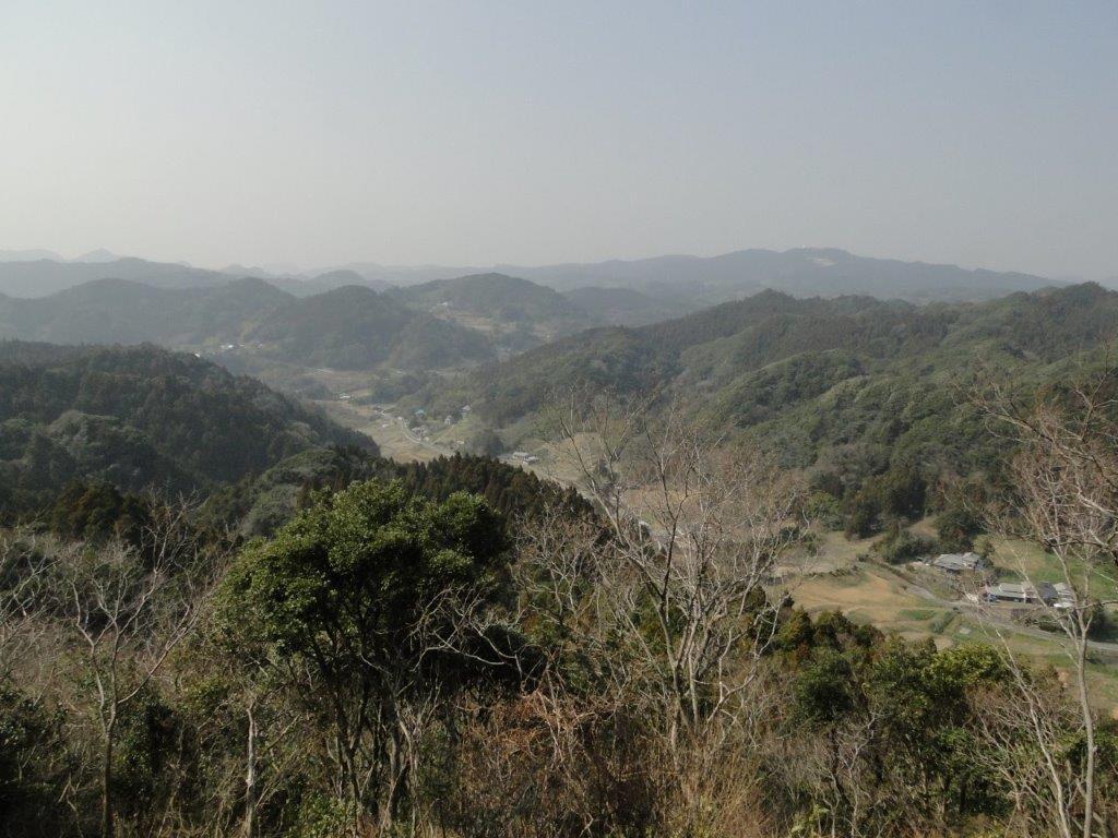
View North from near the top of Mt Karasuba

Hiking along the Bride Route
Despite its low elevation, this 5-hour up and down route is best attempted by fit, experienced hikers, as there are no escape routes along the way. It’s recommended to do it in a clockwise direction, starting with the “hanayome” or bride route (花嫁コース), continuing with the “hanamuko” or bridegroom route (花婿コース), and ending with the “kurotaki” or black waterfall Route (黒滝コース) which passes by Kurotaki waterfall.

Hiking along the Bridegroom Route
Hiking along the Kurotaki Route
The start of the hike can be conveniently accessed on foot from Wadaura Station on the Uchibo local line, a little over 2 hours from Tokyo, thanks to the comfortable Wakashio limited express that runs between Tokyo and Awa-Kamogawa stations.
Ask for a hiking map for Mt Karasuba
Mt Takegawa (1052m), Mt Futago (883m), Yokoze Town, Saitama Prefecture

Mt Nango (610m), Mt Maku (626m) and Mt Shiro (563m), Yugawara Town, Kanagawa Prefecture

I felt like it was time to try something different, something special to Japan; I wanted to do a hike next to the ocean. I found one such hike in my hiking book, but it seemed a bit short, so I combined it with a couple of nearby peaks. Although the elevation of these three mountains was relatively low, they seemed quite impressive when seen from the sea-side town of Yugawara, famous for its plum blossoms and hot springs. The area is also known for rock climbing, although today’s purpose was purely hiking.
HOW TO GET THERE: From Tokyo or Shinagawa station, catch the Tokaido line to Atami; Yugawara is the stop before. Depending on the type of train you catch, it takes between 60 and 90 minutes, direct or with changes. This is not a line I take often so it was a pleasant change with lots of views of the sea (sit on the left when heading out). From the station there are frequent buses to “Kaiya” which is the last stop. I was the sole person on the bus for the last portion of the trip, and on the first part of the hike.
Ask for a hiking map for Mt Nango, Mt Maku, Mt Shiro
THE ROUTE: The bus stops in front of a temple, but the hiking trail doesn’t go through it. There wasn’t anybody around to ask, but I found a sign for the hiking trail along the road that continues up the mountain to the left of the temple. The signposting was particularly poor on this hike, and some route-finding was needed (this was nearly ten years ago so things may have changed). I followed the road as it curved to the right and then back to the left again, with many minor roads branching off it. I eventually reached a sign pointing straight up a very steep slope; it must of had an inclination of 45 degrees; I cannot imagine driving up here with ice or snow, although I guess that it rarely happens in this area (it felt pretty balmy for December).
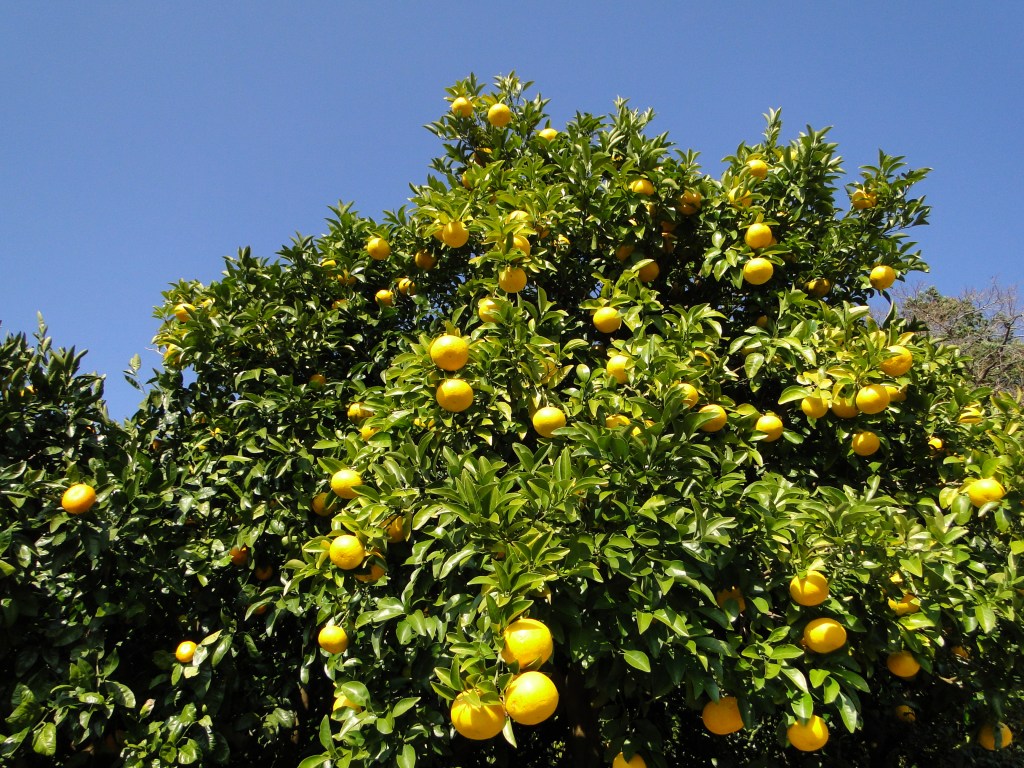
Japanese citrus fruit or mikan

Manazuru peninsula jutting into Sagami bay
Soon I was walking among the mikan trees with their bright orange fruit. I was getting pretty views of Yugawara town, Sagami bay and the surrounding mountains. I couldn’t see any more signs, but I decided to stick to the main road, a tough proposition since the other roads that branched off seemed to be the same width (wide enough for a small car). Instinct served me well, for shortly after entering a forest section, I found another wooden signpost for the summit. Unfortunately this sign was placed a few meters before another junction. I hesitated for a couple of minutes, and then continued in the most plausible direction which was straight ahead.
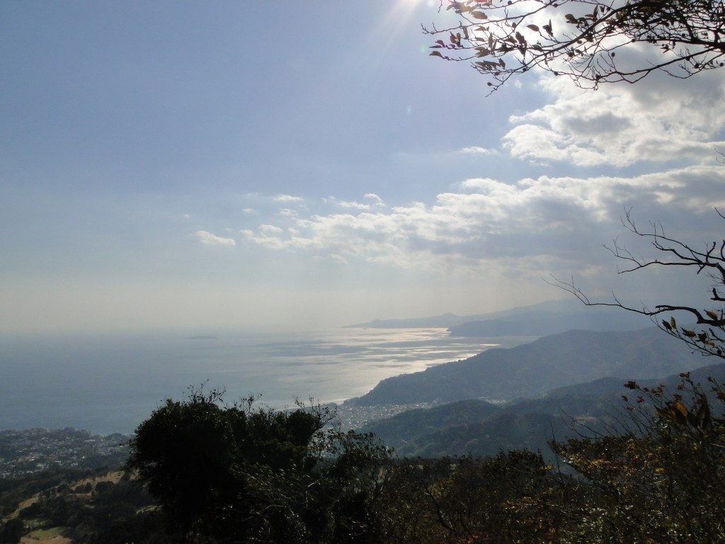
Looking South to Izu
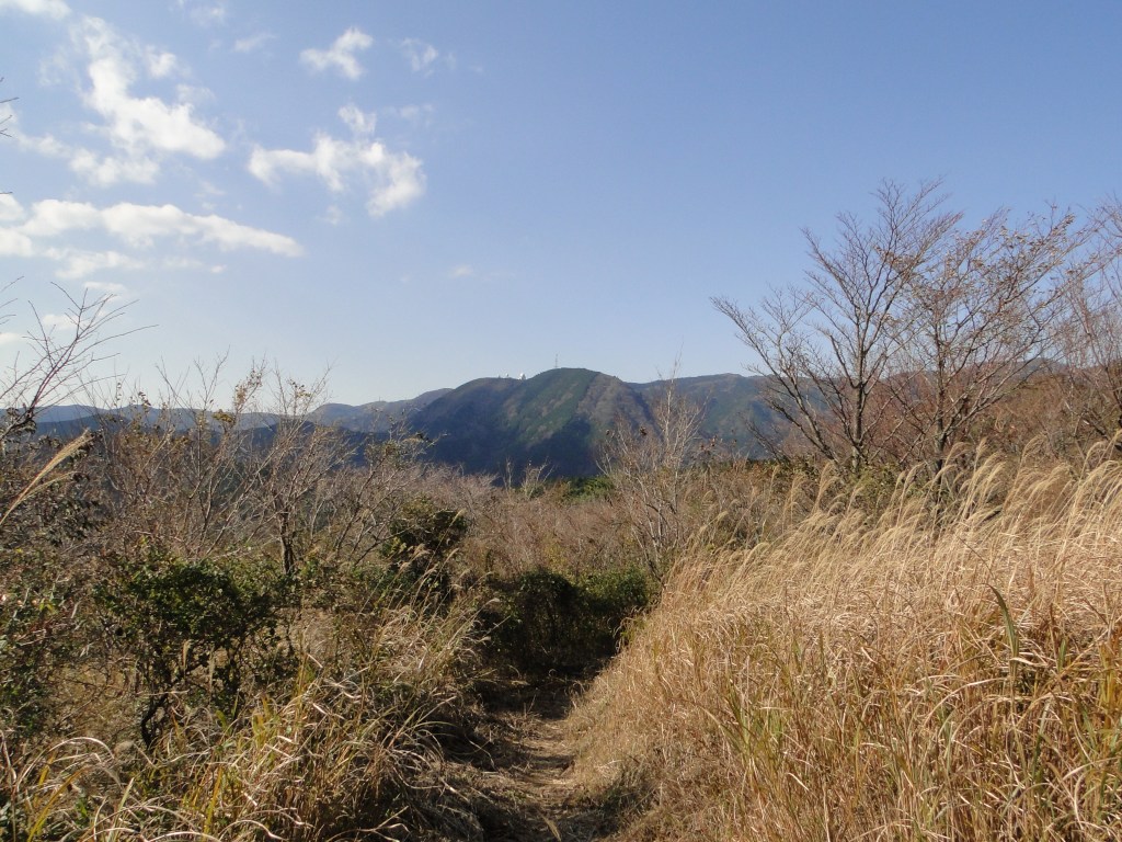
Near the top of Mt Nango
Since I was going up the side of a steep mountain, taking the wrong way could have big consequences. Fortunately, as I reached the top of the ridge, I came upon a third and better sign marking the start of a proper hiking trail. The surrounding landscape had become quite fascinating, not because of its beauty, but because of the sense of abandonment. This area had enjoyed a boom a few decades ago, but was now in decline, and there were a lot of ruined buildings making it a little spooky.
Now I was following a proper hiking path along the ridge. The views were hidden by the surrounding vegetation, lucky in a way, since it had become considerably windy. I was skirting a golf course, surrounded by an electric fence to keep trespassers (or hikers) out. I then reached a road, and after following it for a few minutes, I came to a hiking path on the left heading to the top of Mt Nango (南郷山 nangosan)about ten minutes away. There were some nice views of the coastline a few meters below the summit, better than from the summit itself. Here I met some other hikers, as it usually happens at the tops of mountains, and was easily able to get someone to take my photo.
Mountain scenery near the coast

Easy walking through the forest
After a short rest, I set out again for summit number two and the highest point of the hike. Here the signposting let me down again. At the first intersection, there were no signs for my mountain, only a sign going straight to a temple, and a one pointing for the road that running between the two mountains. I had to cross the road at one point, but according to my map, not before passing by a small lake. So I decided to continue straight ahead. This turned out to be wrong, and I was soon forced to retrace my steps. Back at the junction, I took the second path towards the road (now going right). This was a pretty trail, zigzagging down through a pine wood before reaching a flat wooded area, where I crossed what must have been the other path leading down from Mt Nango.

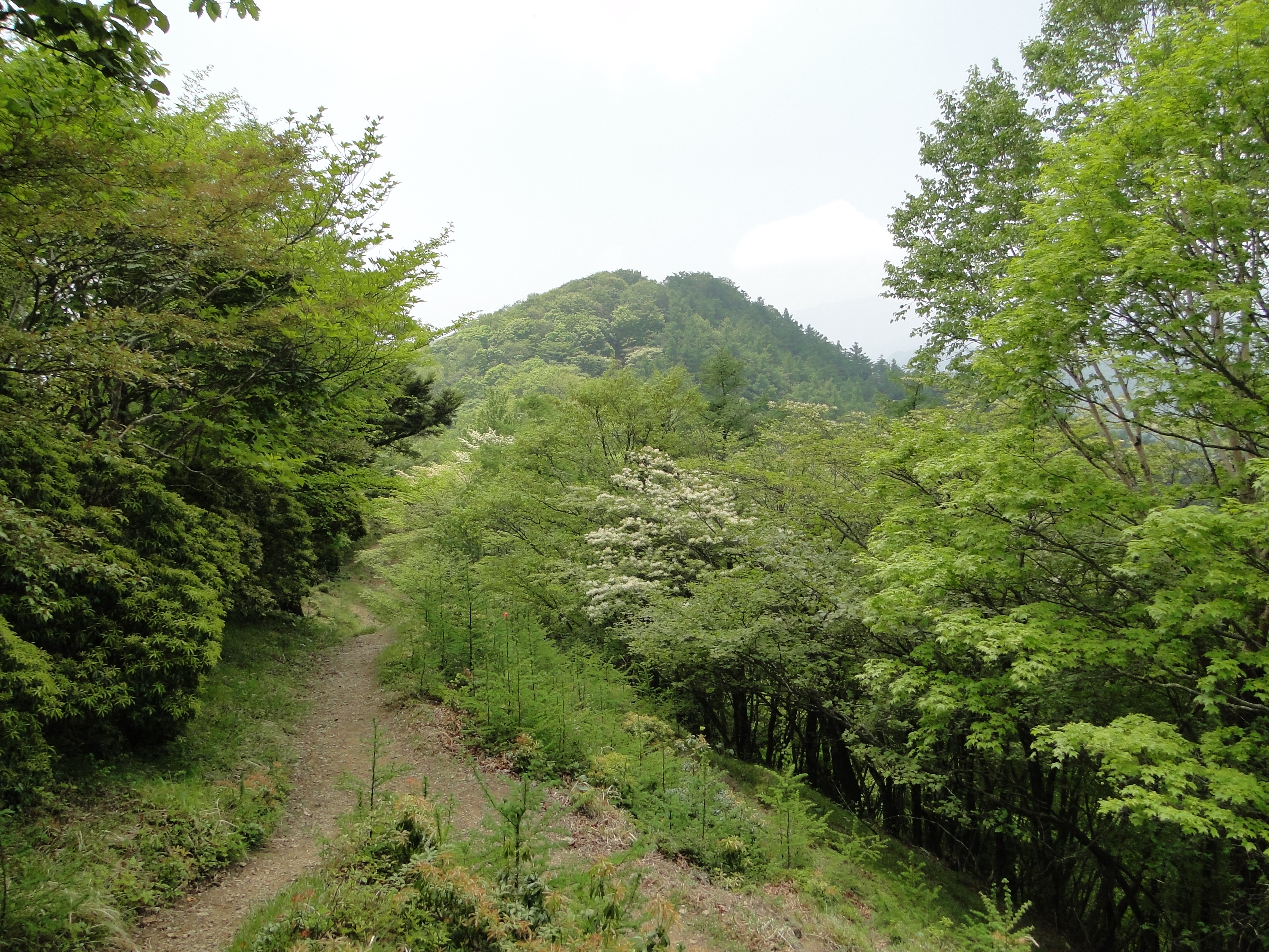
The path to Mt Maku

Getting close to the top of Mt Maku
Here I turned right and continued walking through some more delightful forest. I finally spotted the lake that I had been aiming for. It was a small and lonely lake hidden in the middle of the forest. Just beyond it was the road which I crossed in order to re-enter the woods on the other side. This part was really pleasant and made me want to bring other people here.
After a few minutes I reached the path heading for the summit. It took me another fifteen minutes of gentle climbing to reach Mt Maku (幕山 makuyama). From there I could see the ocean and the surrounding mountains. There weren’t any benches so I sat on the ground to have lunch. Since my view while sitting was obscured by bamboo grass, and the wind was terribly strong, probably due to the proximity of the sea, I decided not to linger.

Nice ocean views

Enjoying the soft autumn sunshine
Heading down, I mistakenly turned onto a path circling the summit. Once I realized this, I cut back through the woods and got back on the correct path. I was soon facing south and had some nice views of Sagami bay. I passed a group who had taken my photo on the summit, and left them behind me scratching their heads, since I had left ahead of them.
Eventually I got to the base of the mountain and got to see its famous rock climbing cliffs. There were a few people practising their skill in the good weather. It was interesting to note that they place mattresses underneath in case they fall. That’s Japanese safety for you. This is where the famous Yugawara plum trees are located (just bare branches at this time of the year).
The rocky base of Mt Maku

The rock climbing area
I was now following a paved road along the bottom of a valley. It was only 3pm, but the winter sun was already starting to dip below the surrounding ridges. I stopped to take photos of the beautiful colours of a maple tree and the shadows nearly overtook me. A little later I crossed a bridge, went straight another hundred meters, turned left up another smaller road, and ten minutes later reached a small hiking trail. The paved road continues around Mt Maku, and joins up with the path I went up on the other side.

Orange Maple tree

Short but nice river walk
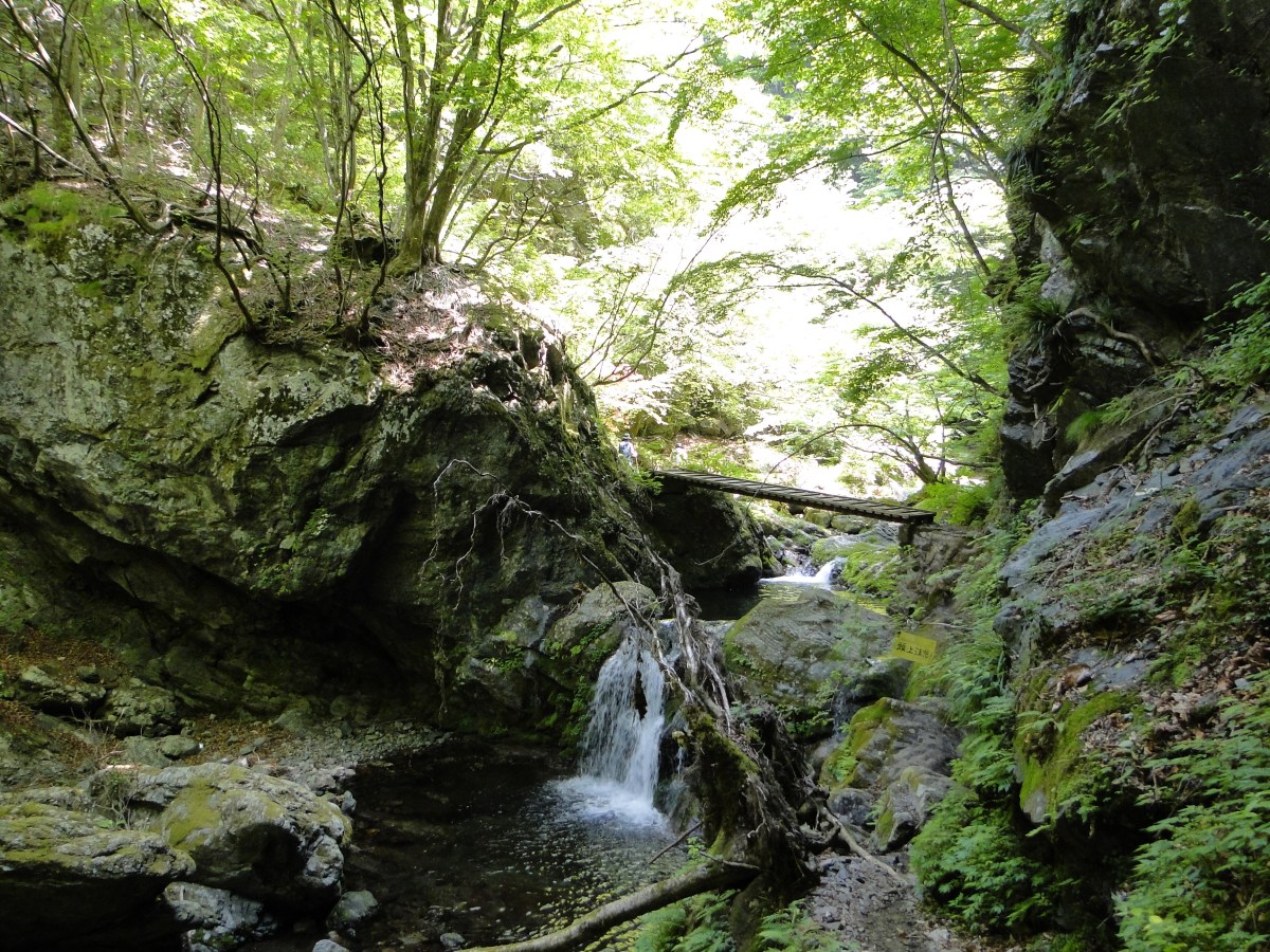
Here darkness overtook me as the path twisted and turned through thick forest. There were a few ropes and chains, but nothing challenging. It was tough to climb up a mountain again, but it was too soon to head back. After about 30 minutes I reached a small shrine under a small waterfall. Above it, there was a paved path lined with stone lanterns switching back and forth; it felt rather sacred. At this time, there was nobody else around.

Walking along the valley before climbing again

The path to the shrine
I reached another road which I followed through a windy tunnel under the highest section of the ridge. On the other side, I emerged back into the sun. I followed the road one hundred meters to a lookout point and a bus stop. Behind the observation platform, I found the hiking trail again. It double backed towards the ridge and passed above the tunnel. This was an enjoyable section despite the strong wind, heading slightly downhill with occasional views of the adjacent ridges and the ocean.
In the sun again…

The Izu peninsula
A short while later I reached the final summit of the day, Mt Shiro (城山 shiroyama). It was the lowest of the three peaks, but it had by far the best view, with places to sit down and no vegetation in the way (and toilets as well!). At this late hour, I had the summit to myself. To the South was the Izu peninsula, to the North was the Shonan coastline, and beyond, the Landmark Tower in Yokohama, to the west was Oshima Island. The most amazing thing about this summit was that it was right at the edge of the sea. I think it’s the first time I have stood about 500 meters directly above the coastline.

The coveted ocean view
Looking back at Mt Maku
I had to pull myself away from this great view only fifteen minutes after arriving, since I really needed to get down before dark. I headed down at a fast pace, the path being relatively easy to walk. There another good view of Oshima island on the way. Very soon I reached a paved road. My map showed that there were a couple of shortcuts so that you didn’t to walk so much on the road. However I got tricked on the second one, it led basically nowhere, and I had to climb five minutes back to the road.
When I got to the real short cut, I didn’t dare to take it so I jogged the wide bend of the road. Soon I started seeing signs of civilisation again: telephone wires, houses and cars. There were again no signs and more roads than were indicated on the map, but following my instinct I ended back at the station by dusk. I celebrated by taking a hot bath at an onsen with outdoor bath just five minutes down the road, on the top floor of the hotel.
Ask for a hiking map for Mt Nango, Mt Maku, Mt Shiro

Final view of Ooshima
Mt Sekirou (702m), Sagamihara City, Kanagawa Prefecture
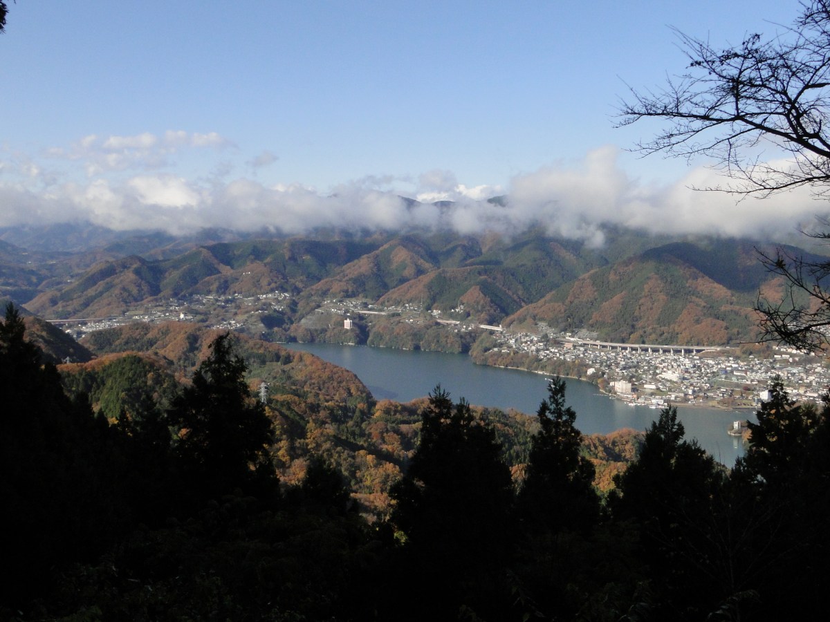
This was my second visit to Mt Sekiro (石老山 sekirouzan) and the first time taking other people; the photos will be a combination of both trips. I feel that this mountain is really exceptional: it’s close to Tokyo, easy to climb, it has great views (including Mt Fuji), there is a temple at the base, and finally there are few hikers since it’s not a famous mountain.
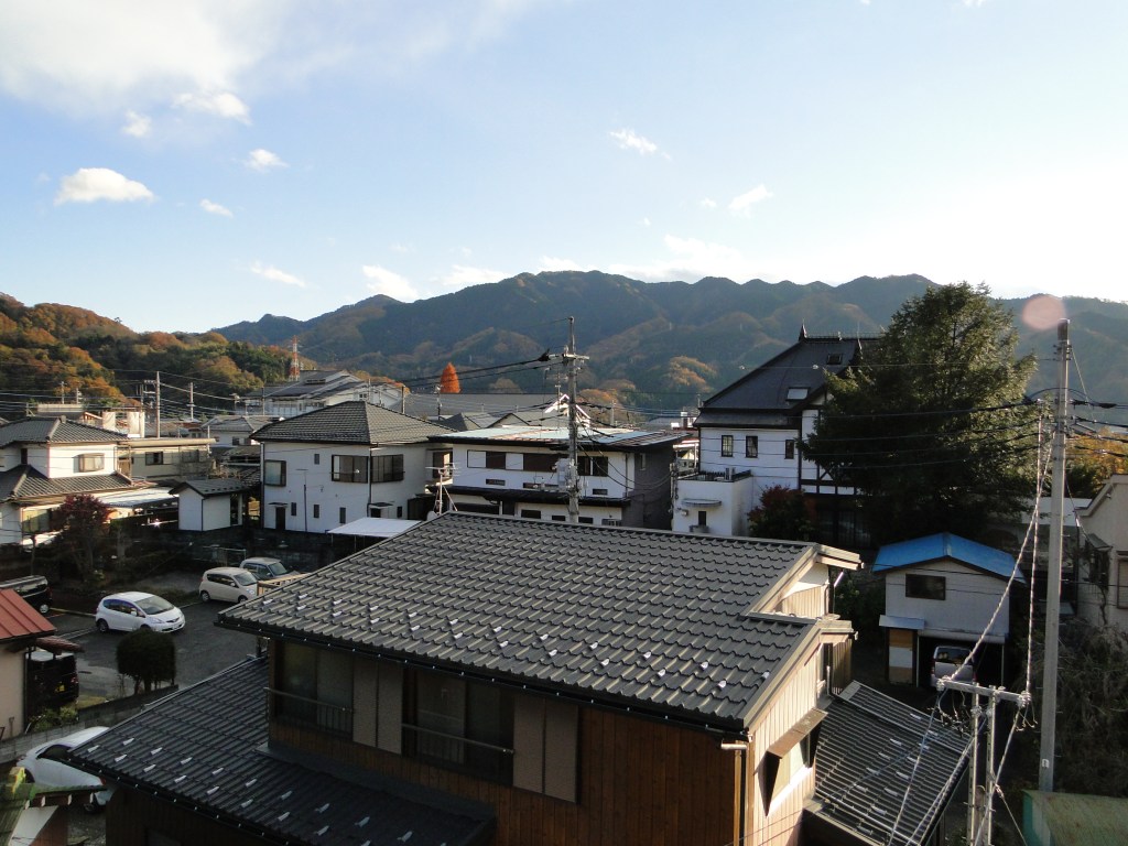
Mt Sekiro from Sagamiko Station
HOW TO GET THERE: Get on the Chuo line for Takao station, ride to the end of the line, and switch to the Chuo line again by simply crossing the platform. Get off at Sagamiko station, the next stop. The only tricky part here is catching a bus to the start of the hiking trail. Departures normally coincide with most train arrivals, but if the wait is too long, it’s possible to take a taxi since it is only ten minutes away.
THE ROUTE: From the bus stop, we crossed the road and headed up the road that lead away from it as a straight angle. There is a sign saying Sekirosan iriguchi (石老山入口 meaning entrance to Mt Sekiro) as well as a big sign showing the route. There are also toilets and a vending machine. After walking along the road for about twenty minutes we reached the start of the trail, behind a hospital. The weather wasn’t great, but it didn’t matter so much since the hike was mostly in the forest during autumn.
Ask for a hiking map for Mt Sekiro
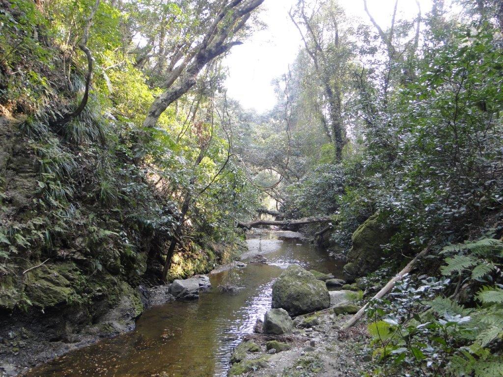
The first part of the hike climbed steadily through a forest of tall cedar trees next to a stream. Massive moss-covered boulders lay strewn on both sides of the path. Some had small signs with Japanese explanations on their legendary origins.
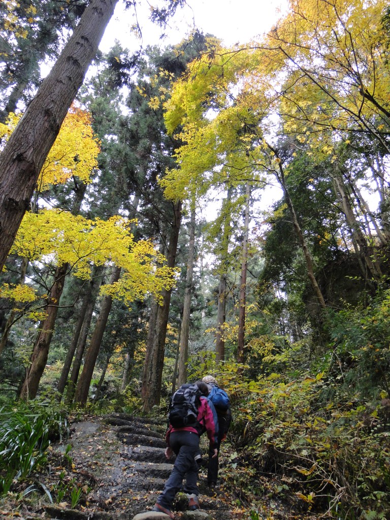
The road to the temple

Huge moss covered boulders
In less than half an hour, we reached Kenkyoji temple (顕鏡寺) perched on the lower reaches of the mountain; we took a photo break since it had some impressive autumn colours. Since there are no other mountains standing in the way, there was also a view west towards Tokyo, but clouds and smog meant that visibility was limited. Northwards, we could see Mt Takao, the closest mountain to Tokyo.
The trail continued behind the temple, winding back and forth, eventually a fork, unmarked on the map. We asked a small family on their way down who confirmed that the paths connected further up and that the right one was easier to walk. We took the right branch and were rewarded with some more nice westward vistas, as the path curved around the side of the mountain.
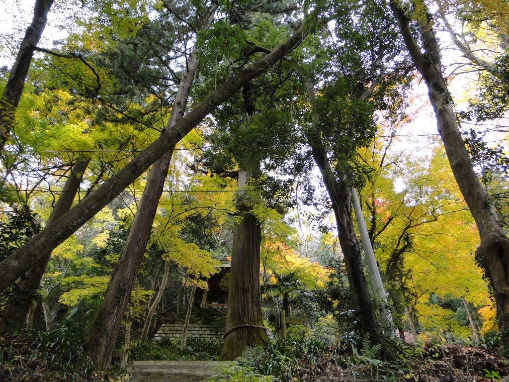
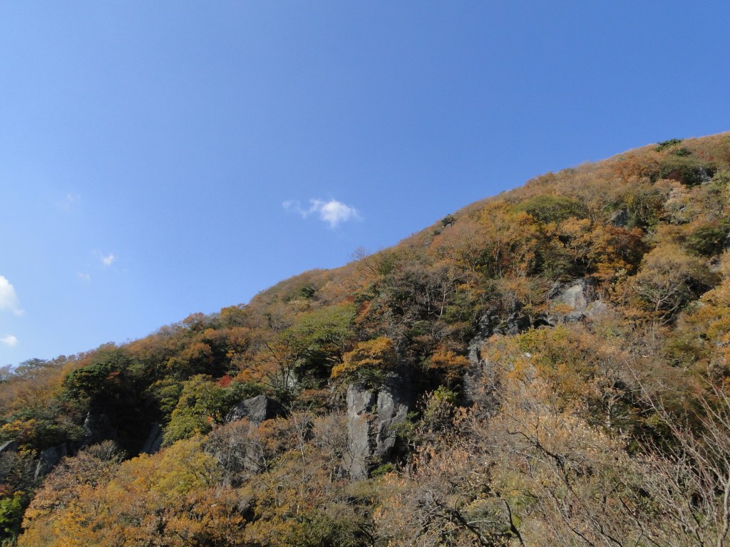
Autumn colours were in full swing
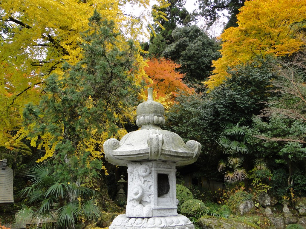
Orange and yellow fighting for dominance behind a stone lantern
Before we knew it, the paths joined up. From that point, the path climbed gently through the forest till a fantastic viewpoint of Lake Sagami. We couldn’t really see much of the view, since the weather was still cloudy. We continued up the mountain at a good pace and meeting few people. The path was a series of short steep climbs followed by flat or slightly downhill sections.
We reached the summit two hours after starting out. There were two or three tables where you can have a picnic while admiring the view of Mt Fuji. Unfortunately today the weather had steadily been getting worse, and there was no hope of seeing the majestic volcano today. We repaired to a table under a tree out of the cold wind that had suddenly started blowing, and prepared our ramen lunch.
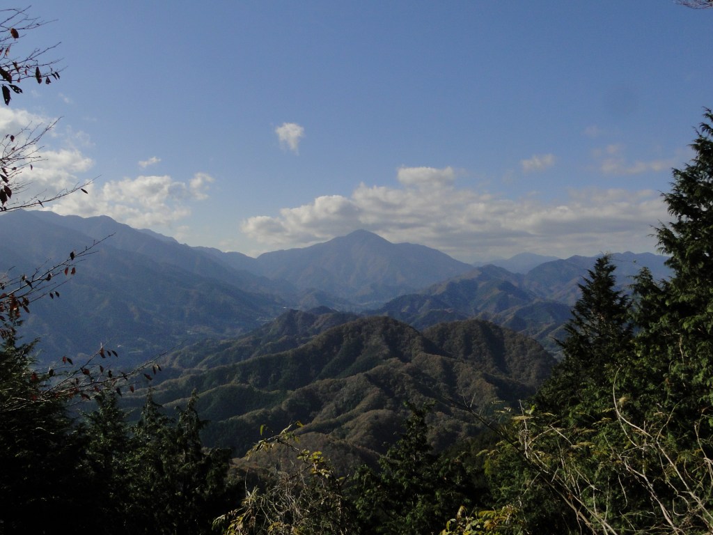
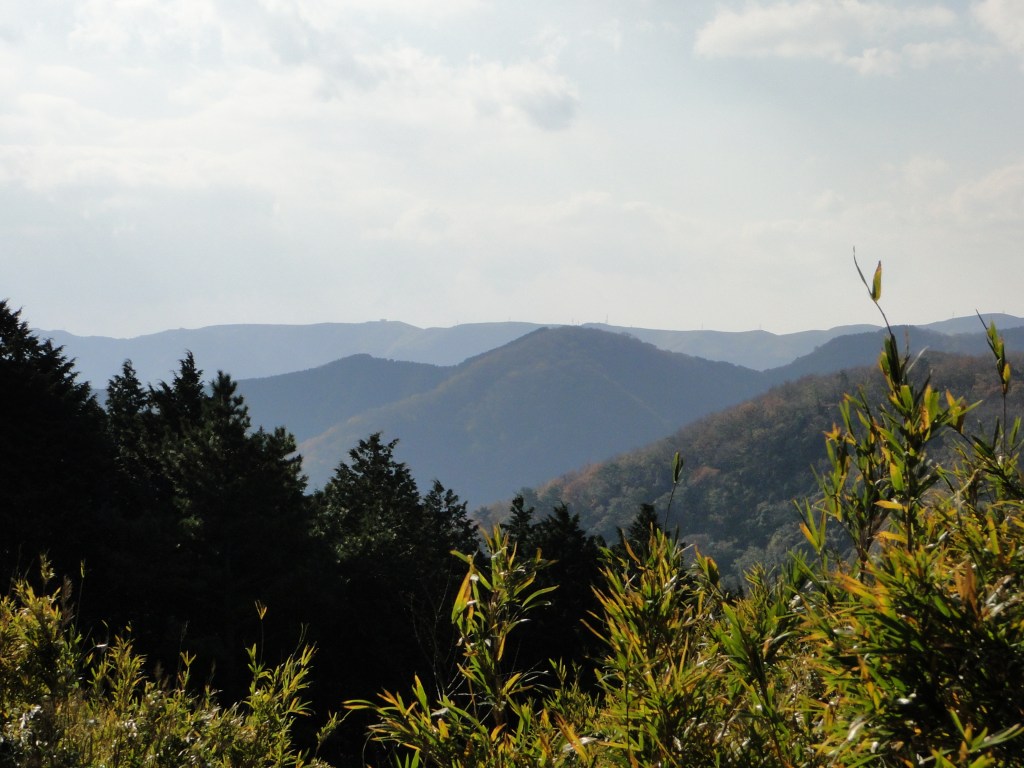
View from the with Mt Omuro in the center (taken the previous year)

First glimpse of Sagami lake on the way down
Even though it was the first of December, the temperature had been warmer than expected. However it suddenly turned freezing and the clouds got greyer. I noticed some white specks on the table; amazingly, it had just started snowing! it wasn’t even the beautiful snowflake type of snow; it was the hard granular kind, that was more like sleet, forcing us to gulp down our lunch, and leave as quickly as possible. By that time, my fingers were feeling pretty numb from the cold.
I had originally planned a loop hike but decided on the spot, that we should head down the same way; it would be safer to down a familiar way in a freak snowstorm. However, as soon as we got a few meters from the summit, the snow stopped falling and it felt noticeably warmer. Ten minutes later we had blue skies above our head and the sun was shining. The storm was over just as quickly as it had started. The path looked quite different going down especially now that the weather was so good. The view of lake Sagami was completely different and we could see the mountain ranges beyond.

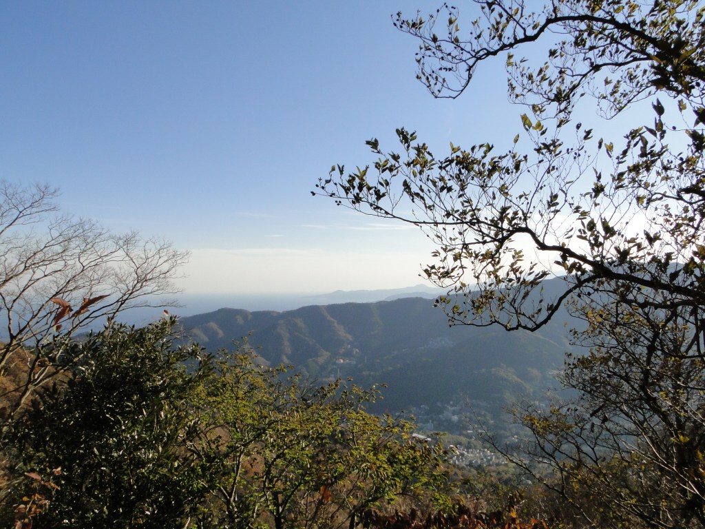
Sunny woods

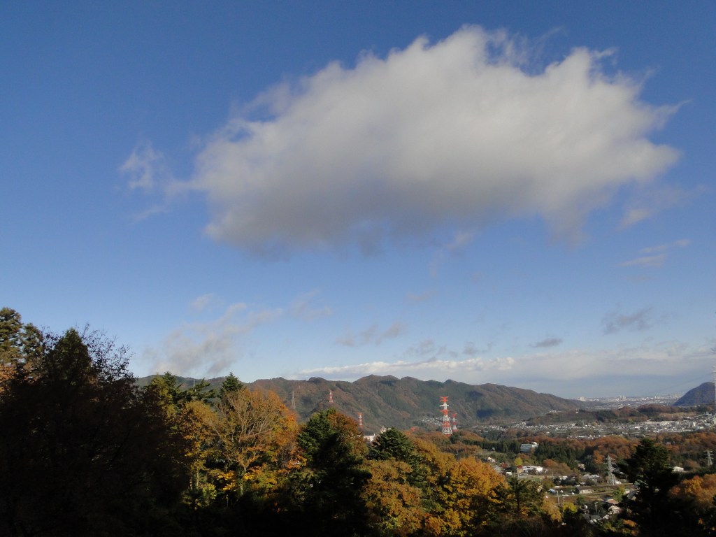
View towards Tokyo
At the junction, we took the other path so as to complete the loop. Just below, there is a good view of Mt Sekiro, as well as the mountains to the west. The path passes through some more huge boulders, but it wasn’t particularly difficult. We got down ninety minutes, and after a twenty minute wait, we were able to hop onto a bus back to the station. In good weather, it’s possible to continue beyond the summit and make a loop back to the start of the hike.
CONCLUSION: Great hike for the late autumn / early winter period, because of its short length and relatively low altitude. It can be combined with some neighbouring mountains if you are a fast hiker.
As of October 2020, the trail around Kenkyoji Temple (顕鏡寺) is still closed due to trail damage due to last year’s Typhoon 19 / Hagibis – it’s not possible to reach the summit of Mt Sekiro via this route. No reopening date has been set yet. Please check the Sagamiko Tourist Association website for future updates.
Ask for a hiking map for Mt Sekiro
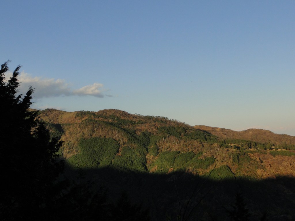
The Takao range seen from the temple

You must be logged in to post a comment.