
Last Saturday, I finally made it back to Mt Sekirou 石老山 (702m) for the 3rd time. I wrote about this mountain in an earlier blog post and at the time I had to cut short the loop hike because of a sudden snowstorm. I had promised to update the post once I managed to complete it but so much time has passed since then – four years – that I think it warrants a new post. Another reason I’d like to write about it again is that as the title suggests, it has many things in common with nearby Mt Takao. However unlike Takao, there aren’t as many people.
First it all it has relatively easy access. Although it requires a bus ride from Sagamiko 相模湖 which is the next station from Takao station, buses depart on average twice an hour all day long. I didn’t even check the bus timetable in advance this time and the bus left within ten minutes of arriving at the station. The best thing is not to fret about the bus and just focus on getting to Sagamiko station at a reasonable time for hiking. Additionally, the bus ride to the entrance of the trail – the bus stop is conveniently called 石老山入口 entrance to Mt Sekirou – takes only about ten minutes so standing is not an issue.
The trail is fairly well marked – there is also a big board with a map at the start – so you don’t really need to bring your own map although I always recommend getting one At one point (just after the temple) the trail splits in two but this isn’t an issue since both trails join up again 30 minutes later. I recommend the right branch since the views are better (sakura michi さくら道 on the signs). If you decide to descend via the same route, rather than the loop trail as described below, you could take the other branch on the way down.
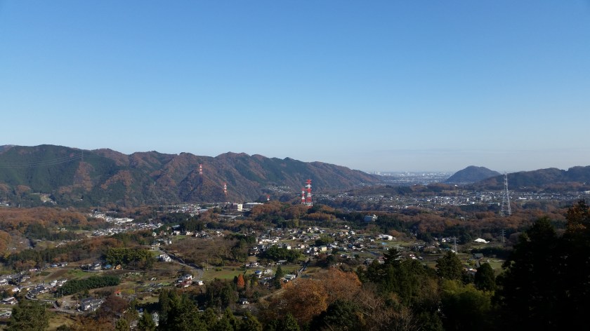
There are several wooden seating platforms where you can eat lunch on the summit and a good view of Mt Fuji as well as Mt Omuro in the Tanzawa range. We had a late start on Saturday so we only got there at 1h30 and we had the summit to ourselves. The path for descending is to the right. This is the one I opted not to take last time because of the weather. After a hundred meters or so there is a split and in order to complete the loop hike, you need to go right again.

The path is very pleasant, generally wide and not too steep. There are however a couple of steep rocky parts which should be descended cautiously. After an hour or so, and a few up and downs, there is an observation platform. It has a nice view of the long ridge that includes Mt Takao and Mt Jimba. After that it’s about 30 minutes of downhill to get back to the road. The path follows a valley with a small stream that can be pretty dark and gloomy towards the end of the day. At times the trail is fairly rocky and difficult to walk, not unlike the part leading to the temple when going up.

After reaching the road it takes another 20 minutes or so to get back to the bus stop. Overall, including a one-hour lunch break and walking at an average pace, the entire hike shouldn’t take more than 5 hours. During that time we saw less than two dozen hikers. Before heading back, I would recommend taking advantage of the very nice Ururi hot spring that is just across the road inside the Pleasure Forest amusement park.
The only two areas where Mt Takao wins against Mt Sekirou is 1) the number of attractions – Takao has several temples, a beer garden, a funicular, a chairlift and a monkey park 2) the numbers of trails up and down the mountain.
As of October 2020, the trail around Kenkyoji Temple (顕鏡寺) is still closed due to trail damage due to last year’s Typhoon 19 / Hagibis – it’s not possible to reach the summit of Mt Sekiro via this route. No reopening date has been set yet. Please check the Sagamiko Tourist Association website for future updates.
