The starting point for this hike was Mitsumine Shrine, a place I had visited a few times before, but had never really taken the time to explore. Since today’s hike was relatively short, I first took some time to check out the Mitsumine visitor center, one of the starting points for visiting the Chichibu-Tama-Kai National Park. It was a pleasant surprise – I found the displays of mounted animals and the model relief of the area particularly interesting.
View of Mt Wanakura (also known at Mt Shiroishi and climbed in 2018) from Mitsumine Shrine
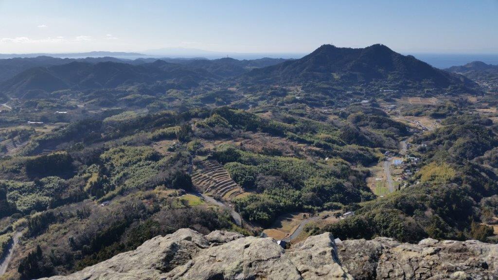
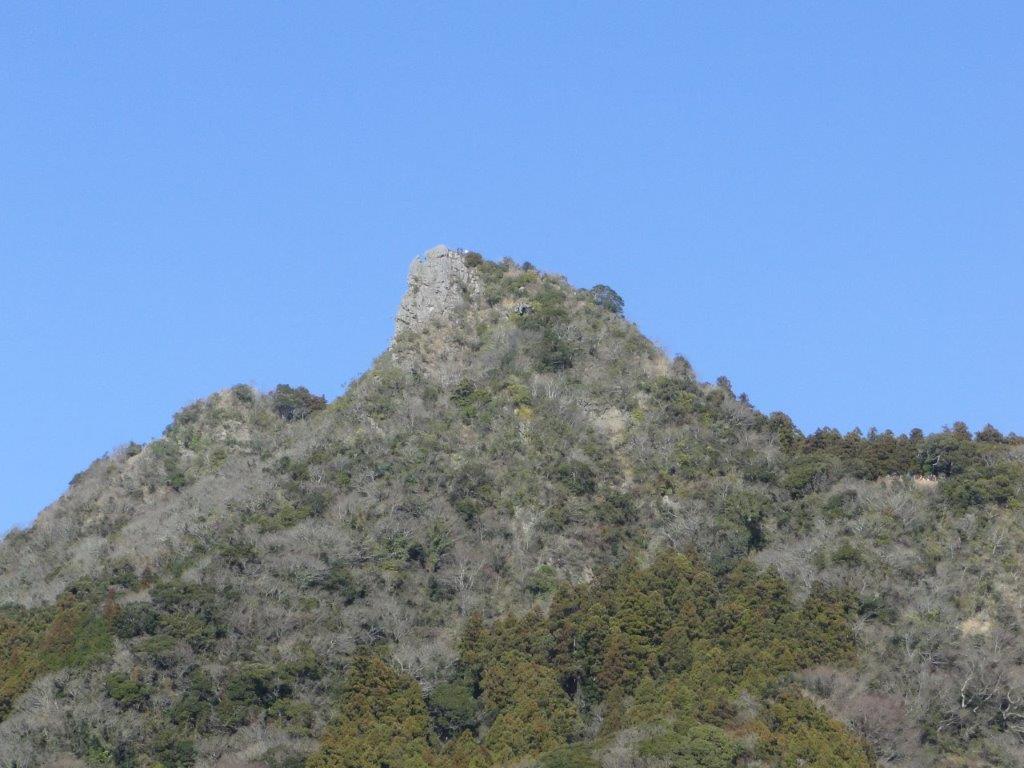
After spending nearly an hour at the visitor center, I hurriedly set off along the hiking path up Mt Kumotori. The autumn colours were at their peak, and since it was a weekday, I had them mostly to myself. Very soon I reached the turnoff for today’s mountain, located on a small ridge branching left off the main ridgeline. In less than an hour, I reached the small shrine at the top of Mt Myoho (妙法山ヶ岳), from where I got some great views of Oku-Chichibu, with Mt Ryokami in the center.
View of the jagged peak of Mt Ryokami from the summit
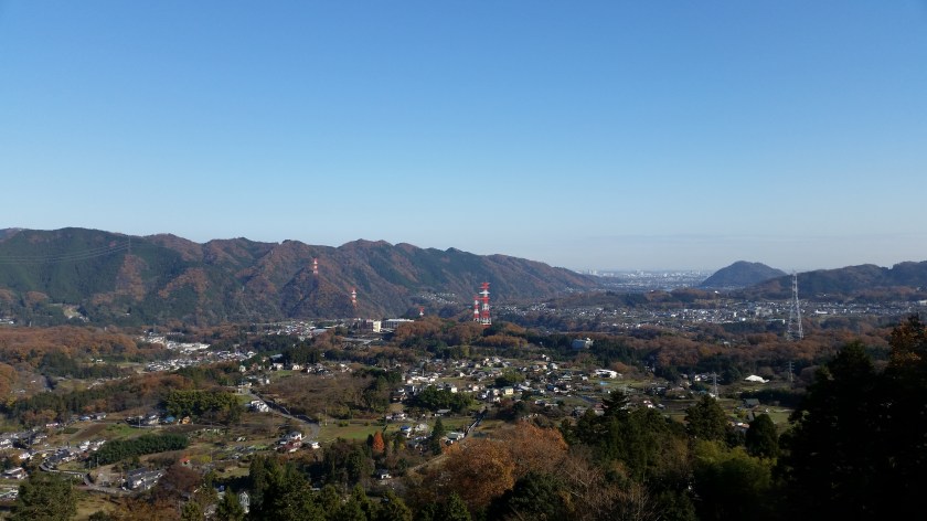
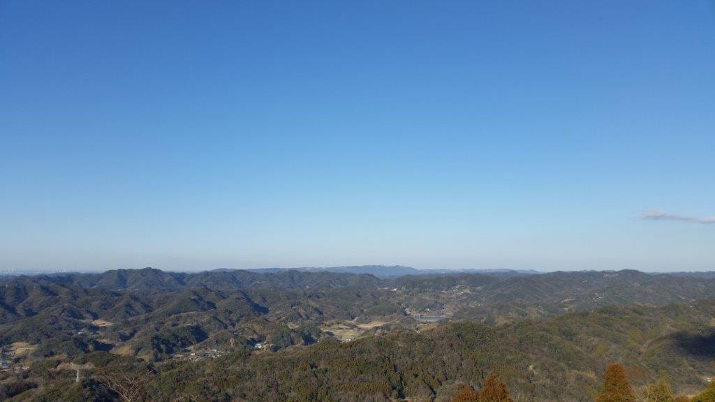
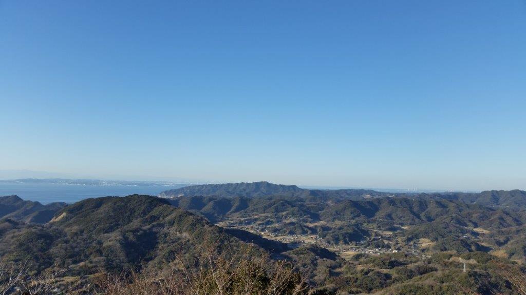
After lunch, I headed back to the shrine, and since it was still early in the day, I took some time to check out the shrine grounds – it was beautiful with all the autumn colours. At the back, there was a spectacular view of the mountain I had just climbed as well as Chichibu city.
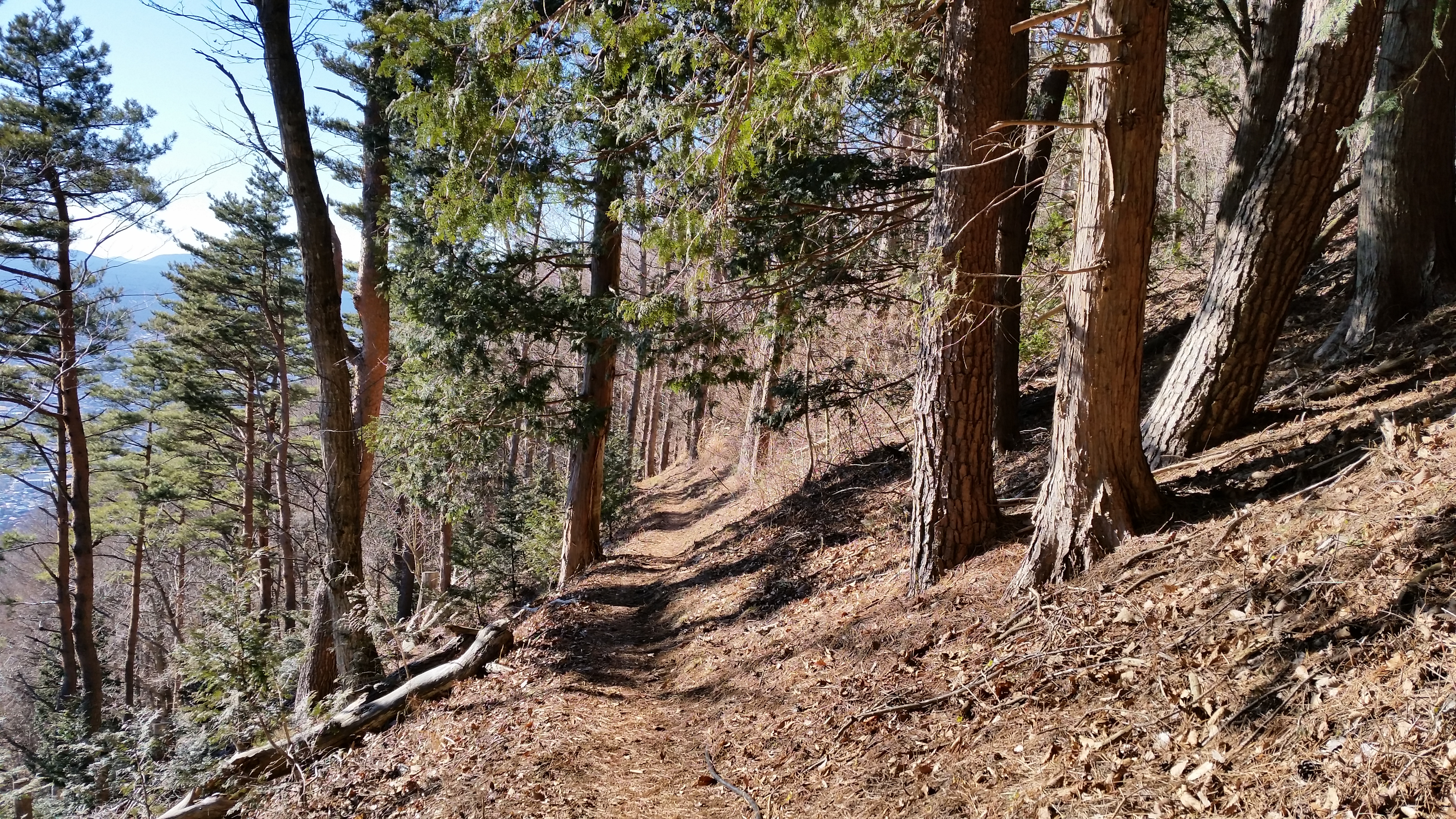
Good views from the trail heading down from Mt Mitsumine shrine
Afterwards, I located the hiking path leading down the mountain. Although there were a number of people at the shrine, no one seemed interested in hiking down, so once again, I had the path entirely to myself. Unfortunately, it wasn’t possible to hike all the way down to the train station, and the path ended up on the road, from where I caught an express bus back to Seibu-Chichibu station.
I did this hike with my mother who was visiting Japan for a couple of weeks. Since it was quite far from Tokyo, we rented a car in Takasaki, and spent the night in a traditional Japanese inn, or “ryokan”, in Kusatsu Onsen. The next morning was sunny, but by the time we had made our way all the way up to Yugama Lake 湯釜 the clouds had rolled in. We admired the light blue colour of the crater lake, but gave up on climbing Mt Kusatsu-Shirane. I had climbed it before in the clouds, and had little interest in doing it again in similar conditions.
A beautiful crater lake
We drove on to Yokoteyama Ropeway which took us to the top of Mt Yokote 横手山. We got some nice views of Shiga Highland 志賀高原. Fortunately, the Nagano side was still free of clouds. We finally arrived at Kumanoyu (meaning the bear’s bath) where we left the car. We were now firmly inside Nagano prefecture. Another short ropeway took up to the start of the hike. Luckily, the weather was holding up. The first part was quite level. At one point the path went through some very high bamboo, higher than our heads, and I was worried about bears. So I reached into my bag to retrieve my bear bell only to realise that I had left it in the car!
View from the top of Mt Yokote
Soon the path started to climb. It was steep, with big rocks and protruding tree roots, making progress slow. The path slowly wound up the side of the mountain. We saw few people, and thankfully no bears. We reached the top of Mt Shiga 志賀山 just before 2 pm. A little way past the summit, there were some good views of Onuma-ike Lake below. The whole hike is inside the Joshin Etsu Kogen National Park and is very wild and beautiful.
The area of our hike – Mt Shiga is in the clouds on the right
We climbed down via a different path, spotting various small ponds on the way. Finally, after passing through a shinto gate or “torii”, we reached the base of the cone-shaped Mt Shiga. The next part involved walking along an elevated walkway through marshlands – much easier than the rocky path down the mountain! The final part back to the ropeway was along a wide and level path through the forest.
Onuma Lake in the middle of Shiga Highland
Since it was getting late, we decided not to take a bath at Kumanoyu, and leave right away. No sooner had we set off, that a dark shadow dashed across the road – it was a bear cub. It disappeared into the bushes opposite. We waited a bit for a mother bear, but she was nowhere to be seen. In any case the place certainly deserves its name!
Elevated walkway through the marshland
On the way back, we stopped briefly for some photos at the marker for the highest national road in Japan at 2172m high. The drive down to Kusatsu onsen was through thick mist. We had a bath at the Sainokawara open-air bath, one of the biggest in Japan. After we were done, it started raining really hard, but we managed to get back to Takasaki safe and sound, a little after nightfall.
I did this hike with my mother who was visiting Japan for a couple of weeks. Since it was quite far from Tokyo, we spent the night at the Takasaki Dormy Inn Hotel, and the next morning, I drove to the Nikko-Shirane Ropeway. Even though it was a weekday, I was surprised by how few people there were, especially since it was the middle of the summer holidays. The place is mainly a ski resort in the winter so perhaps people aren’t aware that it also runs from June to October. I love ropeways and I keep on discovering new ones – it’s amazing how many there are in Japan!
Sun shining through the forest
At the top of the ropeway, inside Nikko National Park and nearly 2000m high, the visibility wasn’t the best, and the views were a little disappointing. At least it was cooler than down in the valley. The hike started out on a fairly level trail through beautiful forest. After an hour or so, we had to climb steeply for a short while to reach the edge of a pond. Here I was able to look up towards the top of Mt Nikko-Shirane. I had been hoping to get my revenge, since it was in clouds when I climbed it several years ago. However, the top was in the clouds again, and another ascent seemed pointless.
Midaga Pond near the top of Mt Nikko-Shirane
We continued a little further and reached the edge of a crater with at the bottom, the beautiful Goshiki-Numa lake 五色沼 (which means five-colour lake). Since we had enough time, I decided we could descend to the shore of the lake and climb back up again. Unfortunately the descent was steep and rocky, and we regretted it a bit.
The Goshiki-numa lake, inside Tochigi prefecture
After enjoying the peace and quiet of the lake, we made our way back up to the edge of the crater via a different path, and then walked back the way we had come. At the pond, we passed a group of noisy school children who had come up a different path. We headed back down the steep path to the forest below, and at the bottom we took another trail that looped back to the top of the ropeway.
View of Maru-numa lake from the ropeway
Check out the views of Nikko-Shirane
On the drive back to Takasaki we stopped at the very impressive Fukiware Waterfalls 吹割の滝 where we could walk along the river and the falls for a short way.
Last Saturday, I finally made it back to Mt Sekirou 石老山 (702m) for the 3rd time. I wrote about this mountain in an earlier blog post and at the time I had to cut short the loop hike because of a sudden snowstorm. I had promised to update the post once I managed to complete it but so much time has passed since then – four years – that I think it warrants a new post. Another reason I’d like to write about it again is that as the title suggests, it has many things in common with nearby Mt Takao. However unlike Takao, there aren’t as many people.
First it all it has relatively easy access. Although it requires a bus ride from Sagamiko 相模湖 which is the next station from Takao station, buses depart on average twice an hour all day long. I didn’t even check the bus timetable in advance this time and the bus left within ten minutes of arriving at the station. The best thing is not to fret about the bus and just focus on getting to Sagamiko station at a reasonable time for hiking. Additionally, the bus ride to the entrance of the trail – the bus stop is conveniently called 石老山入口 entrance to Mt Sekirou – takes only about ten minutes so standing is not an issue.
The trail is fairly well marked – there is also a big board with a map at the start – so you don’t really need to bring your own map although I always recommend getting one At one point (just after the temple) the trail splits in two but this isn’t an issue since both trails join up again 30 minutes later. I recommend the right branch since the views are better (sakura michi さくら道 on the signs). If you decide to descend via the same route, rather than the loop trail as described below, you could take the other branch on the way down.
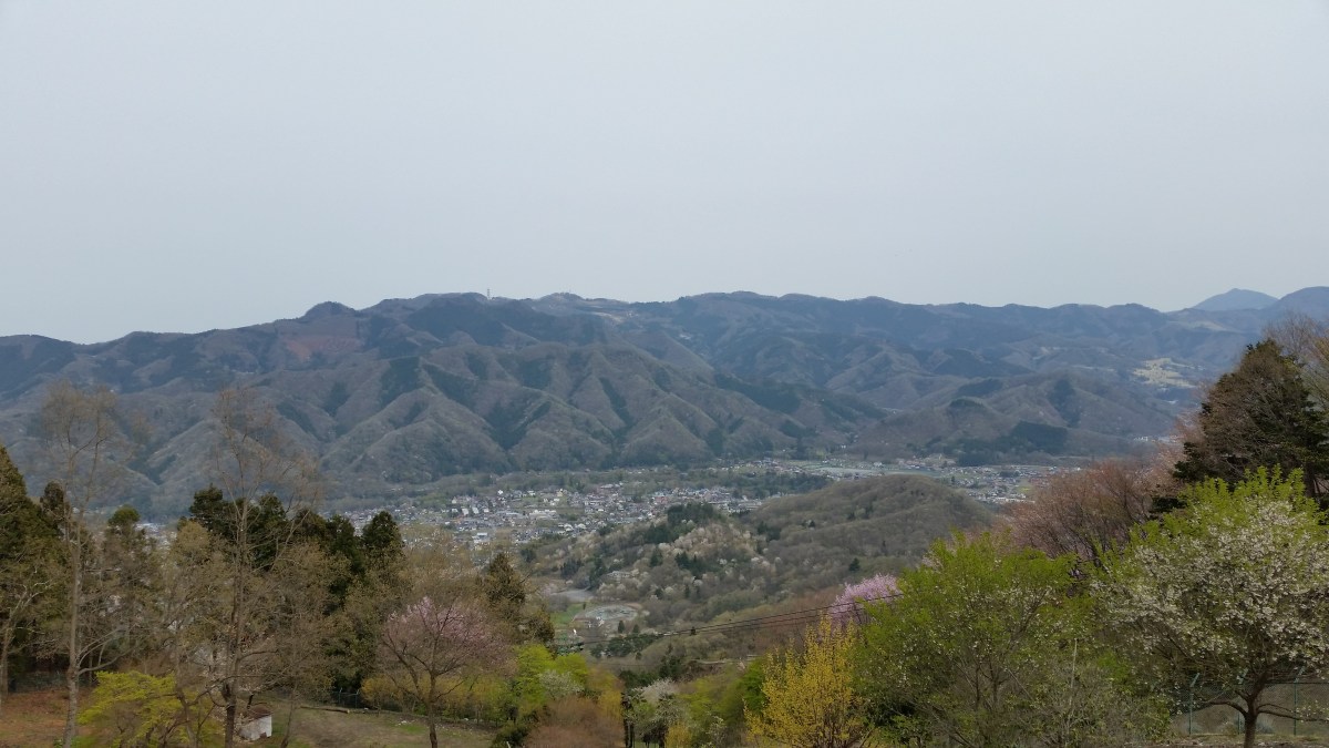
View of Mt Takao from the Sakura path
There are several wooden seating platforms where you can eat lunch on the summit and a good view of Mt Fuji as well as Mt Omuro in the Tanzawa range. We had a late start on Saturday so we only got there at 1h30 and we had the summit to ourselves. The path for descending is to the right. This is the one I opted not to take last time because of the weather. After a hundred meters or so there is a split and in order to complete the loop hike, you need to go right again.
The empty summit
The path is very pleasant, generally wide and not too steep. There are however a couple of steep rocky parts which should be descended cautiously. After an hour or so, and a few up and downs, there is an observation platform. It has a nice view of the long ridge that includes Mt Takao and Mt Jimba. After that it’s about 30 minutes of downhill to get back to the road. The path follows a valley with a small stream that can be pretty dark and gloomy towards the end of the day. At times the trail is fairly rocky and difficult to walk, not unlike the part leading to the temple when going up.
View from the observation platform
After reaching the road it takes another 20 minutes or so to get back to the bus stop. Overall, including a one-hour lunch break and walking at an average pace, the entire hike shouldn’t take more than 5 hours. During that time we saw less than two dozen hikers. Before heading back, I would recommend taking advantage of the very nice Ururi hot spring that is just across the road inside the Pleasure Forest amusement park.
The only two areas where Mt Takao wins against Mt Sekirou is 1) the number of attractions – Takao has several temples, a beer garden, a funicular, a chairlift and a monkey park 2) the numbers of trails up and down the mountain.
As of October 2020, the trail around Kenkyoji Temple (顕鏡寺) is still closed due to trail damage due to last year’s Typhoon 19 / Hagibis – it’s not possible to reach the summit of Mt Sekiro via this route. No reopening date has been set yet. Please check the Sagamiko Tourist Association website for future updates.
With early freak snowstorm, mountains in the Kanto area received up to 20 cm of fresh snow. I did a short reconnaissance up Mt Hiwada 日和田山 (305m) near Hanno station on Friday. Unfortunately snow and November temperatures don’t really mix, and everything was melting as if Mother Nature was trying to cover up some big mistake in a hurry.
Big lumps of snow were falling from the branches making walking under the trees quite perilous. In other places snowmelt was coming down in streams of water just as if it were raining, except that it was a beautiful sunny day. Overall the muddy and wet conditions were starting to make me despair that I would be able to find a good place to go hiking on Saturday. Too low, I would encounter similar slushy conditions. Too high and there was a risk of losing the trail or worse, running into trouble on a steep section.
I finally hit upon an interesting idea which I was able to confirm after a quick search on internet. Buses for Daibosatsurei (2047m) 大菩薩嶺, one of the hundred famous mountains, usually run till about mid-December, after which the service is stopped till the spring because of snow. Daibosatsurei is a relatively easy mountain to hike, a place I was familiar with, and that would also make a good snow hike, except that in the in the winter months you would have to hike up (and down) from a much lower point, the entrance of the Daibosatsu mountain trail at 900m. However, despite the unusual snowfall the buses were still running on Saturday November 25th and thus it was possible to get all the way up to Kamihikawatouge 上日川峠, nearly 600m higher, and a very good convenient starting point for a stroll in the snow.
After getting off at Kaiyamato 甲斐大和 station, I rushed to get in line at the bus stop. Daibosatsurei is a highly popular place to hike, not only because it’s a hyakumeizan but it’s also relatively close to Tokyo and easy to hike. However this time, we were only a handful of people waiting for the bus. Perhaps most people were dissuaded by the snowy conditions or maybe less people go there after the Koyo (autumn leaves) season.
Whatever the reason, I almost thought they were right when the bus failed to turn up on time. We were informed by the bus driver of another bus that ours was running late because of the icy roads. Our ride finally rolled in 30 minutes late making a loud rattling noise because of the snow chains. For once this was a good thing, since the hike I had planned, a simple loop of the top part of the mountain was a tad too short. With half an hour shaved off, the timing was perfect.
There are few mountain roads in the Tokyo area that are open through winter and thus it was quite a unique experience riding up the mountain with snow banks on either side and, ice and snow underneath on the higher parts of the road.
Icy conditions on the road to Kamihikawa Pass
I was finally able to start hiking just after 11am. At 1600m the snow was already getting heavy and wet, and any hiking below that point was bound to be unpleasant. I took the ridge trail leading straight up to the summit. Under the trees, it was enjoyable to hike on the snow, made compact and firm by the footsteps of previous hikers, and on the rocky sections higher up, the snow had completely disappeared from anything in direct sunlight. There was no ice, and crampons weren’t necessary on the ascent although I had light ones in my pack, and several people were using them, mainly for going down. The views of Mt Fuji and the entire range of the South Alps were stunning. I had been to Daibosatsurei before but the views hadn’t been anywhere as great.
Mt Fuji in a sea of cloudsThe South Alps with their winter caps on
The top ridge at around 2000m was freezing and the snow was 20cm deep and practically powdery. From the highest point, you can walk down along the ridge enjoying the beautiful winter scenery. At the emergency hut on the Daibosatsu Pass I turned right and walked down along the gently sloping wide path that meanders through the forest at the base of the top ridge back to the bus stop. Being somewhat sure-footed and having heavy solid hiking boots, I never had to resort to my crampons.
All in all a satisfying if somewhat short hike (under 4 hours) in a snowy setting and a good choice after a late autumn / early winter snowstorm. Most likely the bulk of the snow under 2000m will have melted by next weekend making this a one-off.
This is a good hike to do in the winter since Chiba usually gets less snow and the temperatures are milder. It’s also relatively short so it can be combined with another mountain in the area, like Mt Tomi. I’d recommend using a car for this hike since there is no suitable bus to the trailhead. There is also a convenient parking lot near the start of the trail, in front of Koshoji Temple 高照寺.
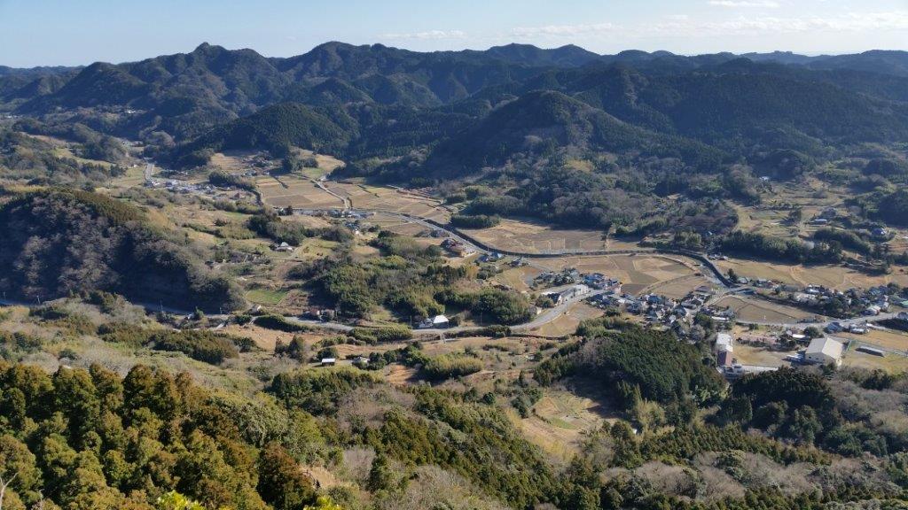
First views of Minamiboso at the start of the hike
It takes about an hour to get to the top of Mt Goten 御殿山. Following the ridgeline, the trail goes past Mt Takatori 鷹取山, and ends at Mt Dainichi 大日山 one hour away. Although the trail is mostly through the forest, there are good views of Mt Tomi and Tokyo Bay from each peak. One might even see Mt Fuji on a very clear day. Although the path continues Southwards down to a road, there is no public transport, so the return is back the same way. It should take a little less than 2 hours to get back to the parking area along the up and down trail.
At first, I wasn’t too excited about climbing this peak in the Chichibu area. It was a short hike accessible via a ropeway, so the trails and summit were bound to be crowded. However, it was a station to station hike and easily accessible from Ikebukuro via a direct train. I was also curious to see the views from the summit. By studying my hiking map, I saw that I could lengthen the hike by starting from Nogami station and following the Nagatoro Alps hiking trail (長瀞アルプス) so called because of its up and down nature.
View from near the end of the hike
Since the direct train ended at Nagatoro station, one stop before Nogami, I had to walk a few kilometers along back roads to reach the start of the trail. This turned out to be a blessing in disguise since Spring was in full swing; there were many cherry blossom trees in full bloom, including a couple of cherry blossom tunnels, as well as all sorts of other colourful flowers. I had good views of the Arakawa river gorge, and even saw people doing kayaking and rafting. I took so much time taking photos that I arrived at the start of the hiking trail around 11h30, two full hours after getting off the train.
Start of the Nagatoro Alps
The trail was straightforward and much easier to walk than the name would suggest. I saw few people as the trail headed Southwards while slowly rising. It was mostly in the forest and there were few views. After about an hour, I reached a short flat section along a forest road, followed by a series of log staircases heading straight up. This marked the final ascent, and at 1pm I was standing on the wide flat top of Mt Hodo 宝登山 hodosan. By the way, the name can be read as “Treasure Climb”. I found a free spot on one of the benches next to a big group, and settled down for lunch; later on one of the members kindly offered me some freshly brewed coffee.
An easy and relaxing hike up Mt Hodo
The views were better than expected, even though the blue skies from the morning had been replaced by a thick white blanket. From East to West, I could see Mt Jomine, Mt Ryokami, Mt Happu, Mt Buko and Mt Mino. At 2pm, I set off again. The top of the Hodosan Ropeway was a few minutes away, and from there it was possible to walk down along a wide dirt road that switched back and forth so that it never got too steep. This part of the hike was a pleasant surprise: there were great views of the Arakawa valley, and the side of the mountain had many cherry blossoms, all the way down to the bottom of the valley.
View South of Chichibu City and Mt Buko
It took me less than an hour to reach the base of the ropeway and a road. A little further on, I arrived at a small park filled with cherry blossom trees, with in the middle a small mountain called Mt Notsuchi (209m) 野土山. I reached my starting point of Nagatoro station after 3pm, six hours after setting off, just in time to catch the direct train back to Ikebukuro. It turned out to be a very satisfying hike, and I look forward to returning one day in a different season.
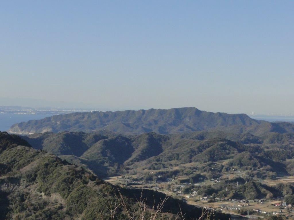
Mt Iyo and Mt Tomi are two peaks with amazing views belonging to the Mineoka Mountain Range in south Boso. They first came to my attention while I was hiking the Kanto Hundred Famous Mountains, and since they were relatively near each other, I decided to combine them as a day trip from Tokyo. Both mountains are featured in my Mountains of Chiba guidebook and thus I followed the accompanying hike descriptions.
Both trail entrances are a short bus ride on the Minamiboso city bus Tomi line (南房総市営路線バス富山線) from Iwai station (岩井駅), itself a stop on the JR Sazanami limited express, a couple of hours from either Tokyo or Shinjuku station. It’s important to note that advance phone reservation is required for the Mt Iyo trailhead. Since buses are infrequent making it tough to combine both using public transport, I decided to go by car via the Tokyo Bay Aqua line between Kawasaki and Kisarazu Cities. On the way there (and back), I could also check out the view of Tokyo Bay and Mt Fuji from the Umihotaru Rest Area (meaning Sea Firefly) at the halfway point of the line.
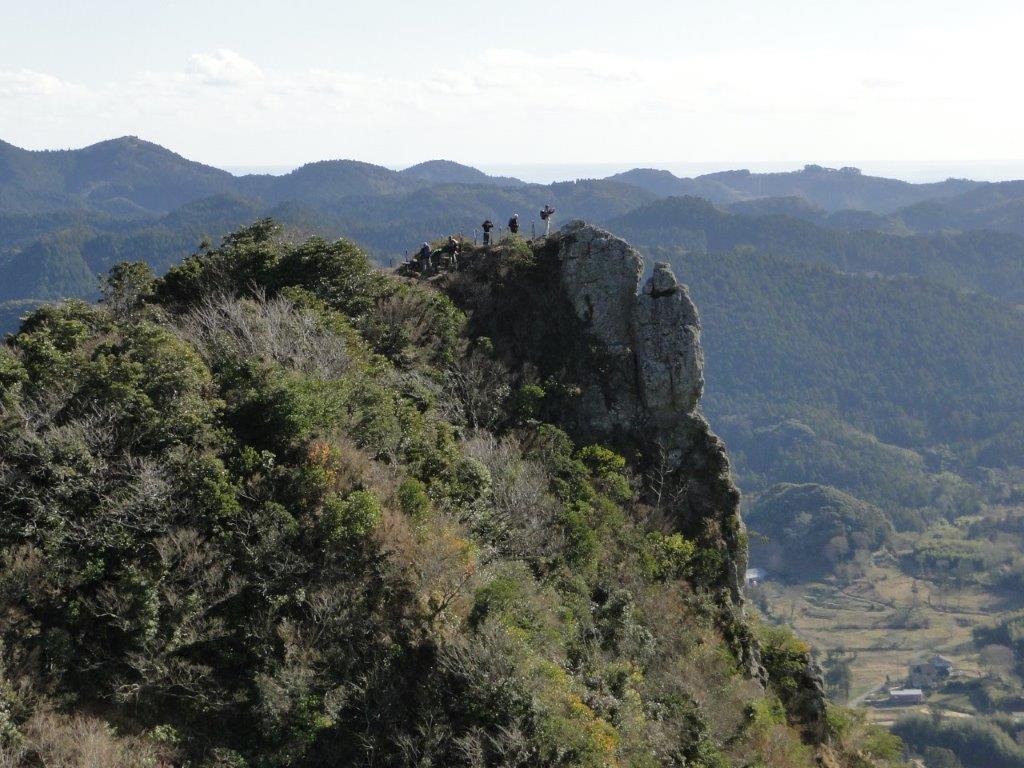
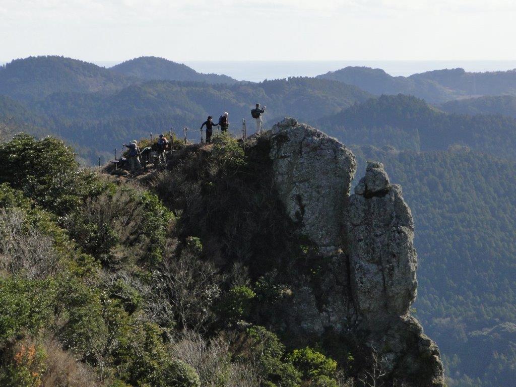
Mt Iyo is a rare rocky summit on the Boso peninsula and is the only one with the character “岳” (“take” meaning “high mountain”) in its name. The hike is a 2-hour loop from the Tenjingo (天神郷) bus stop and parking area near Heguri Ten Shrine (平群天神社), including a short round-trip between the north and south peaks. The narrow south peak (南峰) has a spectacular 360° view that includes Mt Atago, Mt Karasuba, Mt Goten, Mt Tomi, Mt Nokogiri, Oshima Island, as well as Mt Fuji; from the north peak (北峰) one can appreciate the precipitous south summit protruding from the mountainside.
Mt Iyo South Summit from Below
The Precipitous South Summit of Mt Iyo
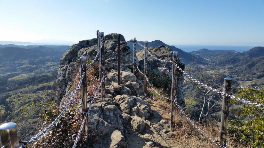
The higher sections of the Mt Iyo trail include steep, rocky sections fitted with rope and chains for safety. This hike is rated intermediate level, despite the low-elevation and short hiking time; surefootedness, upper body strength and a head for heights are recommended. The lower trail sections inside the forest follow well-maintained and easy to walk paths, including a short section along a paved road.
Safety Chains on the South Summit of Mt Iyo
View of Minamiboso from Mt Tomi
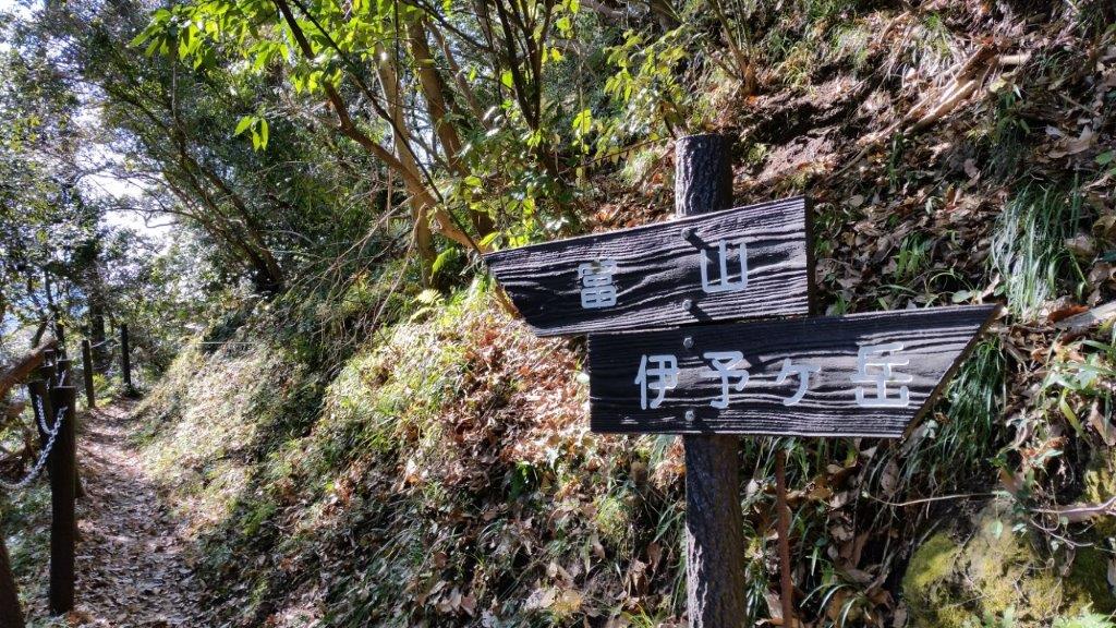
Mt Tomi (富山 とみさん tomi-san)
Mt Tomi is a standalone peak closer to the coastline and the 7th highest mountain of the Boso Peninsula; it’s situated inside the Tomisan Prefectural Natural Park (県立富山自然公園). The trailhead can be reached from the bus stop at the Furari Road Station (道の駅 富楽里); for the return, one can walk through the countryside back to Iwai station. This hike is a 3-hour loop along well-maintained trails, the steeper sections fitted with log steps. The highlight is the wooden observation deck on the north summit (北峰), a short roundtrip from the main trail, with a wide view on the east side of Mt Nokogiri, Mt Kano & Mt Hitobone; Tokyo Bay, the Miura peninsula, Oshima island, and Mt Fuji are also visible. Although Mt Tomi consists of two peaks, the south peak is off the trail and within the forest.
Mt Fuji from Mt Iyo
Mt Nokogiri from Mt Tomi
To make the best of the panoramic views, it’s best to attempt both hikes during the cold, clear days of winter, although each can be comfortably done between October and June; both hikes are unsuitable during the hot and humid months of summer. After a late start at Mt Iyo at noon, I was back at the car before 2pm. I then drove to the Fusehime-roketsu Parking Lot (伏姫籠穴駐車場), and headed up Mt Tomi around 2h30. I walked fairly quickly and was back at my car at about 4pm. On the way back, I was able to enjoy the sunset, as well as the night view of Tokyo City from the Umihotaru in the middle of Tokyo Bay.
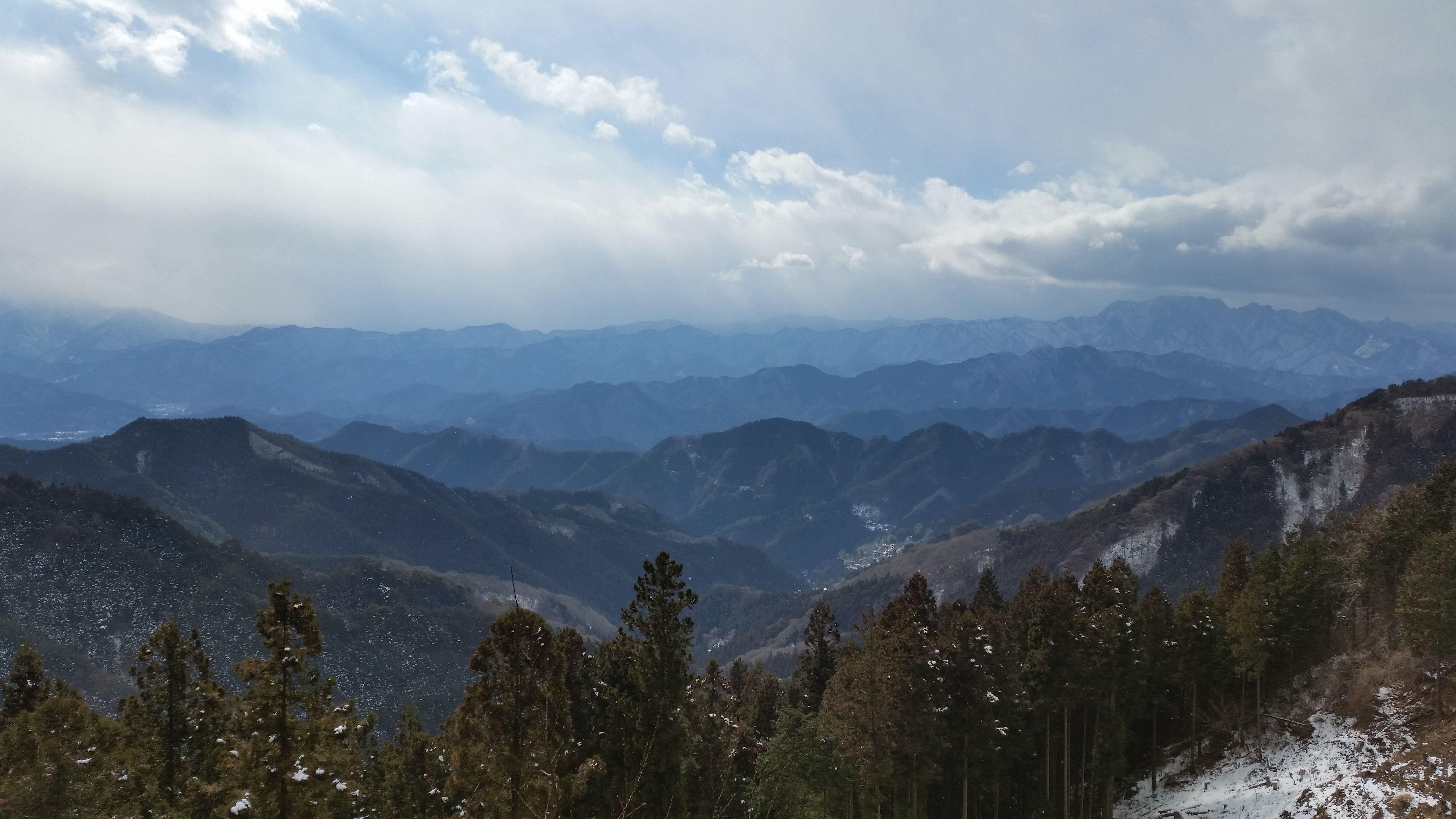
This is a good mountain to climb in the spring and the autumn, especially when the days are shorter as this isn’t a long hike. Since the Kanto Fureai no Michi passes by the summit, some sections are guaranteed to be easy to walk. Finally, there is a 360 degree view of the Chichibu mountains from the top, so it’s worth doing this one in clear weather.
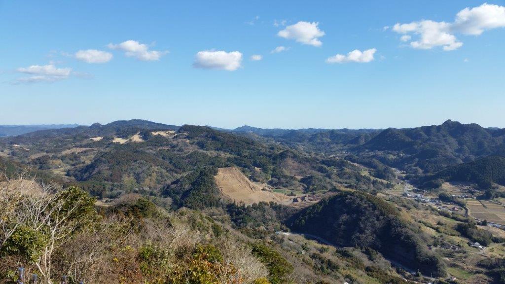
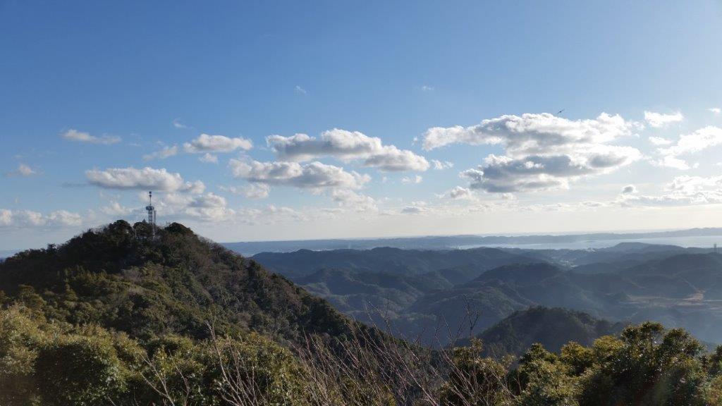
Endless mountains from the top of the observation tower
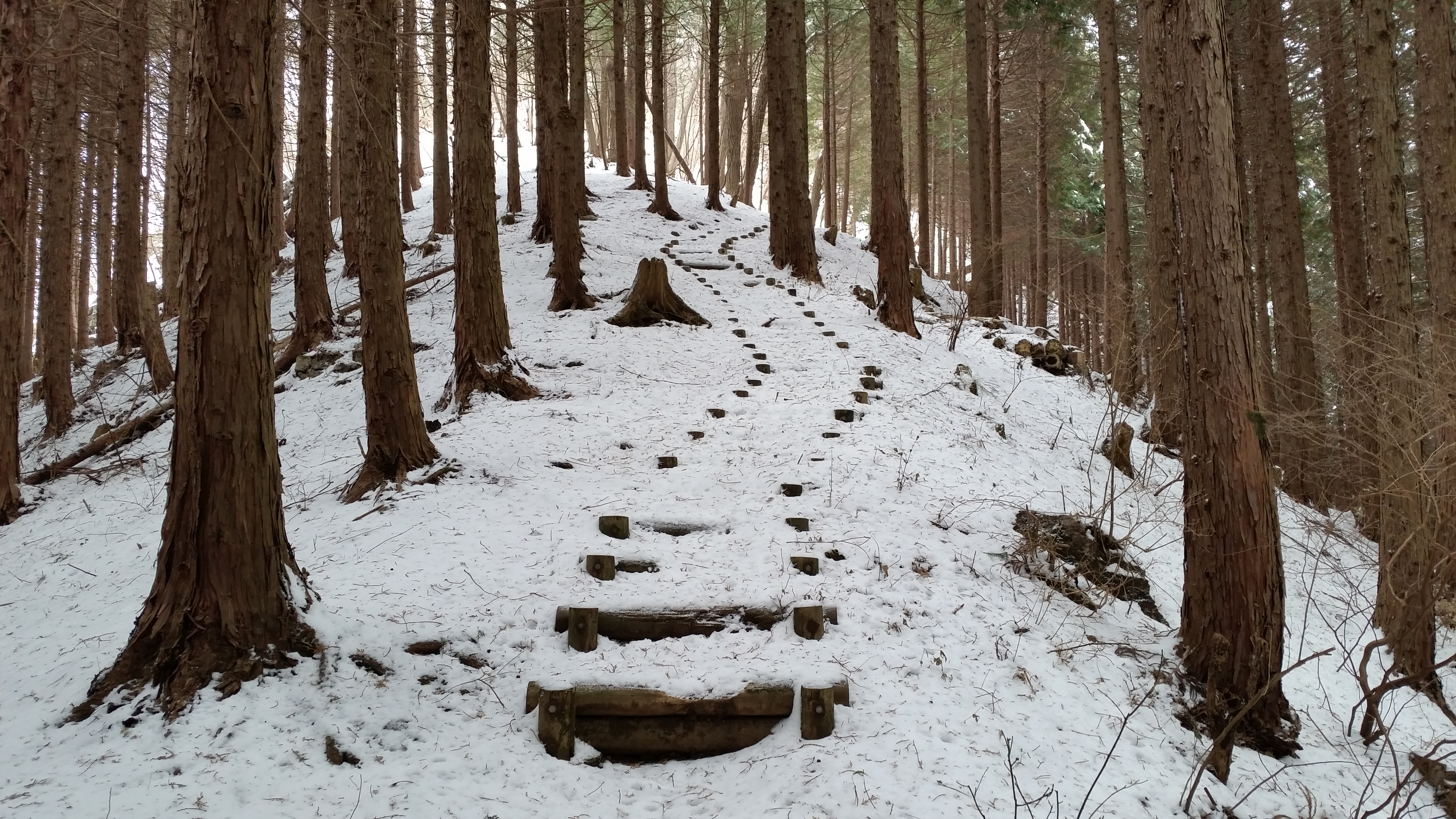
The bus from Minano station on the Chichibu railway takes about half an hour to get to the start of the Fureai no Michi. From the bus stop, the trail follows the road for a bit, before turning right, and heading up the mountain side through thick forest. The steeper parts of the climb are made easier by several log staircases. It should take less than two hours to reach the observation tower at the top of Mt Jomine (城峰山), a Kanto Hyakumeizan. Among the dozens of mountains, it should be easy to pick out the massive craggy top of Mt Ryokami on the West side.
Log staircase barely visible under the snow in the middle of January
Walking down fifteen minutes, the trail leads to Jomine Shrine, where there is another good view Westwards. It should take another hour down the Omotesando trail to reach the trailhead, along a narrow forested valley. From there it’s another 90 minute walk along the road to the nearest bus stop. The road follows a river past charming countryside dwellings. The bus goes all the way to Seibu-Chichibu station with it’s onsen, food hall, sake shop and direct train connection to Tokyo.
At the very right, the craggy bulk of Mt Ryokami
I did this hike on a snowy winter day, so I made another trip on a sunny Spring day to see the view. I drove to the top, something I don’t recommend since the road is long and narrow; fortunately, I didn’t meet any other cars going up or down. I returned a third time, once again climbing via the Fureai no Michi, but this time going down the South Ridge trail (南尾根コース). This was a more interesting and adventurous way to descend the mountain, the narrow trail following the ridgeline through the forest. I ended up on the road same road as on the first hike, but less than half the distance from the bus stop.
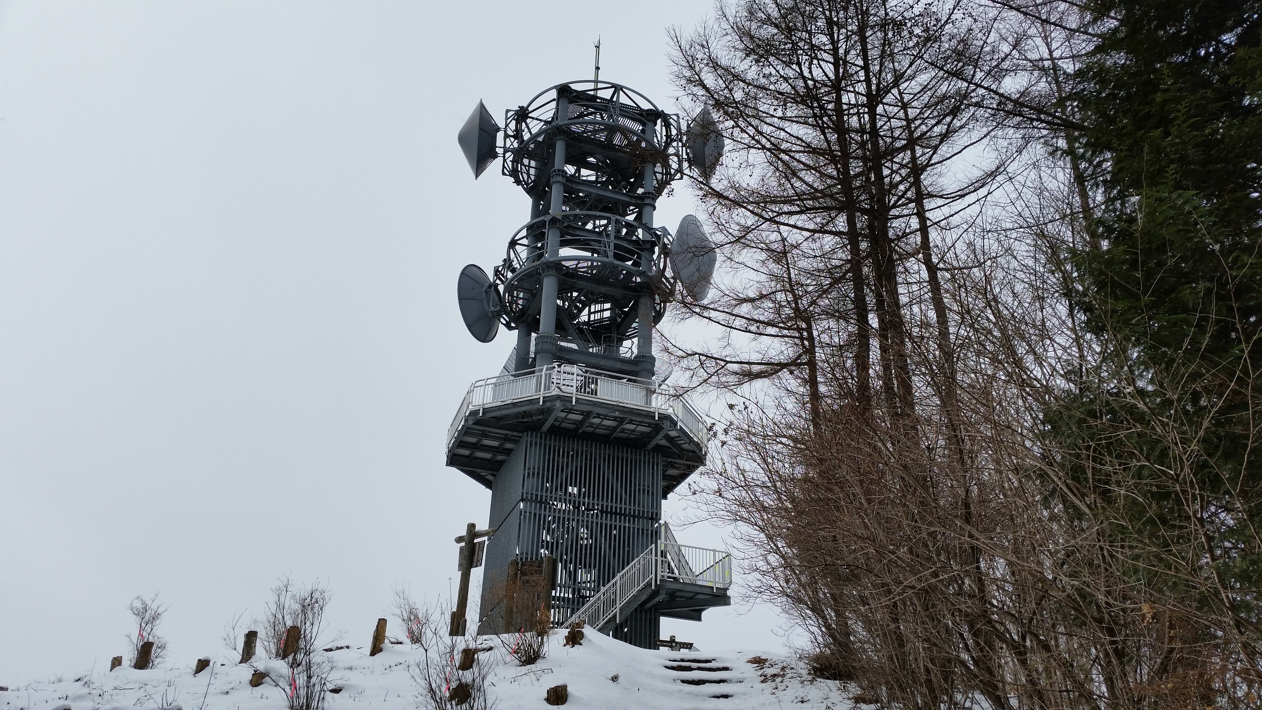
The observation tower which seems to double as a telecommunication antenna
This was my first day hike of 2015, and since it was during the Japanese New Year or “shogatsu“, I wanted to have some good views of Mt Fuji, do a station to station hike (buses run on special schedules during that time), and, if it wasn’t too much to ask, end the hike at a nice onsen. I want all hikes to be good hikes, but the first one of the year should be special.
I took a train to Mitsutoge station: I hadn’t been there since I first climbed Mt Mitsutoge several years before, and I had completely forgotten that there was a fantastic view of Mt Fuji from just outside the station. This time, however, I was climbing a mountain on the other side of the railway line. The trail started next to Yaku Shrine, 15 minutes from the station. However, I accidentally went down another trail that was level instead of going up. Once I realised my mistake, I cut through the forest up the side of the mountain to reconnect with the correct trail.
The Kawaguchi toll road snaking down the valley
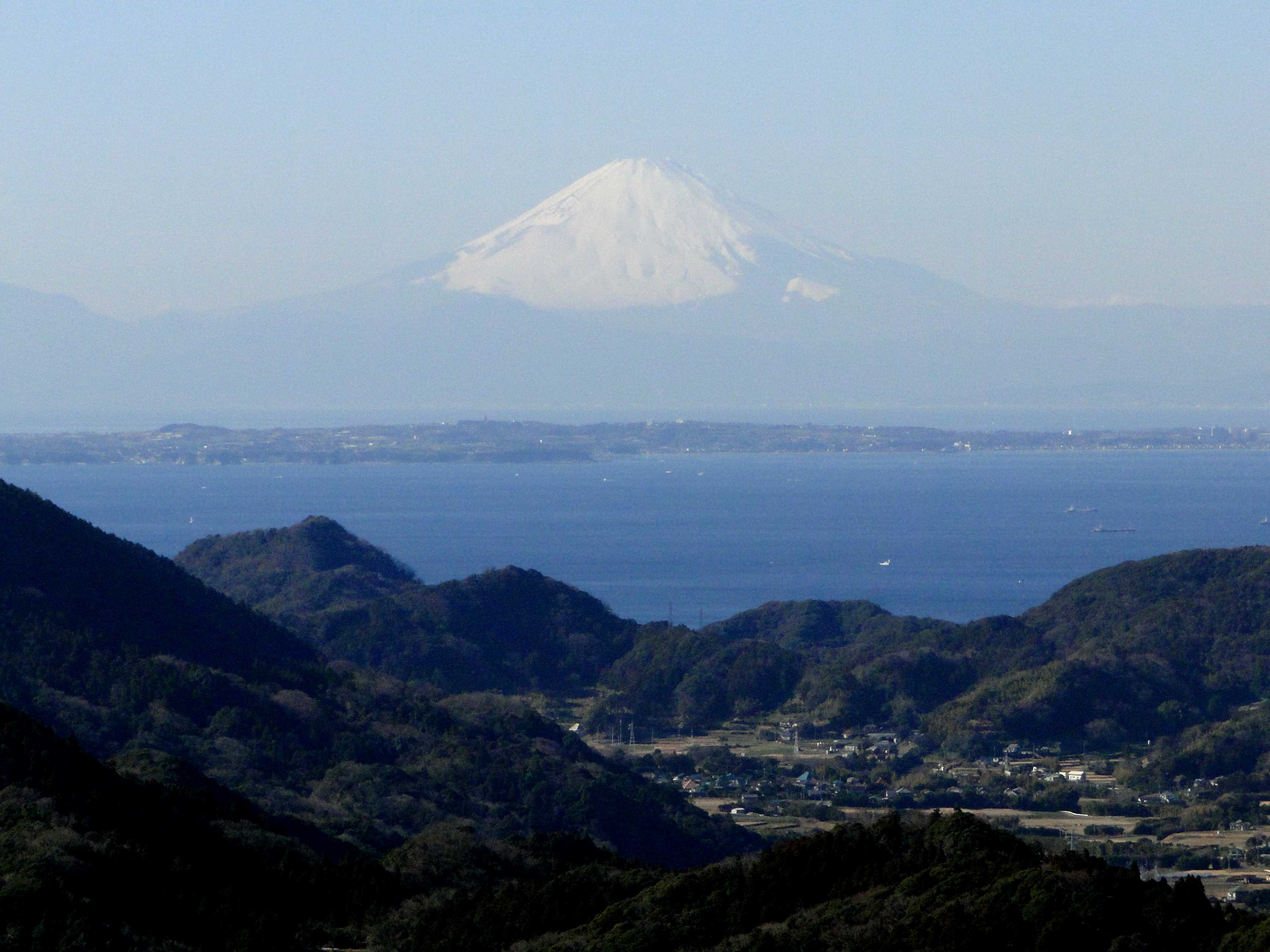
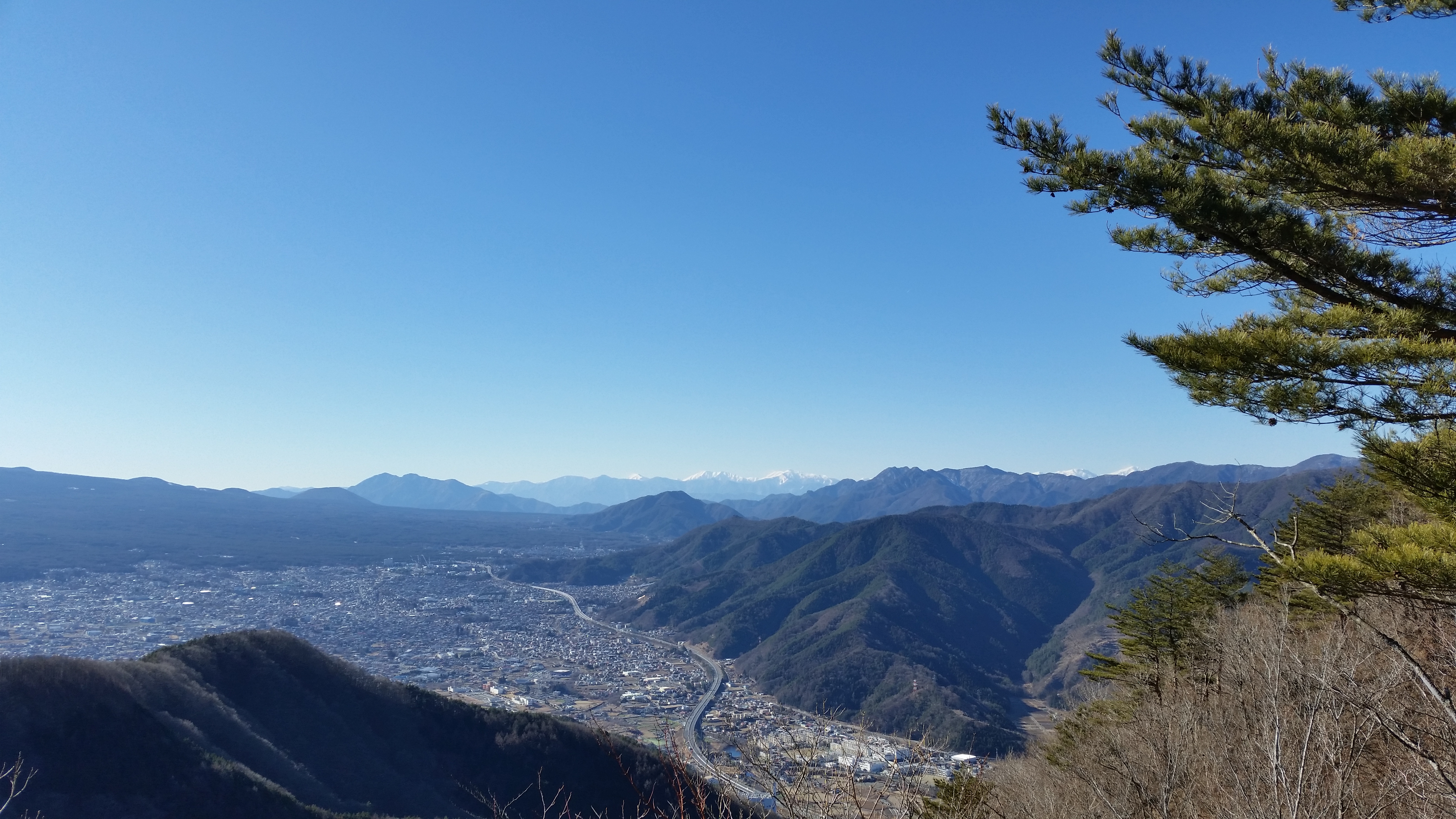
I soon started getting some good views up and down the valley connecting Kawaguchiko and Otsuki cities. It was a fairly relaxing climb, the only steep bit came at the end, going up the small pyramidal summit. I reached the top of Mt Kurami (Kuramiyama 倉見山) after about 90 minutes, around noon. There was an excellent view of Mt Fuji, resplendissant in its winter coat. I could also see Mt Mitsutoge, the cliffs below the summit area making it look like an impregnable fortress. Looking North, I could spot the peaks of the Oku-Chichibu mountains. Looking South, I could gaze on the vast urban sprawl of Kawaguchiko City. On this clear sunny day, the snowy peaks of the Minami Alps were clearly visible.
Easy hiking on the way down
The descent, through a beautiful pine forest, took another ninety minutes. The trail was very easy to walk, and offered many good views along the way. It often felt like I was flying above the small houses in the valley below. The sun was now slightly behind Mt Fuji, so the side facing me was in the shadows, less good for taking photos. I reached the bottom of the valley just past 3pm. I then walked another 30 minutes to Yoshinoike Onsen 葭之池温泉 for a quick hot spring bath, before taking the train from the nearby station back to Tokyo.
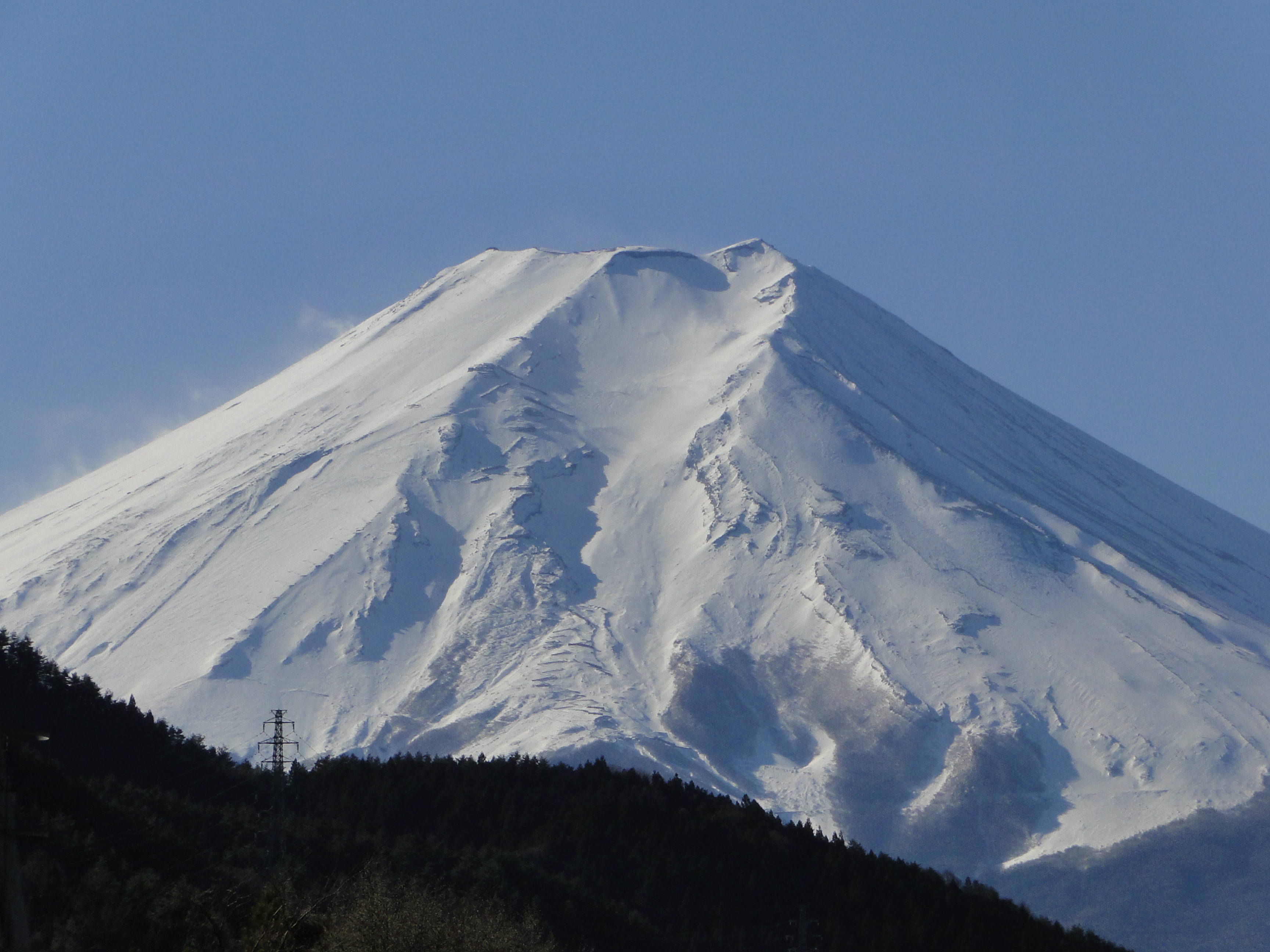
Mt Fuji view from Mitsutoge station (using camera zoom)


![Mt Jomine (1038), Chichibu City, Saitama Prefecture, January 2015 [Omotesando Route]](https://hikingtokyo.com/wp-content/uploads/2020/04/20150117_125508.jpg?w=1200)
![Mt Kurami (1256m), Tsuru City, Yamanashi Prefecture [Map Available]](https://hikingtokyo.com/wp-content/uploads/2020/04/20150103_124330.jpg?w=1200)


You must be logged in to post a comment.