
This is a good mountain to climb in the spring and the autumn, especially when the days are shorter as this isn’t a long hike. Since the Kanto Fureai no Michi passes by the summit, some sections are guaranteed to be easy to walk. Finally, there is a 360 degree view of the Chichibu mountains from the top, so it’s worth doing this one in clear weather.

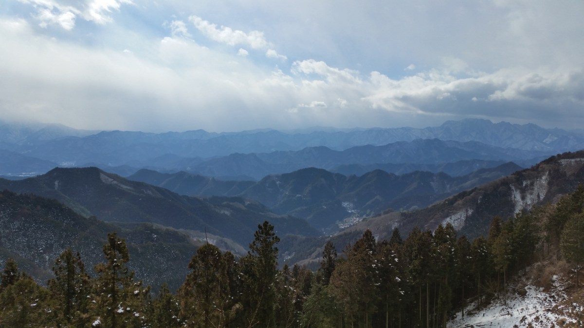
Endless mountains from the top of the observation tower
The bus from Minano station on the Chichibu railway takes about half an hour to get to the start of the Fureai no Michi. From the bus stop, the trail follows the road for a bit, before turning right, and heading up the mountain side through thick forest. The steeper parts of the climb are made easier by several log staircases. It should take less than two hours to reach the observation tower at the top of Mt Jomine (城峰山), a Kanto Hyakumeizan. Among the dozens of mountains, it should be easy to pick out the massive craggy top of Mt Ryokami on the West side.

Log staircase barely visible under the snow in the middle of January
Walking down fifteen minutes, the trail leads to Jomine Shrine, where there is another good view Westwards. It should take another hour down the Omotesando trail to reach the trailhead, along a narrow forested valley. From there it’s another 90 minute walk along the road to the nearest bus stop. The road follows a river past charming countryside dwellings. The bus goes all the way to Seibu-Chichibu station with it’s onsen, food hall, sake shop and direct train connection to Tokyo.

At the very right, the craggy bulk of Mt Ryokami
I did this hike on a snowy winter day, so I made another trip on a sunny Spring day to see the view. I drove to the top, something I don’t recommend since the road is long and narrow; fortunately, I didn’t meet any other cars going up or down. I returned a third time, once again climbing via the Fureai no Michi, but this time going down the South Ridge trail (南尾根コース). This was a more interesting and adventurous way to descend the mountain, the narrow trail following the ridgeline through the forest. I ended up on the road same road as on the first hike, but less than half the distance from the bus stop.

The observation tower which seems to double as a telecommunication antenna

One thought on “Mt Jomine (1038), Chichibu City, Saitama Prefecture, January 2015 [Omotesando Route]”