
At first, I wasn’t too excited about climbing this peak in the Chichibu area. It was a short hike accessible via a ropeway, so the trails and summit were bound to be crowded. However, it was a station to station hike and easily accessible from Ikebukuro via a direct train. I was also curious to see the views from the summit. By studying my hiking map, I saw that I could lengthen the hike by starting from Nogami station and following the Nagatoro Alps hiking trail (長瀞アルプス) so called because of its up and down nature.

View from near the end of the hike
Since the direct train ended at Nagatoro station, one stop before Nogami, I had to walk a few kilometers along back roads to reach the start of the trail. This turned out to be a blessing in disguise since Spring was in full swing; there were many cherry blossom trees in full bloom, including a couple of cherry blossom tunnels, as well as all sorts of other colourful flowers. I had good views of the Arakawa river gorge, and even saw people doing kayaking and rafting. I took so much time taking photos that I arrived at the start of the hiking trail around 11h30, two full hours after getting off the train.

Start of the Nagatoro Alps
The trail was straightforward and much easier to walk than the name would suggest. I saw few people as the trail headed Southwards while slowly rising. It was mostly in the forest and there were few views. After about an hour, I reached a short flat section along a forest road, followed by a series of log staircases heading straight up. This marked the final ascent, and at 1pm I was standing on the wide flat top of Mt Hodo 宝登山 hodosan. By the way, the name can be read as “Treasure Climb”. I found a free spot on one of the benches next to a big group, and settled down for lunch; later on one of the members kindly offered me some freshly brewed coffee.

An easy and relaxing hike up Mt Hodo
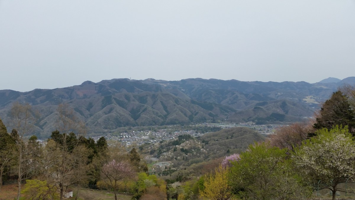
The views were better than expected, even though the blue skies from the morning had been replaced by a thick white blanket. From East to West, I could see Mt Jomine, Mt Ryokami, Mt Happu, Mt Buko and Mt Mino. At 2pm, I set off again. The top of the Hodosan Ropeway was a few minutes away, and from there it was possible to walk down along a wide dirt road that switched back and forth so that it never got too steep. This part of the hike was a pleasant surprise: there were great views of the Arakawa valley, and the side of the mountain had many cherry blossoms, all the way down to the bottom of the valley.

View South of Chichibu City and Mt Buko
It took me less than an hour to reach the base of the ropeway and a road. A little further on, I arrived at a small park filled with cherry blossom trees, with in the middle a small mountain called Mt Notsuchi (209m) 野土山. I reached my starting point of Nagatoro station after 3pm, six hours after setting off, just in time to catch the direct train back to Ikebukuro. It turned out to be a very satisfying hike, and I look forward to returning one day in a different season.

The Nagatoro area of Chichibu
Riding the Chichibu Railway

