Mt Kurohime (2053m), Shinano Town, Nagano Prefecture, Saturday, November 9, 2019

Hiking in the Togakushi Highlands 戸隠高原

This was my fourth hike inside Togakushi kogen and the Myoko-Togakushi renzan National Park, one of the places I definitely wanted to visit again in 2019. Although Nagano prefecture had some bad flooding because of Typhoon Hagibis, it was spared the strong winds that knocked down many trees in the Kanto area. I used the shinkansen to make it a day trip. It was also my last “big hike” of 2019; temperatures dropped significantly in the second half of November, and there was more rain than average, meaning snow in the mountains.

Evening clouds mimicking volcanic fumes from the top of Mt Kurohime,

After arriving at Nagano city, I made my way to the Alpico Information Desk across from Zenkoji exit to buy my one-way ticket to the Togakushi Campground. My plan was to walk down the other side of the mountain and end at a train station along the Hoku-Shinano train line, so that I wouldn’t have to go back the same way. Although it was out of season, there were quite a few people, so an extra bus turned up, and everyone was able to sit comfortably during the one-hour ride. All the other passengers got off at the stop for Togakushi shrine, and I was the sole person getting off at the end.

Japanese birch trees cover the mountainside

 Easy and fun hiking along the crater rim

It was a thirty-minute walk along the road, till I reached a turn-off for a forest road closed to cars, and yet another half and hour to reach the start of the hiking trail. Autumn was late this year, and the needles of the fiery larch trees were still tumbling to the ground. I finally started climbing at 10h30. Very soon, the trees changed to white birch. After one hour of steep climbing, I reached the top of the ridge – actually the crater rim since it’s a volcano – and my first views. Looking back, I could see the entire Togakushi highland, as well as Mt Takatsuma and Mt Izuna. In the distance, I could see the Northern Alps, Mt Yatsugatake and Mt Asama, with plumes of smoke drifting up. Unfortunately, I couldn’t make out Mt Fuji – it should have been visible but it was perhaps too late in the day. Looking forward, I could see Mt Amakazari, Mt Hiuchi and Mt Myoko, the latter two with a dusting of snow on the top.

Mt Takasuma (2353m), a hundred famous mountain, climbed in 2011 & 2014

Mt Izuma (1917m), another volcano and 200 famous mountain, climbed in 2014

I set off again, and saw some patches of leftover snow on the trail, a sure sign that this was the very end of the regular climbing season. As I followed the curve of the crater, slowly bending Northwards, the Chikuma river valley came into view, the longest river in Japan. Looming up above, were the mountains of the Joshin-Etsu. It was my first time to see the view from this side – I had seen it before while skiing in Nozawa Onsen, diametrically opposite. In the center was Mt Madarao and Nojiri lake. The view reminded me of the wide valleys of the Swiss Alps. To my right, the lower half of Mt Izuna was all orange because of the larch trees covering its side and base.

The “Joshin-Etsu” mountains, where Nagano, Niigata and Gunma meet

Mt Madarao (1382m), also a ski resort in the winter, and Nojiri lake

From this point, the trail was fairly easy to walk with some slight ups and downs, but I lost time taking photos. I reached the summit of Mt Kurohime (黒姫山) a little after 1pm, a 200 famous mountain of Japan, and one five famous mountains of Northern Shishu. At this late hour, I had the summit to myself. Despite the near freezing temperatures, it felt pleasant in the sunshine, with almost no wind. I was so busy admiring the views and taking pictures, that I almost forgot the time, and finally set off after 2pm. I was shocked to discover that my ankle, which hadn’t bothered me much today, was suddenly quite painful. I had been counting on a quick descent to make it down before sunset, but I was uncertain how fast I could go with a lame ankle. Fortunately after a few minutes the pain dissipated, but it was a good reminder to always keep a buffer of time.

Mt Hiuchi (2462m), a 100 famous mountain, climbed in 2012, and Otomi lake

Mt Myoko (2454m), another hundred famous mountain, also climbed in 2012

The path continued along the ridge for a while, before turning sharply to the right and down the steep side of the volcano. With more time, it’s possible to descend the opposite side and explore the ponds inside the narrow crater area. However, I was now confronted with a problem other than time: there was a lot more snow than I had expected. I had to proceed carefully to avoid slipping. Luckily the trail zigzagged down and never became too steep. The snow persisted till more than halfway down, and I was relieved when I was finally walking on leaves and dirt again. I reached the end of the trail a couple of hours later, just past 4pm, and less than thirty minutes later I was at Kurohime station, where I caught a local train back to Nagano station. Hopefully I will get to this area next month for some skiing!

Early winter snow on the way down

IMG_20191109_162409

The name Kurohime translates into English as “Black Princess”

Mt Suzu (1564m), Maebashi City, Gunma Prefecture, Monday, November 4, 2019

This was my third hike on Mt Akagi, also a dormant volcano and one of the three famous mountains of Gunma (the third one is Mt Myogi). Since it’s a hundred famous mountains of Japan, I knew that the bus from Maebashi station would be packed. Thankfully, they had an extra bus prepared, so everybody was able to sit during the one-hour trip – a good thing considering that the road had many sharp curves. I got off a few stops before the Akagi Visitor Center, at Shinzakadaira 新坂平, and took refuge at the nearby Akagi Tourist Information Center. It was cold and windy – a big change from the warm weather just 2 days ago.

Hiking on Mt Akagi 赤城山


Easy hiking among white birch trees

I had a quick look at the displays, which included a mounted bear, then had some coffee and toast for breakfast at the small cafeteria. At 10h30, I was ready to brave the near freezing conditions. The first part of the hike was on an easy path along a forested ridge. An hour later, I reached the highest point, Mt Kuwagara 鍬柄山 (1562m), where I had a fantastic view of the whole area. To the East, I could see the ancient caldera of Mt Akagi with Ono Lake at the center, and the highest point, Mt Kurobi, above. To the North, I could make out Mt Nikko-Shirane and Mt Sukai. To the West, was Mt Haruna, with Mt Asama looming behind. To the South was the round top of Mt Jizo with its TV antennas, another of Akagi’s peaks.

View of Mt Akagi’s main peak Mt Kurobi and Ono Lake

The next part was a steep but short slope bringing me to a saddle at the base of my target peak. The next part was an easy short scramble up a rocky path, aided by chains in a couple of sections. The trees were small and already completely leafless, so I was mostly in the sun. Those same trees blocked most of the view from the top of Mt Suzugatake 鈴ヶ岳, but they kept out the wind during lunch. By standing on a rock, I could make out Mt Kusatsu-Shirane between the trees, although the summit was hidden in the clouds.

The rounded forested summit of Mt Suzu

It was already past 1pm, so I quickly went back down to the same way to the base of Mt Suzu. My guidebook suggested continuing back the same way to my starting point, but since I had time, I decided to take a detour around Mt Suzu. It involved descending about 400 meters on one side, and then ascending the same amount on the other side, but I was feeling fit from all the recent hiking so I didn’t mind. On top of that, I was hoping to see some beautiful autumn colours and enjoy the solitude of a path few people hiked. The path was a bit hard to follow – I had to look out for the “yellow strips” – but from time to time a helpful signpost appeared in the middle of the forest.

The autumn colours were at their peak

As I had hoped, the autumn colours were amazing, especially beautiful in the early afternoon sun – I felt like I was walking down an enchanted valley. To my left was a mischievous mountain stream, sometimes running above ground and sometimes under, the noise of rushing water alternating with silence. Thirty minutes later I reached the other end of Mt Suzu, where huge moss-covered boulders were mysteriously strewn throughout the forest, having apparently rolled down from above. Just beyond, I entered a larch forest, forming a wonderful orange ceiling above my head. I emerged onto a road half an hour later, and a little later I reached the lowest point of the hike, as well as the entrance of another section of the “Kanto fureai no michi” 関東ふれないの道, heading up a forested valley on the other side of Mt Suzu.

Mountain stream and autumn colours

Although the trail was now easier to follow, it was also in the shade, so it was harder to appreciate the autumn colours – it was much colder as well! At one point, the path met up with another stream. Apparently there were some waterfalls further up, but I didn’t have time to investigate. Soon I was climbing back up the side of the mountain. It was hard to make out where I was heading among the multiple folds of the mountain side, and for a while I wasn’t exactly sure where I was on the map. However, according to the ever useful signposts, I was on the right path.

The name “Akagi” can be translated at “Red Castle”

After going up what seemed like a never-ending wooden staircase, it was with relief that I arrived at Depari Pass, joining up with a path I had hiked previously on Akagi. It was nearly four o’clock and the sun was quickly dipping behind the side of the mountain. It took me another thirty minutes to reach the shore of Ono Lake and the bus stop just after sunset. Fortunately the bus back to Maebashi station was fairly empty, most people having taken an earlier bus back.

Mt Akagi mountain stream and crater lake

NEXT UP – Mt Kurohime (Togakushi Kogen) in Nagano


Mt Tengu (1179m), Takasaki City, Gunma Prefecture, Saturday November 2, 2019

Hiking on Mt Haruna 榛名山

This was my third hike on this dormant volcano, and one of the three famous mountains of Gunma. It’s also a popular sightseeing spot – there was a long line at the bus stop, opposite the West exit of Takasaki station. I got the very last seat, which was lucky since the ride takes one hour (halfway there, they added a second bus for those standing). It turned out that most people were visiting Haruna Jinja, a 1400-year old shrine located on the Southern side of the volcano. Most people got off at the shrine – however I continued all the way to the last stop at the shore of Haruna lake. Once off the bus, I was stunned by the reflection of Mt Haruna-Fuji on the blue surface of the lake.


This was my first time to see this Haruna lake under blue skies

The first part of the hike was down the side of the mountain along the “Kanto Furenai no Michi” (関東ふれないの道). The path had suffered a bit from the recent typhoons, but was still walkable. The autumn leaves were still at their peak, and looked great in the clear autumn weather. At one point I passed an interesting rock formation, that looked to me like a kind of giant monster. Less than an hour after setting out I reached Haruna Shrine which I had passed earlier by bus. I decided to follow the masses of people and check out the shrine. Although it seemed like your typical Japanese shrine, I was impressed by the massive cedar trees. After reaching the main building, I retraced my steps and located the start of the trail, up a road closed to cars near the massive gate marking the entrance to the shrine.

I happened to be at this strange rock just when the sun was shining from behind

The road soon narrowed; for a short while a stream passed over it – its passage underneath having been blocked by stones, no doubt due to the recent typhoons. The start of the hiking trail was marked by a small red “torii”. A few minutes later, I lost the trail. I backtracked a bit, and after scanning the surrounding forest, I managed to pick it up again (a signpost would be good here). A little further, there was a steep, but short slope that brought to the top of a ridge, and a fork. I first headed right to the top of Mt Kyodai (1079m) 鏡台山, completely surrounded by trees. I retraced my steps, and followed the left fork, which brought me to a rocky outcrop and a great panoramic view of Mt Asama and Mt Myogi to the West. After a short break, I headed back, and continued along a very enjoyable and mostly level path with few people.

Beautiful autumn colours on the side of Mt Haruna

Eventually I got to another fork. To the right, was a peak with no view. To the left, the path, running alongside a series of miniature “torii”, led to the true summit of Mt Tengu 天狗山, which I reached around 2pm. There was an excellent view of the Kanto plain to the South, a few meters past the summit. Unfortunately, as with the previous viewpoint, it was against the sun so it didn’t photograph well. I enjoyed the rest of my lunch, perched on top of one of the huge boulders at the viewpoint. My guidebook suggested going back the same way, but I decided to make a loop hike along a slightly longer, less traveled way, following the ridge above the trail I had come on.

Kissing rocks near the top of Mt Tengu

The entrance to this trail was hard to spot – there was a very small sign pointing the way through the bamboo grass, and the trail was very faint. I had to constantly search for “yellow strips” attached to trees. It was an exciting path with great occasional glimpses of the higher peaks of Mt Haruna to the East. However, it was also nerve-wracking, since I was alone on the trail, and I had to be careful not to lose my way. It was starting to get late, and I wanted to be sure to complete the hike before nightfall. On the way, I passed the minor peaks (but also highest peaks of the day) of Mt Kokanehara (1225m) 小鐘原ヶ岳 and Mt Okanehara (1252m) 大鐘原ヶ岳. After the second summit, the path descended quickly, and I was even more careful checking for the yellow strips – I didn’t want to have to climb back up like I had done the previous month in the Tanzawa mountains!

Late afternoon view of Mt Haruna in full autumn splendor

I was relieved to finally reach Jizo pass, where I turned left off the ridge and down into the valley. However the path remained difficult to follow with few signposts. Thanks to some judicious pathfinding, I got on to a good path next to a pretty stream and finally managed to rejoin the road I had walked up a few hours earlier. I was back at Haruna Shrine a little after 4pm, and I had ample time to catch the now mostly empty bus back to Takasaki station.

The birds of Mt Haruna – Swan gliding over the lake and Falcon flying in the sky above

NEXT UP – Mt Suzu (Mt Akagi) in Gunma

Mt Ihai (1458m), Susono City, Shizuoka Prefecture, Sunday, October 27, 2019

Hiking on Mt Ashitaka 愛鷹山

This wasn’t my first visit to Mt Ashitaka – I had already climbed the highest peak, Mt Gozen (1504m), in December 2013. I had taken the most direct route up, then headed Northeast to Mt Kuro (1086m), before ending up on the Eastern side of the mountain. The close-up views of snow-capped Fuji were absolutely stunning. However, Mt Ashitaka, a 200-famous mountain, is quite a huge mountain with more peaks to climb and ridges to hike, and I had been meaning to return for a while. As usual, logistics held me up, but his year I discovered that there was limited express train that runs several times a day between Shinjuku and Gotemba – it’s also a very easy way to get to the Mt Fuji area – so I decided it was time to visit Shizuoka again.

Mt Fuji visible from behind the ridge leading up to Mt Ihai

After arriving at Gotemba station, I hopped onto a mostly empty bus for the short ride to the base of Mt Ashitaka. Despite the good forecast, the weather was pretty horrible, and the top of the mountain was hidden in the clouds. After getting off the bus, I couldn’t find any signs, but thanks to Google Maps, I eventually stumbled on a sign indicating the start of the trail. It pointed to a staircase going down, but no sooner had I stepped on it, out of the corner of my eye, I spotted a spiderweb spread right across it…with a massive “jorogumo” (a kind of orb-weaver spider) in the center. Although they aren’t poisonous, I didn’t really want one on myself. There was no way around or under it, and rather than destroy the web, I choose to climb over the railing and lower myself onto the staircase lower down.

Today I got to see Mt Fuji wearing a baseball cap

At the bottom of the short staircase, I crossed a small stream and headed up into the forest on the other side. At 9h30, I was finally hiking. Almost immediately, I walked into another spiderweb – luckily it seemed to be spiderless. However, from that point onwards, I decided to arm myself with a small stick, and wave it in front of me as I marched on. The path followed a gently sloping ridge through cedar forest, with few signs to confirm that I was on the correct path. There was no one else, apart from a couple of deer that escaped into the forest. There was a section with many fallen trees, possibly caused by the recent typhoons. Most of this hike on the Eastern side of Mt Ashitaka is inside the Southern part of the Fuji section of the Fuji-Hakone-Izu National Park, although there weren’t any signs indicating this.

Cloudy day yet Mt Fuji was clear

Just before 11am, I got my first views of Mt Fuji on the West side. The weather had cleared up a bit but the top of Mt Fuji was still in the clouds – under a kind of baseball cap. The further I climbed, the more the ridge narrowed, and the more views I got. Soon, Mt Fuji was totally clear and I started to lose a lot of time taking photos. I also had some views of Hakone to the East The ridge went on and on, and after what seemed like a long time, I reached Mt Mae, connecting with a trail coming from the valley – there was no view, and the summit marker was half-broken. Beyond that, the path descended a bit and I was able to make out my target peak – it looked close, but it took me another hour to reach. Occasionally I could hear the roar of lions from the nearby Fuji Safari Park below.

Cloudy ridge on the Northern side of Mt Ashitaka

I arrived at the top of Mt Ihai 位牌 (meaning “mortuary tablet” although there were none at the top) at quarter to one, and very behind schedule. There were 2 other people at the top, about to head down. They kindly offered me some tasty “age-senbei” or fried rice crackers, which I enjoyed on the train ride back. From the top, looking Westwards, I could see Mt Fuji and Mt Gozen – according to the sign, the connecting ridge is quite dangerous. The weather was much better now – blue skies with swirls of mist floating by. Southwards, I could make out an impressive valley, but not much else since there were still a lot of clouds in that direction. Originally, I had been planning to hike towards Mt Ashitaka, the peak that gives the whole mountain its name, but I realised that there was no way I could catch the last bus back – at 3h35 – if I took this longer way. If I missed my bus, I faced another two hours of walking to Mishima station on paved roads. So this time, I took the shorter route down.

Swan cloud passing by

Even with this shorter route, I would barely make it to the bus stop on time. Very soon I reached an amazing viewpoint. Behind me, the top of Mt Fuji was visible from behind the ridge I had just climbed up, with a beautiful blue sky in the background. In front, the Hakone mountain range rose up from the valley in between. I had never seen Hakone from this angle – I was so fascinated that I stepped into some brambles, and I had to spend a few minutes putting bandaids on all the scratches (the weather was warm enough for shorts).

Hakone Panorama

I finally managed to pull myself away from the view and continue down the mountain. I really enjoyed this part of the hike, following a narrow forested ridge, and it was a shame I had to rush it. It took me ninety minutes to reach the viewpoint at Ikenodaira 池ノ平 (846m), where I could get a view of Numazu city, Suruga Bay and the Izu peninsula, although the visibility wasn’t the best at this time of the day. I snapped a few pictures and continued down. Very soon I reached a parking and a road, from where it was another thirty minutes to the bus stop, which I reached with ten minutes to spare. This time the bus was pretty full, but I was able to sit all the way to Mishima station, where I caught the shinkansen back to Tokyo.

Clouds on Mt Ashitaka

NEXT TIME: Mt Tengu (Mt Haruna) in Gunma

Mt Gongen (2715m) & Mt Amigasa (2524m), Hokuto City & Fujimi Town, Yamanashi & Nagano Prefectures, Thursday, October 23, 2019

Hiking on Mt Yatsugatake 八ヶ岳

I was hoping to climb one last big mountain in 2019, before the arrival of snow, and I had had my eye on the two Southernmost peaks in the Yatsugatake range for a while. Even though they are the closest to Tokyo, right between Yamanashi and Nagano, they’re challenging to climb as a day trip from Tokyo – Mt Tengu, further North, was possible thanks to the Hokuriku shinkansen. In the end, I decided to stay the night in Kofu and drive to the mountain; this way I could leave at dawn, and finish around sunset. I had to travel to Yamanashi and back by highway bus, since the trains weren’t running as usual due to damage by typhoon Hagibis. This was a blessing in disguise, since the bus costs half the price of the train, so I could recoup some of the cost of the hotel and the car.

Looking back at the pointy tip of Mt Gongen from Mitsugashira

On Thursday morning, the sky above Kofu city was foggy, but as I drove West along the highway, blue skies appeared overhead. As Yatsugatake came into sight, I got a shock: the top was white with snow! As I drew closer, I saw with relief that it was only the highest peak, Mt Aka (2899m), that was covered in snow, and today’s hike would be snow-free. I reached the Kannondaira parking lot (1560m) just before 8am – there were quite a few cars, even on a weekday. The first part of the hike, a gently rising trail through forest that was still green, was fairly easy. After half an hour, I reached a clearing with a good viewpoint of Mt Fuji sporting a brand new snow cap – a good place for breakfast.

Snow-capped Mt Fuji – the morning mists haven’t fully dissipated yet

The trail continued through thick forest, and after another half an hour I reached the turn-off for my first peak. A steep climb straight up the side of the mountain, with occasional views through the forest of the Kofu valley behind me, brought me to the bare and rocky top of Mt Amigasa 編笠山 at 10h30. The 360 degree view was one of the best I’ve ever seen while hiking.

From left to right I could see Mt Fuji, the Minami Alps, the Chuo Alps, Mt Ontake, Mt Norikura and the Kita Alps – all the highest were covered with snow. I could also see the entire Yatsugatake range stretching North, with in the center the matterhorn-like peak of Mt Aka. There were so many great pictures from this hike, that it was impossible to share them all here.

Today’s mountain is the highest point on the far right, but lower than Mt Aka in the center

After a quick bite, I set off downhill just after 11am, towards a saddle where the Seinen Hut was located, just 20 minutes away. The last part was full of giant boulders, and it took some time since I had to step carefully from boulder to boulder, following painted yellow arrows. After that, I was climbing again through forest. Suddenly, I was above the treeline at around 2600m; there was a sharp drop on my left, and an impressive rocky outcrop towering in front of me.

Fortunately, there was a switchback path on the right, with helpful chains in several places. It looped around the back, and led up to what I thought was the highest point. Noticing that there was no summit marker, I turned around – the true top was behind me, five minutes away and just a little higher. Looking left, I could the impressive “kiretto” or mountain ridge, leading to Mt Aka.

The “kiretto”, on the right, leading up to the highest point of the Yatsugatake

Originally I had planned to go up and down the same way. However, I had made good time climbing up, so I decided to take a different and longer route down. I hurried past another hut to the highest point of my hike, Mt Gongen (権現岳 gongendake) – in fact the highest mountain climbed in 2019. I couldn’t actually get to the very highest point since it consisted of a bunch of huge boulders, but I got as high as I felt safe doing, and had the rest of the lunch while enjoying the view of Mt Fuji in the distance. Since a boulder was in a way, I couldn’t get a perfect 360 degree view. The weather was still sunny, with almost no wind. Despite the high altitude, and proximity of the snowline 200m higher, I was perfectly fine wearing just a base layer. At one point a cargo plane, probably from the Japan Self-Defense Force, flew past the summit (see video at the end).

Perfect view of Mt Fuji from the top of Mt Gongen

I had to set off fairly quickly if I wanted to complete the hike before dark, around 5pm. First I headed down and back up again to Mitsugashira 三ツ頭 (2580m). Looking back, the view of snow-covered Mt Aka, wrapped in mist was breath-taking. By now, it was nearly 2pm and I needed at least a couple of hours to get back to my car, so I pulled myself away from the view, and descended into the forest. This was one of the nicest and easiest downhill hikes I’ve ever done. There were good views of my first peak, with orange larch trees around the base. One hour and a half later, I reached the Yatsugatake crossing path (“oudan hodo” 八ヶ岳横断歩道), part of a trail that circles the entire mountain range –  something to try one day. From there, it was another thirty minutes back to the parking area along a mostly level trail, although the last meters were steep uphill – pretty tough after what was nearly an 8 hour hike! Fortunately, there was a hot spring at the base of the mountain, so I could have a good soak before making the long trip back to Tokyo.

Although it’s called the red peak, today it was partly white

I believe this was a JIETAI plane flying past the summit

NEXT UP: Mt Ihai (Mt Ashitaka) in Shizuoka

6 Tips for Planning Your Hike

Autumn is probably the best time of the year to go hiking in Japan: the weather is usually clear and the leaves are beautiful. However, with a dizzying number of mountains and hiking trails, and a complex public transportation system, it’s not easy to figure out where to go, and how to get there – and back. I’m often asked how to get started with hiking, so here are six tips on how to plan your first hike, and hopefully many others!

1) Buy a Guidebook

I started out with the “Otona no Ensoku” (大人の遠足) book series by JTB Publishing. The two I have are Kanto Area Day Hikes Ending at a Hot Spring and Best Day Hikes in the Kanto Area. There may be more people on the trail but at least you’ll be walking on well-trodden paths. Among all the guidebooks out there, I find these to have the clearest layout.

With the hike + onsen book you’ll save time looking for a hot spring (photo source: books.jtbpublishing.co.jp)

If you’re looking for hikes in a specific area, I’d recommend the “Bunken Tozan Gaido” (分県登山ガイド), book series published by Yamakei. They have guides for each prefecture, and each one has around 50 hikes. The layout is also fairly easy-to-understand, and the hikes range from beginner to advanced. Some are even secret trails known to locals only – and you! If you live in Tokyo, the book to get is “The mountains of Tokyo Prefecture”, but the ones for the mountains of Saitama, Kanagawa and Yamanashi are all excellent choices.

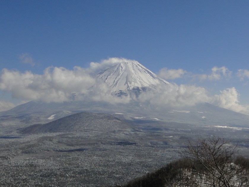
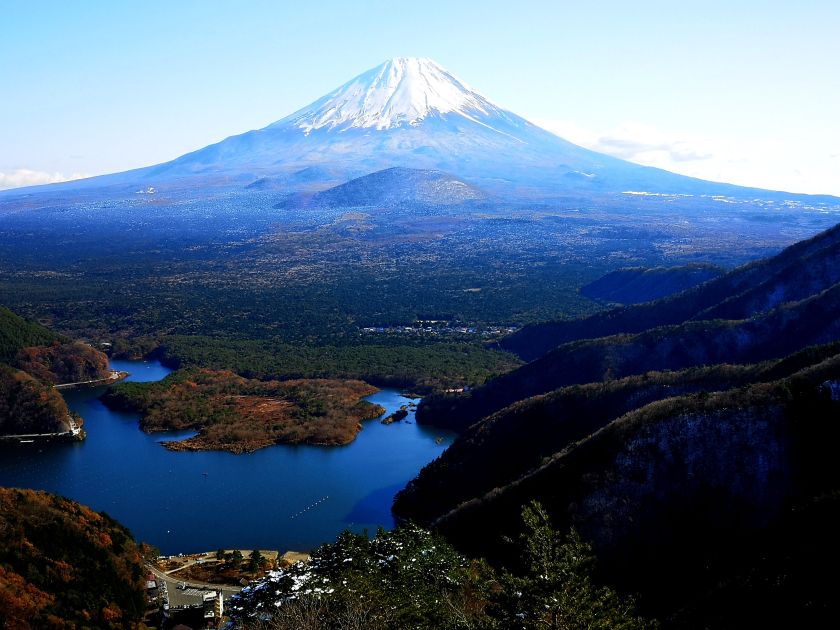
Mt Fuji can be seen from the top of many mountains in the Tokyo area (photo source: http://www.amazon.co.jp)

2) Get a Paper Map

Although the above guidebooks include a map of the hike, nothing beats a separate paper map. It contains a lot more details and covers a wider area. The most popular hiking map series are “Yama to Kogen Chizu”, or “yama chizu” for short, by Mapple. Even if you don’t read Japanese, you’ll be grateful for the mountain routes, times and elevations. It’s possible to buy a digital map and pay for updates, but I’m a little concerned about my phone battery dying on a hike!

Section of the Okutama map – the paper is robust and water-resistant

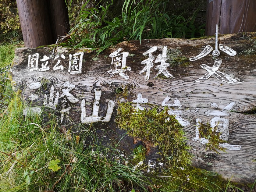
The map I’ve got the most use out of is the Takao – Jinba (高尾 陣馬) map. It covers, not only Mt Takao, but also the mountains along the Chuo line all the way to Otsuki station. Many of these can be done as station to station hikes, so there is no need to worry about bus times. Other excellent maps are the ones for Okutama 奥多摩 (Tokyo prefecture), Tanzawa 丹沢 (Kanagawa prefecture) and Oku-musashi Chichibu 奥武蔵・秩父 (Saitama prefecture).

The very useful Takao-Jinba map – on the left side are all the mountains featured (photo source: http://www.amazon.co.jp)

3) Check the Trail Condition

Once I’ve chosen a hike, I go online to get the most up-to-date trail information. First, I check yamareco (meaning “mountain record” ヤマレコ), a Japanese only site, where people can post pictures and descriptions of their hikes. Popular mountains will usually get many updates, especially after the weekend. Googling “yamareco” + the mountain’s name (in Japanese or English) is an easy and quick way to get to the right page.

Some trails can be unexpectedly challenging – chains assist a hiker down a rocky section on Mt Take in Gunma

Afterwards, googling the name of the mountain by itself can lead me to other useful resources for planning my hike. Depending on the mountain, recent trail information can be found on a website for :

  • a Visitor Center
  • a Mountain Lodge or Hut
  • a Nearby City or Town
  • a Ropeway or Cable Car
  • a Private Hiking Blog

Before setting out on your hike, it’s important to know whether the trail is not closed for some reason! On the other hand, if a website announces that autumn colours are at their peak on your chosen hike, you can expect crowds of people! Some of these websites have English versions, or automatic translation functions.

Hiking with the crowds in Oze in the autumn

4) Find Out How to Get There

[2023 update: Hyperdia is no longer in use. Google Maps is the best option for planning hikes from home to the trail entrance]

If the hike is from train station to train station, then you just need to check the train route and times on the English version of hyperdia. More work is needed if access to the start of the trail (and back) is by bus, since there is no hyperdia for bus routes. Bus companies operating in popular sightseeing spots, like Nikko and Mt Fuji, have websites with routes and timetables in English. However, most bus companies provide information in Japanese only. Googling the name of the bus company + the bus stop (in Japanese) will often get you a PDF with the bus timetable, but not always.

Bus stop names are sometimes translated in English

Recently, Google Maps has started providing bus schedules, so it’s worth playing around with that as well. However, it’s still a work in progress, and not all bus routes are in the system yet. If Google Maps can’t find a bus route, that doesn’t necessarily mean there is no bus service in the area. Finally, I always double check the day and date, since bus times can vary according to the day of the week and time of the year.

The bus is the most usual way to get to the start of the trail – many buses now accept IC cards such as Suica/Pasmo

5) Keep an Eye on the Weather

After choosing and planning my hike, I spend some time checking the weather. You don’t want to get caught in a downpour (or a snowstorm) mid-hike. I prefer Japan-specific websites such as Weather News (Japanese only) and the Japanese Meteorological Agency (Japanese and English) to get an idea of the weather in the area near my hike.

Snow on the trail – here Daibosatsurei in November – can radically change the nature of a hike

Even if it’s sunny in the lowlands, mountain weather can be completely different. It’s important to check the temperature and wind strength on the mountain itself so that you can dress appropriately. Mountain Forecast gives detailed forecasts for famous mountains throughout Japan. Tenki to Kurasu has more mountains, but it’s in Japanese only. The latter has a handy rating system that helps me decide whether I need to postpone/change my hike – or adjust my clothes. For example:

  • Sunny but cold and windy weather might be rated “C”, meaning unsuitable for hiking.
  • Cloudy but mild weather with little wind might be rated “A”, meaning suitable for hiking.

Both sites are automatically updated several times a day. Forecasts can sometimes be wrong so it’s best to be prepared for different conditions – I always pack rain gear even on sunny days!

Rain clouds hovering above Hakone – fortunately it didn’t rain on this hike

6) Look For a Hot Spring

I am a big fan of Japanese hot springs, or “onsen”: there is nothing better than relaxing in a hot bath after a long tiring hike. Not every mountain will have a hot spring at its base, but many do, so it’s worth taking some time to research this in advance. The guide books mentioned in the first tip will include hot spring information, if available. The hiking maps from the second tip will show the hot spring symbol. It’s best to check the website of the hot spring place to make sure that it’s open the day and time of your visit.

Expect the hot spring to be a lot more crowded on a weekend!

If there aren’t any hot springs mentioned in the guidebook or on the map, I try searching for “日帰り温泉” (day-trip hot spring) on Google Maps near my hike. I’ve found great places that were a short walk from the train station, or located along the bus route. If nothing comes up, I also search for “日帰り入浴” (day-trip hot bath), so that I can just take a regular bath to wash off the sweat before the train ride home. Sometimes some extra effort is required to get to that hot bath – it’s up to you to decide whether it’s worth it!

From the Archives: Tokyo Day Hikes, November 2017

November is the peak of the hiking season, and thanks to the usually good weather in Japan around that time, I was able to climb a mountain every weekend, and two National Holidays. Half of the six hikes already have their own write-ups on this blog. Here are the summaries of the other half.

Mt Myoho (1332m), Chichibu City, Saitama Prefecture, Thursday, November 2, 2017

Hiking in the Chichibu Mountains 秩父山地

The starting point for this hike was Mitsumine Shrine, a place I had visited a few times before, but had never really taken the time to explore. Since today’s hike was relatively short, I first took some time to check out the Mitsumine visitor center, one of the starting points for visiting the Chichibu-Tama-Kai National Park. It was a pleasant surprise – I found the displays of mounted animals and the model relief of the area particularly interesting.

View of Mt Wanakura (also known at Mt Shiroishi and climbed in 2018) from Mitsumine Shrine

After spending nearly an hour at the visitor center, I hurriedly set off along the hiking path up Mt Kumotori. The autumn colours were at their peak, and since it was a weekday, I had them mostly to myself. Very soon I reached the turnoff for today’s mountain, located on a small ridge branching left off the main ridgeline. In less than an hour, I reached the small shrine at the top of Mt Myoho 妙法山, from where I got some great views of Oku-Chichibu, with Mt Ryokami in the center.

View of the jagged peak of Mt Ryokami from the summit

After lunch, I headed back to the shrine, and since it was still early in the day, I took some time to check out the shrine grounds – it was beautiful with all the autumn colours. At the back, there was a spectacular view of the mountain I had just climbed as well as Chichibu city.

Good views from the trail heading down from Mt Mitsumine shrine

Afterwards, I located the hiking path leading down the mountain. Although there were a number of people at the shrine, no one seemed interested in hiking down, so once again, I had the path entirely to myself. Unfortunately, it wasn’t possible to hike all the way down to the train station, and the path ended up on the road, from where I caught an express bus back to Seibu-Chichibu station.

Mt Nemoto (1199m) & Mt Kumataka (1169m), Kiryu City, Gunma Prefecture, Saturday, November 4, 2017

Hiking in the Ashio Mountains 足尾山地

This was my very first visit to Kiryu City – I returned a couple more times last year in the autumn. I was again the only person on the bus, and when I got off at the last stop, I was surprised that it cost only 200 yen – probably the cheapest bus ride I’ve ever done in Japan. I had to walk another thirty minutes along the road, but I didn’t mind since it followed the beautiful Kiryu river.

Kiryu river, one of the top 100 forested valleys in Japan

I reached the start of the trail around noon – there was a well-made sign in Japanese and English explaining that the Kiryu River had been selected as one of the top 100 forested valleys in Japan – I wasn’t aware that such a list even existed! There are two trails up the mountain – the one on the left following a small mountain stream is the more challenging one. I took the more direct trail going up the ridgeline. This trail had its share of fun, with rocky sections lined with ropes for safety – it’s not really dangerous, but it isn’t for beginners either.

The autumn colours made up for the gloomy weather

The autumn colours were still at their peak, and a little before 1h30, I reached the top of Mt Nemoto 根本山 (meaning “tree root”), a Gunma 100 famous mountain. There was no view, but there was a brand new sign. The weather had been sunny and cloudy all morning, but now it was completely overcast, with a cold wind. It felt like it might snow at any moment.

Mt Akagi, looking somber

I continued along the ridgeline, circling the source of the Kiryu river, clockwise. Soon, I was walking South along an easy trail, and I arrived at Mt Kumataka 熊鷹山 less than an hour later. There was a small observation tower with a 360° view of the surrounding mountains. I could make out Mt Koshin and Mt Kesamaru to the North, where there was some sun, and Mt Akagi under a dark cloud to the West. In the East, it seemed like it was raining.

Trees marching up the side of the mountain – blue skies returned at the end of the hike

After enjoying the view and before my hands froze, I started to head down the mountain. The hiking trail quickly became a forest road, and the sun came out again. Soon, I was walking next to the Kiryu river again under blue skies. I was back at the start of the trail before 4pm, and half an hour later I was riding the last bus back to Kiryu City.

Kiryu river, also one of the 100 top forested water sources

Mt Nantai (654m), Daigo Town, Ibaraki Prefecture, Sunday November 12, 2017

Hiking in the Abukuma Mountains 阿武隈山地

This was a trip to a prefecture that I have recently come to appreciate as a great hiking destination. This was also my first time to take the Suigun line that connects Mito, the capital of Ibaraki, and Koriyama in Fukushima (I took it again this year). This was also a good station to station hike – I had to walk one hour along a road from Saigane station to reach the start of the trail, but the surrounding scenery was beautiful.

One of the other peaks in the area

Once I started hiking in earnest, I got some really great views of the rocky summit of this Kanto 100 famous mountain. The weather was perfect, and the autumn colours were still at their peak. Soon I started climbing through some beautiful forest, and I reached the top of Mt Nantai 男体山 around 1h30. From the top, there was no doubt that this was the highest mountain in the area. To the south, I could see the shape of Mt Tsukuba in the distance.

At the very back, Mt Tsukuba and neighbouring mountains

After enjoying the bird’s eye views, I continued along the ridge. First down a steep slope, then along a pleasant mostly level path. It was so pleasant that I completely missed the turn-off down the mountain. After a while, I realised I was going in the wrong direction and retraced my steps to the junction which was properly signposted – I must have looked the other direction just when the sign came into view!

The prominent bulk of Mt Nantai

The downhill part to Kami-Ogawa station was through pleasant autumn forest, then along countryside back roads. Looking back, I got some more nice views of the rocky summit of the mountain I had just climbed. I reached the station in time for the infrequent train back to Mito city.

The other November hikes can be found here:

Mt Shishigura (1288m), Okutama Town and Tabayama Village, Tokyo & Yamanashi Prefectures, Sunday November 19, 2017

Mt Komochi (1296m), Shibukawa City, Gunma Prefecture, Friday November 24, 2017

Mt Nanten (1483m), Chichibu City, Saitama Prefecture, Saturday November 25, 2017

Mt Gongen (1019m), Yamakita Town, Kanagawa Prefecture, Sunday, October 20, 2019

Hiking in the Tanzawa Mountains 丹沢山地

This was my first hike since typhoon Hagibis, which hit the Kanto area the previous week. Not only did it flood many low-lying areas, but it also damaged mountain roads and hiking trails. According to the latest update from the Nishi-Tanzawa visitor center, all trails in their vicinity were open, but this was before the heavy rains that hit the Kanto area again two days before my hike.

The Sunday forecast was supposed to be good, but when I got to Shin-Matsuda station it was definitely overcast. Oddly enough I was the only person to board the bus for Nishi-Tanzawa, a popular hiking destination, especially in the Autumn season. The reason soon became clear – Friday’s rain had caused a landslide along the road, preventing the bus from reaching the visitor center, the starting point for most hikes. Fortunately for me, I was getting off before that, at Tanzawa Lake. The bus ride was along a river, and I noticed that the water was brown and muddy. Further upstream there was a sign saying that water was being released from the dam at Tanzawa lake.

Once, I got off the bus, I was shocked to see the amount of debris, mostly tree branches, floating on the lake. The lake colour was muddy-brown like the river; hopefully it will regain its normal colour soon. On the bright side, it seemed that my target mountain was just low enough to stay clear of the clouds. Before I set off, I dropped by Ochiaikan 落合館 a nice little hotel where I took a bath after hiking Mt Ono three years earlier, to confirm whether they still allowed daytrippers to take a bath (“higaeri nyuyoku” 日帰り入浴). I was told yes, and I said I would be back around 4pm.

Tanzawa lake: May 2016 (left) and Oct 2019 (right)

I had to walk counter-clockwise alongside the lake for about forty minutes to reach the start of the trail. Along the way, I saw a small parking area full of cars and cameras mounted on tripods nearby. I asked one person what they were hoping to photograph. He replied “taka” which according to my dictionary is a falcon or a hawk. Always curious about the local wildlife, I would have liked to stick around to catch a glimpse of the bird, but I was running late, so I had to move on.

Wood debris floating on Tanzawa lake

I reached the start of the trail a little before noon, and started climbing immediately. The trail climbed steeply through cedar forest. From the start it was hard to follow – this wasn’t a popular trail, and according to my guidebook, this hike is mainly done in the spring because of certain flowers that grow higher up. I got a nice surprise on the way – a small light-green frog hopped onto the path. Further up, it was the turn of a light-grey one. I have occasionally seen toads while hiking, but I had never seen a frog till this year. Earlier in the month I had also seen a couple of frogs along the Nakasendo in Nagano prefecture. I had read that the frog population was declining, but perhaps it’s making a rebound?

Frogs posing for pictures along the trail

I’m not sure whether it was because of the recent typhoon, but bright green cedar leaf branches were scattered all over the trail. I had never seen so many before, but they were effective at making the muddy trail underneath less slippery. As I gained altitude, the path became less steep, and the forest less dense, helping me spot two young deer dash away ahead of me. At times, the path was hard to follow, and I often had to rely on the “pink ribbons” to find the correct way.

The hiking path was covered with cedar leaf branches

I reached the flat top of Mt Mitsuba ミツバ山 (834m) just before 1pm. There was an opening in the trees a few meters to the South, but everything was in the clouds beyond the next ridge. In good weather, I imagine one could see Mt Fuji. After a quick break, I continued to climb along the ridgeline. Eventually, I saw mist to my right, so I figured that the top was in the cloud after all. Curiously enough, the left side remained clear for a while, before being engulfed in cloud as well.

This sign was kind of funny so I left it as it was

I reached the lonely summit of Mt Gongen 権現山 before 1pm. According to my map, there weren’t any views, just as well since there wouldn’t have been any because of the mist. This mountain’s name is fairly common: purely by coincidence, the next mountain I climbed, just 3 days later, had the same name. I didn’t even realise it until I went through my photos. After a quick lunch, I set off immediately. Since I had climbed fairly quickly, I hoped to descend equally quickly, and catch an earlier bus back, especially since the weather was poor.

Mysterious and quiet forest at the top

The path down (heading left – the path going past the top is a shortcut leading back down to Tanzawa lake) was as hard to follow as the one going up. There were steps built into the steep slope, but they lacked maintenance. It seems that this path has fallen out of favour among the hiking community, and I can’t recommend it, unless one is seeking absolute solitude. On the way down I had some glimpses of Nakagawa onsen 中川温泉 in the valley below, an aging hot spring town I had stayed at a couple of years ago.

I lost quite a bit of time looking for the trail, at one point heading down a steep valley by mistake and having to climb back up, and I ended up missing the earlier bus, as well as the next one, arriving at the bus stop just below Nakagawa Onsen, at around 4h30. Even though sunset was at 5pm, it got quite dark hiking in the forest after 4pm. I might even have spotted the elusive “taka” taking off from a branch at one one point, but it might have been just a crow.

I finally arrived back at Tanzawa lake just before 5pm, and was looking forward to a hot bath, only to discover that the hotel was closed! However, after knocking at the door, the owner arrived, and kindly let me have a quick bath – since they didn’t see me arrive at 4pm, they thought I had changed my plans, and decided to lock up for the day. After a quick bath, I caught the last bus back to Shin-Matsuda station.

NEXT UP: Mt Gongen in Yamanashi Pref. (Yatsugatake)

Mt Shirasuna (2140m), Nakanojo Town, Gunma Prefecture, Thursday, October 10, 2019

Hiking in the Mikuni Mountains 三国山脈

This is another mountain that had been on my to-climb list for ages. One reason was access: buses to Nozori lake 野反湖 only ran on weekdays – strange since there is nothing there except a campsite. Another reason was that it seemed to be perpetually inside the clouds. It’s probably one of the rare mountains I’ve never been able to see, despite having made multiple trips to the area, the most recent about 3 weeks earlier.

Mt Shirasuna, cloud-free version

Three weeks ago, I had the opportunity to do a weekday hike, and with perfect blue sky weather before the arrival of yet another typhoon, I decided to tackle this two-hundred famous mountain of Japan. Once I started planning in earnest, another issue arose – it couldn’t be done as a day trip using public transportation. I needed to stay the night at a hotel near Shin-Maebashi station to catch the first train for Naganohara-Kusatsuguchi station. Luckily, I was able to book a decent room the same evening.

The path down with Mt Asamayama in the background

The day of the hike, I caught the first outbound train on the Agatsuma line. For some reason, the train was full of high-school students, who all got off at the same station, apparently to go to Kusatsu onsen. There didn’t seem to be any accompanying teachers, but I guess it was some kind of school trip. I recognised some of them on the train back. After getting off the train, I got on a tiny bus with just one other person. It reminded me of the bus that I used for Mt Mikabo. The ride was very picturesque, through villages and along river valleys. It was part of Gunma that I had never visited before. After more than one hour, we reached a viewpoint over the lake – the driver kindly stopped there for a few seconds so that we could take in the view. In the early morning sun, the surface was a beautiful blue.

The beautiful blue of Nozori lake

The last bus back was at 3pm and I only had a short six hours to reach the top and come back. I had gotten ready on the bus, so after confirming the time of the last bus back with the driver, I left without delay. The start of the hike was through beautiful forest, mostly birch and silver fir trees, but not much in terms of autumn colours. I met no other hikers, not surprising on a weekday. 90 minutes later, I got my first views of the lake and the entire Asamayama range emerging from the morning mist. Later on, I had some good views of Mt Iwasuge 岩菅山, another two-hundred famous mountain I hope to climb someday. Before I knew it, I reached the top of Mt Doiwa 堂岩山 2051m, completely in the trees, just before 11am.

Misty Asamayama – I was hiking the peak on the right side the previous month

From the summit, there were some glimpses of mountains to the North through the trees. However, a few steps beyond, just as the path started descending, I got my first glorious view of the day. The weather was still perfect and I could see the path ahead all the way to my target mountain, as well as the mountains of the Joshinetsu-kogen National Park to the North.

To the South, I could even make out Mt Fuji popping up behind the mountains of Oku-chichibu. I also spotted other hikers climbing the mountain so I wasn’t alone. My original plan was to go up and down the same way. However, since I had progressed quickly, I decided to do a longer loop hike that would end at the other side of the lake (the viewpoint the driver paused at). I was now at the fork of the trail, so I would need to retrace my steps later on, something I didn’t mind doing since it was all views from here on.

Mt Fuji, barely visible 150km away

I lost time admiring and photographing the great views, so I had to hurry during the final climb, and I reached the top of Mt Shirasuna 白砂山 a little after noon. Since I wanted to do the longer route down, I had to pull myself away from the great 360 degree views only after thirty minutes. North was Mt Naeba, East, the Tanigawa range, with Mt Sukai in the distance behind, South, Mt Akagi and Mt Haruna, West, Mt Asama and Shirane-Kusatsu, with the North Alps visible behind. By the way, the hiking path continues all the way to Mt Mikuni, but it’s necessary to stay in a hut along the way.

The path continues…some day I might return to walk it

I hurried back and reached the fork for the loop hike at 1h30. From here I followed a wide and grassy path southwards – I tried to run a bit, but the terrain was uneven under the grass, so I had to be careful. There were good views to my left but the right side was blocked by trees. I was surprised that even on this less traveled hiking path the signage was fairly new and in English. Eventually the path bottomed out and I found myself climbing again. With some effort I reached the top of Mt Hachiken 1953m 八間山 with forty minutes to spare before the last bus back.

Looking back at Mt Doiwa (on the left) and Mt Shirasuna (on the right)

After a couple of minutes rest, I set off again, the final stretch down to the pass above the lake. At this stage I was running most of the way. The ridge seemed endless and I was greatly relieved when the lake and pass appeared to my right. I made to the bus stop with ten minutes to spare. The bus was actually a little late, but according to another passenger, the driver had waited for me for a few minutes before departing. It was the same driver as in the morning, and since I had asked about the last bus he had assumed I would be coming down the say way (that was my original plan) – how kind of him to wait for me!

NEXT UP: Mt Gongen in Kanagawa pref. (Tanzawa)


From the Archives: Two Shirane Mountains in Two Days, Gunma Prefecture, August 2017 [Map Available]

These two hikes in Gunma prefecture are from August 2017, during another of my mother’s visits. We had taken the train to Takasaki the previous day, and had spent the night at Dormy Inn. In the morning, we used a Times Share car to drive to the base of Mt Nikko-Shirane. After our hike, we then made our way to Kusatsu-onsen on the other side of the Kanto plain, and spent the night at a hot spring hotel. The next day, we went to the base of another Shirane mountain – Mt Kusatsu-Shirane – after which we drove over to Shiga Highland to climb Mt Shiga.

Download a map of the Mt Oku-Shirane hike

This map was developed for Japanwilds with the Hokkaido Cartographer

Find more Japan hiking maps on Avenza

Since these two hikes weren’t day trips, they fall outside the scope of this blog, but they are in areas relatively close to Tokyo and inside National Parks, so they are well worth a visit. I think that each area is reachable from Tokyo as a day-trip using the Tokyo Wide Pass, and I might attempt it one day!

Nikko-Shirane Ropeway & Goshiki-Numa Lake

A beautiful lake high up in the mountains

The drive from Takasaki to the Nikko-Shirane Ropeway was fairly uneventful. Even though it was a weekday, I was surprised by how few people there were, especially since it was the middle of the summer holidays. The place is mainly a ski resort in the winter so perhaps people aren’t aware that it also runs from June to October. I love ropeways and I keep on discovering new ones – it’s amazing how many there are in Japan!

Sun shining through the forest

At the top of the ropeway, inside Nikko National Park and nearly 2000m high, the visibility wasn’t the best, and the views were a little disappointing. At least it was cooler than down in the valley. The hike started out on a fairly level trail through beautiful forest. After an hour or so, we had to climb steeply for a short while to reach the edge of a pond. Here I was able to look up towards the top of Mt Nikko-Shirane. I had been hoping to get my revenge, since it was in clouds when I climbed it several years ago. However, the top was in the clouds again, and another ascent seemed pointless.

Midaga Pond near the top of Mt Nikko-Shirane

We continued a little further and reached the edge of a crater with at the bottom, the beautiful Goshiki-Numa lake 五色沼 (which means five-colour lake). Since we had enough time, I decided we could descend to the shore of the lake and climb back up again. Unfortunately the descent was steep and rocky, and we regretted it a bit.

The Goshiki-numa lake, inside Tochigi prefecture

After enjoying the peace and quiet of the lake, we made our way back up to the edge of the crater via a different path, and then walked back the way we had come. At the pond, we passed a group of noisy school children who had come up a different path. We headed back down the steep path to the forest below, and at the bottom we took another trail that looped back to the top of the ropeway.

View of Maru-numa lake from the ropeway

Check out the views of Nikko-Shirane

On the drive back we stopped at the very impressive Fukiware Waterfalls 吹割の滝 where we could walk along the river and the falls for a short way. Afterwards, we drove on to Kusatsu Hot Spring about 100km away, and we reached our ryokan after dark.

Where is all the water going?

Check out one of the famous waterfalls in Japan

Yugama Lake, Mt Yokote (2307m) & Mt Shiga (2037m)

Looking back towards Mt Shiga

The next morning was sunny, but by the time we had drove all the way up to Yugama Lake 湯釜 the clouds had rolled in. We admired the light blue colour of the crater lake, but gave up on climbing Mt Kusatsu-Shirane. I had climbed it before in the clouds, and had little interest in doing it again in similar conditions.

A beautiful crater lake

We drove on to Yokoteyama Ropeway which took us to the top of Mt Yokote 横手山. We got some nice views of Shiga Highland 志賀高原. Fortunately, the Nagano side was still free of clouds. We finally arrived at Kumanoyu (meaning the bear’s bath) where we left the car. We were now firmly inside Nagano prefecture. Another short ropeway took up to the start of the hike. Luckily, the weather was holding up. The first part was quite level. At one point the path went through some very high bamboo, higher than our heads, and I was worried about bears. So I reached into my bag to retrieve my bear bell only to realise that I had left it in the car!

View from the top of Mt Yokote

Soon the path started to climb. It was steep, with big rocks and protruding tree roots, making progress slow. The path slowly wound up the side of the mountain. We saw few people, and thankfully no bears. We reached the top of Mt Shiga 志賀山 just before 2 pm. A little way past the summit, there were some good views of Onuma-ike Lake below. The whole hike is inside the Joshin Etsu Kogen National Park and is very wild and beautiful.

The area of our hike – Mt Shiga is in the clouds on the right

We climbed down via a different path, spotting various small ponds on the way. Finally, after passing through a shinto gate or “torii”, we reached the base of the cone-shaped Mt Shiga. The next part involved walking along an elevated walkway through marshlands – much easier than the rocky path down the mountain! The final part back to the ropeway was along a wide and level path through the forest.

Onuma Lake in the middle of Shiga Highland

Since it was getting late, we decided not to take a bath at Kumanoyu, and leave right away. No sooner had we set off, that a dark shadow dashed across the road – it was a bear cub. It disappeared into the bushes opposite. We waited a bit for a mother bear, but she was nowhere to be seen. In any case the place certainly deserves its name!

On the way back, we stopped briefly for some photos at the marker for the highest national road in Japan at 2172m high. The drive down to Kusatsu onsen was through thick mist. We had a bath at the Sainokawara open-air bath, one of the biggest in Japan. After we were done, it started raining really hard, but we managed to get back to Takasaki safe and sound, a little after nightfall.

Hiking up and down Mt Shiga