Hiking in Tohoku: Mt Karo (430m), Shinchi Town, Fukushima Prefecture

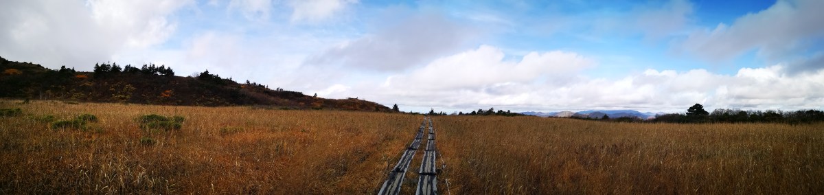
I had first heard about the newly-created Michinoku Coastal Trail inside the Sanriku Fukko National Park in 2019, but I couldn’t consider hiking it till the JR East Welcome Pass was introduced last year. My first task was to pick a section that could be done as a day-hike from Tokyo. The ones near the Miyagi / Fukushima border seemed ideal since they could easily be reached from Sendai, a 90-minute shinkansen ride from Tokyo. Next I tried to find a section with more hiking trails than roads. I settled on the Shinchi route: although it followed some roads, it also went up a small mountain with views of the Pacific ocean and the Mt Zao mountain range – hopefully the weather would be good. Even if it weren’t, I was excited to hike in new area of Japan.

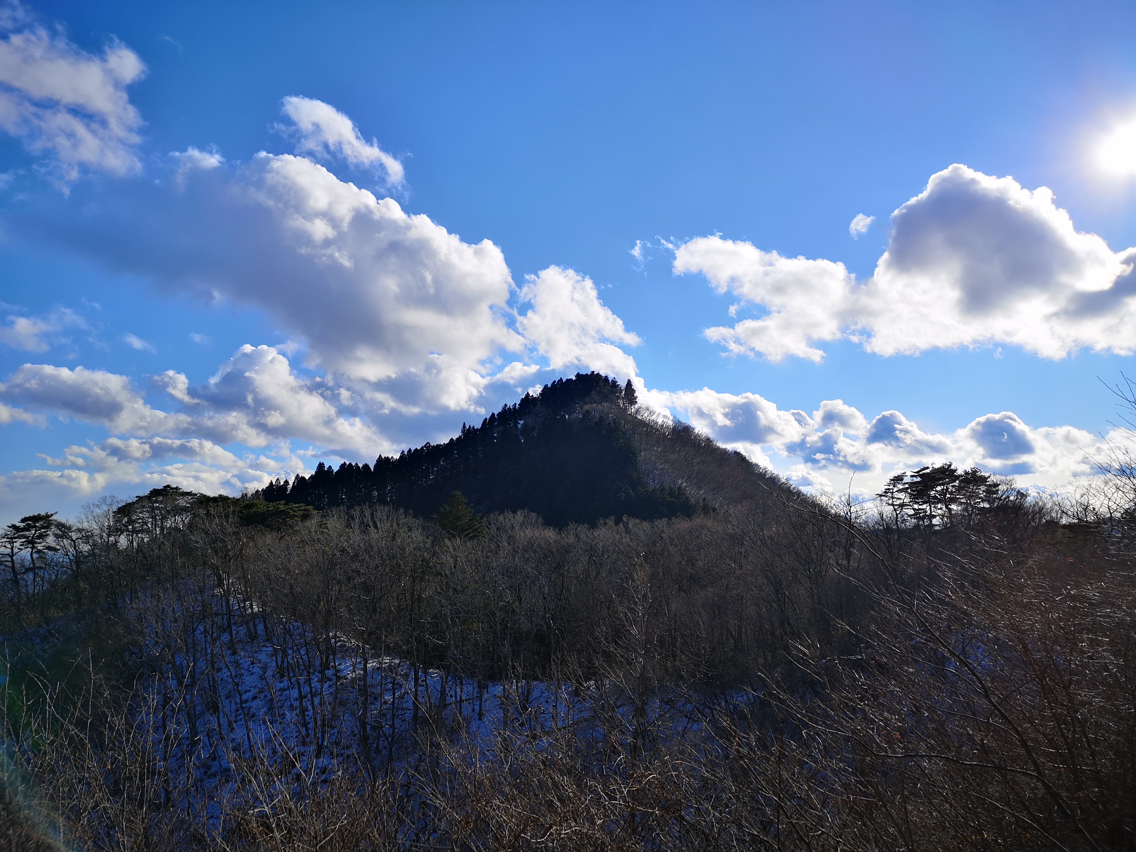
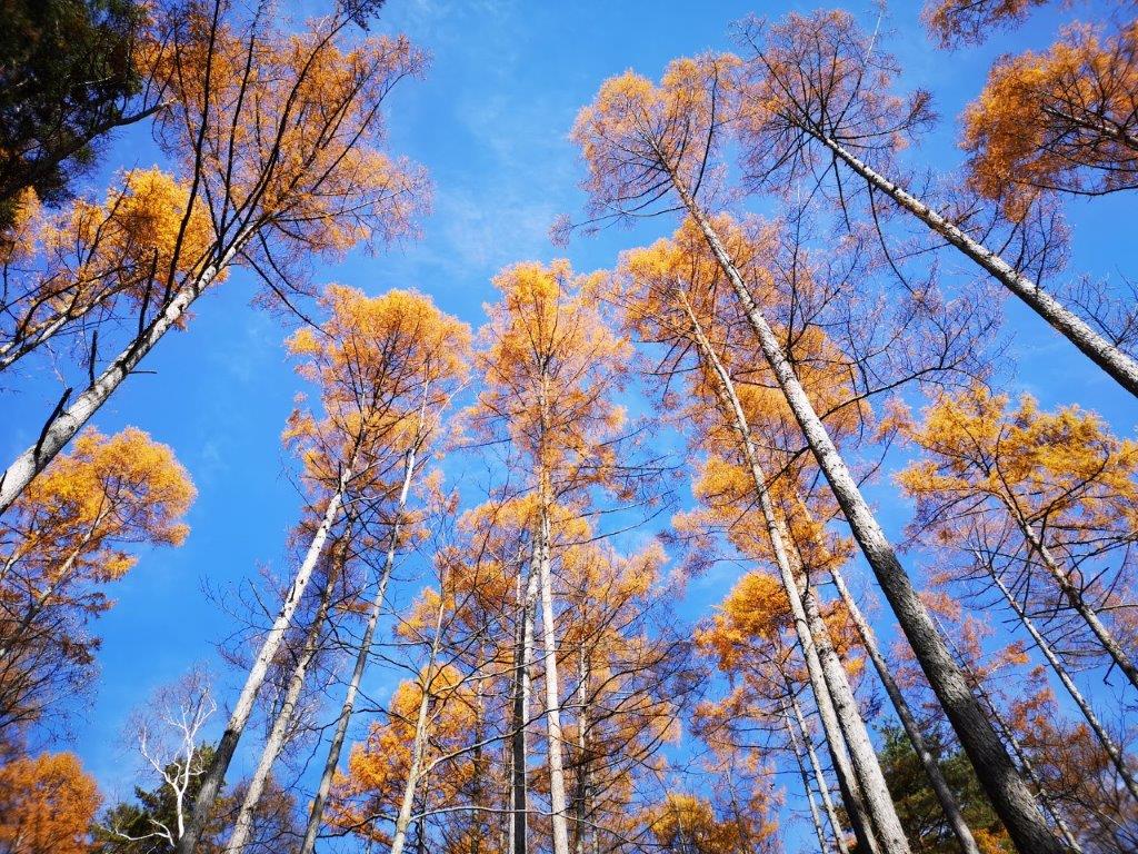
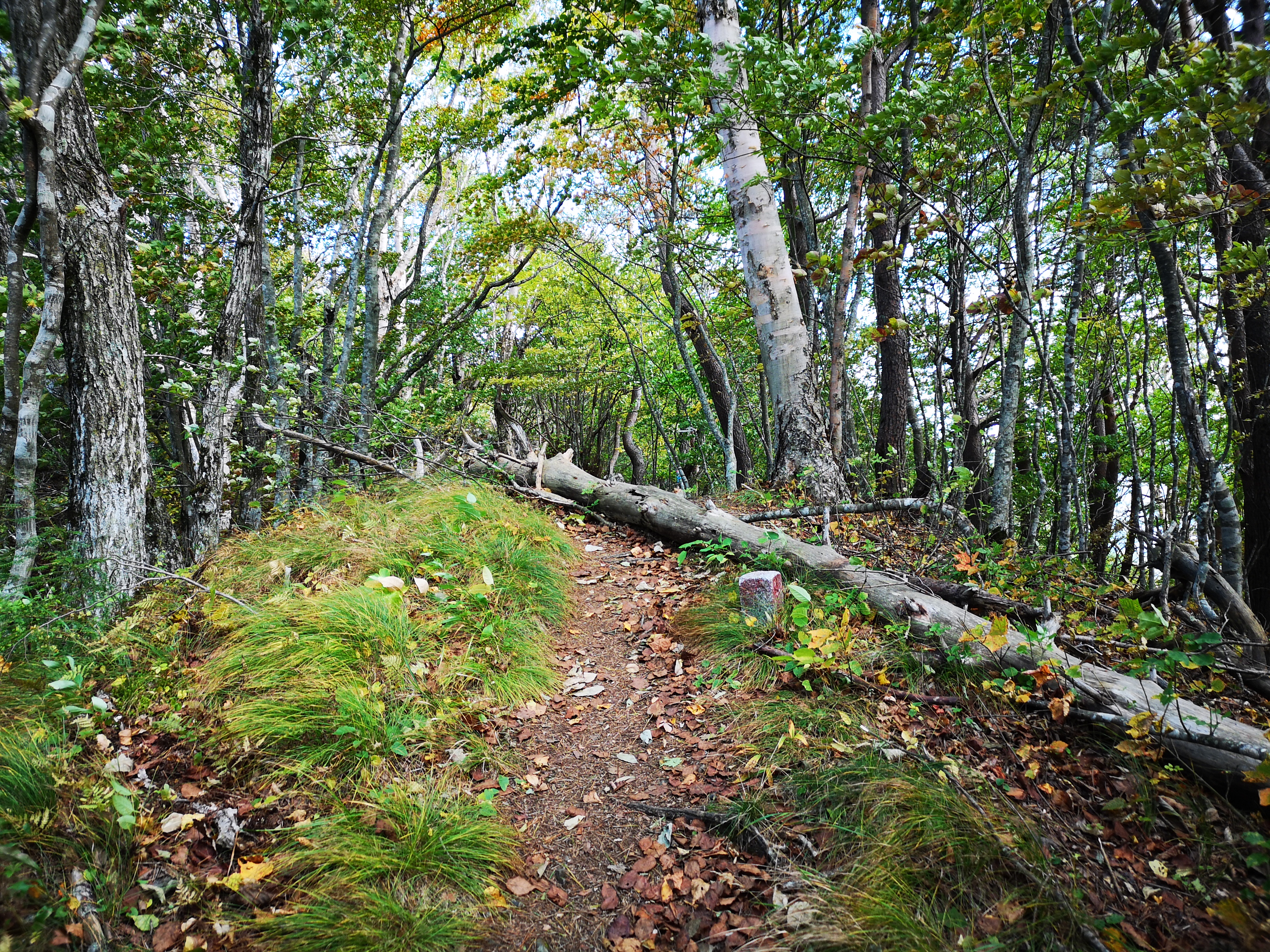
The north side of Mt Karo covered in trees

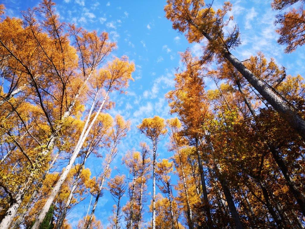
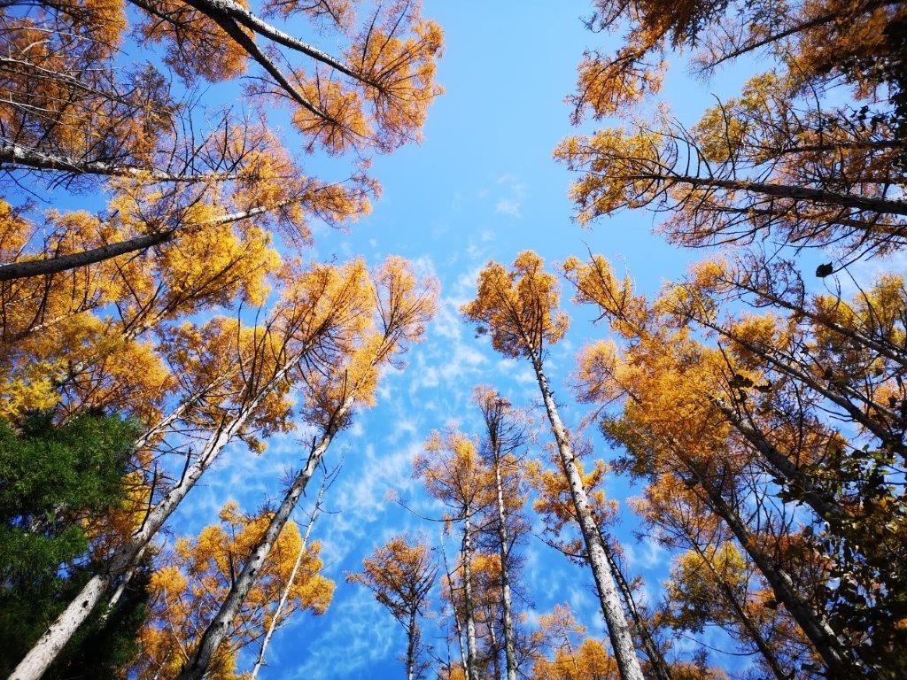
For once, the shinkansen was delayed, and I lost one hour on the way to Sendai. To make up for this, I called a taxi from Shinchi station on the Joban line to take me to the start of the trail, 6 kilometers away, and I was ready to start hiking at 11h45. The weather was good but cold; there was even a thin layer of snow in places out of the sun’s reach. I chose to head up the “chobo” or view trail; it meant I would be walking with my back to the view, but I wanted to be in the sun to warm myself up. Even though it was a short climb, there were frequent signs along the way telling me how many meters were left to the summit.

Mask-wearing shrine guardian

Walking the sunny “view” path up

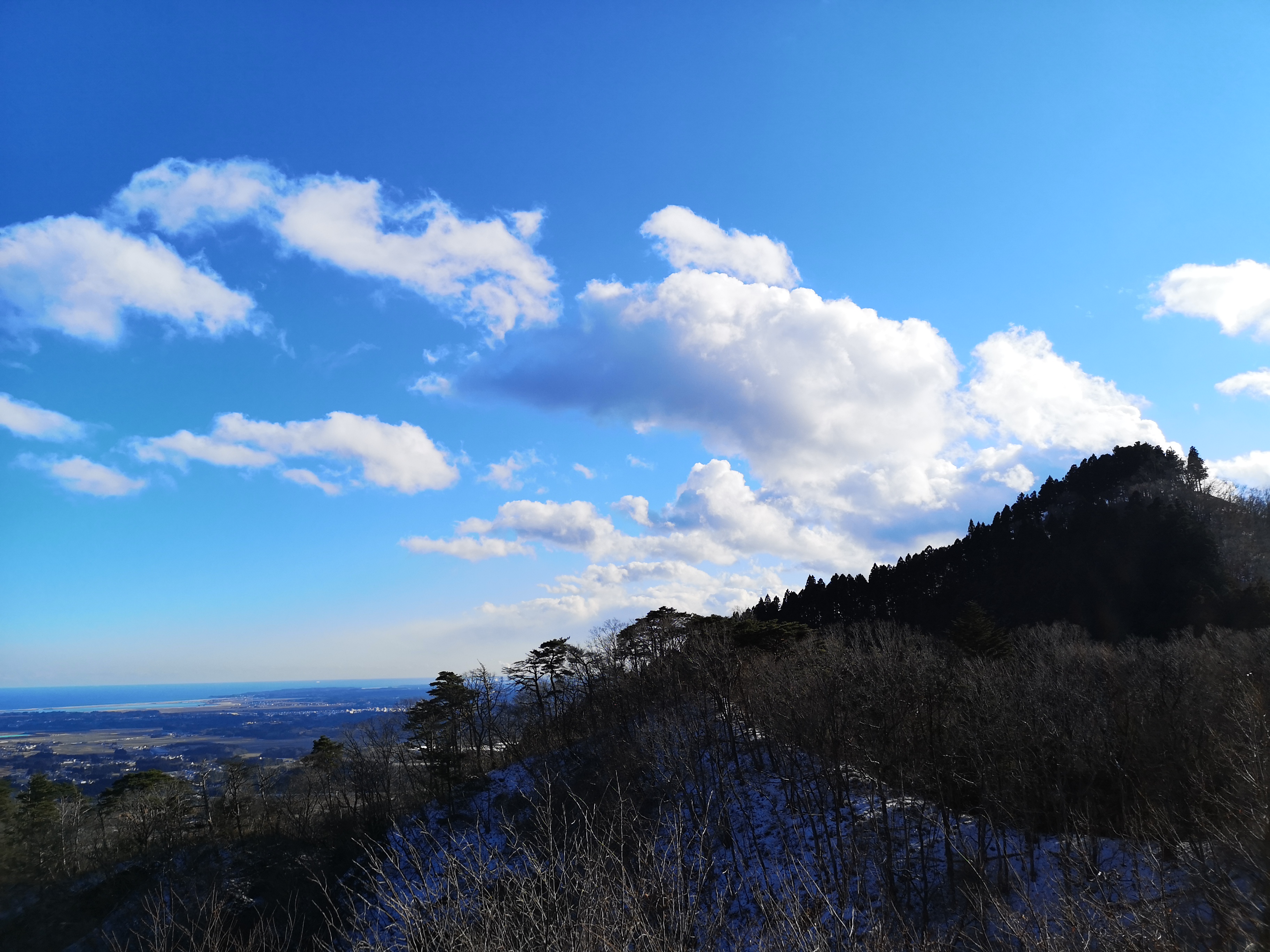
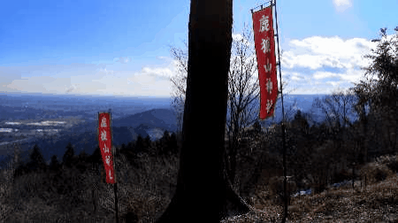
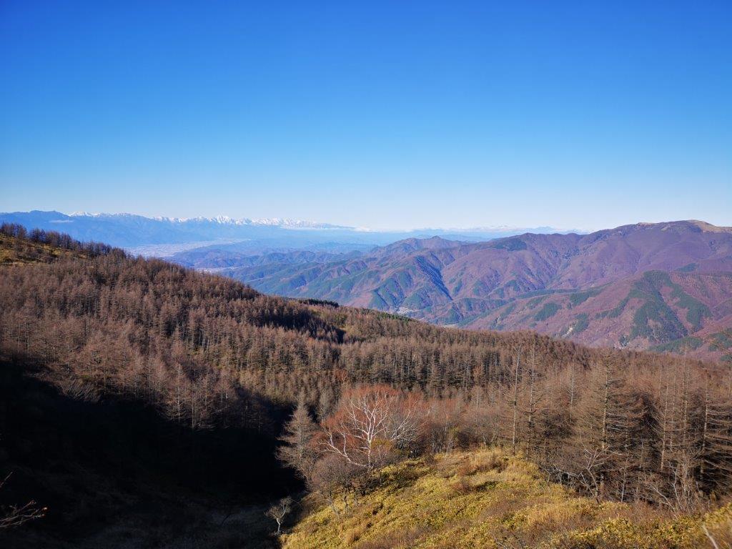
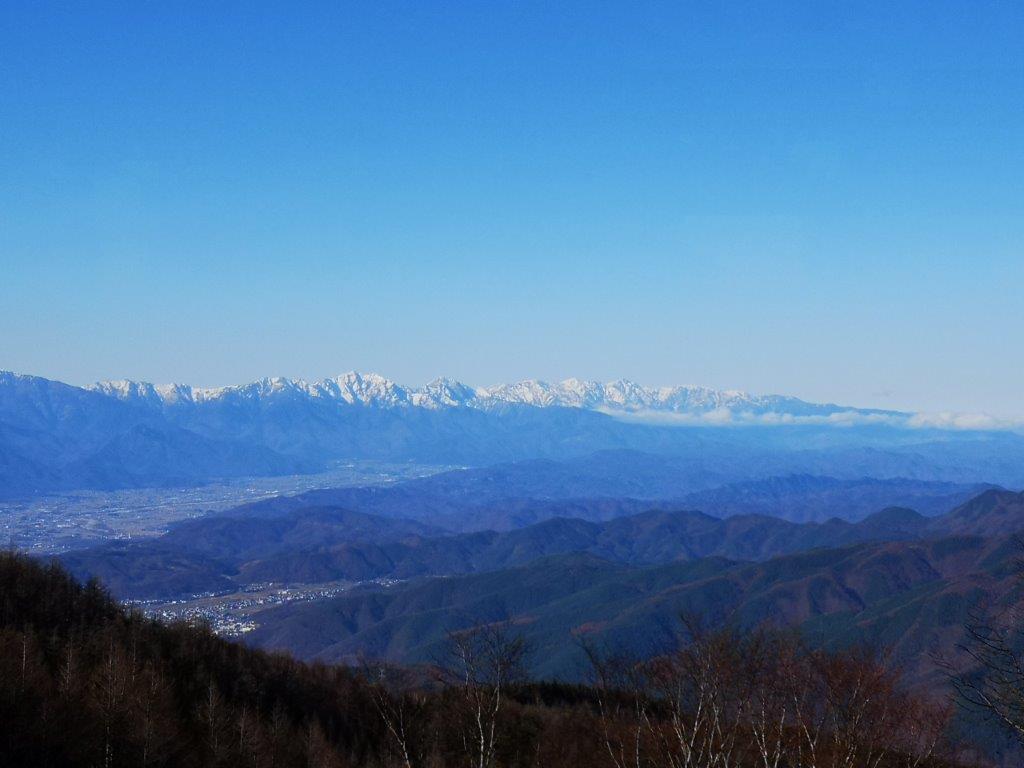
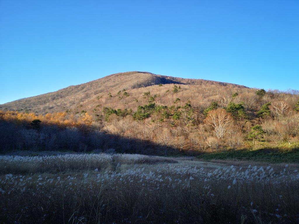
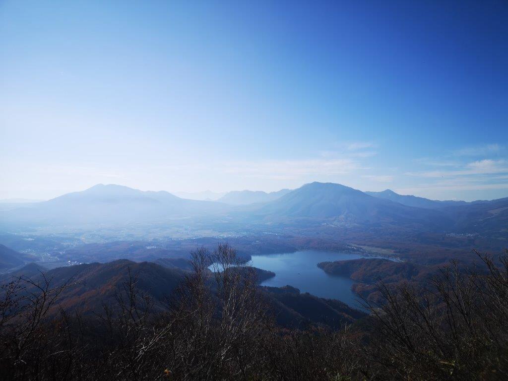
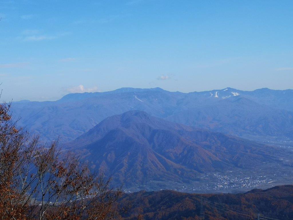
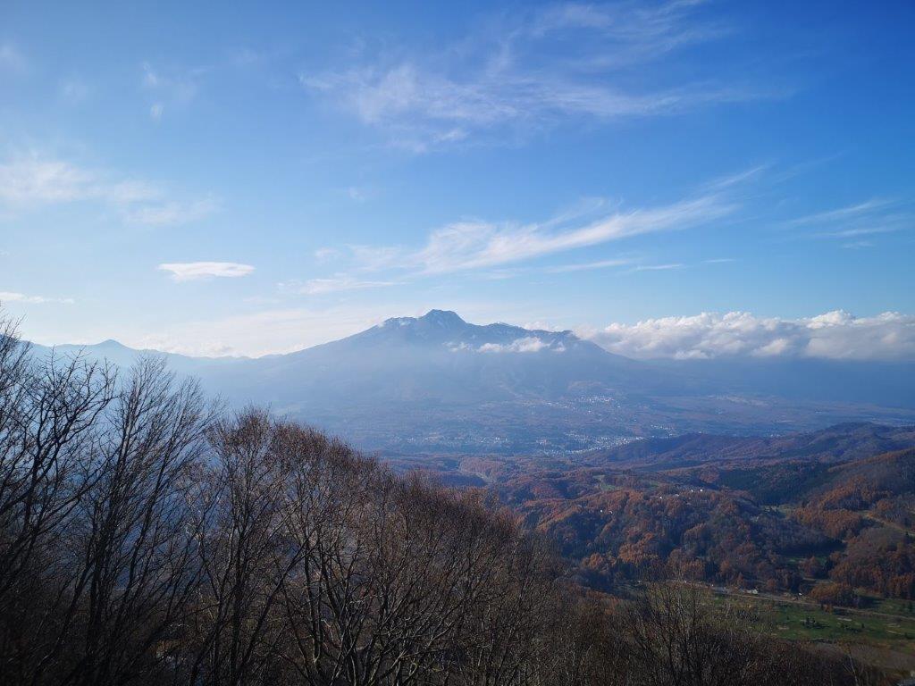
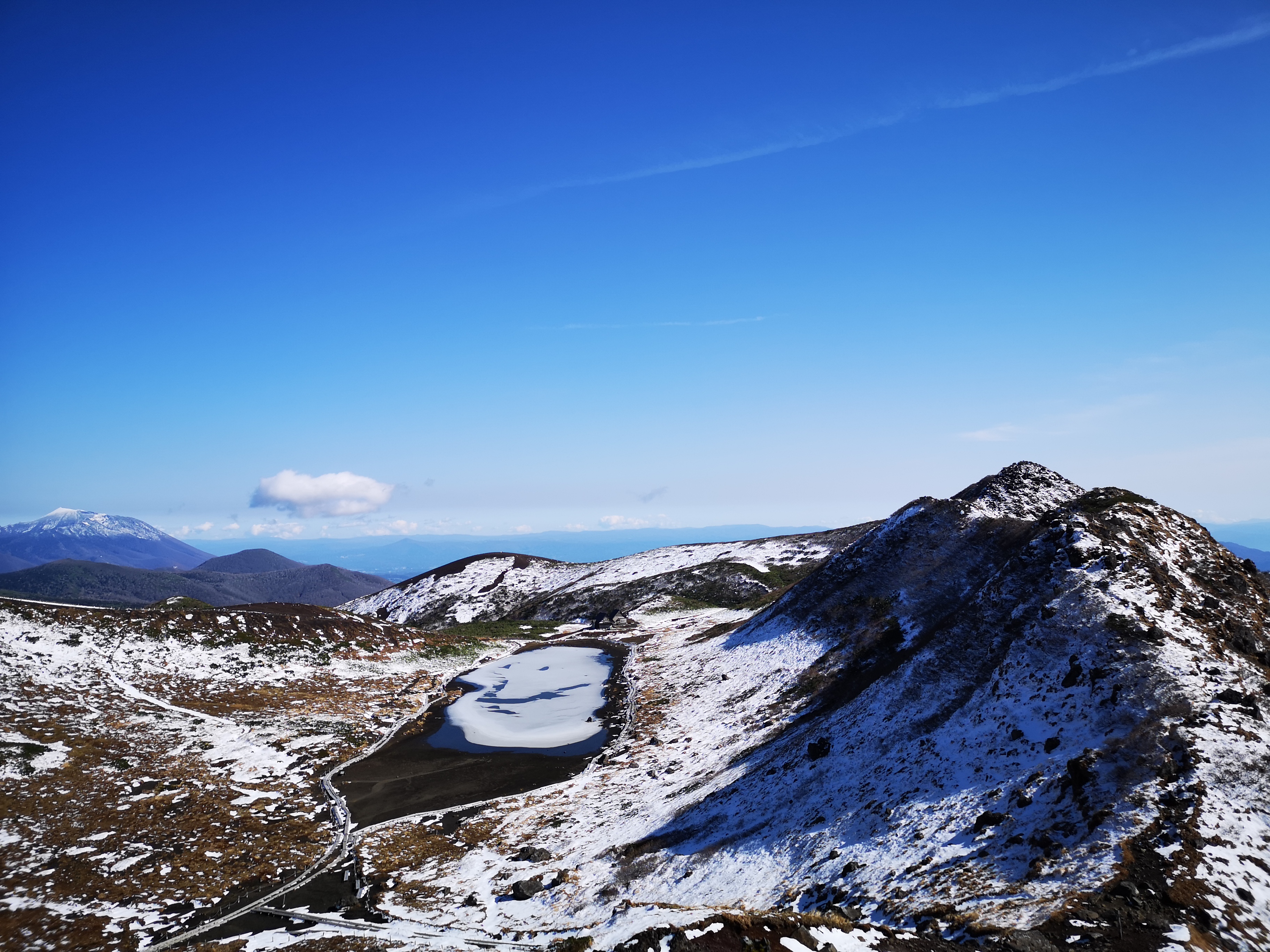
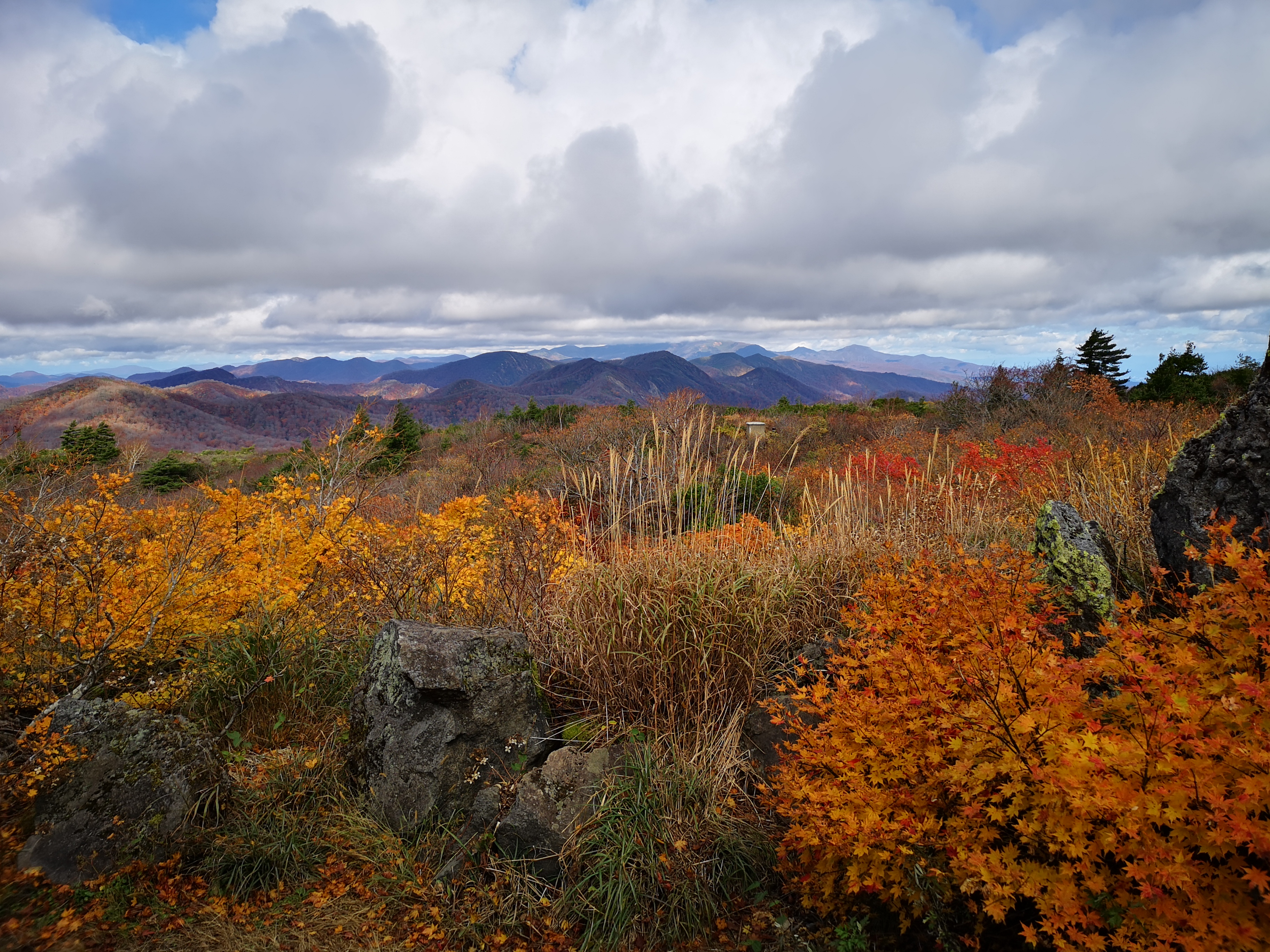
It took me half an hour to reach a small shrine inside a cluster of cedar trees. Right next to it, and bare of trees, was the summit of Mt Karo (鹿狼山 かろうさん karousan). Looking east, I took in the blue immensity of the Pacific ocean; squinting north, I could just make out the Oshika peninsula in Miyagi; gazing south, I could admire the rolling hills of the Abukuma highlands; turning west, I could see the mountains and valleys of Fukushima, but in the distance, Mt Zao was in the clouds. I decided to walk northwards to the end of the trail, and then retrace my steps for a second chance at the view.

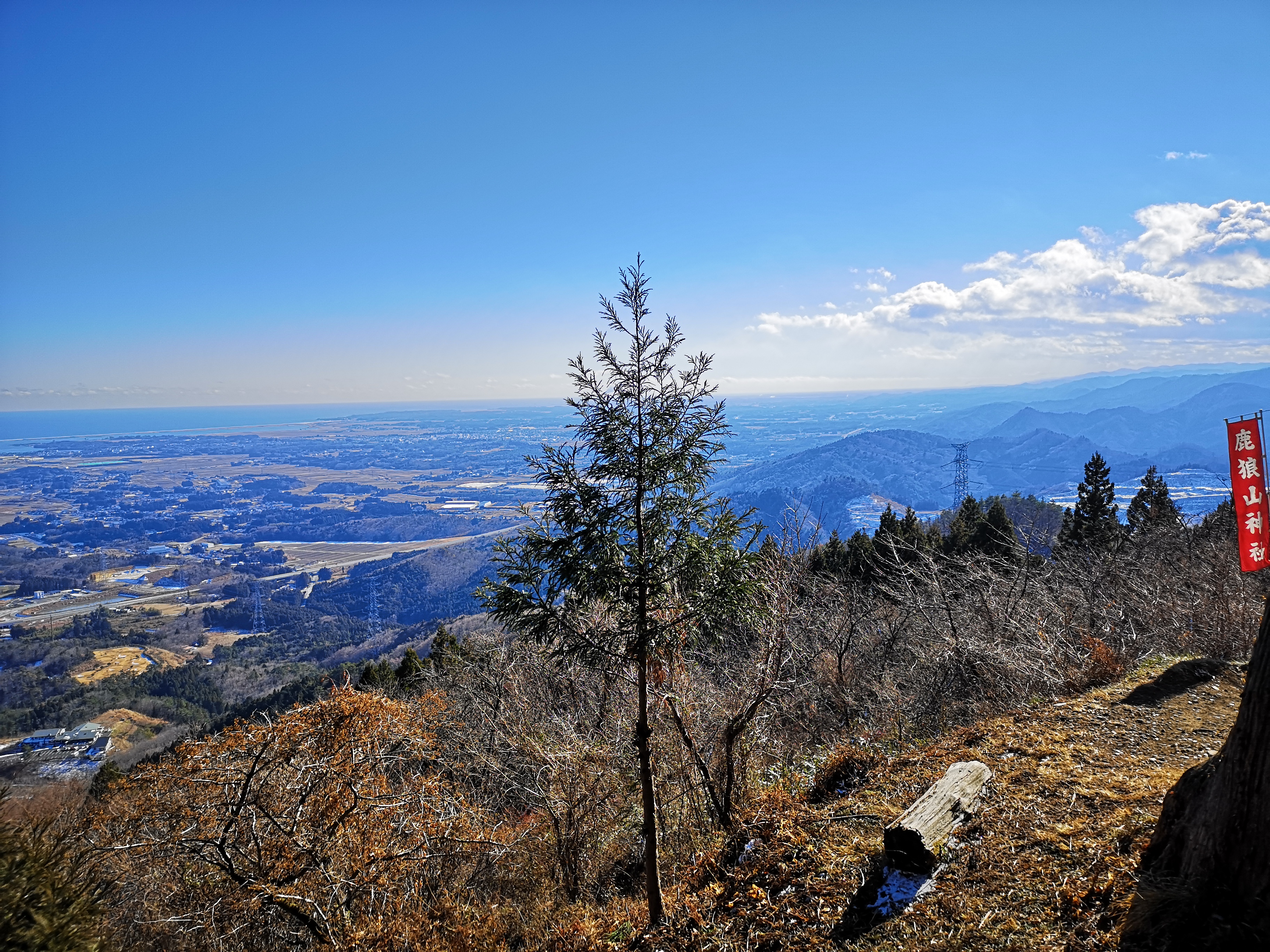
View from the the top of Mt Karo

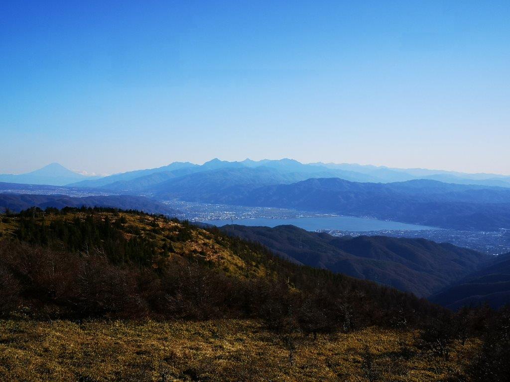
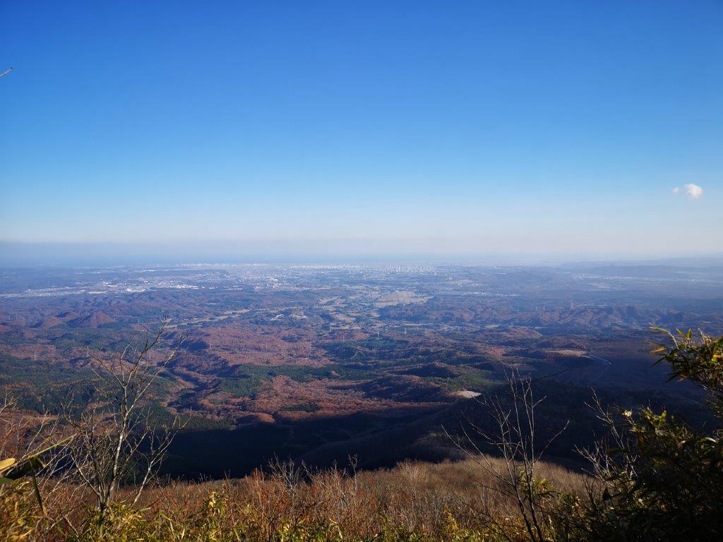
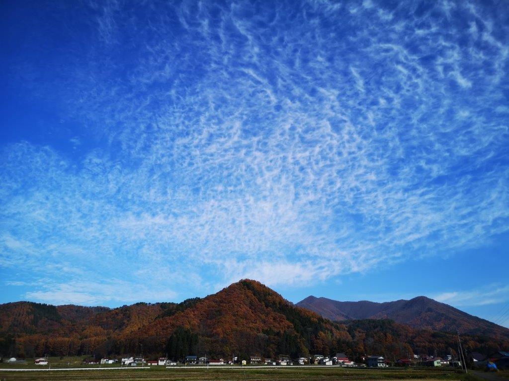
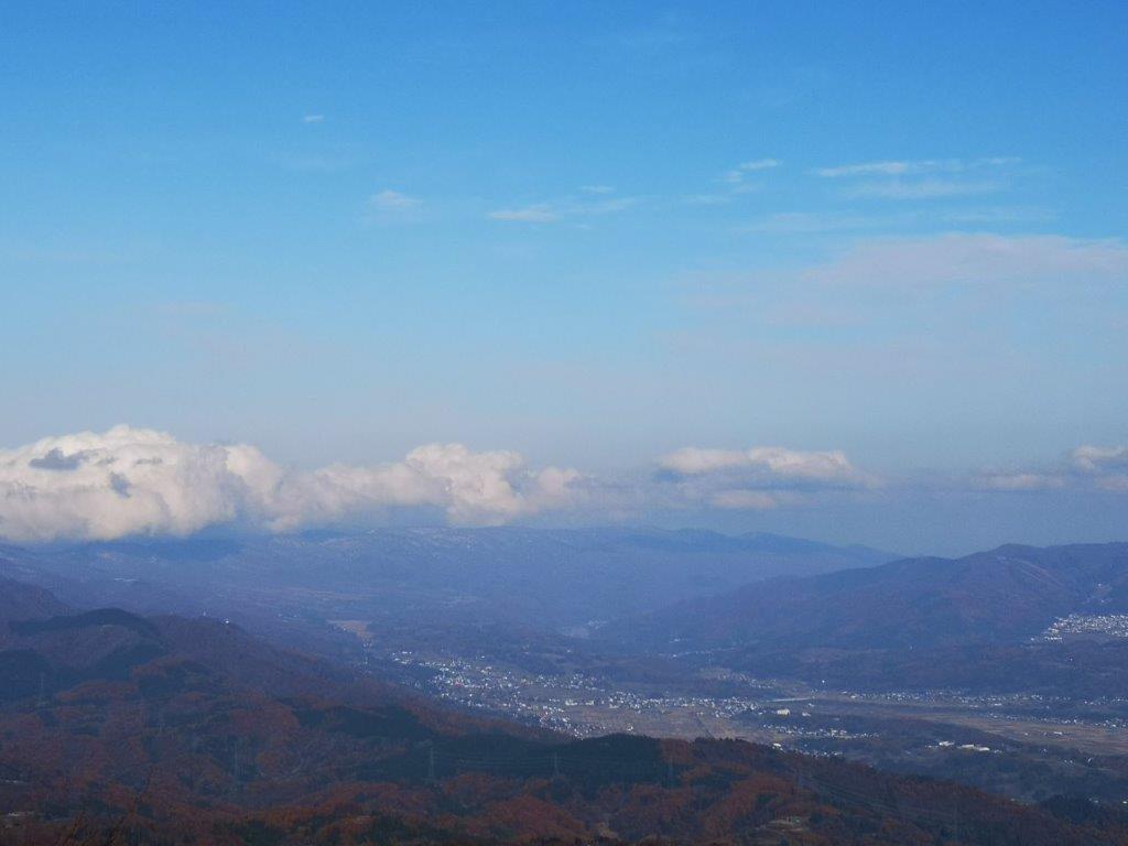
Beautiful weather over the Pacific

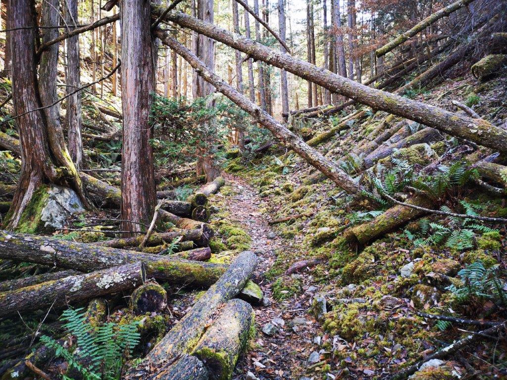
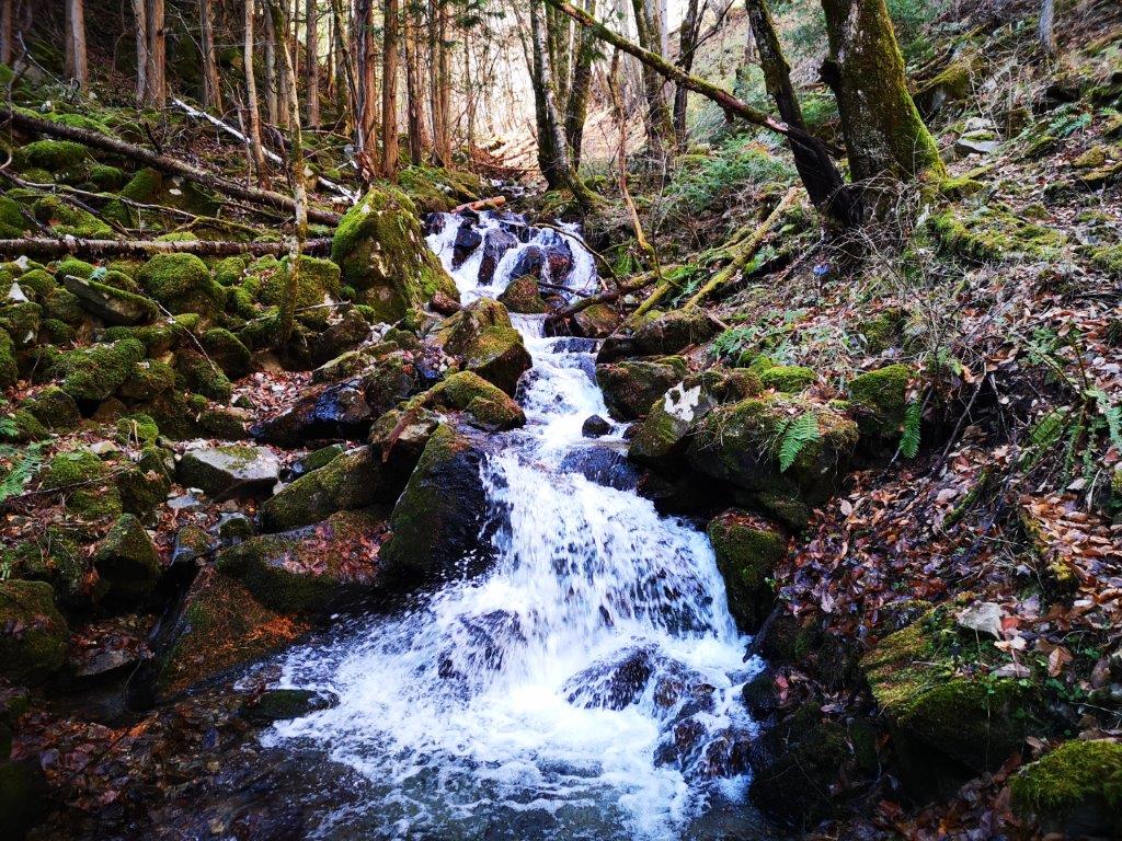
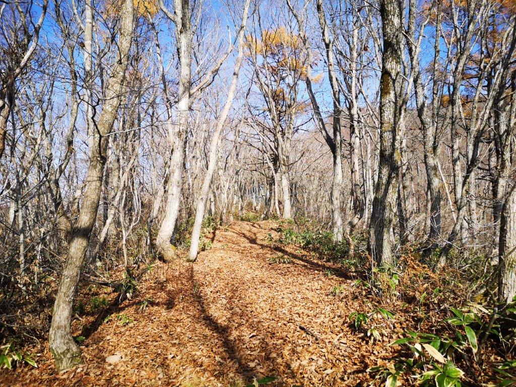
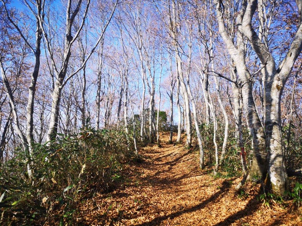
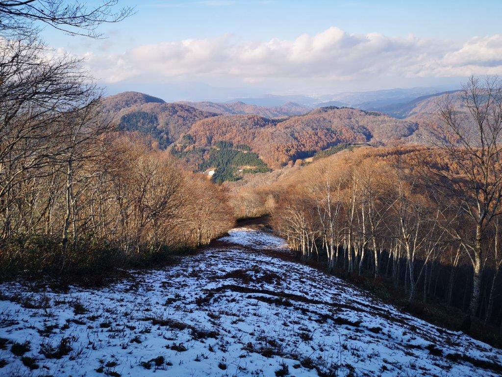
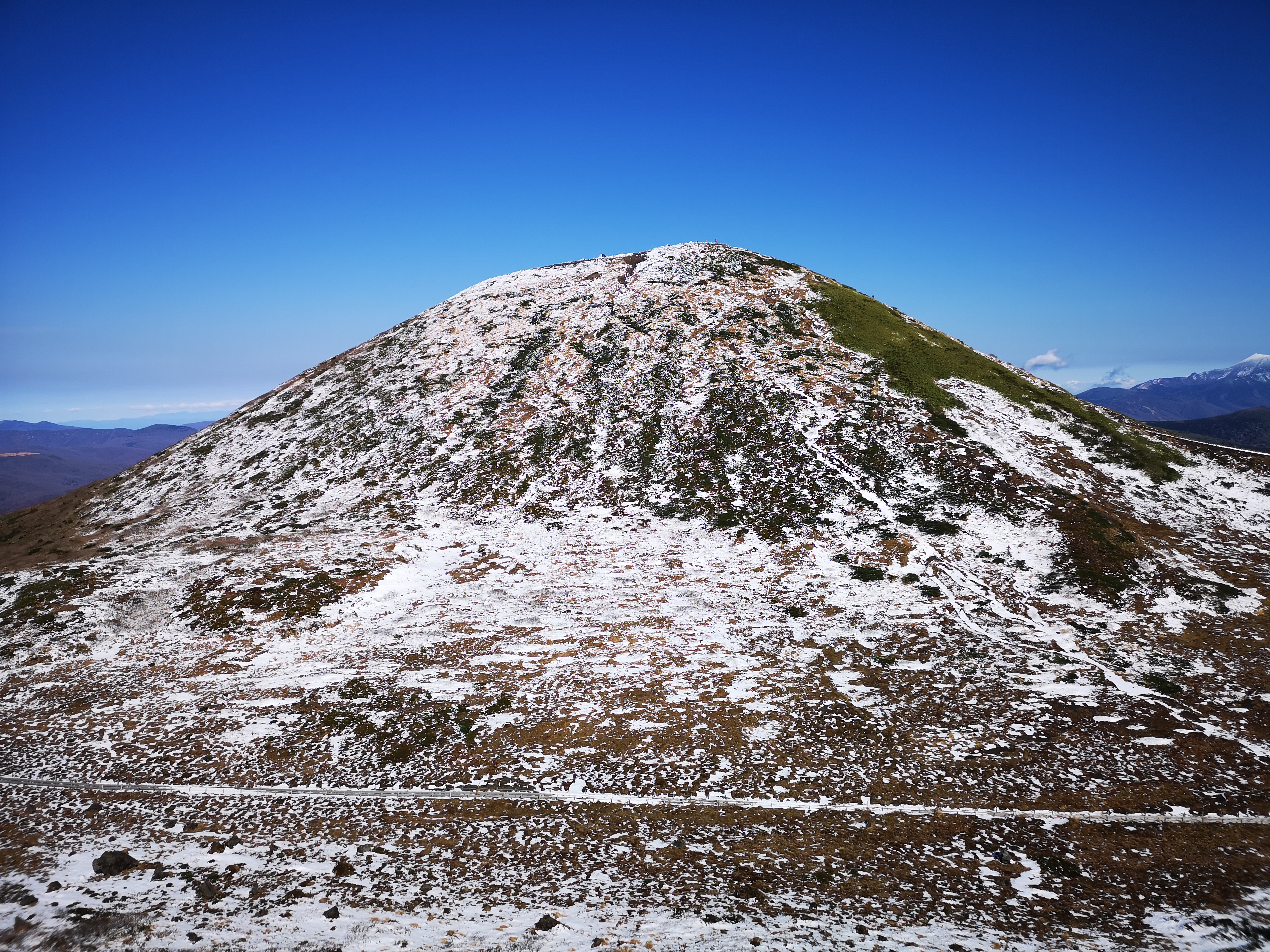
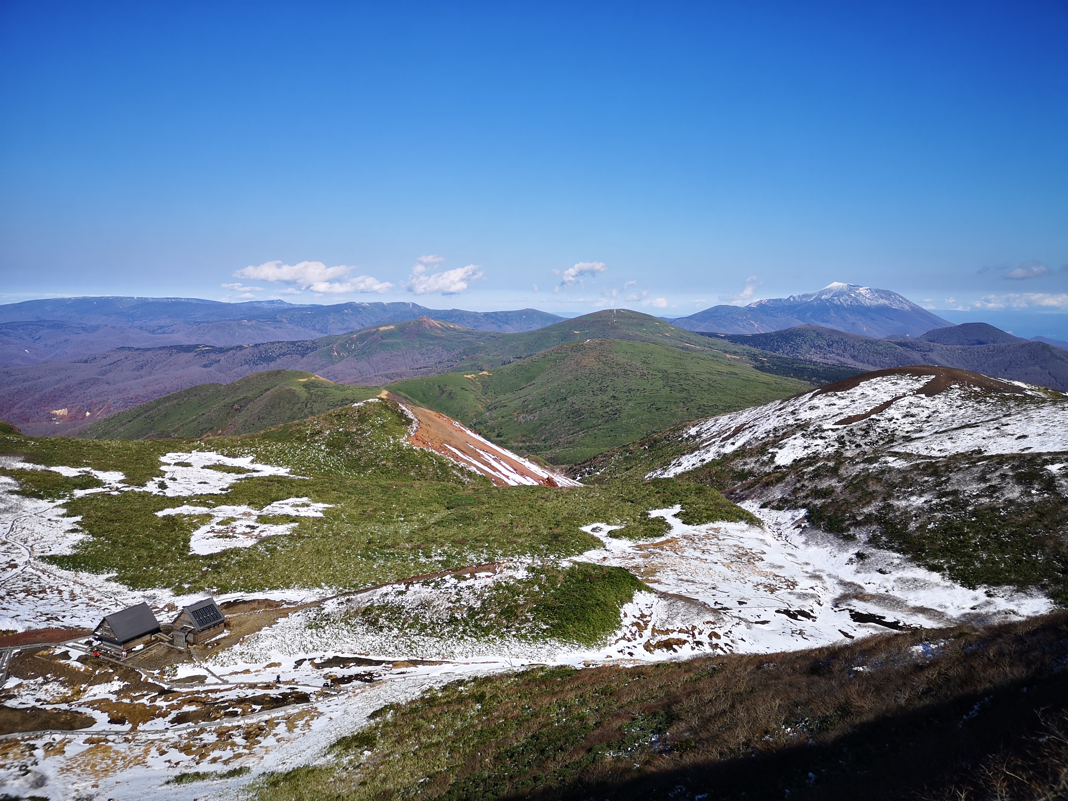
First I had to tackle a steep and slippery staircase covered in snow. The trail then followed the rolling ridgeline as it slowly descended to the coastal plain. The surrounding forest, bare of foliage, was beautiful as the sun shined through unimpeded. It took me 45 minutes to reach the end of the hiking trail at a road crossing. There, I turned around and walked the same way back. Although this trail is called the Zao view route, the only view of Mt Zao was from the summit, which I reached again at 2h30.

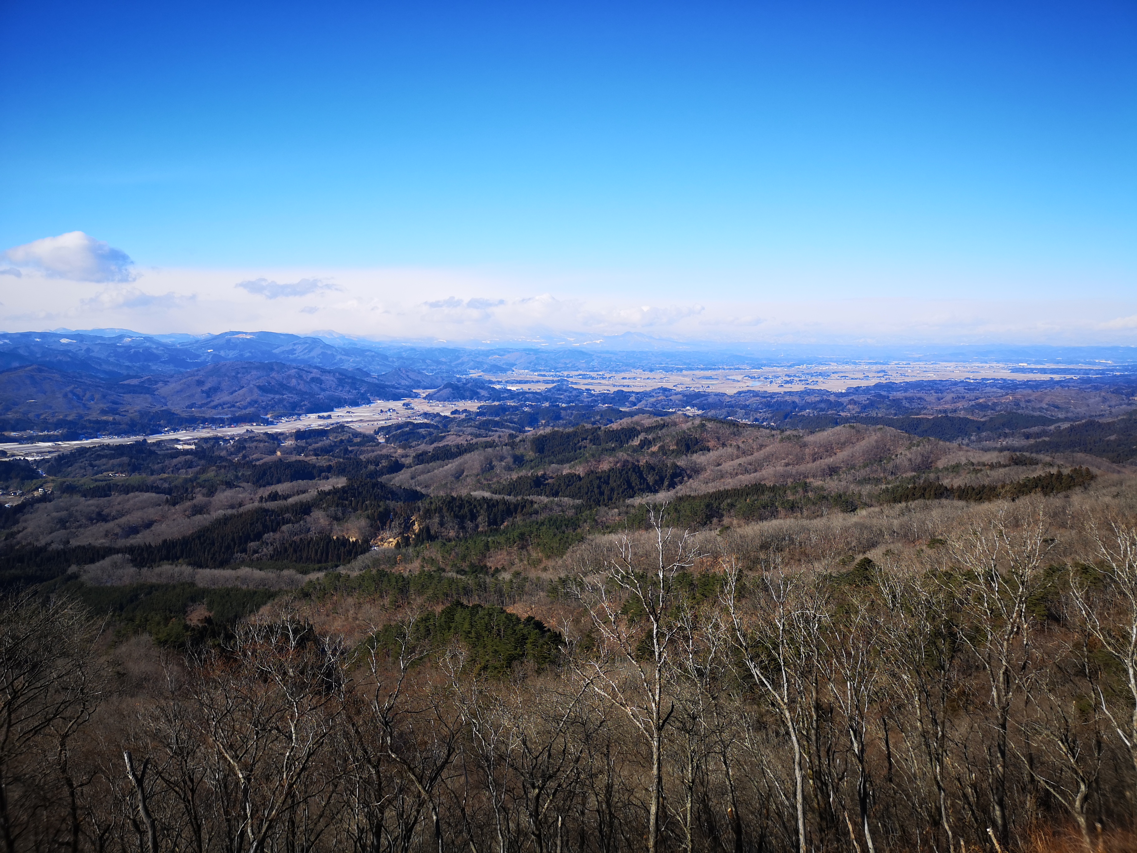
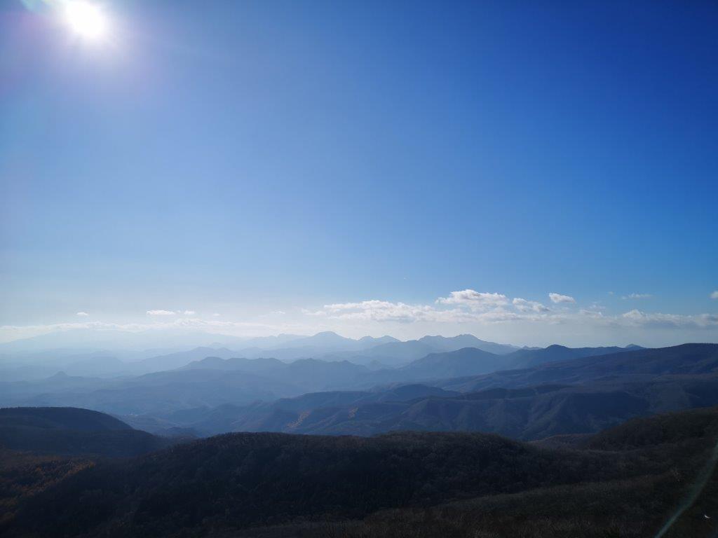
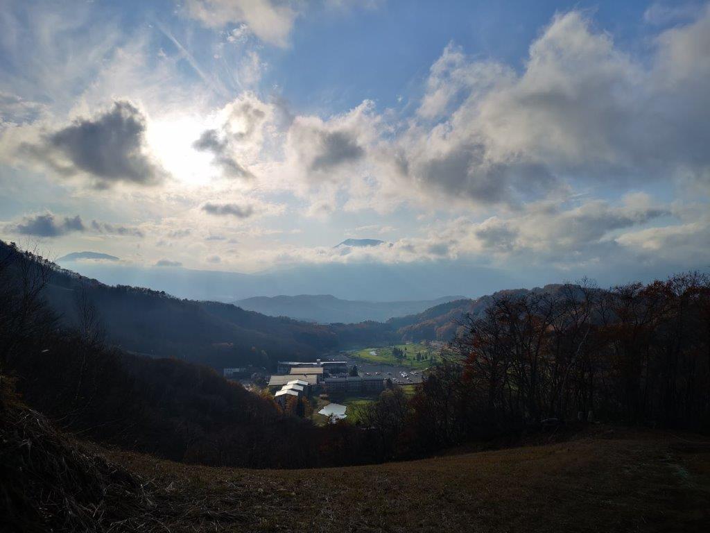
In the back somewhere is Mt Zao

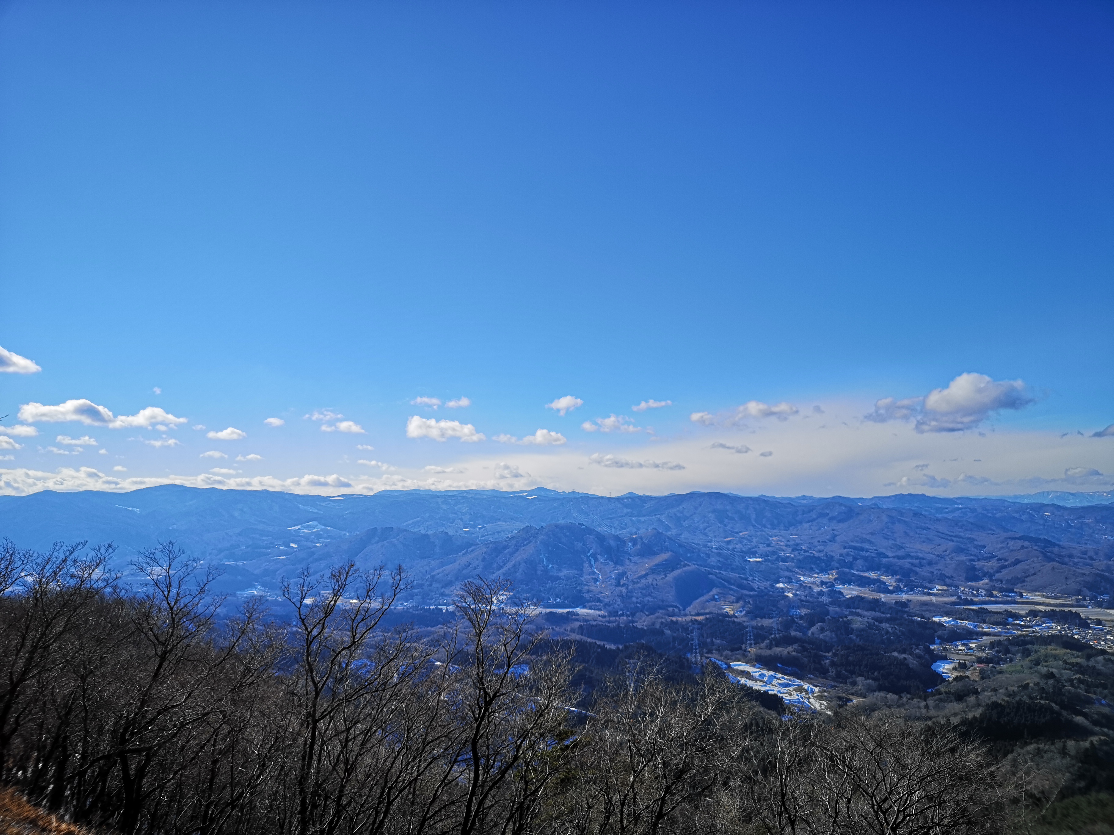
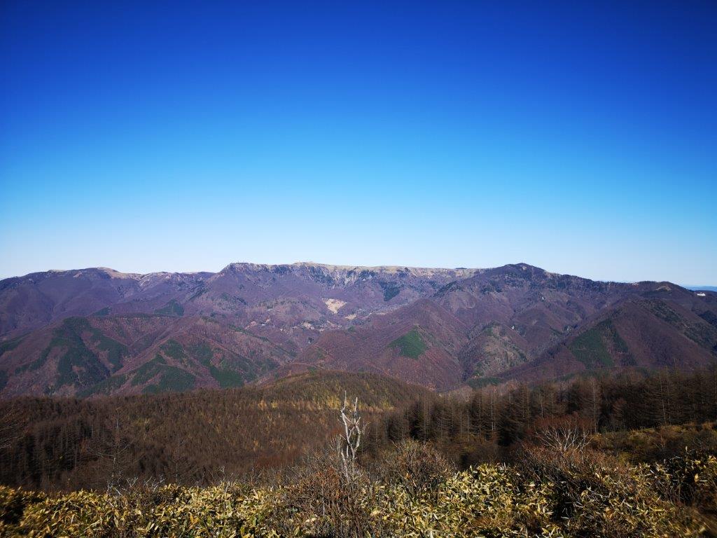
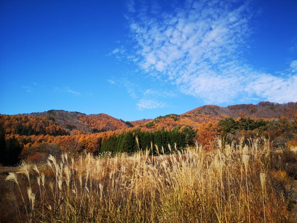
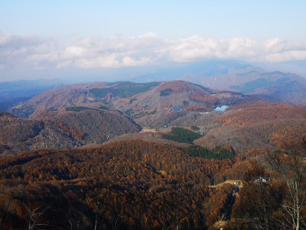
Most of the other mountains were visible

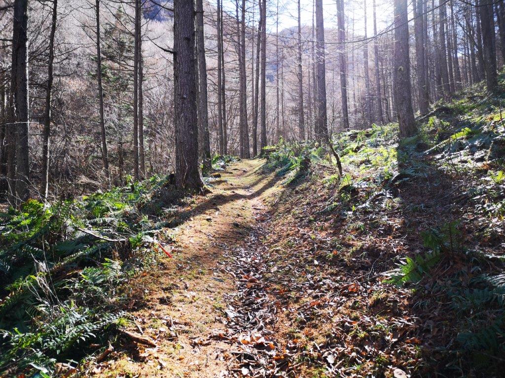
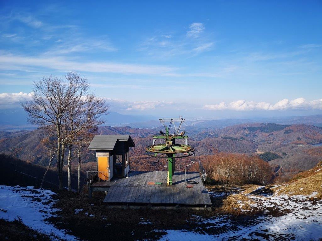
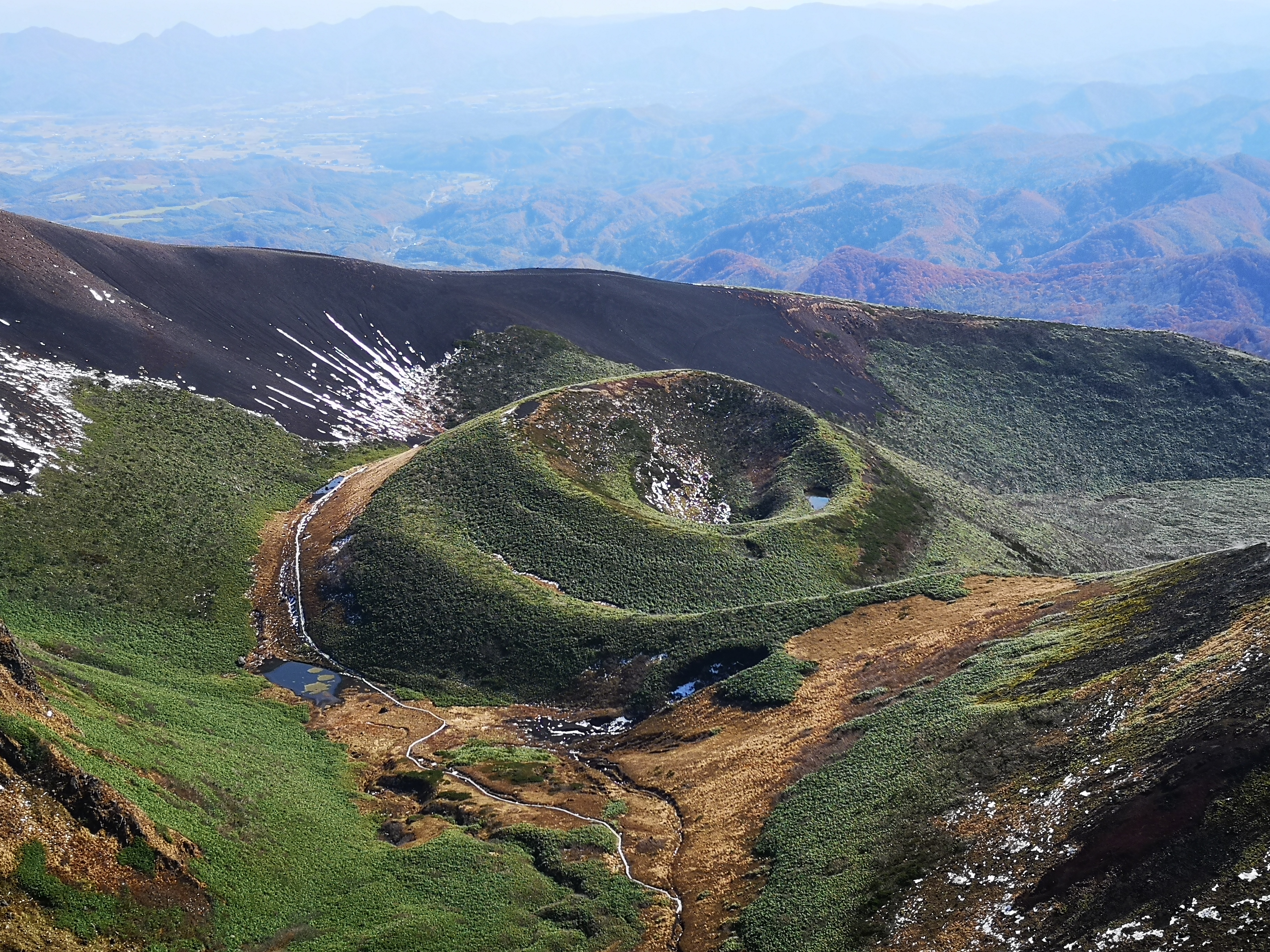
Mt Zao was still stubbornly inside the clouds, so after eating the last part of my lunch, I quickly made my way down the mountain following the “jukai” or “sea of trees” route. It was entirely in the shade and covered in snow. Luckily it wasn’t too steep, but I had to be careful not to slip. The trees next to the path had labels, and this kept me at a safe speed, as I stopped to study their names. At the bottom, I turned right and followed the road for a short while to reach the Karo no Yu onsen.

A tricky descent aided by ropes

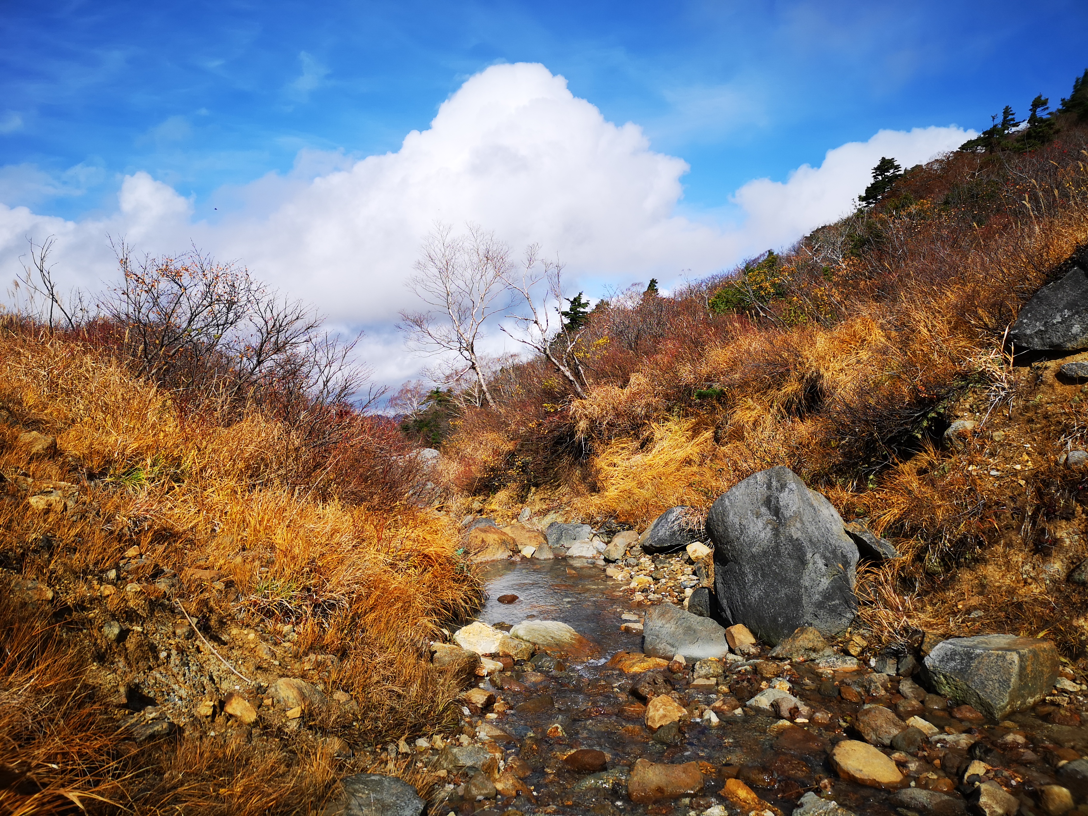
Most of the snow along the ridge had melted

I had an excellent view of the coast from the outdoor bath; the bath itself was tiny and could only fit one person, probably a good thing in these times. I ended up calling a taxi again for the return to Shinchi station since it was already 4 o’clock and a long way back to Tokyo. While waiting for the train, I noticed that the train station was brand new, and reflected on how well the area had recovered so far, after being ravaged by the 2011 Tohoku earthquake and tsunami.

Hiking in Tohoku: Mt Otakine (1192m), Fukushima Prefecture, November 2020

It seemed that north-eastern Japan didn’t share the sunny autumn weather of the Kanto area, as most of the central, mountainous part was continuously engulfed in cold, cloudy weather. I was forced to look southeast for a place with more suitable hiking conditions, and I finally settled on this remote mountain, the highest peak of the Abukuma Plateau (阿武隈高地). It was also an opportunity to ride a new train line, the Ban-Etsuto line (磐越東線). There was no public transport, but since the trailhead was only a short taxi ride away, I felt it wouldn’t be an issue. The weather forecast was sunny but with strong winds. Since this was a relatively low mountain below the tree line, it didn’t worry me either. I was really looking forward to seeing the summit view in an area I had never been to before.

View of the Abukuma Plateau halfway up

I had great views of the Nikko mountains on the shinkansen, thanks to the clear weather over the Kanto area. At Koriyama station, I transferred to the local JR Ban-Etsuto line and arrived at the tiny station of Kanmata at 10:40. The taxi driver wasn’t familiar with the start of the hiking trail; at first he thought I wanted to go to Abunuma Cave (something for another visit), so I ended up giving him directions using Google Maps. At 11:20, I was finally ready to start hiking up the “ishipokke” (石ポッケ) trail. Although it’s a 300-famous mountain of Japan, at times the path was hard to follow; I had to hunt for the “pink ribbons”, small strips of coloured paper attached to tree branches marking the way. Soon I was walking through green bamboo grass among white bare trees under blue skies – quite similar to my recent hike on Mt Izumi. There were no other hikers on the mountain; apparently it isn’t a popular hiking destination in the colder months. Some trees were twisted into fantastic shapes reminding me of the Spooky Old Tree children’s book.

Hiking up through the bamboo grass

One of the “fantastic” trees along the way

The mountainside soon became dotted with boulders, probably the reason behind the name of the trail (“ishi” means stone in Japanese). They had interesting names like “yareyare ishi” (meaning “oh dear! rock”). Around the same time, the wind suddenly picked up and clouds filled the sky. At 12h30, I reached a series of huge rocks taller than the trees. I climbed on top of the biggest one, and nearly got knocked down by the powerful gusts (see video). I was surprised that the wind could be so strong at this low altitude. Staying on all fours, I quickly snapped some photos of the view. Eastwards was the Pacific ocean; stretching southwards, I could see the low mountains of the Abunuma plateau; westwards, Mt Nasu was sitting under big, dark clouds; finally, looking northwards, I could see the highest point of today’s mountain. It was also the location of a Japan Self-defense base, in the shape of a white sphere, like a planetarium. Directly below in the opposite direction, wind turbines were working hard on this windy day. I was glad to see alternative forms of energy taking root in the area.

View from the “pokke” rocks

The Abunuma Plateau

I managed to eat my sandwich before it got blown away, and left as soon as I was done, since the sun was now in the clouds and it was freezing cold. A little after 1pm, I reached the turn-off for “perapera-ishi“(ペラペラ石) which according to my guidebook was worth a look. It took me 15 minutes of mostly level walking to reach a collection of big rocks looking out on the Pacific coast. Dark grey clouds hovered above, and the view wasn’t as great as I had hoped. In the distance, I thought I could see a chimney of the Fukushima Daiichi nuclear power plant just 30 kilometers away, where disaster had struck about 10 years ago. Back then, some people in Tokyo were afraid of Fukushima, but now some people living in places such as Fukushima are afraid of people from Tokyo. I retraced my steps to the main trail, and continued to the nearby summit area.

Skirting the south side of the base

The wind turbines were working hard today

The path didn’t lead directly to the highest point, but first skirted the southern side of the base; on the left was a wide view of the valley. I soon reached another intersection, where I took a level path on the right through the forest. At 2h15, I finally reached a shrine that doubled as the summit marker of Mt Otakine (大滝根山 おおたきねやま otakineyama). Right next to it was the base, surrounded by a fence and blocking the view on the north side (the south side was blocked by trees); although the base looked impressive from a distance, I felt envious that only self-defense soldiers could get a view after climbing the mountain (if they didn’t helicopter up). I made my way back to the intersection where the view was better and sat down in the grass to have the rest of my lunch. This time I was able to enjoy it more, as the sun had come back and the wind was busy blowing somewhere else. Seen from above, the impressive “pokke” rock formation reminded me of Mt Komochi.

Following the power line down the mountain

Golden pampas grass in the afternoon sun

I checked my watch and saw that it was past 2h30. I had to get back to the station in less than two hours, including walking back to the station. The return path followed a clearing made for a power line and electric poles, heading straight down the mountain. It was steep and tough on the knees but the bird’s-eye view was worth it. Lower down, as the slope became less steep, I enjoyed walking among the “suzuki” (Japanese pampas grass), golden in the afternoon sun. It took me about 30 minutes to reach the road at the base of the mountain. From there it was another hour walk to the station. Looking back occasionally, I could see the round white self-defense base shining in the late afternoon sun, the grey “pokke” rocks poking through the winter forest, and the silver wind turbines spinning in the never-tiring wind.

See the strong winds that nearly blew me off my feet on Mt Otakine

Mt Mae-Hachibuse (1836m) & Mt Hachibuse (1928m), Okaya City, Nagano Prefecture, November 2020

This mountain came to my attention quite recently, while watching the anime Yuru-Kyan (Laid-back Camp). One of the characters goes solo camping at Takapotchi Highland (高ボッチ高原), a place in Nagano prefecture I had never heard of before. So I looked it up on my map, and although it didn’t seem to have much hiking potential, the mountain north of it seemed worth a visit; even more since there was an onsen near the start of the trail. The main issue was access, since there was no public transport. In the end, I decided to rent a car, since it was less than an hour drive from Matsumoto. I would need to walk up and down the same way, but I didn’t mind, since the highlight of the hike was the panoramic view of the North Alps from the summit. This meant that I had to make sure to go on a day with clear weather. That day also turned out to have a strong wind forecast, so I mentally prepared myself for being buffeted by winter gusts on the treeless summit.

View towards the North Alps and Utsukushigahara

There was almost no traffic on the way there, which was a relief, since the last part was along a narrow mountain road. I arrived at 11am, and after getting ready, set off at 11h30. Fifteen minutes later, I reached a river and a bridge. I crossed the bridge and followed the river for a short while before climbing up the mountainside through forest. There is a distinct feeling about hiking in Nagano, that is different from the Kanto area. The forest feels wild and untouched; there is moss everywhere growing on rocks and fallen trees, probably because of the colder, wetter weather. The sun was shining, and although the autumn leaves season was already over, the surrounding forest was still beautiful. At this late hour, I was the only person on the trail.

Start of the hike through a mossy forest

Late morning sunny hiking

The trail met up with the river again about twenty minutes later and followed it for the next hour. It might have taken me less time, except that the river was so beautiful in the sunlight that I spent a lot of time taking photos and shooting movies. It was probably one of the most beautiful river walks I had ever done, almost rivaling Tokuwa river valley from a few weeks before. I could only imagine how beautiful it was in the spring or autumn. Around 1pm, the path and river finally parted ways. I walked as fast as I could to make up for lost time, as the path now zigzagged up the side of the mountain.

Lots of great river views on the way up

The perfect hike for river lovers

I had my first views of Utsukushigara Highland (美ヶ原高原) About half an hour later, rising above the trees. I also got blasted with an icy cold wind forcing me to stop and add a layer of clothing. A few meters further, I got the view I had come for: the entire range of the North Alps, also known as the spine of Japan, stretching south to north, from Mt Hotaka, all the way to Mt Shirouma. It sometimes seems exaggerated to compare the Japan Alps with the Swiss Alps; today, however, the appellation was justified, as the entire range was crowned in snow. I had seen this view before, but from further away, and this might be the best view one can get of the North Alps.

The northern half of the North Alps

Utsukushigahara, one of the hundred famous mountains of Japan

Just before 2pm, I reached a crossroads. I turned right and a few minutes later I was standing on top of Mt Mae-Hachibuse (前鉢伏山 まえはちぶせやま maehachibuseyama). The wind wasn’t too strong here, so I decided to have lunch. I then retraced my steps to the intersection, and walked up a wide gravel path with sweeping views of the whole area. Shortly afterwards, I reached the summit of Mt Hachibuse (鉢伏山 はちぶせやま hachibuseyama), a 300-famous mountain of Japan. On the other side, there was a tiny shrine and a shinto gate, which looked quite spectacular with the North Alps in the background. There was also a small observation tower, which seemed quite pointless seeing that there were no trees around to obscure the view. Nonetheless, I climbed the ladder to the top.

Shinto shrine near the top of Mt Hachibuse

Observation tower near the top of Mt Hachibuse

Just as I stood on the top, the wind suddenly picked up. I had a great view of Yatsugatake, Mt Fuji, Suwa lake, the Central Alps, the South Alps, as well as the North Alps. As I was filming the view, my smartphone nearly got blown out of my hands. It was getting cold and it was already past 3pm. I decided to quickly head back. Although I had no bus to catch, I preferred to avoid driving in the dark along narrow mountain roads. I was back at my car 90 minutes later, and after a nice soak at Hinoki no Yu, I was driving back to Matsumoto city, where I caught the Chuo limited express for the 2h40 train ride back to Tokyo.

Mt Fuji, the South Alps and Suwa lake

Check out the river running down the slopes of Mt Hachibuse

See the view of the North Alps from the top of Mt Hachibuse

Hiking in Tohoku: Mt Izumigadake (1175m), Miyagi Prefecture, November 2020

For my next trip using the JR East Welcome Rail Pass 2020 I decided to head back to Tohoku, but not so far north this time, since I wanted to have a snow-free hike. It seemed that it had snowed on this mountain earlier in the month, but it had mostly melted by now. I packed my light crampons just in case. The weather forecast was sunny, but very windy, not suitable conditions for hiking according to the mountain weather website I use. I decided to risk it anyway. Another concern was getting there. After a 90-minute shinkansen ride to Sendai city, 300km from Tokyo, I would have to navigate the Sendai subway to get to the bus stop – I hadn’t even known that Sendai city had a subway! Hopefully, it would be less complicated that the Tokyo one. Finally, since it was apparently a popular hiking destination, a kind of Mt Takao for Miyagi prefecture (it even has a chairlift), there were many trails up the mountain, so I had to figure out the best route to take. In the end, I choose the Suijin trail up (水神コース) and a combination of the Kakko and Kamoshika trails down, since they seemed to have the best views.

The summit of Mt Izumi from Okanuma

Navigating the Sendai subway turned out to be fairly easy. A kind Sendaian(?) pointed me to the correct platform for the bus. I was first in line but the bus turned out to be surprisingly empty. I arrived at the the huge parking lot at the base of the mountain around 11h30. There were quite a few other hikers on the trail, enjoying the fine weather, and trying to catch the last of the autumn colours. Fortunately, the Suijin trail was wide and rocky. I walked quickly as the path climbed gradually through a forest of leafless trees. There were no views; however, the contrast of pale tree trunks against the blue sky was stunning.

Going up the Suijin trail

Contrast of bare trees and blue sky

At 1pm, I reached an open space and the first views, as well as strong gusts of wind! After putting on an extra layer, I was able to enjoy the view; to the east was the flat coastal plain with Sendai city in the center; to the West I could see Mt Funagata with patches of snow on the top; stretching southwards was the mountainous area on the border of Miyagi and Yamagata prefectures. Visibility was excellent today. I was able to make out the Ide and Asahi mountain ranges, as well as Mt Zao. It took me just a few more minutes to reach the highest point of Mt Izumi (泉ヶ岳 いずみがだけ izumigadake), a 300-famous mountain of Japan.

On the right, Mt Funagata

The view towards Mt Zao

The flat wide summit was completely in the trees. There was no wind but also no views. I walked five minutes westwards towards the next peak, Mt Kita-Izumi, and found a spot with a view and without too much wind, perfect for lunch. At 2pm, I was ready to descend. I seemed to be the last person left on the mountain. The wind had completely disappeared, and the conditions were perfect for hiking. At first, I had great views east towards Sendai city. Then the path curved westwards around the mountain-side and entered the forest. Half an hour later, I reached an open space. Turning around, I had a good view of the rounded summit I had just come down from. I continued along the now level path, and soon reached a junction. Here, I turned left and headed towards the Kamoshika trail.

In the distance, Sendai city

Lots of mountains to climb

At 3pm, I reached Okanuma (岡沼), a wide open space with Japanese pampa grass, called suzuki in Japanese. Looking back, I had some more good views of the summit in the late autumn sun. After a short climb and descent, I reached another open space called Usagidaira (兎平 meaning rabbit plain) with pampas grass and isolated groups of birch trees. There was no-one around; I was definitely the last person left on the mountain. I reached the final descent which was very steep and followed a ski run (this mountain is also a ski resort in the winter). The view of the mountains west and south in the late afternoon sun was fantastic. I descended as quickly as my knees would allow, and reached the bottom of the mountain at 4pm, only 5 minutes before the departure of the return bus. At 5pm, I was back on the Sendai subway, and at 6pm I was on the shinkansen back to Tokyo.

Miyagi mountains in the late afternoon sun 

See the wind blowing through “Suzuki”

Mt Madarao (1382m), Shinano Town, Nagano Prefecture, November 2020

I first spotted this mountain while hiking Mt Kurohime the previous year. I knew about it as a ski resort, so I thought I would do some skiing there in the winter. However, there was little snow last season, and I ended up not going. So I decided to use the JR East Welcome Rail Pass 2020 to go to Nagano, and climb it before it the snow arrived. The best approach seemed to be to walk from the train station to the start of the trail, and finish at Tangram hot spring on the other side. From there, I could catch a bus back .It wasn’t a long hike so I would have plenty of time for a hot bath. The weather forecast was good: sunny in the morning, cloudy in the afternoon. It was supposed to snow the next day – good news, since I still hoped to ski there this winter.

Nojiri lake with Mt Izuna on the left, and Mt Kurohime on the right

I was the only passenger who got off at the tiny Furuma station at 10am. The weather was clear, with just some wisps of white clouds on a blue background, a sure sign that rain or snow was on the way. I could clearly see the mountains of the Myoko-Togakushi-Renzan National Park to the west. I would be hiking just outside that park today, as its outer limit only stretched as far as the nearby Nojiri lake. The one-hour walk to the start of the trail was pleasant, following small roads through harvested fields, with good views of today’s mountain, the base of which was still a fiery red orange colour.

Cirrus clouds with Mt Madarao behind on the right

Autumn colours at the base of the mountains

Fifteen minutes later, I was in the midst of the autumn larch trees. Looking up at the orange tree crowns against the blue sky, I had the feeling of being inside the world of the Lorax from the Dr Seuss book. A little later, I even came across a hairy caterpillar that could have featured in one of his books (see video). Around noon, the path started to climb gently, and half an hour later I reached the top of the ridge. The surrounding trees were now bare of leaves, but the branches were still thick enough to hide the view.

Larch trees in the autumn

Straight out of a Dr Seuss book

At 1pm, I reached a superb viewpoint of lake Nojiri with the peaks of Togakushi Highland rising up directly behind. This was the top of the minor peak of Mt Daimyojin (1360m 大明神岳). I sat down for lunch with a view, and then continued a few more minutes to the highest point of Mt Madarao (斑尾山 まだらおやま Madarao-yama), a 300-famous mountain of Japan. The summit was mostly in the trees, except the north-east side, through which I could see the Nozawa-Onsen ski resort, across the valley less than 20 kilometers away. Behind, I could see the snowy summit of Mt Hakkai.

Easy hiking most of the way up

On the summit ridge, it’s already winter

I was surprised to see snow on the next part of the trail, as it turned north along the summit ridge. Apparently, there had been a snowstorm in the past few days. I hadn’t taken my crampons but I soon realised that the snow was soft and wet. I proceeded cautiously as the trail went down a steep slope. I soon reached a sunny flat section, and I was able to relax again. On the right, I got good views of Shiga Kogen, and Mt Kosha, a mountain I hope to climb one day. At 2 pm, I reached the turn-off for Madarao village. This wasn’t the way I had chosen to go down, but I decided to have a quick look.

Mt Kosha with Shiga Kogen behind

Highest point of the Madarao ski resport

I arrived at another great viewpoint, a few meters further, next to the top of a chairlift. I was glad I had chosen to check it out. I sat at the edge of the landing platform – I didn’t quite dare sit on one of the chairs – and had the rest of my lunch. To the north, a low mountain range straddled the border of Nagano and Niigata prefectures. The Shin-Etsu trail follows the top ridge and I hope to hike that section one day (part of today’s hike was also along it). Looking east, I could make out the majestic top of Mt Myoko above the trees.

The Shin-Etsu trail passes just under the clouds

Looking north towards Niigata prefecture

Back on the main trail, I soon reached a 360 degree viewpoint after some more downhill, combining all previous views. After snapping the necessary photos, I set off again, and ten minutes later, I arrived at another chairlift with more good views of Mt Myoko. It was now against the sun with a thin line of clouds in front, creating a dramatic appearance, like the entrance to a mysterious mountain kingdom. At this point, I had two options for reaching the hot spring, my final destination. Even though, I wasn’t behind schedule, I chose the most direct route, since I couldn’t afford to miss the bus back.

Mt Myoko is one of the 100-famous mountains of Japan

Mt Myoko also has a ski resort famous for getting lots of snow

The direct way followed a steep ski slope, probably a black run. There was also some snow here, but the hiking path zigzagged instead of going straight, so I was able to descend safely. The next part followed what seemed to be a blue run, wide and almost flat. At 15:15, I reached a road on the border with Niigata. The trail continued on the other side, but here I turned and followed the road to nearby the Tangram onsen. By now, the clouds had rolled in, and I could no longer see the top of the mountain I had just come down; it felt like it could start snowing at any moment. After a nice hot bath, I boarded the last mini-bus for Kurohime station. There, I took the Kita-Shinano line to Nagano station and then switched to the Shinkansen for the 90-minute trip back to Tokyo.

Zigzagging down the ski slope

Tangram Onsen with the top of Mt Myoko in the background

See the view from the top and the base of Mt Madarao

Hiking in Tohoku: Mt Akita-Komagatake (1637m), Akita Prefecture, October 2020 [Map Available]

For my second hike using the JR East Welcome Rail Pass 2020, I decided to venture further North. My first trip took me to the border of Akita prefecture; this time I would be completely inside. As before, I had to leave with the very first shinkansen to get to Tazawako station, 450 kilometers from Tokyo, in time for the bus to the 8th station. The weather was supposed to be sunny and warm for late October. As before, I got a detailed route description from Wes Lang’s hiking in Japan website. I only had one concern: according to online reports, there was a thin layer of snow on the summit. Just in case, I decided to bring some light crampons; I wouldn’t want to have to turn back on my first real hike in Akita!

Hiking in the Towada-Hachimantai National Park 十和田八幡平国立公園

Download a map of the Mt Akita-Komagatake hike

This map was developed for Japanwilds with the Hokkaido Cartographer

Find more Japan hiking maps on Avenza

While getting ready near the start of the trail at Hachigome (八合目 1300m), I was able to admire the snow-covered peaks of this still active volcano. The snow didn’t extend down to the parking lot 300 meters below, and didn’t seem very thick. Autumn blues skies extending in every direction made me feel optimistic about today’s hike. As long as the snow wasn’t too deep, I wouldn’t have too worry.

Looking down at Nyuto Onsen

I set off at 9h30 up a gently sloping path circling the base of the first peak. The mountains of Akita, coloured red brown at the end of the autumn season, spread out to the west. As I progressed, the view gradually extended southwards. Soon, I was able to see Tazawa lake, and even Mt Chokai in the far distance. It felt great to be hiking on such a beautiful day inside the Towada-Hachimantai National Park.

Lake Tazawa, Japan’s deepest lake

It took me 45 minutes to reach the first snow on the saddle between the two highest peaks. I made my way along a wooden walkway, next to a frozen lake, till I reached the Hachigome hut (八合目小屋). There, I turned left for the final climb, up a wooden staircase. Less than 30 minutes after reaching the saddle, I was at the top of Mt Oname (男女岳 the name combines the characters for man and women), the highest point of Mt Akita-Komagatake (秋田駒ヶ岳), the highest peak of Akita prefecture and a 200-famous mountain of Japan.

The wooden walkway near the top of Mt Akita-Koma

After taking in the fantastic 360 degree views from the summit, including Mt Iwate to the North, I went back down the same way I had come up. At the hut, I took the path on the opposite side of the lake, and after a few minutes, I reached the turn-off on the left for my next peak. A few minutes of tough climbing along a snowy slope brought me to the ridge, where I turned right. It was nearly 11h30 and, despite the snow, it was starting to get quite warm.

The semi-frozen volcanic crater lake with Mt Iwate in the background

Fortunately the snow was soft in the late morning sun, and no crampons were needed for the narrow rocky path along the top ridge. I reached the small snow-covered shrine at the top of Mt Odake (女岳 using only the character for woman here) around 11h30 with a great view of Tazawa lake. There was almost no wind, and it felt quite pleasant in the autumn sun, so I took short break for lunch.

The path between Mt Odake and Mt Yoko

Since I had completed the first part of the hike on schedule, I decided to take the longer route, following the crater ridge counter-clockwise. This section was narrower and rockier, and few hikers had chosen to take this route. Fortunately, the thin layer of snow wasn’t an issue, and the views looking back to Mt Oname were spectacular. So far, this was a very enjoyable hike, even with the thin layer of snow.

Mt Oname, the highest-point of Mt Akita-koma

After passing several small peaks, I finally reached Mt Yoko (横岳) at 12h30, where I had a good view of the central plain of Iwate prefecture to the east. It was starting to get quite warm, and I felt that I had been wrong to worry about the snow. I had the rest of my lunch and set off in good spirits.

Mini-crater on the southern side of the volcano

It only took me a few minutes to reach the next peak, the flat rounded top of Yakemori (焼森), from where I had a breath-taking view of Mt Akita-Komagatake. I’m surprised it isn’t part of the hundred famous mountains of Japan. I spent some time enjoying the panoramic views. There was path going directly back to Hachigome, but I decided to continue straight, and take the longer route back since it was still early.

Looking North towards the Towada-Hachimantai National Park

Suddenly I was walking in deep snow (see video). It had snowed a lot more on this side, probably because it was facing Northwards. It was soft, so I could run down through it. However, I soon had another problem. This part of the trail was overgrown with bamboo grass! I had to fray a passage through it and at times the bamboo was higher than my head. I started to wonder whether I had made a mistake taking the longer way.

Mt Akita-Koma in the afternoon

Eventually the path leveled and then started to climb again. The snow had disappeared but the path was muddy and slippery. At 1h30 I reached the top of Mt Sasamori (笹森山 meaning bamboo forest, a well-deserved name!). I was pretty exhausted after fighting through the bamboo, and then having to keep my balance on the treacherous trail. After a short break, I continued on my loop hike, now heading downhill and westwards.

Mt Akita-Koma in the autumn

After a short up and down, I was standing on top of Mt Yumori (湯森山) at 2pm, the last of today’s peaks. After gazing at the mountains of Akita one last time, I set off on the final descent towards the parking lot at Hachigome. It followed a staircase in bad need of maintenance. At 2h30 I was finally back at my starting point. On the way back, I stopped by at the Arupa Komakusa hot spring which had perhaps one of the best views I’ve ever had from an outdoor bath.

After-hike soak with a spectacular view

Hiking on the highest peak of Akita Prefecture

Akita-Komagatake throughout the year (drone footage) by Go North Japan

Hiking in Tohoku: Mt Kurikoma (1626m), Miyagi Prefecture, October 2020

On October 16th, JR East introduced the JR East Welcome Rail Pass 2020. For just 12000 yen, I could travel for 3 consecutive days in Kanto, Nagano, Niigata and the whole of Tohoku, including the use of the shinkansen. My first thought was: “How many mountains can I climb thanks to this?” The second was: “Can I do them as day trips from Tokyo?” Up to now I had been mostly limited to the Kanto area, but now, thanks to the shinkansen, my strike zone had been considerably expanded. For this first mountain, I had to leave Tokyo before 6am to catch the 9am bus from Ichinoseki station on the Tohoku shinkansen line, nearly 400 kilometers North of Tokyo. I had 6 hours to complete the hike, which seemed more than enough. I would even have time for a hot bath at Sukawa Onsen (須川温泉) near the start of the hiking trail. I didn’t have a hiking guide book for Miyagi prefecture, so I relied on Wes Lang’s description of the route. The weather forecast seemed good: some clouds, some sun, and most importantly, no rain. I was ready for my first hike in Miyagi prefecture.

Crossing Nagorigahara Marsh

Sukawa Onsen’s big rotemburo

There was some construction going on in front of the bus stop at Ichinoseki station, and I wasn’t sure where to stand in line for the bus. In the end, there was just one other passenger, also a hiker, so there was ample seating space for the ninety-minute trip. The ride from the valley up to Sukawa Onsen at 1100 meters was spectacular: even though the clouds were in, the autumn colours were still at their peak. After getting off the bus at 10:30, I had a quick look around in the visitor center, which would certainly be closed by the time I finished my hike. They had an interesting collection of stuffed wildlife, including several bears. Directly opposite was an outdoor bath, one option for the after-hike soak. Just beyond, a hot water stream rushed down the mountain side, creating puffs of steam (see video), reminding me that today’s mountain was also an active volcano.

Autumn colours were still at their peak

One of the several streams on the mountain

I reached the start of the hiking path at the top of some stone steps, and very soon I had some good views of the mountainous area to the North. This time, I was inside the Kurikoma Quasi-National Park (栗駒国定公園) and it seemed very wild and devoid of human activity. Around 11h30, I arrived at Nagorigahara marsh (名残ヶ原), crossed via a wooden walkway like in the Oze marshlands. The weather continued to be mostly overcast, with occasional sunny spells, and I was worried that the summit would be in the clouds. I passed the junction for the most direct route up to the summit, currently closed due to high levels of volcanic gas. I was now back on a muddy hiking trail. After crossing several streams, the trail started to climb. Soon I was above the trees, and there were good views north and east.

Path leading down to Kurikoma highland in Miyagi

View North towards Iwate

Around 12h30, I reached the final climb to the summit. There were patches of snow here and there, but none on the trail itself, which was a relief, since I hadn’t brought crampons. At 1pm, I was standing on the top of Mt Kurikoma (栗駒山 くりこまやま kurikomayama), one of the 200-famous mountains of Japan. I was surprised to see several other hikers; apparently the trail on the other side from Kurikoma Highland (car access only) is more popular. Miyagi prefecture stretched away beneath me to the east; south and north were many mountains I couldn’t identity since I wasn’t familiar with the area. No sooner had I finished lunch that the mist arrived. There were no more views and it was suddenly very cold. It was nearly 2pm and heading down at once seemed like a good idea.

Different path on the return through the marshland

The changing room at Kurikoma Sanso

I descended the same way as before but turned left in the marshland so that I could return via a different route. It took me through an area with white sand that reminded me of my hike on Kozushima island. I was back at Sukawa onsen at 3h30 and had an hour before the return bus. I decided to take a bath at Kurikoma Sanso a few minutes down the road inside Akita prefecture, since it had an outdoor bath with a view of the valley. It was a good decision since the bath was nearly empty at this time and it was very relaxing. Afterwards, I caught the 4h30 bus back to Ichinoseki station, with the same hiker as on the way there. At the shinkansen station, I hopped on the Tohoku shinkansen for the 2h30 high-speed ride back to Tokyo.

Mt Morai (1717m), Sakuho Town, Nagano Prefecture, Monday, October 5th, 2020

Having climbed Mt Ogura in 2018, I had wanted to do another hike in the same area, between Yatsugatake and Western Gunma. After checking my Nagano guidebook, I found the perfect candidate just ten kilometers to the north. I attempted it last year, but had to abort at the last minute because of poor weather (I visited Picchio in Karuizawa instead). Since access was with the Komi line via Saku-Daira, I needed to use the Tokyo Wide Pass. The weather on my chosen day was dubious, so I decided to delay my departure by a couple of hours to take advantage of sunnier weather forecast to arrive in the afternoon. Since it was a short hike, and I had planned to use a taxi to get to the start of the trail, a late start wouldn’t be an issue. So once again, my number one concern was the weather – would I get clear skies on my second attempt on this faraway mountain?

Panoramic view from the summit

I arrived at Haguroshita station at the rather late hour of 11am. The sky was still overcast but I was feeling optimistic. The taxi driver told me that the current Emperor, an avid hiker, had once climbed this mountain. The last kilometer of the road, including the parking area, was closed due to road repair, and so I expected to see no one else on the mountain today. The first part of the hike followed a forest road parallel to a river. The surrounding forest was wild and undisturbed, and it felt wonderful to be hiking in Nagano prefecture. I was occasionally startled by sudden noises coming from the forest – falling chestnuts, not a bear stepping on a branch. A little after noon, I reached the official start of the hiking trail. Looking up, I could see wide patches of blue sky.

Forest road at the start of the hike

One of the 100 giant trees of Japan

The trail climbed slowly through the dark and peaceful forest. It took me about half an hour to reach a giant Japanese Horse Chestnut tree (トチノキ tochinoki). It’s one of the hundred giant trees in Japan (I had last encountered one in Ibaraki earlier this year). After checking out this impressive giant tree, I continued on my way. For the first time while hiking, I spotted several daddy long-legs spiders (see video at the end). There were many fern plants on the ground, a nice change from bamboo grass. The path was getting steeper and steeper, and soon it became a series of switchbacks. I was quickly gaining altitude, and thirty minutes later I popped onto a ridge. I was greeted with a blast of cold wind, and I had to take a short break to add a layer of clothing.

Steep climbing among the ferns and birch trees

Hard to believe that the top is only minutes away

After only a few minutes of fast walking along the wooded ridge, I reached the rocky top of Mt Morai (茂来山 もらいさん moraisan) a little before 2pm. Above my head was a nice surprise – beautiful blue sky, as I had hoped. I dropped my pack and enjoyed the views. Spreading beneath me eastwards, were the low mountains of Nishi-Joshu (western Gunma). Straight ahead was the flat top of Mt Arafune, and to the right, was the serrated top of Mt Myogi. Southwards, I could see Mt Ogura, and behind it, the pointy top of Mt Kinpu. South-West, I could just make out the outline of the South Alps. Northwards was the populated valley of Saku. However, the summits of both Yatsugatake and Asamayama were still in the clouds. After spending a full hour on the summit, I started to head down.

Blue skies!

Dark clouds lingered above Mt Yatsu

I retraced my steps to where I had joined the ridgeline earlier, and continued straight. The path soon dived down the other side of the mountain. At times, it was faint and hard to follow, and I had to slow to check the way carefully. After a steep descent, the path leveled, and became easier to walk as it followed a small river. It took me just thirty minutes to descend all the way to the parking lot on the other side of the mountain. However, it was another hour and a half walk, first along a forest road, then a paved road, back to the station. The first part was along a river through beautiful forest; the second part went next to yellow rice fields ready for harvest (and a few already harvested), with good views of Mt Morai. I got to the small unmanned Kaize station at 5pm, fifteen minutes before the train arrived to take me back to Tokyo.

Caution: video features spiders!

Mt Morai with a banana hairstyle

Mt Hayachine (1917m), Hanamaki City, Iwate Prefecture, Wednesday, October 21, 2020 [Map Available]

Every year, I try to make at least one hiking trip to northeastern Japan. In 2020, I was able to visit the area several times thanks to the now discontinued JR East Welcome Rail Pass. On this first trip of the season, after climbing Mt Iwate on the first day, the next day I headed south to tackle the prefecture’s second highest peak. As on the previous day, I went by car, the only option, since the bus to the trailhead had already stopped running for the year. It was just as well because of the 4 trails leading to the summit, the ones from Kadoma and Kawaranobo were currently closed, and the one from Take was too long for a daytrip, meaning that a traverse of the mountain was out of the question. I was happy to go up and down the same trail, although I would have to be extra careful on the rocky section fitted with a long ladder just above the 5th station. The clear autumn weather was supposed to continue for another day, although strong wind and some clouds were expected in the afternoon. I was looking forward to seeing the great views from the summit, as well as catching the last of the autumn colours around the mountain base.

Hiking in the Hayachine Quasi-National Park 早池峰国定公園

Download a map of the Mt Hayachine Hike

This map was developed for Japanwilds with the Hokkaido Cartographer

Find more Japan hiking maps on Avenza

Looking westwards from the halfway point

Heading down in the afternoon

I left Morioka city just after sunrise on a cloudless day and arrived at the Kawaranobo (河原の坊) parking area a couple of hours later. The last few kilometers were along a narrow road surrounded by beautiful autumn colours; since it was a weekday, I met no other cars coming in the other direction. After getting ready, I walked up the road to Odagoe (小田越) and the start of the trail. I arrived there just on time to witness the removal of the portable toilets (see video), a strong hint that the hiking season was nearly at its end.

Hiking above the treeline

The ropes help the hikers stay on the trail

At 9h30, I stepped onto a wooden walkway leading into the forest in the heart of the Hayachine Quasi-National Park (早池峰国定公園). The path soon started to ascend; half an hour later, I emerged from the trees into an alpine landscape of rocks and ground-hugging creeping pine; turning around, I had a good view of Mt Yakushi (薬師岳), the other main peak of the quasi-national park. The path was easy to follow with good signposts, the sides roped off to prevent hikers from straying in case of a whiteout.

The biggest challenge: the long ladder!

More relaxed hiking close to the summit

I had impressive views of the long valley running east to west, thanks to the perfect weather and absence of trees. I reached the rocky area just before 11am and made my way carefully up the long metal ladder. Shortly after, I reached the the flat summit ridge. I turned left, and ten minutes later, I was standing on the top of Mt Hayachine (早池峰山 はやちねさん hayachine-san), a 100 famous mountain of Japan. Since it’s the highest peak in the whole area, I had a bird’s eye view of the mountains of Iwate prefecture in all directions. To the northwest, 50km away, I could make out the triangular outline of Mt Iwate.

View from next to the summit hut

The views were quite different on the way down

The wind had started to blow and low clouds rolled in overhead. After exploring the summit area, I found a sheltered spot to sit down for an early lunch. At 12h30, I headed back along the top ridge, and continued past the trail junction to a viewpoint on the east side, just beyond a rocky outcrop. I had a fantastic view of autumn colours below, occasionally lit up the sun, now playing hide and seek in the clouds. At 1pm, I started to head down the same way, once again tackling the ladder section with great care.

Climbing down with care

Mt Yakushi, opposite, is also part of the Hayachine quasi-national park

The views of the valley in the afternoon were even more impressive, although it was now mostly overcast; below the top ridge, the wind had abated and the conditions were ideal for a more leisurely pace. One hour after starting the descent, I reached the tree line, and I was back at my car before 3pm. On the way back, I made a brief stop to see the views of Hayachine lake (早池峰湖). I was back at Morioka by 5pm, and after returning the car, I hopped on the shinkansen for the two-ride back to Tokyo.

See the views from the top of Mt Hayachine

Mt Iwate (2038m), Hachimantai City, Iwate Prefecture, Tuesday, October 20, 2020

Every year, I try to make at least one hiking trip to northeastern Japan. In 2020, I was able to visit the area several times thanks to the now discontinued JR East Welcome Rail Pass. On this first trip of the season, I rode the shinkansen 450 kilometers to Morioka city, where I spent the night. The next day, I would drive to the eastern side of the volcano, and go up and down the Uwabo Trail, one of the 7 trails leading up to summit crater. Going by bus would allow for a traverse, but would also require an overnight stay at a hut. According to the forecast, the weather was supposed to be mostly clear and not too windy, perfect conditions, since the top part was completely exposed. I was feeling fit and ready for the big climb and descent, and was looking forward to seeing the panoramic views from Iwate prefecture’s highest peak.

Hiking in the Towada-Hachimantai National Park

十和田八幡平国立公園

The summit crater of Mt Iwate

Looking down at Onawashiro Lake

I could see the conical shape of Mt Iwate just 20 kilometers away, from the bridge over Kitakami river, on the way to pick up my car. A little after 8am, I parked on the forest road behind Uwabo shrine (上坊神社). Looking straight ahead, I could already see the flat crater summit above the trees. I quickly set off on the well sign-posted Uwabo Trail (上坊コース). Shortly after entering the forest, I came upon a huge bear bell and gave it hearty gong. I followed the path straight up the volcano side through a beautiful forest, and at 10am, reached Tsuruhashi junction (ツルハシ分れ), where it merged with the Sunabashiri trail (砂走コース).

First close-up view of the volcano

Below the crater

I had my first views of the flat valley to the east, giving me a preview of what to expect higher up. I followed the now level trail as it headed north, hugging the volcano side and passing under some ghostly white beech tree branches, already bare of leaves. At 10h30, the tree cover suddenly disappeared; I could see the summit crater again, a dark outline against the mid-morning sun. A few minutes later, I reached the comfortable-looking Hirakasafudo emergency hut (平笠不動避難小屋). From here the views widened, the vegetation mostly consisting of creeping pine; northwards, I could see the Hachimantai plateau, covered with thick forest.

Looking north towards Hachimantai

Walking the crater rim

I started to climb the steep, inner crater, the path heading straight up under the high sun, the low vegetation gradually replaced by volcanic rock and sand. I could now see the tear-shaped Onawashiro lake (御苗代湖), encircled by trees and enclosed by the outer crater; beyond, views of the Towada-Hachimantai National Park extended northwards. After reaching the rim, I turned left for the final, gentler climb to the highest point. A little after 11am, I was standing on the summit of Mt Iwate (岩手山(いわてさん iwate-san), a Japan 100 famous mountain. Huge clouds floated past overhead, blocking the view of Akita to the west.

The top of Mt Iwate, like a different world

Completing the tour of the crater

Looking east, however, was like looking out of the window of a plane, the buildings and roads of the flat plain barely discernable, 1500 meters below. I made my way around the crater rim in a clockwise direction, enjoying the desert-like views, and at 12h30, I started my descent. One hour later, I was back at the Tsuruhashi junction, and by 3pm I was back at my car. Before heading to my hotel in Morioka, I dropped by the Yakehashiri-no-Yu (焼け走りの湯) for a well-deserved hot spring bath.

See the views from the top of Mt Iwate volcano