For my second hike using the JR East Welcome Rail Pass 2020, I decided to venture further North. My first trip took me to the border of Akita prefecture; this time I would be completely inside. As before, I had to leave with the very first shinkansen to get to Tazawako station, 450 kilometers from Tokyo, in time for the bus to the 8th station. The weather was supposed to be sunny and warm for late October. As before, I got a detailed route description from Wes Lang’s hiking in Japan website. I only had one concern: according to online reports, there was a thin layer of snow on the summit. Just in case, I decided to bring some light crampons; I wouldn’t want to have to turn back on my first real hike in Akita!
Hiking in the Towada-Hachimantai National Park 十和田八幡平国立公園
Download a map of the Mt Akita-Komagatake hike
This map was developed for Japanwilds with the Hokkaido Cartographer
Find more Japan hiking maps on Avenza
While getting ready near the start of the trail at Hachigome (八合目 1300m), I was able to admire the snow-covered peaks of this still active volcano. The snow didn’t extend down to the parking lot 300 meters below, and didn’t seem very thick. Autumn blues skies extending in every direction made me feel optimistic about today’s hike. As long as the snow wasn’t too deep, I wouldn’t have too worry.
Looking down at Nyuto Onsen
I set off at 9h30 up a gently sloping path circling the base of the first peak. The mountains of Akita, coloured red brown at the end of the autumn season, spread out to the west. As I progressed, the view gradually extended southwards. Soon, I was able to see Tazawa lake, and even Mt Chokai in the far distance. It felt great to be hiking on such a beautiful day inside the Towada-Hachimantai National Park.
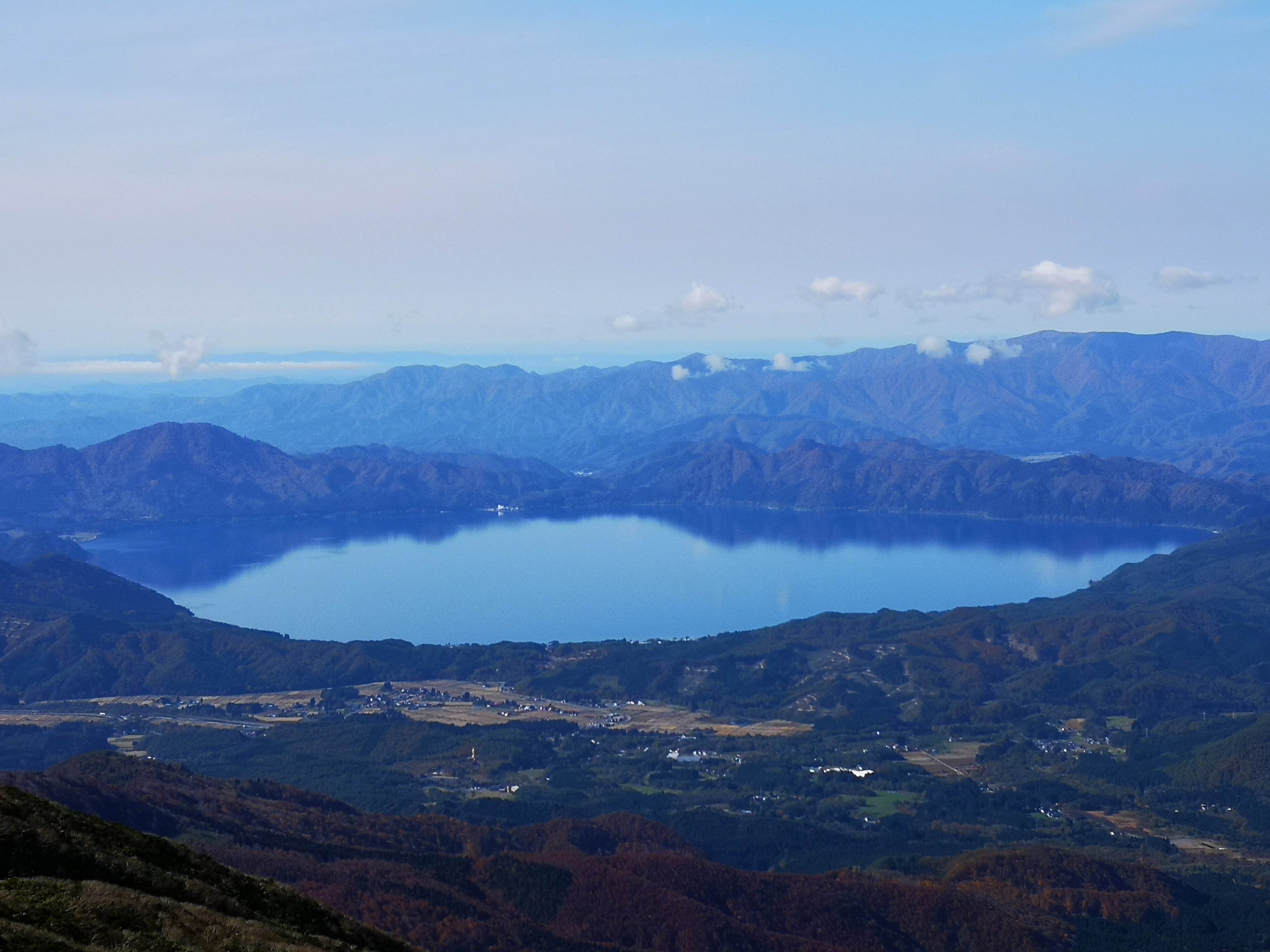
Lake Tazawa, Japan’s deepest lake
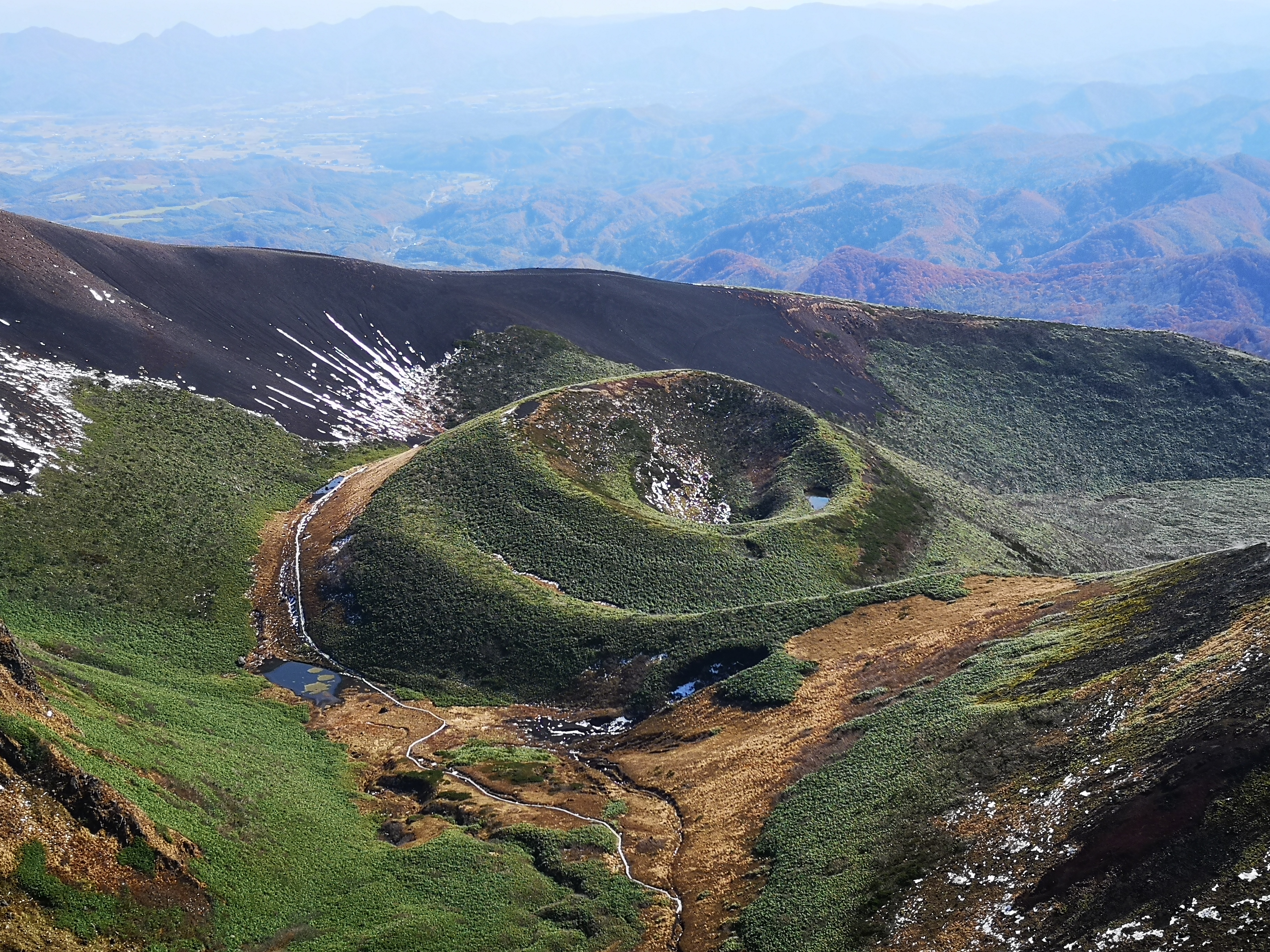
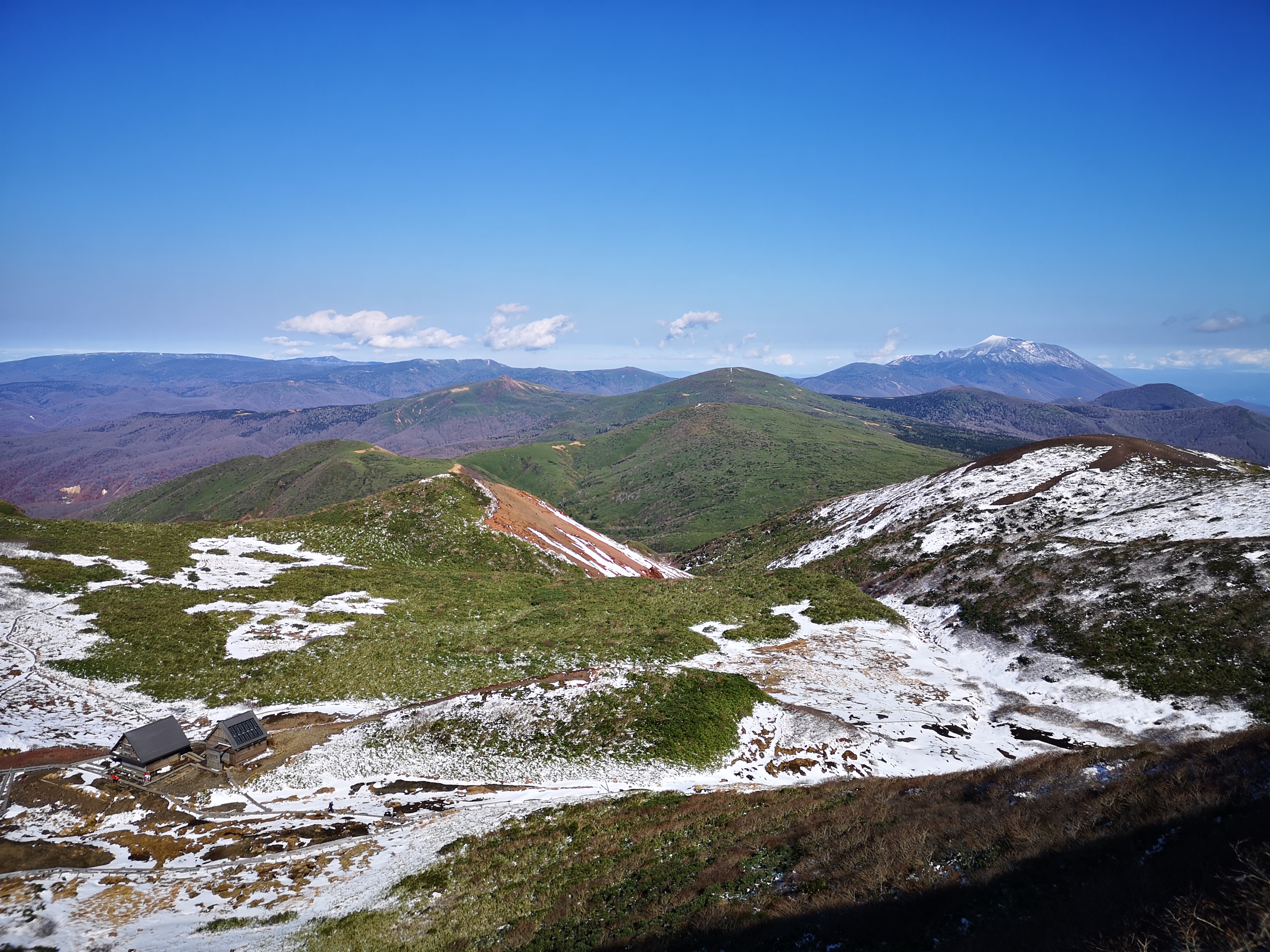
It took me 45 minutes to reach the first snow on the saddle between the two highest peaks. I made my way along a wooden walkway, next to a frozen lake, till I reached the Hachigome hut (八合目小屋). There, I turned left for the final climb, up a wooden staircase. Less than 30 minutes after reaching the saddle, I was at the top of Mt Oname (男女岳 the name combines the characters for man and women), the highest point of Mt Akita-Komagatake (秋田駒ヶ岳), the highest peak of Akita prefecture and a 200-famous mountain of Japan.
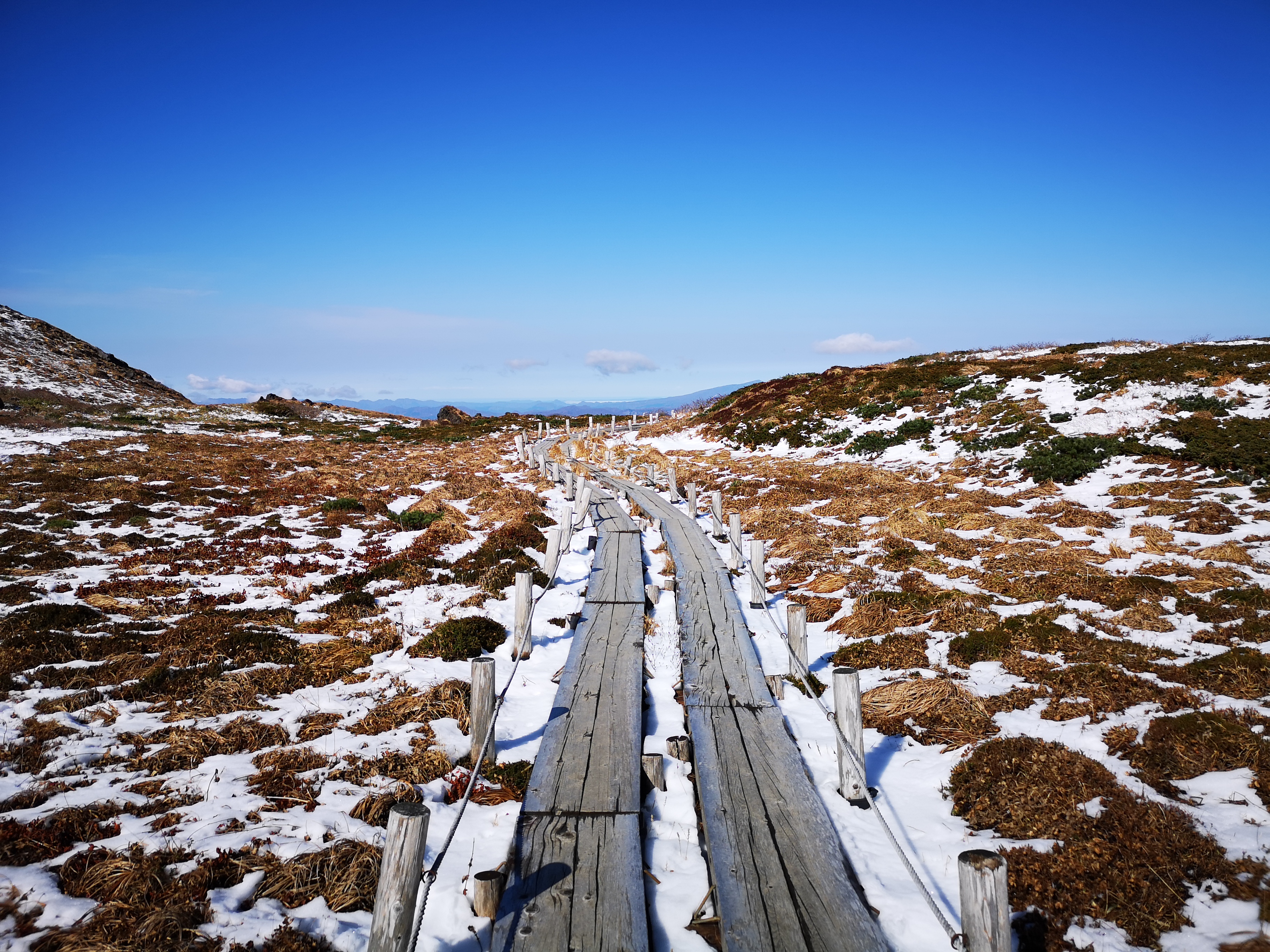
The wooden walkway near the top of Mt Akita-Koma
After taking in the fantastic 360 degree views from the summit, including Mt Iwate to the North, I went back down the same way I had come up. At the hut, I took the path on the opposite side of the lake, and after a few minutes, I reached the turn-off on the left for my next peak. A few minutes of tough climbing along a snowy slope brought me to the ridge, where I turned right. It was nearly 11h30 and, despite the snow, it was starting to get quite warm.
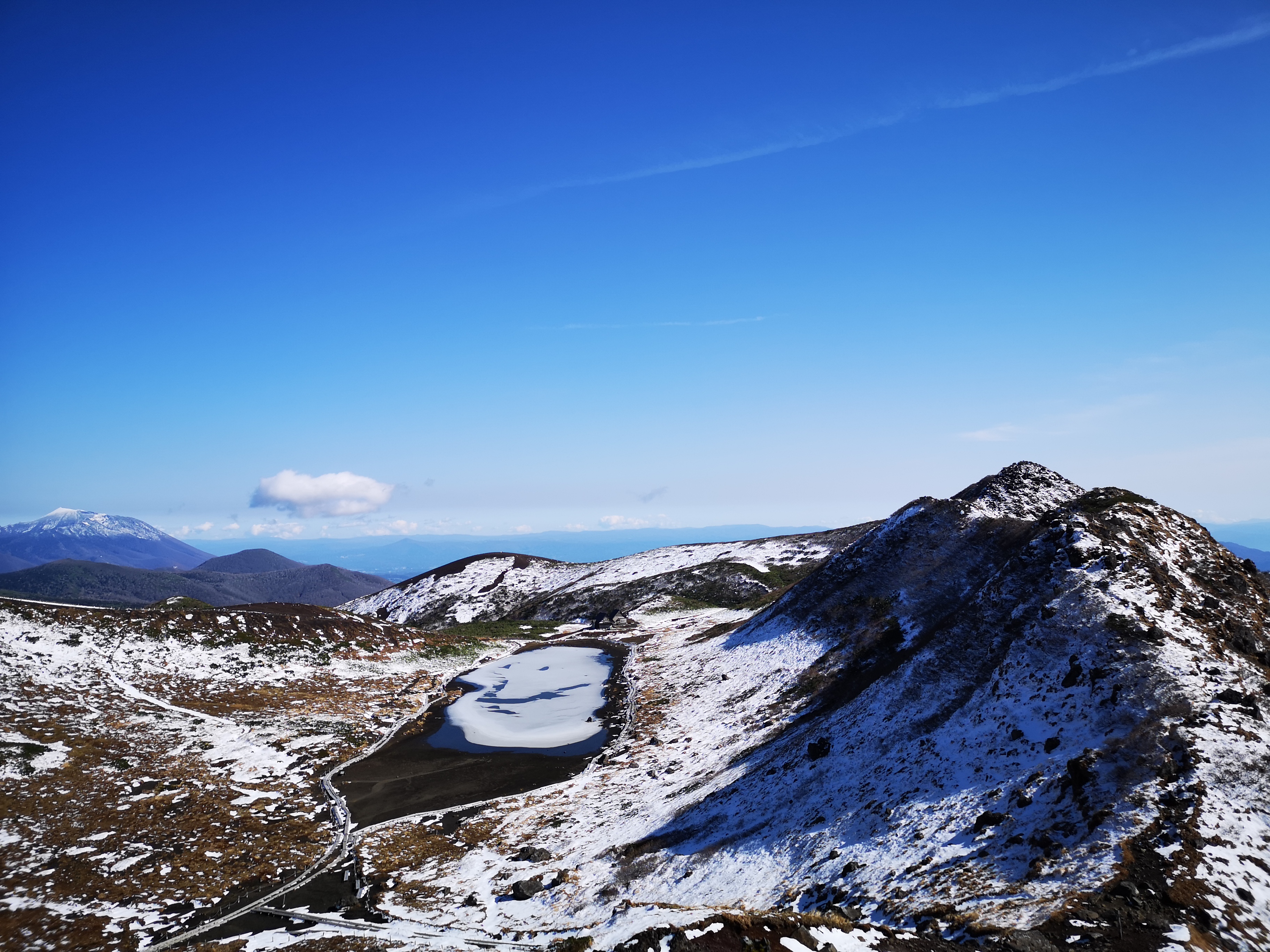
The semi-frozen volcanic crater lake with Mt Iwate in the background
Fortunately the snow was soft in the late morning sun, and no crampons were needed for the narrow rocky path along the top ridge. I reached the small snow-covered shrine at the top of Mt Odake (女岳 using only the character for woman here) around 11h30 with a great view of Tazawa lake. There was almost no wind, and it felt quite pleasant in the autumn sun, so I took short break for lunch.

The path between Mt Odake and Mt Yoko
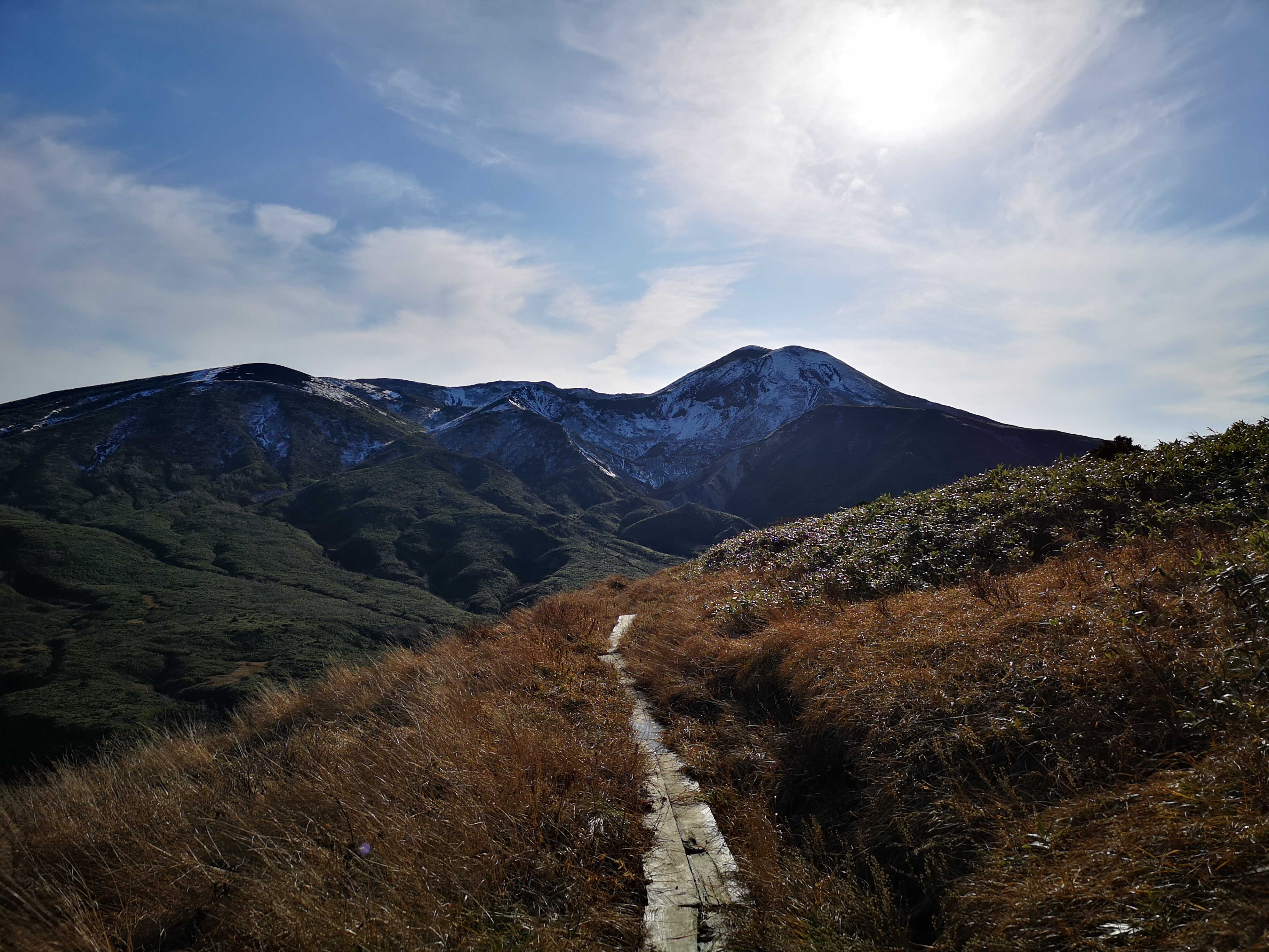
Since I had completed the first part of the hike on schedule, I decided to take the longer route, following the crater ridge counter-clockwise. This section was narrower and rockier, and few hikers had chosen to take this route. Fortunately, the thin layer of snow wasn’t an issue, and the views looking back to Mt Oname were spectacular. So far, this was a very enjoyable hike, even with the thin layer of snow.
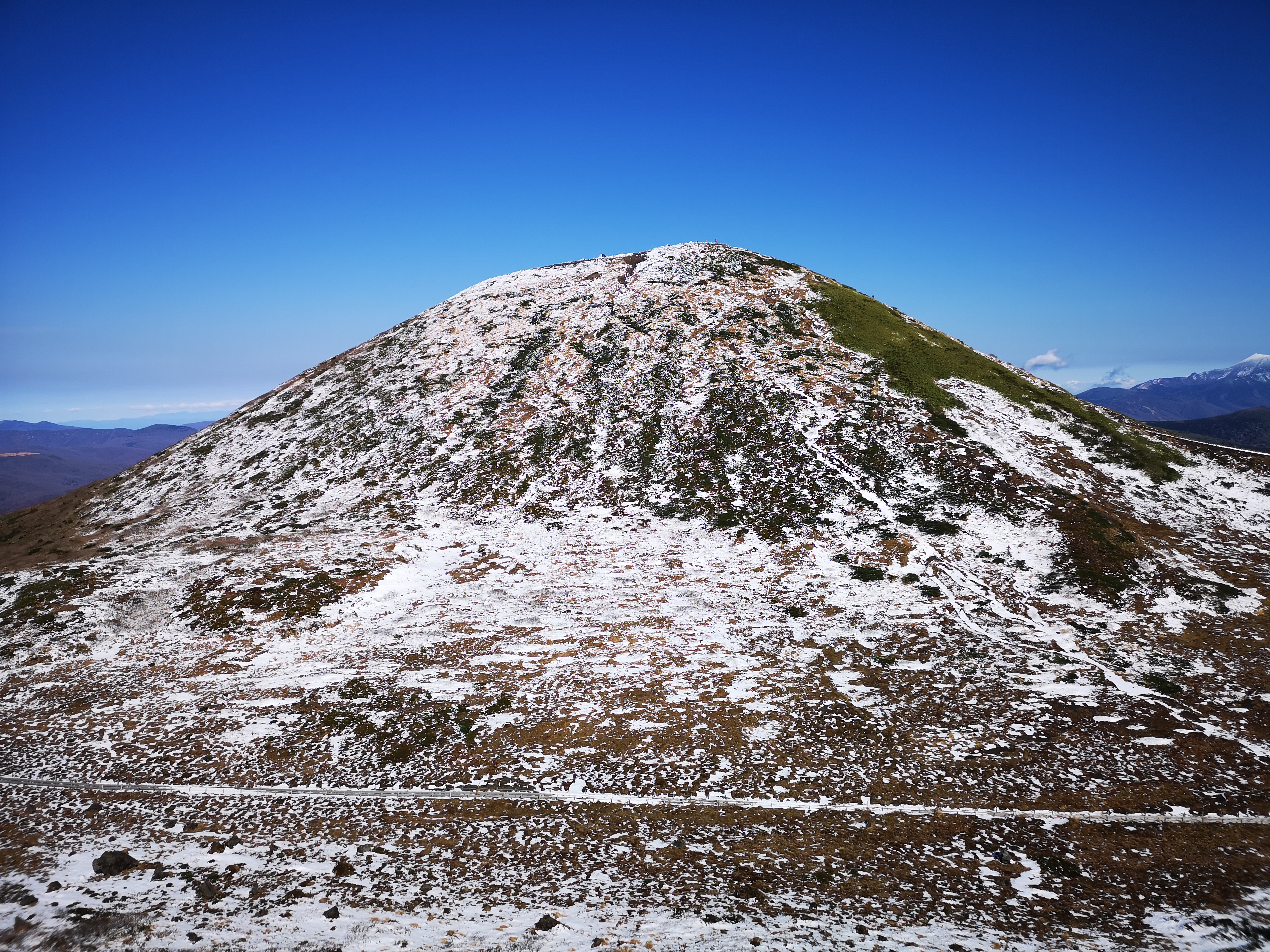
Mt Oname, the highest-point of Mt Akita-koma
After passing several small peaks, I finally reached Mt Yoko (横岳) at 12h30, where I had a good view of the central plain of Iwate prefecture to the east. It was starting to get quite warm, and I felt that I had been wrong to worry about the snow. I had the rest of my lunch and set off in good spirits.
Mini-crater on the southern side of the volcano
It only took me a few minutes to reach the next peak, the flat rounded top of Yakemori (焼森), from where I had a breath-taking view of Mt Akita-Komagatake. I’m surprised it isn’t part of the hundred famous mountains of Japan. I spent some time enjoying the panoramic views. There was path going directly back to Hachigome, but I decided to continue straight, and take the longer route back since it was still early.
Looking North towards the Towada-Hachimantai National Park
Suddenly I was walking in deep snow (see video). It had snowed a lot more on this side, probably because it was facing Northwards. It was soft, so I could run down through it. However, I soon had another problem. This part of the trail was overgrown with bamboo grass! I had to fray a passage through it and at times the bamboo was higher than my head. I started to wonder whether I had made a mistake taking the longer way.
Mt Akita-Koma in the afternoon
Eventually the path leveled and then started to climb again. The snow had disappeared but the path was muddy and slippery. At 1h30 I reached the top of Mt Sasamori (笹森山 meaning bamboo forest, a well-deserved name!). I was pretty exhausted after fighting through the bamboo, and then having to keep my balance on the treacherous trail. After a short break, I continued on my loop hike, now heading downhill and westwards.
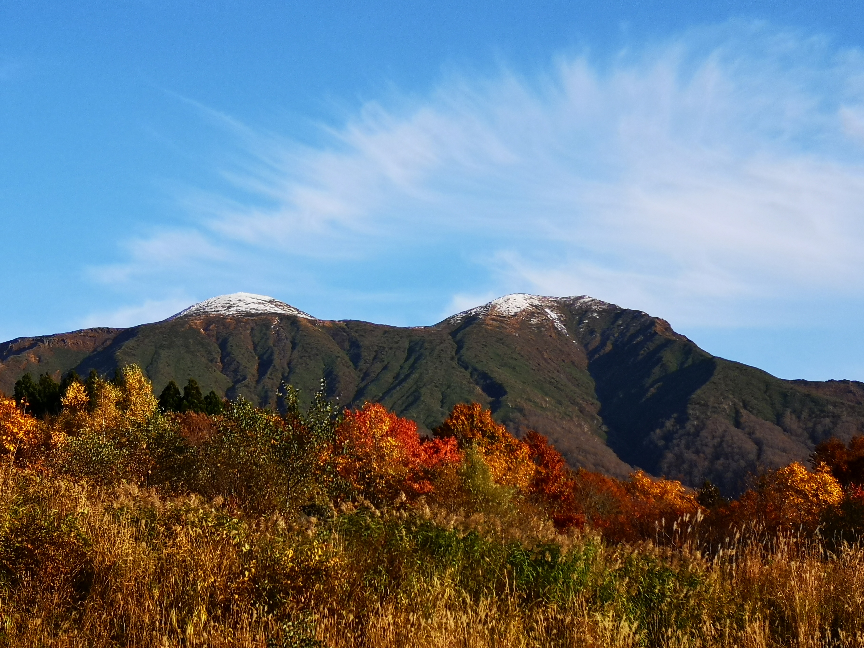
Mt Akita-Koma in the autumn
After a short up and down, I was standing on top of Mt Yumori (湯森山) at 2pm, the last of today’s peaks. After gazing at the mountains of Akita one last time, I set off on the final descent towards the parking lot at Hachigome. It followed a staircase in bad need of maintenance. At 2h30 I was finally back at my starting point. On the way back, I stopped by at the Arupa Komakusa hot spring which had perhaps one of the best views I’ve ever had from an outdoor bath.
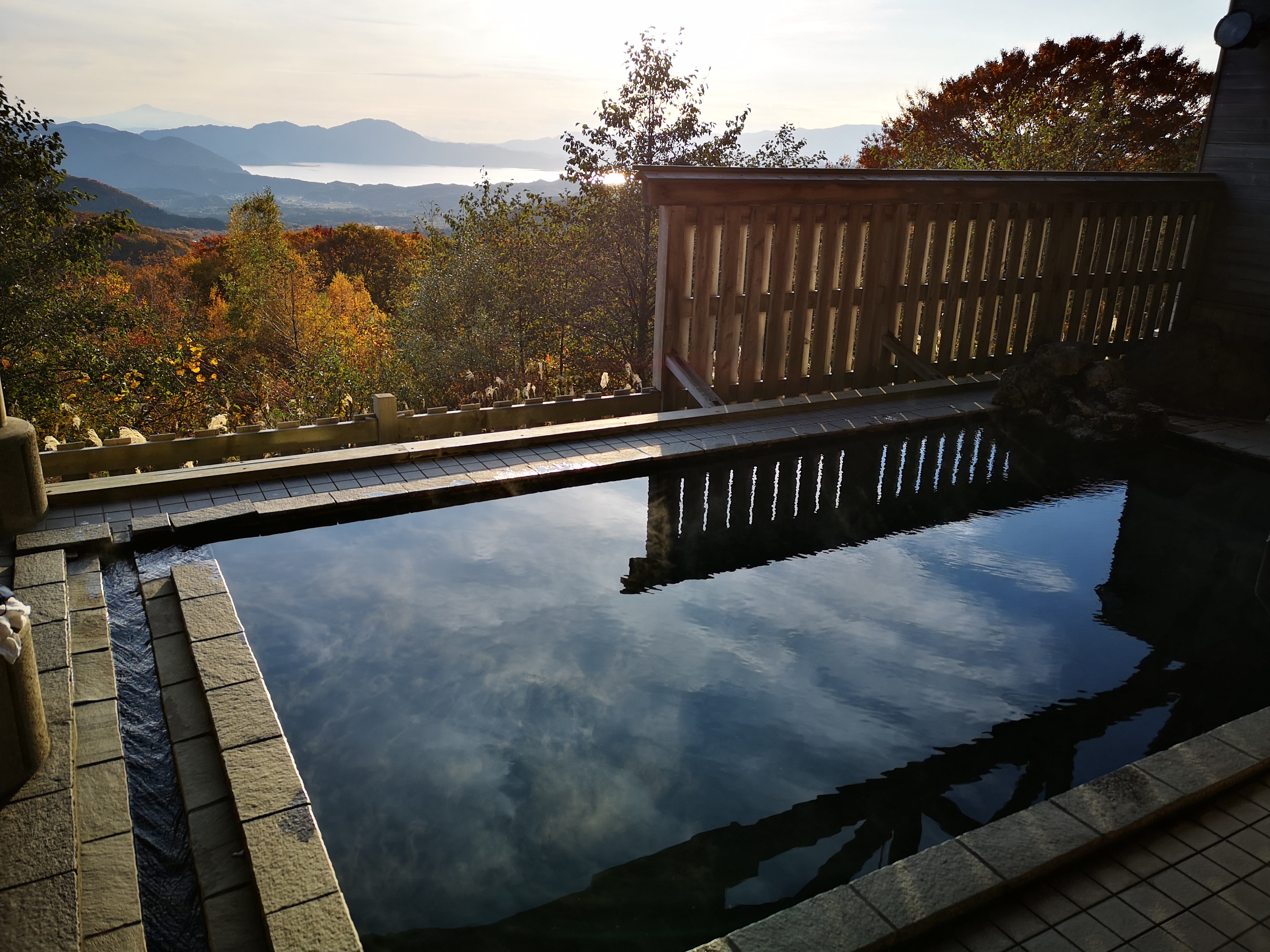
After-hike soak with a spectacular view
Hiking on the highest peak of Akita Prefecture
Akita-Komagatake throughout the year (drone footage) by Go North Japan