Mt Gojo (305m) & Mt Nagaone (273m), Hanno City, Saitama Prefecture, Saturday, May 24, 2025

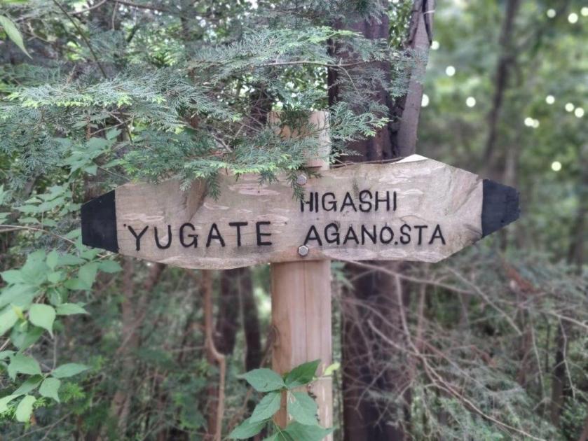
I needed to find another short hike near Tokyo while I waited for the return of the sunny days of May, better suited for long day trips. I decided to tackle a couple of minor, unclimbed peaks along a ridge running parallel to the Mt Fukuzawa one. Instead of starting from Kamakita lake on the north side, I’d approach it from the west via Yugate. Although it promised no new views, I hoped to have the latter part of the trail to myself.

For subscribers, read this Post on Hiking Around Tokyo for a better viewing experience and the latest updates

Hiking in Oku-musashi 奥武蔵

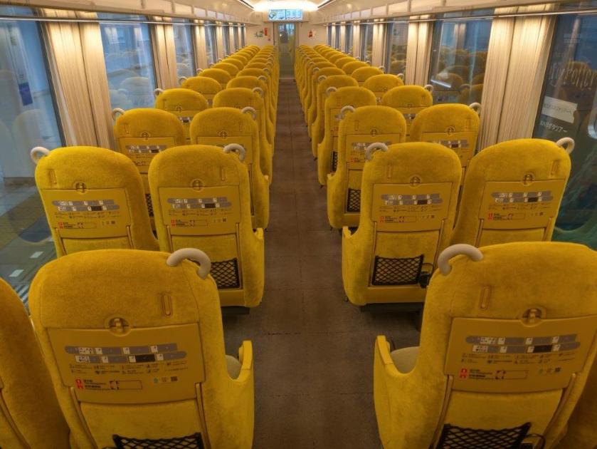
To get to the start of the hike, I’d ride the Laview limited express to Hanno, and there, change to the Chichibu line for the short ride to Higashi-agano station. I could use the same route for the return, catching the train from Musashi-yokote station, one stop up on the same line. The weather was supposed to be cloudy all day with temperatures almost cool for the season, although rain was forecast in the late afternoon. I was looking forward to exploring new peaks in a frequently visited place.

Find Japan Hiking Maps on Japanwilds and subscribe to our newsletter

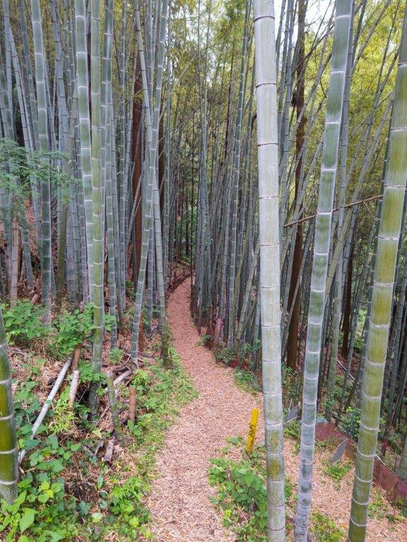
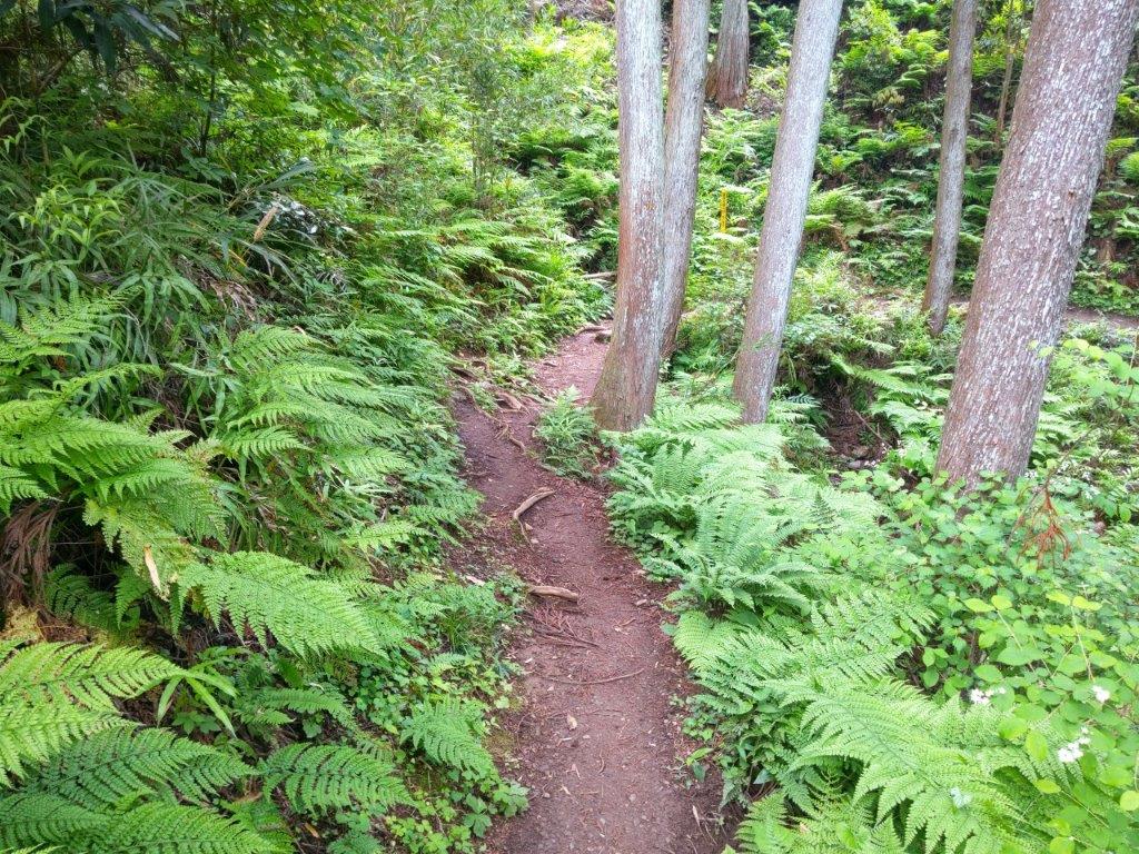
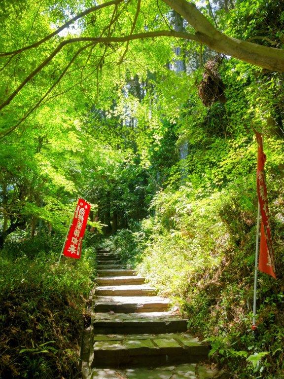
Start of the Hike (left) Bamboo Grove past Yugate (right)

Trail along the 3rd clearing (left) Re-entering the Forest (right)

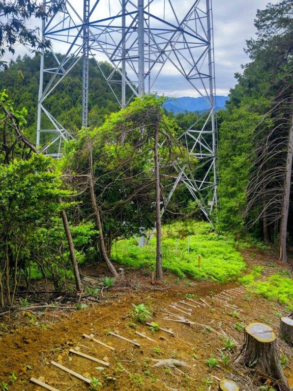
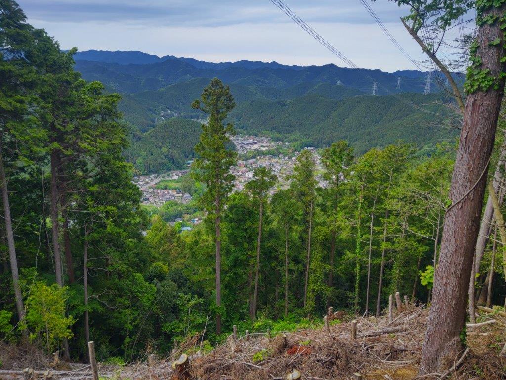
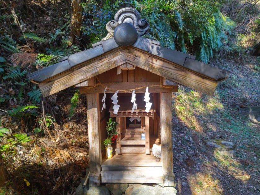
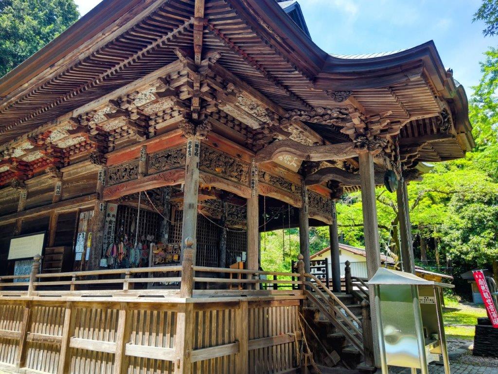
I got off the train at Higashi-Agano station under grey skies at 1130; on the bright side, it was the perfect temperature for hiking. After crossing a busy main road, I climbed some stone steps to get to Agana Shrine (吾野神社) and then headed up the Hikyaku Trail (飛脚道 meaning courier trail) to the right of the main shrine building. A little past noon, I reached a spot where the forest had been cleared to allow for the passage of an electric power line.

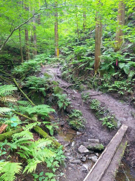
Plank Bridge over a Stream (left) Level Section through Ferns (right)

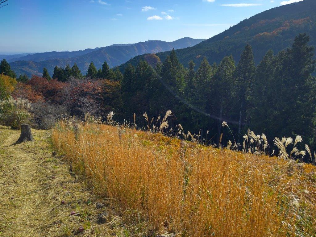
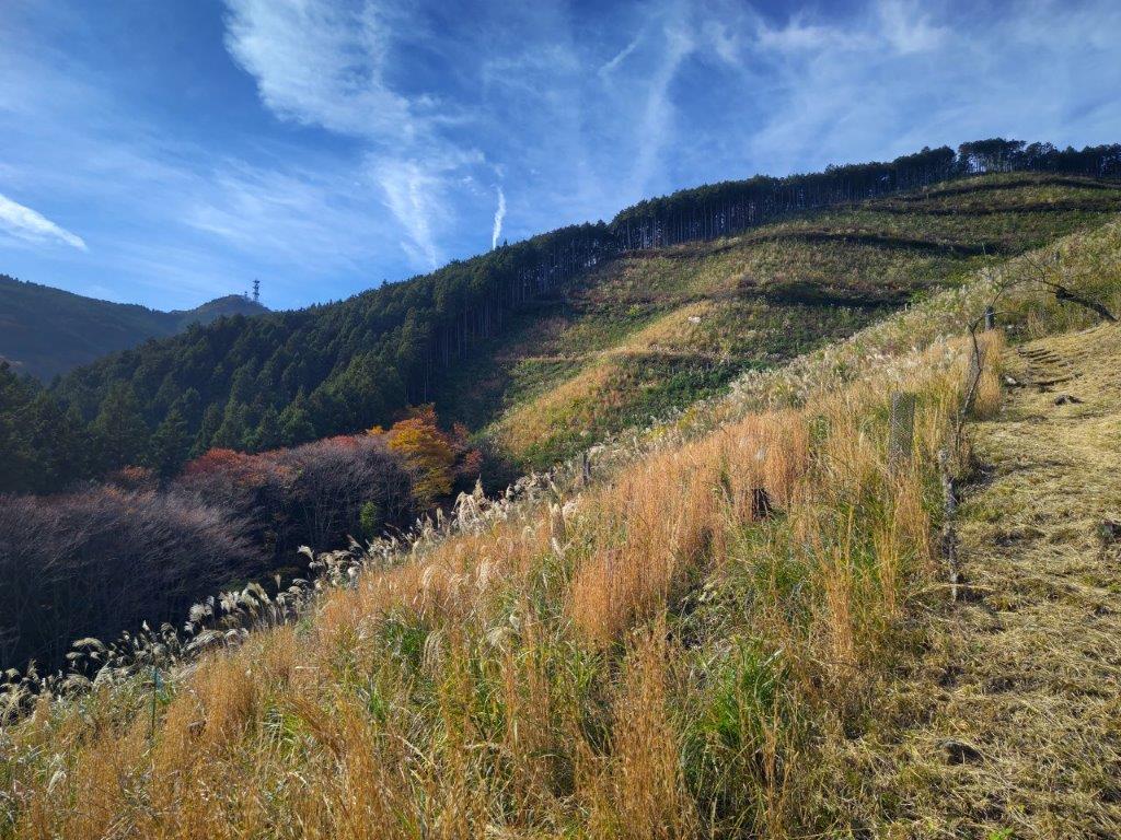
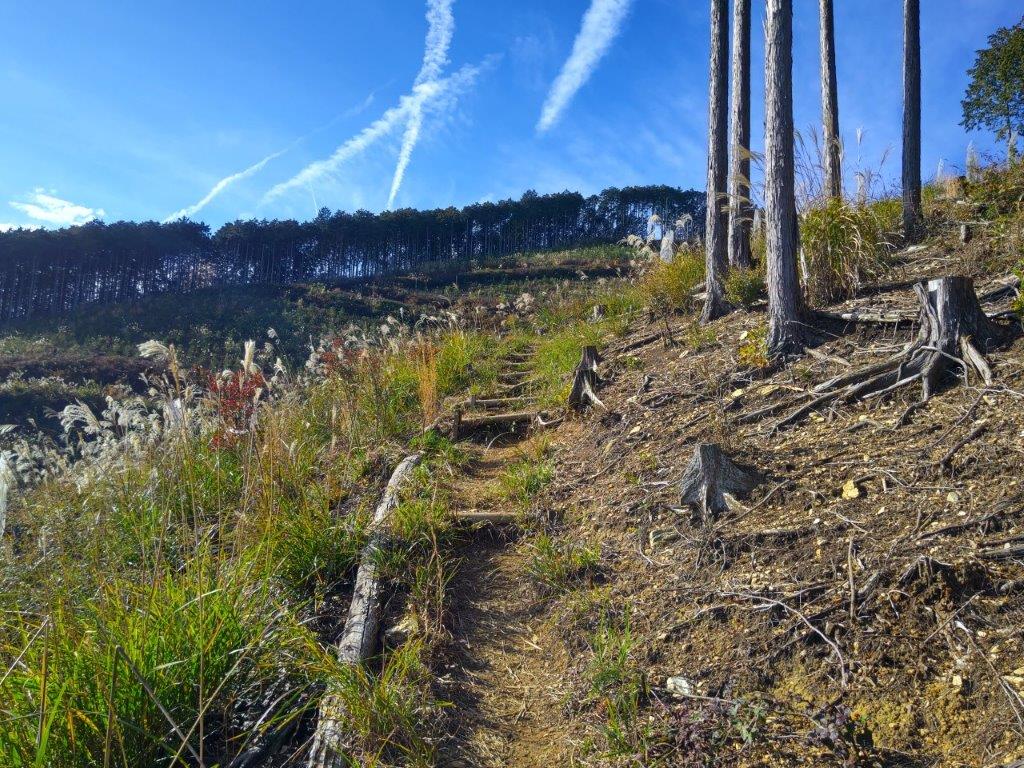
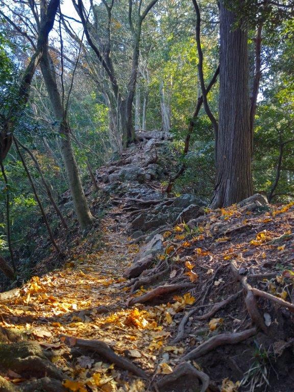
Ridge before (left) and after (right) Mt Gojo

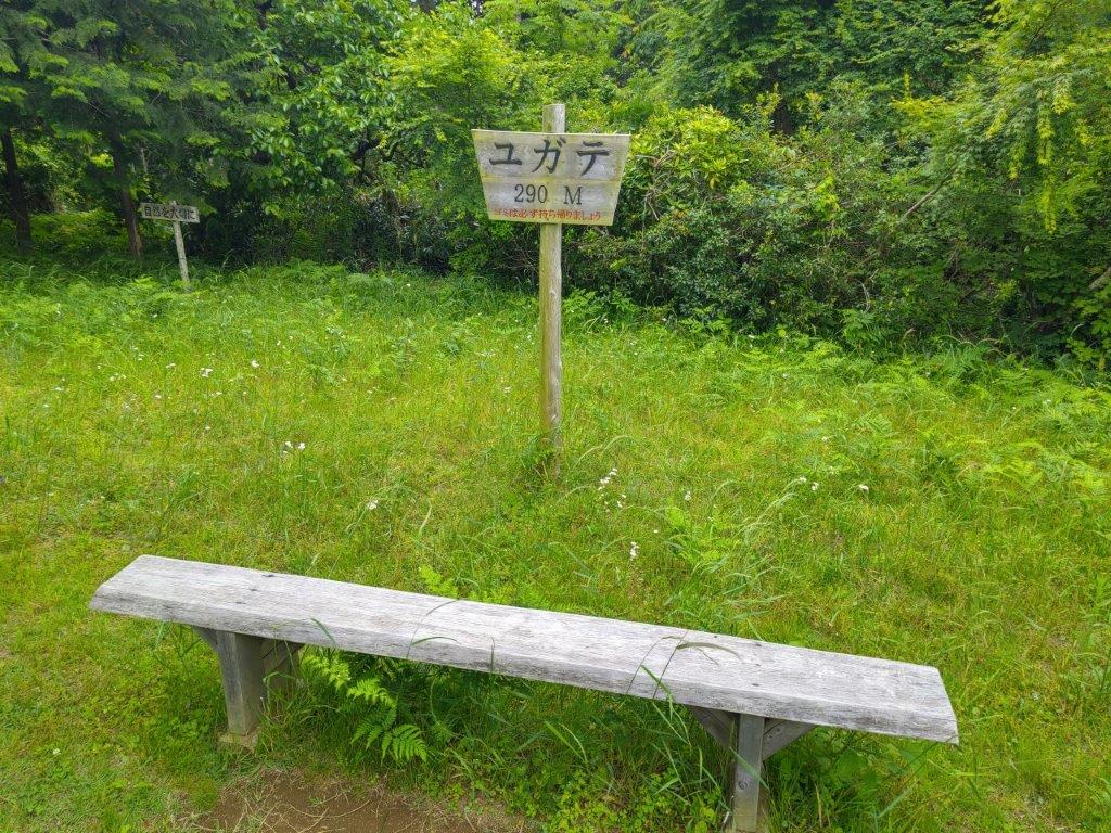
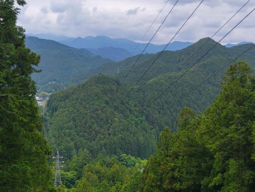
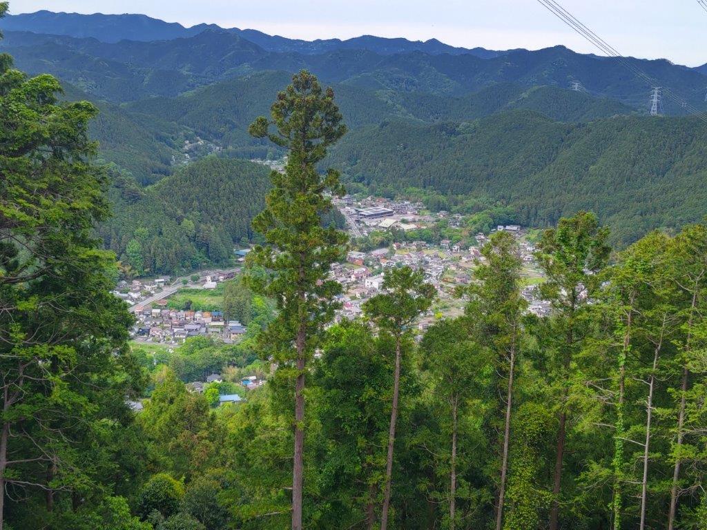
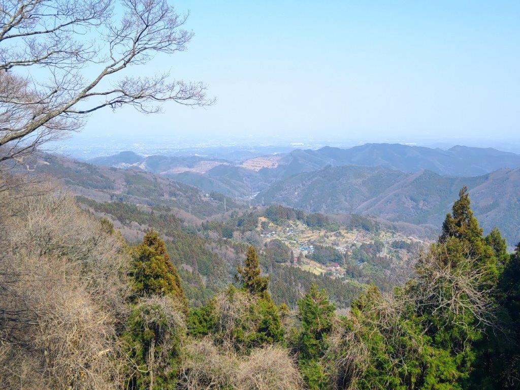
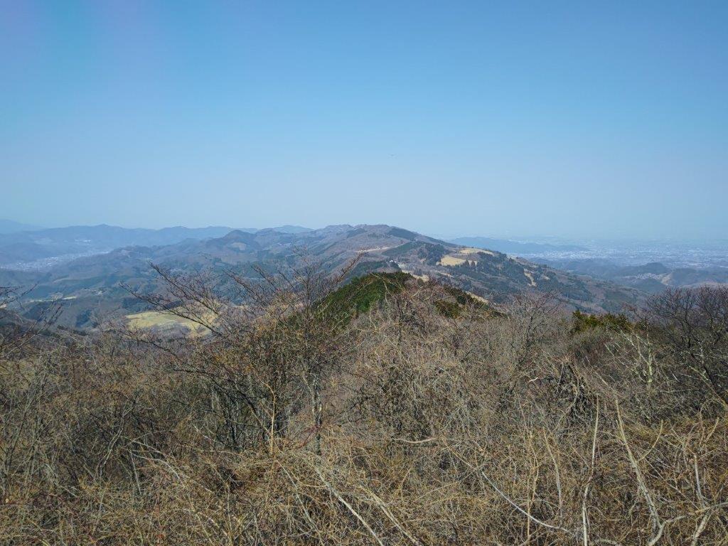
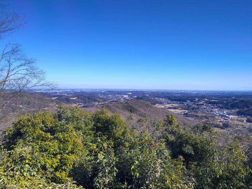
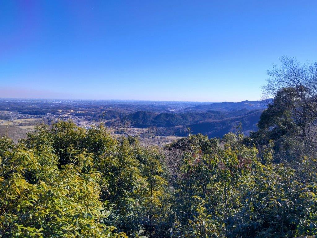
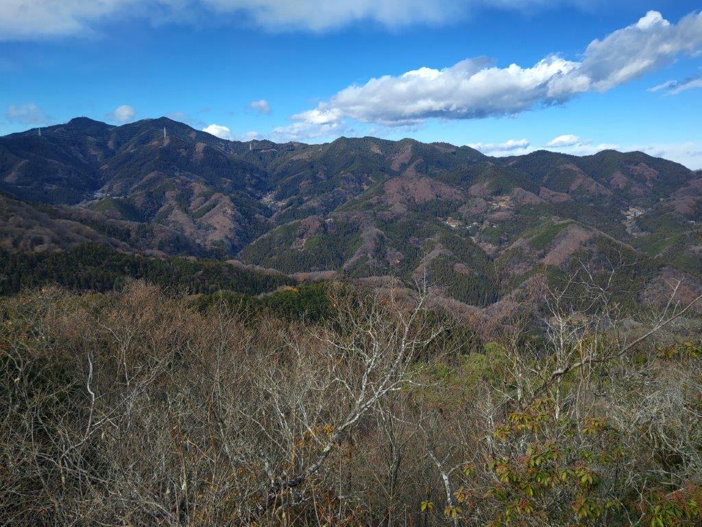
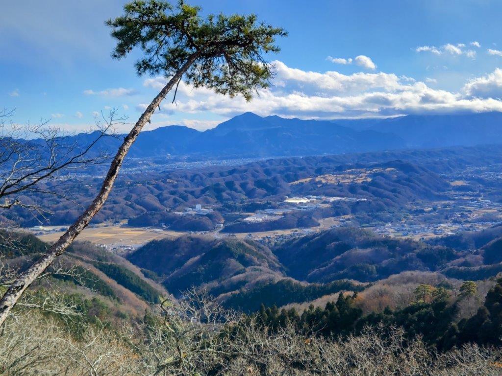
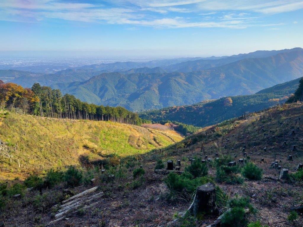
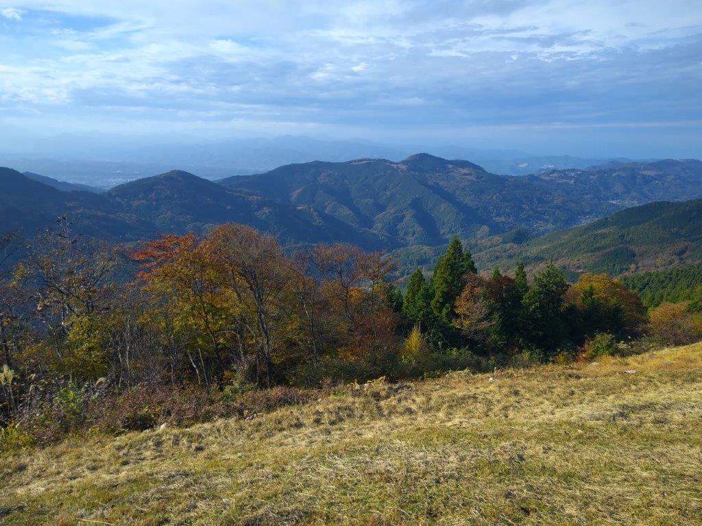
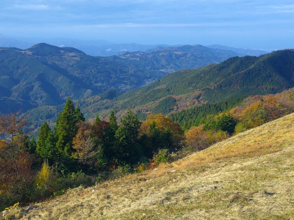
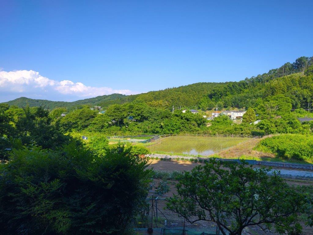
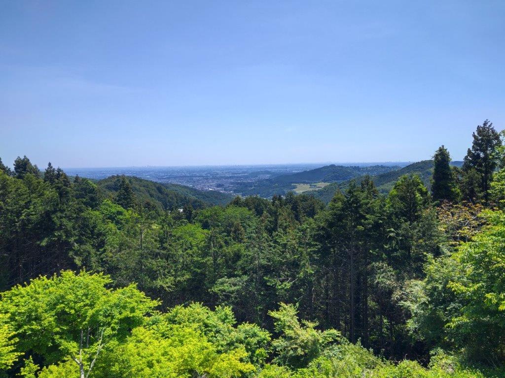
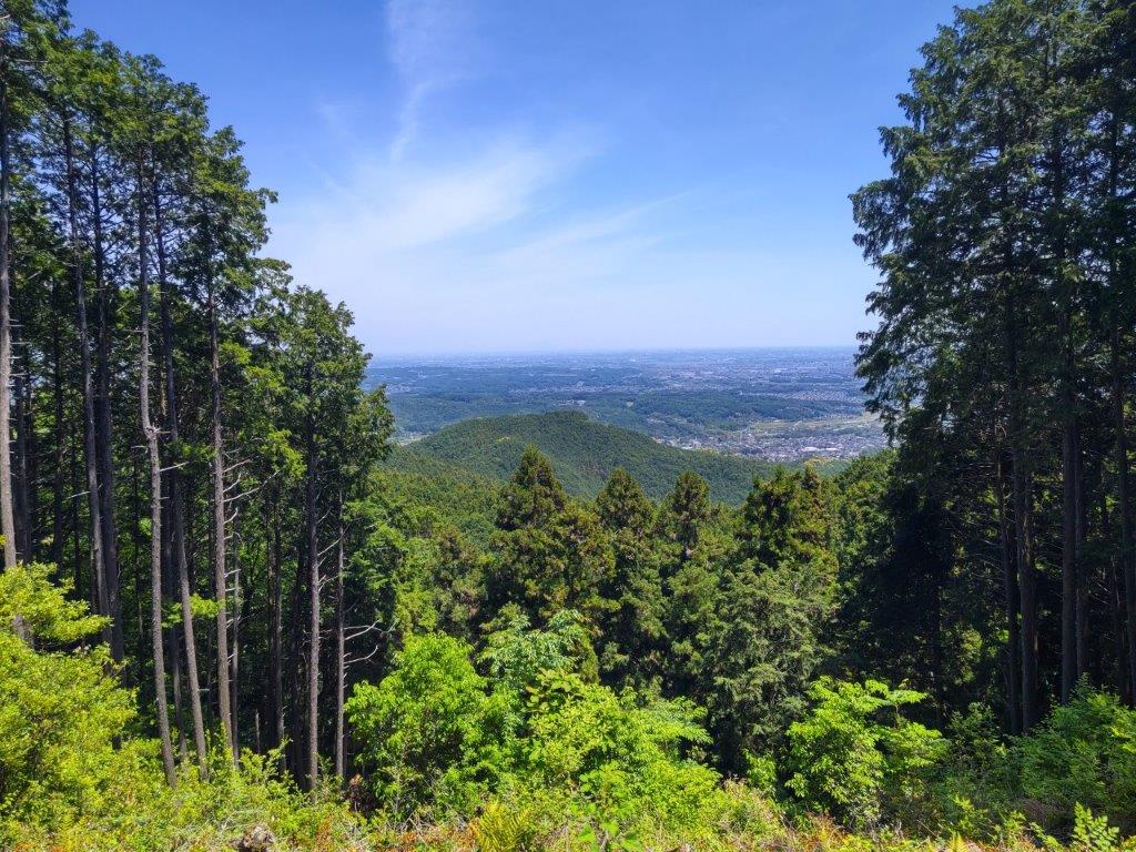
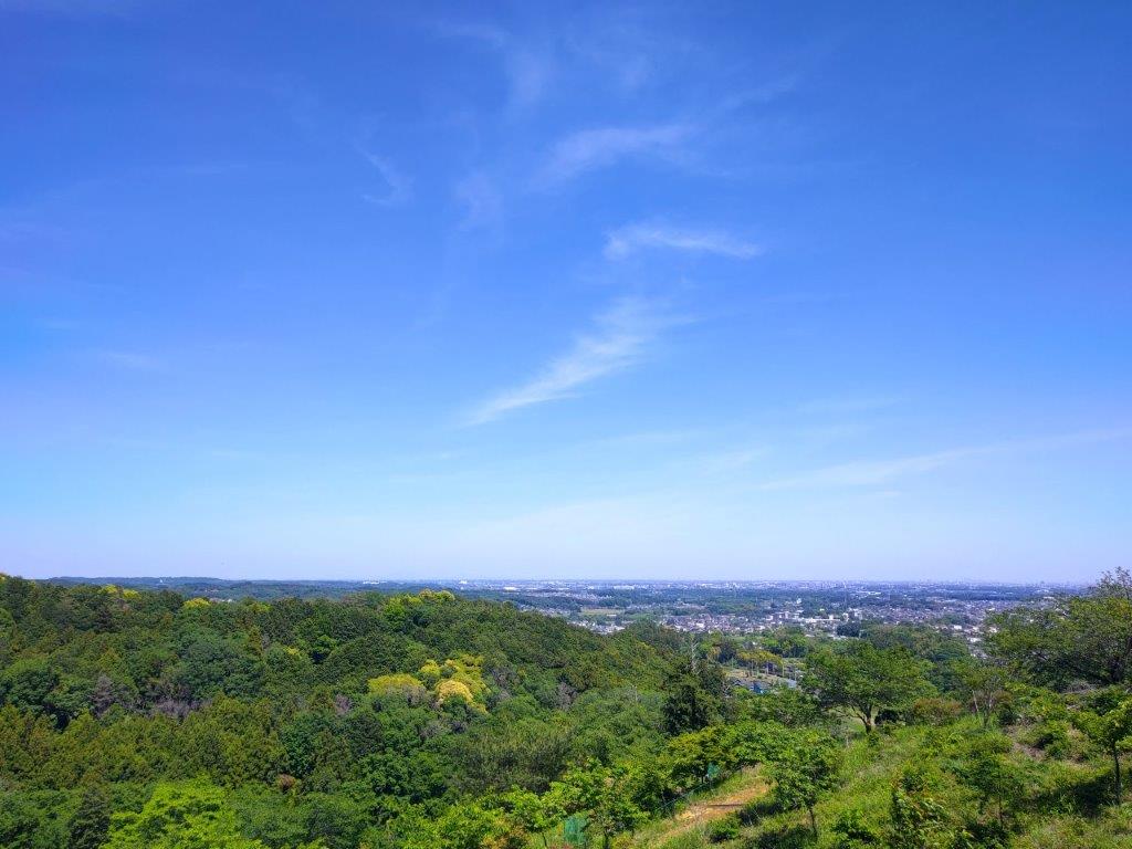
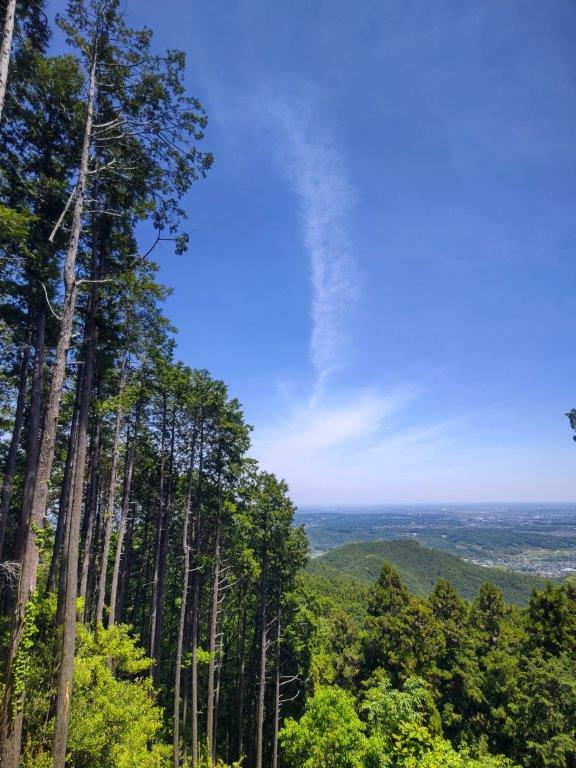
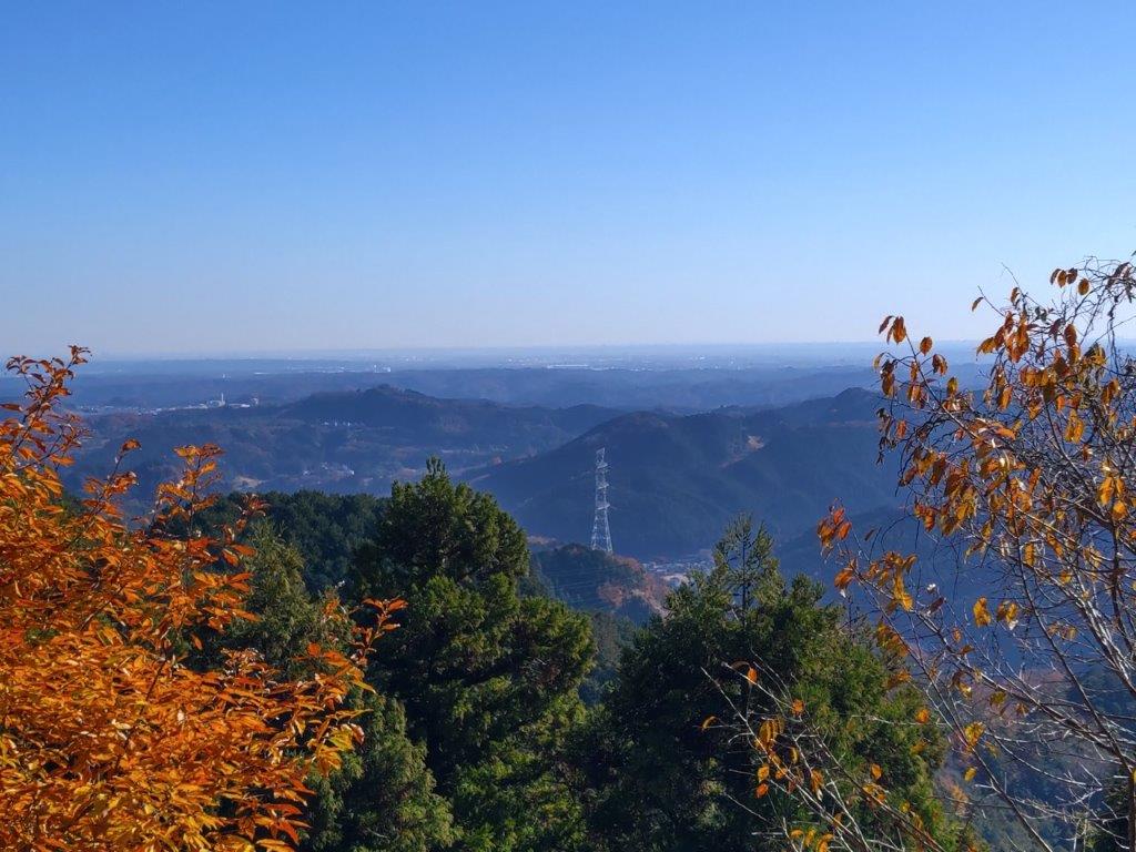
I was glad to get a view early on in the hike, although I had been past this spot before. Looking left, I could see the Hanno Alps directly opposite; further in the distance, I could just make out Mt Izugatake and Mt Buko, half-hidden by low clouds. I soon moved on, and after an up and down, arrived at the top of Mt Hashimoto (橋本山 321m) where a similar view awaited me on the west side. I quickly moved on, and after a short descent, I followed a wide track that led me to the fields and gardens of Yugate Village (ユガテ 290m); looking up, I could see a second set of power lines stretching across the sky.

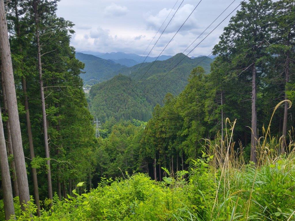
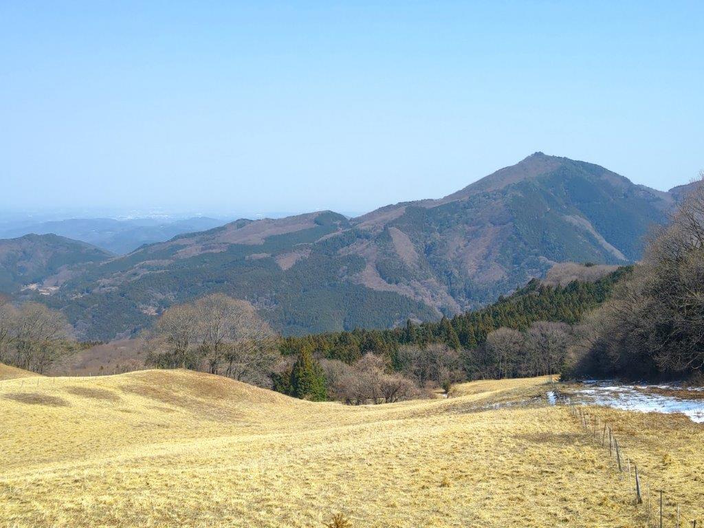
Looking West towards Izugatake and Buko-san

The Hanno Alps from the First Clearing

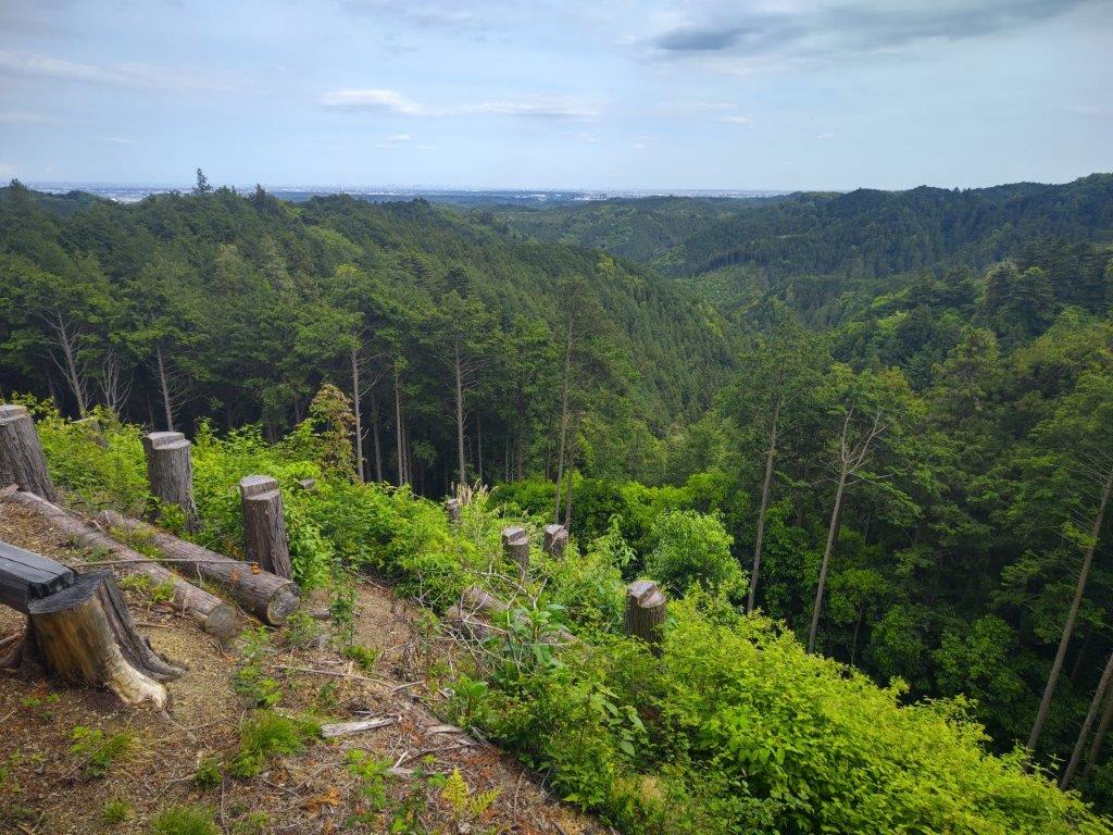
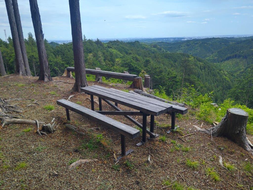
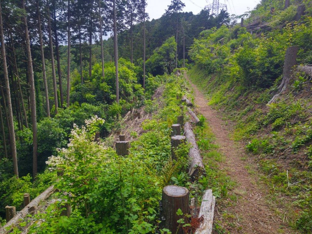
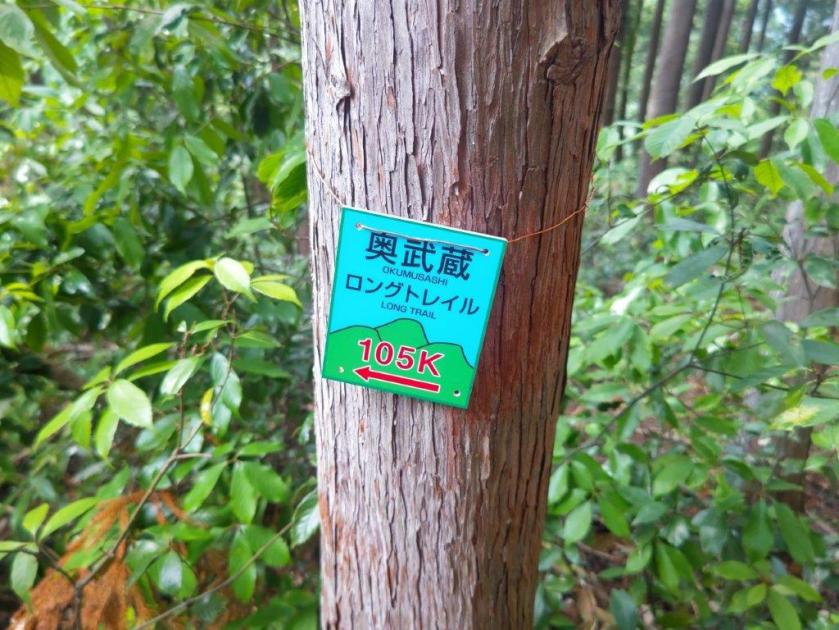
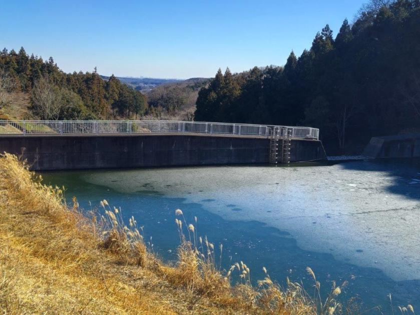
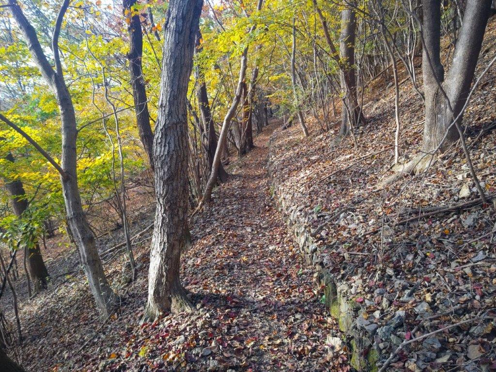
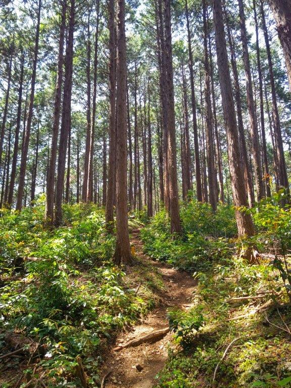
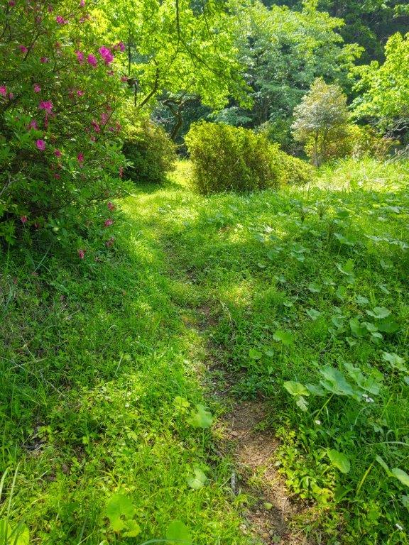
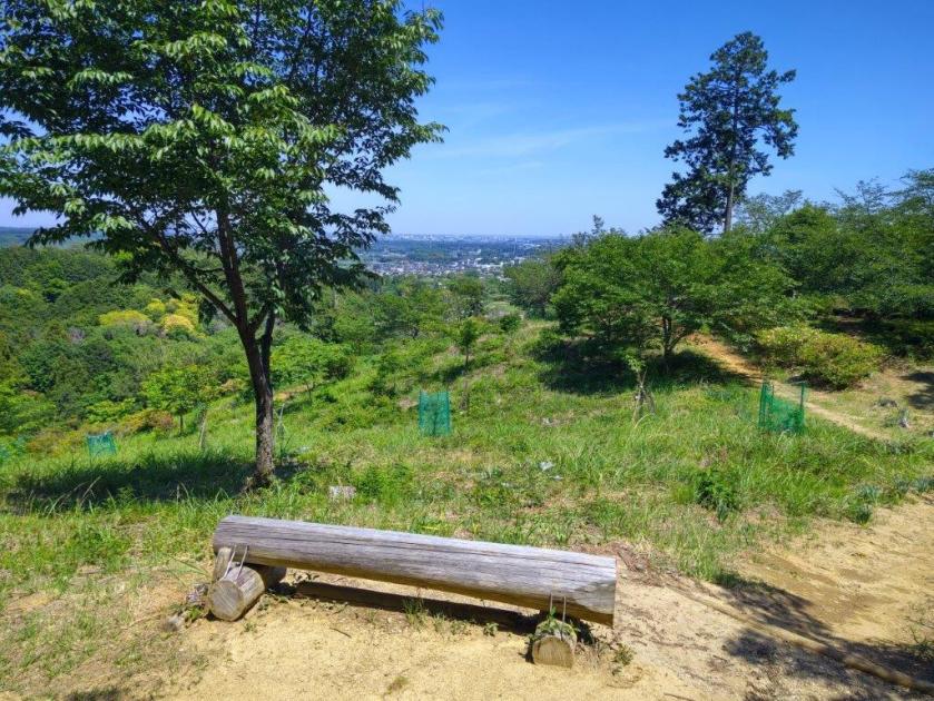
I was lucky to get the last free table under a large tree, although many benches were empty. It was nearly one o’clock so I decided to have an early lunch. I set off again a little past 1pm, now following the Oku-musashi Long Trail (奥武蔵ロングトレイル). After passing through a bamboo grove, I followed a winding path hugging the mountain side. Beyond a stream, the path started to climb, then became level at a clearing for the power line passing over Yugate. Shortly after crossing a second stream on a bridge made of two wooden planks, I arrived at Tsuchiyama Pass (土山峠), intersecting with my Fukuzawa hike.

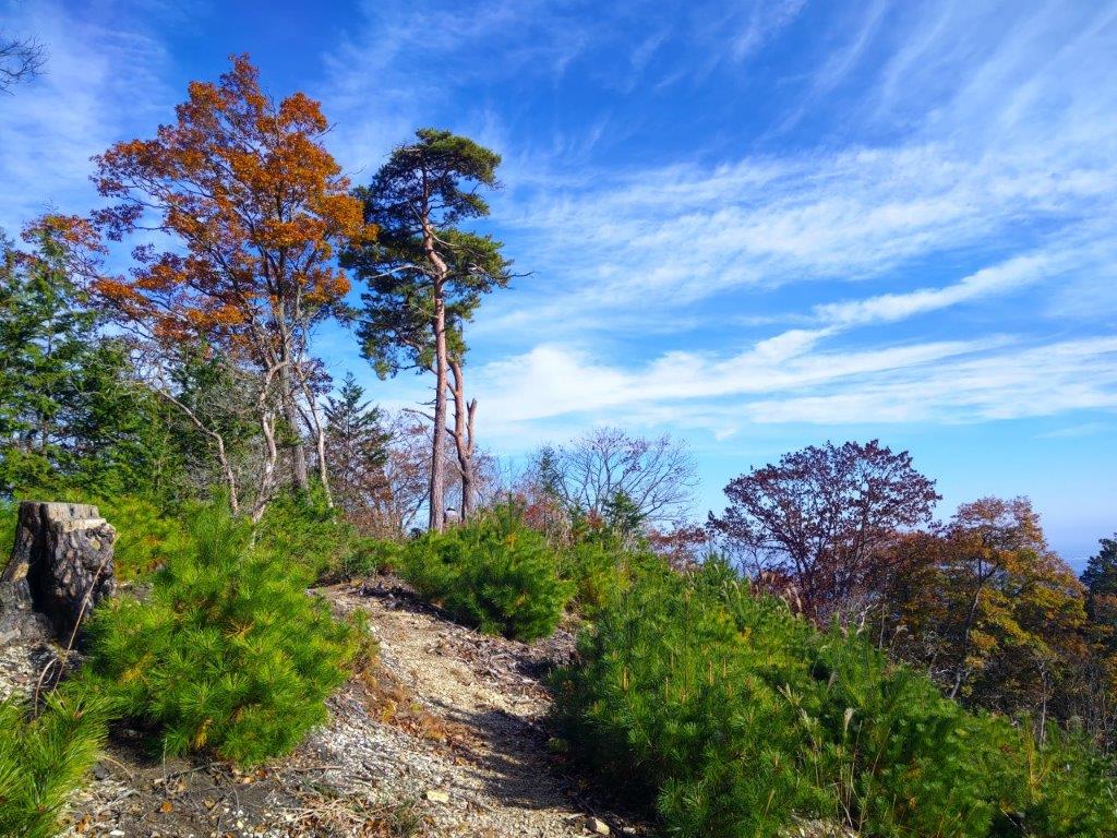
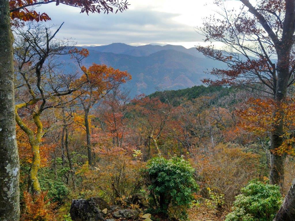
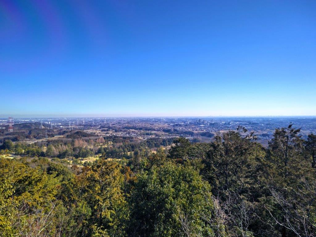
Nearing the Top of Mt Hashimoto

View of the Hanno Alps from Mt Hashimoto

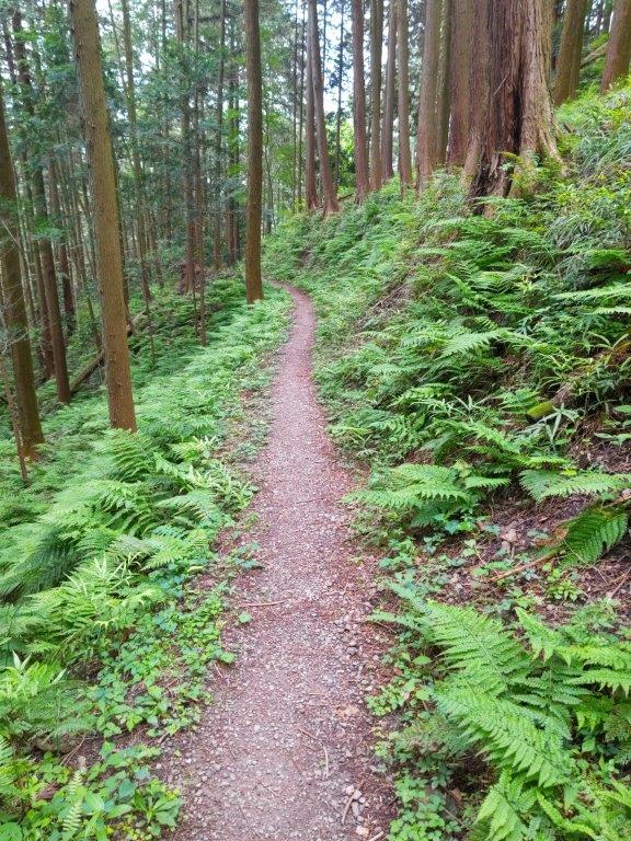
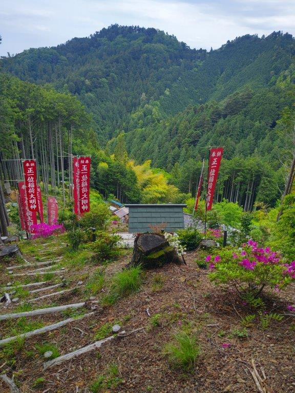
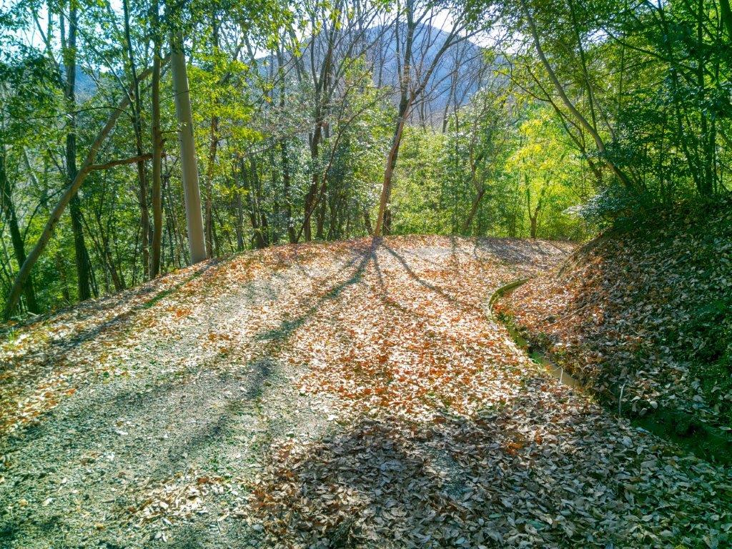
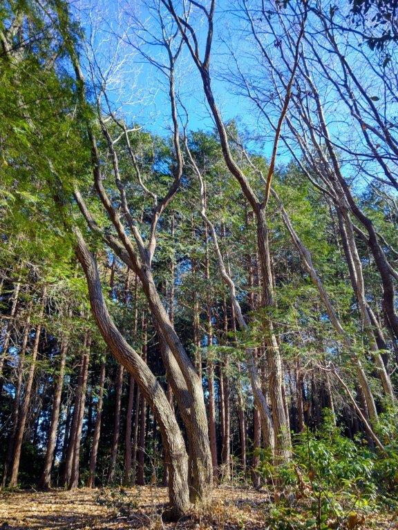
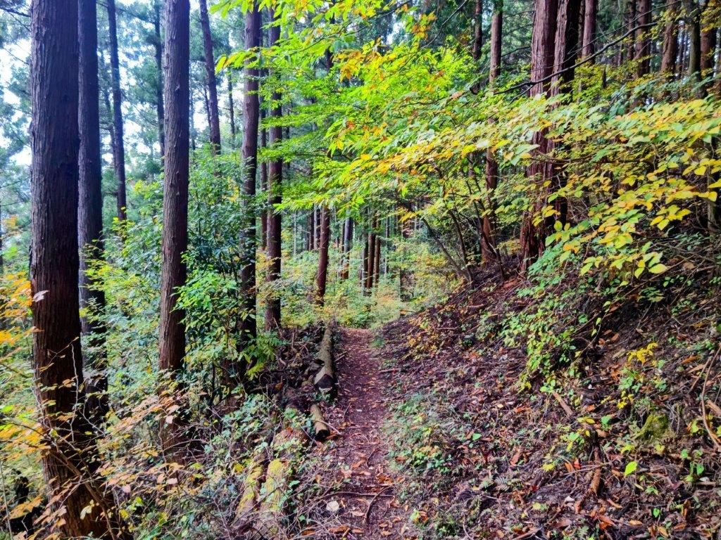
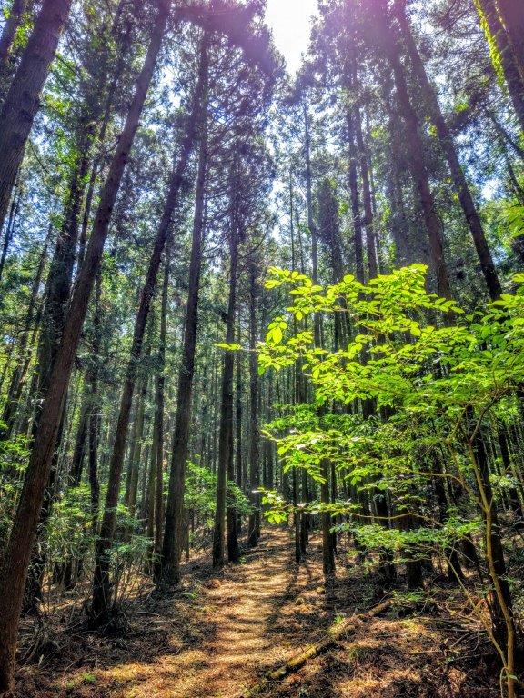
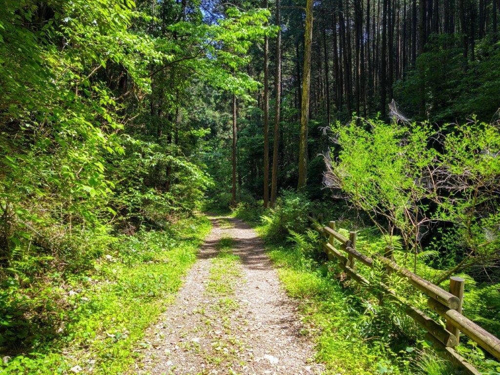
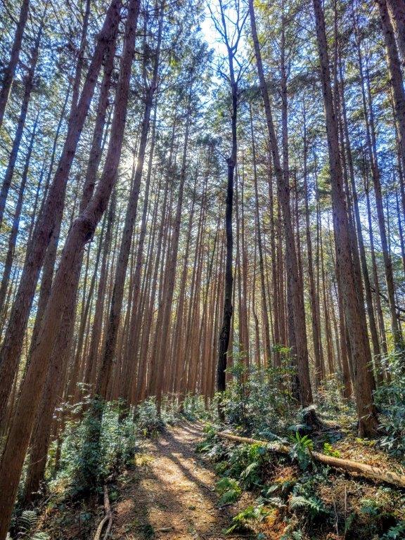
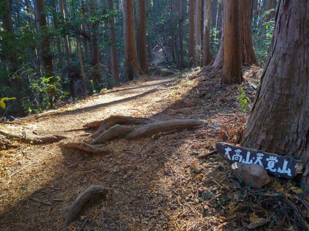
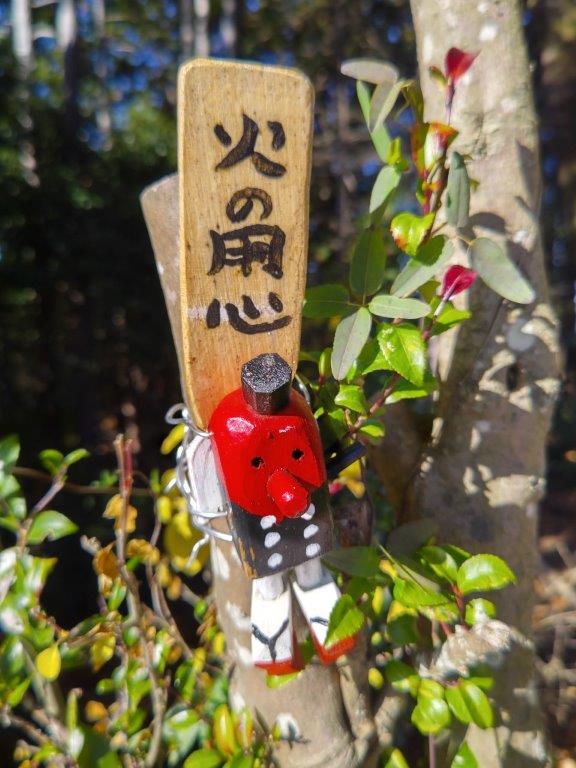
As I stood next to the charming carved wood figure sitting on top of a signpost, I decided to explore the trail heading straight as I was ahead of schedule, leaving the more usual route over Mt Omine to the right. Here, I also left the Oku-musashi Long Trail as it headed left to Kitamukijizo (北向地蔵). After a short and pleasant level section through cedars and green ferns, I popped onto a paved road past a small cemetery around 2pm. I turned right and soon spotted a faint un-signposted trail into the woods, opposite a solitary house.

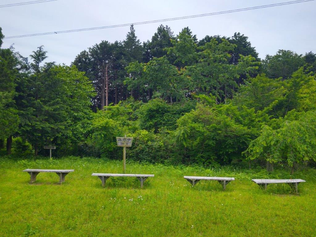
Empty Benches at Yugate

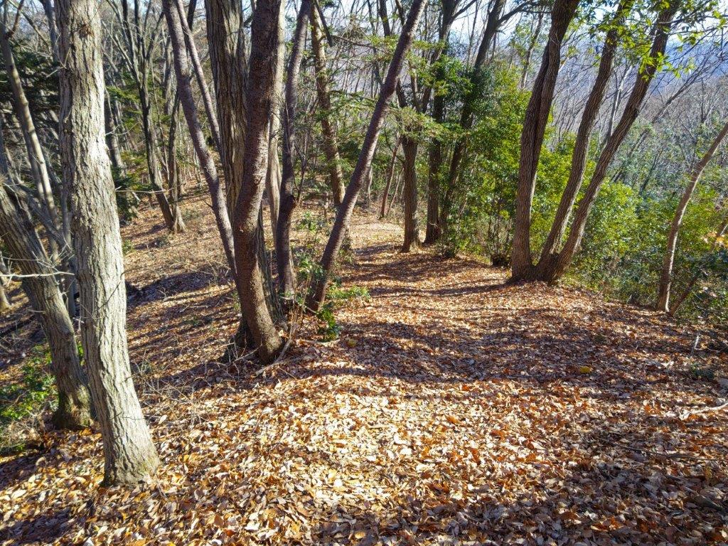
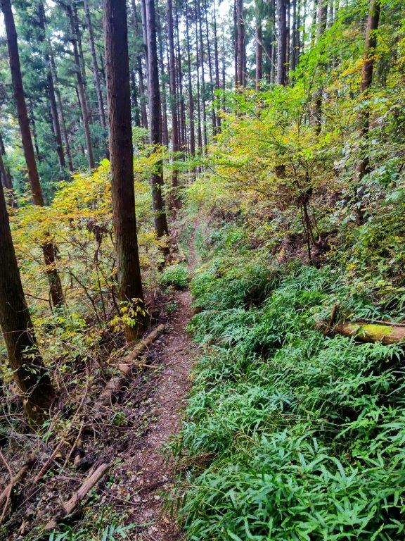
Level Trail Hugging the Mountain Side

The trail was rough at first, as it followed the contour of the mountain side. Using my phone GPS, as well as the odd strip of pink tape stuck to tree branches, to guide me, I soon reached a wider and easier to follow section, eventually merging with the main trail from Tsuchiyama Pass. In total, this interesting detour around the summit of Mt Omine took me half an hour. Almost immediately, I reached a fork; here, I headed down the left branch, this time leaving the Mt Fukuzawa ridgeline for good.

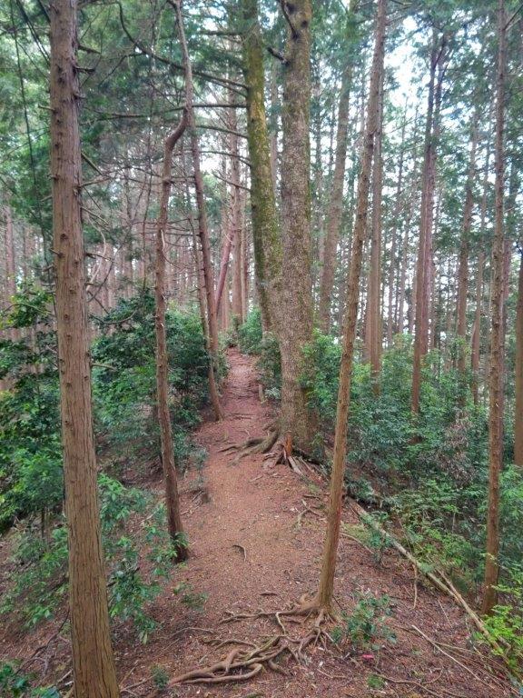
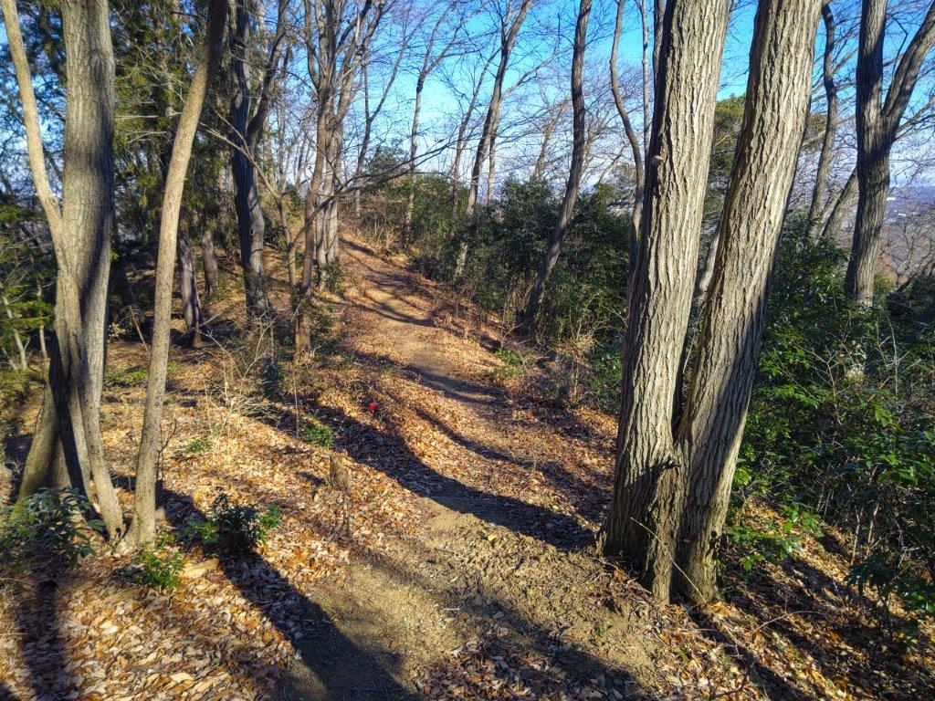
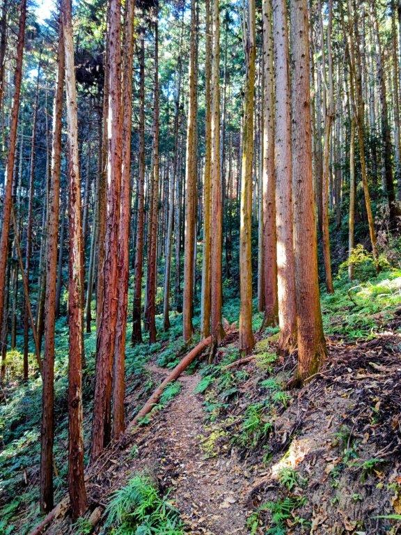
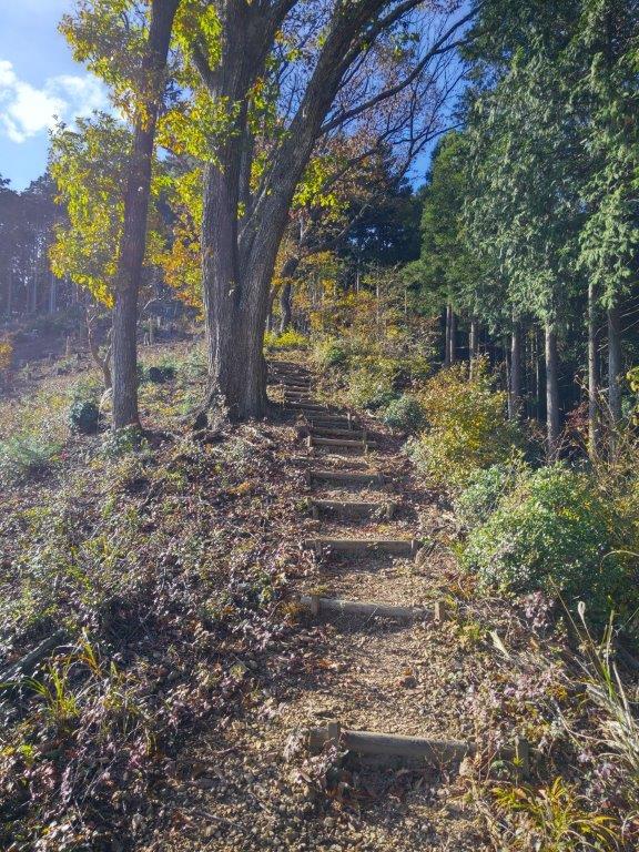
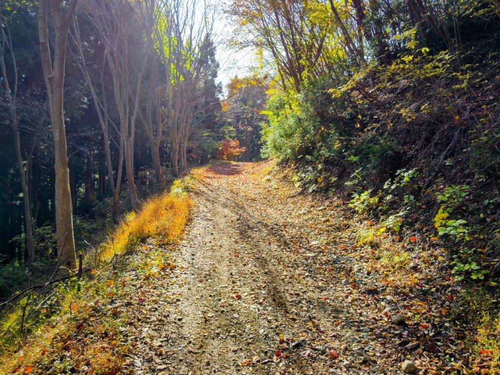
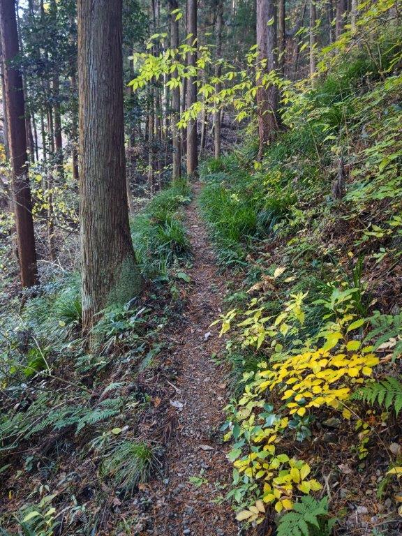
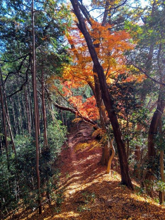
Path between Yugate and Tsuchiyama-toge

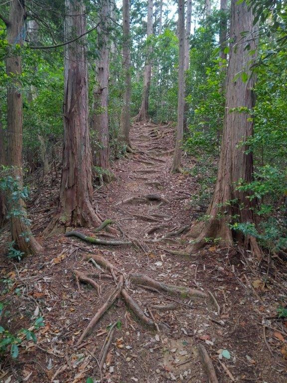
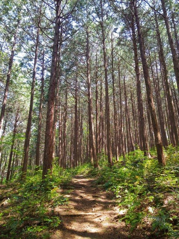
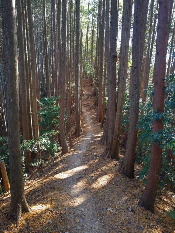
Nice Path along the Oku-musashi Long Trail

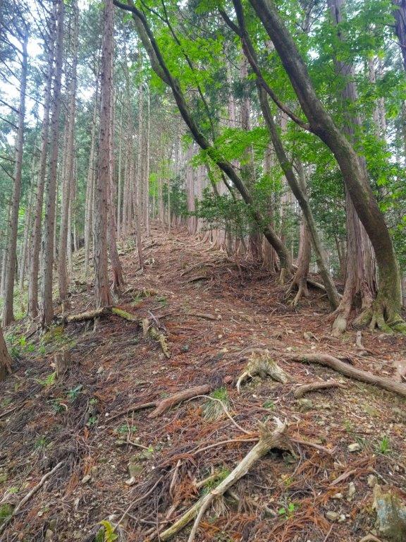
I had only just started down this separate ridge that I spotted a small handwritten sign warning hikers of the up and down nature of the trail ahead; it was good news to me, since I wanted a good workout. My only concern was the threat of a downpour as I could smell rain in the air. I quickened my pace and in no time reached the top of Mt Gojo 五常山(ごじょうやま), a minor peak completely in the trees. I continued without a break, quickly passing over a couple of equally minor ups and downs.

Taking a Detour around Mt Omine

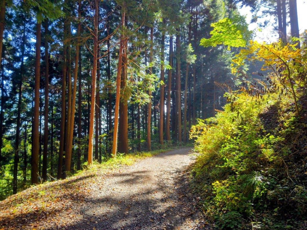
Walking through Cedars and Ferns

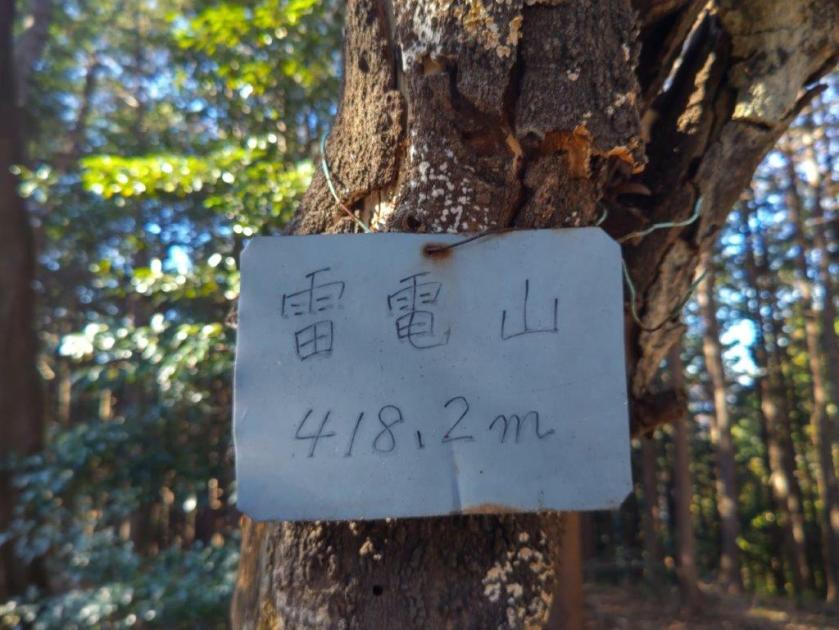
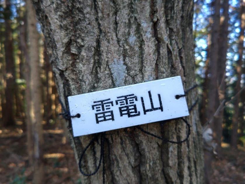
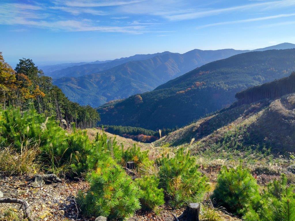
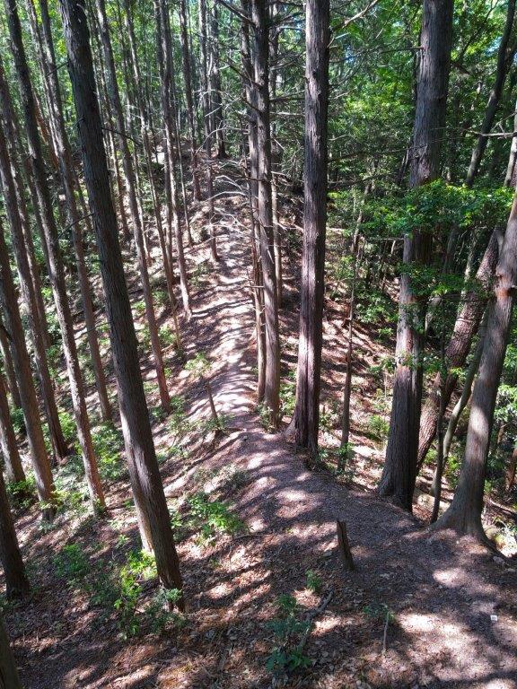
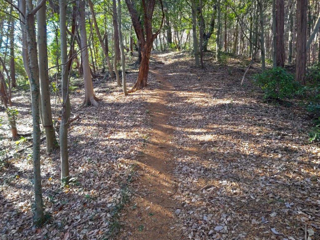
I enjoyed the solitude of the narrow forested ridgeline, on a well-defined trail with no other hikers. After passing another clearing for a third power line, I reached the base of a steep slope. It was the toughest climb of the day but I soon reached the top of Mt Nagaone (長尾根山 ながおねやま meaning long ridge), also completely in the trees; a log bench provided me with an excuse to take a short break and relax in the peaceful surroundings of this seemingly isolated summit. Surprisingly, it equaled the record of Mt Raiden for most summit markers: I counted up to five different ones.

Clearing near the Third Electric Power Line

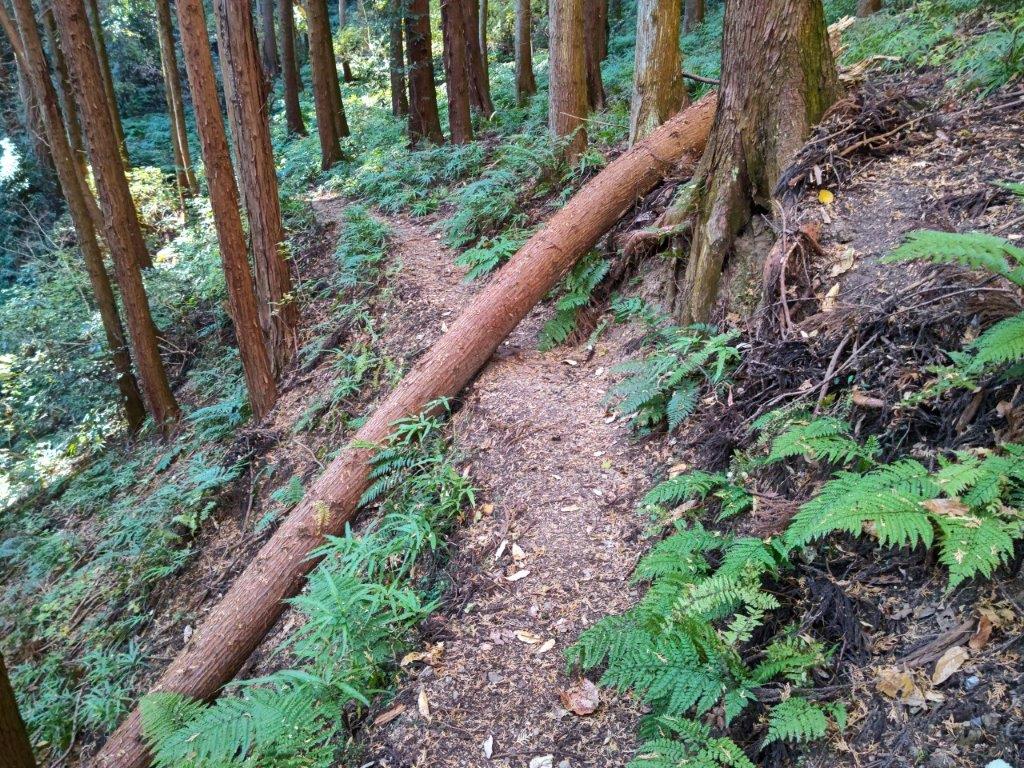
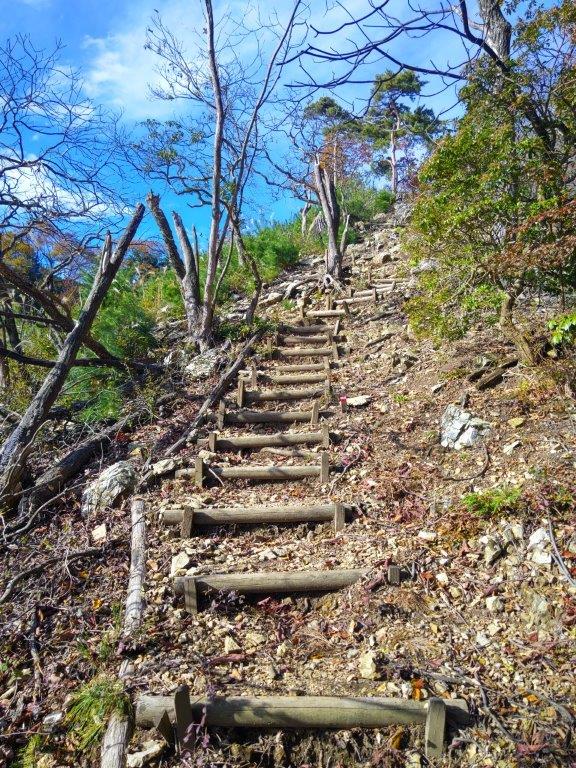
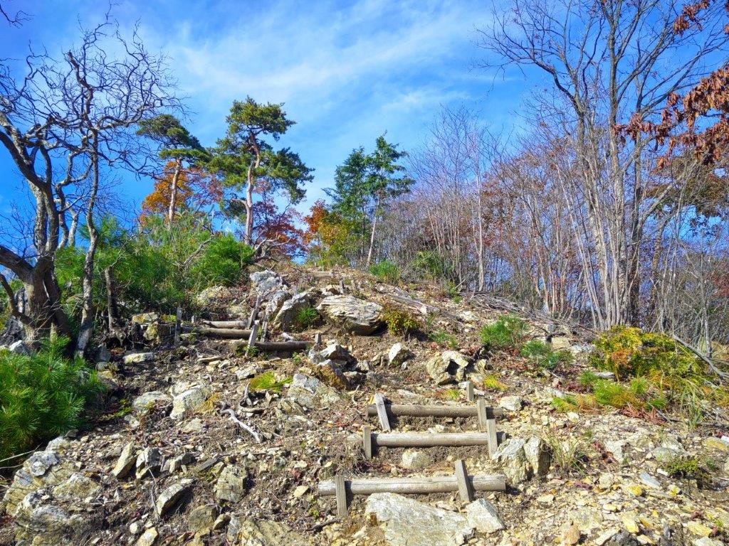
Steep Slope before Mt Nagaone

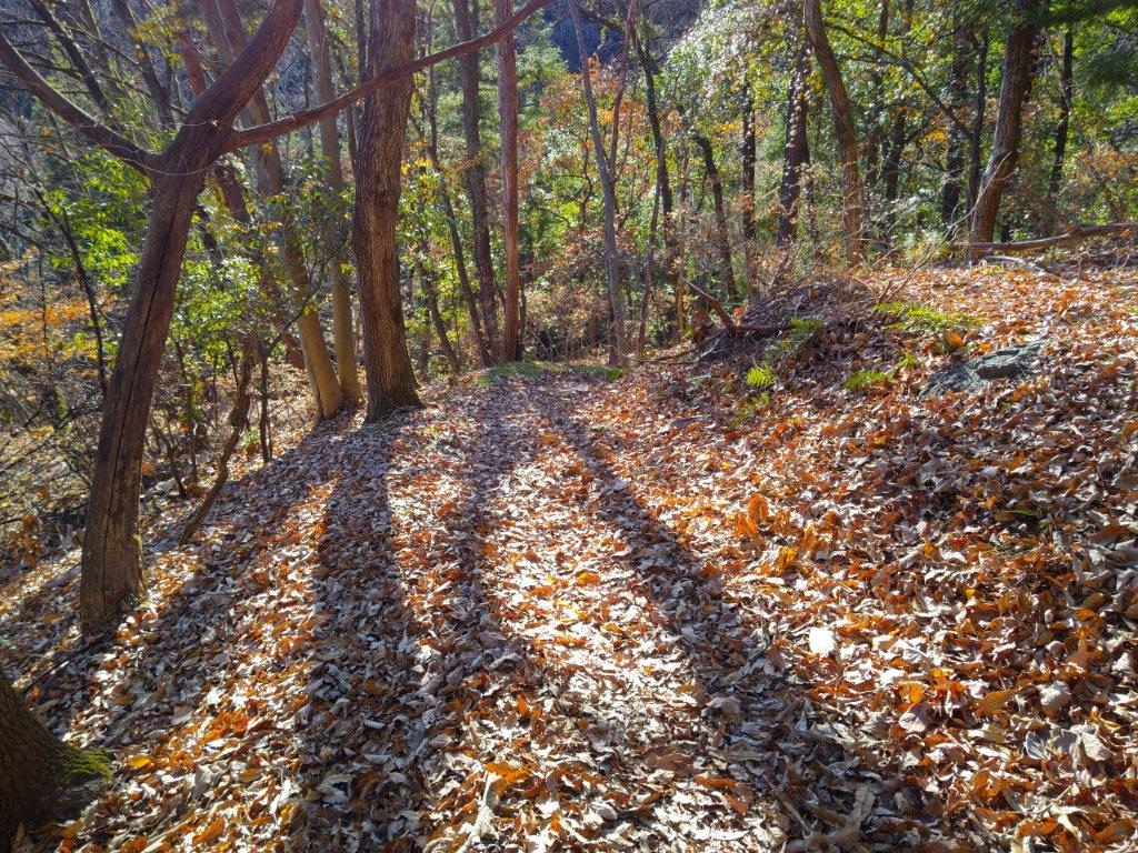
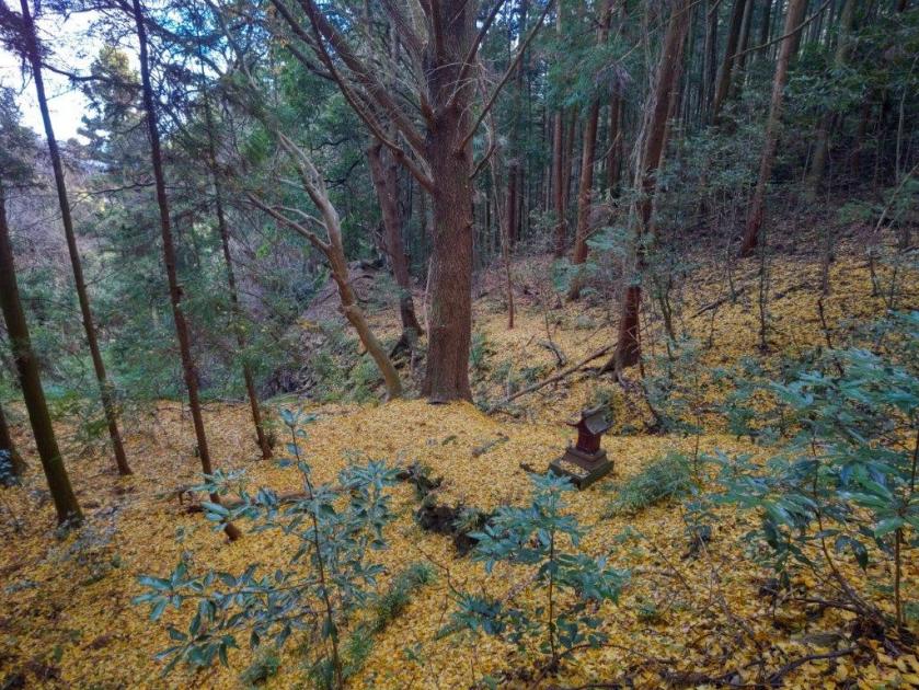
At 3pm, I headed down the south side, the steepest section of today’s hike, lined with rope for safety. No sooner had the trail leveled, that I turned left down some logs steps, choosing an alternative to the main route that continued straight. I passed another clearing for a power line, the one I had passed at the very start of the hike. The trail became hard to follow, apparently little used these days, but I stayed on track thanks to my phone GPS. Shortly after passing a “Toro“, or “stone lantern”, and other signs of temple grounds, I reached a paved road at the bottom of some stone steps. At 3h30, I reached Musashi-Yokote station, well before the start of the rain.

Watch a Video of the Hike

Watch the Video of the Hike on YouTube

See a Slideshow of More Pictures of the Hike

Mt Onita (505m) & Mt Atago (412m) Hanno City, Saitama Prefecture, Sunday, May 11, 2025

I passed by Mt Onita about four years ago, at the end of a long traverse from Okutama. At the time, I’d noticed another trail heading down from the top and thought I could return one day and use it for a short loop hike on the same mountain. Looking at Google Maps, I saw that this trail went by another peak, the summit of which had recently been cleared of trees on the east side and thus opening up a view. As an added bonus, it was also part of the Oku-musashi long trail.

For subscribers, read this Post on Hiking Around Tokyo for a better viewing experience and the latest updates

Hiking in Oku-musashi 奥武蔵

The weather forecast called for clouds and warm temperatures for most of the weekend so I decided it was a good time for some more exploring of the nearby Oku-musashi hills. To get there, I would ride the Laview Limited express to Hanno, and then, board a local bus for the thirty-minute ride to the trailhead; for the return, I’d catch the same bus, three stops up the line. I was looking forward to checking out some new trails in a familiar area.

Find Japan Hiking Maps on Japanwilds and subscribe to our newsletter

Start of the Hike (left) Heading up the Ridge (right)

Level (left) and Downhill (right) sections past Mt Onita

It was a grey, overcast day as I rode the limited express to Hanno, more like June weather than the beginning of May. I got off the nearly empty bus at noon, and after crossing a bridge over the Iruma river, headed up a trail on the left side, past a weather worn sign warning of a bear sighting ten years ago . I felt excited to be back in nature as I followed a footpath through an open grassy space surrounded by talls cedars, all signs and sounds of civilisation instantly gone.

Level Section Before (left) and After (right) Mt Atago

Open (left) and Forest (right) Sections on the way to the Power Station

My enthusiasm was quickly dampened as all signs of the trail completely vanished under rampant bamboo grass; when I had descended this way in the winter, the trail had been easy to follow. After a slight detour and some help from my phone GPS, I was soon back on an easy to follow trail. A little later, I started to climb a steep and root-riddled ridge through mixed forest. I had rushed down this section in semi-darkness back in 2021 so it felt like it was first time to walk this trail.

Open Grassy Space at the Start of the Hike

Climbing a Steep and Root-riddled Ridge

It was surprisingly humid for this time of the year; I regretted not bringing a change of clothes for the return as I started to feel that sticky sensation one usually gets in the rainy season. One hour after setting off, I was standing on the top of Mt Onita (大仁田山 おおにたやま oonita-yama) for the second time. The view was less impressive than I had remembered: only a narrow section of central Tokyo around the Sky Tree could be seen between two tree trunks. I continued without a break, hoping for a better view at the next summit, now leaving the route followed on my previous hike.

View South near Ibotori Jizo

View East from the Top of Mt Atago

Almost at once, I got disoriented by the twisting nature of the hilly terrain, compounded by local trails and signposts for places not shown on my map. I was surprised by how much geographical complexity could be packed in such a tiny wooded area. I was equally surprised by the variety of signs competing for my attention, ranging from the beautiful Oku-musashi Long Trail ones to some crude homemade efforts. Relying on my GPS again, I eventually got back on track. At 2pm, I reached a crossroads at Ibotori Jizo (いぼとり地蔵). Although my route turned left, I decided to check out the trail going straight. Very soon, I reached a view on the south side at the top of some log steps.

Summit Table on Mt Atago

Path around the Top of Mt Atago

I could see the undulating ridgeline extending east from Mt Honita, part of the Nariki Ridge Hiking Trail (成木ハイキングコース) which I hope to do one day. Closer by, I could see the red banners for the small red Inari shrine situated a few meters below. After enjoying this unexpected view and observing a butterfly suck up nectar of some purple Azalea (“tsutsuji”), I headed back to the crossroads and turned right along a level path. I soon arrived at a fork where I headed up a steep unmarked track on the left, ignoring the other branch hugging the mountain side. After a short climb, I reached the top of Mt Atago (愛宕山 あたごやま atago-yama), a common mountain name in Japan.

Looking Down at the Iruma River Valley

Oku-musashi Mountains in the Background

I was glad to have the top to myself although at this precise moment I heard voices float up from below, followed shortly after by the apparition of a couple of hikers, the first and only other hikers I saw all day. They didn’t dwell and a little later I was by myself again. Directly ahead, I could see the Kanto Plain and the tall buildings of Tokyo, flanked by the green hills of Oku-musashi on each side. It was past 2pm, so I sat at the summit table and had a late lunch with a view and birdsong in the background. Half an hour later, I set off again. After a short descent, I merged with the level trail left earlier, following my GPS down the mountain, rather than the signs.

River Valley near the End of the Hike

Crossing the Iruma River at the End of the Hike

I made one exception near the end of the hike: since I was ahead of schedule, I made a round-trip along a trail signposted for “Hendenjo” (変電所), a Tepco power station according to Google Maps. I only went as far as a viewpoint of the Iruma River Valley near an electric pylon before turning back. At 3h30, I reached a stream at the valley bottom, and shortly after, emerged from the forest at a spot called Shijuuhachi-magari (48 turns), helpfully indicated by the solidly built Oku-muashai Long Trail post. After a short walk through a residential area, I reached a bridge over the Iruma river, beyond which was the bus stop. Less than an hour later, I was comfortably seated on the practically empty Laview limited express for the forty-minute ride back to Ikebukuro.

Watch a Video of the Hike

Watch the Video of the Hike on YouTube

See a Slideshow of More Pictures of the Hike

Mt Ogiri (766m), Higashi-chichibu & Chichibu Cities, Saitama Prefecture, Sunday, March 23, 2025

I wanted to do another hike in Higashi-Chichibu, as my previous hike there a few months ago had reminded me of what a great place it was for hiking. Looking at my map, I saw I could traverse from eastern to central Chichibu, passing by a peak climbed some years ago. The middle part of my planned hike followed the Kanto Fureai no Michi, as well as the Outer Chichibu 7 Peaks Traverse Hiking Trail, meaning the trail would be easy to follow. It had snowed heavily a few days before, but looking online, it seemed that most of the snow had already melted in the subsequent warm weather.

For subscribers, read this Post on Hiking Around Tokyo for a better viewing experience and the latest updates

To get to the start of the hike, I’d ride the Tobu-Tojo express train from Ikebukuro to Ogawamachi, and from there, board the Higashi-chichibu Village line bus for the half an hour trip to Kaiya in Higashi-Chichibu. For the return, I could catch a bus from Sadamine in Chichibu itself for the thirty-minute ride to Seibu-Chichibu station, where I could get a hot bath at Matsuri-no-yu and taste some local nihonshu from their “sake server” before catching the Laview Limited Express for Tokyo. The weather was supposed to be sunny and warm for the season and so I was looking forward to an early spring hike in the Chichibu mountains north of Tokyo.

Find Japan Hiking Maps on Japanwilds and subscribe to our newsletter

Trail past the Summit (left) After Sadamine Pass (right)

Hiking the Outer Chichibu 7 Peaks Traverse Hiking Trail

外秩父七峰縦走ハイキングコース

Hiking the Kanto Fureai no Michi 関東ふれあいの道

View of Higashi-Chichibu from above Kaiya

Looking back at the Road for Kayunita Pass

The first part of the hike took me from the base of the valley to the open shelter at the Kayunita Pass (粥仁田峠), where I turned left, onto the Fureai no Michi the Outer Chichibu 7 Peaks Traverse. I started out at 11am and arrived at the pass just before 1230 during which time I saw only one other hiker, wearing a traditional Japanese straw hat or “amigasa”. He was walking behind me and occasionally picked up pieces of trash, so I assumed he was a member of the “Kaiya Genki Club”, the name shown on the many new-looking signposts I had seen along the way.

These Fields will Turn Green in the Summer

View East Between Kayunita Pass and Mt Ogiri

This first part was entirely along deserted country lanes through open fields, meaning I had wide sweeping views of the Higashi-Chichibu valley every time I stopped and turned around. On the southeast side, I could see Mt Kasa and Mt Dodaira, climbed in November last year; on the northeast side was Mt Kannokura. Most of the surrounding vegetation was still in winter mode which felt a bit strange considering that the temperature was above 20°. On the same day I saw cherry blossom trees that had already reached full bloom and patches of leftover snow, sometimes even at the same spot.

Walking the Outer Chichibu 7 Peaks Traverse Hiking Trail

View of Chichibu Highland Farm from Mt Ogiri

The next part from the Kayunita pass to the summit, up a proper hiking trail, took half an hour. It was mostly in the forest although I had a view of Higashi-Chichibu through a gap in the trees mid-way. The guy in the “amigasa” caught up with me at the summit but it turned out that he was just another hiker. The view was a bit hazy and better appreciated with the naked eye than in photos. Straight ahead, northwards, I could see Chichibu Highland Farm, Mt Misuzu and the Nagatoro Alps. To the west was the outline of Mt Ryokami and the Oku-Chichibu mountains: and on the south side was the easily recognisable pyramid summit of Mt Buko. Mt Ogiri (大霧山 おおぎりやま meaning big fog) is a 100 famous mountain of Kanto, hard to believe since I had the summit to myself (the straw hat guy left after a short break).

Level Section Past the Summit

View East of Mt Kasa and Mt Dodaira

I sat on one of the benches for a half hour lunch break. During that time, using the detailed “View Guide” (展望案内), I tried to identify many of the mountains that could be seen on a day with perfect visibility. At 1h30, I set off again, and reached the Old Sadamine Pass (旧定峰峠) less than an hour later. This up and down section was also mostly in the trees, except for a view of Mt Kasa and Mt Dodaira beyond a field on the left side. The ground was dry and free of mud despite the heavy snow just a few days ago, allowing me to walk at a good pace. I was also glad to be in the shade of the trees, shielding me from the sun on an unseasonably warm spring day.

Leftover Snow on a Warm Spring Day

Approaching the Sadamine Pass

At the Old Sadamine Pass, a crossway surrounded by tall cedars, I turned right, heading down the valley towards Sadamine, leaving the Fureai no Michi and 7 Peaks Traverse which both continued straight along the ridgeline. A signboard recounted the Legend of Daidarabotchi, including the origin of Mt Ogiri:


Long ago, there was a giant named Daidabo who lived in the Musashi Plain. One day, on his way to Mt. Haguro, he straddled the Chichibu Mountains, sitting on Sadamine Pass, and putting his straw hat on top of Mt Kasa. He stretched out his legs toward the nearby Yokogawa Rive and, placing his bowl of cooked rice gruel on Kayunita Pass, enjoyed his lunch. After he finished eating, he placed his chopsticks (made from two logs) into the ground and stood up, accidentally leaving a large rock behind that had been supporting his lower back. He then took a sip of water from the Arakawa River and blew it out—this is said to have formed Mt. Ōgiri. To this day, the footprints left behind by the giant remain in the form of wetlands and marshes in the upper reaches of the Yokogawa River and in the mountains around Shiraiwa.

End of the Hike in Sadamine on the Chichibu Side

View Towards Maruyama from Sadamine

The last part of the hike was a straightforward descent through forest. At 3pm, I popped back onto a road near Sadamine. It was another 30 minute walk back to the road and a bus stop. Since I was ahead of schedule, rather than waiting under the afternoon sun, I decided to visit the nearby Shimabuji Temple (四萬部寺), #1 on the Kannon Temple Circuit. By 4h30, I was on the bus for Seibu-Chichibu station. Surprisingly the food court and souvenir shops were not crowded, possibly because March is still out of season for the area. Shortly after 6pm, I was comfortably seated on the Laview Limited express for the 90 minute ride back to Ikebukuro.

Watch a Video of the Mt Ogiri Hike

Watch the Video of the Hike on YouTube

See a Slideshow of More Pictures of the Hike

Mt Raiden (418m), Tokigawa Town, Saitama Prefecture, Saturday, January 18, 2025

I was looking for a short, low-altitude, and relatively easy hike near Tokyo, with some good views, as well as a hot spring bath at the end, to take full advantage of the clear skies of the cold winter days. Poring over my map, I spotted a peak in the Tokigawa area, overlooked up to now, but which checked all the boxes. The summit was supposedly in the trees, but the shoulder beneath it was described online as a “Scenic ridge”. As an added bonus, I could check out the Sanba Gorge on the Toki river before heading to the nearby Toki no Yu hot spring.

For subscribers, read this Post on Hiking Around Tokyo for a better viewing experience and the latest updates

To get to the start of the hike, I’d rode a Tobu-Tojo express train from Ikebukuro directly to Ogawamachi, and there, hop on a local bus for the short ride to Suzume Dam. After a hot spring bath at the end of the hike, I’d walk a short way to the Seseragi Bus center. There, I’d catch a bus for Musashi-Ranzan station, and then board a Tobu line train for the trip back to Ikebukuro. The weather was supposed to be cold and sunny all day, and I was looking forward to a relaxing hike in the hilly countryside of Oku-Musashi.

Hiking in Oku-Musashi 奥武蔵

Find Japan Hiking Maps on Japanwilds

Suzume River and Dam

Trail past the Summit of Mt Raiden

It was another splendid winter day as I rode the express train to Ogawamachi, arriving there around 11am. After a short ride on a diminutive bus filled to capacity, I got off at the Suzume Dam entrance (雀ダム入口) in Hikage, actually a 10-minute walk to the dam itself. Along the way, I passed Hikage Shrine, its “shide” (zigzag-shaped paper streamers) swaying gently in the breeze. At the top of a slope, I reached the parking of a park, descriptively name the Suzume river dam erosion control park (雀川ダム砂防公園). A short climb up a steep staircase brought me to the top of the dam wall.

Sunny Hiking on a Winter Day

Following the Panoramic Ridgeline

Surprisingly, the water behind the dam was half frozen, sparkling white under the morning sun; yellow Japanese Pampas grass (“susuki“) in the foreground completed the scenery. In the far distance beyond the top of the dam, I could see the skyscrapers of Tokyo. I followed the road into the forest, and past a bend, reached a signpost marking the trail entrance on the right, shortly after noon.

View Southeast of Tokigawa Town

View East of Mt Doyama

It was a pleasant climb up a gentle slope through a mixed forest, the warm sunlight filtering through the leafless trees. Less than an hour later, I arrived at the small shrine marking the summit of Mt Raiden (雷電山 らいでんやま raiden-yama meaning thunder and lightning). This peak might hold the record for the most summit markers: I counted five different ones. It was completely in the trees, so after a short break, I headed down a trail on the east side.

View South of Mt Yumidate

Trail for Mt Doyama

I felt relieved that the trail was easy to walk and well-maintained, just what I had been hoping for. I saw no other hikers so I was also able to enjoy it in near complete silence in this season, before the return of the birds and insects. After a couple of turns, I reached the scenic ridge, although all I could see were the trees on both sides. Suddenly, at the top of a gentle slope and just before a steep descent, a view opened up on the right side.

Trail past Mt Doyama

Road near the End of the Hike

I was delighted to finally get a view, especially on such a beautiful day. Looking southeast, I could see Tokigawa Town, and beyond, the Kanto plain with the skyscrapers of central Tokyo in the distance. On the south side was Mt Yumidate, and below on the east side, the next part of the ridge. Since it was 1h30, I sat on a tree root at the side of the trail and had lunch with a view. Once done, I set off again, ready to tackle the steep section head.

Sanba Gorge on the Toki River

Looking back at Mt Doyama

This was the trickiest section of the hike, dead leaves making it especially slippery. I made good use of the attached rope, and once past it, the trail was mostly level. Thirty minutes later, I passed the minor peak of Mt Doyama 堂山 (どうやま 250m), and there, turned left down a pretty trail through green ferns. At 2h30, I exited the forest and reached a road along the Toki river which I followed to the entrance of Sanba Gorge (山波渓谷). I was lucky to catch the last rays of sun on the cascading, rushing water. After exploring the rocky riverbed for a while, I headed to nearby Toki no Yu at. After a relaxing bath, I walked to the bus center where I boarded another diminutive bus for the short ride to Musashi-Renzan station.

Watch a video of the Mt Raiden Hike

Watch the Video of the Hike on YouTube

See a Slideshow of More Pictures of the Hike

Mt Happu (626m) & Mt Omae (653m), Minano Town & Chichibu City, Saitama Prefecture, Sunday, December 22, 2024

I had hiked Mt Happu about a year ago but wanted to return to explore some more trails on this up and down ridge, also known as the Minano Alps. Its relatively easy access and low elevation made it the perfect place for an outing during the cold, short days at the end of December. Finally, I was eager to try out our Japanwilds Happu-san Hiking Map, published in March 2024, by making sure to download the free map in Avenza before heading out.

For subscribers, read this Post on Hiking Around Tokyo for a better viewing experience and the latest updates

To get to the start of the hike, I’d ride a bus from Minano station and get off on the north side, just past Mangan no Yu. I’d follow the Kanto Fureai no Michi to the summit, then continue to Fudatachi Pass, and from there, follow the Edo Old Pilgrimage Trail down the south side. At the base of the mountain, it was a one-hour walk through the countryside to Seoto no Yu. After a hot bath, I could use their free shuttle bus to get back to Minano station.

Hiking the Minano Alps 皆野アルプス

Hiking in Chichibu 秩父

If time allowed and the weather was clear, I’d do a round-trip to one of the viewpoints along the ridge beyond Fudatachi Pass; I could also do another round-trip to Temple #33 on the Kannon Temple Circuit, about ten minutes on foot from the hot spring at the end of the hike. The weather was supposed to be sunny but cold for the season. I was looking forward to exploring new trails on a well-trodden mountain.

Get a map of the Mt Happu hike

Find Japan Hiking Maps on Japanwilds

Trail before Saru Rock (left) Trail between Mt Happu & Fudatachi Pass (right)

It was a beautiful, sunny day as I rode the Laview Limited Express from Ikebukuro. After transferring to the local Chichibu line in Yokote, I got off at Minano station around 10am. The sun had mischievously vanished behind thick clouds rolling in from the surrounding mountains; I checked the updated forecast for the day, and it seemed the sun would return in the early afternoon. I walked to the nearby bus stop and also noticed that the departure time had been pushed back slightly since last year, meaning I had to wait a little longer out in the cold.

Walking along Nyokin Ridge (left) Walking the Old Pilgrimage Road (right)

I felt a little warmer after getting off the heated bus at Futto Iriguchi (風戸入口). I was the sole passenger and, considering the gloomy weather conditions, I wondered if I might be the only person on the mountain today. At 11am, I started up the Kanto Fureai no Michi, behind an “Onsen Stand“; this is like a petrol station, but instead of petrol, people pay a small fee to fill plastic containers with hot spring water for home use; while I was getting ready a couple cars pulled up, so it seemed a more popular activity than hiking on a cold day. After barely a few minutes, the trail ended at the road bend, which I followed up and through a village. I opened the Avenza app on my smartphone and loaded the Happu-san Hiking map, a blue dot tracking my progress along a green line showing the trail.

Start of the Trail Near Futto

Looking up, I was delighted to see patches of blue in the sky, a hopeful sign for the rest of the day. I passed an ancient “kura“, or storehouse, encircled by vegetation, slender bamboo on one side and evergreen trees on the other, the bright green contrasting with the deep blue sky; gusts of wind rustled through the leaves, contributing to the this enchanting sight, as well as pushing the remaining clouds further away. At 1130, I reached an open shelter with a view of Mt Hodo to the north. Here, the hiking trail resumed, clearly indicated by the familiar wooden Kanto Fureai no Michi (関東ふれあいの道) signposts. At the top of some log steps, I entered the forest.

View North from the Summit of Mt Happu

I was surprised to see a carpet of golden leaves covering the path ahead and the nearby forest floor. Looking left, I spotted a tall, leafless ginko with a small shrine at its foot: what a magnificent sight it must have been earlier in the month. Autumn was still hanging on in Tokyo but here in the mountains winter had arrived. After a short climb through the forest, I arrived at the Kasato junction (another reading of “Futto”) and turned right along the main ridgeline of the Minano Alps, now following last year’s hike, but in reverse. At noon, I arrived at Saru-iwa (猿岩 meaning “monkey rock”), a huge yellow-coloured rock protruding dramatically from the narrow ridge.

View of the Chichibu Basin from Nyokin Ridge

I was glad to see it properly this time as I had somehow missed it on my last visit, possibly because it was hidden by the foliage which had now fallen; it was also clearly labeled on the Japanwilds Hiking Map, so I was sure to see it, foliage or not. Apparently, the rock resembles the face of a monkey looking up, but before I had time to turn my own face up to confirm this, a big group suddenly arrived from the other direction, and I quickly departed (the face can be discerned in the slideshow picture at the end of this blog post). Shortly after, I arrived at the top of Mt Happu (破風山 はっぷさん happu-san), my third time to stand on the top.

Pine Tree and Mt Buko below the Top of Mt Omae

The breathtaking view of the Chichibu basin and the Oku-Chichibu mountains on the south side was dulled by the lingering, low grey clouds, while the more muted view on the north side was nearly clear of clouds. As more people arrived, I set off without a break, down the steeper trail on the east side. At 1230, I reached Fudatachi Pass, earlier than expected, so I pushed ahead along the ridge, feeling optimistic as the weather was slowly but surely improving. After some easy walking through the forest, now off the Kanto Fureai no michi, I reached Nyokin Ridge.

View of the Oku-Chichibu Mountains from the Musashi Observatory

From this point, I found myself scrambling over some rocky sections, chains attached for safety; I also had to navigate a narrow ledge with drops on both sides, lined with a rope to prevent any mishaps. I was surprised how quickly I had to change my walking style from carefree rambling to a cautious advance. I still made good time and soon reached the Musashi Viewpoint, on top of a prominent rock with a couple of twisted pine trees, like two hairs on a bald head. By now, the clouds on the south had mostly retreated, with most of the basin bathed in sunlight.

View North of the Nagatoro Alps from Musashi Observatory

The view had considerably improved in the space of one hour, although the triangular peak of Mt Buko was still the only easily recognizable mountain. Blue skies continued to rule on the north side, and I could see Mt Hodo, with the Nagatoro Alps behind, and even further behind were the Hachioji Hills (no relation to Hachioji city), beyond a narrow neck of the Kanto Plain. I decided to continue a little further, and after a short climb, arrived at Mt Omae (大前山 おおまえやま oomae-yama), also the location of a small statue. It was surrounded by trees but a few meters away, on the south side, was a ledge with a view.

Fallen Tree along the Old Pilgrimage Road

I kept my distance from the edge as the mountain side dropped away steeply, offering a remarkable bird’s eye view of the wrinkled terrain far below. Since it was past 1pm, I found a tree root that could double as a seat and settled down for lunch with a view. Looking to my right, I could see Mt Tengu, the highest peak of the Minano Alps: it looked deceptively close but I knew from previous experience that the next valley would take time and energy, the ridge really starting to deserve its Alps nickname, and the views wouldn’t be worth it.

Fallen Leaves and Afternoon Sun on the Old Pilgrimage Road

I made my way back at a swift pace, taking care when traversing Nyoho ridge, arriving back at the crossroads at Fudatachi Pass at 2pm; there, I turned right onto a narrow but well-defined trail. I was now following signs for Fudasho #33 Kikusui-ji Temple (札所33番 菊水時), along the Edo Old Pilgrimage road (江戸巡礼古道), heading eastwards and hugging the mountainside. Judging from my lunch spot perch, I expected a steep gradient but so far I was enjoying a gentle, almost level descent. I was making good time, except for some maneuvering around a couple of fallen trees; on the other hand, the fallen leaves, rather than being a nuisance, shone brightly under the sun, as the sky was back to its morning blueness.

Watch a Video of the Mt Happu Hike

Watch the Video of the Hike on YouTube

The path abruptly ended at a road, which I followed for a short while before rejoining the trail on the right side. At 3pm, I popped onto another road, leading me to a temple and a main road at the base of the mountain. Following the signs for Temple #33, as well as Google Maps since I was now off the Japanwilds Hiking Map, I turned right and followed back lanes past the “Michi no Eki” Ryusei Kaikan, till I found myself beside the Akahira river. The sun had already sunk below the rim of the Chichibu Basin, and so I had to save my visit to Temple #33 for another time. I reached Seoto no Yu just before 4pm, my 2nd time to this charming hot spring. At 5pm, I was the only person to board the free shuttle, the last of the day, and less than a hour later, I was at Seibu-Chichibu station, sampling some local sake from their convenient self-serving sake machine (“sake server”) while waiting to board the Laview Limited Express for the comfortable ride back to Ikebukuro.

See a Slideshow of More Pictures of the Hike

Mt Dodaira (875m) & Mt Kasa (837m), Tokigawa & Ogawa Towns, Saitama Prefecture, Sunday, November 17, 2024

I had already done the Tokigawa Trekking Trail in February 2017, at the end of a long hike and partly in the dark. I wanted to experience this excellent trail in better conditions and in a different season, so I decided to redo it but in reverse, east to west, starting from Ryozen-in, a short distance past Jiko Temple. After summiting Mt Dodaira, if time allowed, I’d continue to neighbouring Mt Kasa, before descending the valley into Higashi-Chichibu. The weather was supposed to be sunny and unseasonably warm, as it had been for the past 2 weeks.

For subscribers, read this Blog Post on Hiking Around Tokyo for a better viewing experience and the latest updates

Trail past Kanmuri-iwa (left) Trail past Mori-no-hiroba (right)

Contrails above the Trail (left) Log steps for the Steep Sections (right)

To get to the start of the hike, I’d take a Tobu-Tojo express train from Ikebukuro to Ogawamachi, and from there, a taxi to Jiko-ji, which I had already done earlier in the year. I’d finish at the starting point for the Higashi-chichibu Village line bus back to Ogawamachi station. I’d be skipping the first part of the trail, the climb from the prefectural road, but I wanted to ensure I could do the later part of the hike in optimal conditions. I was looking forward to revisiting a familiar area and seeing some more autumn colours.

Tokigawa Trekking Trail ときがわトレッキングコース

Trail before Matsu-no-ki-toge (left) Arriving at Matsu-no-ki-toge (right)

Heading to Dodaira Observatory (left) Descending into Higashi-Chichibu (right)

It was a blue-sky day as I rode the express train to Ogawamachi. After buying lunch and water at the convenience store opposite the station, I rode a taxi to Ryozen-in Temple (霊山院), a peaceful place in the middle of the forest, completely deserted as when I was last there 7 years ago. After quickly getting ready, I set off at 11am, following the stone markers for the Tokigawa Trekking Trail. I was surprised how warm it still felt, although a cold wind occasionally blew through the trees.

Sunny Trail past Nanae-toge Rest Spot

Arriving at Mori-no-hiroba

I was concerned to see webs and spiders, hanging from nearby branches. I had hoped I wouldn’t have to deal with “jorogumo” spiders past mid-November but apparently the unusually warm weather had extended their life cycle. Fortunately, I was walking along a level forest road with little chance of webs spanning its width. I soon left the forest road, following a sign for the observatory (天文台 “tenmondai“) up some steps on the right. At 1130, I arrived at Kanmuri rock (冠岩 “kanmuri-iwa“), merging with my May hike. However this time, I continued straight.

Susuki above Mori-no-hiroba

Cirrus Clouds High in the Sky

I was delighted to be following a level trail through tall cedars, the shade welcome on this unseasonably warm day. Very soon, I reached a road which the Tokigawa Trekking Trail then follows to the Nanae Pass Rest Spot (七重峠休憩所); however, I opted to take a path on the other side of the road, a more direct route to the rest spot. Past that point, I was again following a forest road, the midday light filtering nicely through the trees. At Mori-no-hiroba (森の広場), I turned right, onto some log steps taking me straight up the mountain side, out of the trees and through a field of “susuki” or Japanese Pampas grass.

Looking back at the Oku-musashi Mountains

Aiming for the Contrails

I was excited to be surrounded again by pampas grass swaying in the breeze, reminding me of last year’s hike on Mt Shakushi. As I climbed the switchback trail, in and out of mini cedar forests, a wide view of the Oku-musashi hills gradually opened up on the south side. After a short, steep section, I arrived at Matsu-no-ki Pass (松の木峠), with a sitting space and a solitary pine, a good place for a breather. Through the vegetation on the north side, I could see the Kanto Plain and the foothills of Mt Akagi.

South View below Matsu-no-ki-toge

An Easy to Walk Trail

This was by far the best part of the hike, the wild scenery complementing the outstanding views. Overhead, cirrus cloud and contrails spread across the sky, announcing a change in the weather. I was puzzled, and grateful at the same time, that more people hadn’t chosen this great trail today. I soon continued on my way, along a short, level section through bright green pine saplings leading to the final climb before the summit. Before reentering the forest, I turned around for one last look.

Final Steps before Matsu-no-ki-toge

Green Saplings and South View from Matsu-no-ki-toge

I was amazed by the plunging view, even though I was relatively low. I could now see beyond the Oku-musashi hills to the hazy Kanto plain in the distance. At 2pm, I arrived at “Stars and Green Creation Center” campground (星と緑の創成センター), where I was able to enjoy a multitude of yellow, orange and red Japanese cedars or “momiji“. Shortly after, I reached the highest point of Mt Dodaira (堂平山 どうだいらさん doudaira-san) for the 3rd time (the first time was in 2011), also a famous 100 mountain of the Kanto area, known for its white dome observatory used for stargazing on clear nights.

Looking back at the Sole Pine of Matsu-no-ki-toge

The Kanto Plain past the Oku-musashi Hills

The summit view was less clear than on my previous visit: directly ahead, the mountains of Higashi-chichibu extended northwards; on the west side, however, I could only make out a vague outline for the Oku-chichibu mountains, high-altitude clouds coming in from the west. The cold breeze from the morning had vanished, and it was quite pleasant at the top of the highest mountain in the area. After a short lunch break, I continued on my way, escaping the company of other people, most of whom had driven to the top.

Autumn Colours near the Top of Mt Dodaira

View of Higashi-chichibu from Mt Dodaira

I was glad to be once again walking on a level dirt road, after the steep one-hour climb to the top. I had reached the end of the Tokigawa Trekking Trail and was now walking along the Outer Chichibu 7 Peaks Traverse Hiking Trail (外秩父七峰縦走ハイキングコース soto-chichibu-shichihou-juusou haikingu kosu), a 42km loop connecting Ogawamachi and Yorii stations. However, I’d only be doing a short portion today. I passed the paragliding jump-off point, sadly deserted today, and reentered the forest.

Walking the Outer Chichibu 7 Peak Traverse Hiking Route

Heading down through the Forest

It was great to be walking through the trees with the trail all to myself, the surrounding forest beautiful in the late afternoon light. After a short descent, I reached a road at Nanae Pass (七重峠), my third time crossing the same road. I alternated between hiking paths and the roads for a short while, and at 3pm arrived at the trail entrance for today’s next mountain. I had more than an hour before my bus so I headed up a steep slope through a dark cedar forest in sharp contrast to the previous section. I soon reached the top ridge and a summit sign.

Walking near Nanae-toge

Ogawamachi View from Mt Kasa

I continued without stopping as I knew that the true summit, five meters higher, was a few more minutes along the ridge. At 3h30, I arrived at Kamisha Shrine (神社上社) and the top of My Kasayama (笠山 かさやま kasayama), meaning Mt Umbrella, also a 100 famous mountain of Kanto. To the east I had a view towards Ogawamachi; on the west side, I had a glimpse through the trees of the Oku-Chichibu mountains, looking dark and menacing under grey clouds. I quickly retraced my steps back to the road, leaving the Outer Chichibu 7 Peaks Traverse Hiking Route, and darted down a path between the guardrails on the left side.

Oku-chichibu View from Mt Kasa

Path for Shiroishi-shako Bus Stop

It was much darker now under the trees, the weather having unexpectedly turned cloudy on the Higashi-chichibu side. I walked at quick pace, the path following the mountain side and descending gradually. A little after 4pm, I reached Shiroishi-shako bus stop where I boarded an empty bus waiting for the departure time. By 5pm, I was back at Ogawamachi station, where I was able to pick up some Okara donuts from Shimizuya before boarding the train for the one hour ride back to Ikebukuro.

Watch a Video of the Tokigawa Hiking Trail Hike

Watch the Video of the Hike on YouTube

See a Slideshow of More Pictures

Mt Toki (463m), Mt Yasuyo (462m), Mt Kana (539m) & Mt Shiho (290m), Tokigawa and Ogawa Towns, Saitama Prefecture, Saturday, May 25, 2024

I wanted to some more hiking in the low hills of northwest Tokyo before the arrival of the rainy season. I was also looking for something short and easy after a 2-week break. Looking at my map, I saw I could walk from Jiko-ji temple in Tokigawa to Matsuoka Sake Brewery in Ogawa. After checking out the temple, I would head westwards to the highest point of the hike, then descend northeast along a ridge, and finish near the end of my hike on Mt Kannookura one year ago. If I got there before 5pm, I would be able to drop by the small shop inside the brewery and maybe even sample some Japanese sake.

Hiking in Oku-Musashi 奥武蔵

I would ride an express train from Ikebukuro to Ogawamachi, and from there, take a taxi to the parking below the temple. To get back to the station, I could catch a bus from a stop close to the brewery. The weather was supposed to be sunny all day with temperatures under 25 degrees, significantly cooler than the previous few weekends. Most of the route was downhill along a rough trail through the forest; I could expect few views but also few people. I was looking forward to a solitary ramble through the hills of Oku-Musashi.

For subscribers, read this Blog Post on Hiking Around Tokyo for a better viewing experience and the latest updates

Steps Leading to Jiko Temple (left) Start of the Hiking Path (right)

Path before Mt Toki (left) Path before Mt Yasuyo (right)

It was a perfect spring day as I rode the Tobu-Tojo line for the one-hour trip to Ogawamachi Station, arriving there at 11am. After buying some Okara donuts from Shimizuya opposite the station, I hopped into a taxi for the 20-minute ride to Jiko-ji temple (慈光寺), part of the Bando 33 Kannon Pilgrimage. After getting ready, I set off at 1230 and headed up some stone steps surrounded by the new green of spring, soon arriving at Kannon-do (観音堂).

Trail past Mt Kana (left) Descending to the Road Crossing (right)

Passing near a Rocky Outcrop (left) Following a Narrow Ridge (right)

After admiring the elaborate wooden carvings of the Kannon temple, I located the start of the trail, leading into the forest behind the building. I was now on the Tokigawa Trekking Route (ときがわトレッキングコース), hiked in 2017, but soon left it, taking an unmarked trail on the right. After a short climb through the cedars, I reached the top of Mt Toki (都幾山 ときさん toki-san). I quickly moved on and after some level walking, arrived at the top of Mt Yasuyo (育代山 やすよやま yasuyo-yama). I continued without a break, and after some more climbing, reached the top of Mt Kana (金嶽 かなたけ kana-take), the highest point of the hike. There, I turned right, heading down the mountain side.

Stone steps through the New Green of Spring

Kannon-do Temple within the Jiko Temple Grounds

I was relieved to be following a clear path through the forest, although I couldn’t spot any signs indicating the way. At 1h30, I arrived at a road crossing, beyond which the trail became faint; fortunately from this point, I could count on pink ribbons to confirm the way, in addition to my phone GPS. As expected, I saw no other hikers on this up and down trail along a narrow ridgeline. At 2h30, I passed under an electric pylon where I had a view of Mt Kasa to the northwest. Soon after, I arrived at the top of Mt Shiho (士峰山 しほうざん shihou-zan), marked by a small shrine. I took a break for lunch, enjoying an Okura donut for dessert. From this point the trail suddenly became harder to walk and follow.

View Southeast from the Electric Pylon

Countryside View at the End of the Hike

I proceeded with caution, picking the most walkable parts among the rocks and bushes. At 3h30, I passed another minor summit (古寺山 280m). From this point, the trail condition improved, although it had suddenly become quite windy. I started to descend quickly, and half an hour later, emerged onto a small lane. I had finished earlier than expected so I headed over to the nearby Matsuoka Sake Brewery and was able to sample their Mikado Matsu brand from their handy sake server. After buying a bottle for home, I set off for the bus stop, and after a short ride, was back at Ogawamachi station just before 5pm.

Watch a Video of the Mt Kana Hike

Watch the Video of the Hike on YouTube

Mt Otakatori (376m), Ogose Town, Saitama Prefecture, Saturday May 11, 2024

I wanted to do a short morning hike close to Tokyo to beat the early summer heat that was forecast for the weekend. I decided to head to Mt Otakatori in the Ogose Alps, last climbed two years ago. Looking at my map, I spotted a trail on its west side leading to an observation deck on the top ridge. From there, I’d follow the ridgeline north to the highest point. I’d then descend a valley on the east side and check out a minor peak protruding from the forested foothills. I’d end the hike at a park at the foot of the mountain, a short walk from the station.

Hiking in Oku-Musashi & the Ogose Alps

奥武蔵 ・  越生アルプス

Start of the Kami-Daima Trail (left) Sun Shining on the New Green (right)

Walking under Fallen Trees (left) and between the Ferns (right)

To get to the start of the trail, I would ride the Tobu express train from Ikebukuro to Sakado and then change to a Tobu local train ending at Ogose station. From there, I’d catch a bus for Kuroyama and get off a few stops before the end of the line. The forecast called for blue skies and temperatures in the high twenties; I hoped I’d be able to wrap up my hike by the early afternoon. I was looking forward to exploring new trails on a familiar mountain and getting some good views on an early summer day.

For subscribers, read this Blog Post on Hiking Around Tokyo for a better viewing experience and the latest updates

Passing by Nishi-Daimon Orchards (left) Path for Kokuzoson (right)

Wide Trail (left) and Narrow Footpath (right) for Nishi-Yamafuji

It was a beautiful spring morning as I rode the train out of the city, glad that I could sit all the way. After arriving at Ogose station shortly after 9am, I boarded the bus for the short ride to Kami-Daima stop near a bridge over a river. After getting ready, I quickly located the start of the trail, an unmarked footpath to the right of a gravel driveway, and by 10am was walking in the cool shade of the cedars. Less than an hour later, I emerged from the forest onto a road at Nishi-Daimon Orchards (西大門農園), a short distance from the Katsuragi Kannon observation deck (桂木観音展望台), which I reached just before 11am.

View Southeast from the Katsuragi Kannon Observation Deck

View Northeast from the Top of Mt Otakatori

I enjoyed the view, the new green of spring contrasting nicely with the bright blue sky; in the distance I could see the flat Kanto Plain and the skyscrapers of Tokyo. I went up a series of stone steps starting directly behind the deck and ending at Katsuraki Kannon temple, the hiking trail continuing on the left. Very soon, I passed the minor summit of Mt Katsuragi (桂木山 かつらぎさん katsuragi-san 376m), completely within the trees. Soon after, I arrived at a large crossroads in the middle of the forest where I continued straight, reaching the summit of Mt Otakatori (大高取山 おおたかとりやま otakatori-yama) soon after.

View of the Ogose Alps from Mt Otakatori

Closeup of the section between Mt Ogose and Kanhashu

Some trees had been cut on the west side, opening up a superb view of the Ogose Alps (越生アルプス): I could see all the way from Mt Ogose on the left to Kanhashu on the right. I then turned to face the more familiar view on the west side: between a gap in the trees, I could see the rounded top of Mt Nishi-Takatori lower down and Ogose Town and the Kanto Plain beyond. It was already 1130 and time to head down; a little after noon, I turned right onto a path for Kokuzon (虚空蔵尊), taking me away from the busy main trail up and down the mountain.

Few People at the Summit on this Beautiful Day

Forest Road leading to Kokuzon Sakura Park

I was delighted to be have the trail to myself again, walking down a green valley alongside a bubbling stream. Half an hour later, I reached a forest road but soon turned right up a trail next to a brooklet, a tributary of the stream from earlier. The path curved in a counter-clockwise direction and I was soon heading east again. I made a short roundtrip to the top of Nishi-Yamafuji (西山富士 にしやまふじ nishi-yamafuji 190m), a peaceful spot in the middle of the forest. Back on the main trail, I soon exited the forest and arrived at a viewpoint and a couple of log benches, also the top of Mt Kokuzon Sakura (虚空蔵尊さくら山 170m), the highest point of the Kokuzon Sakura Park.

East Ridge of Mt Otakatori from Mt Kokuzon Sakura

View of the Kanto Plain from Kokuzon Sakura Park

I was pleasantly surprised by this beautiful view, not shown on any of my maps. I could see the eastern ridge of today’s mountain, freckled with light green, as well as the flat Kanto plain stretching away under the light blue sky streaked with white cirrus clouds. After a short break, I set off again, heading down one of the many paths through the park and arriving at the mountain base at about 1h30. I made my way back to Ogose station as fast as I could; although the surrounding countryside was pleasant, I was now out of the forest and fully exposed to the hot afternoon sun. By 2pm, I was glad to be sitting again in the cool interior of the train bound for Tokyo.

Watch a Video of the Mt Otakatori Hike

Watch the Video of the Hike on YouTube

See a Slideshow of More Pictures of the Hike

Mt Fuji (220m) & Shirogane-Daira (195m), Hidaka City, Saitama Prefecture, Tuesday, January 30, 2024

I wanted to do a short hike to get back into shape after a three-week break. I settled upon going on a weekday morning, as other commitments and poor weather had prevented me from going the previous weekend. I decided to do a hike up a minor peak on the eastern edge of the Oku-Musashi hills, planned last year and kept in reserve for a cold winter day. Although it shared a name with Japan’s most famous volcano due its conical summit, the climb would be a lot less arduous. I was more interested in the nearby observation deck and its view of the Kanto plain. To round out the hike, I would make a short roundtrip to a nearby waterfall. I would take the Laview limited express to Hanno, and there, ride a bus north towards Hidaka City. I would then make my way to Koma station on the Seibu-Chichibu line, from where I could catch a train for Hanno. The weather forecast was sunny and warmer than the previous days, which was good news since I would be starting earlier in the day. I was looking forward to a morning hike in the forested hills close to Tokyo after a few weeks off.

Hiking in Oku-Musashi 奥武蔵

For subscribers, read this Blog Post on Hiking Around Tokyo for a better viewing experience

Start of the Hike (left) Trail past Shirogane-Daira (right)

Trail past Takizawa Falls

It was sunny, cold day as I rode the limited express train to Hanno. After a 40-minute bus ride, roughly the same duration as the train ride, I got off at a stop a little after 9am, a few minutes on foot from Ten Shrine (天神社) and the start of the hike. After getting ready and quickly checking out shrine, I set off around 9h30. I headed up a paved road leading past Komagawa Country Club and took a left at a signboard of today’s hiking route, featuring the birds “Kurikka” and “Kurippi”, Hidaka City’s mascots.

Walking up Mt Fuji

The Shirogane-Daira Observation Deck

I was delighted to be walking in nature, tall pines on both sides, the sun shining down from above; to my right was the Komagawa golf course, a low fence protecting me from stray balls. At 10am, I reached the hiking trail, beyond a stone “torii” (shinto gate). Very soon the path rose steeply, but I had barely broken a sweat when I emerged onto the sunny top of Mt Fuji (富士山 ふじやま fujiyama). Despite being in the sun, the top area was surrounded by trees. As I took a break next to the small summit shrine, a helicopter darted across the sky, probably headed to the nearby Tokorozawa airfield.

View Northeast of the Kanto Plain from Shirogane-Daira

View East of the Kanto Plain from Shirogane-Daira

I set off down a steep series of steps, at the end of which I turned left along a level path, and soon reached the Observation Deck at Shirogane-Daira (白銀平 しろがねだいら), at 10h30. From the top of the white, square structure, I had a view of the Kanto plain on the east side. Apparently Mt Tsukuba, Mt Nantai, Mt Akagi, the Tanzawa mountains and even Mt Fuji are visible, but I couldn’t make them out despite the clear skies. However, I could see the Tokyo skyscrapers, as well as Seibu dome; turning around I could see Mt Hiwada and Mt Monomi above the trees on the west side. After a late breakfast, I retraced my steps and followed a path along the mountain side.

Trail between Shirogane-Daira and Takizawa Falls

Wooden Carved Pillars outside Koma Station

I was surprised to see such beautiful forest so close to the big city. All too soon, I reached a paved road next to another golf course. I turned right, and shortly after, rejoined the trail on the left, taking me to the turnoff for the Takizawa Falls (滝沢の滝). I had seen more impressive waterfalls, although the dry winter season might be to blame, and quickly headed back to the main trail. After a short up and down along a sunny trail, I popped onto a pleasant countryside lane, ending at a busy road for Koma station, where I arrived shortly after noon. After admiring the two demon pillars guarding the station building, I hopped onto the local train for Hanno, just 2 stops away, and then boarded the express train for Ikebukuro.

Watch a Video of the Mt Fuji Hike

Watch the Video of the Hike on Youtube

See a Slideshow of More Pictures of the Hike

Mt Otaka (493m), Mt Tenkaku (445m) & Mt Kamado (293m), Hanno City, Saitama Prefecture, Sunday, December 10, 2023 [Hanno Alps]

I wanted to do a hike with little elevation gain, since I had been out sick for the past two weeks. I decided to continue my hike along the Hanno Alps, from where I had left off two years ago, as well as explore more of the newly created Oku-Musashi Long Trail. Looking at my map, I saw I could follow a couple of new trails allowing me to get on and off the “Alps”. I would take a bus from Hanno station to Nakazawa, at the end of the line, then walk to Maezaka Pass. I would end the hike at Musashi-Yokote-station, on the Seibu-Chichibu line. The weather was supposed to be sunny with temperatures reaching 20° Celsius in the afternoon, a record for the season. I had hiked most of this trail nearly ten years ago, and remembered it was mostly in the trees. I expected few views on the way; since the elevation was relatively low, I hoped to still see some Autumn colours. I was looking forward to exploring some new trails, along a familiar route.

Hiking in Oku-Musashi 奥武蔵

Hiking the Hanno Alps 飯能アルプス

Read this Blog Post on Hiking Around Tokyo

Autumn Leaves Along the Trail

It was a perfect blue sky day as I rode the Laview limited express to Hanno station. There, I skipped a long line of hikers headed for Bonomine, and boarded a mostly empty bus for the short ride to Nakazawa (中沢), at the start of the road leading to Takedera. Morning frost on the road and a biting cold in the shade reminded me that it was nearly the start of Winter. After a short walk up a road, I reached the entrance to the hiking trail at 9h30.

Start of the hike (left) Rocky Section before Mt Otaka (right)

Flat Section past Mt Otaka (left) Maple Tree on the way to Mt Tenkaku (right)

I was happy to be walking again in nature after a two-week break. After a short climb, I reached a level section; I sat down on a log in the sun to enjoy a late breakfast, while listening to the sound of birdsong. The trail then headed down a valley and I soon emerged onto a road, the same one I had followed on my previous visit. At a bend in the road, I rejoined the hiking trail, and at 11am, I arrived at Maezaka Pass (前坂峠). There, I turned right, heading southeast along the Hanno Alps (飯能アルプス) and the Oku-Musashi Long Trail.

Maple Tree Past Oiwa Rock (left) Fantastic Tree along a Narrow Ridge (right)

Trail Before Mt Tenkaku (left) Trail for Mt Kamado (right)

I spotted the first Autumn leaves of the day, halfway up a slope: a mix of orange and yellow, on a background of dark green cedar and bright blue sky. Soon after, I reached the summit of Mt Otaka (大高山 おおたかやま ootakayama). After peering at the view on the west side, I set off again. At the base of a steep slope, I passed under a huge Japanese maple, its leaves falling gently in the breeze. At noon, I arrived at Oiwa Rock, a a big boulder in the middle of the forest. After some ups and downs, and the occasional tree sporting its autumn colours, I reached the top of Mt Tenkaku (天覚山 てんかくざん tenkakuzan).

Joining the Hanno Alps at Maezaka Pass

Westward View from Mt Otaka

I was surprised by the wide view on the south side, proof that a refresher had been necessary. Southeast, I could see the Kanto plain, the central Tokyo skyscrapers barely visible in the midday haze; to the right was the outline of the Tanzawa mountains; southwest, slightly hidden by the trees, were the highest peaks of the Okutama mountains. Since it was 1pm, I found a bench in the sun and sat down for lunch. After spending some time basking in the sun, I set off again a little before 2pm. After some descending through Japanese pampas grass, I reached a paved road which I followed for a short while to Azuma Pass (東峠), where I rejoined the hiking trail.

Orange and Red Japanese Maple Overhead

Explosion of Colours Above

The endless ups and downs of the next section made me feel that the “Alps” nickname was well-deserved. Through a break in the trees, I had a good view to the east of Mt Sukari; it was above Fudo-Iwa Rock, which I had to skip as I was running late. At a junction with a bench, I turned left, leaving the last part of the Hanno Alps for another day. At 3pm, I arrived at the last peak of the day, Mt Kamado (釜戸山 かまどやま kamadoyama), with only a narrow view on the south side. I rushed down the mountain side, popping onto a forest road a little before 3h30. After a short walk, I arrived at Musashi-Yokote station where I caught the train for Hanno, 3 stops away. There, I boarded the limited express for the 40-minute ride back to Ikebukuro.

View of the Kanto plain from Mt Tenkaku

View of Mt Sukari from near Fudo-Iwa

The entire hike took me about 6 hours, including a leisurely break on the top of Mt Tenkaku. It was longer than I had planned for, and my knees were aching a little after all the ups and downs (I had neglected to bring my walking stick). Although I did pass several people along the way, there were a lot less hikers than would be expected on an easily accessible trail close to Tokyo; I did however see some families with very young children. I saw no on on the final part along Mt Kamado even though the signage was brand new. I was glad I got to see some beautiful autumn colours on the way, and I hope to one day redo this hike in the Spring.

Watch a Video of the Autumn Colours on the Mt Tenkaku Hike

Watch the Video of the Hike on Youtube

See a Slideshow of more Pictures of the Hike