

I was looking for an easy and short station to station hike nearby Tokyo to help me get back into hiking mode after a two-month forced break. I thought it would be too hot and uncomfortable to hike in the low hills of Oku-Musashi 奥武蔵 in the month of June. Also, I had hiked these trails three times previously, so I thought it might not be so interesting. Finally, I had no idea whether the trail would be open and properly maintained. In the end, I couldn’t come up with a better idea, and since the train ride was just over an hour, I decided to just go for it.

Looking towards Chichibu

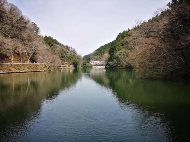
Sakura next to Kamakita Lake
After getting off the train at Higashi-Agano station 東吾野 a little after 10am, it took me less than 5 minutes to reach the start of the hiking trail, behind Agana Shrine 吾野神社. This is surely one of the most convenient hiking trails in the area! the trail immediately starting climbing through beautiful forest. I was pleasantly surprised to see that the trail was well-maintained and the signposts were relatively new; often they were entirely in English. As I moved along the trail, I was amazed at how different the surrounding vegetation looked. Previously, I had seen the light green of early spring, the colours of Autumn, and the snowy whiteness of winter. This time, I was treated to the lush dark green of summer. The forest was still relatively insect-free and the humidity was average; contrary to my expectations, the conditions were nearly ideal. All my concerns had been washed away minutes after starting the hike!

Start of the hiking trail for Yugate
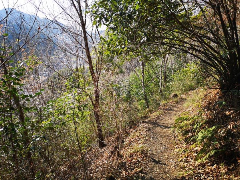
A pleasant hiking trail up the mountain side
After less than an hour, I reached the top of Mt Hashimoto 橋本山 (はしもとやま) where I had a good view of the Chichibu mountains to the West. After a late breakfast, I set off again, and reached the tiny village of Yugate ユガテ at noon. Yugate is made up of a handful of houses and fields situated on a small plateau among the hills. There is a nice grassy field on one side, with a couple of benches in the shade – the perfect place for a lunch break. Today however, it was too early for lunch, and the benches were already occupied by groups of hikers. I moved on quickly, reached a fork, and headed along the right branch. I had planned to do a circle hike centered on Yugate, so I would be returning via the left branch later in the day.
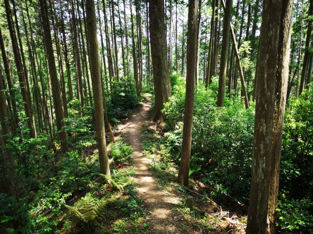
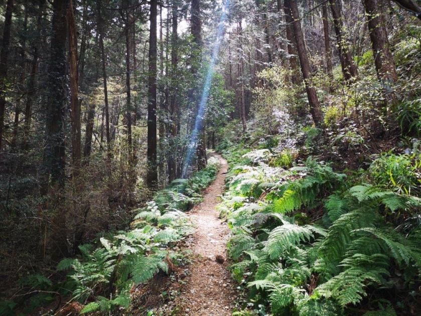
Easy to hike trail through the forest

The flowers of Yugate
The next section was highly enjoyable: for 40 minutes, the narrow trail followed the side of the mountain through silent forest, crossed a couple of small streams, before climbing to the Oku-Musashi Green Line Road. I saw and heard no one during this time. The area between the station and this road is part of the Nishikawa Forestry Area 西川林業地, and I suppose special care is taken to its maintenance. I had now reached Kitamukijizo 北向地蔵. Instead of following the top of the ridge towards the left, I decided to make a longer loop by descending to the lake on Moroyama Town side of the mountain. The forest here was less beautiful, but the descent was pleasant, and at one point there was a view of the Kanto Plain to the East.

Yugate, a good place for a break
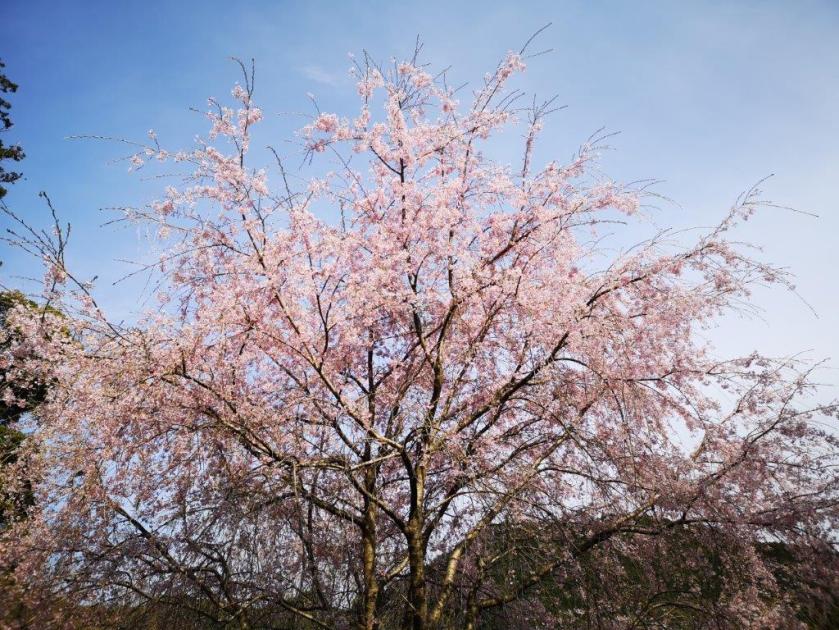
Sakura tree in full bloom in Yugate
I reached the edge of Kamakita lake 鎌北湖 just after 1pm, and I was shocked to see that it had been entirely drained for construction work. By now, it was getting pretty hot, and it would have been refreshing to walk alongside a body of water. Instead it was a dusty pit filled with noisy excavators. I wasn’t sure what the purpose was, but apparently it would be completed by April next year. I quickly made my way around the side of the lake. I was walking on an asphalt road now, and I was starting to feel pretty hot. At 2pm, I turned left onto a gently climbing path up the side of the mountain, bringing me under the welcome shade of the forest.
UPDATE: I walked from Yamakita lake to Nishi-Agano station via Yugate in April 2022 and the lake had been refilled (see picture below).
View from the hiking path along Kamakita Lake
Following the path back up to the top of the ridge
After a short climb, I was back on top of the ridge. I noticed that several of the Japanese-only signs had the English names scribbled on them, and I couldn’t help wondering who had added them. I now made my way back down to Yugate. This time the benches were empty, but I wanted to catch an early train back (and I already had eaten my lunch) so after a quick sit down, I moved on. I followed the trail I had come up in the morning, but skipped the summit of Mt Hashimoto by following the “Woman’s Slope” 女坂 that went around the other side. I took an alternative path at the very end and finished at Fukutokuji Temple 福徳寺 from where it was a ten minute walk back to the Higashi-Agano station, arriving there at 3h30.

The crossroads of Yugate

Sakura near Nishi-Agano station
This hike is probably one of the best kept secrets of the Tokyo area. Even though, there are no famous shrines or great views, it’s easy to reach and ideal for those who want to do some peaceful “nature bathing”. However, it’s best to wait till that lake is filled up again!
[UPDATE: The lake has been filled up again!]
