Mt Sekison (1049m) & Mt Takada (1212m), Nakanojo Town, Gunma Prefecture, Sunday, October 29, 2023

I wanted to see some autumn colours, and also do a more challenging hike than the previous week. I chose a pair of minor peaks in the Nakanojo area, last visited a year and a half ago, not mentioned in my guidebook, nor shown on my hiking map. I knew about them thanks to a hiking pamphlet I had picked up during my stay at Shima Onsen in 2019. Although it wasn’t a long hike, it started from the valley bottom and seemed to go high enough to satisfy both my conditions. After riding the shinkansen to Takasaki, and then the Agatsuma line to Nakanojo station, I would catch the bus for Shima Onsen to the start of the trail. If I finished early enough, I could get the bus connecting with the Kusatsu limited express, direct for Ueno on the return; otherwise, I would use the same route as in the morning. I was a little concerned about the weather forecast: sunny in the morning but cloudy in the afternoon. I was looking forward to a peaceful hike on a quiet mountain and seeing the first autumn leaves of the season.

Get a Map of the Mt Sekison Hike

This map was developed for Japanwilds with the Hokkaido Cartographer

Find Japan Hiking Maps on Japanwilds

Read this Blog Post on Hiking Around Tokyo

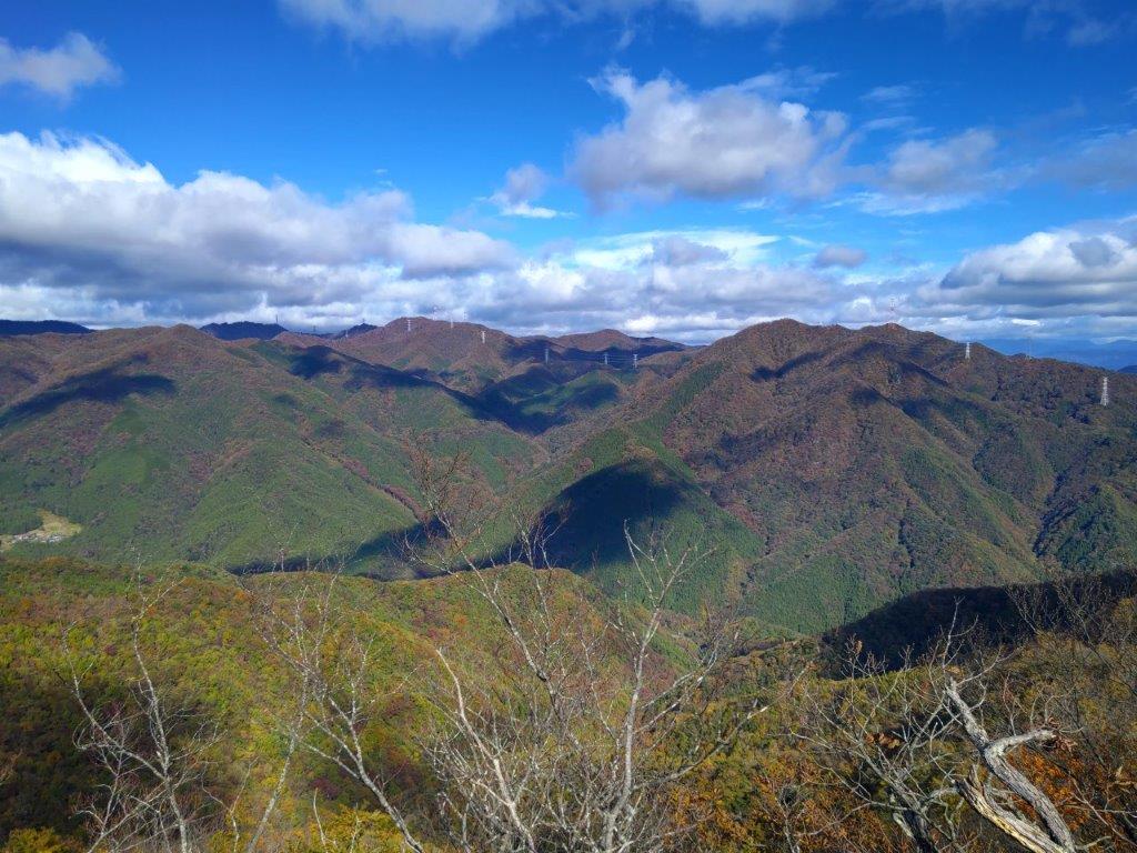
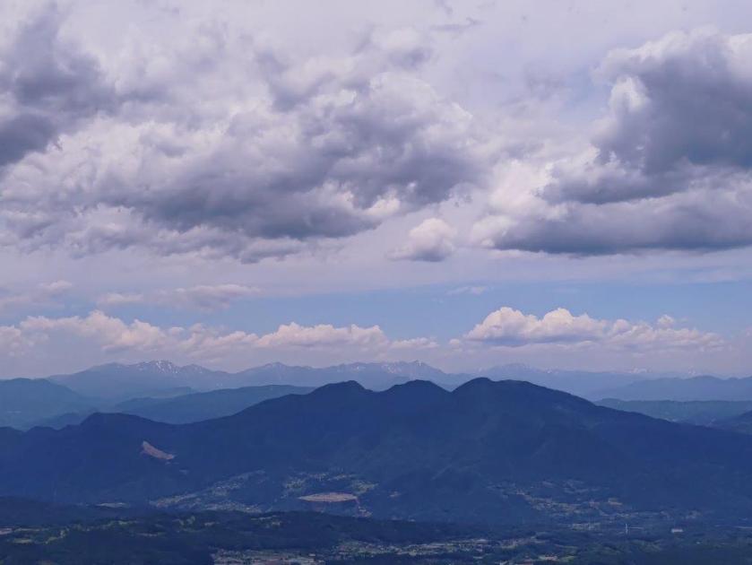
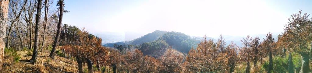
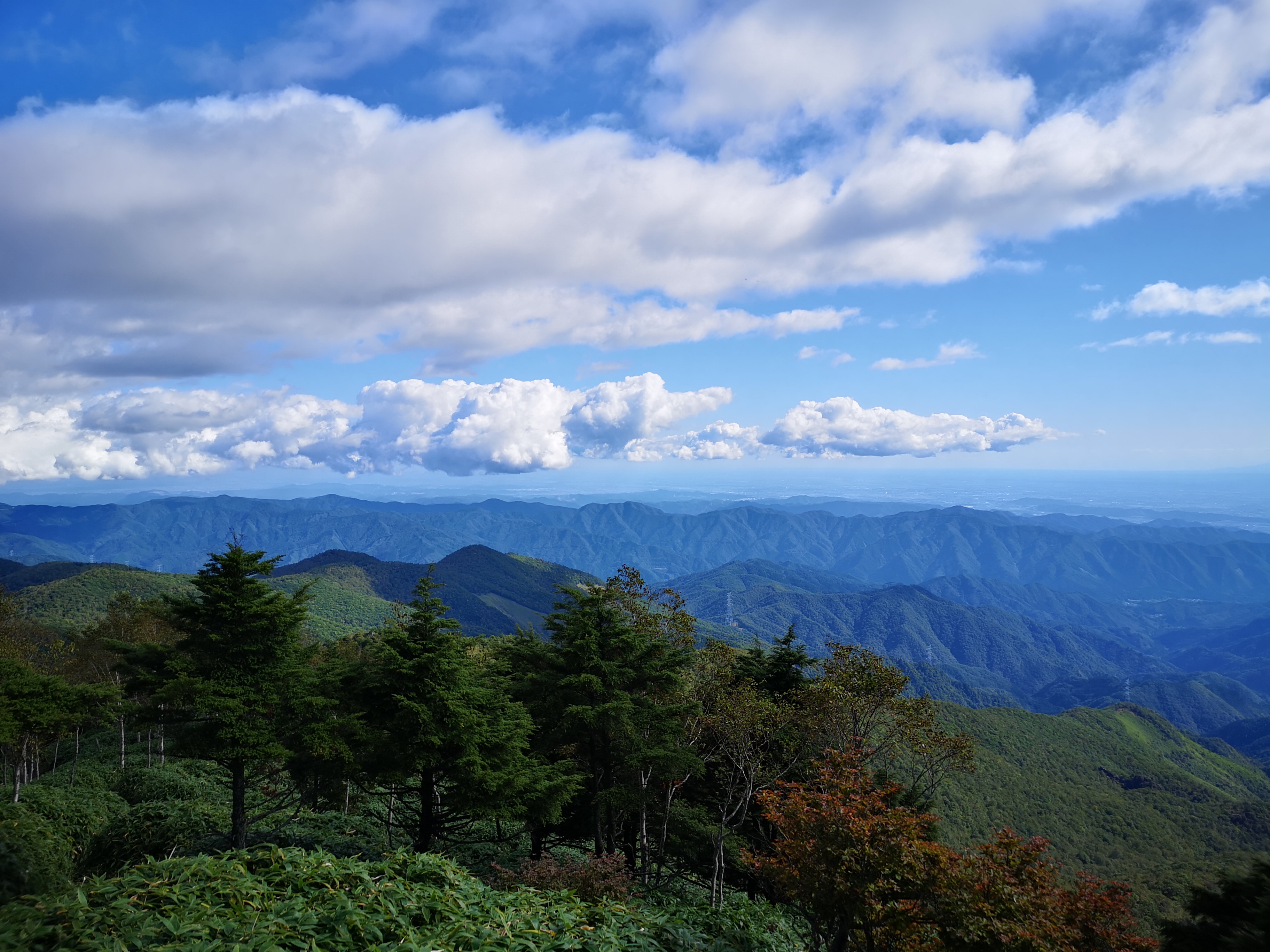
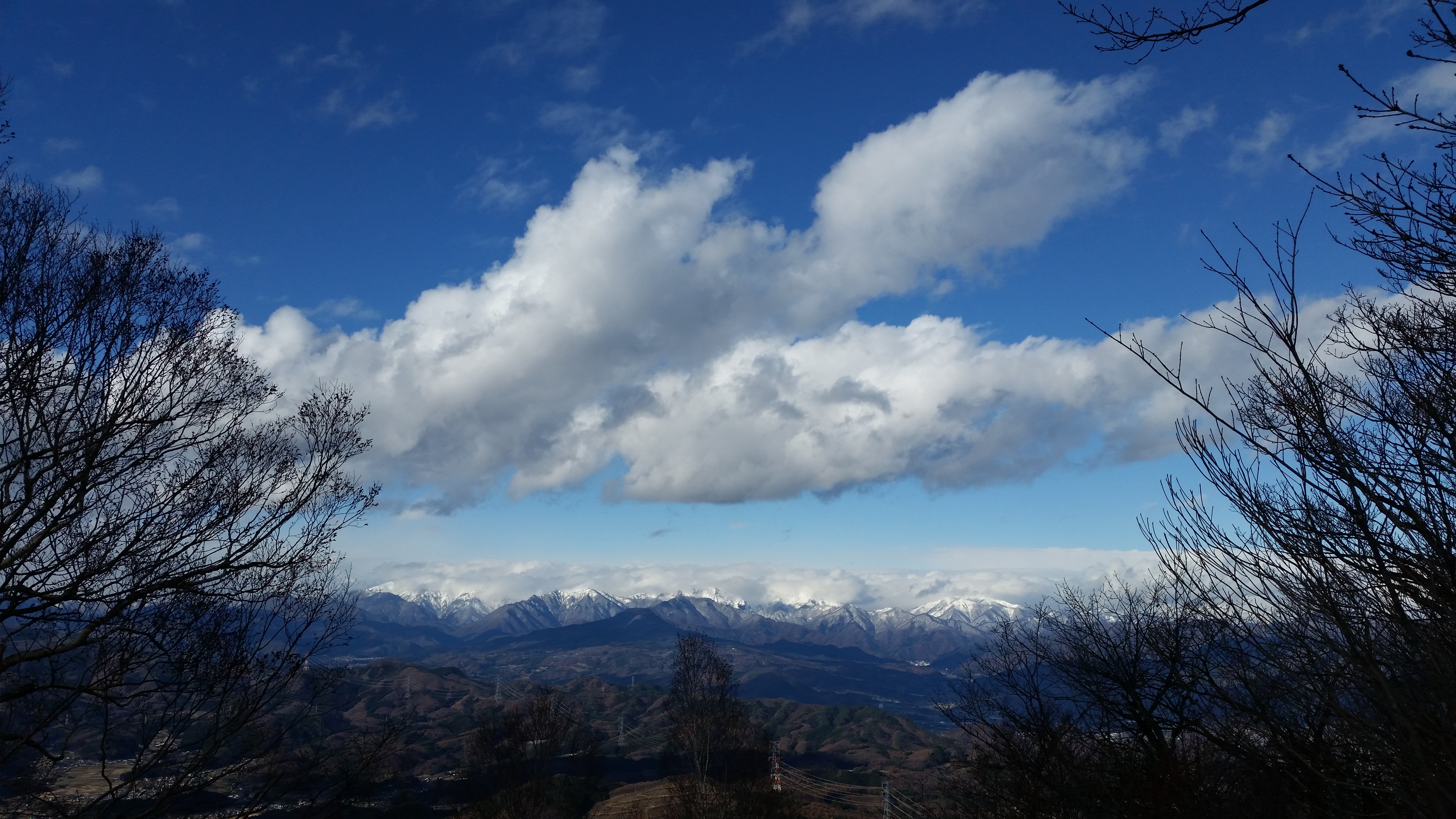
View north towards the Joshin-Etsu Mountain Range

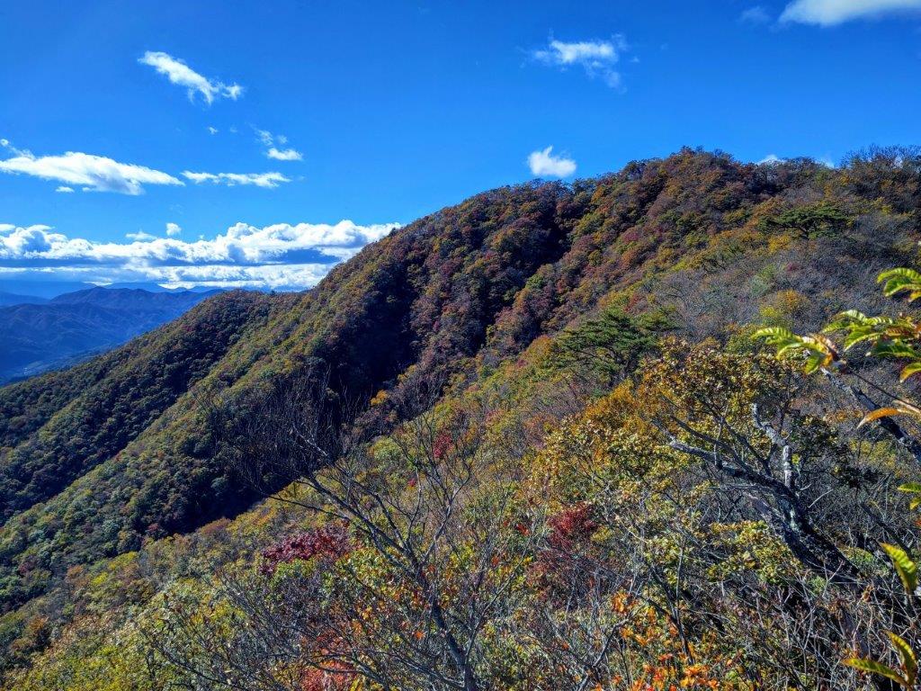
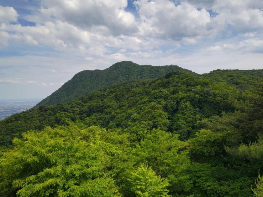
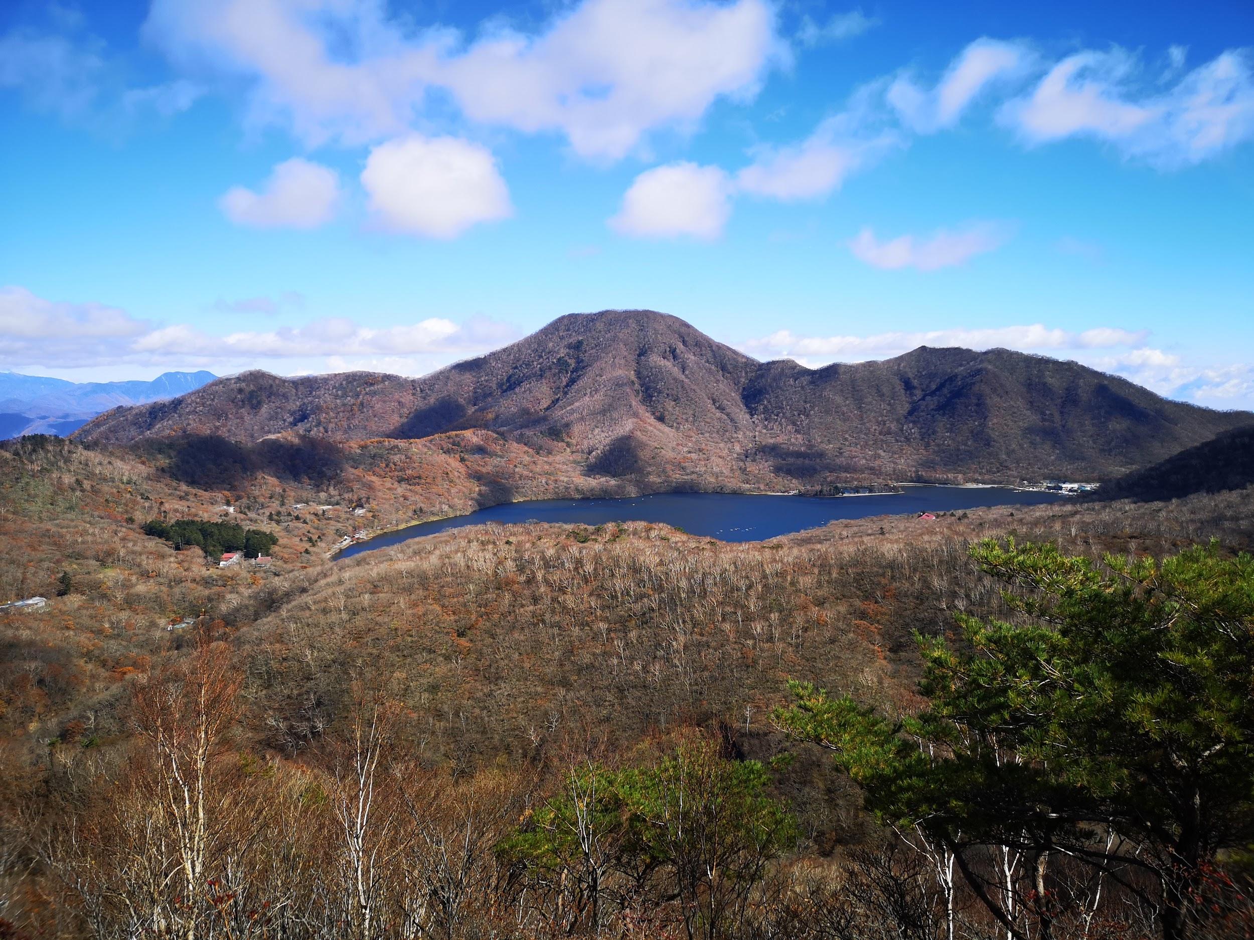
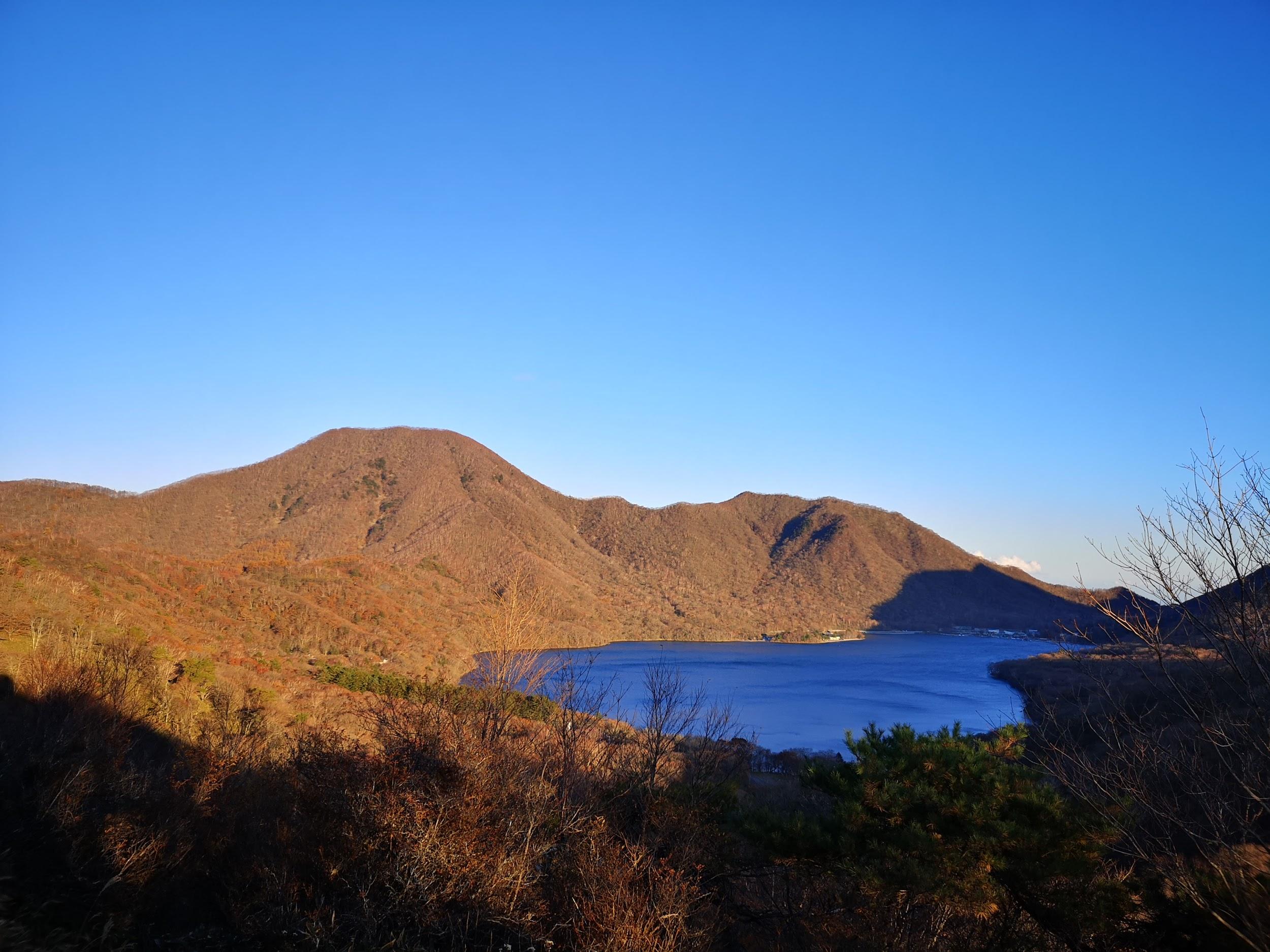
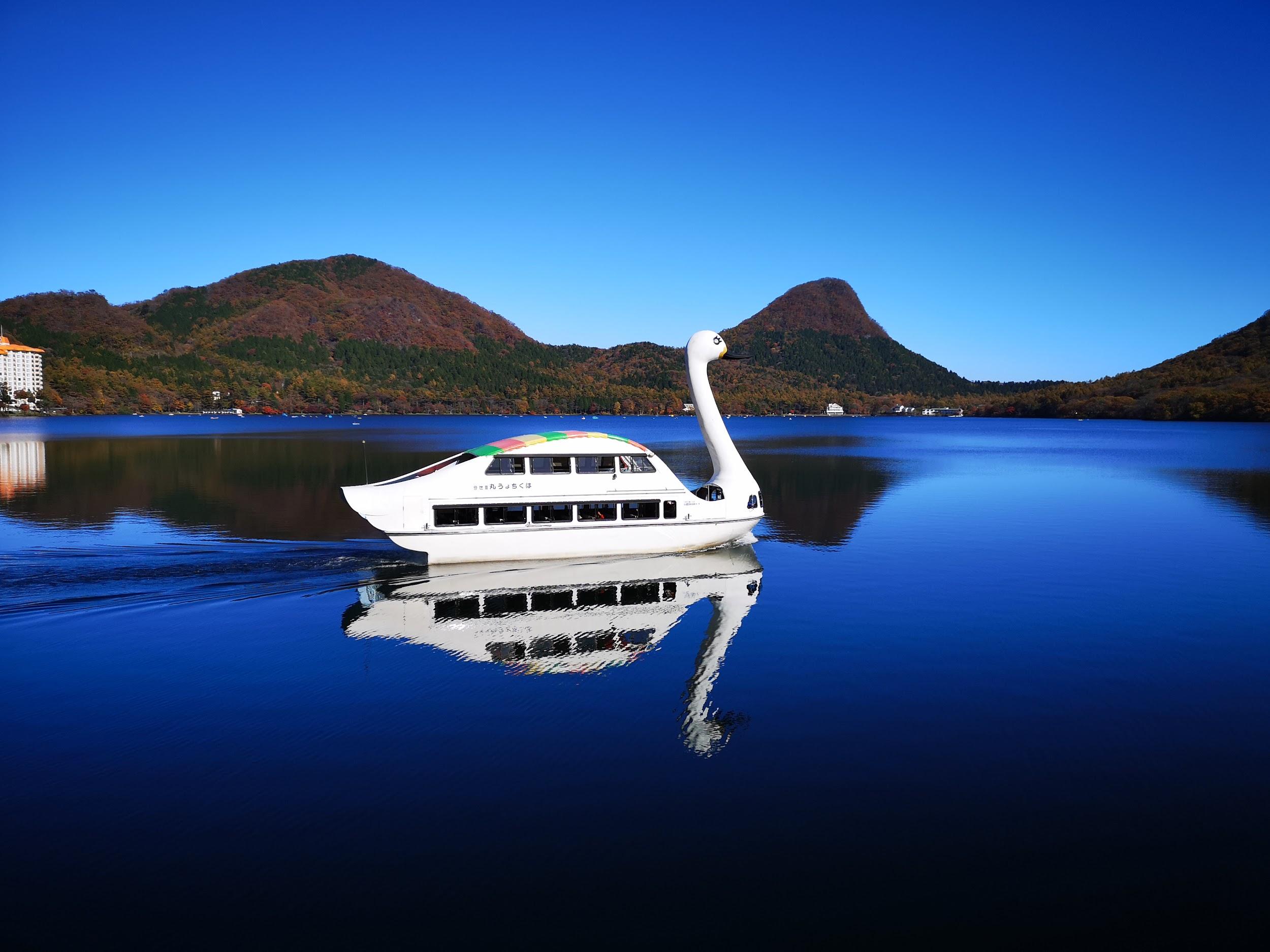
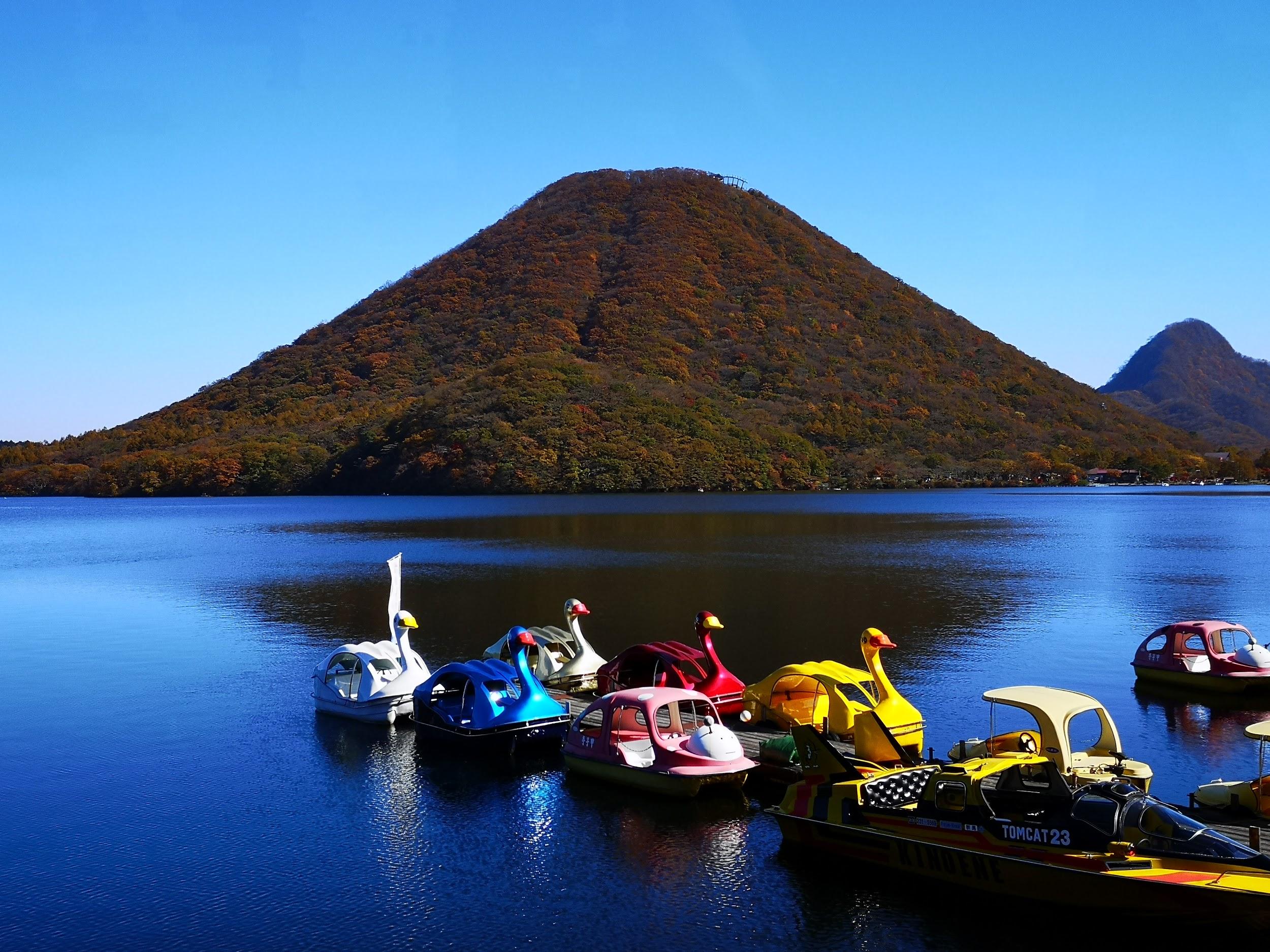
View of Mt Juni, Mt Komochi and Mt Akagi

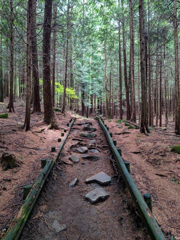
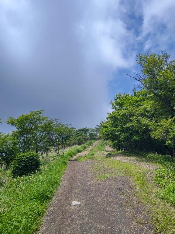
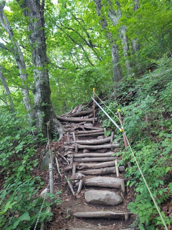
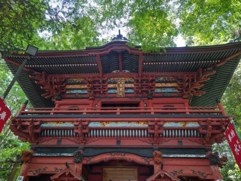
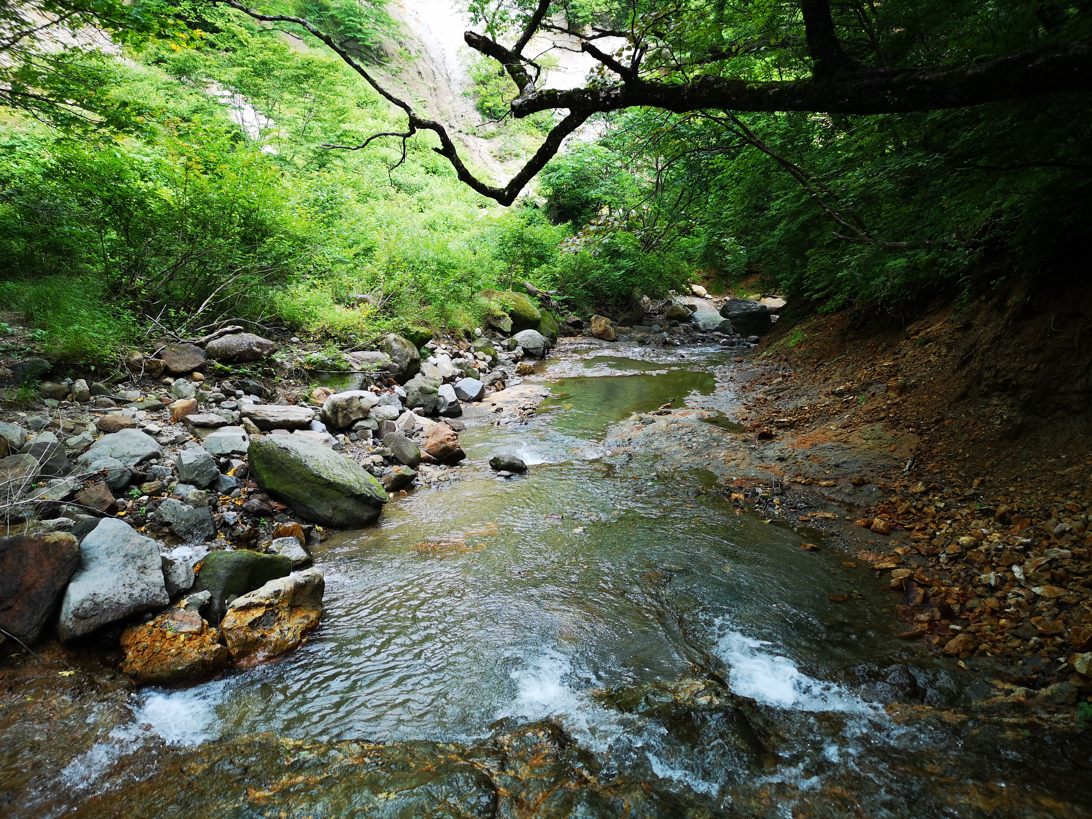
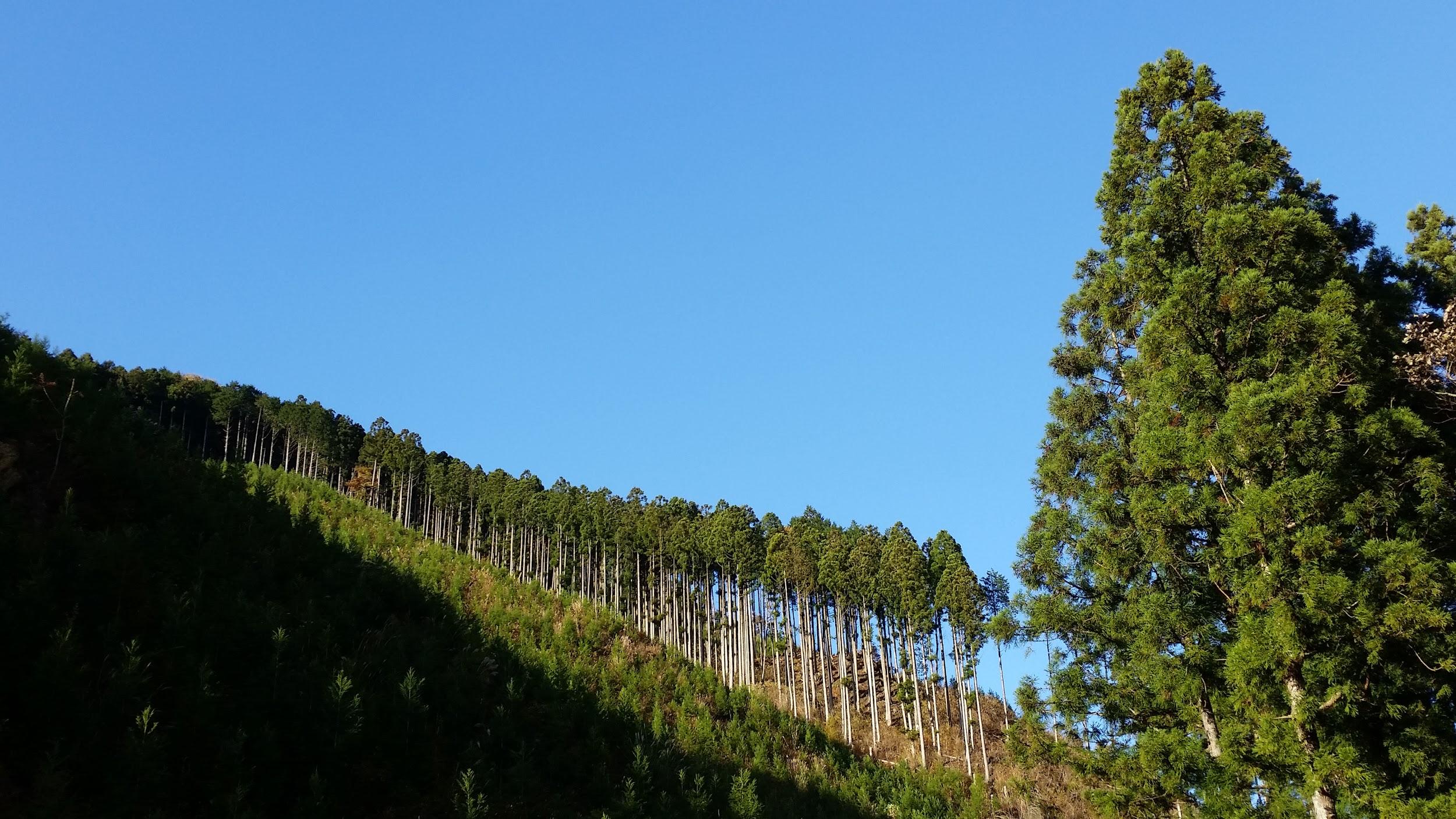
It was a sunny day with few clouds as I got off the bus around 1030. After getting ready, I found the trail entrance behind Komaiwa village, and started hiking from 11am; according to the locals, I was 3rd person of the day to head up. I followed a gently sloping forest road through the cedars, before reaching a stone “torii” (shinto gate) and the start of a steep slope half an hour later.

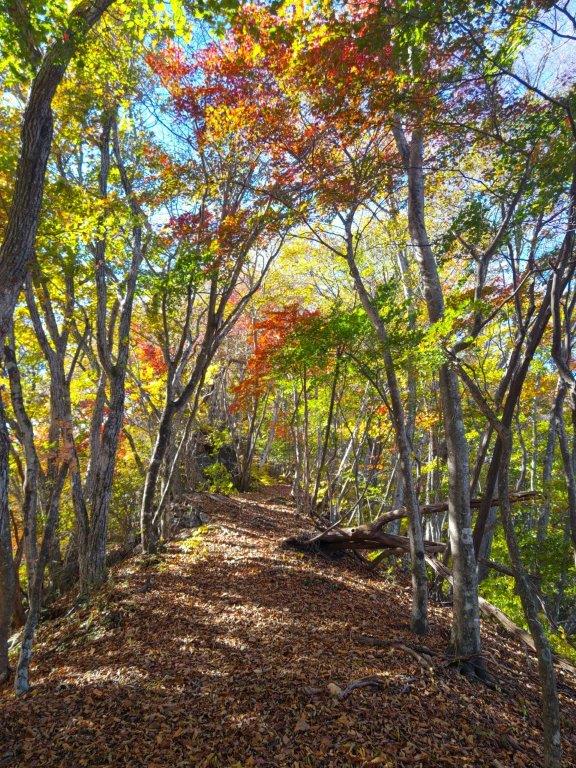
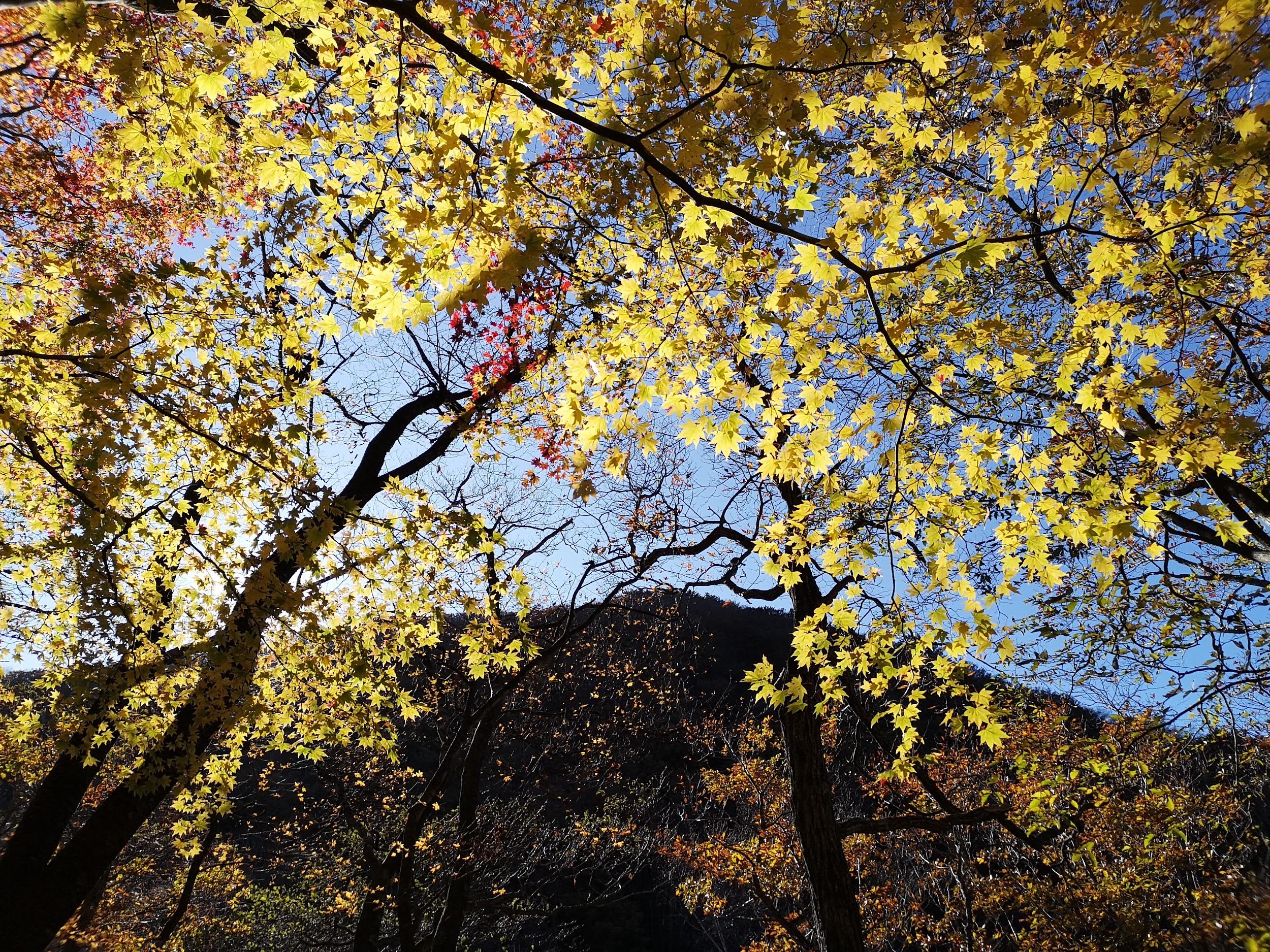
First Autumn Colours

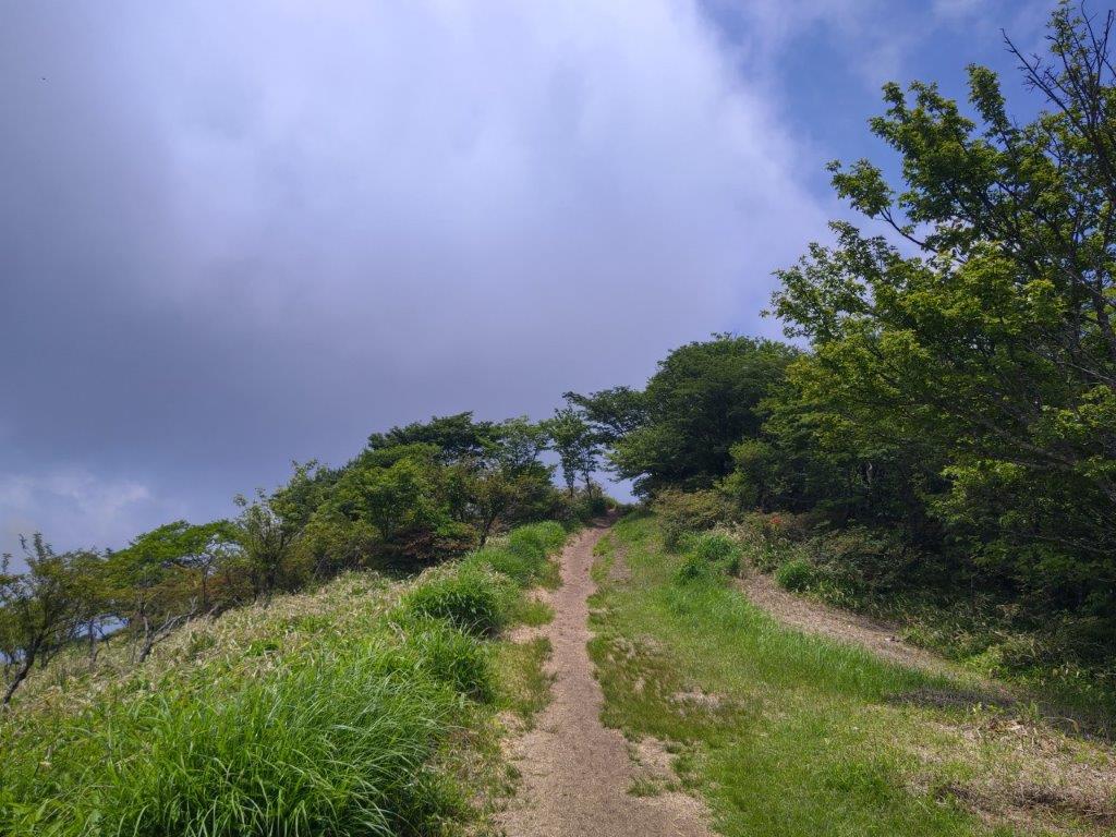
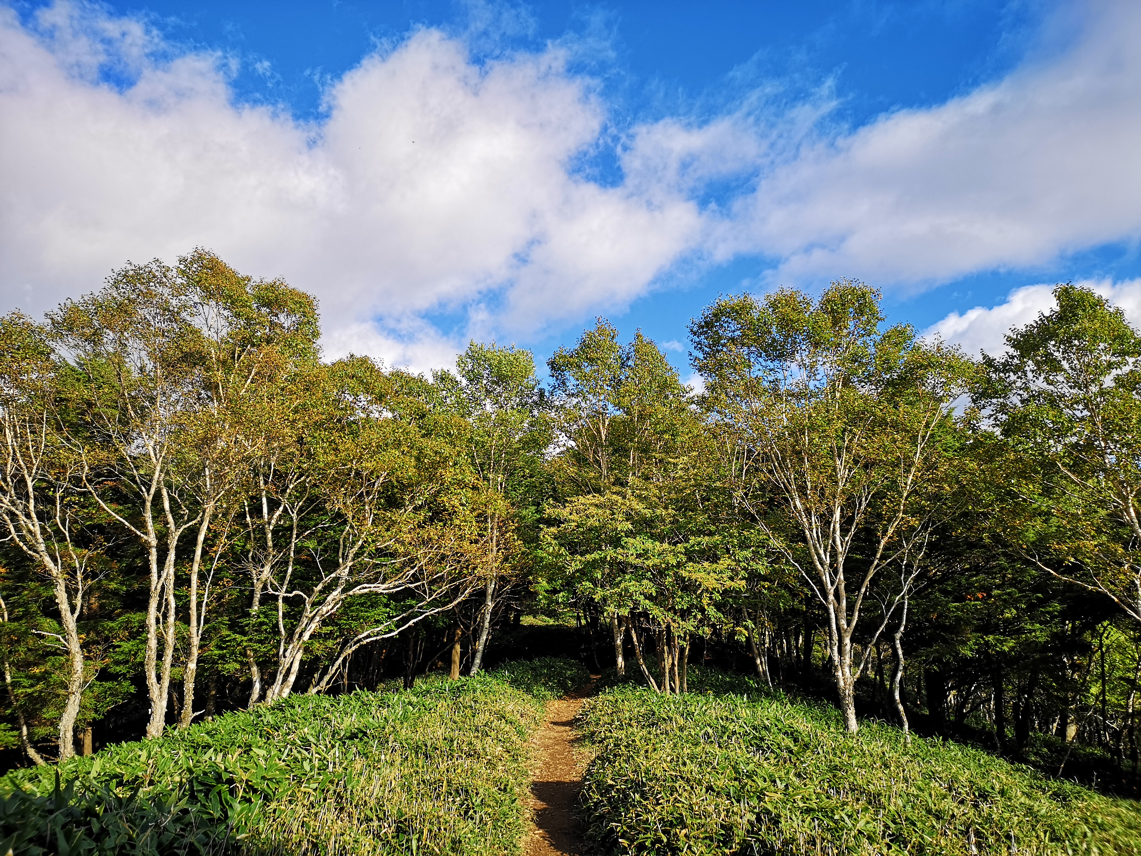
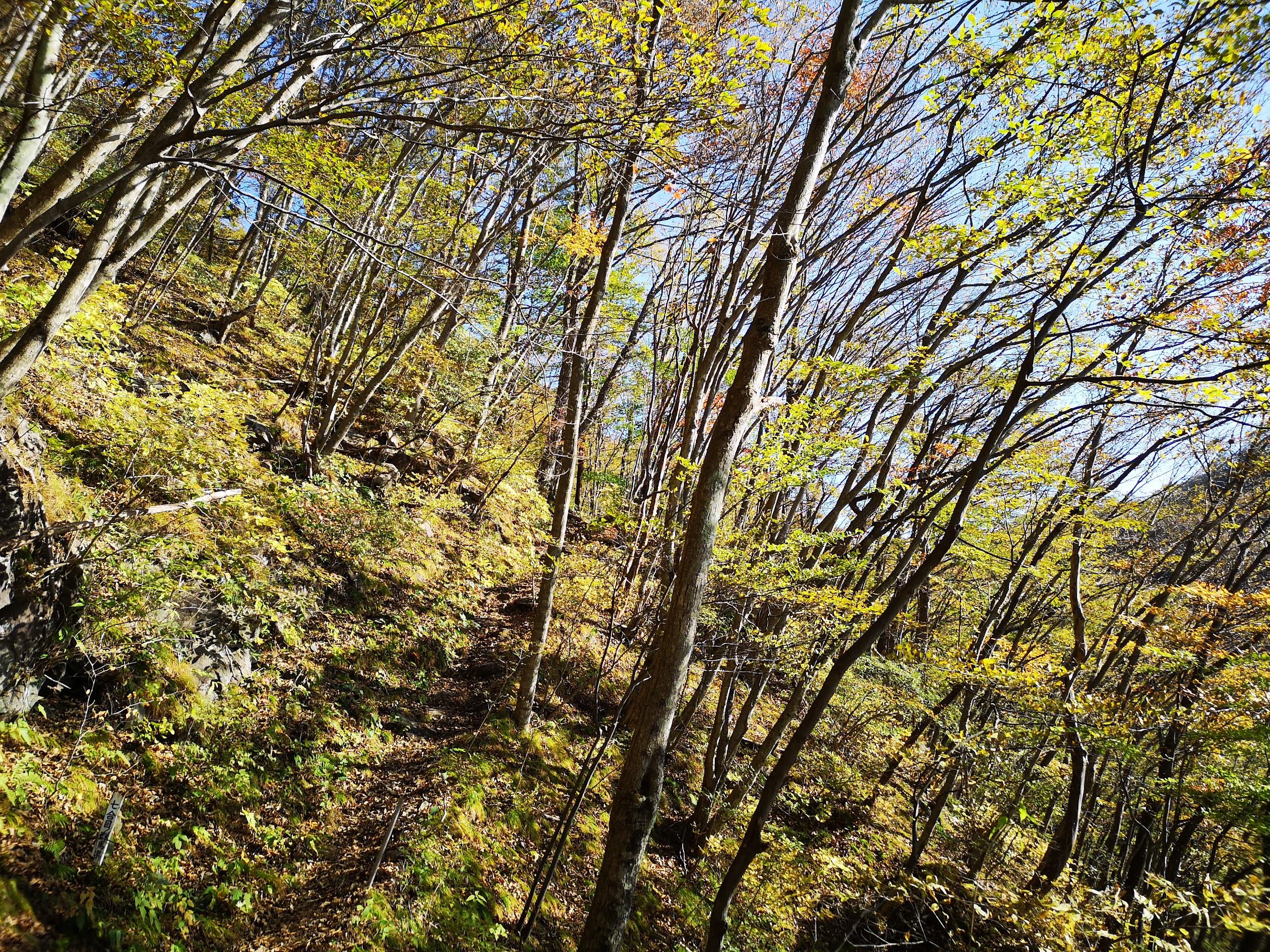
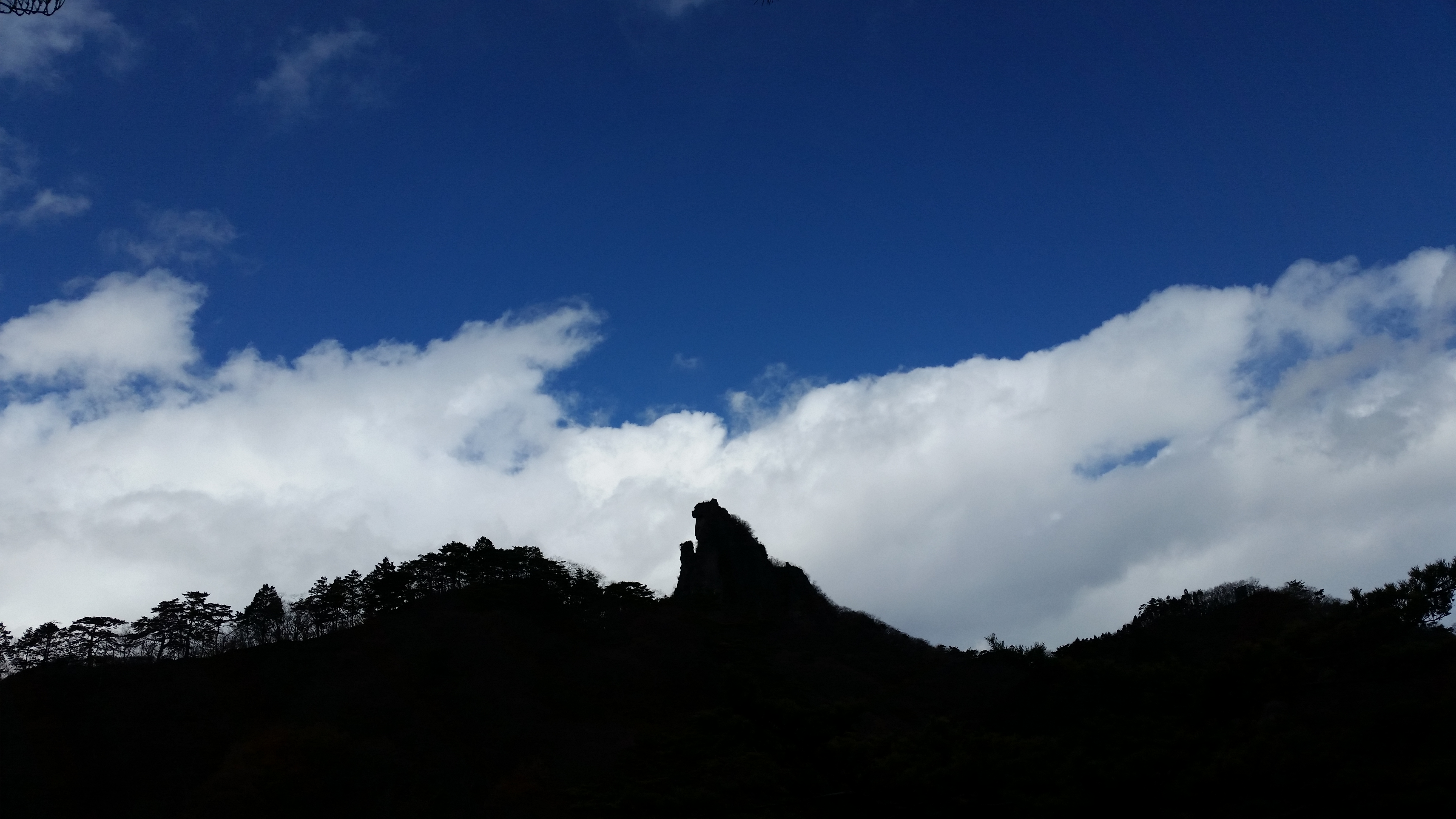
I got my wish for a workout as I followed the switchback trail up the mountain side through mixed forest. The leaves hadn’t changed yet this low down, but would probably look spectacular in a couple of weeks. With relief, I reached the top of the long climb just before noon. The trail then curved around the mountain, becoming faint at times, so that the final approach was along a ridge on the north side, buffeted by a cold wind.

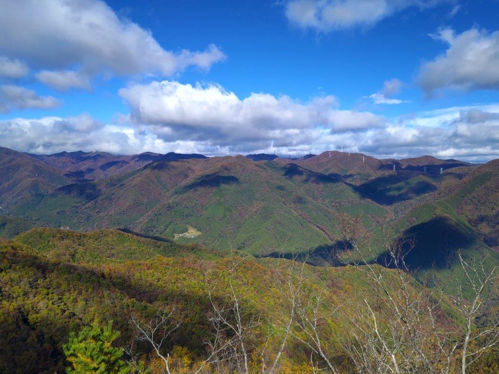
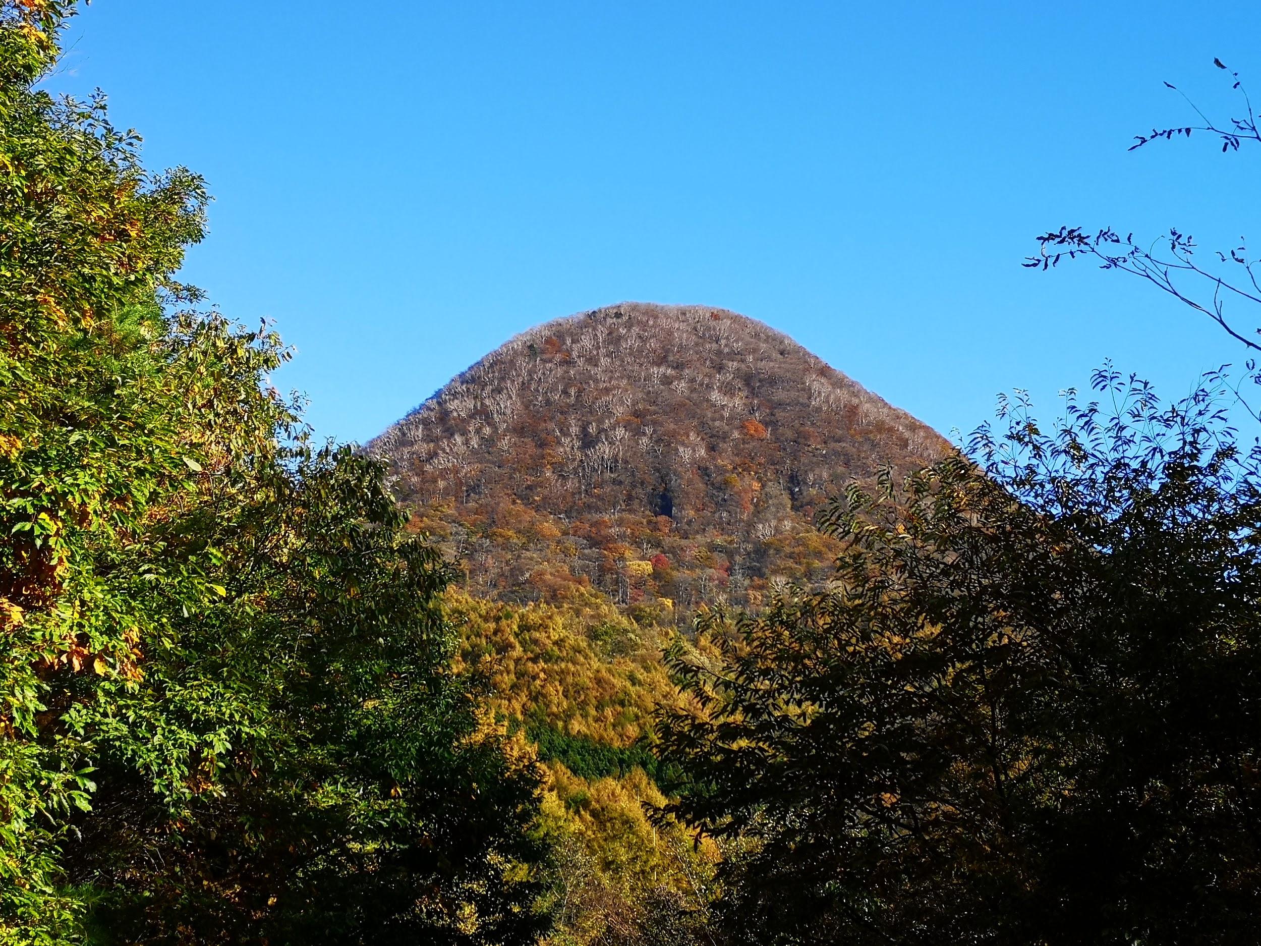
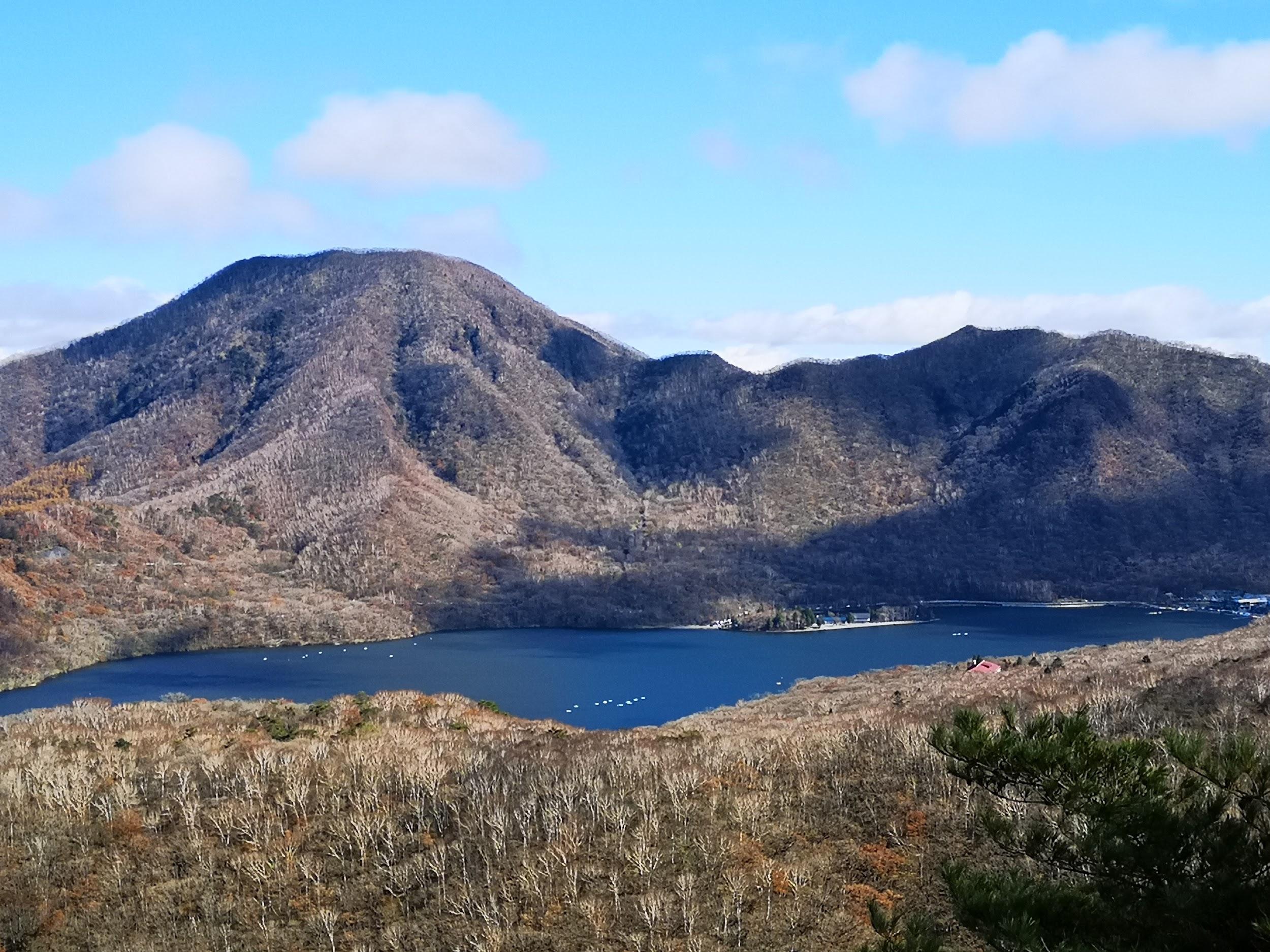
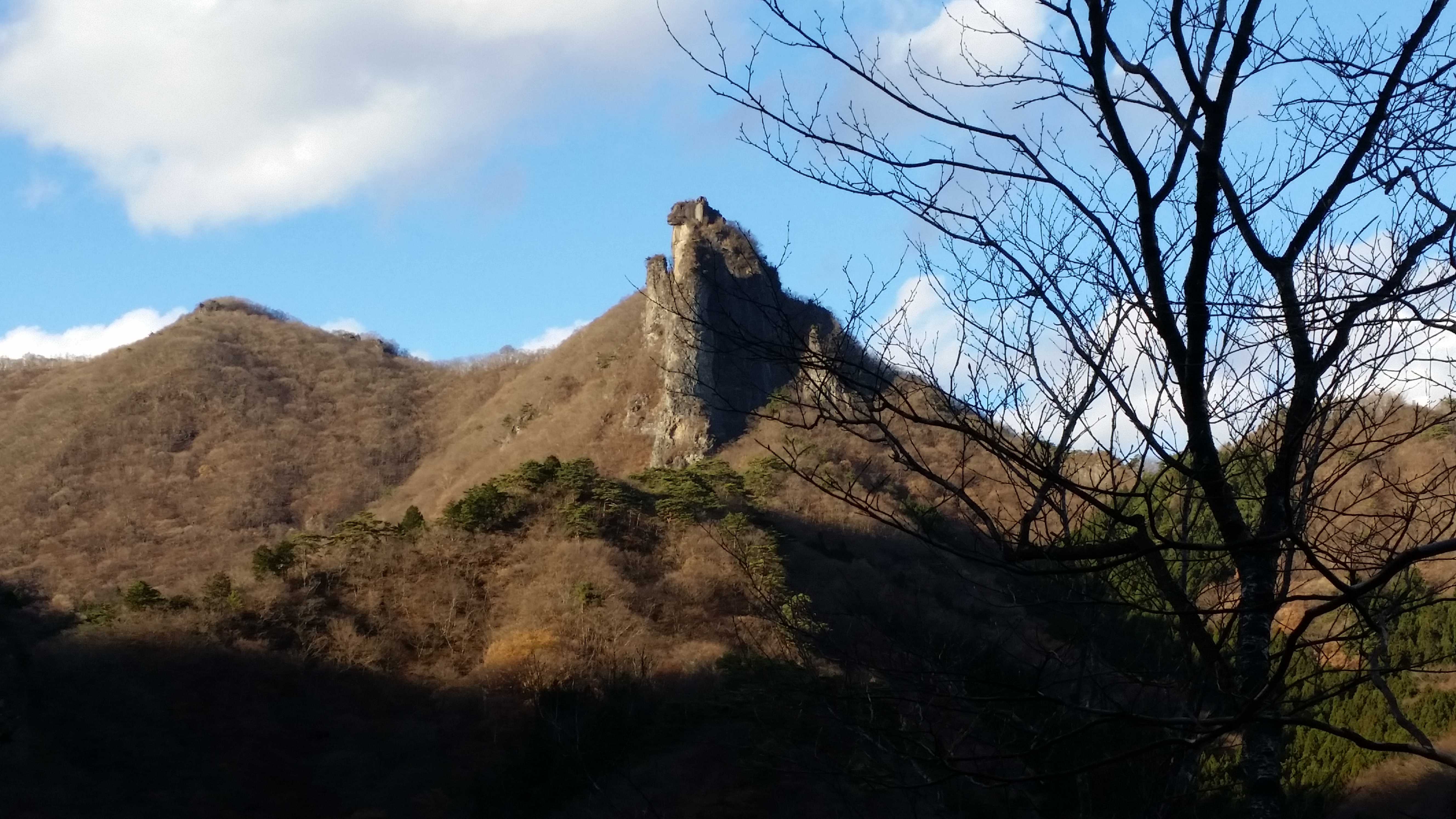
Directly opposite, Mt Suisho and Mt Buno

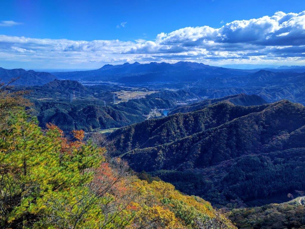
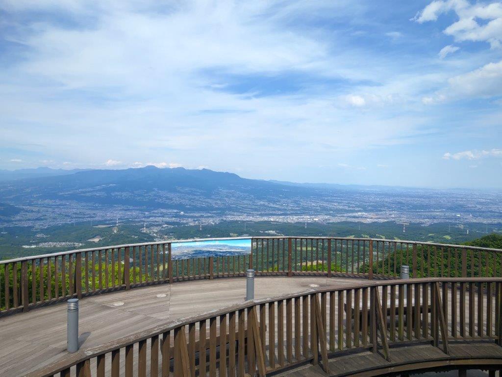
Bird’s-eye view from the Top of Mt Sekison

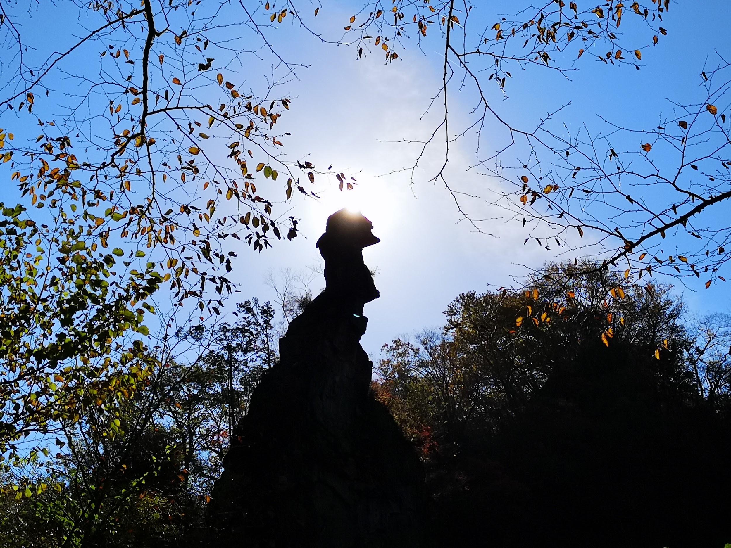
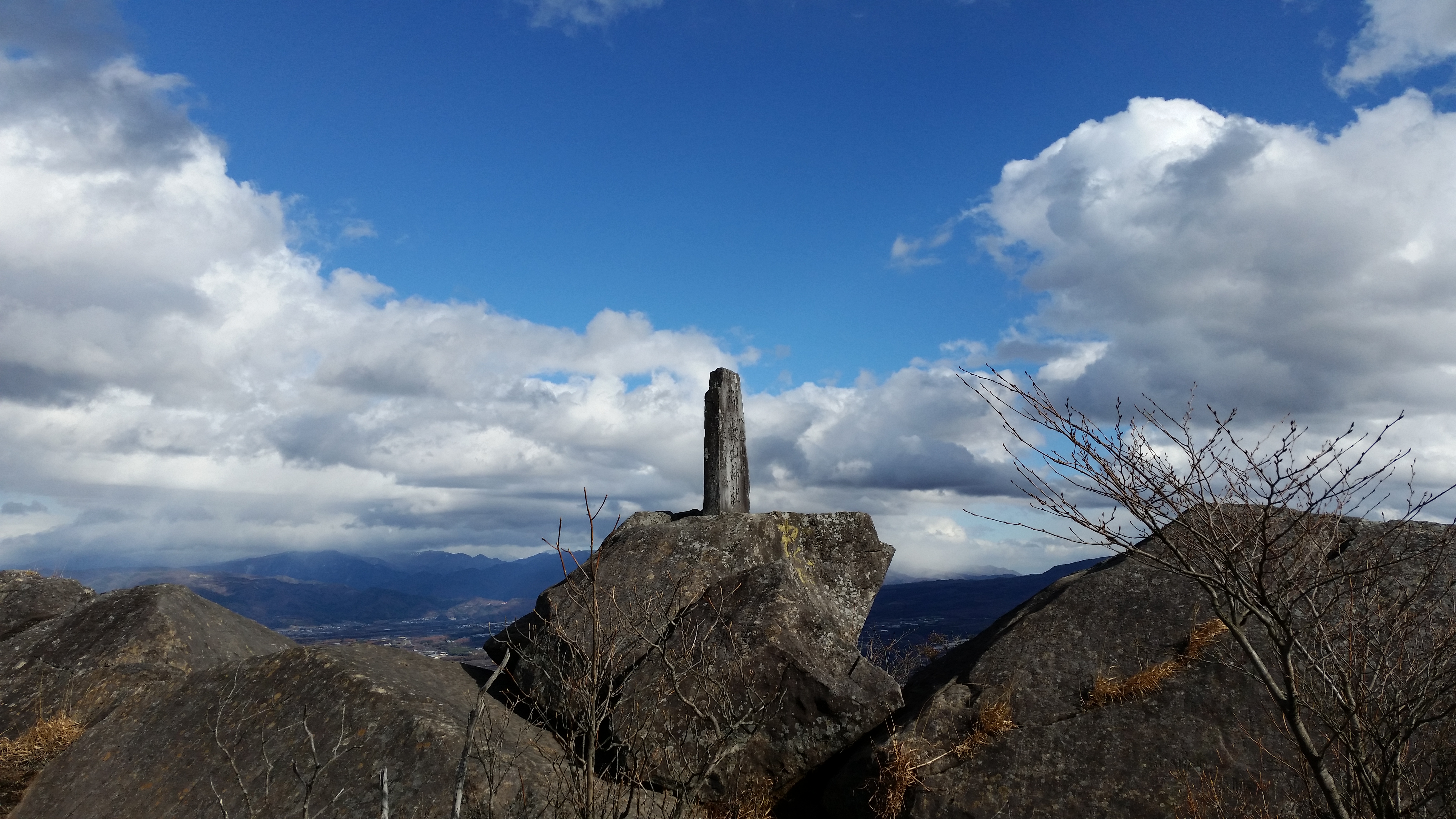
I spotted the first autumn colours of the day on a bright red “momiji” (Japanese maple), to the right of the trail, as I followed the narrow ridgeline, now heading west. Very soon, I was walking under oranges and yellows, and after scrambling up a short steep bit, I emerged onto the top of Mt Sekison (石尊山 せきそんさん sekison-san), just before 12h30. The narrow summit was mostly free of trees, so I settled down for an early lunch.

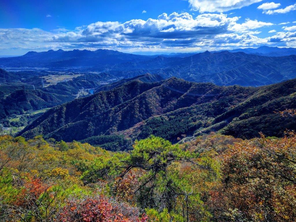
View North from the Mt Sekison Summit

Mt Takada seen from Mt Sekison

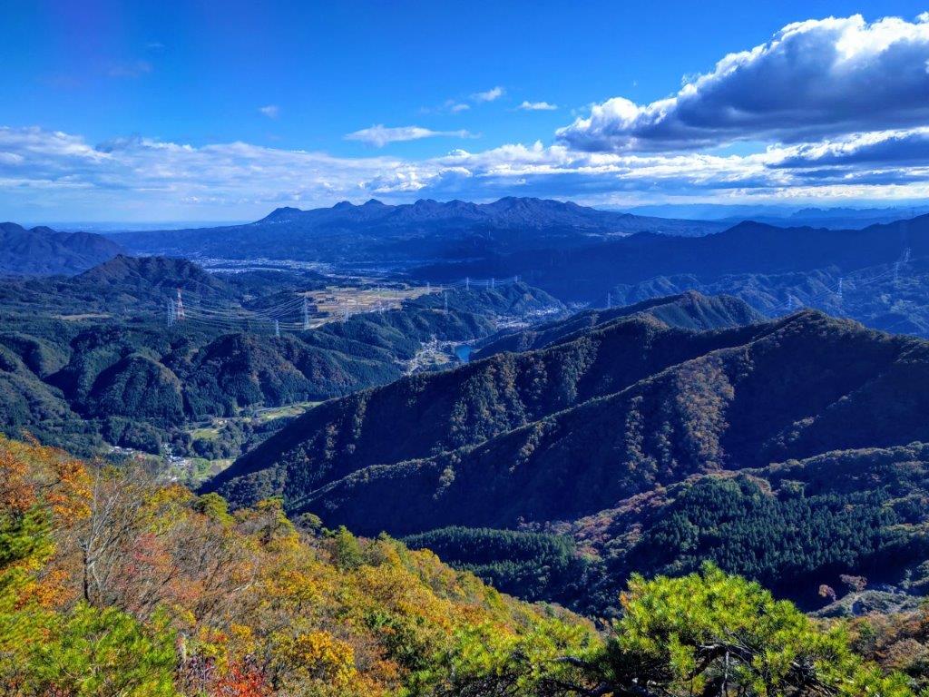
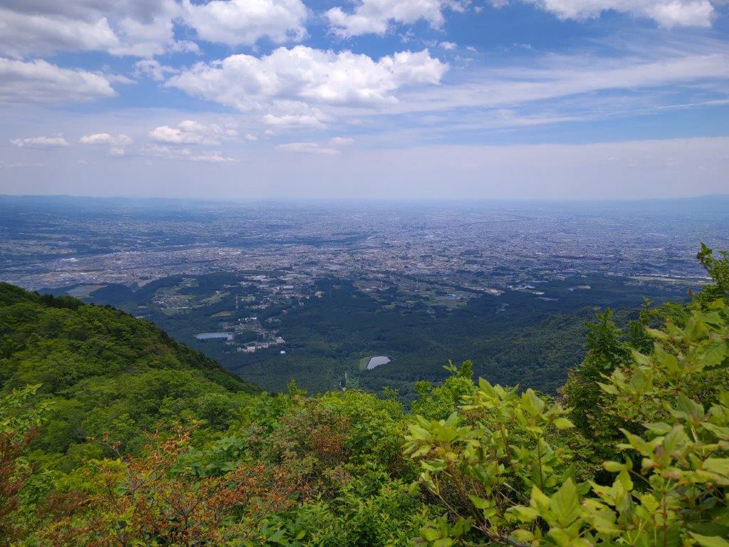
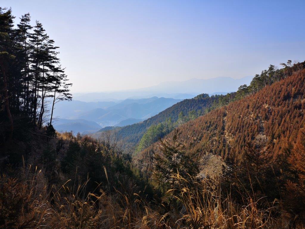
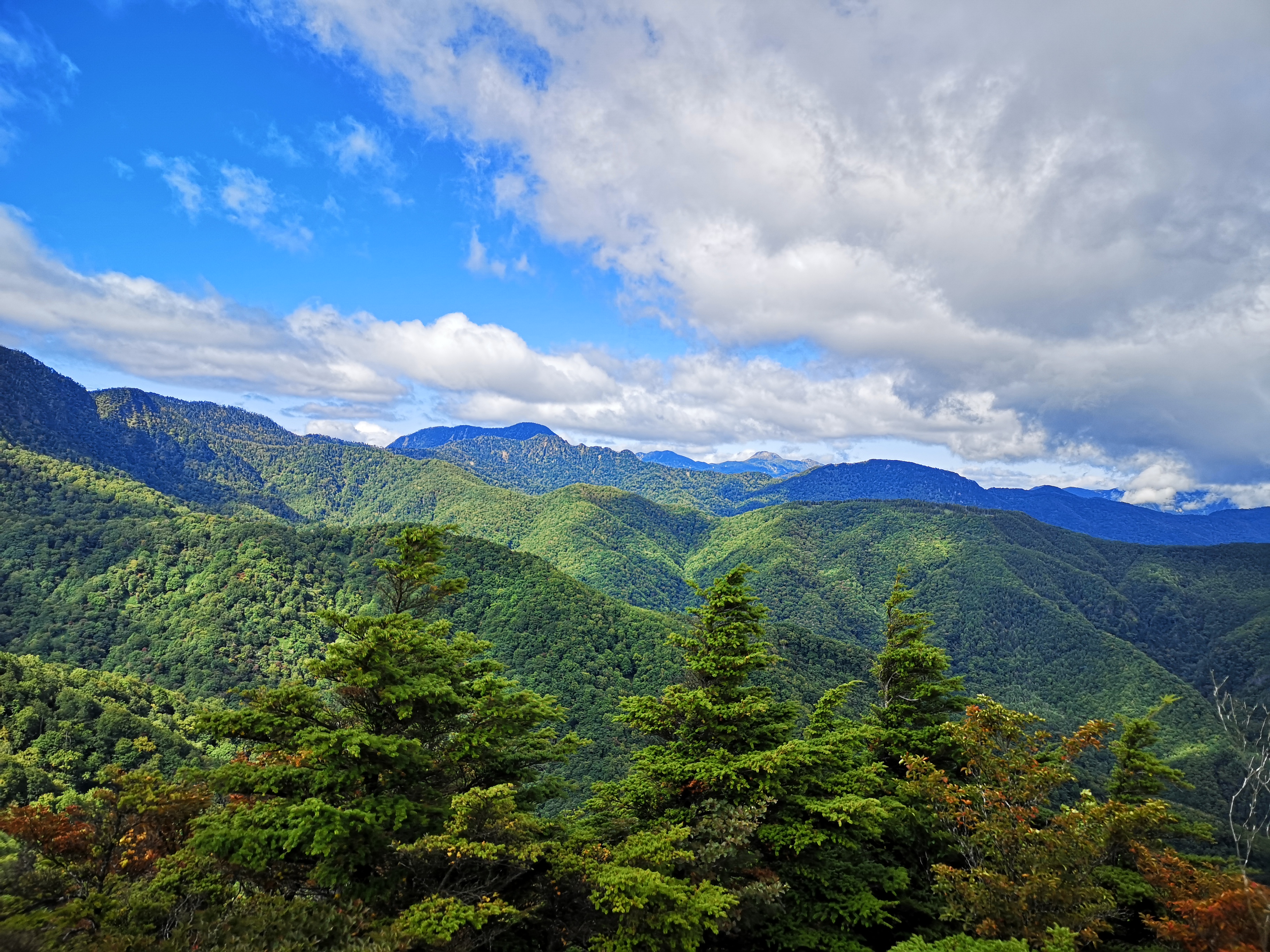
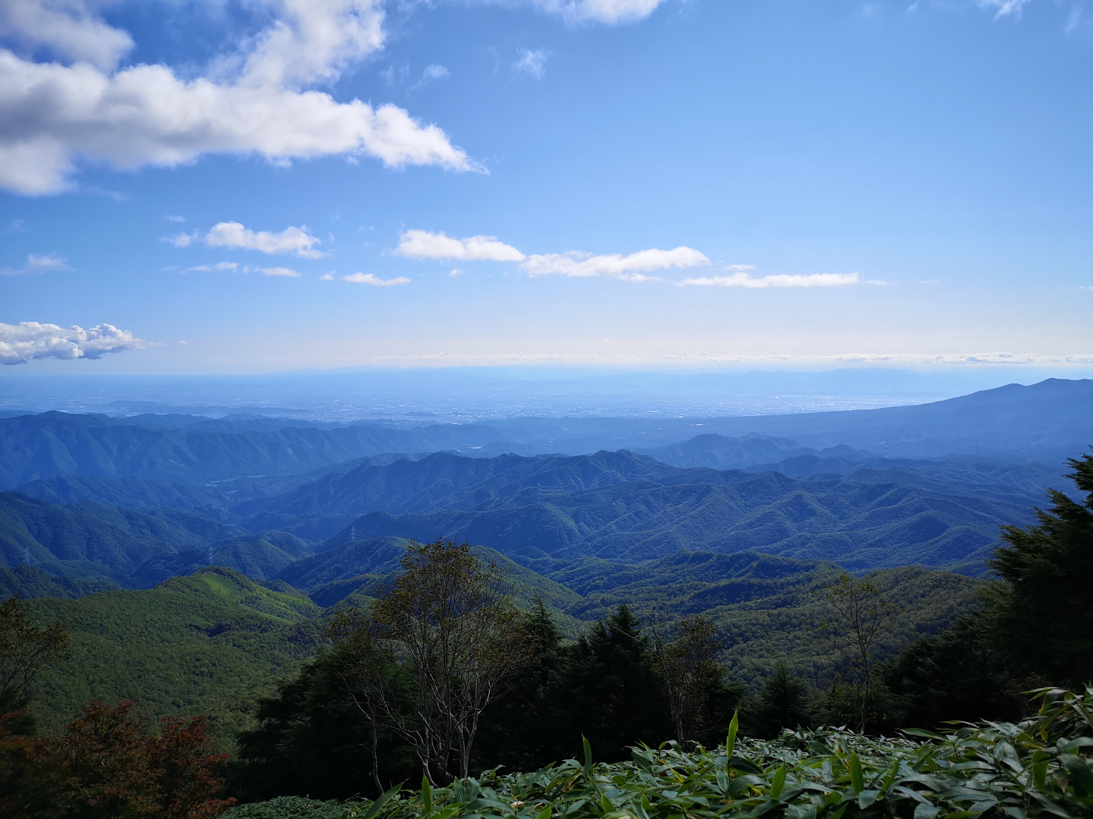
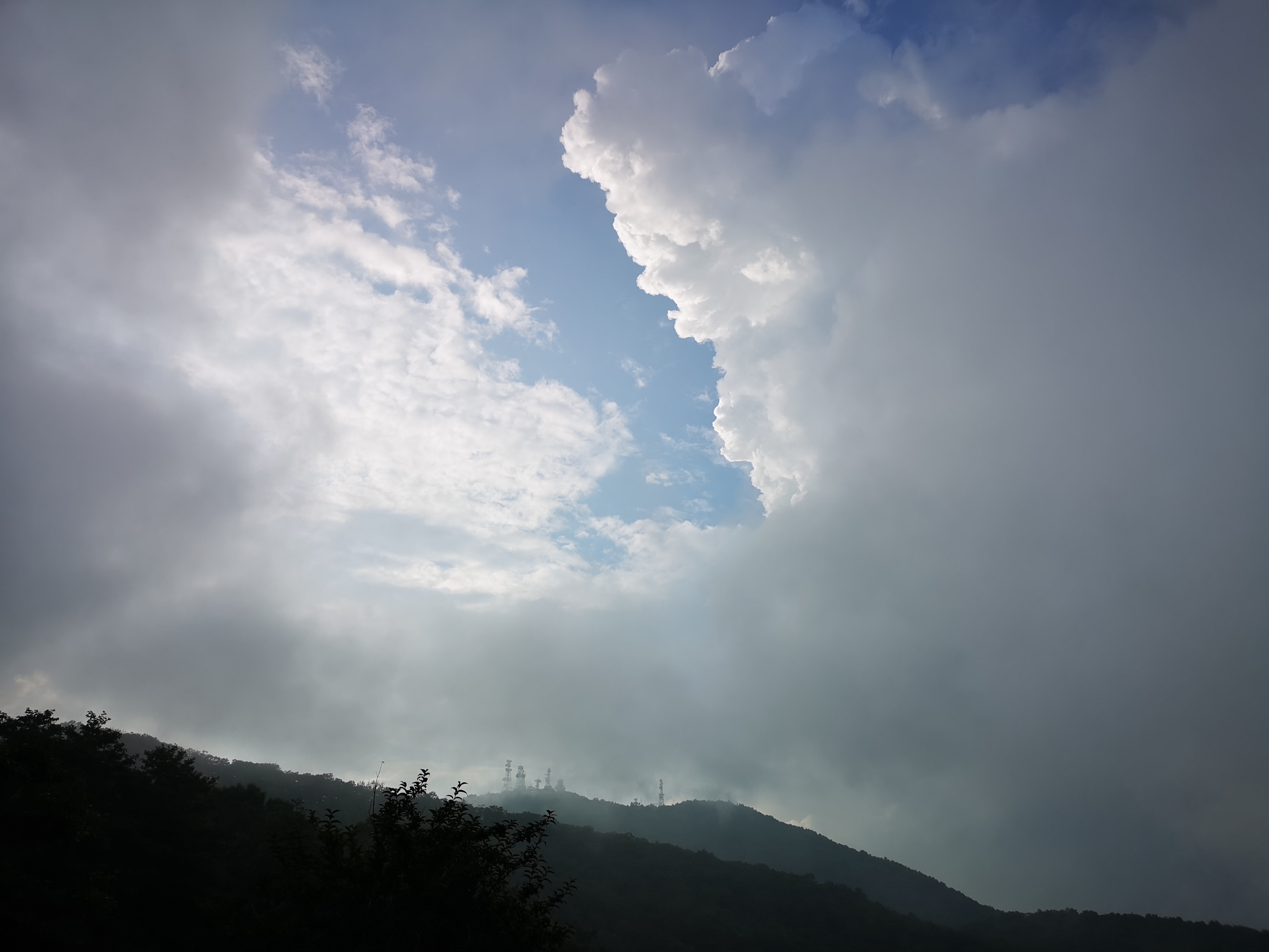
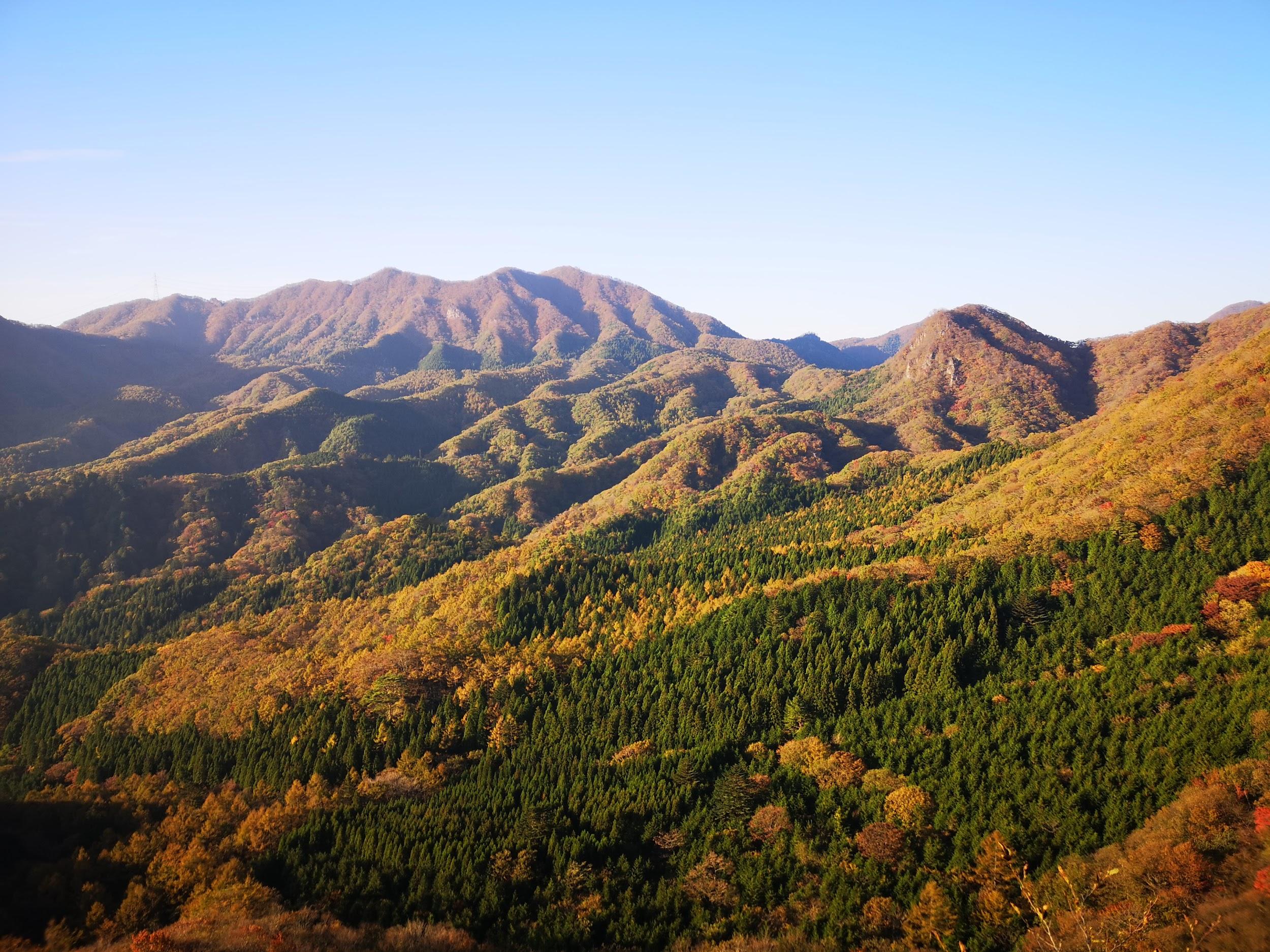
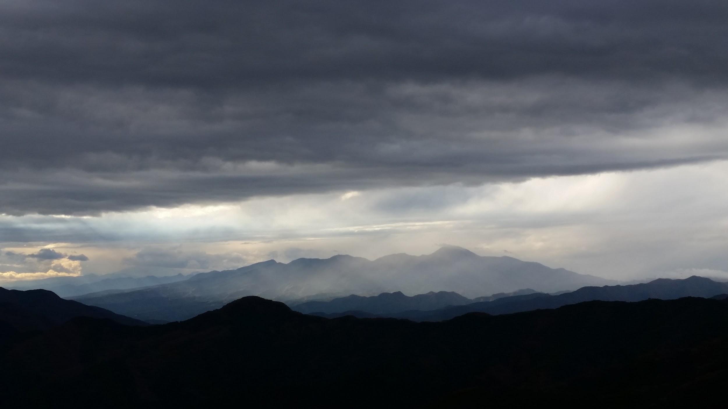
I was surprised that such a little-known summit had such a great view: on the north side, I could see the foothills of the Joshin-Etsu mountain range; to the south was Mt Haruna; southwest was the pointed shape of Mt Asamakakushi, and behind, Mt Asama, sitting under a dark cloud; looking east, Mt Akagi, Mt Komochi and Mt Juni were lined up; directly below, I had a bird’s-eye view of the mountains and valleys of Nakanojo. At 1pm, I set off for the next summit, looking tantalizingly close further along the ridgeline.

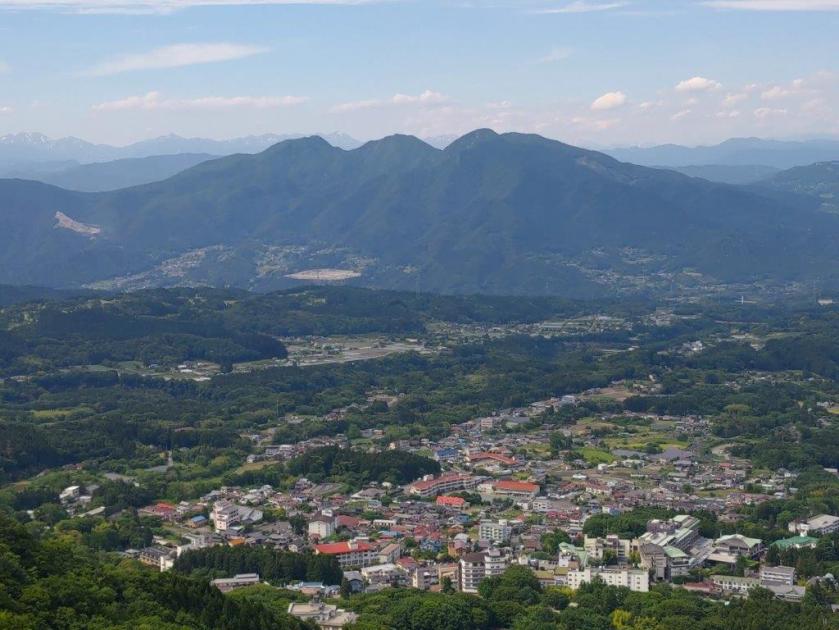
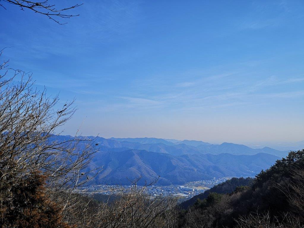
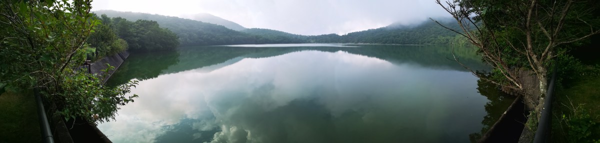
The Mountains and Valleys of Nakanojo

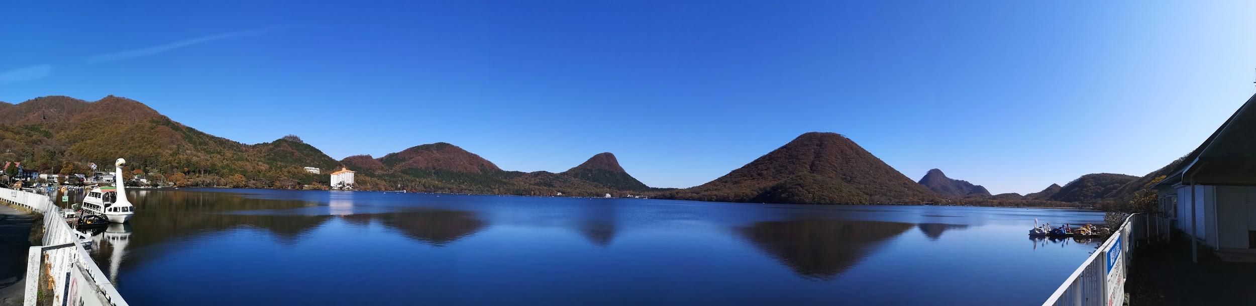
View towards the Joshin-Etsu Kogen National Park

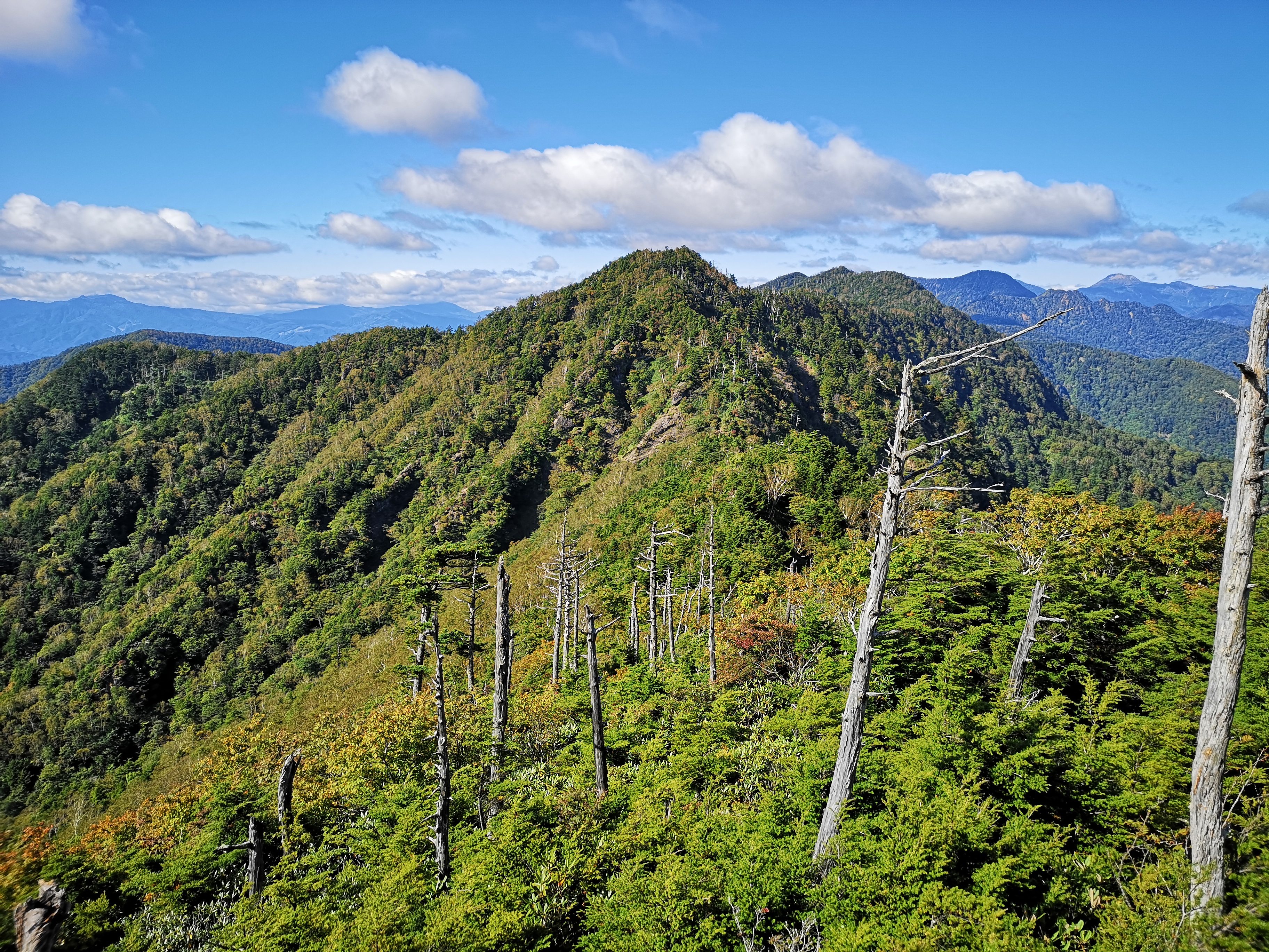
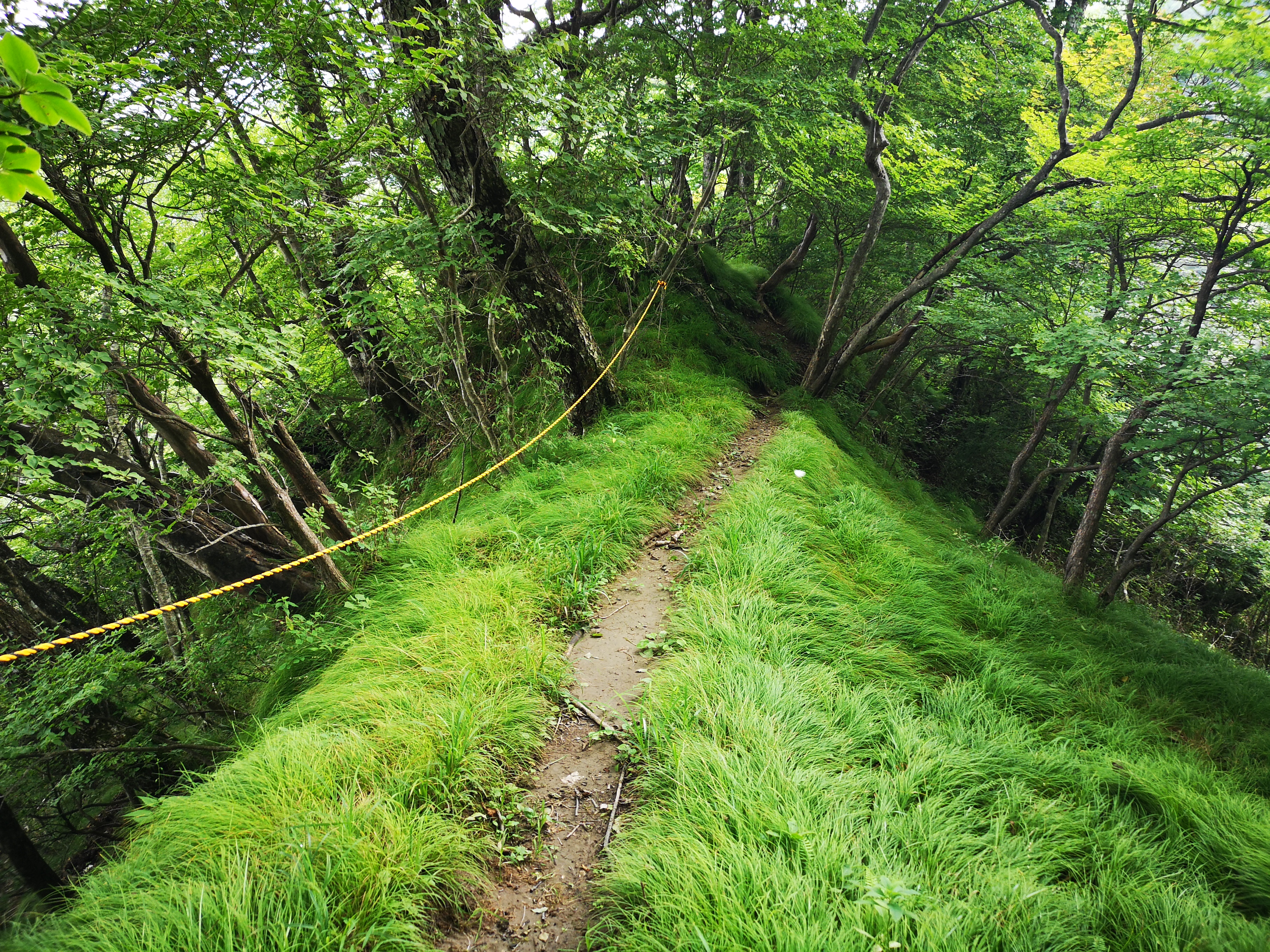
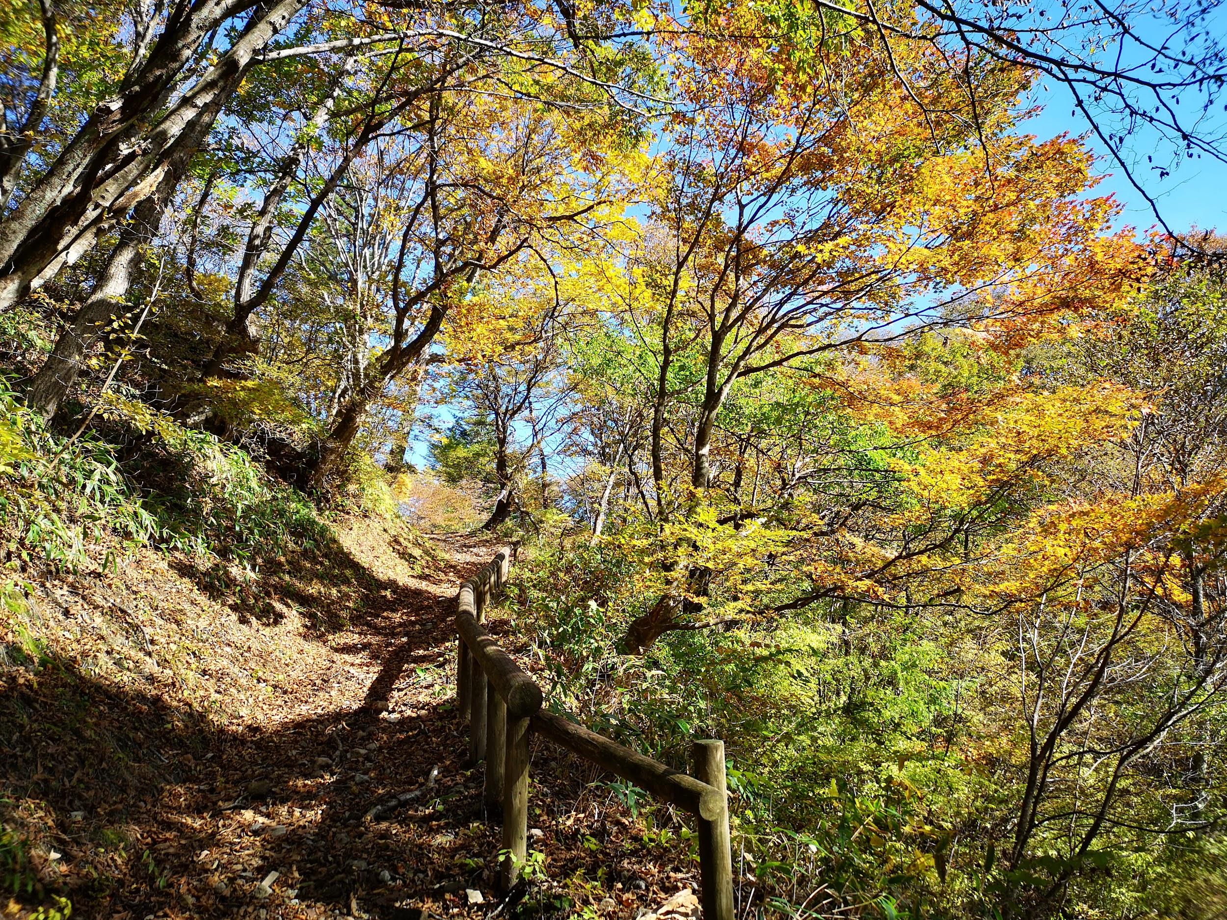
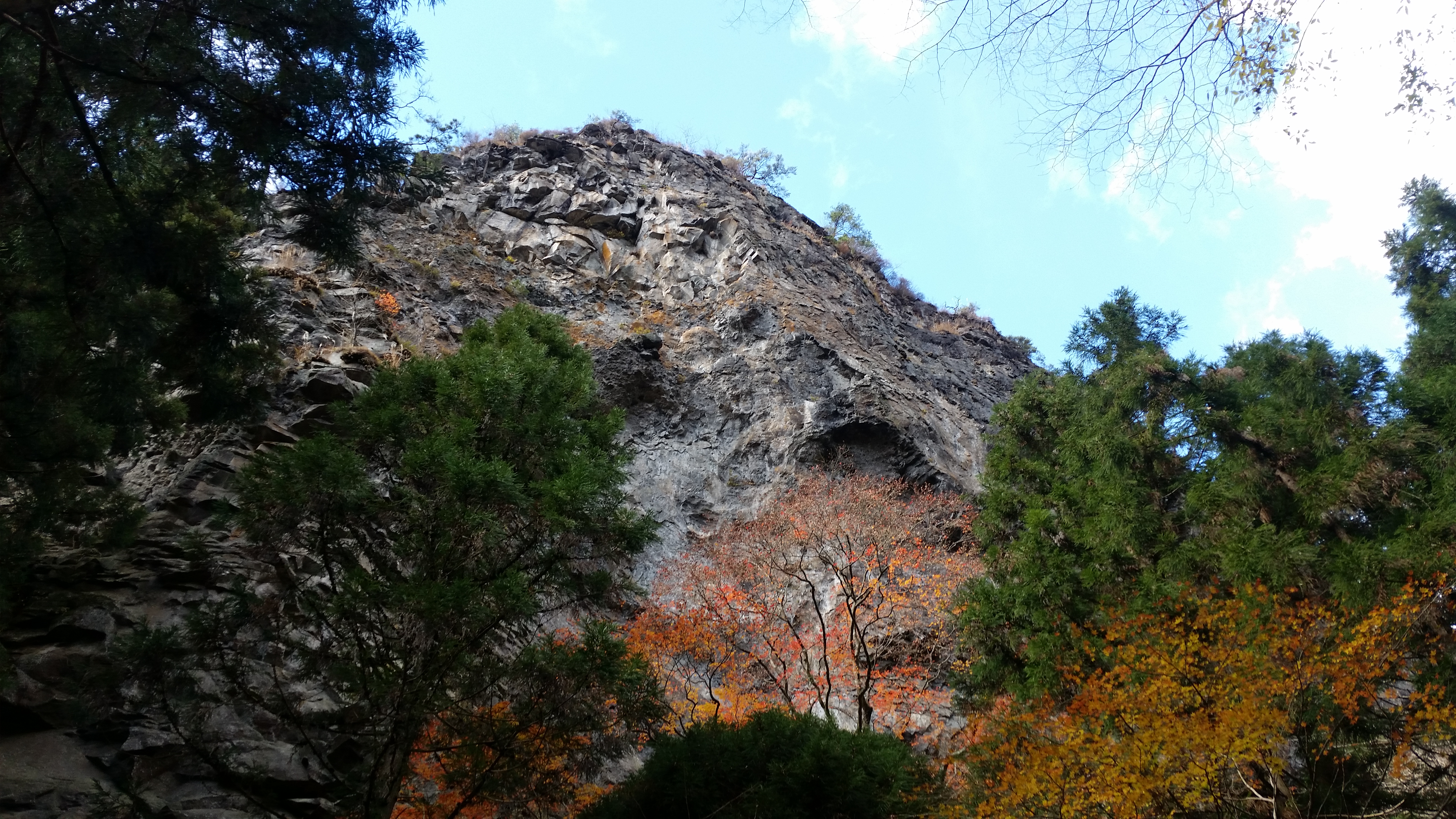
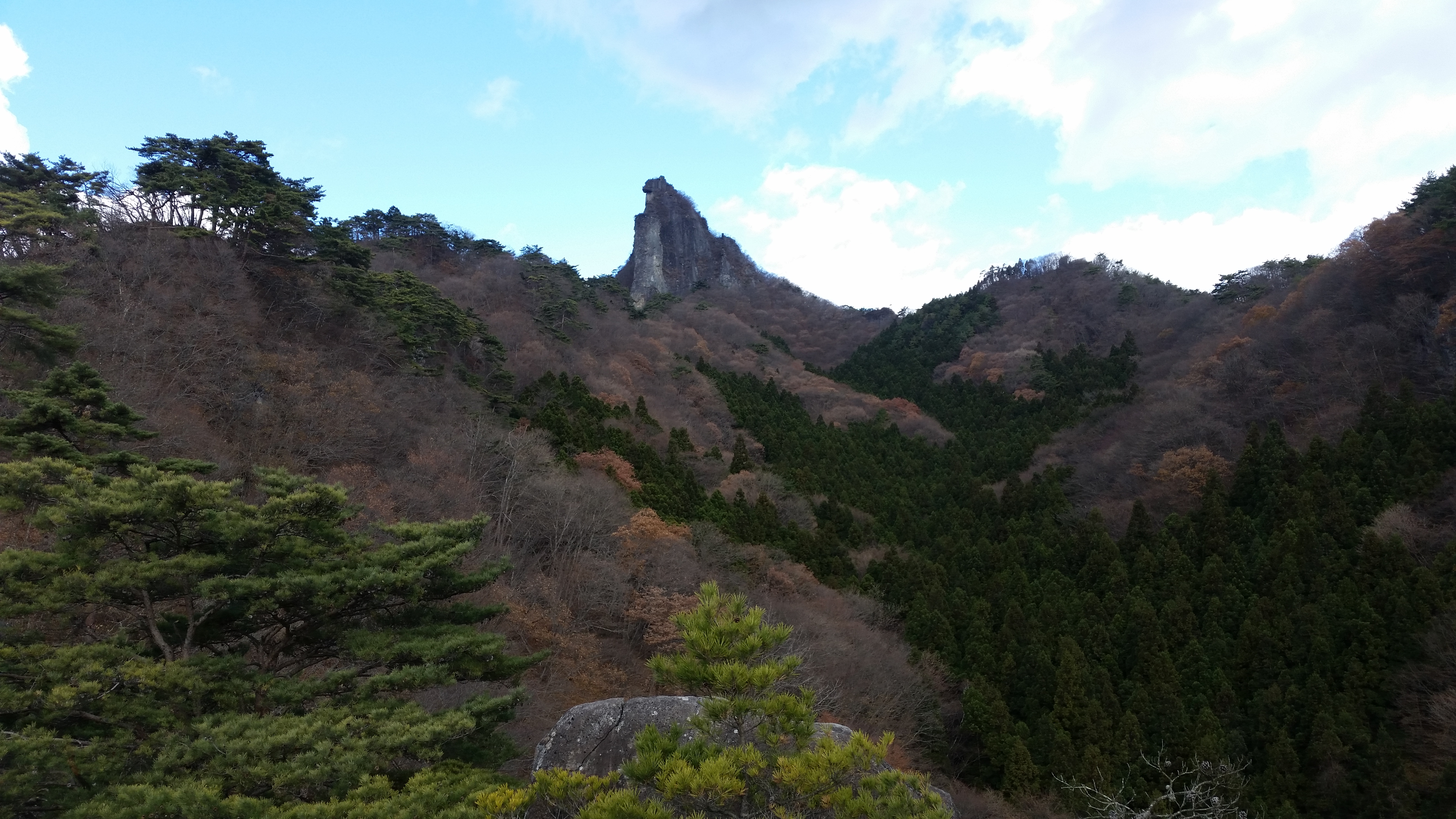
I hadn’t expected the next part to be so challenging: the trail kept on going up and down, and included a short rocky section fitted with rope; on the other hand there were good views to be had in both directions at various points. It took a full half hour to reach the top of Mt Takada (高田山 たかだやま takada-yama). Since it was mostly in the trees, I turned around at once and headed back along the up-and-down ridge, arriving at Mt Sekison around 2pm.

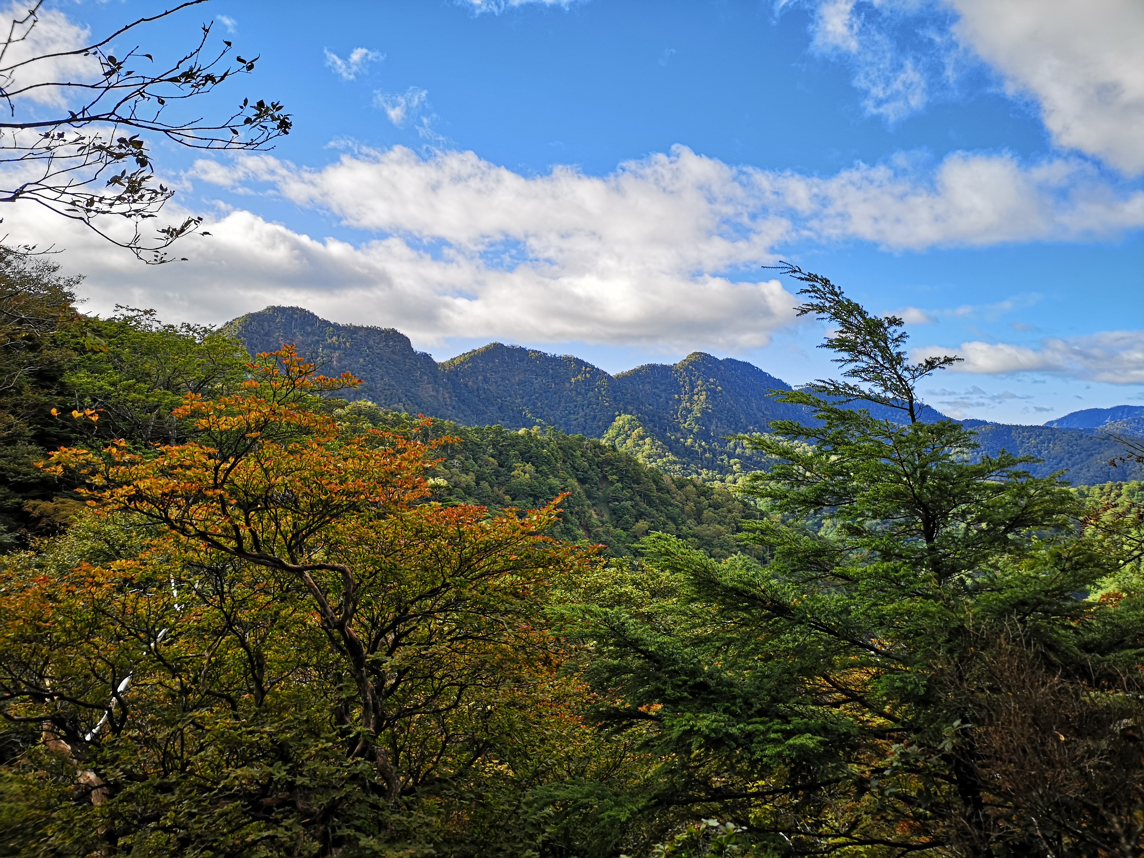
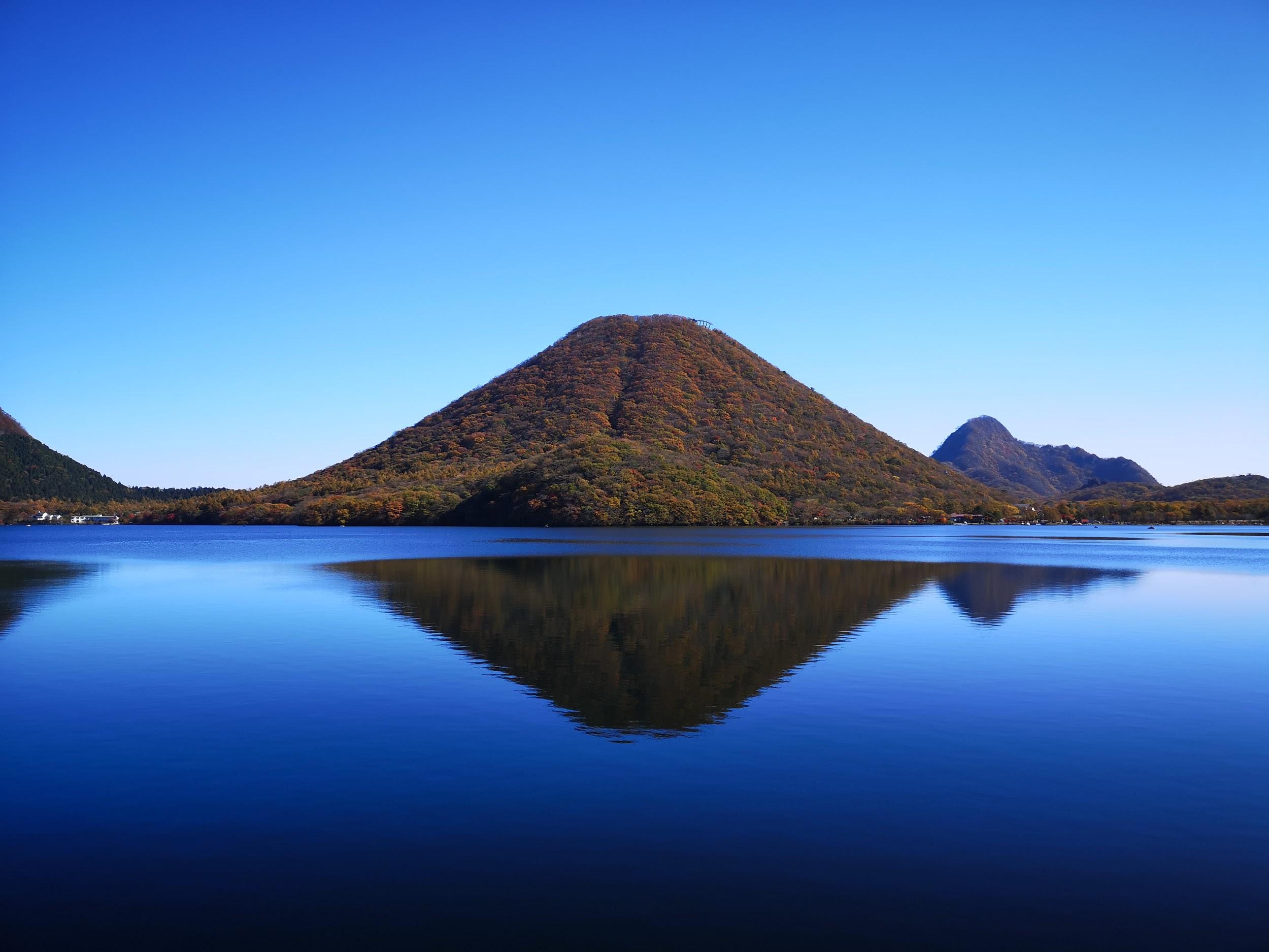
In the background, Mt Haruna

In the foreground, Mt Takeyama

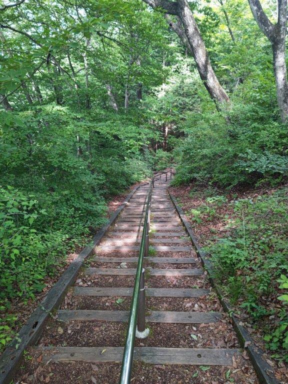
I was amazed by how pleasantly warm it was, the sunny weather outperforming the forecast; since it was now too late to catch the earlier bus, I spent another thirty minutes enjoying the panoramic view. I had the summit to myself, having passed the two other hikers earlier in the day. After descending at a relaxed pace, I was back at the bus stop a little before 4pm.

On the right side, the Agatsuma River Valley and Mt Asamakakushi

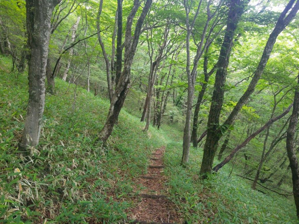
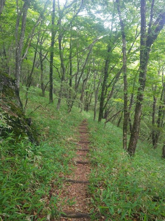
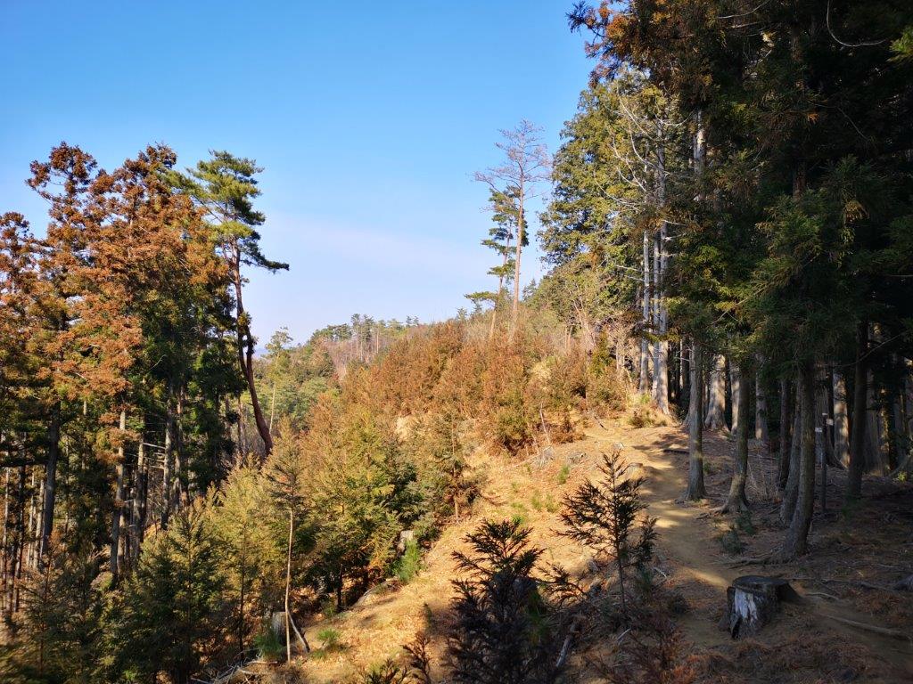
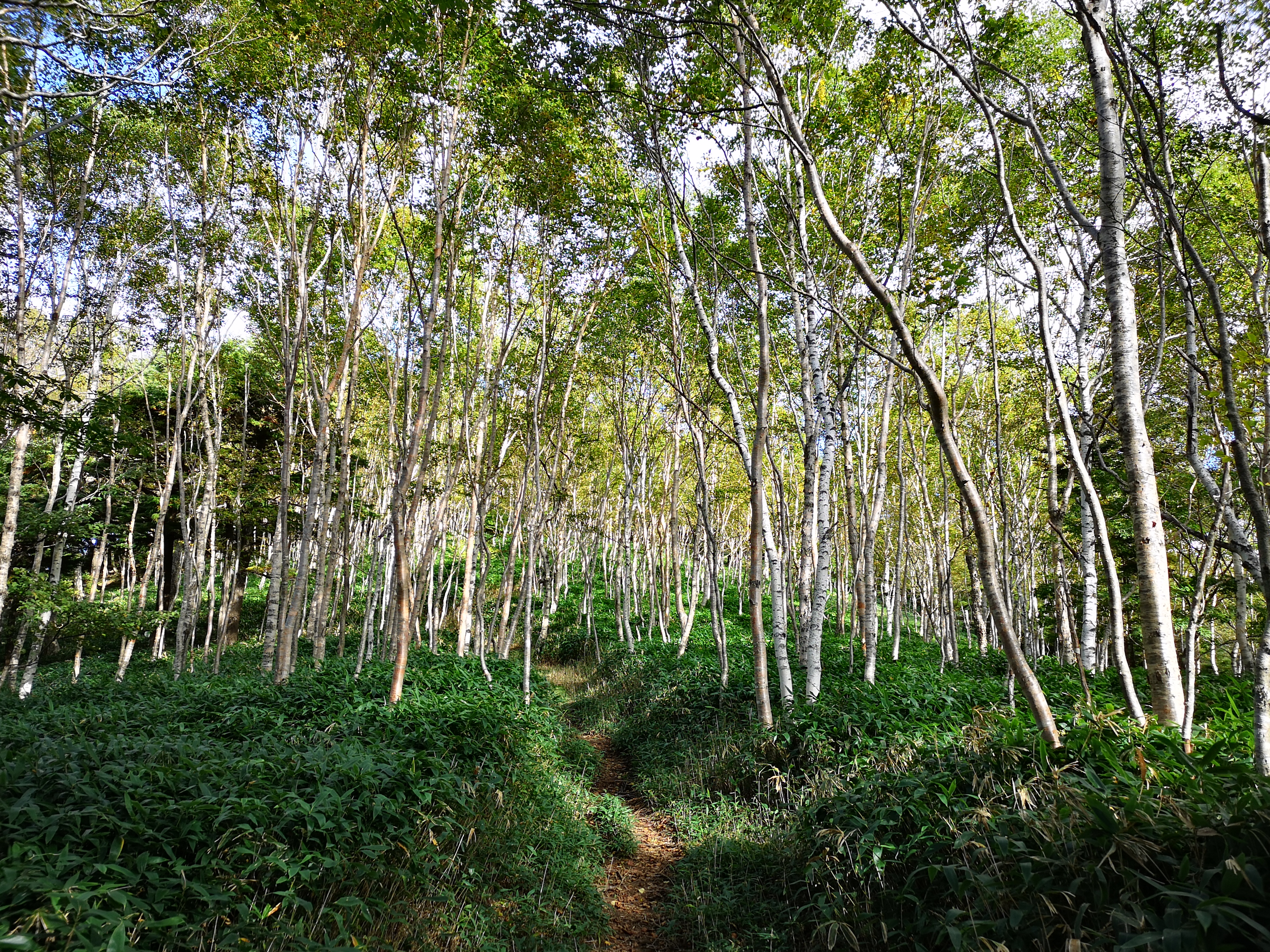
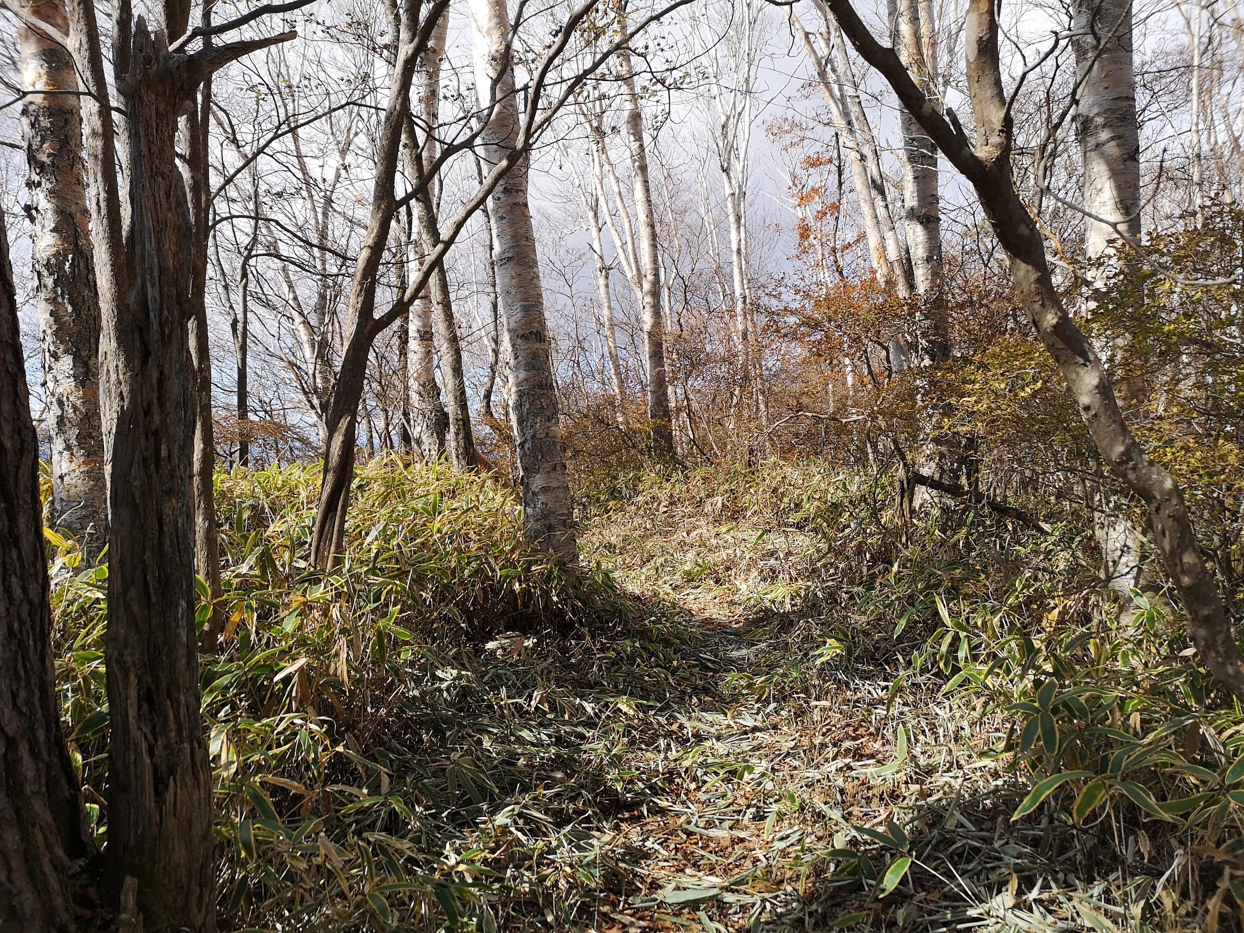
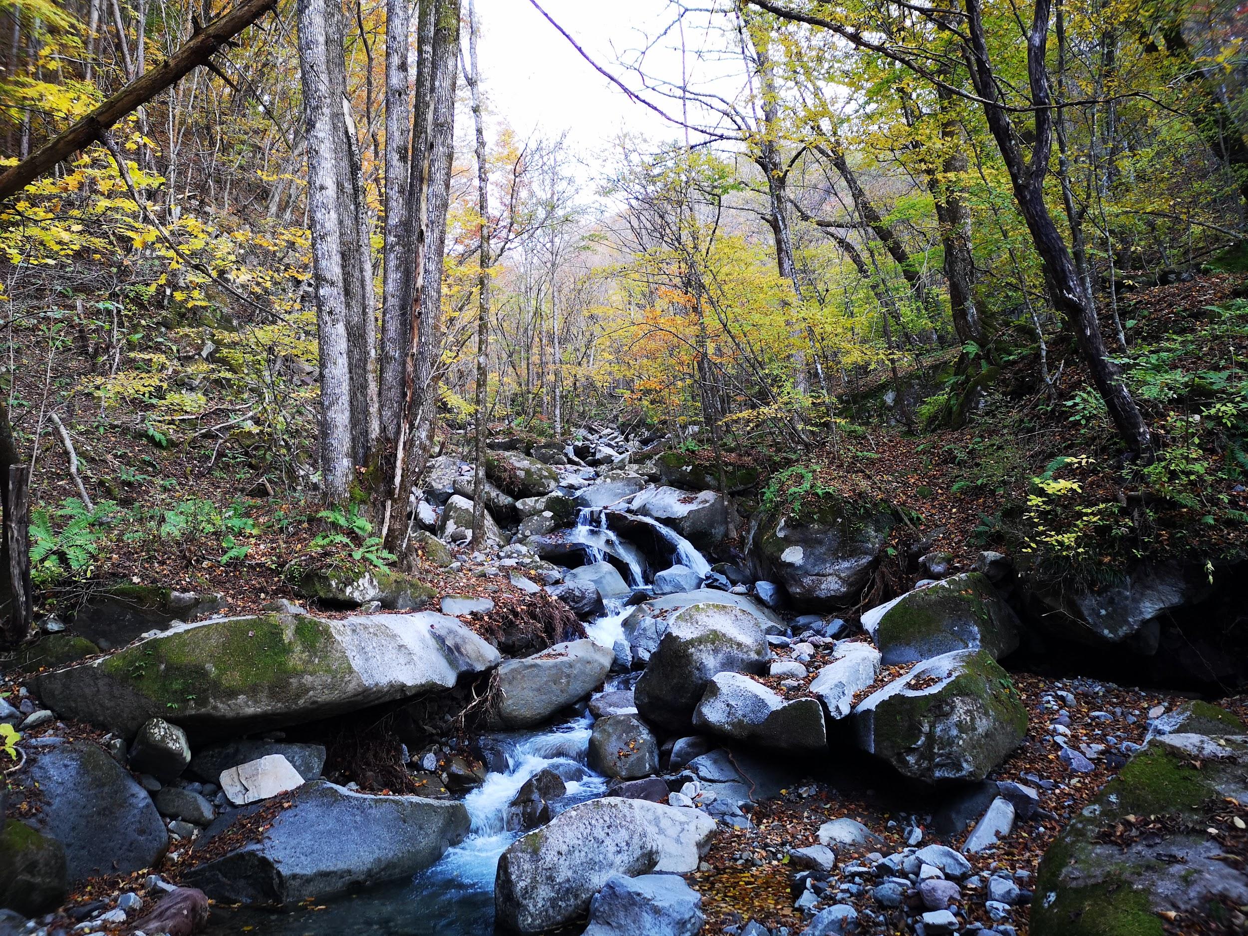
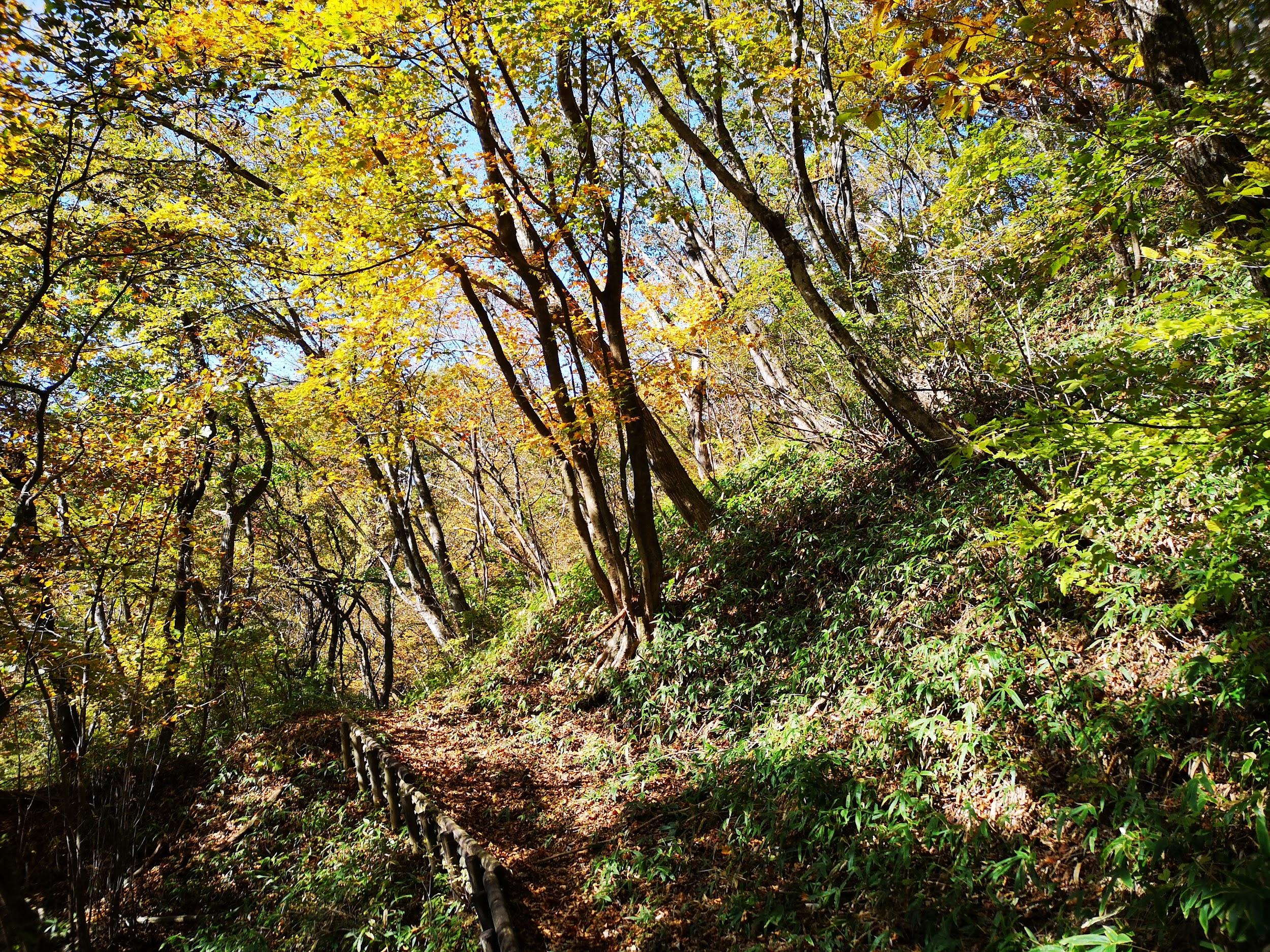
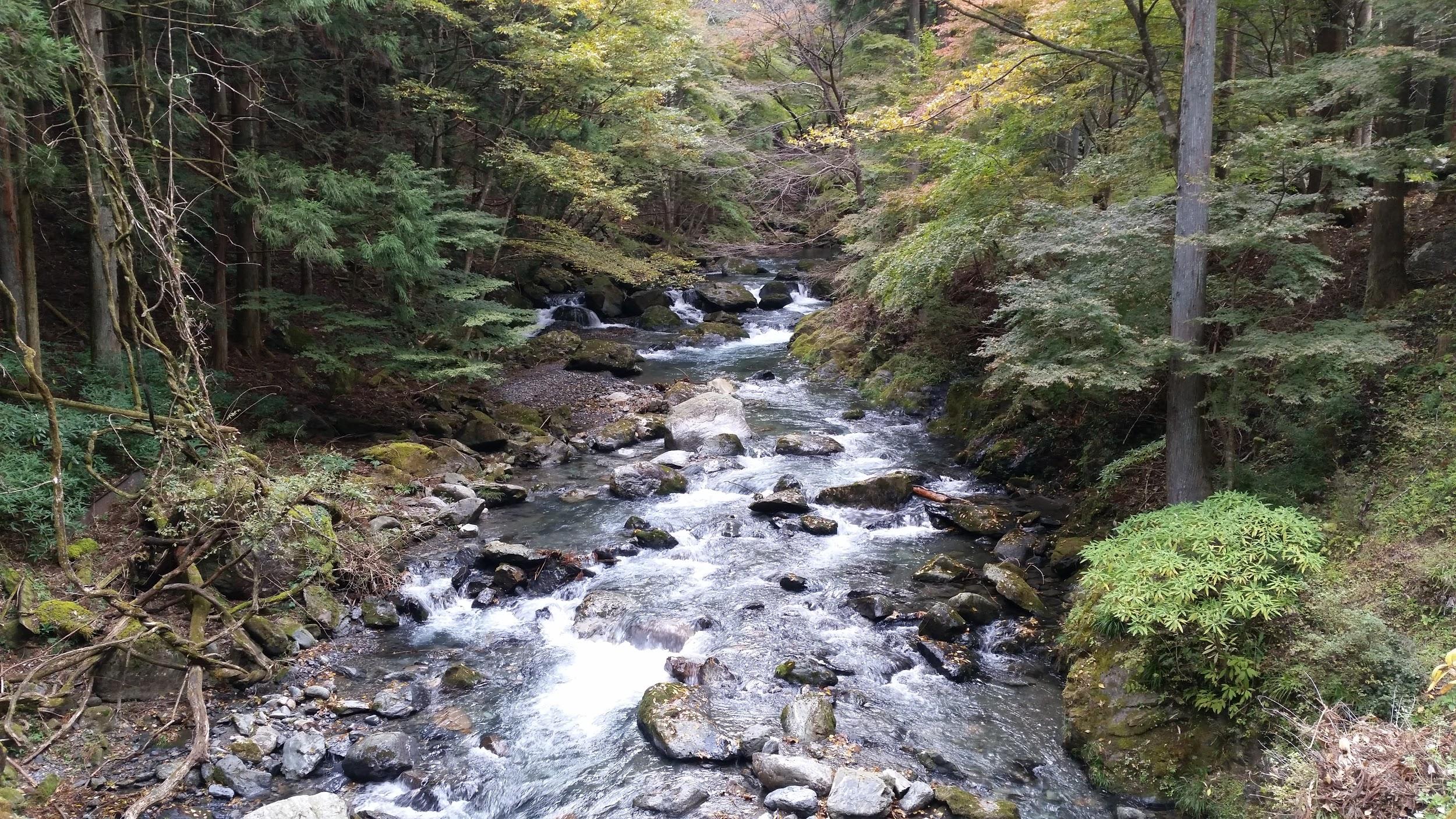
Heading down through the Forest

The toughest part of this 4h1/2 hike was without doubt the roundtrip ridge walk between the two peaks: the views were superb but it required surefootedness due to the steep slopes on each side. If I had been faster, I could have enjoyed a comfortable train ride directly back to Tokyo, but since the good weather held throughout the day, it was worth spending more time on the mountain itself. Going a little later in the season, I could have seen more autumn leaves but I was glad I had gone when few other people were on the trail.

Watch a Video of the Mt Takada & Mt Sekison Hike

Watch the Video of the Hike on Youtube

Mt Nabewari (1332m), Maebashi City, Gunma Prefecture, Sunday, June 25, 2023

I wanted to do one last hike before the hot and humid summer. I found a peak I had never climbed before on Mt Akagi, last visited three years ago. It promised good views, but the roundtrip to the summit was on the short side. I saw on my map that I could combine it with the Kanto Fureai no Michi and end at Fudo-daki waterfall. Since it was mostly along a level trail on the south side of the volcano, it seemed ideal for a warm summer day. I would take a bus from Maebashi station for the Akagi Visitor Center and get off at a stop half way up the mountain. For the return, I planned to use the “furusato basu” to get to the nearest train station, an on-demand bus system requiring me to request a pickup before the end of my hike. I had never used such a system before, and if for some reason it didn’t work, I would have to call an expensive taxi instead. The weather was supposed to be overcast in the morning, then sunny in the afternoon, the temperatures comfortable enough for hiking. I wasn’t sure I would get any views this time, but I hoped to have one last satisfying hike before the long summer break.

Hiking on Mt Akagi and the Fureai no Michi

赤城山 ・ 関東ふれあいの道

Read this Blog Post on Hiking Around Tokyo

View Towards Mt Akagi on the Way Back from Mt Nabewari

Start of the Ridge Leading to Mt Nabewari

It was a cloudy morning as I got off the train at Maebashi station around 9am. I was surprised how few people boarded the bus for the one hour ride to Akagi mountain, although the parking lot next to the trail entrance was packed with cars. I set off a little before 11am, up a wide, gently sloping trail through the forest; rays of sunshine pierced the clouds, a sign of improving weather. Half an hour later, I reached Arayama Highland (荒山高原). To the south, I had a view of the head of the ridge leading to today’s summit. Many hikers were taking a break, so I quickly moved on. After a short climb, I reached a level path along a bare ridgeline.

Start of the Hike (left) Easy Walking through the Forest (right)

Near the Top of the Ridge (left) Just Before the Summit (right)

I was amazed to find such an exposed ridgeline at a relatively low altitude, although the surrounding views were hidden by the clouds. After passing two minor summits, Mt Hiokoshi (火起山) and Mt Kamado (竈山), the path reentered the forest and descended for a short while, before reaching another section of the ridgeline out of the trees. At noon, I arrived at the top of Mt Nabewari (鍋割山 なべわりやま nabewari-yama). Looking south, I could barely make out the Kanto plain through the haze; in clear weather, one can see Mt Fuji, Tanzawa, Oku-Chichibu, the South Alps and Yatsugatake. Patches of blue sky above gave me hope for the rest of the day. I sat on a bench for some lunch, before retracing my steps half an hour later.

Jumble of Rocks on the way to Arayama Kogen

Walking the Exposed Ridgeline

I was lucky to get some views on the return on the north side: I could see the long ridgeline on the west side of the volcano, ending at the rounded peak of Mt Suzu. Directly ahead, I could see Mt Ara and Mt Jizo, two other peaks of Mt Akagi (climbed in September 2015), slowly emerging from the mist. On a clear day, it would have been possible to see the North Alps, Mt Asama, Mt Azuma, Mt Kusatsu-Shirane, Mt Naeba, Mt Tanigawa, and Mt Hotaka. At 1pm, I was back at Arayama Kogen, where I joined the “Fureai no Michi”, heading west through the forest. From this point, I saw no other hikers, the sound of voices replaced by the buzzing of insects.

Some Blue Sky Above

On the Right, Mt Suzu

This was by far the best part of today’s hike, as I could totally immerse myself in the surrounding nature. The sun had finally come out but it remained tolerably cool under the tree shade. It took me about three hours of pleasant hiking to reach the trail entrance for Fudo-daki waterfall (不動滝).

I checked it out myself: it was indeed impassible, but I was rewarded with a close-up encounter with a deer. The short trail to the waterfall followed a rushing river, requiring some surefootedness along a rocky section, equipped with a small ladder for safety.

Heading back to Arayama Highland

Following the Fureai no Michi

I was stunned by how high this waterfall was, as it suddenly appeared past a rocky cliff in a bend in the river; according to a nearby information board, it was 32 meters tall. I got as close as I could to the thundering water, the cold splashing water welcome on this warm summer day. At 4h30 I turned back, and after reaching the road at the trail entrance, turned left. From here, it was about an hour walk down the mountain. As soon as I was back within phone range, I dialed the “furusato bus” number. After several long rings, my call was answered. I requested to be picked up from Nakanosawa Museum, the closest stop to the mountain.

Walking in the shade (left) Staircase at the End of the Fureai no Michi (right)

First view of Fudo-daki Waterfall (left) Close-up view of the Waterfall (right)

I was relieved when my request was accepted without any hesitation. I arrived at the museum just before 5h30, and a few anxious minutes later, a minibus arrived, dot on time. After a short ride through the countryside (total cost 210 yen), I was dropped off at Ogo station on the Jomo railway, a 15 minute train ride from Chuo-Maebashi station, which in turn is a ten minute bus ride from Maebashi station. I was glad I could experience a new form of transport, although on a busier day it would have taken longer to accommodate more passengers. I hope to redo this hike one day on a clear winter day so I can see all the views along the ridgeline and from the summit.

Watch a Video of the Mt Nabewari Hike

Watch the Video of the Hike on Youtube

Mt Mizusawa (1194m), Shibukawa City, Gunma Prefecture, Monday, June 5th, 2023

I had a chance to go hiking on a weekday, so for once, I wanted to visit a popular mountain. I decided to redo one of the peaks on Mt Haruna, first climbed during Golden Week 2016, via a different route. Back then, it was a short roundtrip off the main trail between Mt Soma, the 2nd highest peak, and Ikaho Hot Spring. This time, I would start from Mizusawa-dera Temple, on the east side of the volcano, and finish again at Ikaho Onsen, since I could get a hot spring bath before heading back. I would take the shinkansen to Takasaki station, and there catch a bus to the temple, my first time to use this bus line. For the return, I could take a bus to Shibukawa station, from where I could catch the Kusatsu Limited Express for Ueno, also my first time to return this way. The weather was supposed to be sunny with some clouds, warm but not too hot, typical for this time of the year. I was looking forward to my first visit to Mt Haruna in nearly 4 years, and what would probably be my last hike before the start of the rainy season.

Hiking on Mt Haruna 榛名山

Read this Blog Post on Hiking Around Tokyo

View of Mt Komochi (left) and Mt Akagi (right) from near the Summit

Side view of the Steep climb up Mt Mizusawa

It was already very warm as I got off the nearly empty bus at 10am, after a one hour ride from Takasaki. I quickly walked past some Udon restaurants and up a steep staircase. I was impressed by the massive Buddhist gate leading to the 1300 year-old Mizusawa-dera 水沢寺, quite busy with sightseers despite the mid-morning heat. I sat on a bench next to a ancient cedar and got ready for my hike. At 10h30, I ducked under a small red Shinto gate and climbed another steep staircase, as chanting from some Buddhist ceremony drifted up from below.

Walking under Towering Cedars (left) Climbing Log Steps (right)

Steps Difficulty Level 2 (left) Steps Difficulty Level 3 (right)

I followed a path in the shade of towering cedars before finally reaching the start of the trail. At first the logs steps were easy to climb, but they gradually got more chaotic as I reached the steepest part of the climb. However, it never got so tough that I couldn’t enjoy the green spring forest. Just past 11h30, I reached the first viewpoint of the day, on the east side, near a row of small Buddhist statues.

Transition between Levels 1 and 2

Viewpoint near the Buddhist Statues

I had a bird’s-eye view of the wide valley between Mt Haruna and Mt Akagi. On the left side, I could also see Mt Onoko (climbed in January 2016), Mt Komochi, and behind it, Mt Hodaka (climbed in September 2015). After a short break, I continued my hike. Although I passed several people on the way up, I still had long stretches of the trail to myself. I soon passed another viewpoint on the south side, the flat Kanto plan stretching away into the distance; after a short scramble up a rocky section, equipped with ropes for safety, I reached one more viewpoint on the north side, near a pair of tiny shrines.

The Kanto Plain Stretching South

Looking down at the Shoulder

In the distance, I was surprised I could make out Mt Sennokura and Mt Tanigawa, still wearing their winter coats, the haze having already returned just two days after heavy rain. A little further, I reached the top of Mt Mizusawa (水沢山 みずさわやま mizusawa-yama), its prominence barely noticeable along the ridgeline, but with a spectacular 360° panorama. Directly ahead on the west side, I could see the highest peaks of Mt Haruna. To the southwest, were the Chichibu mountains, and to the southeast were Mt Kusatsu-Shirane, Mt Shirasuna and Mt Naeba (climbed in June 2015), its white, flat peak only just visible. It was past noon, so I sat down for some lunch.

The Chichibu Mountains on the Southwest Side

The Highest Peaks of Mt Haruna

After I had my full of the spectacular view on this sunny day, I set off again, around 1h30. After some descending along the forested, rocky ridge, I reached a paved road, and there, turned right along the path for “Tsutsuji-ga-oka”, or Azalea hill, although they were now out of season and no flowers could be seen. I soon reached an open shelter before another road crossing, where I had an impressive side view of the peak I had just climbed. I continued along the easy-to-walk trail, and at 2h30, arrived at the “Tokimeki Deck”, a wooden observation deck near the top of the Haruna Ropeway.

View of Mt Akagi from the Tokimeki Observation Deck

View of Mt Mizusawa from the Tokimeki Observation Deck

I enjoyed this view more than during my two previous visits, since not only had I now crossed the entire Mt Mizusawa ridge on the south side, but also many of the other peaks in the area. Looking north, I could see the hot spring town of Ikaho Onsen, nestled at the base of the mountain. I skipped the ropeway and followed the Fureai no Michi for the last part of the hike. At 3pm, I reached Ikako Shrine, at the top of the famous stone steps that cross the entire town. Almost immediately, I found a hot spring accepting day trippers. After a relaxing bath, I boarded the bus for the short ride to Shibukawa station, where I caught the limited express for the 100-minute comfortable ride back to Tokyo.

Trail past Tsutsuji-ga-oka (left) Staircase leading to Haruna-jinja (right)

Looking down at Ikaho Onsen from Tokimeki Deck

I was glad I could squeeze in this short hike, around 4 hours, just before the start of the rainy season. Although many people were hiking up and down the east side of Mt Mizusawa, there were a lot less people on the west side, so the second half of the hike was more peaceful. I’d like to return in the future to try some more hikes on Mt Haruna, especially now that I discovered the bus from Takasaki and the limited express from Shibukawa; however, whatever route I choose, I am sure I’ll always end with a hot spring bath at Ikaho Onsen.

Watch a Video of the Mt Mizusawa Hike

Watch a Slideshow of more Photos of the Mt Mizusawa Hike

Watch the Video of the Hike on Youtube

Mt Azuma (481m), Kiryu City, Gunma Prefecture

I wanted to do another hike in the Kiryu area since its low hilly terrain is perfect for winter. I had already completed all the ones in my hiking book, but searching online, I noticed that a section of the “Kanto Fureai no Michi” went up a peak I had yet to climb, before going down the other side and ending at a nature center and a bus stop. It was a little on the short side, so I decided to extend it with a roundtrip to the next peak along the same ridge; the trail continued further for another 5 km to Mt Narukami, which I had climbed two years ago. If I walked that far, I probably wouldn’t make it down before dark, so I decided to keep that section for a longer day. I had been to Kiryu station before so I knew exactly how to get there. Since there was no bus to catch to the start of the trail, I could be flexible with my departure time, something which is much appreciated on cold winter mornings!

View of Kiryu city from the Kite’s Rock

I got to Kiryu station in under 2 hours on a sunny and windless day – ideal conditions for hiking. After a thirty minute walk through a residential neighbourhood, I reached the entrance of Azuma Park behind a temple, and the start of the hiking trail. Today’s mountain seemed popular with families, and many children were having fun climbing the steep, rocky “man’s slope” (男坂). The rocks formed a kind of natural staircase and it was easier to go up than it seemed at first.

View of the Hachioji Hills from the top of Mt Azuma

Nice hiking north of Kiryu city

I soon had my first view of the day from the Kite’s Rock (トンビ岩). Eastwards and directly below, Kiryu city filled up all available flat space between hilly ridgelines. Directly south, the Hachioji Hills stretched west to east between the city and the Kanto plain. However, I couldn’t spot any Black Kites circling above the valley. After some more steep climbing, I arrived at the top of Mt Azuma (吾妻山 あづまやま azumayama), a little after noon.

The long ridge leading to Mt Senjin

Viewpoint near the highest point of the hike

It was unseasonably warm – a thermometer under the summit sign indicated 20°C! The views were similar to before and, after finding a place to sit, I had an early lunch. The summit was getting crowded, and I decided to set off again after twenty minutes. The trail followed the gentle ridge northwards through a mixed forest of pine and cedar. I had occasional views on both sides; to the east was the long ridge leading to Mt Senjn; to the west, I could make out the shape of Mt Akagi despite the midday haze. I had seen no other hikers since lunch, and it was very peaceful.

Less protection from the wind along this section

Looking west, Mt Akagi faintly visible on the right

An hour later, I passed the turn-off for the nature center. I continued up the ridge and was rewarded with a sweeping view to the south. I could see the forested ridge I had walked up, and beyond, the Kanto plain, a vast urban area, its many buildings reflecting the afternoon sun. Past this viewpoint, the trail entered a leafless forest; unimpeded, the cold winter wind now swept over the ridge. At 2pm, I was standing at the top of Mt Ogata (681m 大形山). My map promised a view to the south but it was completely obscured by trees, even without their leaves. However, I did get a glimpse of Mt Narukami on the North side.

Last view of the day from the Nature Observation Forest

Some easy hiking to finish the day

I walked back to the previous viewpoint where I sat down for a short break under the warm sun. By 3pm, I was on the path for the nature center, heading down and west; thirty minutes later I reached the Nature Observation Forest (自然観察の森). There were several paths through this forest, and since the bus wasn’t due for another hour, I tried to pick the longest one. I reached the bus stop at 4h30, a few minutes before the sun disappeared behind the mountains, and I was back at Kiryu station by 5pm, where I boarded a local train for the 2 hour ride back to Tokyo.

Mt Mae-Kesamaru (1878m), Midori Town, Gunma & Tochigi Prefectures

I climbed the highest peak of this mountain two years ago in June, the “back peak”. I had planned to climb the lower “front peak” last year but it kept on getting postponed. At just 100 km from Tokyo, it’s closer than many other peaks I’ve easily climbed as day trips. However, the trail entrance is a two-hour drive from the closest city. Apart from the long drive, the hike itself seemed straightforward, going up and down the same way. The front and back peaks used to be connected by a trail, but over time it has “weathered” and it’s now officially closed. The weather was supposed to be good, but since I would be hiking inside the Nikko National Park, I knew the weather could be changeable. For the effort of going to the same mountain, I was hoping I would get a different view from last time.

Hiking in the Ashio Mountains 足尾山地

The Southern section of the Nikko National Park

I arrived at Maebashi station around 8h30 and was on the road by 9am. Once I arrived in the Watarase river valley, there were fewer cars and I enjoyed the drive. Just before Sori station, I turned left up a narrow mountain road. The road was in rather bad condition, with potholes, fallen rocks and branches on the road, and I had to drive really slowly till the parking lot next to the trail entrance (elevation 1200m). It was 11am and there were three ladies enjoying a break at the resthouse. I asked them whether they had just come down the mountain; they told me they were volunteers who cleaned the parking toilet. They offered me some snacks, and then drove off.

Turning around, Mt Akagi

A nice ridge walk, not easy to find in the area

Twenty minutes later, I started up the staircase at the start of the hike. After a short climb, the path leveled as it followed a narrow ridge. The thick forest blocked out the sunlight, and the trail was faint and hard to follow. I was soon back in the sun after one side of the ridge became a grassy slope, giving me a great profile view of today’s mountain. Turning around, I saw Mt Akagi where I was hiking less than two months ago. As I climbed, the grassy slope got steeper and steeper, but soon I was back in the forest and on a level track.

The Ashio mountains, beautiful and hard to reach

From left to right: Mt Sukai, Mt Nikko-Shirane and Mt Koshin

A little past noon, I reached a wooden lookout tower and a marker for the Kanto Fureai no Michi. The tower was disappointing as the view was mostly blocked by trees – not really surprising since it was built 25 years ago. However I was alarmed to see lots of big dark clouds gathering on the other side of the ridge; there was no time to dawdle. Luckily the next section was mostly flat. At a clearing I passed the turnoff for the emergency hut; there were many rock cairns, and it felt a bit spooky. Further on, there was another clearing filled with rock cairns. It was odd to see so many of them since the trail was well below the tree limit and there was no risk of getting lost.

Walking through the birch trees

Withered pine trees near the top

After some gently climbing, I reached the top of Mt Komaru 1676m (小丸山 komaruyama). The clouds had temporarily moved away, and I had an excellent view of the Ashio mountains (足尾山地) stretching northwards all the way to Mt Koshin, Mt Sukai and Mt Nikko-Shirane to the North. After a short break, I continued along the path, going down for a bit, and then past a very dodgy emergency yellow-coloured shelter – it would have to be a very big emergency for me to stay there! the path then climbed again, through a forest of white-barked birch trees. I soon reached the base of a very steep climb below the summit. Grabbing ropes, rocks and branches, I pulled myself up and up. It wasn’t dangerous, but it was quite a workout.

Below, a great hiking area closer to Tokyo

Stretching into the distance, the Kanto Plain

After the path flattened and started to curve around the round summit, I was rewarded with sweeping views to the West. I could see the low mountains of Southern Tochigi and Eastern Gunma, the Kanto plain and Mt Akagi. Since the Kanto plain is flat and wide, it felt like being on a plane. At 2pm I was standing on the top of Mt Mae-Kesamaru 1878m (前袈裟丸山 maekesamaruyama). The view from the summit marker was so-so, but moving through the trees towards the start of the closed trail for Mt Ato-Kesamaru, gave me a much better view. Straight ahead was the other Kesamaru mountain; to the right were the Ashio mountains and the Nikko National Park; to the left the mountains of Northern Gunma. Maybe it was due to climbing in a different season, but I felt that the views on this Kesamaru mountain were better.

Looking at “back Kesamaru” from “front Kesamaru”

Autumn is around the corner

I started down at 2h30. I was anxious to get to my car as soon as possible; I wanted to get back to Maebashi before dark. Also, since I was heading back the same way, I knew I was alone on the mountain. Actually, I was wrong; once I reached the grassy slope close the parking area, I saw, and heard, several deer jumping through the forest. After observing and listening to the deer, I moved on, and was back at my car less than 2 hours after leaving the top. It was still sunny; I was relieved that the weather had held all day. I drove back the same way, and got back to Maebashi station around 6h30 before it got completely dark. I caught the train for Takasaki, and then jumped on the direct train for Tokyo.

Mt Mae-Kesamaru in the late afternoon sun

Mt Choshichiro (1579m), Maebashi City, Gunma Prefecture

This was my 4th trip to Mt Akagi, but my first time by car. This ancient volcano has many peaks and trails surrounding the top crater, making it a great hiking destination for all levels. On my previous visit, I followed a little-used trail down a beautiful river valley. I was looking to repeat that experience, but on the other side of the mountain. As usual, I was concerned about the weather. The forecast called for rain showers, but I hoped that there would be an equal amount of sunshine.

Hiking on Mt Akagi 赤城山

IMG_20200803_152428

I arrived at the Konuma Parking lot around 1pm in sunny weather. Today’s hike was relatively short so I stopped for an early soba lunch on the way. The moment I set off, thicks clouds rolled in, followed by some light rain. Fortunately, there was no wind and the temperature was comfortable. It took me barely half an hour to reach the top of Mt Choshichiro (長七郎山 choushichirousan), less than 100 meters higher than my starting point. The rain had let up, but all I could see was white cloud…and lots of dragonflies.

IMG_20200803_132317

Do you dare to walk under?

IMG_20200803_133637

The East side of Mt Akagi

After this nice warm-up, I continued down the other side. This path was steep, and some sections had been washed away, maybe by last year’s powerful typhoons. Ten minutes later, I reached a four-way intersection with a sign. I took the path opposite for Otogi no Mori オトギの森, meaning fairytale forest. There were many paths but almost no signs; most joined up a little further down; a few headed down to the Kasu river on the right. I avoided the latter since from my pre-hike research I knew that the area around the river had been damaged by typhoons.

IMG_20200803_142319

A hidden river valley near the top of Mt Akagi

IMG_20200803_142435

Otogi no Mori or Fairytale Forest

Eventually I reached the center of Otogi no mori, a flat quite area with many impressive oak trees, possible “konara“, and a view across the river valley. Continuing straight along the sole remaining path, I soon reached another intersection where I turned right towards Cha-no-ki-batake Pass (茶ノ木畑峠). Here it was possible to hike down to a waterfall and Akagi hot spring, but that will be a hike for another day. I turned right again, and followed the ridge. It was an easy walk, but the views through the trees were lost in the cloud.

IMG_20200803_151609

Ropes to help the hiker

IMG_20200803_165016

For once the bamboo grass was replaced with regular grass

Very soon, the path started to descend steeply. It was slippery because of the recent rain, but I managed to reach the river without any mishaps. I hadn’t expected to find such a beautiful river valley on the upper slopes of Mt Akagi. There was no one else and it felt lonely and mysterious. At the end, the water was funnelled through a narrow opening between some rocks and disappeared into a dark cave – quite an interesting and unexpected sight. It’s called Choushi no Garan 銚子の伽藍 (“choshi” is a kind of sake container, narrow at the top and wide at the base).

IMG_20200803_152825

The Kasu river valley, a fun place to explore

IMG_20200803_154610

All the water from the river disappeared into a rocky tunnel

It was now 4pm, and it had started raining softly again. The trail continued up the other side of the mountain, but it was steep, muddy and overgrown with bamboo grass, so I decided to head back the same way. Soon, the rain stopped again and some sun broke through. I took a different and more direct path back through Fairytale Forest and reached Konuma lake around 5pm. I had an amazing view of the lake through the mist, with Mt Jizo and its TV antenna behind. From a distance, it looked like the spires of a fairytale castle. While walking back to the my car, I had one more surprise – a couple of deer bounding away through the forest.

IMG_20200803_172459

The “towers” of Jizo

IMG_20200803_173329

Konuma Lake in the late afternoon

I was glad I was able to discover another great river valley, although there was no path next to it. The weather was good enough for hiking, but I’ll need to return on a sunny day for the views, probably in the Spring of the Autumn.

Check out “Choushi no Garan” on Mt Akagi

IMG_20200803_124507


Mt Suzu (1564m), Maebashi City, Gunma Prefecture, Monday, November 4, 2019

This was my third hike on Mt Akagi, also a dormant volcano and one of the three famous mountains of Gunma (the third one is Mt Myogi). Since it’s a hundred famous mountains of Japan, I knew that the bus from Maebashi station would be packed. Thankfully, they had an extra bus prepared, so everybody was able to sit during the one-hour trip – a good thing considering that the road had many sharp curves. I got off a few stops before the Akagi Visitor Center, at Shinzakadaira 新坂平, and took refuge at the nearby Akagi Tourist Information Center. It was cold and windy – a big change from the warm weather just 2 days ago.

Hiking on Mt Akagi 赤城山


Easy hiking among white birch trees

I had a quick look at the displays, which included a mounted bear, then had some coffee and toast for breakfast at the small cafeteria. At 10h30, I was ready to brave the near freezing conditions. The first part of the hike was on an easy path along a forested ridge. An hour later, I reached the highest point, Mt Kuwagara 鍬柄山 (1562m), where I had a fantastic view of the whole area. To the East, I could see the ancient caldera of Mt Akagi with Ono Lake at the center, and the highest point, Mt Kurobi, above. To the North, I could make out Mt Nikko-Shirane and Mt Sukai. To the West, was Mt Haruna, with Mt Asama looming behind. To the South was the round top of Mt Jizo with its TV antennas, another of Akagi’s peaks.

View of Mt Akagi’s main peak Mt Kurobi and Ono Lake

The next part was a steep but short slope bringing me to a saddle at the base of my target peak. The next part was an easy short scramble up a rocky path, aided by chains in a couple of sections. The trees were small and already completely leafless, so I was mostly in the sun. Those same trees blocked most of the view from the top of Mt Suzugatake 鈴ヶ岳, but they kept out the wind during lunch. By standing on a rock, I could make out Mt Kusatsu-Shirane between the trees, although the summit was hidden in the clouds.

The rounded forested summit of Mt Suzu

It was already past 1pm, so I quickly went back down to the same way to the base of Mt Suzu. My guidebook suggested continuing back the same way to my starting point, but since I had time, I decided to take a detour around Mt Suzu. It involved descending about 400 meters on one side, and then ascending the same amount on the other side, but I was feeling fit from all the recent hiking so I didn’t mind. On top of that, I was hoping to see some beautiful autumn colours and enjoy the solitude of a path few people hiked. The path was a bit hard to follow – I had to look out for the “yellow strips” – but from time to time a helpful signpost appeared in the middle of the forest.

The autumn colours were at their peak

As I had hoped, the autumn colours were amazing, especially beautiful in the early afternoon sun – I felt like I was walking down an enchanted valley. To my left was a mischievous mountain stream, sometimes running above ground and sometimes under, the noise of rushing water alternating with silence. Thirty minutes later I reached the other end of Mt Suzu, where huge moss-covered boulders were mysteriously strewn throughout the forest, having apparently rolled down from above. Just beyond, I entered a larch forest, forming a wonderful orange ceiling above my head. I emerged onto a road half an hour later, and a little later I reached the lowest point of the hike, as well as the entrance of another section of the “Kanto fureai no michi” 関東ふれないの道, heading up a forested valley on the other side of Mt Suzu.

Mountain stream and autumn colours

Although the trail was now easier to follow, it was also in the shade, so it was harder to appreciate the autumn colours – it was much colder as well! At one point, the path met up with another stream. Apparently there were some waterfalls further up, but I didn’t have time to investigate. Soon I was climbing back up the side of the mountain. It was hard to make out where I was heading among the multiple folds of the mountain side, and for a while I wasn’t exactly sure where I was on the map. However, according to the ever useful signposts, I was on the right path.

The name “Akagi” can be translated at “Red Castle”

After going up what seemed like a never-ending wooden staircase, it was with relief that I arrived at Depari Pass, joining up with a path I had hiked previously on Akagi. It was nearly four o’clock and the sun was quickly dipping behind the side of the mountain. It took me another thirty minutes to reach the shore of Ono Lake and the bus stop just after sunset. Fortunately the bus back to Maebashi station was fairly empty, most people having taken an earlier bus back.

Mt Akagi mountain stream and crater lake

NEXT UP – Mt Kurohime (Togakushi Kogen) in Nagano


Mt Tengu (1179m), Takasaki City, Gunma Prefecture, Saturday November 2, 2019

Hiking on Mt Haruna 榛名山

This was my third hike on this dormant volcano, and one of the three famous mountains of Gunma. It’s also a popular sightseeing spot – there was a long line at the bus stop, opposite the West exit of Takasaki station. I got the very last seat, which was lucky since the ride takes one hour (halfway there, they added a second bus for those standing). It turned out that most people were visiting Haruna Jinja, a 1400-year old shrine located on the Southern side of the volcano. Most people got off at the shrine – however I continued all the way to the last stop at the shore of Haruna lake. Once off the bus, I was stunned by the reflection of Mt Haruna-Fuji on the blue surface of the lake.


This was my first time to see this Haruna lake under blue skies

The first part of the hike was down the side of the mountain along the “Kanto Furenai no Michi” (関東ふれないの道). The path had suffered a bit from the recent typhoons, but was still walkable. The autumn leaves were still at their peak, and looked great in the clear autumn weather. At one point I passed an interesting rock formation, that looked to me like a kind of giant monster. Less than an hour after setting out I reached Haruna Shrine which I had passed earlier by bus. I decided to follow the masses of people and check out the shrine. Although it seemed like your typical Japanese shrine, I was impressed by the massive cedar trees. After reaching the main building, I retraced my steps and located the start of the trail, up a road closed to cars near the massive gate marking the entrance to the shrine.

I happened to be at this strange rock just when the sun was shining from behind

The road soon narrowed; for a short while a stream passed over it – its passage underneath having been blocked by stones, no doubt due to the recent typhoons. The start of the hiking trail was marked by a small red “torii”. A few minutes later, I lost the trail. I backtracked a bit, and after scanning the surrounding forest, I managed to pick it up again (a signpost would be good here). A little further, there was a steep, but short slope that brought to the top of a ridge, and a fork. I first headed right to the top of Mt Kyodai (1079m) 鏡台山, completely surrounded by trees. I retraced my steps, and followed the left fork, which brought me to a rocky outcrop and a great panoramic view of Mt Asama and Mt Myogi to the West. After a short break, I headed back, and continued along a very enjoyable and mostly level path with few people.

Beautiful autumn colours on the side of Mt Haruna

Eventually I got to another fork. To the right, was a peak with no view. To the left, the path, running alongside a series of miniature “torii”, led to the true summit of Mt Tengu 天狗山, which I reached around 2pm. There was an excellent view of the Kanto plain to the South, a few meters past the summit. Unfortunately, as with the previous viewpoint, it was against the sun so it didn’t photograph well. I enjoyed the rest of my lunch, perched on top of one of the huge boulders at the viewpoint. My guidebook suggested going back the same way, but I decided to make a loop hike along a slightly longer, less traveled way, following the ridge above the trail I had come on.

Kissing rocks near the top of Mt Tengu

The entrance to this trail was hard to spot – there was a very small sign pointing the way through the bamboo grass, and the trail was very faint. I had to constantly search for “yellow strips” attached to trees. It was an exciting path with great occasional glimpses of the higher peaks of Mt Haruna to the East. However, it was also nerve-wracking, since I was alone on the trail, and I had to be careful not to lose my way. It was starting to get late, and I wanted to be sure to complete the hike before nightfall. On the way, I passed the minor peaks (but also highest peaks of the day) of Mt Kokanehara (1225m) 小鐘原ヶ岳 and Mt Okanehara (1252m) 大鐘原ヶ岳. After the second summit, the path descended quickly, and I was even more careful checking for the yellow strips – I didn’t want to have to climb back up like I had done the previous month in the Tanzawa mountains!

Late afternoon view of Mt Haruna in full autumn splendor

I was relieved to finally reach Jizo pass, where I turned left off the ridge and down into the valley. However the path remained difficult to follow with few signposts. Thanks to some judicious pathfinding, I got on to a good path next to a pretty stream and finally managed to rejoin the road I had walked up a few hours earlier. I was back at Haruna Shrine a little after 4pm, and I had ample time to catch the now mostly empty bus back to Takasaki station.

The birds of Mt Haruna – Swan gliding over the lake and Falcon flying in the sky above

NEXT UP – Mt Suzu (Mt Akagi) in Gunma

Pulpit of the Devil, Mt Komochi (1296m), Gunma Prefecture


Mt Komochi (1296m), Shibukawa City, Gunma Prefecture, Friday November 24, 2017

20171124_114221

In 2010 I made a trip to Colombia and visited El Cocuy a mountain that is famous for a huge oblong sized boulder sitting near the summit called “Pulpito del Diablo” or the Devil’s Pulpit in English. Last week, I finally found its Japanese version, sitting near the top of Mt Komochi 子持山 (1296m), a Kanto 100 famous mountain about 30km North of Takasaki in Gunma prefecture.

I saw the photos when doing my research, the taxi driver pointed it out to me on the drive from Shibukawa station, but nobody had ever told me that such a thing existed in Japan so I took no notice. Yet Shishi-Iwa or Shishi Rock 獅子岩 deserves to know as one of the wonders of Japan, at least among hikers. Not along can you gaze at it as you climb up and down, from below, above and from the side, you can climb to its top via a combination of chains and ladders and gaze down into the void below.

20171124_125200
Top of Shishi rock

I had a taxi driver drop me off near the start of the trail since the price was affordable and it saved me a great deal of time. Unfortunately you can’t go to the start of the trail anymore because the last part of the road was severely damaged by a recent typhoon. This seems to happen quite a bit – I saw another example at the base of Mt Kogashi – and I doubt whether these roads will ever be fixed one day.

A sunny day had turned to clouds when I reached the official trail entrance, looking a bit despondent devoid of people perhaps because I was there on a Friday or because autumn season was over. The path soon me below a massive cliff, Byobu-Iwa or Byobu Rock 屛風岩, the top parts of which were literally hanging over the path. I hurried along nervously let a loose piece of rock fall upon my head. What did fall upon my head just moments later were some snowflakes – winter had come to my surprise since the forecast had called for clear weather. Fortunately no snowstorm followed and the flakes stopped and started again before disappearing altogether.

20171124_111411
The overhanging cliff, Byoubu Rock

In the meanwhile I was making my way up the back of the cliff and then onto the top of it. This was actually quite frightening because as I mentioned before the upper parts were hanging over the valley below. To the left and the right there was just void. I am not afraid of heights but when the ridge narrowed suddenly before the final part I gave up and retraced my steps. In any case this was just a short aside – the main path continued straight up the ridgeline in the opposite direction.

20171124_112837
First glimpse of the “pulpit”

It’s around this point that I was getting my first glimpses of Shishi Rock. I was amazed at how long it took me to finally get to the base. This just goes to show how big it is and how deceptively small it looks from a distance. The front side is pure cliff so you need to make your way around the back in order to climb it. It’s pretty straightforward until you get to the ladder. Its metal, vertical, goes up a ten meter long chimney but not rigid so it moves slightly when you climb it, which will totally freak you out when you are nearing the top and the whole thing suddenly shifts.

Finally standing at the top felt fantastic especially after you had been staring at this marvel of nature during most of the climb up. I was especially careful not to get too close to the sides lest a gust of wind made me lose balance. It was surprising that there were no warning signs but then those who made it so far would be careful. The views of the surrounding peaks was amazing.

20171124_134519
Tanigawa Ridgeline from the summit


20171124_122745
View of Mt Akagi to the East

After climbing down, carefully, I made my way to the true summit another hour or so away. There I could take in all the peaks of the Joushin-Etsu Kogen National Park, already covered in snow.  The view is not quite as good as from the top of neighbouring Mt Onoko but breathtaking all the same. After a quick lunch I quickly descended via another route that offered occasional glimpses of Shishi rock through the trees, arriving finally back at my starting point with about an hour of daylight left, just enough time to walk back to the nearest train station Shikishima.

20171124_152507
One last look at Shishi Rock

DSC00887
The Colombian Pulpito del Diablo


Mt Nemoto (1199m) & Mt Kumataka (1169m), Kiryu City, Gunma Prefecture

This was my very first visit to Kiryu City – I returned a couple more times last year in the autumn. However I had hiked in the Ashio mountains 足尾山地 several times before. I was again the only person on the bus, and when I got off at the last stop, I was surprised that it cost only 200 yen – probably the cheapest bus ride I’ve ever done in Japan. I had to walk another thirty minutes along the road, but I didn’t mind since it followed the beautiful Kiryu river.

Kiryu river, one of the top 100 forested valleys in Japan

I reached the start of the trail around noon – there was a well-made sign in Japanese and English explaining that the Kiryu River had been selected as one of the top 100 forested valleys in Japan – I wasn’t aware that such a list even existed! There are two trails up the mountain – the one on the left follows a small mountain stream, and is more challenging. I took the more direct trail going up the ridgeline. This trail had its share of fun, with rocky sections lined with ropes for safety – it’s not really dangerous, but it isn’t for beginners either.

The autumn colours made up for the gloomy weather

The autumn colours were still at their peak, and a little before 1h30, I reached the top of Mt Nemoto 根本山 (meaning “tree root”), a Gunma 100 famous mountain. There was no view, but there was a brand new sign. The weather had been sunny and cloudy all morning, but now it was completely overcast, with a cold wind. It felt like it might snow at any moment.

Mt Akagi, looking somber

I continued along the ridgeline, circling the source of the Kiryu river, clockwise. Soon, I was walking South along an easy trail, and I arrived at Mt Kumataka 熊鷹山 less than an hour later. There was a small observation tower with a 360° view of the surrounding mountains. I could make out Mt Koshin and Mt Kesamaru to the North, where there was some sun, and Mt Akagi under a dark cloud to the West. In the East, it seemed like it was raining.

Trees marching up the side of the mountain – blue skies returned at the end of the hike

After enjoying the view and before my hands froze, I started to head down the mountain. The hiking trail quickly became a forest road, and the sun came out again. Soon, I was walking next to the Kiryu river again under blue skies. I was back at the start of the trail before 4pm, and half an hour later I was riding the last bus back to Kiryu City.

Kiryu river, also one of the 100 top forested water sources