Mt Rakanji (1058m) & Mt Shirosuna (920m), Kofu City, Yamanashi Prefecture, Sunday, October 12, 2025

I had been up Mt Rakanji once before when I visited Shosenkyo in October 2013. Back then, I drove from Kofu and used the ropeway, since the main purpose was to explore the spectacular Mitake-Shosenkyo gorge. I was reminded of this interesting peak when I saw it from Mt Shiro last year. Looking at my Mountains of Yamanashi guidebook, I found a relatively easy hike traversing this mountain from north to south, including another peak I had never climbed. As an added bonus, I’d also be able to check out the nearby Kanazakura Shrine.

Hiking in the Chichibu-Tama-Kai National Park

秩父多摩甲斐国立公園

To get to the start of the hike, I’d take the Chuo line limited express to Kofu, and then ride a bus to Shosenkyo, getting off at the end of the line. From there, I’d follow a paved road on foot for another 30 minutes to get to the trail entrance. For the return, I’d catch the same bus, two stops up the line at the entrance of the gorge. I planned to get off at Yumura Onsen, on the bus route and inside Kofu city, for a quick hot spring bath at Yumura Hotel before catching the train back.

Trail before the the Top of the Ropeway (left) Trail for Mt Rakanji (right)

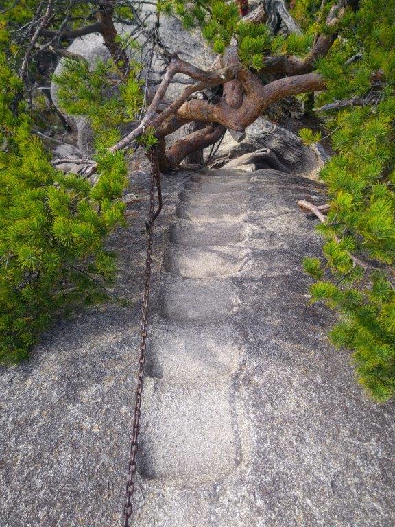
Stone Steps & Chains on Mt Rakanji (left) View from Mt Shirosuna (right)

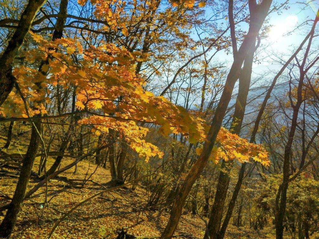
The weather was supposed to be clear in the morning and overcast in the afternoon, with temperatures approaching 30° in the Kofu basin, unusually high for the season. I hoped it would feel cooler up the mountains; I also hoped I’d be able to get a glimpse of Mt Fuji and the South Alps before the clouds rolled in; finally, since the Autumn leaves were only due next month, I was counting on smaller crowds than usual. I was looking forward to a relaxing early Autumn hike in a familiar area.

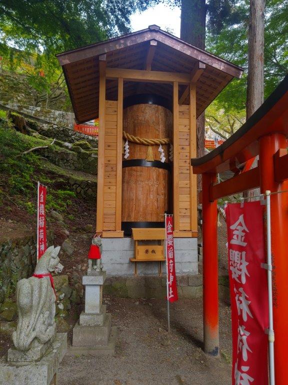
Shinto Gate at the Entrance of Kanazakura Shrine

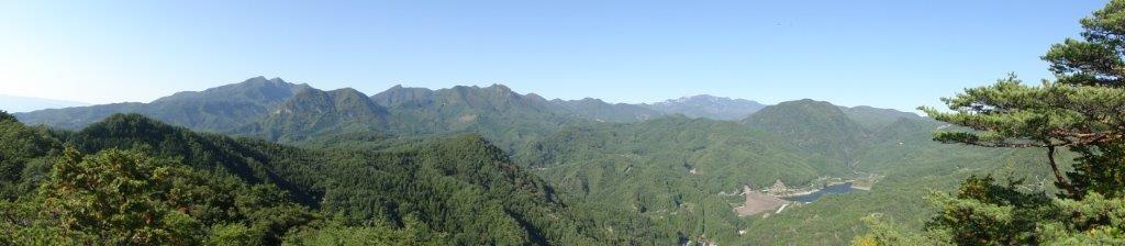
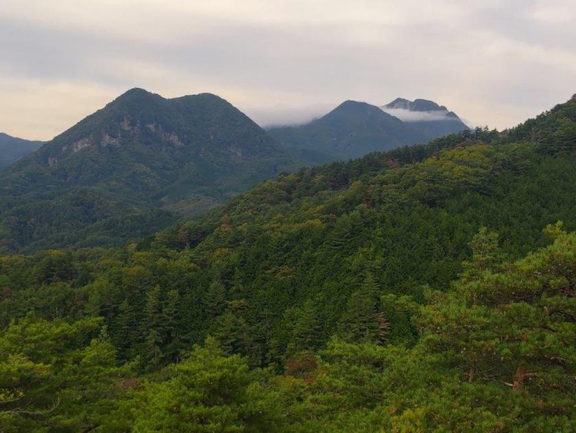
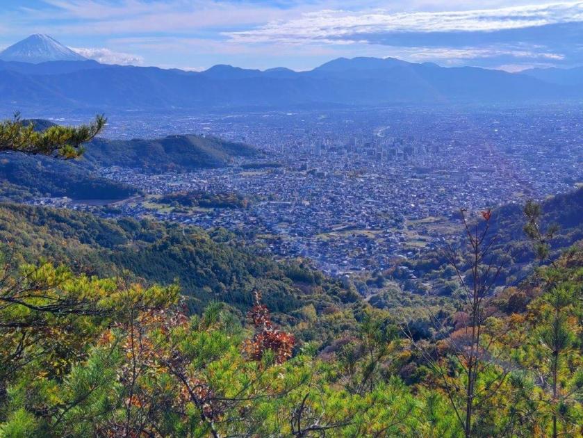
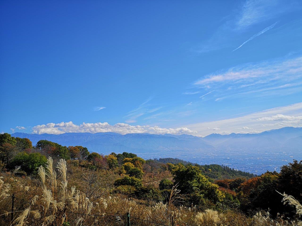
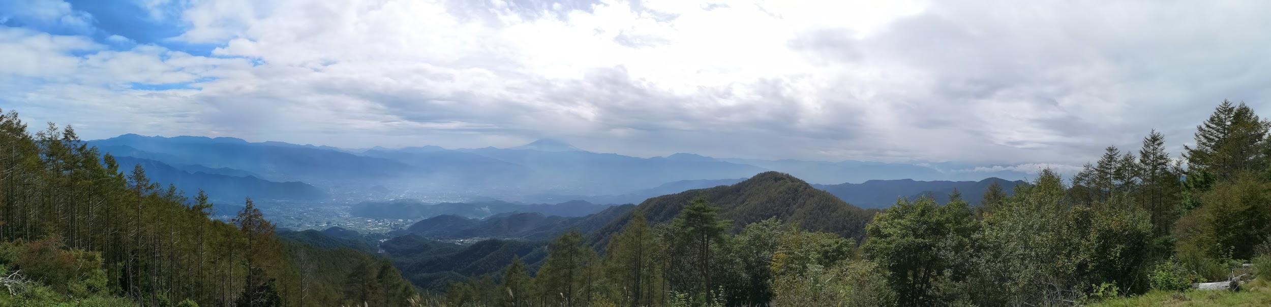
View of the Oku-Chichibu Mountains near the Start of the Hike

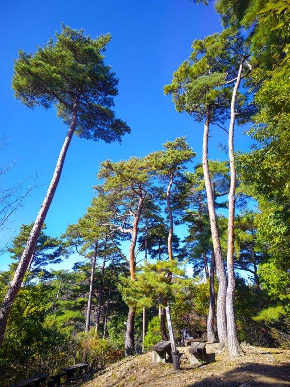
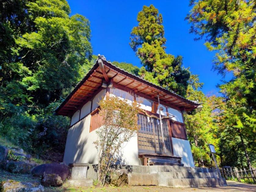
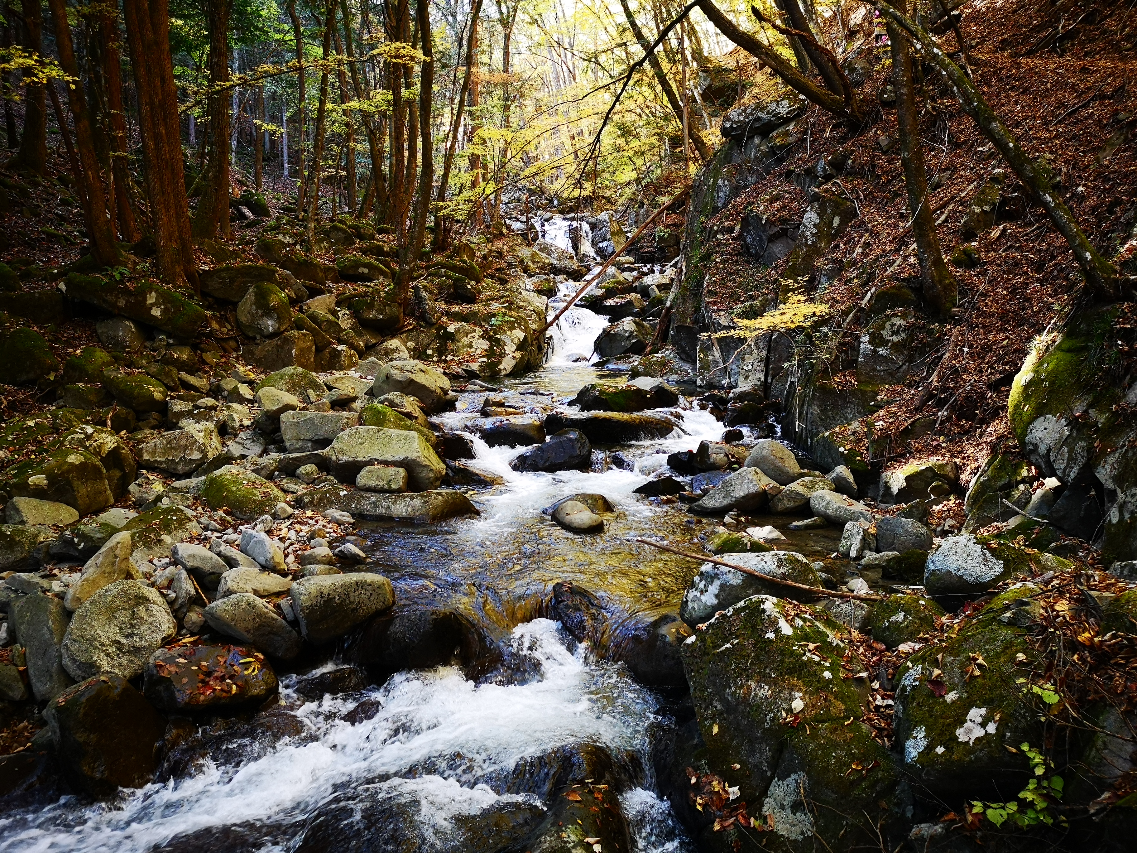
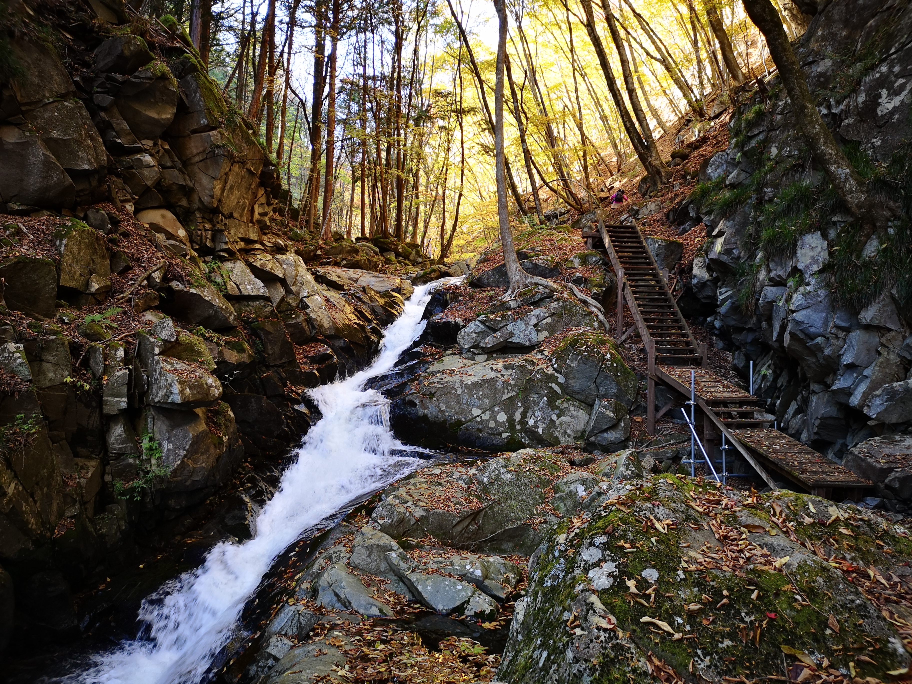
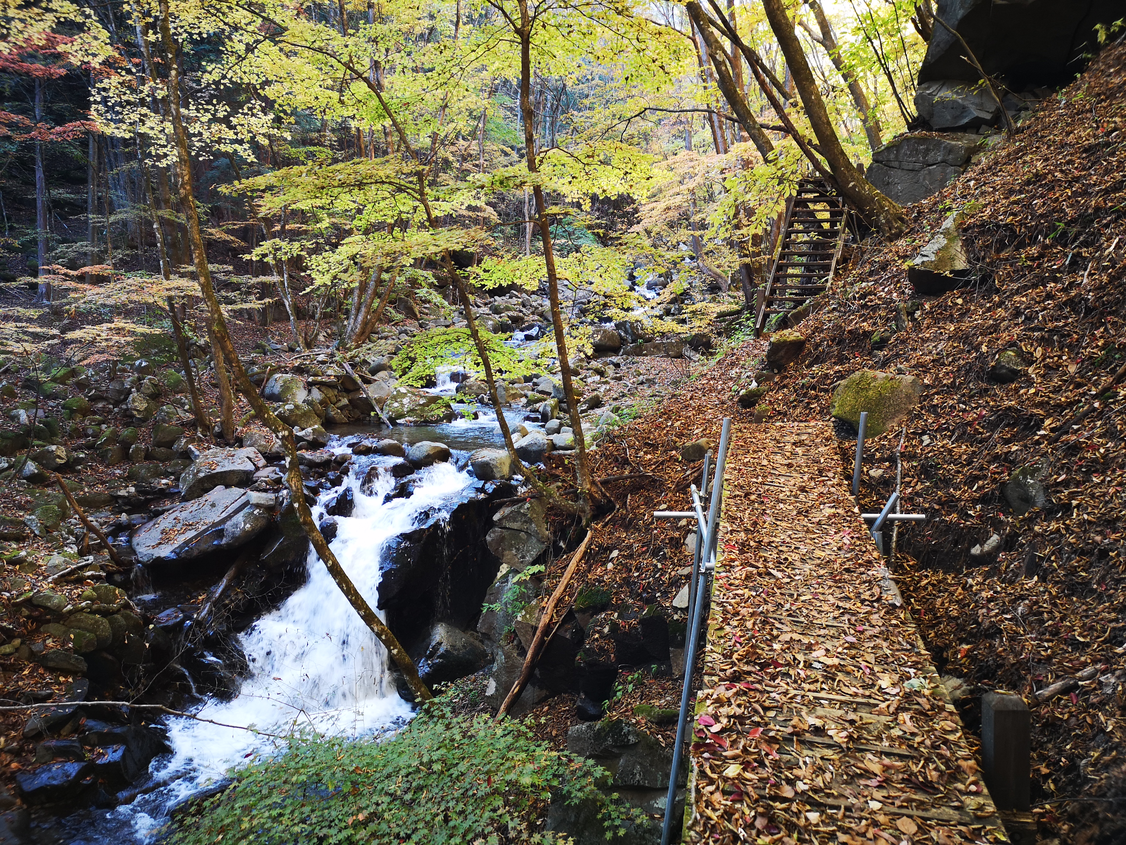
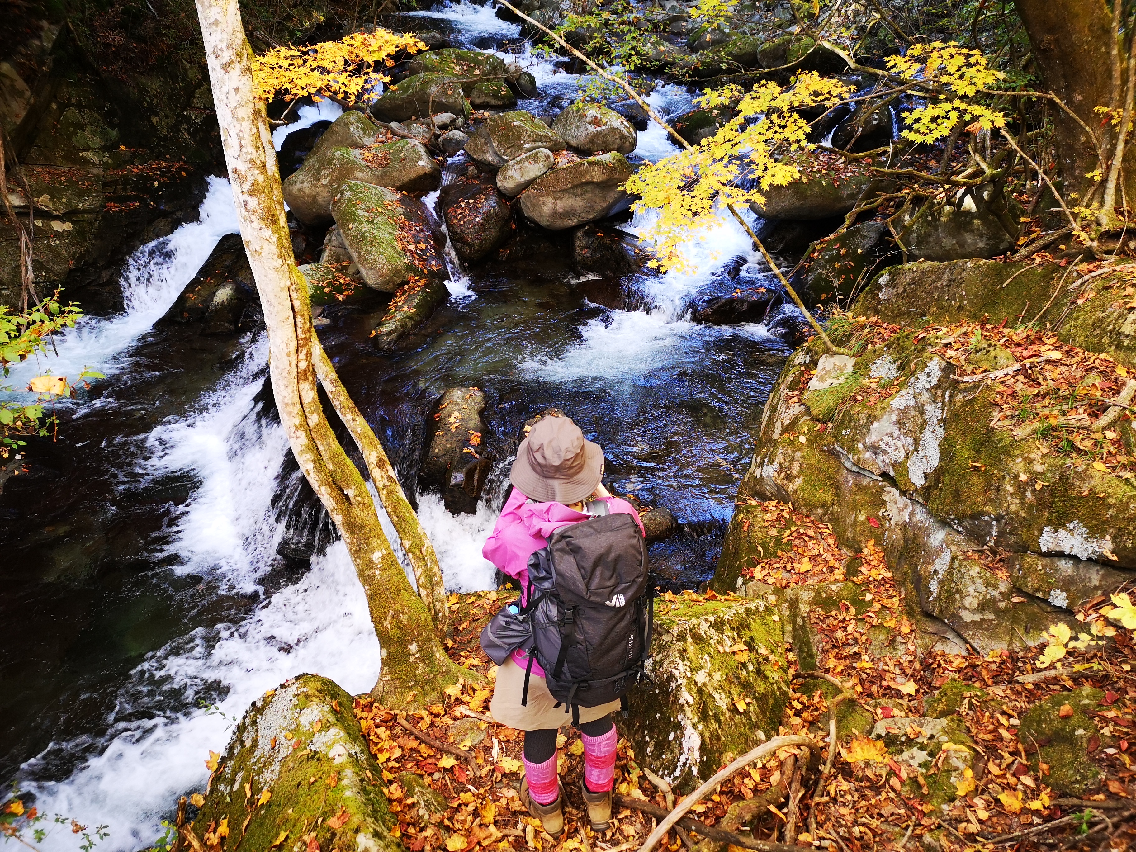
It was a cloudy morning as I left Tokyo but after entering the Kofu Basin, I was greeted with blue skies and a view of the South Alps, still clear of snow. I arrived at Kofu station just after 10am, and after standing in line waiting for the “Green Line” (グリーンライン), felt lucky to be seated on the crowded bus for the fifty-minute ride to Shosenkyo-Takiue, five minutes on foot from the Shosenkyo ropeway (昇仙峡ロープウェイ). After observing hoverflies busily nectaring at purple Asters and Jorogumo spiders hungrily eating their prey, I set off along the Shosenkyo Line road and away from the various tourist attractions surrounding Sengataki station (仙娥滝駅) at the base of the ropeway. A little before noon, I arrived at a shrine entrance at a bend in the road.

View of Mt Kenashi (left) and the South Alps (right)

Start of the Dirt Road for Mt Rakanji

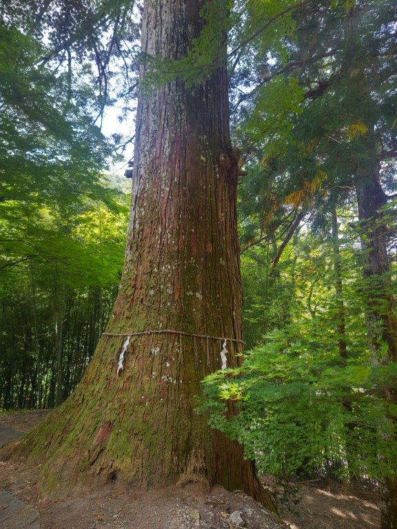
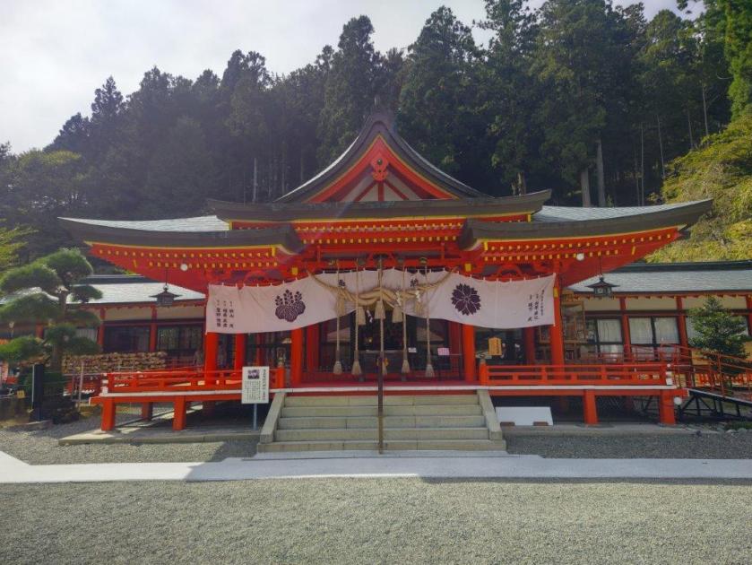
I was impressed by the bright red Shinto gate (“torii”), surrounded by colourful pennants flapping in the breeze, and also by several towering cedars at the top of a steep flight of steps. A small sign propped at the base of one of them indicated it was part of the 100 trees of historical interest in Yamanashi prefecture, although I couldn’t tell whether it was taller than its neighbours. At the top of another flight of steps, I reached the main building of Kanazakura Shrine (金桜神社), another striking bright red structure. On the opposite side was a gravel path with an enticing sign for a nearby viewpoint of Mt Fuji.

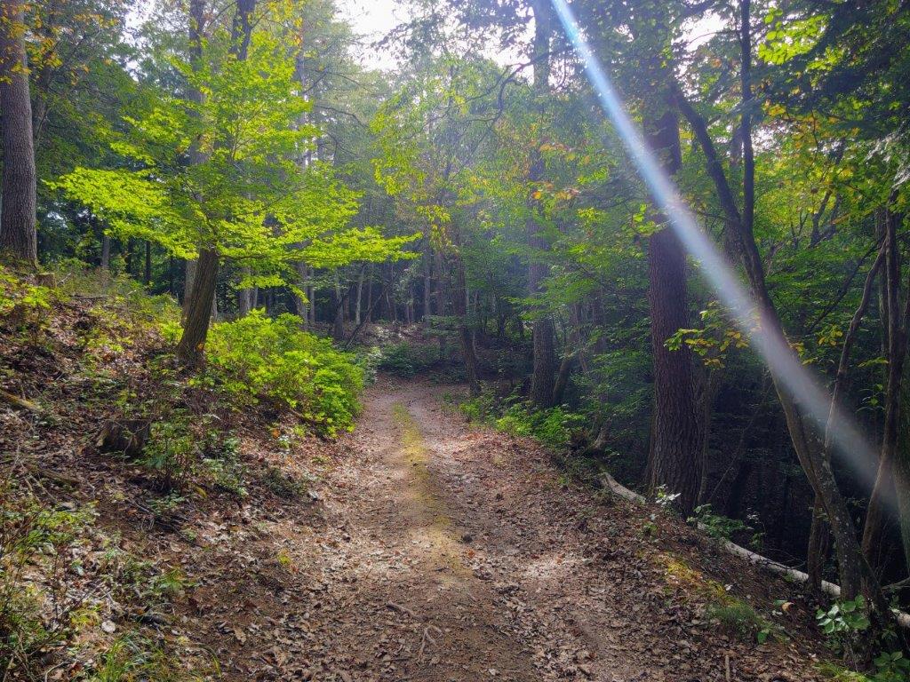
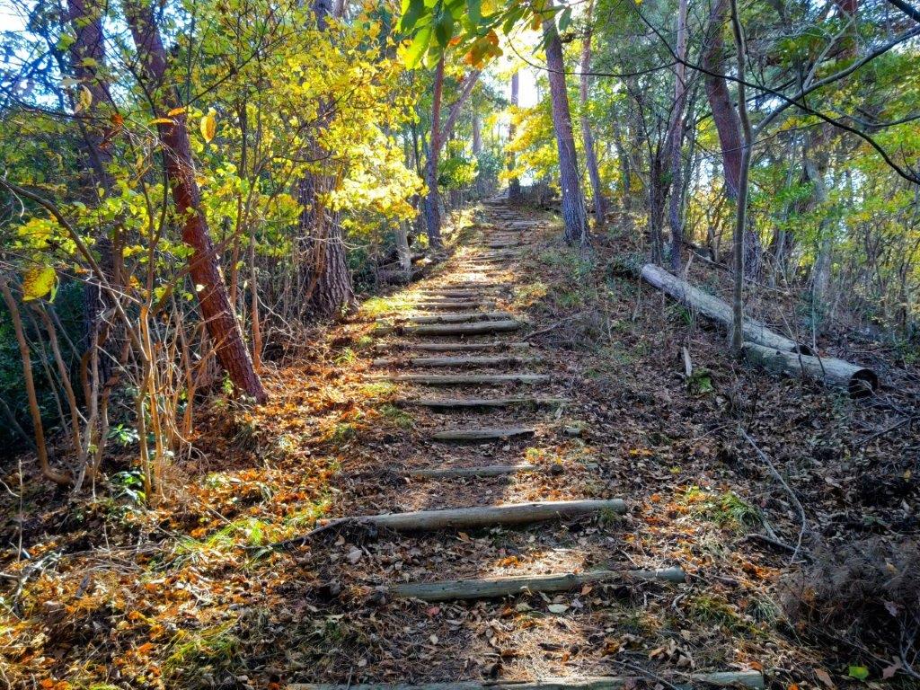
Wooden Walkway on the Way to Mt Rakanji

View of Kurofuji (left) and Mt Kinpu (right)

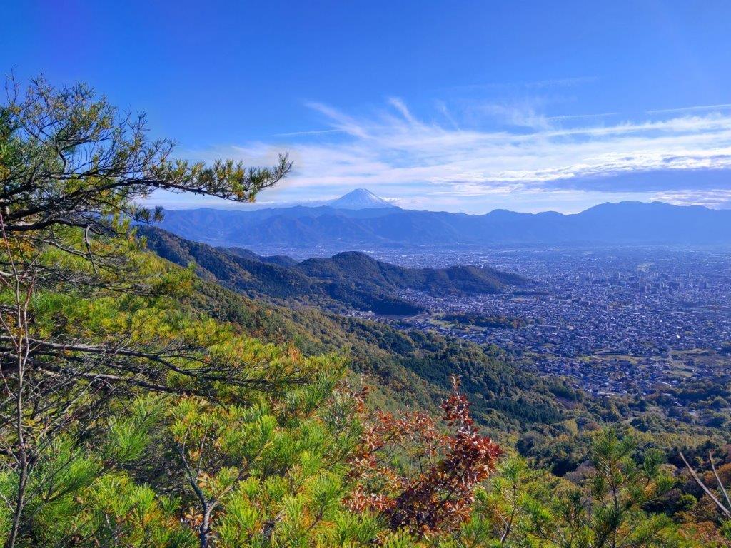
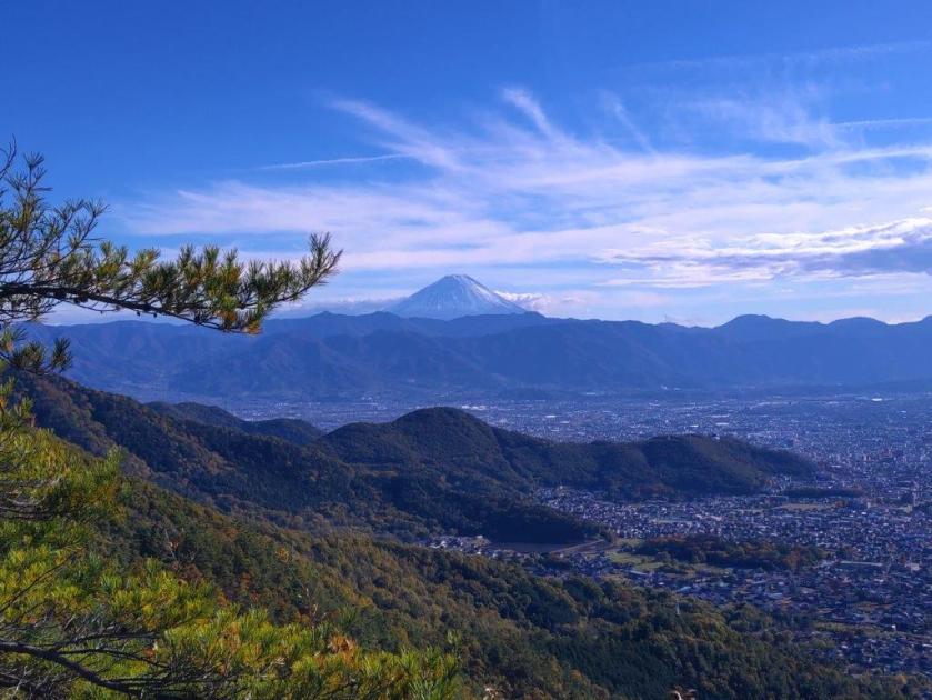
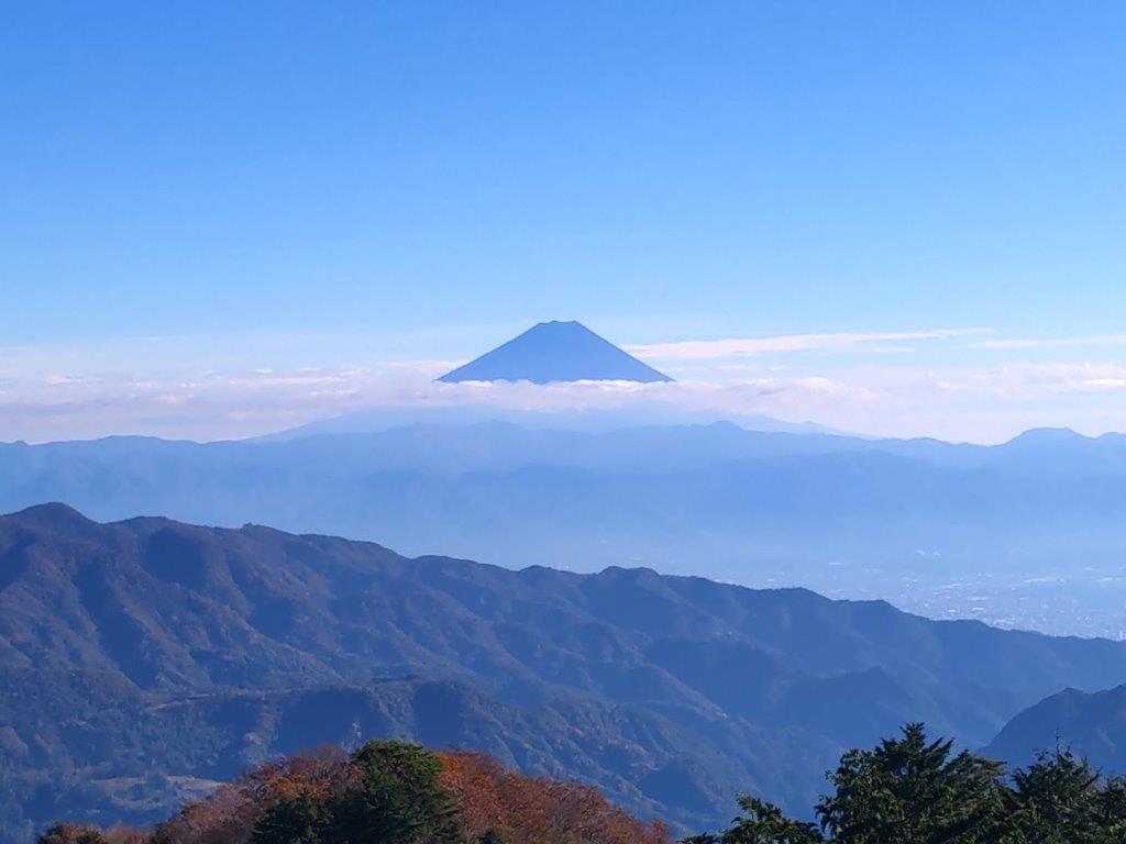
I couldn’t resist making the short round-trip, especially since the sun was shining and the trail seemed easy to walk. After a 10-minute walk through tall cedars, I arrived at an open space with a view of Mt Fuji framed by pines to the south; looking north, I could make out the broad summit ridge of Mt Kinpu, recognisable by the manmade boulder formation protruding from its highest point. After a short break to enjoy the peaceful surroundings, I retraced my steps to the base of the shrine, and a short distance away, turned right up a road signposted for today’s mountain. After a few bends, I reached the end of the paved road and entered an open space with a view to the northeast.

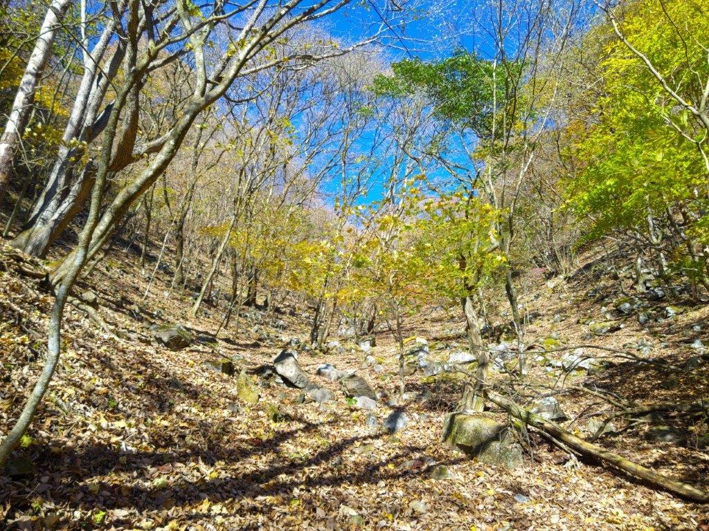
Forest Road along the Level Ridgetop

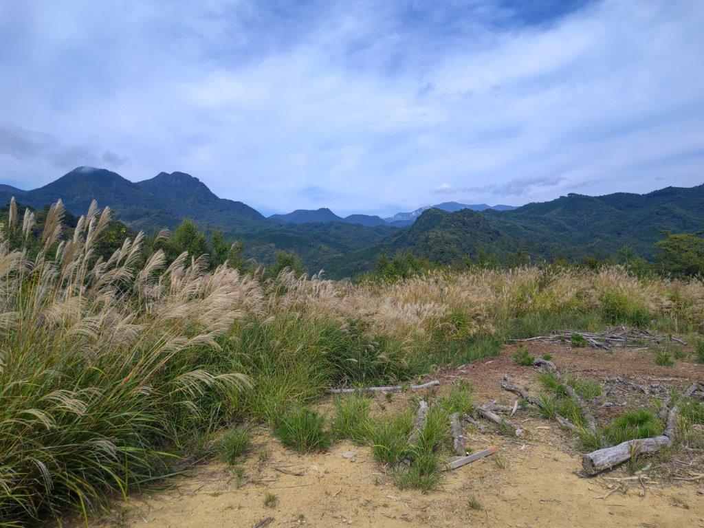
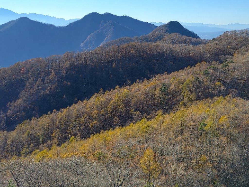
Mt Kaya (left), Mt Tachioka (center) and Kurofuji (right)

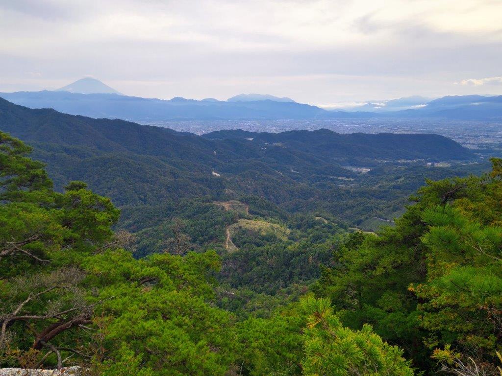
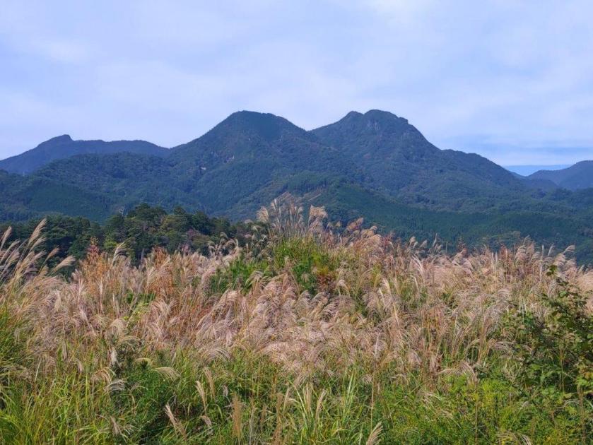
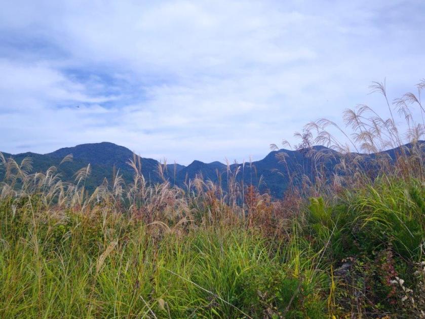
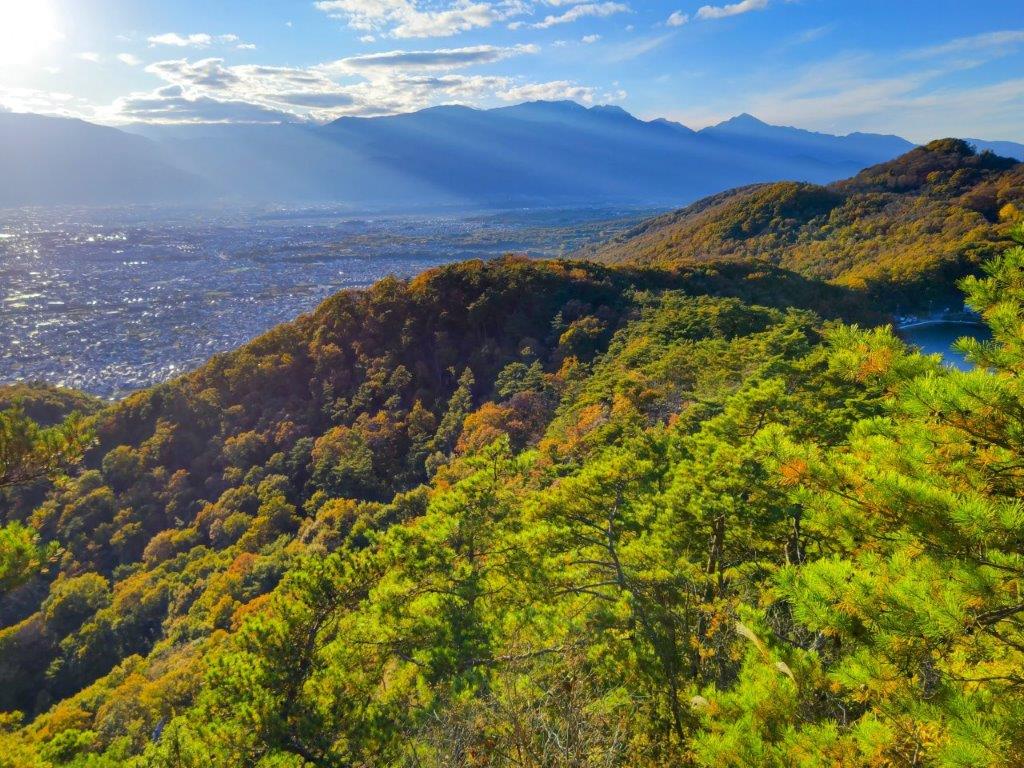
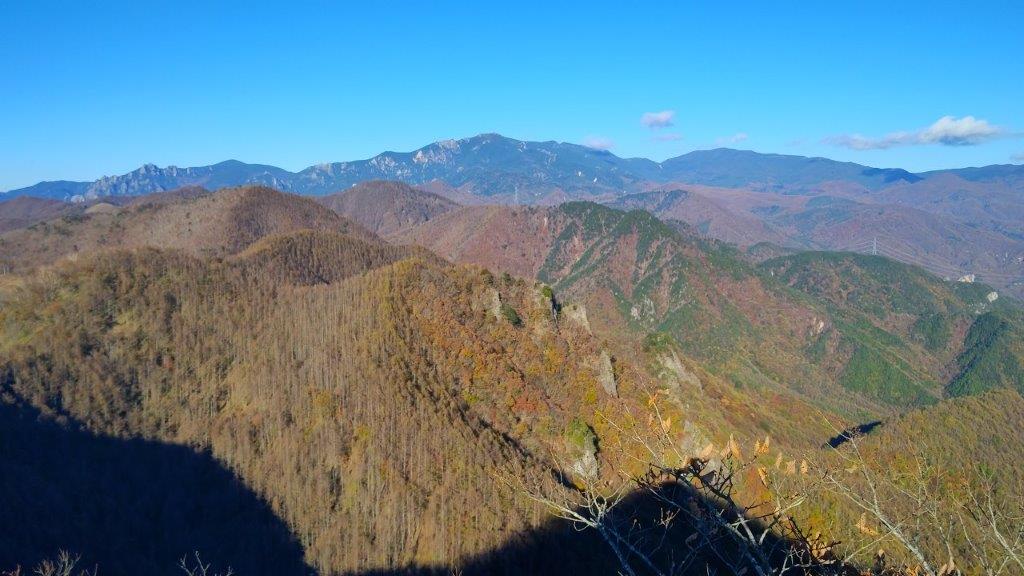
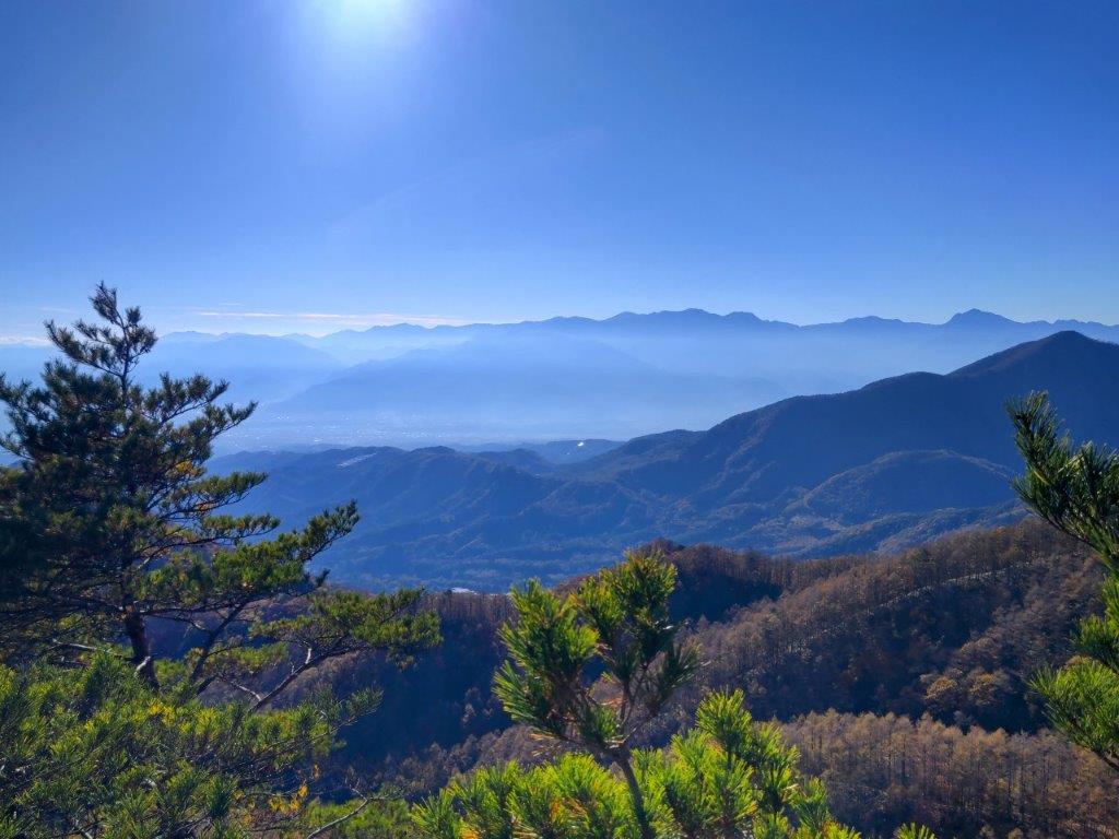
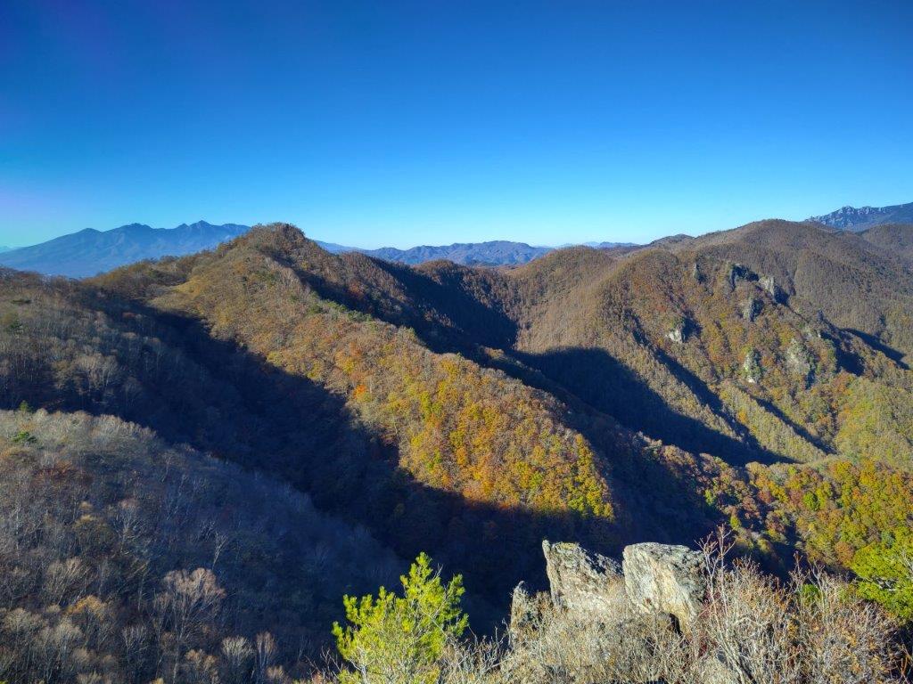
I was glad to get such a wide view so soon on the hike. On the left side, I could see Kurofuji, its cone-shaped summit not visible from this angle, and on the right side, was Mt Kinpu again, its rocky flanks now visible from this higher elevation. I followed a path for a few minutes westwards and off the main trail, to get a view of the South Alps, hazy blue in the far distance and with golden yellow Japanese Pampas grass (“susuki”) in the foreground. I made my way back through the “susuki” field and turned right up a dirt road. I soon reached a cleared area at the edge of the forest with a view on the north and east sides.

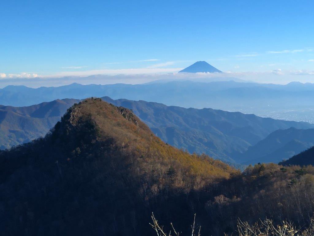
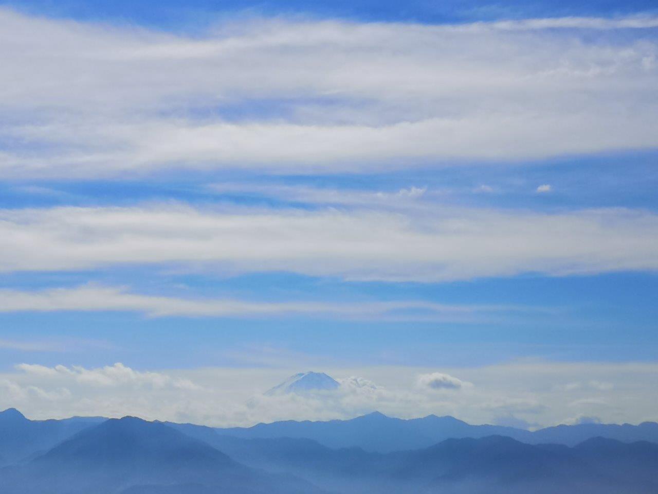
Mt Fuji from near the Panorama-dai Station (2013 photo)

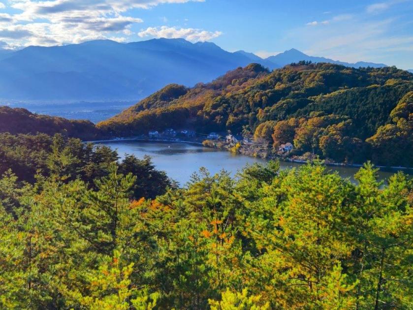
Mt Kinpu and Lake Nosen from the Panorama-dai Viewpoint (2013 photo)

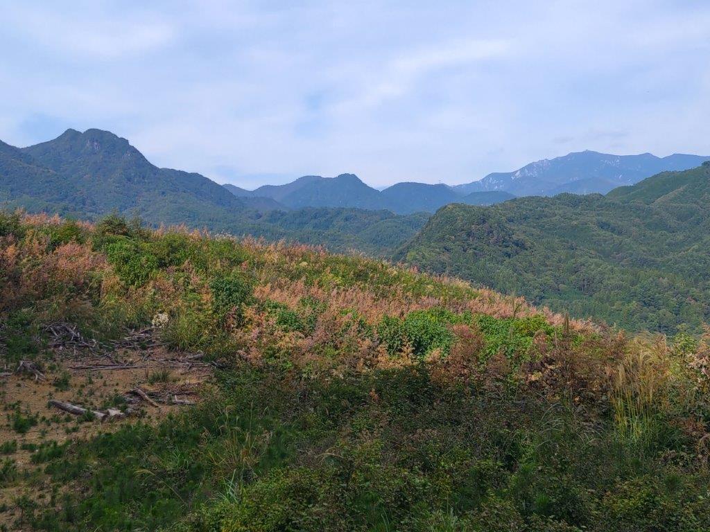
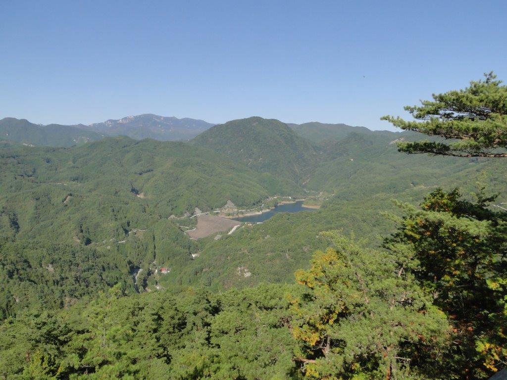
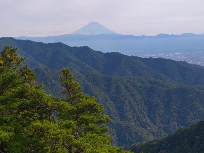
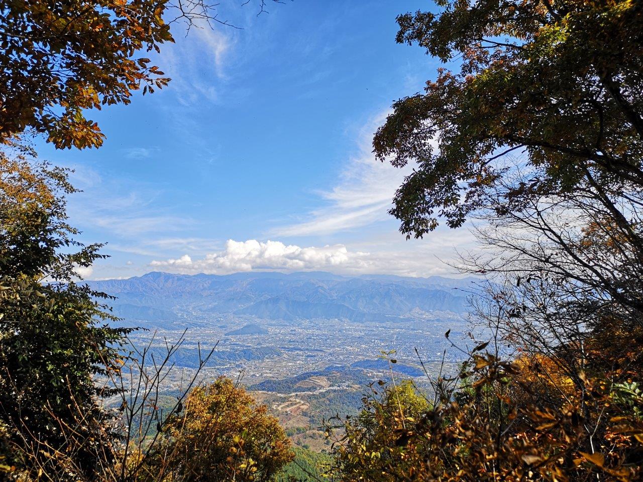
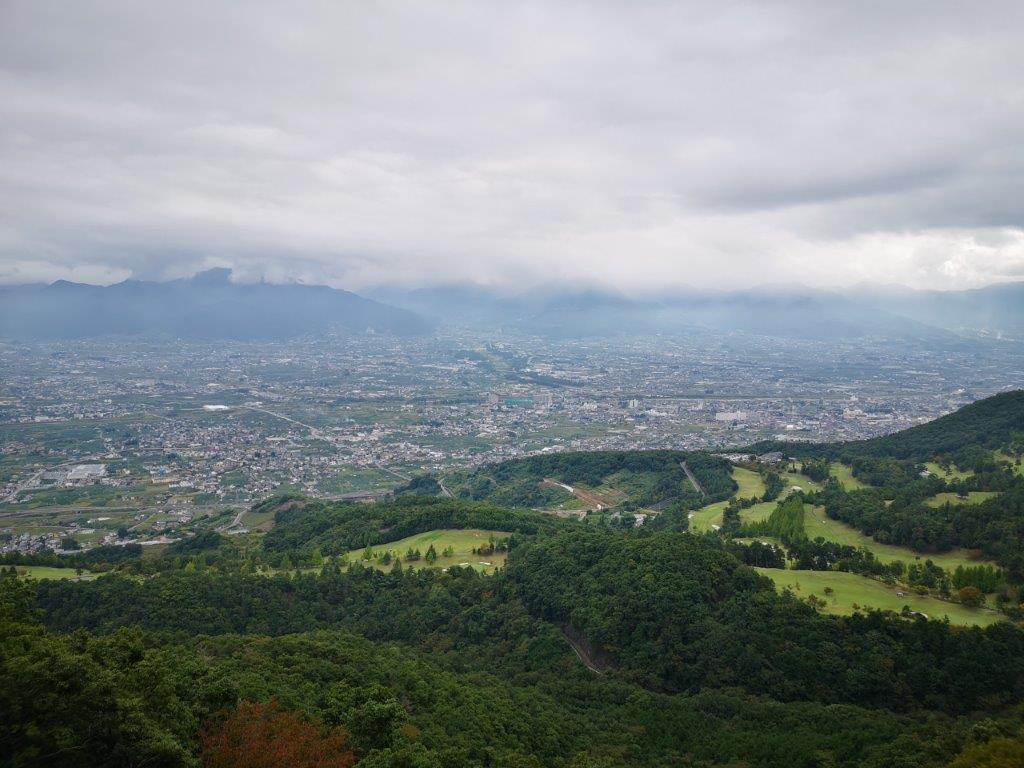
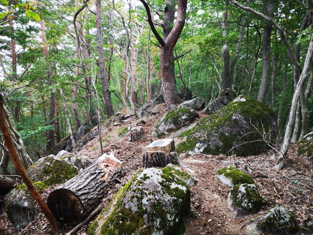
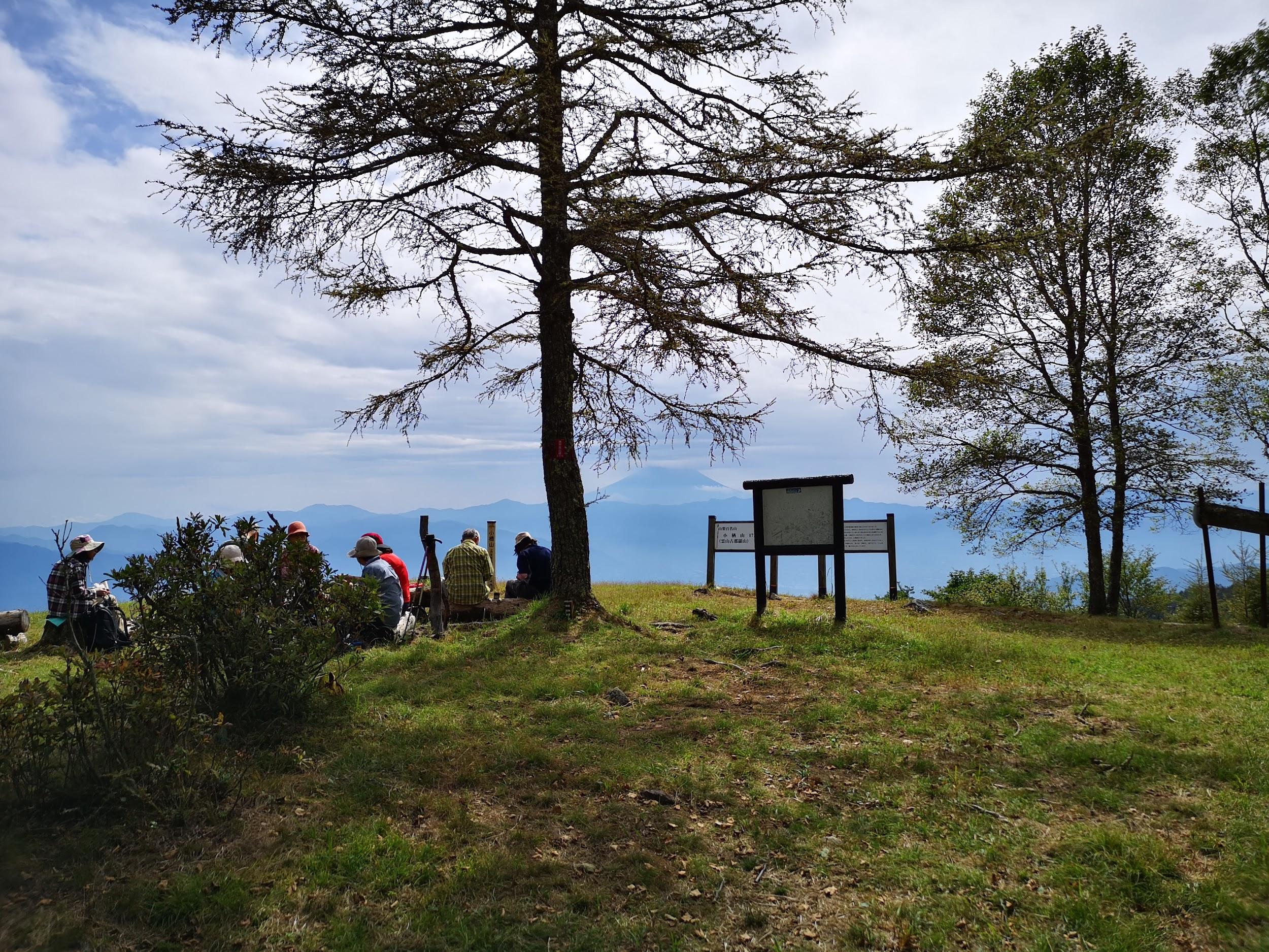
I was pleasantly surprised to get such a wide view on this side of the mountain, which now included Mt Tachioka at the very left and Lake Nosen at the very right. Mt Kinpu rose prominently in the background, the second highest peak in the Chichibu-Tama-Kai National Park and a 100 famous mountain of Japan. Since it was nearly 1h30, I found a suitable tree stump to sit on for a late lunch break. As forecast, the clouds had spread across the sky from the south, providing some welcome shade on a warm Autumn day. I set off again along a winding track sticking close to the level ridgeline, and just before 2pm, exited the forest just below the Panorama-dai Station (パノラマ台駅) of the Shosenkyo ropeway.

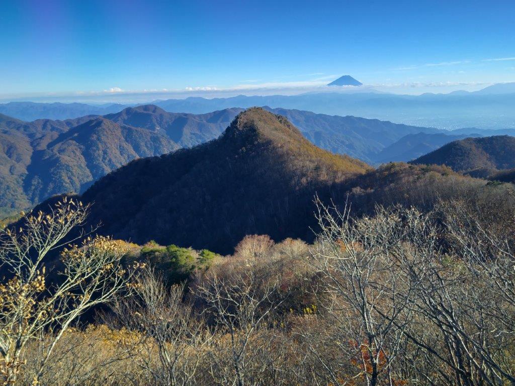
Mt Fuji (left) and Mt Kenashi (right) on the way to Mr Rakanji

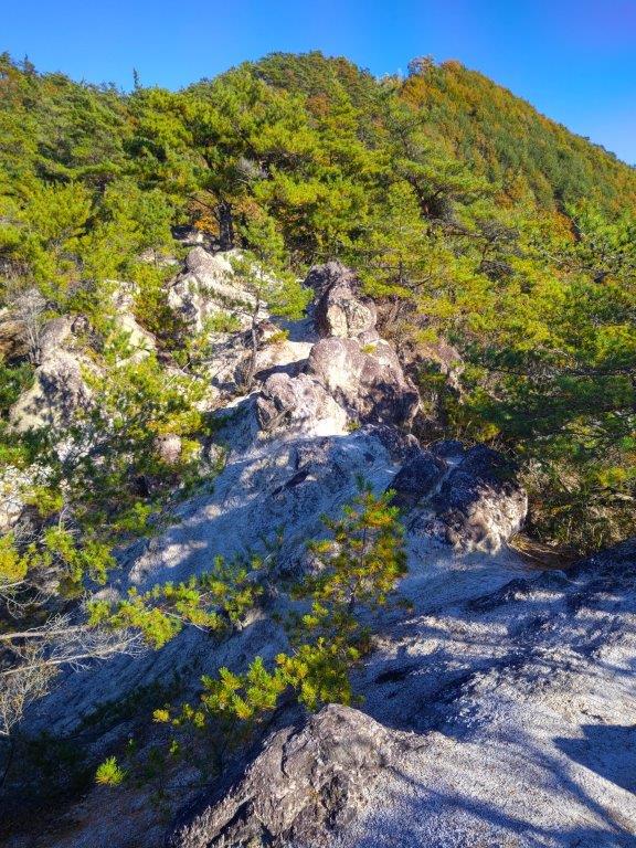
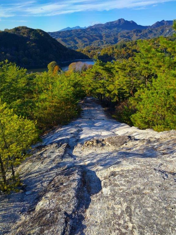
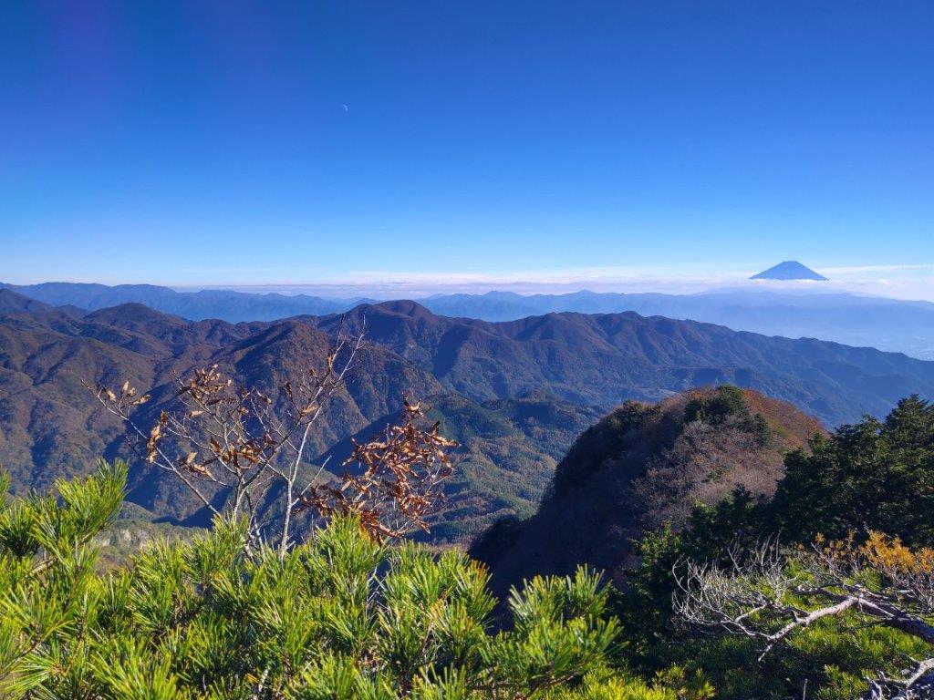
Mt Shirosuna from Mt Rakanji

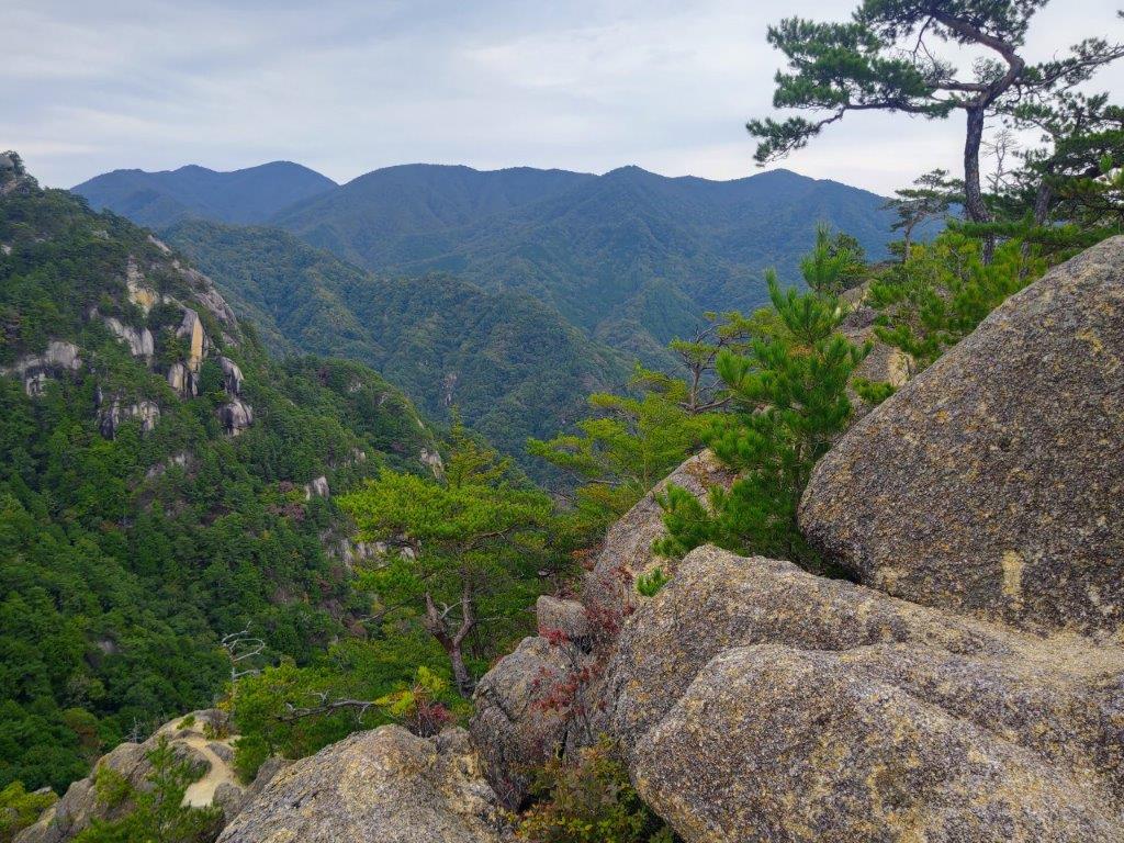
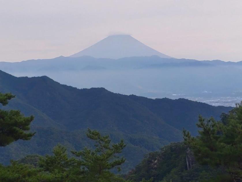
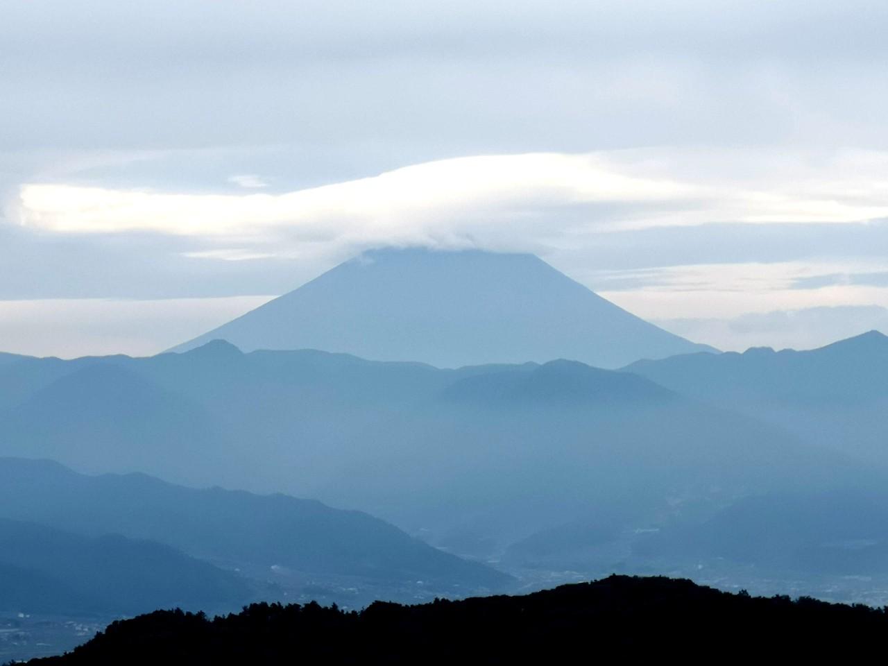
I sped through the sightseeing spots around the ropeway and up the trail for today’s first peak, taking care in the rocky sections and making good use of the safety chains; luckily, the thin pre-autumn leaves crowds meant I could make good time, and at 2h30, I reached the summit of Mt Rakanji (羅漢寺山 らかんじやま rakanjiyama) also known as Mt Yasaburo (弥三郎岳 やさぶろうだけ yasaburoyama), a famous 100 mountain of Yamanashi. I took a moment to enjoy the alpine-like scenery of white smooth rocks and pine trees, as well as the 360° view from the top; Mt Fuji now had a cloud perched on its summit crater in lieu of snow. I then retraced my steps back to the ropeway area and headed down a half-hidden path on the south side.

South View from the Top of Mt Rakanji

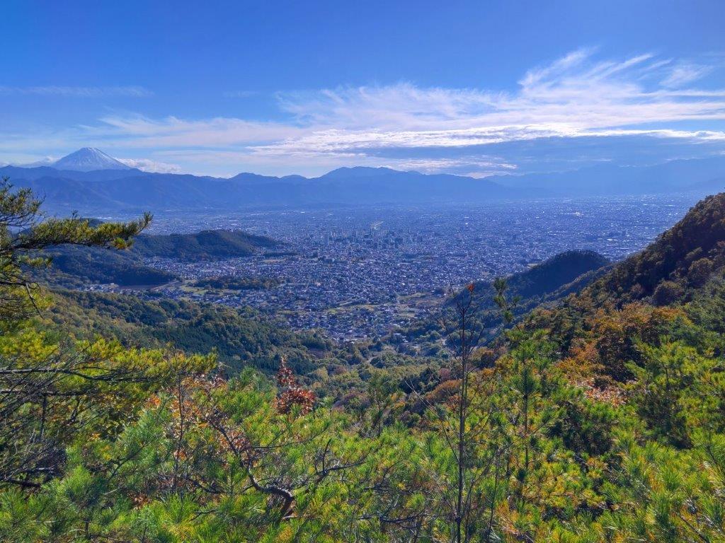
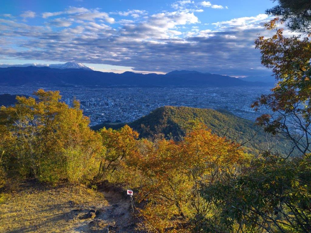
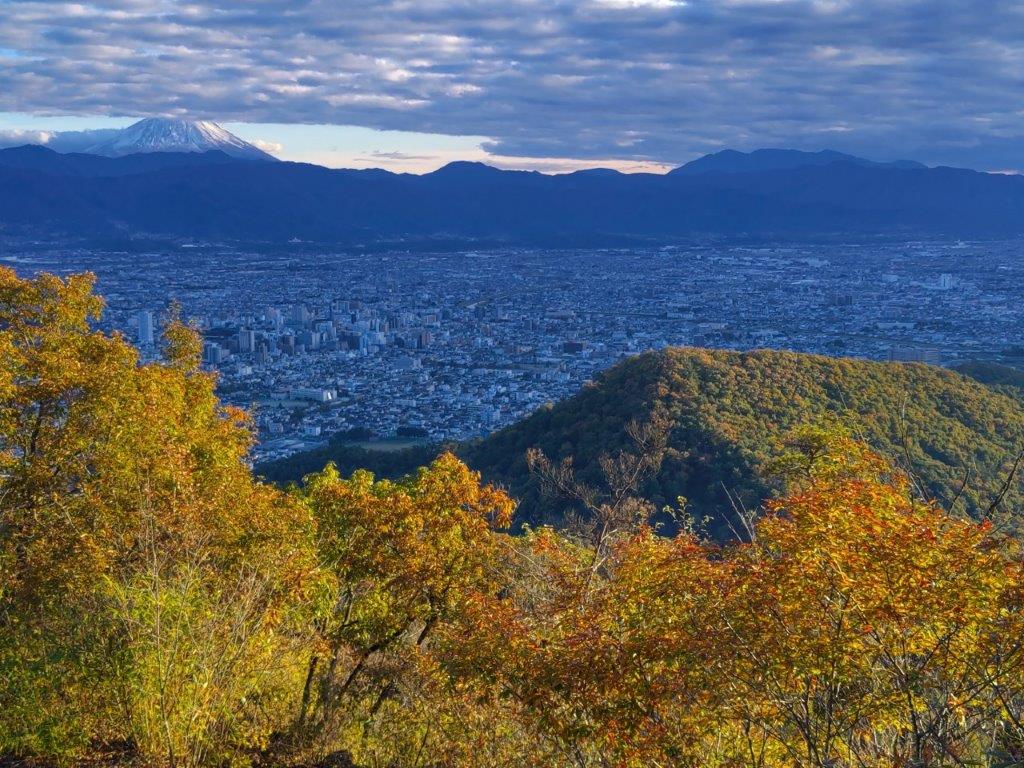
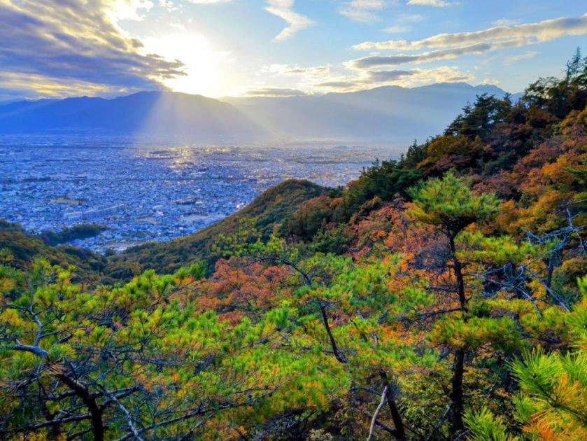
Between Mt Fuji and Mt Kenashi lies Kofu City

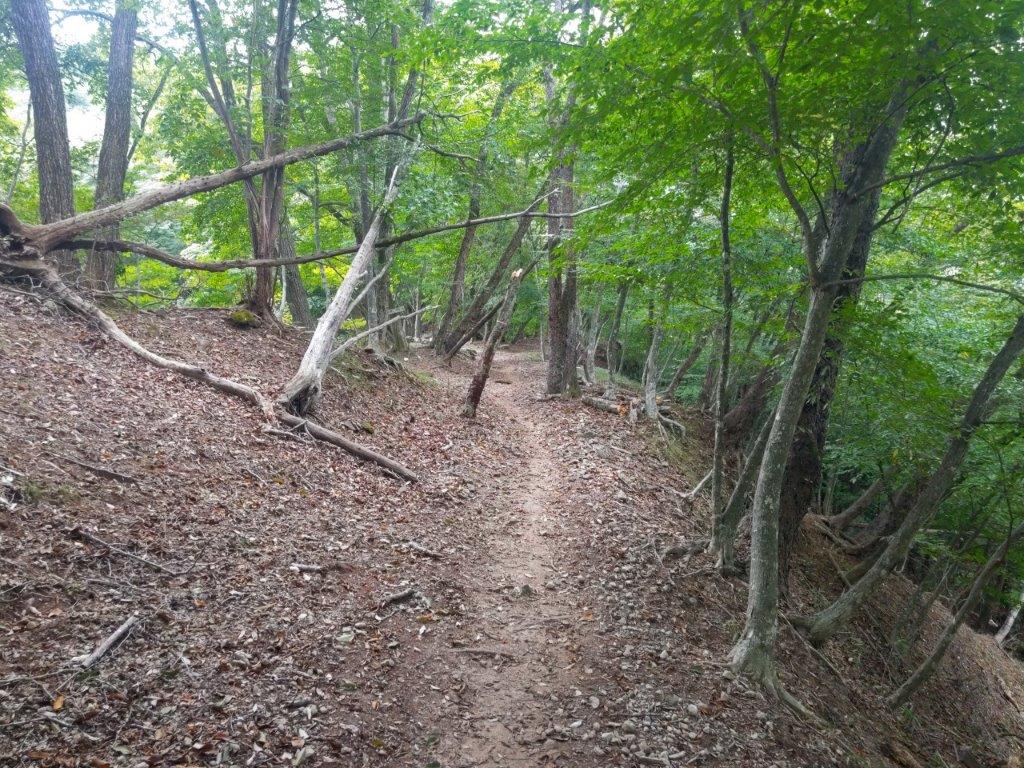
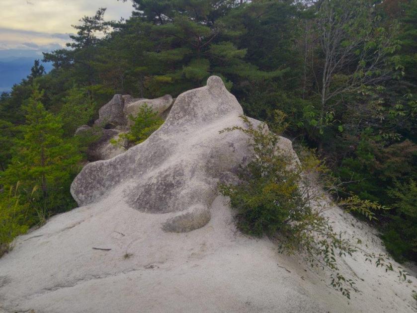
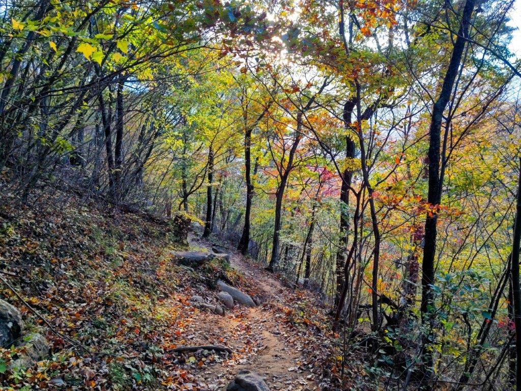
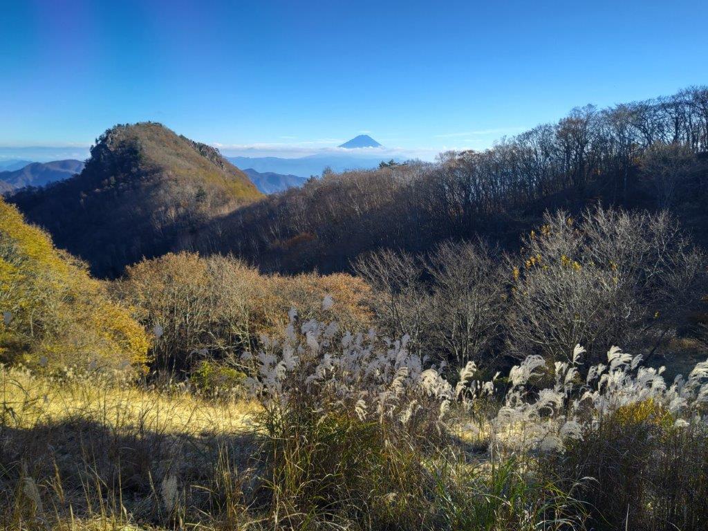
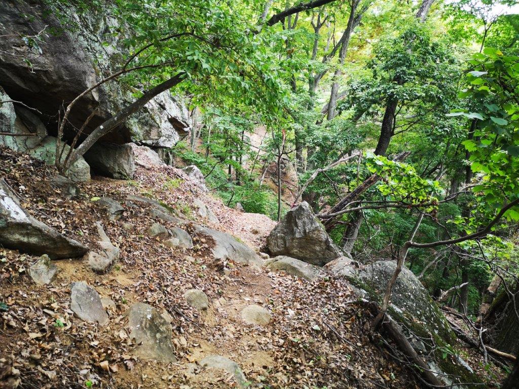
I was happy to leave the crowds behind although I now found myself walking all alone through forest in the middle of the afternoon. Fortunately the path was easy to follow, and at 3pm, I arrived at the turn-off on the left side for today’s next peak. It took me about ten minutes of climbing to reach an exposed rocky area with a view of the ridge leading to Mt Rakanji. A few more minutes brought me to another such place but with a view southwards of Mt Fuji and the Kofu basin. Finally, after a couple more minutes of walking through the smooth white boulders and gnarly pines, I arrived at the top of Mt Shirosuna (白砂山 しろすなやま shirosunayama), aptly translated as white sand mountain.

Trail below the Shosenkyo Panorama-dai Station

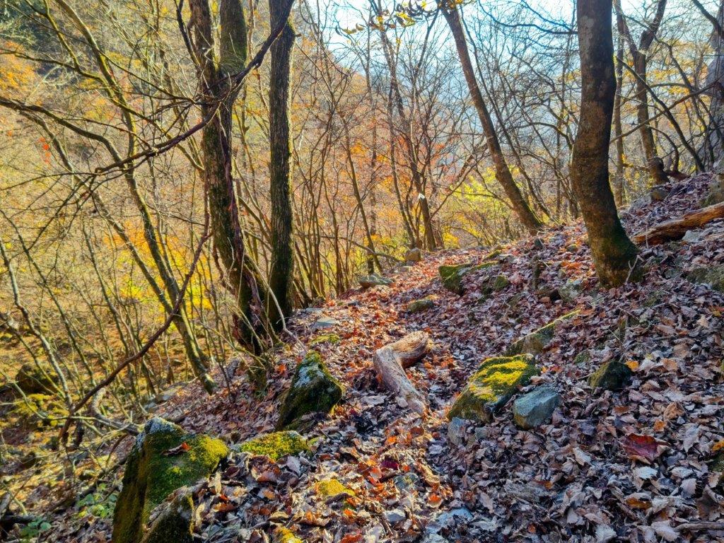
Trail for Mt Shirosuna

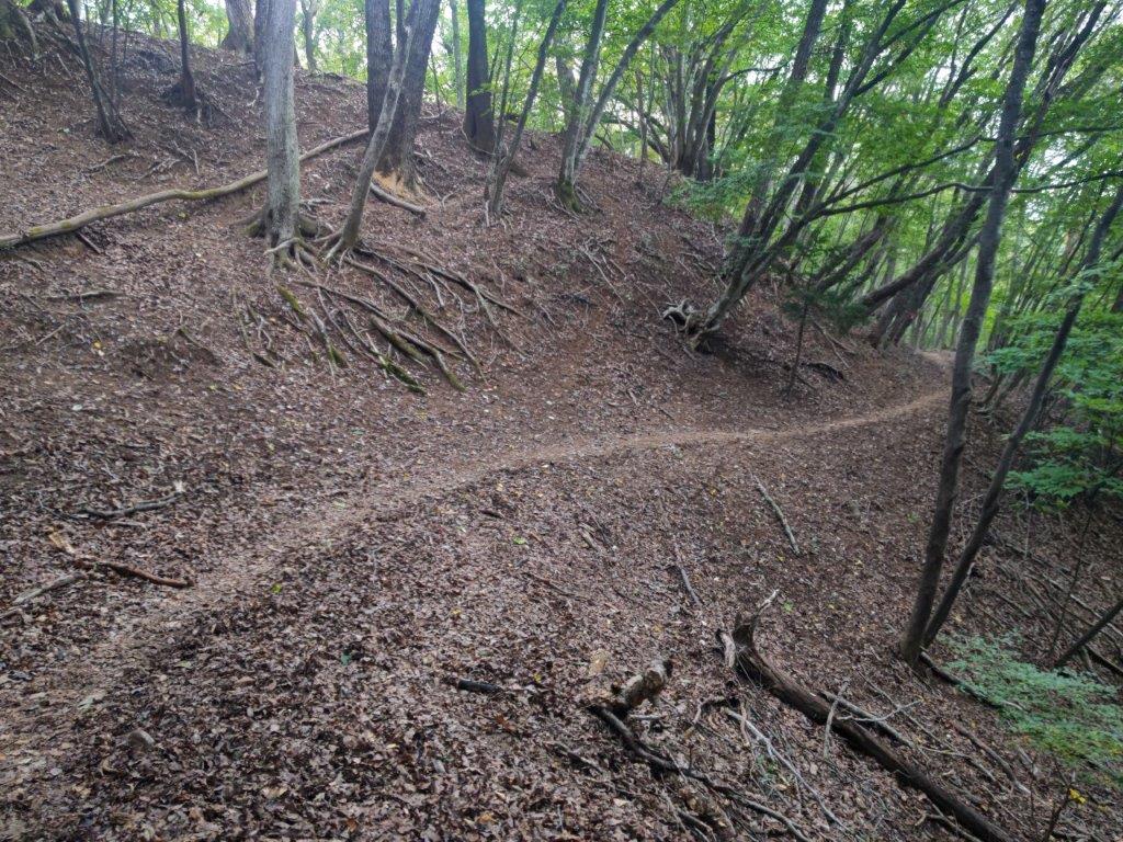
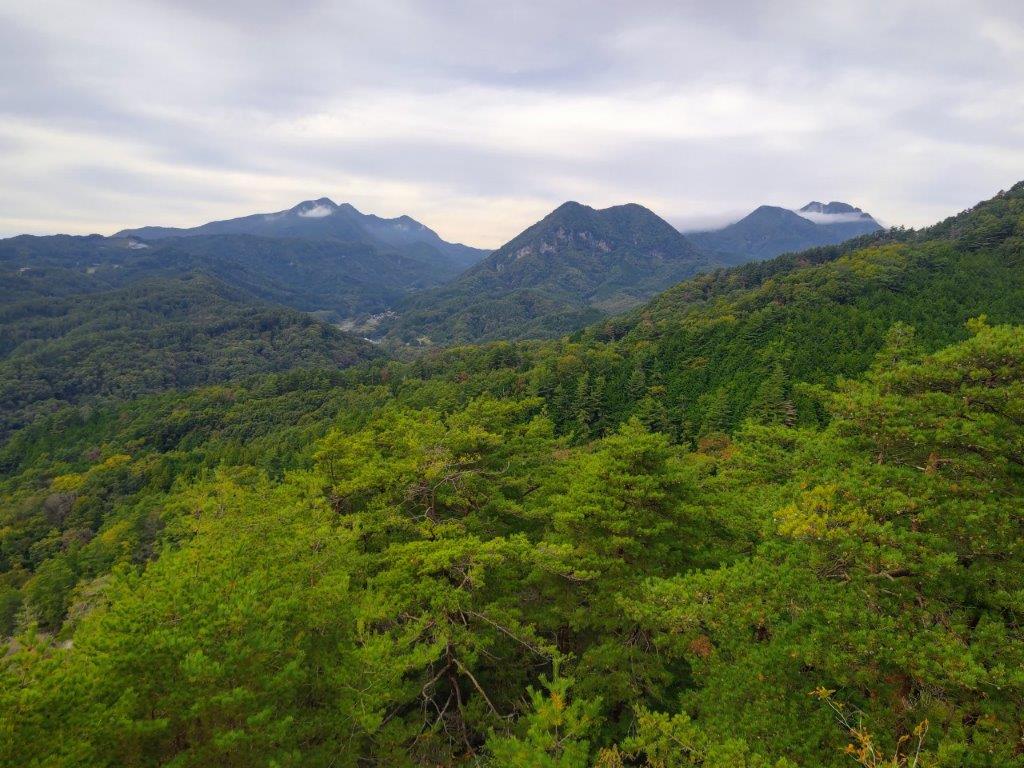
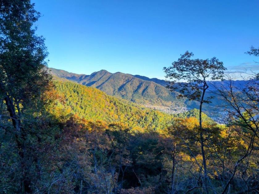
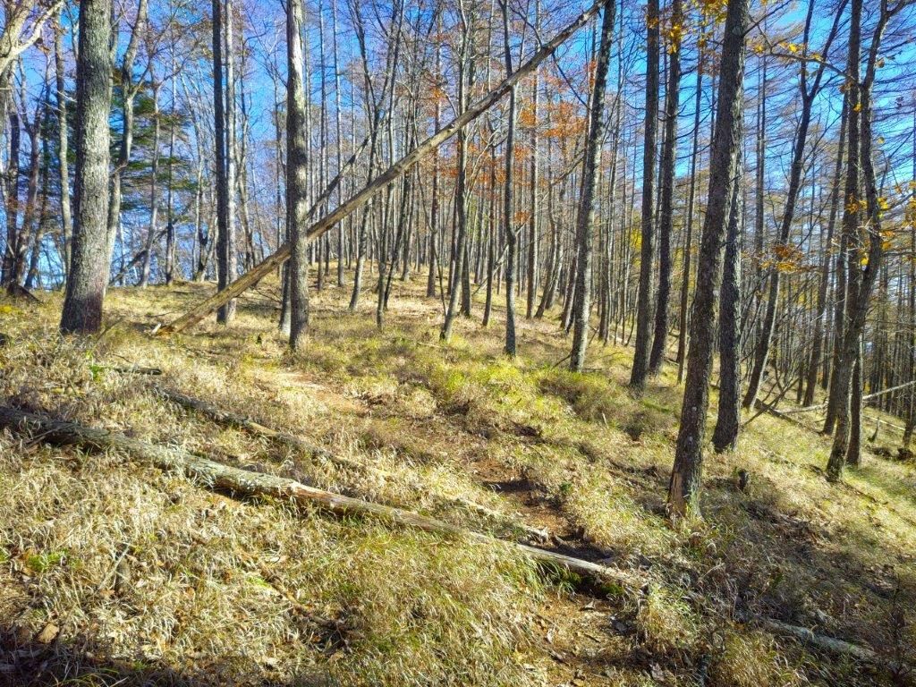
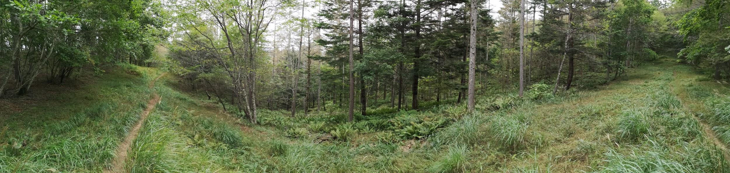
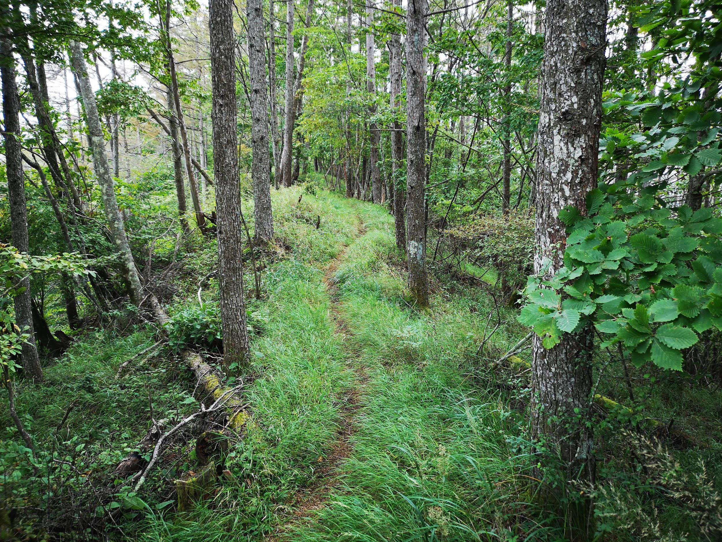
I was delighted to get a view of the peak I had been standing on a short while ago, allowing me to appreciate its steep and rugged shape. I had now fallen behind schedule so I retraced my steps to the main trail without a break. It took me just 15 minutes to reach another turn-off, this time to the right. A few seconds later, I reached the Mt Shiro (白山 900m) viewpoint, a minor peak with a view of the South Alps, now partially hidden by clouds, as well as the Kurofuji Volcanic group, its highest peaks wrapped in mist. I continued on my way, following the level path through mixed forest as it hugged the mountain side, the late afternoon gloom gradually increasing.

View of the Kofu Basin on the way to Mt Shirosuna

Alpine” Scenery near the Top of Mt Shirasuna

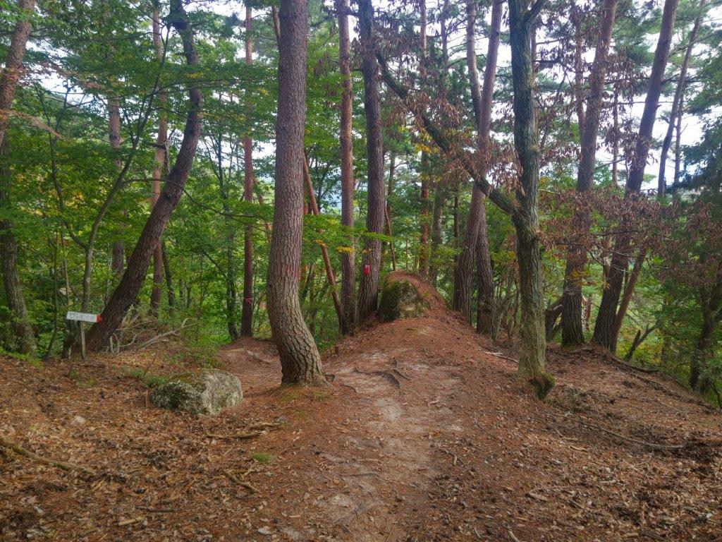
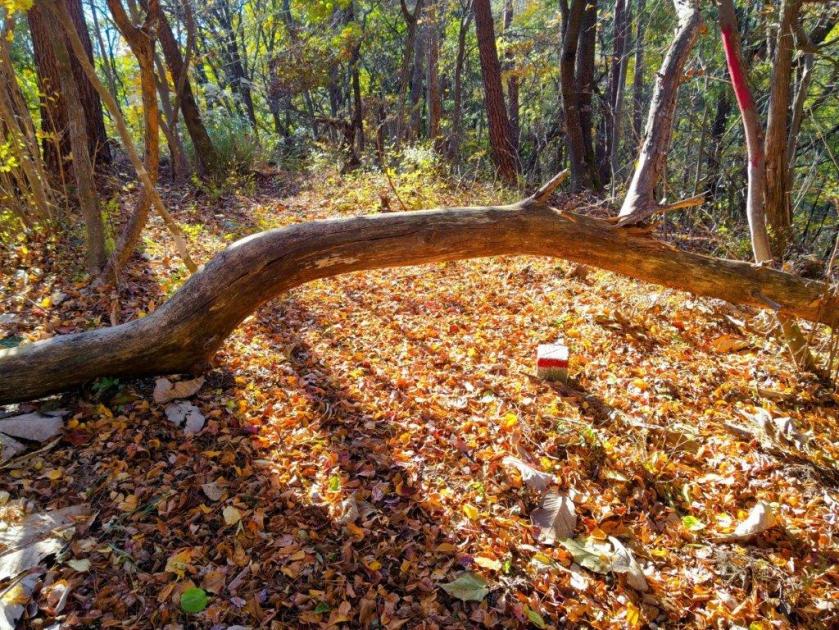
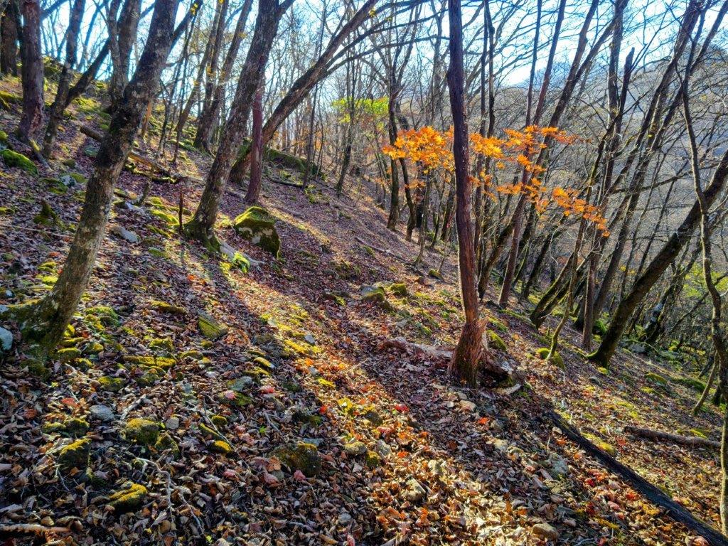
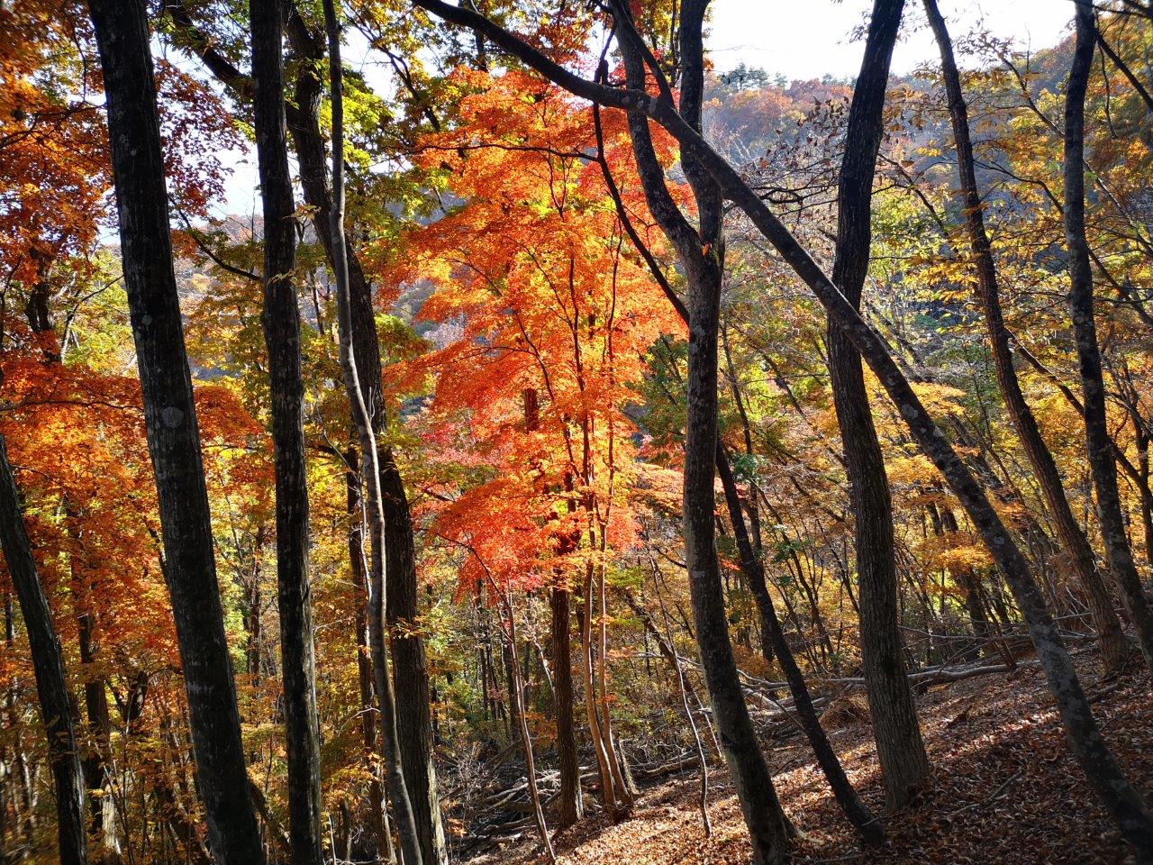
I wondered if I’d reach the base before sunset, quite early at this time of the year. I picked up the pace and around 4pm I reached a junction: the Furusato Nature Observation Trail (ふるさと自然観察路) which I had been following since the ropeway went right; however, I went down the left trail, leaving the ridgeline. Interestingly the signage around this point was a lot more polished than before even though I was far from any sightseeing spots. I also saw no other hikers during this section, possibly because most people planned to visit next month when the Autumn colours would be at their peak.

White Sand Rock near the Top of Mt Shirasuna

Mt Rakanji from the Top of Mt Shirosuna

I felt relief when I popped out of the dark forest onto a paved road. About a hundred meters further the trail dived back into the forest, but I could now hear the sound of a busy road in the valley below. At 4h30, I passed through a wildlife gate next to a spooky abandoned building, and arrived back on the Shosenkyo Line Road and Nagatoro Bridge (長潭橋), beyond which was the Shosenkyo Entrance bus stop. Including the one-hour Shrine visit the entire hike had taken 5 hours, and could have been extended with a walk up the gorge at the start.

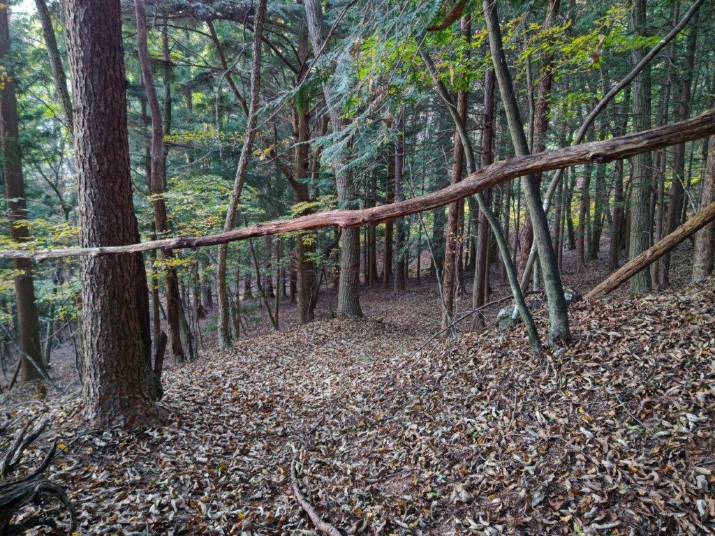
A Level Trail Hugging the Mountain Side

The Kurofuji Volcanic Group from Mt Shiro

Sunset was still half an hour away but the sun had already vanished behind the mountain ridges casting the valley bottoms into premature darkness. It took just twenty-minutes on a mostly empty bus to reach Yumura Onsen; after a refreshing hot bath, I caught a city bus for the ten-minute ride to Kofu station, from where it was a 90-minute comfortable ride on the limited express train back to Tokyo.

Watch a Video of the Hike

See More Pictures of the Hike

Mt Komatsu (514m), Mt Shiro (640m) & Mt Yumura (446m), Kofu City, Yamanashi Prefecture, Saturday, November 23, 2024

I was looking for another hike in Yamanashi before the arrival of the snow. I also wanted to stay relatively low since the temperatures had plummeted since the previous week. Looking at my map, I spotted a group of suitable mountains just north of Kofu. I had already done a great hike on the northeast side so I was keen to explore the area more. I saw that I could make an open loop passing by several viewpoints, including an interesting rock formation and a lake, within a reasonable amount of time.

Hiking in the Chichibu-Tama-Kai National Park

秩父多摩甲斐国立公園

To get to the start of the hike near Suwa Shrine, I’d ride the Chuo limited express to Kofu station, and from there, ride a bus to a stop within walking distance of the shrine. I’d finish the hike at Yumura Onsen in northwest Kofu, and after a hot spring bath, ride a bus back to the station. The weather was supposed to be clear but cold. I hoped I could get some good views of the surrounding mountains, including Mt Fuji, and still catch the Autumn leaves at their best.

For subscribers, read this Blog Post on Hiking Around Tokyo for a better viewing experience and the latest updates

Find Japan Hiking Maps on Japanwilds

Start of the Hike near Suwa Shrine (left) Tall Pines on Mt Komatsu (right)

Exposed Rocks above Kinsu-toge (left) Autumn Colours near Chiyoda Lake (right)

It was a cloudless, blue-sky day as I stepped off the limited express in Kofu station at 10am. I boarded a local bus, the driver even kindly confirmed my destination, and after a short ride, I got off at a stop still within the confines of the city. A few minutes of walking brought me to the foot of the mountains, and after a short climb, I arrived at Hizakutsu-suwa Shrine (膝屈諏訪神社). It was just after 11am as I passed under the stone shinto gate next to an impressive yellow gingko-tree.

Trail below Mt Shiro (left) Trail past Mt Hosenji (right)

Path for Mt Yumura (left) Flagstones for Yumura Castle Ruins (right)

Turning around, I was rewarded with a view of snow-capped Fuji. I made my way to the white shrine building surrounded by tall cedars, and after taking a few minutes to adjust my gear, set off along a level trail at the far end of the shrine grounds. I soon emerged from the trees onto a sports field, and after crossing a busy road, followed a residential street up the mountain side to a staircase below the trail entrance. This section has no signposts and I had to rely entirely on my phone GPS.

Log Steps Leading to the Top of Mt Komatsu

Walking the Takeda no Mori Promenade

I was surprised to see that the trail was partly overgrown, a sign that it was little used in this season; I was even more surprised to notice spiders again, a sign of their resilience to cold weather. Once the path started to climb, the trail became better defined; I saw the first signpost of the day upon reaching a wide path along the top ridge. I turned right, and after climbing a series of log steps, arrived at the top of Mt Komatsu (小松山 こまつやま komatsu-yama), the promised view mostly blocked by vegetation.

Heading up to Kinsu-toge

The exposed rocks of Mt Awayuki

I was tempted to take a break at one of the sunny summit picnic tables but since it was barely noon, I decided to press on. Even though the mountain name means “little pine”, it was home to some very tall red pines, one of the 100 famous forests of Yamanashi. I went back down the steps and followed the ridge northwards, soon merging with the Takeda Forest Promenade (武田の森遊歩道 takeda-no-mori-yuhodo named after Takeda Shingen, a famous feudal lord from the Sengoku era), an ancient road connecting Wada and Iwado passes; I had already walked the latter part on my Mt Yogai hike. I strolled along the wide, level path as it followed the mountain side eastwards through the forest.

First view of the day near Kinsu-toge

Mt Fuji, the Misaka Mountains and the Kofu Basin

From time to time, I waved a stick to clear the stubborn spider webs that were too low to duck under, their occupants groggily moving out of the way. Shortly before 1pm, I left the promenade and turned left onto a wide path leading up the mountain side, the webs now thankfully gone. I soon reached Kinsu Pass (679m 金子峠) where I had a view of Mt Fuji between a gap in the trees. I now rejoined a hiking trail, and continued eastwards, soon arriving at a group of white-coloured rocks, called “Exposed Rocks of Mt Awayuki” (702m 淡雪山の露岩 あわゆきやまのつゆいわ), similar to the scenery one can find at the nearby Shosenkyo. It was also the highest point of today’s hike.

Mt Kaikoma from the Exposed Rocks

Afternoon Light at Chiyoda Lake

I felt lucky to have such a spot all to myself. Above the pines on the south side, I had a fantastic view of Mt Fuji and the Kofu basin. To the west, I could see Mt Kaikoma, also known for its white rocks, and the long summit ridge of Mt Houou. After taking a few minutes to explore and take photos, I selected a suitable rock to sit on for a lunch break. A little after 2pm, I headed back to Kinsu Pass, and followed the ridge westwards. Here the trail became faint and I had to rely on my phone GPS and the occasional pink ribbon. After a short descent, I reached a proper trail which soon turned into a road through a residential area; at 3pm, I arrived at the edge of Chiyoda lake.

Autumn Colours on the way to the Mt Shiro Viewpoint

Chiyoda Lake from the Mt Shiro Viewpoint

I was dazzled by the reflection of sunlight on the blue water surface and green water plants. I headed up log steps surrounded by red and orange leaves, happy to be back on a hiking trail. After a short climb, I reached an open shelter at the Shiroyama Viewpoint (白山展望台). Directly below was Chiyoda lake; to the west, I could the see the outline of Mt Houu against the fast sinking sun; looking north, I spotted Mt Kaya and the Kurofuji volcanic group, with the white rocks of Shosenkyo in the foreground and the peaks of Yatsugatake in the background. I still had a little way to go to the next summit, so after a short break, I set off again. The up and down trail was easy to follow, and at 3h30, I reached the Hachioji shrine (八王子神社) at the top of Mt Shiroyama (白山 しろやま), meaning “white mountain”.

View of Kofu from the top of Mt Shiro

Dark Clouds and Yellow Leaves from Mt Shiro

I was stunned by the view of fleecy clouds spreading from the snowy slopes of Mt Fuji, casting shade over Kofu city’s urban sprawl; luckily, the light still reached the surrounding slopes, lighting them up in gold. I quickly admired the view of the South Alps on the other side of the shrine, before moving on, picking up the pace as I wanted to get down before dark. I descended a steep, sandy trail, the rocky outcroppings and gnarly pines along the way feeling quite typical of the Chichibu-Tama-Kai national park. I was delayed by two more superb viewpoints, the setting sun creating a striking contrast of light and shade, before reaching a level trail, now in the shade. At 4pm, I passed the minor summit of Mt Hosenji (539m 法泉寺山 ほうせんじやま), completely within the trees.

The Tip of Mt Fuji hidden by the Clouds

The South Alps from the Top of Mt Shiro

I was suddenly walking on flagstones (“ishidatami), a reminder that today’s last summit was also the location of Yumura castle (湯村城), although only some stone foundations remain today; I had to be careful not to miss my step, especially since the visibility was starting to fade. After a short descent, I reached a fire beacon (“noroshi“), a recent reconstruction of one of the many that used to exist during the Edo period, creating an ancient communication system. One final effort brought me to the open shelter at the top of Mt Yumura (湯村山 ゆむらやま yumura-yama), meaning “hot spring village”.

Sun Setting behind Mt Houou

Trail between Mt Shiro and Mt Yumura

I had one last view of Mt Fuji, its top half truncated by a layer of grey clouds. It was 4h30, so I sped back to the fire beacon and headed down a switchback trail on the west side, occasionally taking the well-worn short cuts between the bends. I was relieved to reach Yumura Onsen (湯村温泉) before it was completely dark, arriving at Yumura Hotel just before 5pm. After a refreshing hot spring bath, I caught a bus for Kofu station, where I boarded the limited express for the 90-minute ride back to Shinjuku.

Easy to Follow Trail below Mt Shiro

Last View of the day from Mt Yumura

This hike ended up taking 6 hours, a bit longer than planned, mainly because of the superb views along the way. The section around Mt Shiro was especially stunning, and I’d like a chance to redo in lighter conditions. It deserves to be better known, and it’s a mystery why I saw no other hikers the whole day. In the future, I’d also like to climb Mt Kata (片山) on the other side of Chiyoda lake and also explore more of the Takeda Forest Promenade towards Yogai Onsen. Before that, I definitely want to revisit the white rocks of nearby Shosenkyo.

Watch a Video of the Mt Shiro Hike

Watch the Video of the Hike on YouTube

See a Slideshow of more Pictures of the Hike

Kurofuji (1633m) & Mt Masugata (1650m), Kai & Kofu Cities, Yamanashi Prefecture, Saturday, November 9, 2024

I wanted to do another hike in the mountains of Yamanashi, as well as get some more views of Mt Fuji; I also wanted to go driving one last time before the mountains roads closed for winter. I decided to head to the southwestern Oku-Chichibu mountains, last visited in 2017 when I climbed Mt Kaya. Last year, I had planned, but not done, a hike in that area, a roundtrip to two neighbouring peaks of the Kurofuji volcanic group. They were featured in my guidebook but with a different route up the northeast side that was no longer used; for my hike, I’d go up and down the same route via Hatcho Pass on the southwest side.

For subscribers, read this Blog Post on Hiking Around Tokyo for a better viewing experience and the latest updates

To get to the trail entrance, I’d take the Chuo line limited express to Kofu, and then, since Kai city buses only run to the area on weekdays, drive a share car to a parking spot near Kurofuji Farm. The weather was supposed to be sunny with mild temperatures, usual for this time of the year. As to the mountain name Kurofuji (“black Fuji”), apparently when seen from its neighbour peak on the north side, it looks like a dark version of Mt Fuji (also visible in the background). I was looking forward to seeing this effect with my own eyes, as well as enjoying the autumn colours, which I hoped would now be at their best.

Hiking in the Chichibu-Tama-Kai National Park

秩父多摩甲斐国立公園

Autumn Colours and Blue Sky just below Hacho-toge

Larches and Grass on the way to Kurofuji

It was a perfect autumn day as I arrived in Kofu around 10am. After locating my share car, it took about an hour to drive to the small parking area near the start of the hike. After getting ready, I finally set off just as the noon chime was ringing. After walking past Kurofuji Farm, I left the paved road for a signposted trail on the right. I soon found myself walking up a narrow valley along a mountain stream, the rushing sound of water soothing the mind. At one point, I saw a white deer skull on the ground. After crossing the stream on a flimsy log bridge, I passed a couple of hikers heading down, the only other people I saw on today’s hike.

View of Mt Fuji from the South Side of Kurofuji

Southwest Oku-Chichibu with Mt Obina (center)

I was surprised by how quickly the trail became hard to follow; even with my phone GPS, I found myself off the path a couple of times. Fortunately, since it simply followed the valley all the way to the top of this ancient crater, I was soon back on track. About an hour after setting off, I reached a steeper, rockier area, a sure sign that was nearing the rim. The beautiful scenery of yellow leaves with a blue sky background slowed me down a bit, but at 1h30, I reached Hacho-toge (八丁峠) where I turned right along a well-trodden and gently rising trail, mixed forest giving way to tall larches.

Mt Magari (left), Yatsugatake (back) & Mt Masugata (right) from Kurofuji

Mt Mizugaki (left), Mt Kinpu (center) & Mt Kokushi (right) from Kurofuji

This was perhaps the nicest part of the hike, the evenly spaced larches and grassy terrain giving an impression of wide open space, even though the trees had already lost most of their needles. I was reminded that I was now inside the western edge of the Chichibu-Tama-Kai National Park. After a short while, I was again climbing through bare trees and over rocky terrain, and at 2pm, reached the summit of Kurofuji (黒富士 くろふじ), a hundred famous mountain of Yamanashi. I could see the South Alps and Mt Kaya to the southwest, but the other directions were blocked by trees. My guidebook mentioned that a better view could be had just below the highest point so I headed down a path on the south side leading to a superb viewpoint at the top of a cliff.

Kurofuji (left) and Mt Fuji (right) from the trail for Mt Masugata

Yatsugatake (left) and Mt Meshimori (right) from Mt Masugata

I carefully sat on a rocky ledge with a small, gnarly pine at my back, keeping a safe distance from the edge. From my perch, I could see Mt Fuji directly ahead; against the sun, it appeared as a black triangle, and I couldn’t tell whether the first snow of the season had fallen. To its right, were the Central Alps, and to its left were the Oku-Chichibu mountains, Mt Obina being the sole recognisable peak. After a short lunch break, I retraced my steps, and followed the summit ridge to another breathtaking viewpoint on the north side, on top of some large rocks protruding from the mountain side.

Mt Kinpu from Mt Masugata

The Oku-Chichibu Mountains from the top of Mt Masugata

Standing on top of one of these rocks, I was astounded by the golden colours covering the mountains sides directly below, patches of grey indicating that the leaves were already past their peak at this elevation. I could see Mt Magari and Mt Marugata, and between them, Yastugatake in the far distance. Turning to the north side, I could see some of the highest summits of the Oku-Chichibu mountains: Mt Mizugaki, Mt Kinpu and Mt Kokushi. Amazingly, the area in-between has almost no hiking trails and few access roads, one of the few wild places in the Tokyo area. I was starting to fall behind schedule so I pulled myself away from the view and headed back the same way; I soon arrived at the intersection for today’s next peak, where I turned right. As I walked up the grassy path, Kurofuji suddenly came into view on the right side.

“Black Fuji” view from the Summit of Mt Masugata

Kurofuji with Mt Fuji in the background

I was excited to already have a view of “black fuji” even before reaching the second summit; viewed from the north side, the conical shape of Kurofuji was nearly entirely in the shade. To its right, I could see the top of Mt Fuji popping up through the clouds; in foreground, golden “susuki” swayed in the light breeze. I continued at a fast pace up the switchback trail, and at 3pm, reached the base of a huge rock. A quick scramble up some natural steps brought me to the narrow, flat top of Mt Masugata (升形山 ますがたやま masugata-yama), the name meaning shaped like a “masu” (a square wooden box used for drinking sake), an apt description for this summit.

Late Afternoon Light just before Hatcho Pass

Late Atfernoon Light just after Hatcho Pass

I was glad to have the summit to myself, as there wasn’t much space on top of the “masu“; I could also enjoy the breathtaking 360° view in perfect silence. To the west was Mt Yatsugatake; on the north side, I could see Mt Kinpu; and finally, turning southwards, was the view of Kurofuji with Mt Fuji in the background. It was only partially dark; perhaps a different time or season is needed for a full blackout. It was now 3h30, so I carefully got off the “masu” and quickly made my way back to Hacho Pass and then down the steep valley. The Autumn colours were even more beautiful in the late afternoon light and the trail was easier to follow on the return even after the sun had dipped below the ridgeline. Shortly before recrossing the stream, I spotted a white antler on the ground, to complement the skull I saw on the way up. At 4h30 I was back at my car, and by 5pm, I was on my way back to Kofu city just as it was getting dark.

Watch a video of the Kurofuji Hike

Watch the Video of the Hike on YouTube

See a Slideshow of More Pictures of the Hike

Mt Tana (1171m), Yamanashi City, Yamanashi Prefecture, Saturday, 6 November, 2021

I wanted to do one last hiking trip in the low mountainous area between Yamanashi and Kofu cities before the end of the year. Looking through my guidebook, I found a suitable loop hike with Mt Fuji views. I could reach the start of the trail by taxi from Yamanashi station and then walk back at the end. I was worried about getting a seat on the train so I decided to reserve it beforehand online. The clear sunny weather was supposed to continue for a few more days and the autumn colours would still be at their peak. I was looking forward to a pleasant hike above the Kofu valley.

Get a Map of the Mt Tana Hike

This map was developed for Japanwilds with the Hokkaido Cartographer

Find Japan Hiking Maps on Japanwilds

View from the summit of Mt Tana

Late afternoon above the Kofu valley

After an uneventful ride on the Chuo limited express under sunny blue skies, I caught a taxi outside Yamanashi-shi station at 10am. Fifteen minutes later, I was standing outside Hottarakashi onsen, a hot spring featured in the manga Yuru Camp. Since today’s hike was on the short side, I took a few minutes to check it out. I discovered that there were two outdoor baths, each with its own entrance: a small one facing Mt Fuji and a large one facing the Kofu valley. From a viewing area next to the bath entrance, I got a glimpse of Japan’s most famous mountain in its brand new winter coat.

View from Hottarakashi hot spring

Mt Fuji in its winter coat

At 10h30, I finally set off along a level forest road passing above the Hottarakashi Camping Ground. The surrounding forest had been cut down so I had some good views south of the Misaka mountains surrounding Mt Fuji, now in the clouds. Half an hour later, I reached the official entrance of the trail through bright yellow “suzuki” grass dancing in the wind. A few minutes later I was walking up the mountain side through dark forest and soon reached a fork: left was the “kasane-ishi” trail (重ね石コース meaning rock pile trail) and right was the “yama-no-kami” trail (山の神コース meaning mountain god trail), both leading to the summit.

The Mikasa mountains

Entrance to the trail through Japanese pampas grass

I took the left branch and made my way up a steep slope, assisted by ropes tied between the trees. At times the path disappeared under a carpet of leaves, so I was glad for the ropes showing the way even, though I didn’t always need to use them. It was the tail end of the autumn leaves season and from time to time the wind blew through the trees, causing dead leaves to tumble gently to the ground. I eventually arrived at “kasane-ishi” marked by a large boulder. From there, the path became less steep and followed a ridge sprinkled with rocks of various sizes. This rocky section was easier to navigate than the one on nearby Mt Kabuto and the ropes clearly showed the way.

Despite the rocks, the path was easy to follow

It was the perfect time for autumn leaves

After another steep section, I reached the nearly flat summit ridge and at 12h15 I was standing on the highest point of Mt Tana (棚山 たなやま tana-yama), meaning shelf mountain, probably referring to its elongated, horizontal summit. Looking west, I could see the South Alps already covered in snow: looking east, I had a view of the massive bulk of Daibosatsurei and the ridgeline stretching south; the other directions were blocked by trees. I was the only person there and, in-between gusts of wind, it was very peaceful. After a leisurely one-hour lunch in the sun, I walked back a few meters to the junction with the mountain god trail.

Walking the summit ridge

The long ridge stretching south from Daibosatsurei

The path leading down was even steeper than the one up and I was glad that I had followed the guidebook’s recommendation to go up the other half. Fortunately, I could count on the ropes to steady myself. Half an hour later, I reached the bottom of a gloomy valley and soon after I was back at the trail junction from where I would follow the same route back. At 2pm, I was back under the sun walking along the forest road, the views in the afternoon sun somewhat different from the morning, although Mt Fuji was still nowhere to be seen.

Looking north towards the Chichibu-Tama-Kai national park

Dusk on Mt Tana (right)

I was surprised to see no other hikers on the mountain since it was an easy hike near a popular camping site. At 2h30, I was back at the Hottakarashi hot spring. It seemed crowded so I continued down the road to the less busy Puku Puku Onsen. Although I couldn’t see Mt Fuji, I had a great view of the mountains lining the eastern half of the Kofu valley from the outdoor bath. At 4pm, I walked down through Fuefukigawa Fruit Farm and arrived at Yamanashi-shi station just before 5pm. Since I had bought my ticket online after my hot spring bath, I just had to board the next limited express for the ninety minute ride back to Tokyo.

See the falling leaves on Mt Tana

Mt Kabuto (913m), Fuefuki City, Yamanashi Prefecture, October 10, 2021

I had done many hikes in Yamanashi, but I had never been to the hills between Yamanashi and Kofu cities. My hiking guide had two suggestions for that area, but, after studying my map, I ended up choosing another mountain in-between, because it was shorter and easier to access. I would take a taxi from Yamanashi-shi station to the start of the trail, and after a loop hike, return on foot via a road to a hot spring, and Kasugaicho station on the local Chuo line. Although the trail went through a rocky area, it didn’t seem to present any major difficulties. I was more concerned about spiders and their webs blocking the way, a recurring headache when hiking under 1000 meters in September and October. The weather was supposed to be cloudy at first with sun in the afternoon, and since there was a viewpoint near the top, I hoped I could get to see the mountains of Yamanashi as well as Mt Fuji.

View south from the rocky area

The weather was gloomy and cloudy as I rode the limited express out of Shinjuku. It didn’t seem like I would get any views today, as white mist spilled out of the valleys on both sides of the Chuo line. I asked the taxi driver to drop me off at “Nageshi Somen“, close to the start of the trail, and less than ten minutes away. As I got ready for the hike, I felt that despite the overcast weather, I was lucky that the temperature felt just right for hiking.

Statue near my taxi drop-off point

An easy to walk path at the start of the hike

After walking along a dirt road for twenty minutes, I arrived at a fireworks store and the start of the hiking trail. I was soon walking on a flat wide path through pleasant forest next to a small river. It took another 20 minutes to reach the start of the “rocky area” trail (岩場コース iwaba-kosu). After a short climb up the side of the mountain, I reached the the rocks and cliffs on the east side of the mountain. I took a break to observe some people practice their rock climbing skills on a huge boulder (see video).

Cairn along the first part of the “rocky area” trail

Walking between the rocks on the east side of the mountain

I reached the first viewpoint of the day as the noon chime echoed through the wide valley below. Directly below, I could see the Kasugai golf course and, on the other side of the valley, the foothills of the Misaka mountains, their peaks lost in the low clouds. I was now halfway up the “rocky area” trail and I had fun scrambling between and over rocks of various sizes, using fixed chains to pull myself up when necessary. I could also relax since there were no webs spun across this section of the trail.

Kasugai golf course and the Misaka mountains

My lunch view – somewhere to the right is Mt Fuji

I soon reached a gently sloping ridgeline, and by 12h30 I was standing on top of Mt Kabuto (兜山 kabuto-yama), meaning helmet mountain because of its rounded shape. The summit, a hundred famous mountain of Yamanashi, was completely in the trees, but after walking south along a short path, I arrived at a bench with a view through a break in the trees, a good place for lunch. The weather hadn’t really improved, and although I was supposed to be able to see Mt Fuji, just 30 kilometers away behind Mt Oni and Mt Settou, all I could make out was a white wall. After lunch, I made my way back to the summit and followed the trail west through the forest.

A rocky narrow ridge near the highest point of the hike

View on the way down at the edge of a deforested area

I walked along a rock strewn ridge, slowly rising to an altitude above 1000 meters, the back of the helmet perhaps; for the first time this season, the air felt chilly. The path then suddenly dropped down the back of the “helmet”, and as the temperature went back to comfortable, I had to start dodging spiderwebs again. Luckily for me, each time I stepped into one, its maker was on the higher half, just above the top of my cap. I turned left into a valley and was now walking through the beautiful “Kabuto-yama no Mori” (the Mt Kabuto forest). I was the only hiker around and I was constantly spooked by falling acorns. At 2pm, I reached a forest road between a deforested area and Umezawa river, the same one I had followed earlier in the day.

Looking back at Mt Kabuto

View from the road between the golf course and the vineyards

I walked at a leisurely pace to the parking lot near the start of the “rocky area” trail, completing the loop. I then continued on a paved road, with the river below on the left and a golf course on my right. Looking back, I could see the helmet-shaped summit of Mt Kabuto. Ahead, I had a bird’s eye view of Kofu valley. The weather was finally improving and patches of blue sky were visible above. After a steep descent through some vineyards, I arrived at the Iwashita hot spring inside a building dating from 1888. It was just past 3pm, so I had time for a quick dip, before walking to the nearby train station. I rode one stop and switched to the limited express for the eighty minute ride back to Shinjuku.

Hiking over “Helmet mountain”

Tokuwa River Valley, Yamanashi City, Yamanashi Prefecture, October 2020

I was looking for a good river walk and apparently the nearby Yamanashi prefecture had many of those. I had to give up my first two choices because the river trails were damaged during the massive typhoons of 2019. Fortunately, my third option, near the entrance to the trail for Mt Kentoku, seemed promising. It was a short hike, and although it was possible to go by bus, I chose to hire a car instead. That way, I could have lunch at a soba restaurant on the way there, and drop by a hot spring facility on the way back. The weather forecast was perfect: sunny and warm for this time of the year. However, I had to be careful not to start hiking too late, since the sun sets early at the end of October, and even earlier in the mountain valleys. I wanted to see the sunshine reflected on the water and the autumn leaves, at least for part of the hike. The only thing that made me uneasy was the possibility of crowds along the trail – how well known was this river valley among the hiking community?

Hiking in the Chichibu-Tama-Kai National Park

秩父多摩甲斐国立公園

One of the river’s many level stretches

…and some of the sudden drops!

I arrived in Kofu after a comfortable train ride on the Chuo line limited express, and used a rental car to drive 45 minutes to the parking lot near the entrance of the trail up Mt Kentoku (乾徳山). On the way, I dropped by Soba Maru (そば丸) for an early soba lunch. From the parking, it was a thirty minute-walk, first on a paved road, and then on a forest road, to Muso waterfall (夢窓の滝 meaning dream window waterfall), and the start of the hiking trail. I was immediately struck by the beauty of the river, one of the best I’ve ever hiked. First, there was no concrete road running next to it (something frequent here). Next, it seemed relatively unscathed by the 2019 typhoons. Finally, there were many excellent views as the river alternated between long flat stretches and sudden drops.

Sunlight reflected on the water surface

…and on the autumn leaves

I decided to have a closer look at the impressive Muso waterfall by walking down a short metal staircase leading to the river side. I had to be extra careful not to slip on the rocks – I didn’t want to get too close! After walking back up, I entered the Tokuwa River valley hiking trail (徳和渓谷コース tokuwa-keikoku kosu). For the first twenty minutes, the trail stayed close to the forest path, occasionally merging with it. Then it suddenly dipped, crossed the river over a wooden bridge, and went up the opposite side. I was pleasantly surprised by how well maintained the trail was and by the near total absence of other hikers. By now, it was nearly 2pm, so it was likely that most people had already come and gone (I had passed a few on the way). Luckily the river valley was still bathed in the autumn sunshine, and the interplay of golden leaves and sparkling water was dazzling.

The start of the hike had many viewpoints next to the river

One of the many small waterfalls dotting the valley

The river views kept on getting more and more spectacular. I was now hiking alongside the western branch of the upper Tokuwa river. I passed four small waterfalls, as the path climbed the rocky right bank via a series of wooden steps. According to my map, I was just inside the southern part of the Chichibu-Tama-Kai National Park. Around 2h20, I reached the highest point of the hike, around 1200m, near Yanagi waterfall (柳滝 meaning willow waterfall). The Tokuwa river continued further but here the path made a U-turn and headed back. I was walking on a level path following the mountain side; below on the right was the river, a white line snaking through the trees. After a few minutes, the trail descended sharply along a ridge, the river disappearing from sight but still heard. I soon arrived back at the wooden bridge, just after a double waterfall, and before the merging of the east and west branches of the river.

The rockier sections were equipped with wooden steps

Many close-up views thanks to the wooden walkways

It was almost 3pm and I was nearing the end of my short hike. I quickly walked back along the forest road, now in the shade, and arrived at my car at 3h30. By now, the entire valley was in the shadow; it was getting cold and nearly everyone had already left. I drove 15 minutes to Hayabusa onsen for a quick hot bath, and then back to Kofu station. As I settled down into my reserved seat for the train ride back to Tokyo, I felt satisfied that I had caught the sunshine and the autumn leaves, and that I hadn’t been caught up in any crowds while hiking this secret river valley.

Travel up and down the Tokuwa river valley

Mt Konara (1712m), Yamanashi City, Yamanashi Prefecture, Saturday, September 28, 2019

There are so many mountains in Yamanashi prefecture that I sometimes feel I won’t be able to climb them all. Today’s hike, mostly level and downhill, was perfect for my ankle that was still a bit painful. On top of that, the weather forecast called for high-altitude clouds – I needed something that would be well below that. Otome highland 乙女高原 at around 1500m and situated below Mt Kinpu seemed liked the perfect place, and I was lucky to get a seat the day before on the reservation-only bus for Odarumi pass.

Mt Fuji with a rocker’s hairstyle

A surprising thing happened on the way to the start of the trail. The bus, operated by Eiwa Kotsu, failed to show up at Enzan station. Despite the gloomy forecast, it was a beautiful sunny morning, and around 30 people were in line. Eventually, a replacement bus arrived 40 minutes late – I never found out what happened.

View from the top of Mt Konara (Mt Fuji on the right)

Luckily I wasn’t on a tight schedule, unlike those who were doing the roundtrip to Mt Kinpu. I was the only person who remained on the bus for the final segment along Otome lake to Yakeyama Pass 焼山峠 – everybody else had transferred to minibuses for Odarumi pass. I was finally ready to start at 10h45, a full hour behind schedule. In the meanwhile, the high-altitude clouds had rolled in.

The start of the trail felt a bit spooky

Shortly after starting out, I was feeling spiderwebs all over my arms and legs. However, I couldn’t see the offending web or find any trace of it on myself. Also, the path was several meters wide – a bit unsuitable for spinning a web. The feeling persisted, and I was starting to think that I was imagining it. Eventually I was able to spot some ultra-thin filaments attached to some leaves – can’t imagine what kind of insects the spider was hoping to catch. The feeling of walking through spider webs continued for the first hour of the hike.

Thin spider webs crossing the path

Cobwebs aside, this part was also some of the best hiking I had done recently. Even though Otome highland is just outside the Chichibu-Tama-Kai National Park, I thought that the trail and the surrounding forest were especially beautiful. I saw just one person on the way to the summit, one hour away. The trail was easy to walk: wide, grassy and gently undulating. The total height gain was less than 200 meters, which is why I had chosen this hike, since steep inclines were bad for my ankle.

At one point the path split into a new and an old path. The new one went up a steep slope, whereas the old one continued level through the forest. I choose the latter one, since according to the map, they joined up again, and they did indeed after a few minutes, with almost no elevation gain – go figure.

New path but worn-out sign?

With very little effort, I reached the top of Mt Konara 小楢山, a mountain few people have heard of, and was greeted with some sunshine, a wide panorama, and a group of hikers having lunch. Luckily the top was quite spacious, and I found a quiet spot for my own lunch. I could see Mt Fuji, although the top was in the clouds and Kofu city. I could also make out Mt Kenashi, Mt Kuro, Mitsutoge and Daibosatsu Rei.

The top of Mt Konara, a good place for lunch

During lunch, I studied the rest of the trail in my guidebook. I realised that the rest of the trail was tougher than I had imagined – a succession of ups and downs with several rocky sections. Normally I would have thought “Perfect!” However, with my weak ankle, I wanted to avoid anything too adventurous. So I decided to take a different route down. Shortly past the summit, instead of continuing southwards, there are a couple of trails heading West. Their names translate roughly as “Missed Mother” and “Missed Father”. I took the latter since it allowed for a slightly longer hike.

After the summit the path gets narrower

Unfortunately, it turned out to be a difficult trail as well. In addition to being hard to see, making it necessary to search for the pink ribbons attached to the trees, it was steep, going directly down the side of the mountain. Luckily it wasn’t too long (about an hour), and I soon emerged onto a forest trail, not without a certain amount of relief. From there it was thirty minutes to the road, and another hour to the bus stop through Yamanashi Prefecture’s famous vineyards. It was the middle of the harvest season, and I was surrounded by beautiful ripe grapes on all sides – I was very tempted to pick some!

The sun tried valiantly to break through the cloud cover

Bus drive to the start of the trail

NEXT UP: Mt Shirasuna in Gunma Prefecture

Mt Kenashi (1964m), Mt Ama (1771m), Fujinomiya City, Shizuoka Prefecture

Mt Kenashi is a famous mountain but not part of the original one hundred. It is part of the famous two hundred mountains, which isn’t too shabby considering that there are thousands of mountains in Japan. It sits opposite Mt Fuji and thus has some excellent viewpoints of Japan’s most famous volcano. Consequently, there are quite a few people climbing this mountain.

Hiking in the Fuji-Hakone-Izu National Park

富士箱根伊豆国立公園

HOW TO GET THERE: The biggest drawback is that this mountain is tough to get to from Tokyo. You will need to shell out 5000 yen to take the Shinkansen from Tokyo station to Shinfuji station in Shizuoka (about an hour), and then put down another 1300 yen for the bus to the Asagiri Green Park entrance (also about an hour). To take your mind of all this spent money, there are great views of Mt Fuji along the way.

Fortunately the way back is slightly cheaper. At the end of the hike you can catch the same bus taken in the morning and get off in Kawaguchiko. From there, you have a choice between a local train or the limited express back to Shinjuku. The latter is more expensive and only runs a few times a day. Alternatively, you can take a bus to Shinjuku station for less than 2000 yen. However if you are going back on a weekend, beware of traffic jams. You could also take this way to go there but you would end up at the start of the hike half an hour later, and to trains heading out to the Mt Fuji can be packed (less so so on the way back).

Get a Map of the Mt Kenashi Hike

This map was developed for Japanwilds with the Hokkaido Cartographer

Find Japan Hiking Maps on Japanwilds

THE ROUTE: Once again I was the only person to get off the bus; it seems that most people come here by car. I had to walk along a flat road for about half an hour to reach the base of the mountain and the start of the hiking trail. The view of Mt Kenashi towering above me was impressive; I wondered if I really was going to be able to manage this long and steep 1000+ meter climb. On the way I passed a wide and grassy camp site on my right with some excellent views of Mt Fuji. I definitely want to camp here some time in the future.

At the end of the long asphalt road I turned left following the signs for Mt Kenashi. Eventually I entered the forest, passed numerous parked cars, and started climbing along a rock path. There were two main paths up Mt Kenashi. I chose the shorter one so that I would have enough time to take the long ridge route down. The path was divided into 10 stations each marked with a sign, similar to the Mt Fuji stations. I passed quite a few people going up and down the mountain. The weather was sunny and not too cold for a November day, although judging from the absence of leaves higher up, it seemed that autumn was already finished on this mountain.

Mt Kenashi with the camp site at its base

As expected the climb was seemingly endless. Similar to when I was climbing Mt Takanosuya in the mist, the top ridge always seemed to be out of reach, always just beyond my level of vision. Every time the path became level, and I thought I was finally there, it would surprise me by rising steeply again. I was slowly getting higher than the rest of the ridgeline, and it felt like I was ascending some kind of spire.

At last I reached a small rocky outcrop, marked as a viewpoint of Mt Fuji. I decided to have an early lunch there, not because I was especially hungry, but because the view was fabulous; there was a comfortable unoccupied sitting spot, and there was no guarantee of something similar at the summit. However I only got past my first sandwich when I was forced to flee because of a group of hikers that talked loudly behind me while taking photos of the view.

Pine tree forest at the base of Mt Kenashi

From this point I reached the top ridge quite quickly. I overtook a lady hiker for the second time, who couldn’t figure it out how that was possible (she hadn’t seen me taking my lunch break on the rocky outcrop earlier on). From there, on it was an easy stroll to the summit of Mt Kenashi (毛無山 kenashiyama – means hairless mountain). Interestingly, just by stepping onto the ridge, the temperature dropped to near freezing. At nearly 2000m, winter had arrived.

As expected, there were plenty of people at the summit. I still managed to find a decent spot to sit down and finish my lunch. Unfortunately, the view of Mt Fuji wasn’t as good from here. However, before I could tuck in, a friendly hiker told me (in good English) that if I continued ten more minutes along the ridge line, I would reach a much better spot for lunch with a 360 view, including Mt Fuji and the Southern Alps. That seemed like a very attractive proposition, so after having him take the obligatory photo of me and the summit marker, I set off for this perfect lunch spot.

The first view of Mt Fuji before the summit

Sadly, I never found it, and one hour later I reached the next summit, Mt Ama (雨ヶ岳 amagadake), the last viewpoint before going down the mountain, and last chance for a (late) lunch. I was lucky I had eaten something before reaching the top, since I wasn’t able to find any good sitting spots with a view along the ridge. Even when I had a 360 degree view, the bamboo grass on either side was just too high to sit down comfortably. I guess the other hiker had walked the ridge in other seasons when the grass hadn’t been so high. The ridge was a mix of cold and shady forested sections, and warm and sunny  grassy sections. The views of Mt Fuji were the best I had ever seen since the sun was behind me; I could make out all the details of the snowy rocky summit area. There were also far less people walking the ridge, since most people, having come by car, had  to go up and down Mt Kenashi the same way.

I found a rectangular block of stone perfect for sitting. moved it into the sun and sat down to enjoy the rest of my lunch while examining Mt Fuji. However, I couldn’t stay too long however since I had a bus to catch. Soon I could see lake Motosuko on my left but too many branches in the way meant that I couldn’t get a good picture.  Oddly enough I had the same kind of experience going down as when going up. Three times I thought I had reached the lowest point between 2 peaks only to discover that the path dipped further down.

Picture perfect view of Mt Fuji along the ridge

Finally I reached the flat part between two peaks and at another viewpoint of Mt Fuji, I saw the escape path for the bus stop leading down to the right. Here I met a male hiker on his way up. He told me that he was going to camp at the top of the mountain so that he could see the sun rising above the summit crater of Mt Fuji the next day, also called Diamond Fuji. It’s something I have never been able to see, but at the same time I don’t think I want to put in some much effort.

After a short while I reached a junction for the Tokai Nature trail. I had to jog along the last flat portion of the way, and I finally reached the bus stop with less than five minutes to spare. The bus back was empty at first but filled up quickly at the next stop. Despite that it was an enjoyable ride since you could see Mt Fuji from time to time.

CONCLUSION: A difficult but rewarding hike with fantastic views up a famous mountain that will see the crowds melt away during the second part.

Ask for a hiking map for Mt Kenashi

View to the South