Mt Settou (1736m), Mt Junigadake (1683m) Kawaguchiko Town, Yamanashi Prefecture

I had already hiked parts of the Misaka mountains – the mountainous area between Mt Fuji and the Oku-Chichibu mountains (for example Mt Ou to Mt Oni). However, I had never hiked the central part, between Kawaguchi and Saiko lakes. I decided to approach from Ashigawa valley on the North side, and finish at lake Saiko, on the South side. I took the Chuo line to Isawa Onsen station, and then the bus to the farmer’s market in Ashigawa 芦川. I had a very good impression of the place since they offered me free tea while I got ready for my hike!

The Fujikyu bus from Isawa Onsen to Ogossoya (the Ashigawa farmer’s market) was discontinued in 2024. Access is now via car, or by bus from Kawaguchiko Station. However, since 2024, a free shuttle bus runs on weekends between Ogossoya and Suzuran.

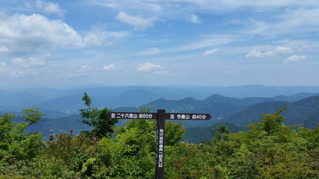
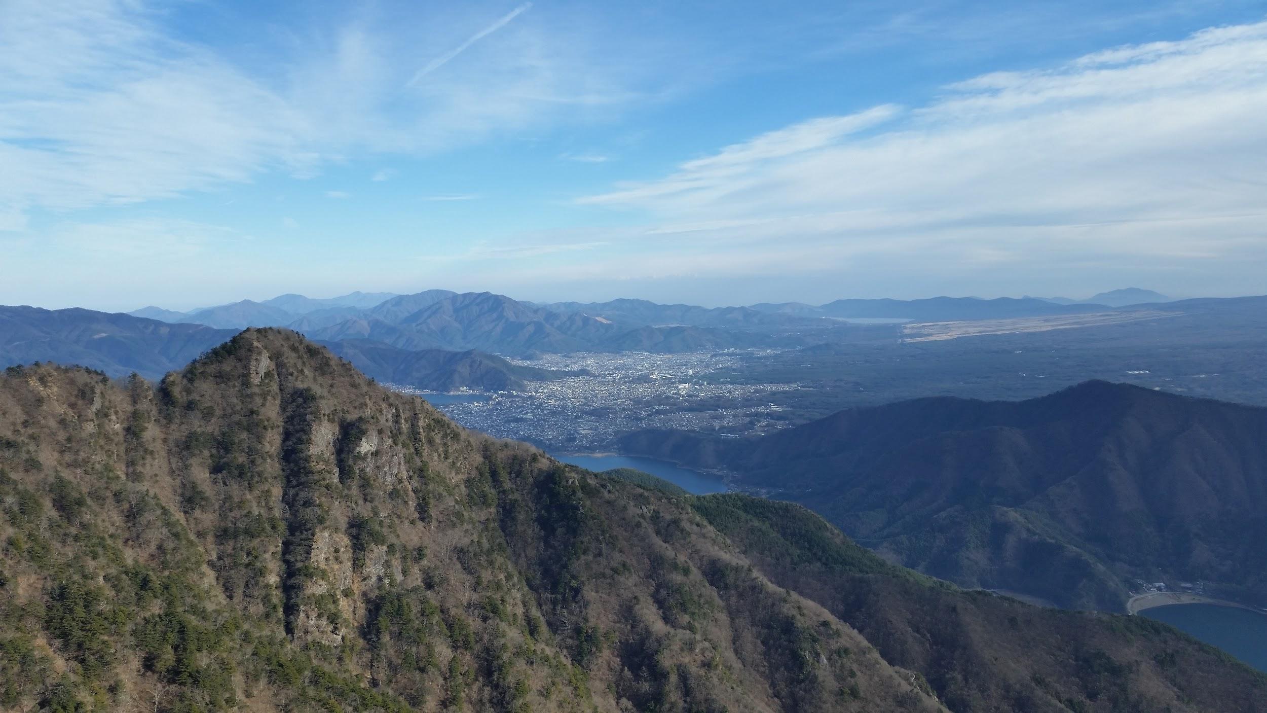
Kawaguchiko City surrounded by nature

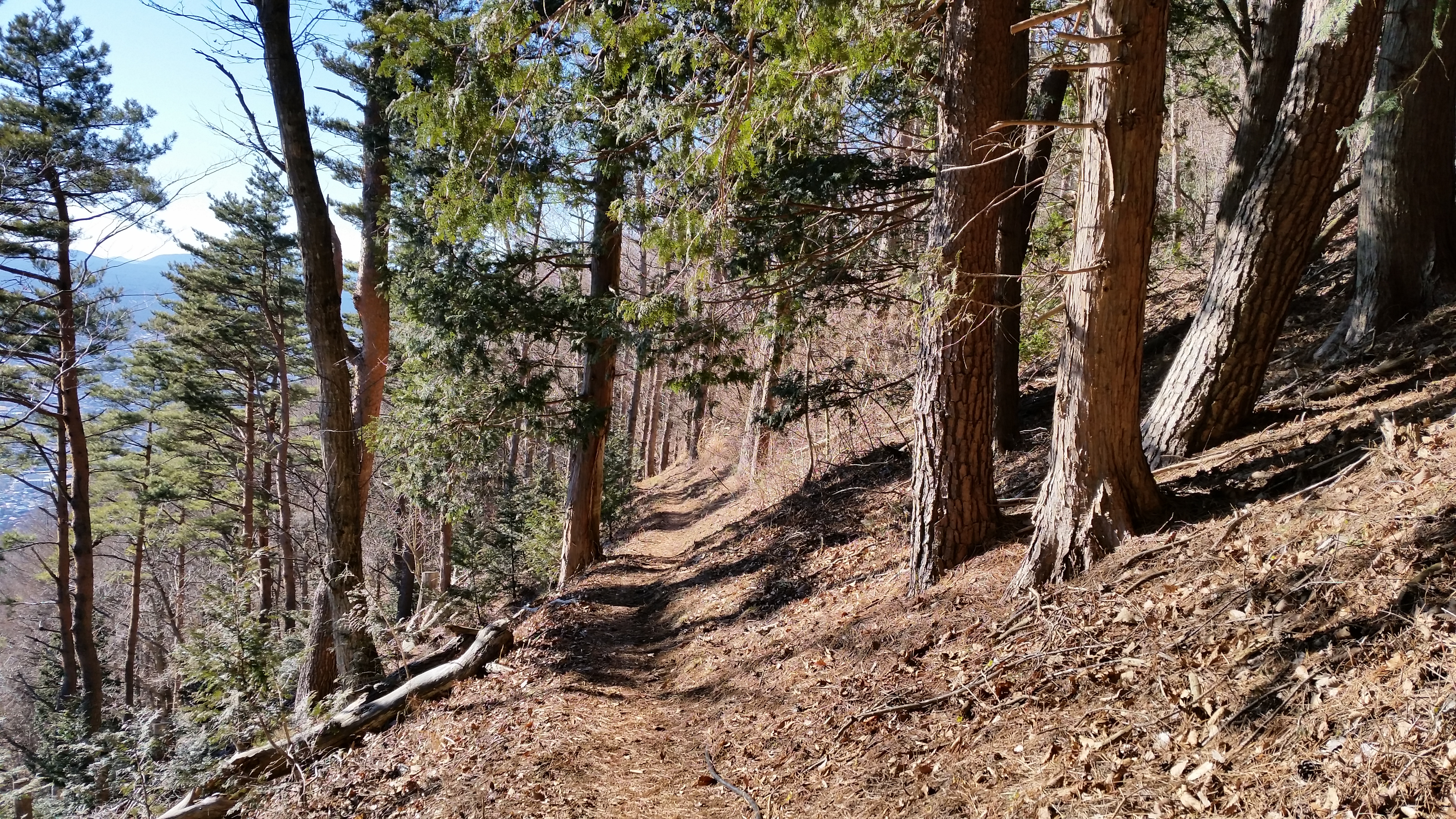
I started out after 10am, and walked along the road for about 20 minutes to the start of the trail, which then went straight up the side of the mountain, through trees completely bare of leaves. I reached Oishi pass (1515m) 大石峠 around noon. I had been there once before when hiking from Mt Kuro further to the East. This time I turned right and continued Westards along the ridge.

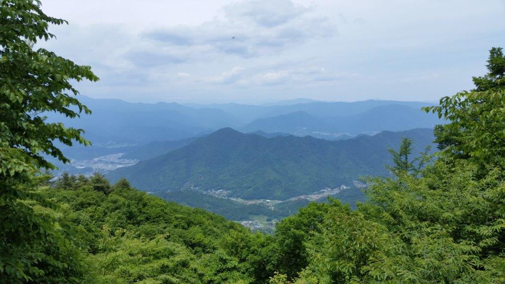
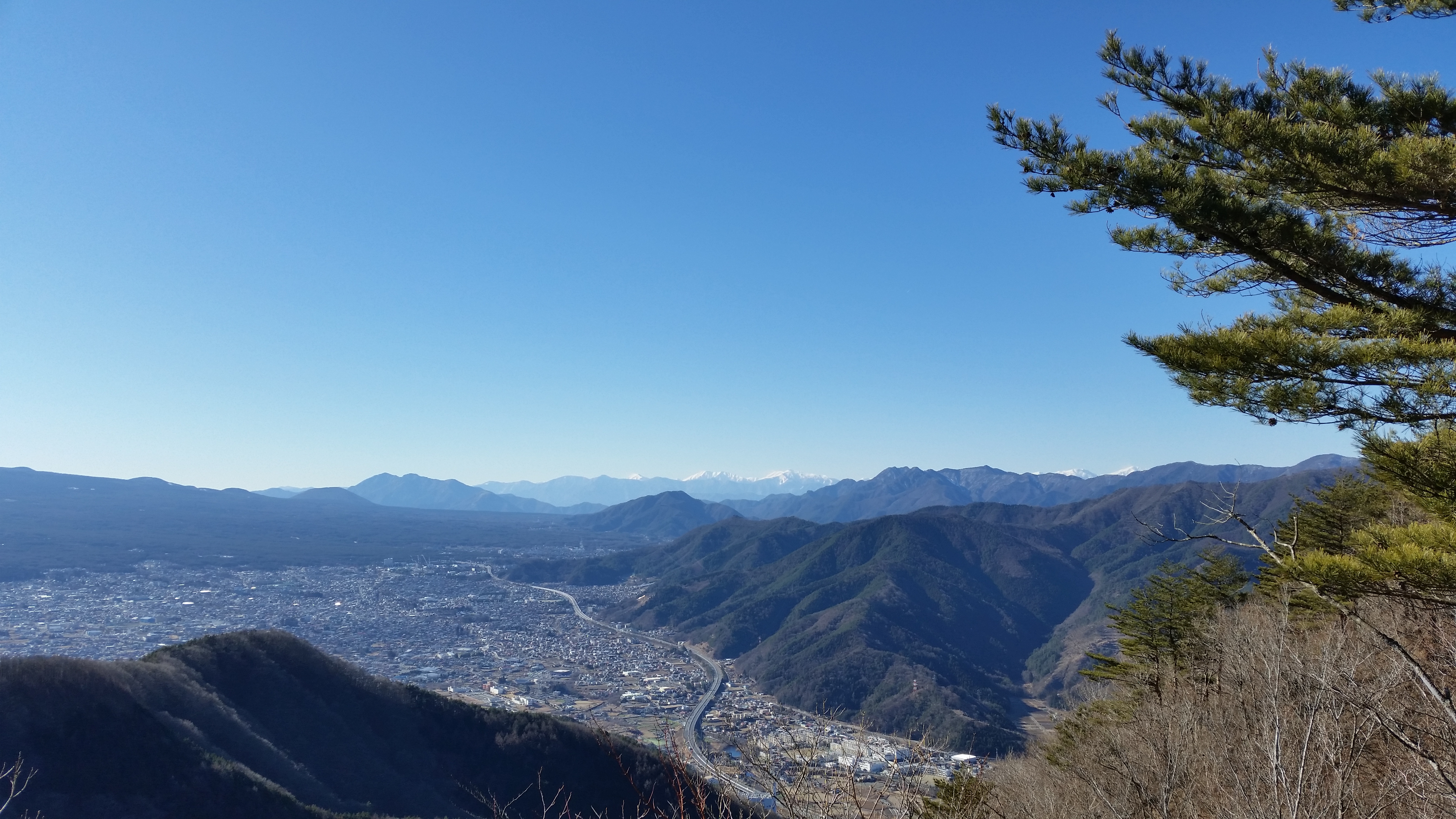
Kofu valley and beyond the Oku-chichibu mountains

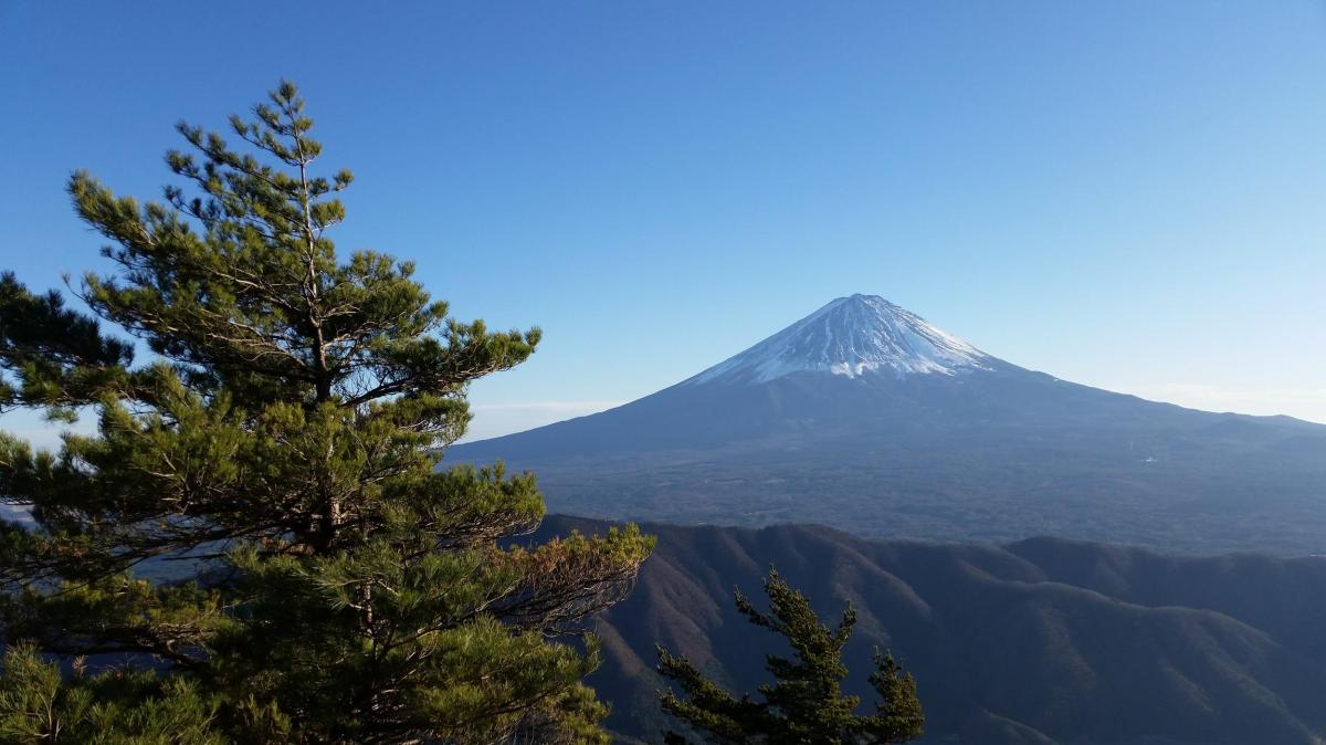
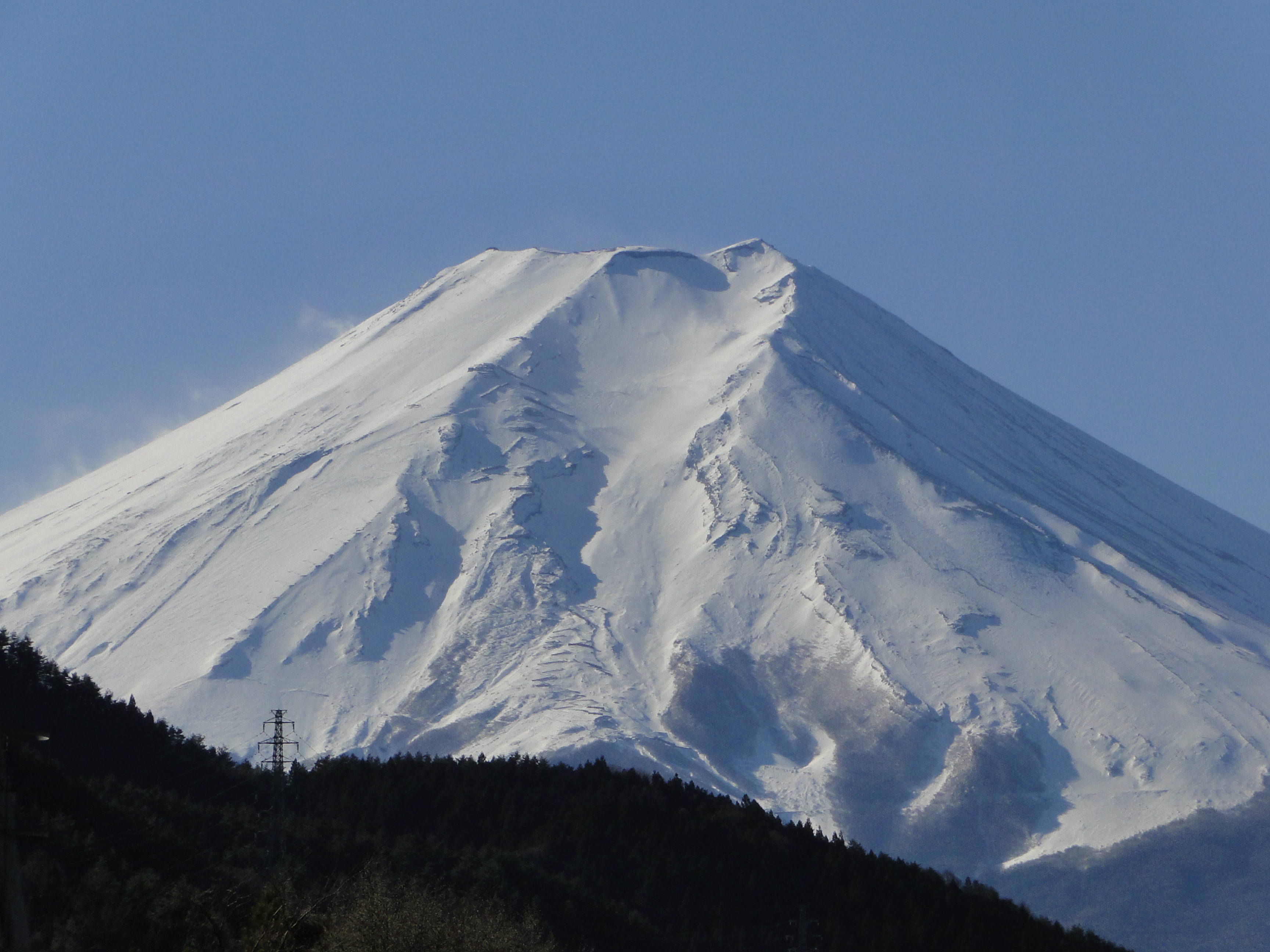
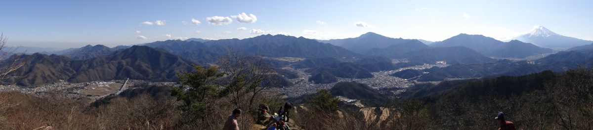
The hiking path went up and down a wide ridge through beautiful evergreen forest. I had occasional views of Mt Fuji to my left, lake Kawaguchi behind me, and the Ashigawa valley to my right. I soon reached the top of Mt Settou 節刀ヶ岳 the third highest mountain along the ridge, after Mt Mitsumine and Mt Oni. From there I could see all the way to the Southern Alps, and the Kofu valley.

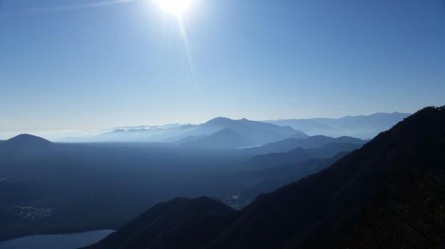
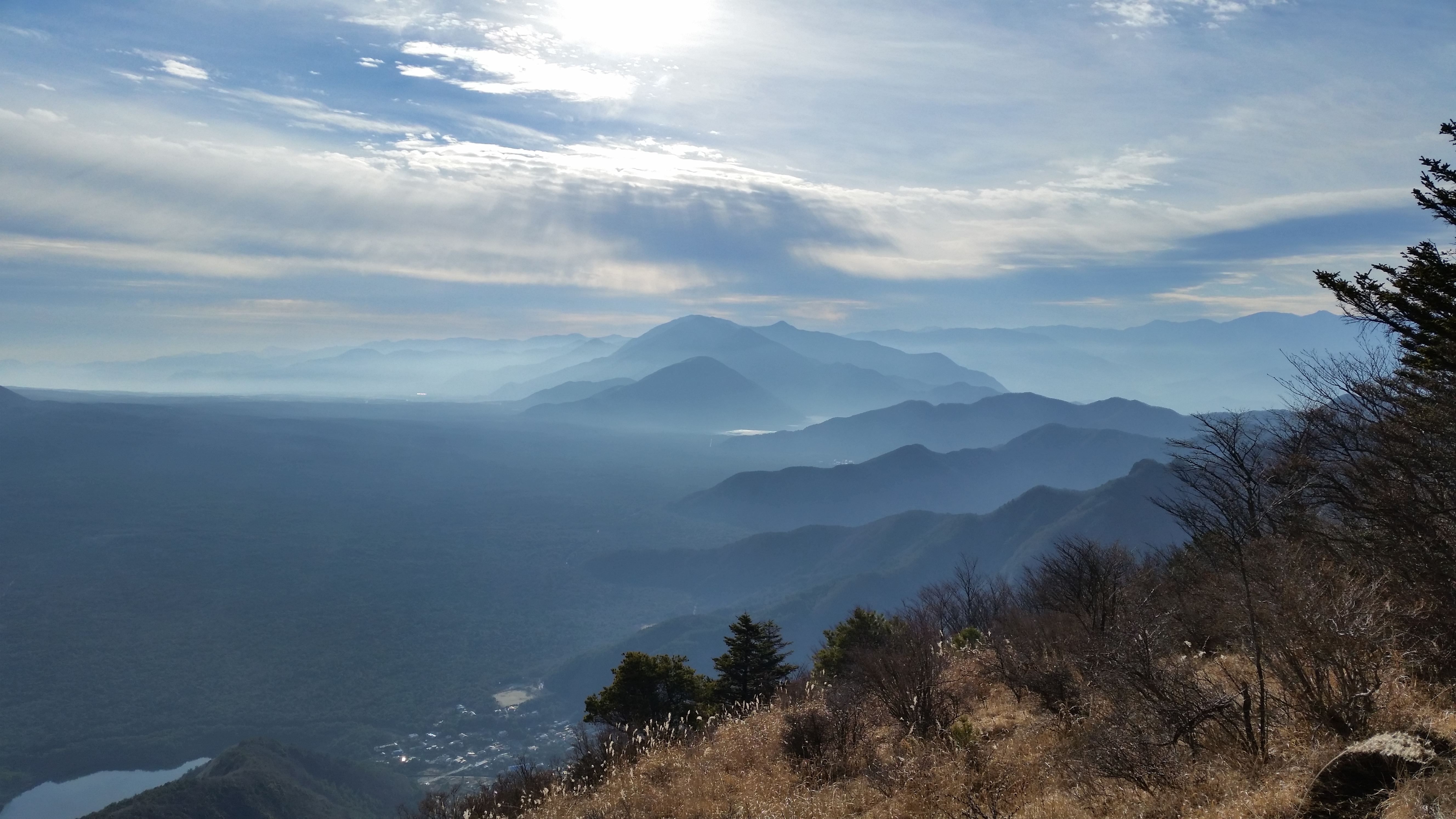
Against the sun, looking back towards Minobu

After admiring the view, I started to head down towards Saiko lake. Soon, I had to negotiate a slightly tricky bit involving some rocks and chains. After that, I arrived at the top of Mt Junigadake 十二ヶ岳 which translates simply as “Peak 12”, from where I had some more great views of Mt Fuji ahead of me. I now had two options. The path to the left was an exciting ridge including suspended bridges. Alternatively, I could head straight down to Izumi no Yu, a hot spring on the side of Saiko Lake. Since it was already 3pm, I decided to head down, and leave the exciting ridge for another hike.

Mt Imakura (1470m) & Mt Nijurokuya (1297m), Tsuru City, Yamanashi Prefecture, Saturday, June 11, 2016

Although the rainy season had already started, the weather stayed good all day. I took a bus from Tsurushi station on the Fujikyu line, all the way to the Michizaka Zuido Iriguchi bus stop. From there, it was a steep but short climb to the top of Mt Imakura (今倉山), completely surrounded by trees, although I had some glimpses of Mt Fuji on the way up. I then headed west along the ridgeline, descending steeply at first.

The hike ends in the Valley below

There were some great views of Mt Fuji and the surrounding mountains from Akaiwa (赤岩) and Mt Nijurokuya (二十六や山). After that last peak, the path curved to the north. I headed downhill first through forest, then through pleasant countryside, finally arriving at Tsuki-machi no Yu hot spring. After a refreshing soak in the outdoor bath, I made my way to the nearby basho-tsukimachinoyu bus stop for the short ride back to Tsurushi station.

A good hike for “fuji spotting” – Mt Shakushi is on the right

Mt Ou (1623m) & Mt Oni (1738m), Fuji-kawaguchiko City, Yamanashi Prefecture


If you want to have spectacular views of Mt Fuji, I recommend hiking the peaks surrounding Japan’s most famous volcano in December or January, when the weather is clear, and the most mountains are still snow-free. Considering the time and effort it takes to get to the area, it would be a shame to miss out on the spectacular views, which are some of the best in Japan.

20160103_141740

Ridgewalking involves some ups and downs

The start of the trail is next to Iyashi no Sato いやしの里 near Lake Saiko, about forty minutes away by bus from Kawaguchiko station (it can take longer due to traffic). It takes one hour along an unused road to reach the entrance of the hiking trail, and from there it’s another hour of steep climbing to the top of Mt Ou 王ヶ岳 (“King mountain”). The reward for this effort is a wide view of Mt Fuji with Aokigahara Forest spread out at its feet.

20160103_145040

The Tenshi Mountains to the South

Following the trail to the right, the next part is an enjoyable hike along a narrow ridgeline, past Mt Kagikake (1589) 鍵掛山, and all the way to Mt Oni 鬼ヶ岳 (“Demon mountain”) about two hours away. It’s best to factor in more time for this part since there are many spectacular views on the way: Mt Fuji, the Misaka mountains, the Tenshi Mountains, the Minami Alps, Yatsugatake, the Kofu valley, Oku-Chichibu mountains, and Kawaguchiko city with its lake.

20160103_141610

Minami Alps (left), Yatsugatake (right) and Mt Kasuga (front right)

From the summit, the path back down is to the right (South) towards Mt Settou (1710m) 雪頭ヶ岳 (not to be confused with nearby Mt Settou 節刀ヶ岳). After this last peak and final views, the trail heads steeply down the mountain through the forest, and ends back at Iyashi no Sato 90 minutes later, where one can catch a bus back to Kawaguchiko station.

null

Kawaguchi City with Mt Juni in front

Mt Kurami (1256m), Tsuru City, Yamanashi Prefecture [Map Available]

This was my first day hike of 2015, and since it was during the Japanese New Year or “shogatsu“, I wanted to have some good views of Mt Fuji, do a station to station hike (buses run on special schedules during that time), and, if it wasn’t too much to ask, end the hike at a nice onsen. I want all hikes to be good hikes, but the first one of the year should be special.

Get a Map of the Mt Kurami Hike

This map was developed for Japanwilds with the Hokkaido Cartographer

Find more Japan Hiking Maps on Avenza

20150103_130713

The city of Kawaguchiko at the base of Mt Fuji

I took a train to Mitsutoge station: I hadn’t been there since I first climbed Mt Mitsutoge several years before, and I had completely forgotten that there was a fantastic view of Mt Fuji from just outside the station. This time, however, I was climbing a mountain on the other side of the railway line. The trail started next to Yaku Shrine, 15 minutes from the station. However, I accidentally went down another trail that was level instead of going up. Once I realised my mistake, I cut through the forest up the side of the mountain to reconnect with the correct trail.

20150103_130733

The Kawaguchi toll road snaking down the valley

I soon started getting some good views up and down the valley connecting Kawaguchiko and Otsuki cities. It was a fairly relaxing climb, the only steep bit came at the end, going up the small pyramidal summit. I reached the top of Mt Kurami  (Kuramiyama 倉見山) after about 90 minutes, around noon. There was an excellent view of Mt Fuji, resplendissant in its winter coat. I could also see Mt Mitsutoge, the cliffs below the summit area making it look like an impregnable fortress. Looking North, I could spot the peaks of the Oku-Chichibu mountains. Looking South, I could gaze on the vast urban sprawl of Kawaguchiko City. On this clear sunny day, the snowy peaks of the Minami Alps were clearly visible.

20150103_134200

Easy hiking on the way down

The descent, through a beautiful pine forest, took another ninety minutes. The trail was very easy to walk, and offered many good views along the way. It often felt like I was flying above the small houses in the valley below. The sun was now slightly behind Mt Fuji, so the side facing me was in the shadows, less good for taking photos. I reached the bottom of the valley just past 3pm. I then walked another 30 minutes to Yoshinoike Onsen 葭之池温泉 for a quick hot spring bath, before taking the train from the nearby station back to Tokyo.

DSC07472

 Mt Fuji view from Mitsutoge station (using camera zoom)

Mt Shakushi (1597m), Fujiyoshida City, Yamanashi Prefecture [MAP AVAILABLE]

The main reason to climb Mt Shakushi, a Yamanashi 100 famous mountain, is to enjoy the fantastic view of Mt Fuji from the summit; there are no mountains in-between, just fields and forest surrounding Oshino village below. The hike is mostly along a ridgeline, with several smaller peaks along the way. Although I was hiking in the middle of November, there were few autumn colours.

HOW TO GET THERE: Take the limited express for Kawaguchiko station, and get off one stop before the end at Mt Fuji / Fujisan station (used to be Fujiyoshida station till 2010). This convenient but pricey train will get you to Fujiyama in time for the bus for Oshino village. It’s also possible to take a combination of local trains, but the connection won’t be as good. I was the only person on the bus – I guess everyone else had gone to see the autumn colours around Kawaguchiko lake.

Get a map of the Mt Shakushi hike

This map was developed for Japanwilds with the Hokkaido Cartographer

Find more Japan hiking maps on Avenza

THE ROUTE: From the bus stop, I headed along a road with Mt Fuji to my back. After crossing a couple of small streams I started seeing signs for the entrance to the hiking  trail. Very soon I walking along a dirt road surrounded by beautiful forest; it felt very different from hiking trails closer to Tokyo, especially since there was no-one else around. Eventually I overtook a family of five who had come by car.

The sun was perfectly aligned above Mt Fuji

After climbing steadily for a while, I reached a pass where I turned left up the main ridge. I soon reached a rocky roped section, with a nice view of Mt Fuji to the side. After the obligatory snapshots, I continued towards the summit. After a while, I arrived at a junction, from where it was a short round-trip to another summit called Mt Shishidome 1632m 鹿留山 (shishidome-yama). Since there was no view, I decided to skip it and continue on my way. The path was now slightly downhill.

A good day for paragliding

Suddenly I came upon the perfect lunch spot – a lonely rock with a stunning view of Mt Fuji. Even though I was a short way from the summit, I decided to stop for lunch; the final part was mostly flat, and peaks can be surprisingly crowded even when there seems to be no one else on the mountain. Occasionally other hikers would stopped behind me to admire the view, but overall it was a very enjoyable lunch. Not only could I see Mt Fuji in front of me, but also the South Alps  (some of the highest peaks were already covered in snow) and lake Yamanaka. Eventually I managed to pull myself away from the view and reach the summit.

Mt Mitsutoge to the West

The top of Mt Shyakushi (杓子山 shakushi-yama) has a couple of benches, and interestingly enough, a bell to scare away bears. I was so busy taking photos of Mt Fuji, I completely forgot to ring it! I was glad I had already taken my lunch break – the sun was moving behind Mt Fuji, and the side facing me was slowly becoming a dark outline. It looked like the sun would set exactly behind the cone, a phenomenon called Diamond Fuji. Unfortunately, there was no way I could stay till sunset, even though it was nice and warm in the autumn sun.

View of Mt Fuji while descending

I hurried down the trail, quickly reentering the forest and losing the Mt Fuji views. I soon passed a jump-off spot for paragliders, just above Ozasu Pass (大権首峠). On the right was the forest road leading to Fudoyu, however I continued straight ahead. After some up and down, including a couple of rocky sections, I arrived at the top of Mt Takasazu (高座山 1304m). A short, steep descent brought me to the top of a wide Japanese Pampas (“susuki”) grass field. Walking along the top edge, I had many dramatic views of the outline of Mt Fuji, against the slowly sinking sun. At 4pm, just as it was getting dark, I was finally back in Oshino village where I caught a bus for Fujisan station.

Ask for a hiking map for Mt Shakushi